President Barack Obama signed into law a bill that approves $12.3 billion in infrastructure projects and aims to boost U.S. ports and waterways.
The measure passed by wide margins in both the House and Senate, and has been applauded by a number of organizations, particularly agriculture groups.
“Our locks and dams transport our cargoes today, but were built in the 1920s and 1930s to accommodate far smaller loads and far less river traffic,” National Corn Growers Association President Martin Barbre said in a news release. “For farmers in particular, this is crucial, as more than 60 percent of the nation’s grain exports are transported by barge.”
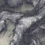
Plume of subtropical moisture streaming into Colorado September 2013 via Weather5280
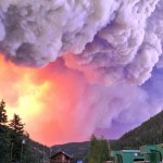
West Fork Fire June 20, 2013 photo the Pike Hot Shots Wildfire Today
Here’s the release from the Western Governors Association:
The opening day of the 2014 Annual Meeting was historic for Western Governors, as they participated in a live video-teleconference with President Barack Obama to discuss the wildfire season and efforts to improve forest management, including an end to the practice of “fire borrowing.”
While it was a continuation of the Governors’ discussion with the President on wildfires, following a White House meeting in February, it represented the first time the Western Governors have had an in-person conversation with any president during a WGA meeting.
At a press conference that concluded Day One of the meeting at The Broadmoor in Colorado Springs, all of the governors characterized the conversation as positive and said they supported legislation in the House and Senate that would end the practice of taking money that would be used for fire mitigation to use for fire suppression.
The day began with members of the Western States Tourism Policy Council, Interior Secretary Sally Jewell and other federal agency heads today signing a memorandum of understanding aimed at promoting federal-state dialogue and cooperation on western states tourism and public lands issues. Governor John Hickenlooper spoke and was joined at the ceremony by governors Matt Mead of Wyoming, Gary Herbert of Utah and Butch Otter of Idaho.
The afternoon session included a keynote by Secretary Jewell, followed by a roundtable on “Preparing for and Responding to Drought and Flooding,” moderated by South Dakota Gov. Dennis Daugaard. Guests on the panel included Jo-Ellen Darcy, Assistant Secretary of the Army (Civil Works), Department of Defense, and Robert Bonnie, Under Secretary, Department of Agriculture.
The afternoon session concluded the signing of an MOU by WGA Chairman Hickenlooper and Dr. Kathryn Sullivan, NOAA Administrator, to continue a collaboration on drought, flooding, and wildfire preparedness (Read more and download the MOU.)
The official business of the day concluded with the governors conducting a press conference attended by the Colorado Springs Gazette, Associated Press, E&E News and Washington Post.
Colorado Gov. John Hickenlooper, WGA Chairman, and Nevada Gov. Brian Sandoval, Vice Chairman, are hosting eight fellow governors at the 2014 Annual Meeting, including Arizona’s Jan Brewer, Idaho’s Butch Otter, Kansas’s Sam Brownback, Montana’s Steve Bullock, , North Dakota’s Jack Dalrymple, South Dakota’s Dennis Daugaard, Utah’s Gary Herbert and Wyoming’s Matt Mead.
As is fairly typical during the springtime in Colorado, May weather patterns brought a taste of nearly every season to our great state. A large snow storm over Mother’s Day weekend produced significant accumulation in every major river basin and stalled the rapid melt that had begun early in the month due to warm temperatures. Colorado also received significant precipitation in the form of rain during May, in fact for the first time this water year, all basins reported above normal monthly precipitation totals. During the last week of May, temperatures across the state exceeded historical averages for multiple days in a row. In the northern and central mountains, which had significant amounts of snow remaining, the high temperatures accelerated snowmelt. This coupled with heavy rainfall, led to high water levels on many rivers and flooding in some areas. With above average streamflows projected for June and July in the northern and central part of the state, water managers in these regions will have ample opportunities to fill their reservoirs this season. In the southern part of the state storage volumes remain low and with most of the snow already gone hopes are pinned on a good monsoon season.
Snowpack
The statewide snowpack totals this season were a welcome change from the last couple of years. This season began with fairly normal snow accumulation up until early February when a series of large storm systems began to hit the state. The storm systems generally favored the northern and central mountains and for the most part missed the mountains in the Southwest, the Upper Rio Grande and the southern tributaries of the Arkansas. The storm patterns continued until the first week of April when most of the basins in the state reached their peak snow accumulation and melt ensued. April was quite dry across the state and it looked like winter may be over when the entire state received significant snow over Mother’s Day weekend. This storm added to the already large snowpack’s in the northern and central mountains but most importantly, boosted the snowpack’s in the southern river basins and helped to delay the rapid melt that had begun in those regions. As of June 1 the statewide snowpack was 197 percent of the median and around 25 percent of the seasonal snowpack remained on the ground.
Precipitation
For the first month this water year all the major river basins in Colorado reported above average mountain precipitation. Statewide precipitation for May was 135 percent of average; the Arkansas basin reported the lowest percentage at 115 percent of average and the South Platte basin had the highest percentage at 155 percent. As of June 1, water year-to-date precipitation totals across the major river basins were near to above normal. The Upper Rio Grande had the lowest percentage at 84 percent of average for the water year. The South Platte had the highest percentage at 124 percent of average. Year-to-date precipitation for the state was 105 percent of average on June 1.
Reservoir Storage
During May Colorado added 419,400 acre-feet of water to its reservoirs. The end of May readings put total storage at 95 percent of average and 62 percent of capacity. Of course storage varies significantly between the major river basins. The South Platte basin has the highest storage totals; with 1,041,600 acre-feet of water, basin wide storage is at 113 percent of average and 94 percent of capacity. The Gunnison basin is not far behind with storage volumes that are 108 percent of average and 80 percent of capacity. The Arkansas basin is storing the lowest volume of water as a percent of average. The basin has 351,100 acre-feet of water stored which is 56 percent of average and 21 percent of capacity. Current reservoir storage mimics the trends in snowpack and spring runoff seen this season across the state. The southern basins have much less water stored than the northern basins. It is important to note that all basins have significantly improved their reservoir storage since last year at this time. Storage in the Upper Rio Grande for example is at just 63 percent of average currently, but this is a great improvement over the 37 percent of average volumes they had last year.
Streamflow
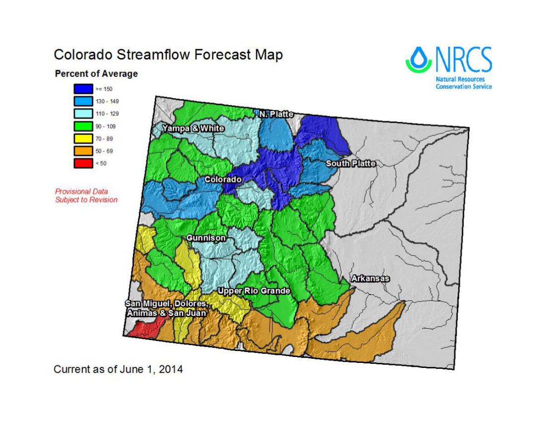
One of the main variables that can influence streamflow forecasts drastically in the spring is how much rain an area receives. For the most part, the streamflow forecasts for Colorado issued on June 1 were very similar to those issued on May 1; the exceptions were forecasts for the South Platte, Colorado and the Yampa and White river basins. These regions received significant amounts of rain throughout May which caused the current forecasts to increase considerably from those issued last month. The South Platte forecasts were the most affected by this; the region was hammered with thunderstorm activity and heavy rains throughout the month. The forecasts for the Cache la Poudre at Canyon Mouth west of Fort Collins, CO saw the most drastic increase this month. April to July forecasts jumped from 122 percent of average predicted on May 1 to 167 percent of average on June 1. June to July forecasts for this gage call for flows at 150 percent of average. In the Colorado basin the forecast for April to July flows into Wolford Mountain Reservoir jumped 31 percentage points this month. The current June to July forecast calls for flows to be at 163 percent of average. Forecasts in the remaining basins did not change much from those issued last month. The Upper Rio Grande still has some of the lowest forecasted flows for the remainder of the summer. The southern tributaries of the Arkansas basin are also forecast to see flows that are well below normal for the rest of this runoff season.
Water initiatives that could have a significant impact on the San Luis Valley are still awaiting Colorado Supreme Court decisions before moving forward to the November ballot box. Still awaiting the higher court’s direction are two initiatives Initiatives 89 and 103 that advocate the Public Trust Doctrine, which would present a radical change from the current water administration throughout the state.
Another ballot initiative, Initiative 75, has already passed through the higher court and now has the green light to collect signatures to place it on the 2014 ballot. Although not directly related to water issues, Initiative 75, the Right to Local Self-Government , could affect water developments and investments. It drew a court challenge from the business community.
The ballot title states: “An amendment to the Colorado constitution concerning a right to local self-government , and, in connection therewith, declaring that the people have an inherent right to local self-government in counties and municipalities , including the power to enact laws to establish and protect fundamental rights of individuals, communities, and nature and the power to define or eliminate the rights and powers of corporations or business entities to prevent them from interfering with those fundamental rights; and declaring that such local laws are not subject to preemption by any federal, state, or international laws.”
Initiative 75 was just one of more than 100 separate initiatives proposed or re-proposed this year. Eleven have been cleared so far to begin the signature-gathering process , and another 34 are still pending before the Colorado Supreme Court.
Those include Initiatives 89 and 103.
The Colorado Water Stewardship Project challenged the title-setting process for Initiatives 89 (Local Government Regulation of Environment ) and 103 (Public Trust Resources), arguing that the proposed initiatives did not meet the requirement of a single title.
These initiatives promote the Public Trust Doctrine. Since the 1800’s Colorado has operated under the Doctrine of Prior Appropriation, rather than the Public Trust Doctrine, so passage of these amendments could radically change the way water is administered in the state. Public Trust Doctrine holds that natural resources such as water are common property, while the Doctrine of Prior Appropriation operates under the principle that the first to put the water to use has priority over subsequent water users on that stream.
Colorado Supreme Court Justice Gregory Hobbs has described The Public Trust Initiative as dropping “what amounts to a nuclear bomb on Colorado water rights and land rights.”
Initiative 89’s ballot title is: “Shall there be an amendment to the Colorado constitution concerning a public right to Colorado’s environment, and, in connection therewith, declaring that Colorado’s environment is the common property of all Coloradans; specifying that the environ- ment includes clean air, pure water, and natural and scenic values and that state and local governments are trustees of this resource; requiring state and local governments to conserve the environment; and declaring that if state or local laws conflict the more restrictive law or regulation governs?”
Initiative 103’s ballot titles is: “Shall there be an amendment to the Colorado constitution concerning public ownership of natural and environmental resources, and, in connection therewith , creating a public trust in those resources, which include clean air, clean water, and the preservation of the environment and natural resources; requiring the state, as trustee, to conserve and maintain public trust resources by using the best science available to protect them against any substantial impairment, regardless of any prior federal, state, or local approval; seeking natural resource damages from anyone who substantially impairs them, and using damages obtained to remediate the impairment; allowing Colorado citizens to file enforcement actions in court; requiring anyone who is proposing an action or policy that might substantially impair public trust resources to prove that the action or policy is not harmful; and criminalizing the manipulation of data, reports, or scientific information in an attempt to use public trust resources for private profit?”
The Colorado Water Stewardship Project is supporting legal actions before the Colorado Supreme Court regarding these initiatives, and the higher court is expected to rule on these appeals before July.
In the meantime The Colorado Water Stewardship Project is continuing to bring awareness to these initiatives and what they could mean to the water community throughout the state.
About 70 groups ranging from municipal utilities and the Colorado Association of Commerce and Industry to conservation and conservancy districts have approved resolutions opposing the Public Trust Doctrine.
San Luis Valley entities that have passed resolutions include: San Luis Valley Irrigation District, Rio Grande Headwaters Land Trust and the Commonwealth Irrigation Company.
If the Colorado Supreme Court confirms the contested ballot titles and their proponents receive the green light to proceed with acquiring signatures, they would have to collect 86,105 valid registered voters’ signatures to get these initiatives on the ballot this fall. The deadline to collect those signatures and turn them in to the Secretary of State’s office would be August 4.
More 2014 Colorado November election coverage <a href="
This year the FIBArk Whitewater Festival will induct Salida natives Teddy and Dannie Makris into the FIBArk Hall of Fame.
“It’s an honor” for him and his brother to be inducted into the FIBArk Hall of Fame, Dannie Makris, who now lives in Woodland Park, said May 28. Teddy Makris died in 2004 in Pueblo.
Dannie Makris said he is “thrilled and tickled” to be inducted into the FIBArk Hall of Fame, “and I am sure my brother would be too.”
Dannie Makris said he started kayaking in 1958 when he got his first boat. Growing up in Salida, he had watched the downriver race every year since it started. Watching the race each year, “I always wanted to boat,” he said.
The two brothers would practice together in the Arkansas River near the F Street bridge, and the first part of the river they ran together was Cottonwood Rapid. Makris said he remembers on the first run down Cottonwood, his brother turned over and told him to “paddle like hell” and that he would meet him at the end.
The brothers were selected for the Hall of Fame because of their “exceptional athletic accomplishments, contributions toward the advancement of FIBArk and for their pioneering spirit within the kayaking community,” FIBArk Board President Christopher Kolomitz said.
The FIBArk Hall of Fame recognizes individuals who have made significant contributions to FIBArk and whitewater paddling.
In 1963 Dannie became the FIBArk downriver champion and the national slalom champ, Kolomitz said. That same year Teddy placed third in the downriver race. In summer 1963, both Teddy and Dannie represented the U.S. at the world championship events in Spittal, Austria. The U.S. team placed seventh.
Dannie won the national whitewater championships in 1961 on the Colorado River and in 1962 on the Feather River in California. He placed first in the FIBArk slalom, earning a national title in 1965, Kolomitz said. That same year he took third in the FIBArk downriver race behind two foreign boaters. In 1967 he was FIBArk commodore, and in 1969 Dannie won the FIBArk sportsmanship award, which was given by the past commodores’ club to a boater who contributes most to boating and good sportsmanship.
Back when he and his brother competed in the races, the European kayakers were talented and increased the level of competition because the countries “would send their best (boaters),” Makris said. In the races back then, 30,000 people would crowd the sides of the Arkansas River to watch the downriver race. Salida would empty out as people moved down river to watch the race.
The railroad also used to run a train following the race, so the passengers could watch. Makris said he and his brother could usually tell how well they were doing in the race by watching the train, “because the train would follow the leaders.”
Since the ’60s, both FIBArk and kayaking have changed, Makris said. Now much of the FIBArk festivities stay in Salida instead of spilling down the sides of the river. He said he misses the international racers the event would bring, and how big the parade was. FIBArk had good times in Salida in the ’60s with people coming from around the state, country and world to watch and race, he said.
Makris said he will visit Salida for this year’s FIBArk, now sponsored by Eddyline Brewing, and looks forward to seeing people in the area and watching the races.
Colorado River pulse flow (Minute 319) reaches the Sea of Cortez for the first time since 1998 on May 15, 2014 via the Sonoran Institute
Photo via the National Geographic
Landsat view of Colorado River pulse flow in Mexico April 2014
Pulse flow tongue upstream of San Luis Rio Colorado. Photo credit: National Geographic
From the Sonoran Institute (click through for photos of the pulse flow):
After eight weeks of water surging across the US – Mexico border, the historic connection between the Colorado River and the Upper Gulf of California officially occurred on Thursday May 15, 2014. This is the first time the river has connected with the sea in at least 15 years. This has not regularly occurred for more than a half-century!
The photos below document the historic connection. Please note that all photos are copyrighted by the Sonoran Institute, with aerial support from our partner LightHawk. If you are interested in using the photos, please contact the Sonoran Institute.
Flooding along the Cache La Poudre River damaged nearly two dozen homes and businesses in Greeley last week, and according to officials at the Northern Colorado Water Conservancy District, the Poudre River does not have any dams or reservoirs specifically for flood control. But there is an effort underway to change that.
The Poudre River is full of melted snow — so much so right now that levels are well above average in Larimer and Weld counties, spilling over banks, and flooding homes and businesses.
“We could fill a reservoir in a year like this,” Brian Werner with the Northern Colorado’s Water Conservancy District said.
He points out farmers’ irrigation dams inside the Poudre Canyon, but says water cannot be diverted to those to prevent flooding. He says there is no reservoir along the river because the idea was unpopular in the past.
“I think the general public is more aware when they see these flows and saying, ‘Boy, couldn’t we just store a little bit of that?’ Which is what this proposal does,” Werner said.
Northern Water wants to build two reservoirs off stream that could store water during high flow times. Planners estimate the project would cost $500 million, including $40 million to re-route Highway 287 to make room for Glade Reservoir, and build a smaller one north of Greeley…
But the federal approval process is moving slowly.
“We’ve been working on this in some form for over 20 years, taking some of the flood flows here on the Poudre and storing it,” Werner said.
They do expect to get some news on the status of studies being conducted on the project by the end of this year. It’s unlikely building would start before 2018.
From the Fort Collins Coloradoan (Ryan Maye Handy):
Several of the reservoirs that feed Northern Colorado are full, or approaching overfull, said Brian Werner, a spokesman for the Northern Colorado Water Conservancy District, which helps manage the reservoirs. Carter Lake, southwest of Loveland, is full, and Lake Granby near Rocky Mountain National Park is about to overflow, Werner added.
“We wouldn’t have guessed that in a million years a year ago,” Werner said Tuesday. Only a month ago, it was fifty-fifty if the reservoir would spill. “Now it looks like it will spill.”
Horsetooth is just 2 feet shy of being full, the highest the reservoir has been in late May and early June in the past six years.
The reservoir can hold enough to submerge 156,735 football fields in a foot of water. As of June 3, Horsetooth was holding 154,480 acre-feet of water, putting it around 98.5 percent full, said Zach Allen, a spokesman for Northern Water.
But what happens if Horsetooth does get full? The answer, Werner said, is basically “nothing.”
“We can control all the inflows to Horsetooth,” he said. Flatiron Reservoir and the Big Thompson River feed Horsetooth, and Northern Water controls all the outflows and inflows to the reservoir; Horsetooth’s water level can’t get higher than Northern Water wants it to, Werner said…
Lake Granby, on the other hand, is fed with snowmelt straight from the mountains. It’s levels are uncontrollable, and it could spill over any day now, Werner said.
“You can’t control what nature is going to do” with Granby, he added…
Northern Water for years has pursued an expansion of its water storage capacity to take advantage of plentiful water years. The Northern Integrated Supply Project would build a reservoir larger than Horsetooth northwest of Fort Collins. The proposal has drawn opposition from environmental groups and is in a yearslong federal review of its potential environmental impacts expected to be released late this year…
Much of Northern Colorado’s snowpack, around 200 percent of normal levels after an early May snow, has yet to melt, which brings the potential for much more water to come down from the mountains in the coming weeks.
From email from Reclamation (Kara Lamb):
We have seen the water level at Green Mountain Reservoir rise to the spillway gates as snow melt runoff inflows continue to come into the reservoir. As a result, we were able to increase the release from the dam to the Lower Blue River by 300 cfs today [June 9], using the spillway.
We are now releasing 1800 cfs to the Lower Blue.
From email from Reclamation (Kara Lamb):
The weekend went pretty smoothly for runoff here on the east slope of the Colorado-Big Thompson Project. Thunderstorms boosted runoff to the Big Thompson River slightly with inflow into Lake Estes peaking early this morning around 721 cfs. But this is still a downward trend.
As a result, outflow through Olympus Dam to the Big Thompson Canyon dropped today down to about 125 cfs. As we move into the rest of the week, visitors to and residents of the canyon will continue to see nightly flows rise with snow runoff, enhanced some by rain runoff, just as they have seen for the past week.
Deliveries to the canal that feeds Horsetooth Reservoir have brought Horsetooth back up to full. Its water level elevation has been fluctuating within the top foot of its storage between 5429 and 5430 feet. With it back up near 5430, we have curtailed the canal to Horsetooth and increased the return of Big Thompson River water to the canyon at the canyon mouth using the concrete chute. By 5 p.m. this evening the chute should be running around 300 cfs.
The drop off in snowmelt runoff inflows will allow us to begin bringing some Colorado-Big Thompson Project West Slope water over again using the Alva B. Adams Tunnel. We anticipate the tunnel coming on mid-week and importing somewhere between 200-250 cfs.
Once the tunnel comes back on, we will also turn the pump to Carter Lake back on, probably on Wednesday of this week. Carter’s water level elevation dropped slightly during runoff operations. It is around 95% full. Now that Horsetooth is basically full, Carter will receive the C-BT water. Turning the pump back on to Carter means residents around and visitors to the reservoir will see it fill for a second time this season.
Pinewood Reservoir, between Lake Estes and Carter Lake, is seeing a more typical start to its summer season. It continues to draft and refill with power generation as it usually does this time of year. This is also true for Flatiron Reservoir, just below Carter Lake and the Flatiron Powerplant. Both are expected to continue operating this way through June.
That is the plan we anticipate the East Slope of the C-BT to follow the rest of this week, June 9-13. We will post information if there is a major change; but as it stands now, I do not plan on sending an update again until next Monday. The state’s gage page is always available for those wishing to continue watching the water on a daily basis.
Word on the street this spring was that Blue Mesa Reservoir would be bursting at its banks this summer. Predictions were based on official and unofficial reports of above-normal river flows. However, a 2012 Environmental Impact Statement (EIS) has changed how local dams are operated in wet years, in deference to endangered fish species downstream. This new operational protocol will preclude the reservoir from filling this year.
“The reservoir is now only scheduled to reach a maximum storage of around 80 percent capacity in 2014,” said Upper Gunnison River District manager Frank Kugel. The U.S. Bureau of Reclamation (BOR) began blasting water through Blue Mesa Dam last week, with simultaneous releases happening at Morrow Point and Crystal Reservoirs, a trifecta of water storage and management that makes up what’s known as the Aspinall Unit.
The Record of Decision (ROD) states, “The EIS modifies the operations of the Aspinall Unit to provide sufficient releases of water at times, quantities, and duration necessary to avoid jeopardy to endangered fish species and adverse modification of their designated critical habitat while maintaining and continuing to meet authorized purposes of the Aspinall Unit.”
Given this new norm of operations adapted by the bureau during wet years, will Blue Mesa ever fill again?
“That’s a valid question, since the reservoir often does not fill in dry years due to lack of supply, and now with the Aspinall EIS, it will have trouble filling in wet years,” said Kugel.
“We all signed onto this because we agreed it’s important to save these fish,” said Colorado Fish and Wildlife Aquatic Species coordinator Harry Crocket.
According to the BOR’s website, an update written by hydraulic engineer Paul Davidson, unregulated inflow to Blue Mesa is 126 percent of normal this year, April through July. That’s 850,000 acre-feet of water entering the lake during the runoff months. “This sets the senior Black Canyon Water Right call for a one-day spring peak flow of 6,400 cfs, the Aspinall 2012 ROD target at a 10-day peak flow of 14,350 cfs… Reclamation plans to operate the Aspinall Unit to meet both the water right and ROD recommendations,” said Davidson.
The Colorado pike minnow, bonytail chub, humpback chub and razorback sucker are the fish that stand to benefit. The big flows are expected to improve the fishes’ critical habitat, at a time when the fish will be looking to spawn. Water will inundate otherwise shallow or dry riverbank areas, creating calm, sheltered spots for hatchlings, and heavy flows will wash the larvae into those areas.
The Gunnison River, said Crocket, was “mostly omitted” from the EIS as critical habitat. However, he said, “Historically, it was home to at least a couple of these species.”
“It’s a highly migratory fish,” Crocket said of the Colorado pike minnow. “It’s adapted to this big river system.”
It’s a system irrefutably changed by humans. Critical habitat for the Colorado pike minnow includes 1,123.6 miles of river, to include stretches of the Green, Yampa and White rivers, from Rifle to Glen Canyon, and the Yampa River to its confluence with the Colorado River.
“They [US Fish and Wildlife] did designate critical habitat [from the mouth of the Gunnison] to the Uncompahgre confluence [at Delta],” Crocket said.
The Colorado pike minnow called the Gunnison River home through the 1960s. “After that,” said Crocket, “it blinked out. It’s not been possible for it to be re-colonized.” A new fish passage at the Redlands structure, two miles upriver from the Gunnison-Colorado River confluence at Grand Junction, allows fish to make their way around the barrier and upstream, marking the first time in more than 100 years for those downstream fish to gain passage to the Gunnison.
Meanwhile, upstream, a form of collateral damage resulting from the big water releases at Blue Mesa worries Fish and Wildlife personnel. The number of fish sucked into and blown out through the dam is staggering. The technical term for this is entrainment.
“Bigger water years mean more water through the dam, and more fish entrained,” said Gunnison area Colorado Fish and Wildlife aquatic biologist Dan Brauch. “Certainly, loss of kokanee with those releases is a concern.”
Water levels and snowpack are 121 percent of normal, with as much as 40 percent yet to melt at some higher elevation areas, according to Snotel data…
Snow water equivalent at the Fremont Pass Snotel site, the headwaters of the Eagle River, had 15.1 inches of snow water equivalent on Friday morning still to melt and run into the river. It hit 17 inches on March 18 and kept piling up until May 17 when it peaked at 25.6 inches. It usually doesn’t melt out until June 18, Johnson said.
Streamflow on the Eagle River in Avon may have peaked on May 30, when the daily mean discharge was 4,110 cubic feet per second, which was 249 percent of median for that date. Thursday’s daily mean discharge was 3,650 cfs, 197 percent of normal for Wednesday.
Gore Creek in Lionshead may have peaked June 4.
“Having 20 to 40 percent of the total snowpack remaining in higher elevations in the Colorado Basin is good overall. It should help sustain streamflows through the month,” [Diane Johnson] said…
Copper Mountain still has 4.1 inches of snow water equivalent. That would normally be melted out by now, Johnson said…
Reservoir storage in the state is running 95 percent of normal and 62 percent of capacity. That, however, depends on where you are.
Colorado Water Plan website screen shot November 1, 2013
From the Glenwood Springs Post Independent (John Stroud):
The daunting task for members of the Colorado River Roundtable to reach some consensus in developing recommendations as part of a statewide water plan took a couple of key steps forward Monday.
The roundtable, made up of water users including municipalities, counties, conservation districts, ranchers and other representatives from a six-county area within the Colorado River Basin, decided at a meeting Monday to adopt a “high conservation standard” as part of its Basin Implementation Plan.
That means water conservation, both on the Western Slope and on the Front Range, to where a significant portion of the Colorado Basin’s water is being diverted, should be the primary emphasis in meeting the state’s water needs into the future, said Jim Pokrandt of the Colorado River District, who chairs the roundtable.
“Even if another transmountain diversion is possible, we’re saying that it has to be the last tool out of the box [to meet future water demands],” Pokrandt said. “And there are a lot of questions around whether it is possible.”[…]
Pitkin County Commissioner Rachel Richards also suggested that, if additional water storage to serve Front Range needs is necessary, more storage projects should be built on the Eastern Slope.
“Especially in years like this, they should be capturing some of these floodwaters and store it when they have that ability,” she said.
If additional Western Slope projects are built, they should be for Western Slope needs first, other members of the roundtable said.
Much of the debate around Gov. John Hickenlooper’s directive to develop a state water plan has centered on the potential need for new Front Range water diversions from the Western Slope to accommodate growth demands over the next 40 to 50 years.
Front Range water planners say those diversions will likely be needed regardless of successful conservation efforts, and that the water plan should contain assurances for new water projects in addition to ones already on the drawing board.
Also Monday, initial approval was given to the draft Colorado Basin Implementation Plan (BIP) being prepared for the roundtable’s consideration by a team of water planning consultants from SGM.
Monday was the deadline for the first round of comments on the basin plan, which is to be presented to the Colorado Water Conservation Board by mid-July to weigh alongside recommendations from other parts of the state.
“We still have a lot of work to do in the next 30 days to get all of your comments into the document,” said Louis Meyer, president and CEO of SGM, who is heading up the BIP project. “We realize there are a lot of holes and a lot of editing to be done before this is ready.”
The draft action plan covers six key themes, including specifics on how to:
• Cultivate healthy streams, rivers, lakes and riparian areas.
• Implement smart growth strategies while emphasizing local control.
• Assure dependable administration of water resources.
• Sustain agriculture.
• Secure safe drinking water.
• Encourage basinwide conservation.
Meyer gave a summary of the comments received by the Monday deadline, which will be incorporated into the basin plan.
Many of the comments followed the “not one more drop” mantra against new trans-mountain diversions. Although the basin plan does not use those specific words, it does emphasize the belief that there is not sufficient water left in the Colorado Basin to develop for Front Range needs without causing serious harm on the Western Slope and for downstream water users, Meyer said.
Other comments centered around coming up with better definitions for what constitutes a “healthy river” and “smart growth,” he said.
There’s also disagreement about whether the state water plan should guide local land-use decisions at all, including feedback from the Garfield County commissioners after a presentation of the BIP during their Monday meeting in Parachute, Meyer said…
Meyer said the commissioners also expressed support for improving the permitting process for water projects, protecting agricultural interests and protecting the Shoshone water right on the Colorado River.
Here’s the release from the Western Governors Association:
The Western Governors’ Association (WGA) and the National Oceanic and Atmospheric Administration (NOAA) signed a Memorandum of Understanding today (June 9, 2014) in Colorado Springs that renews and strengthens collaboration on drought and flood preparedness.
The purpose of the new MOU is to improve the development, coordination and dissemination of drought and extreme weather data, information and analysis in support of resource management decisions in Western states.
The agreement was signed in a ceremony during the opening day of the 2014 WGA Annual Meeting in Colorado Springs by NOAA Administrator Dr. Kathryn Sullivan and WGA Chairman and Colorado Gov. John Hickenlooper.
“The droughts and wildfires across our nation’s western states directly, or indirectly, affect us all,” said Dr. Sullivan. “NOAA is working, along with our partners like the WGA and governors, to ensure that people have the environmental intelligence they need to be prepared to tackle threats from drought and wildfires. From weather and water forecasts to climate analyses and predictions, demand for NOAA’s data is greater than ever, as western businesses and citizens plan for what is likely to be a very dry summer.”
The parties will work to ensure that collection and sharing of crucial drought, flooding and extreme weather-related data and information are improved and sustained. This may include soil moisture monitoring in the Missouri River Basin and snowpack monitoring in the Mountain West and coastal watersheds.
“I never met anyone who ran for Governor because he or she wanted to be the state’s chief emergency services manager,” said Jim Ogsbury, WGA Executive Director. “But that is one of the roles that Governors perform. In renewing this Memorandum of Understanding with NOAA, Western Governors are working to ensure that they have the data and analysis they need for an informed response to drought, flooding, and wildfire.”
The partnership will also support the Western Governors’ Drought Forum, an initiative of incoming WGA Chair Gov. Brian Sandoval.
For additional information or to arrange an interview, contact: Joe Rassenfoss, Communications Director, Western Governors’ Association; 720-897-4555 or joe@westgov.org
Read the complete MOU.
The WGA Annual Meeting continues through Wednesday, June 11, at The Broadmoor in Colorado Springs. Follow the meeting by visiting the Western Governors’ Association (@WestGov) website.
Wildfires are bigger, droughts are more severe and floods are catastrophic. States usually are at a loss to predict when or where those events will happen and can only mop up after the disasters.
On Monday, the Western Governors Association signed an agreement with the National Oceanic and Atmospheric Administration designed to give more certainty in forecasting nasty weather.
“We get the benefit of the finest scientific minds out there about what kind of weather we’ll have for the season,” said Colorado Gov. John Hickenlooper, chairman of the WGA.
A three-day conference at The Broadmoor is looking at weather, water and wildfire, along with oil and gas development — issues common to the Western states.
The agreement with NOAA will improve the regional analysis of data by combining the global expertise of the federal weather agency with onthe- ground observations at the state level. It will look at ways to improve lesser understood indicators like soil moisture and snowpack measurement.
“The fire season is 60-80 days longer,” Interior Secretary Sally Jewell told the governors of 10 states who attended the meeting. “We’re getting smarter about it, but we have to work closely with state, local and federal agencies.”
Interior announced Monday it is providing nearly $20 million in grants to look at ways to improve water efficiency at its projects throughout the West.
Federal agencies have learned much from floods and droughts in the last five years, added Jo-Ellen Darcy, assistant secretary of the Army for Civil Works, which includes the Army Corps of Engineers. In some states, reservoir releases controlled by the Corps can be timed to help alleviate impacts of severe weather.
NOAA Administrator Kathryn Sullivan said there is the possibility for more floods and drought-related fires this summer. She said improved observation can reduce states’ exposure.
The federal Agriculture Department also is cooperating in the effort.
“One of the things we found out in the 2012 drought was the importance of good conservation practices,” said Robert Bonnie, Agriculture undersecretary.
A partnership has been renewed to combat extreme weather conditions in the Western U.S.
Colorado has been through flood, wildfire, and drought, all of which cost the state millions.
The Western Governors’ Association (WGA) and the National Oceanic Atmospheric Administration (NOAA) signed a memorandum of understanding. It’s agreement to help the Western states in times of emergency. The agreement was renewed for five years
Roger Pulwarty works for the NOAA. He said the organization can help Colorado by providing data.
“We are working with the different offices the Colorado Water Conservation Board, the Natural Resources Department on how best to use the climate information and weather information and making sure to reduce risk and highlight investments at ski areas and other recreational places that can be sustained,” he said.
“We can dispatch those resources, those people, those assets and firefighting equipment assets to states like Colorado in the case of a fire and (when there is) need of them,” South Dakota Gov. Dennis Daugaard said.
Ten Western governors are meeting this week in Colorado Springs to discuss issues including the drought and the environment.
Colorado Gov. John Hickenlooper and Nevada Gov. Brian Sandoval are hosting the meeting at The Broadmoor hotel, which starts Monday.
Environmental Protection Agency Gina McCarthy is scheduled to speak to the governors on Tuesday, a week after announcing big cuts in pollution produced by the country’s power plants.
The other governors attending are Jan Brewer of Arizona, Butch Otter of Idaho, Sam Brownback of Kansas, Steve Bullock of Montana, Jack Dalrymple of North Dakota, Dennis Daugaard of South Dakota, Gary Herbert of Utah and Matt Mead from Wyoming.
Released in May, a federal scientific report called the National Climate Assessment concludes that the harms of global warming will become more and more disruptive across the nation throughout this century and beyond. The report emphasizes how warming and its all-too wild weather are changing daily lives, even using the phrase “climate disruption” as another way of saying global warming.
Colorado and the rest of the southwest region are described in the report as having increased heat, drought and insect outbreaks all linked to climate change and resulting in increased wildfires. The report also found the region has declining water supplies, reduced agricultural yields, health impacts in cities due to heat, and flooding and erosion in coastal areas.
The report finds that temperatures in the decade between 2001-2010 were the warmest on record, with an average temperature almost two degrees Fahrenheit warmer than historic averages. It also predicted that if global emissions continue to rise, average temperatures in the southwest region could rise by as much as 9.5 degrees by sometime between 2070-2099.
If emissions are “substantially reduced,” the report reduced temperature increase during the same time frame by 3.5 to 5.5 degrees.
“Summertime heat waves are projected to become longer and hotter, whereas the trend of decreasing wintertime cold air outbreaks is projected to continue,” the report says.
Because the southwest has the highest percentage of population living in cities, the report says the heat may cause repercussions for public health. The authors suggest that as high temperatures or heat waves are magnified by the urban heat island effect, the energy system will become stressed and thereby increase the possibility of brownouts or power outages. Without adequate cooling, populations will be subjected to the heat and face increase chance of illness or death.
By the end of the century, the report projects Colorado’s average snowfall will be reduced to 74 percent of what it was in the 30 years preceding 2000. Additionally, the report predicts the snow will melt earlier because of a layer of dust and soot resulting from agriculture and development.
Warmer winters and dryer conditions due to climate change are referenced in the report as causes of exacerbated bark beetle outbreaks leading to dead trees and wildfire danger. Other factors cited as increasing wildfire danger include non-native grasses and the federal policy of fighting fires, which allowed fuels to accumulate.
The report recommends prescribed burning, mechanical thinning and retention of large trees.
“These adaptation measures also reduce emissions of the gases that cause climate change because long-term storage of carbon in large trees can outweigh short-term emissions from prescribed burning,” the report says.
The Colorado Springs City Council is looking at competing proposals to deal with stormwater control. The action is important to Pueblo because of agreements related to Pueblo County’s 1041 permit for Southern Delivery System and the need to reduce flooding on Fountain Creek. Pueblo County officials have asked Colorado Springs to show how stormwater control will be funded since council abolished the city’s stormwater enterprise in 2009.
A study in February by CH2MHill found 282 projects totaling $687 million in Colorado Springs, and 268 projects totaling $102 million in areas out side of Colorado Springs in the Fountain Creek watershed. Of the total, 54 projects totalling $192 million are considered critical for public health and safety.
Council Monday heard proposals to form the Pikes Peak Regional Drainage Authority by a stormwater task force that has been meeting for two years and a counterproposal by Mayor Steve Bach and city staff that would roll stormwater funding into other capital projects.
The proposal for the regional authority would create an intergovernmental agreement among El Paso County, Colorado Springs, Manitou Springs, Fountain, Green Mountain Falls, Monument and Palmer Lake. The task force intends to introduce a ballot initiative forming the authority for the November general election ballot. Stormwater charges of $9 per month for homeowners could raise about $50 million annually for stormwater projects throughout the Fountain Creek watershed.
Bach’s proposal is to include Colorado Springs stormwater needs alongside other capital needs for technology, parks, public safety and public works. A report presented to council Monday by chief of staff Steve Cox concluded: “Stormwater is only part of the broader capital problem.”
It proposes funding $25.5 million annually for five years to catch up with stormwater needs through either refinancing bonds or imposing a sales tax of either three-quarters or one-cent sales tax.