Castle Rock hopes to get 75% of water supply from renewable sources by 2050

castlerock
From The Denver Post (Clayton Woullard):

After one year of operation, the Plum Creek Water Purification Facility has exceeded Castle Rock’s expectations in terms of efficiency as it plays an important role in the town’s long-term renewable water projects. The $22.6-million-dollar plant went online in April 2013, specifically to treat more ground water, as well as renewable surface water from Plum Creek. The facility is part of an effort by Castle Rock to have 75 percent of its water come from renewable sources by 2050, when the town projects it will be built out at 100,000 people. The town’s population is at about 53,000 now.

Other parts of the project are a renewable water agreement through the Water, Infrastructure and Supply Efficiency partnership (WISE) with Denver Water and Aurora Water, as well as storage of 8,000 acre feet of water in Rueter-Hess Reservoir in Parker. Castle Rock Utilities Director Mark Marlowe said the plant’s operating costs, along with the WISE partnerships, are coming in under budget.

“If we don’t do these things, we continue to be reliant on our deep water supplies,” Marlowe said.

That’s something the town and other Douglas County jurisdictions can’t afford, because well water continues to be depleted.

The WISE partnership agreement is almost complete, Marlowe said and will eventually bring about 7,225 acre feet of renewable water and 1,000 acre feet in the short term to Castle Rock. Marlowe said two contingencies must be finished by next year to get WISE water flowing: the $4 million purchase of a pipeline that will get water from Denver and Aurora to Castle Rock; and a new pipeline the town will need to allow it to begin receiving renewable water.

Marlowe said the water supply from WISE is interruptible, unlike the supply coming through the treatment facility.

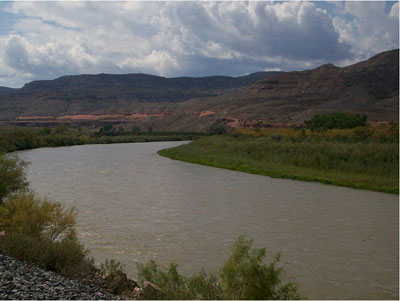
The Plum Creek Purification Facility captures water from East and West Plum Creek and lawn irrigation return flows. The plant treats more than 4 million gallons of water per day but has the capability to treat up to 12 million gallons when it is eventually expanded. The plant has the capacity to bring the town 35 percent renewable water; now it’s between 12 and 20 percent renewable, depending on demand.

“It is exciting for our community that we get to use this resource,” said Karen McGrath, spokeswoman for the town.

Because the plant also treats surface water, it has different processes, including a series of racks or tubes of thousands of very thin, vertical membranes that filter the water and require regular maintenance and cleaning. Marlowe said surface water requires more treatment than ground water and necessitated the facility.

Most of the plant’s processes run automatically, so the plant only requires about two workers at any time. The system is set up with alarms and auto-correcting mechanisms.

Level 4 plant operator Ken Timm said it’s the most advanced water treatment plant he’s worked at.

“The only challenge is if something breaks,” Timm said, “and how fast can we get it repaired and what caused it.”

More Denver Basin Aquifer System coverage here.

Epicenter of Saturday earthquake in Greeley was near oil, gas wastewater injection wells — The Greeley Tribune

Deep injection well
Deep injection well

From The Greeley Tribune (Trenton Sperry):

As the annual number of earthquakes in the United States has increased, some have pointed to the oil and gas industry as a cause. But while scientists say there is evidence to suggest wastewater injection wells used by the industry could be linked to the increase, there is little or no evidence to suggest a similar link for fracking operations.

“Hydraulic fracturing almost never causes true earthquakes,” University of Texas seismologist Cliff Frohlich told the Associated Press in September during a gathering at West Virginia University for a National Research Council workshop. “It is the disposal of fluids that is a concern.”

Frohlich was referring to the disposal of wastewater, a byproduct of oil and natural gas production from tight shale formations and coal beds, according to the U.S. Department of the Interior’s website. Wastewater produced from many oil and gas production wells within a field may be injected through a single or just a few disposal wells, according to the website.

The question of whether oil and gas operations cause earthquakes was on the minds of Weld County residents Sunday after a 3.4-magnitude earthquake struck 4.8 miles northeast of Greeley about 9:35 p.m. Saturday night, according to the U.S. Geological Survey. The epicenter was near Weld County roads 66 and 43, which is about 3 miles northeast of Greeley.

The epicenter of the quake was about 1.5 miles from two oil and gas wastewater injection wells, both operated by High Sierra Water Services LLC of Denver, according to data from the Colorado Oil and Gas Conservation Commission. They are the only injection wells in at least a 5-mile radius of the quake’s epicenter.

Injection wells provide one of the most economical ways to dispose of wastewater, according to the USGS website, forcing the wastewater deep below aquifers that provide drinking water.

The USGS website also notes, however, wastewater injection increases the underground pore pressure, which may, in effect, lubricate nearby faults, thereby weakening them. If the pore pressure increases enough, the weakened fault will slip, releasing stored tectonic stress in the form of an earthquake. Even faults that have not moved in millions of years can be made to slip and cause an earthquake if conditions underground are appropriate, according to the USGS website.

USGS scientists have found the increase in seismicity in some locations coincides with a significant increase in the injection of wastewater into disposal wells, mostly in Colorado, Texas, Arkansas, Oklahoma and Ohio, according to the Department of the Interior’s website.

Saturday night’s quake near Greeley provided minor shaking that was felt as far south as Longmont and as far north as Fort Collins, according to the USGS website.

The 10,800-foot injection wells near the epicenter were last inspected by the Weld County Department of Public Health and Environment in October 2013, according to COGCC records. State inspectors last checked the wells in August 2012, about four months before one of the wells was completed as a wastewater injection well, according to COGCC records.

Representatives of High Sierra Water Services and the COGCC did not immediately respond to requests for comment Sunday.

The vast majority of wastewater injection wells do not cause earthquakes. According to the Department of the Interior’s website, of approximately 150,000 Class II injection wells in the United States — including roughly 40,000 wastewater disposal wells for oil and gas operations — only a tiny fraction have induced earthquakes large enough to be of concern to the public.

However, injection wells in Colorado causing earthquakes would not be without precedent. In 1961, a 12,000-foot well was drilled at the Rocky Mountain Arsenal, northeast of Denver, for disposing of waste fluids from Arsenal operations, according to the USGS. Injection began in March 1962, and an unusual series of earthquakes erupted in the area shortly after. The U.S. Army ceased use of the injection well in 1966, and in 1990 a solid link was established between the injection of fluids and the subsequent rash of earthquakes.

But Paul Earle, a seismologist with the USGS, said there’s still plenty to consider to determine if the Greeley earthquake was natural or man-made.

“Just because there are injection wells near there doesn’t necessarily mean they caused the earthquake,” Earle said. “There are a number of things you have to address to make that determination. But it’s certainly something we need to look at and will look at.”

More oil and gas coverage here.

Tamarisk Coalition “Raft the River” event, June 29 #ColoradoRiver

Colorado River -- photo via Wikipedia
Colorado River — photo via Wikipedia

Click here for the inside skinny.

Longmont plans to replace every bridge from Main to Hover. Flood bond ballots in mail today.

Continued Northern Water water rate meeting June 5

Carter Lake via Northern Water

From email from Northern Water:

Northern Water’s water rate hearing has been continued to June 5, 2014 at 1 p.m. at Northern Water’s headquarters in Berthoud, 220 Water Ave. The first part of the rate hearing was held in Berthoud on May 1.

Draft Cost of Service Rate Study Available
The Draft Cost of Service Rate Study Report is now available. The Cost of Service Rate Study provides data and information to allottees and provides the Northern Water Board of Directors information to make a fair and equitable decision regarding future water assessments at Northern Water. The study has developed a range of possible financial futures and associated rate design options.

For more information or to submit written comments, please contact Jerry Gibbens at 970-622-2299 or RateStudy@northernwater.org.

Rate Study Documents
Draft Cost of Service Rate Study Report
Rate Study Summary
Rate Study Summary Update

More Northern Colorado Water Conservancy District coverage here.

Runoff/snowpack news: Cache la Poudre a foot above flood stage (Sun.) in Greeley

Click on a thumbnail graphic for a gallery of snowpack data from last Thursday. There has been a lot of melting since then.

From The Greeley Tribune:

The Poudre River flowed at approximately 9 feet high in the Greeley area Sunday, about a foot higher than flood stage but not any higher than Saturday’s levels.

Joel Hemesath, director of public works in Greeley, said the city is still monitoring the roads, but there are no condition changes since Saturday night. He said the river hit 9 feet Sunday morning and held steady there throughout the afternoon. Several areas are close to flooding, and it wouldn’t take much to push them over.

County spokeswoman Jennifer Finch said at 3:30 p.m. Sunday she had received word of three additional closures in the area. County Road 3 is closed between county roads 36 and 8, Fern Avenue in Greeley is closed between 8th and 16th streets and County Road 13 is closed from County Road 68 1/2 to Colo. 392.

Flooding on the river closed another major road early Sunday. About 12:30 a.m. Sunday, the Colorado Department of Transportation announced that Colo. 257 on the southeast side of Windsor was closed. It has been closed between Crossroads Boulevard and Eastman Park Drive because of water over the highway, and there is no estimated time of reopening.

From The Denver Post (Eric Gorski):

Another band of storms brought minor flooding and nickel-sized hail Saturday to parts of the Front Range, but the next few days are expected to be warm and dry, providing relief to flood-prone areas.

More than a dozen Colorado counties were under flood warnings or advisories Saturday because of the threat of heavy rain combined with the peak of the high-country snowmelt.

The Cache la Poudre River was the main point of concern, with two flood warnings issued near Greeley and west of Fort Collins.

Minor flooding was reported on eight to 10 houses on McConnell and Green Ridge drives along the river in Laporte. Nick Christensen of the Larimer County Sheriff’s Office said no evacuations had been ordered.

The Cache la Poudre was a foot above its 7.5-foot flood stage Saturday afternoon, is expected to crest at 8.4 feet Sunday morning and likely won’t dip below flood stage until Monday afternoon, the National Weather Service said.

Downstream in Greeley, Weld County officials were surprised Saturday morning when the stream-flow readings on the Cache la Poudre in the city suddenly dropped from more than 3,300 cubic feet per second to a comparative trickle — 120 cfs.

Investigators from the city of Greeley Water Department and Weld County Emergency Management discovered the river had breached the Varra Gravel Pit east of Greeley.

The water was flowing into the pit, and once filled was expected to flow across a field and back into the riverbed, officials said in a release.

There was no threat to homes, they said.

In El Paso County, a fast-moving storm dumped hail and caused minor street flooding in Colorado Springs.

A small stream and river flood advisory will remain in effect until 9:15 a.m. Monday for Jackson and Grand counties

Jim Kalina, a Boulder-based meteorologist with the National Weather Service, said a dry southwestern flow should push the moist air east out of Colorado starting Sunday.

In metro Denver, expect temperatures in the 80s and little chance of precipitation through Tuesday, he said. There is a slight chance of showers and thunderstorms Thursday and Friday with forecast highs in the mid-70s.

From the Cañon City Daily Record (Brandon Hopper):

The Arkansas River water levels continue to soar past over the 3,200 cubic feet per second mark. As I type, they’ve just met 4,000 cfs. This means commercial rafting companies are advised by the Arkansas Headwaters Recreation Area not to boat the Royal Gorge section of the river…

The highest the water has been in the last 59 years of data on May 30 was in 1984 when it reached 4,260. That (probably) won’t happen in the next five hours. The May 31, 1984, mark was 4,540. In June 1984, the first eight days of readings went like this: 4,650; 4,820; 4,430; 4,190; 3,880; 3,480; 3,290; 2,750. My hypothesis is that we’ll break at least one of those days’ records.

World verging on ‘sixth great extinction,’ study says — Washington Post

Habitat loss via Steve Greenberg

From the Washington Post (Terrance McCoy):

The story of the buffy-tufted-ear marmoset is part of the story of a great extinction, according to a study published Thursday in the journal Science. Species of plants and animals are dying out at least 1,000 times faster than before the advent of the human species, and if things don’t turn around, it may get a whole lot worse, researchers said.

“We are on the verge of the sixth great extinction,” Stuart Pimm, a professor at Duke University who lead a team of nine international scientists, told the Associated Press. ”Whether we avoid it or not will depend on our actions.”

Previous mass extinctions are often associated with a meteor strike, one of which likely killed off the dinosaurs 66 million years ago. Another extinction, called the Great Dying, offed 90 percent of the world’s species 250 million years ago — though as The Washington Post’s Fred Barbash pointed out, that one may have been caused by a microbe.

This study focused on contemporary rates of extinction and used databases such as the Red List of Threatened Species. Researchers compared today’s rates with those before humans arrived. And today’s, according to the AP, are 10 times faster than scientists had earlier believed.

“Recent studies clarify where the most vulnerable species live, where and how humanity changes the planet, and how that drives extinctions,’ the study said. ”We assess key statistics about species, their distribution, and their status.” Many land-based species are distributed across terrains smaller than the state of Delaware, Pimm said in this Duke University press release.

Such species are “geographically concentrated and are disproportionately likely to be threatened or already extinct,” the study said. “Future rates depend on many factors and are poised to increase. Although there has been rapid progress in developing protected areas, such efforts are not ecologically representative, nor do they optimally protect biodiversity.”

The number one threat to the world’s many species: habitat loss. It is becoming increasingly difficult, researchers said, to find any speck of planet that hasn’t been either altered or built upon by humans. Complicating efforts: There are so many species no one knows of. “Most species remain unknown to science, and they likely face greater threats than the ones we do know,” Pimm said in the press release.