New NASA videos show two climate-change scenarios: bad and really bad — Fusion

Hockey Stick based on Mann & Jones 2003

Click here to view the videos from NASA.

Click here to read the report. Here’s an excerpt:

In the Southwest and Central Plains of Western North America, climate change is expected to increase drought severity in the coming decades. These regions nevertheless experienced extended Medieval-era droughts that were more persistent than any historical event, providing crucial targets in the paleoclimate record for bench- marking the severity of future drought risks. We use an empirical drought reconstruction and three soil moisture metrics from 17 state-of-the-art general circulation models to show that these models project significantly drier conditions in the later half of the 21st century compared to the 20th century and earlier paleoclimatic intervals. This desiccation is consistent across most of the models and moisture balance variables, indicating a coherent and robust drying response to warming despite the diversity of models and metrics analyzed. Notably, future drought risk will likely exceed even the driest centuries of the Medieval Climate Anomaly (1100–1300 CE) in both moderate (RCP 4.5) and high (RCP 8.5) future emissions scenarios, leading to unprecedented drought conditions during the last millennium.

A look at the art of water board governance from The Greeley Tribune #ColoradoRiver

Here’s an in-depth look at the Greeley Water and Sewer Board from Sherrie Peif writing for The Greeley Tribune. Click through to read the whole article and for the sidebar with the details about the current board along with some historic notes:

Most anyone who works closely with the water industry agrees the commodity is taken for granted by consumers, except for in a couple of instances.

“When water doesn’t come out of the faucet,” said Harold Evans with a laugh. “And when they get their bill.”

Evans, the chairman of the Greeley Water and Sewer Board, said it is unlikely that most know where their water comes from or how it gets to their faucets.

It is a complicated process involving more than a dozen lakes, ponds, rivers and reservoirs across Colorado. And in Greeley, seven men oversee it all.

It is so complicated, in fact, that fellow board member Robert Ruyle said it takes several years on the board before a member really understands it.

“Water board members serve 10-15 years before they really know what to do,” Ruyle said. “Even if they come to the board with water experience. Our system is unique, and it takes a while to understand it.”

It is also why, Evans said, the water board needs the absolute power it currently enjoys.

“The primary reason for establishing it this way was to provide for long-term needs in a non-political way,” Evans said.

Not everyone agrees, however, including a former top Greeley official who may take a proposal to the voters to put the power back into the hands of the Greeley City Council.

Many argue the Greeley water board has too much power, and its authority to set rates, development fees and the cost to bring raw water to a new development are all too high and there is no one that can reverse its decisions.

Members of the water board say what most don’t realize is how far ahead of the game Greeley is compared to other communities and water districts in northern Colorado.

And that — they say — is because of the way the Greeley Home Rule Charter is set up, giving board members the power to set rates and fees, acquire water and manage the system that cleans and transports it.

“When you think about what you pay for a cup of coffee, we supply a gallon of safe drinking water for four-tenths of one penny,” Evans said.

Board members all believe they are assuring many more generations to come plenty of the precious resource.

But has the original intention of Greeley’s forefathers outlived its usefulness?

Should voters change the way water has been managed for nearly six decades?

It all depends on who you ask.

WHICH WAY DID IT GO?

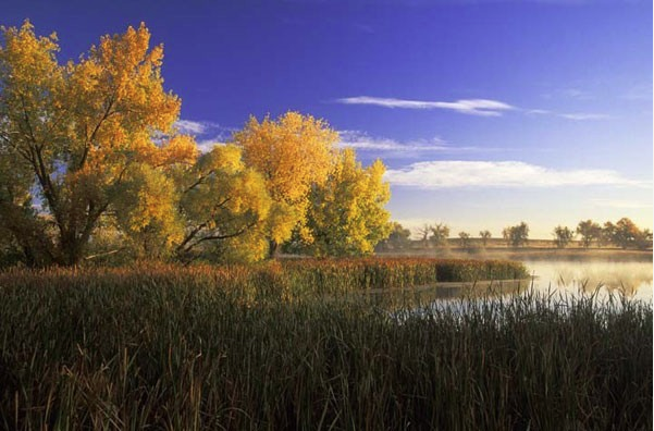
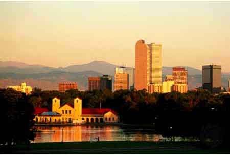
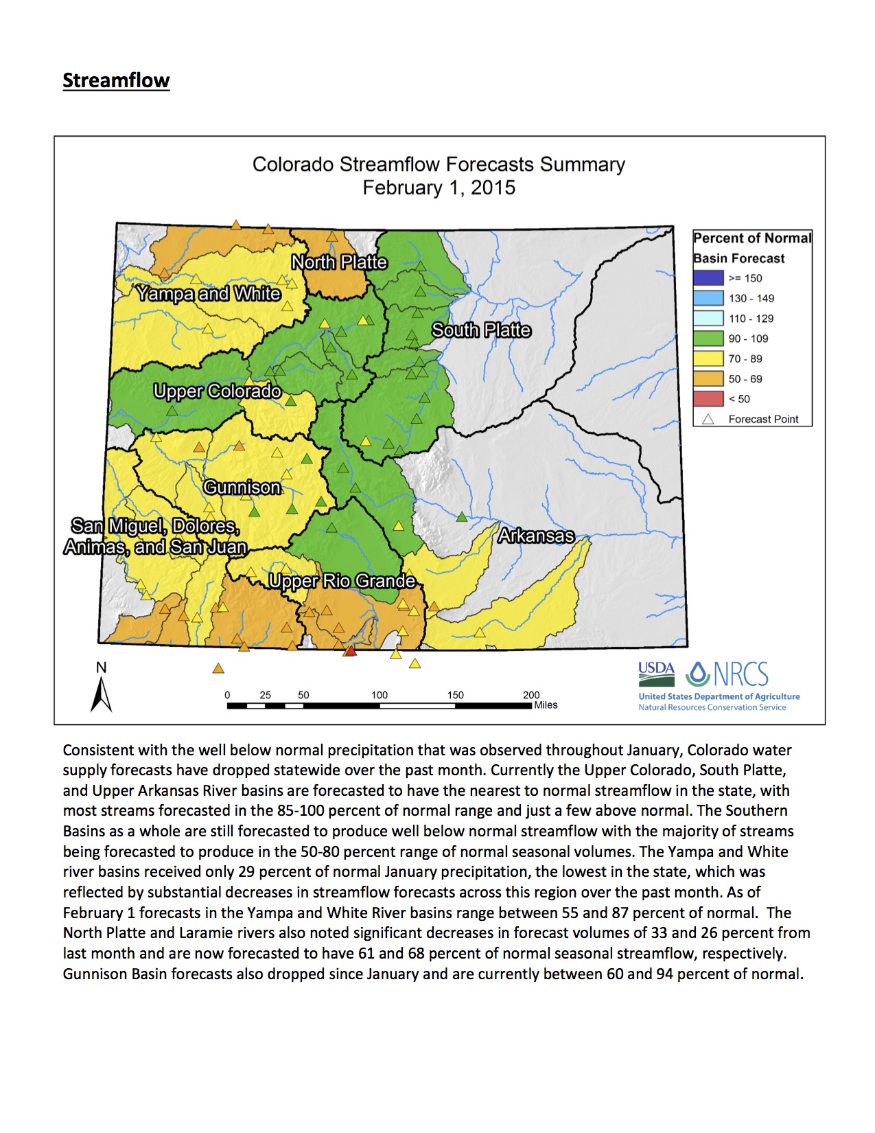
From as far away as Lake Granby on the Western Slope, into the Colorado-Big Thompson system, and eventually the South Platte River; or from as far away as Cameron Pass and the Poudre River, spring snow melt from the mountains flows through 500 miles of pipeline into two water treatment plants and into homes and business in Greeley.

It didn’t take long after Greeley was founded in 1869 for its forefathers to realize they needed to secure the rights to the water coming out of the mountains.

W.D. Farr, known to many as Mr. Water, and former Greeley Tribune publisher Charles Hansen are credited for bringing water from the Colorado River across the Continental Divide and to the Front Range. The Greeley water system is among the most elaborate and most rich in the nation, everyone close to the situation says.

Many say that’s thanks to the authority granted the Greeley Water Board when it was formed in the 1958 charter to manage the system.

Norman Dean, who was a member of the charter committee and one of those responsible for the Water Board’s authority, said it was a battle over who to put in charge.

“It was a very contentious subject,” Dean said. “Some guys wanted it to be a department of the city.”

But in the end, a University of Northern Colorado professor convinced the majority, including Dean, that it needed to be separate.

“Water and sewer generates a lot of money,” Dean said. “He did not want it to flow into the general fund for city council to use it as they wanted.”

Technically, it is a department of the city, but it is run by the water board.

The other option, said Leonard Wiest, former Greeley city manager who is now a consultant, would be to make the board an advisory board. Let them continue to do what they do, but leave the final decision to the Greeley City Council.

“We get a chance to vote on the city council,” Wiest said. “If we don’t like what they do, we can vote them out. The only thing the council can do right now to the water board is cut the budget. But they never do that either.”

The seven members of the water board are appointed by city council to serve a five-year term and cannot be recalled by voters. At the end of that term, they must be reappointed to serve again. However, no one can recall a time when the council did not reappoint someone.

“If at anytime they came to one of us and said, ‘We don’t think you’re doing your job,’ we would step down,” Evans said. “We may make decisions that some may not like, but we have to do what is best for the whole big picture.”

Additionally, there are no limits to the number of terms a water board member can serve. New members are recommended to the city council by the current board, leaving some to refer to it as a “good ol’ boys club.”

Many members have served for decades. Dean, who served 15 years on the board from 1989-1994, said that, too, was thought out by the charter committee.

“It seemed a shame to put term limits on them,” Dean said. “They finally get to understand it all and then they have to leave the board.”

The board controls a $26 million budget. Although city council ultimately has to approve any loans the water board requests, the water board has the authority to borrow money and sell bonds without going to voters, Wiest said.

“It’s taxation without representation,” Wiest said. “The water and sewer board is entirely independent. They do whatever they want.”

The board is responsible for setting water and sewer rates, plant investment fees (which are fees paid by a developer when a new home or business is constructed) and cash-in-lieu charges to get water to a new development.

Council can raise the rates and fees, but has no authority to lower the rates below a minimum formula set by the charter, which includes things such as depreciation and maintenance.

City Manager Roy Otto equates it to buying a car. You have to pay a minimum amount for a basic car, but all the bells and whistles are additional. If the water and sewer board wanted to raise the rates above what the formula says is needed to pay the bills, council could deny that.

“I have never since I’ve been city manager had a disagreement over the budget,” Otto said of the recommended budget versus what the council wants. “We all understand the importance of our rate structure. We have a sound system, I would put our system up against any in the area because the charter language considers depreciation and maintenance.”

Developers, however, have recently threatened to stop building in Greeley because development fees, especially for water and sewer, are too high, they say.

Many developers in the area have asked Wiest to lead an effort to ask voters to amend the Home Rule Charter in November, to make it an advisory board.

Wiest isn’t sure yet if he will, but he’s leaning toward leading the effort.

WHO PAYS THE WAY FOR GROWTH?

Greeley City Council has long charged its staff with the directive that growth pays its own way. In other words, fees should be charged to handle improvements or expansions when new developments come in.

Water and sewer is no different. New developments require the developer to supply the water rights to service the area, and new residential and commercial development must pay plant investment fees to help with maintenance and expansion to the system when it is needed because of growth.

However, the fees set by the water board are the source of disagreement.

At several recent meetings held by the city to discuss increased development fees that go in effect March 1, real estate brokers and contractors expressed concern that development was about to stop in Greeley because they can’t afford to build here compared to other communities. In particular, many believe the water and sewer fees charged against developers are too excessive.

Their contention is the increased fees drive up the cost of new homes in an area continuing to battle with poverty.

A recent attempt to lower those fees failed on a 4-3 city council vote. The argument against lowering the fees is that it puts the burden of paying for growth in the water system on the current users.

“It’s a philosophical belief,” Evans said. “Because on the other hand, you can say new development benefits everyone.”

Wiest said the water and sewer board are more concerned about someone who may move here in 50 years than they are those who live here now.

“The growth factor flies in our face,” Wiest said. “The person who moves here in 50 years will still have to bring their own water. But we are spending hundreds of thousands of dollars for water for the future.”

WHAT THE FUTURE HOLDS

Water board members say they are only trying to continue the logic of Farr, which has made Greeley the envy of many in Colorado for its long-term planning and vision in acquiring water rights.

“When you think about the previous boards and what they’ve done, we have the chance to stand on the shoulders of giants,” Evans said.

He added the land around northern Colorado is drying up, and people need to remember where they live.

“We are an arid landscape, but we want to look like the Midwest,” Evans said. “We have had water restrictions in place since 1905 for a reason.”

Ruyle agreed, adding it is getting more and more difficult every day to acquire water.

“It is a challenge to be able to acquire enough raw water to supply new growth for the city,” Ruyle said. “It is a limited resource in the area we live.”

In fact, 80 percent to 85 percent of the water used in Colorado is still used for agricultural purposes. That is a real challenge, both men said, because changing water use from ag to domestic in water court is a complicated process.

So what happens when Greeley’s economy moves away from agriculture? Evans asked.

“It is predicted we will have more than double our population by 2050,” Evans said. “Where is the water going to come from? What is it going to look like in 2050? Who knows? We’ll figure it out, but it’s going to look different.

“But we are fortunate to have the system we have. It allows us to do things others can’t do. When 2100 rolls around, I hope people look back on us and say, ‘Those guys in 2015 did a great job for us.’ ”

More Greeley coverage here.

Public lands rally February 25 — Backcountry Hunters and Anglers

Public Lands Rally graphic via Backcountry Hunters and Anglers

“One final paragraph of advice: do not burn yourselves out. Be as I am – a reluctant enthusiast….a part-time crusader, a half-hearted fanatic. Save the other half of yourselves and your lives for pleasure and adventure. It is not enough to fight for the land; it is even more important to enjoy it. While you can. While it’s still here. So get out there and hunt and fish and mess around with your friends, ramble out yonder and explore the forests, climb the mountains, bag the peaks, run the rivers, breathe deep of that yet sweet and lucid air, sit quietly for a while and contemplate the precious stillness, the lovely, mysterious, and awesome space. Enjoy yourselves, keep your brain in your head and your head firmly attached to the body, the body active and alive, and I promise you this much; I promise you this one sweet victory over our enemies, over those desk-bound men and women with their hearts in a safe deposit box, and their eyes hypnotized by desk calculators. I promise you this; You will outlive the bastards.” ― Edward Abbey

Here’s the link to the website. Here’s an excerpt:

Rally with Colorado Sportsmen for Your Public Lands

What: Rally for Public Lands

When: 12:00PM Wednesday, Feb. 25th

Where: West Steps, Colorado State Capitol, Denver

Who: Backcountry Hunters & Anglers, Trout Unlimited, Theodore Roosevelt Conservation Partnership, and Colorado Wildlife Federation

Why: Join your fellow Colorado sportsmen and women at the Colorado State Capitol in Denver to oppose transferring millions of acres of national public lands to the state. Sportsmen know that they will lose access and opportunity if lands owned by all Americans are transferred to individual states. Sportsmen need to speak up and say NO to a public lands transfer.

Join us at 12 p.m. Wednesday, Feb. 25th, on the West steps of the State Capitol.

RSVP to Join us Here!

We’ll be hosting a reception at Stoney’s Bar & Grill immediately following the event. Join us for beers, gear giveaways and more.

For more information on the foolish, but growing efforts to wrest public lands away from public ownership, check out this report.

Cant make it, but still interested in helping? Tell your elected officials to stop the public land sell-off by signing the Sportsman’s Pledge here.

Help keep our public lands public, Join Backcountry Hunters & Anglers Today!

For More information call: 406-370-4325

Pacific Northwest’s Winter, Warm and Wet, Is Climate Change Preview — Circle of Blue

Westwide SNOTEL snow water equivalent as a percent of normal February 12, 2015 via the NRCS

Snowfall in the West will probably decline under climate change. Even in areas with more precipitation that moisture will likely come as rain. This is a big water rights question as many irrigators do not have storage and will likely not have much end of crop season water. Here’s a report from Brett Walton writing for Circle of Blue. Click through and read the whole post. Here’s an excerpt:

Famously overcast and stormy in the cold months, the Pacific Northwest is normally a haven for snow lovers. From volcanic peaks to valley basins, winter resounds with the glee of cherry-cheeked skiers and the terror of thunderous avalanches. Mount Baker, a mainstay of the Washington state ski circuit, is accustomed to skyscraping snow accumulations deep enough to entomb an 18-meter (60-foot) building.

Not this year. Record-warm temperatures expose bare mountain ridges and disappoint ski bums and lift operators alike. Despite average levels of precipitation, rain is falling, not snow. Snowpack in much of the Olympics, the remote Washington peninsula mountain range, and in the Cascades, the spine from here to northern California, is less than 30 percent of normal.

It is a worrisome development, say hydrologists. Snowpack acts as a natural reservoir, a bank of moisture that melts slowly and keeps rivers flowing through the heat of the August dry season when spawning salmon, big wheat fields, and apple orchards are most in need of water…

Snowless conditions in the Cascades this winter are a cautionary signal for the entire American West, which is undergoing a “major hydrological shift” from snow to rain because of higher temperatures, according to a paper from University of Idaho researchers published last July. Their analysis projects that the area in which temperatures are cold enough for snow in the 11 western states will decrease by roughly 30 percent by mid-century…

Water managers need to balance a constellation of competing interests, from hydropower generation and flood protection, to fish health, forest fire risks, and water supply to cities and farms. The old playbook for operating dams and reservoirs must be revised and adapted to the new hydrology, managers say.

To do so, they argue, local, state, and federal governments must continue a recent trend of investing in stream gauges and equipment that monitors river flows, snow levels, and weather patterns. These tools are the guide ropes that managers use to allocate water and prepare for droughts and floods…

Better Management through Better Data

On-the-ground data is the lifeblood of hydrological forecasting. Computer models that predict conditions up to a year in advance need to be calibrated and refined by comparing the model’s output with historical measurements. The region’s river forecast centers use stream flow information from U.S. Geological Survey monitoring networks and snow measurements from National Resources Conservation Service sites.

Both Seattle Public Utilities and the Bureau of Reclamation use forecasts from the Northwest River Forecast Center, one of 13 regional forecasting divisions of the National Weather Service. Yet even as the complexity of river forecasting increases, and hydrological cycles are more disrupted than ever before, the nation’s resolve to pay for data collection and analysis is in transition.

Two years ago, at the height of Congress’s drive for fiscal austerity, some 618 stream gauges were shut down by the U.S. Geological Survey and its local partners for lack of money. Federal dollars used to support half the cost of operating a jointly-funded stream gauge. Now, the federal share is down to 30 percent. National Water and Climate Center officials told Circle of Blue last year that they deferred maintenance of many snow-monitoring sites after a 15 percent budget cut in 2011 and a 7 percent retraction during sequestration in 2013.

Recently, though, Congress increased funding for the National Streamflow Information Program, which goes toward stream gauges, by $US 6 million in 2014 and $US 1.2 million in 2015, a 26 percent increase over two years. It was enough money to provide full support for 1,000 of the 8,100 monitoring sites in the national streamflow program. The remaining sites are paid for by state and local agencies.

“Congress is starting to get it,” Pixie Hamilton told Circle of Blue. Hamilton is the national coordinator of the Cooperative Water Program, a branch of the U.S. Geological Survey that facilitates data collection partnerships. “Congressional folks are understanding the value of stream gauges in their districts. Word is getting out that stream gauges serve multiple needs, and there is keen interest around the states and Congress to keep up these gauges.”

Still, there is room for improvement. The Cooperative Water Program’s budget — $US 59 million — has remained roughly the same for 25 years, cutting the real value of its funding in half because of inflation. More of the 4,759 gauges deemed a national priority could be supported by a full appropriation from Congress, and the federal cost-share for collaborative projects could be increased.

“We are creatures of the water cycle,” Fleming said referring to his water management colleagues. “The more we can enhance our knowledge and bring it into the decision-making, the better position we’ll be in.”

More infrastructure coverage here.

Snowpack news

Westwide SNOTEL snow water equivalent as a percent of normal February 12, 2015 via the NRCS

From The Mountain Town News (Allen Best) (Click through for the graphics):

Across much of the West last week it was a wonderful week, as good as they get for March or even April. Except, of course, that it was early February.

In Fraser, the warmth was unsettling to Andy Miller. To have streets bare of snow was one thing. But out on the cross-country ski trails, he found the snow conditions unlike anything he could remember seeing in his almost 40 years of residency. Off trail, the snow was sugary, without a base. But more disturbing was the wetness of the ski trails themselves.

“We used to get spoiled. We put on green wax and, on warm days, a dab of blue. Waxing skis was never much of challenge,” says Miller, a town trustee in Fraser.

But on the ski trails, Miller has been putting purple, a softer wax, on his skis and this week thought he actually needed klister, the softest of waxes ordinarily reserved for skiing on hot spring days.

It’s something I can’t ever remember happening before,” says Miller.

Memory loss? Not at all. Records collated by the Colorado Climate Center show the entire state in the grip of a mid-winter heat wave from Jan. 27 to Feb. 29.

“The northwest portion of the state was 15 degrees above average, and other parts of the state were 12 degrees above average,” said Wendy Ryan, assistant state climatologist.

Steamboat Springs had the highest temperatures for that period in 105 years of record-keeping. Snowfall has been reasonable, but the snowpack has shrunken with the warm temperatures. Instead of a three-wire winter, as ranchers called a year of deep snow, it’s a one-wire winter.

In Summit County, it was the warmest mid-winter period ever in the 54 years of record-keeping at Dillon. In Crested Butte, it was the 5th warmest out of 100 years. And at Grand Junction, it was fourth warmest after 116 years of measurements.

After a dry January, attention turned to reservoir levels. Many are near capacity, a legacy of the big winter of 2013-2014. That’s a little less the case in southwest Colorado.

Lawns on south-facing houses in Telluride were bare last week. How often does that happen in Telluride in early February? “About once or twice a decade,” said Art Goodtimes, a resident since 1981.

West of Durango, the unpaved parking lot at the tiny Hesperus ski area looked like it was made to order for a Tough Mudder race: spatter-the-windshield muddy.

At Beaver Creek, temperatures that hit 40 degrees seemed to favor ski racers in the World Alpine Ski Races who went first, before the snow turned slushy and skis got grabby.

In Crested Butte, the lean snow is causing organizations of the annual Ally Loop ski race to alter starts and finishes.

In the Cascade Range, dump trucks have been called upon in years past to haul up to 55 loads of snow from Mount Bachelor to a ski and snowboard event held each mid-February in Bend, Ore. This year, snow is too scarce and temperatures so balmy that a motocross stunt team was scheduled to replace the snow sports, reports the Bend Bulletin.

In California, it was worse. The state water agency there said that January will likely go down as the driest month in California’s recorded history. Along the shores of Lake Tahoe, “people are raking, picking up pine cones and wondering if winter is only for those who live on the East Coast,” reported the Lake Tahoe News in early February. The website described the situation as “horrible.”

In Alberta, it was dry enough for prescribed burns in the Banff-Canmore area. In Jasper, the Fitzhugh talked about melting snow and rain showers. But examining weather records from the past 30 years, the newspaper blamed faulty memories, not errant weather.

“Despite our memories of frigid Januaries, full of long johns, woolies and frozen eyelashes, this January’s weather … is nothing new or unusual.”

But in Fraser, weather during the last few weeks has been distinctly different from what Miller remembers or the icy climate in which the town 70 miles northwest of Denver takes perverse pride. The town got the title in the 1950 and 1960s when local weather tracker Edna Tucker reliably got up every few hours to note the temperature. Morning radio shows—this was before TV—often had Fraser as coldest in the nation, with minus 30 and minus 40 not all that uncommon in January and February.

This winter, says Miller, it got to 20 below one night. He also remembers that in decades past, the temperature might warm to almost freezing at night – a sure signal of more snow, followed by the icebox once again.

Now, even after a storm, it’s staying well above zero. This icebox clearly is busted.

Rain to replace snow in the Sierra Nevada

LAKE TAHOE, Calif. – Those big dumps of snow that the Sierra Nevada is famous for? In the future, as the air warms, many of them will be replaced by big drenchings.

The National Oceanic and Atmospheric Administration said that 2014 was the 38th straight year with global annual temperatures above the long-term average.

In California, temperatures last year averaged 61.5 degrees Fahrenheit in California, or 4.1 degrees hotter than the 20th century average, reports the San Jose Mercury News, citing a new report issued last week by federal scientists.

Three other Western states—Alaska, Arizona and Nevada—also experienced their hottest years since 1895, when modern instrumentation became widespread. And Anchorage, Alaska, didn’t have a single day in 2014 in which the temperature dropped below zero, the first time in 101 years of record keeping.

A report by the Aspen Global Change Institute, a non-profit that caters primarily to visiting physicists, finds that the temperature in Aspen has increased during all seasons since 1940. However, precipitation, including snowfall, has increased.

Climate scientists say that it’s only going to get warmer.

Mike Dettinger, with the U.S. Geological Society, was in Lake Tahoe recently, and he echoed the forecast that the average snowpack for the Sierra Nevada in 2050 is expected to be half of what it is now.

“With more rain, less snow, and larger storms, it all comes together that the flood risk goes up in the Sierra,” Dettinger said, according to an account in Lake Tahoe News.

While peak runoff today is in May, rising temperatures will cause peak runoff to eventually be in April, said Arlan Nickel, with the U.S. Bureau of Reclamation.

The Tahoe News also noted that Jim Hansen, one of the most vocal of scientists about the need to abate the burning of fossil fuels, also spoke at the conference.

“If you add C02 to the atmosphere, it’s like putting a blanket on the planet,” he explained.

The Lake Tahoe News reported that Hansen, former director of the NASA Goddard Institute for Space Studies, argues that the only way to solve the problem is to levy an across-the-board fee on carbon, with revenues redistributed to households.

From InkStain (John Fleck):

The Colorado Basin’s two primary reservoirs lost, on paper, a million acre feet of water because of January’s dry snowpack, according to the latest numbers from the U.S. Bureau of Reclamation. That’s the difference between what we expected to end the current water year with based on the January forecast, versus what the forecast looks like today, a month later. The Bureau’s monthly “24-month study” (it comes out once a month and projects conditions for the next two years, hence the name – pdf here) anticipates 1.162 million acre feet less water in Lake Powell than was expected just a month ago.

As currently forecast, that means Lake Powell is expected to drop 8 feet in elevation in 2015, while Lake Mead drops 7 feet.

2015 Colorado legislation: House approves ‘flex-use’ water bill [HB15-1038] — The Grand Junction Daily Sentinel

Sprawl
Sprawl

From The Grand Junction Daily Sentinel (Charles Ashby):

Several Western Slope lawmakers didn’t get their way Tuesday on a bill that is designed to prevent so-called buy-and-dry tactics on water rights for farms and ranches.

While supporters of the measure, HB1038, say it gives water rights owners more flexibility in selling a portion of their water for other beneficial uses, opponents said it forgets water rights owners who aren’t parties in those sales.

The bill, which cleared the Colorado House on a bipartisan 42-22 vote, creates a “flex use” change in water decrees, which supporters say is designed to create a different option for water suppliers from buying agricultural water rights and then diverting that water from a farm or ranch.

But opponents said it has the potential to impact other water users, and would force them into water court to resolve issues created by those new flex decrees.

“The way water law works right now is, if you want to change the use then you go to water court and you prove that it’s not going to damage any other water right,” said Rep. J. Paul Brown, R-Ignacio. “What this bill does is, it does away with that process and bypasses the water courts. It will force legitimate water rights owners to go to water court if they feel like their water rights have been devalued.”

Rep. Don Coram, R-Montrose, said the bill will end up doing the opposite of what it’s intended, saying that such decrees will increase the value of water and spur more sales for municipal uses, leading more farms and ranches to stop producing and dry up their lands as a result.

At the same time, it will harm farmers and ranchers who want to continue in agriculture but aren’t parties to those flex agreements because it will force them to go to court to protect their water rights.

“They don’t know if they’re going to have enough money to farm the next year, and if they are damaged they certainly don’t have the resources to bring it to water court,” Coram said.

Rep. Jeni Arndt, D-Fort Collins, said that’s not going to happen because water owners still have to carve out agreements that keep the water for beneficial uses. At the same time, the bill will help address the growing need for municipal water in growing Front Range communities without drying up nearby farms and ranches, she said.

“We’re helping preserve agriculture and rural Colorado, addressing the state’s water needs and conserving our more precious natural resource,” she said.

The measure heads to the Senate for more debate.

More 2015 Colorado legislation coverage here.

Judge rules that Adams County stormwater utility is exempt from TABOR

Adams County photo via CIG

From The Denver Post (Anthony Cotton):

A judge in Adams County ruled Monday in favor of the county in a lawsuit filed by residents who opposed the stormwater utility fee that was approved by the county commissioners in 2012.

The lawsuit was filed in August 2013 by the Stop Stormwater Utility Association, which argued that the fee was really a tax and therefore a violation of the Taxpayer’s Bill of Rights in the Colorado Constitution because the collection was not approved by voters.

“Throughout this process the county has maintained the belief that the stormwater utility is a fee, not a tax and is necessary to provide storm water related services and facilities,” Commissioner Chaz Tedesco said.

In his ruling, Judge Mark Warner said “The utility is a government-owned business that receives less than 10 percent of its funds from state and local authorities combined, and is therefore an “enterprise” that is exempted from TABOR. Further, defendant has not engaged in an unconstitutional “bait and switch” by imposing the fee and using it, in part, for administrative and personnel costs.

“Further, the Court concludes the stormwater utility fee is reasonably related to the overall cost of providing services related water drainage and water related activities in the service area. Thus, based upon the foregoing interpretation of Colorado law, the stormwater utility charge is a fee, not a tax and not subject to TABOR.”

More stormwater coverage here.

#COWaterPlan: An Important Step — James Eklund @EklundCWCB

Colorado Water Plan website screen shot November 1, 2013

From The Washington Park Profile (James Eklund):

No single issue will have a more direct impact on Colorado’s future than our ability to successfully and collaboratively manage our life-giving water. Water pumps the beating heart of Colorado’s sublime appeal. It provides for thriving agriculture, the green hue of our forests, farm fields and, yes, even lawns, it courses through our wondrous landscapes and fills reservoirs and rivers cherished by anglers and rafters. It allows for more families and businesses to share in our state, entices tourists to visit and sustains our economies and environment.

But we only have so much of it. As our state continues to grow, how do we work together so that we continue to accrue all of these benefits water provides even as our supplies are limited – constrained both by what nature provides and what we’re obligated by law to send downstream, across state and national borders?

Further, how are we best to proceed and prepare when our finite supplies are subject to the volatility of Mother Nature as illustrated so starkly by recent drought, wildfire and flooding?

A statewide conversation to address these questions began in earnest in 2005, when roundtables, populated by people with myriad and often conflicting opinions and interests, convened in each river basin. Since then, these nine Basin Roundtables, along with a group that includes members from each roundtable (the 27-member Interbasin Compact Committee), have engaged in an unprecedented effort at consensus-building.

Those discussions bring us to today, when the Colorado Water Conservation Board – drawing on nine years of grassroots dialogue and more than 13,000 public comments through the roundtable and IBCC process – has released the first draft of Colorado’s Water Plan.

The water plan represents the consensus view from this process that unless Colorado takes a strategic, statewide approach to water, we will face a more difficult future and risk leaving the fate of our water to decisions and actions from outsiders, the federal government and other states within the Colorado River Basin.

Colorado’s Water Plan reflects agreement from water interests statewide on broad, near-term actions needed to secure our water future. These include efforts to conserve and store water, additional re-use and recycling of water and providing more options to agriculture to avoid the permanent dry-up of our farm and ranch land.

Colorado’s Water Plan doesn’t prescribe specific projects. Instead it outlines how various interests across basins can attain locally driven, collaborative solutions, and how balanced approaches can garner the broad support needed to accelerate projects and shorten the federal regulatory process often associated with water-related actions in Colorado.

With an issue as significant as water, it’s important to underscore what Colorado’s Water Plan does not do: In no way does it infringe upon water rights as a private property right; likewise is does not advocate for any kind of ban on buying and selling of those water rights among willing participants. It does not seek alternatives to our Prior Appropriation Doctrine that has guided water use since before our state’s founding; nor does it erode or in any way cede Colorado’s interstate compact entitlements.

But by creating a broad grassroots framework for how we, together, ought to approach and manage Colorado’s water, it gives us greater control of our destiny, sends a clear message of a unified Colorado vision to federal regulators and fortifies us against outcomes that could gradually be imposed upon us without a broadly supported path forward for our water.

The water plan published in December is not the end, but a beginning. We’ve published draft chapters online (http://coloradowaterplan.com) as we’ve assembled them as just part of our effort to maximize public participation beyond the public roundtable and IBCC process. This draft plan is now subject to more public comment, participation and revision, with a finalized version scheduled for submittal to Governor Hickenlooper later in 2015.

The plan itself will never be a finished one, however. We see Colorado’s Water Plan as an organic, living document, developed from the bottom up and shaped and shepherded by the public will and the evolving conditions and priorities necessary to maintain Colorado’s splendorous stature as a place to visit, explore, work and live.

More Colorado Water Plan coverage here.

CWCB: The next Water Availability Task Force meeting is February 18

Cliff Palace Mesa Verde National Park via Wikipedia

From email from the Colorado Water Conservation Board (Ben Wade):

The next Water Availability Task Force meeting will be held on Wednesday, February 18, 2015 from 1:00p-2:30p at the Colorado Parks & Wildlife Headquarters, 6060 Broadway, Denver in the Red Fox Room.

The agenda is posted at the CWCB website.

After warm, dry January, @usbr trims 1.2 MAF from its forecast for Lake Mead and Lake Powell for 2015 — John Fleck #ColoradoRiver

Colorado River Basin including out of basin demands -- Graphic/USBR
Colorado River Basin including out of basin demands — Graphic/USBR

Small scale hydropower enjoys bipartisan support — Diana DeGette

Walton Water: New USGS report says US ground water polluted by farms & urban area

Drought news: Temperatures were well above average this past week across the West #drought

Click on a thumbnail graphic to view a gallery of drought data from the US Drought Monitor. Here’s an excerpt:

Summary

This U.S. Drought Monitor week saw improvements along the West Coast as a series of strong Pacific storms produced substantial rainfall accumulations in northern California and western portions of Oregon and Washington. The storms were the first significant precipitation event to affect California since mid-December. Since the moisture associated with these storms was subtropical in origin, the vast majority of the precipitation fell as rain while snowfall was restricted to the higher elevations. Overall, the storms had little impact on the well-below-normal snowpack conditions across the Sierra Nevada and Cascades ranges. Elsewhere in the West, mountain snowpack conditions are currently below normal across the Great Basin and Southwest as well as in parts of the Intermountain West and Central Rockies. Reservoir storage remains below normal in Arizona, California, Nevada, New Mexico, Oregon, and Utah in contrast to slightly above average conditions in Colorado, Idaho, Montana, Washington, and Wyoming. Temperatures during the past week were well above normal in the western half of the conterminous U.S. with record high temperatures observed across the West and Central Plains. In contrast, the Northeast remained in a cold, snowy pattern with areas of Massachusetts, New York, New Hampshire, and Vermont receiving more than a foot of new snowfall…

The Plains

Across the northern and southern Plains states, temperatures were well above normal for the period. During the weekend, record high temperatures were observed in Kansas and South Dakota. In western Kansas, temperatures soared into the high 70s and low 80s, while portions of South Dakota reached the mid-60s. On this week’s map, changes included expansion of Abnormally Dry (D0) into western South Dakota in response to above normal temperatures and precipitation deficits during the past 30 days. In southeastern Kansas, some minor expansion in an area of Moderate Drought (D1) occurred in response to warmer temperatures and deterioration in local stock pond levels…

The West

During the past week, a series of strong Pacific storms came ashore late last week and continued throughout the weekend. This storm system – which tapped a conveyor-belt of warm, moist air from the subtropics – delivered widespread, heavy rainfall to northern California and the western portions of Oregon and Washington. In northern California, liquid precipitation accumulations ranged from three-to-fifteen inches, with the highest accumulations centered over the mountains of northwestern and north-central California as well as further south in the Santa Cruz and Santa Lucia ranges. In the northern half of the Sierra Nevada Range, rainfall accumulations ranged from three-to-ten inches, and the greatest accumulations occurred on the western slope between 2000 and 7000 feet in elevation. Snow levels were generally high (above 8000 feet) throughout the storms, and the cumulative effect of the snowfall received did not have a significant impact on the poor snowpack conditions across the range. According to the California Department of Water Resources, California’s snowpack (snow water equivalent) is currently at 27% of normal. On a more positive note, runoff associated with the event provided the addition of approximately 500,000 acre feet of inflow to the four major reservoirs (Folsom, Oroville, Shasta, and Trinity) in northern California. In response to the storm, a one-category improvement was made to areas of Extreme Drought (D3) in northwestern California as well as in the Santa Cruz Mountains (between San Francisco and Santa Cruz) and in the northern half of the Santa Lucia Range along the Central Coast. No changes were made on the map in the Sierra Nevada Range because snowpack conditions remain well below normal. In the Pacific Northwest, the same series of storms brought heavy rains (four-to-eight inches) to western portions of Oregon and Washington leading to one-category improvements in southwestern Oregon. According to the National Resource Conservation Service (NRCS) SNOTEL network, the snowpack in the Cascades of Oregon and Washington remains well below normal for this time year with snow water equivalent (SWE) percentages ranging from 7 to 64% of normal with the lowest values being observed in Oregon. Overall, the past week was unseasonably warm (three to fifteen degrees above normal) across the entire West with record high temperatures observed in California, Colorado, Idaho, Nevada, Utah, Washington, and Wyoming…

Looking Ahead

The NWS HPC 7-Day Quantitative Precipitation Forecast (QPF) calls for light precipitation accumulations (generally less than one inch) across the eastern half of the country while portions of the central and southern Rockies are forecasted to receive between one and two inches of liquid accumulation. The 6–10 day outlooks call for a high probability of above-normal temperatures across the West while below-normal temperatures are forecasted for the eastern half of the country. A high probability of above-normal precipitation is forecasted across eastern portions of the West, Plains, South, Southeast, and the Mid-Atlantic regions while below-normal precipitation is expected in the Pacific Northwest, northern California, Great Basin, and the Upper Midwest.

Denver and the Front Range, we’ve had a wet season — 0.62 inches [swe] ahead of normal — Matt Makens

Westwide SNOTEL snow water equivalent as a percent of normal February 11, 2015 via the NRCS

From TheDenverChannel.com (Matt Makens):

We’ve had snows, but nothing too big. Denver’s largest snow has been 5.4 inches on December 29, 2014.

Since moisture is critical to the state, and so many neighboring state’s rely on our snowpack, let’s check on how the season is doing…

For Denver and the Front Range, we’ve had a wet season — 0.62 inches ahead of normal. Further, this north-central section has been Colorado’s wettest on average. For Denver alone, the season’s snowfall is currently about 3 inches behind, but we’ve had rain to compensate so our total moisture is in good shape.

The south-central mountains on the other hand are the driest. Closing in on a quarter inch below average, this area needs quite a bit of snowfall to return to normal. Just looking at snowfall, that area is 59 percent of normal water within their snowpack. (see attached image of Colorado’s current water from snowpack status). The entire mountain range needs snow. Remember, our snowpack provides water for all of the southwestern US, and without it, they will be in water trouble too.

West Drought Monitor February 3, 2015

From the National Water and Climate Center via the Sierra Sun Times:

An unusually warm, dry January slowed snowpack accumulation in much of the West, according to data from the second 2015 forecast by the United States Department of Agriculture’s National Water and Climate Center (NWCC). California, Arizona and New Mexico, as well as parts of Colorado, Utah, Oregon and Nevada, remain in prolonged drought.

“January is usually a big month for snowpack accumulation,” NWCC hydrologist Cara McCarthy said. “But most of the West didn’t see significant gains this month. With isolated exceptions, only Arizona, New Mexico, Utah and Montana received near average precipitation last month.”

“This is as low a snowpack as I’ve seen across the Sierra Nevada and Cascades for many locations at this time of year,” said NWCC Director Mike Strobel. Several Snow Telemetry (SNOTEL) sites in those ranges are snowless, which is very unusual for this time of year.

Even the precipitation in the Southwest wasn’t enough to take these regions out of drought conditions. In Western states where snowmelt accounts for the majority of seasonal water supply, information about snowpack serves as an indicator of future water availability. Streamflow in the West consists largely of accumulated mountain snow that melts and flows into streams as temperatures warm in spring and summer. NWCC scientists analyze the snowpack, air temperature, soil moisture and other measurements taken from remote sites to develop the water supply forecasts.

The Cascades of Oregon and Washington have received normal levels of precipitation this water year, but it’s mostly fallen as rain instead of snow. California’s Sierra Nevada has seen little rain or snow. The extreme drought in California may be further aggravated by reduced streamflow in other parts of the West.

“This month the inflow forecast for Lake Powell fell from 90 to 70 percent of normal,” said McCarthy. “Because southern California draws water from the Colorado River, this may impact their water supply. This is only the second forecast of the season, and there’s still time for conditions to change. We’ll keep watching conditions and updating our forecasts as the year continues.”

The NWCC, part of USDA’s Natural Resources Conservation Service, monitors conditions year-round and will continue to issue monthly forecasts until June. The water supply forecast is part of several USDA efforts to improve public awareness and mitigate the impacts of climate change, including drought and other extreme weather events. Through the creation of the National Drought Resilience Partnership, launched as part of the President’s Climate Action Plan, federal agencies are working closely with states, tribes and local governments to develop a coordinated response to drought.

Since 1939, USDA has conducted snow surveys and issued regular water supply forecasts. Other resources on drought include the U.S. Drought MonitorThis is an external link or third-party site outside of the United States Department of Agriculture (USDA) website.. For information on USDA’s drought efforts, visit USDA Disaster and Drought Information. And to learn more about how NRCS is helping private landowners deal with drought, visit the NRCS’ drought resources.

“It’s called the forgotten reach…there’s no water there, and there’s no people” — Colin McDonald #RioGrande

Rio Grande and Pecos River basins

From KSAT.com (Justin Horne):

It was over a year ago that Colin McDonald, a former environmental journalist for the San Antonio Express-News, stepped away from his desk job and decided to set out on a journey few people have attempted before: traversing the entire length of the Rio Grande. His goal was to bring awareness to what he called a “disappearing river”.

“I started on June 20 at Stony Pass in the San Juan Mountains of Colorado,” said McDonald.

These are the headwaters of the nearly 1,900-mile long river. According to McDonald, it is a river rich with history and with plenty of stories to tell.

“They weren’t being covered for a broad audience, and that’s what I wanted to do,” said McDonald.

Video he captured along the way showed a wide range of landscape from raging rivers to serene surroundings and everything in between.

“I can paddle for two or three days and not see anybody.”

We caught up with McDonald near Brownsville as he was set to finish the last leg of his seven month expedition. He told stories of his encounters, from interactions with locals, to interviews he conducted with Pueblo Indians in New Mexico over water rights. He ventured into Mexico, to explain differences between how water from the river is utilized by Mexico and the United States.

“This river has basically been governed by 19th century water law, but is trying to deal with 21st century problems,” said McDonald.

McDonald also explained that parts of the Rio Grande in Texas cannot be paddled, because it is dried up. He walked these parts of the expedition.

“It’s called the forgotten reach because it’s left out, there’s no water there, and there’s no people,” he said.

All along his journey, McDonald took water samples to test water quality. He found much of the river to be clean, despite raw sewage flowing into the river from Nuevo Laredo. He also studied the impact of global warming on the waterway.

In the end, McDonald believed his journey restored his faith in humanity.

“I was taken in by the police chief of Eagle Pass; taken in by biologists in New Mexico; just people that have incredible insight and passion about the river,” said McDonald.

Ritschard Dam repairs are a top priority for Colorado River District officials #ColoradoRiver

Wolford Mountain Reservoir

From CBS Denver:

The Ritschard Dam on Wolford Mountain Reservoir near the town of Kremmling has some residents in the area concerned.

There have already been a few public meetings regarding the dam in Grand County. The Ritschard Dam has a clay core and is filled in around that with rocks, but the dam hasn’t held its shape. Something has happened with the settling of all the material over the past two decades.

“In 2009 it was discovered that pieces of the dam have settled faster than was expected by designers,” Jim Pokrandt with the Colorado River District said.

Sophisticated monitors have been placed inside the dam. The crest of the dam has settled down 2 feet, twice as much as expected — and also shifted downstream 8 inches.

“We’ve been studying that since 2009, spent $1.5 million or more on this, and we really can’t say why exactly, other than there could be some compaction issues that date back to construction time,” Pokrandt said.

Engineers have said it’s the river district’s top priority, and not fixing the dam could send a devastating flood down the Colorado River.

“Public safety is not at risk and it won’t be at risk because we’re going to take this quick action,” Pokrandt said.

Exactly how the dam will be secured and fixed won’t be decided until later in the year. One idea is making the dam and reservoir bigger.

“You can imagine that if you’re going to fix a settlement issue you might be scraping off part of the dam and rebuilding it. How much, we don’t know.”

Forty percent of the water in the dam is owned by Denver Water. The rest is to ensure water in the river for endangered fish and water for municipalities on the Western Slope. But making the reservoir hold more water brings in a whole new set of issues.

“It’s premature to talk about what the exact repair scenario could be,” Pokrandt said. “There’s no quick fix.”

The Colorado River District board will likely make a decision on how the dam will be fixed by the end of the year.

More infrastructure coverage here.

Southern Delivery System update: Damages awarded to rancher vacated by Colorado Supreme Court

Southern Delivery System route map -- Graphic / Reclamation
Southern Delivery System route map — Graphic / Reclamation

From The Pueblo Chieftain (Chris Woodka):

The Colorado Supreme Court vacated a Pueblo District Court order that would have required Colorado Springs to pay Pueblo County rancher Gary Walker more than $500,000 in costs in a legal dispute over Southern Delivery System.

The order, issued last week, throws out former District Judge Victor Reyes’ Dec. 4 decision to award Walker Ranches $387,000 plus 8 percent annual interest since 2011 for costs leading up to a trial that has been postponed several times. That amounted to about $509,000.

Reyes retired at the end of last year.

Reyes issued a supplemental order that the payment was binding because of Colorado Springs’ 1041 land-use agreement with Pueblo County that prevents “undue financial burdens” for Pueblo County residents affected by SDS.

The state Supreme Court directed Pueblo District Court to determine costs after a trial to determine the value of the easement for SDS across Walker Ranches. The trial is scheduled to begin in April.

Colorado Springs had argued legal costs should not be negotiated until after the trial concluded, while Walker’s lawyers said costs were incurred even as Colorado Springs sought delays for trial.

Walker has not made a request for payment under the 1041 agreement from Pueblo County commissioners, and the county is not a party to the dispute over payment, said Ray Petros, special counsel for Pueblo County.

Walker and Colorado Springs are miles apart on the value of the SDS pipeline easement. Colorado Springs contends it is worth $100,000, while Walker’s attorneys filed documents indicating damage to the ranches as a whole from the pipeline is $25 million.

2015 Colorado legislation: HB15-1038 (Flexible Water Markets) moves out of committee

Colorado Capitol building

From Colorado Public Radio (Megan Verlee):

The state House moved forward Tuesday with a bill [HB15-1038] intended to make Colorado’s water markets more flexible.

The measure would make it easier for some farmers and ranchers to transfer part of their water rights to other uses. If they found ways to conserve water in their agricultural operations, they’d be able to sell the excess to cities or other users.

“Currently you have to use your entire water right or you stand a chance of losing it. So there’s no incentive to conserve,” said Democratic Representative Jeni Arndt of Fort Collins.

Arndt said the goal is to find new ways to address the state’s growing need to for water.

The bill would limit the number of flexible water rights available statewide. The House approved it with bipartisan support. Western slope lawmakers, though, are concerned about its potential impact on water markets.

The measure now heads to the state Senate, which rejected a similar proposal last year.

More 2015 Colorado legislation coverage here.

Weekly Climate, Water and Drought Assessment of the Upper #ColoradoRiver Basin

Upper  Colorado River Basin month to date precipitation February 1 thru February 8, 2015
Upper Colorado River Basin month to date precipitation February 1 thru February 8, 2015

Click here to read the current assessment. Click here to go to the NIDIS website hosted by the Colorado Climate Center.

More Colorado River Basin coverage here.

CDPHE: State provides $4.6 million for flood recovery projects #COflood

Storm pattern over Colorado September 2013 -- Graphic/NWS via USA Today
Storm pattern over Colorado September 2013 — Graphic/NWS via USA Today

From the Colorado Department of Public Health and Environment:

Nine Colorado community drinking water and wastewater systems will receive a total of $4.6 million in grants to assist with projects helping them recover from the September 2013 flooding. This funding is provided under HB14-1002.

These grants provide funding for planning, design, construction, improvement, renovation or reconstruction of wastewater treatment works and public drinking water systems that were affected, damaged or destroyed as a result of the floods. Grants were issued in counties where Gov. John Hickenlooper declared a disaster emergency.

cpdhefloodrecoveryprojectlist02062015

@ColoBIP — There is time to still get involved – Colorado Water Plan! Attend the Basin Roundtable meetings.

Join Colorado Sportsmen as we rally to keep public lands in public hands

@COWaterCongress — Join POND, Feb. 24, to learn about Winter Park’s Water Rights, the proposed Federal Ski Area Water Rights rule

Snowpack news: Accumulations have flatlined or are dropping. Where’s Ullr?

From 9News.com (Anastasiya Bolton):

Justin Whitesell of the Wildland Fire Management Section at the Division of Fire Prevention and Control is also watching the conditions.

“‘We’re average’ still means that we have potential for wild land fires, that doesn’t mean we’re out of the woods,” Whitesell said. “You can still have a High Park Fire even though it’s showing average. You’re going to see the average number of fires.”

Firefighters and meteorologists try to predict how bad the season will be.

“It’s a crap shoot, it really is,” Whitesell said. “We all gear up almost the same way every year.”

“Don’t Frack Denver” asks city leaders to prohibit exploration and production in the city limits

Denver City Park sunrise

From TheDenverChannel.com (Alan Gathright, Jennifer Kovaleski):

A coalition including conservationists and neighborhood activists is asking Denver’s mayor and City Council to block fracking in the city and the river valleys that supply its drinking water.

The “Don’t Frack Denver” alliance on Tuesday called for elected leaders to impose an immediate moratorium on fracking in the city.

Opponents want to prevent “fracking wells being sunk into an area where Denver draws nearly 40 percent of its drinking water supply,” Sam Schabacker, regional director of Food & Water Watch, told an afternoon rally outside Denver’s City and County Building.

He’s talking about the Platte River Basin, a watershed that also “supplies thousands of jobs and an immense about of economic activity for the recreation industry.”

“Out in northeast Denver, residents that live in communities like Montbello and Green Valley Ranch are faced with the risk of having fracking wells put next to their homes or [where] they send their children to school,” Schabacker said. He asserted that contamination from fracking chemicals could place people at “increased risk of things like cancer, birth defects, lower birth rates.

Whether local governments can regulate fracking is the subject of debate. A task force appointed by Gov. John Hickenlooper is considering how much control local governments should have.

Hickenlooper, a geologist and the former mayor of Denver, has argued the state should regulate drilling.

In response to the alliance’s call for a fracking moratorium, Mayor Michael B. Hancock’s spokeswoman Amber Miller issued this statement:

“Mayor Hancock hears their concerns loud and clear and will continue to work toward a shared goal of preserving our environment and quality of life here in Denver. The Mayor is keeping a keen eye on this issue, and eagerly anticipates the recommendations from the Governor’s Oil and Gas Task Force before any action would be considered on a municipal level. Understanding the Task Force is working on a responsible balance, the Mayor asks for the community and stakeholders to remain patient and allow a thoughtful process to take place.”

Backers of the new campaign include nature photographer John Fielder, local affiliates of Food & Water Watch and the Sierra Club, three microbreweries and others.

At the rally, Fielder expressed concern about potential oil spills and protecting Colorado’s beauty.

“We want to make sure that they hear us, and hear our voices and that is that South Park is the last place we want to see oil and gas exploration in Colorado,” Fielder said of the high plain where the Platte River flows through Platte County. It’s a popular area for trout fishing and other outdoor recreation.

The Bureau of Land Management issued this statement about the South Park drilling site:

“The Bureau of Land Management Royal Gorge Field Office will be conducting a Master Leasing Plan for South Park as part of its upcoming Resource Management Plan revision. The purpose of a Master Leasing Plan is to provide BLM managers a way to strategically plan for oil and gas leasing and development and address potential resource conflicts. The BLM anticipates starting the public planning process this summer, in which public participation plays a vital role. “

From The Denver Post (Jon Murray):

Oil and gas representatives Tuesday assailed a campaign to ban new fracking operations in the state capital, with one pro-industry group equating the effort to “declaring war on Denver’s economy.”

Activists behind “Don’t Frack Denver” countered that they want to ward off the threat of expanded fracking in a city where oil extraction near homes is much less common than in some suburbs.

The push by environmental and community groups, activists and businesses received no immediate commitment from Denver Mayor Michael Hancock or the City Council.

It spurred Vital for Colorado, a pro-industry business advocacy group, to issue a blistering statement that referred to the activists as “anti-science extremists.”

“Groups that peddle fear, instead of facts, are out to hurt Colorado’s economy and out to reduce the tax base that supports our schools, parks and libraries,” said Peter Moore, the group’s board chairman.

But with fracking operations planned or setting up just outside far northeast Denver, the activists say they’re right to worry. Environmental group Food & Water Watch is coordinating the effort, The Denver Post reported in Tuesday’s print editions.

A Hancock spokeswoman said he understood the activist coalition’s concerns, but she said he wouldn’t consider backing any local action until a state oil and gas task force looking at regulatory issues publishes its recommendations. Those are due Feb. 27.

Councilman Chris Herndon, who represents northeast Denver, echoed Hancock’s comments.

A moratorium also could be in murky legal territory, given recent state court rulings that have overturned other cities’ fracking bans. Those are on appeal.

The most noticeable fracking in Denver occurs at Denver International Airport, which has 70 active wells leased out to oil and gas companies.

The activists also asked Hancock and the council to voice opposition to potential fracking leases on federal land in South Park near the headwaters of the South Platte River, a major source of drinking water for the metro area. Those could be years from winning approval, though, since the Bureau of Land Management has hit the pause button while it begins extensive studies that it says will consider environmental safety.

About three dozen activists Tuesday delivered letters to the mayor’s office and to City Councilwoman Susan Shepherd.

The signatories included environmental, community and social justice groups, businesses — including two microbreweries concerned about water quality — and nature photographer John Fielder.

Pro- and anti-fracking forces sparred over science, safety, air quality and water quality.

Fracking involves injecting water, sand and chemicals to break up underground rocks, releasing oil and gas. The industry says it has been safe for six decades and is subject to intense federal and state regulations that keep it from harming the environment.

But Rossina Schroeer-Santiago and other residents of Greenwood Valley Ranch, where Hancock lives, have watched oil companies lease ground nearby in Aurora.

“I want protection from these airborne hazards — not just for myself, but as a mother, for my children and for the other families in the community,” Schroeer-Santiago said. “Don’t frack my community.”

A spokeswoman for Green Valley Ranch’s developer, Oakwood Homes, told The Post this week that it has no plans for mineral exploration in the neighborhood.

From the Denver Business Journal (Cathy Proctor):

Colorado’s fracking wars arrived at Denver city hall Tuesday, with a coalition of 25 groups that included some of the standard bearers of the anti-fracking movement in the state delivering a statement calling for Mayor Michael Hancock and the City Council to ban the use of hydraulic fracturing within the city limits.

“We think it’s just a matter of time before they start fracking in Denver,” Sam Schabacker, the western region director for Food & Water Watch, who’s been working on the fracking issue in Colorado for the last few years, told the Denver Business Journal.

The Don’t Frack Denver coalition includes photographer John Fielder, Food & Water Watch; Greenpeace, Kids Against Fracking, Mercury Café, MM Local, Mo’ Betta Green Marketplace, Padres & Jóvenes Unidos, Rosenberg’s Bagels, Sierra Club – Denver Metro Network, Slow Food Denver; and the WildEarth Guardians.
And if the coalition is looking for a fight, the chairman of Vital for Colorado, a coalition of more than 35,000 Coloradans, businesses, civic leaders and trade organizations that support the oil and gas industry, says the organization is ready.

“We cannot let anti-science extremists destroy Denver’s economy over hype and environmental hysteria,” said Peter Moore, a Denver attorney and Vital’s board chairman, noting that fracking has been done in Colorado for decades and fracking fluid has never been discovered in underground water supplies.
“Groups that peddle fear, instead of facts, are out to hurt Colorado’s economy and out to reduce the tax base that supports our schools, parks and libraries. Extreme environmentalists are declaring war on Denver’s economy and thousands of Coloradans are ready for the fight,” Moore said…

On the one hand, fracking already has occurred in Denver. Denver International Airport owns 76 oil and gas wells, all of which have been fracked, a spokesman said.

The 76 wells have generated between $5 million and $7 million a year in revenue for the airport since 2010, money that’s used to pay for airport operations, according to the airport’s figures.

On the other hand, the group’s concerns Tuesday focused on Green Valley Ranch in northeast Denver, the home of Mayor Michael Hancock.

No drilling has taken place and no drilling is planned on the Denver side of that community, according to Wendy Aiello, a spokeswoman for the Oakwood Homes developer of the community.
ConocoPhillips (NYSE: COP) owns mineral rights near Green Valley Ranch, but they’re on the Aurora side of the Denver-Aurora border.

“However, we do not have any plans to drill there in 2015,” a company spokeswoman said Tuesday…

Food & Water Watch, based in Washington, D.C., wants the nation to shift to greener, renewable energy sources, Schabacker said.

“We think we need to move away from these forms of extreme energy extraction and need to be moving toward renewable energy,” he said.

“This ‘Don’t Frack Denver’ is asking for a moratorium on fracking in the Denver city limits to protect Denver’s residents, and also asking for Denver to ask the BLM {Bureau of Land Management] to not allow fracking in the water shed,” he said.

The group wants the BLM to halt plans to explore a master plan for leasing and drilling in the South Park area, a project the federal agency launched in response to environmental groups’ criticisms of previous efforts to explore the area for oil and gas.

Schabacker said the coalition worries that if the BLM finishes its plan and leases the South Park area for oil and gas operations, and if oil and gas companies drill for oil, then a spill could happen that contaminates the South Platte River, which supplies water to Denver.

“There will be an accident and spills into Denver’s water supply,” Schabacker said. “The question is what will it cost, and what are the implications for Denver’s residents and businesses who rely on that water.”
Karen Crummy, spokeswoman for an oil and gas advocacy group called Protecting Colorado’s Environment, Economy, and Energy Independence, said the new Denver anti-fracking group is “looking for a solution to a problem that doesn’t exist.”

The U.S. Environmental Protection Agency “has never found a case where fracking has contaminated groundwater, but this shows what happens when extreme, Washington-D.C. groups come into Colorado: they scare the heck out of people by peddling propaganda to further their agenda,” Crummy said.

More oil and gas coverage here.

2015 Colorado legislation: SB15-130 (Assist Conservation Easement Tax Credit Buyers) dies in committee

Saguache Creek
Saguache Creek

From The Denver Post (David Migoya):

A bill that aimed to offer relief to taxpayers who bought into the early days of Colorado’s conservation easement program and were blind-sided years later by hefty penalties was defeated in committee Tuesday.

The bill, SB-130, by Sen. John Kefalas, D-Fort Collins, met with stern opposition from state revenue officials who said taxpayers who purchased millions of dollars worth of easement tax credits were on their own, and the state shouldn’t have to fix their errors.

“This bill would place the government in the middle of a financial transaction between two private parties, and that is an area we should not occupy,” said John Vecchiarelli, Colorado’s director of taxation at the Department of Revenue. “Those responsible should be held accountable and the people of the state should not have to provide that relief.”

The Senate Finance Committee voted 5-0 to defeat the measure despite acknowledgments of testimony from taxpayers who were forced to pay as much as 10 times the original amount of their income tax bill.

“It’s our obligation to pay taxes so government works, but don’t do it in a way that makes me feel robbed,” said Julius Medgyesy, who runs Front Range Cancer Specialists in Fort Collins. “We’ve done nothing wrong in trusting a government program.”

At issue were millions of dollars in tax credits given to landowners in return for preserving their property from future development. The tax credits could be sold and taxpayers bought them at a discount and used them against their personal tax liability.

The first years of the program were not policed by the state and credits were claimed on donations whose underlying appraisals were grossly inflated — some by as much as 166,000 percent, state officials said.

Credit buyers learned of the abuses and poor appraisals years after they’d already used the credits, only to learn they had to pay the state their original tax debt. Worse, the landowners they’d bought the credits from no longer had the cash to repay the buyers and their land was now virtually worthless, stuck in the conservation easement forever.

“We are left taking bankrupt or broke landowners to court to collect money that’s no longer there,” testified Mark Heiden of Fort Collins. “What’s been fair to the credit buyers? Nothing. I’ve paid 150 percent to the state of what my normal tax liability would have been. The landowners got my money and spent it. The state got the rest.”

Senators said they struggled between an obvious injustice and the state’s liability to cover the taxpayers’ losses.

“This was a troubling afternoon of testimony,” said Sen. Mike Johnston, D-Denver. “We have those who supported (a program) and got short-changed on their investment, and that’s unfortunate and catastrophic. But the challenge is I can’t fit it into the precedent of the state’s obligation to correct it for them.”

More 2015 Colorado legislation coverage here.

2015 Colorado legislation: HB15-1144 (Prohibit Plastic Microbeads Personal Care Products) moves out of committee

Polypropylene microbeads via CBS Chicago

From TheDenverChannel.com (Theresa Marchetta, Sandra Barry):

A bill that would ban the production, sale, and promotion of any personal care product containing microbeads moved forward Tuesday at the State Capitol.

State Representative Dianne Primavera (D-Broomfield) and State Senator Nancy Todd (D-Aurora) introduced HB15-1144, which would be implemented over several years to take full effect in 2020, with penalties for violations as high as $10,000.

The House Public Health Care and Human Services Committee, which Primavera chairs, voted Tuesday afternoon to approve the bill.

In May 2014, the CALL7 Investigators were first to expose concerns over microbeads in Colorado water. That investigation confirmed the plastic particles — which are found in some toothpastes, face washes, body washes, shampoos, eyeliners, lip glosses and deodorants — had made their way through state filtration systems and into the South Platte River. The CALL7 Investigators sent water samples from the South Platte to a specialized lab in Marietta, Ga., which found microbeads made of polypropylene, a type of plastic. The toxic particles can be consumed by fish, and ultimately, by humans…

In 2014, Illinois became the first state to ban microbeads. At least five other states have either pending or approved legislation banning or significantly minimizing their use.

The Federal Drug Administration has approved microbead use in personal care products, but some dental professionals say they’re concerned not only about the impact on the environment, but on the consumers who use products containing microbeads…

In September, Procter & Gamble, which manufactures Crest toothpaste, confirmed plans to remove microbeads from most of its products within six months — and from all of its products by March 2016. Johnson & Johnson, L’Oreal, and Colgate have made similar commitments. Primavera said Johnson & Johnson approached her to propose HB15-1144.

The bill moves next to a vote on the House floor.

More 2015 Colorado legislation coverage here

Wolfe v. Sedalia average annual historical use decision from the Colorado Supreme Court

Plum Creek near Sedalia

Back at the end of January I was howling with other water wonks at the Colorado Water Congress Annual Convention. The case, Wolfe v. Sedalia, Historical Beneficial Consumptive Use Calculation — Change of Water Right And Augmentation Plan Decree — Claim And Issue Preclusion – Prolonged Unjustified Period of Nonuse was a topic of discussion by many in the hallways in between sessions.

The decision came down yesterday from the Colorado Supreme Court. Here’s an excerpt:

JUSTICE HOBBS delivered the Opinion of the Court.

This appeal concerns the historical beneficial consumptive use quantification of an 1872 irrigation right in a change of water right and augmentation plan proceeding involving water diverted from West Plum Creek in the South Platte River system, Water Division No. 1. Sedalia Water and Sanitation District (“Sedalia”) is the current owner of a portion of that water right, which it acquired from Owens Brothers Concrete Company (“Owens Concrete”). The State and Division Engineers (“the Engineers”) participated as parties in Owens Concrete’s 1986 augmentation plan case. They also appear as parties in this case.

When the concrete company owned this portion of the originally decreed appropriation, it obtained a change of water right decree quantifying an annual average of 13 acre-feet of water available for use as augmentation plan credit for replacement of out-of-priority tributary groundwater depletions from a well. Having acquired the concrete company’s interest in the 1872 priority, Sedalia claimed a right to the same amount of historical consumptive use water for its well augmentation plan in this case. On competing motions for summary judgment, the water court ruled that the doctrine of issue preclusion prohibited the Engineers from relitigating the quantification question, although the Engineers could raise the issue of abandonment at trial if they wished.

The issue the Engineers present for appeal concerns “a third successive change of the Ball Ditch water right” and whether its “average annual historical use last quantified by the second change decree” should be requantified in this proceeding to take into account “twenty-four years of subsequent nonuse.” In their briefs and at oral argument, the Engineers urge us to adopt a comprehensive rule that every change case triggers requantification of a water right. On the other hand, Sedalia asks us to adopt the polar opposite rule—that once determined in a previous change case, the amount of historical beneficial consumptive use allocated to the original appropriation carries through every subsequent change case and cannot be relitigated.

We adopt no such cosmic rule. Instead, we address the case before us in light of applicable claim and issue preclusion water cases. We affirm the water court’s judgment in part and reverse it in part. We hold that issue preclusion applies to prevent relitigation of the historical beneficial consumptive use quantification made in the 1986 Owens Concrete change of water right and augmentation decree, but this legal doctrine does not prevent a water court inquiry into the 24 years of post-1986 nonuse the Engineers allege. On remand from this decision and in finalizing Sedalia’s decree, the water court should take any evidence and legal argument offered by the parties on the issue of the alleged post-1986 nonuse. If the water court finds there has been prolonged unjustified nonuse of the water right between entry of the prior change decree and the pending decree application, it may conclude that this constitutes a changed circumstance calling for the selection of a revised representative period of time for calculating the average annual consumptive use amount available for Sedalia’s change of water right and augmentation decree.

The legislature may provide even more guidance to the State Engineer’s office with SB15-084, Water Right Partial Historical Consumptive Use.

More water law coverage here.

The latest One World One Water Center newsletter is hot off the presses

@CIRESnews: We cannot continue to release CO2 and hope to clean it up later

USGS: Climate Change Viewer shows projected changes in climate by state, county, or HUC

Relief from the (mostly) dry weather?

Precipitation forecast February 15 thru February 19, 2015 via the Climate Prediction Center

From the Vail Daily (Scott N. Miller):

While snowfall is being measured in feet in the northeastern U.S., particularly New England — Boston has broken a 30-day snowfall record — the western part of the country has been clear and dry. In fact, the last sustained snowfall in the valley dates back weeks now, probably into the last days of 2014.

HIGH PRESSURE SYSTEM

The culprit has been a lingering high pressure system in the western U.S. that has shuffled Pacific storm systems into a persistent low-pressure system in the eastern part of the country. The result has been great gobs of snow there, with just a few random snowstorms in this part of the country.

The question, then, is when those patterns will change, bringing relief to the Northeast and the relief of fresh powder to the Mountain West?

‘EVENTUALLY’

The answer, at this point, is a somewhat vague, “eventually.”

Ellen Heffernan, a forecaster at the National Weather Service’s Grand Junction office, said next week could bring a slight disturbance in those persistent patterns. The predicted snow, though, could track mostly into the southern part of the state.

But if you think this part of the state could use some snow, Southern Colorado is really hurting. The U.S. Drought Monitor website shows the southeastern part of the state is already in a “severe” drought, with other areas rated as being in a “moderate” drought.

West Drought Monitor February 3, 2015

Most of Western Colorado is rated as “abnormally dry.”

WATER SUPPLY FOR SUMMER

That’s bad for powder-loving skiers, of course. It could also be bad news for summer water supplies, since virtually all of Colorado relies on mountain snowfall for agricultural and domestic water.

But Jim Pringle, another forecaster at the National Weather Service’s Grand Junction office, said current snowpack numbers are OK, despite several dry weeks. Still, he said, the warm weather is abnormal for the region.

According to a Feb. 5 release from the U.S. Natural Resources Conservation Service, the Colorado River basin, of which Eagle County is a part, still had 95 percent of its average snowpack despite a very dry January.

But snow is needed, and fairly soon, to maintain a good snow supply for the summer.

Diane Johnson of the Eagle River Water & Sanitation District said it’s important to look ahead into the spring, toward the dates when snowpack generally is at its peak for the snow season.

“Every day you don’t get precipitation, you’re affecting that peak,” Johnson said.

That’s why good numbers now can quickly turn dismal if the weather doesn’t cooperate.

The peak dates are also important because snowpack numbers tend to fall quickly once the warm days of spring arrive. Even a big snowfall in late April won’t have much of an impact because that snow tends to melt quickly.

LONGTERM OUTLOOK

Forecasters can’t predict specific storm patterns past 10 days or so. On the other hand, the long-term outlook is pretty positive. The National Weather Service Climate Prediction Center calls for near-normal temperatures and above-average precipitation through the end of March and into April.

Pringle acknowledged the difficulty of long-range forecasts for specific storms, but added the Climate Prediction Center’s more general forecasts are generally pretty reliable.

Don’t put away the boots and shovels or drain the gas tanks on the snow blowers just yet.

From Steamboat Today (Tom Ross):

In spite of sparse January snowfall and the early spring skiing weather that prevailed during the first week of February, the moisture stored in the snow on the West Summit of Rabbit Ears Pass is a healthy 98 percent of median for Feb. 9.

To the south, in the foothills of the Flat Tops at Crosho Lake, that number is 119 percent of the median for the date. Snowpack numbers at Rabbit Ears and Crosho Lake don’t jive with the overall Feb. 1 snowpack numbers released Feb. 5 for the combined Yampa/White River basins by the Natural Resources Conservation Service. And in other locations in Northwest Colorado, snowpack is much lower.

Colorado Snow Survey Supervisor Brian Domonkos said in a news release that the North Platte River Basin along with the combined Yampa/White River Basins saw snowpack decrease in January by margins of 23 and 26 percent of normal respectively.

“With nearly one-third of the winter remaining, Colorado is running short of time to catch up,” Domonkos said. “Statewide snowfall would need to amount to 124 percent of normal from now until mid-April to achieve normal snowpack peak levels.”[…]

Domonkos said that although summer outlooks for streamflow volumes for April through July vary significantly around the state, most are forecasted to be between 60 percent and 85 percent of average.

streamflowforecast02012015nrcs

The forecast for the Yampa stood at 81 percent of average streamflow on Feb. 1. The Little Snake River drainage to the northwest of Routt County was forecasted to have only 71 percent of average flows. And the forecast for the White is 79 percent.

If there is a reason for optimism, it could be found in the current water storage in reservoirs around Colorado. Reservoirs in the Yampa/White River drainages are among the strongest in the state, averaging 112 percent after heavy rainfall in July, August and September, according to the Conservation Service.

The snowpack numbers around the Yampa and Elk River drainages are spotty.

On Buffalo Pass at the tower measuring site, snowpack was 79 percent of median on Monday. But even Buffalo Pass seems to be benefitting from the fact that the relative handful of snow storms that have passed over the northern Flat Tops and the Park Range have been high-moisture events.

At Rabbit Ears on Feb. 2, the snow depth was a modest 37 inches and contained 12.2 inches of moisture. Four days later on Feb. 6, 15 inches of additional snow depth had bumped the water content to 14.8 inches, or an additional 2.6 inches of snowpack.

It was a similar story on top of Buffalo Pass where the snowpack picked up an additional 4.3 inches of water thanks to 20 inches of new snow that boosted snow depth to 77 inches.

North of Steamboat, the Elk River and Lost Dog sites at 8,700 feet on the edge of the Mount Zirkel Wilderness area both stand at 83 percent of average.

Click on a thumbnail graphic below to view a gallery of snowpack data from the Natural Resources Conservation Service.

“Conservation has been successful and will be an integral part of meeting our future water needs” — Jim Lochhead

Cheesman Dam spilling June 2014 via Tim O'Hara
Cheesman Dam spilling June 2014 via Tim O’Hara

From The Denver Post (Bruce Finley):

Maybe it is projects such as replacing 10,000 toilets in Denver Public Schools. Maybe it is Denver Water’s ceaseless “Use Only What You Need” campaign. Or maybe residents seeing scarcity are self-motivated. Whatever the reasons, water use in metro Denver has dipped to 40-year lows.

The total amount residents used in December decreased to 3.19 billion gallons, and in January to 3.36 billion gallons — down from previous winter highs topping 4 billion gallons, utility officials said.

The last time December use dropped this low was in 1973 when Denver had 350,000 fewer people.

“Our customers are responding. … Conservation has been successful and will be an integral part of meeting our future water needs — along with reuse and new supply,” Denver Water manager Jim Lochhead said.

The low use this winter continues a trend of declining water use despite a growing population. Denver residents use 82 gallons a day per person for all indoor and outdoor purposes, utility data show. That’s down from 104 gallons in 2001 and puts Denver ahead of other Western cities that are counting on conservation to avoid running dry.

Water supply has become more of a challenge around the West, with population growth and droughts projected to be more frequent and severe. The crisis in California, where mountain snowpack lags at 25 percent of normal, prompted Interior Secretary Sally Jewell to meet with Gov. Jerry Brown last week to hash out relief.

Farmers use the most water, by far, for food production — an 85 percent share in Colorado. Yet it is city dwellers who are making the greatest strides in water conservation.

Denver Water leaders last week declared a new target for 1.3 million customers: 30 gallons a day for indoor use.

The overall water conservation effort relies on a widening strategy: rebates for those who switch to water-saving appliances, tiered water rates that encourage using less, summer lawn-watering restrictions, and a rule that all new development must include soil “amendments” so that soil retains more water.

Water bills still are relatively low. Denver Water charges about $455 a year for households using less than 115,000 gallons, compared with $1,283 in Arapahoe County and $890 in Colorado Springs.

The recent low use likely resulted partly from citywide conservation projects, utility officials said — including the replacement of toilets in 140 public schools with low-flow models designed in Japan.

Denver Public Schools field supervisor Jeff Lane said current toilets use 3.5 gallons per flush while the Toto toilets use 1.25 gallons. That’s expected to save the city 65.9 million gallons a year.

So far, district crews have replaced 3,200 toilets, Lane said this week at Colfax Elementary. The rest should be done by 2018.

Less water coursing through 4-inch iron and clay sewer lines could complicate the effort, Lane said. “It could get caught up.” But Denver Water officials said they’ve investigated and that, as long as lines are in good condition, there shouldn’t be a problem.

Denver Water pays DPS rebates of $90 per toilet. DPS officials said they’ll also sell old brass parts, $2 a pound, to help finance the switch.

The reduced water use also is attributed to Denver Water “messaging” using billboards, television and utility bills. Last month, bills contained blurbs touting the 30-gallon target. “Each person in an average single-family house should use roughly 30 gallons inside per day, or better yet, shoot for less!”

This is “something to aspire to,” Lochhead said.

Water bill blurbs also exhorted residents to “rethink your fixtures,” consult with neighbors because “understanding how others conserve will help you, too,” and replace portions of lawns with low-water shrubs.

A widening awareness of water supply challenges also appeared to be motivating residents to use less. “Whether it is a drought in Colorado or the West,” Lochhead said, “water availability is becoming a more familiar topic for many people.”

More conservation coverage here.

Drought news gallery: Five years of early February Drought Monitor maps

Click on a thumbnail graphic for a gallery of drought data from the US Drought Monitor.

Upward is the only recent direction for C-BT share prices

Colorado-Big Thompson Project east slope facilities

From BizWest (Steve Lynn):

Prices of Colorado-Big Thompson water have reached an all-time high, selling for nearly three times more than just two years ago.

Shares of the water went for more than $26,000 apiece at an auction Jan. 23, according to Berthoud-based Northern Colorado Water Conservancy District, the equivalent of $52,000 an acre foot. An acre foot equals 326,000 gallons, enough water to serve 2.5 households annually.

The water was bought for industrial and municipal uses, said Brian Werner, spokesman for the district. The identity of the buyer has not yet been disclosed.

The high prices are likely to cause concern in the agricultural world, where farm water traditionally has been lower priced. Residential homebuilders also are likely to feel the squeeze, as fees for new water taps rise.

“It’s fairly expensive water these days, if you can find it,” Werner said. “Some people can’t even find it.”[…]

Built originally in the 1930s to serve the region’s massive irrigated agriculture economy, shares in the C-BT gradually have been acquired by fast-growing cities and energy companies. Now the water is largely owned by cities, and leased back to farmers or others who seek to use it on a temporary annual basis.

How much water is associated with each share in the system changes each year and is based on how much water is derived from snowpacks and precipitation. This year, a share of water equals six-tenths of an acre foot since the Northern Water Board of Directors declared a 60 percent quota last April, meaning water-rights owners can use only 60 percent of the resource they own.

The high prices for water come despite record levels of water storage in October in the district’s reservoirs, which span Northern Colorado and the Boulder Valley.

“Storage remained high throughout this year and through the winter,” Werner said.

As of Jan. 1, Colorado-Big Thompson had 665,000 acre feet of water in storage, 45 percent above normal, Werner said.

The higher levels stemmed from above-average snowpack, increased precipitation and less water delivered to water users. Flooding in September 2013 also replenished groundwater supplies in many areas.

Higher water storage may mean more water available to rent, but it may not affect water-rights prices, said Tom Cech, director of One World One Water at Metropolitan State University.

“The price of (Colorado-Big Thompson) water and other water rights in the region are directly tied to demand such as from energy development, water for fracking purposes, and then urban development,” Cech said. “Those are the two big drivers.”

Fracking involves pumping millions of gallons of water under high pressure deep underground to free oil and gas from dense shale formations. As energy companies benefit from the water, Cech said, agriculture has faced increasing challenges because of the high water prices.

“Irrigated agriculture is generally short of adequate water supplies,” he said. “In the wet years, there’s enough, but you always have the dry years around the corner.”

Slowing energy development because of lower oil prices could temper high water prices in the next year or so, he said. Oil and natural-gas drilling permits approved in Weld County remained flat during the third and fourth quarters amid falling oil prices, according to the Colorado Oil and Gas Conservation Commission.

Urban development, however, has shown no signs of abating. The population of Weld and Larimer counties is expected to grow from 580,000 to more than 1 million people by 2040.

“You have to have water supplies for the new residents, so developers and municipalities have to go out and acquire more water rights,” he said. “That should drive the price of water up.”

Developers in Northern Colorado cities such as Greeley already face higher tap fees when they have to rely on Colorado-Big Thompson water.

\If developers do not have water to supply their developments, they instead pay cash to use Greeley’s supply. Here also, rates have skyrocketed, with Greeley charging $25,000 per share in recent months, nearly triple the $9,000 per share it was charging in October 2012, according to Eric Reckentine, the city of Greeley’s deputy director of water resources.

Mike DiTullio, district manager for the Fort Collins-Loveland Water District, said the higher prices are making new homes increasingly expensive. He said he closed a deal in January for 200 units of Colorado-Big Thompson water – for about $5 million, at $25,000 per share.

The higher water prices will not affect rates of existing residential customers, DiTullio said. Instead, new homeowners and developers will foot the bill. The water district serves about 16,000 customers in Larimer County.

“That increase in raw water costs is paid for by new houses,” he said. “There’s no such thing as affordable housing in Larimer and Weld counties.”

Snowpack news: South Platte Basin = 103% of normal (best in state), Rio Grande = 62%

Westwide SNOTEL snow water equivalent as a percent of normal via the NRCS

From Aspen Public Radio (Marci Krivonen):

In the dry month of January, snowpack levels in nearly every river basin in Colorado declined. In the Roaring Fork Valley, not only did the amount of snow diminish but drought conditions returned.

The U.S. Drought Monitor released Thursday puts the Western Slope in the “abnormally dry” category, including the majority of Eagle and Pitkin Counties and all of Garfield County. “Abnormally dry” is the least severe of five categories.

The latest snowpack report shows the Roaring Fork Watershed sits at 90 percent of normal – less than last year at this time, but significantly more snow than two years ago. Sarah Johnson is with the Roaring Fork Conservancy.

“It’s important to remember that even though our snowpack numbers are behind right now, I think the high country is holding the snow that it’s received and I think the warm temperatures are mostly affecting our valley floor. The snow that we have received is sticking around, which is really important because that snow in the high country determines our streamflow later in the spring and summer.”

The snowpack typically peaks in April, leading to peak river flows in June. Early season melting could lead to diminished water supplies and increased wildfire risk. There’s still time to catch up. March normally brings the wettest snow of the year.

From The Aspen Times (Scott Condon):

Last year wasn’t the hottest on record for Aspen, according to daily maximum and minimum temperature data stretching back to 1940, but data shows a definitive long-term trend toward significant warming, according to Jaime Cundiff, forest program director for the Aspen Center for Environmental Studies.

The number of annual frost-free days has soared since the 1950s and the number of consecutive frost-free days also is trending higher, Cundiff said. Snowpack levels vary from year to year with no definitive trend, but evidence shows that the snowpack is melting out sooner in the spring, she said. And the number of winter days with temperatures at or below zero is falling, creating more mild winters.

All of those factors have consequences for the environment, Cundiff said. Frost-free days, for example, can affect the budburst of vegetation and the overall species composition of an area.

ACES is analyzing weather and snowpack data for Aspen, among other mounds of data, as part of its Forest Health Index — an ongoing project to monitor a wide range of interlocking environmental conditions that affect forest health.

As part of the study, ACES found that the number of frost-free days in Aspen increased from an average of 73 per year in the 1950s to 99 in the 1990s and 107 in the 2000s.

Aspen also is experiencing milder winters. In the 1940s, there was an average of 35 days per year at or below 0 degrees during the 1940s. That fell to an average of 15 days per year during the 2000s.

“Extreme low temperatures are understood to play an important role in forest ecology,” the Forest Health Index said. “For instance, hard freezes are believed to help control insect-related disturbances such as the Mountain Pine Beetle infestation. Changes in extreme cold also serve as a broader indicator of change to the region’s climate.”

The index also found, in general, that the Aspen-area snowpack starts melting a week earlier in the spring and reaches the half-way melt-out period about one week sooner in the summer than it did in earlier decades.

A second report, Climate Change and Aspen, prepared by the Aspen Global Change Institute for the city of Aspen, noted many of the same environmental trends.

“For Aspen, climate change will likely include longer summertime warm periods, earlier onset of spring snowmelt, more precipitation arriving as rain rather than snow, and longer dry periods with heavier precipitation events in between,” said the report, released in December. “These types of changes could exacerbate already risky wildfire conditions, place extra pressure on already stretched water providers and users, provide additional challenges to ski area operators and other winter and summer recreation providers, as well as result in other impacts to every sector important to the Aspen community.”

Cundiff said the Forest Health Index places more stock in extremes, such as number of days with high and low temperatures rather than average annual temperatures. Statistics for any given year aren’t really useful. It’s trends that the index is seeking.

Nevertheless, she analyzed maximum and minimum daily temperatures for Aspen since 1940 and found that the average annual temperature between 1940 and 2014 was 41.44 degrees. The average for 2014 alone was 42.71 degrees. However, 2014 didn’t stand out. Several other years were at or above that temperature, she said. So, climate change didn’t make 2014 the hottest on record for Aspen, but trends show global warming is stressing Aspen’s environment.

From InkStain (John Fleck):

Today’s high in Durango was 59F (15C), 18 degrees above the 1981-2010 average for Feb. 8. In the mountains to the east – the mountains that provide Albuquerque’s San Juan-Chama drinking water – the snow has already begun to melt.

The snowpack there is lousy to begin with – 62 percent of normal for this time of year at the sites measured with automated SNOTEL gauges. But the first week of February is ridiculously early for the Azotea Tunnel, which brings SJC water under the continental divide and drops it into the Rio Grande Basin, to begin flowing.

It’s not a lot of water right now, a peak of ~23 cubic feet per second this morning. But the normal for this time of year is zero, and the tunnel typically doesn’t break 20cfs until the second week in March. This is basically a month early…

The worry here is not early melt. We’ve had that pattern for a while, with more of the snowmelt coming in March-May, and less in June and July. The early melt water coming through the tunnel will end up in Heron Reservoir, part of usable supply for Albuquerque and the other SJC water users. The worry is that weather this warm, dry and early could start a round of early sublimation – snow evaporating into the dry air before it has a chance to melt.

The vast potential of small hydropower — Rocky Mountain PBS I-News

Micro-hydroelectric plant

From Inside Energy via The Durango Herald:

A prime example of the future of hydropower is perched in the rugged peaks outside of Silverton.

This is no behemoth new dam blocking one of America’s rivers. It’s a humming generator no bigger than a wheelbarrow, pulling in water from a mountain stream and making enough power to serve 10 homes.

“I think the days of the megaprojects in hydropower are gone,” said Boulder-based energy analyst Cameron Brooks.

Instead, a fledgling industry is taking shape, focused on putting small electricity generation on already existing non-powered hydro infrastructure. It’s a flurry of new economic activity for which Congress can take much credit, and it’s an issue with opportunity for further political compromise as Republicans take control in the U.S. Senate.

The San Juan County Historical Society operates an 8-kilowatt plant near the historic Mayflower Mill that overlooks the Animas River about a mile northeast of downtown Silverton. The group was given the mill site about 15 years ago.

Millworkers used the pipeline in the early 20th century to help process gold and silver ore mined in the neighboring mountains.

Historical society chairwoman Beverly Rich wanted to use the pipeline to generate electricity. Yet, the project stalled when she was told her generator would have to go through a federal licensing process akin to what would be required if the historical society wanted to build a new Hoover Dam.

In the summer of 2013, the Silverton mill project was a poster child in hearings on legislation meant to showcase an overly-burdensome federal regulatory process for small hydropower. The hearing proved persuasive to lawmakers.

“Incredibly enough, in this horrible time of gridlock, it passed unanimously,” Rich said of the bill.

President Barack Obama went on to sign that and another major reform bill for small hydro.

These laws dramatically streamlined the federal licensing process for projects like the mill.

Brooks said the package of legislation hit a rare bipartisan sweet spot. For lawmakers on the right, the legislation shrank federal bureaucracy. On the left, it meant a win for renewable energy without building new dams.

Fans of small hydropower are actually happy with Congress right now. Still, they are looking for more.

Kurt Johnson is a Colorado-based hydropower consultant who testified at a congressional hearing for the 2013 bills. He agrees that the new laws have been very helpful in spurring more development of small hydro. Yet, he describes them as a kitchen knife gently cutting the government’s red tape, when what really is needed is a machete.

For Johnson, it shouldn’t just be a matter of reducing the licensing process.

“If the projects are tiny and non-controversial,” he asked, “why is the federal government involved at all?”

Johnson said 97 percent of the nation’s nearly 80,000 dams currently do not have hydropower, showing the scope of the opportunity. But to really make it happen will require more congressional slashing of remaining red tape.

Removing all federal oversight may be a tall order even for this new Republican-controlled Congress.

However, hydropower legislation likely will make a reappearance. Alaska Sen. Lisa Murkowski is set to be the new chairwoman of the Senate Committee on Energy and Natural Resources. Her office declined multiple interview requests for this story, but she’s on record calling hydropower an under-developed resource, saying more hydro could support economic growth and create jobs. As far as the country’s energy needs, there is vast potential.

Johnson recently met for an interview at the base of Button Rock Dam near Longmont, where a surging jet of water was launching at least 50 feet into North St. Vrain Creek.

“This is a great example of an enormous amount of mechanical energy which is currently being completely wasted,” he said.

There is no generator hooked up at the outlet of Button Rock Dam. If there were, it could power 500 homes.

A project of that size is considered small hydro; in fact, a project more than double that size would be labeled as such. Johnson said a developer for Button Rock is in the early stages of the federal application process set out under the 2013 bills.

The Department of Energy estimates that if generators were put on all existing non-powered dams in the U.S., such as Button Rock, it would create about as much power as a dozen large coal-fired power plants – or, to put it another way, enough electricity for at least 4 million homes.

The Durango Herald brings you this report in partnership with Rocky Mountain PBS I-News. Inside Energy is a reporting collaborative led by Rocky Mountain PBS. Email Dan Boyce at danboyce@rmpbs.org.

More hydroelectric/hydropower coverage here.

USBR: Additional FY 2015 Funding of $96.9 Million Available


From the US Bureau of Reclamation (Peter Soeth):

Bureau of Reclamation Commissioner Estevan López today released the spending plan for $96.9 million provided to Reclamation in the Consolidated and Further Continuing Appropriations Act of 2015. The funds will go toward Western drought response and rural water projects, among other important activities.
“Reclamation and its partners are confronting a growing gap between supply and demand in river basins throughout the West,” López said. “The funding released today will help us meet immediate needs and support long-term infrastructure and environmental needs of key water projects.”

The funding is divided among six areas:

  • Western drought response ($50 million),
  • rural water projects ($31 million),
  • water conservation and delivery ($8 million),
  • fish passage and fish screens ($4 million),
  • facility operation, maintenance and rehabilitation ($2.9 million),
  • environmental restoration and compliance ($1 million).

Extreme and prolonged drought has gripped major river basins across the West. In many areas, mountain snowpack is far below average for this time of year. The $50 million provided for Western drought response will address seven projects:

  • Central Valley Project, which includes funding for the Delta Division, Friant Division, Shasta Division and water and power operations, California ($19.9 million);
  • WaterSMART Grants, Title XVI Water Reclamation and Reuse Program, and Drought Response and Comprehensive Drought Planning ($14 million);
  • Lower Colorado River Basin Drought Response Action Plan, California, Arizona and Nevada ($8.6 million);
    Native American Programs ($4 million);
  • Yakima River Basin Water Enhancement Project, Washington ($2 million);
  • Lewiston Orchards Project, Idaho ($1 million);
  • Carlsbad Project, New Mexico ($500,000).

Reclamation based its Western drought funding on a thorough review at national, regional and program levels, to ensure a balanced approach. In some cases the funding allows Reclamation to accelerate selected projects to meet high-priority needs sooner than it would in absence of the new funding. In other cases it allows Reclamation to respond immediately to many of the West’s most critical drought-related needs.

Reclamation is also advancing the completion of its authorized rural water projects with the goal of delivering potable water to tribal and non-tribal residents within the rural water project areas. A total of $31 million will go toward five projects:

  • Pick-Sloan Missouri Basin Program – Garrison Diversion Unit, North Dakota ($10.3 million);
  • Rocky Boy’s/North Central Montana Rural Water System, Montana ($6.8 million);
  • Fort Peck Reservation/Dry Prairie Rural Water System, Montana ($6.6 million);
  • Lewis and Clark Rural Water System, South Dakota, Iowa, Minnesota ($6.6 million);
  • Eastern New Mexico Water Supply, New Mexico ($700,000).

The remaining $15.9 million will go toward nine projects:

  • fish screen and restoration projects in the Central Valley Project, California ($2.5 million);
  • Yakima River Basin Water Enhancement Project at Cle Elum Dam, Washington ($1.5 million);
  • agricultural water use efficiency projects within the Central Valley Project, California ($5 million);
  • Endangered Species Recovery Implementation Program on the Platte River, Colorado, Nebraska and Wyoming ($2 million);
  • water conservation projects on Rogue River Basin Project, Oregon ($1 million);
  • water leasing for supplemental water on the Middle Rio Grande ($1 million);
  • rehabilitation work at the Coleman National Fish Hatchery and Keswick Dam Powerplant in the Central Valley Project, California ($1.3 million);
  • renovation of the Olmsted Powerplant, Utah ($1 million);
  • repairs on the Colorado River Basin Salinity Control Project, ($650,000).

Visit http://www.usbr.gov/budget/ to view a summary of all the projects in this spending plan.

Colorado Water Congress Annual Convention “Aspinall Award” goes to Bill Trampe

Bill Trampe via the Colorado Water Conservation Board

I should have posted this last week. From the Colorado Water Congress (Fiona Smith):

Gunnison Rancher Bill Trampe awarded prestigious 2015 Aspinall Award

The Colorado Water Congress awarded Bill Trampe, a life-long Gunnison Rancher and Colorado water advocate, the 2015 Wayne N. Aspinall “Water Leader of the Year” Award.

The Aspinall Award is given annually in recognition of a career of service and contribution to Colorado’s water community. It is awarded to a person who has dedicated a significant part of his or her career to the advancement of the state and its programs to protect, develop and preserve the state’s water resources.

Trampe is a pivotal and influential advocate for water use and water quality, known for his ability to develop consensus among ranchers, farmers and other water users. His many accomplishments, including his participation in the negotiation of the Colorado River Cooperative Agreement, prove that he inspires historic cooperation among municipal, industrial, and recreational interests. He was a key negotiator at the Colorado River Water Conservation District in the Black Canyon of the Gunnison reserved federal water rights case and the Colorado River Basin Proposal on water supply solutions.

Trampe was selected for the award by the previous Aspinall Award winners and Colorado Water Congress officers. John McClow, CWC Board President said: “Bill Trampe’s leadership and original thinking in water and agriculture have had a tremendous positive impact in our community and the entire state. His modesty, wisdom and tireless commitment to achieving the best result, even when there is strong resistance, inspires everyone who has the opportunity to work with him.”

About Bill Trampe

Bill Trampe is a third generation cattle rancher from the Gunnison/Crested Butte area. He attended Colorado State University and has been managing the family ranching business from 1967 to the present. Trampe served on the Board of Directors of the Upper Gunnison River Water Conservancy District and currently serves on the Colorado River Water Conservation District. He is a founding Director of the Gunnison Ranchland Conservation Legacy, a non-profit organization dedicated to the preservation of Gunnison Basin ranchlands.

About the Wayne N. Aspinall Award

The Colorado Water Congress presents the prestigious Wayne N. Aspinall Award annually to a Coloradan who has long demonstrated courage, dedication, knowledge and leadership in the development, protection and preservation of Colorado water – those attributes possessed by Mr. Aspinall. The late Wayne Aspinall, a lawyer and former member of the U.S. House of Representatives, remains one of the most influential water leaders in Colorado history.

USGS: Wonder where all the wind turbines in the US are?

Water Lines: February offers water-focused education in western Colorado

Fog-filled Black Canyon via the National Park Service

From the Grand Junction Free Press (Hannah Holm):

February offers western Coloradans a wealth of opportunities to learn about agricultural irrigation and general water issues. In addition to the Water Center at Colorado Mesa University’s annual three-evening water course Feb. 11, 18 and 25, the Ditch and Reservoir Company Alliance (DARCA) will hold its annual convention Feb. 11-13 at Two Rivers Convention Center in Grand Junction. The Center for Snow and Avalanche Studies will also hold a snow school for water managers Feb. 11-13 in Silverton.

While the Water Center’s water course will offer insights into how agricultural water use relates to other water uses, the DARCA convention will offer the opportunity to dive into technical issues irrigation water providers wrestle with, as well as the significance of the Colorado Water Plan for agriculture. The snow school in Silverton, on the other hand, will take participants upstream both conceptually and physically, as they gain an in-depth understanding of how snowpack dynamics and climate change could affect water supplies.

WATER COURSE: WATER FOR AGRICULTURE

The Water Course will be held on consecutive Wednesdays — Feb. 11, 18 and 25 — from 6-9 p.m., in CMU’s University Center Ballroom. Presentations will also be live-streamed online. [ed. emphasis mine] Session 1, on Feb. 11, will focus on the climate and legal context for agriculture in Colorado; Session 2, on Feb. 18, will focus on current water use and the economics of agriculture; and Session 3, on Feb. 25, will focus on the future of irrigated agriculture in Colorado and the Colorado River Basin. To learn more about the water course, visit http://www.coloradomesa.edu/WaterCenter.

DITCH AND RESERVOIR COMPANY ALLIANCE CONVENTION

On Feb. 11, DARCA’s pre-convention workshops will cover technological and data tools for ditch managers. On Feb. 12, speakers will discuss the California drought, water marketing, and financing tools before the focus turns to Colorado’s water plan. On Feb. 13, participants can choose from workshops on the corporate formalities of ditch companies, water court and appellate processes, and ditch rider issues and rights.

While the DARCA convention is primarily geared towards ditch company board members, staff and share-holders, anyone who seeks a deeper understanding of western water issues would be well-served by attending. Agriculture is the primary consumer of water in our region, and how ditches are managed affects the recreational and environmental values in rivers and streams, as well as our region’s ability to grow food. In addition, ditch companies increasingly provide irrigation water to subdivisions as well as farms.

To learn more about the DARCA convention, visit http://www.darca.org/annualconvention.

SNOW SCHOOL FOR WATER MANAGERS

Held in Silverton Feb. 11-13, this snow school will combine classroom instruction with hands-on field sessions to enhance participant understanding of snowpack processes, snowpack monitoring, and snowpack data. The Center for Snow and Avalanche Studies, which is hosting the school, monitors study sites in the Senator Beck Basin Study Area near Red Mountain Pass that capture weather, snowpack, radiation, dust-on-snow, soils, plant community and hydrologic signals of regional climate trends.

To learn more about the Snow School for Water Managers, visit http://www.snowstudies.org/education1.html.

This is part of a series of articles coordinated by the Water Center at Colorado Mesa University in cooperation with the Colorado and Gunnison Basin Roundtables to raise awareness about water needs, uses and policies in our region. To learn more about the basin roundtables and statewide water planning, and to let the roundtables know what you think, go to http://www.coloradomesa.edu/WaterCenter. You can also find the Water Center on Facebook at http://Facebook.com/WaterCenter.CMU or Twitter at http://Twitter.com/WaterCenterCMU.

More education coverage here.

Climate change will increase irrigation requirements and evaporation in the #ColoradoRiver Basin

Lake Mead water levels via NOAA

From the Las Vegas Review-Journal (Henry Brean):

The Colorado River faces a dual threat from climate change as rising temperatures increase the demand for irrigation water and accelerate evaporation at the river’s two largest reservoirs.

So says a new report from the U.S. Bureau of Reclamation, which predicts an 8 percent increase in irrigation demand on the lower half of the Colorado River Basin and a 10 percent increase in evaporation from Lake Mead by 2080.

The upper half of the basin, above Glen Canyon Dam in Arizona, is expected to see demand for agricultural water jump by almost 23 percent, while Lake Powell loses 7 percent more water to evaporation than it did during the last half of the 20th century.

The estimates are based on a projected temperature increase of about 5 degrees across the region.

In a statement announcing the report Friday, Reclamation Commissioner Estevan Lopez said the findings will help regulators and stakeholders address the challenges that lie ahead.

“Understanding how climate change will impact crop irrigation demand and reservoir evaporation provides vital information for the development of alternatives and solutions to meet those challenges and support the nation’s economy,” Lopez said.

Agriculture accounts for roughly 80 percent of all the water diverted from the Colorado River, so even a small increase in demand can have a significant impact on the system.

The new report is the latest in a series of region-wide risk assessments looking at the impacts of climate change on water resources in the West.

A previous bureau study predicted a 9 percent decline in the Colorado’s flow by 2050 as a result of climate change…

In all, the Bureau of Reclamation’s new report looks at 12 reservoirs on seven river systems west of the Mississippi. Its outlook is also bleak for the Truckee and Carson Rivers, which supply water to farms and communities in northwestern Nevada, Reno among them.

According to the report, rising temperatures will drive up agricultural demand on the Truckee and the Carson by more than 14 percent over the next 65 years, while evaporation will increase by 14 percent at Lake Tahoe and by 7 percent at Lahontan Reservoir.

The bureau’s projections of future irrigation demand do not account for changing crop patterns or efficiency improvements at farms.

More Colorado River Basin coverage here.

Snowpack news: “Water planners would rather have some big storms falling right now” — Mike Nelson

Westwide SNOTEL snow water equivalent as a percent of normal February 6, 2015 via the NRCS

From TheDenverChannel.com (Marc Stewart):

“Water planners would rather have some big storms falling right now and packing that up so you don’t depend upon a storm coming in — in late March and April,” said Nelson.

7NEWS traveled to Lake Dillon in Summit County to check on water levels, and for the moment, the levels are above average.

Yet, Denver Water is always watching.

“You never know when the next dry period is going to come and even more important, you never know how long it’s going to last,” said Denver Water spokesperson Travis Thompson.

Sunny days in Colorado may bring smiles, but they also generate uncertainty.

“In a state like Colorado, water is gold,” said Nelson.

From Inkstain (John Fleck):

January was dry in the water-producing parts of the Colorado River Basin.

The official Feb. 1 forecast for the Colorado River above Lake Powell (the part of the Basin where all the water comes from) calls for just 80 percent of median April-July inflow. That’s a big drop from the Jan. 1 forecast, which called for inflow of normal (and by “normal” I mean at the median).

That’s about 1.2 million acre feet less inflow forecast.

Click on a thumbnail graphic below to view a gallery of snowpack data from the Natural Resources Conservation Service.