Denver waterways Weir Gulch, Harvard Gulch S. Platte R. get attention — The Denver Post

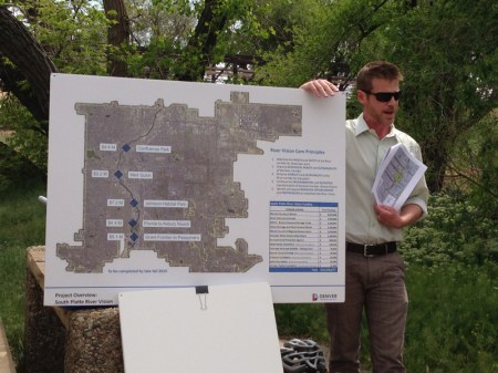
Michael Bouchard (Denver Parks and Recreation) with details about planned recreational development along the river through Denver

From The Denver Post (Joe Vaccarelli):

The U.S. Army Corps of Engineers, the city of Denver and other local agencies will be spending the next few years exploring ways to improve the South Platte River, Harvard Gulch and Weir Gulch as part of a comprehensive plan for the waterways.

The Urban Waterways Restoration Study will look into improving the ecosystem, reduce flood risk and adding recreational opportunities at all three sites. The South Platte will be studied between Sixth and 58th avenues.

“It’s a huge coordinated effort,” said Selena Klosowski, project manager for the Urban Waterways Restoration Study with Denver Public Works.

Weir Gulch runs into the South Platte River and generally ranges from 10th Avenue to Jewell Avenue and west to Alameda Parkway. The Harvard Gulch watershed is bounded by the South Platte to the west, Interstate 25 to the east and Evans Avenue to Mansfield Avenue.

Other local entities involved with the study include the Colorado Water Conservation Board and the Urban Drainage and Flood Control District.

Residents will have an opportunity to learn more about the study and give feedback at three upcoming meetings. Three more meetings are coming in the fall, and another one in the spring of 2016. All meetings will have translators present for non-English speakers. The study should be complete by spring or early summer 2017.

More restoration/reclamation coverage here.

Circle of Blue: Our @waltonwater annual pricing survey of 30 US cities is out

#Drought news (Part 2): Last week’s storminess helps the South Platte Basin drought picture (drought free)

Click here to go to the US Drought Monitor website. Here’s an excerpt:

Summary

During the past 7-days, moderate to heavy rain (generally 0.5-3.0 inches, locally greater) fell across portions of the Southeast, the Gulf Coast, the Great Plains, and the Ohio Valley. These areas of precipitation occurred in proximity to several slow-moving/stationary fronts and mid-level troughs. By far the heaviest precipitation totals were observed near the Gulf Coast, where numerous coastal counties from southeastern Texas to the extreme western Florida Panhandle received 5-10 inches during the past week. Precipitation amounts were generally light (0.5-inch or less) in the interior Pacific Northwest, the Southwest and the northern Plains…

The Plains

In North Dakota, light rain fell during the past 7-days, offsetting further deterioration of conditions. Temperatures also fell significantly (below freezing in some areas), keeping evaporation rates low. In South Dakota, only slight adjustments were made to the drought depiction. In north-central South Dakota, moderate drought (D1) was extended slightly northward into Walworth and Edmunds Counties. In southeastern South Dakota, moderate drought (D1) was expanded slightly southward to include eastern Hutchinson, central Turner, and northern Lincoln Counties. Most other areas of the state received enough rain this past week (a quarter-inch to an inch) to offset additional deterioration of conditions, but not enough to justify improvements. In the southern portion of the Nebraska Panhandle and nearby southeastern Wyoming, abnormal dryness (D0) was eliminated due to a recent storm system that produced about 2 inches of precipitation (liquid equivalent), much of which fell as wet snow. The region is finally beginning to experience spring green-up. The improved conditions also warranted the removal of abnormal dryness (D0) in the northern Laramie Range in southeastern Wyoming. During the past week in the Sand hills region of north-central Nebraska, 2-4 inch rainfall surpluses and good soil moisture infiltration prompted a 1-category improvement to the depiction. In northeastern Nebraska, despite receiving decent moisture over the past 2 weeks, significant deficits still linger at the 30-, 60-, and 90-day time periods. Therefore, the depiction remains unchanged in this area, pending reassessment next week. In Kansas, respectable rains (mostly 0.5-2.0 inches, locally greater) helped to offset any additional degradation. Surface water supplies are still low, and runoff is minimal. No alteration was made to the Kansas drought depiction this week.

The southern Great Plains also experienced a mix of both improvements and degradations. In Oklahoma, 1-category degradations were made in the western Panhandle, as only 1.0-1.5 inches of rain fell during the past 30-days. There were reports of dust storms and dead dryland wheat across much of this area. In west-central Oklahoma, a swath of 4-8 inch rains prompted a 1-category improvement from about Roger Mills County northeastward to Major County. In extreme northeastern and northwestern Roger Mills County, and most of adjacent Ellis County, no good runoff rains were reported, suggesting status quo for those areas. In Texas, widespread 1-category improvements were made to the drought depiction after recent rain fell over many areas that needed it. Stream flows are improving in southern and south-central Texas, and there is continued reservoir improvement in the Dallas area. In the Panhandle region, some of the wheat crop is expected to be salvaged, but it is unlikely the crop will return to normal…

The West

Moderate precipitation (0.5-2.0 inches, liquid equivalent) fell in much of the Upper Colorado River Basin this past week, though not enough to greatly improve snowpack or stream flows. This region will be monitored for possible improvements next week. In parts of northeastern Colorado, where 1-3 inches of rain have fallen so far this April, 1-category upgrades were made. This includes Cheyenne County in extreme eastern Colorado, and near the northern border with Wyoming. In southern New Mexico, moderate drought (D1) was removed from southwestern Chavez and all of Otero Counties due to good moisture conditions. The Pecos River Valley is doing well on the eastern side of the state, with full reservoirs and commencement of irrigation. Conditions are not as promising though for the Rio Grande Valley.

In northeastern California, exceptional drought (D4) was expanded across the northern Sierras this week, while in northern Modoc County, a one-category improvement (from D4 to D3) was rendered to the depiction to more accurately reflect local conditions. In east-central California near Yosemite National Park, the average surface elevation of Mono Lake stood at 6378.9 feet, as of April 15th. This is the lowest surface elevation of the lake since early 1996. The target elevation is 6391 feet. For the past two weeks, extreme to exceptional drought (D3-D4) covered two-thirds of California. In northern Nevada, a one-category degradation was made to northwestern Elko County, while in southwestern Montana, small improvements were made to the drought depiction in Gallatin County.

In Washington state, record/near-record low snowpack supports the expansion of moderate drought (D1) across the northern Cascades, and the introduction of moderate drought in northeastern Washington…

Looking Ahead

For the ensuing 5-day period, April 23-27, northern New England, portions of Georgia and Alabama, and southern Florida are expected to receive 1.0-1.5 inches of precipitation, which would help in the mitigation of existing dryness/drought. Up to about 2 inches of rain is forecast for the easternmost portions of the drought region in both Oklahoma and Texas, during this period. Light precipitation (0.25-inch or less) is anticipated for most of the Dakotas and upper Mississippi Valley, though western South Dakota is expected to receive 1.0-1.5 inches of rain. Between 1.0-1.5 inches of precipitation (liquid equivalent) is predicted for parts of the West.

For the 6-10 day period, April 28-May 2, there are enhanced odds of near- to below-median precipitation across most of the contiguous U.S. Odds favor above-median rainfall from the central and eastern Gulf Coast region northeastward across the Southeast, mid-Atlantic, and southeastern New England.

Snowpack news: “Snowpack still low in Colorado; Lake Powell inflows below average” — Hannah Holm #ColoradoRiver

From the Grand Junction Free Press (Hannah Holm):

Last week’s storms, which snarled Interstate 70 and (briefly) turned Grand Valley trails to sticky mud, calmed fears of an early start to wildfire season; but it didn’t significantly improve the regional water supply picture.

April 20 snowpack levels in western Colorado ranged from 40 percent of average in the Southwestern basins to 71 percent in the Colorado Basin. The statewide snowpack was at 61 percent of average. The South Platte Basin snowpack, upstream from Colorado’s most populated areas, got the biggest bump out of the storms and reached 94 percent of average. Statewide, the total amount of water in the snow that has fallen since the 2015 water year began on October 1, 2014 (as opposed to snowpack at this moment in time) was a little less than 80 percent of normal.

As mediocre as Colorado’s snowpack is, it’s in better shape than the snowpack in most of the rest of the West. Eastern Utah is down to just four percent of normal, with no basin in the state above 50 percent.

Unsurprisingly, forecast inflows into Lake Powell are significantly below average. The Bureau of Reclamation forecast released April 20 predicted inflows of just 6.832 million acre feet, or 63 percent of normal, for the full 2015 water year.

At the same time, the total forecast releases from Lake Powell to Lake Mead, under operating criteria agreed to several years ago by the states that share the river, are expected to be between 8.23 and 9.0 million acre feet.

So Lake Powell, which is currently 45-percent full, will certainly not be getting any fuller this year. Lake Mead is 39-percent full, and total Colorado River Basin storage is 48-percent full, up one percentage point from last year. [ed. emphasis mine]

The U.S. Drought Monitor predicts that the next three months are likely to be wetter than average for the four-corners states, and that the relatively mild drought (compared to California) over most of Western Colorado is likely to improve. Farther to the South and West, however, drought conditions are expected to persist or intensify.

This year, due to good storage levels, we probably won’t see severe water shortages in Colorado; and downstream, Lake Mead is likely to get just enough water to prevent a formal shortage declaration, which would lead to reduced water deliveries to some Arizona farmers.

But the troubling long-term picture in the Colorado River Basin as a whole is not improving, and another year like this one will lead to those formal shortage declarations in the Lower Basin, as well as drop Lake Powell closer to the minimum level at which it can generate power.

This regional context is important to keep in mind as Colorado’s water leaders continue their work to complete a statewide water plan. The East Slope as well as the West Slope relies heavily on water from the Colorado River Basin, and both current and future uses of this water could be impacted if water storage levels drop much lower.

This is part of a series of articles coordinated by the Water Center at Colorado Mesa University in cooperation with the Colorado and Gunnison Basin Roundtables to raise awareness about water needs, uses and policies in our region. To learn more about the basin roundtables and statewide water planning, and to let the roundtables know what you think, go to http://www.coloradomesa.edu/WaterCenter. You can also find the Water Center on Facebook at http://Facebook.com/WaterCenter.CMU or Twitter at http://Twitter.com/WaterCenterCMU.

#Drought news: “Blob of warm Pacific water threatens ecosystem, may intensify drought” — CNN

From CNN (Steve Almasy, Dave Hennen and Jennifer Gray):

A University of Washington climate scientist and his associates have been studying the blob — a huge area of unusually warm water in the Pacific — for months.

“In the fall of 2013 and early 2014 we started to notice a big, almost circular mass of water that just didn’t cool off as much as it usually did, so by spring of 2014 it was warmer than we had ever seen it for that time of year,” said Nick Bond, who works at the Joint Institute for the Study of the Atmosphere and Ocean in Seattle, Washington.

Bond, who gave the blob its name, said it was 1,000 miles long, 1,000 miles wide and 100 yards deep in 2014 — and it has grown this year.

And it’s not the only one; there are two others that emerged in 2014, Nate Mantua of the Southwest Fisheries Science Center — part of the National Oceanic and Atmospheric Administration (NOAA) — said in September. One is in the Bering Sea and the other is off the coast of Southern California.

Waters in the blob have been warmer by about 5.5 degrees, a significant rise.

Persistent pressure

A recent set of studies published in Geophysical Research Letters by Bond’s group points to a high-pressure ridge over the West Coast that has calmed ocean waters for two winters. The result was more heat staying in the water because storms didn’t kick up and help cool the surface water.

“The warmer temperatures we see now aren’t due to more heating, but less winter cooling,” a recent news release from the University of Washington announcing the studies said. The university has worked with NOAA on the research.

According to New Scientist magazine, some marine species are exploring the warmer waters, leading some fish to migrate hundreds of miles from their normal habitats.

The magazine cited fisherman and wildlife officials in Alaska who have seen skipjack tuna and thresher sharks.

Pygmy killer whales have been spotted off the coast of Washington.

“I’ve never seen some of these species here before,” Bill Peterson of the Northwest Fisheries Science Center in Seattle told the New Scientist.

And he was worried about the adult Pacific salmon that normally feed on tiny crustaceans and other food sources that are not around in the same numbers off the coast of the Pacific Northwest.

“They had nothing to eat,” he told the magazine of last year’s conditions in the blob. It appears that food has moved to cooler waters.

In January, Bond told the Chinook Observer in Long Beach, Washington, that his concern is for very young salmon that are still upstream.

“In particular, the year class that would be going to sea next spring,” he said.

NOAA said in a news release last month that California sea lion pups have been found extremely underweight and dying, possibly because of an ocean with fewer things to eat.

“We have been seeing emaciated or dehydrated sea lions show up on beaches,” Justin Greenman, assistant stranding coordinator for NOAA on the West Coast, told CNN.

The numbers are overwhelming facilities that care for the stranded sea lions, most of whom are pups, local officials said.

Record number of sea lion pups stranded in California

Warmer water, less snow

The blob also is affecting life on land. For the past few years, that persistent ridge of high pressure has kept the West dry and warm, exacerbating the drought in California, Oregon and Washington.

One of the primary problems is small snow accumulation in the mountains.

In early April, officials measured the snowpack in California at a time when it should be the highest. This year it hit an all-time low at 1.4 inches of water content in the snow, just 5% of the annual average. The previous low for April 1 had been 25% in 1977 and 2014. (pdf)

Gov. Jerry Brown, in announcing water restrictions the same day, stood on a patch of dry, brown grass in the Sierra Nevada mountains that is usually blanketed by up to 5 feet of snow.

Low California snowpack ushers mandatory water restrictions

The heat has caused rising air, which can lead to conditions that produce more thunderstorms. With warmer air in California, areas at higher elevations that usually see snow have seen rain instead. That has led to the lower snowpack and helped compound the drought. The storms also mean more lightning and more wildfires.

And the blob affects people on other areas of the country.

That same persistent jet stream pattern has allowed cold air to spill into much of the Midwest and East.

This stuck pattern has led to the record cold and snow in the Midwest and Northeast over the last two seasons with record snows we have seen in Boston and Detroit, and the most snow we have seen in decades for cities such as Chicago.

Still a mystery

The weather pattern is confusing the experts.

There are some that think it might be a Pacific Decadal Oscillation, a long-lasting El Nino-like pattern in the Pacific.

Dennis Hartmann, a professor of atmospheric science at the University of Washington, doesn’t believe the answer is clear.

“I don’t think we know …” he said in the university’s news release. “Maybe it will go away quickly and we won’t talk about it anymore, but if it persists for a third year, then we’ll know something really unusual is going on.”
From The Produce News (Kathleen Thomas Gaspar):

With an ongoing drought a major factor in the San Luis Valley’s potato industry, planting this coming season could be down between 8 and 10 percent from last year’s 55,000 acres.

Jim Ehrlich, executive director of the Colorado Potato Administrative Committee based on Monte Vista, told The Produce News in mid-April he had ā€œno way of knowingā€ going into planting, but he said given circumstances he looks for it to be down.

ā€œIt could be between 50,000 and 52,000 acres, but right now we just don’t know,ā€ Ehrlich said. Acreage in 2014 was bumped up from the previous year’s 49,700 acres, and Colorado’s largest potato production area saw an overall better growing season. Summer hail hit just under 4,000 acres, but nonetheless shipments year-to-date for March 2015 were up from the previous year.

Arkansas River Basin Water Forum recap: “We like our chances better with a strategy” — James Eklund #COWaterPlan

Colorado Water Plan website screen shot November 1, 2013

From The Pueblo Chieftain (Chris Woodka):

A state water plan may not prevent a crisis, but it would give the state a way to better deal with it.

ā€œWe like our chances better with a strategy,ā€ said James Eklund, executive director of the Colorado Water Conservation Board. ā€œWe’ve got a path forward.ā€

Eklund addressed about 150 people who attended the opening day of the Arkansas River Basin Water Forum at Pueblo Community College.

The state will spend most of this year putting the finishing touches on a water plan to be presented to Gov. John Hickenlooper on Dec. 10. Eklund has spent the last 20 months talking to water groups throughout the state about what the plan does and how it will be used. Most recently, the state’s basin roundtables wrapped up basin implementation plans that feed into the final document.

Actually, it won’t be ā€œfinal.ā€

Eklund called it ā€œopensource policymaking,ā€ meaning anyone with a smartphone or computer can logon (http://coloradowaterplan.com) and comment at any time.

California and Texas voters approved bond issues for $7.5 billion and $2 billion by 2-1 margins, largely because they had water plans in place, Eklund said.

ā€œWe’ve got to determine water priorities more aggressively than in the past,ā€ he said. ā€œThe state will not pick winners or losers, but will be able to prioritize regional projects, like we do now for transportation.ā€

The plan also will connect state policies on water, ending current trends that put water quality in one ā€œsiloā€ (Colorado Department of Public Health and Environment) and quantity in another (Division of Water Resources).

ā€œThe Arkansas basin is a poster child for how you do this work,ā€ Eklund said. ā€œWe need you to comment and help on the plan. We need to make sure our house is in order and that we’re unified as a state.ā€

The plan has to be flexible enough to meet the needs of a state that is expected to see its population double in 50 years. During his presentations, Eklund likes to show a picture of his own dour-faced great-greatgrandparents, whom he jokes would want no part of a water plan.

But times change.

ā€œWe’re living with the water policies our grandparents gave us, but we’re designing policies for our grandchildren,ā€ Eklund said. ā€œWhen people go home to be with their kids, they have to realize it’s not something you can take for granted. You have to plan for it.ā€

More Colorado Water Plan coverage here.

Rio Grande National Forest federal reserved water right decree a “huge success story” — The Pueblo Chieftain

riograndebasin

From The Pueblo Chieftain (Matt Hildner):

Few things heighten the blood pressure of water users like a federal reserved water right.

Around the American West they’ve been used to secure water supplies for Indian reservations, national parks and other federal lands, occasionally overturning the pecking order defined in water law by the maxim ā€œfirst in time, first in right.ā€

But local water users in the San Luis Valley have spent the last couple of months urging the Rio Grande National Forest to protect one that’s believed to be the only one of its kind ever granted to an entire national forest.

ā€œIt’s a huge success story, not only for the federal agency, but for the water users in the San Luis Valley,ā€ said Travis Smith, who represents the region on the Colorado Water Conservation Board.

Local groups and forest officials spent more than two decades negotiating the decree that protects in-stream flows on the 1.9 million-acre national forest before hammering out an agreement in 2000.

The decree established 303 quantification points on the headwaters of streams and rivers in the eastern San Juan and La Garita mountains and the northern Sangre de Cristos.

Each quantification point includes minimum high flows and maximum high flows that vary depending on the time of year.

The in-stream flows, which don’t involve the removal or consumption of any water, are designed to protect stream function and fish habitat.

The decree also gave forest officials the right to an unspecified amount for fighting fires.

But the upcoming revision of the forest’s management plan has prompted the federal agency to examine its existing management practices — including those for water — and collect public opinion on whether change is needed.

The plan-revision process is expected to last four years, but U.S. Forest Service officials want the feedback before they begin devising management alternatives later this year.

Toward that end, the Rio Grande Basin Roundtable, a 21-member panel representing users from around the valley, voted earlier this month to submit comments calling for the decree to stay the same.

The Rio Grande Water Conservation District followed with a similar vote Tuesday.

Such consensus would have seemed unlikely in the 1970s when the Forest Service began seeking federal reserved rights for in-stream flows at water courts around the state.

The trials for those efforts in the South Platte and Arkansas river basins were sprawling affairs with each ending up in the Colorado Supreme Court before being sent back to their respective trial courts.

Neither water court, in the end, granted in-stream-flow rights to the national forests in those basins.

And, initially, there was plenty of opposition in the Rio Grande Basin as 35 parties filed objections to the Forest Service’s filing.

Steve Vandiver is director of the Rio Grande Water Conservation District but he was involved in negotiations for the Rio Grande’s decree as the division engineer at the time.

He said the lack of development in the headwaters of the Rio Grande compared to other river basins made it much easier to reach a deal.

ā€œIf you look at the other basins, there’s a lot of private ground in and above the forest,ā€ he said. ā€œIf you’re Vail, or you’re Aspen or Copper Mountain, you don’t want a dedicated flow below you that has to be met every day.ā€

The decree signed by Judge Robert Ogburn mirrors Vandiver’s point, noting that there are only four large reservoirs and 181 other water rights located on or upstream of Forest Service lands.

Still, local water organizations secured important concessions in the decree.

The priority date for the forest’s water right was pegged at 1999, even though the lands covered by the decree were brought into the national forest between 1902 and 1938.

Another point in the agreement holds that if the Forest Service impeded on the exercise of other water rights or increased its stream flows through the use of its land-use authority, the decree could be reopened.

Jim Webb, who served as forest supervisor for the Rio Grande at the time of the decree, credited Vandiver and other local water leaders at the time for being forward thinking. ā€œThere was a high degree of trust,ā€ he told The Chieftain in a phone interview.

Moreover, he said the failed efforts by American Water Development Inc. and Stockman’s Water Co. to take water out of the valley made water managers more amenable to locking down in-stream flows on the forest.

He, like Vandiver, wants the decree left untouched, adding that there’s no unclaimed water left on the forest to increase the in-stream flows or become available for downstream users.

He also doesn’t want to see anyone mess with the decree because of the impact it would have on the forest’s relationships with its neighbors in the valley.

ā€œPolitically, it would be a bomb,ā€ he said.

More Rio Grande River Basin coverage here.