The Faculty, D.U. Water Law Review Symposium, “The Law Without Scholarship Would Build A Boat to Float a Waterless Sea,” April 9-10, 2015
Convener Emily Dowd
“Bring our young people in, let the Four Corners shine on them!”
John Fielder
“Call Yampa, White, the Rio Grande, San Juan, the Platte, the Arkansas.”
Marty Katz
“Fit crafts require skilled navigators and the whole great ocean to venture in.”
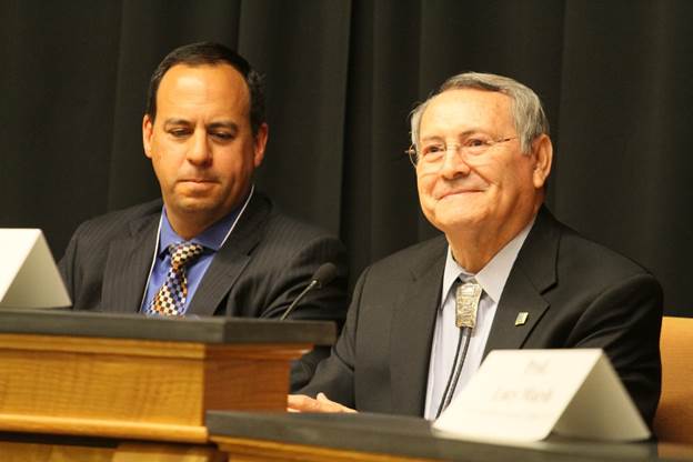
Allison Eid and Nancy Rice
“Kindness and respect being firm and resolute when it’s time for decision.”
Abigail Adams
“The right to vote maturing to pair equality and opportunity.”
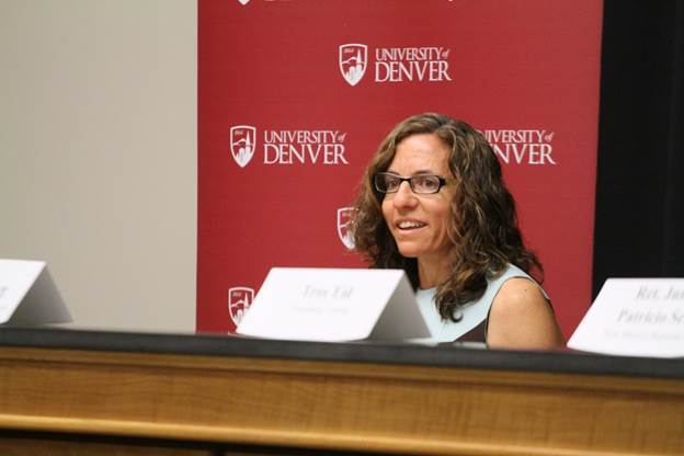
Troy Eid and Patricio Serna
“Give wise counsel freely to another, stir the leaven into good and edible fry bread.”
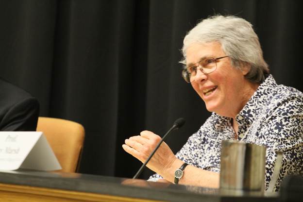
Lucy Marsh
“Enjoin the law, heal, forgive, breathe in wisdom’s simple undying spirit.”
Sarah Krakoff
“Nothing’s written but isn’t once and future increment.”
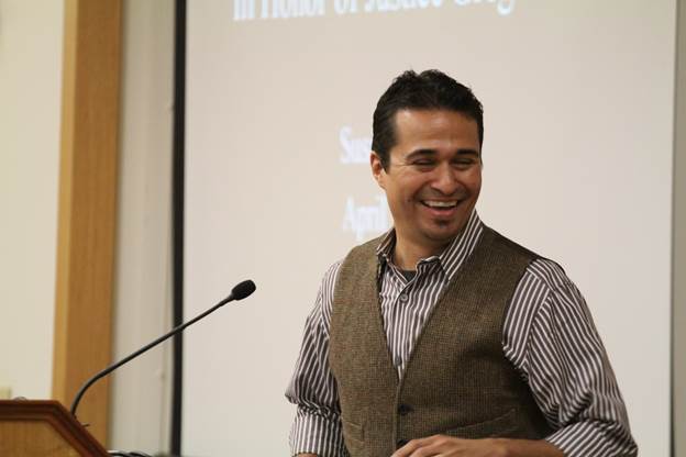
Tom Romero
“In the music of this stream we can hear our people talking to us.”
Susan Schulten
“Lincoln didn’t crave a fight to make it right, but couldn’t short for standing tall, “all created equal” meant all his might.”
Patty Limerick
“Find the tipping point within the argument.”
Ken and Ruth Wright
“A wheeling condor can see the stepping waters spring, amidst a starburst. Climb from the earth’s center, circle on circle.”
Fred Cheever
“The state of being free is founded on the land itself.”
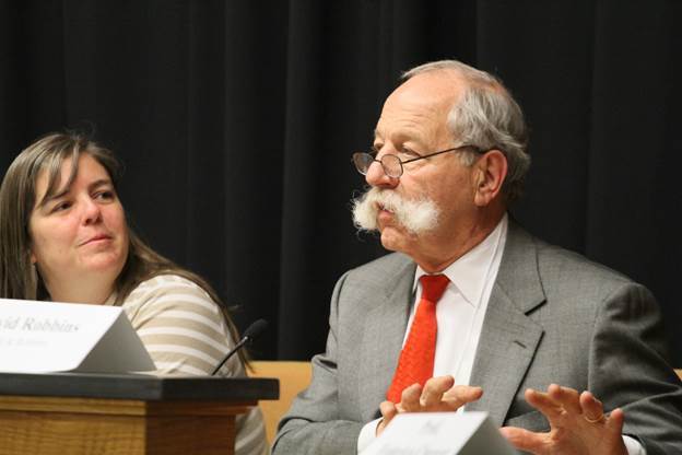
Amy Beatie and David Robbins
“Many tributaries flow from the mountains, all would head for the sea.”
Sandi Zellmer
“Whatever possessory interests we might assert, the land, the air, the waters own us.”
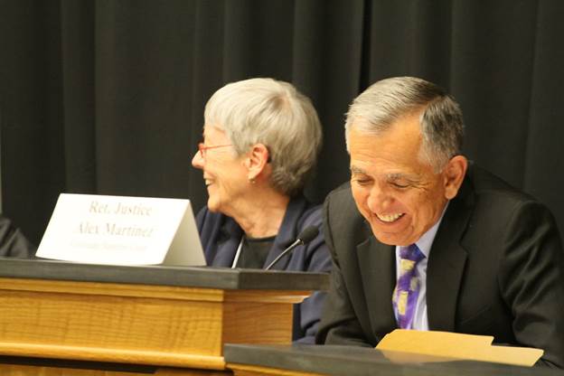
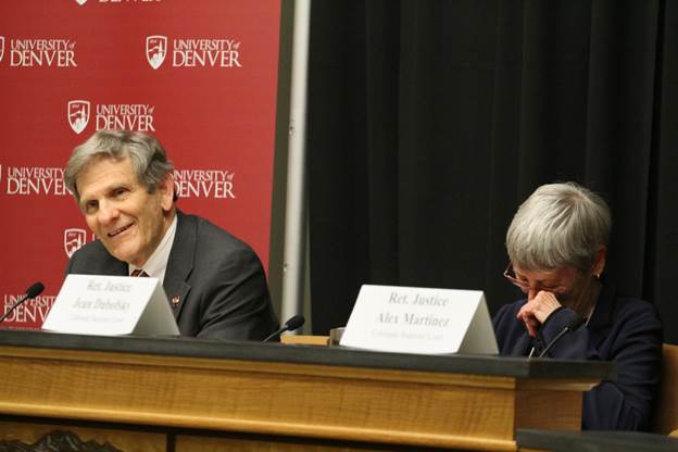
Jean Dubofsky and Alex Martinez
“What it means to govern is to unite, no more perfect than each of us might see. Possibilities are numbered in the generations.”
Mike Bender
“Recall the direction we are travelling is not linear. Never, exactly, has the world moved as any individual thought it could or should.”
Greg and Bobbie Hobbs
“Into the canopy, the turn of Nature’s day, the rule of love.”
Photos by Christopher Ainscough. Quotes from Greg Hobbs, Volume 18/Special Poetry Issue/Spring 2015, University of Denver Water Law Review.
The irrigation season opened at the beginning of the month and stream-flow forecasts are down in the basin’s two major rivers — the Rio Grande and the Conejos.
“It definitely is below average,” Division Engineer Craig Cotten said.
Stream flows on the Rio Grande at Del Norte, which is the point where many of the irrigation ditches in the northern half of the valley begin to pull from the river, are projected to be 500,000 acre-feet this year…
The Conejos is predicted to have 235,000 acre-feet this year, which is below the average of 330,000 acre-feet.
But the poor stream flow forecast, if it holds true, means Colorado will also have a lighter delivery obligation under the Rio Grande Compact, which divvies up the river’s flows between Colorado, New Mexico and Texas.
On the Rio Grande, the state is projected to have to send 127,000 acre-feet from the beginning of April through the end of the year.
The obligation on the Conejos during that same time frame is 31,000 acre-feet…
But Colorado got a head start on its deliveries because of a warmer than average March that ate away at snowpack in the San Juan Mountains.
“We did deliver significantly more in March to the downstream states, so that’s really good,” Cotten said.
The March runoff, which came before irrigators had opened their headgates, was about 2.5 times larger than normal on both rivers…
Curtailment on the Rio Grande is currently at 6.4 percent, while that figure on the Conejos is 15 percent.
A few weeks ago, Arkansas River water users were speculating whether Lake Pueblo would be able to hold enough water to avoid triggering releases to increase flood containment capacity. After more than a month without substantial snow accumulation, it’s apparent the reservoir won’t be overflowing anytime soon.
About 3-4 inches of snow already had fallen in Chaffee and Lake counties overnight Thursday and more was expected to accumulate during the day. It will take a lot more to boost the region’s dwindling snowpack, however.
“There’s snow in the upper reaches of the Arkansas River basin, but the southern part of the basin is hurting,” said Roy Vaughan, manager of the Fryingpan-Arkansas Project for the U.S. Bureau of Reclamation.
The snow already has melted out at lower elevations under about 10,000 feet, although some high-altitude sites are still holding up well. Statewide, prior to Thursday’s snowfall, snowpack was 54 percent. That’s troubling, because this is the peak time of year for snowpack. On the other hand, more snow could arrive later, as it did last year and in 2011, Vaughan said.
The Arkansas River basin was at just 61 percent of median, although higher sites in the Upper Arkansas basin were 80-100 percent of average. But the snow has been melting.
At Independence Pass, for instance, snowpack was 92 percent of normal Thursday, but the depth had decreased to 3 feet from 4 feet a month earlier.
Meanwhile, the Rio Grande basin is lagging at 36 percent of average.
On the positive side, major reservoirs are relatively full. Turquoise Lake, which was lowered to make room for imports, is at 94 percent of average; Twin Lakes at 103 percent; and Lake Pueblo at 129 percent.
The Southeastern Colorado Water Conservancy District board learned Thursday it may have less water to allocate next month. Vaughan dropped the estimated of imports to 47,000 acre-feet (15.3 billion gallons), down from 53,000 acre-feet at the beginning of the month.
Optimism is washing away further down the Arkansas Valley as well.
Division Engineer Steve Witte told the board full allocations for well users have been approved for the first time in four years, but cautioned plans could change.
“The approval is subject to change, depending on water supply,” he said.
There are some bright spots in the water picture. Colorado’s state line deliveries to Kansas under the Arkansas River Compact Supreme Court decision remain at a 40,000 acrefoot surplus, although that’s slipped 18,000 acre-feet from last year.
Deliveries are measured on a 10-year rolling average, so the 11,000 acre-foot surplus from 2005 and a 7,000 acre-foot deficit in 2014 reduced Colorado’s advantage.
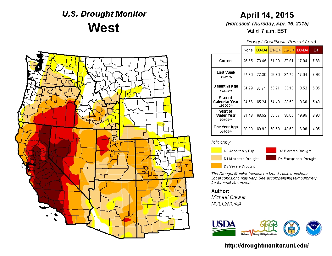
West Drought Monitor April 15, 2015
The U.S. Drought Monitor continues to show Southeastern and Western Colorado in severe drought, which is a lower stage than the extreme and exceptional drought gripping all of California and parts of Oregon, Nevada, Oklahoma and Texas at the present time.
Snow was measured in feet across the mountains west of Fort Collins. About 2 feet piled up in parts of Rocky Mountain National Park, and 52 inches of heavy, wet snow buried an area 8 miles northeast of Four Corners in Larimer County, the National Weather Services reports. Several spotters measured snow 30 to 40 inches deep in areas northwest of Fort Collins.
The spring storm boosted snowpack in the South Platte River Basin to 93 percent of normal, according to Saturday’s update from the Natural Resources Conservation Service. That jump – up from 81 percent on Tuesday — came after more than a month of stagnated snowpack and bucked a trend that was beginning to mirror a parched 2012. Levels are now almost spot-on with 2013 figures.
Statewide snowpack also climbed after a month-long decline. However, Saturday levels were still just 68 percent of normal.
And for river watchers, the Poudre continues to be flowing nearly three times as high as the historic average of 140 cubic feet per second. Saturday afternoon flows at the mouth of the canyon were recorded at 326 cfs — down from a Friday high of about 420 cfs…
Since the storm rolled in mid-week, 2.8 inches of rain drenched areas in west Fort Collins and near Horsetooth Reservoir — about two inches fell consistently across the city with some localized amounts topping 3 inches, city rain gauge data show.
From the Colorado Water Conservation Board (Taryn Finnessey/Tracy Kosloff):
Colorado has been warm and dry for so far this spring. March was four degrees above average across much of the state making it the 6th warmest on record. In addition, the three week period from March 9- April 1, 2015 was one of the driest on record. As of April 14th, many river basins had zero percent of average precipitation for the month to date, while others had just seven percent. Conditions are widely expected to change as spring storms move through the state over the next week and deposit a good amount of moisture.
Water year-to-date precipitation at mountain SNOTEL sites, as of April 14, is at 57% of normal. Most basins have already passed their normal peak accumulations date and are experiencing melting. However, cooler conditions and snow are expected over the next two week and that will help to slow the rate of snowmelt.
April 1st streamflow forecasts have dropped significantly from the previous month. Statewide forecasts range from 37-102% of average. The highest forecast is 102% in the Colorado at the Dillon Reservoir inflow, while the lowest streamflow forecast is 37% of average in the Yampa basin on Elkhead Creek.
Reservoir Storage statewide is at 108% of average as of April 1st a slight improvement from last month. Storage in the northern half of the state is well above average with multiple basins seeing storage levels in excess of 120% of average. The Upper Rio Grande and the Arkansas have the lowest storage at 77% and 79% of average respectively. Strong storage is helping to alleviate concerns about dry conditions.
The Surface Water Supply Index (SWSI) is near normal in much of the South Platte, Gunnison and Arkansas, but showing moderate to severe drought in portions of the state. The lowest SWSI value in the state is in the North–Fork Gunnison where stream flow forecasts are currently 36% of average, the highest value is in the Upper Arkansas.
Current El Nino conditions have strengthened and are forecasted to continue strengthening, with some projections indicating a possible Super El Nino. El Nino typically favors more precipitation in Colorado during the growing season.
The wildfire season is forecast to be “normal” this year and the state is well positioned to respond. A normal fire season equates to roughly three thousand fires across the state.
Water providers in attendance reported their systems are in good shape, largely due to plentiful storage. While demand has begun to increase it remains near where it was at this time last year.
Between 2011 and 2013 was the driest three-year stretch of weather in recorded history for parts of southeast Colorado. Conditions have improved slightly since then. But a look at U.S. Drought Monitor maps over recent months shows drought persisting at varying levels.
The scarcity of water is connected to another problem in Colorado. The state’s population is expected to double by 2050, and there won’t be enough water to meet the demand. For farmers like Mauch, there’s hardly enough water to meet current needs with the drought, let alone future ones. This tension is one of several reasons why the state is creating its first-ever water plan with the help of regional water managers. Friday, they hand in their plans for how to be prepared for the future.
City vs. ag tug of war
A big question is where municipalities along the Front Range will find more water.
Over the years, the scarcity has led to municipalities buying up land and water rights near Rocky Ford, Colorado.
“If the Front Range is going to continue to grow, it will only be at the expense of agriculture,” said Mauch. “There’s just not enough water.”
Recently an affiliate of real estate development firm C&M Companies and Resource Land Holdings LLC announced a pending purchase of 14,600 acres of farm land in the area. With talk of more land exchanges between local farmers and C&M, Mauch said he’s worried.
“We seem to kind of have a target on our back right now with a lot of land acquisitions, and a lot of municipals interested in our water, large groups speculating on our water,” said Mauch.
Karl Nyquist with C&M Companies said the plan is to use the 14,600 acres of land for agriculture. The exact partners who will use the land have yet to be determined.
Water plan in progress
As Mauch worries about the plans of his new neighbor, water managers in the Arkansas River Basin have crafted a plan for the future. The group and eight others are submitting their plans today to the state.
“The Arkansas River is the entire economy of the Arkansas Basin,” said Gary Barber, who worked as project manager on the local Basin Implementation Plan…
The South Platte River Basin, which includes the agricultural powerhouse Weld County, provides another illustration of what can be lost. In 1976, the basin had more than 1 million acres of irrigated farmland. In 2010, the amount of irrigated land dropped to 850,000 acres…
“Basically 80 percent of the river goes to agriculture. So if you’re looking for water, and one group has 80 percent of it, where are you going to go look for it?”
Even though a panel of 300 delegates from the state’s nine water basin roundtables almost unanimously approved the “seven points of light,” as Eklund likes to call them, the three representatives of Western Slope water roundtables who accompanied Eklund to Club 20 were not in full agreement with them.
“Our core belief is that a transmountain water diversion is not in the best interests of western Colorado,” said Jim Pokrandt of Glenwood Springs, chairman of the Colorado Basin Roundtable. “But we can’t say not one more drop. The Colorado Constitution says you can’t say that.”
“We’re going to keep the discussion alive,” said Mike Preston of Cortez, chairman of the Southwest Basin Roundtable. “We’re concerned about the environment — the best feature of western Colorado.”[…]
“It’s actually very didactic — western Colorado has gained some influence,” Preston said.
The final point states that, “Environmental resiliency and recreational needs must be addressed both before and conjunctively with a new TMD.”
First, the good news: A conceptual agreement among all seven Colorado river basins is looking good, and it will effectively make any potential construction of major new trans-mountain diversions more rooted in reality. That’s the only sane course of action, because we know the Western Slope and our downstream neighbors do not have another drop of water to spare for Front Range cities. Those cities can and should get more serious about conservation and water recycling. We’re hopeful that this conceptual agreement will hold for the final water plan, to be released in later this year.
Now for the challenges. We all know that Colorado depends on the recreation economy. For the Colorado River basin alone, it’s a $9 billion per year economic engine for our state. That means any water planning should include whatever it takes to keep our rivers at healthy flows. We have the knowledge and data about the amount of water that needs to stay in rivers. Those data aren’t currently integrated into the state plan, and they should be.