#AnimasRiver: Owner of Gold King Mine feels victimized by EPA — The Durango Herald

From The Durango Herald (Jonathan Romeo):

Todd Hennis, owner of the Gold King Mine, was vacationing at a remote lake in upstate New York when a friend sent him images of the Environmental Protection Agency-contracted crew’s triggered blowout on his property, effectively turning the Animas River into an orange spectacle. He was speechless and horrified, but not surprised…

Hennis, for his part, has long maintained increased flows from the Gold King Mine are a result of groundwater seeping from the vast, adjacent Sunnyside Mine network after it was plugged, first in 1996.

“I went up to the Sunnyside offices that were in Gladstone at that point and said, ‘I’d like to talk about the discharge,’” he said. “They denied everything, and have been denying it ever since.”[…]

He acquired his first mine in a back-taxes sale in 1995 – the Mogul, which he estimates still holds 5 million tons of ore. In 2005, he picked up Gold King Mine and a few other scatterings of claims throughout the district. And just this past September, he closed on a sale of the old Howardsville Mill site.

When all was said and done, Hennis had an appealing mining package for anyone interested in the still-mineral-rich Silverton caldera. He has never mined the property, and said he never had that intention.

Historically “dry” mines – both the Mogul and Gold King – began discharging shortly after the state and Sunnyside agreed to bulkhead the American Tunnel in the late 1990s. And in 2014, the EPA decided pollution had gotten so bad, the agency began its own remediation project in the district.

“(The EPA) decided it was too big a job for that year, so they piled many, many tons of earth and rock on the portal to, quote, prevent a blowout during the winter,” he said. “In doing so, they created the blowout conditions this year.”

In the aftermath of the Aug. 5 blowout, Hennis said he gave the EPA the keys to his land for an immediate cleanup response. But since, he claims the federal agency has enforced a complete takeover of his property.

Cement Creek aerial photo -- Jonathan Thompson via Twitter
Cement Creek aerial photo — Jonathan Thompson via Twitter

“…forests play a crucial role in our lives” — the Nature Conservancy #Colorado

This link showed up on the Nature Conservancy Twitter feed today. From their website:

Colorado Restoring our Forests

From the water we drink and the air we breathe, to the jobs and products we depend on, forests play a crucial role in our lives.

After several devastating wildfire seasons, it’s clear the pace of forest restoration in Colorado must increase. Six million acres of our forests urgently need restoration.

Poor forest conditions have caused uncharacteristically large and severe wildfires as well as insect and disease epidemics. These conditions pose an ongoing wildfire risk, threatening lives, property, wildlife habitat and forested watersheds that filter and supply drinking water for most Coloradans. Conditions are expected to get worse as Colorado gets hotter and drier.

At The Nature Conservancy, our long-term vision is to restore Colorado’s forests to a more resilient and healthy condition, preserving wildlife habitats, ensuring clean drinking water, and providing recreational and many other benefits for people long into the future.

Click here to read about their efforts at restoring forests in Colorado.

Longmont councilors approve exempting low-income customers from monthly service charge

Water hauler early Longmont via the Longmont Times-Call

From the Longmont Times-Call (Karen Antonacci):

The Longmont City Council on Tuesday unanimously approved expanding a pilot water-bill discount for some low-income people in the coming year.

The city has an existing program that knocks roughly 28 percent off the average water bill for senior citizens who meet low-income requirements.

This pilot program would exempt low-income Longmont residents — with no age requirement — from the monthly service charge, which for the average bill is about a 15 percent discount.

The discount program is only available to people who live in single-family homes. Because apartment buildings or other multi-family buildings have one meter for several households, the city is unable to offer individual discounts to residents of those buildings.

Barb McGrane, the business services manager for Longmont public works and natural resources, said Tuesday the program should be ready to launch in the first quarter of 2016.

To qualify for the new program, residents would need to meet income limits based on state numbers for a property tax/rent/heat credit rebate. To qualify for Longmont’s new water bill rebate pilot program, a single resident would need to make less than $12,720 in a year or a married couple would need to earn less than $17,146 in a year.

Those are the most recent income limits available, but McGrane said she expects the state will soon release new limits for the coming year.

USGS Webinar: How to Prioritize Key Areas for Conservation Efforts in a Changing Climate — A Look at “Climate Refugia”

Ground Squirrel photo credit Toni Lyn Morreli (Northeast Climate Science Center)

Speaker(s): Toni Lyn Morelli, Northeast Climate Science Center

Presentation Date: Tuesday, December 8, 2015

Presentation Time: 3:00 PM EST

Registration: Registration is required for this webinar.

Please Register Here
(Video will be posted online one to two weeks after the presentation date.)

Documents & Resources
Speaker Bio
Ground Squirrels & Drought
Refugia in the Northeast (Related Project)

Project Summary
When making important resource management decisions in the face of accelerating impacts from climate change, managers and conservation practitioners must prioritize areas for adaptation actions. “Climate refugia” are often highlighted as potential target areas for conservation because they are buffered from climate change and therefore can help to ensure greater protection of wildlife and resources.

In this presentation, Toni Lyn Morelli will summarize the physical processes that create climate refugia, discuss a new framework for locating and managing them, and use examples to illustrate ways to identify and verify climate refugia. She will highlight her research using historical comparisons, genetic data, and surveys of Belding’s ground squirrels in the Sierra Nevada to conduct a rare test to determine which montane meadows are acting as refugia to buffer wildlife populations from climate change. Focusing on climate refugia could be an important strategy to help managers prioritize habitats for conservation in a changing climate.

This research was supported by the California Landscape Conservation Cooperative and the Northeast Climate Science Center.

Weekly Climate, Water and Drought Assessment of the Upper #ColoradoRiver Basin

Click here to read the current assessment. Click here to go to the NIDIS website hosted by the Colorado Climate Center. Below is the month to date precipitation map through November 29, 2015.

Upper Colorado River Basin November 2015 month to date precipitation November 1 through November 29, 2015

Denver Water’s “Water News” for December 2015 is hot off the presses

Click here to read the news. Here’s an excerpt:

Looking back, some of the 2015 highlights include:

  • A glorious rig. We placed a temporary siphon in Dillon Dam’s Morning Glory Spillway, and it was a glowing success. The siphon kept water flowing out of Dillon Reservoir, so fishing and boating could continue during the months crews worked to upgrade the facilities below the surface.
  • Liquid knowledge. We made magic happen in May, when we called on water professionals from throughout the state to share a dose of knowledge with more than 1,200 sixthgraders at the second annual Denver Metro Water Festival.
Strontia Springs Reservoir started spilling on May 2.
  • Bountiful fills and spills. May showers brought enough precipitation to set new records at three of our reservoirs, and a fourth saw its second-highest water levels in history. Then we got the thrill of seeing reservoirs spill, which is a beautiful thing when it comes to water supply. Water-wise weather watchers. May marked the second wettest month Denver-area residents have seen in 40 years. And customers clearly kept their eyes on the skies instead of watering blindly. Their decision to leave sprinklers off saved more than 2 billion gallons of water. Water use was the lowest since 1961 — when the population count was half a million people less than today.

Protecting large swaths of land requires perseverance and creativity — The Nature Conservancy

Roan Cliffs Aerial via Rocky Mountain Wild

This link popped up yesterday in the Nature Conservancy’s Twitter feed (@Nature_Colorado):

Colorado’s landscapes are spectacular, but areas that are important to people and nature are at risk.

In the Yampa River Basin in northwest Colorado, sage grouse, elk and ranchers all share one thing in common: they depend on large, unbroken tracts of land. Development in the region threatens to divide this landscape into pieces. The result? Habitats and water supplies are stretched thin.

In eastern Colorado’s grasslands, you’ll find one of the largest expanses of intact prairie left in the United States. Pronghorn, migratory birds, fossils, Native American history—they’re all part of this spectacular landscape. So, too, are the ranchers, farmers and communities that depend on the landscape for their way of life.

At The Nature Conservancy, our long-term vision is to protect important places that are large enough to sustain nature and resilient enough to withstand climate change and ongoing development.

Click here to go to the website and learn more about the Nature Conservancy’s successes in Colorado.

The Yampa River flows through the Carpenter Ranch. Photo courtesy of John Fielder from his new book, “Colorado’s Yampa River: Free Flowing & Wild from the Flat Tops to the Green.” -- via The Mountain Town News
The Yampa River flows through the Carpenter Ranch. Photo courtesy of John Fielder from his new book, “Colorado’s Yampa River: Free Flowing & Wild from the Flat Tops to the Green.” — via The Mountain Town News

Proposed Basalt whitewater park public meetings start Monday

Proposed Basalt whitewater park via the Aspen Daily News

From Pitkin County via Glenwood Springs Post Independent:

Pitkin County and Basalt will kick off a series of public meetings Monday to see what type of streamside improvements people want alongside a proposed whitewater wave park in the Roaring Fork River in Basalt.

The Basalt Town Council approved Pitkin County’s plan for the whitewater park in September with the condition that meetings be held to solicit public opinion on streamside amenities. The council also wanted to give the fishing industry a chance to learn more about the plan and comment.

The open house meeting will start Monday at 5:30 p.m. at the Basalt Regional Library. A brief overview will be presented at 6 p.m.

The whitewater wave feature will be constructed about halfway between Fisherman’s Park and the 7 Eleven Bridge in Basalt in fall 2016. Features will be placed in a 450-foot stretch of the river “for the purpose of creating a kayaking, tubing, rafting, and fishing recreation area,” according to the county’s permit from the U.S. Army Corps of Engineers. The site is upstream from the confluence with the Fryingpan River. County officials identified that stretch as most suitable for a whitewater park because of the flow rate there.

The stream bank adjacent to the river in that stretch is narrow and steep. County and town officials want to collect public comment on amenities that would enhance the experience along the play wave. Ideas include an overlook and seating area, additional parking along Two Rivers Road, direct access to the play area from the street, a pedestrian trail and an interpretative-educational zone.

Pitkin County pursued a special water right called a Recreational In-Channel Diversion so it could make a call for water and maintain seasonal stream flows.

“The kayak play wave is an incidental amenity of what the Healthy Rivers Board was really trying to accomplish and that was securing an important water right for this critically de-watered zone of the Roaring Fork River,” said Andre Wille, chairman of the Healthy Rivers board of directors. “The man-made wave will not only be fun for kayakers, but it will help maintain healthy river ecology throughout the upper Roaring Fork.”

The Colorado Water Conservation Board and Colorado water court have already ratified the special water right.

The Healthy Rivers website said the county will construct two play-wave features with adjacent eddies. “It will be a fun and convenient mid-valley surf spot and a place for teaching/learning whitewater skills,” the website said.

More information on the county project can be found at http://www.pitkincountyrivers.com/healthy-rivers-project—basalt-co.html.

Save Water by Measuring Temp of Plants — Agriculture.com

From Agriculture.com (Laurie Bedord):

“With water becoming more precious, we need to exploit the potential of every tool available,” says Kendall DeJonge, an Agricultural Research Service engineer in Fort Collins, Colorado. “Using an infrared radiometric thermometer (IRT) to determine a crop’s water needs just makes sense.”

Currently in research applications, IRTs are placed on field posts or center pivot irrigation systems. Temperature readings are gathered hourly or daily on crops. Scientists then interpret the data by using one of several indices, including the crop water stress index (CWSI), which is considered the gold standard for quanti fying water stress. Developed in the early 1980s, the CWSI also requires that users know air temperatures and humidity levels.

Because the CWSI method is fairly technical and requires additional measurements, many farmers will guesstimate when to irrigate, which could mean water is wasted by overirrigating. As a result, yields will suffer because crops aren’t getting enough to drink. What farmers need is a simple, yet effective, method to monitor the water demands of a crop.

Simplified process

That’s where DeJonge comes in. The scientist has found a way to simplify the process by using canopy temperatures to determine if crops are water stressed.

His research centers around IRTs, affordable sensors that can determine the crop canopy temperature and whether a crop is water stressed.

He and his colleagues compared the CWSI with five other formulas for interpreting IRT data to see how well they could detect crop water stress over two years in a corn-sunflower rotation. All of the indices used crop canopy temperatures to determine water stress levels.

The team developed two indices for the study, which are simpler than CWSI. The Degrees Above Non-Stressed (DANS) index is calculated by comparing a stressed plant’s temperature with the temperature of a nonstressed plant in the same environment. The second study, Degrees Above Critical Temperature (DACT), is based on an established crop temperature threshold, with plant water stress determined by how many degrees above that threshold the plant temperature reaches.

Crop canopy temperatures for DANS and DACT were taken each day at 2 p.m., when water stress levels were usually highest. Researchers monitored soil water levels and crop water use. They fully irrigated part of the field, while intentionally stressing other areas.

Even though they require much simpler measurements, the findings show the DANS and DACT indices are just as effective as CWSI.

DeJonge plans to develop crop water coefficients that establish water needs of specific crops under different scenarios. With that data, IRTs could soon be widely used by farmers. He also foresees farmers using handheld IRTs in the not-so-distant future and eventually using the thermometers with drones to calculate water needs over extensive areas.

cropcirclescoloradoindependent

The latest “The Current” newsletter is hot off the presses from the Eagle River Watershed Council

Click here to read the newsletter. Here’s an excerpt:

While the West has transformed and evolved greatly since the pioneer days, mining laws remain largely unchanged. Hardrock mining and extraction is, to this day, governed by President Ulysses S. Grant’s General Mining Law of 1872.

Five U.S. Senators, including Sen. Michael Bennet of Colorado, have introduced the Hardrock Mining and Reclamation Act of 2015 in an attempt to reform that 140-year-old law and provide a modern mechanism by which we might cleanup abandoned mines throughout the West…

Kate is the education & outreach coordinator for the Watershed Council. Click here to read more about the proposed legislation.

Snowpack news: The Arkansas River basin = 123% (best in state)

Click a thumbnail graphic below to view a gallery of snowpack data from the Natural Resources Conservation Service.

Below is the December 1st Westside SNOTEL map from the Natural Resources Conservation Sevice.

Westwide SNOTEL December 1, 2015 via the NRCS

Garden City: 2015 Annual Meeting Arkansas River Compact Administration, December 10

Garden City, Kansas, back in the day

From email from the Arkansas River Compact Administration:

The 2015 Annual Meeting of the Arkansas River Compact Administration (ARCA) will be held on Thursday, December 10, 2015, commencing at 9:00 A.M. CST (8:00 A.M. MST) in the Clarion Inn, Garden City, Kansas. The meeting will be recessed for lunch at about 12:00 P.M. and reconvened for the completion of business in the afternoon as necessary.

The Engineering, Operations, and Administrative/Legal Committees of ARCA will meet on Wednesday, December 9, 2015, also at the Clarion Inn, starting at 2:00 PM. CST (1:00 P.M. MST) and continuing to completion. The public is invited to attend the Committee meetings, however please be aware time for comments may be limited.

Meetings of ARCA are operated in compliance with the federal Americans with Disabilities Act. If you need a special accommodation as a result of a disability please contact Stephanie Gonzales at (719) 688-0799 at least three days before the meeting.

This information is also available on ARCA’s website: http://www.co-ks-arkansasrivercompactadmin.org/

Arkansas River Basin via The Encyclopedia of Earth

USDA: Climate Change, Water Scarcity, and Adaptation in the U.S. Fieldcrop Sector

Click here to go to the website and read the report. From the website:

Despite increased temperatures and much regional variation in production response, U.S. irrigated fieldcrop acreage and water used for irrigation are projected to decline with long-term climate change. Driving the decline in water use are changes in crop growth due to temperature stress, changes in growing-season precipitation, and shifts in surface-water supply availability.

climatechangefieldcropcoverusda

New tap fees approved by Wiggins trustees

waterfromtap

From The Fort Morgan times (Stephanie Alderton):

The Wiggins board of trustees passed a resolution [November 11, 2015] clarifying how much town residents will have to pay to install new water taps.

This resolution is the latest in a series of efforts by the town council to conform to the Colorado Health Department’s new water regulations. Although Wiggins already had laws listing the required water tap fees, or “water plant investment fees,” for small home installations, the council decided the laws weren’t clear enough for larger, commercial installations. The new resolution aims to fix that problem.

Resolution 48-2015 lists the amount anyone applying for a water tap will have to pay the town, based on the tap’s size. It also states that all applicants will have to install the tap at their own expense, and that all water services must be metered and approved by the town manager. This is in accordance with Regulation 11 in the Colorado Health Department’s 2015 Water Quality Control Commission regulations.

For new builders, the fees will range from $11,500—for a small, household tap—to $225,000 for the largest tap. Town administrator Paul Larino said these fees are “competitive” compared to those of neighboring towns. He also said this won’t be the last water-related resolution the council will have to consider. The new Health Department regulations are hundreds of pages long, and the Wiggins trustees are still in the process of reading through them.

Study finds High Plains Aquifer [Ogallala] peak use by state, overall usage decline

The High Plains Aquifer provides 30 percent of the water used in the nation's irrigated agriculture. The aquifer runs under South Dakota, Wyoming, Nebraska, Colorado, Kansas, Oklahoma, New Mexico and Texas.
The High Plains Aquifer provides 30 percent of the water used in the nation’s irrigated agriculture. The aquifer runs under South Dakota, Wyoming, Nebraska, Colorado, Kansas, Oklahoma, New Mexico and Texas.

Here’s the release from Kansas State University (Greg Tammen):

A new Kansas State University study finds that the over-tapping of the High Plains Aquifer’s groundwater beyond the aquifer’s recharge rate peaked in 2006. Its use is projected to decrease by roughly 50 percent in the next 100 years.

David Steward, professor of civil engineering, and Andrew Allen, civil engineering doctoral student, Manhattan, published those findings in the recent Agricultural Water Management study “Peak groundwater depletion in the High Plains Aquifer, projects from 1930 to 2110.” It is the first paper to look at and quantify peak aquifer depletion.

Researchers looked at the historic and projected future groundwater use rates of the eight states comprising the High Plains Aquifer. The aquifer runs under South Dakota, Wyoming, Nebraska, Colorado, Kansas, Oklahoma, New Mexico and Texas — eight agriculturally important states. It provides 30 percent of the irrigated water for the nation’s agriculture and is pivotal in food production.

This latest study builds on the 2013 Proceedings of the National Academy of Sciences study in which Steward and colleagues forecasted the future of the Ogallala Aquifer in Kansas. Researchers expanded their projections to include wells in Kansas that were both depleted and steady in their historic groundwater levels as well as the eight states that rely on the High Plains Aquifer. A total of 3,200 Kansas wells and 11,000 wells from the other seven states were studied to understand their water depletion processes.

Allen wrote the computer code necessary to analyze massive amounts of geographic information systems data about the more than 14,000 wells using the aquifer. A logistic equation was developed to apply more than 300,000 well measurements to create a historical record of its water level and also its projected water level through 2110.

“When we did the Kansas study, it really focused on those wells in Kansas that were depleting,” Steward said. “We came up with a set of projections that looked at how long the water would last and how the depletion process would play out over time. With this study, we wanted to learn how the depletion in various locations plays into a larger picture of the aquifer.”

Steward and Allen found that the High Plains Aquifer’s depletion followed a south to north progression, with its depletion peaking in 2006 for the entire High Plains Aquifer. Overall, researchers saw that some portions of the aquifer are depleting while others are not. Texas peaked in 1999, New Mexico in 2002, Kansas in 2010, Oklahoma in 2012 and Colorado is projected to peak in 2023. Nebraska, South Dakota and Wyoming are not projected to reach peaks before 2110.

“We are on a declining trend right now for water use in irrigated agriculture,” Steward said. “As we project what happens in the future following the existing water use patterns, the amount of depletion and the amount of water that comes out of the aquifer will decrease by about half over the next 100 years.”

Additionally, researchers saw that the water depletion rates for each state in the High Plains Aquifer follow a similar bell-shaped curve pattern as the one for oil depletion in the U.S. modeled by the Hubbert peak theory.

Pump photo via Kansas State University

While water is a finite resource, Steward said the intent behind the study is not raise alarm, but rather encourage proactivity to manage and preserve this resource.

“This study helps add to the dialogue of how is it that we manage water and the effects of the choices that we make today,” Steward said. “It has the same kind of message of our previous paper, which is that our future is not set; it’s not cast. The projections we show are projections based on the data we have available that show the trends based on how we used water. People have the opportunities to make choices about the way that things are done, and the findings from this study help add to the dialogue.”

The National Science Foundation and the U.S. Department of Agriculture funded the study. The U.S. Geological Survey and the Kansas Geological Survey contributed decades of information about the High Plains Aquifer and the Ogallala Aquifer for analysis.

Snowpack news: NW #Colorado is drying out with respect to the median, Yampa/White = 79%

Click on a thumbnail graphic to view a gallery of snowpack data from the Natural Resources Conservation Service.

Pueblo: Workshop to eye water transfers — The Pueblo Chieftain

Flood irrigation -- photo via the CSU Water Center
Flood irrigation — photo via the CSU Water Center

From The Pueblo Chieftain (Chris Woodka):

A free workshop discussing alternative transfers of agricultural irrigation water will be in Pueblo next week.

The workshop is sponsored by the Ditch and Reservoir Co. Alliance and will be 7:30 a.m.- 1 p.m. Dec. 8 at the Pueblo Community College Student Center, Suite 201 A.

“DARCA is working hard this year to help Colorado’s ditch and reservoir companies prosper for years to come,” said Executive Director John McKenzie.

The goal of alternative transfers, such as the Arkansas Valley Super Ditch, is to keep control of the water in the hands of farmers through temporary leases, which could include cities, wildlife or even other farmers. That prevents the permanent transfer of water to municipalities and the dry-up of farm ground.

Included in the presentation will be a discussion of the role of these types of transfers in the Colorado Water Plan by John Stulp, special policy adviser to the governor.

Leah Martinsson, an attorney who represents the Lower Arkansas Valley Water Conservancy District, is also among speakers. She will discuss impediments to implementing ATMs. Others will look at the economics and the role of ditch companies in alternative transfers.

To register, visit http://darca.org.

Seminar: Sorting through the problems and promises of aquifers in Colorado — The Mountain Town News

From The Mountain Town News (Allen Best):

With temperatures rising, will aquifers replace above-ground reservoirs for water storage?

This idea isn’t particularly new. Florida, New Jersey, Oregon and other states have used aquifer for storage for years, says Andrew Stone, of the American Ground Water Trust. Stone’s organization will conduct a one-day seminar on Friday, Dec. 4, at the Holiday Inn in Denver’s Stapleton neighborhood.

Arizona has also famously banked water for decades. In Colorado and other states, there has been more limited aquifer recharge. Centennial Water, which serves Highlands Ranch, in south-metropolitan Denver, has been using an aquifer for storage. Now, other communities in the south-metro area are starting to move in that direction, too, as a result of the WISE project.

Stone makes the case that aquifers can be collaboratively managed in line with the general direction of the new State Water Plan. “Managing recharge operations and determining the right to recovered water will require collaboration among farmers, land owners, ditch companies, state agencies and their legal representatives,” he says.

Doug Kemper will be among those speaking at the seminar. He was with Aurora Water from 1986 to 2005, when he took the reins of the Colorado Water Congress. That’s long enough to have seen the management of water become much more high-tech.

Data collections is phenomenally different, he says. “We used to have a guy just go around for two days to read 20 stream gauges,” he says. “Now remote sensing can handle it all.”

Too, technical specialization has increased. “That creates interdependence, because you end all these different skill sets that need to interact.”

Kemper will also touch on system security, as both cyber-security and terrorist threats have become more significant issues. They will, he says, likely “play out in ways that we are not even able to understand right now.”

And specifically regarding groundwater, he thinks we are just starting to get our arms around conjunctive use, making groundwater storage a larger part of our water systems.

“If you look back 35 or even 15 years, the tools for modeling groundwater are so much different than they were,” he observes.

One of the issues at this year’s seminar will be the lined gravel pits long the South Platte River, which have restricted the return of groundwater not the river and which impede recharge to the aquifers.

Other speakers include:

  • John Stulp, special policy advisor for water to Gov. John Hickenlooper, who will address “basins where groundwater if of particular importance.”
  • Rick Marsicek, director of engineering for the South Metro Water Supply Authority, who will talk about changing uses of the Denver Basin Aquifer.
  • Joseph Ryan, professor, of the AirWaterGas Sustainability Research Network, at the University of Colorado, who will speak to impacts to Colorado’s groundwater from hydraulic fracturing processes.
  • Say hello to SaintVrainCreekCoalition.org

    Click here to visit the website.

    saintvraincreekcoalistionorgscreenshot11292015

    CO2: Earth Passes Into ‘Uncharted Territory’ — KQED Science

    From KQED Science (Andrew Alden):

    This week [November 22, 2015], you can watch as Earth passes a threshold not seen for at least a million years. The concentration of carbon dioxide in the air will rise above 400 parts per million. And scientists predict neither you nor your children will ever see it go below 400 ppm again.

    The World Meteorological Organization (WMO) said on Monday that this year’s El Niño combined with global warming puts the world “in uncharted territory.”

    “This naturally occurring El Niño event and human induced climate change may interact and modify each other in ways which we have never before experienced,” said WMO Secretary-General Michel Jarraud.

    ‘An Icon of Climate Change’

    When scientists talk about atmospheric CO2, their yardstick is the so-called Keeling curve. It’s the record of the air’s composition, made each day at a station run by the Scripps Institution of Oceanography in the pure air high on Mauna Loa volcano, in Hawaii.

    This week’s carbon dioxide readings at the Mauna Loa Observatory are updated every day. As they rise above the 400 parts-per-million threshold, scientists warn that they will not return to it in our lifetimes. (Scripps/UC San Diego)
    This week’s carbon dioxide readings at the Mauna Loa Observatory are updated every day. As they rise above the 400 parts-per-million threshold, scientists warn that they will not return to it in our lifetimes. (Scripps/UC San Diego)

    Ralph Keeling, the custodian of the CO2 record, made his prediction last week in a blog post on the Keeling Curve website.

    The Keeling curve was started in 1958 under the direction of Keeling’s father, Charles David “Dave” Keeling. Today it’s the longest series of such measurements in the world. It was named a National Historic Chemical Landmark this year.

    The Keeling curve is an icon of climate change. What does it show?

    In the 1960s, Dave Keeling’s measurements showed that the CO2 level in the air was rising steadily. That long-term increase is the mark of human influence. It comes overwhelmingly from the fossil fuels we burn — largely to generate electricity, but also to smelt metals, produce cement, run motors and so on. Other smaller sources of CO2 are from humans cutting down forests and from large-scale mechanical farming, which removes most of the carbon-rich humus contained in soil.

    Since the 1960s, the long-term increase in CO2 has sped up. A little over half of the CO2 we produce is absorbed by the ocean and by growing plants. The rest stays in the air and acts as a greenhouse gas.

    #ColoradoRiver: Rising temperatures explain drop in reservoirs better than drought

    From The Mountain Town News (Allen Best):

    The Colorado River originates in Rocky Mountain National Park in Colorado, gathering water from tributary rivers that arise near Winter Park and Breckenridge, Vail and Crested Butte.

    A little more than halfway on its 1,450-mile route to the Pacific Ocean, the Colorado River gets blocked by a giant slab of concrete called Hoover Dam. This dam creates Lake Mead, the primary water source for Las Vegas.

    Lake Mead in December 2012. Photo/Allen Best
    Lake Mead in December 2012. Photo/Allen Best

    Since 2000, water levels have declined in Lake Mead and the other major Colorado River impoundment, Lake Powell. The usual explanation is drought. Certainly, there have been some very snow-deficient winters, and at one point the Southern Nevada Water Authority decided that its two tunnels into Lake Mead might not be enough if the reservoir declined further. So, a 3-mile tunnel was engineered to come in at the very bottom of the reservoir.

    That tunnel, completed at a cost of $817 million, was unplugged in late September, giving Las Vegas a resource in case the reservoir empties. Engineers compared the challenge of the work to construction of the Eisenhower-Johnson Tunnels for Interstate 70 in Colorado. Those two-mile-long tunnels are at over 11,000 feet in elevation.

    Speaking at a recent conference sponsored by the Colorado Mesa University Water Center, Doug Kenney warned against thinking that the drought will end.

    “There’s a lot of thinking that when the drought ends, the reservoirs will come back,” observed Kenney, a research fellow in western water policy at the University of Colorado-Boulder’s Getches-Wilkinson Natural Resources Law Center.

    Kenney also pointed out that over the last 15 years, the good years and bad years of snow have more or less evened out. The total precipitation has declined only a few percentage points from the longer-term average.

    Drought is only third on the list of what explains the declining reservoir levels in the Colorado River Basin, he observed. The larger story is that demand has now outstripped supply. Las Vegas, for example, exceeded the population of Manhattan about a decade ago and now has two million people.

    But there’s also a second reason why the levels have been declining, said Kenney. Temperatures in the Colorado River Basin have already been rising, causing greater evaporative losses, both in the soil and from reservoirs.

    These rising temperatures have broad implications: hay, corn, and cotton crops need more water, and soils dry out more readily. “The warming climate affects the water cycle in ways that are problematic for the basin,” he said.

    Dagmar Llewellyn, of the U.S. Bureau of Reclamation, said that rising temperatures predicted by climate models will increase demands for water used by agriculture and municipal lawn watering.

    But hotter temperatures will also increase evaporation of existing reservoirs, such as Elephant Butte, on the Rio Grande in New Mexico, which already loses a quarter of its annual storage to evaporation.

    Better storage mechanisms will be needed as the climate warms, she said, and suggested that recharge of a partially depleted aquifer underlying Albuquerque might be one answer.

    Rural Nebraska, Keystone, and the Paris climate talks — The Mountain Town News

    A sign along U.S. Highway 20 in Stuart, Nebraska, in May 2012. Stuart is on the edge of the Sand Hills, a few miles from Newport. Photo/Allen Best
    A sign along U.S. Highway 20 in Stuart, Nebraska, in May 2012. Stuart is on the edge of the Sand Hills, a few miles from Newport. Photo/Allen Best

    From The Mountain Town News (Allen Best):

    How Nebraska’s farm towns became part of U.S. climate change strategy

    To call Newport, Neb., a small town inflates its size. Located on the edge of the sparsely populated Sand Hills, the hamlet has just 70 people. Like nearly all of Nebraska’s rural areas, it has been shedding residents.

    But Newport will have an influence on upcoming climate negotiations in Paris. Opposition to the Keystone XL pipeline first arose at Newport and other itty-bitty places on the Great Plains. Ranch and farm owners became riled up by what they considered bullying tactics by the proponent, Calgary-based TransCanada. Their opposition caught the attention of national environmental groups and climate-change activists such as Bill McKibben, who in turn made the Keystone a centerpiece of their campaigns against fossil fuels.

    President Barack Obama last week said that opponents had overstated the effect of the pipeline in causing increased greenhouse gas emissions, but nonetheless affirmed the veto by Secretary of State John Kerry. At issue, he said, was U.S. credibility when he meets other world leaders in Paris. Approving Keystone XL, he said, “would have undercut that global leadership.”

    As with the civil rights movement 50 years before, the Keystone story testifies to the power of grassroots protest. Determined, local activists—when amplified—can make a difference. The Keystone story, however, had unlikely partners.

    Rural Nebraska bleeds conservative red. In Rock County, where Newport is located, Obama got only 18 percent of the votes in 2008. Four years later, he got only 13 percent. People were furious about Obama’s Affordable Health Care Act. They don’t like mandates. They don’t think Koch is a four-letter word.

    Unlike most of the Great Plains, the Ogalalla Aquifers has been rising in Nebraska. During spring, it sometimes comes to the surface in the Sand Hills. May 2012 photo/Allen Best
    Unlike most of the Great Plains, the Ogalalla Aquifers has been rising in Nebraska. During spring, it sometimes comes to the surface in the Sand Hills. May 2012 photo/Allen Best

    More unpopular than Obama, though, were the land agents for TransCanada who had begun banging on ranch-house doors. The company already had pipeline in eastern Nebraska to export diluted bitumen from the tar-like sands of northern Alberta to U.S. refineries. This time, the company chose a more direct route that nicked the corner of the state’s iconic Sand Hills. The Ogallala Aquifer lies below the Sand Hills, and during spring, rises to the surface. This pipeline route didn’t set well with ranchers and farmers. As I learned during a reporting trip there for a magazine several years ago, they’re fiercely protective of their land and water.

    One day in 2009, Lynda Buoy, who has a small ranch in the Sand Hills, went to Newport to talk about this with several ranch women over coffee at Sunny’s Café. The women she met, ranging from their 30s to their 70s, didn’t know what to do. They had received letters from TransCanada offering terms for easements but also a warning: accept this offer or else their property would be condemned. “They were devastated that this could happen in America,” says Buoy. Only later did they learn that TransCanada had no such authority.

    Meetings in small towns drew large crowds. Environmental groups got involved. Climate change was not yet at the forefront of their messaging. Long-time Sierra Club representative Ken Winston urged landowners to stand their constitutional grounds against a foreign corporation. Those messages resonated with conservatives who listened to Mike Huckabee’s radio program by day and watched Fox News at night.

    The National Farmers Union passed a resolution in 2010 crafted with the aid of local representative Graham Christensen. The National Wildlife Federation sponsored trips by locals to testify in Washington D.C. Money began flowing downward from national groups. If driven by different motives, big-green environmental organizations and grassroots activists had a common goal.

    Later, in 2013, another unlikely pairing called the Cowboy-Indian Alliance was forged, partnering the landowners with the indigenous Ponca, Pawnee, and Sioux along with other tribes in Canada.

    Karl Connell objected to the terms offered by TransCanada and to the very presence of a pipeline across his ranch along the Niobrara River. May 2012 photo/Allen Best
    Karl Connell objected to the terms offered by TransCanada and to the very presence of a pipeline across his ranch along the Niobrara River. May 2012 photo/Allen Best

    Landowners in Nebraska did not kill the Keystone XL pipeline, but they created the situation that allowed Secretary of State John Kerry to veto the permit. It’s like a car going by at 60 mph, says John K. Hansen, the president of Nebraska Farmers Union. At that speed, you might notice that it’s red or an SUV, but not much more. Only when the car stops can you see the wheel-well rust or the front-fender dent. Ranchers and farmers slowed this speeding car for closer inspection.

    The civil rights movement has certain parallels. Fifty years ago this past August, Congress passed the Voting Rights Act. It did so only after Bloody Sunday on the Edmund Pettus Bridge in Selma, Alabama, several months before. U.S. Congressman John Lewis, then a student activist from Georgia, was among the victims that day. Martin Luther King Jr. later led marchers successfully to the state capitol in Montgomery. But King and the student activists arrived only after the local residents had shown their pluck, insisting on their right as Americans to vote. Changes happen from the grassroots.

    Bill McKibben at an event in Telluride, Colo. Photo/Allen Best
    Bill McKibben at an event in Telluride, Colo. Photo/Allen Best

    Last week, shortly after Obama’s announcement, environmental leaders proudly noted that this was the first defeat of major fossil fuel infrastructure and suggested further efforts to keep carbon in the ground.

    That’s still not a strong message in Nebraska. “I can guarantee you that none of these cowboys believe in climate change,” said Buoy last weekend from her home in the Sand Hills. “They know there’s something weird with the weather, but they don’t think it’s climate change.”

    But Christensen, the former Farmers Union representative, very much has climate change in mind. He has returned to the farm north of Omaha that has been in his family since 1867. Now, he wants to push the energy revolution from the grassroots. Farmers, he says, need to be energy generators, harnessing the power of wind and other renewable resources. Working at the grassroots, he’s trying to help them.

    Allen Best originally reported on the pipeline controversy in 2012 for Planning, a magazine of the American Planning Association.

    Ute Water customers to pay more for 4th year in a row — The Grand Junction Daily Sentinel

    From The Grand Junction Daily Sentinel (Charles Ashby):

    Rates for Ute Water customers are headed higher for the fourth year in a row.

    The water conservancy district’s board of directors announced Tuesday that starting Jan. 1 the minimum charge for the first 3,000 gallons of water used in a month will go from $20 to $22, while residential tap fees will increase 3 percent, from $6,800 per tap to $7,000.

    That’s double the rate increases the district imposed this year. In 2012, the district’s rate was $15 for the first 3,000 gallons.

    The increase is needed to replenish reserve funds the district used when it bought water in Ruedi Reservoir near Basalt from the Bureau of Land Management, which the district did in 2013, said Joe Burtard, external affairs manager for the district. The additional money from the latest increase is for the district’s next major project, expanding Monument Reservoir on Grand Mesa, he said.

    “Our board has been really aggressive and proactive in establishing a reserve fund for projects like Ruedi,” he said. “What we don’t want to do is, go into the construction of Monument Reservoir and take out loans and bonds to pay for that because that increases the construction costs, and that cost is then passed on to our consumers.”

    Burtard said the increase is expected to generate about $800,000 a year toward that project, he said.

    He said the increases stem from a Raw Water Study the district did back in 2011, which identified the need for more water storage, as much as 21,400 acre-feet, to handle the anticipated population growth in the Grand Valley.

    That population is expected to increase the district’s customers to about 197,000 residents by 2045, more than double the 80,000 people it serves now.

    To address that potential demand, the district has been working in recent years to expand its water supplies, including purchasing more acre-feet at Ruedi and expanding Monument Reservoir.

    The Monument project, which is expected to cost about $21 million, would provide another 4,700 acre-feet of water. The district is nearing the end of getting a permit for the project, Burtard said.

    This summer, the district also spent about $450,000 on a hydropower electric project, which is designed to power its water-treatment plant and help it save operating costs in the long term.

    The district also is expanding pipelines on Orchard Mesa and in the Redlands areas, expanding its water pumping capabilities and upgrading or replacing some of its vehicles, he said.

    It has about $6 million budgeted for capital projects for next year. “Water providers are having to become really creative in thinking outside of the box in how they’re going to develop additional water resources,” Burtard said. “One of ours was the purchase of Ruedi Reservoir, which I think anyone can say that’s probably the most significant that Ute Water’s ever made in its history.”

    He said the district’s board of directors prefers to build its cash reserves to pay for large projects rather than go into debt or sell bonds for such projects.

    Burtard said the board opted for an increase in its 3,000-gallon minimum rather than implement a different tiered payment structure because it doesn’t want to penalize people who conserve water by staying under that threshold.

    The board also didn’t like the idea of increasing tap fees because of fears it might hinder growth, but felt it was better to put a greater burden on future development rather than existing customers, he said.

    Grand Junction back in the day with the Grand Mesa in background
    Grand Junction back in the day with the Grand Mesa in background

    USGS: Flooding in the South Platte River and Fountain Creek Basins in eastern Colorado, September 9–18, 2013

    floodingsouthplattefountaincreek092013usgscover

    Here’s the abstract from the United States Geological Survey:

    On September 9, 2013, rain began to fall in eastern Colorado as a large low-pressure system pulled plumes of tropical moisture northward from the Pacific Ocean and the Gulf of Mexico. By September 16, 2013, as much as 12 to 20 inches of rain had fallen in the foothills of the Front Range of the Southern Rocky Mountains and adjacent plains near Colorado Springs, Colorado, north to the Colorado-Wyoming border. The rain caused major flooding during September 9–18, 2013, in a large part of the South Platte River Basin and in the Fountain Creek Basin. The floods resulted in several fatalities, more than 31,000 damaged or destroyed structures, and an estimated 3 billion dollars in damages. The U.S. Geological Survey (USGS) documented peak stage, streamflow, or both from the flood event for 80 sites located on selected rivers and streams in the South Platte River and Fountain Creek Basins and on the Platte River in Nebraska. The majority of flood-peak streamflows occurred on September 12 or 13, 2013, coinciding with the period of maximum rainfall. The flood resulted in new record peak streamflows at 17 streamgages having at least 10 years of record; 13 in the South Platte River Basin and 4 in the Fountain Creek Basin.

    Flooding in the South Platte River Basin was primarily contained to select streams in Aurora and the Denver metropolitan area, most of the mountain tributaries joining the main stem South Platte River from Denver to Greeley, and in the main stem South Platte River from Denver to the Colorado-Nebraska State line. In Aurora, where about 15 inches of rain fell, streamflow peaked at 5,470 cubic feet per second (ft3/s) in Toll Gate Creek, a tributary to Sand Creek. Downstream from Aurora near the confluence with the South Platte River, Sand Creek peaked at 14,900 ft3/s, which was the highest streamflow since at least 1992, but less than the peak of 25,500 ft3/s in 1957 that occurred 4 miles upstream from the mouth. Flood-peak streamflows in the Denver metropolitan area were generally below historic records. The peak of 3,930 ft3/s on September 12 at the State of Colorado streamgage South Platte River at Denver ranked 59 out of 116 peaks and was less than the 1965 peak of 40,300 ft3/s. Ten of the 13 streamgages in the South Platte River Basin with new record peak streamflows were located on the mountain tributaries; Bear Creek, Fourmile Creek, Boulder Creek, St. Vrain Creek, the Big Thompson River, and the Cache la Poudre River. A daily average streamflow of 8,910 ft3/s on September 13 in Boulder Creek at the confluence with St. Vrain Creek was more than twice the previous instantaneous peak of 4,410 ft3/s from 1938. The USGS calculated a peak streamflow of 23,800 ft3/s for the St. Vrain Creek at Lyons; the highest streamflow on record at this State of Colorado streamgage (122 years of record) is 10,500 ft3/s from 1941. A peak streamflow of 16,200 ft3/s was calculated for the Big Thompson River at mouth of canyon near Drake streamgage, which is the second highest peak in 90 years of record and about one-half the magnitude of the peak of 31,200 ft3/s from July 31, 1976. A streamflow of 60,000 ft3/s in the South Platte River at Fort Morgan (September 15, 2013) suggests that a new record streamflow occurred in the main stem in the Greeley area, about 45 miles upstream from Fort Morgan. The current peak of record at a State of Colorado streamgage at Kersey, about 6.5 miles downstream from Greeley, is 31,500 ft3/s from 1973. Given that there was minimal inflow between Kersey and Fort Morgan, the USGS estimates there was probably at least 60,000 ft3/s at Kersey, which would be almost double the peak streamflow of record from 1973.

    Flooding in the Fountain Creek Basin was primarily contained to Fountain Creek from southern Colorado Springs to its confluence with the Arkansas River in Pueblo, in lower Monument Creek, and in several mountain tributaries. New record peak streamflows occurred at four mountain tributary streamgages having at least 10 years of record; Bear Creek, Cheyenne Creek, Rock Creek, and Little Fountain Creek. Five streamgages with at least 10 years of record in a 32-mile reach of Fountain Creek extending from Colorado Springs to Piñon had peak streamflows in the top five for the period of record. A peak of 15,300 ft3/s at Fountain Creek near Fountain was the highest streamflow recorded in the Fountain Creek Basin during the September 2013 event and ranks the third highest peak in 46 years. Near the mouth of the basin, a peak of 11,800 ft3/s in Pueblo was only the thirteenth highest annual peak in 74 years. A new Colorado record for daily rainfall of 11.85 inches was recorded at a USGS rain gage in the Little Fountain Creek Basin on September 12, 2013.

    Mt. Emmons treatment plant deal in the works — The Crested Butte News

    Mount Emmons
    Mount Emmons

    From The Crested Butte News (Mark Reaman):

    In what has been described as a “serendipitous” and “interconnected” moment, there could be real headway in a permanent solution to the Mt. Emmons water treatment plant and overall molybdenum mine situation.

    While very preliminary, the signals are good that this new path with new players, in part spurred by last summer’s dramatic Gold King Mine release into the Animas River, could bring about substantial changes to the Red Lady situation.

    Gunnison County, the town of Crested Butte, several departments in the state, mining giant Freeport-McMoRan and U.S. Energy, the company with rights to the local molybdenum deposit, appear to be headed toward a collaborative deal to upgrade and permanently fund the water treatment plant on Coal Creek and address the idea of a potential mine.

    This most recent chapter in a very long story started late last August when the county and the town sent a letter to the state and feds expressing serious concern over U.S. Energy’s ability to maintain the water treatment plant, especially if an accident occurred at the plant. U.S. Energy had been taking a giant financial hit with the decrease in energy prices and it has only gotten worse, with its stock selling this week for under 30 cents a share.

    The two local governments sent a letter saying that the environmental and human health consequences of any release of untreated mine drainage are beyond the governments’ response capacity. They asked the Colorado Water Quality Control Division to reopen a permit renewal process for the mine’s discharge permit, which regulates the water treatment plant.

    Several state agencies, including the Department of Natural Resources, the Colorado Water Quality Control Division, the State Attorney General’s Office and the Colorado Division of Reclamation Mining and Safety, set up a meeting in October. Crested Butte town attorney John Belkin, Gunnison County attorney David Baumgarten and special counsel for the town, Barbara Green, met with them to discuss concerns about U.S. Energy and its financial ability to continue operating the plant. By all accounts, it was a positive meeting.

    Shortly after that, Freeport-McMoRan, a renowned international copper, gold and molybdenum miner that operates the Climax and Henderson moly mines in Colorado, also came into the picture. While it never had an interest in the molybdenum beneath Mt. Emmons, the company bought Phelps Dodge in 2007. That mining corporation had acquired the company that originally built the water treatment plant. Freeport in essence became tied to the site through a connection of mergers and acquisitions.

    ‘Colorado’s Conceptual Framework’ included in #COWaterPlan — Aspen Journalism

    Hand wheel Brent Gardner Smith/Aspen Journalism

    From Aspen Journalism (Brent Gardner-Smith):

    A way to look at any new transmountain diversions in Colorado has been dubbed “Colorado’s Conceptual Framework” in the Colorado Water Plan after previously being called “the seven points” and the “draft conceptual agreement” as it has evolved over the past two years.

    It’s a lofty title for a framework that major water providers on the east slope are adamant does not carry any force of law, rule, or policy, and which still divides water stakeholders in Colorado.

    But no matter what it is called the framework is, despite challenges, in fact included in the first-ever Colorado Water Plan, which was developed by the Colorado Water Conservation Board and presented to the governor on Nov. 19.

    A number of Front Range entities told the CWCB that it should not adopt the conceptual framework or include it in the water plan.

    “Even with wording changes, the basin roundtables recommend that the CWCB not adopt the framework as it is a work in progress that may be modified as dialogue continues,” wrote the S. Platte and Metro basin roundtables, two of nine regional water-supply groups that meet under the auspices of the CWCB, in a combined Sept. 17 comment letter.

    In its introduction to the framework in Chapter 8, the water plan recognizes that “a long-standing controversial issue in Colorado is the development of water supply from the Colorado River system for use on the eastern slope. It is controversial because of supply gaps, environmental health, compact compliance, and other issues.”

    The water plan describes describes the framework as providing “a path forward that considers the option of developing a new transmountain diversion and addresses the concerns of roundtables, stakeholders, and environmental groups. The conceptual framework presents seven principles to guide future negotiations between proponents of a new transmountain diversion, if it were to be built, and the communities it would affect.”

    Some of the framework in the River House on the San Juan River.
    Some of the framework in the River House on the San Juan River.

    The principles

    The seven principles include concepts such as making sure a new transmountain diversion, or TMD, does not increase the likelihood of a compact call from states in the lower Colorado River basin, ensuring the eastern slope has other sources of water in dry years, and establishing guidelines for when diversions may need to be curtailed to keep enough water in Lake Powell.

    The framework also says new diversions should not limit Western Slope development, that it’s important to increase both municipal and agricultural water-conservation efforts in Colorado, and that steps should be taken repair damaged river ecosystems with or without new diversions.

    The water plan says the CWCB will “use the conceptual framework as an integrated package of concepts to: encourage environmental resiliency; set high conservation standards; develop stakeholder support for interstate cooperative solutions; and establish conditions for a new multi purpose and cooperative transmountain diversion (TMD) project if proposed in the future.”

    The framework was drafted and adopted by the members of the Interbasin Compact Committee, which includes two representatives from each of the state’s nine basin roundtables, six gubernatorial appointees, two legislative appointees, and the director of compact negotiations on the IBCC.

    The group’s “main charge is to work with the basin roundtables to develop and ratify cross-basin agreements,” the water plan says.

    The end of the tunnel that brings water from Hunter Creek to the Fryingpan River drainage, and then on to the eastern slope.
    The end of the tunnel that brings water from Hunter Creek to the Fryingpan River drainage, and then on to the eastern slope.

    Divergence

    The water plan describes both the conceptual framework and the lingering geographic differences of opinion about future transmountain diversions.

    “Generally, eastern slope roundtables identify the need for a balanced program to preserve the option of future development of Colorado River System water,” the plan says.

    “Western Slope roundtables express concern regarding the impact on future development on the Western Slope, as well as the potential for overdevelopment related to both a Colorado River compact deficit and critical levels for system reservoir storage, such as the minimum storage level necessary to reliably produce hydroelectric power at Glen Canyon Dam,” the plan states.

    The water plan also finds that the Colorado River basin roundtable, which meets regularly in Glenwood Springs, and the S. Platte and Metro roundtables, which meet in Longmont and Denver, respectively, have the “greatest divergence” when it comes to the idea of more TMDs.

    “In its BIP, the Colorado Basin Roundtable points out the variability in hydrology, stating that TMDs ‘should be the last “tool” considered as a water supply solution, once the many and complex questions are addressed over hydrology,'” the plan says.

    On the other side of the divide, the water plan says that “in the South Platte/Metro basin implementation plan, the roundtable advocates to ‘simultaneously advance the consideration and preservation of new Colorado River supply options.’”

    “Both viewpoints recognize the constraints of water availability and Colorado water law, but differ in their beliefs about whether such a project fits into water supply planning,” the plan concludes.

    The members of the Front Range Water Council also have made it clear to the CWCB that they don’t see the framework as binding.

    In a Sept. 15 letter to the CWCB on the water plan, the council said that the framework “’has no regulatory force or effect. Rather, it is guidance, the implementation and use of which will depend on the positions taken by the parties who engage in good faith negotiations on the construction of future specific proposed projects.”

    The Front Range Water Council includes Denver Water, Aurora Water, Colorado Springs Utilities, Northern Water, the Southeastern Colorado Water Conservancy District, the Twin Lakes Reservoir and Canal Co., and the Board of Water Works of Pueblo.

    A heron at rest along the bank of the Colorado River.
    A heron at rest along the bank of the Colorado River.

    Resiliency

    The concept of “environmental resiliency” is also laid out in the framework and is done so on terms that are as environmentally staunch as any other statement in the water plan.

    The framework says that “Colorado’s Water Plan, basin implementation plans, and stakeholder groups across the state should identify, secure funding for, and implement projects that help recover imperiled species and enhance ecological resiliency, whether or not a new TMD is built.“

    In terms of next steps on the conceptual framework, the water plan only says that “the CWCB will monitor ongoing discussions” at the roundtable and Interbasin Compact Committee levels “that involve the topics associated with the seven principles of the conceptual framework.”

    Upper Lake Powell, October 2014.
    Upper Lake Powell, October 2014.

    The seven principles in the conceptual framework

    Principle 1: Eastern slope water providers are not looking for firm yield from a new transmountain diversion (TMD) and the project proponent would accept hydrologic risk for that project.

    Principle 2: A new TMD would be used conjunctively with eastern slope supplies, such as interruptible supply agreements, Denver basin aquifer resources, carry-over storage, terminal storage, drought restriction savings, and other non-Western Slope water sources.

    Principle 3: In order to manage when a new TMD would be able to divert, triggers are needed. Triggers are operating parameters that determine when and how much water a potential new TMD could divert, based upon predetermined conditions within the Colorado River system.

    Principle 4: A collaborative program that protects against involuntary curtailment is needed for existing uses and some reasonable increment of future development in the Colorado River system, but it will not cover a new TMD.

    Principle 5: Future Western Slope needs should be accommodated as part of a new TMD project.

    Principle 6: Colorado will continue its commitment to improve conservation and reuse.

    Principle 7: Environmental resiliency and recreational needs must be addressed both before and conjunctively with a new TMD.

    Gears on the top of the dam that forms Lost Man Reservoir, part of the diversion system on the upper Roaring Fork River headwaters.
    Gears on the top of the dam that forms Lost Man Reservoir, part of the diversion system on the upper Roaring Fork River headwaters.

    Major Transmountain Diversions in Colorado*

    Grand River Ditch 18,000 AFY

    Adams Tunnel 226,000 AFY

    Moffat Tunnel 55,000 AFY

    Roberts Tunnel 62,000 AFY

    Blue Mountain Project 9,000 AFY

    Homestake Tunnel 25,000 AFY

    Busk Ivanhoe Tunnel 5,100

    Boustead Tunnel 56,000 AFY

    Twin Lakes Tunnel 41,000 AFY

    San Juan-Chama Project 83,000 AFY

    Aurora Homestake Pipeline 16,000 AFY

    * Source: Colorado Water Plan

    Editor’s note: Aspen Journalism is collaborating with The Aspen Times and the Glenwood Springs Post Independent on coverage of rivers and water.

    Bart Miller: Giving thanks for a #COWaterPlan

    From the Boulder Daily Camera (Bart Miller):

    There is much to be thankful for in our lives. This is especially true for Colorado’s rivers. We fish, boat, picnic, hike, swim and enjoy their serenity. The good news is the Colorado Water Plan is the first time the state has put together a plan for how to address water in Colorado, and it sets a course to ensure that all our kids and grandkids can enjoy thriving Colorado rivers for years to come.

    So we raise our glasses to Gov. Hickenlooper and the Colorado Water Conservation Board for adopting a Colorado Water Plan on Nov. 19 that includes many strong elements! This is an important step forward on future water management.

    We are extremely pleased that the new water plan sets the first-ever statewide water conservation goal. The Colorado Water Plan sets a goal of conserving 400,000 acre-feet of water by 2050, which is a nearly 1 percent annual reduction in per person water use in our cities and towns. This is a very doable and cost-effective strategy to stretch our existing water supplies, relying on innovation and new best practices that can maintain our high quality of life. This is a common sense approach and a key element for state water management.

    Second, the water plan proposes annual funding for healthy rivers, creating ongoing financial support for river assessments and projects that help make our rivers resilient. For too long our state has been overly focused on pipes and concrete to move water around — and not on the impacts to our rivers. We have a $9 billion recreation industry in Colorado that relies on healthy rivers, and our own joy and happiness require healthy rivers. So it’s great to see the plan make a solid down payment toward future river health.

    Finally, we applaud that the new plan makes large, new river diversions from the Western Slope to the Front Range highly unlikely. A framework presented in the plan about how to make decisions on these projects will help ensure the expense, time and alternative approaches are thoroughly considered. There are cheaper, faster and better ways to meet our water needs than piping water west to east over the Rockies.

    James Eklund and Governor Hickenlooper roll out the Colorado Water Plan, Thursday, November 19, 2015 via The Colorado Independent
    James Eklund and Governor Hickenlooper roll out the Colorado Water Plan, Thursday, November 19, 2015 via The Colorado Independent

    Fountain Creek: “The Water Quality Control Commission has ignored the problems” — Jay Winner

    Fountain Creek Watershed
    Fountain Creek Watershed

    From The Pueblo Chieftain (Chris Woodka):

    Recent revelations about deficiencies in stormwater control could snag Colorado Springs plans to expand its water system.

    The Bureau of Reclamation and Pueblo County need to take a second look at the environmental impact statement that cleared the way to build the $841 million Southern Delivery System, and the newly constructed water pipeline from the Pueblo dam to El Paso County should not be turned on until the issue is settled, said Jay Winner, general manager of the Lower Arkansas Valley Water Conservancy District.

    “We’ve been saying this for years,” Winner said. “We need to get past the talk from Colorado Springs and stop them from flushing all their crap down Fountain Creek. They need to walk the walk.”

    Winner was reacting to an inspection report released this week by the Environmental Protection Agency that could be the basis for a federal lawsuit over inadequate stormwater control in Colorado Springs.
    Among other things, the report says the city failed to correct problems identified two years earlier, that it knowingly violated the terms of its municipal separate storm sewer system permit and that it is not enforcing its own guidelines for new development.

    Reclamation’s EIS was done in 2009, when Colorado Springs had a stormwater enterprise in place that generated millions of dollars annually to take care of the very problems outlined in the inspection. The assumption by Reclamation was that since it was in place, the only issue were future flows generated by new development related to SDS.

    If that created problems, Reclamation relied on a vague “adaptive management” concept to rectify problems.
    Reclamation failed to answer political calls to reopen the EIS in 2010 after Colorado Springs City Council torpedoed the stormwater enterprise on a split vote after a city election.

    The EPA’s inspection report shows problems continue to worsen as Colorado Springs ignores its stormwater infrastructure. The Colorado Springs City Council and Mayor John Suthers have devised a plan to provide $19 million in funding toward complying with the MS4 permit and addressing a more than $500 million backlog in projects.

    Winner said a more permanent funding source is needed, which the EPA concurs with in its inspection report. This needs to be a consideration for Pueblo County commissioners, who are negotiating with Colorado Springs over compliance on the stormwater issue as it relates to the 1041 permit for SDS.

    “I think we’ve been hoodwinked long enough by their City Council,” Winner said. “I would hope the new (Pueblo) City Council will become more engaged and not put up with these shenanigans.”

    One of the new Pueblo City Council members is Winner’s wife, Lori Winner.

    Winner also is uneasy that the Arkansas Basin Roundtable this month endorsed a Colorado Springs Utilities employee, Mark Shea, for a seat on the Colorado Water Quality Control Commission. Winner, a member of the roundtable, urged caution at the meeting. Recently, another Utilities executive, Mark Pifher, (now a consultant for Utilities) served on the commission.

    “The Water Quality Control Commission has ignored the problems,” Winner said. “It’s like asking the fox to guard the henhouse.”

    More coverage from Chris Woodka writing for The Pueblo Chieftain:

    Turns out the bare minimum that Colorado Springs said it was doing to prevent contaminated water from its streets flowing into Fountain Creek was not enough to satisfy the federal government.

    The one constant that Colorado Springs officials had assured Pueblo County and the Lower Arkansas Valley Water Conservancy District was being met was the MS4 permit with the Environmental Protection Agency.

    MS4 stands for municipal separate storm sewer system, and the existence of the permit itself has been held up for years in presentations by Colorado Springs as evidence that the city was doing basic work to regulate stormwater.

    But according to an EPA report finalized in August, little progress has been made to rectify problems identified in a February 2013 audit. The inspection could be the basis for a federal lawsuit over Colorado Springs stormwater deficiencies.

    In fact, city o€fficials were aware of shortcomings, as the EPA stated: “During the inspection, city representatives stated they were fully aware of the lack of resources to adequately implement the MS4 program, and cited the termination of the city’s SWENT (stormwater enterprise) in 2009 and overall lack of political, managerial and community support for the city’s MS4 program as contributing factors.”

    Photographs in the report show severe erosion, crumbled drop structures, vegetation growing in concrete ditches and cracked channels clogged by logs and trash throughout the city.

    Colorado Springs also has assured Pueblo County and the Lower Ark that new development that benefits from the soon-to-be-completed Southern Delivery System would be regulated to avoid any additional impact on Fountain Creek.

    There has also been a lot of talk about how the city has developed a design criteria manual to protect Fountain Creek.

    The EPA inspection, however, notes that Colorado Springs is doing very little to make new development comply with regulations after looking at more than 600 plans reviewed by the city. The report stated: “It was unclear at the time of the inspection how the city would ensure submittal of appropriate design elements in the future. … The city did not ensure that public and private permanent BMPs (best management practices) were properly designed, approved and installed.”

    #AnimasRiver: Questions remain for mine spill claims process — The Farmington Daily Times

    From the Farmington Daily Times (Noel Lyn Smith):

    Navajo Nation Attorney General Ethel Branch is continuing to question the U.S. Environmental Protection Agency about the procedure to file claims for damages caused by the Gold King Mine spill.

    Branch presented her concerns and issues in a Nov. 18 letter to Avi Garbow, general counsel for the EPA. Her letter, which was released by the tribe on Monday, questions the EPA’s efforts to address claims and recovery efforts for the Aug. 5 spill…

    Branch’s letter was in response to a Nov. 3 letter Garbow wrote to the attorney general, which was a reply to two letters Branch wrote in October.

    The attorney general stated she was “surprised” by Garbow’s suggestion the EPA has not determined if the Federal Tort Claims Act applies to the spill. The Federal Tort Claims Act is a federal law that permits private parties to sue the United States in federal court for damages committed by individuals acting on behalf of the country.

    “This position cannot be squared with the U.S. EPA’s repeated public statements of responsibility for the spill,” Branch wrote.

    She added that indecision does not seem to jibe with the EPA’s distribution of Standard Form 95 on the Navajo Nation and on the EPA website.

    Branch’s second expressed concern is that the EPA still does not have a process in place to “ensure full, fair and prompt recovery” for the Navajo people and tribe.

    She added that Garbow’s letter did not accept the tribe’s proposal to establish an interim claims process and relief fund for tribal members who seek compensation without releasing future claims or those unknown to the claimant.

    “I was disappointed to hear your position that the U.S. EPA does not ‘have the ability to establish’ such a process,” Branch wrote.

    The attorney general said the tribe is continuing to examine all options, including working with Congress on legislation to improve the process to allow interim claims.

    In hopes such congressional action occurs, Branch stated Navajo officials are providing tribal members with claim forms that include language reserving the claimant’s right to file supplemental claims.

    She said tribal officials have been talking to individuals who were impacted by the spill, and many of those people have wondered about the need to present documentation to support their claims.

    “My concern is that my people may forego submitting legitimate claims because they do not have itemized documentation of every loss,” she wrote.

    In concluding her letter, Branch stated she remains committed to working with federal agencies, and she hopes Garbow clarifies statements made in his Nov. 3 letter.

    In Garbow’s letter to Branch, he assured Branch the EPA remains committed to cleanup responsibilities and to a long-term monitoring strategy.

    He mentioned the EPA is continuing an internal review of events leading up to the spill. In addition, the agency received the results of an independent evaluation by the U.S. Department of the Interior and is waiting for the release of a review by the Office of Inspector General.

    “The findings and conclusions of these reports and investigations, once complete, will be carefully reviewed by EPA’s Claims Officer in order to assess the applicability of the FTCA for purposes of paying legitimate claims against the United States for money damages arising from the Gold King Mine incident,” Garbow wrote.

    He added it is “not unusual” for claimants to need additional time to assess damages, and the Federal Tort Claims Act allows claimants up to two years to file a claim.

    Garbow wrote the EPA does not have “the ability to establish an interim claims process by amending the Standard Form 95,” which was requested by the Navajo Nation.

    “I am also committed to exploring and considering all options to seek means of providing compensation as allowed by law for legitimate money damages arising from the incident, both within the Navajo Nation, and in other impacted communities,” Garbow stated in the conclusion of his letter.

    Bottom of Animas River at Durango August 8, 2015 via Twitter and The Durango Herald
    Bottom of Animas River at Durango August 8, 2015 via Twitter and The Durango Herald

    #COWaterPlan: “…the same giant unresolved issue is always present — funding” — Greg Walcher

    From The Grand Junction Daily Sentinel (Greg Walcher):

    Ever since the writings of Solomon more than 900 years BC, it has been said that “there is nothing new under the sun.” He was not referring to Colorado’s continual water planning, but he could not have described it better.

    Gov. John Hickenlooper just announced what he called Colorado’s “first-ever” comprehensive water plan. It is the final product of a decade of meetings, committees, and proposals. As finally adopted by the Colorado Water Conservation Board (CWCB), the 500-page plan calls for $20 billion worth of conservation measures, though no specific strategy for funding it.

    Interestingly, the press reports mention the 10-year process, but also claim this governor ordered CWCB to begin statewide water planning in 2013. In fact it has been underway a long time — not one decade, but several. But when things go well, there is plenty of credit to go around, and much of this new water plan is praiseworthy.

    It calls for a new statewide conservation goal of 400,000 acre-feet of water by 2050. It also mentions a projected shortfall in municipal and industrial water demand of 560,000 acre-feet by 2050, and proposes to reduce that shortfall to zero by 2030. Again, the math is a bit unclear, but whether we plan to conserve 400,000 or 560,000 acre feet, it would be a good thing either way.

    Interestingly, the plan also calls for construction of 400,000 acre-feet of additional water storage — which many of us have advocated for years. Our state is growing, not shrinking, and our need for water will continue to grow. Colorado is entitled under interstate agreements to substantially more water than it uses, so it is simply irresponsible not to store the water we get during wet periods, so we can use it during dry periods. When I served on the CWCB 15 years ago, we advocated creative new ways to store water, by expanding existing reservoirs, and using underground storage in closed aquifers. Both techniques have been used successfully elsewhere, and both are now part of Colorado’s official state plan. Bravo.

    Unfortunately, the plan also mentions the prospect of new trans-mountain diversions — which should not and will not happen. Half of the Colorado River is already diverted to the Front Range, more than enough. There are, as the plan points out, plenty of ways for Denver to conserve water, and to store more of its own supply. In fact, as Denver Water CEO Jim Lochhead points out, their residents have already reduced usage 20 percent over the last 10 years without any major problems. Lochhead was quoted saying, “We can go a lot lower without sacrificing quality of life.” He is right.

    We have been down this road many times before, and the same giant unresolved issue is always present — funding. Much of the anticipated $20 billion cost of these water measures would be borne by utilities and their customers (who have not yet been asked if they want higher water bills), but the state also needs another $100 million a year for its share. The report suggests new federal funding (unlikely from today’s budget-sensitive Congress), tax increases (perhaps a statewide mill levy, higher severance taxes, or a sales tax increase) — or a new bond program. Only the latter approach would really be new, and believe me, it is a can of worms.

    You see, new water projects are always viewed with suspicion in Colorado. A 2003 initiative [Referendum A] to create bonding authority for water projects became so thoroughly unpopular that it was defeated in every county, and became a campaign issue against candidates (including me) in three consecutive elections. That measure authorized no water projects; it was merely a future funding mechanism. Still, a century of history gave Coloradans good reason to suspect the worst: that someone might eventually use it to build trans-mountain diversions to “steal” water from one basin to another. So the proposal went down in flames at the ballot box and the result was, for another generation, no new water storage at all.

    The comprehensive plan completed this week provides some hope that Coloradans might eventually emerge from those years of distrust and work together on a long-term solution. That could involve both conservation and creative new storage in every river basin of the state (instead of diverting water between them), public-private partnerships, bonding and other new funding sources, and a genuinely more prosperous future for all of Colorado. That would be something new under the sun, and would be worth all the effort that has gone into it.

    Greg Walcher is president of the Natural Resources Group and author of “Smoking Them Out: The Theft of the Environment and How to Take it Back.” He is a Western Slope native.

    “We’re pleased that the #COWaterPlan recognizes that healthy rivers are central to Colorado’s quality of life” — David Nickum

    The Western Slope headwaters of the Yampa River, which legally still has water that could be put to beneficial use on the Front Range.
    The Western Slope headwaters of the Yampa River, which legally still has water that could be put to beneficial use on the Front Range.

    Here’s the release from Colorado Trout Unlimited:

    Trout Unlimited praised the final Colorado Water Plan unveiled today by the Colorado Water Conservation Board, saying that it recognizes the key role that healthy rivers and streams play in sustaining the state’s economy and quality of life.

    “We’re pleased that the Colorado Water Plan recognizes that healthy rivers are central to Colorado’s quality of life and help drive our booming, $13 billion recreation economy,” said David Nickum, executive director of Colorado Trout Unlimited. “If we want a future of Gold Medal trout rivers and outdoor opportunities, we need to plan for that future—and this plan is a step in the right direction.”

    “Instead of fighting over a dwindling resource, with winners and losers, Coloradans should work together to find solutions that meet all of our diverse needs, from agriculture and industry to recreation and the environment. Collaboration is key,” said Drew Peternell, director of TU’s Colorado Water Project. “There are a number of concepts highlighted in the Water Plan that could lead Colorado to a better water future.”

    Trout Unlimited pointed to three specific features of the Water Plan that, if adequately supported and funded by state lawmakers, will help protect Colorado’s rivers and sustain our economy:

    1. The Water Plan calls for irrigation modernization.

    Across Colorado, TU is a leader in working with ranchers and farmers on innovative irrigation modernization projects that improve water delivery while protecting river flows and habitat. “We are pleased that the plan recognizes the benefit of modernizing irrigation infrastructure,” said Peternell. “But ranchers and farmers need support and incentives to undertake these improvements.”

    TU called on the Colorado General Assembly to provide increased funding for irrigation modernization and innovation projects and to enact substantive legislation to facilitate these projects.

    Peternell noted that water rights are valuable property interests, and TU strongly believes that agricultural producers who use their water rights to improve stream flows should be compensated for doing so. “We look forward to working with state lawmakers, the CWCB and other stakeholders to promote irrigation modernization and innovation during the plan implementation,” said Peternell.

    “We need to get money to the ground for good projects,” he added. “That’s the next challenge—moving from good ideas to on-the-ground action.”

    2. The Water Plan encourages local communities to create stream management plans.

    TU also praised the plan for encouraging local communities to create stream management plans (SMPs). SMPs will help stakeholders gain a better understanding of the stream flows necessary to support river health and recreational uses of water, while continuing to meet other water uses. Healthy flow levels can be integrated into community-driven water plans that meet diverse water needs.

    “Steam management plans bring local water users together to determine how best to use limited water resources,” Peternell said. “They are an exercise in collaboration.”

    TU applauded the CWCB and General Assembly for setting aside funding for SMPs through the 2015 projects bill. However, the $1 million currently earmarked will not be sufficient for these important plans in coming years. TU calls on the CWCB and General Assembly to increase funding for SMPs in future years.

    The Water Plan establishes a framework for evaluating proposed trans-mountain diversions of water.
    TU is also pleased that the Water Plan contains a “Conceptual Framework” for evaluating new proposed diversions of water from one basin to another. TU believes that the Conceptual Framework should prevent unnecessary, river-damaging trans-mountain diversions (TMDs).

    TU has argued that Colorado should reject all new TMDs unless the project proponent (1) is employing high levels of conservation; (2) demonstrates that water is available for the project; and (3) makes commitments that guarantee against environmental or economic harm to the basin of origin.

    The Colorado Water Plan, requested by Gov. Hickenlooper in 2013, is the product of more than two years of public meetings, thousands of public comments and eight Basin Implementation Plans. Trout Unlimited staff and volunteers have been actively involved throughout the Colorado Water Plan process, submitting comments and helping shape Basin Implementation Plans. Through its Our Colorado River program, TU has helped unite tens of thousands of Coloradans around core water values such as collaboration, infrastructure modernization, and conserving healthy rivers and streams.

    While the final plan contains a host of strong ideas, TU said that implementing these good ideas will be the true measure of success.

    “The Final Water Plan is a beginning not an end,” said Nickum. “The key to Colorado’s water future will be actual on-the-ground collaboration to meet our water needs while protecting our state’s rivers and agricultural heritage.”

    Colorado transmountain diversions via the University of Colorado
    Colorado transmountain diversions via the University of Colorado

    Summit County could face strain from #COWaterPlan — Summit Daily News

    Blue River
    Blue River

    From the Summit Daily News (Kevin Fixler):

    “Seeing what California is going through, it’s much better to plan ahead than having to react to an emergency,” said Karn Stiegelmeier, one of Summit County’s commissioners, and vice chair of the Colorado Basin Roundtable, a council tasked with management and assessment of the Western Slope’s water supply. “That’s why we’re focused on conservation, which is obviously the most cost-effective way to ‘get more water,’ or share more water.”

    Many, including a wide array of environmental and conservation groups endorse the new plan, citing a balanced safeguarding of the state’s $9 billion outdoors and recreation economy with its robust agricultural industries as well as the wildlife that call Colorado’s waterways home. They say it helps lay out Colorado’s environmental and outdoor values, and the timing is key.

    “It’s very crucial in this moment, because it’s the best narrative of what is going on,” said Jim Pokrandt of the Colorado River District, a public water policy agency in charge of protecting the Colorado River Basin. “Water is something people take so for granted until you go to your spigot and it doesn’t come out.

    Pokrandt, also the chair of the Colorado Basin Roundtable and f0rmer Summit Daily editor, used the swelling weekend traffic of the I-70 mountain corridor as an analogy for this story of the West and how, similarly, increased measures will be necessary to help counterbalance an already stressed system. The state’s water network, he said, needs the liquid equivalent of traffic metering, a toll road and extra lanes bored through Veterans Memorial Tunnels, to negate the effects of earlier decisions like water-centric Kentucky bluegrass across the state’s suburban neighborhoods.

    “The offshoot of that is the water equation,” said Pokrandt. “Those people are already coming. They’re already here. How are we going to build water infrastructure for the next increments of residential development? Are we going to put more importance on urban, grassy landscapes, or are we going to moderate that and keep an eye on a better future for the Colorado River and agriculture?”[…]

    The mountain communities have consistency voiced concern over additional trans-mountain diversions, taking more of that melted snowpack downstream to the state’s largest population zones, such as Denver, Aurora and Colorado Springs, that demand and require it. Before the final water plan was announced, a community group calling themselves the Citizens for Western Slope Water submitted a petition to Gov. Hickerlooper with almost 15,000 signatures against any new diversions from the headwaters. Fears of doing so consist of more negative environmental impact due to the rivers being tapped further, which could affect the rafting and fishing industries, in addition to producing more strain on local farmers and ranchers.

    Colorado was one of the last Western states to adopt a water plan. Arizona, New Mexico, Utah, Texas and California all have one. Because Colorado’s individual municipalities are the ones that make decisions as to who gets water and how much, rather than the state itself, there is some question as to whether Colorado even needed one.

    Proponents call the water plan historic in its deployment, even if at this stage, it provides no big solutions and produces little more than a suggested course of action that requires prolonged implementation of its guidelines. Few argue with the intent of the policy, however, in its attempts to solidify local awareness as well extend the conversation about Western water for decades to come — a move which even the plan’s harshest critics can agree upon.

    #ColoradoRiver: The fall 2015 issue of Headwaters Magazine is hot off the presses from the Colorado Foundation for Water Education

    greatamericanriverfall2015headwaters

    Click here to go to read the issue online. From the website:

    Revered and manipulated, cherished and disregarded, the Colorado is a lifeline and an overallocated system exacerbated by drought. Explore this defining moment on the Colorado, fact check some assumptions about the river, and read about ways that Colorado is taking proactive steps to shore up contingency plans for water shortage. Flip through or download the issue here.
    Want to receive Headwaters? Send us an email for your free copy. Better yet, support Headwaters and water education by donating to the Headwaters Fund or becoming a member of the Colorado Foundation for Water Education.

    CFWE Webinar: Agriculture and Water Scarcity—Managing Groundwater Declines

    From the Colorado Foundation for Water Education:

    Register now to join us December 10 from 9-10 AM for a webinar on managing groundwater for agriculture.

    Water is an essential ingredient for productive agriculture, but not always easy to come by in semi-arid Colorado. Some of the state’s most significant agricultural producing regions rely on groundwater levels that are in decline. As water tables drop, the threat of limited water availability puts the state’s agricultural producers and rural communities at risk. Join us to explore solutions to sustain groundwater aquifers that can support agriculture for the long term. Click here to register.

    Topics will include state administration, as well as locally guided efforts to address the legal threats of well shut-downs and physical limits of shrinking aquifers. We’ll take a statewide look at the issue, then focus on management approaches, local perspectives, and on-farm adaptations farmers are making to remain viable in the Rio Grande Basin and Republican River Basin.

    We’ll hear from and have the opportunity to ask questions of speakers:

    Kevin Rein, Deputy State Engineer, Colorado Division of Water Resources
    Sheldon Rockey, Rockey Farm and Board Member with the Rio Grande Water Conservation District
    Deb Daniel, General Manager, Republican River Conservation District

    This webinar is brought to you through a partnership between the Colorado Foundation for Water Education and CoBank.

    Groundwater movement via the USGS
    Groundwater movement via the USGS

    Watering the West: How pioneers built local towns through irrigation — The Watch

    Dolores River watershed
    Dolores River watershed

    From The Watch (Regan Tuttle):

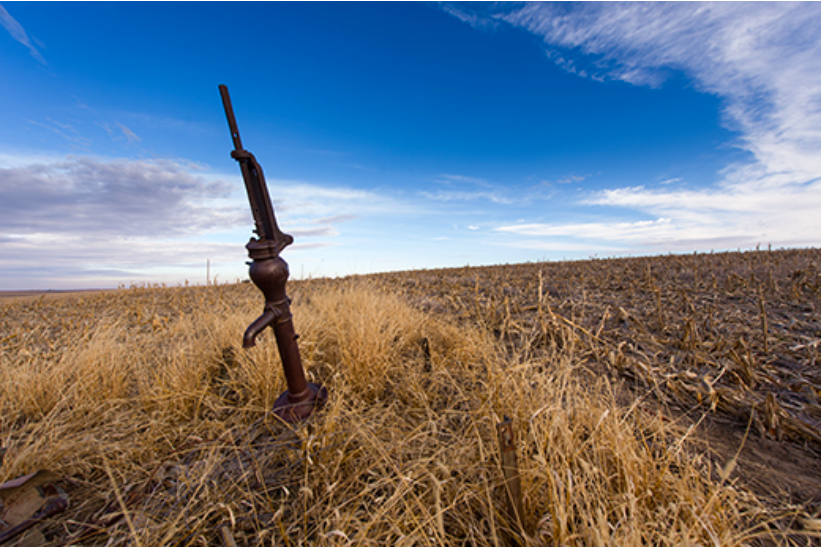
    Telluride’s early days, survival depended dearly on water. The enterprises that built the region — farming, ranching and mining — required irrigation from rivers, and lots of it. Of course, water becomes scarcer the farther one moves from the mountains or from the San Miguel River.

    For the pioneers, creating an infrastructure that could sustain them in the short term and withstand the march of progress was no easy task. Suffering cold conditions, subsisting on biscuits and beans, laboring with shovels, axes and other hand tools, pioneers worked to channel water from its source to where they needed it.
    Back then, this was legal. Just decades ago, as the old-timers established our local towns, “Water could be diverted from the stream, and ditches built across public and private land to convey water to its place of beneficial use,” the Colorado Foundation for Water Education reported.

    “In a dry and thirsty land it is necessary to divert the waters of the streams from their natural channels,” Colorado Chief Justice Moses Hallet said in the late 1800s.

    Telluride

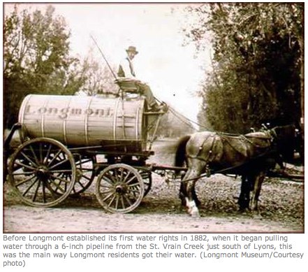
    During Telluride’s early days, water was hauled from the San Miguel River and from springs on the east side of town. Wilson Rockwell said in his book “Uncompahgre Country” that a man named Dutch George in the late 1800s delivered five-gallon buckets of water from the spring at Cornet Creek to saloons and businesses on what is now Colorado Avenue for 10 cents each, two buckets at a time, balanced by a yoke around his neck.

    When attorney L.L. Nunn needed water for his commercial bathhouse on the east end, he ran a garden hose from Cornet Falls. Later, in 1886, H. H. Corbin constructed a 370-foot vertical pipeline that transported water from Cornet Creek into town.

    Though people then said it couldn’t be done, high pressure water was flumed from Trout Lake to help establish the Ames power plant, and later the Ilium plant, that would put Telluride on the map as the first city in the world to be powered by alternating electric current. Of course, the purpose was to support the mining industry.

    Nucla

    For some, creating access to water was more difficult. The Town of Nucla, formerly Tabeguache Park, was founded by a socialist organization whose members wanted to escape their greedy landlords in Denver. By accident, they discovered the location that provided everything they desired: mild winters, ample sunlight, virgin soil — but no water.

    Called the Colorado Cooperative Company, the members, or comrades, set up camp in the late 1800s in what became the second largest city in Montrose County to bring water to the homesteads for which they’d filed claims.
    They were told their task was impossible.

    “I believe [that] actually helped build the ditch. When you are told you can’t, you’ll bust a tug to do it,” Leonard F. Zatterstrom said in a memoir published in Marie Templeton’s book “The Visionaries.”

    The Colorado Cooperative Company constructed a 17-mile-long wooden flume, called the CC Ditch, built along the wall of the San Miguel River canyon. David Lavender in “One Man’s West” writes that those who worked on the ditch were compensated by “credit at the commissary for food and supplies, plus water credits toward the purchase of ditch rights. The canal succeeded, and several prosperous farms sprang up.”

    People like Zatterstrom worked eight-hour days building the flume, sleeping in the bunkhouse, buying their food through the company store and receiving rations of milk from the cooperative’s dairy cows.

    Nucla was born when the project was completed in 1904, and “Piñon became a ghost town practically overnight,” Zatterstrom said.

    But the hard work didn’t pay off for everyone. Mary Rogers was a 9-year old girl during the CC Ditch project. Because both her parents died, she went to live with her grandmother and uncles, the Heinemans, who worked on the CC Ditch. Like others, the German family came to Piñon in search of a better life, and hoped to one day own a farm.

    “My mother worked in the garden and did dishes,” Norma McKeever, now 88, said. According to her, the conditions were not pleasant, especially in the winter. Rogers said the food was terrible, just biscuits and beans at the camp’s boardinghouse in the cold season. But it was worth it to the family. They’d filed a homestead claim with hopes that when the CC Ditch was done, they’d have irrigation water and could build a life.

    Rogers was in her teens by the time the CC Ditch was completed. But the water didn’t reach the Heineman’s farm in 1904. The majority of the CC Ditch workers had accomplished what they’d needed for their own homesteads, and they weren’t willing to extend the project. What can you do with a farm that has no water?

    Grandmother Heineman went to work as a washerwoman and housekeeper for those who owned prosperous farms. Mary Rogers got a job at the Western Hotel in Norwood. One of her uncles moved to Nevada and never came back.

    McKeever said the Heinemans, buried in the pauper site at Nucla Cemetery, weren’t the only ones to feel cheated out of their homestead dreams.

    Though socialism failed, the town has not. Water still serves Nucla to this day, though the wooden flume has mostly been replaced by more practical means. The town celebrates the water victory every July with their Water Days celebration.

    Norwood

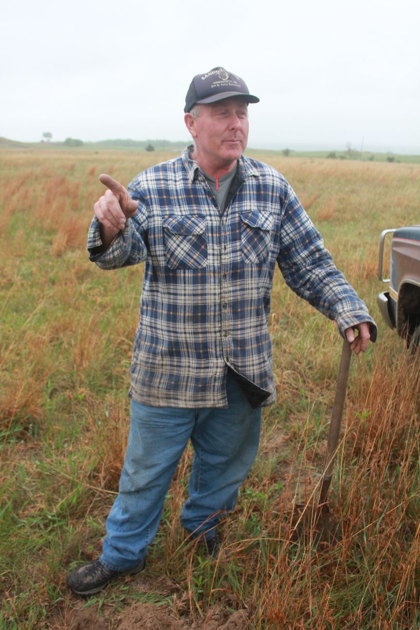
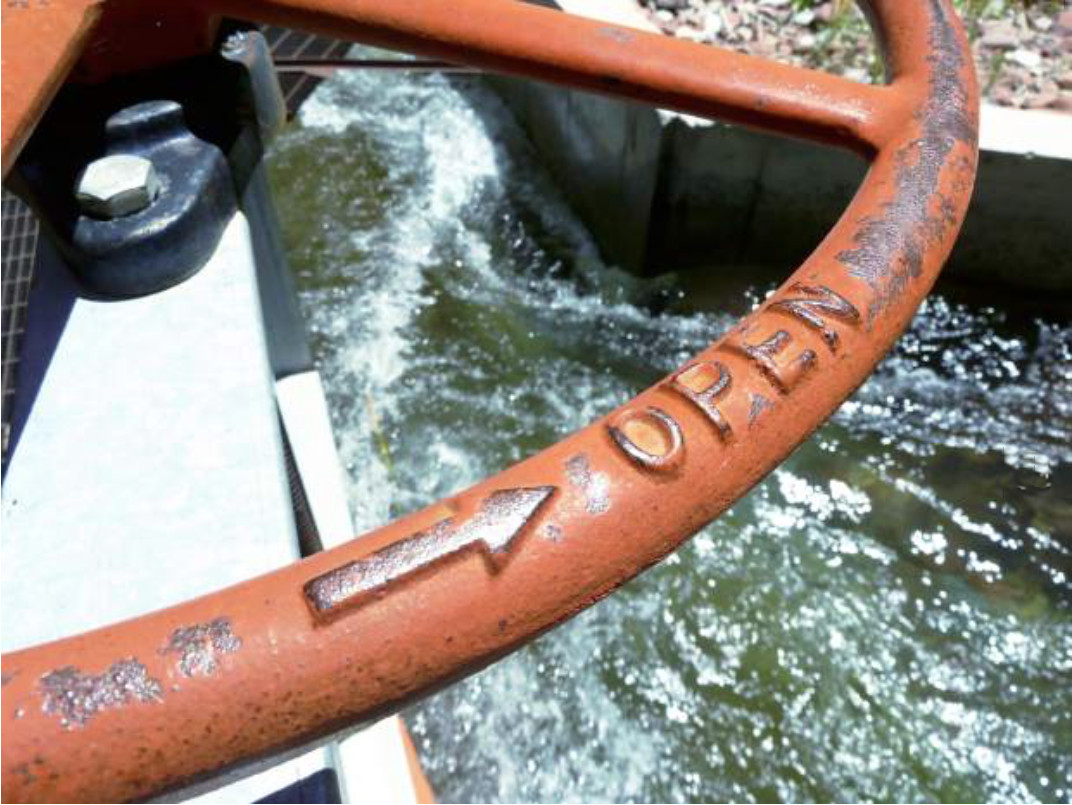
    Wilson Barrett of Redvale is the ditch rider — the patroller or inspector — for the waterway that is the lifeblood of Norwood, the Gurley Ditch. He is the only employee of Farmer’s Water Development, the stock company that “owns” the Gurley and divides its shares of water. But nobody really owns the water in Colorado, he said, just the rights to use it. According to him, life in Norwood wouldn’t be possible for anyone if the old-timers hadn’t dug the ditch.

    In the late 1800s, when pioneers began settling Wrights Mesa, Rockwell said Ed Joseph — of the Joseph family, one of the first to settle the area — began construction of a reservoir east of the Lone Cone in the high country.

    Some people disagree as to who later built the Gurley Ditch and finished the reservoir above it. Barrett said it was Naturita Land and Cattle Company. Regardless, whatever company worked on the project went bankrupt. One of the owners in that outfit was named Charles Gorley. Over time, the spelling of “Gorley” evolved into “Gurley,” which is used today.

    To avoid losing the rights to use their water, local farmers and ranchers on the mesa decided to purchase the floundering company, buying it out of bankruptcy, and then established Farmer’s Water Development.

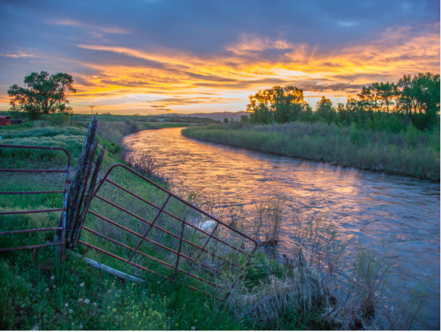
    Now irrigation water runs from the dam through Beaver Park and to Wrights Mesa, mostly for agricultural purposes, but a small percentage is used for domestic water in town.

    Barrett’s great uncle, Gordon Barrett, was one of the first workers to help dig the Gurley.

    “They came in 1914, and they worked on the ditch in the fall. If you worked in the fall, you could get shares in the company,” Barrett said. “He was nominated to work on the ditch as part of the family so they could get more water.”

    Recently, going through old paperwork, Barrett found one of the original invoices for equipment. He discovered a purchase order, sandwiched between old papers, for picks, boxes of dynamite, shovels and other tools that made the Gurley.

    Without the ditch, Barrett said, Norwood would not have survived.

    Ridgway

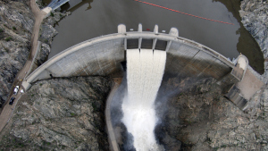
    Most people probably don’t know that Ridgway almost didn’t survive. Years ago, in the 1960s, there were plans for a dam to be constructed just north of where Ridgway now sits. Had the original plans been executed, Ridgway would now be under water.

    Some refer to it as “the town that refused to die,” and Ridgway lucked out when officials in the 1970s decided to move the dam farther north. Now, the Ridgway Reservoir, constructed in the late ‘80s, covers what was the old ghost town of Dallas.

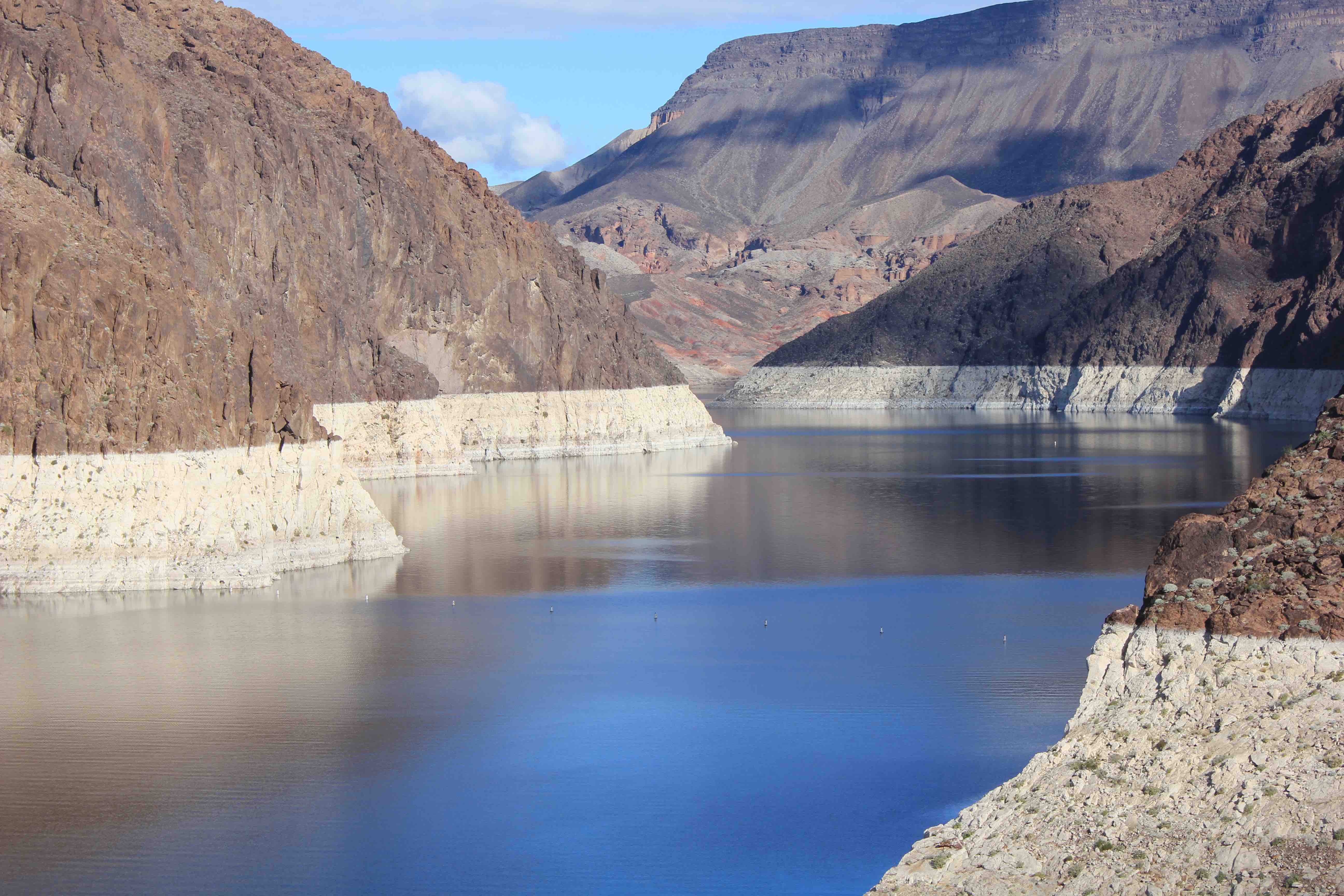
    Though Ridgway is situated on the Uncompahgre River, that stream is not the town’s source of water. Sometimes running yellow or orange, the Uncompahgre is known as a “dirty river” due to the minerals it contains. The town of Ridgway sourced its water in the late 1800s from Hartwell Lake, now Lake Otonowanda, below Mount Sneffels.

    Ridgway completed a major expansion of its reservoir last summer.

    Today

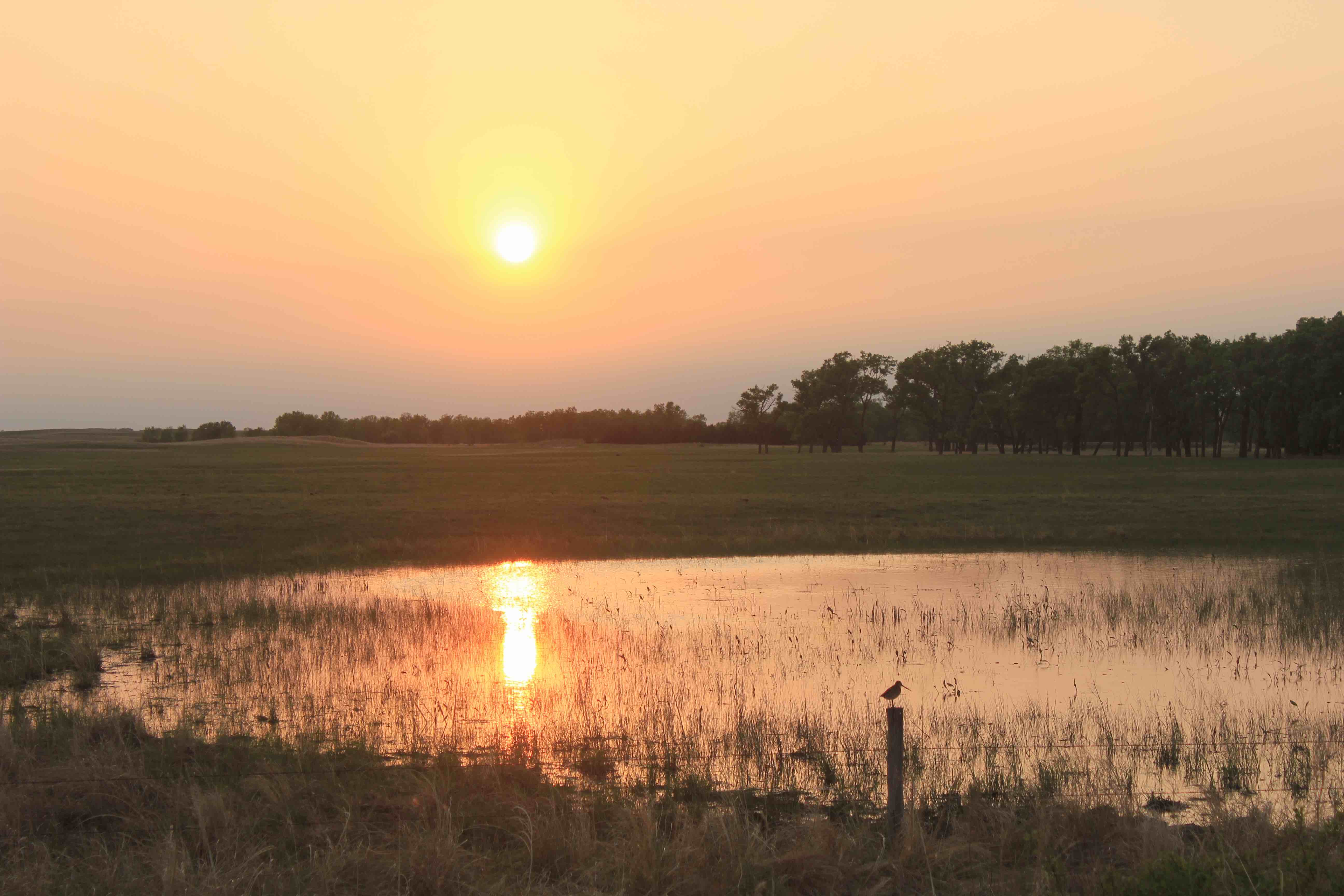
    Today, being on town water is a luxury most people probably don’t think much about. While just 100 years ago we were hauling water and digging ditches through the local mountains, most folks now just turn on the tap. Our pioneers have made it possible for us to have access to water even in places where water didn’t naturally occur.

    Those who live further out in the country have other water issues, and real estate in many parts of Colorado becomes complicated when water rights enter the picture. Sometimes water rights are a part of landownership; sometimes they’re not. Water is overseen by water commissions and boards in various regions.

    These days, one cannot simply dig a diversion ditch from an existing stream or take water from a manmade ditch. Now, water projects involve planning, permits, engineering work and financing. The Colorado Doctrine, a set of laws pertaining to water use and landownership, has been in place since the 1860s.

    Some producers, especially the new farmers without water rights, have trouble wrapping their heads around the laws.

    Last July Leila Seraphin, formerly of California, bought a property in Norwood that the Gurley Ditch runs through. She said she wishes she could use some of that water for her own farming and gardening, but she knows it’s against the law.

    “We were told right when we moved here water was a big issue and taking from the Gurley was not allowed, and that all the water was owned,” she said.

    Building a life as a new producer on Wrights Mesa, she has learned a lot about where her water comes from.

    “It’s hard to imagine water being free to use, as every drop has a price tag,” she said.

    Barrett said people living in this region should be grateful for their water.

    “The water we have — 99 percent of it was done with a shovel and a pick. Without the pioneers, there would be nobody here,” he said.

    He believes that is especially true for Wrights Mesa, as he said that before the Gurley ditch, life didn’t exist in Norwood.

    “The early homesteaders had to go clear into the San Miguel River or into Naturita Creek with wagons and barrels to haul it to have any water at all,” he said. “I’d say for most people [this] is new information.”

    Uncompahgre River Valley looking south
    Uncompahgre River Valley looking south

    #COWaterPlan tackles state water shortages — The Crested Butte News #ColoradoRiver

    Crested Butte
    Crested Butte

    From The Crested Butte News (Alissa Johnson):

    “The final version of the Colorado Water Plan adds more clarity as far as the position on trans-mountain diversions,” said local water expert Frank Kugel. As general manager for the Upper Gunnison River Water Conservancy District, Kugel said the plan makes it clear that, “The Front Range interests—if they pursue trans-mountain diversion—understand there’s not a firm supply. They would accept the risk of any project development that the water may not be there when they need it.”

    In addition, Governor Hickenlooper made it clear that diverting more water across the mountains will be a last resort.

    According to the Denver Post, Hickenlooper stated that if water conservation is ramped up, water is incorporated into land-use planning and reservoir construction is done right, “the diversion of more water across the mountains won’t be necessary.”[…]

    Kugel says that’s a good thing for the Western Slope.

    “The other aspects of the water plan that are favorable for our basin are that there are other proposals [besides trans-mountain diversion] for meeting the gap between supply and demand,” he said.

    They include reuse projects for the Front Range, limits to the permanent drying up of agricultural lands, opportunities to lease water rights and temporary fallowing of farmlands.

    “The plan is a step in the right direction as far as providing for the future of Western Slope water. We certainly need to remain vigilant to guarantee that the protections laid out in the plan are followed through, but there has been a great deal of good work done to solve future water problems,” Kugel continued.

    The plan also outlines projects for the local water basin, including about 130 projects to deal with decreasing water supplies. According to Kugel, climate change studies project that on a local level, warmer temperatures will lead to increased evaporation and transpiration and in turn a 10 percent to 20 percent reduction in water supplies by the middle of the century.

    Droughts and shortages experienced in 2002 and 2012 could become more commonplace. In 2002, diversions on the East River and the Slate River completely dried up.

    The projects outlined in the water plan will look at water consumption and shortages as well as environmental and recreation concerns. Stream management plans for Ohio Creek and the East River are already under way. While the projected population growth on the Front Range makes its water problems most noticeable, Kugel says that meeting water demand is a statewide issue.

    “The shortages are state-wide. In the coming decades there are more acute projects for the Front Range because of growth… making conservation and other methods and efficiency efforts more important there. But as citizens of Colorado we all have obligations to maximize the use of water.”

    More information on the Colorado Water Plan is available at http://www.coloradowaterplan.com, including an executive summary.

    Weekly Climate, Water and #Drought Assessment of the Upper #ColoradoRiver Basin

    Upper Colorado River Basin month to date precipitation through November 22, 2015 via the Colorado Climate Center
    Upper Colorado River Basin month to date precipitation through November 22, 2015 via the Colorado Climate Center

    Click here to read the current assessment. Click here to go to the NIDIS website hosted by the Colorado Climate Center.

    #Drought news: ~0.5 inches of precip in northern and eastern #Colorado over the past week

    Click here to go to the US Drought Monitor website. Here’s an excerpt:

    Summary

    A strong upper-level low pressure system funneled Gulf of Mexico moisture into the central U.S. at the beginning of this USDM week, triggering widespread heavy rains and severe weather. Two to 5 inches of rain fell on November 17 from eastern Texas to Missouri eastward to Mississippi and Illinois. An inch or more of precipitation was observed from northwest Kansas to central Nebraska, across Iowa and Minnesota, and into the western Great Lakes. As the Low and cold front moved eastward on the next day, 1 to locally 3+ inches of precipitation fell across the Southeast, Tennessee Valley, and Upper Mississippi Valley. By the third day, the system had dropped an inch or more of precipitation along the East Coast. Meanwhile, another storm system brought rain and snow to the Pacific Northwest, with 1 to 3+ inches, and locally up to 5 inches, of precipitation measured in Washington and northwest Oregon west of the Cascades. Another system moved from the Pacific Northwest, across the Plains to the southern Great Lakes, leaving a blanket of snow in its wake, up to a foot or more deep in places. As a result, drought and abnormal dryness contracted over large parts of the country. The weather systems missed the Southwest and northern Plains. Virtually no precipitation fell across California to parts of Colorado, New Mexico, and Texas, with a tenth of an inch or less widespread across the northern Plains. Temperatures averaged warmer than normal across much of the East to northern Plains, and in parts of the central Plains and Far West. Cooler-than-normal temperatures dominated from the Pacific Northwest and Northern Rockies to the southern Plains…

    California and Great Basin

    Parts of the northern coast of California received up to 2 inches of precipitation this week, and some northern sections of the Great Basin measured a few tenths of an inch, but most of California and the Great Basin received no precipitation. According to November 22 USDA reports, 85% of the topsoil and 85% of the subsoil in California was rated short or very short of moisture (dry to very dry). In Utah, 48% of the subsoil and 36% of the topsoil was short or very short of moisture. No change was made to the drought depiction in this region…

    Great Plains to Mississippi Valley

    This week saw a continuation of widespread heavy rains across much of the eastern Great Plains and Mississippi Valley. An inch or more of rain fell from the eastern portions of the Plains states – from Texas to the Dakotas – eastward to the Mississippi Valley and beyond. A band of 1-inch precipitation stretched from northwest Kansas into central Nebraska. Two inches to locally 5+ inches was observed from eastern Texas and Oklahoma to Mississippi, western Tennessee, and Illinois. Two-plus inches of precipitation were measured across parts of South Dakota, Iowa, and Minnesota. This heavy precipitation effectively erased the D0 and D1 that remained from last week’s rains across southern and eastern portions of the region. D0 was removed from eastern Texas and southeastern Oklahoma. The rain in southeast Oklahoma contributed to Broken Bow and Hugo Lakes returning to near- to above-normal pool stage. D0-D1 disappeared from Arkansas and Mississippi, with only a small sliver of D0 remaining in northeast Mississippi to reflect longer-term precipitation deficits. D0 was removed from Missouri, southeast Iowa, southwest Tennessee, most of Illinois, and the confluence of the Ohio and Mississippi Rivers area. The recent rains in Illinois have restored soil moisture and benefited winter wheat. D1 was removed and D0 shrunk in Minnesota and Iowa. Heavy snow sliced away at the D0 in northwest Kansas, southwest Nebraska, and northeast Colorado. At the other end of the state, precipitation eroded D0 and deleted D1 in southeast Nebraska and northeast Kansas.

    In the northern Plains where precipitation was sparse this week, D0 expanded in southwest North Dakota and adjacent South Dakota. Below-normal precipitation for the last 7-90 days, coupled with windy and warmer-than-normal weather in recent weeks, continued to dry soils, with 23% of the topsoil and 28% of the subsoil moisture short or very short in North Dakota. In Wyoming, the storm system that blew through this week increased snow depth 4-12 inches at SNOTEL stations in the Big Horns. But even with this increase, snow depth was still less than a foot in this region, and snow water content and water year-to-date precipitation still ranked in the lowest 20th percentile to driest fifth percentile, so no change was made to the D0 in northeast Wyoming. November 22 USDA reports rated 44% of the topsoil and 46% of the subsoil in Wyoming short or very short of moisture. With low streamflows and precipitation deficits stretching over the last 2-12 months and longer, the drought impacts designator for the D0 and D1 in Kansas and north central Oklahoma was changed to SL to indicate both short- and long-term drought conditions…

    Pacific Northwest and Northern Rockies

    Another round of precipitation in coastal Washington and northwest Oregon resulted in improvement to the drought depiction. Two to 5 inches, and locally more, this week added to the precipitation of last week to bring two-week totals to 15-20 inches, or more, in favored upslope areas. Streams were bank full and flooding in many areas west of the Cascade ridge line, especially in Washington. It should be noted that instantaneous streamflow observations are an important flash flood monitoring indicator, but they should never be used for drought monitoring; the base streamflow is best used for drought monitoring, and that is estimated by averaging over several days. The persistent heavy rains and swollen rivers in Washington improved reservoir levels. Seattle-Everett-Tacoma deactivated their water shortage response plans November 23 due to improving reservoirs.

    Precipitation along and west of the Cascade Mountains was above normal for the last 7 to 90 days, and in some places above normal out to the last 12 months. The precipitation resulted in pullback of the D0 to the Cascade ridge line in Washington and contraction of D1-D3 in areas further north, and pullback of D0-D2 in northwest Oregon. But the weather systems producing this precipitation were embedded in a westerly flow, and areas in the rainshadow east of the Cascades continued to have below-normal precipitation at all time scales from the last 7 days to the last 36 months, so D2-D3 continued for Washington and Oregon east of the Cascades. The USGS 7-day, 14-day, and 28-day streamflow indicators show low streamflow in eastern Washington. According to the Bureau of Reclamation, November 22 reservoir statistics still showed low reservoir levels in the Yakima River Basin east of the Cascades, including Kachess and Cle Elum at 33% full each and Rimrock at 29% full. Kachess and Rimrock were well below average, even after the November precipitation. NRCS reservoir statistics are available on a monthly basis. The NRCS October 31 values for reservoirs east of the Cascade ridge line ranged from 30 to 70 percent of average and included 32% at Cle Elum Reservoir, 39% at Keechelus, 56% at Lake Shannon, 71% at Ross, 77% at Kachess, and 79% at Upper Baker.

    Winter mountain snowpack is crucial to spring and summer water supplies. The Pacific Northwest experienced an abysmally low snowpack during the 2014-2015 snow season. The 2015-2016 snow season has started out with snowpack below average. In Washington, a handful of SNOTEL stations have 3 to 5 feet of snow in the northern Cascades, but most of the SNOTEL stations in the Cascades of Washington and Oregon had less than a foot of snow, even after the recent storm systems, and these are all at high elevations. This is still early in the snow season, but these values are less than 75% of normal, and in many cases less than 50% of normal. Snow depths ranged up to 2 feet in some of the higher SNOTEL stations in the northern Rockies of Idaho, but even many of these were still below normal for this time of year.

    November 22 USDA reports noted that 18% of the winter wheat in Washington and 15 % in Oregon was rated in poor to very poor condition. In Washington, 38% of the winter wheat was rated in good to excellent condition, but this value dropped 3 percentage points compared to last week. More than half of the topsoil was rated short to very short of moisture in Oregon (55%) and Washington (51%), with 21% so rated in Idaho. Subsoil moisture conditions were even drier, with 76% short to very short in Oregon, 59% in Washington, and 38% in Idaho…

    Southwest

    Half an inch to an inch of precipitation fell across eastern and northern parts of Colorado, with a few tenths in northern Utah and northeast New Mexico. But other than that, most of the Southwest received no precipitation this week. D0 was trimmed in northeast Colorado, where precipitation improved Standardized Precipitation Index values at several time scales. No change was made to the drought depiction in the rest of the region.