Click on a thumbnail graphic below to view a gallery


Click here to go to the US Drought Monitor website. Here’s an excerpt:
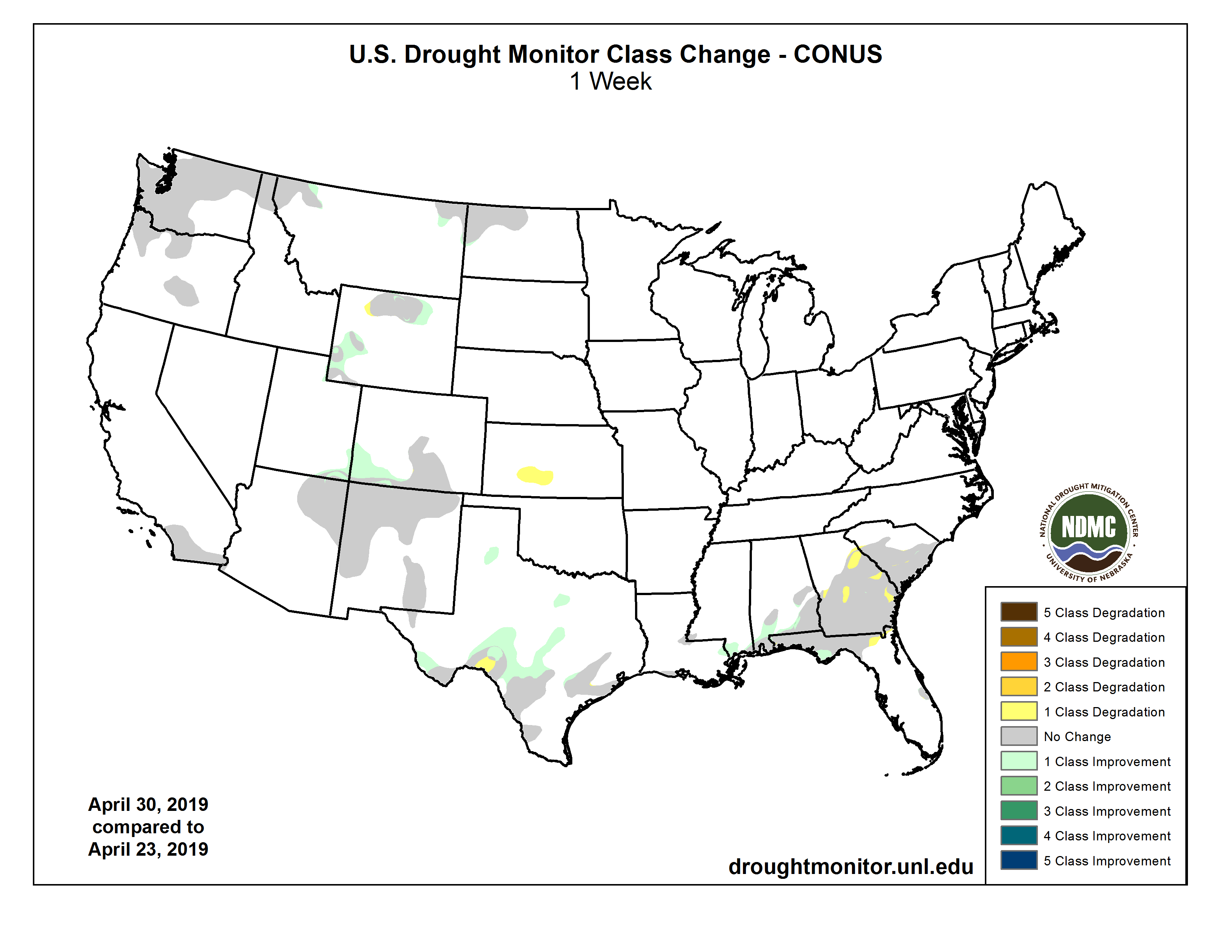
This Week’s Drought Summary
An active weather pattern maintained historically low drought coverage across the contiguous United States, with only a few areas currently experiencing dryness (D0) or moderate to severe drought (D1 to D2). Prior to April 2019, the record-low drought coverage across the Lower 48 States during the 20-year history of the U.S. Drought Monitor stood at 4.52% on May 23, 2017. During the drought-monitoring period ending on the morning of April 30, locally significant precipitation fell in dryness- and drought-affected areas across the Rockies, Intermountain West, northern Plains, and parts of the South. In contrast, little or no precipitation fell in the Far West and the southern Atlantic region…
A new area of abnormal dryness (D0) was introduced in Kansas, where little precipitation has fallen since March 1. Elsewhere, pockets of abnormal dryness (D0) and moderate drought (D1) were limited to Colorado, North Dakota, and Wyoming. Some late-April snow fell in the D0 area of North Dakota, where statewide topsoil moisture rated very short to short stood at 10% on April 28. Coverage of D0 and D1 was reduced in Wyoming and Colorado due to late-April precipitation and generally favorable snowpack values and warm-season runoff prospects…
Minimal changes were introduced in the Far West, while slight reductions in the coverage of abnormal dryness (D0) and moderate drought (D1) were made in the Rockies and environs on the strength of late-season precipitation, robust high-elevation snowpack, and increasing confidence in favorable spring and summer runoff…
Locally heavy showers swept across the South, especially the central Gulf Coast region and from west-central to northeastern Texas, trimming dryness (D0) and moderate drought (D1). Selected daily-record rainfall totals during the drought-monitoring period included 2.57 inches (on April 25) in Vicksburg, Mississippi; 1.88 inches (on April 24) in Austin, Texas; and 1.37 inches (on April 23) in Oklahoma City, Oklahoma. Dallas-Fort Worth, Texas, recorded 3.57 inches on April 23-24. Lingering pockets of D0 and D1 primarily stretch from southern Texas to the central Gulf Coast…
Looking Ahead
During the next couple of days, showers and thunderstorms across the nation’s mid-section will gradually shift into the South, East, and lower Midwest. Five-day rainfall totals could reach 1 to 5 inches or more along an axis stretching from the southeastern Plains into the lower Great Lakes region. In contrast, areas west of the Rockies will experience mostly dry weather and a gradual warming trend. During the weekend, a new surge of cold air will arrive across the northern Plains and upper Midwest, accompanied by rain and snow showers.
The NWS 6- to 10-day outlook for May 7 – 11 calls for the likelihood of wetter-than-normal weather nearly nationwide. Below-normal precipitation should be limited to northern California and the Pacific Northwest. Meanwhile, warmer-than-normal conditions across the Southeast and the Far West should contrast with below-normal temperatures in most other regions, including a large area stretching from the Southwest into large sections of the Rockies, Plains, and upper Midwest.