Here’s the release from Stanford University (David Lobell, Rob Jordan):
Like a baseball slugger whose home run totals rise despite missing more curveballs each season, the U.S. Corn Belt’s prodigious output conceals a growing vulnerability. A new Stanford study reveals that while yields have increased overall – likely due to new technologies and management approaches – the staple crop has become significantly more sensitive to drought conditions. The research, published Oct. 26 in Nature Food, uses a novel approach based on wide differences in the moisture-holding capabilities among soils. The analysis could help lay the groundwork for speeding development of approaches to increase agricultural resilience to climate change.
“The good news is that new technologies are really helping to raise yields, in all types of weather conditions,” said study lead author David Lobell, the Gloria and Richard Kushel Director of the Center on Food Security and the Environment. “The bad news is that these technologies, which include some specifically designed to withstand drought, are so helpful in good conditions that the cost of bad conditions are rising. So there’s no sign yet that they will help reduce the cost of climate change.”
Corn production in the U.S. is a seemingly unstoppable juggernaut. Despite concerns about resistant weeds, climate change and many other factors, the industry has set record yields in five of the last seven years. Likely drivers of these bumper crops include changes in planting and harvesting practices, such as adoption of drought-tolerant varieties, and changes in environmental conditions, such as reduced ozone levels and increased atmospheric carbon dioxide concentrations that generally improve the water-use efficiency of crops.
As climate change intensifies, however, the cost to maintain crop yields will likely increase.
Using county soil maps and satellite-based yield estimates, among other data, the researchers examined fields in the Corn Belt, a nine-state region of the Midwest that accounts for about two-thirds of U.S. corn production. By comparing fields along gradients of drought stress each year, they could identify how sensitivity to drought is changing over time.
Even within a single county, they found a wide range of soil moisture retention, with some soils able to hold twice as much water as others. As might be expected, there were generally higher yields for soils that held more water. They found yield sensitivity to soil water storage in the region increased by 55 percent on average between 1999 and 2018, with larger increases in drier states.
The results made clear soil’s ability to hold water was the primary reason for yield loss. In some cases, soil’s ability to hold an increased amount of moisture was three times more effective at increasing yields than an equivalent increase in precipitation.
So, why have yields become more sensitive to drought? A variety of factors, such as increased crop water needs due to increased plant sowing density may be at play. What is clear is that despite robust corn yields, the cost of drought and global demand for corn are rising simultaneously.
To better understand how climate impacts to corn are evolving over time, the researchers call for increased access to field-level yield data that are measured independently of weather data, such as government insurance data that were previously available to the public but no longer are.
“This study shows the power of satellite data, and if needed we can try to track things from space alone. That’s exciting,” Lobell said. “But knowing if farmers are adapting well to climate stress, and which practices are most helpful, are key questions for our nation. In today’s world there’s really no good reason that researchers shouldn’t have access to all the best available data to answer these questions.”
Jaime McCullah points out past samples taken from boats of invasive mussel species at the boat inspection check point at Ruedi Reservoir on Wednesday, July 22, 2020. (Kelsey Brunner/Aspen Times via Aspen Journalism)
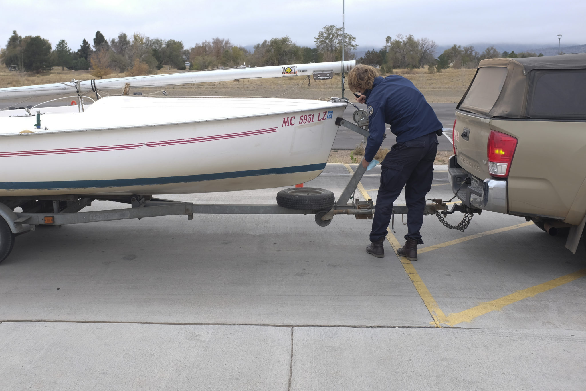
Inspectors in Colorado this season intercepted a record number of watercraft showing signs of invasive mussel infestations as reservoirs across the state saw surging numbers of boaters.
Ruedi Reservoir, near Basalt, recorded the state’s highest number of intercepted boats carrying mussels. Officials said that is probably due to the reservoir’s relative proximity to Utah’s Lake Powell, which has been dealing with a mussel infestation for years.
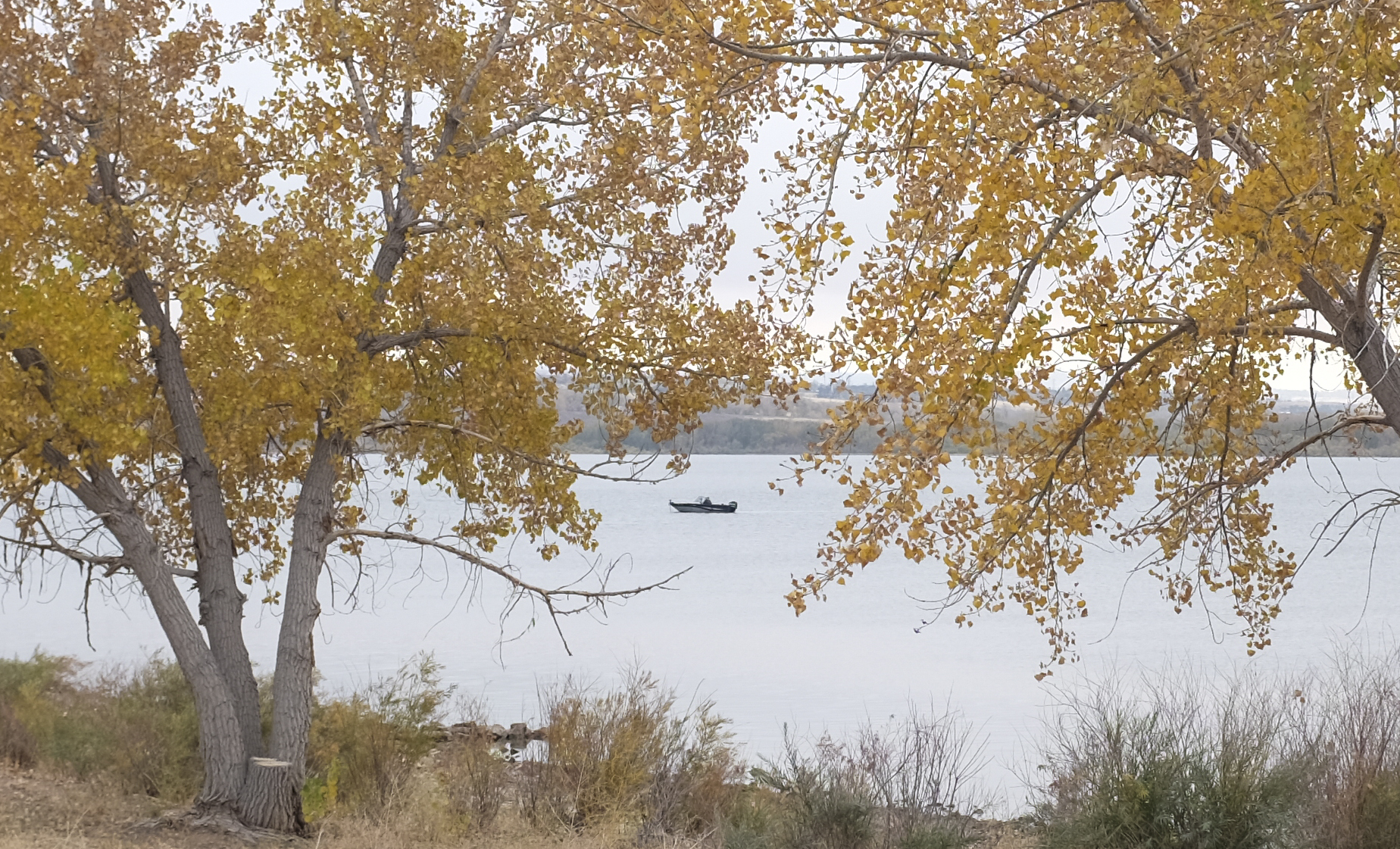
As public health experts have urged people to maintain their distance and avoid enclosed spaces during the COVID-19 pandemic, one logical response for many Coloradans has been to take to the water. Boating, kayaking and paddleboarding have exploded in popularity this year, according to reservoir managers across the state. Riding the wave of that trend are invasive mussels, attaching themselves to watercraft.
“With more opportunities … for a boat to be transporting something into our waters, there is, of course, a little bit more risk,” said Robert Walters, an invasive-species specialist with Colorado Parks and Wildlife.
By mid-September in Colorado, where the boating season officially will close in November, the state had already recorded more than 600,000 boat inspections. In an average year, it conducts about 475,000. At least 94 boats were intercepted with confirmed adult mussels, the highest number recorded in the state since it began boat inspections in 2008.
Native to Eastern Europe, zebra and quagga mussels have infested waters around the world. The creatures, each wrapped in a hard, sharp shell, cling to surfaces in fresh water and quickly breed. Mussels can devastate aquatic ecosystems and damage infrastructure such as pipes and hydroelectric equipment. The larvae of these aquatic nuisance species — as they are designated by the state — have been detected in several Colorado reservoirs over the years, but adult mussels have never emerged.
Mussels pose a particularly high threat in Colorado because of the state’s position upstream of other watersheds. Scientists suspect that zebra and quagga mussels would have difficulty establishing in a high-elevation river, but it’s still possible that they could be distributed downstream.
“We are at the top of the watershed,” Walters said. “So if something were to happen in one of our headwaters or really anywhere in the state of Colorado, it would have significant potential to impact those downstream of us.”
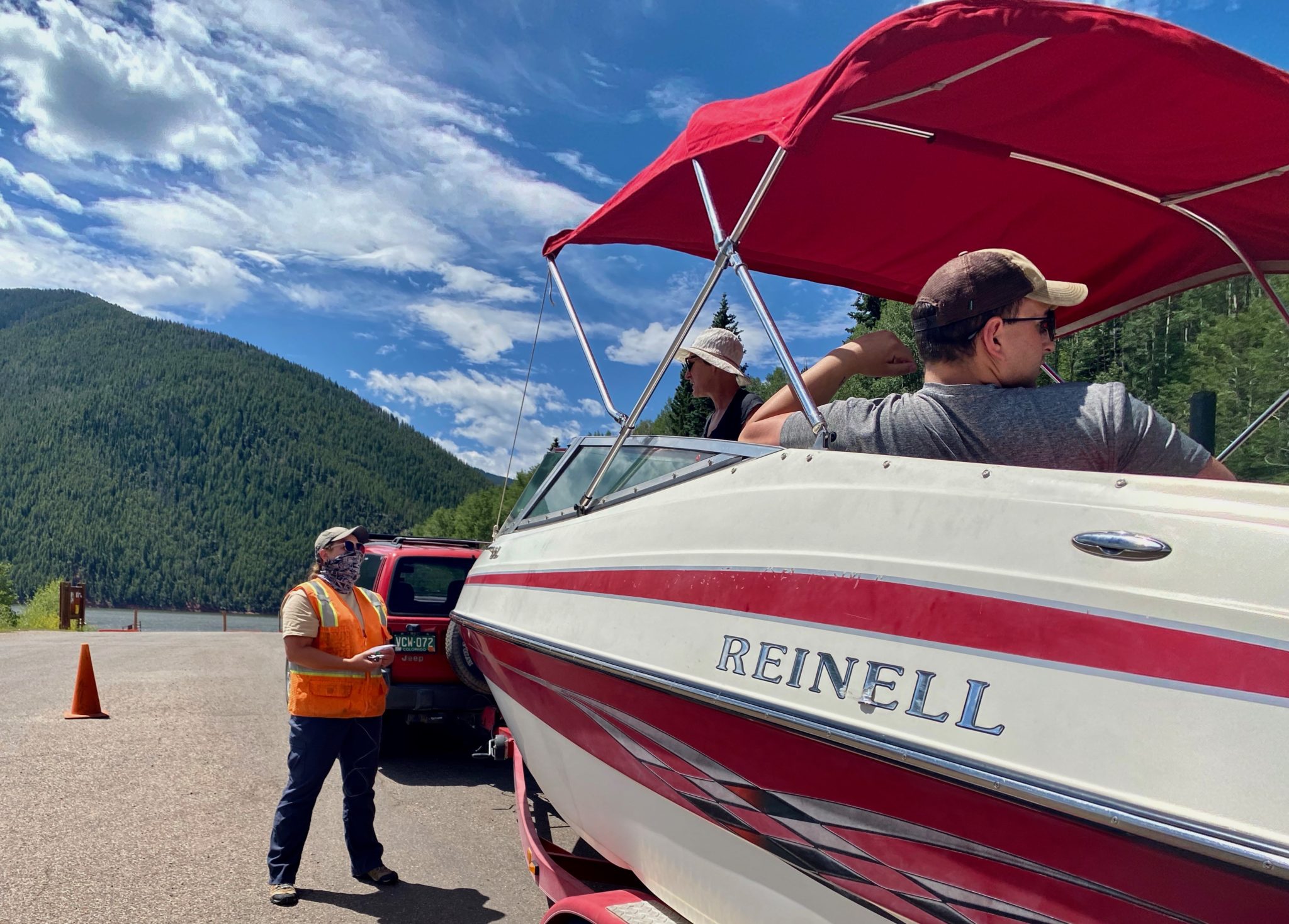
Park ranger Geraint Mansfield examines the registration of a boat headed into Chatfield Reservoir, near Denver, on Oct. 18. Since 2008, the state has had an inspection program designed to keep invasive zebra and quagga mussels — which can damage infrastructure and disrupt the aquatic food chain — out of Colorado waterways. Photo credit: Lindsay Fendt/Aspen Journalism
Keeping up with the crowds
CPW regularly tests the state’s reservoirs for mussel larvae, and so far there are no signs that the increased boating activity has spurred an infestation, which is a testament to the state’s thorough inspection program. Still, keeping pace with the increased boat inspections has been a challenge for many agencies, especially those dealing with pandemic-induced budget constraints.
“I think we’re pretty fortunate that we were even allowed to hire our normal staffing,” said Mark Caughlan, district manager at Horsetooth Reservoir, just west of Fort Collins. “But don’t get me wrong, it still wasn’t enough staffing to handle that massive influx of visitation that we saw.”
According to Caughlan, Horsetooth Reservoir normally gets around 1.2 million visitors a year. This year, the reservoir saw a 30% to 40% increase in visitation, much of which was boaters. The volume of visitors, the limited staff and the need to carefully inspect boats meant that some people waited hours to get on the water. Most reservoirs, including Horsetooth, put inspection stations at every boat ramp, making it improbable that any boat will touch the water before it’s checked out.
Adult mussels can stick to the outside of a boat or be sucked into the ballast tanks of wakeboard boats and ski boats. If mussels are found, inspectors spray the boat with a high-powered water jet to clear them off. The ballasts have to be emptied and washed to ensure that no larvae are inside. The full decontamination process can take up to 30 minutes depending on the extent of the infestation.
Even before boating exploded in popularity during the pandemic, the threat of mussels slipping through the cracks was increasing. In 2017, CPW intercepted 26 infested boats, which was a record at the time. That number increased to 51 in 2018 and to 86 in 2019.
Reservoir managers attribute the increase to surrounding states’ growing number of bodies of waters with mussel infestations, in particular Lake Powell, which became fully colonized by mussels in 2016. Boats leaving Lake Powell are required to undergo inspection by the National Park Service, but many boats slip through. Nearly 70% of the mussel-infested boats intercepted in Colorado come from Lake Powell.
An inspector from Rocky Mountain Recreation begins the boat-inspection process at Ruedi Reservoir in July. Seventeen boats at Ruedi were found to have invasive zebra and quagga mussels this season, which is the highest number anywhere in the state in what was a record year for boats intercepted with the invasive species. The mussels disrupt the aquatic food chain and clog intake pipes for water-related facilities and boat engines. Photo credit: Christin Kay/Aspen Journalism
Ruedi on the frontlines
The impact of Lake Powell’s mussel colonies on Colorado is most striking at reservoirs closest to the Utah border. Ruedi Reservoir, in the Fryingpan River Valley above Basalt, has seen more boats containing invasive mussels than any other body of water in Colorado, with 17 interceptions this year. Ruedi is particularly vulnerable to mussels. The turbines and pipes inside its hydroelectric dam are difficult to clean and could be destroyed if they are colonized. Mussels are also a filtering species, meaning they feed off the microinvertebrates, such as plankton, in their ecosystem. These microinvertebrates make up the base of the food chain, which helps sustain the renowned fishery downstream of the reservoir on the Fryingpan River.
“Given our proximity, I think we share a lot of the same boaters with Lake Powell,” said April Long, executive director at Ruedi Water and Power Authority. “Their mussel population is increasing, and I don’t believe that their ability to inspect is also increasing.”
Due to the pandemic, Ruedi delayed opening to boaters until June 1, but Long said the number of boats inspected there has still nearly doubled in 2020. Inspectors worked overtime hours through June and July to keep up.
A boater floats in the waters at Chatfield Reservoir, near Denver, on Oct. 18. Reservoirs across the state reported surging or record use this year as the COVID-19 pandemic drove more people outdoors. Those higher numbers corresponded with increased inspections and interceptions of invasive mussels, which state authorities are trying to keep out of Colorado reservoirs. Photo credit: Lindsay Fendt/Aspen Journalism
Most boaters are cooperative — and officials want to keep it that way
Despite the long waits, inspectors across the state say most boaters are cooperative. Long worries that this could change if long lines become the norm, and she said the RWPA is discussing expanding its inspection staff next year.
“If they get frustrated with the amount of time that it takes to do these inspections or decontaminations, we may see some compliance shift to noncompliance,” she said. “We don’t want that to happen.”
While long lines could aggravate some boaters, Walters said boaters, generally, are invested in keeping the waters where they spend time healthy. The mussel colonies at Lake Powell have served as a firm warning for many Colorado boaters.
“If there is anything positive that I can say of the infestation out there at Lake Powell,” he said, “it’s that Colorado boaters love to go out there and seeing something like that happen to one of their favorite waters has really hammered home what this could potentially look like if it happened here in Colorado. From what I’ve seen, I think that’s made the boaters much more supportive of the program and that they don’t want to see that happen at their home waters.”
This story ran in the Oct. 24 edition of The Aspen Times and the Oct. 26 edition of the Glenwood Springs Post Independent.
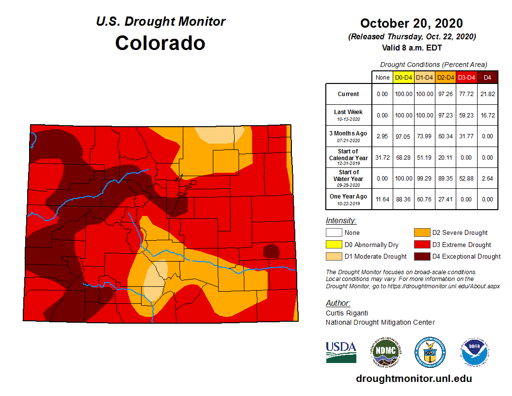
The situation is worst by far on the Western Slope, where vast swaths of landscape are dubbed D4, the highest on the scale, for “exceptional drought.”
And the exceptional dry is spreading.
In just one week, between Oct. 13 to Oct. 20, the latest map reveals, the “exceptional” drought already blanketing much of Ouray, Montrose and San Miguel counties had gained ground to encompass much of Archuleta, Hinsdale and Mineral counties, as well. The latter trio, which were considered to be in “extreme” drought up until this week, are located just east of San Juan County (which is also under an “exceptional” drought, and is where this region’s most recent conflagration, the Ice fire, had burned one square mile and was 25 percent contained as of Thursday morning).
Curtis Riganti of the National Drought Mitigation Center — a team of climate experts at the University of Nebraska in Lincoln — produced the maps of Colorado these past two weeks. He recalled camping with friends at Ridgway State Reservoir in June of 2019, “right after a blockbuster year that you had in terms of snow,” as he put it. “The trouble (that produced the current drought) kind of started during the period of summer-into-fall of that year,” Riganti said. “We’re looking at a drought that goes back toward that period.” There wasn’t much in the way of moisture during the summer 2019 monsoon, Riganti noted, “and it didn’t help that precipitation this past spring, and the summer monsoon season, were pretty muted.” The result, according to Riganti: “We’re looking at both short-term and long-term drought conditions in southwest Colorado right now. Part of the problem you’re getting with all the fires is that it’s a tinderbox. And the warm and windy conditions haven’t been helpful.”
Riganti was out here not only in 2019, but again recently, hiking with friends above Telluride and in the Cimarron Range, overlooking Owl Creek Pass. “I noticed how full the Ridgway reservoir was in 2019, compared to how low it is now,” he remarked ruefully. “Exactly how much precipitation will be needed to recover from the drought is impossible for me to say. But one precipitation event isn’t going to do it.”
Peter Gobel, a Colorado Climate Center ‘service’ climatologist who splits his time between scientific research and public education, addressed the subject of the drought in an interview with the Planet on Thursday afternoon.
“The drought and the wildfires aren’t really separable from each other,” Gobel pointed out. “We’re in the throes of an unprecedented ecological drought: as soon as the wildfires start, they take off to beat the band. The East Troublesome fire (out of Granby) grew over 100,000 acres in a 24-hour period. Prior to this year, just three fires had grown to that size at all.”
Closer to home, “much of the San Juans have had their driest summer, and nearly their fall, on record. I suspect the fire danger is really quite high there, as well. We need snow, and a nice cold snap, where we can really press our advantage when it comes to these fires. We really need a good snow year to hit the ‘reset’ button. An average snow year would do a lot, but it wouldn’t get us all the way to recovery. We need two to three good snow years in a row.”
In some ways, Gobel added, “this year has rewritten the script when it comes to wildfire behavior. The 416 fire two years ago (out of Durango) started in June,” he pointed out. “We figured we had a good handle on why that was: we figured that because we get a lot warmer in June, and the sun is nice and high, conditions are dry, and things can become a tinderbox. We hadn’t seen a year where so many large wildfires started later; the ones this year have quickly gotten enormous. Typically, summer moisture, in terms of the monsoon,” eases dry conditions. “And by fall, you have cooler temperatures,” Goble added, “and after that, the snowpack settles in. And so the fire season, at least at higher elevations, comes to an end. We saw snow in early September, but then the weather pattern quickly reverted to hot and dry. Typically, we would have had one or two or more snow events by this point in Southwestern Colorado. This is right around the time that we start to see snow hang around on the ground. We’re hoping that this next event will start that process.”
In response to increasing tributary flows, the Bureau of Reclamation has scheduled a decrease in the release from Navajo Dam from 600 cubic feet per second (cfs) to 500 cfs on Tuesday, October 27th, starting at 4:00 AM. Releases are made for the authorized purposes of the Navajo Unit, and to attempt to maintain a target base flow through the endangered fish critical habitat reach of the San Juan River (Farmington to Lake Powell).
The San Juan River Basin Recovery Implementation Program recommends a target base flow of between 500 cfs and 1,000 cfs through the critical habitat area. The target base flow is calculated as the weekly average of gaged flows throughout the critical habitat area from Farmington to Lake Powell.