Click on a thumbnail graphic to view a gallery of drought data from the US Drought Monitor.
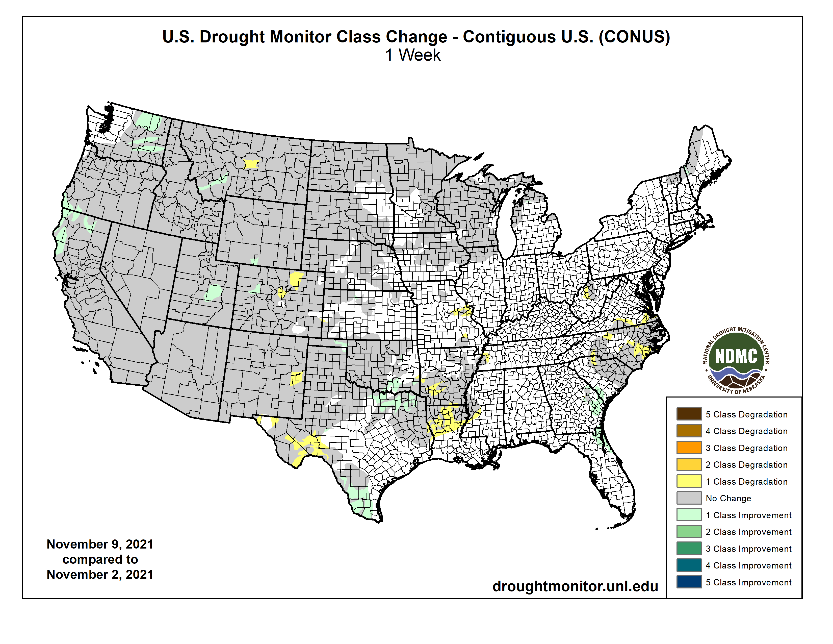
US Drought Monitor map November 9, 2021.
High Plains Drought Monitor map November 9, 2021.
West Drought Monitor map November 9, 2021.
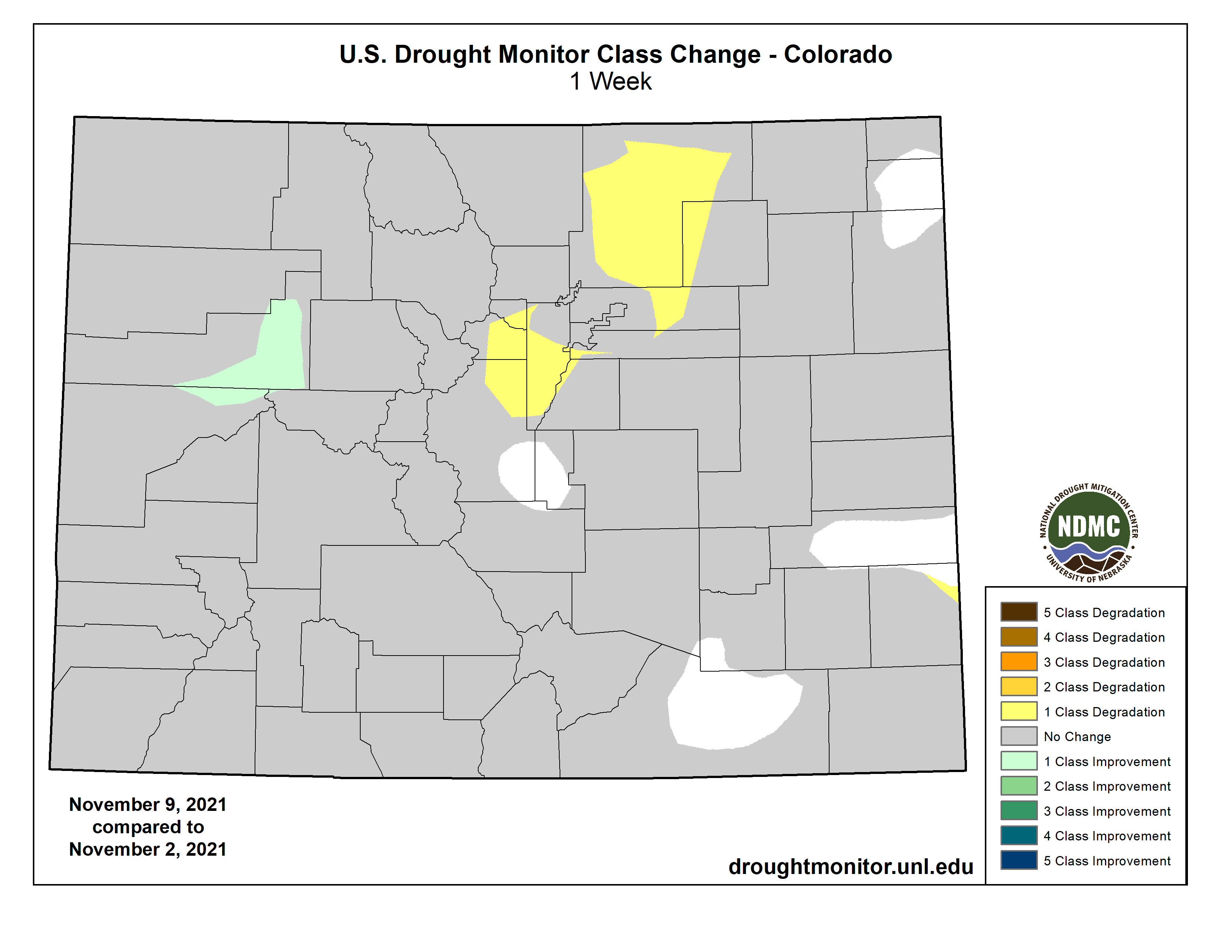
Colorado Drought Monitor map November 9, 2021.
Click here to go to the US Drought Monitor website. Here’s an excerpt:
This Week’s Drought Summary
Over the last week, multiple storm systems moved into the Pacific Coast, resulting in mostly beneficial precipitation in western portions of Washington, Oregon, and northern California. Some of these areas saw improvements to ongoing drought conditions as a result of these precipitation events. A few other spots in the West, primarily north and east of the Great Basin, saw some precipitation, but conditions in other parts of the West were largely dry. Outside of the Pacific Coast states, only a few changes were made to the Drought Monitor this week in the West. For more detail on these changes, please see the West region paragraph below. Elsewhere in the contiguous United States, widespread rain, amounting to between half an inch and 2 inches, fell in the Southern Great Plains, primarily along and to the east of Interstate 35. As a result, some areas along the Texas/Oklahoma border and parts of south Texas saw improvements to drought conditions. Farther east, heavy rainfall struck parts of Florida and the southeast U.S. coastline, resulting in some improvements to dryness in Florida, Georgia, and southern South Carolina. In drier parts of North Carolina and adjacent South Carolina, drought conditions remained the same or worsened. While not enough to improve ongoing dryness and drought in the Michigan UP, lake effect snow staved off any worsening of drought. Along the Pacific Coast, temperatures were generally within a few degrees of normal this week. Farther east, roughly northwest of a line from the Great Lakes to El Paso, temperatures were well above normal. Parts of the Dakotas saw temperatures 6 to 10 degrees warmer than normal. Southeast of that line, temperatures were mostly cooler than normal, with parts of Arkansas, Louisiana, and Texas falling 6 to 10 degrees below normal…
Primarily dry weather occurred in the High Plains region this week. In western South Dakota, precipitation amounts up to an inch fell, and more minor precipitation amounts occurred in south-central Kansas. A couple minor improvements to conditions occurred in western Kansas. Well above normal temperatures returned this week in the Dakotas, where temperatures from 6 to 10 degrees above normal occurred. In the Dakotas, where long-term drought is still ongoing, livestock water quality and fawn production were both reported to be suffering as a result of the drought…
Colorado Drought Monitor one week change map week ending November 9, 2021.
Along the Pacific Coast, near or slightly below normal temperatures combined with heavy precipitation (which exceeded 5 inches in some areas) to improve drought conditions in parts of northern California, southwest Oregon, and Washington. In central Utah, groundwater conditions and long-term precipitation deficits had improved enough for some of the exceptional drought to improve to extreme drought. In Montana, much of the eastern part of the state remained dry, leading to some expansion in exceptional drought, where multiple short- and long-term datasets indicate worsening conditions. In western Montana, a small part of exceptional drought improved to extreme drought where short- and long-term precipitation deficits had improved. In small parts of western Colorado and south-central Wyoming, streamflow and precipitation deficits had decreased enough to lead to improving drought conditions. Farther east in Colorado, recent warm temperatures combined with dry weather to lead to worsening drought conditions in a few areas. Finally, moderate drought expanded in eastern New Mexico, where short-term dry weather combined with depleted soil moisture to lead to worsening conditions. In Oregon and California, long-term drought conditions have adversely affected salmon populations and migratory birds. Due to widespread recent precipitation, much of the West region is now experiencing long-term drought, rather than both short- and long-term drought…
In eastern Texas and Oklahoma, and in far northwest Louisiana and western Arkansas, widespread rain over a half inch fell this week. As a result, many areas from the Dallas-Fort Worth Metroplex and eastward along the Red River saw improvements to ongoing drought and dryness. Improvements also occurred in south Texas. In parts of southwest Texas that did not see rain, some worsening of drought conditions occurred, due to increasing precipitation deficits and lessening soil moisture. Conditions also worsened in parts of northern Louisiana and southern Arkansas where short-term precipitation deficits increased. Most of the region saw cooler than normal temperatures this week, with widespread readings between 6 and 10 degrees below normal in east Texas, Louisiana, and Arkansas. The western reaches of the South region saw near- or above-normal temperatures…
Looking Ahead
The Weather Prediction Center’s forecast (valid November 10 – 16) calls for multiple rounds of precipitation in the Pacific Northwest. These events are expected to bring heavy rain with local areas of flash flooding. Snow is expected over the high elevations of the Pacific Northwest to the Upper Midwest. A cold front sweeping across the eastern half of the country will bring showers and thunderstorms to the South and rain and rain to much of the East. As the front moves through, temperatures will drop 2 – 5 degrees below normal in the central part of the country and 4 – 9 degrees cooler than normal across the Lower Midwest and Southeast. Temperatures will be 5 – 11 degrees warmer than normal across the West.
The Climate Prediction Center’s 6 – 10-day outlook (valid November 16– 19) favors an active storm track across the northern tier of the Lower 48. This pattern would bring above-normal rainfall to the Pacific Northwest eastward to the Upper Midwest. Below-normal precipitation is likely across the southern tier of the Lower 48, with the greatest odds (more than 50%) over parts of the Southwest, the Southeast, and Alaska. The highest odds for above-normal temperatures occur in the Southwest (greater than 70%). Odds of above-normal temperatures decrease moving northward. The highest odds for below-normal temperatures occur in the Southeast (greater than 60%). Odds of below-normal temperatures decrease across the South and Midwest.
US Drought Monitor one week change map ending November 9, 2021.
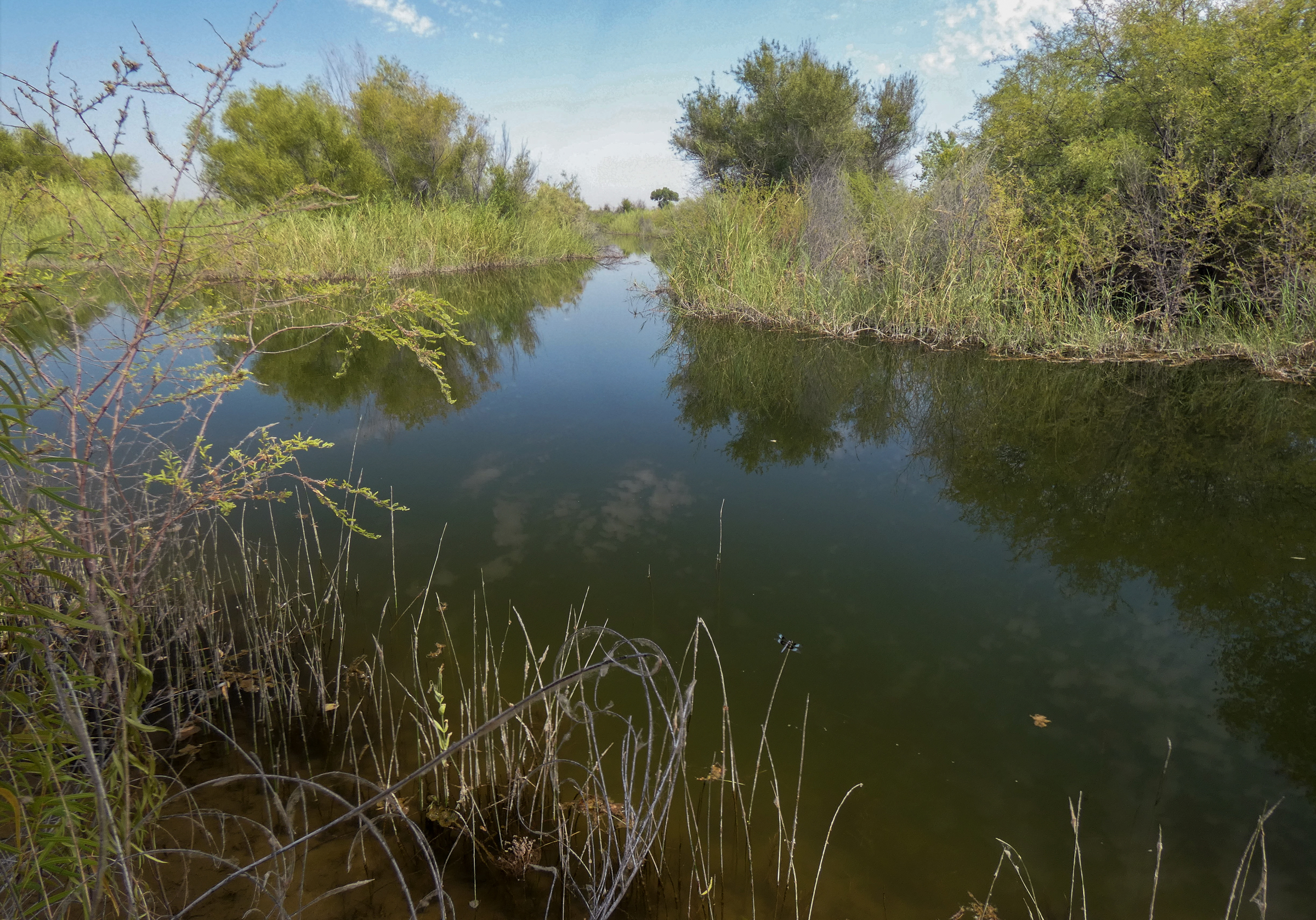
Colorado River “Beginnings”. Photo: Brent Gardner-Smith/Aspen Journalism
“We can’t ignore that science any longer” — John Fleck
“If you don’t understand the nature of the problem you’re going to come up with a solution that’s less than adequate” — Brad Udall
From PBS: “The Colorado River runs nearly fifteen hundred miles, winding through seven states and Mexico. It supplies drinking water to nearly 40 million people, irrigates nearly 4 million acres of farmland and attracts millions of nature lovers to scenic Grand Canyon vistas. And it is on the brink. A 20 year mega-drought — exacerbated by climate change — is squeezing the Colorado dry. It’s a crisis for the people of the Southwest and a “canary in the coal mine” for us all.”
Brad Udall: Here’s the latest version of my 4-Panel plot thru Water Year (Oct-Sep) of 2021 of the Colorado River big reservoirs, natural flows, precipitation, and temperature. Data (PRISM) goes back or 1906 (or 1935 for reservoirs.) This updates previous work with @GreatLakesPeck.The river is flowing [May 2021]! Observers have not yet confirmed that the freshwater has met the sea, but they think it may with the next high tide. Photo: Jennifer Pitt/Audubon