Wildfires torched up to a fifth of all giant sequoia trees — The Associated Press

Wildland firefighters apply structure wrap to the base of a giant sequoia tree to protect it from the KNP Complex Wildfire, September 17, 2021. Photo credit: Inciweb.org

From The Associated Press (Brian Malley):

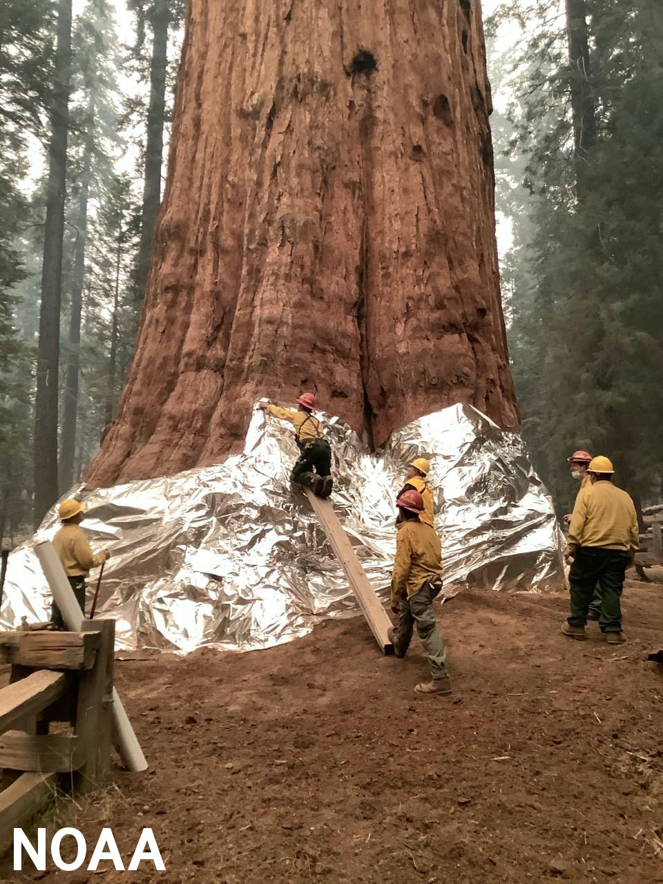
Lightning-sparked wildfires killed thousands of giant sequoias this year, leading to a staggering two-year death toll that accounts for up to nearly a fifth of Earth’s largest trees, officials said Friday.

Fires in Sequoia National Park and surrounding Sequoia National Forest tore through more than a third of groves in California and torched an estimated 2,261 to 3,637 sequoias, which are the largest trees by volume.

Nearby wildfires last year killed an unprecedented 7,500 to 10,400 giant sequoias that are only native in about 70 groves scattered along the western side of the Sierra Nevada range. Losses now account for 13% to 19% of the 75,000 sequoias greater than 4 feet (1.2 meters) in diameter.

Blazes so intense to burn hot enough and high enough to kill so many giant sequoias — trees once considered nearly fire-proof — puts an exclamation point on climate change’s impact. A warming planet that has created hotter droughts combined with a century of fire suppression that choked forests with thick undergrowth have fueled flames that have sounded the death knell for trees dating to ancient civilizations.

Upper #SanJuanRiver Basin streamflow, #drought, and #snowpack report — The #PagosaSprings Sun #ColoradoRiver #COriver #aridification

From The Pagosa Springs Sun (Clayton Chaney):

River report

According to the U.S. Geological Survey (USGS), the San Juan River was flowing at a rate of 51.5 cfs in Pagosa Springs as of noon on Wednesday, Nov. 17.

Based on 86 years of water records at this site, the lowest recorded flow rate for this date is 24 cfs, recorded in 1952. The highest recorded rate for this date was in 1995 at 312 cfs. The average flow rate for this date is 93 cfs.

As of noon on Wednesday, Nov. 17, the Piedra River near Arboles was flowing at a rate of 48.1 cfs. The highest recorded rate for this date was 365 cfs in 1995. The lowest recorded rate for this date was 47.3 cfs in 2003. Based on 59 years of water records at this site, the average flow rate for that date is 115 cfs.

Snow report

According to the U.S. Department of Agriculture (USDA) National Water and Climate Center’s snow pack report, the Wolf Creek summit, at 11,000 feet of elevation, had 4 inches of snow water equivalent as of 12 p.m. on Nov. 17.

The San Miguel, Dolores, Animas and San Juan River Basins were at 69 percent of the Nov. 17 median in terms of snow pack.

Colorado Drought Monitor map November 16, 2021.

Drought report

The National Integrated Drought Information System (NIDIS) was last updated on Nov. 9.

The NIDIS website indicates 100 percent of Archuleta County is abnormally dry. The percentage of the county in a moderate drought is listed at 70.86, which is consistent with the previous report. The NIDIS website also notes that 47.66 percent of the county is in a severe drought stage, consistent with the previous week’s report. Additionally, the NIDIS website notes that 10.33 of the county remains in an extreme drought, consistent with the previous week’s report. No portion of the county is in an exceptional drought.

For more information and maps, visit: https://www.drought.gov/states/Colorado/county/Archuleta.