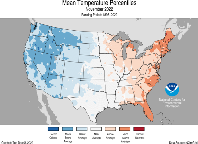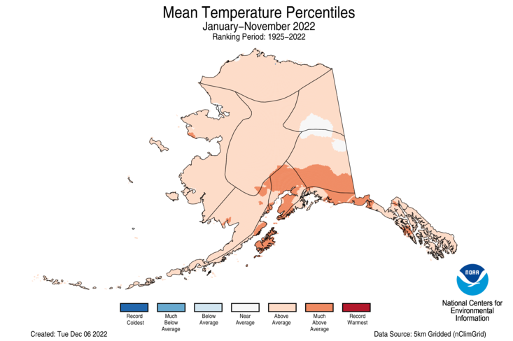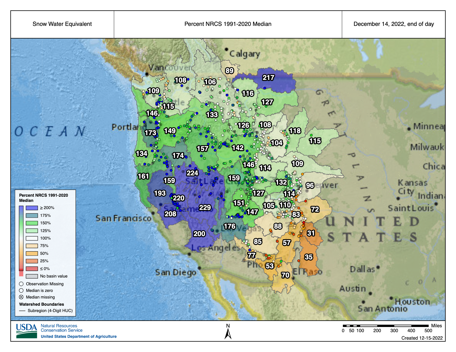
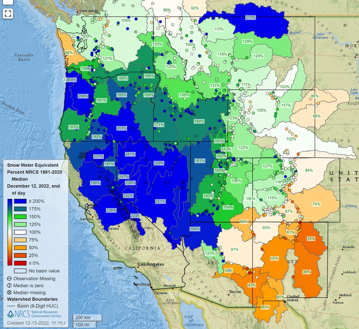
NRCS #Snowpack basin-filled map December 14, 2022 #CRWUA2022


From email from the CWCB (Chris Arend):
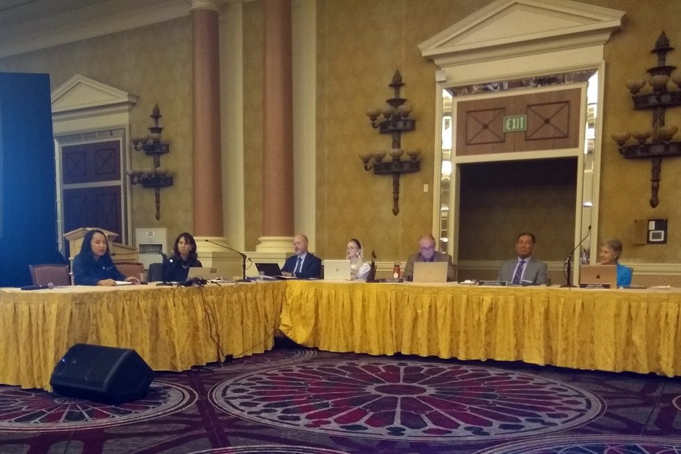
The Upper Colorado River Commission (UCRC) announcedsignificant progress in implementing its Five-Point Plan at its meeting on December 14, 2022, at the Colorado River Water Users Association Meeting in Las Vegas, Nevada.
Colorado Commissioner Becky Mitchell emphasized that the most impactful thing that can be done to manage the Colorado River System is to reduce uses in dry years. Colorado achieves this through strict administration of water rights based on hydrology—in 2021, administration impacted water use on over 203,000 acres within the Colorado River Basin in Colorado. Collectively, preliminary data from the UCRC shows that the Upper Division States used 25% less water in 2021 than in 2020 due to constraints on the physical and legal availability of water. “We must continue to live within the means of what the river provides year to year and we ask others to do the same. This is the only way the system will continue as we know it into the future,” said Commissioner Mitchell.
At its meeting, the UCRC released a pre-solicitation for request for proposals for participation in the System Conservation Pilot Program, a large-scale program involving temporary, voluntary, and compensated reductions in consumptive use across the Upper Division States. Conserved system water could help mitigate the impacts of drought in the Upper Basin.
The UCRC also announced progress on the interstate Demand Management feasibility investigation and released a summary report of the study detailing key findings of the interstate investigation. This report will help inform next steps in Colorado’s Demand Management investigation, which will continue into 2023. More information on Demand Management is available at the CWCB website.
The Upper Division States will also consider additional releases from upstream reservoirs pursuant to the Drought Response Operations Agreement, in addition to the 661,000 acre-feet previously committed. The Commissioners emphasized the need to maintain the benefits of this water in Lake Powell.
Click the link to read the article on the Water Education Colorado website (Jerd Smith):
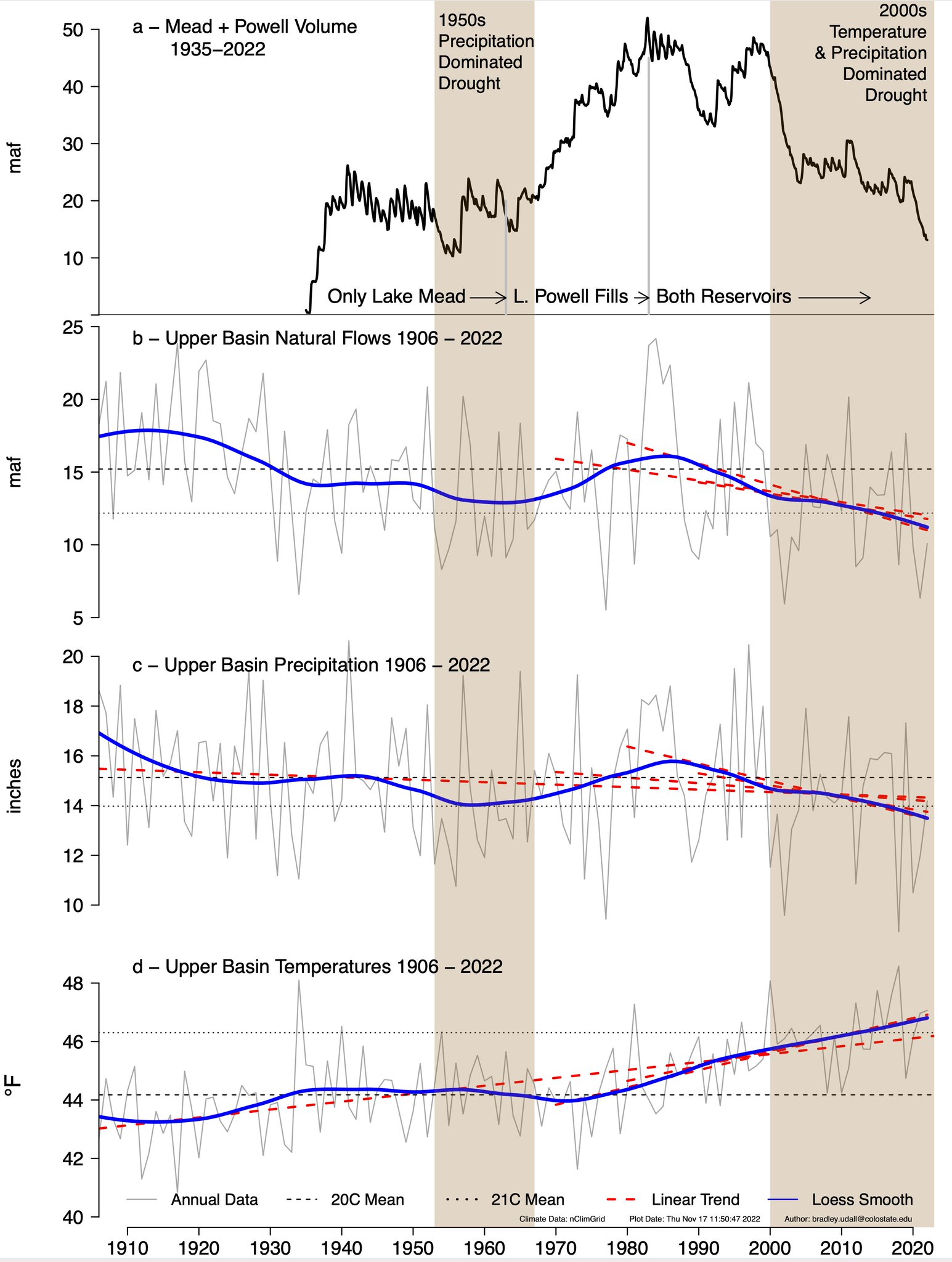
As the Colorado River crisis deepens, a new federal analysis of flows into Lake Powell shows that they will continue to plummet through 2025, before beginning to recover.

James Prairie, a hydrologic engineer for the U.S. Bureau of Reclamation, said flows are likely to be just 24% of average this year, making it unlikely under various planning scenarios that Powell will have enough water for the Upper Basin states of Colorado, New Mexico, Utah and Wyoming to meet their legal commitment to deliver a minimum of 7 million acre-feet of water to the Lower Basin. That amount is already reduced from the historical delivery obligation due to low flows on the river.
The news comes as more than 1,300 of the river’s most powerful water users gather this week in Las Vegas for the Colorado River Water Users Association Conference, the largest annual confab on the river.
This year it has sold out for the first time in its history, according to Crystal Thompson, communications manager at the Central Arizona Project, a major user of Colorado River water and a conference organizer.
In the water world, stream and reservoir measurements are based on what’s known as the water year, which begins Oct. 1. Prairie said Upper Basin flows in water year 2023 are expected to be just 24% of average. In 2024 they are likely to improve, reaching 58% of average, before rising to 61% of average in 2025.
But because Lake Powell is so low — it’s just 23% full with roughly 5.5 million acre-feet of water stored right now — it won’t be able to recover enough water to keep those releases going, Prairie said. And that means that users across the seven-state Colorado River Basin will see more dramatic cutbacks in their water supplies to try to protect remaining supplies in both Lake Powell and Lake Mead, farther downstream.
The basin, mired in a drought believed to be the worst in 1,200 years, is divided into two regions. The Upper Basin includes Colorado, New Mexico, Utah and Wyoming, while the Lower Basin covers Arizona, California and Nevada.
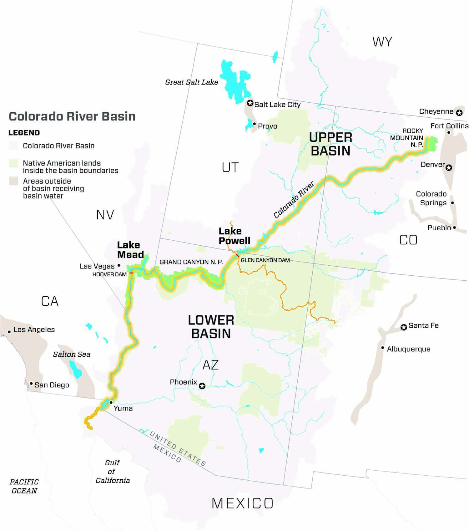
During a meeting of the Upper Colorado River Commission held Wednesday during the confab, hundreds packed a conference room to hear the reports. The commission works to ensure the Upper Basin states receive their allocation of Colorado River Water and that they meet their obligations to send water to the Lower Basin.
“We all know that we are gathering here today in a time of unprecedented crisis in the basin,” said Anne Castle, a Colorado water attorney who President Biden appointed to serve as federal chair of the commission in September 2022.
“We all know we have a huge imbalance between supply and demand and we also know we don’t have much time to correct it,” Castle said.
Last summer U.S. Bureau of Reclamation Commissioner Camille Touton ordered the states to figure out how to reduce water use by 2 million to 4 million acre-feet, but no agreements have been reached, leaving the possibility that the federal government will decide how to make the cuts.
Touton urged water users to continue working together to find a solution to the crisis.
As lakes Powell and Mead have dwindled, all seven states have had to get by with less water and federal forecasts indicate that is likely to be the case for several more years.
In Colorado, major cutbacks have already occurred.
Becky Mitchell, director of the Colorado Water Conservation Board who also represents Colorado on the Upper Colorado River Commission, said the state has already had to temporarily dry up thousands of acres of irrigated farmland because of the crisis.
Mitchell said the state used 25% less Colorado River water in 2021 than it did in 2020 because of the drought.
Critical negotiations among the states are underway to reach a consensus on how to slash water use enough to keep Lake Powell full enough to continue producing power.
“The gap is big enough that no one basin, no one state, no one sector of the economy can solve it alone,” Castle said.
“The real enemy here is not another basin, or another state or alfalfa or golf courses. It is climate-change-induced lower flows. It’s not an enemy that we can defeat. It is one that we have to learn to live with,” she said.
Jerd Smith is editor of Fresh Water News. She can be reached at 720-398-6474, via email at jerd@wateredco.org or @jerd_smith.
Click the link to read the article on The Los Angeles Times website (Hayley Smith and Ian James). Here’s an excerpt:
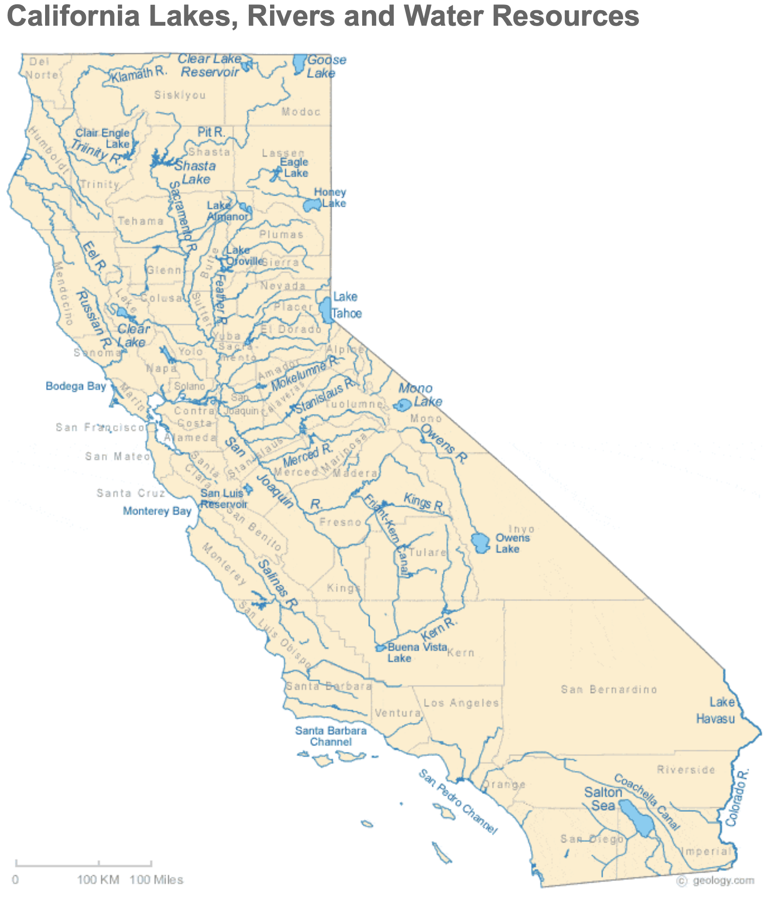
As California faces the prospect of a fourth consecutive dry year, officials with the Metropolitan Water District of Southern California have declared a regional drought emergency and called on water agencies to immediately reduce their use of all imported supplies. The decision from the MWD’s board came about eight months after officials declared a similar emergency for 7 million people who are dependent on supplies from the State Water Project, a vast network of reservoirs, canals and dams that convey water from Northern California. Residents reliant on California’s other major supply — the Colorado River — had not been included in that emergency declaration.
“Conditions on the Colorado River are growing increasingly dire,” MWD Chairwoman Gloria Gray said in a statement. “We simply cannot continue turning to that source to make up the difference in our limited state supplies. In addition, three years of California drought are drawing down our local storage.”
Officials said the call for conservation in Colorado River-dependent areas could become mandatory if drought conditions persist in the coming months, which some experts say is likely. By April, the MWD will consider allocating supplies to all of its 26 member agencies, requiring them to either cut their use of imported water or face steep additional fees…MWD member agencies, which include the Los Angeles Department of Water and Power, the Municipal Water District of Orange County and the Inland Empire Utilities Agency, will implement voluntary and mandatory conservation measures at the local level based on their particular circumstances, officials said. Those with local supplies or other alternative options may be able to rely on them in the interim.

Click the link to read the article on the Fort Collins Coloradoan website (Sady Swanson). Here’s an excerpt:
The planned $2 billion Northern Integrated Supply Project received a federal Clean Water Act Section 404 Record of Decision from the U.S. Army Corps of Engineers on Friday, Northern Water Conservancy District — the group leading the project — announced in a news release, calling this “a major milestone” for the project.This is the final large-scale permit needed for the project to move forward, Northern Water spokesperson Jeff Stahla told the Coloradoan.
“This action is the culmination of nearly 20 years of study, project design and refinement to develop water resources well into the 21st century,” Northern Water General Manager Brad Wind said in the news release. “This Project will also allow participating communities to serve their customers without targeting water now used on the region’s farms.”
NISP will divert water from the Poudre and South Platte rivers to store in two new reservoirs — Glade Reservoir north of Fort Collins and the smaller Galeton Reservoir east of Ault — to supply water for 15 growing North Front Range communities and water suppliers, including the Fort Collins-Loveland Water District and others in Weld and Boulder counties.,.Northern Water is still in the design phase for NISP, and Stahla said construction could begin in late 2024 or early 2025 and should be operational four years after that, based on the timeline for the Chimney Hollow Reservoir.
Click the link to read the article on The Denver Post website (John Aguilar). Here’s an excerpt:
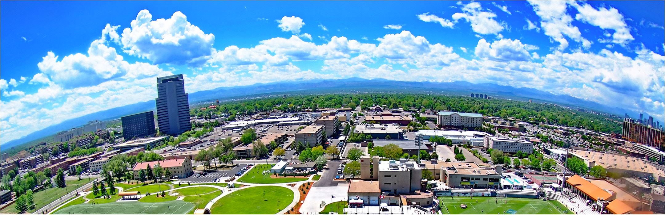
Arapahoe County may triple the amount of water developers will be made to bring to any new subdivision they build, as a historic drought continues to grip the region and demographers project the county’s population to surge to more than 800,000 by 2050. The stricter limit, which would increase the required groundwater allocation for new development from the state minimum of 100 years to 300 years — known among water managers as the “300-year rule” — will be considered as part of an 18-month, $500,000 water study Arapahoe County is launching this month. Any new regulations or directives from the county’s study, the first of its kind in 20 years, would apply only to unincorporated parts of the county…
The county would join several others in Colorado, like Adams, Elbert and El Paso, that have adopted the 300-year rule as demand on metro area aquifers has shot up over the decades. The population in the Greeley/Boulder/Denver metropolitan statistical area, under which the Denver Basin water table lies, has leaped from less than 2 million in 1985 to nearly 3.6 million last year. It could jump to 4.4 million people by mid-century, according to state demography data. And much of that new development is headed to the eastern periphery of metro Denver, just beyond the E-470 beltway. Sixteen of the top 20 best-selling residential developments in the metro area are in Adams, Arapahoe and Douglas counties, which accounted for 76% of all metro area lots under development, according to 2021 data from real estate analytics firm Zonda. But just how much growth is constrained by stricter water supply requirements in Arapahoe County, with a population of 655,000, is not clear. According to state demography numbers, the county’s projected population will increase to just over 800,000 over the next 28 years, which would translate to an additional demand of 21,200 to 53,300 acre-feet of water a year.

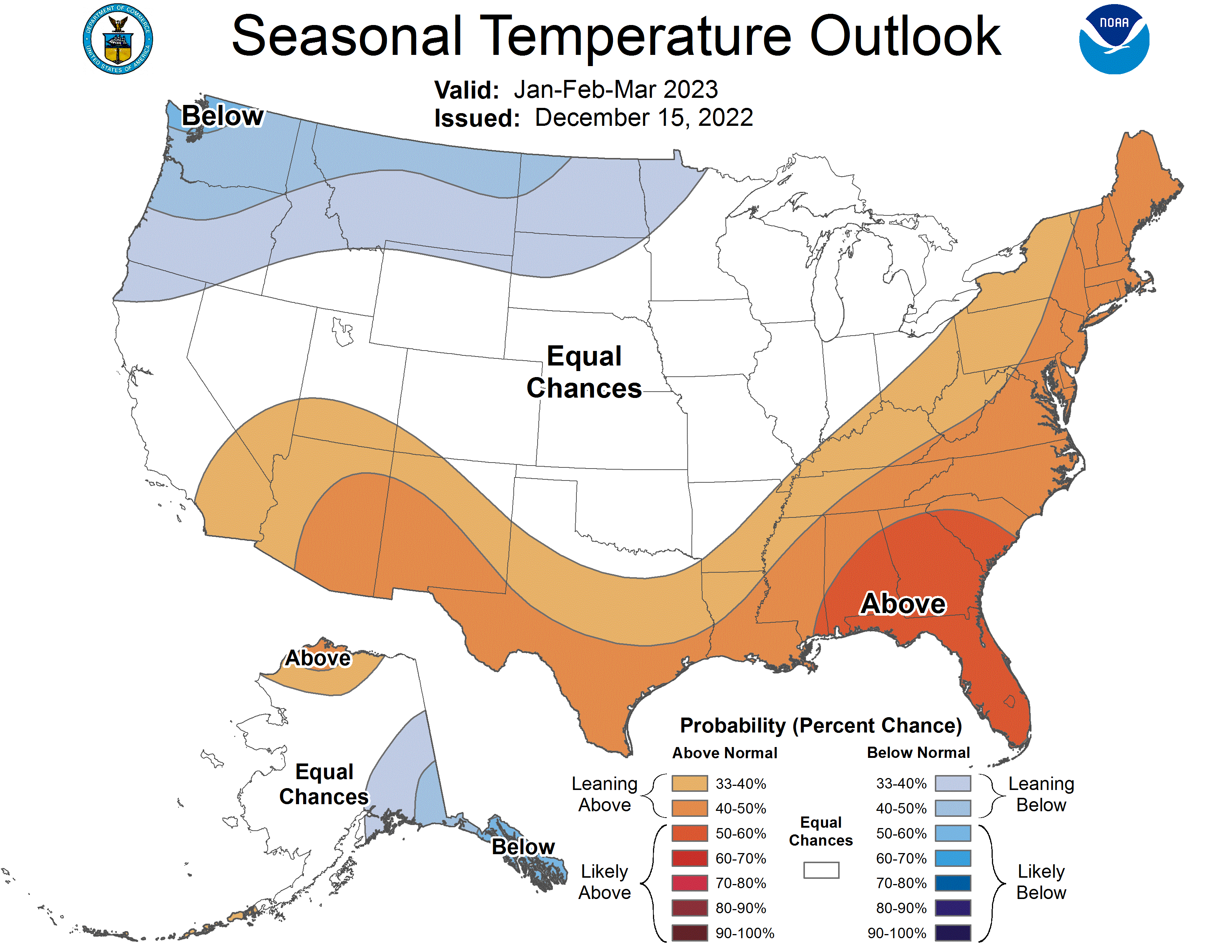
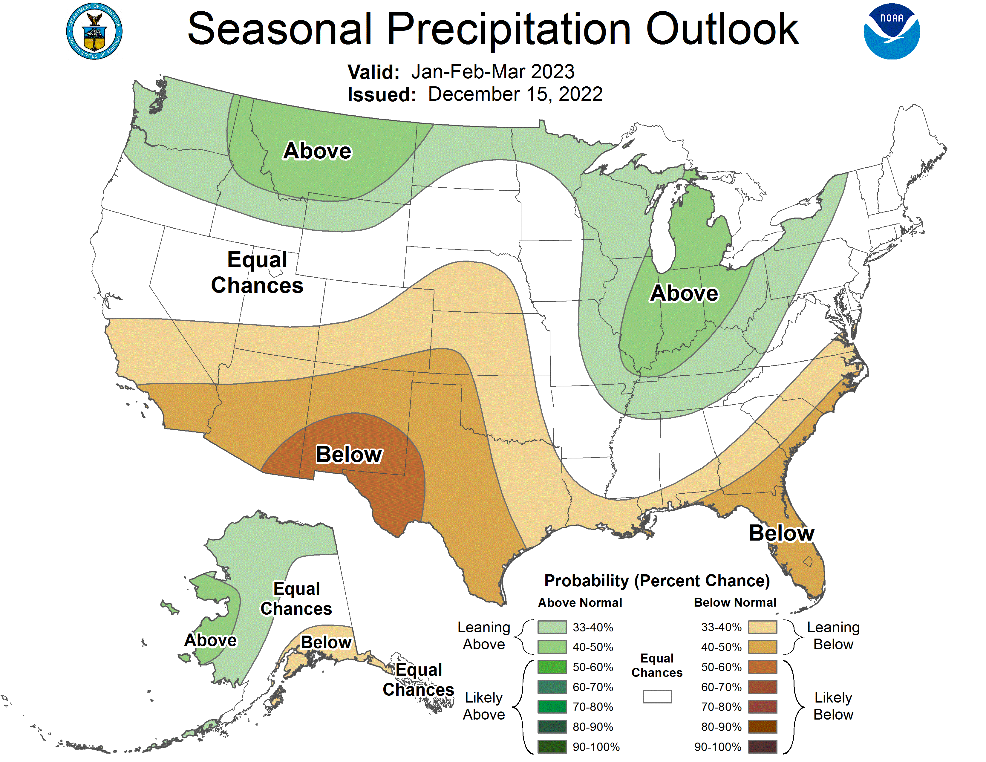
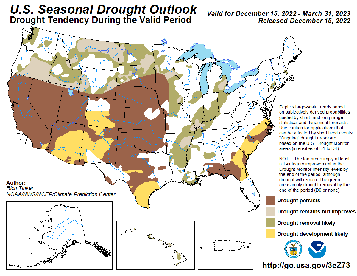
Click on a thumbnail graphic to view a gallery of drought data from the US Drought Monitor website.

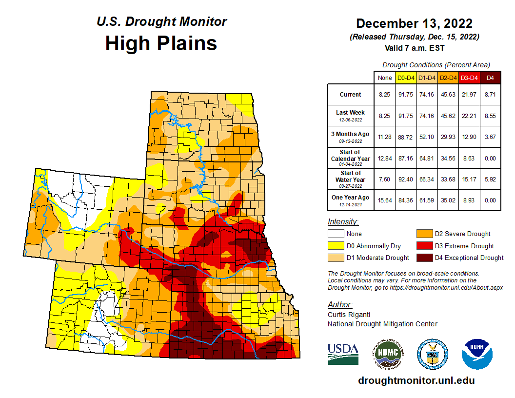

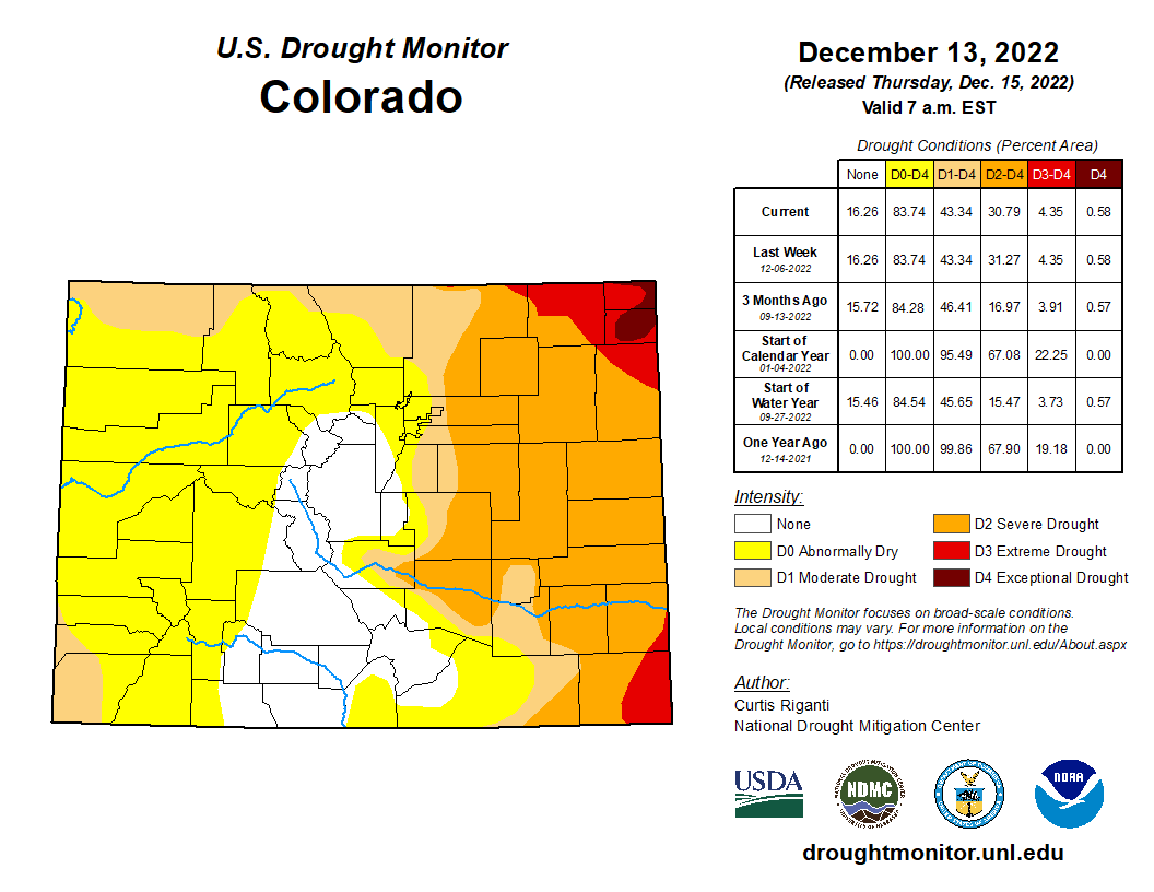
Click the link to go to the US Drought Monitor website. Here’s an excerpt:
This Week’s Drought Summary
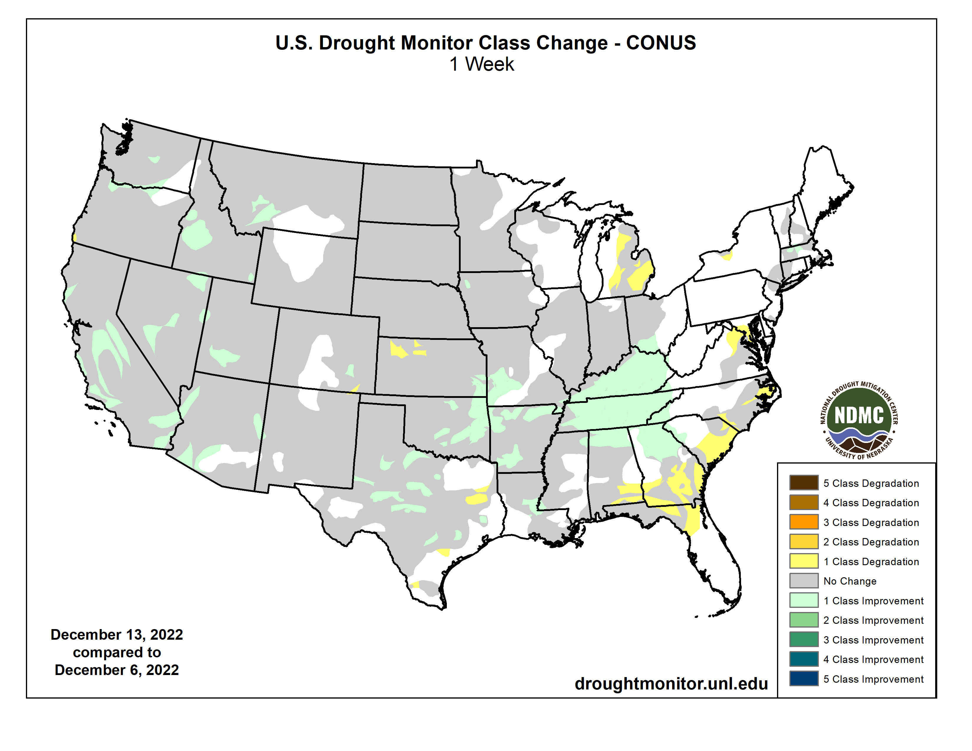
While much of the contiguous U.S. is still experiencing drought or abnormal dryness, several storm systems dropped large amounts of precipitation over the past week in the form of rain or snow, especially in California and from eastern Oklahoma through Tennessee. Since some of this precipitation fell near the Tuesday morning data cutoff, more analysis of the early week precipitation will be performed next week, when more data is available to analyze changes to ongoing drought conditions. In parts of the Great Lakes, Southeast, and northwest Kansas that missed out on recent precipitation, drought or abnormal dryness developed or worsened…
High Plains
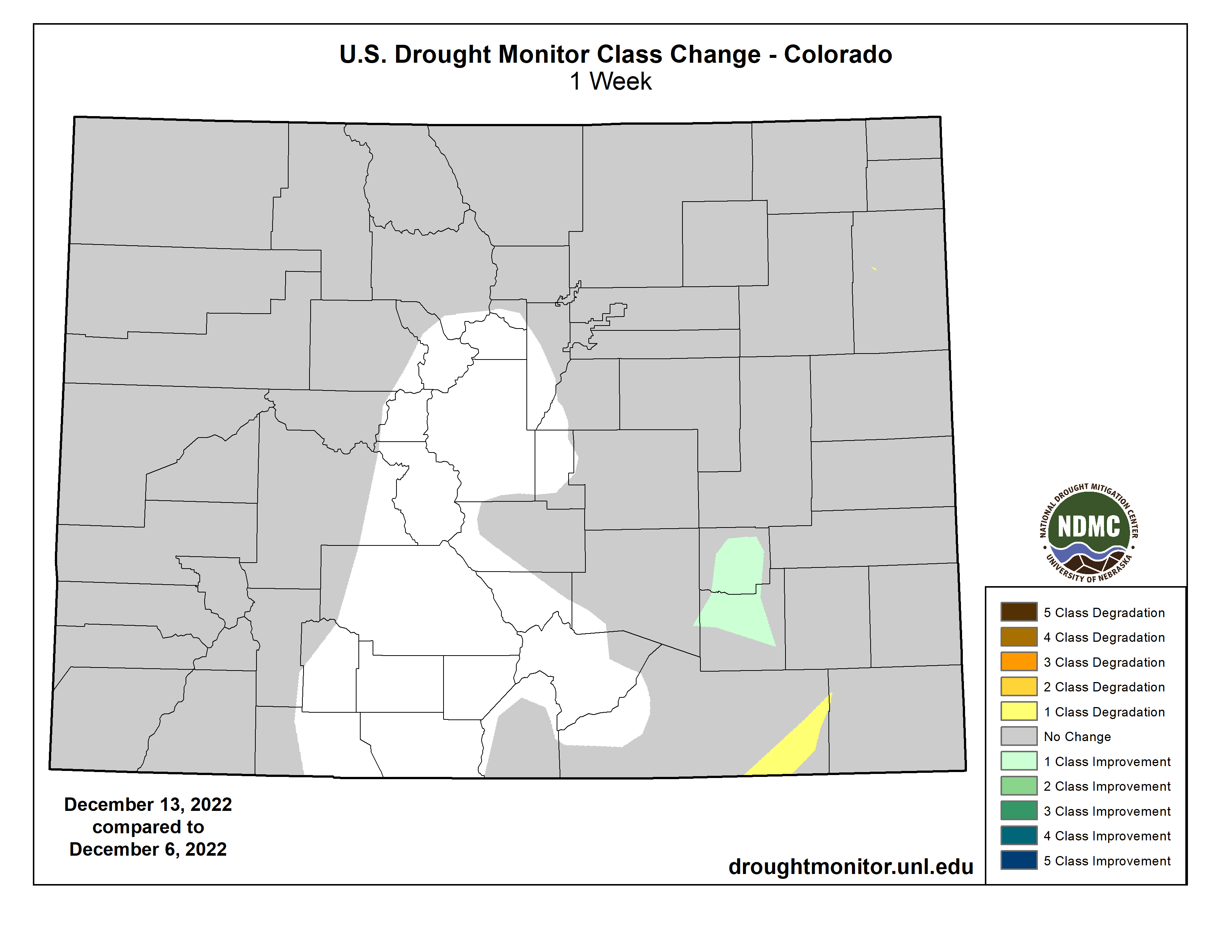
Heavier rains accumulated Monday night into early Tuesday in parts of southeast Kansas, leading to some improvements in the drought situation there as precipitation deficits lessened. Dry weather continued in parts of northwest Kansas, where soil moisture deficits and long-term precipitation deficits continued to worsen. A few small changes (one improvement and one degradation) were made in southeast Colorado and adjacent northeast New Mexico, where surface conditions changed in tandem with recent precipitation or lack thereof. Elsewhere, conditions did not change much across the region. Snow and rain that fell Monday night and Tuesday morning from northeast Colorado into Nebraska and southern South Dakota will be analyzed further next week for possible improvements to ongoing drought. Temperature anomalies for the week varied from north to south across the region, with below-normal temperatures occurring in most of North Dakota, while near- or slightly above-normal temperatures were more common in Colorado and Kansas…
West
Widespread improvements to ongoing drought occurred across parts of the West region this week, due to copious amounts of rain or snow. Hefty rainfall amounts in some of the coastal mountain ranges of California caused high streamflow, which lessened precipitation deficits and led to localized improvements. Widespread improvements occurred in parts of the central Sierra Nevada range, where heavy snow fell and added to a healthy early-season snowpack. Recent rain and snow also improved conditions in parts of Arizona, Nevada, Utah, Idaho, southwest Montana, and near the Columbia River along the Arizona/Washington border. Despite recent precipitation, a small part of southwest Oregon saw abnormal dryness develop where precipitation and soil moisture deficits mounted. Temperatures across the West region were generally near or a bit below normal, with the exceptions of New Mexico and eastern Montana, which had above- and below-normal temperatures, respectively…
South
In northern parts of the region, from central and eastern Oklahoma eastward through Tennessee, widespread moderate to heavy rain fell, leading to widespread improvements to ongoing drought and abnormal dryness. In central Oklahoma and north Texas, given that some of this rain fell near the data cutoff, more changes may be made next week as more data becomes available. Wetter recent weather led to improvements in surface conditions and precipitation deficits in central and west-central Texas, leading to some improvements in ongoing drought there. Due to recent heavy rainfall, severe drought areas in southwest Arkansas and near the Louisiana/Mississippi border were removed. A few localized spots in the eastern half of Texas saw conditions worsen after missing out on recent rains. Most of the region saw above-normal temperatures this week, with large portions of central and eastern Texas, Louisiana, and Mississippi seeing readings at least 15 degrees above normal…
Looking Ahead
According to forecasts from the National Weather Service (NWS) Weather Prediction Center, as the weekend progresses into early next week, most areas east of the Rocky Mountains may expect near- or slightly below-normal temperatures. Meanwhile, a much-colder-than-normal airmass should build into the northern Great Plains. Widespread precipitation is forecast for the Great Lakes region through Monday evening, and from the southern Appalachians into the Northeast.
From December 20-28, the NWS Climate Prediction Center outlooks suggest that this cold airmass will spill into parts of the central and eastern U.S., where high confidence forecasts of below-normal temperatures exist. In parts of California and Nevada, forecasts lean toward above-normal temperatures during this period, especially from December 22-28. Precipitation forecasts lean toward above-normal precipitation for the Northern Rockies, Pacific Northwest, Northern Great Plains, and Northeast from December 20-28. Drier-than-normal weather is favored in the Desert Southwest, Southern Great Plains, and the Ohio and Tennessee River valleys. For Alaska, above-normal precipitation is favored in the southern part of the state, while below-normal precipitation is favored in the northern part of the state. The temperature forecasts vary more between the 6-10 and 8-14 day periods, but generally, below-normal temperatures are more likely in eastern Alaska, while the Aleutian Islands are more likely to see warmer-than-normal temperatures.
Matthew L. Druckenmiller, University of Colorado Boulder; Rick Thoman, University of Alaska Fairbanks, and Twila Moon, University of Colorado Boulder
In the Arctic, the freedom to travel, hunt and make day-to-day decisions is profoundly tied to cold and frozen conditions for much of the year. These conditions are rapidly changing as the Arctic warms.
The Arctic is now seeing more rainfall when historically it would be snowing. Sea ice that once protected coastlines from erosion during fall storms is forming later. And thinner river and lake ice is making travel by snowmobile increasingly life-threatening.
Ship traffic in the Arctic is also increasing, bringing new risks to fragile ecosystems, and the Greenland ice sheet is continuing to send freshwater and ice into the ocean, raising global sea level
In the annual Arctic Report Card, released Dec. 13, 2022, we brought together 144 other Arctic scientists from 11 countries to examine the current state of the Arctic system.
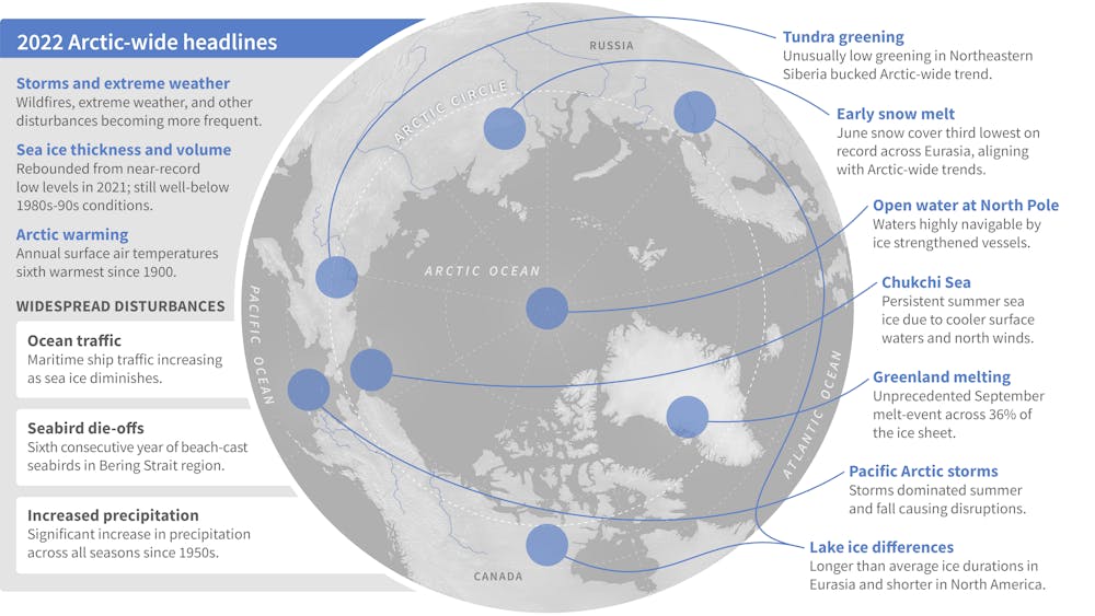
We found that Arctic precipitation is on the rise across all seasons, and these seasons are shifting.
Much of this new precipitation is now falling as rain, sometimes during winter and traditionally frozen times of the year. This disrupts daily life for humans, wildlife and plants.
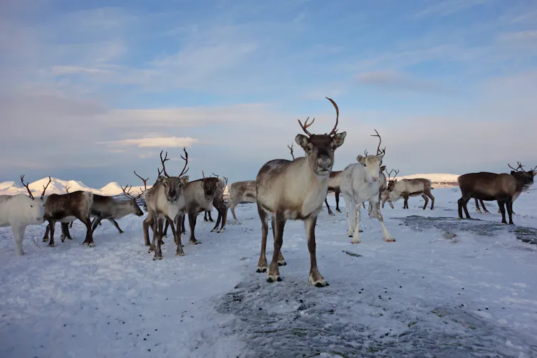
Roads become dangerously icy more often, and communities face greater risk of river flooding events. For Indigenous reindeer herding communities, winter rain can create an impenetrable ice layer that prevents their reindeer from accessing vegetation beneath the snow.
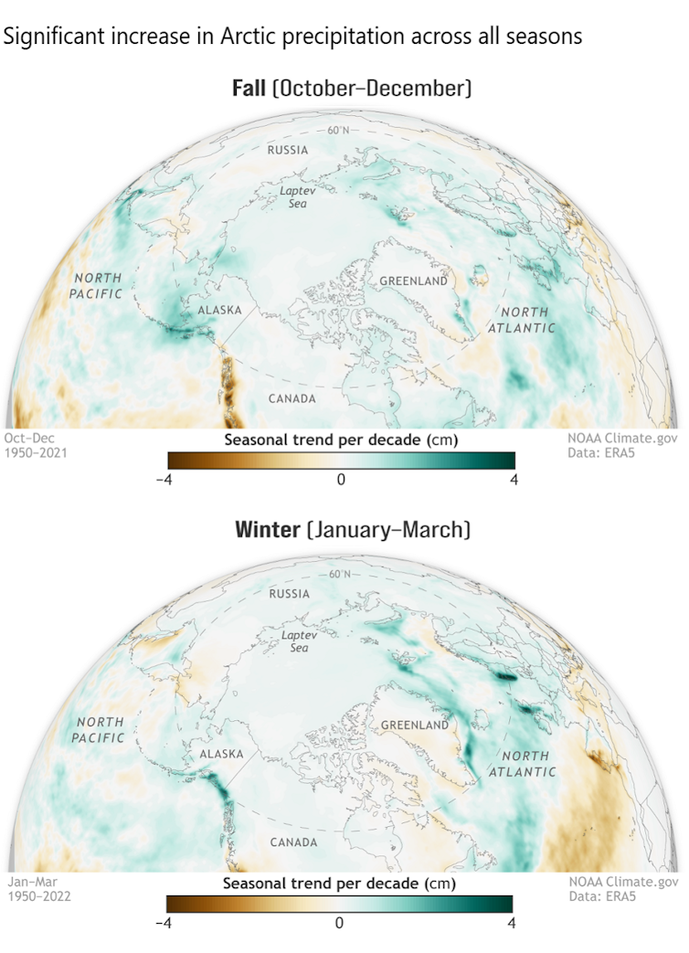
Arctic-wide, this shift toward wetter conditions can disrupt the lives of animals and plants that have evolved for dry and cold conditions, potentially altering Arctic peoples’ local foods.
When Fairbanks, Alaska, got 1.4 inches of freezing rain in December 2021, the moisture created an ice layer that persisted for months, bringing down trees and disrupting travel, infrastructure and the ability of some Arctic animals to forage for food. The resulting ice layer was largely responsible for the deaths of a third of a bison herd in interior Alaska.
There are multiple reasons for this increase in Arctic precipitation.
As sea ice rapidly declines, more open water is exposed, which feeds increased moisture into the atmosphere. The entire Arctic region has seen a more than 40% loss in summer sea ice extent over the 44-year satellite record.
The Arctic atmosphere is also warming more than twice as fast as the rest of the globe, and this warmer air can hold more moisture.
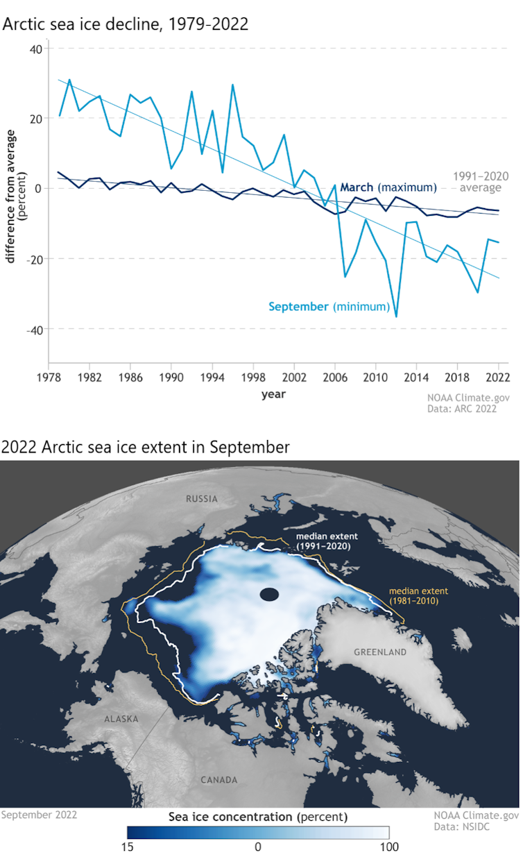
Under the ground, the wetter, rainier Arctic is accelerating the thaw of permafrost, upon which most Arctic communities and infrastructure are built. The result is crumbling buildings, sagging and cracked roads, the emergence of sinkholes and the collapse of community coastlines along rivers and ocean.
Wetter weather also disrupts the building of a reliable winter snowpack and safe, reliable river ice, and often challenges Indigenous communities’ efforts to harvest and secure their food.
When Typhoon Merbok hit in September 2022, fueled by unusually warm Pacific water, its hurricane-force winds, 50-foot waves and far-reaching storm surge damaged homes and infrastructure over 1,000 miles of Bering Sea coastline, and disrupted hunting and harvesting at a crucial time.
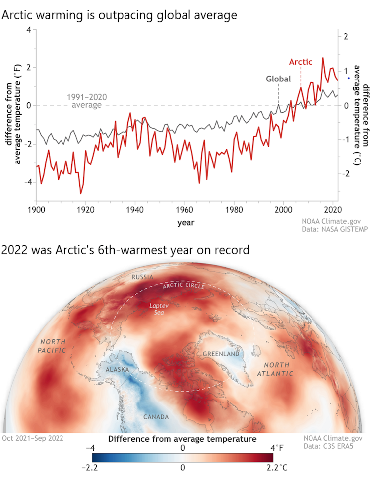
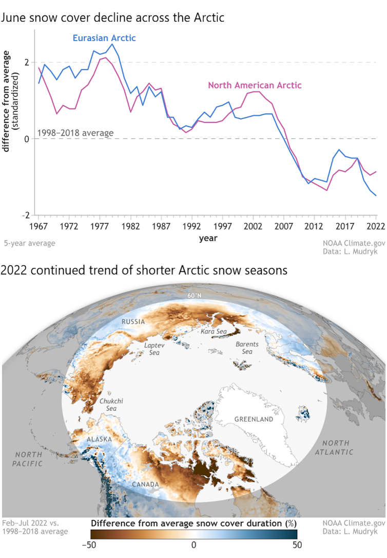
Snow plays critical roles in the Arctic, and the snow season is shrinking.
Snow helps to keep the Arctic cool by reflecting incoming solar radiation back to space, rather than allowing it to be absorbed by the darker snow-free ground. Its presence helps lake ice last longer into spring and helps the land to retain moisture longer into summer, preventing overly dry conditions that are ripe for devastating wildfires.
Snow is also a travel platform for hunters and a habitat for many animals that rely on it for nesting and protection from predators.
A shrinking snow season is disrupting these critical functions. For example, the June snow cover extent across the Arctic is declining at a rate of nearly 20% per decade, marking a dramatic shift in how the snow season is defined and experienced across the North.
Even in the depth of winter, warmer temperatures are breaking through. The far northern Alaska town of Utqiaġvik hit 40 degrees Fahrenheit (4.4 C) – 8 F above freezing – on Dec. 5, 2022, even though the sun does not breach the horizon from mid-November through mid-January.
Fatal falls through thin sea, lake and river ice are on the rise across Alaska, resulting in immediate tragedies as well as adding to the cumulative human cost of climate change that Arctic Indigenous peoples are now experiencing on a generational scale.
The impacts of Arctic warming are not limited to the Arctic. In 2022, the Greenland ice sheet lost ice for the 25th consecutive year. This adds to rising seas, which escalates the danger coastal communities around the world must plan for to mitigate flooding and storm surge.
In early September 2022, the Greenland ice sheet experienced an unprecedented late-season melt event across 36% of the ice sheet surface. This was followed by another, even later melt event that same month, caused by the remnants of Hurricane Fiona moving up along eastern North America.
International teams of scientists are dedicated to assessing the scale to which the Greenland ice sheet’s ice formation and ice loss are out of balance. They are also increasingly learning about the transformative role that warming ocean waters play.

This year’s Arctic Report Card includes findings from the NASA Oceans Melting Greenland (OMG) mission that has confirmed that warming ocean temperatures are increasing ice loss at the edges of the ice sheet.
We are living in a new geological age — the Anthropocene — in which human activity is the dominant influence on our climate and environments.
In the warming Arctic, this requires decision-makers to better anticipate the interplay between a changing climate and human activity. For example, satellite-based ship data since 2009 clearly show that maritime ship traffic has increased within all Arctic high seas and national exclusive economic zones as the region has warmed.
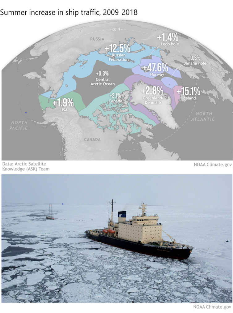
For these ecologically sensitive waters, this added ship traffic raises urgent concerns ranging from the future of Arctic trade routes to the introduction of even more human-caused stresses on Arctic peoples, ecosystems and the climate. These concerns are especially pronounced given uncertainties regarding the current geopolitical tensions between Russia and the other Arctic states over its war in Ukraine.
Rapid Arctic warming requires new forms of partnership and information sharing, including between scientists and Indigenous knowledge-holders. Cooperation and building resilience can help to reduce some risks, but global action to rein in greenhouse gas pollution is essential for the entire planet.
Matthew L. Druckenmiller, Research Scientist, National Snow and Ice Data Center (NSIDC), Cooperative Institute for Research in Environmental Sciences (CIRES), University of Colorado Boulder; Rick Thoman, Alaska Climate Specialist, University of Alaska Fairbanks, and Twila Moon, Deputy Lead Scientist, National Snow and Ice Data Center (NSIDC), Cooperative Institute for Research in Environmental Sciences (CIRES), University of Colorado Boulder
This article is republished from The Conversation under a Creative Commons license. Read the original article.
Click the link to read the article on the American Rivers website (Sinjin Eberle):
The situation on the Colorado River continues to get worse. For months, there has been abundant news about falling lake levels (Lake Powell is below 25% full, and Lake Mead is hovering below 30% full) and while some areas of the west had a terrific monsoon, other areas were left high and dry. Now consider a forecasted La Nina winter (could be the third in a row,) which generally features a warmer and dryer season and reduced snowpack throughout the West, including the Rockies; the confluence of a grim water year is staring at us in the face.

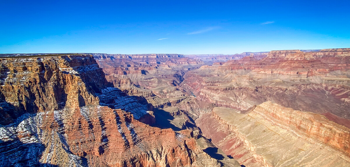
Without being overly melodramatic, the reality is that unless some serious decisions are made, and fast, we could be facing the difficult reality of very little to no water being able to pass through Glen Canyon Dam, in essence creating a Grand Canyon without the guarantee of a flowing Colorado River. For anyone who has been on the river, whether on a raft trip or hiking to Phantom Ranch or trout fishing at Lee’s Ferry, this is a frightening vision. But what would someone who simply peers over the edge of the Canyon at the South Rim, enjoying the expanse and color and light of the distant rocks and buttes – does it matter to them that the small, silver ribbon in the distance is actually dry, rather than wet? Does it matter to people that the very thing that helped create, and certainly supports the web of life, culture, and connection of one of the grandest landscapes in the world, could be reduced to a mere trickle if we don’t take action – and soon? Are we ok with that scenario?
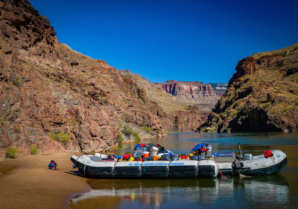
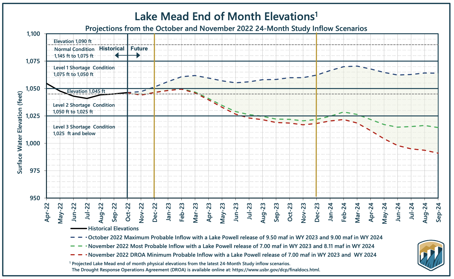
Let’s review what all this means in a practical sense. You may know that the Bureau of Reclamation, the Federal government agency that oversees/manages many of these big reservoirs and the Colorado River system overall, publishes a set of forecasts periodically to try to “project” what lake levels might be – usually up to two years into the future. These are called “24-month studies” and they take scores of different scenarios into account to forecast where the lake levels might be given varying amounts of runoff, soil moisture, snowpack, different temperature possibilities, and how much water is being used in different places across the entire basin. This all feeds into planning how much water needs to be stored, or how much can be released and when, for Lake Powell, Grand Canyon, and Lake Mead, among other federal facilities within the system. These predictions impact millions of people across the Southwest, and across the country when we start to consider that the vast majority of vegetables grown for our winter food supply rely on Colorado River water.
On average, about 8 million acre-feet of water (just one acre-foot is a football field of water, one foot deep, or just over 326,000 gallons) flows from Lake Powell to Grand Canyon in a normal year. But what happens if that number is drastically reduced, or water can’t safely flow through the dam at all? What happens then? Already this year, nearly a million-acre feet has both been sent downstream (from storage in Wyoming’s Flaming Gorge Reservoir) and held back in Lake Powell to slow the fall of the lake. Right now, there is only about 7 million acre-feet flowing into the Canyon in 2022. But levels are still declining, and we are getting closer to the point where Glen Canyon Dam cannot generate electricity, and potentially even worse, where water really can’t safely flow through the dam at all. What if those flows ultimately consisted of about 10% of what flows today – and all from seepage and springs dotting the length of the canyon itself?
Now back to the most recent 24-month study, where Reclamation projects through what they call the “minimum, most, and maximum probable” hydrology projections. For the first time in the history of these projections, the minimum probable projection indicates that Lake Powell could decline to a level where no electricity can be generated (below elevation 3,490ft) by as early as December of 2023. But that says nothing about the efficiency of that power, since the lower the lake gets, the weaker the power generation capability is.
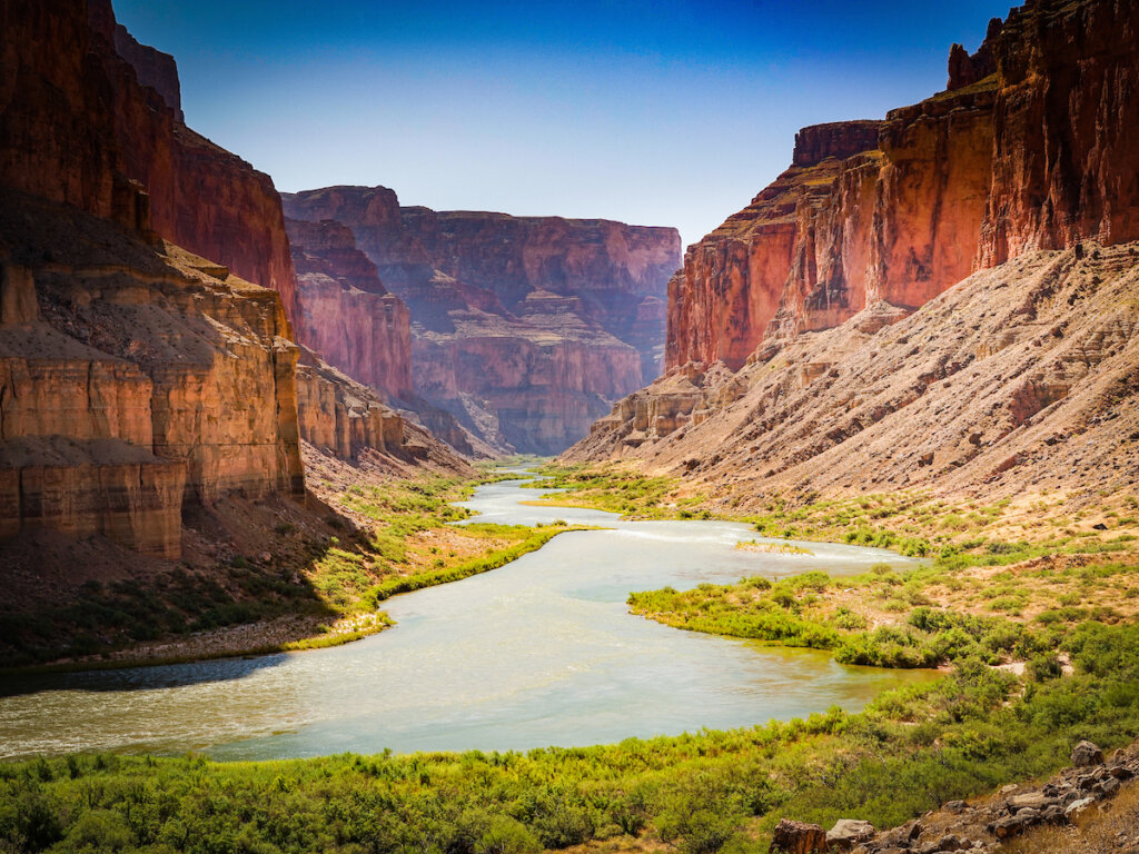
Below that, water would need to be released through tubes that have never been tested for sustained use. Limited space exists where water can still flow through the dam, supplying water to Grand Canyon and Lake Mead, but not generating any power. Overall, this space is only 120 feet, then the lake would be at “dead pool” (at elevation 3,370 ft.) which is in essence exactly how it sounds – a pool of water not flowing through the dam at all.)
So how much more water needs to be held back in order to keep Lake Powell on life support? John Fleck, Eric Kuhn, and Jack Schmidt contemplate that very question as they set forth the rationale for doing keeping Lake Powell functional in an article they authored last week. We know that the Federal government has emphatically said that they will protect “critical infrastructure” which means Glen Canyon Dam and both the hydropower and water supply systems that depend upon it. We also know that there are many rules that dictate how this whole system is managed. The Colorado River community is comprised of 7 states, as well as the Republic of Mexico and the Department of Interior, along with stakeholders that include municipalities, irrigators, hydropower customers, recreationalists, and environmentalists. Each hold varying interests in different parts of the Basin, but all must find a way to participate as a whole within the Basin that sustains us all. Critical to considering the Basin going forward also requires recognition of the 30 Federally recognized Tribal nations which have long been left out of the decision-making process around the river. Their rights and role as it relates to the river can no longer be overlooked. Their opportunities to participate are gaining and they should be even more deeply included in decisions going forward. In short, nobody can go it alone, and everyone needs water security and predictability to plan for the future.
Fleck, Kuhn, and Schmidt argue that now might be the time for Reclamation to impose a restricted flow through the dam of only 5.5MAF – ~ 30% less than “normal” flows and still another 13% less water than is flowing into Grand Canyon today. And last week, the Bureau of Reclamation proposed “Moving forward with administrative actions needed to authorize a reduction of Glen Canyon Dam releases below seven million acre-feet per year, if needed, to protect critical infrastructure at Glen Canyon Dam.” This proposal would attempt to keep at least some water flowing through the hydropower turbines (and further lower the levels at Lake Mead) but would keep electricity flowing in both. But what impact would this have on the Grand Canyon ecosystem, including the four species of native fish, the coldwater fishery above Lee’s Ferry, and the amazing diversity of plant, animal, and bird life throughout the Canyon? What would happen to the vibrant and sought-after rafting industry, which between both private and commercial trips, ferry’s more than 26,000 people per year through one of the most amazing, humbling, and majestic landscapes on earth? And maybe most importantly, where does this leave the cultural and spiritual considerations that water flowing through the Canyon has for the various Tribal communities that consider the Colorado River and Grand Canyon sacred places – essential to their way of life?
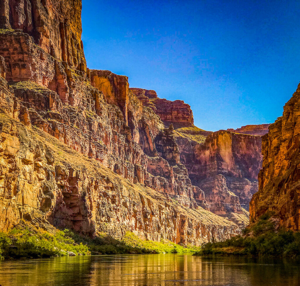
Can everyone come together with a solution to at least hold the river and the two reservoirs it feeds to a level that would at least triage the situation? If not, what then? While hypothetical, we need to recognize that a nearly dry or severely depleted Grand Canyon in a few short years is more plausible than ever. For anyone who has ever done a river trip leaving at Lee’s Ferry, you know that the Paria River comes in just a mile or so below the put-in, but that is a highly unpredictable river – often either pretty small or nearly dry much of the year, or a raging torrent during the monsoon season. The next “reliable” water coming into the Canyon is at the Little Colorado River, 75 miles from the dam – and 75 miles is a long way when there is so much riding on the health and sustainability of this ecosystem. Some water from seepage around the dam does occur, but with lowering lake levels, does that seepage get reduced as well? So many unknowns are staring us all in the face.

The upshot is that this is a scary time in the Colorado River system, with many options to consider – rules and laws, and treaties to follow (or change) and lots of people depending on getting it right. And increasingly important in all this, is that getting it right means getting it right together – the possibility of litigation or other legal action would define the worst-case scenario, as any opportunity for compromise and collaboration and finding solutions together instantly stops the minute the first lawsuit is filed.
The 22-year drought and its associated aridification of soils and plants, the exposure of more than 40 million people to water shortage, the whole country being impacted by the potential of reduced food production, and in the middle of all this, one of the seven wonders of the world and the ecosystem, and people, who are deeply connected to this place. Where do we go from here?
Click the link to read the article on the ENSO blog website (Emily Becker):
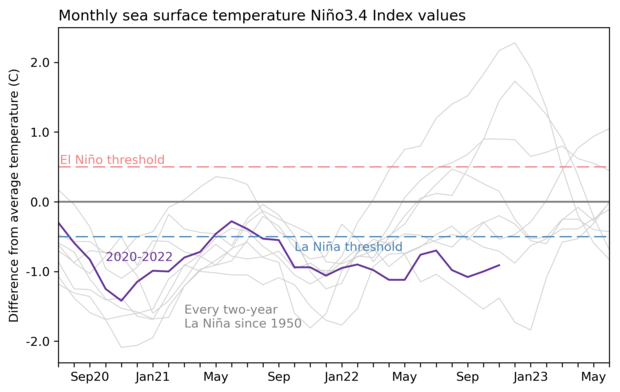
As our regular readers will be very aware, La Niña has been rolling along in the tropical Pacific for many months, and our third La Niña winter in a row is under way. La Niña is the cool phase of the El Niño-Southern Oscillation (“ENSO” for short) climate pattern. The current forecast is for La Niña to continue into the winter, with 50-50 chances for La Niña and neutral in the January–March average.
Conditions in the tropical Pacific ocean-atmosphere system have been consistent with La Niña for long enough that, in November, one of our frequent readers commented—accurately—that they might as well have just re-read the October post! However, while La Niña seems stuck in a rut right now, the last thing we want is to give the impression that ENSO is boring! So this month, I’ll do a quick recap of current conditions before looking into a question I’ve been curious about for a while now: how does ENSO affect daily temperatures during winter?
Current events
The sea surface temperature in the tropical Pacific is still well within La Niña territory, at about 0.9 °C cooler than the long-term average in November, according to ERSSTv5, our favorite sea surface temperature dataset. This anomaly—the difference from the long-term average—has been gradually warming up over the past few months, since reaching -1.1 °C in September.
The atmosphere also continues to reflect La Niña’s amped-up Walker circulation, with more rain than average over Indonesia, drier-than-average conditions over the central Pacific, and stronger winds, both near-surface and high in the atmosphere, all observed during November. The near-surface winds—the east-to-west trade winds—fluctuated a bit, slowing a little in mid-November. Since these winds cause upwelling, their slow-down may have contributed to the slight weakening in the sea surface temperature anomaly.
What’s next?
Forecasters are very confident that La Niña will continue in the short term, followed by a transition to neutral conditions. The exact timing of the transition is not clear, with equal chances of both La Niña and neutral for the January–March average. Confidence that La Niña will have exited by the February–April period, however, is fairly high, with a 71% chance of neutral. This forecast indicates that we can expect La Niña to influence our winter climate conditions this year. Check out the September post for a round-up of La Niña’s typical effects on winter temperature, rain and snow, and other weather and climate.

Speaking of La Niña impacts…
When we talk about the expected La Niña influence on seasonal temperature, we almost always talk about how the seasonal average is shifted during ENSO events. For example, during La Niña, winter in the northern U.S. tends to be cooler than average. The seasonal average temperature is very important, with implications for the amount of energy used for heating, and so on. Also, looking at seasonal averages means that we are filtering out short-term fluctuations and can be more confident that the shifts in climate are truly linked to ENSO.
However, you and I generally experience weather from a day-to-day perspective. We’ll notice big shifts in temperature from one day to the next, or unusually warm or cold days. To get an idea of how ENSO affects daily temperatures, I’ll start by looking at the range of daily average temperature within each winter. How much does the temperature normally vary from day to day? Then we can ask, for example, do La Niña winters have a wider range of daily temperatures in some locations than average? Narrower? No change? This is just a starting place, but we have to start somewhere!
The footnote has details about the calculations and data I used for the maps I show below. Also, I’m far from the first person to look at ENSO’s impact on daily characteristics of temperature, of course, and the footnote includes some information on earlier studies.
Free range
The standard deviation is a common statistic to understand the spread of a set of numbers. For example, if most of your daily winter temperatures occur in the range of 40–50 °F, the standard deviation will be smaller than if most of your daily temperatures are in the range of 35–55 °F, even though the average temperature may be the same at both locations. This statistic is widely employed in weather and climate science, and it’s what I use here.
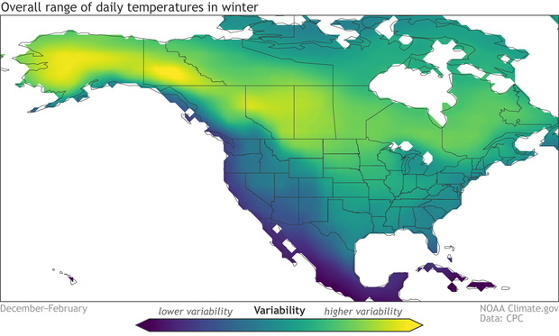
First, let’s see what the typical range of daily winter temperature is across North America. The central regions of the continent have the greatest variability on average, while the Pacific coast has a relatively narrow range of daily winter temperatures, modulated by the nearby ocean. The very moist climate of the tropics features the least daily variability.

El Niño’s effect on the range of daily temperatures in winter is generally opposite to La Niña’s, with mostly decreased variability when compared to average, especially across the western half of North America.
Overall, I think this is an interesting result: La Niña makes daily temperatures in winter more variable in most places, and El Niño makes them less variable. But it presents an incomplete picture, of course. These maps show the average changes during El Niño and La Niña—to understand how consistent this effect is, we could illustrate each winter separately like in Nat’s post last month that shows every winter’s precipitation and temperature patterns. What does a wider range of daily average temperature really mean? Why are we seeing these patterns? Would we expect to see the same patterns in the daily high or daily low temperature? These and other questions will have to wait for future posts…
Footnote
Details on the analysis:
- ENSO criteria: Any year with the December–February Oceanic Niño Index (ONI) greater than 0.5 °C was included in the “El Niño” sample, and any year with ONI less than -0.5 °C was included in La Niña. Not including ONI equal to 0.5 °C or -0.5 °C means I excluded the very weakest events, as well as borderline not-quite-ENSO years.
- The El Niño maps show the standard deviation averaged over the resulting 20 El Niño winters divided by the overall average winter standard deviation. The La Niña maps show the average during the 18 La Niña winters divided by the overall winter average.
- Daily temperature data: I used Berkeley Earth daily average temperature dataset. It’s also available here.
- Years included: 1950–2019. Berkeley Earth is available through near-present, but the data I downloaded ended in 2019. I’ll update with 2020–2022, but don’t expect the overall results to change.
- Programming language: I used Python. Jupyter notebook available upon request.
- Earlier studies: The most cited paper on this topic is Smith and Sardeshmukh 2000. My results mostly reproduced theirs, with the expected differences because we used different temperature data, they looked at 1959 to 1998, and we even had different criteria for defining ENSO events. Also, there’s a recent study, Yang et al. 2022 (Nat is a co-author) that my results agree with. I’m going to discuss that paper a little more next month… stay tuned!
Click the link to read the article on the WyoFile website (Dustin Bleizeffer):
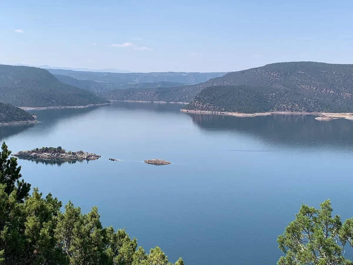
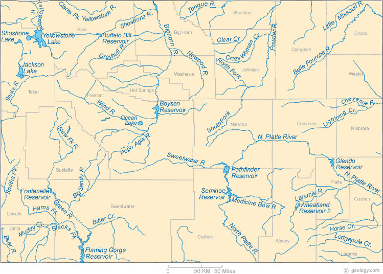
Lower water levels at Flaming Gorge Reservoir, which have left several boat ramps and docks high and dry, are likely the “new normal” for years to come, according to federal officials.
The Bureau of Reclamation’s most recent water-balancing adjustment under the Colorado River drought contingency plan, announced this month, maintains current plans at Flaming Gorge Reservoir on the Wyoming-Utah border. Those plans entail releasing an extra 500,000 acre-feet of water through April as per actions implemented in May. However, Flaming Gorge — along with two other major Upper Colorado River Basin reservoirs, Blue Mesa in Colorado and Navajo in New Mexico — remains a primary backup water source and may likely be tapped for more water, according BOR officials.
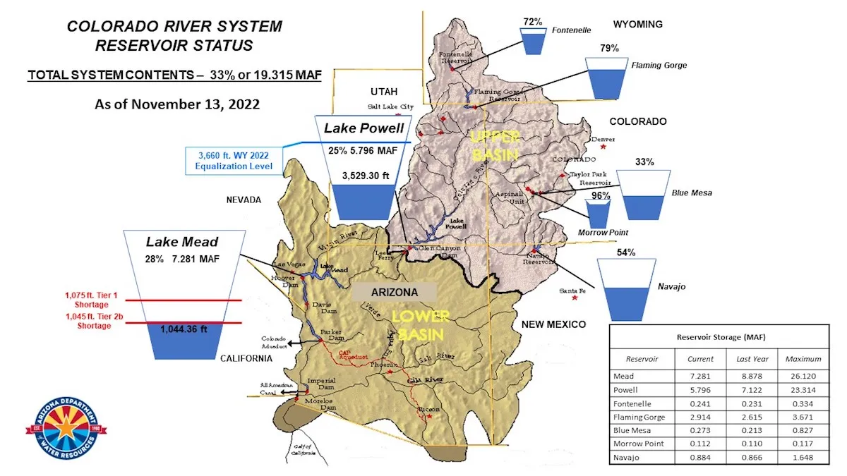
The BOR, meanwhile, will reduce releases from the Glen Canyon Dam at Lake Powell by 523,000 acre-feet of water from December through April, then allow that same volume to flow downstream to Lake Mead during the summer months. Future adjustments will likely include siphoning more water from Flaming Gorge, according to BOR officials.
Ongoing incremental adjustments are intended to sustain hydropower generation at the Glen Canyon and Hoover dams as a 22-year drought — exacerbated by human-caused climate change — continues to push the Colorado River Basin into a water scarcity crisis.
Taken all together, that means the bathtub rings of exposed shoreline at Flaming Gorge represent what is likely a “new normal” for the reservoir, Drought Response Operations program manager for the Upper Colorado Basin Region Dale Hamilton told WyoFile.
“We will continue to work with our Basin partners to consider additional releases implemented under the Upper Basin [drought contingency plan] from the upstream Colorado River Storage Project initial units, which includes Flaming Gorge,” Hamilton said.
Much depends on winter precipitation and spring runoff, Hamilton added, so any decision regarding further actions at Flaming Gorge is likely months away. “Those actions are still being discussed,” he said.
New normal
After decades of relatively steady water levels at Flaming Gorge, the reservoir is undergoing unprecedented changes as water managers release extra water in an attempt to to help balance water levels among major downstream storage reservoirs along the Colorado River.
The BOR released an extra 125,000 acre-feet of water from the reservoir in 2021 as part of the Colorado River drought contingency plan, dropping the surface level by about 5 feet. The current “extra” release of 500,000 acre-feet of water, combined with lower-than-average natural infill (just 57% of average from April through July) diminished the reservoir to 72% capacity in November, according to the BOR.
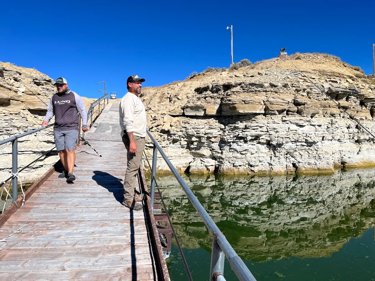
The reservoir has dropped by about 9 feet this year, exposing vast areas of lakebed at the upper reaches and water-ring patterns on canyon walls in some areas.
Recon Angling fishing guide Shane DuBois tried his luck ice-fishing Monday in 7 feet of water where, normally, the water depth should be nearly 40 feet, he said.
“A lot of [fishermen] have been fishing different spots for burbot,” DuBois told WyoFile. “I think [lower water levels are] going to start messing up everything, especially with all the sediment that’s pushed up on the rocks where [fish] usually spawn. It’s not going to be conducive for successful spawning for, really, any fish.”
Recreational access is becoming increasingly difficult, as water recedes from boat ramps. The ramp at the Anvil boat launch area on the west side of the reservoir in Wyoming was closed recently, DuBois said, while the Buckboard Marina in Wyoming continues to try to keep boat docks in the water.
“We’re not naive,” DuBois said. “Even if we have a big-snow year, they’re probably just gonna take all that water right back out.”
Click the link to read the post on the InkStain website (John Fleck):
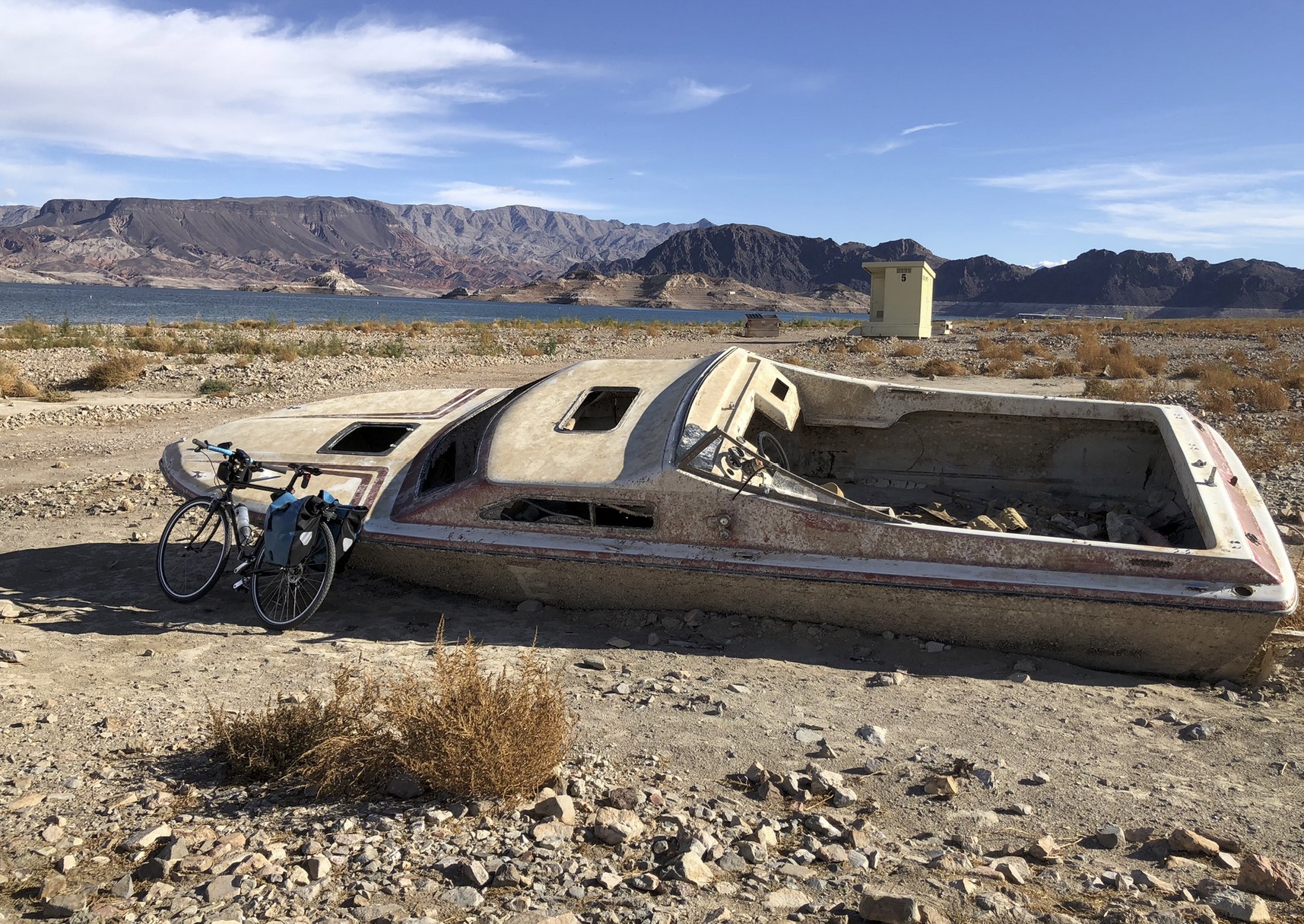
The Park Service has cut a raggedy new dirt road (“4×4 recommended”) north of Hemenway Harbor along Lake Mead’s receding shoreline so you can still get in to go fishing and do the beach thing.
Mead was at elevation 1,043 and change as I rode it on my bike yesterday afternoon, with lunch and time on my hands to ponder the stakes. You could see the uppermost Las Vegas water pipe, exposed to the winter air, and the stranded intake from the World War II-era Basic Magnesium factory.
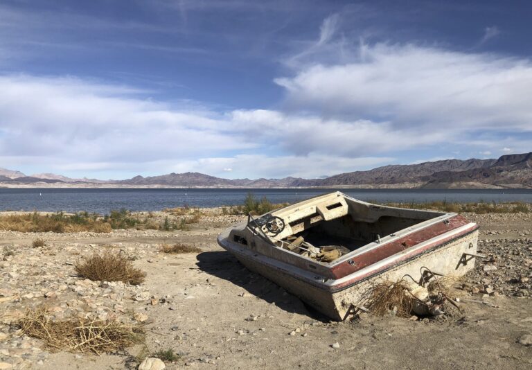
I passed three Lake Mead shipwrecks, the media icons of the great collapse, ruin porn of the Colorado River. I was happy, I guess, to finally bag the pictures for myself. I guess?
It was my annual pre-Colorado River Water Users Association Lake Mead visit – a bike ride along the reservoir, a trip to Hoover Dam, some quiet time in Boulder City before heading into the madhouse of Las Vegas and CRWUA and a Colorado River in crisis.
MANAGING IN CRISIS MODE
The challenge right now is a very practical one. We’ve no longer time the sort of vague generalizations I got when I turned to ChatGPT for help – “Implementing stricter water usage regulations and reducing water waste can help bring the supply and demand of the Colorado River into balance.” Great. Thanks. How we gonna do that?
The Colorado River brain trust has to write new rules, and it has to write them now, in a very specific way, with little time or room for error.
I have long had a dodge when reporters or my students or whoever asked me what I think we should do: It doesn’t matter what I think we should do, I would tell them. What matters, I would say, is what emerges from the seven states and the federal government, and increasingly the Tribes and others who who now, rightly, find themselves at the negotiating table(s).
Unfortunately, what has emerged from that process is shipwrecks emerging from Lake Mead.
So I’ve dropped the shield and begun thinking about how I would rewrite the rules, if anyone asked me. Come to think of it, the Federal Government has asked me, along with all the rest of you, via this Federal Register notice. You’ve got a week left before your assignment is due.
Basically, we need to do two things.
First, we need to rewrite the rules governing releases from Glen Canyon Dam to protect Lake Powell from reaching critically low levels that, by forcing the use of the dam’s lower outlet works, might threaten the structural integrity of the dam. We do this by setting a maximum release from Powell based on the current year inflow.
Second, we need rules to cut far more deeply into Lower Basin water use, like right now – far deeper than the rules we’ve got now. They’re just not sufficient. We have to include evaporation and system losses as part of each Lower Basin state’s allocation.
SAVING GLEN CANYON DAM

Section 6C and 6D of the 2007 Interim Guidelines is the critical first step.
This is where the current rules lay out how much water is to be released each year from Glen Canyon Dam. Note the quaintly anachronistic “Lake Powell Active Storage” column on the right, with “dead pool” – zero active storage – at elevation 3,370.
If Reclamation decides it doesn’t trust the dam’s outlet works, which sit down there, then suddenly “active storage” doesn’t start until elevation 3,490, the level of the power plant intakes.
For now at least, 3,490 is the new dead pool.
That would mean that at elevation 3,525, rather than having 5.93 million acre feet of “active storage” – the amount of water above “dead pool” – we’ve really got less than 2 million acre feet of really actually usable, releasable water in Powell. The whole notion of “balancing” active storage in Mead and Powell, so central to the ’07 Guidelines, now has to look completely different.
When you get close to dead pool, you’ve got a “run of the river” system, which means that the only water that leaves a reservoir is the amount that comes in. Given that we’re apparently redefining that for Powell on the fly, the new versions of 6C and 6D somehow have to restrict releases from Powell to not much more than comes in. Basically starting now, and for the foreseeable future, until we can begin to refill Powell or drill some new tubes at the bottom that we trust.
A simple approach to the new rule here might be rewrite the release rules when you’re in the “Mid-Elevation Release Tier” (below 3,575) and the “Lower Elevation Release Tier” (below 3,525) to cap releases to inflow minus evaporation. That would set a sort ratchet that would prevent a further decline in Lake Powell below its current dangerously low levels.
You could start the year by capping Powell releases at the 24-month study’s “minimum probable” unregulated Powell inflow level, with the option of raising the release an April review based on the “most probable” unregulated inflow. Minus evaporation. You’d have to subtract evaporation from that.
Other than that, the 6C and 6D rules could stay the same.
SAVING LAKE MEAD
As the modeling presented by Reclamation in its webinars two weeks ago shows, if you operate Powell the way I describe under low flow scenarios, you can crash Mead in a hurry. We need rules that are ready for that.
Taking evaporation and system losses off the top before we begin handing out water is a start. The “structural deficit” is real, it’s a result of not taking evaporation and system losses into account, and it’s written in shipwrecks emerging from the depths of Lake Mead.
Right now evaporation and system losses are in the ballpark of 1 million acre feet per year, but to be on the safe side, let’s set them at the 1.2 million acre foot per year level in the classic Reclamation “structural deficit” Powerpoint slide.
So the cuts in section 2D of the Interim Guidelines would have to be rewritten, with Arizona, Nevada, and California taking a proportional share of system losses right off the top.
You can do this some really complicated ways, based on the distance downstream of each user’s intake – so Imperial and Yuma would take a bigger system losses hit, and Las Vegas (pulling straight out of Lake Mead) would only suffer evaporative loss.
That seems like a recipe for scientized litigation, so my proposal is simple: Everyone shares this equally (sorry, Nevada friends).
That would leave us with a base allocation that looks something like this:

The cuts in the big ’07 Guidelines/DCP allocation tables would then be deducted from these numbers. So under this scenario, if we drop into the Mead elevation 1,040-1,045 tier, the total allocations would be:
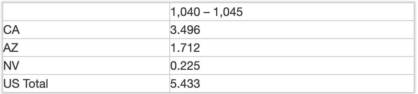
Notably, this gets us to the 2 million acre of cuts Reclamation Commissioner Camille Touton said we need in her testimony to Congress last summer.
UPPER BASIN
This obviously doesn’t touch the Upper Basin. The process Interior is using for this round of crisis management – a straight up revision to the ’07 Guidelines – doesn’t seem to offer a clear path to force the Upper Basin to come up with contributions of their own. For now, I’m OK with that. Since the ’07 Guidelines were signed, the Upper Basin has delivered more than 10 million acre feet of water above the required 8.25 million acre foot annual requirement. Despite that, the Lake Mead shipwrecks are emerging from the shallows. The key here is clearly to get Lower Basin overuse under control.
But I don’t think in the longer term the Upper Basin is off the hook. Reclamation’s modeling clearly shows a risk of the Upper Basin slipping below its 82.5×10 obligation if we have a few more bad years. We need a plan to deal with that. And it’s also a matter of fairness, in my view. We all have to contribute.
My scheme for Upper Basin contributions involves the next wet year – figuring out how to forego some of the Upper Basin storage we’ve got and get that water into Lake Powell instead. Suggestions for how to write that rule are welcomed – bonus if anyone can figure out how to fit that into the rewrite of the ’07 Guidelines currently underway.

COLLABORATION
I still believe in the power of the collaborative governance framework we’ve developed in the Colorado River Basin. As Assistant Secretary of Interior Tanya Trujillo told me when I was moderating her appearance at last summer’s Getches-Wilkinson Center conference, we’d be in a lot worse shape without it.
For what it’s worth, ChatGPT agrees: “Collaboration and cooperation among states and water users is crucial in finding solutions to the supply-demand imbalance on the Colorado River.”

Click the link to read the article on the KUNC website (Alex Hager). Here’s an excerpt:
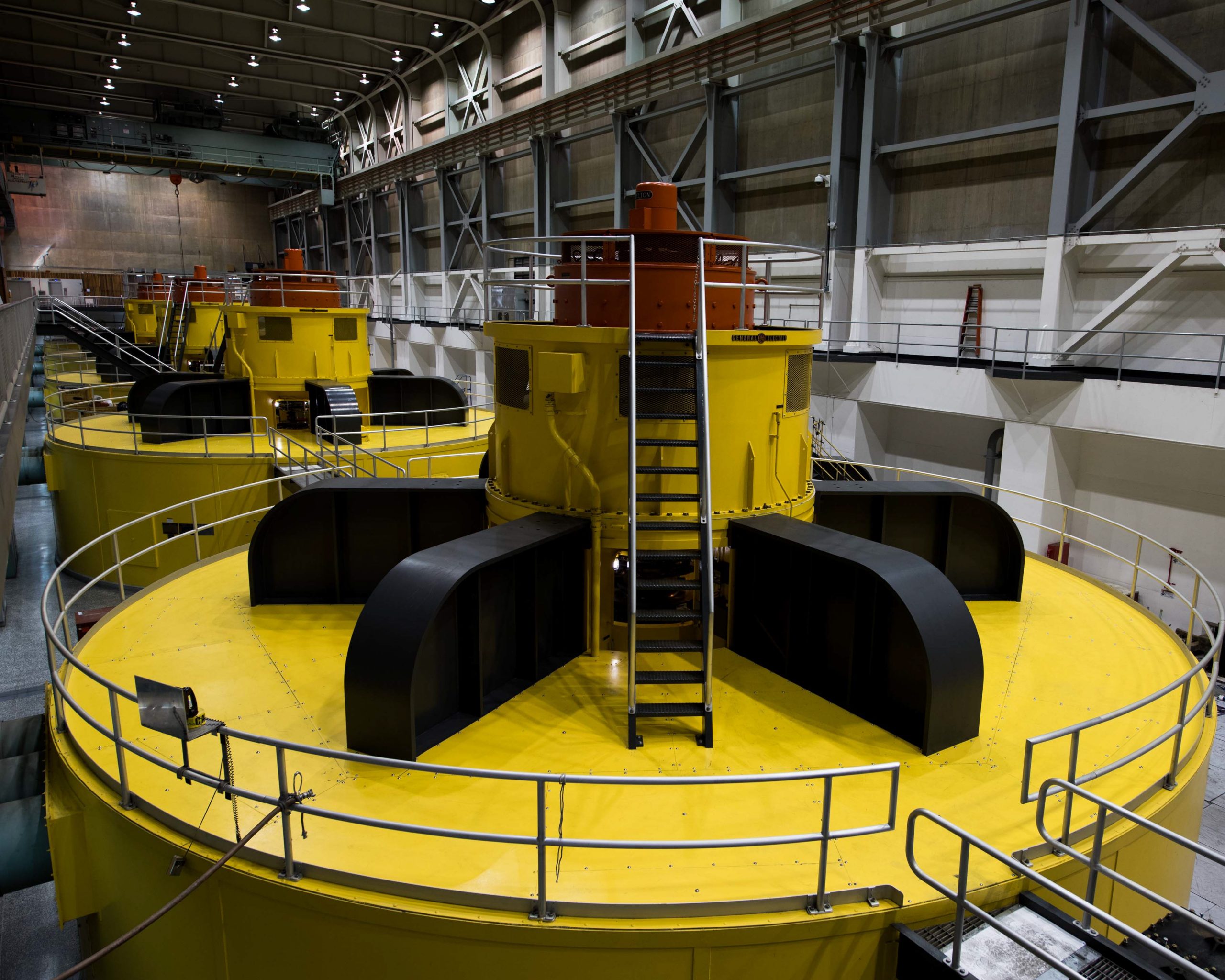
The dam’s innards are a time capsule of 1960s engineering. Bolts as thick as a forearm hold together the hulking metal casing for hydroelectric generators. Here, the Colorado River surges through turbines, producing power for about 5 million people across seven states. Now, the Colorado River is on the decline, and the dam faces threats that could soon render it useless after decades as a symbol of American engineering achievement. In a room that evokes the inside of a submarine, Bob Martin opened a heavy door to reveal one of those turbines. A gleaming silver cylinder whirred along inside.
“This is all original,” he said. “This is like pulling your grandpa’s 1964 Cadillac out of the garage and it’s in the same condition it was in 1964. That’s the world class maintenance that we’ve done – generations have done – at Glen Canyon.”
[…]
Below the hydropower intake is the pipe which allows water to pass from Lake Powell to the river on the other side. Water levels could conceivably drop below that, too. At that point, the only pass-through would be a set of four rarely-used backup tubes near the bottom of the concrete. Those tubes, known as the “river outlet works,” were originally meant to be a failsafe pr to pass water in high flow years, and aren’t wide enough to carry the legally required amount of water from one side to the other. A century-old agreement mandates that the Upper Basin states of Colorado, Wyoming, Utah and New Mexico must deliver a specific amount of water downstream to the Lower Basin states of California, Arizona and Nevada each year. The bulk of that water starts as high-mountain snow in the Rockies. Because winter snowpack varies widely year to year, the Upper Basin states resolved to add some insurance in the form of Lake Powell. Since the 1960s, it has served as a way to bank excess during wet years, and ensure enough would flow to the Lower Basin during dry years.

Click the link to read the article on the Las Vegas Review-Journal website (Colton Lochhead). Here’s an excerpt:
Nearly six months have passed since Bureau of Reclamation Commissioner Camille Touton first asked the Western states to come up with a plan to cut back on water use from the river next year by as much as 30 percent, but a cohesive proposal from the seven states that pull from the Colorado that supplies water to some 40 million people has yet to emerge. Things have only gotten worse along the river since Touton’s request, and that decline shows no signs of slowing down…
“The risks we saw then have only further materialized given the projected and plausible hydrology,” Touton said during a Dec. 2 meeting to discuss the options the federal government is looking at in lieu of a deal between the states…
Only piecemeal proposals have been made public thus far, including a proposal from California water agencies to conserve up to 400,000 acre-feet of water annually, or about 9 percent of the state’s annual allocation from the river, in exchange for the federal government making a commitment to contribute to Salton Sea stabilization efforts. The Southern Nevada Water Authority and nearly 30 other municipalities have signed a memorandum of understanding committing to drastically reducing the amount of thirsty decorative turf that lines their respective cities, an idea that took root in the Las Vegas Valley last year.

Brian E. Roe, The Ohio State University
You saw it at Thanksgiving, and you’ll likely see it at your next holiday feast: piles of unwanted food – unfinished second helpings, underwhelming kitchen experiments and the like – all dressed up with no place to go, except the back of the refrigerator. With luck, hungry relatives will discover some of it before the inevitable green mold renders it inedible.
U.S. consumers waste a lot of food year-round – about one-third of all purchased food. That’s equivalent to 1,250 calories per person per day, or US$1,500 worth of groceries for a four-person household each year, an estimate that doesn’t include recent food price inflation. And when food goes bad, the land, labor, water, chemicals and energy that went into producing, processing, transporting, storing and preparing it are wasted too.
Where does all that unwanted food go? Mainly underground. Food waste occupies almost 25% of landfill space nationwide. Once buried, it breaks down, generating methane, a potent greenhouse gas that contributes to climate change. Recognizing those impacts, the U.S. government has set a goal of cutting food waste in half by 2030.
Reducing wasted food could protect natural resources, save consumers money, reduce hunger and slow climate change. But as an agricultural economist and director of the Ohio State Food Waste Collaborative, I know all too well that there’s no ready elegant solution. Developing meaningful interventions requires burrowing into the systems that make reducing food waste such a challenge for consumers, and understanding how both physical and human factors drive this problem.
To avoid being wasted, food must avert a gauntlet of possible missteps as it moves from soil to stomach. Baruch College marketing expert Lauren Block and her colleagues call this pathway the squander sequence.
It’s an example of what economists call an O-ring technology, harking back to the rubber seals whose catastrophic failure caused the Space Shuttle Challenger disaster in 1986. As in that event, failure of even a small component in the multistage sequence of transforming raw materials into human nutrition leads to failure of the entire task.
MIT economist Michael Kremer has shown that when corporations of many types are confronted with such sequential tasks, they put their highest-skilled staff at the final stages of production. Otherwise the companies risk losing all the value they have added to their raw materials through the production sequence.
Who performs the final stages of production in today’s modern food system? That would be us: frenzied, multitasking, money- and time-constrained consumers. At the end of a typical day, we’re often juggling myriad demands as we try to produce a nutritious, delicious meal for our households.
Unfortunately, sprawling modern food systems are not managed like a single integrated firm that’s focused on maximizing profits. And consumers are not the highly skilled heavy hitters that Kremer envisioned to manage the final stage of the complex food system. It’s not surprising that failure – here, wasting food – often is the result.
Indeed, out of everyone employed across the fragmented U.S. food system, consumers may have the least professional training in handling and preparing food. Adding to the mayhem, firms may not always want to help consumers get the most out of food purchases. That could reduce their sales – and if food that’s been stored longer degrades and becomes less appetizing or safe, producers’ reputations could suffer. https://www.youtube.com/embed/PwTqA9q2L4Y?wmode=transparent&start=0 Reducing household food waste is a step that everyone can take to help slow climate change – but consumers may not know where to start.
What options exist for reducing food waste in the kitchen? Here are several approaches.
This could start with students, perhaps through reinvesting in family and consumer science courses – the modern, expanded realm of old-school home economics classes. Or schools could insert food-related modules into existing classes. Biology students could learn why mold forms, and math students could calculate how to expand or reduce recipes.
Outside of school, there are expanding self-education opportunities available online or via clever gamified experiences like Hellman’s Fridge Night Mission, an app that challenges and coaches users to get one more meal a week out of their fridges, freezers and pantries. Yes, it may involve adding some mayo.
Recent studies have found that when people had the opportunity to brush up on their kitchen management skills early in the COVID-19 pandemic, food waste declined. However, as consumers returned to busy pre-COVID schedules and routines such as eating out, wastage rebounded.
Enter the meal kit, which provides the exact quantity of ingredients needed. One recent study showed that compared to traditional home-cooked meals, wasted food declined by 38% for meals prepared from kits.
Meal kits generate increased packaging waste, but this additional impact may be offset by reduced food waste. Net environmental benefits may be case specific, and warrant more study.
South Korea has begun implementing taxes on food wasted in homes by requiring people to dispose of it in special costly bags or, for apartment dwellers, through pay-as-you-go kiosks.

A recent analysis suggests that a small tax of 6 cents per kilogram – which, translated for a typical U.S. household, would total about $12 yearly – yielded a nearly 20% reduction in waste among the affected households. The tax also spurred households to spend 5% more time, or about an hour more per week, preparing meals, but the changes that people made reduced their yearly grocery bills by about $170.
Each of these paths is promising, but there is no single solution to this problem. Not all consumers will seek out or encounter opportunities to improve their food-handling skills. Meal kits introduce logistical issues of their own and could be too expensive for some households. And few U.S. cities may be willing or able to develop systems for tracking and taxing wasted food.
As the National Academies of Science, Engineering and Medicine concluded in a 2020 report, there’s a need for many solutions to address food waste’s large contribution to global climate change and worldwide nutritional shortfalls. Both the United Nations and the U.S. National Science Foundation are funding efforts to track and measure food waste. I expect that this work will help us understand waste patterns more clearly and find effective ways to squelch the squander sequence.
Brian E. Roe, Professor of Agricultural, Environmental, and Development Economics, The Ohio State University
This article is republished from The Conversation under a Creative Commons license. Read the original article.
From email from the U.S. Department of Interior:
Senior leaders from the Department of the Interior will join the 2022 Colorado River Water Users Association Annual Conference this week to highlight the urgent actions being taken to improve and protect the long-term sustainability of the Colorado River System and the worsening drought crisis that continues to impact communities across the West. The Department is focused on the need for continued collaboration and partnerships across the Upper and Lower Basin States, with Tribes, and with the country of Mexico.
The Inflation Reduction Act includes $4 billion in funding specifically for water management and conservation efforts in the Colorado River Basin and other areas experiencing similar levels of drought. The Department has announced new drought mitigation fundingopportunities for both the Upper and Lower Basins, as well as funding for the Salton Sea. To address the serious operational realities facing the System, the Bureau of Reclamation has initiated an expedited, supplemental process to evaluate potential revisions to the current interim operating guidelines for the operation of Glen Canyon and Hoover Dams in 2023 and 2024 in order to address the likelihood of continued low-runoff conditions across the Basin.
WHO:
- Tommy Beaudreau, Deputy Secretary
- Tanya Trujillo, Assistant Secretary for Water and Science
- Camille Calimlim Touton, Commissioner, Bureau of Reclamation
WHEN: Wednesday, December 14, 2022 – Friday, December 16, 2022. Keynote remarks will be delivered on Friday at 8:30am PT.
WHERE: Las Vegas, Nev.
RSVP: Credentialed members of the media interested in attending the event can RSVP to Crystal Thompson at cthompson@cap-az.com.
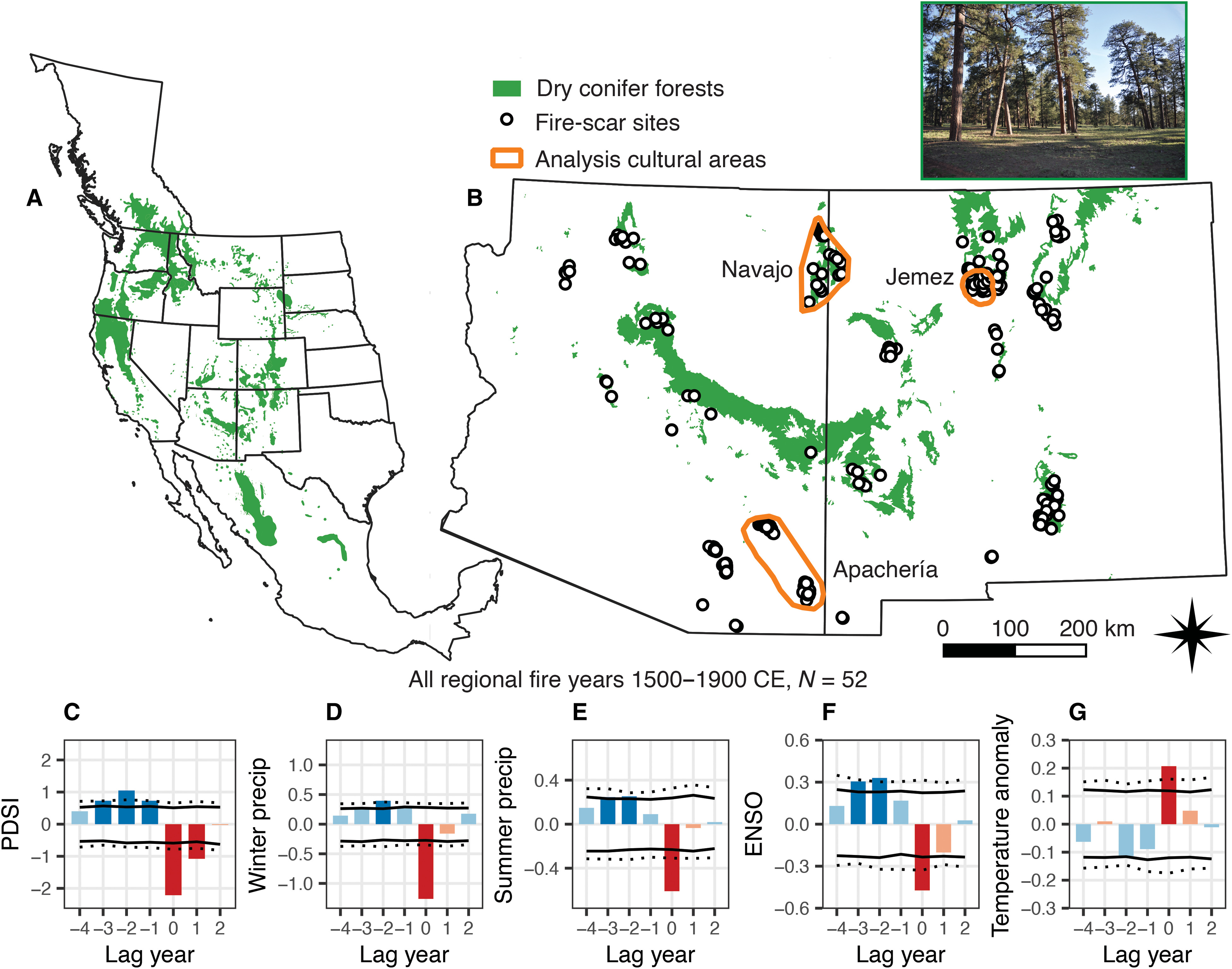
Click the link to access the article on the Science Advances website (CHRISTOPHER I. ROOS, Et. al). Here’s the abstract:
Prior research suggests that Indigenous fire management buffers climate influences on wildfires, but it is unclear whether these benefits accrue across geographic scales. We use a network of 4824 fire-scarred trees in Southwest United States dry forests to analyze up to 400 years of fire-climate relationships at local, landscape, and regional scales for traditional territories of three different Indigenous cultures. Comparison of fire-year and prior climate conditions for periods of intensive cultural use and less-intensive use indicates that Indigenous fire management weakened fire-climate relationships at local and landscape scales. This effect did not scale up across the entire region because land use was spatially and temporally heterogeneous at that scale. Restoring or emulating Indigenous fire practices could buffer climate impacts at local scales but would need to be repeatedly implemented at broad scales for broader regional benefits.
Click the link to read the article on the Aspen Journalism website (Heather Sackett):
Upper Colorado River basin officials have released details of a conservation program that would pay water users to reduce their use of Colorado River water, with the goal of implementing it as soon as this summer.
In July the Upper Colorado River Commission released its 5-Point Plan, designed to protect critical elevations at the nation’s two largest reservoirs, Lake Powell and Lake Mead. The first action listed in that plan was to restart the System Conservation Pilot Program, which ran from 2015 to 2018 and paid water users to cut back.
The SCPP reboot comes with $125 million of federal funding through 2026, but no target for an amount of water to be saved through the temporary and voluntary program. The money comes from the $4 billion in Inflation Reduction Act funding for Colorado River projects.
The goal would be to reduce Colorado River use and mitigate the impacts of long-term drought and depleted storage, not to guarantee a certain amount of water makes it to any particular reservoir, said UCRC Executive Director Chuck Cullom.
“Anyone who is proposing or providing any sort of estimate about what this program might yield is engaging in wild speculation given the water stress that all the Colorado River water users are suffering in the upper basin,” Cullom said. “Even though we have a significant financial resource available it’s unclear to me how many people will be able to subscribe to the program.”
The SCPP is open to Colorado River water users in the four upper basin states — Colorado, Wyoming, Utah and New Mexico — who can demonstrate they have a project that can reduce their water use. That could include farmers, ranchers, cities, tribes, irrigation districts or industrial users.
The UCRC will unveil a request for proposals at its meeting at the annual Colorado River Water Users Association conference in Las Vegas on Dec. 14. Proposals will be reviewed by the UCRC and upper basin states, and the commission plans to award contracts in March to begin conserving water during the 2023 irrigation season. The UCRC posted a template for a program implementation agreement to its website on Friday.
It’s not yet clear how much the program would pay per acre-foot; Cullom said that information would be in the RFP. An acre-foot is the amount of water needed to cover an acre of land to a depth of one foot. One acre-foot can supply one to two families per year.
The UCRC will set a minimum price, but applicants can propose a higher rate if they believe they should be compensated more, Cullom said. Officials will also be on the lookout for those hoping to unfairly profit from the program, which has been a longtime concern of these types of water savings programs.
“If you propose more, we are going to scrutinize,” Cullom said. “We don’t intend to overpay for the resource and we will look very carefully at proposals that are clearly speculative.”
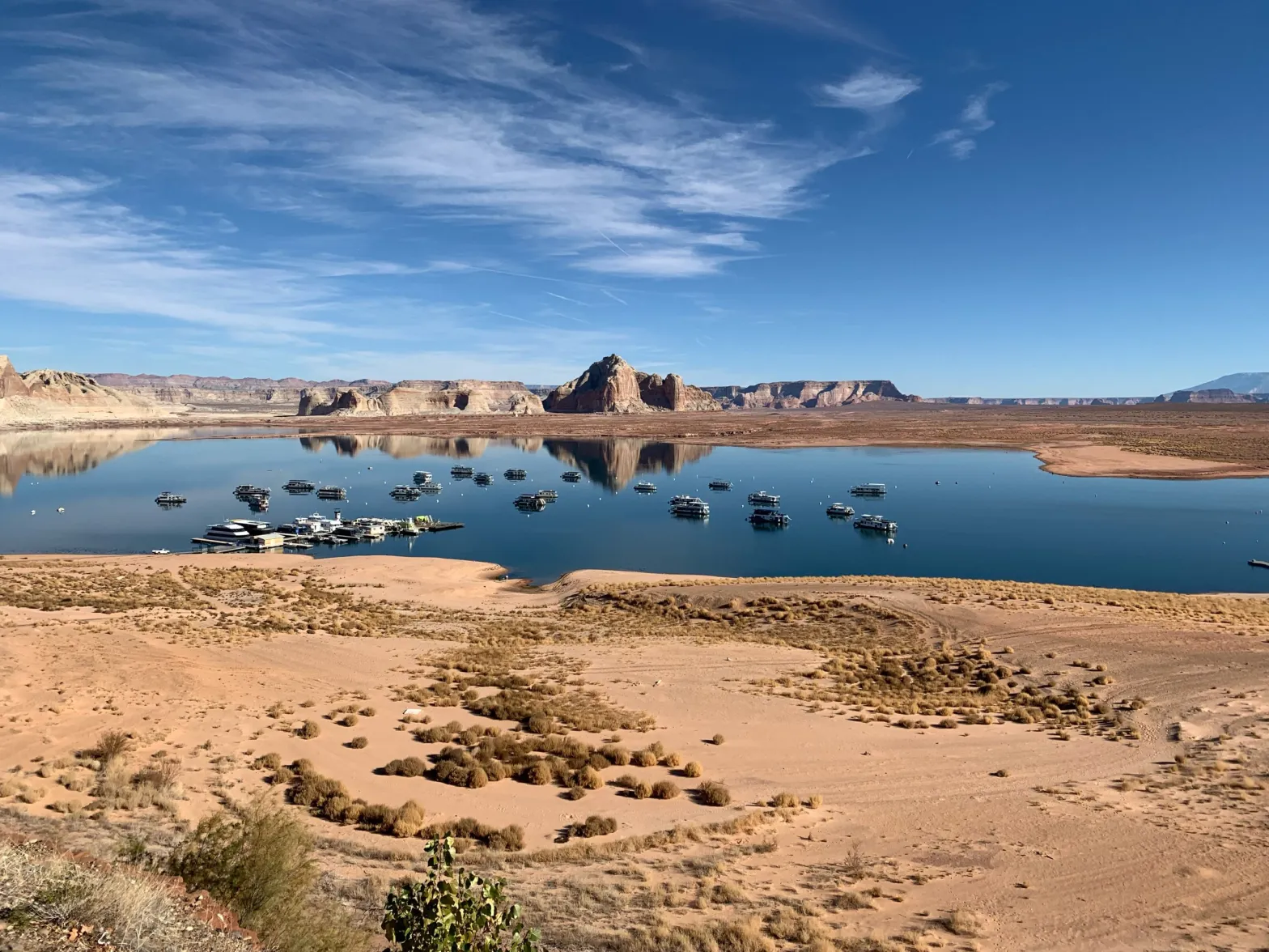
The 5-Point Plan is the upper basin’s response to a call from U.S. Bureau of Reclamation Commissioner Camille Touton in June for 2 to 4 million acre-feet of conservation. Climate change and a two-decade mega-drought continue to rob the Colorado River and its tributaries of streamflows. Reservoirs Powell and Mead are at historically low levels, threatening the dams’ ability to produce hydroelectric power. As of this week, Lake Powell was only about 24% full.
Upper basin water managers have been quick to point out that water use is much higher in the lower basin — California, Arizona and Nevada — and therefore, that’s where the majority of water savings should come from.
“We are not at fault for the situation the river is in, but we can be part of the solution,” said Colorado commissioner to the UCRC Rebecca Mitchell. “We have tried to move as expeditiously as possible.”
Program concerns
General Manager of the Durango-based Southwestern Water Conservation District Steve Wolf said he had concerns about the program. He said he has been talking with state officials about having more local oversight of projects that apply to participate in the SCPP. Ideally, his districts and others like it, such as the Glenwood Springs-based Colorado River Water Conservation District, would get to veto projects or at least review and comment on them, he said.
“We are hoping to get a few more protections for West Slope water users wrapped into the program before it actually is activated,” Wolf said. “I am fully supportive of an individual being able to do what they want with their water rights but from where I sit, I need to make sure that action does not impact other water users, so I want some sort of oversight rule.”
One of the largest water users in western Colorado, the Grand Valley Water Users Association, participated in the original SCPP. The valley has also been the site of many of the recent speculation concerns by Colorado lawmakers and others.
The renewed SCPP is different from an upper basin demand management program, something the UCRC is studying and to which the state of Colorado devoted more than two years and nine workgroups as part of its feasibility investigation. The 2019 Drought Contingency Plan created the framework for a demand management program: a 500,000 acre-foot pool in Lake Powell in which the upper basin states could store water saved as part of a voluntary, temporary and compensated program that pays water users to cut back with the aim of meeting water delivery obligations to the lower basin.
The results of the UCRC’s study on demand management is on the agenda for its Dec. 14 meeting.
Cullom said a measure of success for the reinstated SCPP is not how much water is conserved. The original program saved about 47,000 acre-feet of water at a cost of about $8.6 million over the four years.
“My measure of success is that we have an open, transparent process,” he said. “I would like to see broad participation in terms of sectors — agriculture, municipal, industrial, tribal — and that at the end the participants are satisfied with how the program went. The volumes (of water) are going to sort themselves out.”
Aspen Journalism covers water and rivers in collaboration with The Aspen Times.
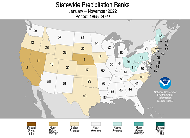
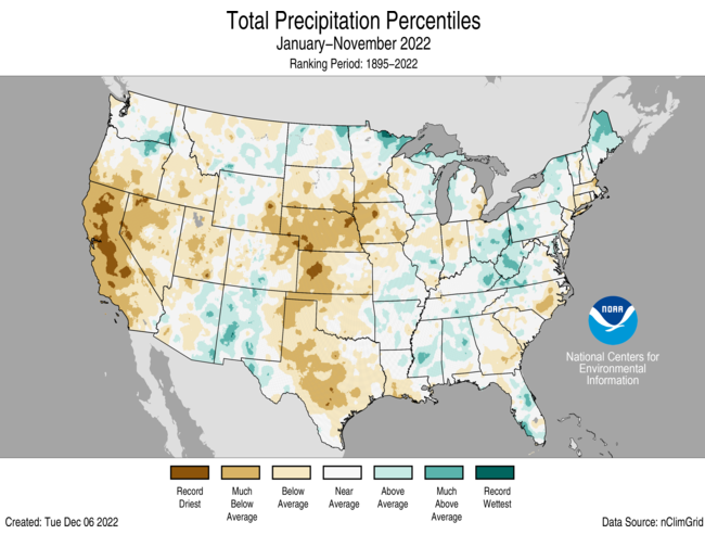
By percentiles, parts of California, Nebraska, Kansas, Nevada, Colorado, Wyoming, Utah, Iowa and Texas have recorded their driest year on record.
Click the link to read the article on the Aspen Journalism website (Heather Sackett):
A water conservancy district has put a call on the White River, an action that has the potential to alter the system for other water users.
On Dec. 1, the Rangely-based Rio Blanco Water Conservancy District placed a call for its water right of 620 cubic feet per second at the Taylor Draw Dam hydroelectric plant, which the district owns and operates. It is only the second-ever call on the White River. A call occurs when a water rights holder isn’t getting the full amount of water to which they are entitled and upstream water users are shut off or “curtailed” so that the downstream user can get their full amount.
“I think maybe it’s a little strong to say it’s going to be life-changing, but it’s going to be significant, especially if we start seeing a call year-round,” said Colorado Division of Water Resources Division 6 Engineer Erin Light. “I think it could really change the regime that everyone in that basin is accustomed to. I think there’s not much question that the basin would become overappropriated.”
DWR designated the nearby Yampa River basin as overappropriated earlier this year, which means that there’s more water on paper than real water in the system at certain times of year and new well users will have to get a water-replacement plan, known as an augmentation plan.
Under Colorado water law, older water rights get first use of the river. In this case, water users junior to the district’s 1966 water right are being shut off. This time of year, that mostly means some industrial users and those who pull water from the river to water their livestock but who don’t have a water right for that specific use, Light said.
Under Colorado water law, watering livestock from ditches during irrigation season is included under an irrigation water right. But in the winter, when fields are not being irrigated, ranchers need a separate decree specifically for livestock watering if they want to continue using their ditches to water the animals.
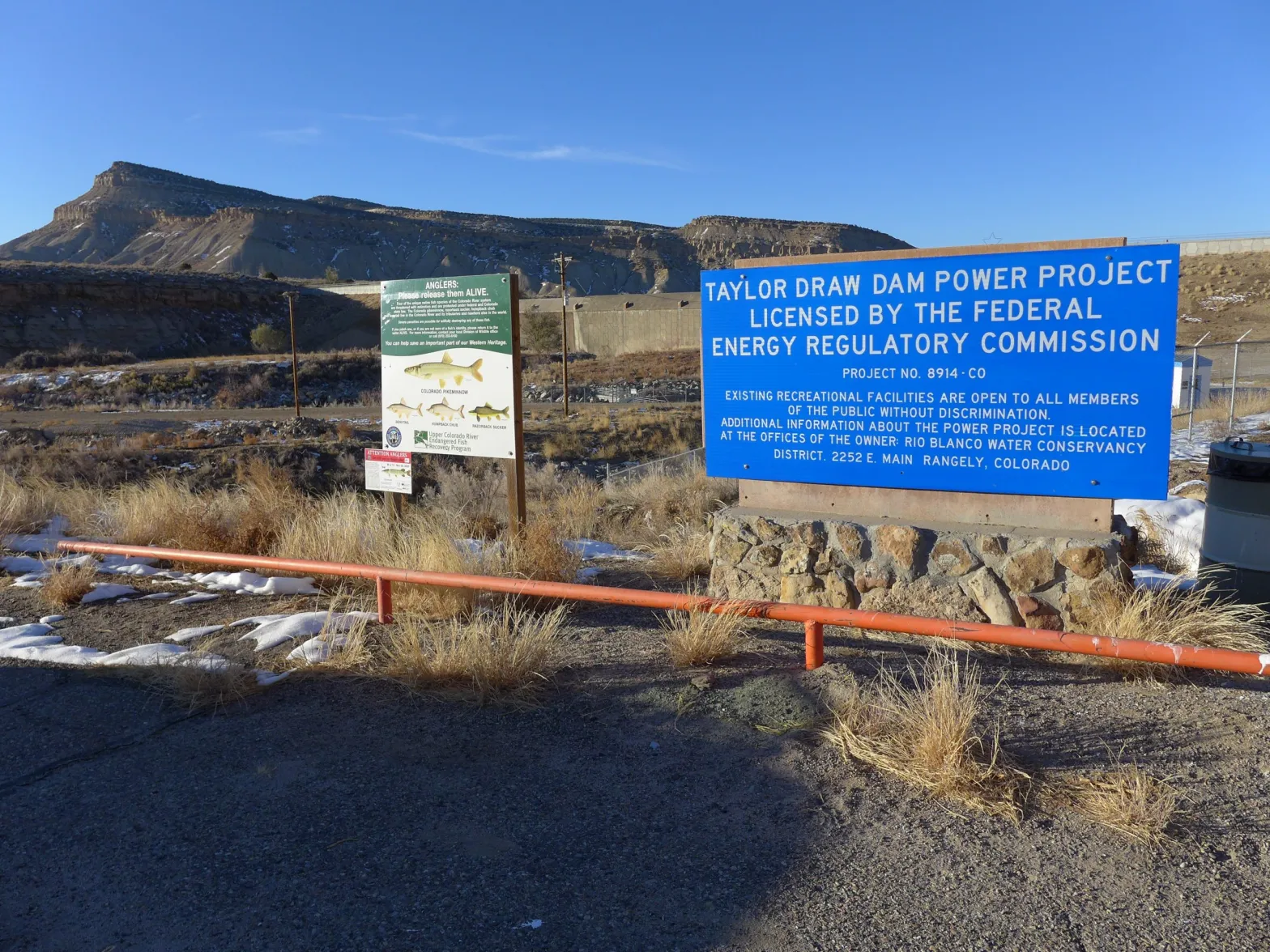
Reduced hydropower revenues
According to a news release from the district, the ongoing drought has significantly reduced seasonal inflows into Kenney Reservoir, which has reduced power production at the dam. According to the district, electricity production has been reduced by 35%, which has reduced the district’s revenues.
District General Manager Alden Vanden Brink said in an email that the district’s full water right was not being met several months out of the year and that the call will remain on until the full water right or capacity of the turbine is met. The district also has a 1982 water right for 125 cfs.
The news release said the district is sensitive to the hardships that the call may have on other water users and is working to create a White River augmentation plan, with a backup water supply for junior users.
Light said her office has curtailed about 10 ditches and two industrial water users since the call came Dec. 1, but assuming the call will be on whenever the river flows at less than 620 cfs, there will be more water rights and water usage curtailed in the summer and fall. During the irrigation season, there will be about 500 ditches and pumps that water commissioners will have to visit to see how much water they are using and whether they are using it legally, she said.
The U.S. Geological Survey stream gauge on the White River above Rangely is currently ice-affected and not giving a reading, but Light said she is certain that the 620-cfs water right at the dam is still not being met, even with curtailing upstream junior users. The river is probably running at about 300 cfs going into Kenney Reservoir, she said. Stream gauge data over the last half dozen years show that outside of seasonal peak flows, the White River near Rangely normally runs below 620 cfs.
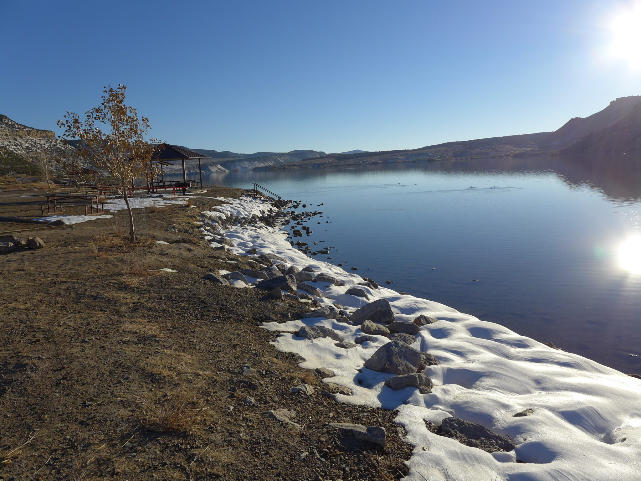
Wake-up call
The White River flows from the Flat Tops west through Meeker and Rangely to its confluence with the Green River in Utah. This sparsely populated basin has seen little regulatory oversight from the state, and water users could generally take as much water as they needed. But that is changing. For the past few years, Division 6 staffers have been pushing water users to install measuring devices on their ditches and canals.
“In Division 6, our basin that has the most number of structures by far without measuring devices is the White River,” Light said. “Unfortunately, probably at the onset of this call in the summer, we will be shutting people off without measuring devices.”
Will Myers is an engineer and rancher on the Williams Fork, a tributary of the Yampa River, and he also serves as the agriculture representative on the Yampa/White/Green Basin Roundtable. Getting a water court decree for stock watering is the best way for agricultural producers to protect their practices, he said, especially in an area not used to strict administration by state officials because there has historically been enough water to go around.
“Any time you have something like this happen, it’s kind of a wake-up call for those in the ag community,” Myers said. “Just because you’ve always done something doesn’t mean you’re not susceptible to an actual legit administrative call.”
Ongoing drought and the impacts of a warming climate are at least partially fueling a trend in never-before-seen calls in parts of western Colorado. In 2018, the Yampa River saw its first-ever call, and the Crystal River saw its first-ever senior irrigation call.
“If that’s indeed true — that we are going to continue to see a drying climate — we are going to continue to see senior water rights not being met,” Light said. “I think that’s become clearly evident in the last four years.”
Aspen Journalism covers water and rivers in collaboration with The Aspen Times.

Click the link to read the article on the NOAA website:
Key Points:
- The average temperature of the contiguous U.S. in November 2022 was 41.0°F, which is 0.7°F below average, ranking in the middle third of the record. Generally, temperatures were above average from the Midwest to the Northeast and Southeast, and below average from the Plains to the West Coast.
- November precipitation for the contiguous U.S. was 2.40 inches, 0.17 inch above average, ranking in the middle third of the historical record. Precipitation was above average from the Great Lakes to the southern Plains, from the Gulf Coast to the Northeast and across portions of the Great Basin, northern Rockies and northern Plains. Precipitation was below average across southern Michigan to the Ohio Valley and in the central Plains.
- Parts of the Pacific Northwest had their coldest November in nearly four decades. Washington State observed its coldest November since 1985. Oregon saw its coldest November since 1994 and Idaho had its coldest November since 2000.
- Hurricane Nicole became the first hurricane in nearly 40 years to make landfall in the United States in November.
- According to the November 29 U.S. Drought Monitor report, about 57.5% of the contiguous United States was in drought. Severe to exceptional drought was widespread from the Great Basin to the Pacific Coast, across much of the Great Plains to Mississippi Valley, and in parts of Hawaii, with moderate to severe drought in parts of the Southeast and Northeast.

Other Highlights:
Temperature
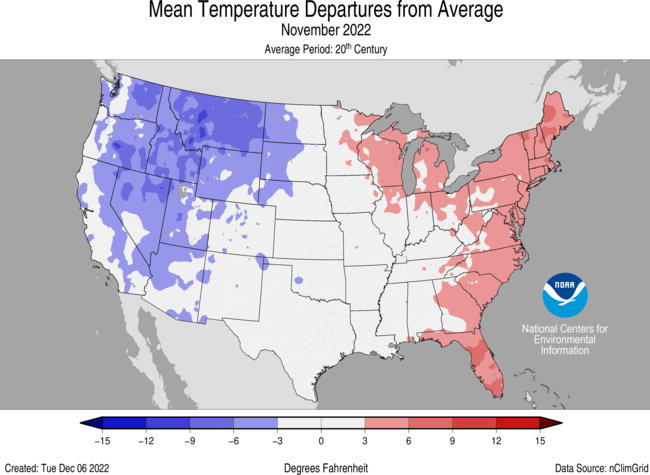
For the month of November, Maine ranked fifth warmest on record while Florida ranked seventh warmest, with five additional states experiencing a top-10 warmest November on record. Conversely, temperatures were below average to record coldest across much of the West. Idaho ranked fourth coldest, Washington ranked sixth and Oregon ranked seventh, while two additional states each had their top-10 coldest November on record.
The meteorological autumn (September-November) average temperature for the Lower 48 was 54.7°F, 1.2°F above average, ranking in the warmest third of the record. Temperatures were above average from the West Coast to the Great Lakes and into the Northeast as well as along portions of the East Coast. Temperatures were near- or below-normal in parts of the Southwest, the southern Plains, and from the southern and central Mississippi Valley to the Ohio Valley and Southeast. Maine ranked fourth warmest while five additional states ranked among their warmest 10 autumn seasons on record.
For the January-November period, the average contiguous U.S. temperature was 55.2°F, 1.5°F above average, ranking 17th warmest in the 128-year record. Temperatures were above average from the West Coast to the Gulf Coast and from the Gulf to New England. California and Florida each ranked fifth warmest while Massachusetts and Rhode Island each had their sixth warmest January-November period on record. Five other states ranked among their warmest 10 year-to-date periods on record. Temperatures were near average from the northern Plains and Upper Midwest to the Tennessee Valley.
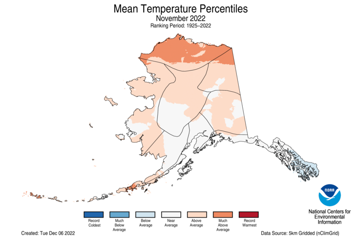
The Alaska statewide November temperature was 16.3°F, 4.6°F above the long-term average. This ranked in the warmest third of the 98-year period of record for the state. Temperatures were above average across much of northern Alaska, the Yukon Delta, the Aleutians and parts of the eastern Interior. South central Alaska and areas along the Gulf of Alaska to the Panhandle experienced near-average conditions, while the southern Panhandle experienced below-average temperatures for the month.
The Alaska autumn temperature was 29.2°F, 3.3°F above the long-term average, ranking 18th warmest on record for the state. Temperatures were above average across most of the state with the central Interior region near average for the season.
The Alaska January-November temperature was 30.7°F, 2.7°F above the long-term average, ranking 15th warmest on record for the state. Above-average temperatures were observed across the vast majority of the state for this 11-month period.
Precipitation

November precipitation was near- to above-average over much of the contiguous U.S. Precipitation was below average in parts of the Southwest, central Plains, Ohio Valley and Great Lakes. No state experienced a top-10 wettest or driest November.
The U.S. autumn precipitation total was 5.92 inches, 0.96 inch below average, ranking in the driest third portion of the September-November record. Precipitation was above average across parts of the Rockies, Southwest and East Coast. Precipitation during September-November was below average along the West Coast and from the northern and central Plains to the Great Lakes and Ohio River Valley. Nebraska ranked fifth driest while four additional states experienced a top-10 driest autumn season on record.
The January-November precipitation total for the contiguous U.S. was 25.61 inches, 1.98 inches below average, ranking in the driest third of the historical record. Precipitation was above average across portions of the Northeast, Great Lakes, Ohio Valley, southern Mississippi Valley, and in parts of the Rockies and Northwest. Precipitation was below average across much of the West, central and southern Plains and parts of the East Coast during the January-November period. California ranked second-driest on record while Nebraska ranked fourth driest and Nevada ranked 11th driest for this 11-month period.
Monthly precipitation averaged across the state of Alaska was 3.37 inches, 0.02 inches below average, ranking in the middle third of the 98-year record. Conditions were wetter than average across the North Slope, central Interior, West Coast and in portions of the Aleutians while much of eastern Alaska and northern parts of the Panhandle experienced near-average conditions. Southern areas of the Panhandle had below-average precipitation for the month.
For the autumn season, precipitation ranked 12th wettest across Alaska with wetter-than-average conditions observed across most of the state. Parts of the central Interior, Aleutians and southern Panhandle experienced near average precipitation for this period.
The January-November precipitation ranked second-wettest on record for Alaska, with above-average to record high precipitation observed across much of the state. The central and northeast Interior regions were near-average while much of the Aleutians experienced below-average precipitation for this period.
Other Notable Events
November had several notable storms that brought severe thunderstorms and tornadoes to portions of the United States:
- On November 4-5, a tornado outbreak occurred across portions of Texas, Oklahoma, Louisiana and Arkansas. A total of 31 tornadoes were confirmed by the National Weather Service, including two EF-4 tornadoes, which brought significant damage to the region including mass power outages.
- On November 29-30, severe storms and tornadoes swept through parts of the South, downing trees, damaging homes in parts of Alabama and Mississippi. The National Weather Service confirmed 11 tornadoes during this outbreak including two EF-3 tornadoes.
On November 10, Hurricane Nicole made landfall along Florida’s eastern shore, flooding the coast and knocking out power to thousands. Nicole was the first hurricane to hit the United States in November in nearly 40 years.
On November 7-10, a winter storm brought heavy snow and strong winds across much of the West. Parts of Washington, California, Montana and North Dakota reported between one to three feet of snow.
A historic snowstorm slammed western and northern New York on November 16-20 with more than six feet of snow reported in some areas, closing roads, triggering driving bans and canceling flights. The city of Buffalo set a record for daily snowfall, with 21.5 inches on Saturday, November 19. The previous record was 7.6 inches. The State Climate Extremes Committee is investigating whether or not a new New York state 24-hour snowfall record has been set.
Drought
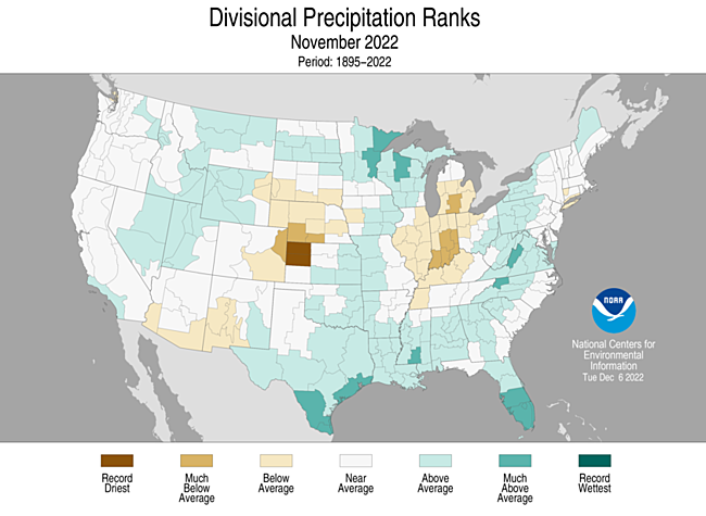
According to the November 29 U.S. Drought Monitor report,about 57.5% of the contiguous U.S. was in drought, down about 5.3% from the beginning of November. Drought conditions expanded or intensified across portions of the Southeast, Great Lakes, Upper Midwest and central Plains. Drought contracted or was eliminated across portions of the Northwest, northern and southern Plains, Mississippi Valley and parts of the Northeast and Hawaii.
According to the One-Month Outlook issued on December 1 from the National Interagency Fire Center, the contiguous U.S. and Alaska are expected to be near normal while the islands of Hawaii have above normal significant wildland fire potential during December.
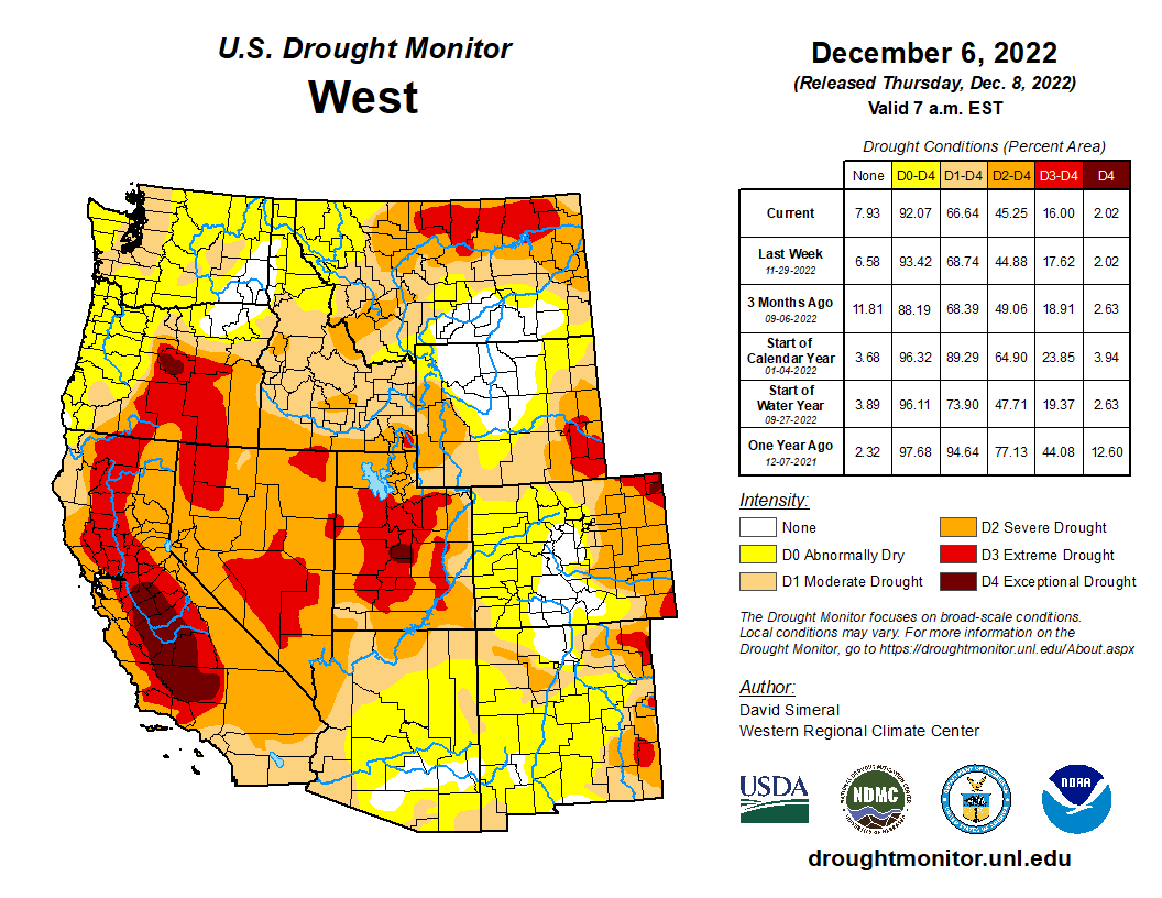

Click the link to read the article on the KUNC website (Alex Hager). Here’s an excerpt:
As climate change continues to shrink the Colorado River’s largest reservoirs, a group of four states that use its water are set to lay out plans to reboot a conservation program. The Upper Colorado River Commission – comprised of Colorado, Utah, Wyoming and New Mexico – plans to announce details of an extended “System Conservation Pilot Program” through which water users could be paid to cut back on their use. The soon-to-be-launched program aims to use a pool of $125 million from the Inflation Reduction Act for payouts to “mitigate the impacts of long-term drought and depleted storage,” according to presentation slides obtained by KUNC…The new program is an extension of a previous effort. An earlier pilot program ran from 2015 through 2018. Designed to serve as a proof of concept, the UCRC distributed more than $8.5 million as a part of that program and conserved an estimated 47,207 acre-feet of water…
The 2023 program would allocate considerably more money than the prior iteration if the UCRC gets approval from Congress to extend the program. The proposed Colorado River Conservation Act authorizes the program to continue until 2026. The Bureau of Reclamation would also need to sign off on the use of $125 million in federal funds. The money will come out of $4 billion from the Inflation Reduction Act that was set aside for Colorado River projects.
Chuck Cullom, executive director of the Upper Colorado River Commission, said his agency is still sorting out how much money it will offer water users on a per-acre-foot basis in exchange for cuts, and does not have a target for a total amount of conservation. The Upper Colorado River Commission is slated to release its first request for proposals on December 14, with a deadline in February. Then each participating state, and the UCRC will be able to review each water-saving proposal, setting higher payout values on a case-by-case basis. Cullom said the intent of such a review is to discourage profiteering, a nagging concern of programs that pay water users to cut back.
Studies of the 2015 pilot program found that lingering uncertainties still surround programs that pay farmers for temporarily fallowing their fields to conserve water. Questions about pricing, soil health, monitoring and ensuring that conserved water reaches the beleaguered Colorado River reservoirs remain unanswered…Cullom said the Upper Colorado River Commission expects to make a formal announcement about 2023 system conservation plans in Las Vegas. The commission will hold a meeting during the Colorado River Water Users Association annual conference, a yearly meeting of policymakers, scientists and water users that has been under increasing scrutiny as the region’s supply-demand imbalance teeters towards crisis levels.

From email from Northern Water (Jeff Stahla):
The U.S. Army Corps of Engineers has issued a federal Clean Water Act Section 404 Record of Decision for the Northern Integrated Supply Project. This is a major milestone for NISP, as it reflects the lead federal regulatory agency’s review and approval of the Project.
The Corps’ approval was based on a lengthy and rigorous scientific analysis under the National Environmental Policy Act and a host of other environmental laws, including the federal Endangered Species Act, National Historic Preservation Act, State Water Quality compliance certification, and State Fish and Wildlife Mitigation Plan requirements.
The Corps has concluded that the Project’s 40,000 acre-foot yield will meet a substantial amount of the 15 Northern Front Range participants’ future water need and that NISP is the least environmentally impactful means of satisfying that need. The Corps considered a range of other potential alternative approaches, including the adverse impacts to the region if no federal action was taken.
“This action is the culmination of nearly 20 years of study, project design and refinement to develop water resources well into the 21st century,” said Northern Water General Manager Brad Wind. “This Project will also allow participating communities to serve their customers without targeting water now used on the region’s farms.”
Through the federal permitting process, the Project was refined to further avoid and minimize environmental impacts and provide mitigation and enhancements to river-related resources. NISP’s operations will send more water down the Poudre River and through downtown Fort Collins in most months of the year, providing additional flows through the city in late summer, fall and winter than currently exist. NISP will also offer significant new flatwater recreation opportunities to everyone.
NISP includes Glade Reservoir, Galeton Reservoir, and associated project infrastructure to deliver high-quality water to more than 250,000 Northeastern Colorado residents.
Participants in the Project include the Town of Erie, Town of Windsor, City of Fort Morgan, Town of Frederick, City of Evans, City of Fort Lupton, Town of Eaton, Town of Severance, City of Lafayette, Town of Firestone, and City of Dacono, as well as the Fort Collins-Loveland Water District, Left Hand Water District, Central Weld County Water District, and the Morgan County Quality Water District.
Learn more about NISP at www.NISPwater.org.

Click the link to read the article on the Aspen Journalism website (Laurine Lassalle):
Snowpack in the Roaring Fork basin reached 120.5% of average for Dec. 4 with 4.7 inches of snow-water equivalent, according to NOAA.
SNOTEL sites that monitor snowfall throughout the winter measured the snowpack at Independence Pass at 93.6% of average on Dec. 4, with a “snow water equivalent” (SWE) of 4.21 inches, up from 2.91 inches on Nov. 27. Last year on Dec. 4, the SNOTEL station up the pass (located at elevation 10,600 feet) recorded an SWE of 3.19 inches, or 70.9% of average.
The monitoring station at McClure Pass located at elevation 9,500 feet recorded a SWE of 4.29 inches on Dec. 4, or 130% of average. That’s up from a SWE of 3.5 inches on Nov. 27. Last year, on Dec. 4, the station also measured a snowpack holding 0.39 inches of water.
On the northeast side of the Roaring Fork Basin, snowpack at Ivanhoe, which sits at an elevation of 10,400 feet, reached 4.8 inches on Dec. 4, or 126.1% of average.
Snowpack at Schofield Pass reached 8.31 inches on Dec. 4, which represents 109.3% of average. Schofield Pass sits at an elevation of 10,700 feet between Marble and Crested Butte.
Snow water equivalent — the metric used to track snowpack — is the amount of water contained within the snowpack, which will become our future water supply running in local rivers and streams.
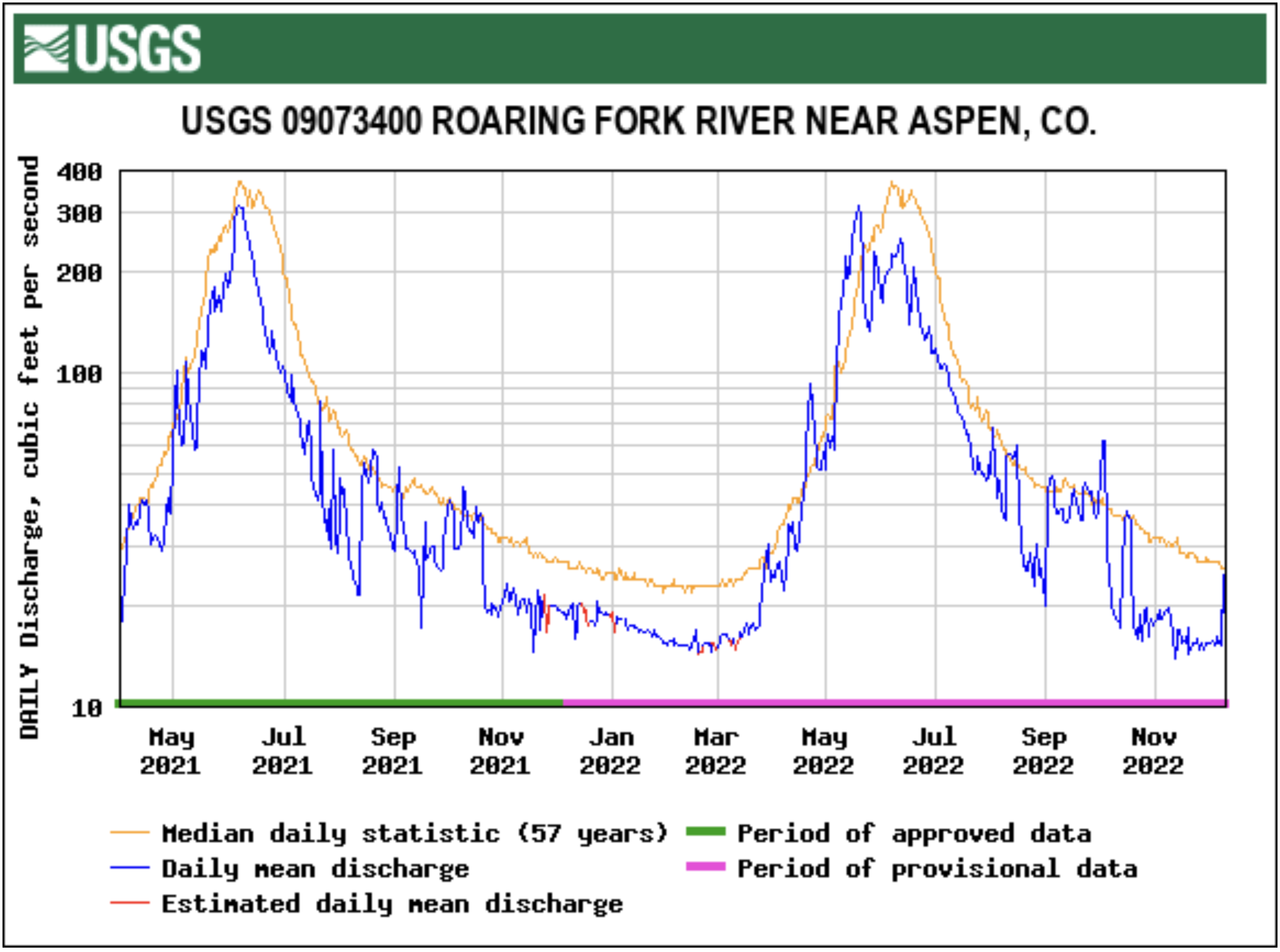
Most streams keep running close to the average
The Roaring Fork River below Maroon Creek flowed at 95 cfs on Dec. 4, or 93.3% of average, according to the USGS gauge. That’s down from Nov. 27, when the river was flowing at 101 cfs, or 103.1% of average.
At Stillwater, located upstream of Aspen, the Fork on Dec. 4 ran at 15.2 cfs or 52.4% of average, down from 15.4 cfs but up from 51.3% of average on Nov. 27.
The upper Fork’s flow is impacted by the Independence Pass transbasin diversion system that sends Roaring Fork headwaters to Front Range cities. Water flowing through the tunnel under the Continental Divide between Grizzly Reservoir on Lincoln Creek and the South Fork of Lake Creek measured 12.2 cfs on Dec. 4.
The Roaring Fork at Emma, below the confluence with the dam-controlled Fryingpan, saw on Dec. 4 streamflow of 263 cfs, or about 96% of average. That’s down from 270 cfs, but up from 94.4% of average, on Nov. 27.
Meanwhile, the Crystal River above Avalanche Creek, which is not impacted by dams or transbasin diversions, flowed at 65 cfs, or 110.7% of average, on Dec. 4. Last week, the river ran at 66 cfs, or 104.6% of average.
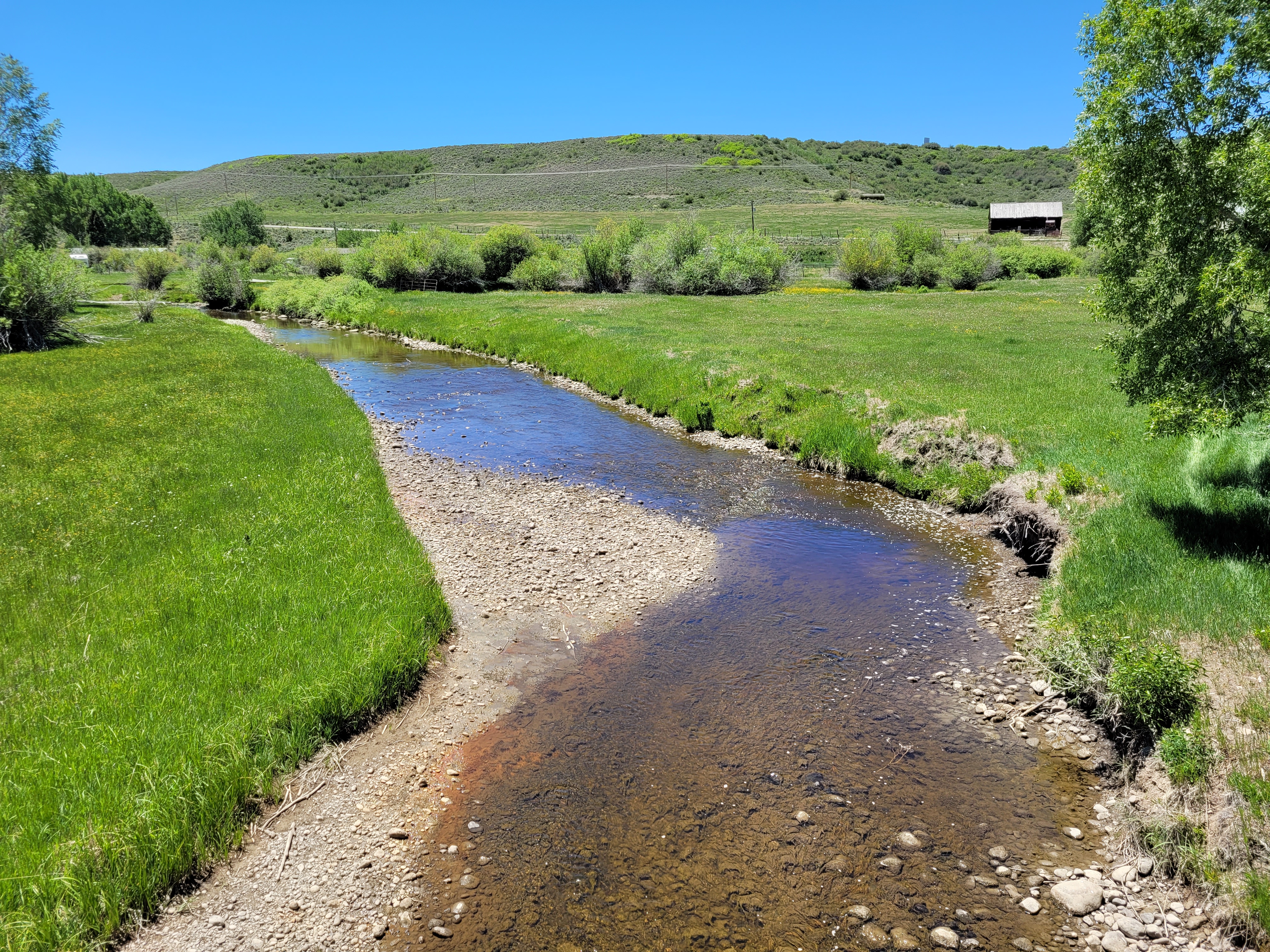
Click the link to read the article on the Steamboat Pilot & Today website (Dylan Anderson). Here’s an excerpt:
For users in the Yampa River Basin, which lacks any reservoirs controlled by the Bureau of Reclamation, Rossi said the focus needs to be on how to exist with the water that is there, not what the [Colorado River Compact] theoretically allows…
Lindsey Marlow, executive director of Friends of the Yampa, said many strategies to help with drought issues, erosion and overall river health are outlined in the newly updated Yampa Integrated Water Management Plan. Completed in September, the update involved dozens of volunteers and stakeholder groups working together for nearly four years.
“The recommendations that came out of (the management plan) were to ensure we are managing a river in balance, so that all user groups can use it effectively while keeping it healthy and sustainable,” Marlow said…
Marlow said the plan has 20 recommendations ranging from increased education for users to adding new infrastructure to the system. Recommendations include conducting a return flow study to understand the impact of water used for agriculture, securing funding to upgrade diversion structures in Routt and Moffat counties and creating a centrally located dashboard for a variety of data concerning river health, among other recommendations. Rossi pointed to a number of initiatives the Upper Yampa district is leading in the management plan, such as exploring water diversions on Coal Creek and Morrison Creek that could add water to district-owned reservoirs and installing a network of soil moisture monitors in the basin.
“I’m not too concerned with what the Bureau of Reclamation asks us to do. I’m more concerned about how can our water users survive through drying times because they’re here to stay,” Rossi said. “When it goes dry, we just don’t have anything to use.”

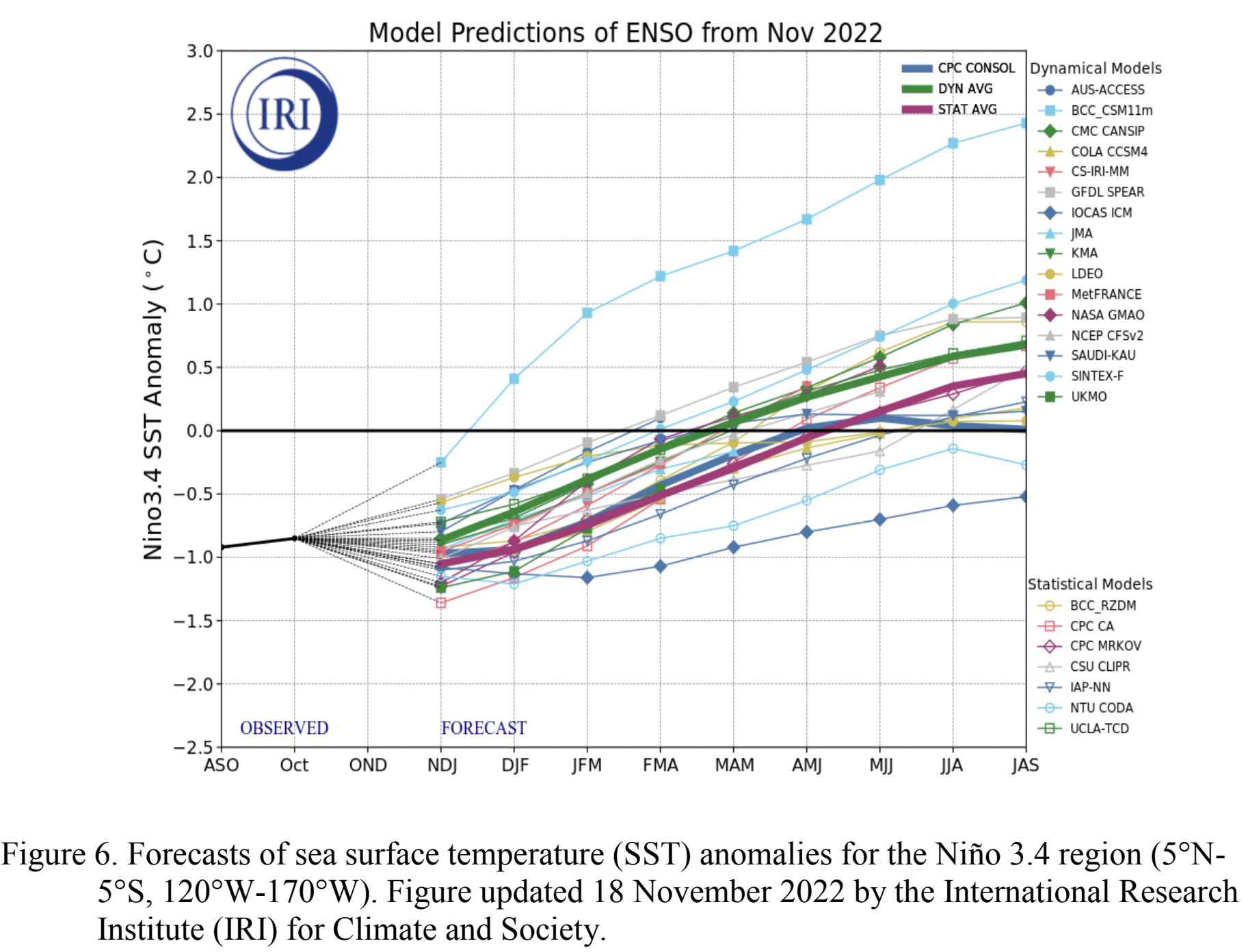
Click the link to read the discussion on the Climate Prediction Center website:
ENSO Alert System Status: La Niña Advisory
Synopsis: La Niña is expected to continue into the winter, with equal chances of La Niña
and ENSO-neutral during January-March 2023. In February-April 2023, there is a 71%
chance of ENSO-neutral.
Below-average sea surface temperatures (SSTs) persisted in the central and eastern Pacific Ocean during the past month. All of the latest weekly Niño index values were near -1.0ºC, except for the Niño-1+2 index which was at -0.5ºC. In November 2022, negative subsurface temperature anomalies weakened, reflecting an eastward expansion of the above-average subsurface temperatures in the western and central Pacific and contraction of the below-average temperatures across the eastern Pacific. Low-level easterly wind anomalies and upper-level westerly wind anomalies were evident across most of the equatorial Pacific throughout the month. The convection pattern continued to show suppressed convection over the western and central tropical Pacific and enhanced convection over Indonesia.
Overall, the coupled ocean-atmosphere system continued to reflect La Niña. The most recent IRI plume indicates that La Niña will persist into the Northern Hemisphere winter 2022-23. For the dynamical model averages, ENSO-neutral is favored in January-March 2023, while the statistical model average shows the transition to ENSO-neutral occurs in February-April 2023. The forecaster consensus, which also considers the North American Multi-Model Ensemble (NMME), is split on whether La Niña or ENSO-neutral will prevail during January-March 2023. Regardless, there is higher confidence that ENSO neutral will emerge by the Northern Hemisphere spring. In summary, La Niña is expected to continue into the winter, with equal chances of La Niña and ENSO-neutral during January March 2023. In February-April 2023, there is a 71% chance of ENSO-neutral.
.
Click the link to read the release on the Southwest Climate Adaptation Science Center website (Erin Thompson):
The newly launched Colorado River Science Wiki, created by SW CASC researchers, is now available for use by managers and other decision-makers, researchers, the media, and the broader public!
The Wiki is a web-based platform with many goals, including helping to inform discussions about the next Interim Guidelines on the Colorado River. The site summarizes and shares the most recent Colorado River research, increases visibility of the activities of the research community, and makes accessible important datasets and tools. Additionally, it is a space where contributions can be made by the community and ownership is shared, and where advances in science are given context so they have more value to non-specialists (e.g., agency staff, congressional staffers, 1st year grad students, journalists).
Information on the Wiki is organized into six sections: Science and Applications, Data and Tools, New Research, Water Law and Policy, Who’s Who, and About the River. Users can navigate through the sections with a menu on the left side, read summaries, and follow links to datasets, tools, and additional resources.
The Wiki was created by SW CASC co-investigator, Brad Udall (Colorado Water Center, Colorado State University), Julie Vano and Tanya Petach (Aspen Global Change Institute), and Jeff Lukas (Lukas Climate Research and Consulting), with funding from the SW CASC. It is still in the early stages of development and the creators welcome feedback from users to improve the site and advance communication of key Colorado River information to stakeholders.
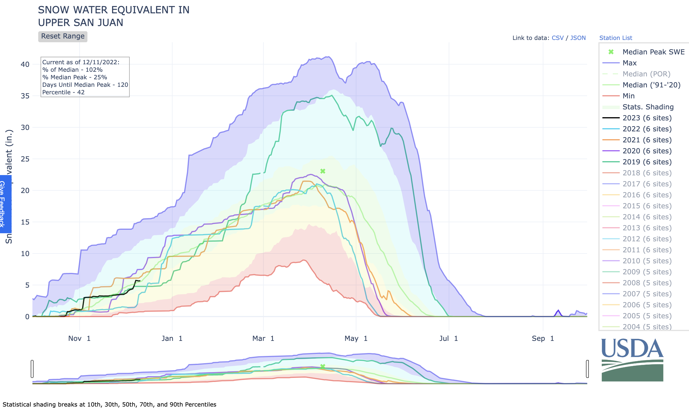
Click the link to read the article on The Pagosa Springs Sun website (Josh Pike). Here’s an excerpt:
An 8 a.m. Dec. 7 report from Wolf Creek Ski Area indicated that Wolf Creek had received 7 inches and 11 inches in the previous 48 hours, bringing the base depth to 39 inches and the season-to-date snowfall to 71 inches. The Wolf Creek summit was a 99 percent of the Dec. 7 snowpack median. The San Miguel, Dolores, Animas and San Juan river basins were 88 percent of the Dec. 7 median terms of snowpack…

River report
Stream flow for the San Juan River on Dec. 7 at approximately 1 p.m. was 84.5 cubic feet per second (cfs), according to the U.S. Geological Service (USGS) National Water Dashboard. This reading is up from last week’s reading of 59.2 cfs at 1 p.m. on Nov. 30.

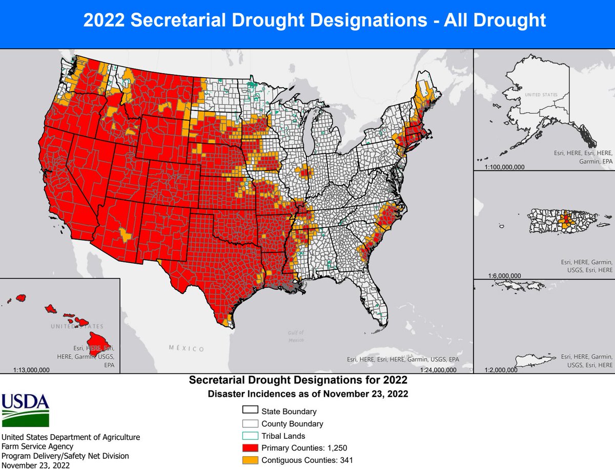
For details on the Emergency Disaster Designation and Declaration Process, please visit https://fsa.usda.gov/Assets/USDA-FSA-Public/usdafiles/FactSheets/emergency_disaster_designation_declaration_process-factsheet.pdf… #drought

Click the link to read the article on The Ark Valley Voice website (Jan Wondra). Here’s an excerpt:
CPW staff first discovered the presence of invasive zebra mussels at Highline Lake State Park on an artificial PVC substrate in the lake during routine invasive species sampling on Sept. 14. In October, during increased testing by CPW staff additional adult zebra mussels were found in Highline Lake. Zebra mussels are an invasive species in the United States…
This is the first time a body of water has been categorized as infested with zebra mussels in the state of Colorado. The discovery is an alert for water managers, fishermen, and recreationists to be on the lookout for a striped invader and to be careful not to be a human carrier.
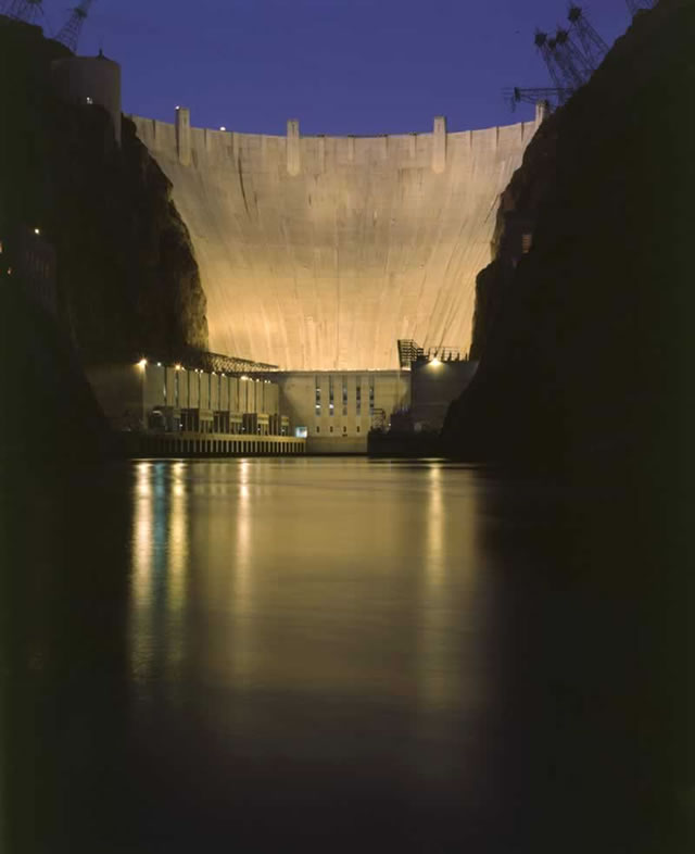
Click the link to read the article on the KOLD website (Steven Sarabia and AZFamily Digital News Staff). Here’s an excerpt:
Arizona is preparing to enter for the first time into a Tier 2A shortage for the lower Colorado River basin, with cuts beginning at the start of the new year. For the state, this means a reduction of 21% of Arizona’s Colorado river supply and about 9% of the state’s total water use, according to the Central Arizona Project. Cities that use the Colorado river will see a 3% reduction while tribal supplies will be reduced by 7%.
And for the users of CAP water, there will no longer be excess water and agriculture pools from the Colorado River. According to the Agriculture & Water Council of Arizona, it will have a big impact on farmers as they work out ways to operate with less water. Arizona Provides a good portion of the leafy greens the country, and Canada eats. In all, the Colorado River provides water to 40 million people across seven states in the American West as well as Mexico and helps feed an agricultural industry valued at $15 billion a year.
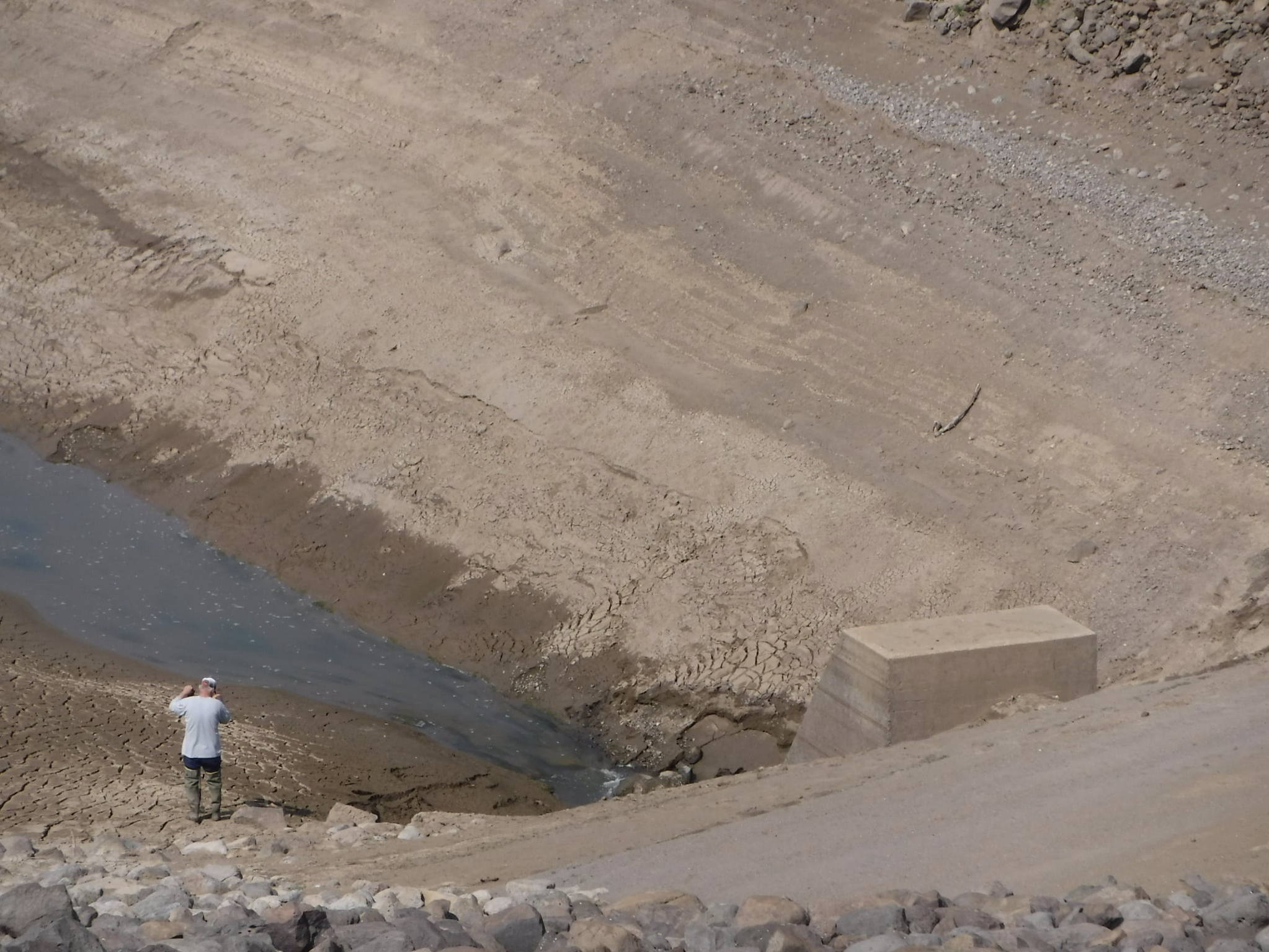
Click the link to read the article on the Steamboat Pilot & Today websire (Suzie Romig). Here’s an excerpt:
When the 75-foot dam for Stillwater Reservoir was built in 1939 by the Civilian Conservation Corps for the former Yampa Reservoirs Public Irrigation District, it was well constructed to meet engineering standards at the time. But by today’s standards, the dam’s abutments would be addressed differently, said Dana Miller, dam safety engineer with the Colorado Division of Water Resources in Steamboat Springs. As a result, the aging dam infrastructure needs expensive upgrades to bring the structure up to current safety standards, Miller said. Since it was constructed, the dam at approximately 10,300 feet elevation has experienced consistent seepage issues where the sides of the dam abut the hillsides. If not addressed, the seepage could eventually lead to a failure of the dam, Miller explained. Although the seepage has been worked on through the years with minimal results, lasting improvements could cost millions, according to the owner Bear River Reservoir Co. The reservoir water is owned by 18 agricultural shareholders and the town of Yampa, and those southern Routt County hay growers have been affected financially due to lower water storage allowances, plus years of drought.
The Stillwater Reservoir was placed on a fill restriction by the state in June 2019 and currently is limited to approximately 80% capacity, which the water storage level may reach during wetter years. The structure is classified as a high-hazard dam, which is not based on its condition but because “loss of life and significant damage is expected downstream if the dam were to fail,” Miller explained. The 129-acre reservoir, which is also known for the trailhead to popular Devil’s Causeway hike, was drained to a small dead pool in August 2021 for inspections of the upstream side of the reservoir outlet gates. The reservoir was drained again in October for work on the hydraulic operating system, said Andi Schaffner, secretary for Bear River Reservoir Co. Yampa resident Schaffner said the owners of the private, nonprofit reservoir company have contributed more than $100,000 to help with dam issues in the past 11 years, and total upgrades to the hydraulics are predicted to cost $300,000.
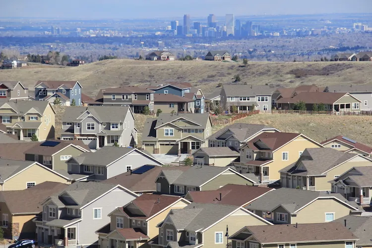
Click the link to read the article on the 9News.com website (Cory Reppenhagen). Here’s an excerpt:
The study includes a scientific survey of 1,024 Colorado residents conducted by the Rasmussen research group. It focuses on several environmental issues, including water. Citing increased traffic, the loss of open space, and a strain on the water supply, 75% of Coloradans surveyed said urban sprawl, which is the encroachment of cities into natural space and agricultural space, is making Colorado a worse place to live.
Kolankiewicz said urban sprawl damages natural waterways, takes water away from agriculture and reduces the supply of water. Of those surveyed, 70% said water should not be diverted away from agriculture in favor of supporting further urban development. And 76% said water should be kept in streams to support wildlife.
Rebecca Mitchell, Director of the Colorado Water Conservation Board, said even with a stable or reduced population, there still may not be enough water because of a 20-plus-year mega-drought in the West.
“We don’t fight with Mother Nature; we dance with her, and we embrace her. And I think how we do that is by living within what she provides,” she said.
Click the link to read the article on the KJZZ webiste (Al Macias). Here’s an excerpt:
This small stretch of the river winds through part of the Cocopah Reservation near Yuma. It’s the last tribal land the river touches before it flows into Mexico. For hundreds of years, the river provided food and other resources to the Cocopah and other river tribes. In the 19th century, the river was hundreds of yards across and steamboats ran up and down the river ferrying supplies. Now the river is a few feet across.

But major change began to take shape in the early 1900s, when the first dam was added. More than a century later, development and an extensive system of 15 dams has changed the river and the people who depended on it. Here on the Cocopah reservation, the landscape changed as well with invasive plant species choking out native cottonwoods, mesquites and other trees. Back in June as this, heavy equipment began ripping out seven acres of invasive plants called phragmites.

Jen Alspach is the director of the Cocopah Environmental Protection Office.
“The goal of this project was to bring back those native plants and create a very special place where they can gather and you know reconnect with the river,” Alspach said.
After the seven acres were cleared, a thousand cottonwoods, willows and mesquites were planted.
Click the link to go to the Aspen Global Change Institute website (Julie Vano and Jeff Lukas):
This User Guide is designed to help planners, policymakers, and communities navigate this often confusing information landscape and acquire information most suitable for their needs. While focused on the U.S. Mountain West, much of the information in the User Guide is transferable to other regions too.
Please share this User Guide with your networks and others who might benefit from this free resource…
This User Guide was made possible through NOAA Sectoral Applications Research program funding. We gratefully acknowledge the tremendous work that went into the climate resources this Guide addresses, and appreciate the valuable feedback we received from so many in the research and management communities.

Click the link to read the article on the Water Education Foundation website (Nick Cahill):
Chorus of experts warn climate change has rendered old assumptions outdated about what the Colorado River can provide, leaving painful water cuts as the only way forward
When the Colorado River Compact was signed 100 years ago, the negotiators for seven Western states bet that the river they were dividing would have ample water to meet everyone’s needs – even those not seated around the table.
A century later, it’s clear the water they bet on is not there. More than two decades of drought, lake evaporation and overuse of water have nearly drained the river’s two anchor reservoirs, Lake Powell on the Arizona-Utah border and Lake Mead near Las Vegas. Climate change is rendering the basin drier, shrinking spring runoff that’s vital for river flows, farms, tribes and cities across the basin – and essential for refilling reservoirs.
The states that endorsed the Colorado River Compact in 1922 – and the tribes and nation of Mexico that were excluded from the table – are now straining to find, and perhaps more importantly accept, solutions on a river that may offer just half of the water that the Compact assumed would be available. And not only are solutions not coming easily, the relationships essential for compromise are getting more frayed.
With the Compact’s shortcomings and the effects of climate change and aridification becoming as clear as the bathtub ring around Lake Mead, previous assumptions of how much water the river can provide and the rules governing how it gets divvyed up must be revised to reflect the West’s new hydrology. One thing is certain among experts and Colorado River veterans: Water cuts are in the short-term and long-term forecast for major cities such as Los Angeles, Las Vegas and Phoenix, as well as farmers from Colorado’s West Slope to growers in California’s Imperial Valley near the Mexican border.
“You don’t have any other arrow in your quiver right now except to reduce use,” Pat Mulroy, former general manager of the Southern Nevada Water Authority, told a gathering of Colorado River water interests this fall. “There are no other arrows.”
The River’s Changing Math
Predicting the amount of water the Colorado River can provide in a given year has always been a challenge. The river’s flow is famously erratic, dictated by the size of the often-fickle Rocky Mountain snowpack and other variables such as soil moisture and changes in temperature.
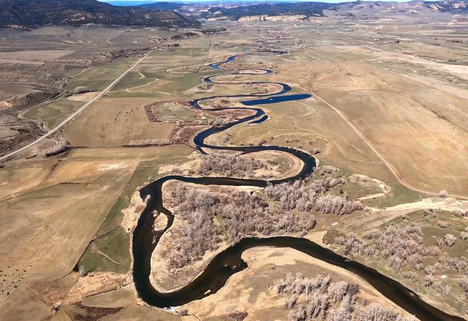
The old expectations of the Compact signers is giving way to a new reality on the river. Over the last century, the river’s flows in the Upper Basin have dropped by 20 percent. Scientists have pinned warming temperatures as the main cause of the disappearing flows and predict the trend will worsen as the Upper Basin, source of most of the river’s water, becomes even hotter and drier.
Water users have been able to counter previous dry spells by relying on the river’s main reservoirs. But after more than two decades of drought, both Lake Mead and Lake Powell are only about one-quarter full. The reservoirs’ rapid declines have forced the Bureau of Reclamation to order unprecedented water cuts to Arizona and Nevada. Mexico is taking similar cuts under binational agreements. And Reclamation has warned more severe actions are needed to prevent the collapse of the Colorado River system.
The Compact signatories, relying on data from a small but abnormally wet time period, estimated the river’s annual average natural flow in the Upper Basin to be about 18 million acre-feet. The figure, they asserted, was enough to cover 7.5 million acre-feet of water in perpetuity for the Upper Basin states of Colorado, New Mexico, Utah and Wyoming, and 7.5 million acre-feet for the Lower Basin states of Arizona, Nevada and California. They also agreed that any water committed to Mexico would be supplied equally by the two Basins. Native American tribes, who now legally hold substantial rights to the river’s water, were barely mentioned.
Brad Udall, Colorado State University climate researcher, said it’s becoming harder and harder for the river to meet the promises outlined in the Compact and the accompanying set of agreements, laws and court cases referred to as the Law of the River. He warned dozens of water managers and policy experts at a recent Water Education Foundation Symposium that climate change caused by greenhouse gas emissions is rapidly and permanently shifting precipitation trends in the Basin.
“It’s not a drought, it’s not temporary, it’s aridification,” said Udall. “Additional 1 degree Celsius or more warming by 2050, Lee Ferry flows in 9 million acre-feet are possible. Every important trend line [is] heading in the wrong direction, notably our reservoirs, but all the science trends as well.” [ed. emphasis mine]
Data from recent decades shows it’s becoming uncommon for the river to meet the benchmark used to craft the Compact. Estimated annual flows at Lee Ferry, a key dividing point between the Colorado River’s Upper and Lower Basins, have surpassed 18 million acre-feet just four times since 1991, while the river’s average flow since 2000 has been 12.3 million acre-feet.
“If we’re taking out more than comes in, it is really simple math that the reservoirs are going to continue to decline,” said Rebecca Mitchell, director of the Colorado Water Conservation Board, the state’s water management agency.
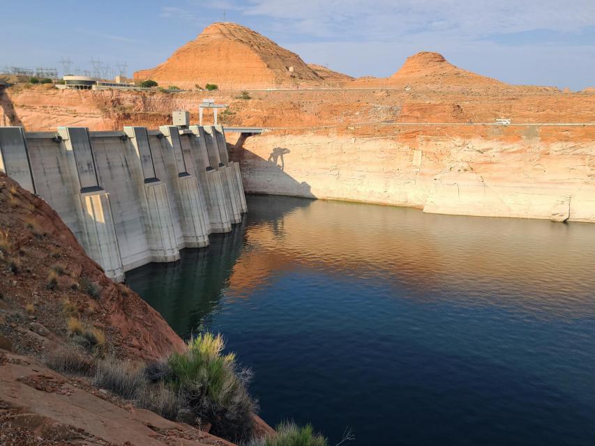
Mitchell was among nearly 200 state and regional water managers, farmers, tribal leaders and other water interests from the seven Basin states, along with key federal and Mexican officials, who attended the Foundation’s biennial Colorado River Symposium in late September to mark the Compact’s 100th anniversary and to discuss the risks and challenges ahead for the iconic Southwestern river.
Discussions were sometimes sobering and sometimes tense, underscoring the growing risks to a river depended upon for drinking water by 40 million people and for irrigation of more than 4 million farmland acres across the Basin. An undercurrent of the discussions was whether Basin interests can avoid taking their differences to court – a prime motivation behind creating the 1922 Compact. Despite the occasional sharply worded airing of differences between Upper and Lower Basin interests, there was broad acknowledgement that action is needed to keep the river system functioning.
Reclamation Commissioner Camille Calimlim Touton was among those urging water interests throughout the Basin to continue working collaboratively toward solutions and she provided a broad outline of actions that federal officials are preparing to take in 2023 – including reducing water releases from Lake Powell and Lake Mead – to keep the river from crashing.
“The actions we choose to take over the next two years,” Touton told participants, “will define the fate of the Colorado River for the next century.”
Living Within New Means
Though the Colorado River’s annual yield has shrunk in the 21st century, demand for its diminishing supply hasn’t, creating a glaring math problem for Basin water managers. In a system where every drop of water is already allocated, the specter of an 11 million acre-foot river — or worse — is forcing users to prepare for a drier future.
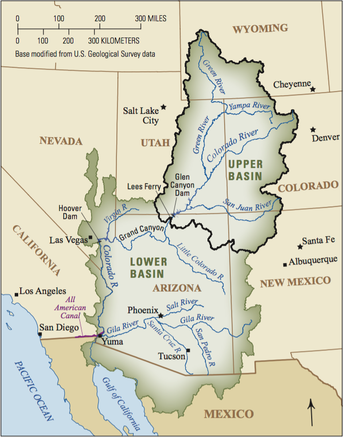
One agency that has been actively finding ways to stretch its river supply is Southern Nevada Water Authority, which serves more than 2 million people in the Las Vegas area. The agency has updated its modeling and long-range planning to reflect the river’s changing hydrology.
John Entsminger, the authority’s general manager, said computer models are sending a direct warning that the Lower Basin will end up with only a slice of the 7.5 million acre-feet per year outlined in the Compact. After accounting for evaporation and system losses, he said, it’s probable the Lower Basin and Mexico will have much less water to split.
“It is incumbent upon the Lower Basin to come up with a plan to live within its 7 million acre-feet release from Lake Powell probably forever going forward and hope it’s not less than that,” said Entsminger.
Like Nevada, Arizona is already feeling the pinch from the latest round of federal water cuts. So far, the two states and Mexico have shouldered most of the pain.
In 2022, Arizona is using approximately 2 million of its 2.8 million acre-feet Colorado River allocation, according to state officials The state’s agricultural industry is taking the hardest hit, including one rural county that fallowed more than 50 percent of its farmland for lack of irrigation water.
“We’re already seeing huge pain, and with an 11 million acre-feet [river] that pain’s just going to continue to grow,” said Tom Buschatzke, Arizona Department of Water Resources director.
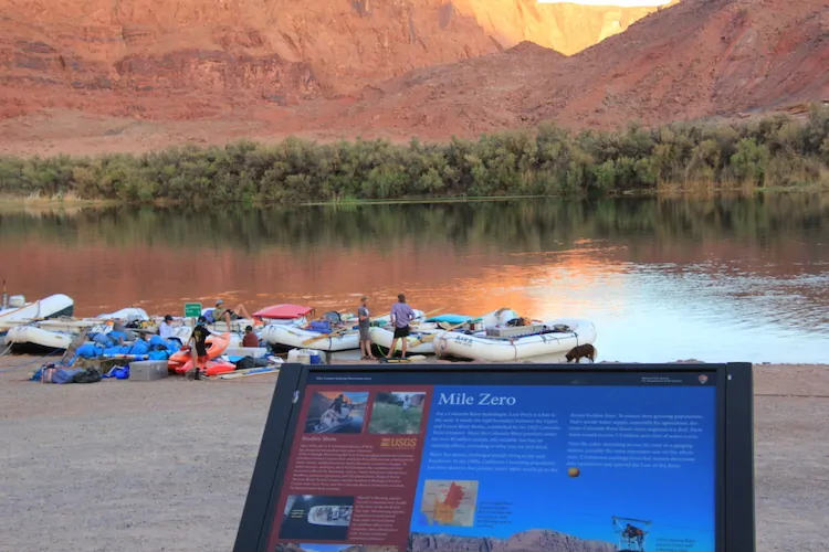
The widening gap between supply and demand is also having an impact above Lee Ferry, where inflows into Lake Powell continue to fall below historical average. Water from Powell is critical for helping the Upper Basin meet its commitment under the 1922 Compact to deliver water to the Lower Basin.
Representatives from the Upper Basin states say they have collectively cut their annual consumptive river use from 4.5 million acre-feet to approximately 3.5 million acre-feet over the last three years. Over the same period, they argue, the Lower Basin has done little to reduce its own consumptive use. Similar to Arizona, Upper Basin farmers also have been on the receiving end of water cuts.
The Ute Mountain Ute Tribe has fallowed the majority of its farmland in southwestern Colorado while in Wyoming, more than 100,000 acres of farmland were cut off from surface water for most of August because of low stream flows in the Upper Basin.
“That equates to about 100,000 acre-feet of [diverted Colorado River water] a month…that’s a third of our average irrigated use,” said Brandon Gebhart, Wyoming State Engineer.
The Upper Basin states have proposed a five-point plan built around paying farmers to reduce water consumption. Though it doesn’t require mandatory cuts for water users, proponents say the success of the plan hinges on whether the Lower Basin agrees to leave more water in Lake Mead.
“I think we need to recognize that the uses are far outweighing what Mother Nature is providing and that is primarily not in the Upper Basin,” said Mitchell with the Colorado Water Conservation Board.
California In the Spotlight
California’s use of the river has been a sore point among others in the Colorado River Basin. California, the largest user of Colorado River water, has been spared from water cuts so far due to its senior priority rights and has been using its full 4.4 million acre-feet entitlement in 2022. Groups in both the Upper and Lower Basins say the state must significantly reduce its use to prevent the river system’s collapse.
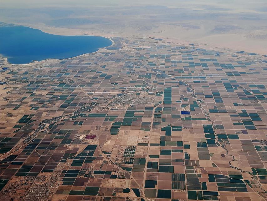
California water agencies and state officials have pushed back on criticism that they aren’t doing enough to help buoy the shrinking reservoirs.
Peter Nelson, chairman of the Colorado River Board of California, argued California delayed the current crisis by enacting voluntary deals that pay farmers not to plant their fields, transfer water to urban users or make their systems more water efficient.
“In the Lower Basin, since the last seven years or so, we’ve stored 1.5 million acre-feet of water in Lake Mead as Intentionally Created Surplus water,” said Nelson, who farms in the Coachella Valley. “That has enabled the lake levels at Lake Mead to stay high enough to stay out of shortages and benefit other states in the Basin.”
Though the state is using its full share amid another bitterly dry year on the Colorado River, California water managers say they are not dismissing the fact that the river is overprescribed and that future cuts are needed. But they warn that the state’s farmers shouldn’t be made the scapegoat for all the Basin’s water problems.
For example, cutting off water to farmers in the Imperial Valley may help solve one crisis but simultaneously cause another, said Henry Martinez, general manager of the Imperial Irrigation District. Agriculture overwhelmingly drives Imperial County’s economy, he said, so fallowing would lead to major job losses in a region already prone to high poverty and unemployment rates.
“You can devastate the whole industry by making the wrong cutbacks at the wrong time. There has to be consideration also as to how to prop up or maintain the economy of the region, otherwise you go from a very poor area to devastating even furthermore the economy,” said Martinez.
In response to Reclamation’s call this summer for river users to voluntarily conserve 2 million to 4 million acre-feet of water in 2023 to protect Lake Mead and Lake Powell, Imperial Irrigation District and other California agencies on Oct. 5 proposed a plan that would save 400,000 acre-feet — 9 percent of California’s river allocation — each year between 2023 and 2026.
Earlier this month, the Department of the Interior approved the deal, committing $250 million from the Inflation Reduction Act to kickstart the conservation plan and support Salton Sea restoration efforts. As a result of water conservation efforts and a long-term transfer of farm water from the Imperial Valley to urban San Diego, the sea has been shrinking, exposing more lakeshore to winds that blow hazardous, lung-choking dust into the region.
California’s offer has received mixed reviews throughout the Basin: Some have applauded the proposal and called it an encouraging first step from the river’s biggest user, but others have cast it as an underwhelming opening gambit.
Wade Crowfoot, California Natural Resources Agency Secretary, said the Basin must continue negotiating and taking advantage of federal aid earmarked for Western drought relief to spur water conservation.
“As challenging and as tense as this is, I think that there’s a real opportunity and that failure is not an option,” said Crowfoot. “Everybody understands we have to figure this out and we have some resources at our disposal.”
“We can’t be caught flat-footed.”
In June, Reclamation Commissioner Touton told a U.S. Senate panel that unless an emergency conservation deal was reached by river users in 60 days, the federal government would have to take unilateral action to prevent the system’s demise.
In response to Reclamation’s call this summer for river users to voluntarily conserve 2 million to 4 million acre-feet of water in 2023 to protect Lake Mead and Lake Powell, Imperial Irrigation District and other California agencies on Oct. 5 proposed a plan that would save 400,000 acre-feet — 9 percent of California’s river allocation — each year between 2023 and 2026.
Earlier this month, the Department of the Interior approved the deal, committing $250 million from the Inflation Reduction Act to kickstart the conservation plan and support Salton Sea restoration efforts. As a result of water conservation efforts and a long-term transfer of farm water from the Imperial Valley to urban San Diego, the sea has been shrinking, exposing more lakeshore to winds that blow hazardous, lung-choking dust into the region.
California’s offer has received mixed reviews throughout the Basin: Some have applauded the proposal and called it an encouraging first step from the river’s biggest user, but others have cast it as an underwhelming opening gambit.
Wade Crowfoot, California Natural Resources Agency Secretary, said the Basin must continue negotiating and taking advantage of federal aid earmarked for Western drought relief to spur water conservation.
“As challenging and as tense as this is, I think that there’s a real opportunity and that failure is not an option,” said Crowfoot. “Everybody understands we have to figure this out and we have some resources at our disposal.”
“We can’t be caught flat-footed.”
In June, Reclamation Commissioner Touton told a U.S. Senate panel that unless an emergency conservation deal was reached by river users in 60 days, the federal government would have to take unilateral action to prevent the system’s demise.

But the deadline passed without a deal and there was no immediate federal response, causing water users to wonder whether repercussions were coming. With little progress on a watershed-wide conservation plan, some Colorado River veterans contend the federal government should take a direct role in facilitating negotiations.
“I think Reclamation is going to have to get some key players in the room, probably including Mexico, and really get down to the brass tacks of leveraging and what needs to be done,” said Tom Davis, general manager of the Yuma County Water Users’ Association. “We need to save this patient’s life in the next 24-36 months.”
Touton’s demand that the Basin states cut 2 million to 4 million acre-feet caught them off guard, said Bruce Babbitt, former Interior secretary and Arizona governor. Since the announcement, Babbitt said, the states have essentially been “stumbling around” in the absence of a well-defined negotiation framework.
Babbitt likened the current situation to the one 100 years ago, when the states’ negotiations on how to split the Colorado River had also stalled before President Warren Harding tapped Herbert Hoover to guide the talks. Babbitt told the September symposium there are important lessons to be taken from the structured discussions at Bishop’s Lodge, just outside of Santa Fe, N.M., that ultimately led to the formulation of the 1922 Compact.
“What finally emerged out of that in terms of process at Bishop’s Lodge is something that I think we need to reflect on because we’re going to have to put together a workable framework,” Babbitt added.
Federal officials contend there isn’t a leadership void.
David Palumbo, Reclamation’s deputy commissioner of operations, said Reclamation is preparing a suite of actions — including reducing releases from Lake Powell in 2023 — to prevent a scenario where water can’t flow out of the system’s main dams.
“If we need to release less than 7 million acre-feet [from Glen Canyon Dam] … if that hydrology is not there, we’re going to have to do something to avoid the crash and we’re going to be prepared to do that,” said Palumbo. “We can’t be caught flat-footed.”
With talks between the states and tribes at a standstill, Interior Secretary Deb Haaland on Oct. 28 announced the federal government is considering deviating from operating rules established in 2007 and 2019 to handle water shortages on the river.
During recent public briefings, federal officials have indicated that Lake Powell releases may be slashed by 2 to 3 million acre-feet annually to keep the reservoir from reaching a point where it could no longer generate electricity or deliver water downstream.
Meanwhile, Reclamation is now offering Lower Basin water users up to $400 per acre-foot of conserved water over the next three years, part of the $4 billion in drought relief funding secured through the Inflation Reduction Act. In addition, at least $500 million will be reserved for water conservation and efficiency projects in the Upper Basin.
Some Colorado River veterans, including Colby Pellegrino, deputy general manager of resources for the Southern Nevada Water Authority, are urging Reclamation to focus the federal drought relief on actions that will not just temporarily halt Lake Mead’s decline, but permanently change water use habits.
“We should be using that money to fundamentally change the way we do everything in this Basin to use the least amount of water possible,” she said.
Considering the scope of the damaging economic, social and ecosystem impacts that would flood the Basin if Lake Mead or Lake Powell were to reach dead pool, others argue Congress should get more involved. One idea, outlined in a policy paper presented at the Symposium by the Foundation’s 2022 Colorado River Water Leaders class, is a biennial program that would provide federal funding for programs that would reduce system demand and encourage more frequent discussions between the states, tribes and other water users in the Basin.
Congress has enacted similar regional programs in recent decades, including in the Florida Everglades, the Chesapeake Bay and the Great Lakes. A stable source of federal funding can create permanent, multi-benefit solutions, said Brenda Burman, former Reclamation commissioner who will take over as general manager of the Central Arizona Project in 2023.
“Whether it’s biennial or yearly, I think we need to be looking at a Colorado River Basin program,” she said.
Tribes Gain a Say
Unlike previous deals, the federal government and states say they are committed to figuring out how to share Colorado River water while acknowledging the sovereignty and water needs of Native American tribes.
Many Basin tribes, which hold legal rights to about a quarter of the river’s water, are hoping to upgrade their infrastructure and fully develop their water rights. As the tribes assert their water rights, the amount of water available to states with junior rights like Arizona or Nevada may shrink. After fighting legal battles to secure their rights to the river — 12 Basin tribes still have unresolved water rights claims — tribes aren’t eager to halt the progress they’ve made in bringing water to their communities and farms.
Lorelei Cloud, a member of the Southern Ute Indian Tribe’s tribal council, said the tribe’s unused river water simply flows by its Colorado reservation to be used by others downstream. She reiterated that unused tribal water, which gets treated as “surplus water”, is a vanishing luxury the rest of the Basin won’t soon be able to bank on.
“Tribes don’t get compensated and have never been compensated for our unused tribal water, especially the water that’s sitting in Lake Powell and Lake Mead,” said Cloud.
Decrepit water infrastructure among other issues prevents the Southern Ute from being able to use its full river allocation as it is, so Cloud added that the tribe is unlikely to cut back its water use even if the river continues to shrink.
“When tribes start to develop their water, what are you all going to do?” Cloud asked the Symposium crowd. “Because that water is ours. We’re in Colorado, so we’re going to get our water first.”
While the tribes have been historically excluded from and considered an afterthought in Colorado River negotiations, there are signs that the balance of decision-making power is shifting. Congress is providing billions of dollars in funding in the Bipartisan Infrastructure Law and the Inflation Reduction Act to help tribes across the country improve their drinking water and water delivery systems.
At the September Symposium, both federal and state officials echoed the need for tribes to be included at the bargaining table.
“Tribes across the Basin will also continue to play a vital role,” said Interior Secretary Haaland, the first Native American to serve as a cabinet secretary. “Indian tribes have water rights, and not only are they deeply affected by the drought, but they have been and will be invaluable partners in finding solutions.”
Other Challenges
Before considering any major changes to the river’s guiding principles, water managers will have to ensure that the country of Mexico is included in the process.
Mexico, already dealing with water shortages in several of its northern cities, is taking cuts to its river supply in 2022 and 2023 under binational agreements. Tensions over sharing the Colorado River have traditionally waxed and waned but the neighboring countries have been able to reach a series of water management agreements in recent decades.
Members of the International Boundary and Water Commission (IBWC), which oversees boundary and water issues between the U.S. and Mexico, said they are confident the two countries can continue communicating and building on previous partnerships.
“I feel that we’re going to go very far and be able to identify what we need to solve the issues along the U.S.-Mexico border,” said Maria-Elena Giner, the U.S. commissioner to the IBWC.
Thus far, talks regarding the river’s future have focused on limiting impacts to cities, farms and tribes. But reserving enough water to ensure the Basin’s fish and wildlife survive the drought is another thorny task water managers are wrangling with.
Environmental groups and other nongovernment organizations argue they are key river partners that can bring myriad resources and ideas to the brainstorming process.
“When the system is not sustainable, it’s not resilient and the environment loses. It’s the one that gets sacrificed first,” said Taylor Hawes, The Nature Conservancy’s Colorado River program director. “Finding solutions that do not sacrifice the environment, that do not look at the environment as a sacrificial lamb, need to be part of our collective path forward.”
Meanwhile, new rules that would require Lower Basin users to account for water lost in large reservoirs to evaporation or leaky water delivery infrastructure are in the works. Currently, Upper Basin states are charged for evaporation losses but the Lower Basin is not.
Federal officials estimate as much as 10 percent of the river’s flow evaporates annually, including more than 1 million acre-feet from the Lower Basin. The federal government has announced it may change the evaporation accounting practices by the end of 2024, meaning the Lower Basin could take a significant cut to its share.
“In these serious times, we need to take the overdue step of assessing how to account for those losses throughout the Basin. This is another tough reality that we must work together to address,” Haaland said.
As water managers attempt to navigate the river’s mounting crises, they can turn to a variety of recent success stories for inspiration.

Cities such as Phoenix, Los Angeles and Las Vegas have shown the ability to decouple water demand from population growth. Restoration efforts at the long-neglected Salton Sea are producing positive results. An innovative water sharing deal is providing economic benefits to the Jicarilla Apache Nation as well as water security for New Mexico and increased river flows for endangered species of fish.
These beneficial programs and decisions — in a refreshing twist from a river history dominated by men — are being crafted with the input of women in high-ranking positions, creating hope on a river in dire straits.
Instead of court battles that could lead to a federal judge taking over management of the Colorado River, water users need to negotiate with open minds as they chart a path for the lifeline that means so much to so many, said Mulroy, former head of the Southern Nevada Water Authority. To cut through the paralysis that has bogged down negotiations, everyone will have to show the courage to deviate from old agreements and assumptions and prepare for cuts.
“We’re talking about a body of law and a structure we’ve lived with predicated on 17 to 18 million acre-feet,” Mulroy said, “and a reality that has 9 to 11 million acre-feet in the river – the two don’t mesh.”
Click the link to read the article on the Denver Water website (Cathy Proctor):
Three years after it started, Denver Water’s Lead Reduction Program is getting a big boost from more than $76 million in federal funding.
The funding will help fast-track the program, replacing thousands more old, customer-owned lead service lines in the next few years than had been originally anticipated.
The state approved allocation of funds to Denver Water in October, and the Denver Board of Water Commissioners formally accepted the funds Dec. 7.
The money will be spent in 2023 through 2025 and is expected to replace up to 7,600 lead service lines, shortening the 15-year program by 1.5 years. Thanks to the new funding, between 3,000 and 5,000 additional lines will be replaced in 2023 — on top of the nearly 5,000 lines already planned for replacement next year.
Since the program started in January 2020, Denver Water has replaced more than 15,000 lead service lines. The lead lines are replaced with lead-free, copper lines at no direct cost to the customer.
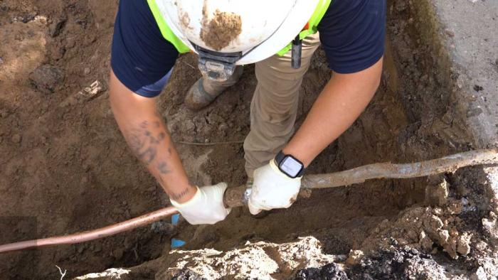
“This infusion of federal money means we will be able to replace thousands more customer-owned lead service lines at a faster pace than we had originally planned, and ultimately shorten the length of the biggest public health initiative in Denver Water’s history. This groundbreaking program is supported by all our customers across our service area,” said Jim Lochhead, Denver Water’s CEO/Manager.
“Removing these lines is the most effective way to eliminate this source of lead exposure, and we are committed to this program until every lead service line has been removed. We’re grateful for the opportunity provided by this funding.”
The water Denver Water delivers to customers is lead-free, but lead can get into the water as it passes through a customer’s internal plumbing or water service line that contains lead. The service line is the small pipe that connects to Denver Water’s pipe in the street and carries water to the customer’s home. Lead can cause serious health problems if too much enters the body, whether from drinking water or other sources.
Denver Water’s groundbreaking Lead Reduction Program aims to replace nearly 5,000 customer-owned lead service lines every year. When the program started, Denver Water estimated there were between 64,000 and 84,000 lead service lines in its service area and expected it would take 15 years to remove them all.
The addition of federal money will help Denver Water exceed its annual target in 2023 by an extra 3,000 to 5,000 lines. For every 4,500 additional lead service lines replaced using the federal funding, the overall length of the program will be one year shorter.
Replacement work will take place in parts of many neighborhoods across Denver in 2023, including Baker, Globeville, Sunnyside, Barnum West, Athmar Park and Capitol Hill.
An initial map of the 2023 replacement work areas is available at denverwater.org/Pipes. The replacement work prioritizes areas with vulnerable, at-risk populations and disproportionately impacted communities while also taking into account planned construction activities, schools and child care centers.
Lead was a commonly used material for water service lines across the U.S. through the mid-1900s and is frequently found in Denver homes built before 1951.
The replacement work is done by contractors through the Lead Reduction Program and by Denver Water crews, who replace any lead service line found during scheduled pipe replacements or during repair work on a broken water main.
In total, Denver Water was approved for $76,123,628 from the Colorado Drinking Water State Revolving Fund, which will receive money from the federal bipartisan Infrastructure Investment and Jobs Act signed into law by President Joe Biden in November 2021. The funding Denver Water received is a low-interest loan that the utility will repay, with $40 million of the loan’s principle forgiven immediately as allowed by the legislation.
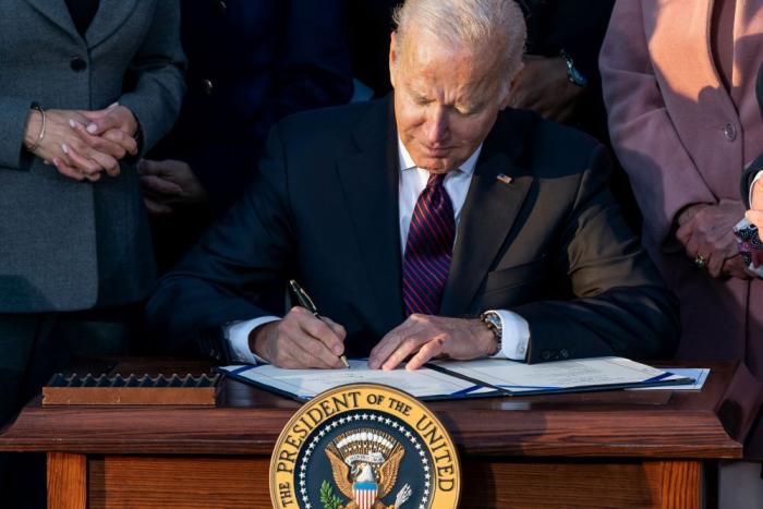
The state will receive federal funding from the Environmental Protection Agency to address lead in drinking water every year for five years, beginning in 2022. Denver Water intends to apply for funds in the future and, if approved, will be able to accelerate the replacement program even more.
The EPA also has approved a continuation of the Lead Reduction Program, via a variance from the federal Safe Drinking Water Act, following a review of the progress made in its first three years.
“Denver Water’s approach to tackling lead in drinking water has been remarkable and an example for other communities across the country,” said EPA Regional Administrator KC Becker, in an announcement.
“Thanks to new funding from the Bipartisan Infrastructure Law the utility’s customers can expect an even faster lead service line replacement schedule delivering health protections for children and adults across the Denver area.”
Lochhead thanked EPA and Denver Water’s community partners for working with the utility to ensure the successful implementation of the program.
“Denver Water’s first priority is sustaining our communities by protecting the health of our customers,” Lochhead said.
In addition to the installation of a new, lead-free, copper water service line at no direct cost, customers enrolled in the program also receive water pitchers and filters certified to remove lead.
Filtered water should be used for cooking, drinking and preparing infant formula until six months after the lead service line is replaced. The utility also has changed the water chemistry, raising the pH of the water it delivers, to better protect customers from the risk of lead.
This has been a huge effort involving many areas of Denver Water, and we couldn’t have done it without the support we’ve received from our customers,” said Alexis Woodrow, who manages the Lead Reduction Program for Denver Water.
“Our customers enrolled in the program allow us into their homes to replace their old lead service lines, and they are patient with all the construction work that accompanies the replacement process. We’re also excited that in a recent survey, 83% of customers said that they use the filters we provide to filter water for cooking, drinking and preparing infant formula.”
With the federal funding, the work surrounding the replacement process will touch more homes and neighborhoods in 2023.
“We’re grateful for all the support we’ve received for this program, from our customers to our community partners and our elected officials,” Woodrow said.
“We’re all working to protect our customers now and for generations to come.”
Click the link to go to the Western Water Assessment Intermountain West Climate Dashboard:
December 7, 2022 – CO, UT, WY
Regional precipitation was a mix of above to much-above normal conditions in northern and western Utah, western Wyoming, and northwestern Colorado, and below to much-below normal conditions in eastern Utah and Wyoming, and most of Colorado. Temperatures were below normal for the entire region. Regional snowpack is near normal for a majority of Colorado and Wyoming and is slightly above to much-above normal in Utah. Regional drought has slightly expanded, with a slight expansion in Wyoming, a slight improvement in Colorado, and a very slight improvement in Utah. La Niña conditions are expected to persist through winter, but will likely return to ENSO-neutral conditions by spring. NOAA December precipitation forecasts suggest an increased probability of above normal precipitation for most of Utah and Wyoming, while probabilities for above normal, below normal, and equal chances are split for Colorado.
November precipitation was above normal (125-200% of average) throughout much of Utah, Wyoming, and northwestern Colorado, and much-above normal (200-800%) in western Utah. Precipitation was below normal (25-75%) in eastern Utah and eastern Wyoming, and was below normal to much-below normal (<25%) in Colorado. Record-wettest conditions were observed in Tooele and Box Elder Counties in Utah, and record-driest conditions were observed in Kit Carson, Cheyenne, Kiowa, Bent, and Prowers Counties in Colorado.
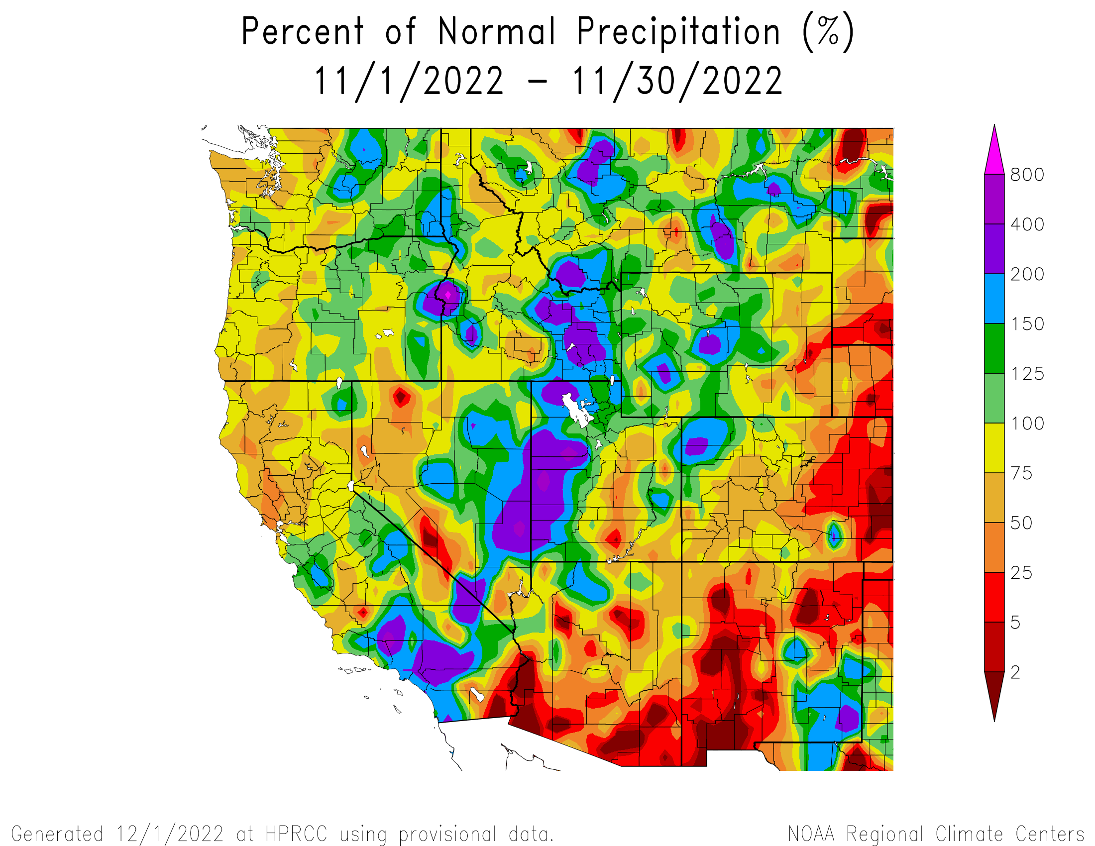

November temperatures were slightly below normal (0 to -3°F) to below normal (-3 to -9°F) for the entire region, with pockets of much-below normal temperatures (-9 to -15°F) in northwestern Wyoming and central Utah.
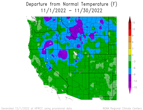
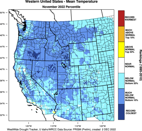
As of December 1st, snow-water equivalent (SWE) was much-above normal in northern and southwestern Utah and slightly above normal in eastern Utah. SWE was near-normal in much of northern Wyoming, above normal in parts of northern and southwestern Wyoming, and below normal in southeastern Wyoming. SWE was near-normal in northern Colorado and below normal in southern Colorado. It was the third snowiest November in Denver in the last 15 years. Most SNOTEL sites above 8,000 ft. reported 2-6” of SWE in Utah and Wyoming, and 1-4” in Colorado.

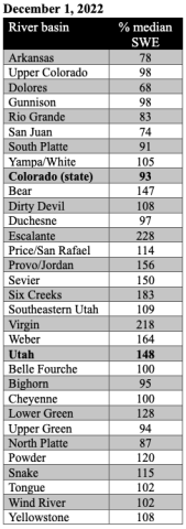
Regional drought coverage remained unchanged from October to November. Drought has been spatially consistent from October to November in our region (CO, UT, WY) with pockets of exceptional (D4) drought remaining particularly in Sanpete County in central Utah and Sedgwick and Phillips Counties in northeastern Colorado. Extreme (D3) drought has expanded to cover 6% of southeastern Wyoming and 4% of eastern Colorado. D3 drought continues to cover 50% of central Utah, although it has improved slightly. D3 drought was removed from the Green and Snake River basins in western Wyoming.
Record-low flows were observed at several locations, including the North Fork Cache La Poudre, San Juan, and White Rivers in Colorado; and the Bear, Dirty Devil, Fremont, San Rafael, and Sevier Rivers in Utah. Many sites in the region, particularly in Utah, recorded below to much-below normal November streamflows. However, there are also many sites throughout the region with normal streamflows, as well as above normal streamflows at six sites in Colorado, five in Utah, and one in Wyoming. There were a few sites that observed much-above normal streamflows, including Blue River in Colorado and Little Bighorn River in Wyoming.


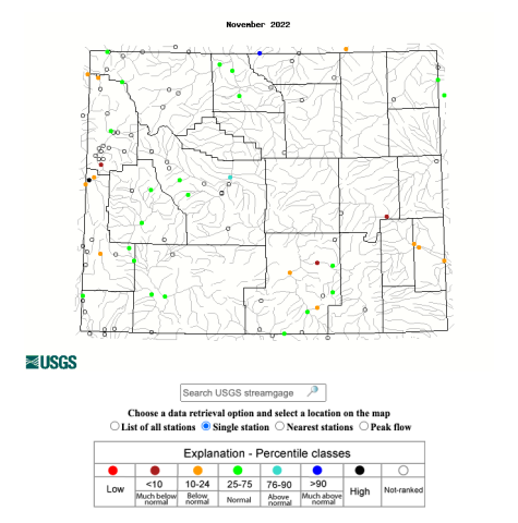
A La Niña advisory remained in place during November as below average sea surface temperature (SST) anomalies persisted in the equatorial Pacific Ocean and increased in the east-central Pacific Ocean, causing temperatures that were nearly 1°C below normal. SST models predict a 76% probability of La Niña conditions continuing through winter (December-February). However, ocean temperatures are projected to warm by the end of winter and there is a 65% probability of ENSO-neutral conditions by early spring (February-April). The NOAA monthly precipitation forecast for December indicates a 40-50% chance of above normal precipitation for western Wyoming and northern Utah, and a 33-40% chance of above normal precipitation in northwestern Colorado, central Utah from west to east, and most of eastern and central Wyoming. There is an increased probability of above normal temperatures in southern Colorado and below normal temperatures in northwestern Utah and central Wyoming from west to east. There are higher probabilities of below normal temperatures in northern Wyoming. Over this winter (December-February), the NOAA seasonal precipitation forecast predicts an increased probability of above normal precipitation in northern and central Wyoming and a 33-40% chance of below normal precipitation in southeastern Utah and southern to eastern Colorado. The seasonal temperature forecast shows a 33-40% chance of above normal temperatures in southern to western Colorado and southern to central Utah during the winter. The forecast shows a 33-40% chance of below normal temperatures in northern Wyoming this winter.
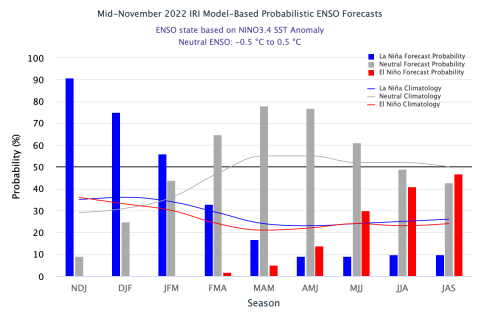
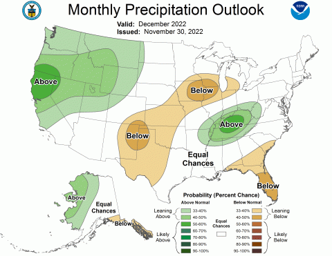
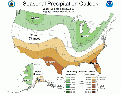

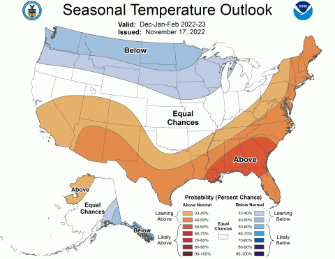
Significant November weather event: Colder than average temperatures covered the entire region with monthly temperatures ranging from 0 to -15°F below normal for the western U.S. Temperatures were coldest in northwestern Wyoming, where November temperatures were up to 8 degrees below normal in Park, Bighorn, Washakie, and Hot Springs Counties. The majority of Colorado and Wyoming experienced below normal temperatures (bottom 33rd percentile) and the majority of Utah experienced much-below normal temperatures (bottom 10th percentile). In Wyoming, Moose experienced its coldest November on record, Jackson and Lamar Ranger Station experienced their second coldest November on record, and Old Faithful and Tower Junction experienced their third coldest November on record. Denver and Salt Lake City had their coldest November since 2000 with average monthly temperatures of 35.6°F and 37.2°F, respectively. Statewide, November 2022 was Colorado’s 20th coldest November since 1895; temperatures were 3.1°F below the 20th-century average.
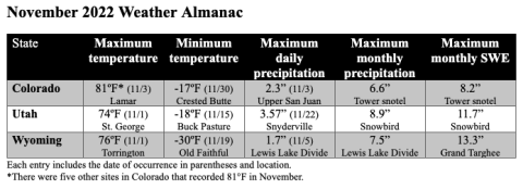
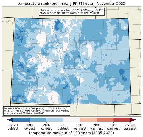

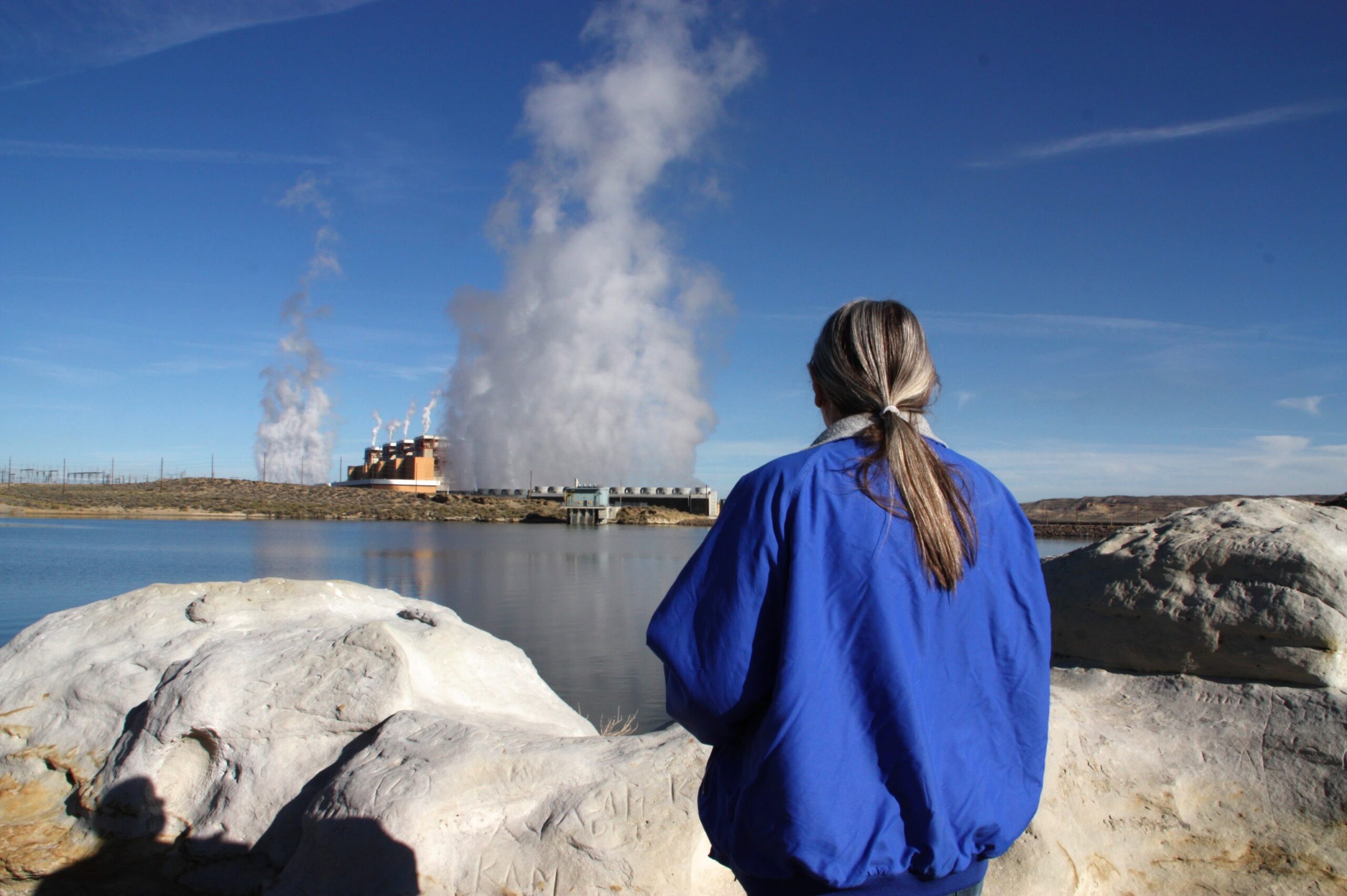
Click the link to read the article on the Inside Climate News website (Nicholas Kusnetz):
In early fall, residents of this desolate corner of southwestern Wyoming opened their mailboxes to find a glossy flyer. On the front, a truck barreled down a four-lane desert highway with a solar farm on one side and what looked like rows of shipping containers on the other. On the back was an invitation.
“CarbonCapture Inc. is launching Project Bison,” it read, announcing a “direct air capture facility” set to begin operations here next year. “Join us at our town hall event to learn more.”
Few had heard about the proposal before receiving the flyer, let alone had any idea what a direct air capture facility was. So the following week, about 150 people packed into a large classroom at Western Wyoming Community College in Rock Springs to find out.
“We are a company that takes CO2 out of the air and stores it underground,” said Patricia Loria, CarbonCapture’s vice president of business development, in opening the meeting.
Loria described a plan to deploy a series of units—the shipping container-like boxes pictured on the flyer—that would filter carbon dioxide from the air and then compress the greenhouse gas for injection underground, where it would remain permanently.
As carbon dioxide levels continue to climb, scientists, entrepreneurs and governments are increasingly determining that cutting emissions is no longer enough. In addition, they say, people will need to pull the greenhouse gas out of the atmosphere, and an emerging field of carbon removal, also called carbon dioxide removal or CDR, is attempting to do just that.
There are companies like Loria’s looking to use machines and others trying to accelerate natural carbon cycles by altering the chemistry of seawater, for example, or mixing crushed minerals into agricultural soils. These efforts remain wildly speculative and have removed hardly any of the greenhouse gas so far.
Some environmental advocates warn that carbon removal will be too expensive or too difficult and is a dangerous diversion of money and attention from the more urgent task of eliminating fossil fuels. Perhaps more troubling, they say, the various approaches could carry profound environmental impacts of their own, disrupting fragile ocean ecosystems or swallowing vast swaths of agricultural fields and open lands for the energy production needed to power the operations.
Yet even as those potential impacts remain poorly understood, the Biden administration is making a multi-billion dollar bet on carbon removal. The administration’s long-term climate strategy assumes that such approaches will account for 6 to 8 percent of the nation’s greenhouse gas reductions by 2050, equal to hundreds of millions of tons per year, and it has pushed through a series of laws to subsidize the technology.
The first investments will come from the Energy Department, which is expected to open applications within weeks for $3.5 billion in federal grants to help build “direct air capture hubs” around the country, with a particular focus on fossil fuel-dependent communities like Rock Springs, where mineral extraction is by far the largest private employer. The goal is to pair climate action with job creation.
The money has prompted a rush of carbon-removal-focused companies to fossil fuel communities, from Rock Springs to West Texas to California’s San Joaquin Valley, seeding hope from supporters that a concept long relegated to pilot plants and academic literature is on the cusp of arriving as an industry.
As Loria made her pitch, Lou Ann Varley was listening intently. Varley sits on a local labor union council and spent a 37-year career working at the Jim Bridger coal plant outside town before retiring in 2020. She knows that young workers starting at the plant today won’t be able to match her longevity there, with its four units slated to close over the next 15 years, and hoped Project Bison might offer some of them a new opportunity.
Others weren’t having it. Throughout the presentation, residents listened quietly, sitting in pairs at folding tables in the classroom. Some munched on sandwiches and cookies the company had provided. Others leaned back, arms crossed. But when it came time for questions, they launched a volley of concerns about the potential risks and unknowns.
Who was going to pay for this? Would it use hazardous chemicals? What about earthquakes from the underground injections of carbon dioxide? What would happen if the company went bankrupt, and who would be liable in the event of an accident? Wyomingites are deeply protective of their open landscapes, and many wondered about the impacts of all of the renewable energy that would be required for power.
Direct air capture machines consume tremendous amounts of energy. Project Bison, according to CarbonCapture’s figures, could eventually require anywhere from 5 to 15 terawatt hours of power per year, equal to 30 percent to 90 percent of Wyoming’s current electricity consumption, depending on whether the company can increase its efficiency.
Laura Pearson, a sheep rancher who wore heavy work clothes, was sitting in the back row that night feeling deeply skeptical of the entire premise. Pearson’s family has worked the same land for generations, and she sees the wind farms and solar panels that have started covering parts of her state as a threat to its open range.
“If you don’t think those affect wildlife and livestock grazing and everything else in this state,” she told Loria from across the room, “you’re crazy.”
Loria said the company was working with wildlife scientists and officials to minimize impacts, but Pearson was unswayed.
“I love Wyoming and I don’t want to see it change,” Pearson said after the meeting ended. She said she doubted the company’s intentions, didn’t think carbon dioxide posed such a threat to the planet and didn’t like seeing out-of-state interests, whose demands for cleaner energy have sent Wyoming’s coal sector into decline and are threatening to do the same for its oil and gas, coming to peddle something new. “It’s all about the money,” she said.
A Town With a Storied Coal History
Rock Springs was built on coal. In 1850, an Army expedition found coal seams cropping out of the valley bluffs. Less than 20 years later the Union Pacific Railroad routed the nation’s first transcontinental line through here so its locomotives could refuel as they crossed the Rockies. The mines soon snaked right under the center of town, where the outlaw Butch Cassidy once worked at a butcher shop and earned his nickname.
The rail line still bisects the town, although the old station has been converted into the Coal Train Coffee Depot cafe. A large sign arcs above the tracks outside: “Home of Rock Springs Coal, Welcome.” A stone monument next to the depot lists everyone who died in the mines each year, coming by the dozen in the early 1900s, with names like Fogliatti, Mihajlovic and Papas reflecting all the countries from which men flocked to find work.
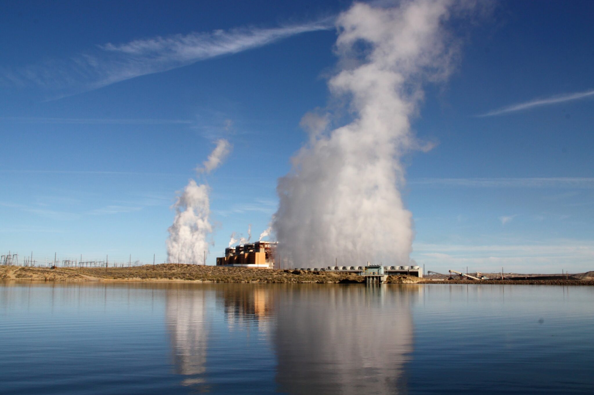
Varley started at Jim Bridger, one of the country’s largest coal plants, in 1983 after getting laid off from mining trona, a mineral used in the manufacturing of glass, detergents, chemicals and other products. All but one of the eight largest private employers in Sweetwater County either mine or use the minerals and fossil fuels that underlie this part of Wyoming. As oil, gas and coal operations have shed jobs in recent years, the trona mines have absorbed many of the losses.
Varley began as a laborer, sweeping and shoveling coal or ash, before working her way up through operations and maintenance. Eventually, she helped operate the computer systems that ran the plant. “I loved the job,” she said.
Two years after retiring, Varley still refers to Bridger as “my plant.”
Until recently, her plant was facing the forced shutdown of some of its units for failing to meet federal pollution rules set by the Environmental Protection Agency. But in February, Wyoming Gov. Mark Gordon struck a deal to forestall any retirements by converting two of Bridger’s four units to burn natural gas instead. Still, all of its units are expected to close within 15 years.
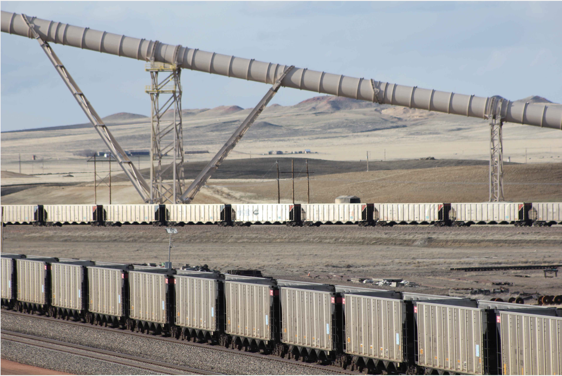
Wyoming produces about 40 percent of the nation’s coal, so the fuel’s plummeting share in the nation’s electricity—from half in 2005 to about 20 percent this year—has brought acute anxiety to towns like Rock Springs.
“It makes it kind of tough when you know that they’re talking towards phasing out coal,” Varley said. Many people who work at the plant, which employs more than 300, get angry about the prospect, she said. “Especially some of the younger ones, because they hired in believing like me that they would be able to retire from that facility.”
Wyoming officials have spent years trying everything to promote carbon capture technology, which removes carbon dioxide from power plant or industrial emissions, in the hope it could save coal. The state university has mapped its geology for places to store CO2. Regulators won federal approval to oversee the underground injection of carbon dioxide, one of only two states to do so, along with North Dakota. (The EPA oversees the practice everywhere else.) In 2020, Wyoming lawmakers passed a law that tried to force utilities to install carbon capture equipment at their coal plants.
These efforts have not yielded a single commercial carbon capture operation at a power plant, but they do seem to have attracted CarbonCapture Inc., to the delight of state economic development officials.
A California-based start-up, CarbonCapture said it has secured enough private investment to begin work next year on the Wyoming plant, although it still needs to receive state and local permits. Rather than attaching to a coal plant, this project would pull carbon dioxide out of ambient air by passing it through giant fans fitted with a chemical sorbent, which traps the CO2. The sorbent is then heated to release the gas for compression before being reused.
Project Bison would initially capture 10,000 metric tons of carbon dioxide per year, but the company said it plans to expand to reach a capacity of 5 million metric tons by 2030. That higher figure would be orders of magnitude above what any company has achieved so far, yet roughly equal to the emissions of one coal power plant, or less than 0.1 percent of total U.S. emissions of nearly 6 billion metric tons in 2020.
The operations would be financed by selling carbon credits to corporations seeking to offset their own emissions. The company said it has already sold credits at $800 per ton to Cloverly, a carbon-offset marketer, and to CO2.com, a new carbon offset venture of TIME, the magazine owned by the billionaire Marc Benioff.
Varley had gone into the town hall meeting feeling optimistic that the project could potentially provide high-quality jobs while also helping the environment. While she wants the coal plant to continue operating for as long as possible, she knows its days are numbered, and when it closes, it could take more than 300 jobs with it.
Southwest Wyoming is hard country to live in: Varley has spent her entire life here and said “it grows on you like a fungus.” The state has the highest suicide rate in the country, and the decline of fossil fuels, it feels to many, will only make life harder.
“People are looking for ways to maintain our ability to live here,” Varley said.
Birth of the Carbon-Removal Dream
The summer of 2022 was yet another season of climate extremes. Drought and severe heat covered large parts of China, Europe, Africa and North America. The United Kingdom recorded its hottest temperature ever. In Pakistan, heavy rains submerged up to one-third of the country, killing more than 1,000, destroying crops and spreading vector-borne diseases like dengue fever.
These disasters have driven many people toward desperate acts of civil disobedience, like a scientist who chained himself to the doors of a private jet terminal. They’ve also pushed many to conclude that carbon removal technologies, however unlikely their deployment, will now be necessary to avoid the worst impacts of warming.
When the United Nations Intergovernmental Panel on Climate Change released its latest report this year on how to keep warming below 2 degrees Celsius, it determined that at least some degree of carbon removal was needed but that the amount could vary drastically, depending on how quickly fossil fuel consumption declined and whether nations adopt more sustainable practices.
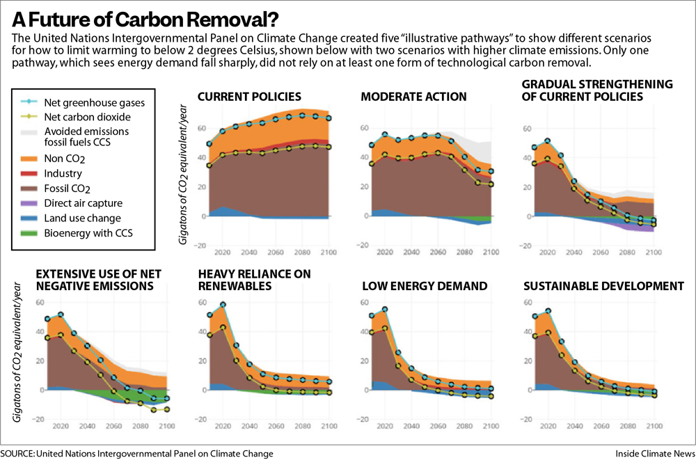
The only scenarios that did not include meaningful levels of carbon removal generally required global energy use to decline, which seemed unlikely, especially if there was any hope of supplying electricity to the nearly 800 million people who currently lack it.
“It’s critical to have this tool,” said Jennifer Wilcox, the principal deputy assistant secretary in the Office of Fossil Energy and Carbon Management at the Department of Energy, “and we need to have it on the order of gigatons,” or billions of tons.
The last year has brought an explosion of funding to try to make that happen. In addition to the $3.5 billion that Congress allocated to the Energy Department for direct air capture hubs, lawmakers earmarked another $1 billion for research and development this year and, as part of the Inflation Reduction Act, more than tripled the value of a federal tax credit for direct air capture.
United Airlines, Airbus, Microsoft, Alphabet, Meta, Stripe and other corporations have collectively pledged billions more. The billionaire entrepreneur Elon Musk has funded a $100 million prize for carbon removal startups. The field is also one of the fastest growing areas of climate philanthropy.
So far, however, hardly any carbon dioxide has been pulled from the atmosphere. The largest direct air capture plant in operation, opened by a company called Climeworks in Iceland, pulls in about 4,000 metric tons of CO2 per year. By contrast, the Jim Bridger plant outside Rock Springs spewed out 10.8 million metric tons of carbon dioxide in 2021 alone.
Skeptics have noted how far carbon removal is from making a dent in global emissions. Supporters, however, argue that the rates of growth the industry must achieve to make a difference, while high, are comparable to what solar energy generation has seen since the 1990s.
The rush of funding and attention has prompted a new set of questions about carbon removal technologies. The concerns of many skeptics have moved beyond whether carbon removal can possibly work, to wondering what it would look like if it somehow did.
Displacing Herds of Native Pronghorn
Pearson’s route to town takes her past Wyoming’s first utility-scale solar farm, which was built in 2018. The 700-acre site was cleared of vegetation before the panels were installed and surrounded with a chain-link fence. Now it marks a shiny, incongruous break in the high desert, though it is hardly the only disturbance around, with trona mines in each direction.
The sight of it was bad enough for Pearson and other residents, but soon after the project’s completion, residents noticed herds of pronghorn, a fleet-footed antelope-like animal indigenous to the region, tramping onto the highway. The area that the solar farm had enclosed, it turned out, had been used by resident pronghorn, and the fences shut them out. The companies behind the project sponsored a study, published last spring in a scientific journal, that determined that the animals lost nearly a square mile of high-use habitat, about 10 percent of their core range. Today, the pronghorn’s trails and droppings line the perimeter of the fence that locked the animals out of lands they once called home.
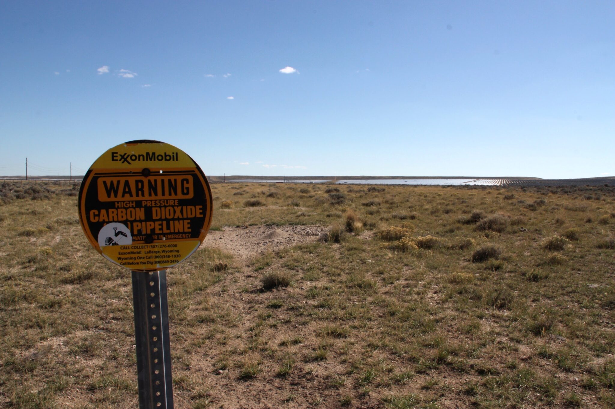
CarbonCapture plans to build its new facility about 20 miles west of the solar farm, a rough and barren landscape of greasewood and sagebrush, and it could eventually need much more solar development to run its operations.
The company has said it will try to minimize the impacts, by choosing lands already disturbed by oil development, for example. But some will be unavoidable. State maps show that the sage grouse, a protected game bird, has core habitats surrounding the area where the plant would be built. Closer to the site, cattle roam on rangeland that is dotted with oil wells and a creek trickles south on its way to the Green River, a tributary of the Colorado.
CarbonCapture said it would initially use natural gas to power its operations while capturing the resulting carbon dioxide emissions, but aims to eventually rely on renewable energy. At full scale, that would require 1,000 acres to house the energy supply, and 100 acres more for the project itself.
The World Resources Institute, an environmental think tank, has estimated that if direct air capture technology reaches the scale envisioned by the Biden administration, about 500 million metric tons of carbon dioxide per year by mid-century, the industry would consume more than 4 percent of the nation’s current total energy supply. If all that energy were generated by wind and solar power, that could mean covering an area equal to a small state with turbines and panels.
The prospect alarms Pearson, who said her family has been offered money to allow solar panels on their land, but that they declined. “We would have been set for life, and we said no way. Because we knew what it would do to the wildlife, to our way of life, to Wyoming’s way of life.”
Adrian Corless, CarbonCapture’s chief executive, said that because the project will connect to the electric grid, the new renewable energy development could be located in other parts of the state, or even out of state.
“There’s a lot of opportunity to find the right situations for land use that are aligned with community expectations and needs,” Corless said.
Justin Loyka, energy program manager in the Wyoming office of the Nature Conservancy, said CarbonCapture asked his organization for help in reducing its impacts, and that there were opportunities to do so. But he added that as renewable energy development spreads, some impacts are inevitable.
“The vast majority of Wyoming is some of the most intact ecosystem in the lower 48,” Loyka said. “Wyoming has these wildlife migration corridors that are hundreds of miles long, and that really doesn’t exist in many other places.”

Click the link to read the article on the Circle of Blue website (Keith Schneider):
For decades, Americans mostly turned a blind eye to the industrial-scale livestock production operations that churn out cheap supplies of meat and dairy for the masses. Occasional opposition to local pollution problems and the casual animal cruelty that characterize conventional US dairy, hog, and poultry production did little to alter practices that are embedded in the rural landscape.
That may be changing. A wave of frontline resistance is now breaking across the Upper Midwest and around the country as organized campaigns aimed at regulating concentrated animal feeding operations, known as CAFOs, are being felt at every level of government, and in state and federal courts.
Opposition to large livestock operations is more intense than at any time in recent memory, say environmental advocates.
“It’s been building and building,” said Rob Michaels, an attorney for the Environmental Law and Policy Center (ELPC), a Chicago-based legal group, who is working to limit CAFO manure discharges in Ohio and Michigan. “It’s now being raised as a political issue. As a legal issue. As a legislative issue.”
On October 19, the 9th Circuit U.S. Court of Appeals issued a ruling that lends legal muscle to a five-year old petition that Food & Water Watch and 36 allies filed to compel the US Environmental Protection Agency (EPA) to update CAFO permitting regulations. The Trump and Biden administrations ignored the 2017 petition. The Court of Appeals said the plaintiff’s petition “raises issues that warrant an answer” from the agency. A Food and Water Watch attorney said the Justice Department has been in touch to schedule a negotiating meeting.
A week later, on October 26, Earthjustice, a nonprofit public interest law group, and 50 allied non-profit and citizen organizations from around the US filed a separate petition calling on the EPA to initiate new rule-making that would require the largest CAFOs, which are significant sources of water pollution, to apply for wastewater discharge permits under the Clean Water Act. The petition asserts that because every CAFO discharges polluting wastes EPA has the authority and duty to require them to operate under wastewater permits.
Calls for moratoriums on new CAFO construction also are being heard by legislatures in Iowa, Missouri, Minnesota, and Wisconsin. Counties in South Dakota and Arkansas have issued local moratoriums. The Missouri Supreme Court is set to decide, perhaps before the year ends, whether counties can regulate CAFO development through local public health ordinances.
At least five Wisconsin counties and three towns have enacted temporary moratoriums, and one county is considering imposing a local ordinance next year. Last year the Wisconsin Supreme Court affirmed the authority of the Wisconsin Department of Natural Resources (DNR) to restrict large livestock farms to protect the state’s water, a rebuke to a 2011 state law that limited the DNR’s authority to regulate CAFOs.
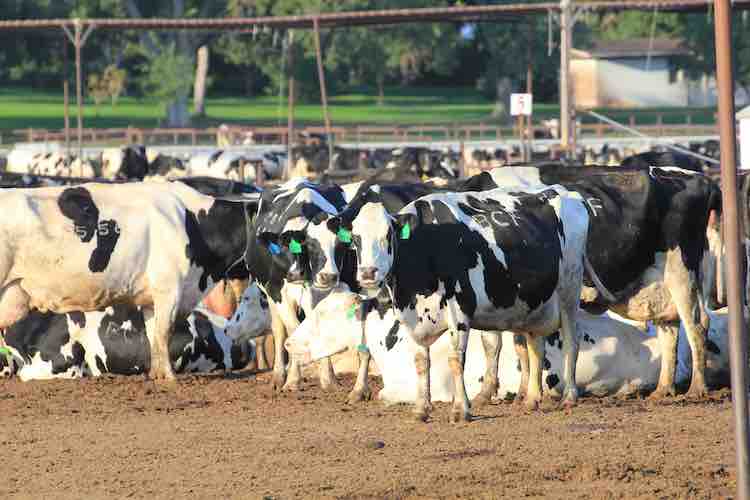
Water worries
The EPA has identified more than 21,000 large CAFOs across the country but just 6,266 of those operate with wastewater discharge permits under the Clean Water Act designed to control and restrict pollutants discharged into waterways, according to EPA figures.
“EPA is weak on regulations on CAFOs,” said Emily Miller, a Food & Water Watch attorney. “Only a fraction have permits and the permits that do exist are just simply ineffective.”
An EPA spokesman said the agency would not comment on either petition. The American Farm Bureau Federation declined to be interviewed for this article.
The National Milk Producers Federation, though, issued this statement in response to the environmentalists’ petitions. “Regulation of CAFOs require a responsible approach, which sometimes isn’t the case among environmental activists who seek to use regulations to reduce the availability of animal protein products for consumers,” said Jamie Jonker, the group’ chief science officer.”
The restiveness about CAFO operations and expansion in the American countryside is due to the same kinds of disruptions occurring in states like Wisconsin, where 340 large livestock operations have been constructed, most of them big milk and hog production facilities. They collectively house hundreds of thousands of animals.
Wisconsin CAFOS pour billions of gallons of untreated liquified manure every year, and millions of tons of solid manure on hundreds of thousands of farm acres. A study for the Wisconsin Legislature made public in October found that the number of private wells contaminated with nitrates or E.coli, the intestinal bacteria, was expanding steadily and identified the source as agricultural discharges.
CAFOs, though, are the only industrial polluting facilities not required to treat their wastes. The federal waiver for treating CAFO wastes dramatically reduces pollution control and operating costs. It is a primary reason the American livestock sector has rapidly changed from numerous small farms that manage livestock on outdoor pastures and barnyards to many fewer industrial-scale operations where animals spend their entire lives indoors.
And because CAFOs operate on efficiencies of scale, they have played an outsize role in keeping commodity prices low and contributed to the closure of small farms in America.
As CAFOs gained influence, for example, Wisconsin in November counted 6,172 dairy farms, down from 11,260 a decade earlier, according to state figures. A study by the American Farm Bureau Federation found that from 2011 to 2020 Wisconsin led the nation in farm bankruptcies.
Though the Biden administration dispatched the EPA administrator and several aides to Cleveland earlier this year to celebrate the 50-year anniversary of the Clean Water Act, the 1972 statute has not come close to achieving its “fishable and swimmable” goal for American surface waters. The problem is unregulated nutrient discharges from agriculture. In 2016, the EPA identified phosphorus and nitrogen discharges from U.S. farmland as “the single greatest challenge to our nation’s water quality.”
Harmful algal blooms caused by phosphorus discharges from CAFOs now contaminate many of America’s iconic waters, among them Chesapeake Bay, Lake Okeechobee, Lake Champlain, California’s Clear Lake, and Lake Erie. “Somewhere between 88 percent and 94 percent of the problem is caused by these CAFOs, these megafarms and their nutrient nonpoint source runoff. Everyone knows it,” said Wade Kapszukiewicz, the mayor of Toledo, Ohio, which was forced in 2014 to shut down its drinking water plant for three days because of bloom-generated toxins. Half a million residents lost their drinking water supply.
CAFO nutrient discharge is worse in the Corn Belt states: the Dakotas, Minnesota, Wisconsin, Iowa, Illinois, Missouri, Nebraska and Kansas. The EPA counted 9,332 concentrated livestock and poultry operations across the Corn Belt in 2021. It is not known how much manure they all produce each year, but it’s prodigious. For comparison the 291 CAFOs in Michigan generate 4 billion gallons of untreated raw liquid manure annually, and millions of tons of solid manure, according to the state environment department.
In Iowa, where almost 4,000 CAFOs operate, nearly every mile of streams and acre of surface water is impaired by nutrients or E.coli. Just 167 Iowa CAFOs have wastewater discharge permits, according to the E.P.A.
The Biden Administration and CAFO opponents know full well that changing the regulatory rules of the CAFO game will be a fierce struggle. Environmentalists, small farm advocates, and E.P.A. administrators under previous administrations, Democratic and Republican, have tried to cross this same ground before and been turned back in federal courts by politically powerful farm groups led by the American Farm Bureau Federation and its allies in the various state and national dairy, pork, poultry, and beef associations.
In 2003, in response to a lawsuit brought by Natural Resources Defense Council and Public Citizen, the EPA issued a new rule that obligated CAFOs to apply for discharge permit unless they could demonstrate that they had “no potential to discharge” damaging nutrients. That rule was challenged by livestock operators, who in 2005 convinced the Second Circuit Court of Appeals to strike it down.
The E.P.A. tried again with a new rule in 2008 that limited the permitting obligation to CAFOs that “propose to discharge” wastes. But in 2011, in a case brought by the National Pork Producers Council and other farm groups, the Fifth Circuit Court of Appeals struck that rule down, too. In both cases plaintiffs argued the law didn’t give the agency authority to regulate “potential” or “proposed” sources of pollution.
With their petitions and grassroots campaigns, activist legal and non-profit groups are pressing E.P.A. to try again. They assert that every CAFO operating in the United States is a source of “actual” wastewater discharges that require much more effective regulation. “The E.P.A. under its current leadership acknowledges that what we’ve asked for needs to happen,” said Amy van Saun, a senior attorney for the Center for Food Safety, which is a party to the 2017 petition. “I don’t think they have any legal way to say no.”
A version of this article was published by The New Lede on November 17, 2022.
Click the link to read the release on the Interior website:
The Department of the Interior announced today that four Tribal water projects in Oregon and California’s Klamath River Basin will receive $5.8 million through the Bureau of Reclamation to restore aquatic ecosystems, improve the resilience of habitats, and mitigate the effects of the ongoing drought crisis. The funding is made available through Reclamation’s Native American Affairs Technical Assistance to Tribes Program.
Secretary Deb Haaland made the announcement while touring the Iron Gate Fish Hatchery with Governors Gavin Newsom and Kate Brown, Congressman Jared Huffman, representatives from the Klamath Basin Tribes and other officials and stakeholders to celebrate the imminent surrender and decommissioning of the Lower Klamath Project, a four-dam hydropower project on the Klamath River. On November 17, 2022, the Federal Energy Regulatory Commission issued an order approving the surrender and decommissioning of the Project, the culmination of nearly two decades of effort to find a path to remove the dams, open up hundreds of miles of historic salmon habitat, improve water quality, and restore the River and the fishery the Basin Tribes have relied upon since time immemorial. Dam removal activities will begin next spring, with full removal completed in 2024.
“Clean water, healthy forests and fertile land made the Klamath Basin and its surrounding watershed home to Tribal communities, productive agriculture, and abundant populations of migratory birds, suckers, salmon and other fish. But over the past 20 years, the Basin has been met with unprecedented challenges due to ongoing drought conditions and limited water supply,” said Secretary Haaland. “The projects we are funding today – combined with millions of dollars in water and habitat resilience investments from President Biden’s Bipartisan Infrastructure Law – will help restore this once abundant ecosystem for the benefit of all its inhabitants.”
“Reclamation is committed to working with Tribes in the Klamath River Basin on important water resource issues,” said Reclamation Commissioner Camille Calimlim Touton. “This funding will help facilitate collaboration with Tribes as they address the severe and continuing drought impacting their lands.”
Reclamation’s Native American Affairs Technical Assistance Program provides technical assistance to Tribes to develop, manage and protect their water and related resources. The funding announced today is provided to Tribes as a grant or cooperative agreement. The projects are:
Hoopa Valley Tribe, Karuk Tribe and Yurok Tribe, in collaboration with U.S. Geological Survey (USGS), Juvenile Salmonid Survival and Migration Rate Study: The project will receive $3.9 million to study juvenile salmon. The Yurok Tribe will estimate specific survival through time of wild and hatchery Chinook Salmon as they migrate through the Klamath Basin under various environmental conditions. The Hoopa Valley and Karuk Tribes will use acoustic tags to monitor juvenile salmonid survival and migration rates from the Scott, Salmon and Trinity rivers and locations on the middle Klamath to Klamath River estuary. The USGS will provide support to the Tribes for this research study.
Hoopa Valley Tribe, Ecological Flow Assessment on the Hoopa Valley Indian Reservation: The Hoopa Valley Tribe will receive $554,325 to complete an ecological flow assessment on the Trinity River. The project includes site selection, field data collection, stream gaging and water temperature monitoring.
Klamath Tribes, Upper Williamson River Restoration: The Klamath Tribes will receive $500,000 to assess and plan river system restoration activities on the Upper Williamson River in southern Oregon. The Tribe will assess the existing condition of approximately five miles of the river, develop plans for restoration activities, and install restoration infrastructures. This project advances goals and objectives established in both the Klamath Basin Integrated Fisheries Restoration and Monitoring Plan and the Upper Klamath Basin Watershed Action Plan.
Yurok Tribe, Oregon Gulch Project, Mainstem Trinity River: The Yurok Tribe will receive $864,533 to remove tailing piles, increase floodplain inundation, promote fluvial processes, and reduce the wood storage deficit. The project will also double rearing habitat, improve the aquatic ecosystem, create seasonal surface water connections, increase vegetation biomass and increase the number of trees along the riverbanks.
This funding supplements nearly $26 million from the Bipartisan Infrastructure Law allocated this year for Klamath Basin restoration projects, including nearly $16 million for ecosystem restoration projects in the Basin and $10 million to expand the Klamath Falls National Fish Hatchery.
As part of the Interior Department’s ongoing commitment to partnership and collaboration, senior Department leaders have held several in-person and virtual engagement sessions with Tribes, state and county officials, interagency partners, and water users to discuss near- and long-term solutions related to drought impacts in the Basin.

Click on a thumbnail graphic to view a gallery of drought data from the US Drought Monitor website.
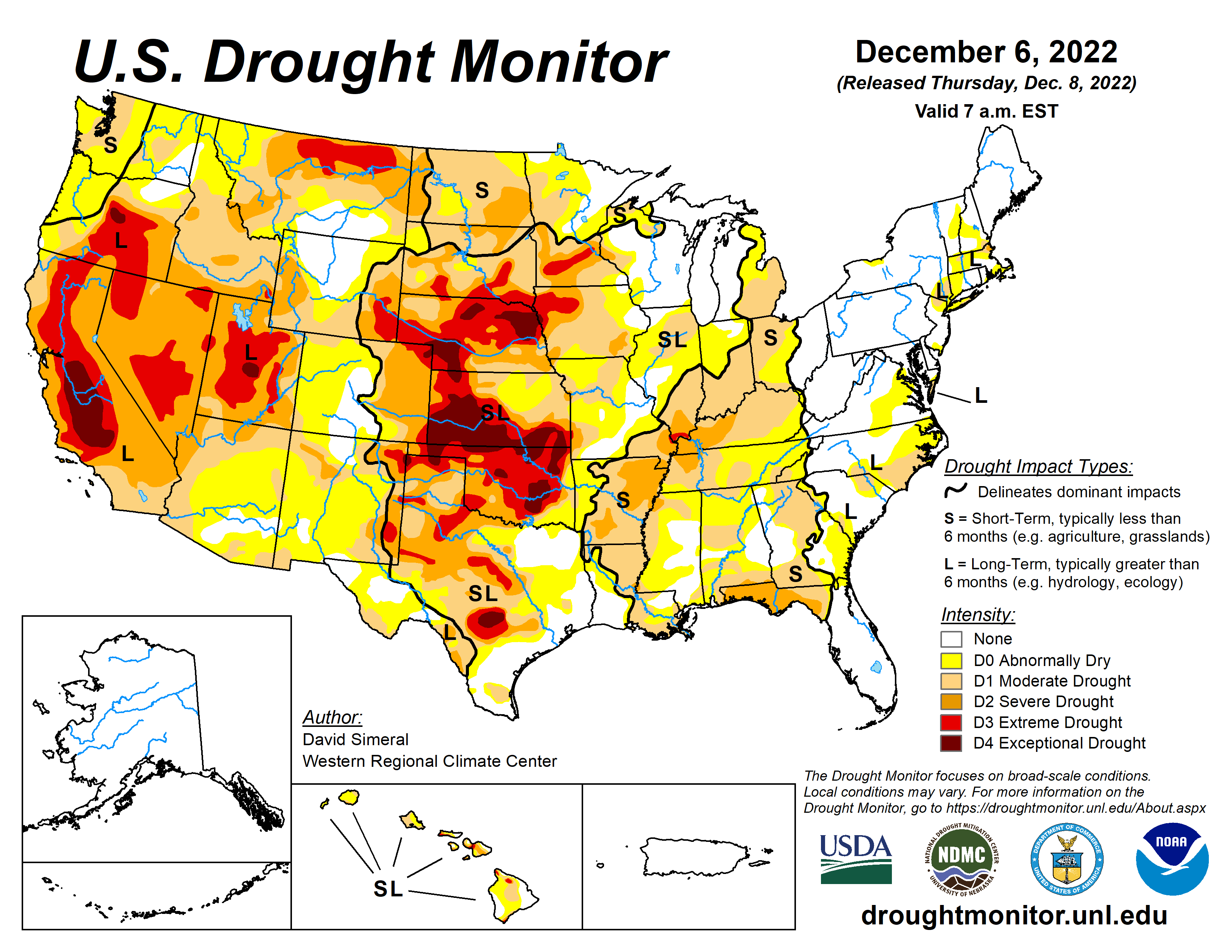


Click the link to go to the US Drought Monitor website Here’s an excerpt:
This Week’s Drought Summary
This U.S. Drought Monitor (USDM) week saw an active storm pattern across much of the Western U.S. as well as another round of isolated heavy rainfall across portions of the South and Southeast. Out West, several rounds of Pacific moisture streamed into the region bringing heavy rains to the lower elevations of the Pacific Coast Ranges and snowfall to the higher elevations of the Sierra Nevada, Klamath Mountains, Cascades, northern Great Basin, and the central and northern Rockies. For the multi-day storm event, the heaviest snowfall accumulations were observed in the Sierra Nevada where up to four feet was observed including at the Central Sierra Snow Lab, which reported a 7-day snowfall total of 48.8 inches. Moreover, the storms boosted basin-wide snow water equivalent (SWE) to well above normal levels in the Sierra Nevada drainage basins and basins across the Intermountain West and Pacific Northwest, according to the National Resources Conservation Service (NRCS) SNOTEL network. Along the Central California coast in the Santa Lucia Range (south of Monterey), 7-day rainfall accumulations ranged from 4 to 11+ inches—helping to reduce longer-term precipitation deficits (past 24 months) that ranged from 8 to 20+ inches after this week’s storms. In the Desert Southwest, locally heavy rainfall was observed in southern Arizona and west-central New Mexico in association with sub-tropical moisture that moved into the region on Saturday with isolated areas receiving 2 to 3+ inches of rain. The rainfall improved soil moisture levels and helped to boost precipitation totals during the past 12-month period to normal to above-normal levels across much of the southern portion of Arizona. In the Northern Plains, light snowfall (2 to 6 inches) was observed in the Dakotas and eastern Montana in addition to the passage of an Arctic front early this week, which dropped temperatures into the single digits in North Dakota. In the Midwest, a wintery mix of rain, freezing rain, and snow impacted southern Wisconsin while light-to-moderate snowfall accumulations (2 to 6 inches) were observed in Minnesota and Upper Peninsula Michigan. In the Interior Deep South, locally heavy showers (2-to-4-inch accumulations) brought some relief to drought-affected areas of northern Alabama and Georgia as well as southeastern Tennessee, and southwestern North Carolina. In the Northeast, light-to-moderate snowfall accumulations (1 to 4 inches) were observed last week with the heaviest accumulations in Upstate New York. In Maine and New Hampshire, strong winds and shower activity (1 to 2 inches) impacted the region last week causing power outages in areas of Maine. In the South and Southeast, locally heavy rainfall was observed across a west-to-east band extending from northern Mississippi to northern Georgia. The storms helped to reduce short-term precipitation deficits (past 30-60 days) in some areas and boosted streamflows and soil moisture to above-normal levels…
High Plains
On this week’s map, improvements were made in northwestern Colorado and Wyoming. In Wyoming, recent storms delivered beneficial snowfall to the Teton and Wind River ranges leading to reduction in areas of Moderate Drought (D1). Moreover, the drainage basins in those ranges, the Snake Headwaters and Upper Green, were reporting SWE percentage of median levels of 129% and 114%, respectively. Additionally, areas of Moderate Drought (D1) were reduced in northwestern Colorado in response to improving conditions from recent storms and above-normal snowpack conditions including in the White-Yampa Basin (122% of median). In Kansas, continued dry conditions led to minor expansion of areas of Extreme Drought (D3) and Exceptional Drought (D4) in western Kansas. Looking at the past 9-month period in the western half of Kansas, precipitation deficits ranged from 3 to 12+ inches. For the week, average temperatures were mainly below normal, with the greatest departures (10 to 15 deg F below normal) observed in North Dakota and north-central Wyoming. In terms of precipitation, the region was generally dry, although some significant mountain snowfall was observed in western Wyoming and in the Rockies of Colorado, while lesser accumulations were reported in areas of the Dakotas…
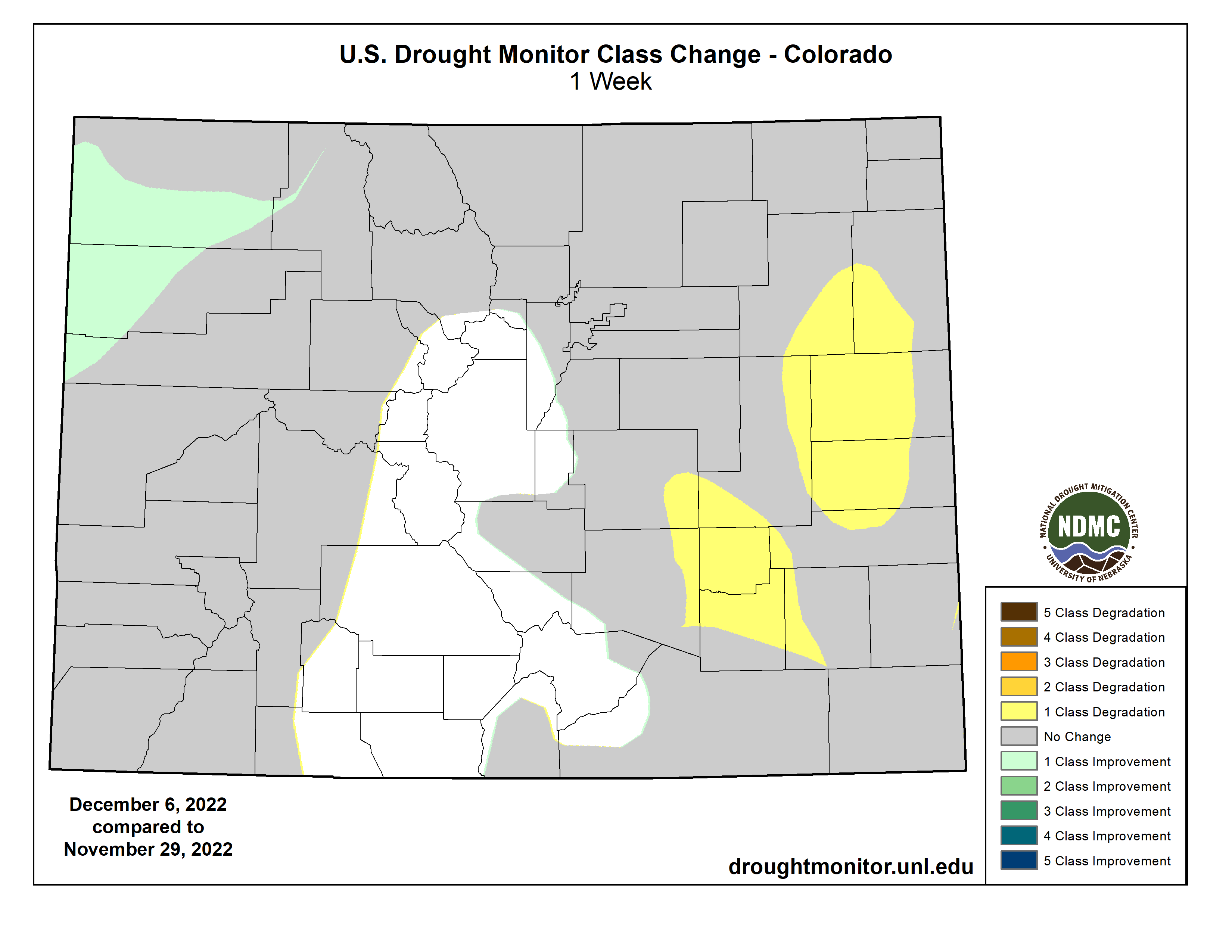
West
Out West, back-to-back storm systems delivered significant rainfall accumulations to the lower elevations of California, Oregon, and Washington as well as heavy mountains snows to the Sierra Nevada, Klamath Mountains, and areas of the Cascades. Moreover, moderate-to-heavy snowfall accumulations were observed in the ranges of the northern Great Basin and the central and northern Rockies. The beneficial rains from the storms led to some minor improvements on the map along the Central Coast of California where rainfall totals exceeded 10 inches in isolated areas of the Santa Lucia Range. Elsewhere in California, no changes were made on the map this week. However, some targeted improvements are likely next week after a more thorough assessment of the impact of the storms in juxtaposition to the significant longer-term precipitation deficits across the state. Nonetheless, California’s snowpack is off to a positive start with the California Cooperative Snow Surveys reporting (12/6) statewide SWE at 171% of normal, with the Northern Sierra at 156%, Central Sierra 160%, and Southern Sierra 203% of normal. In the Southwest, some improvements were made on the map in drought-affected areas in southern Arizona in response to this week’s round of subtropical moisture that delivered locally heavy rains—improving soil moisture and streamflow conditions. In the Intermountain West, improvements were made on the map in areas of Extreme Drought (D3) in central and eastern Nevada as well as in Utah where conditions have improved during the past 6-month period across various indicators including soil moisture, streamflows, shallow groundwater, and precipitation. In southwest Montana, recent snowfall and overall improving conditions on various drought metrics led to removal of areas of Moderate Drought (D1) on the map. For the week, the northern half of the region experienced cooler-than-normal temperatures (2 to 20 deg F below normal) with the greatest departures observed along the northern border with Canada…
South
In the South, improvements to drought-related conditions were made on the map in areas of Arkansas, Mississippi, and Tennessee in response to rainfall over the past 30-day period. Elsewhere, some minor degradations occurred in South Texas and the Oklahoma Panhandle. Across the western portion of the region, generally dry conditions prevailed, while the eastern half saw rainfall accumulations ranging from 1 to 4+ inches with the highest totals logged in northeastern Mississippi and southern Tennessee. Average temperatures for the week were generally above normal (1 to 10 deg F) with the greatest anomalies observed in the Trans Pecos region of Texas and along the central Gulf Coast Region. In contrast, eastern Oklahoma, Arkansas, and Tennessee experienced average temperatures that were near to slightly below normal…
Looking Ahead
The NWS WPC 7-Day Quantitative Precipitation Forecast (QPF) calls for moderate-to-heavy precipitation accumulations (including heavy snowfall accumulations) ranging from 2 to 4+ inches (liquid) across much of the Cascades of Oregon and Washington, Klamath Mountains, Coast Ranges of Northern California, and the Sierra Nevada Range-similar to last week’s QPF for the West Coast region. In the Intermountain West, 1-to-2-inch (liquid) accumulations are expected in the Rocky Mountains of Colorado, while lesser accumulations are expected in the Wasatch Range of Utah and the ranges of central and northern Idaho. Elsewhere in the conterminous U.S., another round of heavy precipitation accumulations is expected in Arkansas, southern Missouri, northern Mississippi, and eastern portions of Kentucky and Tennessee (3-to-5+-inches liquid). In areas of the Midwest and Northeast, accumulations are expected to be generally <1-inch. The CPC 6-10-day Outlooks call for a moderate-to-high probability of above-normal temperatures for the eastern half of the conterminous U.S. with near-normal temperatures across much of the Plains states, while the Western U.S. is forecasted to be below normal. In terms of precipitation, above-normal precipitation is expected across most of the conterminous U.S. except for western Texas and areas of New Mexico.

Just for grins here’s a gallery of US Drought Monitor maps for early December for the past few years.
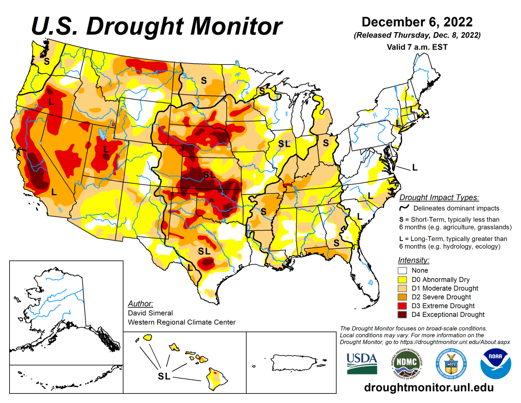

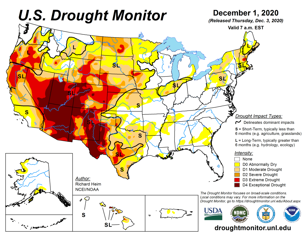

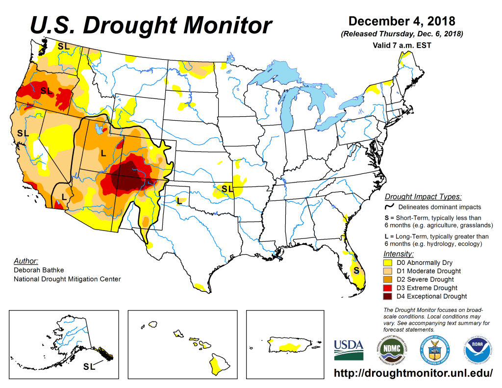
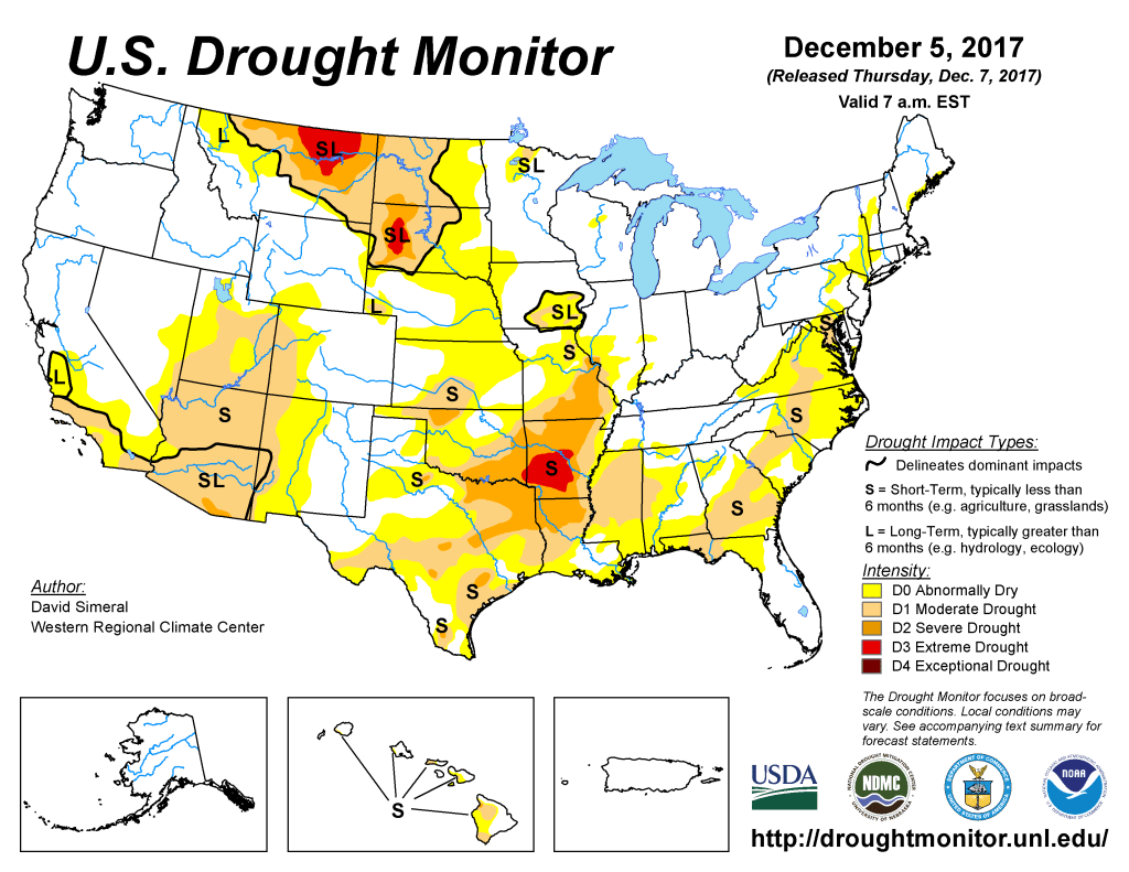

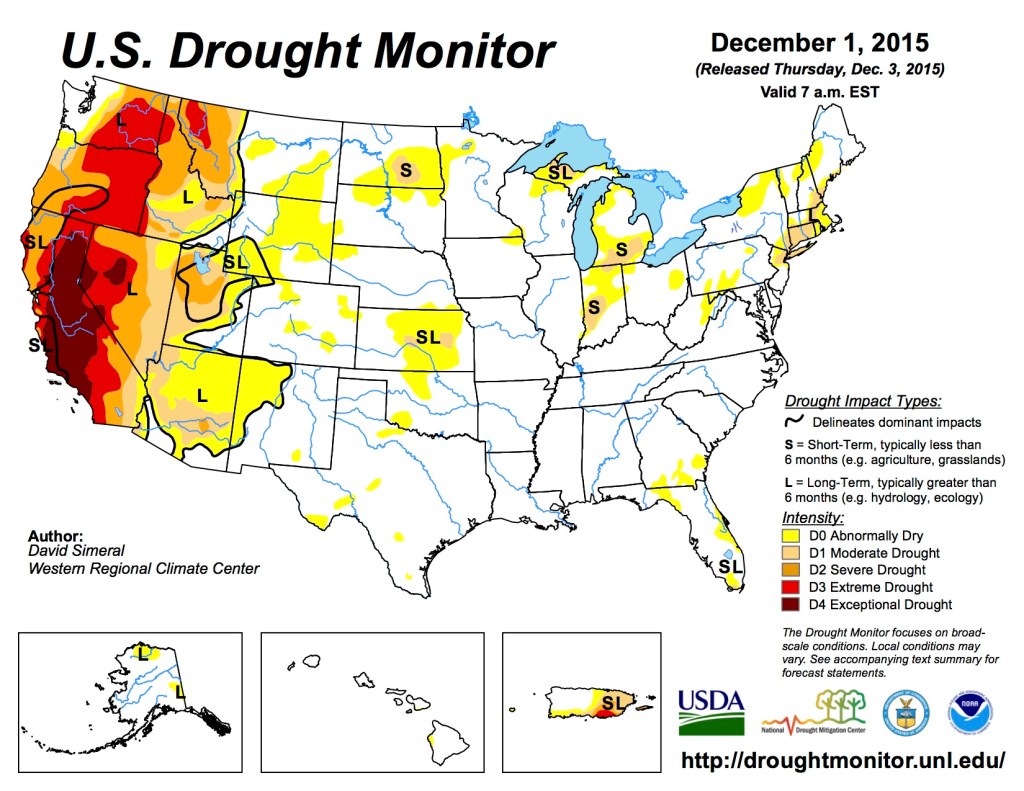
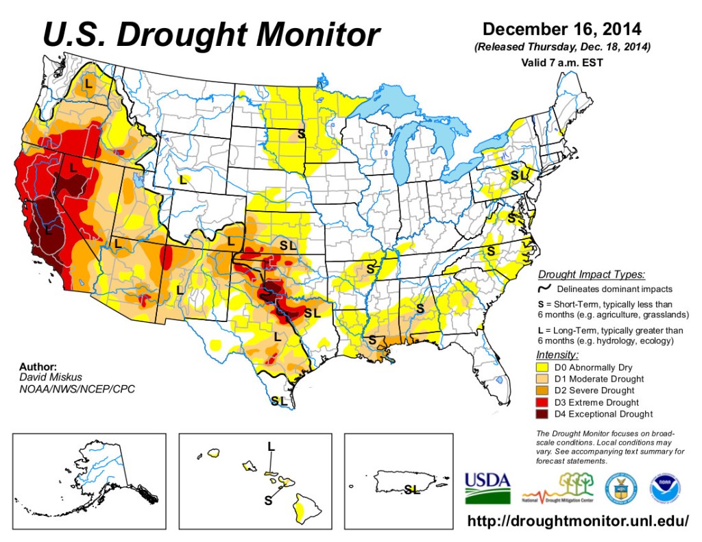
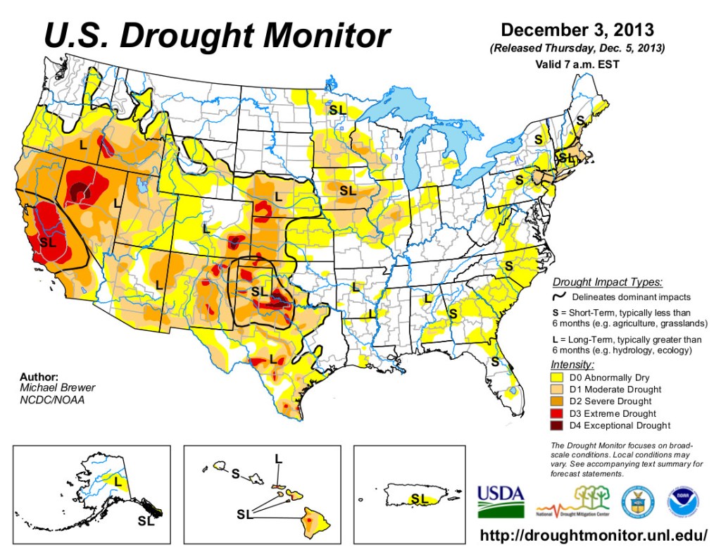


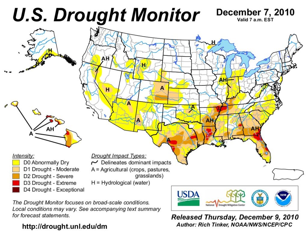
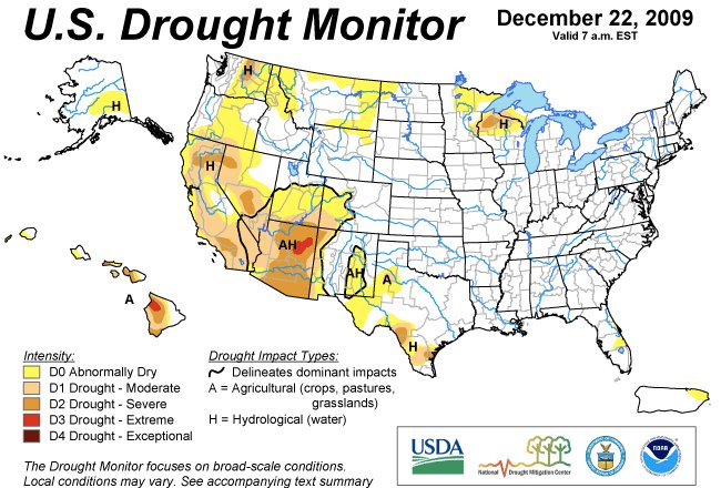
Click the link to read the article on The Washington Post website (Joshua Partlow). Here’s an excerpt:
The first sign of serious trouble for the drought-strickenAmerican Southwest could be a whirlpool. It could happen if the surface of Lake Powell, a man-made reservoir along the Colorado River that’s already a quarter of its former size, drops another 38 feet down the concrete face of the 710-footGlen Canyon Dam here. At that point, the surface would be approaching the tops of eightunderwater openings that allow river water to pass through the hydroelectric dam. The normally placid Lake Powell, the nation’s second-largest reservoir, could suddenly transform into something resembling a funnel, with water circling the openings,the dam’s operators say. If that happens,the massive turbines that generate electricity for 4.5 million people would have to shut down — after nearly 60 years of use —or risk destruction from air bubbles. The only outlet for Colorado River water from the damwould then be a set of smaller, deeper and rarely used bypass tubes with a far more limited ability to pass water downstream to the Grand Canyon and the cities and farms in Arizona, Nevada and California. Such an outcome — known as a “minimum power pool” — was once unfathomable here. Now, the federal government projects that day could come as soon as July.
Worse, officials warn, is the remote possibility of an even more catastrophic event. That is if the water level falls all the way to the lowest holes, so only small amounts could pass through the dam. Such a scenario — called “dead pool” — would transform Glen Canyon Dam from something that regulates an artery of national importance into a hulking concrete plug corking the Colorado River. Anxiety about such outcomes has worsened this year as a long-running drought has intensified in the Southwest. Reservoirs and groundwater supplies across the region have fallen dramatically, and states and cities have faced restrictions on water use amid dwindling supplies. The Colorado River, which serves roughly 1 in 10 Americans, is the region’s most important waterway.
On the way to such dire outcomes at Lake Powell — which federal officials have begun both planning for and working aggressively to avoid — scientists and dam operators say water temperatures in the Grand Canyon would hit a roller coaster, going frigid overnight and then heating up again, throwing the iconic ecosystem into turmoil. Lake Powell’s surface has already fallen 170 feet. Lucrative industries that attract visitors from around the world — the rainbow trout fishery above Lees Ferry, rafting trips through the Grand Canyon — would be threatened. And eventually the only water escaping to the Colorado River basin’s southern states and Mexico could be what flows into Lake Powell from the north and sloshes over the lip of the dam’s lowest holes.

Click the link to read the article on the Western Resource Advocates website (Lindsay Rogers):
Did you know that 50% of urban water is used outdoors? Most of this water is used to irrigate “non-functional” turf – meaning the only use is for aesthetics that could be achieved through other, lower water use means. One of the most impactful solutions WRA is driving helps municipalities, homeowners, and other property owners replace unnecessary, thirsty grass and lawns – also called “turf” in policy arenas – with low-water alternatives, such as native grasses and plants, trees, and shrubs.
THE BENEFITS OF REPLACING NON-FUNCTIONAL GRASS
- Saves residents money. Lower water use means lower water bills and reducing the likelihood that utilities will need to invest in costly new water projects to meet demand.
- Supports healthy ecosystems. Native landscaping supports local wildlife, pollinators, and the environment while better reflecting the landscapes around them. They can also reduce urban air pollution from lawn mowing and improve stormwater quality by reducing pesticide and fertilizer applications.
- Uses less water and keep more water in rivers. Reducing water use at the municipal level takes pressure off our rivers and streams.
- Increases water security and resilience to climate change. Improving water conservation will help communities adapt to lower water supplies.
SWAPPING TURF FOR LOW-WATER LANDSCAPING WILL PROTECT COMMUNITIES’ WATER SUPPLIES
The rivers that sustain our communities and environment – from the Colorado to the Rio Grande and the Gunnison to the Gila – are overtaxed due to climate change, multi-year drought, and decades of overuse. Additionally, as flows in the Colorado River and water levels in major Western reservoirs become further depleted – Lake Powell and Lake Mead, the largest reservoirs in the region, are at their lowest levels on record – there is a high likelihood in the coming years that the Colorado River system will collapse, generating a crisis across the West.
This means that local municipalities have a real water security problem. Water demand in communities across the region already outpaces available supply, and this only will get worse as climate change intensifies. WRA is developing and implementing innovative policies and programs that help communities live within their water means while getting rivers back into balance.
WHY NON-ESSENTIAL TURF?
While Western states are among the driest in the country, irrigated turf – think lush, green lawns – has been ubiquitous in many communities across the region, from front yards to sprawling office parks to roadway medians. Much of this grass is not used but requires a large amount of water. In fact, non-functional landscape irrigation makes up more than half of water use in the West. In Colorado, where I live, outdoor water use accounts for 38% of all municipal demand each year. Most of this outdoor water use is dedicated to landscaping and irrigated grass. With the growing impacts on the Colorado River, this is water the region cannot afford to waste.
Replacing grass and lawns is a key part of increasing community resilience to climate change, improving water security, and adapting to a present and future with less water. In other words, turning the sprinklers off will help cities keep the taps on. While many municipalities have had success conserving water through strategies such as requiring low-flow toilets and showers and more water-efficient home appliances, further conservation is needed in the urban sector.
Outdoor water conservation is particularly important because, unlike indoor water use, outdoor water is largely consumptive, meaning it evaporates or is used by the plant and cannot be reused down the line. Switching from grass to low-water plants is the next low-hanging fruit that will help municipalities stretch increasingly limited water supplies over the coming decades.
Additionally, one of the best parts about replacing thirsty grass is that anyone can play a role: An individual homeowner, a large business, a city, or an entire state. By swapping a traditional lawn with drought-proof landscaping, we can help save 50% or more in outdoor water use.
GRASS REPLACEMENT IS IN HIGH DEMAND
As more local communities seek opportunities to replace high-water use grass, WRA is designing, advocating for, and implementing policies and programs to support their efforts. In 2022, WRA helped develop legislation creating the first state-wide turf replacement program in Colorado and advocated for a similar program in Utah. These voluntary programs will ensure every property owner in the state can access financial resources to replace their lawn with drought-tolerant, sustainable alternatives. We’re also supporting municipalities, like the city of Aurora in Colorado, with crafting effective local water-saving ordinances that meet their unique needs, such as banning new golf courses or restricting lawns in new developments. This builds on WRA’s years of work helping municipalities integrate water into land use planning, ensuring that growth and development are efficient and water smart.
The region is moving in the right direction on lawns. A growing number of Western water providers are creating and advocating for programs that encourage their customers to swap underutilized grassy areas for waterwise landscaping. In Colorado, 22 utilities — including Castle Rock and Fort Collins — provide customers with rebates for replacing water-thirsty plants with low- or no-water alternatives. In Utah, more than a dozen municipalities participate in the Flip Your Strip program, which encourages residents to remove park-strip grass in their front yard and replace it with waterwise landscaping. The Southern Nevada Water Authority (SNWA), which serves Las Vegas and other areas of the state, has perhaps the most successful lawn replacement program in the country. SNWA’s cash for grass program has saved nearly 467,000 acre-feet of water, which is 167,000 acre-feet more than the amount of Colorado River water that the entire state of Nevada has the right to use each year. SNWA shows that, when implemented at large scale, grass replacement efforts can serve as vital water supply infrastructure — the same as pipes, tanks, and reservoirs.
WHAT CAN WATERWISE LANDSCAPING LOOK LIKE WHERE YOU LIVE?
WRA envisions a future where Western communities showcase beautiful native landscaping reflective of our region that provide all the benefits of grass with a fraction of the water. To be sustainable, communities will need to reflect the water and climate reality we now have, as well as the open spaces that surround them.
Replacing non-functional grass with waterwise landscaping will look different across our states and communities. In Arizona, a grassy highway median could be transformed with saguaros and beargrass. In Colorado, a front lawn could have pops of color with purple gayfeather, yellow rabbitbrush, and blue flax. In New Mexico, orange sunset hyssop and green agave could grow alongside a small, low water buffalo grass lawn in a backyard. Drought-resistant landscaping that occurs naturally in the Western region encompasses an extraordinary range and depth of plants, trees, shrubs, and other flora, from native grasses to fields of wildflowers to large shade trees, that mirror the unique ecosystems of each state.

There is still, however, a role for grass in our communities. Playgrounds, parks, sports fields, and reasonably sized backyards all provide valuable benefits and should be prioritized. These types of spaces provide important community functions. Replacing all non-functional grass allows communities to better maintain turf spaces that are meant for all to enjoy. Replacing or reducing the size of lawns creates an opportunity to prioritize limited water for trees. A healthy tree canopy is vital to combat urban heat island, reduce power bills, and shade yards, which further reduces water needs for plants.
When it comes to the impacts of drought and climate change on the Colorado River, replacing lawns and non-functional grass must happen alongside other large-scale conservation efforts, such as boosting use of recycled water and enabling water from retired coal plants to flow back into rivers. Major water users throughout the basin, including agricultural producers, will also need to do their part to reduce use through a variety of temporary and permanent means.
WHAT’S NEXT FOR TURF REPLACEMENT IN THE WEST
Western communities need to do more – and faster – to improve their water security through expanding turf replacement programs and promoting waterwise landscaping. WRA is instrumental in supporting local governments by:
- Pushing for additional, local lawn replacement policies and programs while increasing funding for current statewide programs in Colorado and Utah;
- Partnering with municipalities to develop local ordinances, local codes, and improved land use and water planning to reduce non-functional turfgrass in new development and redevelopment;
- Partnering with water utilities to develop and expand grass replacement programs;
- Providing input on state water plans to make sure they include and prioritize grass replacement in urban conservation efforts;
- And encouraging more waterwise training and certification opportunities for landscape and irrigation professionals.
In addition to doubling down on grass replacement programs and policies across the West, important shifts are needed to ensure success. First, programs need more dedicated funding. Lawn replacement programs, particularly at the municipal level, are incredibly popular but quickly run out of funding. States, municipalities, and water utilities need to set aside adequate funds for these programs so anyone who is interested can participate and programs can scale to maximize their impact. Water providers, city planners, and local elected officials interested in financing programs can find resources in WRA’s white paper: Financing the Future: How to Pay for Turf Replacement in Colorado.
Additionally, landscaping professionals should focus more training and industry knowledge around caring for native and low-water plants, while ensuring there is plant availability to meet growing consumer demand. Although more residents are converting their thirsty lawns to waterwise gardens, we still have a long way to go in transforming our landscapes and we need everyone involved. Increasing financial incentives, providing additional support, and offering educational resources for homeowners and other property owners will go a long way.
THE WEST NEEDS A WATERWISE FUTURE
In the face of climate change and a growing population, communities across the West must do more to make every drop of water count. Swapping underutilized and high-water-use grass is a key part of the solution with multiple benefits, from increasing water security and reducing water bills to supporting healthy, flowing rivers. States and municipalities must prioritize creating and growing lawn replacement programs in urban areas to improve their climate resilience and protect water users.
If you want to see more waterwise landscaping opportunities in your community, take action! You can contact your local elected officials, like city council members and state representatives, as well as your water utility to tell them you want more lawn replacement programs where you live. You can also help protect rivers while showing your neighbors what a waterwise garden can look like by transforming your own lawn. There are many resources to help you get started, depending on where you live, including:
- Arizona: The Arizona Native Plant Society
- Colorado: Plant Select
- Montana: Montana Native Plants for Pollinator-Friendly Plantings
- Nevada: Native Plant tool
- New Mexico: Native Plant Society of New Mexico
- Utah: Range Plants of Utah
- Wyoming: Native Rangeland Plants

Click the link to read the article on The Pueblo Chietain website (James Bartolo). Here’s an excerpt:
With soil sampling 98% complete at the Colorado Smelter Superfund Site, the Environmental Protection Agency seeks to finish its residential cleanup by spring 2024, if not sooner.
Since 2015, the EPA has conducted outdoor soil and indoor dust samplings of lead and arsenic levels at residences near the former Colorado Smelter. When samples taken from residences show harmful levels of contaminants, the properties are then earmarked for EPA cleanup.
Due to the COVID-19 pandemic, the EPA’s progress on dust sampling has trailed behind its soil sampling efforts. The agency has sampled dust at 73% of the properties it’s targeted in Pueblo’s Bessemer, Eilers and Grove neighborhoods.
As of Oct. 28, about 44% of the 1,833 properties that have received soil sampling have required cleanup, according to the EPA, as have about 36% of the 1,361 dust-sampled properties.
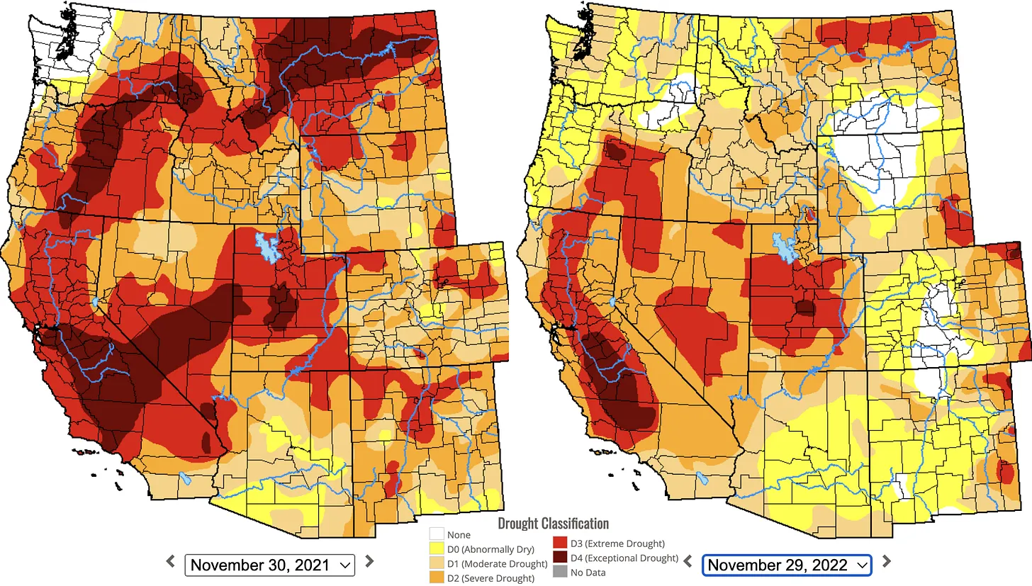
Click the link to read the article on The Land Desk website (Jonathan P. Thompson):
The meteorological winter has only just begun, and the 2023 water year is a mere two months old, so it’s probably too early to be talking about snowpack and precipitation trends. But I’m going to do it anyway because things are getting kind of interesting.
As I’ve noted before, La Niña has returned for a third consecutive winter, a rare occurrence. La Niña strengthens the trade winds along the equator, pushing warm Pacific Ocean water away from South America’s west coast, which then causes cool water to upswell to the surface to replace the warmer waters. This pushes the jet stream northward, bringing drier conditions to the Southwest and moisture and cold to the Northwest.
At least that’s what usually happens.
So far, though, Western weather hasn’t always followed the rules. What else is new, right? For example:
- The snowpack in the Upper Colorado River watershed is currently just above the median for this time of year, and is quite a bit healthier than on this date in 2021 and 2022—also La Niña years. If current trends continue through the winter it should buoy levels at Lake Powell, or at least keep them from declining so rapidly. Currently the reservoir’s surface is at about 3,527 feet above sea level. On the one hand, that’s 14 feet below what it was at this time last year, which is not so great. On the other hand, levels have held fairly steady since late September thanks in part to a wet fall.
- Southern Arizona experienced its 16th driest November on record, which fits the La Niña pattern. But it was also the coolest November since 2004, in defiance of the pattern. Go figure.
- As if to rub it in, Phoenix, which had a pretty healthy monsoon this summer, just experienced its wettest day in almost a year, receiving .76 inches of rain over a 24-hour period. Tucson, meanwhile, received .69 inches of rain during the first week of December, nearly five times the normal amount for the entire month.
- The rains apparently hammered southwestern New Mexico, as well, as streams and rivers there swelled up to levels usually only seen during summer thunderstorms. The Blue River in Clifton, Arizona, shot up from about 20 cubic feet per second to almost 3,500 cfs in a matter of hours, setting a new high for 2022. Also:
- Meanwhile, the Northwest is cool and wet, just as one would expect during a La Niña year. A scan of SNOTEL stations in Idaho, Wyoming, and Montana show some stations have more than twice the usual snowpack for this time of year.
Still, the winter is young, and things could change radically. Last winter started out dry in much of Colorado, for example, leading to the late December Marshall Fire near Boulder that wiped out 1,000 homes. Then some monster storms came, forcing everyone to reassess. Then the dryness returned. This year, forecasters are expecting La Niña to mellow or disappear by early spring, so maybe things will return to normal. Whatever that means.