Click on a thumbnail graphic to view a gallery of drought data from the US Drought Monitor website.


Click the link to go to the US Drought Monitor website. Here’s an excerpt:
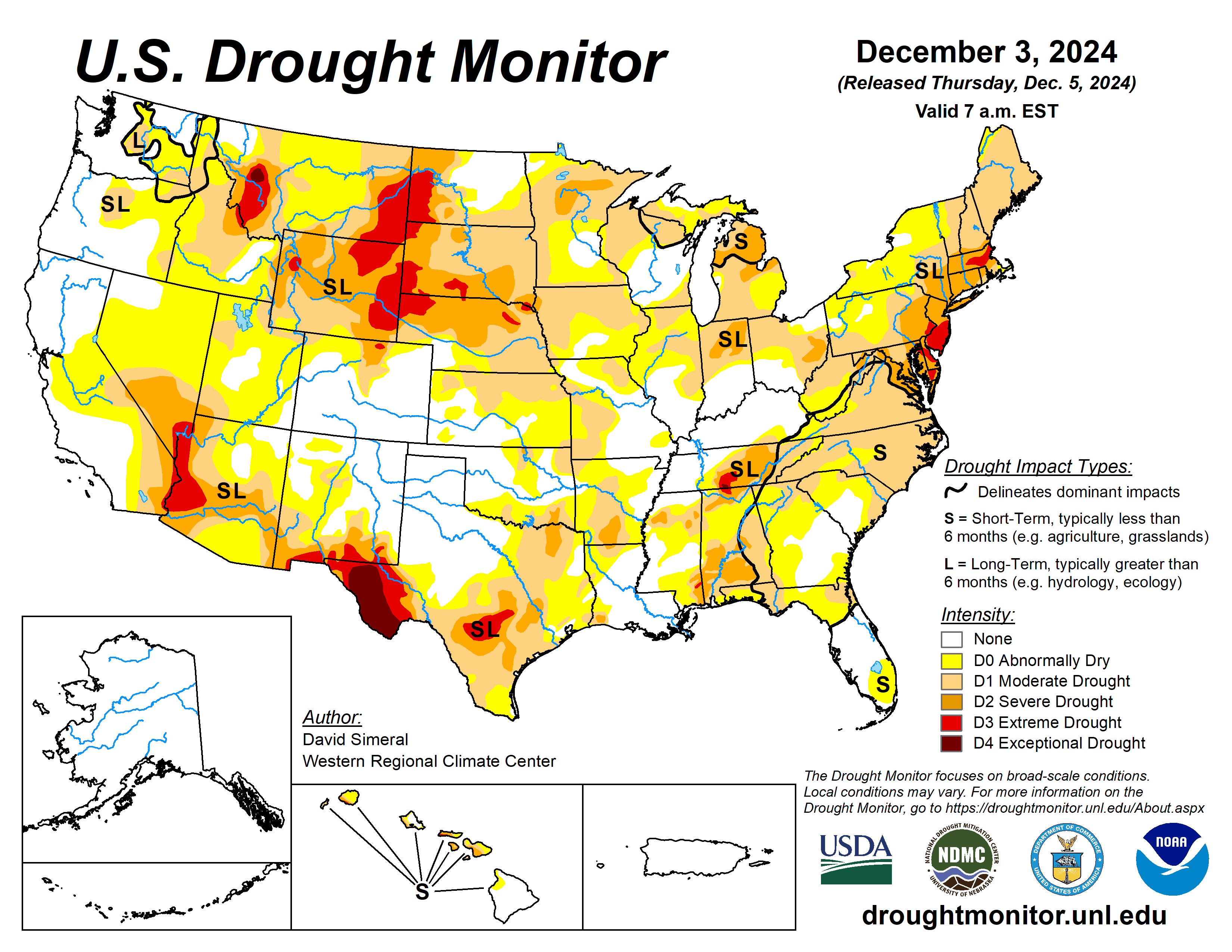
This Week’s Drought Summary
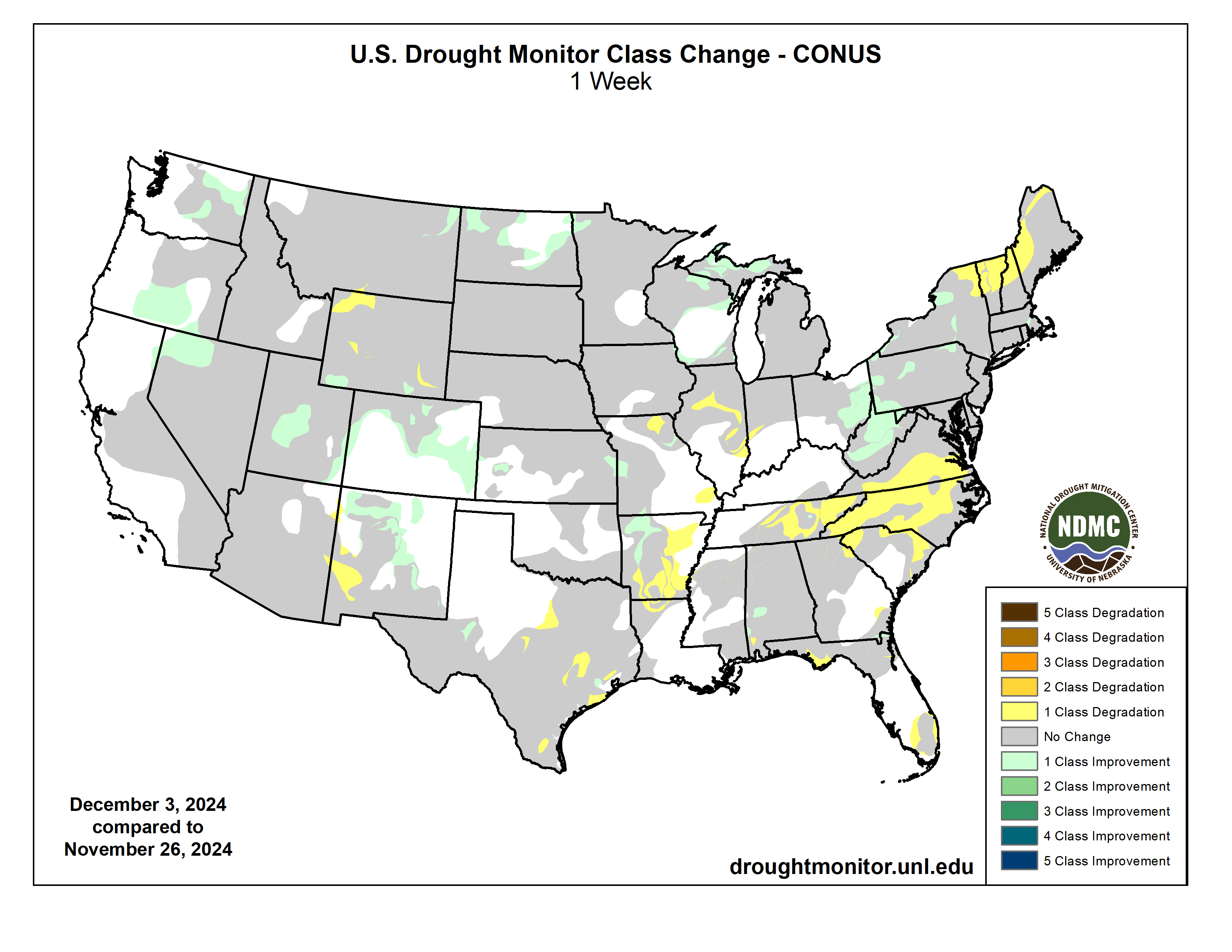
This U.S. Drought Monitor (USDM) week saw improvement in areas of the Northeast, Midwest, and the West. In the Northeast, very heavy snowfall accumulations (up to 5+ feet in some areas) were observed in downwind locations of Lake Ontario and Lake Erie in New York, and northwestern Pennsylvania. The highest totals were observed downwind of Lake Erie between Erie, Pennsylvania and Buffalo, New York. Further south, 2-to-8-inch accumulations were observed in areas of the Appalachian Mountains in West Virginia, leading to improvements on the map in drought-affected areas. In the Upper Midwest, heavy lake-effect snowfall impacted much of Upper Peninsula Michigan as well as areas downwind of Lake Michigan in Northern Michigan and southeastern Michigan. In other parts of the Midwest, light accumulations (1 to 4 inches) were logged in Minnesota, Missouri, Illinois, Indiana, and Ohio. In the Southeast and South, dry conditions prevailed across both regions except for light precipitation accumulations in isolated areas of Alabama, Georgia, Florida, South Carolina, and southeastern Texas. In Florida, short-term dryness led to additional expansion of areas of drought in the Panhandle region. Elsewhere in the Southeast, areas of drought expanded on the map in Virginia, North Carolina, and South Carolina in response to short-term dryness and declining streamflow levels. In the High Plains, dry conditions prevailed across much of the region; however, some light snowfall was observed in the eastern portion of the Dakotas. Out West, drier conditions prevailed this week across much of the region, although areas of northern Arizona, northern New Mexico, and Colorado experienced snow in the higher elevations. In terms of reservoir storage in areas of the West, California’s reservoirs continue to be at or above historical averages for the date (December 3) with the state’s two largest reservoirs, Lake Shasta and Lake Oroville, at 113% and 109% of their averages, respectively. In the Southwest, Lake Powell is currently 37% full (59% of typical storage level for the date) and Lake Mead is 33% full (53% of average), with the total Lower Colorado system 42% full as of December 2 (compared to 43% full at the same time last year), according to the U.S. Bureau of Reclamation…
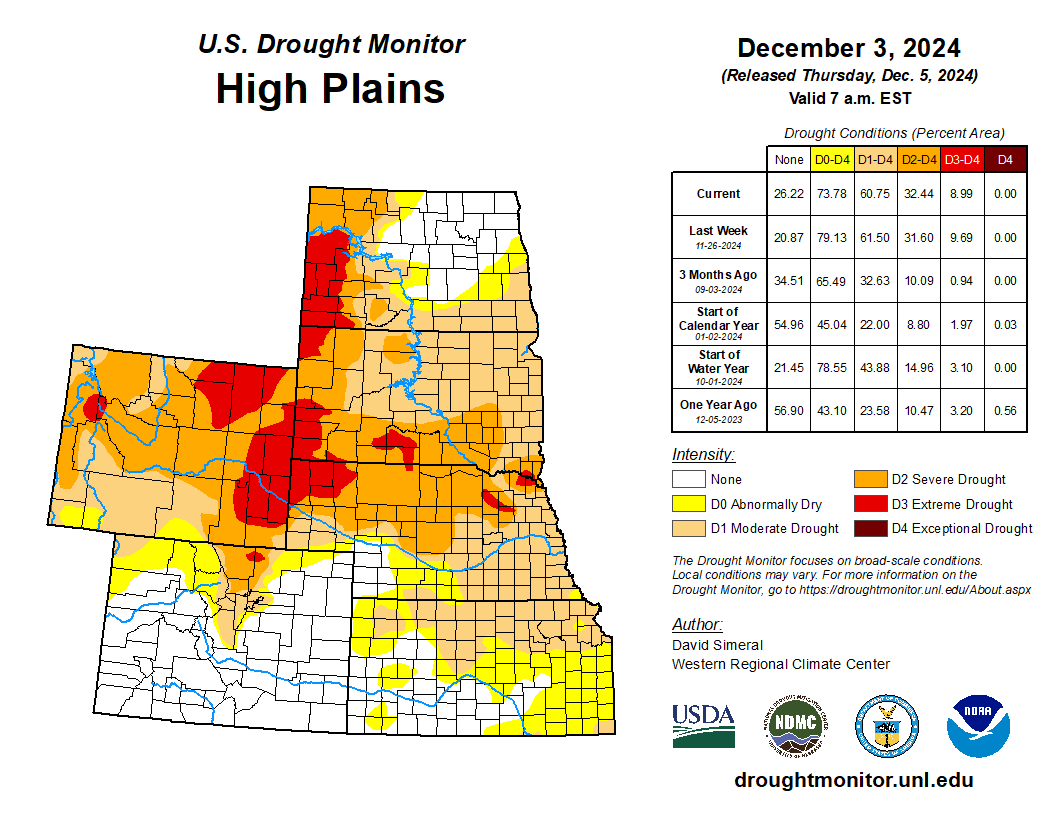
High Plains
On this week’s map, only minor changes were made in the region, including in areas of North Dakota in response to recent snowfall events and above-normal precipitation during the past 30-day period. Some minor improvements were made also in west-central Kansas, where precipitation has been above normal during the past 30–60-day period. For the week, the region was generally dry except for some light snowfall across portions of the Dakotas. In terms of average temperatures for the week, cooler-than-normal temperatures (2 to 25 deg F below normal) prevailed, with frigid temperatures observed across North Dakota…
West
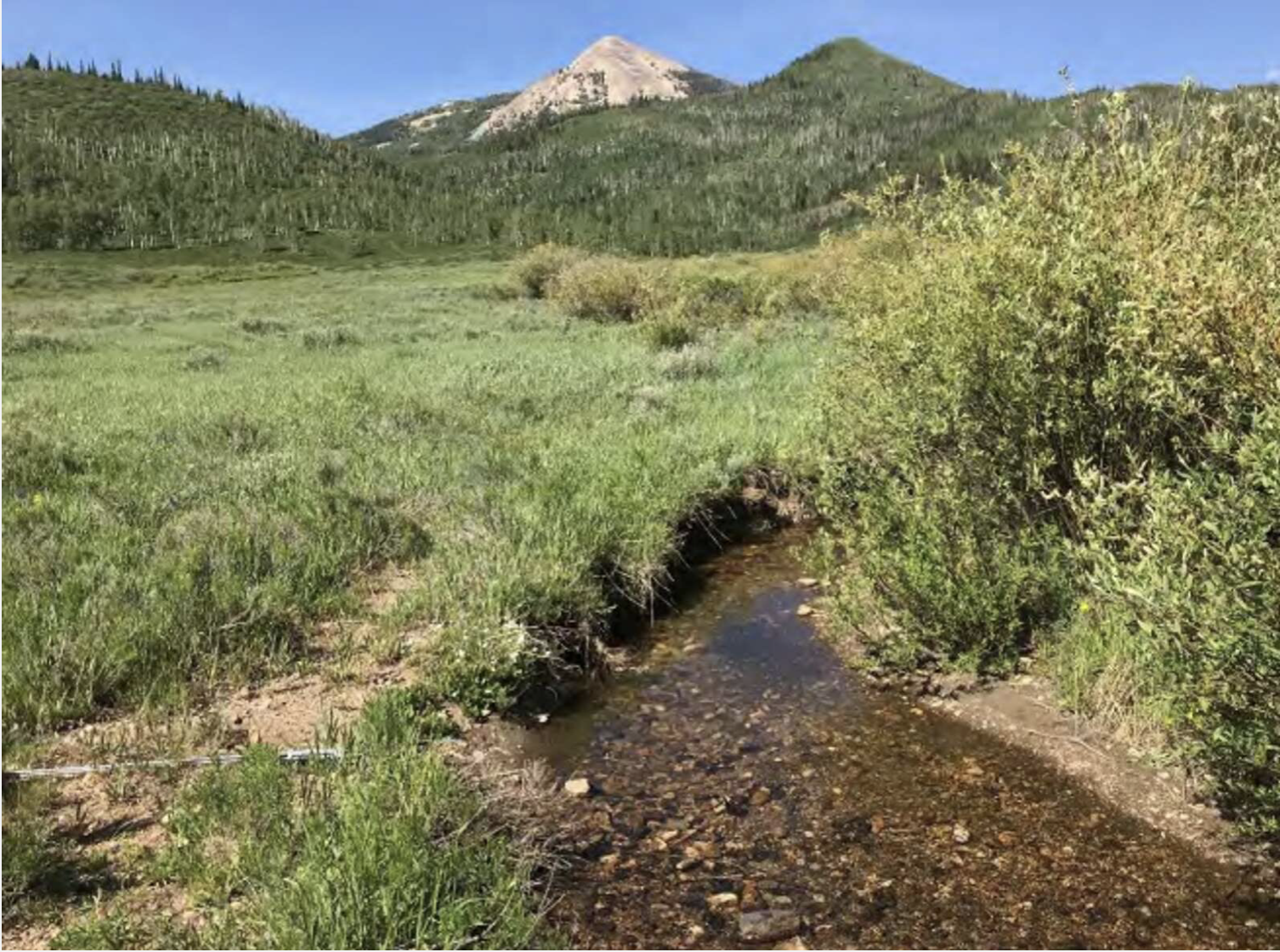
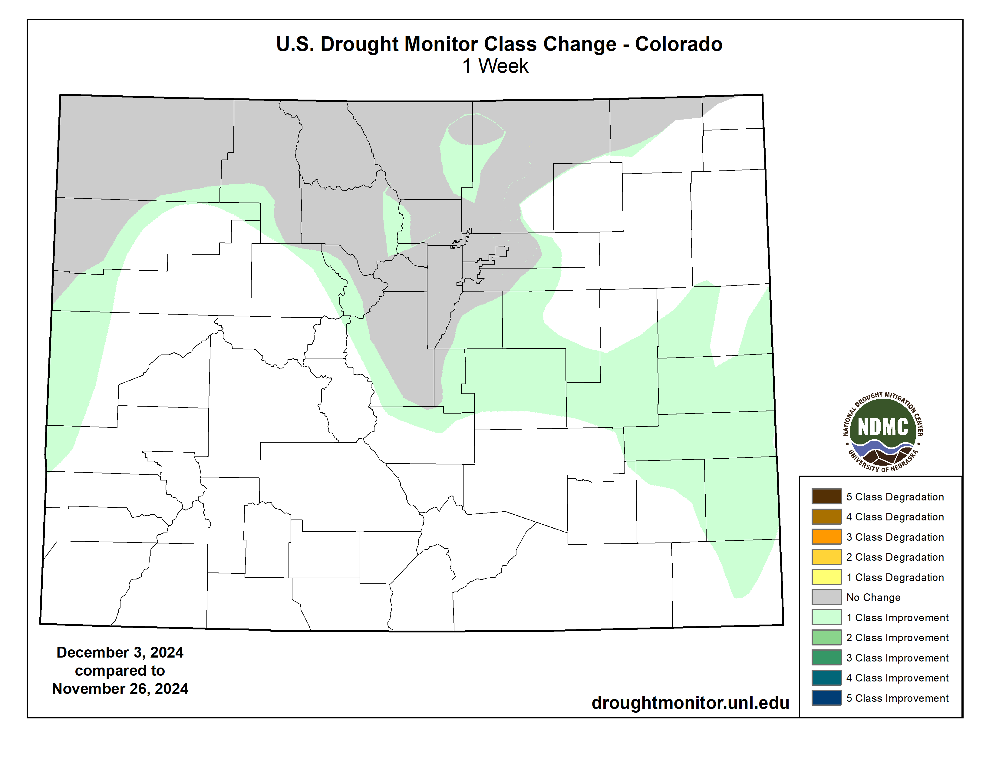
Out West, areas of the region received mountain snowfall during the past week, including the Southern Sierra Nevada, the eastern Great Basin, ranges of south-central Utah, and the Colorado Rockies. On the map, storm events during the past several weeks led to continued improvements in drought-affected areas of Washington, Oregon, California, Nevada, Utah, Colorado, and New Mexico, while some degradation occurred in isolated areas of Arizona, New Mexico, and Wyoming. Looking at the regional snowpack situation, the Natural Resources Conservation Service SNOTEL network is reporting (December 3) the following region-level (2-digit HUC) SWE levels (% of median): Pacific Northwest 126%, Missouri 75%, Upper Colorado 110%, Great Basin 111%, Lower Colorado 72%, Rio Grande 124%, Souris-Red-Rainy 94%, and Arkansas-White-Red 149%. In California, the California Department of Water Resources is reporting statewide snowpack at 157% of normal for the date (December 2). For the week, average temperatures were below normal across much of the northern tier of the region, with the greatest departures observed in northern Montana where temperatures ranged from 10 to 25 degrees below normal. In the Desert Southwest, areas of southern Arizona and New Mexico were 5 to 10 degrees above normal…
South
Across the region, generally dry conditions prevailed this week with the exception of light precipitation in isolated areas of Mississippi and Tennessee. On the map, some minor degradations were made in areas of Texas after another dry week, including in the southern North Central, northeastern Edwards Plateau, northeastern South Central, and along the Upper Coast. According to the latest USDA Texas Crop Progress Report (November 25), pasture and range conditions were rated at 62%, poor to very poor, with producers around the state continuing to use supplemental feed for livestock. Elsewhere, a mix of short- and long-term dryness led to further expansion and intensification of drought in the eastern half of Tennessee where numerous stream gauges are reporting flows in the 2nd to 9th percentile (far below normal) range. The USDA reports that producers in Tennessee are continuing to use supplemental feed and hauling water for livestock. In Arkansas, areas of drought were introduced in response to a combination of factors including short-term precipitation deficits, low streamflows, and declining soil moisture…
Looking Ahead
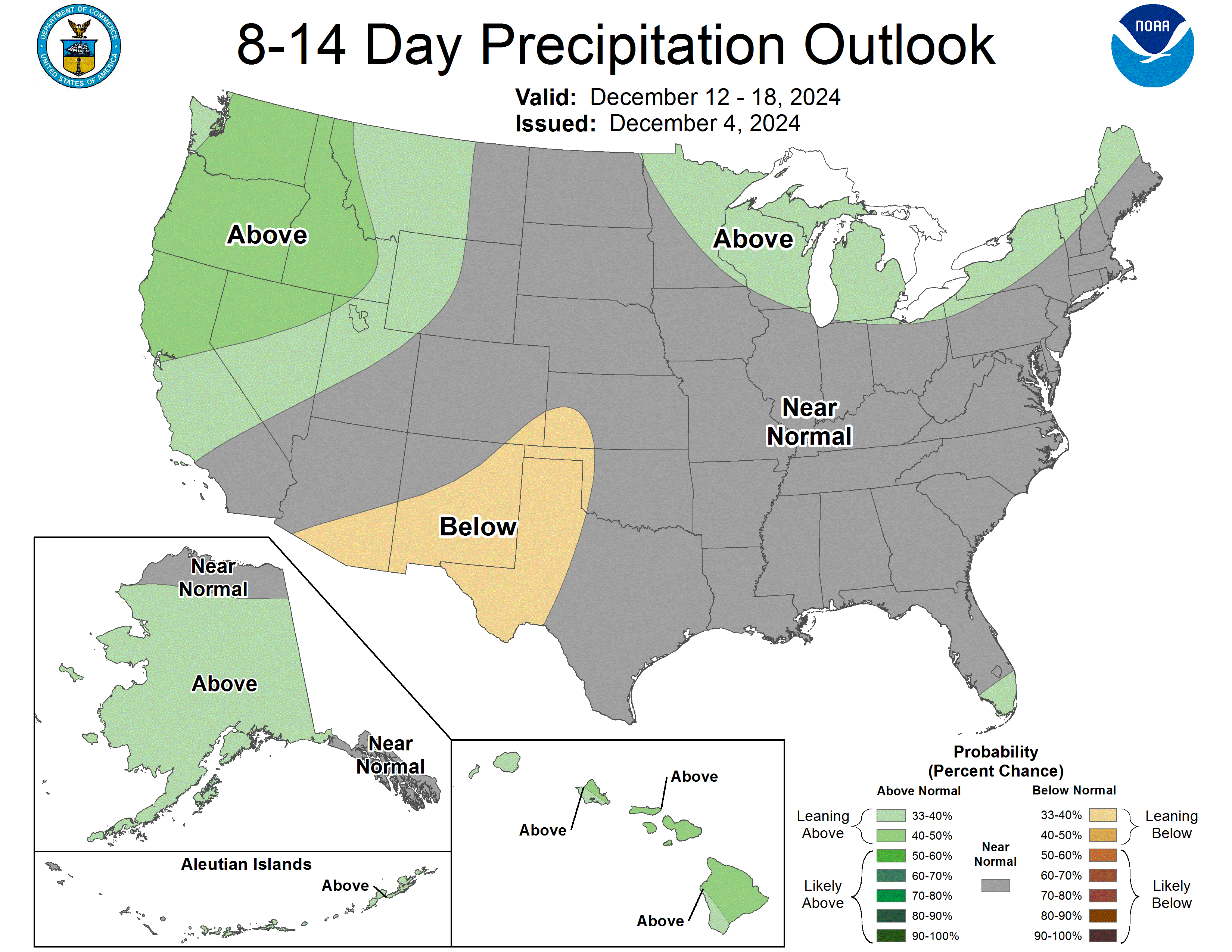
The NWS Weather Prediction Center 7-Day Quantitative Precipitation Forecast calls for moderate-to-heavy precipitation accumulations ranging from 2 to 4 inches (liquid) across areas of the Pacific Northwest, including the Olympic Mountains and Cascades of Washington. In the South, areas of eastern Texas, Louisiana, Mississippi, Alabama, western Georgia, and southern Tennessee are forecasted to receive accumulations ranging from 2 to 6+ inches. Elsewhere, light accumulations (<1 inch) are expected in areas of the Northern Rockies in the Panhandle of Idaho, northwestern Montana, and locations across the Upper Midwest and Northeast. The Climate Prediction Center (CPC) 6-10-day Outlook calls for a moderate-to-high probability of above-normal temperatures across much of the West, the Central and Northern Plains states, and the eastern third of the contiguous U.S. Meanwhile, near-normal temperatures are expected across much of the South and in the Four Corner states. In terms of precipitation, there is a low-to-moderate probability of above-normal precipitation across the eastern third of the contiguous U.S., eastern Texas, eastern portions of the Midwest, and areas along the entire greater U.S.-Canada border. Elsewhere, below-normal precipitation is expected across portions of the West including California, Nevada, Utah, Arizona, and New Mexico.
Just for grins below is a slideshow of early December US Drought Monitor maps for the past few years.

US Drought Monitor map December 3, 2024. 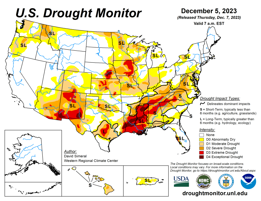
US Drought Monitor map December 5, 2023. 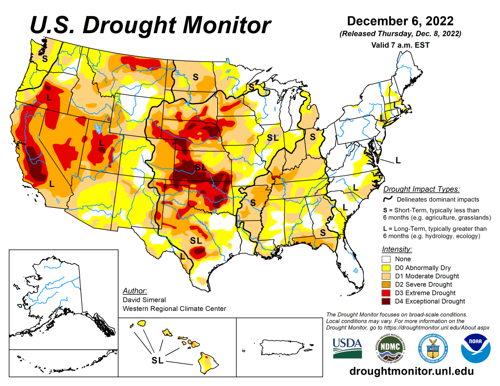
US Drought Monitor map December 6, 2022. 
US Drought Monitor map December 7, 2021. 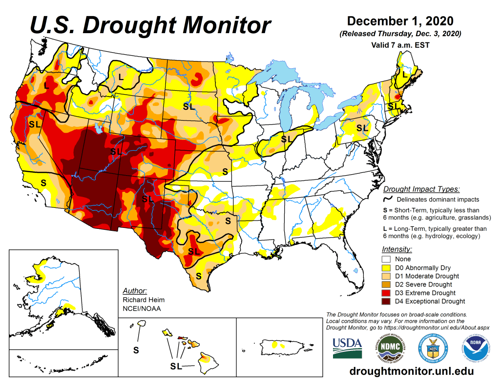
US Drought Monitor December 1, 2020. 
US Drought Monitor December 3, 2019. 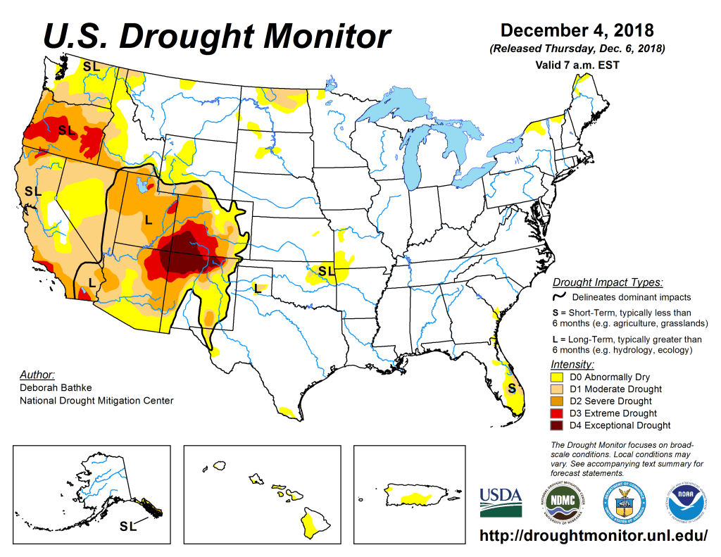
US Drought Monitor December 4, 2018. 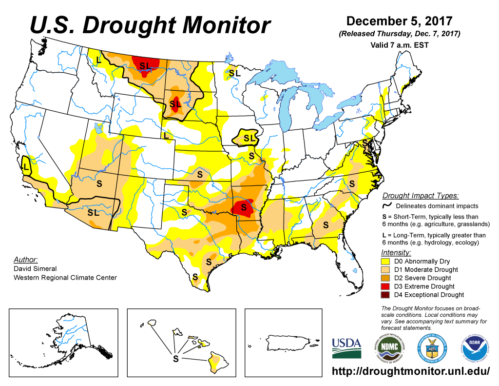
US Drought Monitor December 5, 2017. 
US Drought Monitor December 13, 2016. 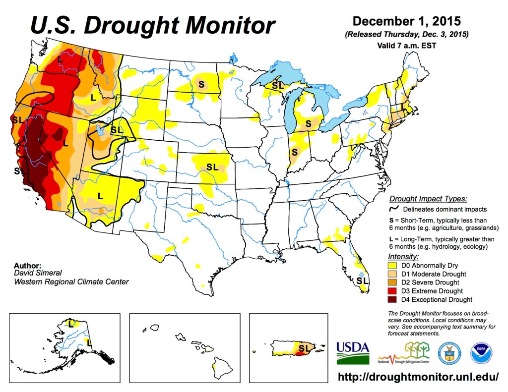
US Drought Monitor December 1, 2015 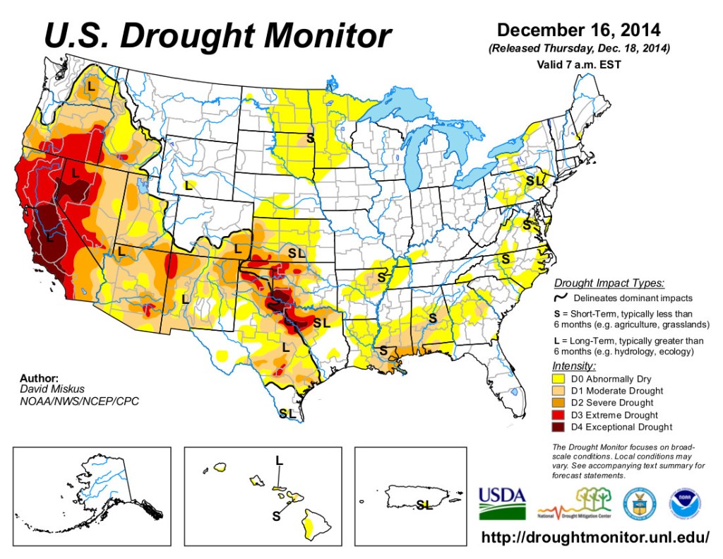
US Drought Monitor December 16, 2014 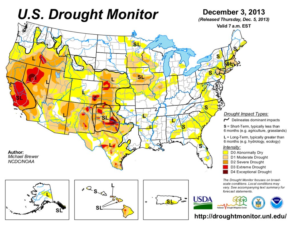
US Drought Monitor December 5, 2013 
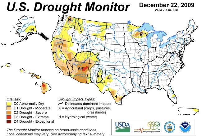
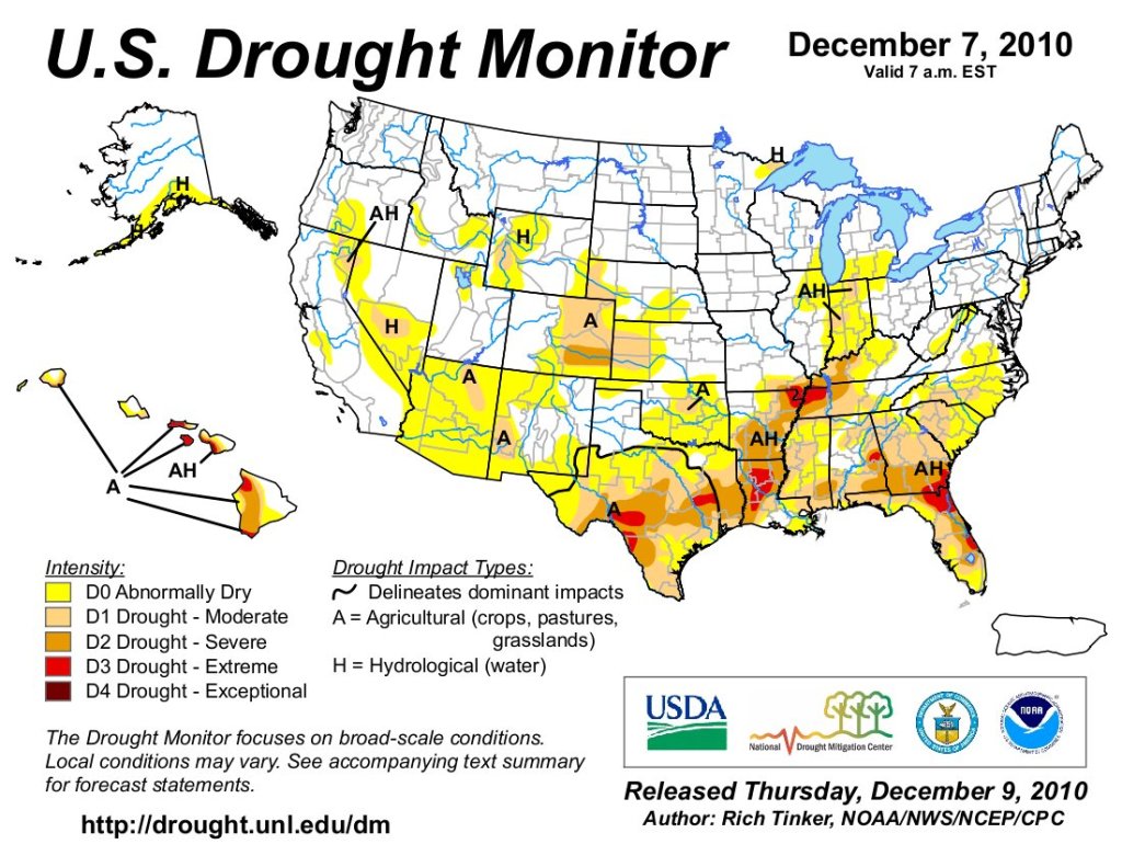
US Drought Monitor December 22, 2009.