Tribes help boost #LakeMead water supply, hope for lame duck passage of $5B federal water act — #Utah News Dispatch #CRWUA2024 #ColoradoRiver #COriver #aridification

Ute Mountain Ute Chairman Manuel Heart, Navajo Nation President Buu Nygren, and Gov. Stephen Roe Lewis of the Gila River Indian Community during a “Soverign-to-Soverign Nation” panel at the Colorado River Water Users Association conference. (Photo: Jeniffer Solis/Nevada Current)

Click the link to read the article on the Utah News Dispatch website (Jennifer Solis):

December 14, 2024

Since 2021, a handful of Colorado River Basin tribes have significantly boosted water supply in Lake Mead through voluntary contributions, helping stabilize a crucial reservoir that 25 million people rely on.

The consequences of a two-decade drought in the west and a shrinking river have given tribes leverage in negotiations over how the river’s water is managed, and persuaded the federal government to pay tribes to conserve water while funding millions in additional infrastructure.

More conservation arrangements with tribes were reached last week, after tribes met with the Bureau of Reclamation during the annual Colorado River Water Users Association conference to extend water-saving agreements that will conserve another 43,000 acre feet of water in Lake Mead, or enough water to serve about 14,000 households for a year.

The San Carlos Apache Tribe in southeastern Arizona agreed to leave 30,000 acre feet in Lake Mead in exchange for $12 million from the federal government. The Fort Yuma Quechan Indian Tribe along the Arizona-California border also signed an agreement to conserve 13,000 acre feet of Lake Mead water for $5.2 million.

Those investments build on other historic water-saving agreements with Colorado River Basin tribes in recent years designed to boost water levels in Lake Mead.

Last year, the Gila River Indian Community in Arizona received $50 million from the Inflation Reduction Act in exchange for agreeing to leave 125,000 acre feet of water in Lake Mead, adding about two feet of water to the reservoir.  The Gila River Indian Community committed to similar water savings this year and in 2025 for an additional $100 million in funding, conserving enough water to supply half a million homes.

In September, the Gila River Indian Community also received $107 million from the Inflation Reduction Act for three separate water conservation infrastructure projects, after agreeing to leave an additional 73,000 acre-feet of water in Lake Mead over the next decade.

During the annual Colorado River Water Users Association conference last week, the Bureau of Reclamation also announced an agreement with the Colorado River Indian Tribes to fund a $5 million study on constructing a new reservoir that could save up to 35,000 acre feet for the tribe, and help them develop their water rights.

Additionally, the Bureau of Reclamation announced $21.5 million in funding from the Inflation Reduction Act last week to help the White Mountain Apache Tribe in Arizona plan and design a rural water delivery system.

The Biden administration committed more than $6 billion to support water infrastructure in Tribal communities between the Bipartisan Infrastructure Law and Inflation Reduction Act, but any future funding will likely depend on what President-elect Donald Trump chooses to do with unspent funds.

During the campaign Trump said he would claw back unspent IRA funding.

Looking to the lame duck

Tribal communities also hope Congress passes and the president signs into law substantial federal water project legislation before the new Congress is sworn in and Trump is inaugurated.

The $5 billion Northeastern Arizona Indian Water Rights Settlement Act that would secure water rights for the Navajo Nation, Hopi Tribe and San Juan Southern Paiute Tribe.

The federal legislation authorizes $5 billion to acquire, build, and maintain essential water development and delivery projects, including a $1.75 billion distribution pipeline. The three tribes would also be guaranteed access to over 56,000 acre-feet of Colorado River water and specific groundwater rights protections.

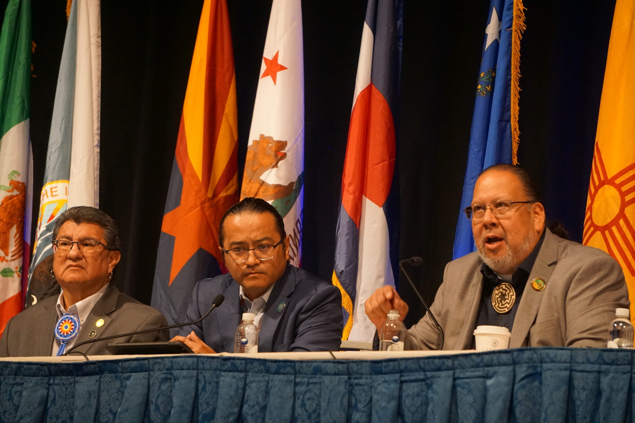
Navajo Nation President Buu Nygren emphasized the urgency of the Northeastern Arizona Indian Water Rights Settlement. Nygren said he hopes basin states will support and advocate for the settlement, which could boost its chances of passing before a new administration takes the White House next month.

However, some Colorado River Basin states have expressed concerns about the settlement and its impact on water use and future management, a fact Nygren acknowledged.

“I was hoping to come in today that we have some consensus, but there’s one underlying issue that we’re trying to resolve,” Nygren said.

Confluence of the Little Colorado River and Colorado River; Credit: EcoFlight

During a press event last week, New Mexico’s representative on Colorado River matters, Estevan Lopez, said the Upper Basin states are concerned the settlement would allow tribes to lease water from the Upper Basin to the Lower Basin.

“When you move water across the basin boundary, that has always required a seven state consensus,” Lopez said.

“We feel it’s imperative that we need to have an actual consensus among the states if that’s going to move forward,” Lopez said.

Lower Basin states — Nevada, Arizona, and California — and Upper Basin states — Colorado, New Mexico, Utah, and Wyoming — have been at odds for months over how to manage the river after current management rules expire in 2026.

Tribal leaders noted that water settlement bills have historically been passed during lame duck congressional sessions, meaning that if it does not pass now, the legislation will have to effectively restart the process anew in the next Congress.

Nygren said he is still hopeful Congress can pass the water settlement bill during the lame duck session, as either a stand-alone bill or as part of a larger package, and urged the seven basin states to support the settlement.

“We’ve got a Congress that’s willing, that’s excited. All we gotta do is come to consensus, and then we put it in Congress’s hands. It would be a great celebration to see President Biden sign off on that within the next couple of weeks,” Nygren said.

Gov. Stephen Roe Lewis of the Gila River Indian Community echoed Nygren’s optimism.

“I remain ever hopeful that we will be celebrating the first anniversary of the Northern Arizona settlement next year,” he said

Lewis added he is not pessimistic about the Trump administration if the settlement fails to come together before Biden steps down, noting that the Drought Contingency Plan in 2019, which stabilized the Colorado River through voluntary reductions and increased conservation, was authorized when Trump was president in 2019.

“I remain hopeful that [the Trump administration] will help us finish this journey that we’re on for those new guidelines. I’m also not worried about Congress stepping up and providing the new authority and funding that we may need to implement the kinds of ideas that we see are necessary,” Lewis said.

“All that is possible,” he said.

Map credit: AGU

December 2024 #ENSO update: party time, excellent — NOAA

Click the link to read the article on the ENSO Blog (Emily Becker):

December 12, 2024

There’s a 59% chance that weak La Niña conditions will develop shortly. This is very similar to last month’s estimate, just applied to November–January. It’s true; if you read last month’s post, you can pretty much carry that information over to this month. However, we have lots of fun sciency details to talk about this month, so stick around!

The office holiday party

La Niña, the cool phase of the El Niño/Southern Oscillation (ENSO), is a coupled ocean-atmosphere pattern in the tropical Pacific Ocean. To qualify as La Niña conditions, we need to see (1) surface water in the tropical Pacific that is at least 0.5 °C (just shy of 1˚F) cooler than the long-term average (long-term=1991–2020) and (2) evidence of changes in the Walker circulation, the atmospheric circulation over the tropical Pacific. This evidence includes stronger upper-level and near-surface winds (the trade winds), more rain than average over Indonesia, and less rain over the central Pacific.

Cocktails with your old friends

Speaking of the tropical ocean and atmosphere—where are they now? Our key monitoring index, the temperature of the surface water in the Niño-3.4 region, is still running just a little cooler than the long-term average. According to our most reliable long-term dataset, ERSSTv5, the November index was -0.2 °C. While below average, this does not exceed the La Niña threshold of -0.5 °C.

It’s important to have both the ocean and the atmosphere showing changes, because there are feedbacks between them (this is the “coupled” part) that help La Niña grow and stick around for several months. When La Niña (or El Niño, can’t forget him) are present, they change global atmospheric circulation in known ways, allowing us a window into potential seasonal temperature and rain/snow patterns.

November 2024 sea surface temperature compared to the 1985-1993 average (details on climatology from Coral Reef Watch). The box indicates the location of the Niño-3.4 ENSO-monitoring region in the tropical Pacific. The surface of the east-central tropical Pacific is slightly below average temperature, but much of the global ocean remains warmer than average. NOAA Climate.gov image from Data Snapshots.

Global ocean temperatures have been running way above average for more than a year now, and as you can see from the map above, November was no exception. [emphasis mine]

Meanwhile, looking up, we see an atmosphere that is showing signs of a Niña-ish pattern. In November, the trade winds were stronger than average, upper-level winds were also stronger, and the tropical Pacific was much less rainy than average. I’ll have more details on this in a few paragraphs.

Dance club

Let’s look at that Niño-3.4 sea surface temperature compared to all the La Niña events since 1950. As you can see below, the Niño-3.4 Index decreased sharply after the peak of last winter’s El Niño, but kind of stalled out in the spring and has been solidly in ENSO-neutral territory for months now.

How sea surface temperatures in the Niño-3.4 region of the tropical Pacific changed over the course of all La Niña events since 1950 (gray lines) and 2024 (black line). This shows the traditional calculation for Niño-3.4, the monthly temperature compared to the most recent 30-year average (1991–2020 for the 2024 line). By this measure, the La Niña threshold has not been crossed, and ENSO is still neutral. Climate.gov graph, based on data from Michelle L’Heureux from CPC using ERSSTv5.

However, that lit-up global ocean we see in the map above may be getting up in ENSO’s grill. Over the past few months, we’ve talked about the Relative Niño-3.4 Index, which compares the Niño-3.4 region to the rest of the tropical oceans. When you take the traditional Niño-3.4 and subtract the tropical average ocean surface temperature, you find a Relative Niño-3.4 Index that dips past the La Niña threshold (see footnote for additional details on Relative Niño-3.4 calculations). In short, the traditional Niño-3.4 says no La Niña yet; the relative index would say we’re already there.

How sea surface temperatures in the Niño-3.4 region of the tropical Pacific changed over the course of all La Niña events since 1950 (gray lines) and 2024 (black line), based on the relative Niño-3.4 calculation. Here, the monthly temperature is compared to the most recent 30-year average, but then the tropical average ocean surface temperature is subtracted, to account for global ocean warmth. By this measure, the La Niña threshold of 0.5 °C has been crossed. The relative Niño-3.4 index is not our official metric, though, and it needs more research. Climate.gov graph, based on data from Michelle L’Heureux.

With that in mind, Michelle investigated some measurements of the atmospheric component of La Niña. Specifically, she graphed the Equatorial Southern Oscillation and the amount of clouds in the central tropical Pacific. The Equatorial Southern Oscillation compares the surface pressure in the eastern equatorial Pacific to the western. When it’s positive, that means the western pressure is weaker than average and the eastern pressure is stronger than average, indicative of a stronger Walker circulation—La Niña’s signature.

Clouds are estimated with satellite observations of outgoing longwave radiation, or “OLR” for short. Very cold surfaces, like the top of a deep thunderstorm cloud, emit less OLR than a warmer surface, like a cloud-free ocean. Therefore, more OLR generally means fewer clouds. Fewer clouds in the central tropical Pacific is also a La Niña signature move.

We don’t use these monthly atmospheric indexes for declaring ENSO events, because they are much more variable (they jump, jump around) than the ocean index. You can see this in how zig-zaggy the lines are in the below graphs compared to the above. They are very useful for understanding how conditions are evolving, though.

Two ways of looking at the atmospheric conditions in the tropical Pacific: the Equatorial Southern Oscillation (left) and cloudiness in the central Pacific (right). The colored lines show 2024, while the gray lines are every La Niña on record. Both measurements provide evidence that the Walker circulation is stronger than average, a La Niña atmospheric signature. Climate.gov graph, based on data from Michelle L’Heureux. When Michelle graphed these two atmospheric indexes, she found that they both looked pretty darn La Niña-y. (In these graphs, higher numbers are more like La Niña). In fact, the OLR from November 2024 ranks higher than any previous La Niña! However, these numbers do change a lot from month to month because of other subseasonal patterns like the Madden-Julian Oscillation (which was active), so it could bounce back down into the mosh pit next month.

Afterparty

So what do we take home from all this? The atmosphere looks like La Niña, and has for a while, but the ocean doesn’t, at least by our traditional sea surface temperature measures. Forecasters still think it’s likely that the traditional Niño-3.4 Index will cross the threshold soon, in part helped along by the strong trade winds, which cool the surface and keep warm water piled up in the far western Pacific.

Out of the three climate possibilities—La Niña, El Niño, and neutral—forecasts say that La Niña conditions are the most likely for the November–January season (blue bar over the NDJ label, 59% chance). NOAA Climate Prediction Center image.

But even if we do declare a La Niña Advisory soon, it will very likely be a weak event at most. Check out Nat’s recent post for the implications of a weak La Niña on North American winter forecasts.

This is very much a developing story—you’re reading about scientific development and discovery in real time. Our official ENSO metrics may not describe ENSO quite as well in the context of the much-above-average global ocean temperatures we’ve seen over the past year, but we don’t know yet if the relative Niño-3.4 Index is going to consistently describe ENSO better into the future. We need more research to better understand what is happening.

What we do know is that the ENSO Blog is going to keep you up to date and make sure you’re never late to the party!

Footnote

After you subtract the tropical average (20°S–20°N) sea surface temperature anomalies, the difference has lower variance than the original SST anomalies. This is why the computation of relative Niño-3.4 also has a variance adjustment where you multiply by a scaling factor (ratio of the standard deviation of the SST anomaly with the standard deviation of the difference index). If you want to see how this really works, here is some github code to compute relative ONI using observations. In the relative SST map above, the standard deviation of SST anomaly at each grid box is used instead of the standard deviation of the Niño-3.4 index.