Click the link to read the discussion on the Colorado Basin River Forecast Center website:
The Colorado Basin River Forecast Center (CBRFC) geographic forecast area includes the Upper Colorado River Basin (UCRB), Lower Colorado River Basin (LCRB), and Eastern Great Basin (GB). Water Supply Forecasts
March 1 water supply forecasts across the CRB and GB are generally below to well below normal and summarized in the figure and table below. Snowpack, soil moisture, and future weather are the primary hydrologic conditions that impact the water supply outlook.

February Weather
The beginning of February featured an atmospheric river regime, which funneled anomalously warm and
moist Pacific air into the Rockies. This resulted in a stretch of heavy precipitation for the northern reaches of the GB and UCRB. Precipitation fell mostly as snow over the critical runoff areas, but given the oceanic origins of the air mass, snow levels became quite high (over 8,000 feet at times). Unfortunately, these atmospheric river events missed the Lower Basin and southern portions of the GB (Sevier) and UCRB (San Juan, Dolores) entirely.After a relatively brief dry spell, active weather returned to the CBRFC area in the middle of the month. The low pressure system that moved in marked the first truly basin-wide precipitation event of the winter. A wet pattern continued over the northern parts of the GB and UCRB in the subsequent days, before drier weather consumed the region toward the end of the month.
Although accumulations from the large mid-month system were beneficial, totals in the LCRB and adjacent areas of the GB and UCRB were a far cry from what is needed to change the trajectory of this season. Numerous SNOTEL sites in AZ, NM, southern UT, and southwest CO observed their driest meteorological winter (December–February) on record. Overall, February presented above normal (>150% of average) precipitation for northern reaches of the GB and UCRB, with below normal precipitation elsewhere. See the figure and table below for details.

Snowpack Conditions
UCRB March 1 snow water equivalent (SWE) conditions range between 55-115% of normal and are most favorable across northern areas including the Upper Green, White/Yampa, and Colorado River headwaters. SWE is below to well below normal elsewhere across the UCRB, with the least favorable conditions in the San Juan River Basin. March 1 observed SWE is below the 10th percentile and ranked in the driest 5 at several SNOTEL stations in the Duchesne, Gunnison, Dolores, and San Juan basins. UCRB March 1 snow covered area is around 52% of the 2001-2024 median, which is down from its winter-to date high of 85% on February 18.<superscript>1</superscript>LCRB March 1 SWE conditions are at or near record low across southwest UT, central AZ, and west-central NM as a result of near record dry winter weather. GB March 1 SWE conditions range between 40-105% of normal and generally improve from south to north. SWE is near to slightly below normal across most of the GB, with the least favorable snowpack conditions in the Sevier River Basin, where March 1 SWE is generally below the 10th percentile and ranked in the driest five on record. UT snow covered area reached its season-to-date high on February 18 at 77% of normal, with March 1 snow covered area across UT at around 55% of the 2001-2024 median.<superscript>1</superscript> SWE conditions are summarized in the figure and table below.

Soil Moisture
CBRFC hydrologic model fall (antecedent) soil moisture conditions impact water supply forecasts and the efficiency of spring runoff. Basins with above average soil moisture conditions can be expected to experience more efficient runoff from rainfall or snowmelt while basins with below average soil moisture conditions can be expected to have lower runoff efficiency until soil moisture deficits are fulfilled. The timing and magnitude of spring runoff is impacted by snowpack conditions, spring weather, and soil moisture conditions.A very dry June-October 2024 across southwest WY and UT resulted in soil moisture conditions that are below normal and worse compared to a year ago. NW CO soil moisture conditions are near to below normal and similar compared to a year ago. SW CO soil moisture conditions are closer to average and improved from a year ago due to a wetter than normal monsoon (mid-June through September). Monsoon precipitation was near/below normal across the LCRB, where soil moisture conditions are below average and similar compared to last year. CBRFC hydrologic model soil moisture conditions are shown in the figures below.

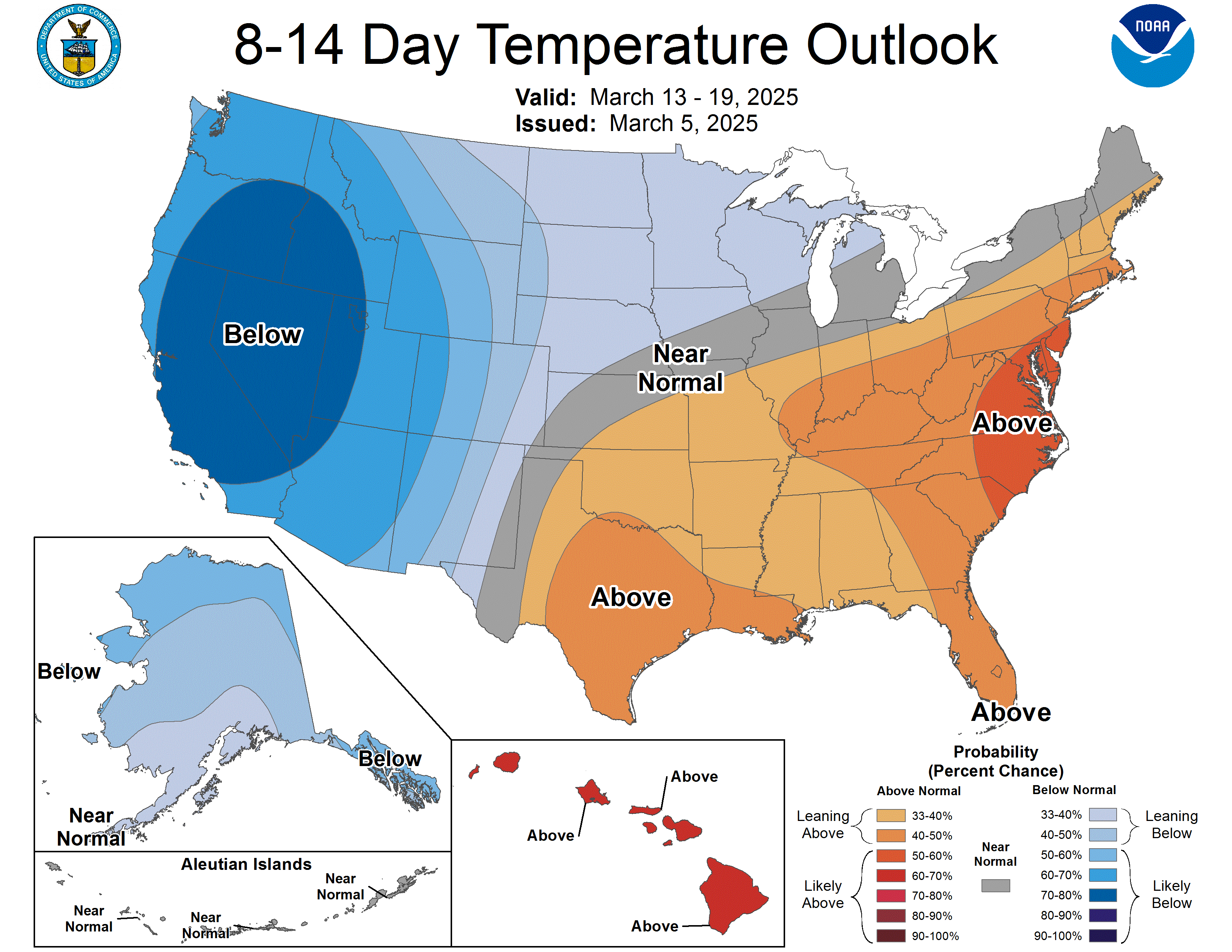
Upcoming Weather
The outlook for the first half of March is quite promising. Multiple basin-wide precipitation events are possible, which is especially good news for the parched LCRB and nearby portions of the GB and UCRB. The 7-day precipitation forecast includes totals of 1–3 inches for the high elevations of the CBRFC area, while the CPC outlook shows wetter and cooler than normal conditions favored into the middle of the month. See the figures below for details.