Montrose County shuts down mechanized streambed mining in the San Miguel River near Uravan

Manhattan Project 1944, Uravan. Photo credit: Uravan.com

From The Montrose Press (Katharhynn Heidelberg):

t’s been about 35 years since the mill at Uravan closed and about 33 since the former West End town was designated a Superfund site, eventually to be bulldozed, burned and buried. But roughly 2 miles away is the Ballpark at Historic Uravan, Colorado, which was never contaminated by uranium and vanadium mining — and the one place people who grew up there still have to gather and remember.

The ballpark, with its primitive camping, has also attracted its share of hobbyist gold miners who access the San Miguel River from there. But when some began showing up with machinery, locals sounded the alarm and on Thursday, Montrose County passed an ordinance prohibiting unauthorized, mechanized mining along the river acreage it owns there. The ordinance can go into effect May 28…

A problem reared its head, though, when she discovered a video on the Facebook page of a hobbyist prospecting group. Thompson said the video showed compressors and a hose that was pumping the river — plus the site was promoting the location to other hobbyists, as was a prospecting book, which has since delisted the location.

“There was a big group that was going to come. They were all going to bring their machinery and have a big weekend there. We decided we probably better let the county know what was happening,” Thompson said.

Although it’s one thing to pan for gold in the river, or put up a small sluice box — that’s still allowed under the new ordinance — mechanized mining imperils the river and the habitat it provides.

“We contacted the group and told them … it belongs to the county. We lease it to the historical society. They have spent many countless hours down there and have turned that into a beautiful little park we encourage people to use. We don’t want it destroyed,” said Montrose County Commissioner Roger Rash, a former Uravan resident.

The county also put up a sign barring machinery in the river.

“But we needed to have some teeth,” Rash said. “We don’t want mechanized mining going on in our park.”

The new ordinance allows panning within the river channel, as long as it occurs at least 2 feet from the bank. Among other provisions, the ordinance prohibits motorized mining activities, including motorized suction dredging.

It also bars activity that undercuts or excavates banks and the ordinance further restricts access to the channel to existing roads and trails.

People cannot disturb more than 1 cubic yard of soil per day and anything that cannot be removed by hand must remain undisturbed.

All digging has to be filled in and the work area must be cleaned up before departure.

Violations are treated as a petty offense, which carry fines between $100 on first occurrence and up to $1,000 for repeat offenses.

If the county property, river or surrounding area sustains damages in excess of $100, violators can be charged with a class-2 misdemeanor punishable by stiffer fines and up to a year in county jail.

Thompson said she and other Rimrockers didn’t understand why anyone would be mining the river with machinery to begin with. The park is open to the public — although it relies upon donations to sustain the picnic structures and fire pits former residents paid for — and has had only minor vandalism issues prior to the mechanized mining.

Current #snowpack and #runoff potential bode well for McPhee releases #ColoradoRiver #COriver

The Dolores River, below Slickrock, and above Bedrock. Photo: Brent Gardner-Smith/Aspen Journalism.

From The Cortez Journal (Jim Mimiaga):

Aquatic biologist Jim White, of Colorado Parks and Wildlife, spoke at a community meeting in Dolores about planned fish surveys, population data and survey techniques.

Parks and Wildlife works with McPhee Reservoir managers to manage downstream flows for three native species that reside in the Lower Dolores – the roundtail chub, bluehead sucker and flannelmouth sucker. The first several miles below the dam to Bradfield Bridge is managed as a cold-water fishery for brown and rainbow trout.

“Roundtail populations have been good,” White said, “and bluehead and flannelmouth are not as abundant.”

The reservoir holds a 33,500 acre-foot reserve for the native fish needs. The “fish pool” is released gradually throughout the year base on biologists’ input. In the winter, flows below the dam are 20-30 cubic feet per second. During summer, they reach 60-80 cfs if there is no whitewater release.

During low water years, the fish pool and farmers share in shortages. When there is a recreation dam release like this year, it is not counted against the fish pool, and the higher flows are managed for ecological benefits such as channel scouring, timing to benefit the fish spawn, and flood plain sedimentation that replenishes nutrient rich sediment on the banks for new seedlings…

Fish counts and surveys are done each year at Slick Rock Canyon, Dove Creek Pump Station, Pyramid Mountain and below the San Miguel confluence.

White explained how a “pit-tag array” installed in 2013 to monitor native fish on the Lower Dolores River works. It is just upstream from the Disappointment Creek confluence.

Native fish captured throughout the Lower Dolores are inserted with a electronic tag, and when they move past the “array” wire above the river, the movement and fish identification is recorded.

So far, 1,421 fish have been tagged. Of those, 38 percent were flannelmouth suckers, 35 were roundtail chubs, and 23 percent were bluehead suckers. Four percent were smallmouth bass, a non-native species biologists are trying to get rid of because they prey on young native fish.

Since installed, 157 tagged fish have been recorded passing under the pit-tag array. In 2018, 14 fish were detected, including eight flannelmouth that arrived after April 8. Five of the flannelmouth were tagged in Slick Rock Canyon, two in the Pyramid Mountain Reach and one tagged in 2014 in the San Miguel River.

The first native fish of 2019 passed under the array on April 5. It was last detected on Oct. 18. On April 16, two flannelmouth were recorded.

#Runoff/#Snowpack news: Dolores is sizing up snowmelt flooding potential

Dolores

From The Cortez Journal (Jim Mimiaga):

On Monday, 30 officials and residents attended an informational meeting at the Dolores Fire Station hosted by Montezuma County emergency manager Mike Pasquin.

The town has not experienced a major flood from the river since 1911, which filled the town valley with up to 3 feet of water.

But there is potential this year because of the heavy snowpack, warming weather, and wet El Niño weather pattern.

The Dolores River peaks from snowmelt between May 15 and June 15, officials said. How much comes down and at what rate depends on snowpack levels, temperature, rain and soil moisture. Runoff forecasting is an educated guess, and possible flood levels require ground truthing as well.

There are some trigger points to watch for, officials said.

Flood stage for the Dolores River in town is 8 feet. A safe maximum flow of the Dolores River is about 6,000 cubic feet per second in town, said Ken Curtis of the Dolores Water Conservancy District.

Flows above that increases the risk of flooding, and flows of 7,000 or 8,000 cfs would start to overflow the banks. Flows can be viewed by visiting the Dolores River Boating Advocates web page

Increased flows from a hot spell or rain event in the upper valley takes time to reach town and usually arrives at night, said town board member Val Truelsen, “so there should be some nighttime monitoring of the banks.”

Residents should stay tuned to the National Weather Service for regional and local flood watches and warnings.

Montezuma County Sheriff Steve Nowlin said the community will be given warnings about predicted flooding conditions through media outlets, town reports, reverse 911, Nixle and social media. The town has recently repaired emergency siren that would also be activated as a warning.

Bridges up the valley are being monitored for debris accumulation and to ensure boaters can safely get under them. Collapsed mines in Rico that collect runoff have automated sensors that warn emergency personnel if the pressure and levels are too high, triggering relief valves.

Community sandbagging projects are happening in some flood-prone towns in the state, said Karen Dixon, emergency manager for the county health department. Local agencies said they are ready to respond to a flood emergency with equipment and staff.

If needed, sand is available at the county shop on County Road 30, said county road manager Rob Englehart.

Officials said severe flooding could compromise utility systems such as water, sewer and natural gas lines, and cause them to be shut down until the water recedes and repairs are made.

Potential shelter areas for evacuees discussed were the Dolores Community Center, Dolores High School, county fairgrounds, House Creek and McPhee campgrounds, and Canyons of the Ancients Museum and Visitor’s Center.

Westwide SNOTEL basin-filled map April 16, 2019 via the NRCS.

@USBR to host public meeting on Dolores Project 2019 water operations, Thursday, April 18, 2019

The Dolores River, below Slickrock, and above Bedrock. Photo: Brent Gardner-Smith/Aspen Journalism.

Here’s the release from the USBR:

The Bureau of Reclamation will host the 2019 operations meeting for the Dolores Project on Thursday, April 18, at 7 p.m. The meeting will be held at the Dolores Community Center, 400 Riverside Avenue in Dolores, Colorado.

“This meeting is a great opportunity for our partners and the public to find out how the 2019 water year is shaping up and to have any related questions answered,” said Western Colorado Area Office Manager Ed Warner.

Meeting topics will include a review of 2018 operations, projected water supplies and runoff for 2019 and the forecasted possibility of a boatable release to the Dolores River below McPhee Dam in 2019.

The meeting will also include presentations and representation from several agencies, including: Reclamation, Bureau of Land Management, United States Forest Service, Dolores Water Conservancy District, Colorado Parks and Wildlife, Dolores River Boating Advocates, American Whitewater and Fort Lewis College. There will be opportunities for questions, comments, and discussion during the meeting.

For more information, please contact Robert Stump at 970-565-7232 or rstump@usbr.gov.

Four States Agricultural Exposition recap: Plan for an uncertain future

Cortez early 1900s via Crow Canyon Archaeological Center

From The Cortez Journal (Sean Dolan):

At a local level, Cortez adopted a conservation plan in November that seeks to reduce per capita water consumption from 200 gallons per day to 180 gallons per day. The plan includes metering water users and rebates for water-efficient appliances.

“Luckily, we had a great year this year, but if we have another couple of dry years, 2020 might be when it gets a little closer,” Padgett said. “But for right now, we’re fine.”

There might not be an immediate threat, but she said the variable hydrology and declining storage at Lake Powell pose real and immediate concerns. She said it’s best to take a proactive approach to planning to avoid getting into sticky situations.

“If we do fall out of compact compliance, it’s a pretty catastrophic event, so we always want to be prepared for that worst-case scenario,” Padgett said. “These recent droughts have really made everyone aware that we need to start planning more for that uncertain future.”

Earthquake reported at the Paradox Valley Salinity Control Facility — @USBR

Here’s the release from the Bureau of Reclamation (Marlon Duke):

The U.S. Geological Survey reported that an earthquake occurred at 10:22 a.m. MST, on Monday, March 4, 2019, near Reclamation’s Paradox Valley Salinity Control Facility near Bedrock, Colorado. Reclamation maintains a comprehensive network of seismic monitoring instruments in the area, which indicated a preliminary magnitude 4.1 for this earthquake. The quake was felt by employees at the Reclamation facility and residents in surrounding areas.

The Paradox Valley Salinity Control Facility injects highly pressurized, concentrated salt water (brine) into a 16,000-foot-deep well, preventing the brine from entering the Dolores River. The well was not operating at the time of the earthquake due to routine maintenance. Operations will not resume until Reclamation completes a thorough assessment of the situation.

High-pressure brine injection has been known to trigger small earthquakes in the past, and today’s event was within the range of previously induced earthquakes. Reclamation’s seismic network in the area monitors the location, magnitude and frequency around the Paradox Valley Salinity Control Facility. Reclamation will continue using that network to monitor earthquakes in the area.

The Paradox Valley Salinity Control Facility substantially benefits downstream water quality in the Colorado River Basin, and helps the United States meet treaty obligations with Mexico for allowable salinity levels in the river. Historically, the Dolores River picked up an estimated 205,000 tons of salt annually as it passed through the Paradox Valley. Since the mid-1990s much of this salt has been collected by the Paradox Valley Salinity Control Unit in shallow wells along the Dolores River and then injected into deep subsurface geologic formations. The deep well injection program removes about 95,000 tons of salt annually from the Dolores and Colorado rivers.

Protecting the River’s Edge from an Invasive Threat

From The Walton Family Foundation (Peter Skidmore):

In the Colorado River Basin, RiversEdge West leads a coordinated effort to restore critical habitat

Doug King’s family has been ranching the lands around the Dolores River in Southwest Colorado since the 1930’s. “It’s beautiful−I call it John Wayne country,” Doug says, proudly. “I’m the third generation on the land, my son will be the fourth generation, and his son will be the fifth.”

Over the decades, Doug experienced firsthand the steady, relentless creep of invasive plant species like tamarisk and Russian olive and its impact on the land he has cared for his whole life. The damage has been extensive, threatening the larger riparian—or river bank—habitat that in the Colorado River Basin ultimately supports more than 40 million lives across two nations.

As the unwelcome vegetation pressed in on essential farmland and fish and wildlife habitat, Doug and many others in the region understood it was time to lock arms and push back.

Originally conceptualized in 1999 to discuss strategies for addressing invasive plant species along rivers in western Colorado, the then-named Tamarisk Coalition was fueled by a desire to shape a landscape-scale solution. The group had observed that conventional site-by-site eradication simply wasn’t able to move quickly enough.

“People were getting grants to do five acres or half a mile” of tamarisk removal, recalls Tim Carlson, the coalition’s first executive director. “That wasn’t going to solve the problem. We started with a bold approach: If we were going to solve this problem, it’s got to be a regional solution.”

The introduction of the tamarisk is a story of unintended consequences. Long thought to prevent erosion along the banks of western rivers, its presence was so valued in earlier days that Boy Scouts would receive badges for planting it. But the persistent shrub with scale-like leaves took to its adopted habitat like a parasite, displacing native vegetation.

Restoring and sustaining the overall health of the Colorado River Basin has been a primary goal of the Walton Family Foundation’s Environment Program since its inception nearly a decade ago. And, the program’s first grant to the Tamarisk Coalition in 2009 supported its restoration efforts along the San Miguel and Dolores river systems. Gradually, the foundation expanded its support to also include work along the Escalante, Verde and Gila systems.

“We have a great relationship with the foundation where we present innovative ideas, and they help us scale up these efforts. The investment affects a vast landscape, bolsters our work and has helped us promote best practices to other organizations,” says Cara Kukuraitis, outreach and education coordinator for the organization now known as RiversEdge West.

The organization changed its name in 2018 to reflect its broader work in Western riparian areas and the surrounding communities. But it retains its unique and core operating model—to facilitate collaboration and information-sharing across diverse groups and individuals to accomplish riparian restoration at a larger scale than any one partner can attain on its own. As a result, RiversEdge West now supports 20 ambitious multi-stakeholder partnerships encompassing federal, state, and community organizations throughout the American West, teaching best practices to over 300 local public and private restoration organizations and successfully restoring some 11,500 acres—and counting—of riparian habitat.

The state of Colorado is among the group’s core partners.

“Our relationship with RiversEdge West has allowed Colorado Parks and Wildlife to more effectively meet our mission of improving the wildlife habitat within the state,” explains Peter Firmin, manager of the James M. Robb-Colorado River State Park.

“The networking and training opportunities provided by RiversEdge West allow us to leverage intellectual and financial resources to improve habitat along the Colorado River. As a group, we are able to accomplish more than we could as individuals.”

The work of RiversEdge West and its growing network is bolstered by an array of technical tools. For example, a multi-partner geodatabase stores and shares data with land managers, so they can see how their projects connect and positively impact the landscape over time.

“The data helps us establish and measure progress against quantitative goals, so the project can jump from removing tamarisk by just cutting trees to collecting data on the extent of the problem and promoting ways to encourage the ecosystem’s overall health,” says Cara.

It is a testament to the organization’s enduring value that its annual conference attracts upwards of 200 representatives from Colorado, Arizona, Nevada, New Mexico, California, Texas, Kansas, Oklahoma, Utah and Mexico to connect on riparian restoration science.

The organization also is working to convey the broad importance of these efforts through its ongoing “Riverside Stories” web series, which tells the personal stories of people who call this land home and are working to restore this habitat for future generations. Among them is Doug and his family.

“I have a theory that we should leave the land better than how we got it,” Doug notes in sharing his story. “The Colorado River is soon going to be the most important resource in the West. We are just caretakers. You are only going to be here 50-60 years, and then somebody else is going to have this land.

#Drought news: Narraguinnep is reduced to minimum pool; Groundhog also is low

From The Cortez Journal (Jim Mimiaga):

Narraguinnep and Groundhog reservoirs are at their lowest level in 16 years, said Brandon Johnson, general manager for the Montezuma Valley Irrigation Co.

The limited water supply caused a reduction in allocations for MVIC shareholders Thursday to 36 inches, or 3 acre-feet per share. Shareholders who have reached that allocation will be shut off on Friday…

During normal snowpack years, a full allocation is 48 inches, or 4 acre-feet per share…

Groundhog Reservoir has a capacity of 21,700 acre-feet, but is at 11,000 acre-feet right now, Johnson said. It is expected to be drawn down to the minimum level of 4,000 acre-feet that is required for the fish pool.

During normal years, Groundhog is kept at 13,000 acre-feet going into winter.

“It will take two to three years of normal winters to refill Groundhog,” Johnson said.

MVIC owns Groundhog and Narraguinnep and also has storage and water rights in McPhee Reservoir. MVIC officials are releasing water from Groundhog, via the Dolores River, into McPhee to be delivered into the MVIC canal system.

As a result, the Dolores River is running at 182 cubic feet per second, but 150 cfs of that is coming from the Groundhog Reservoir release.

The irrigation supply in McPhee Reservoir is also running low, but the system is still delivering water, said engineer Ken Curtis.

Farmers had shortages this year, and the season was reduced from the usual three cuttings of alfalfa to two cuttings for most farmers.

During average years, irrigation supply in McPhee is 240,000 acre-feet of water, but this year, only 150,000 acre-feet was available, or 60 percent of normal. And most of the supply was carried over from the previous above-average winter.

There will be no carryover going into next year’s water season.

Say hello to the new Water Information Program website

Water Information Website screen shot July 23, 2018.

Click here to go to the website.

Norwood to complete raw water system this summer

Lone Cone from Norwood

From The Norwood Post (April 19, 2018) by Regan Tuttle:

For decades, town officials have wondered if a raw water system might be possible. Now — after three years of study, group collaboration, grant applications and awards, engineering, numerous public meetings, and more — Norwood will complete its raw water system by end of summer. That means next spring, many people (those that purchased raw water taps for their residences) will be running a sprinkler, watering a garden, planting vegetable patches and growing flowers. And the system, officials say, also has other benefits…

Experts say that for farming and gardening, raw water is ideal. Raw water attracts pollinators, like bees and butterflies, and plants and flowers flourish quite well with the microbes and other naturally occurring particles present in it.

“Putting treated water on a plant, we take out the ingredients that a plant likes, the things that are good for them,” Norwood’s Public Works Director Tim Lippert said. “Using treated water on plants and vegetation isn’t a good thing. Raw water already has the nutrients in it.”

Because it doesn’t go through the treatment process, it’s a cheaper utility to deliver than potable water. Lippert said that in addition to being affordable, raw water is easy to manage, because no regulation of it is needed (other than making the pipe it comes out of purple, to distinguish it from treated water). Raw water is a seasonal product, available only during the growing season…

HOW NORWOOD’S SYSTEM CAME TOGETHER

It’s taken a community of people and organizations coming together to make Norwood’s raw water system possible. From the beginning, officials in the Norwood Water Commission and the Public Works Department had wondered if the town could make the project plausible. Lippert said the town explored the idea some 20 years ago, but citizens weren’t ready for it then.

He said that in the last few years, officials began to revisit the idea and wondered if the town’s existing water shares could be put to use as a raw water utility service for residents. The town does own 119 shares of Gurley water (managed by Farmer’s Water Development).

In 2015, town officials reopened the conversation with members of the Norwood Water Commission, Farmers Water and other regional water groups.

The first step included the Colorado Water Board Conservancy awarding a $47,000 grant to the Town of Norwood in 2016 to support a feasibility study on the project. (SGM, of Durango, did the study and continued with the engineering work.)

Along the way, the Norwood Lawn and Garden Group, spearheaded by Clay Wadman, who owns a home in Norwood and who wanted to see the project succeed, worked on education and outreach in town. The garden group worked to help the town sell residential raw water taps and supported Norwood in the fundraising process.

Soon, grants began rolling in from the Southwest Water Conservation District ($175,000), San Miguel Water Conservancy ($5,000), the Telluride Foundation ($5,000) and San Miguel County ($25,000). In 2017, the Department of Local Affairs made a decision to give Norwood’s project around $690,000 in a matching grant to make raw water in Norwood a reality.

The Town of Norwood also put money in — around $68,000 for final engineering — from the town’s reserves to move the project along. In 2017, town officials also budgeted $25,000 for the project; they’ve earmarked another $200,000 from the capital improvement fund if those funds are needed.

Norwood’s Town Administrator Patti Grafmyer said seeing the raw water system come to fruition is quite an accomplishment for the town.

“The idea of a raw water system has been discussed for many years, but with the help of a grant from CWCB, Norwood was able to complete a feasibility study. From the feasibility study came the grassroots Norwood Lawn and Garden Group, which became the public outreach group that assisted the Town of Norwood and Norwood Water Commission in this project,” she said. “There are so many people who were key players in this project. This project is the product of teamwork. So many people have shown their support for the raw water system.”

OTHER BENEFITS OF UNTREATED WATER

While it’s true that utilizing raw water makes flower and vegetable gardening possible, officials say it offers additional benefits, such as helping to increase property values.

The Kurtex Management Company, which owns Norwood’s Cottonwood Creek Estates, purchased 31 residential taps for raw water. Wadman has said the system there will no doubt transform the look of the neighborhood: rocky areas that comprise the lots can be replaced with landscaping, and raw water at each residence will sustain the lawns. At the same time, Cottonwood Creek Estates’ residents will have the option of gardening and producing their own food.

@COParksWildlife closes some state wildlife areas near #Durango; others and state parks remain open #416Fire #BurroFire

From email from Colorado Parks and Wildlife (Joe Lewandowski):

To assist federal and local agencies during the current dangerous fire conditions and recently enacted public land closures, Colorado Parks and Wildlife has announced that some State Wildlife Areas in southwest Colorado are now closed to all public access. But in addition, several other water-based wildlife areas and two state parks remain open to the public.

In and near Durango the Bodo, Perins Peak, Haviland Lake, Devil Creek and Williams Creek state wildlife areas are closed until further notice. In Bayfield the Lion’s Club shooting range, managed by CPW, is also closed.

West of Durango in Dolores and Montezuma Counties, Lone Dome and Fish Creek State Wildlife Areas are also closed.

“We regret having to enact these closures, but we do so in an effort to protect the public and protect natural resources. These measures will also help with compliance to the recent closures enacted by the U.S. Forest Service and La Plata County,” said Adrian Archuleta, a District Wildlife Manager with CPW.

CPW also wants area residents and visitors to know that there are several other State Wildlife Areas and State Parks that remain open for recreation. CPW asks that people comply with any current local fire restrictions so that these areas can remain open for recreation.

The areas that are open include: Echo Canyon SWA in Archuleta County; Pastorious SWA in La Plata County; in Montezuma and Dolores counties — Summit, Puett, Narraguinnep, Totten, Twin Spruce, Dolores River, Joe Moore and Ground Hog Reservoir state wildlife areas.

Also open are Navajo State Park in Archuleta County; and Mancos State Park in Montezuma County. Both parks offer campsites, hiking, fishing and other water recreation.

Two companies contact the Dolores Water Conservancy District on potential pump-back hydroelectric power facility at McPhee Reservoir

Pumped storage hydro electric.

From The Cortez Journal (Jim Mimiaga):

Pump-back storage systems utilize two reservoirs at different elevations. To generate power, water is released from the upper reservoir to the lower, powering a turbine on the way down that is connected to the grid.

In 2014, the Dolores Water Conservancy District released an investor’s memorandum on the potential for a project at Plateau Creek to inform energy companies and investors of the opportunity. The canyon’s steep vertical drop in a short distance makes it a good location.

District General Manager Mike Preston, speaking at Thursday’s board meeting, described pump-back storage plant idea as giant battery that is part of a green energy power grid.

When electric prices are high, the water is released from the upper reservoir through a turbine, and the power is sold to the grid to meet demand. When electric prices are low, the water is pumped back to the upper reservoir through a tunnel, recharging the battery.

Preston recently toured the Plateau Creek site by plane with Carl Borquist, president of Absaroka Energy, of Montana. The company proposed to build a pump-back hydroelectric facility at Gordon Butte, northwest of Billings, Montana…

The Dolores Water Conservancy District holds the water rights for the potential Plateau Creek project, estimated to cost $1 billion, based on the 2014 study. It would require environmental reviews and approval because it would be on San Juan National Forest land. McPhee could be used as the lower reservoir, with a small reservoir built above Plateau Canyon.

The project needs investors before it could get off the ground, but once online, it would generate an estimated $100 million per year in electricity sales. As the holder of the water rights, the district could benefit financially from the deal.

“We have the site, and if we could realize a revenue stream, it would help the district financially,” Preston said.

Shortly after Absaroka Energy’s visit, the district received a letter from Matthew Shapiro, CEO of Gridflex Energy, based in Boise, Idaho, expressing interest in exploring a pump-back storage system at McPhee.

“We recently developed a concept for this site that the district may not have considered before, one which we believe would have greater viability than the prior concept,” he stated. “We believe that the timing for this particular project is promising.”

Pump-back hydroelectric storage is considered a nonconsumptive, green energy power source. Energy companies are potential investors in hydro projects as they expand their portfolios to include green energy. They need supplemental sources to meet demand when the sun does not shine or the wind does not blow.

The Dolores Water Conservancy District had obtained a preliminary permit for a facility at Plateau Creek from the Federal Energy Regulatory Commission, but it was not renewed in 2016 because the project had not moved forward enough.

CDPHE revokes Piñon Ridge uranium mill license

From The Cortez Journal (Jim Mimiaga):

The decision to pull the license came after a five-year legal challenge from environmental groups including the Sheep Mountain Alliance, Rocky Mountain Wild and Center for Biologic Diversity. The groups have long opposed a plan hatched in 2009 by Energy Fuels Inc., of Toronto, Canada, to build a uranium mill on 880 acres in Paradox Valley, west of Nucla in Montrose County.

They filed a legal challenge against a key radioactive materials license granted for the project in 2013 by the Colorado Department of Health and Environment.

Energy Fuels has since sold the assets of the mill project, including the radioactive license, a company spokesman said Friday. Documents show the license was being held by Piñon Ridge Resources Corp.

On April 17, District Court Judge Richard W. Dana recommended the proposed mill’s radioactive license be revoked after concluding that Energy Fuels failed to demonstrate adequate environmental protections, including prevention of wind-dispersed radioactive materials, contamination of groundwater and protection of plants and wildlife. The ruling also questioned whether there was adequate water to operate the mill and tailings ponds.

Two days later, in an April 26 letter, the Colorado Department of Health informed Piñon Ridge Corp. CEO George Glasier that its radioactive materials license has been revoked.

“Although the Department believes the original decision on the license application was appropriate, the department has elected not to challenge Judge Dana’s decision. As such, this decision provides the Department with the rationale to revoke the license,” wrote Jennifer Opila, Radiation Program Manager for the health department’s hazardous materials division.

Environmental groups applauded the decision.

“We were extremely concerned with the impacts that a new uranium mill would have on the delicate sagebrush ecosystem of the Paradox Valley and the impacts downstream to endangered Colorado River fish,” said Matt Sandler, staff attorney with Rocky Mountain Wild. “Those impacts were simply unacceptable, and we’re happy to know that corporations who want to revive the uranium industry in Colorado will be required to fully comply with the laws aimed at protecting the environment.”

[…]

Lexi Tuddenham, executive director or Sheep Mountain Alliance, based in San Miguel County, said the decision helps to resolve the uncertainty about the project in the community and encourages a more diversified economic future that does not rely on the toxic uranium industry.

“The decision is a long time coming,” she said. “The impacts to the ecosystem and public were unacceptable. The mill was really a pipe dream, more speculation that contributes to the historic boom and bust cycle of mining that has been difficult for this area’s economy.”

The region is turning to hemp farming and outdoor recreation because they are more sustainable and do not pollute the environment, she said.

This is the second time the CDPHE granted, then revoked the radioactive license for Piñon Ridge. After it was granted in 2011, environmental groups challenged it, pointing out that the state had not held a public hearing as required. A judge agreed and invalidated the permit. After a five-day hearing in Nucla, the state reapproved the license in 2013, which was again revoked this week.

Travis Stills, an attorney with Energy and Conservation Law in Durango, represented the environmental groups in the case.

He said Dana’s ruling was based on community testimony and scientific evidence that indicated the mill plan questionable.

“The project plan had big holes in it and did not protect water, life and air,” he said. “Experts testified that micro-climates and inversions would have caused the valley to be socked in with industrial emissions.”

The towns of Telluride and Ophir also objected to the mill, fearing that prevailing winds would carry radioactive pollution onto the local snowpack and San Miguel watershed, Stills said.

Down ‘The River Of Lost Souls’ With Jonathan Thompson — Colorado Public Radio

From Colorado Public Radio (Nathan Heffel). Click through to listen to the interview:

A new book puts the Gold King Mine spill within the long history of mining and pollution in Southwest Colorado.

Jonathan Thompson will be at the Book Bar tonight. I wonder if Denver is a bit of a shock to his system even though he’s a sixth-generation Coloradan?

I am so happy to finally get to finally meet Jonathan. His new book, River of Lost Souls, is an important read. Understanding the industrialization of our state over the years will help us chart a less destructive course.

I loved the passages where Jonathan reminisces about spending time around the Four Corners and in the San Juans. He transports you to those times in your life spent next to the river or exploring what sights the land has to offer. He connects you to the Four Corners in a way that only a son of the San Juans could.

Cement Creek aerial photo — Jonathan Thompson via Twitter

Telluride Regional Wastewater Treatment Master Plan

Dolores River watershed

From The Telluride Daily Planet (Justin Criado):

Gugliemone explained that the price tag is a “conservative” (aka “likely high”) estimate, and the engineering team is looking into alternative wastewater-treatment technologies that could possibly cut the cost by $20 million. (“That would be nice,” she said about the possible price reduction during her presentation.)

Stantec Inc. — a design and consulting company headquartered in Edmonton, Alberta — is the engineer under contract, Gugliemone said. The company’s slogan is “We design with community in mind,” according to its official website (stantec.com).

Gugliemone added that the towns of Telluride and Mountain Village recently tabbed Financial Consulting Services to complete a financial analysis, along with a Financial Analysis Task Force and the town councils. The analysis will “lay out how the community might best meet the financial obligations before us,” she said.

Water and wastewater projects are covered through separate enterprise funds, which use taxes and service fees to raise capital. At a June 2017 wastewater treatment plant update, Telluride Councilman Todd Brown theorized there most likely would be a utility rate increase to help with project costs.

At Monday’s meeting, Mountain Village Mayor Laila Benitez pondered whether setting up a special taxing district for the treatment plant would be another funding option. Gugliemone said the financial consulting company is looking into that, but nothing has been suggested — let alone decided — yet.

The current wastewater treatment plant at Society Turn serves the communities of Telluride, Mountain Village, Eider Creek, Sunset Ridge, Aldasoro and Lawson Hill.

The plant is reaching its originally designed capacity, officials have explained. Plus, Department of Public Health and Environment regulations through the Colorado Discharge Permit System have been altered over the years. (Colorado Water Quality Control Division stipulations regarding acceptable metal levels in the water also changed in 2017.)

Those variables, in conjunction with an increased waste stream and new treatment options, make updating and eventually expanding the current plant paramount within the next decade. (A 1.5-percent annual population growth has been used to calculate increased wastewater loads until 2047. Basically, if the plant isn’t expanded, the San Miguel River would run with waste, which is a disgusting, vile thought.)

Dolores River: Water district lawsuit against in-stream flows fails

Photo via the Sheep Mountain Alliance

From The Cortez Journal (Jim Mimiaga):

In 2015, the state water board appropriated an in-stream flow standard of 900 cubic feet per second on the Dolores River during spring, between the confluence of the San Miguel River and Gateway.

It is intended to support river health including three species of native fish: the flannelmouth sucker, bluehead sucker and roundtail chub.

The Southwestern Water Conservation District filed a legal challenge to the new minimum flow standard, arguing that the flows were too high and could not be met in drought conditions. They further claimed that Colorado Water Conservation Board improperly concluded it could not adopt a 1 percent depletion allowance on the in-stream flow to accommodate future developments as a condition.

But the Colorado water court rejected the lawsuit claims, and confirmed the newly designated in-stream flow for the Dolores in a ruling Thursday.

District Court Judge J. Steven Patrick said the water board has the authority to appropriate in-stream flows and that it followed proper procedures.

“The Court finds nothing in the record to support a finding that CWCB’s action was unreasonable,” the judge wrote in the decision. “The CWCB did not abuse its discretion in refusing to consider … the proposed depletion allowance.”

Environmental groups applauded the decision. Durango-based San Juan Citizen’s Alliance, Western Resource Advocates and Conservation Colorado had joined the water board in defending the board’s new Dolores in-stream flows.

“We believe this decision not only protects the beautiful Dolores River, but affirms the use of in-stream flow water rights as a vital tool to leave a legacy of healthy rivers throughout Colorado,” said Jimbo Buickerood, land and forest protection manager for San Juan Citizen’s Alliance.

The court ruling secures up to 900 cubic feet per second of water during spring peak flows, as well as essential winter flows, for a 33-mile stretch of the river. Environmentalists say the flows will help prevent at-risk native fish species from becoming listed as endangered or threatened under the Endangered Species Act. The river anchors a remote desert oasis and has plentiful recreation opportunities, they said…

The reach slated for the largest in-stream flow protection on the Dolores River is near the Unaweep-Tabeguache Scenic and Historic Byway between Gateway and Uravan, Colorado.

New in-stream flows are junior to existing water rights, but senior to future water right claims.

The Dolores Water Conservancy District also objected to the new Dolores in-stream flow, and urged that it should at least have a condition to allow for some future development needs. The district manages McPhee Reservoir and dam, which are upstream from the new appropriation.

During a previous hearing on the matter, DWCD attorney Barry Spear, said the proposed 1 percent depletion proposal was to “set aside an amount that the small water developer could use to keep the water in the state.”

[…]

The new in-stream flows for lower Dolores River begin below the San Miguel confluence are as follows: minimum flows of 200 cfs from March 16 to April 14; 900 cfs from April 15 to June 14; 400 cfs from June 15 to July 15; 200 cfs from July 16 to Aug. 14; and 100 cfs from Aug. 15 to March 15.

Rico scores $60,000 from @CWCB_DNR for source water study

Rico photo via WesternMiningHistory.com

From The Telluride Daily Planet (Heather Sackett):

During a recent meeting in Broomfield, the Colorado Water Conservation Board (CWCB) approved a $60,000 grant from its Water Reserve Supply account for the town to conduct a water system analysis. Half of the grant money will come from the Southwest Basin Roundtable account, while the other $30,000 will be from the CWCB statewide fund. Rico and Southwestern Water Conservation District will contribute an additional $30,000 each for a project total of $120,000.

The town will hire a water engineer to conduct the study, which will find ways to increase water efficiency, quality and productivity for residents.

Kari Distefano, who became Rico’s town manager in May 2017, said one of the first things she did was to hold a community meeting to assess residents’ priorities regarding the town’s infrastructure.

“Water rose to the top,” she said. “Our water system is problematic. I looked in our reserves and decided we needed some help.”

Rico has two water sources — an alluvial well just north of town and Silver Creek, which flows into the east side of town and is a tributary of the Dolores River. The Silver Creek system is currently offline because it does not meet the Colorado Department of Health and Environment turbidity standards for surface-water filtration and is only used as an emergency backup system.

The well, which has junior water rights, only provides .178 cubic feet per second because it must comply with instream flow requirements on the Dolores River. That amount of water is adequate for Rico’s current population of roughly 200 year-round and 500 summer residents, but would not be enough if the town were to grow. The well provides water to 31 commercial and 242 residential taps, respectively.

The study will determine what it would take to re-establish Silver Creek as a water supply.

“I’m hoping (the study) will tell us what it’s going to cost to upgrade the filtration system,” Distefano said. “The ultimate goal would be to combine the two systems and have a redundant source of water. To allow more growth, Rico needs a little more volume.”

[…]

The water analysis also aims to find a way to relocate the aging outdoor water meter boxes to inside residences, making them less vulnerable to damage from the elements.

Pat Drew, a Rico water consultant for Rico, has been helping the town with regulatory compliance issues. He said the water study also will evaluate weaknesses and leaks in the system…

The project also will meet some of the goals laid out in Colorado’s Water Plan, which Gov. John Hickenlooper unveiled in late 2015, as well as goals identified by the Southwest Basin Roundtable Basin Implementation Plan. Those goals include providing safe drinking water to southwest Colorado’s citizens and visitors, promoting wise and efficient water use through municipal conservation, and supporting water reuse strategies.

@CWCB_DNR: The latest “CWCB Confluence” newsletter is hot off the presses

Dolores River watershed

Click here to read the newsletter. Here’s an excerpt:

Collaboration in the Dolores River Watershed (Celene Hawkins):

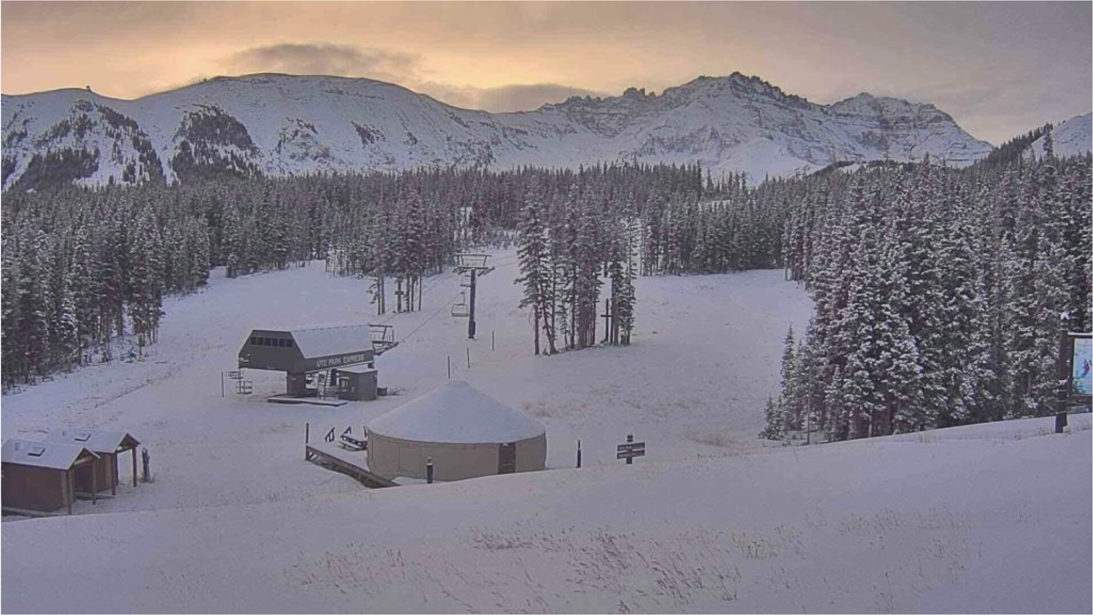
About one year ago, I was backcountry skiing into some of the highest elevations of the Dolores River watershed near Lizard Head Pass. I was appreciating the above-average snowpack that Mother Nature blessed the basin with, which covered the always-spectacular beauty of the San Juan Mountains.

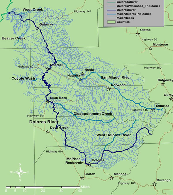
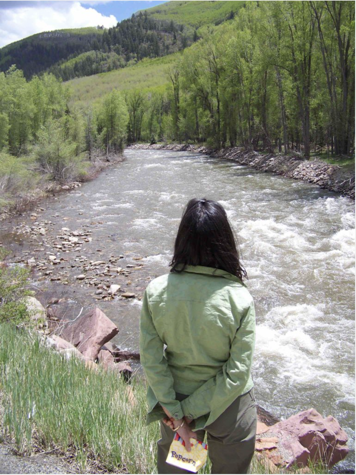
Over the course of 2017, I got to visit and revisit that snowpack as it melted and flowed down the upper portions of the Dolores watershed, filled McPhee Reservoir (where it would serve important municipal, industrial, agricultural, and Tribal uses), and provided enough water for a rare and large managed release from McPhee Reservoir into the lower Dolores River.

Because the Dolores River watershed has experienced so few recent years of abundant water, the abundant 2017 water year provided cause for local and regional celebration. Local farmers had full supplies of water from the Dolores Project to support their agricultural operations, recreational users of the Dolores River below McPhee Dam enjoyed a whitewater boating season of 63 days, and the entire ecology of the Dolores River benefitted from the longest and highest flows experienced in a decade.

Yet, now, in January 2018, I’m watching one of the driest and warmest early winters in recent history, reflecting on local water work in 2017. The bigger and more interesting story in the Dolores River watershed is not one about the snowpack or water supplies, but is instead one about collaborative water and resource management work in the watershed.

Collaborative work can take a significant amount of time and resources from already-taxed governmental agencies and non-profit groups. Collaborative work around water and watershed management requires a delicate balance of a proper respect for important private property interests in the use and delivery of critical water supplies, and the ability to find creative solutions and projects to protect the wider public and resource management interests, as well as private industry, that rely on the same river and watershed. On the Dolores River, water managers; federal, state, local, and Tribal governmental agencies; non- profit groups; local industry; private citizens; and others are working throughout the watershed to address important and often difficult water and natural resource management challenges.

Two major collaborative efforts on the Dolores River saw significant growth and success in 2017, and it is worth celebrating now and continuing to watch and support in 2018.

The Upper Watershed—Dolores Watershed Resilient Forest Collaborative

In 2015, Firewise of Southwest Colorado and the Dolores Water Conservancy District launched a new effort to form a collaborative network in the Dolores River watershed to address community wildlife and post-fire risks at a watershed scale. This new collaborative effort recognizes that droughts, beetle infestation, and a perennially longer fire season are all setting the stage for a broad-scale natural disaster in the forested upper Dolores River watershed. The potential for such a natural disaster puts at risk community lives, property, and public and natural resources (including the water in McPhee Reservoir that supports cities, farms and ranches, industry, and rural areas in the Montezuma Valley).

Momentum for establishing and growing capacity in the Dolores Watershed Resilient Forest Collaborative (known by the charming acronym of the “DWRF Collaborative”) has been tremendous over the last two and a half years. By the end of 2017, over 40 different public and private entities were participating at some level in the collaborative.

Some example partners include: the Dolores Water Conservancy District, Montezuma and Dolores counties, the towns of Dolores and Dove Creek and the City of Cortez, the Ute Mountain Ute Tribe, San Juan National Forest, Colorado State Forest Service, Tres Rios BLM, representatives of the local timber industry (including Aspen Wall Wood, Findley Logging, Montrose Forest Products, and Stonertop Lumber), conservation organizations (including Mountain Studies Institute, San Juan Citizens Alliance, The Nature Conservancy, and Trout Unlimited), and private citizens.

The DWRF Collaborative has also successfully garnered resources to support capacity building within the organization, including the impressive coordination work of Rebecca Samulski, Assistant Director for Firewise of Southwest Colorado. She says, “The stakeholders continue to show up each month and share the workload. It is inspiring to see the conversations that continue after each stakeholder meeting, then to hear about the efforts that have emerged among participants because the DWRF Collaborative has gotten them in a room together.”

The group has already undertaken an impressive mix of “on the ground” forestry and fire- adaptive treatment projects, planning work, and engaging on key issues in the upper Dolores watershed. In 2016 and 2017, the DWRF Collaborative implemented forestry and fire- adaptive treatment projects near Joe Moore Reservoir (Lost Canyon tributary) and on Granath Mesa, which sits directly above McPhee Reservoir and the Town of Dolores.

The DWRF Collaborative has allowed the San Juan National Forest to establish Good Neighbor Authority projects with the Colorado State Forest Service (bringing additional capacity and resources to accomplish cross boundary projects on private lands and adjacent national forest lands).

The DWRF collaborative has also completed modeling of wildfire risk and post-fire flooding and erosion risk that will inform a Watershed Wildfire Protection Plan with a better understanding of how wildfires are likely to affect key community values (such as public safety, structures, infrastructure, and water resources) and how to target future treatment projects.

Finally, the DWRF collaborative has launched into key local issues in the Dolores River watershed through professional background presentations to the stakeholders and working groups. These efforts include engagement and support of the local timber industry to explore opportunities that will make forest restoration for watershed protection more cost effective.

An emerging bark beetle epidemic in the Dolores River watershed is another key issue that the collaborative is developing local strategies for, such as an identification and management workshop series to launch in 2018.

Below McPhee Dam—Dolores River Native Fish Monitoring and Recommendation Team

Water managers and diverse groups of stakeholders have been engaged in collaborative work on the Dolores River below McPhee Dam for more than a decade. For example, the Dolores River Restoration Partnership (a public-private partnership) has been working hard and successfully since 2009 to restore the riparian corridor of the Dolores River below McPhee Dam. They have worked to control invasive plant species and restore riparian vegetation.

Since the Dolores River Dialogue (DRD) re-initiated discussions about the Dolores River downstream ecology in 2004, water managers and a large and diverse group of stakeholders have been working to address some of the toughest land, resource, and water management challenges facing McPhee Reservoir and the Dolores River below McPhee Dam.

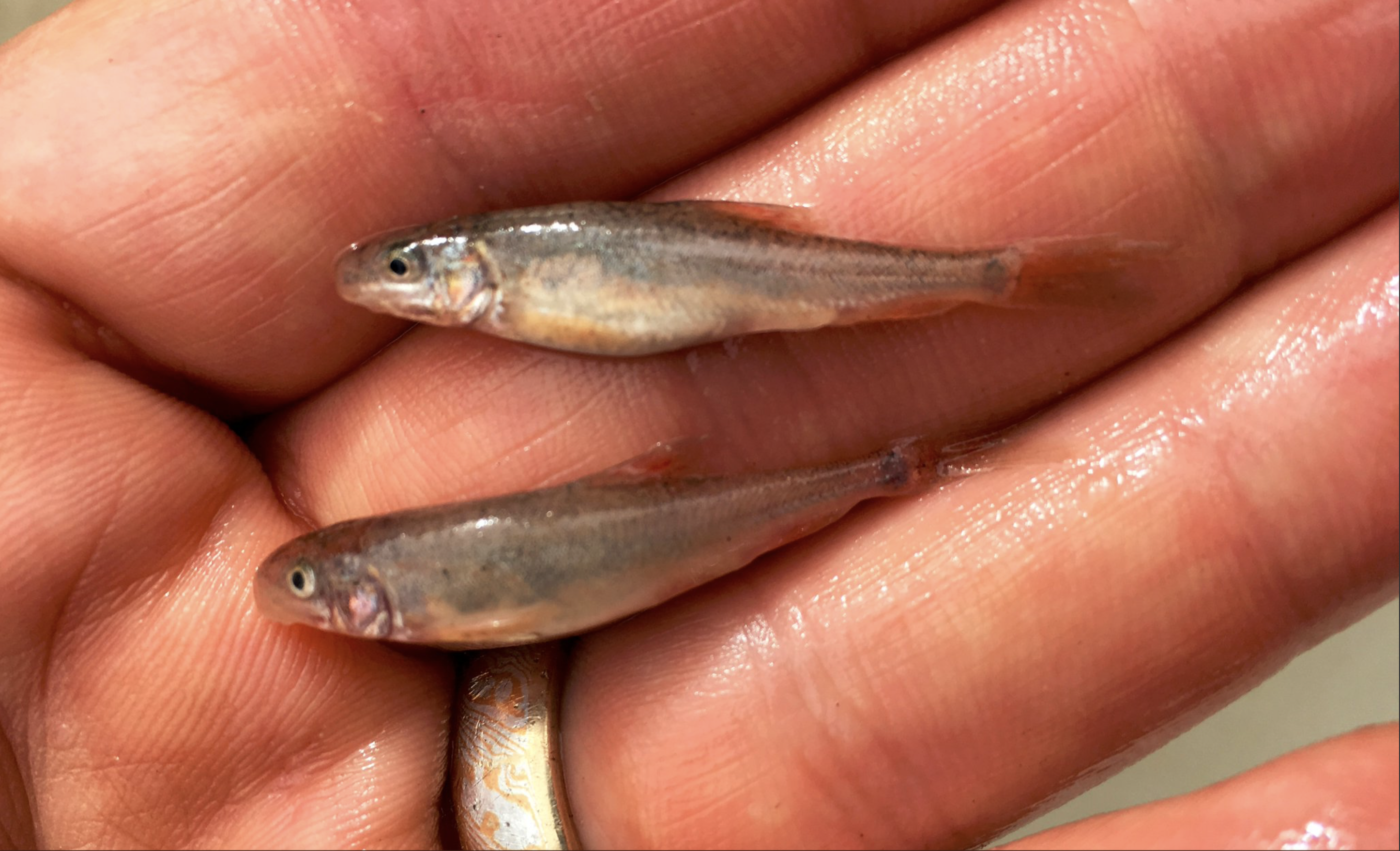
In 2017, the Dolores River Native Fish Monitoring and Recommendation Team (M&R Team), tasked with monitoring changes to the downstream river ecology, really stepped up to provide guidance and monitoring work on the largest managed release from McPhee Reservoir in more than a decade. The M&R Team was formed during a multi-year, science-driven collaborative planning process around the needs of the sensitive, native warm-water fisheries in the Dolores River that resulted in the finalization of the Lower Dolores River Implementation, Monitoring and Evaluation Plan for Native Fish (2014) (“2014 Plan”). Both the 2014 Plan and the M&R Team’s work to help implement opportunities identified in the plan are guided by the DRD purpose statement, which is “. . . to explore management opportunities, build support for and take action to improve the ecological conditions in the Dolores River downstream of McPhee Reservoir while honoring water rights, protecting agricultural and municipal supplies, and the continued enjoyment of boating and fishing.”

Because the 2014 Plan was finalized in the middle of a tough span of especially dry years on the Dolores River, the M&R Team was not able to use the 2014 Plan to help guide the management of any significant releases of surplus water from McPhee Dam for ecological and other purposes for several years. However, in 2017, the combination of an above-average snowpack in the San Juan Mountains in the Dolores River basin and good carry-over storage from 2016 in McPhee Reservoir provided water managers and the M&R Team with the opportunity to shape the largest managed release of surplus water from McPhee Dam in more than a decade.

Armed with the 2014 Plan (and a diverse team that includes the Dolores Water Conservancy District, Montezuma Valley Irrigation Company, the Bureau of Reclamation, the Tres Rios Field Office, Bureau of Land Management, San Juan National Forest, Ute Mountain Ute Tribe, Colorado Parks & Wildlife, Dolores, Montezuma, San Miguel, and Montrose counties, American Whitewater, The Nature Conservancy, Trout Unlimited, and San Juan Citizens Alliance) the M&R Team was able to help water managers begin to make decisions about how to plan for the large managed release as early as February of 2017.

Sample hydrographs and ecological targets developed in the 2014 Plan were adapted for use with the specific forecasting for the Dolores River Basin’s 2017 water year to help shape a release plan that included a “peak flow” release of 4,000 cfs to support fish habitat maintenance on the Dolores River. Recreational and conservation interests from the M&R Team (American Whitewater and The Nature Conservancy), Colorado Parks & Wildlife, the Bureau of Land Management, and the Dolores River Boating Advocates all worked closely with the Dolores Water Conservancy District and the Bureau of Reclamation to assist the water managers with necessary adjustments to the release plan as the water managers addressed a wildly-fluctuating forecast and runoff pattern on the Dolores River in the spring of 2017.

In addition, flow hypotheses and measurable benchmarks from the 2014 Plan allowed members of the M&R Team to set up and deploy field monitoring along the Dolores River below McPhee Dam. Armed with years of scientific research and the 2014 Plan, Colorado Parks & Wildlife and The Nature Conservancy were able to develop an ecological monitoring plan and pull together a collaborative group of researchers to set up monitoring sites on the river within a few weeks of the first M&R Team meeting and notification from the Bureau of Reclamation about the potential magnitude of the 2017 managed release. American Whitewater and the Dolores River Boating Advocates launched a boater survey to evaluate recreational use of the Dolores River below McPhee Dam. Colorado Parks & Wildlife also deployed several fish monitoring crews on the Dolores River during the managed release, including undertaking a challenging fish survey in the remote Slickrock Canyon (which had last been surveyed in 2007) that provided important information on the status of the sensitive, native warm-water fisheries in that stretch of the river.

The collaborative research team is continuing to work on analyzing the results of this monitoring work over the winter of 2017-2018 to provide information to the M&R Team and water managers that may help inform future releases and other management efforts on the Dolores River.

“In 2017 we finally had the snowpack we needed to conduct and monitor a large managed release. In addition to the snowpack, mother nature also provided March warming driving early release, declining forecasts and wide temperature swings.

The fact that all ecological and water supply goals were met is due to the flexibility of the researchers working closely with reservoir managers. We shared in the responsibility for keeping all constituencies informed. Providing large and extended ecological releases with the assurance that all water obligations would be met and McPhee reservoir filled could only happen with this level of cooperation. Having this level of information and communication in managing and assessing a multiple- objective release was a water manager’s dream.” — Mike Preston, General Manager, Dolores Water Conservancy District.

Collaboration into 2018 and Beyond

The grim SNOTEL report for southwestern Colorado (sitting at 36 percent of average and just 21 percent of what we had in 2017 as of the end of January) and the current spring forecasts have many water managers and interests planning for a year of “famine” in 2018, after the relative water “feast” that occurred just a year ago in 2017. The increasing uncertainty around snowpack, water availability, and the timing of runoff that we are experiencing in southwestern Colorado, as well as other drivers of wildfire risk, will continue to be powerful motivators for collaborative work in the Dolores River watershed.

I look forward to supporting these continued collaborative efforts, through feast and famine, in this iconic Colorado watershed.

#Snowpack news: Telluride’s low-snow-winter experiment — The Mountain Town News

The storm on [January 10, 2018 provided a badly needed thin blanket of snow at Telluride. After a ski season of virtually no snow, the resort received 23 inches in five days. Photo/ Telluride Ski & Golf

From The Mountain Town News (Allen Best):

Making lemonade in Telluride during a winter of very little natural snow

It finally snowed during the last week in Telluride, 23 inches in five days, enough to whiten the landscape and cloak some of the grass. At least for a bit, the lab experiment is on hold.

That unwitting experiment being tested at Telluride and a good many other resorts this winter has been whether a ski resort can operate and have great success without snow falling from the heavens?

Snow surveys conducted last week in the San Juan Mountains of southwestern Colorado found snow depths 22 percent of normal. To the north in Colorado, they were reported to be 65 percent of normal. Aspen got nine inches over the weekend, hardly worth mentioning in most years. This year it’s the equivalent of a man biting a dog.

In Telluride, the chief executive of the community’s promotional arm reports no grim hits to the community tourism economy—not yet at least. “It’s not all about snow,” says Michael Martelon, of VisitTelluride. “But if we had it, it would make everything else better.”

Martelon is quick to note that Telluride differs from resorts close to cities in that its customers mostly come from long distances. Denver is six hours away, Phoenix eight. Snow is somewhat less important to its visitors than weekend skiing customers on Colorado’s I-70 corridor or those from Utah’s Wasatch Front.

Telluride still has skiing, thanks in part to $15 million in snowmaking investments in the last six years. But for many visitors, skiing is not the end all, be all. There are galleries, restaurants, and even the Jud Wiebe Trail. Located on the south-facing slopes above Telluride, it was still accessible even after the first storm in the recent sequence.

Christmas was strong, and the only repercussion so far has been a softening in bookings for spring break. Lodges require 45-day advance payment, he notes. But for the moment, bookings are pacing to be ahead of last year.

Martelon sees lemonade when others, especially locals accustomed to daily blasts of powder, see lemons. “It might be a blessing in disguise,” he says. “Taking care of the guest becomes the absolute priority, because the snow isn’t doing it for you.”

That said, he suggested checking back in May, to see if his optimism was fully justified.

Wednesday morning [January 10, 2018] at Telluride. Photo/Telluride Ski & Golf.

Elsewhere in the West’s ski towns, Ketchum and Sun Valley reported a lucrative holiday season, better in most cases than the year before. Before, there was powder to ski in the morning. This year, there was little compelling reason to arise, so people stay out at night, explained the Idaho Mountain Express.

At the foot of the ski area, the Ketchum Ranger Station had no measurable snow on the ground on Jan. 1. That’s a first since record-keeping began in 1938, according to the National Weather Service.

But on Wednesday, the Mountain Express proclaimed that the valley “finally looks like winter.”

In Aspen, there was optimism that snowmaking—helped by cold nights—will save the day for the X Games Aspen on Jan. 25-28.

“It really is impressive what the snowmaking and grooming teams have been able to do,” Jeff Hanle, spokesman for the company, told the Aspen Daily News.

In California, an early January snow survey near the entrance to the Sierra-at-Tahoe ski area revealed an average depth of 1.3 inches of snow. The water in that snow is 3 percent of the long-term average for the location, at about 6,640 feet (2,020 meters) in elevation, reported Lake Tahoe News.

Will this change? “There is still a lot of winter left,” Frank Gehrke, who conducts the survey, said. “January, February and into March are frequently productive.”

That said, there are concerns about whether the warming Arctic could in coming decades produce changes in the Pacific Ocean that will more frequently create the high-pressure ridges that have plagued California in recent years. This same high-pressure ridge was blamed for the lack of snow across the West until this past week. See Dec. 7 story in Mountain Town News.

@AspenJournalism: Study provides insight into how dams affect ecology of southwestern #Colorado rivers

The Dolores River in southwestern Colorado on Memorial Day in 2009. Photo/Allen Best

From Aspen Journalism (Heather Sackett):

The San Miguel and Dolores rivers are both southwestern Colorado waterways that begin high in the San Juan Mountains.

Both carve through narrow, red sandstone canyons. Eventually, the two rivers become one when the San Miguel merges into the Dolores and the Dolores with the Colorado River in eastern Utah.

But there is one major difference: The Dolores is dammed at McPhee Reservoir near the town of Dolores, while the San Miguel is one of the last free-flowing rivers in the West.

A study of plant traits on these two rivers may provide clues about how riparian habitats will respond to climate change, not just in southwestern Colorado, but across the state and the West.

Measuring traits

Researchers from Colorado State University recently completed a two-year study on the Dolores and San Miguel rivers, the results of which were presented at the Upper Colorado River Basin Forum in Grand Junction in November.

The study compared two sites on the Dolores (Rico and Bedrock) with two sites on the San Miguel (Placerville and Uravan) by documenting different plant traits at each of the four sites. A “trait” is simply a measureable feature of a plant, such as leaf area, root depth, and height. The more diverse these traits are, the higher something called “functional diversity.”

For both of the upstream sites, Placerville and Rico, functional diversity was higher than it was at the downstream sites, which scientists expected because the downstream sites receive less rainfall. But the Bedrock site, downstream from McPhee Reservoir, had a much lower functional diversity than its sister site of Uravan. This is likely due to the changes in the river’s flow as a result of the dam. With lower functional diversity comes a decreased resistance to invasive species or climate change.

“Dams really do have a huge impact on the downstream ecosystem, and it’s not always talked about,” said Erin Cubley, one of the researchers on the project and a Ph.D. candidate in ecology at Colorado State University. “Dams hold sediments and seeds, they change the flow; they change the processes that are essential in maintaining these ecosystems.”

The dam across the Dolores River that forms McPhee Reservoir is downstream from the small town of Dolores. It forms the fifth biggest reservoir in the state and holds back about 381,000 acre-feet of water. McPhee Reservoir supplies the agricultural irrigation needs of farmers and ranchers south of the Dolores River Basin. The resulting decreased flow below the dam has big impacts on the downstream ecology, Cubley said. A smaller river channel cuts deeper, not wider, and this lowers the groundwater that riparian plants depend upon for survival.

“Riparian species have a big taproot and can access water a few feet down, but if they can’t access groundwater, they die,” Cubley said. “That is what we are seeing at Bedrock.”

Spring runoff

By measuring traits and functional diversity instead of specific plant species (which may vary depending on the river and location in the watershed), the study has implications for many of the state’s rivers.

“By using traits, we can look at how similar their traits are and put them into groups and say, ‘OK, we can transfer our findings across rivers that have different species compositions,’” Cubley said.

Another way dams alter the natural flow of the river has to do with spring runoff. Many dams are managed solely with maximum storage capacity in mind, said David M. Merritt, a riparian ecologist with the U.S. Forest Service National Stream and Aquatic Ecology Center. There are easy tweaks water managers can make that will not compromise the power or storage needs of the dam that can also improve the ecological functioning downstream.

For example, one of the most important components of river health is peak flows and flooding with spring runoff. Some species, such as the cottonwood tree, time the release of their seeds to coincide with peak flows. The fluffy white fibers use the river to carry them downstream to hopefully take root in the riverbank. But when dams control the river and don’t allow for this peak flow to happen, it can have a negative effect on cottonwoods, as well as the whole downstream ecosystem.

“If you are a dam operator, it might be easy for you to time a spike that coincides with that historic timing,” Merritt said. “The timing of peak flow is reliant on temperatures with a little variability annually. A dam operator would have tremendous flexibility on when that would occur.”

A view of the Dolores River below Slickrock.

Effects of climate change

Assuming that the future of the American West will be warmer and drier than it currently is, the research team can model what a future ecosystem might look like: At what point will more drought-resistant plants move in? If you change the flows of a river, then how will the vegetation respond? What would happen if water managers changed dam operations?

“What if climate change is twice as bad or what if it’s not as bad?” Merritt said. “We are scientists who predict change. … We will be able to show predictions of what the vegetation will look like. It’s a model and a technique that can be used on any river anywhere.”

Editor’s note: Aspen Journalism is collaborating with the Vail Daily, the Summit Daily, The Aspen Times, and the Glenwood Springs Post Independent on coverage of rivers and water. The Vail Daily published this story on Jan. 2, 2017. The Summit Daily published it on Jan. 3.

Dolores River watershed

Dolores River: Drone footage from big McPhee release in May, 2017

Dolores River cleanup near Rico update

St Louis Tunnel Ponds June 29, 2010 – view south towards Rico. Photo via the EPA.

From The Denver Post (Bruce Finley):

This re-engineering along headwaters of the Dolores River requires replanting wetlands with native grasses and laying in soil to mimic natural processes — an innovative approach that may be deployed more widely across the water-challenged West, where tens of thousands of toxic mines foul rivers and streams. So far, the experiment is working, removing fish-killing zinc, manganese linked to birth deformities and cancer-causing cadmium from muck flowing from the Argentine Mine complex uphill from Rico.

“Mining is what brought communities to life at the turn of the 19th century, but now residents and visitors would like to see these scars restored as much as possible — especially focusing on water cleanup,” San Miguel County commissioner Hilary Cooper said from her perch in Telluride, 22 miles north of the mess. “For many of these areas, human intervention is required to initiate the cleanup. But planning, which ultimately allows native vegetation, restored natural floodplains and the engineering skills of beavers to assist with the cleanup is generally preferred when possible. In the end, we will find it is more effective.”

[…]

Wildlife, including river otters, may be reviving in Rico because multiple factors favor environmental recovery.

First, federal agencies enforced laws. The Environmental Protection Agency in 2011 issued an emergency order compelling action to stop contamination of Dolores headwaters after state regulators and mine owners failed to get a grip. Then, EPA officials swiftly identified and enlisted a private company legally responsible for the mess — something agency officials haven’t done at other sites, including the Gold King Superfund district, where a potentially responsible corporation is fighting the EPA in court.

And the company, Atlantic Richfield — now owned by global energy giant BP — resolutely embarked on a cleanup, investing tens of millions of dollars. This compares with less than $5 million that the EPA has mustered for cleanup of the 48-site Gold King district above Silverton. For another Superfund disaster that the EPA declared in 2008 in Creede, federal funds have been so scarce that cleanup has barely begun.

In 2012, Atlantic Richfield contractors at Rico faced rising water inside mine tunnels that threatened a ruinous blowout. The St. Louis Tunnel, within a few hundred yards of the Dolores River, had collapsed and was oozing as much as 1,300 gallons a minute of toxic muck. A lime water treatment plant installed to neutralize sulfuric acid in the flow, churning out thousands of cubic yards a year of waste solids, wasn’t working. (The acid, private contractors later determined, is mostly neutralized by natural calcium deposits inside the tunnel before the muck flows out.) Cleanup crews also had to deal with eroding, unlined tailings ponds where rain and melting snow leached toxic metals into the river…

The innovative cleanup by Atlantic Richfield modernizes the standard approach of installing water treatment plants in the high country along with bulkhead plugs to try to control leaks. Contractors scooped out and lined the old ponds, planted grasses interspersed with stones and put in a sediment mix of manure, hay, alfalfa and woodchips — all aimed at filtering out toxic metals…

This massive experiment now covers 55 acres, closed inside fences and berms, below the newly dammed St. Louis Tunnel. The toxic muck still flows at rates fluctuating from 700 to more than 1,000 gallons a minute but now is channeled through three black tubes that carry the muck through the engineered ponds and wetlands.

In one pond, the toxic mine water seeps down vertically 2.5 feet through sediment, where chemical reactions help break out the manganese, zinc and cadmium. Native sedge and rush grasses are starting to grow atop that sediment layer. In other ponds, water is pushed through wetlands created using stones and grasses that grow naturally in the San Juan Mountain to filter out and chemically extract toxic metals.

Once contractors figure out which method or combination works best, they say they’ll seek EPA approval and then fully install engineered wetlands, eventually removing fences and roads.

Dolores River watershed

McPhee still free of quaggas

Mcphee Reservoir

From The Durango Herald (Jim Mimiaga):

A coalition of local government agencies that formed to prevent an invasive mussel contamination at McPhee Reservoir can claim victory in its first year.

A test in October showed no sign of the dreaded quagga or zebra mussels, which proliferate rapidly and can attach in suffocating layers to irrigation and municipal infrastructure.

“With the help of the community, we have avoided contamination and protected our water source,” Ken Curtis, an engineer with the Dolores Water Conservancy District, said during a recent community meeting to gather public comment.

The success is credited to stringent new rules that require all motorized and trailered boats to go through mussel inspection stations at either the House Creek or McPhee boat ramps during open hours. Mussels are carried in standing water of engines and ballasts.

Restricted access changed the culture of McPhee access.

Pleasant View: Experimental “Water Dragon” drip system trial

Photo credit: AgriExpo.com.

From The Cortez Journal (Jim Mimiaga):

The High Desert Conservation District has teamed up with farmer Brian Wilson and Teeter Irrigation, of Johnson City, Kansas, to determine if the company’s trademarked Dragon-Line system will work for this area.

Instead of using the nozzles on the center pivot to irrigate, a row of drip lines are attached that drag behind the sprinkler watering the crop at its base instead of from above.

“It saves water and reduces evaporation, erosion and runoff,” said Travis Custer, agricultural consultant with High Desert. “It is the first trial of the technology in the area.”

To compare crop yields, one section of the center pivot irrigates a field of wheat normally from spray nozzles, and an adjacent section utilizes a series of drip lines attached to the nozzles. After harvest, the yields will be compared. Soil moisture monitors have also been installed in areas watered by the drip and nozzle sections of the sprinkler.

The hybrid center pivot and drip line technology was created by Teeter Irrigation, and launched in 2015. The technology has proven effective in Kansas and other plain states that irrigate from an underground aquifer, Custer said.

But since local farms use surface water delivered via ditches and pipelines that carry more debris, a filter system had to be installed on the center pivot being used on the Pleasant View trial…

Farmers have switched to center-pivot sprinkler technology because it is less labor-intensive than side-roll sprinklers, which must be moved by hand. Center pivots are automated, and move in a circular pattern, watering from a row of nozzle heads. Water flow and speed are adjustable and can be controlled remotely.

But center pivots work best on flatter ground. On undulating farmland and fields with steeper slopes, center pivots can cause water to pool in low spots and run off the field or drain into the sprinkler’s wheel tracks, creating muddy conditions.

What’s exciting is that the drip-system attachment to the center-pivot could eliminate those problems because the water is delivered at ground level, said Steve Miles, board member of the High Desert Conservation District…

It appears to be working in the test plots. The lower areas of the drip-line section are not getting waterlogged, and there is less runoff the field. How often the filter-system has to be flushed is also part of the experiment.

@CPW and @JSandersonCO find ~8 week old bluehead sucker fry in Dolores River

August 16, 2017: Colorado ParksWildlife and John Sanderson found imperiled bluehead sucker fry on Dolores River — a hopeful sign.
Blue head sucker
Dolores River watershed

S.W. #Colorado “River Protection Workgroup” disbands

Proposed Hermosa Creek watershed protection area via The Durango Herald

From The Durango Herald (Jonathan Romeo):

After more than a decade, the River Protection Workgroup, tasked with drafting a region-wide approach to land and river management in Southwest Colorado, has decided to disband after divided interests could not reach a compromise.

“Water in the West is complicated and there are many, many interests,” said Marsha Porter-Norton, a facilitator for the group. “I think people left in a civil way … and agreed to disagree.”

[…]

Wanting to start a community-wide conversation, the San Juan Citizens Alliance, a Durango-based environmental group, proposed forming a workgroup to look at what sort of management plan may work for the region.

As a result, representatives from various interest groups partnered to form the River Protection Workgroup, including SJCA, the Wilderness Society, Trout Unlimited, and the Southwestern Water Conservation District – the entity tasked with developing water resources in the Southwest basin.

Over the past decade, the group embarked on an extensive public outreach effort, holding up to 24 meetings in each river basin to get a sense of how nearby residents and water users would like to see the land and water managed.

The group’s most notable success was in 2014, when after six years of negotiations, the Hermosa Creek Watershed Protection Act was signed into law, designating 37,400 acres as wilderness area and 70,600 acres as a Special Management Area in the San Juan Mountains, north of Durango…

But as negotiations came down to the wire, the group was unable to reach agreement on a region-wide package.

The Southwestern Water Conservation District offered to place Hermosa Creek on the Wild and Scenic list, which would have been the second river in Colorado to carry such a designation, but only if the other rivers were dropped from consideration.

However, SJCA argued that Hermosa Creek is already highly protected through the 2014 act, and conservation efforts would be giving up a lot to have all those other segments taken out of the Wild and Scenic designation.

The final blow was the language in the draft legislation concerning new water projects. SWCD agreed to no new “major impoundments” on the Animas and Piedra within a quarter mile of the river corridor.

But conservation groups wanted more of a concrete definition of “major impoundment,” fearing there could be loopholes for large-scale construction projects, which could possibly impact the wild quality of the rivers.

Trout Unlimited was on board with the deal, but SJCA and the Wilderness Society were ultimately unsatisfied.

“One of the reasons to do this (workgroup) was to avoid litigation,” said Jimbo Buickerood, with SJCA. “Because there was no concrete definition (of major impoundments), we didn’t see it as progress, and that there could be litigation in the future.”

Bruce Whitehead, executive director of SWCD, said it’s the water district’s responsibility to ensure existing and future water needs, and that some of the environmental group’s demands would have conflicted with that mission.

“It’s critical for us to maintain those balances,” Whitehead said. “(The group) just kept coming back around and talking about the same issues and eventually it ran its course.”

On May 19, members of the River Protection Group decided to part ways.

Southwestern Water Conservation District annual Water Seminar presentations are now online

Lake Nighthorse and Durango March 2016 photo via Greg Hobbs.

Click here to view the presentations. Click here to go to the website:

Thanks for talking water with us!
It’s never too late to say thank you for attending the Southwestern Water Conservation District’s 2017 Annual Water Seminar! Just under 200 people gathered in early April to discuss the current funding needs for water-related projects in the state.

Missed the seminar this year? Fortunately, many of the speakers have generously shared their presentations; click on the button below to view them online. You can also read a short summary of the event in the Durango Herald, “Water conference explores financial solutions.”

Mark your calendars for the 2018 Annual Water Seminar on Friday, April 6, again at the DoubleTree Hotel in Durango.

Boaters taking advantage of McPhee Reservoir with closures on other SW #Colorado flat-water

From The Cortez Journal:

McPhee Reservoir is seeing increased use this summer because of decreased opportunities for motorized boating on other Southwest Colorado reservoirs that have been closed to guard against the introduction of aquatic nuisance species, according to the San Juan National Forest.

And to accommodate boaters during the July Fourth holiday, the inspection station for the House Creek boat ramp will extend its hours to 6 a.m. to 8 p.m. Friday through Tuesday, the forest said in a news release.

The inspection station at the more crowded McPhee boat ramp will remain open seven days a week from 6 a.m. to 8 p.m. All other access points to McPhee Reservoir have been gated to prevent uninspected boats from entering the reservoir.

McPhee is one of a few reservoirs in Southwest Colorado with mussel inspection stations that allow for motorized boating, public affairs specialist Ann Bond said in the news release.

The McPhee boat ramp has seen an 85 percent increase in inspections this summer from last year, Bond said.

“Because of the increased usage, parking areas and boat ramps are experiencing congestion, especially on weekends,” she said. “The U.S. Forest Service urges visitors to use parking areas and ramps as efficiently as possible to lessen congestion.”

The Forest Service encourages boaters to prep their craft before launching to reduce time at the ramp and to follow traffic signs to ensure safety for all visitors. Boaters who park vehicles without trailers are asked to use overflow parking areas to leave the larger parking areas available for trailers. Weekday users will find less crowded conditions.

Weekend users are encouraged to use the House Creek boat ramp, which is often less crowded.

Inspection stations are working smoothly, with previously inspected boats carrying documentation and tags moving through the process within 10 minutes. Boats that have not been cleaned, drained and dried – and require decontamination procedures – are urged to enter inspection stations during weekdays, because the decontamination process takes more time.

For more information, contact Tom Rice at 970-882-6843.

Telluride Regional Wastewater Plan update

Telluride

From The Telluride Daily Planet (Justin Criado):

Council members and several town officials visited their Mountain Village neighbors to the north in order to discuss the proposed Telluride Regional Wastewater Treatment Master Plan. The plan has not been formally finalized, but it’s not likely to change drastically, Public Works Director Paul Ruud said.

The two-hour work session included a presentation highlighting immediate, short-term and long-term goals over the next 10 years…

The current wastewater treatment plant at Society Turn serves the communities of Telluride, Mountain Village, Eider Creek, Sunset Ridge, Aldasoro and Lawson Hill.

The plant is reaching its originally designed capacity, officials explained. Plus, Department of Public Health and Environment regulations through the Colorado Discharge Permit System have been altered over the years. (Colorado Water Quality Control Division stipulations regarding acceptable metals levels in the water also changed beginning this year.)

Those variables, in conjunction with an increased waste stream and new treatment options, make updating and eventually expanding the current plant paramount within the next decade…

Immediate focuses include talking with commercial wastewater dischargers about pre-treatment agreements, seasonal restrictions on septage hauling to the plant and a receiving station for storage of septage, among other items.

Ruud called the more immediate objectives “stepping stones.”

The long-term plan, outlined until 2027, includes plant expansion to meet possible new state nutrient regulations.

The San Miguel Valley Corporation owns the land immediately around the current plant. Ruud said there have been “very preliminary” talks with corporation officials about possibly acquiring more land.

The total cost of all proposed master plan improvements would be in the $30-$40 million range. Telluride officials explained addressing future wastewater plans in annual budgets would help with the planning process. (Telluride had a specific focus on water and wastewater projects when sculpting its 2017 budget.)

The recently opened, $22 million Fruita wastewater plant was used as an example of what is possible, but Ruud explained Telluride’s wastewater flow is higher than Fruita’s, which calls for larger improvements.

Telluride Town Manager Greg Clifton said none of the master plan objectives are necessarily “set in stone” just yet…

The city continues to replace outdated water lines, update treatment plant technology, and develop better ways to store and treat water and wastewater.

Water and wastewater projects are covered through separate enterprise funds, which use taxes and service fees to raise capital.//

For 2017, projected Telluride Water Fund revenues are $2.6 million, while projected expenditures are $3.5 million.

Plans to replace more pipes around town and the Bridal Veil Basin are in the works for this year, including repairs to pipes that carry water through the Lewis and Blue lakes areas. The Mill Creek Water Treatment Plant is in need of equipment and holding tank updates, which are projected to be $278,500, according to town officials.

Clifton added that exploring alternative, outside funding options will be a hot topic at future meetings.

Spring Flood on the River of Sorrows

Ponderosa Gorge, Dolores River. Photo credit RiverSearch.com.

From The Nature Conservancy (John Sanderson):

Like a Frenchman knows good years and bad years for wine, I remember years in Colorado for their snowpack. In 1995, deep snow remained well into summer. In 2002, the snow never came and Coloradans were reminded of how bad drought can be. In 2011, the snow at my family’s favorite backcountry ski trailhead was still 10 feet deep in early May. In 2012, it was drought again; later that summer fires raged west of my home in Fort Collins.

Water from this snowpack is the proverbial lifeblood of Rocky Mountain rivers. In fact, water is the lifeblood of the entire economy of the West—for brewers in cities, for corn growers east of Fort Collins, and for angling guides in our high county. Competition for water can be fierce.

Residents of the Southwest weren’t yet competing for water in 1776 when two Spanish priests — Francisco Atanacio Dominguez and Silvestre Valez de Escalante — christened one of our lifeblood rivers, El Rio de Nuestra Senora de las Dolores. Better known as the Dolores — the Sorrows — many view this epithet as reflecting the current state of the river. In 1983, the gates closed on the McPhee Dam, one of the last projects during the United States Bureau of Reclamation’s era of big dams. Within a decade, a series of dry years came along and a fight exploded over the impacts of the dam on the ecology of the river.

With its origins in the high, remote mountains near Telluride in southwest Colorado, the Dolores is a river of extremes. Fed by snowmelt gushing off the Rocky Mountains, spring flood flows before the dam could reach 1000 times the low flows of late summer. The reason people dam rivers is to make the water supply — in this case irrigation water — more predictable. Capture the spring snowmelt in a reservoir. Send the water to farm fields later in the summer. That’s good for farmers. But it’s bad for native fish.

At the time of Dominguez and Escalante, only about half a dozen fish species lived in the 175 miles of river now below McPhee Dam. These fish are all built for extremes. Aerodynamic bodies help them withstand huge floods. Tolerance for hot temperatures allow them to wait out low, warm waters during drought. Some of these fish can detect chemical and electrical signals of their prey, so they can hunt in dark murky water. Many can live for decades, allowing populations to survive a string of bad years with little or no reproduction.

The best known native of the Dolores is America’s largest minnow: the Colorado pikeminnow. The pikeminnow can reach 6 feet long and weigh up to 80 pounds. One hundred years ago, pikeminnow were so abundant that fishermen would haul them out of rivers with pitchforks. Pikeminnow harvests even supported a commercial cannery near Yuma, Arizona. This species has been around for more than 3 million years. But after just a few decades of 20th century dam building, they were nearly extinct.

Releases from McPhee reservoir enabled a great Lower Dolores River early boating season

Dolores River watershed

Here’s a report from Jason Blevins writing for The Denver Post. Click through and read the whole article. Here’s an excerpt:

The fickle Dolores River is emblematic of Western water woes, where increasing recreation demands and calls for conservation clash with traditional uses that quench arid towns and farms.

That tension has created conflict in the past, as the river veers from tidal to trickle. There’s no other way to see Slickrock Canyon except by boat, and without raft-floating flows, the canyon is essentially closed.

But, recently, the Dolores River water wrangling has yielded collaboration. And this year, after more than a decade of planning, a diverse team of water users — including water managers, farmers, boaters, conservationists, ecologists and land managers — have galvanized to celebrate and study more than 60 days of boatable flows, creating one of the most vibrant seasons in recent memory on the miles of varying Dolores River below McPhee.

“It’s been a ghost and you have to chase it,” said Schafer, the Western Slope advocacy director for Conservation Colorado, who first navigated Slickrock Canyon during a quick, small release last year. “These last couple years have really opened my eyes to the complexities of Western water policy, the complexities of public land management and the complexities recreation management. But at the end of the day, the overwhelming experience is sheer and utter beauty. This is one of the most spectacular river canyons on the planet.”

[…]

The Lower Dolores River through Slickrock Canyon — traversing a 30,000-acre Bureau of Land Management wilderness study area — offers geology spanning hundreds of millions of years.

Entrenched channels carve through Wingate Sandstone, the Kayenta Formation and Navajo Sandstone layers that tower hundreds of feet above the river. Panels of petroglyphs and pictographs reveal the canyon’s millennia-old appeal. Ancestral Puebloan, Archaic and Fremont people frequented the remote canyon. Several pictographs and petroglyphs in the canyon show the horned Fremont Man and bear paws. Some of that artwork is near dinosaur tracks…

Those capricious flows have defined the Lower Dolores since the Bureau of Reclamation finished building the McPhee Dam in 1984. McPhee Reservoir, managed by the Dolores River Water Conservancy District, holds roughly 380,000 acre-feet of water, most of it allocated for agricultural use around the Four Corners region.

In 2004, Dolores River stakeholders gathered to forge a unified mission. The group included the water conservancy district; irrigation users; the Bureau of Reclamation, which owns the dam; the Bureau of Land Management; conservation groups; boater groups such as American Whitewater; and Colorado Parks and Wildlife. That mission outlined how the groups can work together to help boaters — who have a legal right to excess water in McPhee Reservoir — and ecologists eager to protect fish habitat while honoring water rights and allocations for irrigation and municipal uses…

It took almost a decade of meetings — during, incidentally, a prolonged drought that pretty much eliminated releases of unallocated water from McPhee — to hammer out a plan that bolstered fish habitat and maximized recreational flows for boaters.

The Lower Dolores Implementation, Monitoring and Evaluation Plan created a team that helped to manage releases. This year, with a healthy snowpack and good carryover water levels from the previous spring melt, American Whitewater helped negotiate significant releases from McPhee — from the end of March to May 21 and another surprise burst last week.

The surges, including a high-flow, three-day pulse of 4,000 cubic feet per second that limited the length of the boating season but helped restore riparian habitat, marked the largest releases since 2008. The flows drew wildlife scientists, conservationists and boaters in droves.

“We are trying to align everyone’s activities so they all fit together, and this was a really successful year for that effort,” said Michael Preston, manager of the Dolores River Water Conservancy District. “We had really great monitoring this season. We have a plan. We have objectives. We are going to start learning a great deal.”

The Nature Conservancy and Colorado Parks and Wildlife worked together in March to study the deeply channelized river bed before the big flow and then again in April and May to observe the river during a variety of flows. The hope was the big pulse and the sustained flows helped push the river out of its entrenched channel, allowing it to scour riverbanks of dense willows and alder, and restore eddies and backwaters…

Jim White, an aquatic biologist with Colorado Parks and Wildlife, got onto the Dolores River below McPhee last month for the first time since 1990. He was looking for endemic populations of roundtail chub, bluehead sucker and flannelmouth sucker fish. He found all three in Slickrock Canyon. His team did not find any smallmouth bass, which can decimate native fish populations. That’s all good news…

“The main thing we want to do is make sure we don’t lose any more ground in terms of the fishery. The density of fish is pretty low, but all three species are present,” says White, who tagged more than 500 fish that can be followed through antennas set above and below Slickrock Canyon. “They are using the habitat in Slickrock and other sections of river. Having a good water year like this helped. Everyone was on the same page. The 4,000 cfs disrupted the channel and … created better fish habitat.”

While scientists surveyed fish, American Whitewater and the Dolores River Boating Advocates canvassed boaters. Conservationists and recreationists have united on the Dolores, merging their missions in a singular push for more water.

The boater survey is trying to quantify the economic impact of boaters rallying in the West End of Montrose County. Paddling advocates want to know whether the flows were announced early enough and whether the timing of the releases offered enough opportunity to float through the wild canyons of the Dolores River.

Early reports show crowding was not an issue, but boaters — almost all of them private paddlers — lamented the accessibility of potential campsites: unimproved sandy beaches that haven’t really been used for several years. Most of the river bank through Slickrock is densely armored with virtually impenetrable willows. Upstream, in Ponderosa Gorge, where the lush mountain river transitions to a red-walled desert canyon, impassable alder thickets guard the banks.

“American Whitewater negotiated a high-flow release, hoping it would help recover fish and habitat. That meant a shorter season. But we will trade a few days if we can get that water down there to work for a healthier ecology,” says American Whitewater’s Nathan Fey.

Rafters rally when the Dolores runs. They come from across the West, with trailers from several states stacked more than a hundred deep at the Bedrock takeout on a Sunday in mid-May…

With McPhee Reservoir pretty much full a month-and-a-half into irrigation season, there’s a good chance that releases will happen again next year, especially if winter snowpack is around normal. Water users, Preston says, are upgrading sprinkler technology, reducing irrigation demand.

Mcphee Reservoir

@CFWEWater’s Southwest Basin Tour Next Week! Scholarship Opportunity and Optional Whitewater Rafting Add-On

This slideshow requires JavaScript.

Click here for the inside skinny and to register.

From email from the Colorado Foundation for Water Education:

The itinerary for this year’s annual river basin tour in Colorado’s Southwest is full of exciting site visits and informative speakers!

We’ll be covering a wide range of local municipal, recreational, industrial, agricultural and ecological projects and priorities. This is an opportunity you don’t want to miss.

But hurry, the tour is next week and there are just eight seats left, including one scholarship spot!

Get on the bus for this year’s Southwest Basin Tour, hosted in Colorado’s beautiful San Juan mountains June 13-14. Share a unique educational experience with other tour participants, including the Colorado legislative Interim Water Resources Review Committee, and get an in-depth look at how the Southwest Basin Implementation Plan is being put into action in the San Miguel and Dolores watersheds. Review the draft agenda here, find some highlights below, and register now to reserve your spot.

On Day 1, we’ll make exciting stops at sites along the lower San Miguel watershed and part of the Dolores, hearing from agency reps, nonprofits, and civic leaders about topics such as:

  • Blending a local ag and recreational economy, and balancing the needs of multiple users
  • Using instream flow appropriations as a tool to protect Wild and Scenic Outstandingly Remarkable Values plus alternative Wild and Scenic stakeholder processes
  • Native fish restoration and the Dolores River Dialogue
  • A local municipal raw water project
  • Other Southwest Basin Implementation plan priorities
  • Plus tour the Paradox Salinity Unit and Indian Ridge Farm

On Day 2, we’ll concentrate on the upper San Miguel and explore topics including:

  • Ski industry concerns in the face of climate change and unpredictable snowpack
  • Regional cloud-seeding efforts to stimulate precipitation
  • Creative and collaborative municipal water management in conjunction with local mining and power supply
  • The evolution of watershed planning and incorporation of stream management plans
  • Plus tour the Valley Floor Project restoration site and view a special showing of the film that debuted at the Telluride Mountain Film Festival

BONUS: Participants now have the option to add on an optional whitewater rafting trip at the end of the tour and will receive a 40% discount off of normal rates. Find out more here.

*Interested in a scholarship? Email Jennie@yourwatercolorado.org to let us know what you do and why you need a scholarship to attend.

#Runoff news: McPhee fills, rafting releases next week on the Dolores River

From The Cortez Journal (Jim Mimiaga):

McPhee Reservoir managers have announced that rafting flows on the Dolores River below the dam will start up again for at least a few days next week.

On Monday, June 5, flows will begin ramping up by 100 cubic feet per second every three hours. By Tuesday noon, flows will be 800 cfs and continue until Thursday or Friday, possibly longer…

Record winter snowpack easily filled the reservoir and provided for a 52-day rafting season that ended May 25 so the reservoir could be topped off. But lingering high-mountain snows continue to provide ample runoff that is more than the reservoir can hold, so another release is necessary.

Curtis said the three-day release could extend to five or longer depending on inflows and weather. Managers will be giving daily updates beginning Monday on the release schedule.

The Colorado Basin River Forecast Center is predicting an increase of inflows into McPhee this weekend. Depending on actual volume, the latest rafting release could be up to a week or 10 days, officials said.

To accommodate boaters on multiday trips, ramp-downs for this release will be slower than usual, dropping 100 cfs per day to allow time for boaters to get off the river.

Piñon Project provides kids with rafting opportunity

Ponderosa Gorge, Dolores River. Photo credit RiverSearch.com.

From The Cortez Journal (Jim Mimiaga):

About a dozen kids from Montezuma and Dolores counties got to experience that adventure thanks to a partnership between the Piñon Project, Dolores River Boating Advocates and the Onward Foundation.

The May 20 trip down Ponderosa Gorge was organized for youth ages 9 to 17 in the Piñon Project mentoring program, and for many of them, it was a first…

Mild to Wild rafting gave the group a discount rate, and it was paid for thanks to a grant from the Onward Foundation.

The goal was to introduce kids to the thrill of rafting and show off the natural wonders of a river in their own backyard, said Amber Clark, program coordinator for the Dolores River Boating Advocates…

The daylong excursion coincided with Colorado’s First Public Lands Day.

A guided boating trip down the Lower Dolores was extra special, Lacourciere said, because a run depends on a water release from McPhee reservoir upstream.

Plus, it was an opportunity for kids to experience an outdoor activity that is often inaccessible for families because of the expense of the boating gear and required river skills.

#Runoff news: Boating season mostly over for the Dolores River

Mcphee Reservoir

From The Cortez Journal (Jim Mimiaga):

By midnight May 23, flows will ramp down to 600 cubic feet per second, hold for 24 hours, then drop to 400 cfs after midnight on May 24. From there the river will drop to 200 cfs, then 75 cfs by Sunday May 28.

“Spring runoff forecasts have steadily dropped with the drier-than-normal weather,” said Ken Curtis, an engineer with the Dolores Water Conservancy District. “It is time to fill the reservoir.”

Curtis said there is a chance that early hot June weather could bring down the remaining snowpack very quickly, which could force a mini whitewater spill of boatable flows for four to six days in June…

A solid winter snowpack allowed for the reservoir to fill for farmers and provide for 52 days of whitewater boating below the dam. In mid-May, 4,000 cfs of flushing flows were released for 72 hours to benefit river ecology, including sediment clearing and channel scouring, which improves native fish habitat. There were seven days of optimal flow releases of around 2,000 cfs.

A year-in-review meeting is being planned by reservoir managers, boaters, and environmental groups to evaluate the season.

Bass flush
A plan by Colorado Parks and Wildlife to flush out small-mouth bass opens up a slight window for kayakable flows later in the summer.

In mid July, biologists want to use part of their reserved fish pool in McPhee reservoir to release 400 cfs for 3-4 days and disrupt the bass spawn. The bass are a threat to the flannelmouth and bluehead suckers and roundtail chub, preying on their young and competing for food sources.

#Snowpack/#Runoff news: McPhee releases reach 4,000 cfs in the Dolores River

Photo via the Sheep Mountain Alliance

From The Telluride Daily Planet (Justin Criado):

The U.S. Bureau of Reclamation just finished a controlled, peak release from the McPhee Reservoir that reached 4,000 cubic feet per second over the past weekend. The ramp down began Sunday, starting at 800 cfs per day until Thursday, May 11.

“This is a really exciting time on the Dolores River because of a combination of high carry over storage in McPhee Reservoir and a good snowpack has resulted in a fairly large managed release from McPhee Reservoir,” said Celene Hawkins of the Colorado Chapter of The Nature Conservancy. “Every seven to 10 years it happens that we’ll have as much water in the system that we’ll have this year. It’s a really important opportunity to manage those flows for the ecology downstream of McPhee Dam.”

She added that 4,000 cfs is the fastest the river has flowed since 2005. As of Monday, the river was at about 3,400 cfs, she said.

As the nature conservancy’s Western Colorado Water Project Manager, Hawkins is monitoring the impacts of the release throughout the whole river system. She is also the co-chair of the Dolores River Native Fish Monitoring and Recommendation Team, which aides the Dolores River Conservancy District.

“We’re doing a lot of monitoring around the release and particularly around this larger peak release to better understand what’s feasible within existing water supplies,” she said.”

Hawkins led a flyover tour of the Dolores River — from the McPhee Reservoir in Dolores to Bedrock in the West End of Montrose County — Monday afternoon. The LightHawk volunteer flight left from Durango’s Animas Air Park and was piloted by Jim Grady, who flew a pair of curious journalists around in his 1953, red-and-white Cessna 180.

Hawkins explained there are three monitoring sites: one in the Dove Creek region and two in the Slickrock area of the Gypsum Valley and near Bedrock. Monitoring includes analyzing the impacts the release has had on downstream ecology, including vegetation and animals. The monitoring isn’t a simple process, Hawkins said, as it will take multiple years to fully collect data and turn it into practical action items, if necessary. She added there are some immediate results of the release such as plains being flooded from the excess water, and later down the system, receding waterlines as a result of the ramp down.

“A big purpose of that release was to do sediment flushing and habitat maintenance,” she said…

“I was on the river during the peak release. It was the highest I had seen it,” said Hawkins, who traversed the river between Bradfield and Slickrock. “It felt like a celebration. People were looking out for each other.”

During the flyover, the Dolores River curved and curled through the Earth’s patchwork quilt of forest, farmland and free-living.
Rafters and kayakers could be spotted in almost every area of the river, appearing more like multicolored specs than anything else…

Organizations like the nature conservancy and the Dolores River Conservancy District work with various stakeholders, including recreational groups like the Dolores River Boating Advocates (DRBA).

“DRBA has been working really hard on the release this year; both communication to boaters and also communication with water managers to help shape the management of the release,” Program Coordinator Amber Clark said.

Hawkins added farm irrigation systems will most likely not be affected by the release.

“We have worked very closely with the water managers and the water users out of McPhee Reservoir to make sure that they will have their full supplies this year,” she said.

The flight lasted just over two hours and featured more than just views of the raging Dolores. Houses and barns looked like mini Monopoly pieces with their red and green roofs. At one point, several elk could be seen bathing in an isolated lake just south of Bedrock. Aerial views of the Ponderosa Gorge and Paradox Valley revealed several changes in colors throughout the rock walls; from tans to browns to reds, including greens from the area’s flora.

@CFWEwater: Southwest Basin Tour June 13-14, 2017


Click here for the inside skinny about the tour from the Colorado Foundation for Water Education:

Join the Colorado Foundation for Water Education for the Southwest Basin Tour, hosted in Colorado’s beautiful San Juan mountains June 13-14.

Tour attendees will visit sites up and down the San Miguel River, from Telluride to the confluence with the Dolores River, hearing from local water managers, city officials, conservation groups and business leaders about water management, economic development and collaborative restoration projects. Share a unique educational experience with other tour participants, which will include members of the Colorado legislative interim Water Resources Review Committee, and get an in-depth look at how the Southwest Basin Implementation Plan is being put into action.

Dolores River: History of the Hanging Flume

From The Grand Junction Daily Sentinel (Bob Silbernagel):

In May, 1891, Nathaniel Turner — manager of the firm that had recently completed the hanging flume in Dolores Canyon — optimistically told the Grand Junction News that the flume was operating just as intended to mine for gold.

“Washing (of gravel and rock) has been in progress for the past 10 days,” the newspaper reported, based on information from Turner, “and everything looks promising for a speedy and profitable return to the company.”

Turner’s prediction proved incorrect, however. Gold production wasn’t as great as hoped, and Turner’s company was in constant financial turmoil.

Turner wasn’t the only one to tout the promise of the wood-and-steel engineering marvel that clings to the rock high above the Dolores River. A year earlier, the national Engineering and Mining Journal had been equally enthusiastic.

“This work will show how easy it is, when backed up by enterprising capital, to bring water … to points which were always thought to be inaccessible,” the Journal said in May 1890. “The total cost will be about $75,000 when finished, and it is expected to be completed within a few months.”

But the Journal was also wrong. The actual cost was between $165,000 and $175,000. And it required more than a year before the flume was partially completed. Turner’s company built seven miles of flume, and planned to construct another three miles to reach the northernmost of the company’s five mining claims along the Dolores River. Instead, it only reached the southernmost of those claims, and never went farther.

The five mining claims were filed from 1883 to 1885 by the Lone Tree Mining Company, a group of Salt Lake City investors. Lone Tree engaged in conventional placer mining on one claim, using limited water from nearby Mesa Creek.

In 1887, Lone Tree sold its claims to the Montrose Placer Mining Company, which consisted of investors from East St. Louis, Illinois. The company was managed by Turner, a somewhat mysterious figure who had reportedly gained experience in hydraulic mining in California.

Turner decided hydraulic mining was the best way to utilize the claims, and conceived the idea for a canal and flume to bring abundant water from the San Miguel River for the task.

Placer mining involves washing sand and gravel in sluice boxes so that the heavier gold is left behind. Hydraulic mining is an industrial variation in which water is shot through a nozzle at high pressure onto the face of a cliff or gravel deposit, washing away tons of gravel, rock and dirt that is run through a large–scale sluicing system.

The Montrose Placer Mining Company constructed seven miles of flume in 1890 and 1891. Another three miles of canal carried the water from the San Miguel River to the wooden flume.

Pine lumber was logged in the La Sal Mountains of Utah, and cut into large planks. At least 18 wagon trails were built to carry materials to locations on the rim of Dolores Canyon, where they could be lowered to the workers below.

Workers were suspended by ropes to mark the grade the flume was to follow, and some were likely suspended while drilling holes for the thick bolts that were drilled into the rock to anchor the flume. Later, the workers used a cantilevered derrick attached to the end of one section of flume to construct the next section.

The problem for Turner’s company wasn’t the flume. It was the ore.

The gold recovered from the hydraulic washing proved to be too fine to be collected in appreciable amounts in the sluicing operations. The hydraulic mining in 1891 continued at least into July, but it’s not clear how long it went on after that.

A year after Turner’s optimistic proclamation, the U.S. General Land Office informed the Montrose Placer Mining Company that it still owed money for one of its five claims. Apparently, Lone Tree Mining had not made the final payment on the claim.

Montrose Placer Mining Company was unable to pay. Turner left the company in disgrace. But in 1893, when the company was sold at a sheriff’s sale, Turner reappeared to purchase it. He formed the Vixen Alluvial Gold Mining Company.

In 1897, Vixen obtained $21,000 in additional financing. Turner and the company apparently intended to complete the final three miles of the flume and begin hydraulic mining on the other four claims. But that never occurred.

The entire system was lost in a court judgment in 1899, then sold again in 1900, this time to a new company called the Montrose Mining Company, whose investors were actually from the Front Range.

The new company filed documents saying it worked its claims for four weeks in 1903, but quit because it ran out of water.

The property was sold one more time, but there is no evidence that any work on the mining claims was conducted after 1903. The flume and mining claims were abandoned by 1904, although settlers and ranchers had already begun scavenging wood from the easily accessible portions of the flume.

A century after the flume was abandoned, an effort began to preserve it. The nonprofit Interpretive Association of Western Colorado, working with the Bureau of Land Management, and with assistance from a Colorado State Historical Grant, the JM Kaplan Fund and John Hendricks of Gateway Canyons Resort, contracted for studies of the flume’s construction and its history. In 2012, 48 feet of the flume were rebuilt, using construction techniques similar to those used in 1890 and 1891.

The flume is listed on the National Register of Historic Structures and is the longest historic structure in Colorado.

Information for this column came from “History and Background of the Hanging Flume,” by Alpine Archaeological Consultants of Montrose; “Flume Work of the Montrose Placer Mining Company,” The Engineering and Mining Journal, May 17, 1890; Interpretive Association of Western Colorado; and from Zebulon Miracle, curator at Gateway Canyons Resort.

#Runoff news: McPhee scheduled releases into Dolores River

Dolores River near Bedrock

From CanoeKayak.com (Eugene Buchanan):

The Dolores River Monitoring and Recommendation team recently agreed on a plan to release water from the dam, which involved input from water managers, boaters, scientists, environmental groups, federal lands agencies, and local governments.

Surplus water is expected to spill from the McPhee Dam from April 13 until mid-June, with 45 to 60 days of flow planned at 2,000 cubic feet per second. Water managers plan to release an even larger burst of water, expected at 4,000 cfs, during three days in late May (May 19-22). Scientists say the extra water will flush extra sediment downstream and create better habitat for native fish.

“That’s a great flow level, something we haven’t seen in years,” says local rafter Sean McNamara. “Bring on Snaggletooth!”

Despite the extra water, water managers say all water allocations will be met, including those for agricultural use.

#Runoff news: Big McPhee spill this season into the Dolores River

Ponderosa Gorge, Dolores River. Photo credit RiverSearch.com.

From The Durango Herald editorial board:

This year’s spill from McPhee Reservoir will be lengthy. Snowfall was particularly good this year. But a steady release is not what appeals to boaters. Better to vary the flow from high to medium levels to give river runners different experiences in the canyon…

A big Dolores spill does not occur often (the most recent of any size was in 2008), thus there are good reasons for making the most of it this year. Expect the river, ecology and terrain to be subjected to its dynamism.

Sediment movement with different flows is important as the river adjusts its pools and eddies while refreshing itself. And to what degree an underground aquifer will replenish depends on higher flows.

While Southwest Colorado will enjoy making the most of the Dolores, there are plenty of uncertainties about how to fund other water projects needed for a state population expected to double by 2050 (requiring an estimated 560,000 acre feet of water).

Both conservation and more efficient water uses are in the equation, but project funding is elusive. Severance taxes provide the bulk of the funding for the Department of Natural Resources, but energy extraction is not providing a predictable revenue source.

From Steamboat Today (Tom Ross:

Flows on the Yampa River this week more closely resembled conditions typical of mid-July than mid-April, and federal scientists who keep an eye on the entire Colorado River Basin are now predicting that flows in the river, which runs through the heart of downtown Steamboat Springs, will trend below average through mid-summer.

“The headwaters of the Colorado River main stem and the San Juan Basin are currently forecast to receive near average runoff volumes, while the Yampa and White river basins now have forecasts for below average April-July runoff volumes,” hydrologists at the Colorado Basin River Forecast in Salt Lake City predict.

The Yampa was flowing at 309 cubic feet per second (cfs) at the Fifth Street Bridge in downtown Steamboat Springs at midday on April 13. That’s below the median for the date of 440 cfs. But this isn’t likely to be a replay of 2012 when the river peaked unusually early for the season at 1,570 cfs on April 27.

There is still 38 inches of snow on the West Summit of Rabbit Ears Pass, according to the Natural Resources Conservation Service.

Based on weather forecasts, the River Forecast Center expects the Yampa in Steamboat to spike to just over 400 cfs Friday, April 14 in the wake of temperatures pushing 70 degrees on Thursday, then retreat to below 230 cfs by April 21.

It’s a different story on the Elk River, which flows into the Yampa west of Steamboat. Contrary to the trend on the Yampa, the Elk was flowing well above average Thursday at 1,080 cfs, compared to the median 641 cfs…

The historic average peak flow for the Yampa is 3,070 cfs at the Fifth Street Bridge. The river peaked at 3,550 cfs on May 5, 2015, and at 3,430 cfs on June 9, 2016.

One of the heaviest runoffs this decade was in 2011, when the river peaked at 5,200 cfs on June 7. The highest recorded peak flow was 6,820 cfs on June 14, 1921, in an era when there were fewer dams upstream from Steamboat.

Agribotix Assists The Nature Conservancy with Dolores River Survey

Dolores River watershed

From Agribotix (Tom McKinnon):

For several years The Nature Conservancy and its many partners have been studying the Dolores River ecosystem downstream of the McPhee Dam while working with water managers to improve the river’s health. It is well known that “taming” rivers, i.e. reducing or eliminating normal spring flooding, has major impacts on the flora and fauna. This year abundant snow and an abnormally warm spring have forced the Dolores Water Conservancy District to pull the lanyard on the spillway to keep the reservoir from flooding. The releases will start at around 800 cubic feet per second and will eventually reach 4000 cfs later in the spring.

All this is great news for people who care about healthy rivers. While not quite as powerful as a normal spring flood, the enhanced flows will clean sediment out of pools for fish and scour the riverbank and restore some of the flora, such as cottonwoods, to its more natural state.

To assess the changes, biologists and fluvial geomorphologists have been surveying the pre-release state of the river ecosystem. In our ongoing support efforts for The Conservancy, Agribotix volunteered to conduct aerial surveys of four sites downstream of the dam.

Agribotix founder, Tom McKinnon, flew the surveys along with Teresa Chapman, a GIS specialist at TNC. They flew both RGB and near IR cameras and returned the results as stitched mosaics at 5 cm ground sampling distance. The field mission went off without a hitch, except for a powerful spring storm that had southwestern Colorado in its sights. Fortunately the team was able to complete the final flight just minutes before the rain arrived. We’ll be headed back later in the summer for the post-release survey.

#Runoff news: Melting #snowpack = start of whitewater season on the Dolores River, 2,000 cfs McPhee release planned this season

Ponderosa Gorge, Dolores River. Photo credit RiverSearch.com.

From The Cortez Journal (Jim Mimiaga):

Flows on the upper Dolores River above McPhee Reservoir were at 1,000 cubic feet per second (cfs) as of Sunday.

Below McPhee Dam, a 60-day whitewater release is planned, with initial ramp-up of 400 cfs per day starting on April 11. By April 16, rafting flows will reach 2,000 cfs, and stay there for 30 days.

In the third week of May, managers will release flushing flows of 4,000 cfs for several days to provide ecological benefits to the river. The high flows mimic a natural spring hydrograph, and benefit the river by scouring the channel, redistributing cobbles for fish spawning and improving pool habitat for native fish species. Flood-plain inundation also helps generate native vegetation growth by spreading seeds beyond the main channel.

After the spike in flows, the river will return to 2,000 cfs for the Memorial Day weekend, with ramp-down of 400 cfs per day expected in early June…

Natural flows at Slick Rock Canyon
Even without the dam release, low-elevation snowmelt has already boosted river flows on the Slick Rock to Bedrock section to 600 cfs and higher, enough for a canoe, kayak or small raft. The popular 50-mile section features Class II and III rapids in remote red-rock canyon country…

The main Lower Dolores River boating run stretches for 100 miles through winding, red-rock canyons interspersed with rapids ranging from Class I to Class IV, including the famed Snaggletooth Rapid at mile marker 27. The Lower Dolores River is considered one of the premiere multiday boat trips in the nation when it has enough water to run. No permit is required.

In the past, when there was a whitewater release, McPhee Reservoir managers targeted 800 cfs for as long as possible below McPhee Dam. But after hearing from boaters in the past few years, the release level was adjusted to the preferred 2,000 cfs flow whenever possible.

“The water managers have made a huge effort to listen to the boating community,” said Sam Carter, of the Dolores River Boating Advocates.

For updates on the whitewater release schedule, go to http://doloreswater.com/releases/ The next update will be April 5. Once the spill begins, regular updates will occur on Mondays and Thursdays.

Dolores River Canyon near Paradox

Meanwhile, the higher flows are an opportunity for scientists to study river ecology. Here’s a report from Jim Mimiaga writing for The Cortez Journal. Here’s an excerpt:

Biologists with Colorado Parks and Wildlife will do fish counts on native and non-native populations, and conduct habitat improvement measures.

The Nature Conservancy, Fort Lewis College and American Whitewater will be studying geomorphology, benefits of flushing flows and recreational boating conditions…

“We have a lot of opportunity this year for fish sampling and monitoring,” said Jim White, a fish biologist for Parks and Wildlife, during a presentation Thursday at the Dolores Water Conservancy office.

His team will be studying population health of three native fish in the Lower Dolores: the roundtail chub, flannelmouth sucker and bluehead sucker.

One of their objectives is to measure the non-native small-mouth bass population, then work toward reducing them. Small-mouth bass are a threat to native fish, preying on their young and competing for food sources.

“We want to find out how widespread small-mouth bass are, especially if they are established in Slick Rock Canyon,” White said.

The bass have developed a stronghold upstream from Slick Rock Canyon to Snaggletooth Rapid. But the high runoff year has opened up an opportunity to try and take out small-mouth bass, White said. In mid-July, Parks and Wildlife plans a flush of 400 cubic feet per second (cfs) for 3-4 days from its fish pool reserves within McPhee Reservoir to disrupt the small-mouth bass spawn…

Parks and Wildlife manages a 32,000 acre feet “fish pool” in McPhee Reservoir for minimum base flows releases below the dam.

During a whitewater release, the fish pool is not debited, White said, giving fish biologists more flexibility in how to use it. They will tap into 2,600 acre feet of the reserve for the bass-removal flush.

Channel scour
The Nature Conservancy is sending a team of researchers to the Lower Dolores for 10-15 days, said Colorado chapter representative Celine Hawkins.

Their work plan includes studying sediment transport and flood-plain inundation, which is needed to widely distribute native seeds. They are especially interested in the impact 4,000 cfs peak flows will have on scouring the river channel…

The Nature Conservancy will be using drones to take aerial photos of the Lower Dolores before and after peak flows to track changes and compare them to past years.

They are focusing monitoring efforts at Disappointment Creek, Dove Creek Pumps, Big Gypsum Valley and Bedrock.

Students at Fort Lewis College will be conducting ecological monitoring on the river as well, including on the alluvial groundwater aquifer…

2016 study results on Lower Dolores
Colorado Parks and Wildlife shared results of a 2016 fish study on the Dolores River.

A cold-water fishery sampling below the dam showed two-thirds brown trout and 16 percent rainbow trout.

Algae due to infrequent flushing flows is abundant in the 12 miles of stream immediately below the dam. There is a concern it could have a negative impact on fish.

In June, the 20-mile Ponderosa Gorge section (Bradfield Bridge to Dove Creek pump house) was surveyed. Of the 180 fish caught, 73 percent were brown trout, and roundtail chub was the second-most abundant. No small-mouth bass were found in the gorge.

Sampling at the Dove Creek pump station showed roundtail chub were holding steady, in part because they are an adapted pool species. Bluehead and flannelmouth suckers were in relative low abundance, and depend more on a ripple environment. In 1992, fish sampling showed much higher numbers of native fish species, the study noted.

“The impact of flushing flows in (2016) was evident, and backwaters looked cleaner,” according to study results.

The past two years, Parks and Wildlife has been stocking bluehead suckers in the Lower Dolores. The fish historically relied on Plateau, Beaver and House creeks for spawning areas, but the dam and reservoir altered the river so suckers cannot reach those ephemeral streams. In 2016, 4316 bluehead fingerlings were released downstream of the Dove Creek Pump house. In 2013, a pit-tag array recorded one flannelmouth traveled 264 miles.

Dolores River watershed

Non-motorized boats will be allowed on Narraguinnep Reservoir

Narraguinnep Reservoir. Photo credit Andreas Hitzig.

From The Cortez Journal (Jim Mimiaga):

The Montezuma Valley Irrigation Co. on Tuesday retreated from its boating ban at Narraguinnep Reservoir and agreed to allow some hand-launched, non-motorized watercraft.

The revised ban still includes motorized and trailered boats, including jet skis. Such watercraft can carry water from infected lakes in the engines, bilges and ballasts, according to the MVIC.

The specific list of nine non-motorized boats that are allowed on the lake include kayaks, canoes, rafts, belly boats, windsurfer boards, sailboards, float tubes, inner tubes and paddle boards.

“The board is in agreement on allowing those crafts,” Gerald Koppenhafer, president of the MVIC board, said on Tuesday.

Totten Lake, which is owned by the Dolores Water Conservancy District, also recently banned boating, but is also expected to allow the specific list of non-motorized boats, general manager Mike Preston said on Tuesday.

“The intention of our board is to be consistent with MVI and allow the exempted watercraft,” he said…

The boating ban triggered an outcry from the boating community, and generated complaints to the Montezuma county commission. Dozens of comments for and against the policy were posted on The Journal’s Facebook page.

McPhee Reservoir allows all types of boating, but trailered and motorized watercraft can only enter the lake through two boat inspection stations at the McPhee boat ramp and the House Creek boat ramp. The list of nine, hand-launched boats can launch from anywhere. Funding is available for boat inspection stations at McPhee but not other area lakes.

Irrigation companies and lake managers are trying to prevent the invasive mussel from entering Colorado waterways. Once a lake becomes contaminated with the mussels, they cannot be eliminated and cause damage to irrigation infrastructure, including dams, municipal systems and power plants. Mitigating a mussel contamination year-to-year also dramatically increases operation costs.

A decision is pending on how to prevent a mussel contamination at Groundhog Reservoir, which also is owned by MVIC.

Boating halted at Totten Reservoir, prevention of quagga and zebra infestation cited

Zebra and Quagga Mussels

From The Cortez Journal (Jim Mimiaga):

The Dolores Water Conservancy District board voted unanimously on Thursday to close Totten Lake to all boating to prevent contamination by non-native quagga and zebra mussels…

The Totten closure follows a boating ban on Narraguinnep Reservoir, enacted last week by the privately owned Montezuma Valley Irrigation Co., which also cited the mussel threat.

“To prevent a mussel contamination, and to be consistent with MVIC’s decision, the board voted to prohibit all boating on Totten,” said DWCD general manager Mike Preston.

The boating ban on the two lakes is for all non-motorized and motorized, and includes kayaks, canoes, stand-up boards, windsurfers, oar boats, rafts and jet-skis. Fishing at the popular lake will be allowed from the shore.

“There was a lot of debate on our board about possible exceptions, but the board decided that to be clear, and best protect our irrigators, the ban will be to all boating,” said MVIC manager Brandon Johnson.

A boating closure order for Totten is being drawn up in cooperation with the Colorado Parks and Wildlife, which manages the fishery. A locked gate on the boat ramp will be installed soon. Narraguinnep already has a locked gate installed. Violators at Totten and Narraguinnep will be issued tickets by Parks and Wildlife and the Montezuma County Sheriff’s Office.

Boat inspection stations are effective at preventing a mussel contamination in lakes. But there is no funding for inspection stations at Totten or Narraguinnep, so managers say their only other option is to close them to boating because the contamination risk is too great.

The Dolores Water Conservancy District is also tightening up boating access on McPhee this year to better prevent the mussels from entering the regional irrigation reservoir.

Boating is still allowed at McPhee because there is funding for boat inspections. But access for motorized and trailered watercraft is only allowed during the season through two boat inspection stations at the McPhee and House Creek boat ramps.

When the stations are closed, newly installed locked gates will prevent lake access. In the past, boats could still launch when the inspection stations were closed.

To accommodate boaters who return to the ramps after the boat stations are locked, one-way spike strips will be installed this season to allow boaters to exit the lake after hours.

“We made that concession to prevent boaters from becoming stranded on the lake,” said McPhee engineer Ken Curtis.

McPhee managers adopted the state standard for preventing the mussel that requires trailered and motorized boats to be inspected, but allows non-motorized, hand-launched craft to enter the lake anywhere without inspection.

In general, non-motorized kayaks, canoes, rowboats, stand-up boards, and windsurfers pose less of a risk or contaminating a waterway with mussels.

However, mussels on a boat from an infected lake can be transported to another waterway.

All boats and their motors should be cleaned, drained and dried before entering a waterway and after leaving a waterway.

MVIC also owns Groundhog Reservoir, and is considering closing it to boating. A decision is expected soon.

Boating halted at Narraguinnep Reservoir to prevent quagga infestation

Quaggas on sandal at Lake Mead

From The Durango Herald (Jim Mimiaga):

The permanent boating ban went into effect Tuesday, said Brandon Johnson, general manager of the Montezuma Valley Irrigation Co., which owns the reservoir.

“We can’t afford to get the mussel in there because of the damage they cause to our infrastructure,” he said. “We had to take drastic action against this threat because we’re in the irrigation business, not the recreation business.”

Mussels from infected lakes, including Lake Powell, can travel in standing water of boats and contaminate other lakes, clogging pipes, valves and canals.

“If they get in there, we can’t deliver water to our stockholders, costs will increase to mitigate them, and they will get into side rolls and pipes,” Johnson said.

The Narraguinnep ban is for all boats, motorized and non-motorized, and includes jet skis, fishing boats, row boats, kayaks and canoes. Colorado Parks and Wildlife would enforce the ban and issue tickets.

Whether paddle boards and windsurfing would be allowed is not clear. “The board decided on a boating ban,” Johnson said. “Whether those two are boats is up to the enforcement agencies.”

MVIC also owns Groundhog Reservoir and is evaluating whether it will close that lake to boating, Johnson said.

Boating could possibly continue at Narraguinnep if there were a boat inspection program, he said, but the irrigation company cannot afford it.

“Recreation is the responsibility of Colorado Parks and Wildlife,” Johnson said.

Parks and Wildlife operates local boat inspection programs, including for McPhee Reservoir, to check for the mussel and decontaminate boats.

But CPW spokesman Joe Lewandowski said the agency does not have the funding to add more boat inspection programs.

“We’re scrambling for funding for the lakes where we do have inspection stations. They are costly to operate,” he said…

McPhee Reservoir is also restricting access to the lake beginning this year to prevent a mussel contamination. Boat ramps at McPhee and House Creek will be gated, and trailered boats can launch only when boat inspection stations are open.

The McPhee boating restriction does not include hand-launched, non-motorized boats such as canoes, kayaks, rafts, windsurfers and paddle boards. Non-motorized, hand-launched boats are free to launch anytime from anywhere on McPhee. However, all boat owners should make sure to clean, drain and dry all boats before and after entering any waterway to avoid invasive species contamination.

Dolores River: #Snowpack = 3 month rafting release?

Ponderosa Gorge, Dolores River. Photo credit RiverSearch.com.

From The Cortez Journal (Jim Mimiaga):

The most probable runoff forecast shows inflow of 440,000 acre-feet for April through July, enough to fill McPhee Reservoir and provide more than a three-month rafting release below the dam.

“Operations this spring are lining up to be exciting,” said Ken Curtis, an engineer with the Dolores Water Conservancy District. “The March forecast is typically not as accurate as the forecast that will come later, but it is good as a planning tool.”

The predicted runoff will fill the reservoir for farmers, with 270,000 acre feet potentially available for whitewater release below the dam. That is enough for an estimated 116-day boating season for approximately 100 miles between the Bradfield Bridge and Bedrock.

By comparison, in 2016, only about 30,000 acre-feet was available for a whitewater release below McPhee Dam, which generated about 10 days of boating flows.

Should the current forecast hold, operators will be able to provide releases of 800 cubic feet per second (cfs) and greater for about 67 days, with flows greater than 2,000 cfs for 45 days, and peak flows of 4,000 cfs for four days. Several ecological benefits also will be realized from a release of that magnitude.

The data in the March 1 operating plan is provisional and subject to change because of Dolores River inflow, future precipitation, weather patterns, managed release criteria and use.

The Dolores Water Conservancy District will be the primary source of information pertaining to release schedules and updates this spring. It will have a newly remodeled website at doloreswater.com.

Last year, the whitewater release lasted about 10 days and only peaked at 1,000 cfs. Before that, there had not been a release since 2011 because of drought conditions and low snowpack.

The main Lower Dolores River boating run stretches for 100 miles through winding, red-rock canyons interspersed with rapids ranging from Class I to Class IV. It is considered one of the premiere multiday boat trips in the nation when it has enough water to run. No permit is required.

#Snowpack news: McPhee Reservoir boating release likely this season

Ponderosa Gorge, Dolores River. Photo credit RiverSearch.com.

From The Cortez Journal (Jacob Klopfenstein):

The livestock association held its annual meeting at the Cortez Elks Lodge. Local, state and federal officials also spoke at the event, including U.S. Rep. Scott Tipton.

[Ken Curtis] said there is about 300,000 acre-feet of water in the snowpack for the McPhee Reservoir basin. However, but the reservoir will only be able to store about 90,000 additional acre-feet, he said.

“We’re going to get a chance to do a lot of active management,” Curtis said.

With water levels looking good, a recreation spill downriver is likely, but it’s still early, he said. Water officials will have to work hard to manage the above-average snowpack levels this season, he said.

Curtis also discussed the issue of mussels in waterways. The invasive quagga and zebra mussels have infiltrated the Great Lakes and are slowly making their way across the West, he said. Colorado has avoided an infestation, but they have appeared as close as Lake Powell, he said.

If mussels get into waterways on the Western Slope, they could cause costly damage to water infrastructure, such as dams and irrigation equipment, Curtis said.

Recreational boat inspections have been taking place on McPhee Reservoir and House Creek, but funding has decreased for inspections in recent years, he said. Hopefully funding will stabilize soon for the inspections, Curtis said, but in the meantime, access may be limited to recreational areas in 2017.

“We need to raise the insurance one level higher,” Curtis said. “We’re going to close lake access when the inspections aren’t happening.”

McPhee should be open seven days a week, but House Creek will probably only be open four days a week, he said.

Montezuma Valley Irrigation Co., which owns Narraguinnep and Groundhog reservoirs, has also considered closing boat access to both those lakes because of the mussel risk.

The U.S. Forest Service, Bureau of Land Management, Bureau of Reclamation and Dolores Water Conservancy District are raising money to continue boat inspections at McPhee and House Creek, he said.

The boat inspection program costs about $95,000 per year, and the Forest Service previously covered that cost, Curtis said.

No mussels have been found on boats during inspections at McPhee, but they have been found as close as Blue Mesa and Navajo reservoirs, Curtis said.

Report: Climate Change and the Upper Dolores Watershed, a Cold Water Fishery Adaptive Management Strategy — Mountain Studies Institute

Dolores River watershed

From The Cortez Journal (Jim Mimiaga):

“Climate Change and the Upper Dolores Watershed, a Cold Water Fishery Adaptive Management Strategy,” is an extensive three-year analysis done in cooperation with the Mountain Studies Institute in Silverton.

The study used 72 climate models to tease out potential impacts to 46 trout streams in the basin from the town of Dolores to Lizard Head Pass up to the year 2100.

“We know there will be change, the question the study addresses is what kind of change can we expect, the approximate timing, and what are the impacts,” said Duncan Rose, director of the Dolores River Anglers chapter of Trout Unlimited.

When climate scientists ran the models over time, they pointed toward a “feast and famine” scenario, where wet periods with higher temperatures are followed by longer, more intense droughts.

According to the study, between 1949 and 2012, the upper Dolores watershed experienced wet periods with increasingly higher temperatures, followed by dry periods that were longer and more intense.

“We see that pattern developing where each drought gets more intense, and the wetter periods have higher temperatures, which causes increased evaporation and overall net loss of moisture,” Rose said.

If cyclical drought conditions were like 2002, the worst in recent years, and lasted for many years, the result could mean an average of 44 percent reduction in stream flows throughout the upper basin in 50-70 years, according to the study. Low stream flows contribute to higher water temperatures, which if reach above 63 degrees, are detrimental to trout species.

“Trout have survived these cycles for millennia, but the climate conditions may be more intense than what we have seen, so we’re going to have more challenges, particularly on the lower elevation streams,” Rose said.

The study is intended to aid current and future managers of Colorado Parks and Wildlife and the San Juan National Forest in sustaining good trout habitat in the basin.

For example, higher elevation streams will be less impacted by the climate predictions. Lower trout streams may be more or less a lost cause, with many perennial streams potentially becoming intermittent or drying up completely.

“That leaves the middle elevation band of streams, where mitigation and stream rehabilitation will do the most good,” Rose said. “It’s an adaptive management model, where we don’t rush in, take it a step at a time and invest limited resources with what climate pattern emerges.”

Protecting trout streams from higher temperatures and lower flows means improving shade, installing instream rocks and trees to create pools where fish can find refuge in lower flows and hot conditions. Streams like Roaring Fork, Scotch Creek, Kilpacker, Burnett, and higher-up stretches of the Dolores Main stem, plus others, would likely benefit the most from habitat improvement in the future.

More regulations may by on the horizon, as a result of the study’s projections, for example, lower bag limits, catch-and-release only rules, barbless hooks, and even rotating some streams into non-fishing status for a year to allow recovery.

The climate models indicate there will likely be a reduction in the 295 miles of trout streams in the upper Dolores Basin in the next 50 to 100 years. More of the fishing spots will be concentrated in the higher elevations, which would result in more people fishing in a smaller area.

“There will be more competition for fewer fish, but the good news it will not happen overnight,” Rose said. “We have time to adapt, as long as we are aware of the potential impacts.”

This summer, the Dolores chapter of Trout Unlimited will be installing eight temperature gages on various streams and rivers at different elevations to start monitoring changes and trends.

The Dolores River climate change study cost about $20,000 with $15,000 paid for by the Colorado Water Conservation Board. Other groups, including TU, Southwestern Water Conservation District and the Montezuma Land Conservancy contributed funds as well.

For a power point summary of the study go to bit.ly/Troutunlimited

Southwestern Water Conservation District board shuffled

San Juan wildflowers.

From The Durango Herald (Jessica Pace):

Board President John Porter and Vice President Steve Fearn, representatives of Montezuma and San Juan counties, respectively, were voted off the board by commissioners in their respective counties.

Fearn, a prominent longtime coordinator of the Animas River Stakeholders Group, has represented San Juan County on the water conservation board since 1990 and served as vice president since 2007.

But San Juan County commissioners said Fearn’s representation no longer reflects county values, which have changed significantly since Silverton’s mining days to include more recreational interests with respect to water, county attorney Paul Sunderland said…

Commissioners voted to appoint Charlie Smith, part-time Silverton resident and eight-year general manager of the Lake Durango Water Authority, as Fearn’s replacement.

“Commissioners thought Charlie Smith would better represent San Juan County,” Sunderland said. “He has a lot of water expertise, and he’s probably more in tune with the wants of the current board. Historically, San Juan County has been largely dominated by mining interests, and Steve Fearn is very much associated with those interests, but the board’s interests have shifted more toward recreation.”

The fact that the state of New Mexico named Fearn in a lawsuit as a “potentially responsible party” for mine pollution in the Gladstone area was noted in the county’s decision, Sunderland said.

“It’s definitely something we’re aware of, given his ownership interests around Gladstone,” he said…

The board consists of nine members representing Archuleta, Dolores, Hinsdale, La Plata, Mineral, Montezuma, Montrose, San Juan and San Miguel counties. Board directors can serve an unlimited number of three-year terms.

“I want to make sure the county’s views are represented,” Smith told The Durango Herald. “I have an understanding of their water rights, and a lot of work needs to be done to secure those rights and make sure the uses align with what the county envisions.”

Montezuma County commissioners selected Don Schwindt to replace Porter, who was general manager of the Dolores Water Conservancy District for 22 years and a Southwestern board director for 26.

Schwindt is a director on the Dolores Water Conservancy District board and a critic of the Dolores National Conservation Area, a controversial proposal in Montezuma County to congressionally protect land and water along the lower Dolores…

Porter thinks the proposal, criticized by Montezuma County commissioners, influenced his removal. Under Porter’s leadership, Southwestern Water Conservation District contributed funds to hire a water attorney to rewrite draft National Conservation Area legislation, which Porter thinks was perceived as support for the bill.

“I perceived the funding as an effort so everyone involved knew all the problems, the facts on both sides and could intelligently make a decision,” Porter said. “I think Southwestern’s involvement was perceived by others that we were very much in favor of the NCA legislation. That had something to do with it, and the fact that I’m 80-plus, and my 26 years on the board.”

Montezuma County Commissioner Larry Suckla said the commission chose Schwindt because of his water knowledge, and the conservation area proposal did not play a part in the decision.

“Don has shown ways that he would save water and retain water for farmers and ranchers,” Suckla said. “John Porter is an icon for Montezuma County. He was involved in the management of the lake (McPhee Reservoir), and all the benefits the county has received from that is because of the work he did, but it felt like it was time for new eyes.”

When Porter joined the board in 1990, he said water storage and dam construction were the district’s primary focus, including such projects as Lake Nighthorse. But gradually, the focus broadened to consider recreational water use and water quality.

Porter refers to his tenure as a career highlight, and said the importance of inter-basin relations and dialogue will only increase as time goes on, water supply dwindles and population grows.

“You’re asking someone who’s biased, but I’ve always felt that the Southwestern board tried its very best to represent all interests,” Porter said. “True, the majority of the members, including myself, were and still are agriculture-oriented. Yet to me, as Colorado’s population grows, it’s inevitable that our water supply will be drying up agriculture. And that’s not in our best interest, but I don’t see a way of satisfying municipal needs that we’re going to have without drying up some ag use. Irrigation takes a lot of water, and just that amount converted to municipal use will take care of a lot of families in an urban situation.”

@WaterCenterCMU webinar: “River Health and Riparian Resilience” January 25, 2017

Click here to register. From the website:

The rivers that roll past our cities, towns, homes, and highways are reflections of all things that happen upstream and uphill. In this lecture, we will learn to see rivers as a sum of their parts, learning the roles, forms and functions of water, sediment, and vegetation. Blue, the role of water, mobilizing and shaping; Brown, the role of sediment, filling, re-routing and building; and Green, growing, holding and slowing all things mobile. From this context, we will launch into discussions of river health, riparian resilience in the face of climate change, and what we can do to protect habitats critical to fish and wildlife and our riverside communities. We’ll see river cameos of the hard-working Dolores, the now-famous Animas, and the unfettered wildness of the Yampa.

Presented by Dr. Chris Rasmussen of EcoMainstream Contracting, and hosted by Abby Burk of Audubon Rockies.