#Runoff news: Much of the #ArkansasRiver above Lake Pueblo is currently runnable

Browns Canyon via BrownsCanyon.org

From The Mountain Mail (Cody Olivas):

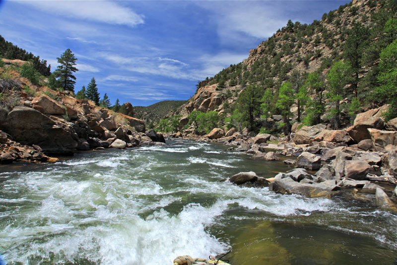
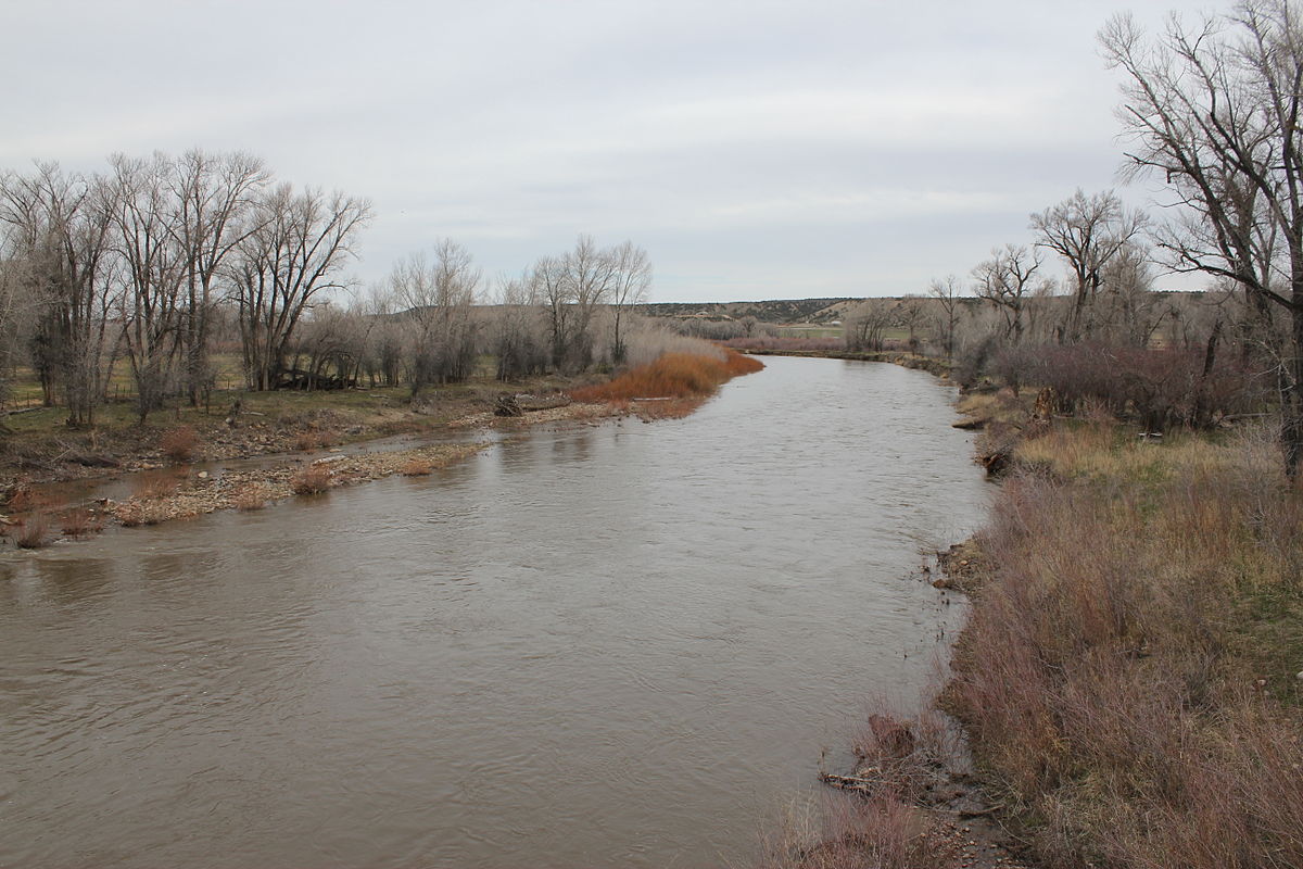
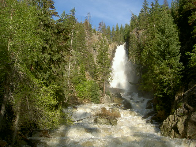
Nearly the entire [Arkansas River], from Granite all the way to the Pueblo Whitewater Park, is flowing at or above 700 cubic feet per second, the level of flow that Colorado Parks and Wildlife maintains for boating from July 1 to Aug. 15 with its voluntary flow management program.

The river was flowing at 696 cfs Wednesday from Granite to Buena Vista. From Buena Vista to Rincon it was flowing at 1,080 cfs, then at 911 cfs to Cañon City and 665 CFS at Pueblo’s water park.

“It seems runoff typically begins between May 1 and May 15,” Rob White, Arkansas Headwaters Recreation Area park manager, said. “It started a little early this year.”

He said he thinks the whole river is currently runnable, and signs are pointing to a good season.

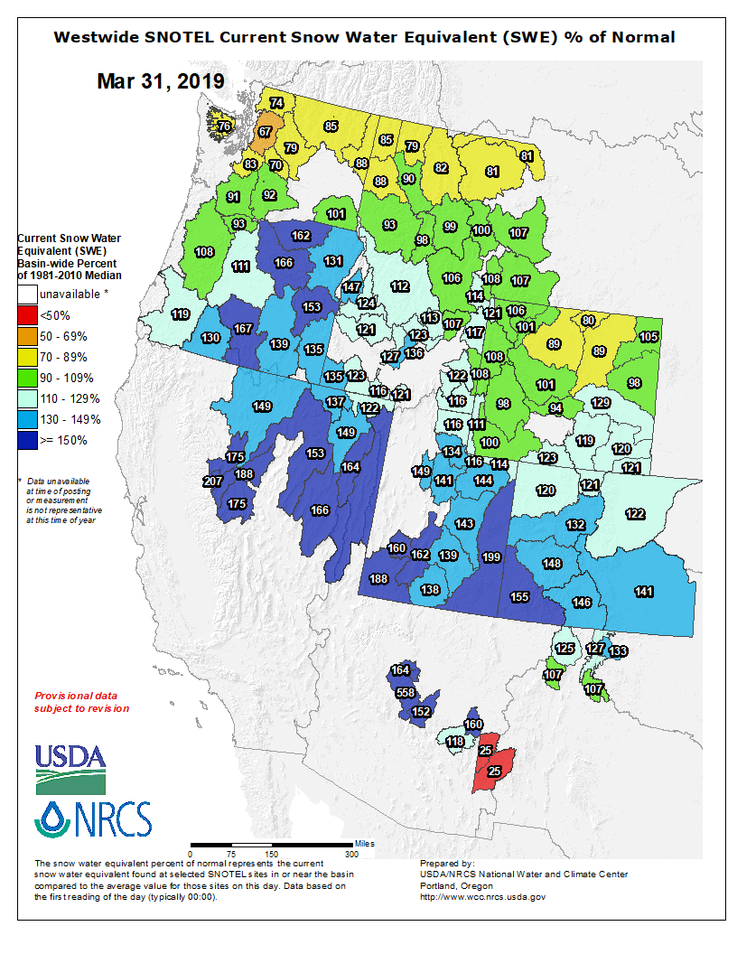
“It appears like it’s going to be a pretty good whitewater season in terms of water,” White said. He said it will depend on how hot it gets as well as how much rain falls, but he noted that with the upper basin’s SNOTEL sites currently above 100 percent, water levels could be above average this season.

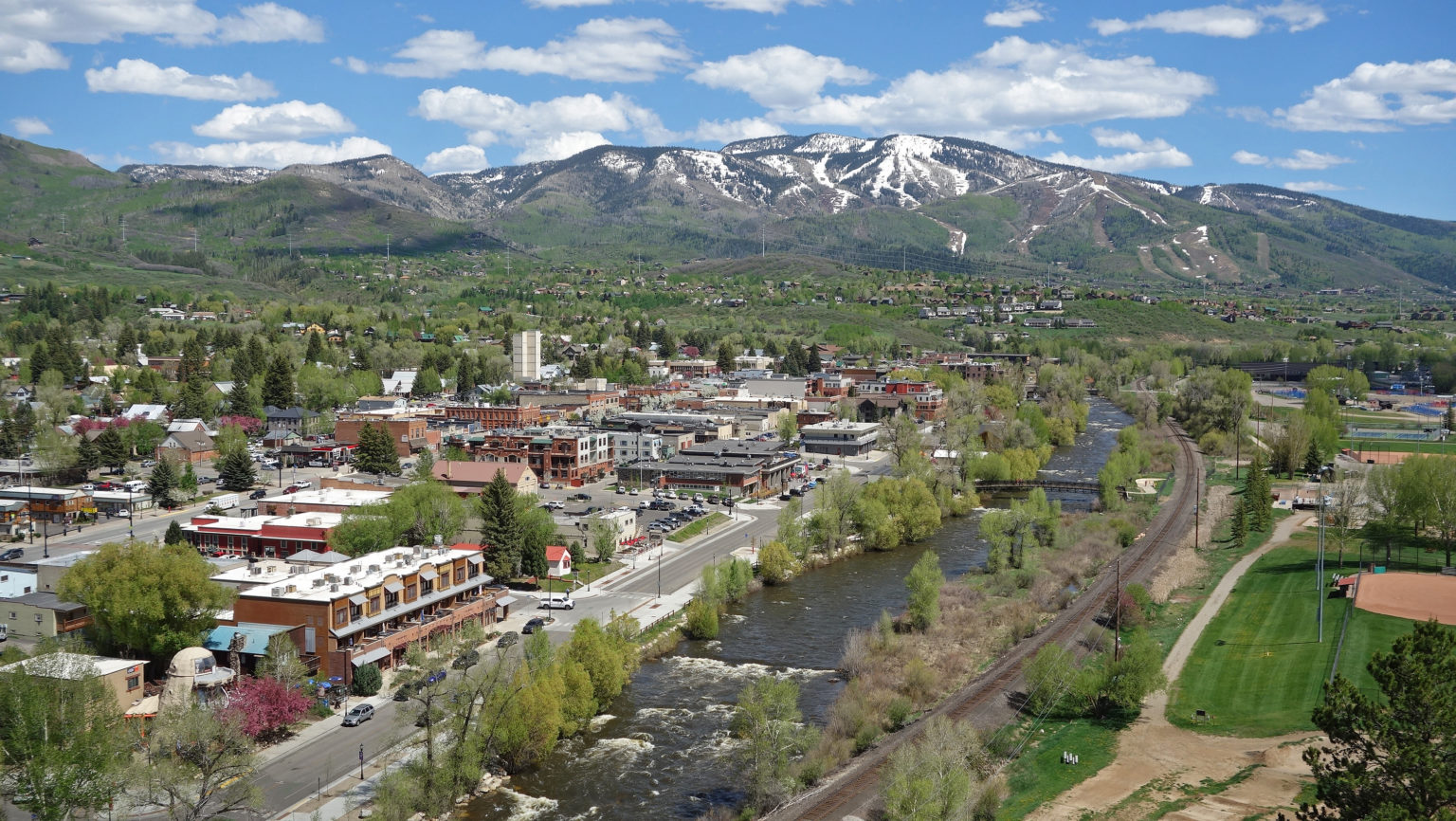
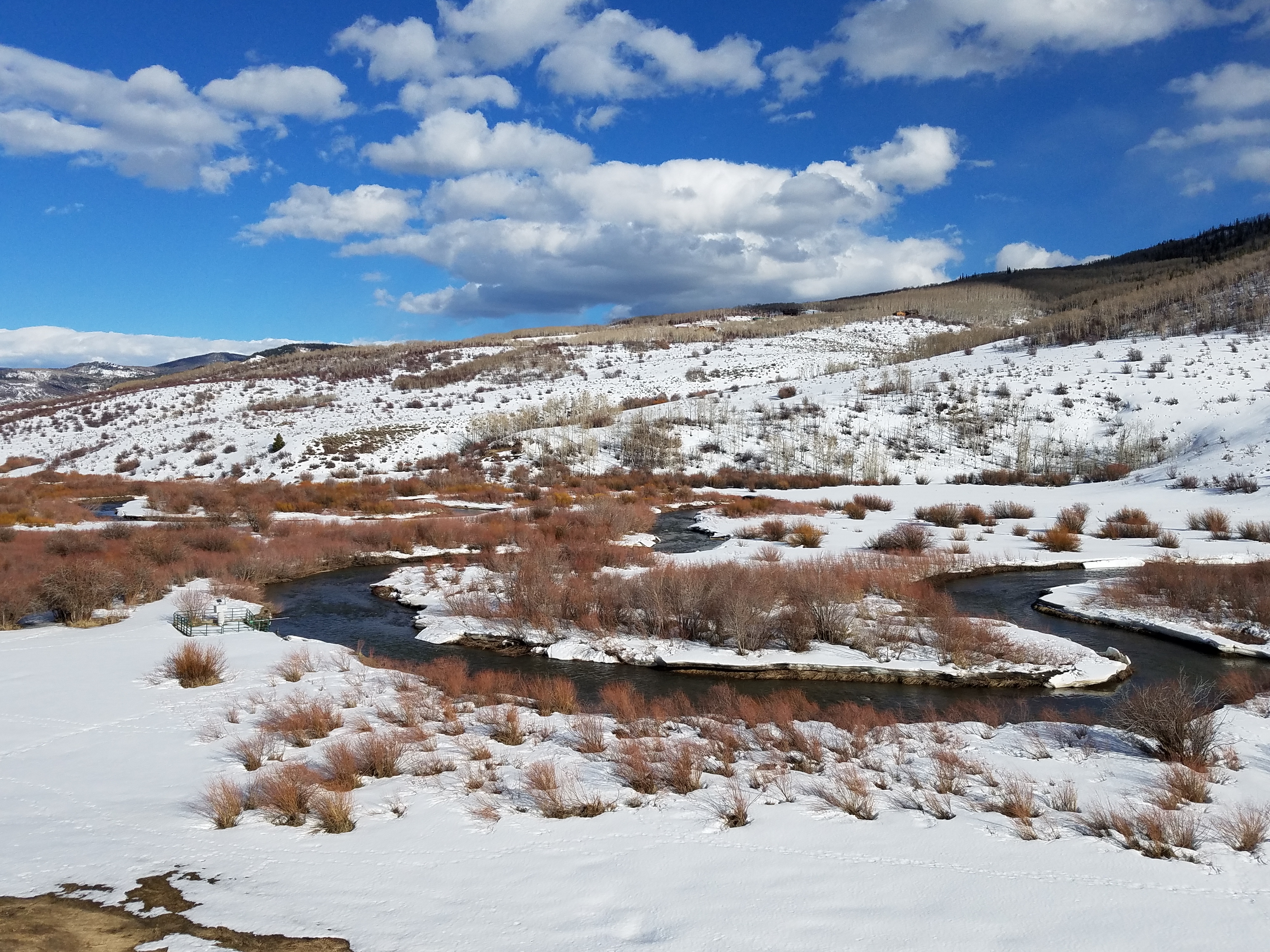
From Steamboat Today (Derek Maiolo):

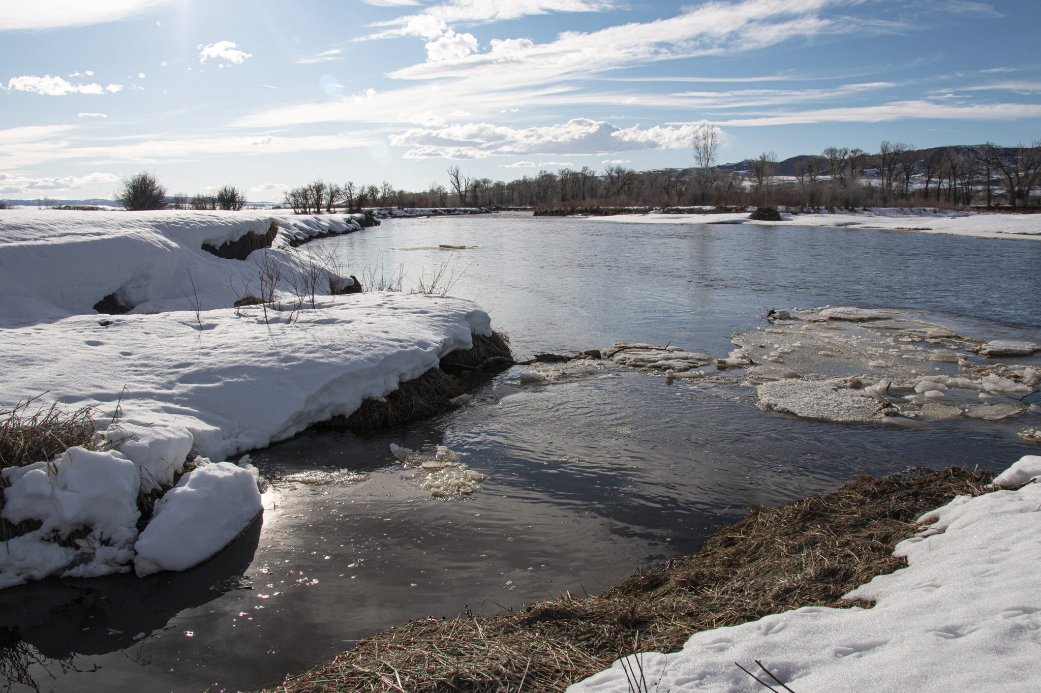
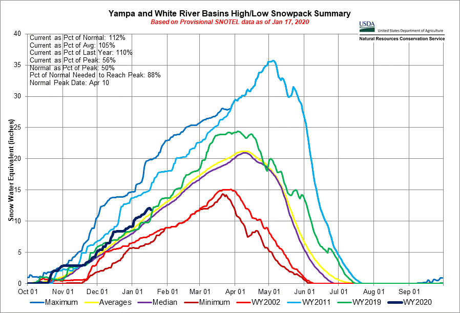
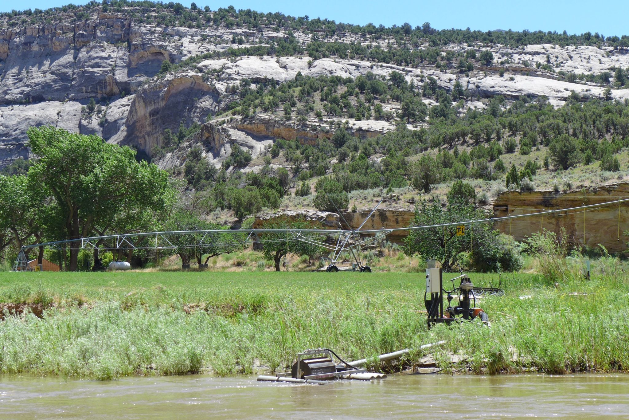
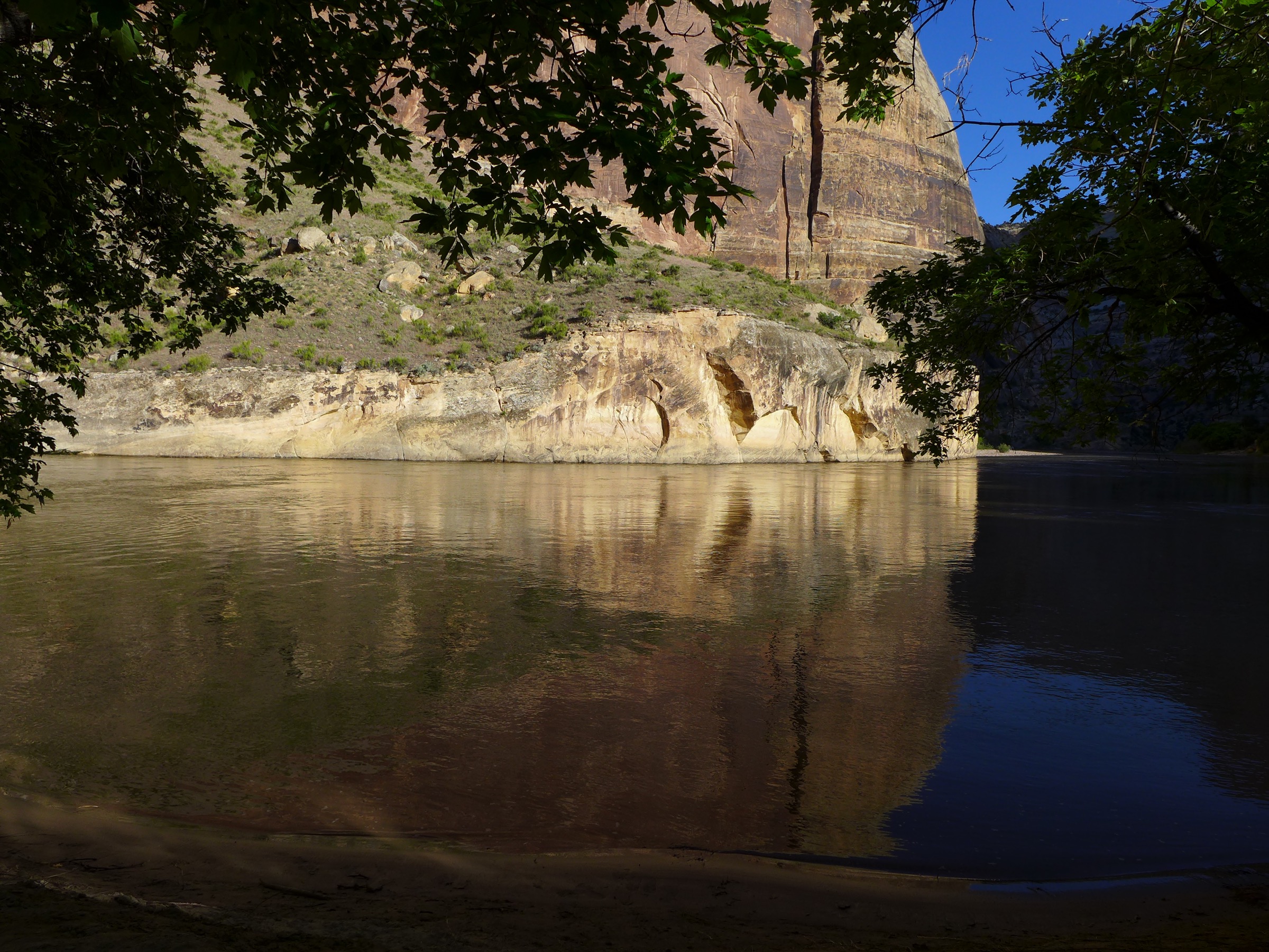
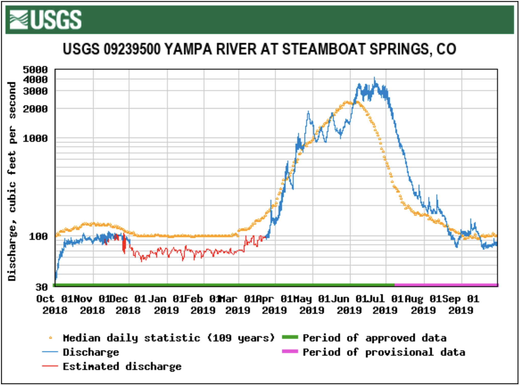
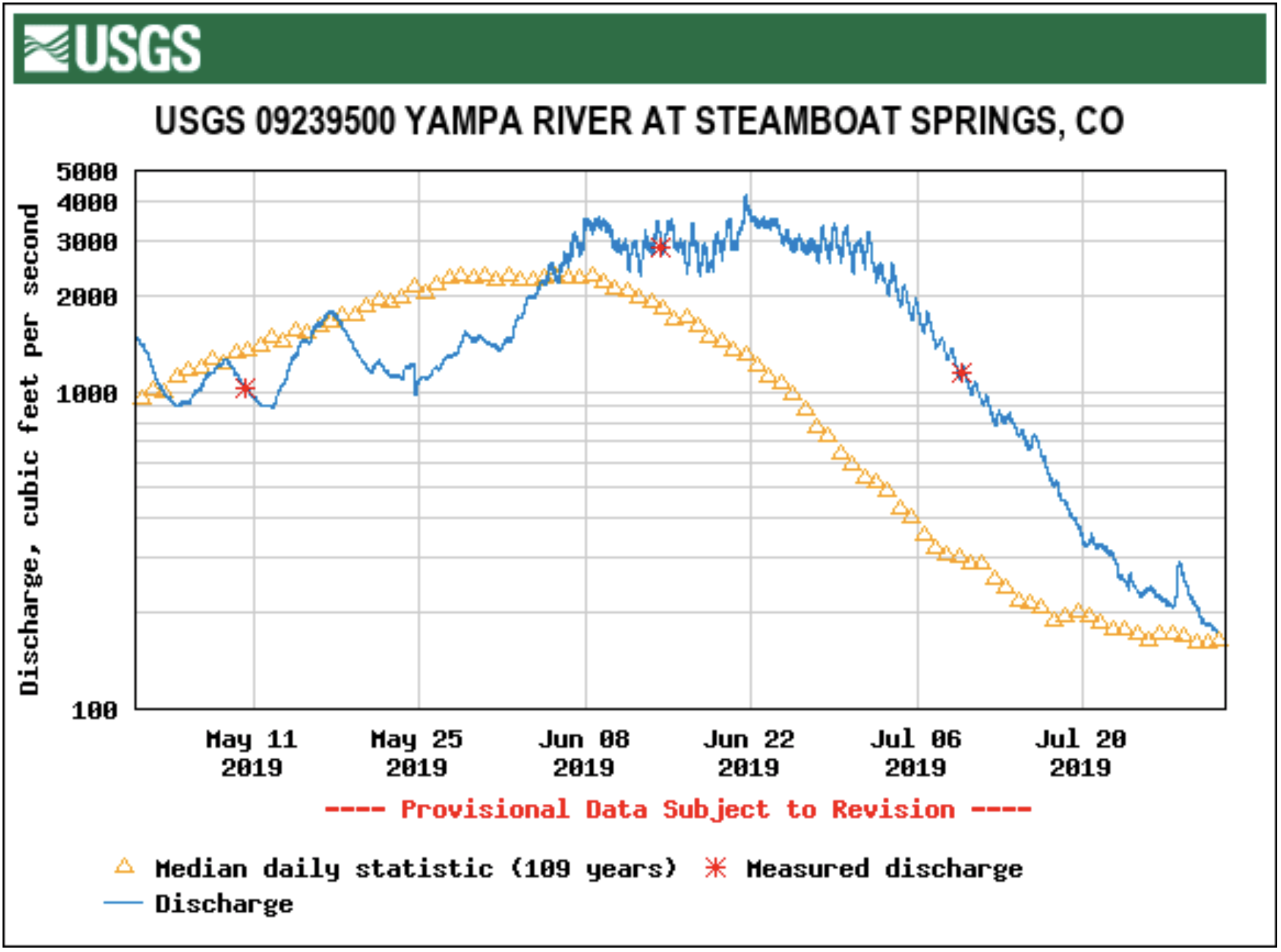
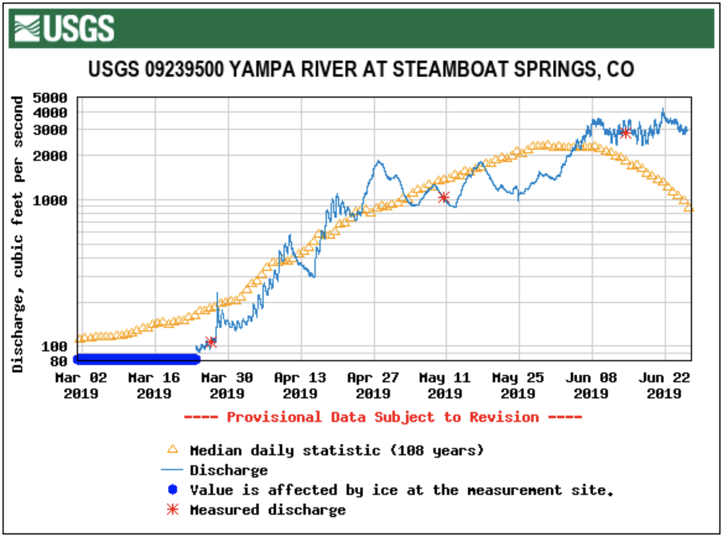
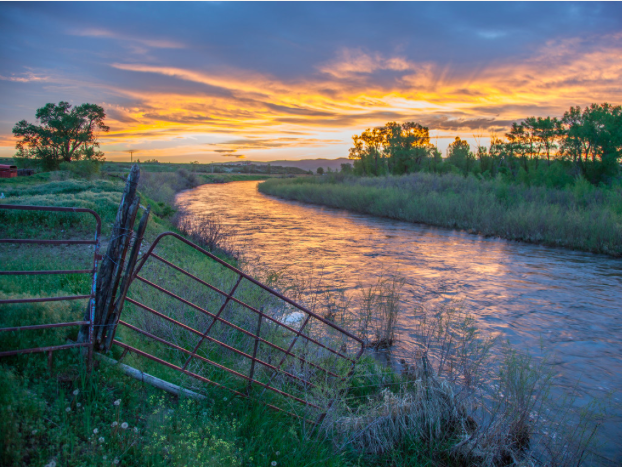
On Monday, the flow of the Yampa River had risen to more than 2,000 cubic feet per second, according to data from the U.S. Geological Survey. The flow has decreased slightly since then, due mainly to fluctuations in snow melt and temperature.

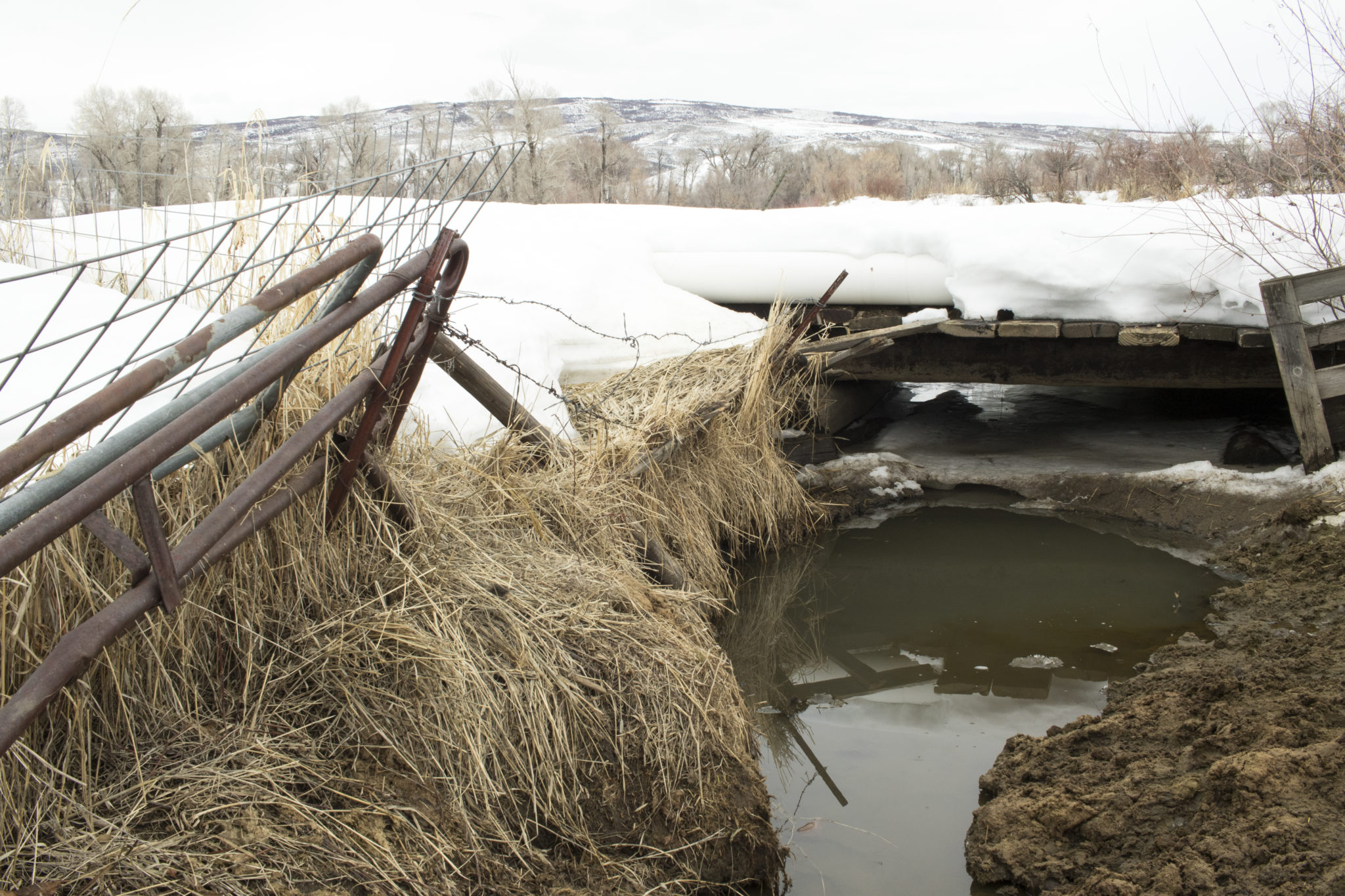
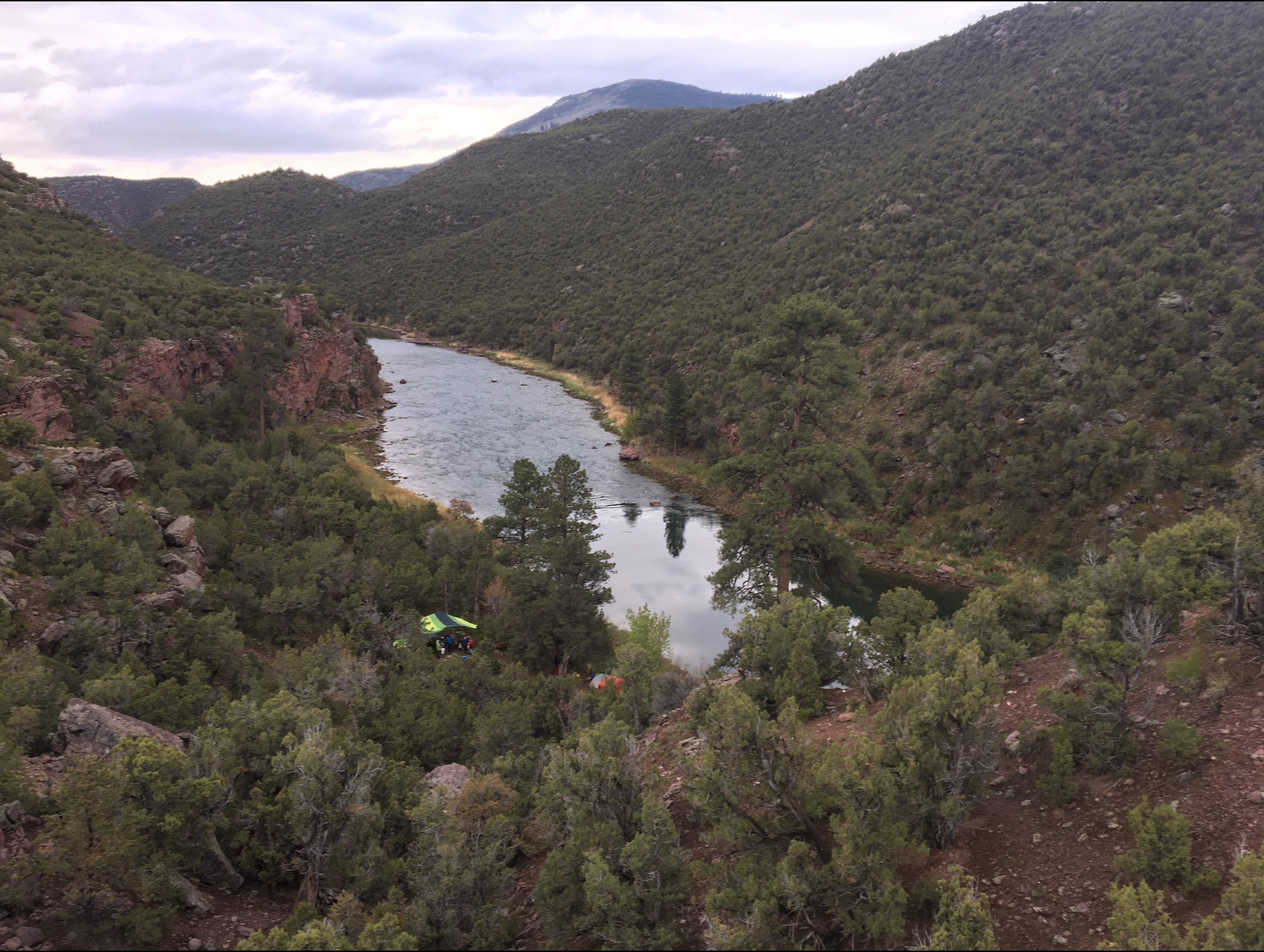
Portions of the Yampa River Core Trail have been closed due to high water, according to Craig Robinson, parks open space and trail manager for Steamboat Springs Parks and Recreation. Signs have been posted in those areas directing people to detours. Most of the trail closures are on underpasses, Robinson said…

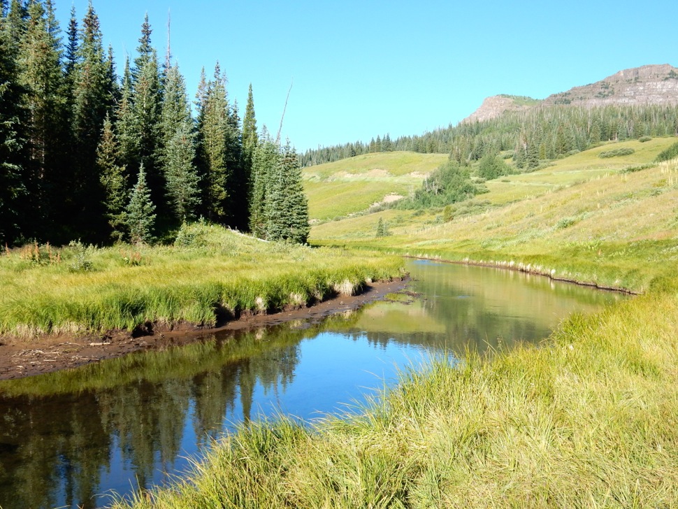
The Yampa River likely will continue to rise and flow at faster rates in the coming weeks, according to Tom Martindale, streets supervisor for the city of Steamboat Springs. The river usually peaks in late May or early June, he said. This comes after snowpack reaches its peak in the higher elevations and warmer temperatures send the melted snow downstream.

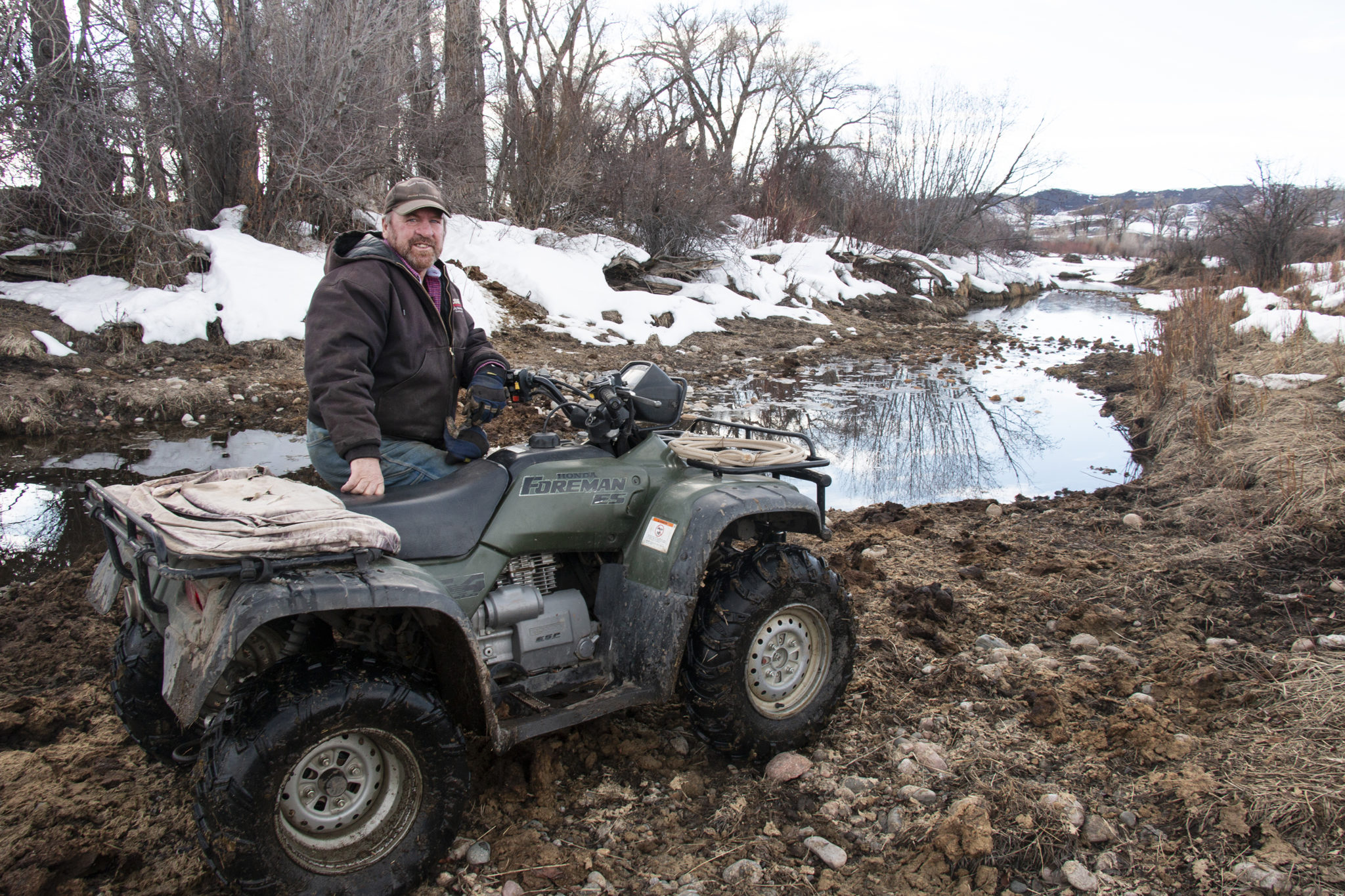
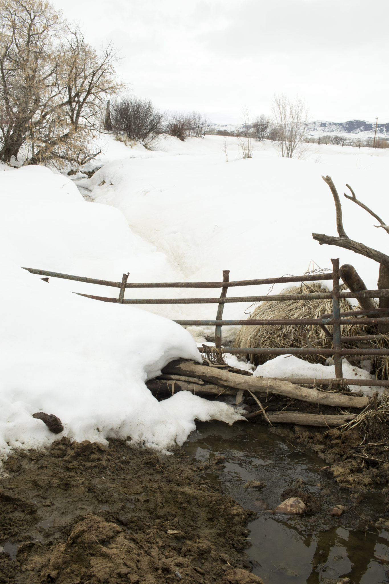
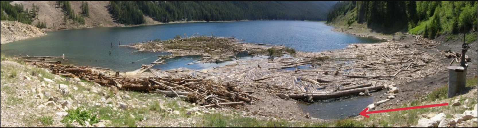
The smaller tributaries that feed into the Yampa River likely have reached or neared their peak levels, Martindale added. He regularly surveys Butcherknife Creek and Soda Creek, checking also for any debris, such as trees, that could dam the waterways and lead to flooding. So far, he has not seen any major issues…

The city currently is offering sand and sandbags for residents who want to fortify their homes against flooding. As of Tuesday, the city had set up two collection sites: one at Missouri Avenue and North Park Road, the other at Short and James streets. A third site at Eighth Street and Crawford Avenue will be established this week, Martindale said.

Uncompahgre River Valley looking south

From The Montrose Press (Katharhynn Heidelberg):

Although snow was nearly average through December, it fell to below average for January and February in the Gunnison Basin, then bounced back close to average in March and hit between 90 to 95 percent of average in April, according to the U.S. Bureau of Reclamation, which manages the Aspinall Unit.

Moderate drought conditions persist throughout the basin.

As of last week, snow conditions in the basin sat just below average, with runoff forecast for the rivers 70 to 80 percent of average. The forecast puts the unit in the “moderately dry” year hydrologic category and if that holds, it will call for a one-day peak flow of 7,017 cubic feet per second in the lower Gunnison, as measured at the Whitewater gauge, according to written information from BuRec.

There are no half-bankfull or peak flow duration targets under this type of hydrologic year.

Flows on the Gunnison through the Black Canyon are projected to peak at nearly 4,000 cubic feet per second. After peak, the flows will likely drop to between 500 and 900 cfs and the baseflow targets at the Whitewater gauge, consistent with moderately dry years, are to be between 890 and 1,050 cfs (summer).

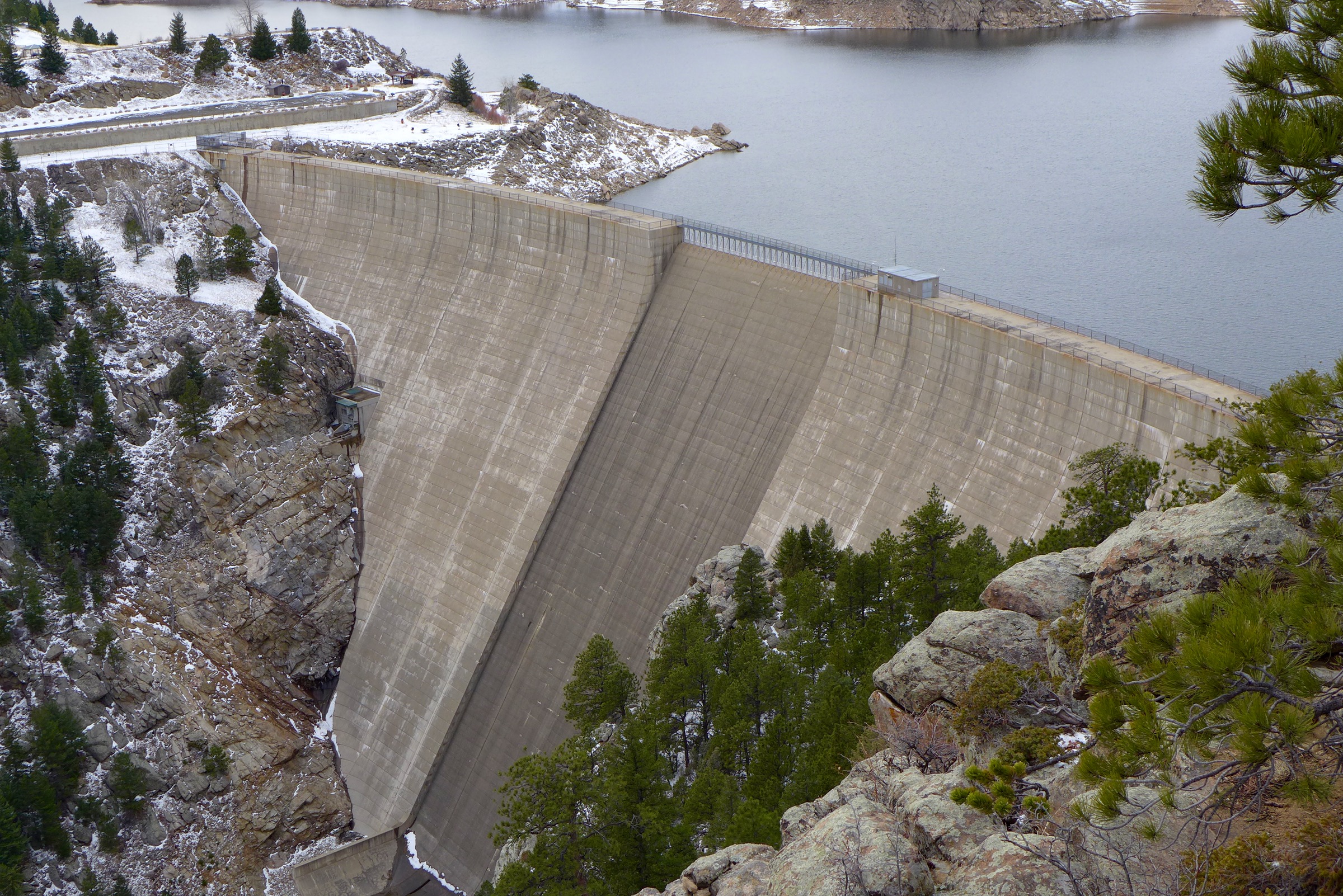
Blue Mesa Reservoir was sitting at 515,000 acre-feet and is forecast to hit a maximum content of 730,000 acre-feet by late June, or about 11 feet below what would be a full reservoir, per BuRec.

The reservoir would then slowly decrease to its winter target level of 580,000 acre feet. Black Canyon flows are projected to drop to 400 cfs by early fall, according to BuRec’s report…

Overall precipitation has been “well below normal” since the start of the water year and moderate drought conditions are predicted in most of the basin. The start of the month could bring below normal precipitation and above-normal temperatures — it is expected to be both warmer and drier…

“The snowpack is disappointing, there’s no doubt about that,” Anderson said. The UVWUA experienced an April “hole” this year, when less snow and colder weather in the high country meant there was not enough water to feed the project and the association had to dip into its storage at Ridgway and Taylor Park reservoirs.

However, the UVWUA had full accounts there going into April.

“Currently, we’re not using any storage and that’s a good thing. We still have plenty to make the irrigation season,” Anderson said.

Water from retired coal plants could help endangered fish in the #YampaRiver — @AspenJournalism

Ice breaks up on the Yampa River as Spring invites warmer temperatures. Should the water that the nearby Hayden and Craig power plants use be allowed to stay in the river once the plants cease to operate, native and endangered fish species in the river would have a higher chance of survival. Photo credit: Bethany Blitz/Aspen Journalism

From Aspen Journalism (Allen Best):

Endangered species of fish in the Yampa River may benefit as coal-fired power stations close in the next 10 to 15 years.

Water demand in the Yampa River valley has been flat, and only modest population growth is expected in coming decades. Unless new industries emerge, the water will probably be allowed to flow downstream.

And that will be of value in recovering populations of fish species.

The Yampa River downstream from Craig has been designated as critical habitat for four species of fish listed for protection under the Endangered Species Act: Colorado pikeminnow, razorback sucker, bonytail and humpback chub.

The Yampa River can fall to very low levels, especially during late summer in drought years, but the water now consumed by power plants at Craig and Hayden could possibly help augment those flows.

The power plants at Craig and Hayden together use about 10% of the water in the Yampa River basin. Municipalities, including Steamboat Springs, Hayden and Craig, use about 10%, and irrigation accounts for 80% of the use, which is common on Western Slope rivers.

Tri-State Generation and Transmission, the dominant owner of the 1,283-megawatt Craig Station, located just outside of Craig and not far from the Yampa River, will close the first unit in 2025 and unit 3 by the end of 2030.

The retirement date for unit 2 isn’t entirely clear. Tri-State has said 2030, but former Colorado Gov. Bill Ritter, who convened stakeholder discussions last year that led to the shutdown plan, told a congressional committee in late February that unit 2 will be closed by 2026. Tri-State spokesman Mark Stutz said the wholesale provider’s partners still need to agree on a retirement date.

Thermoelectric power generation plants in Moffat County, which includes the Craig plants, used 17,500 acre-feet of water in 2008, according to a 2014 study. Routt County used 2,700 acre-feet.

Xcel Energy, the dominant owner of 441-megawatt Hayden Station, will make its plans more clear in early 2021 when it submits its electric resource plan to the Colorado Public Utilities Commission as it is required to do every four years, said Xcel spokeswoman Michelle Aguayo.

Nobody knows for sure yet how the water will be used once those plants close and remediation is completed. But Eric Kuhn, former general manager of the Colorado River Water Conservation District, expects the water will be allowed to flow downstream. He points out that demand in the Yampa Valley has been flat.

“What will happen with that water being used? Probably nothing,” Kuhn said.

And that could help the endangered fish, which are struggling to survive in a river depleted by humans.

“We have a hard time meeting our flow recommendations, particularly in dry years,” said Tom Chart, program director for the Upper Colorado River Endangered Fish Recovery Program.

“As water becomes more available through the closure of those power plants, we could improve performance in meeting our flow recommendations, and that would certainly benefit the aquatic environment and the endangered fish,” he said.

Tri-State, however, has not divulged plans for future use of water from Craig Station. Tri-State spokesman Stutzsays Tri-State will continue to use the associated water during the decommissioning of its power plants and mines.

Steamboat-based water attorney Tom Sharp sees the water from the power plants mattering most in low-water years, such as 2002, 2012 and 2018.

And in the pinch time of August and early fall, Sharp said, the water from the coal plants could make a difference for endangered fish if the water is left in the river or held in storage for release during low-flow times.

Doug Monger, director of the Upper Yampa Water Conservancy District, shows the abandoned meander of the Yampa River that flows through his ranch, Monger Cattle Company, outside of Hayden, Colo. Monger said he isn’t too concerned about Front Range water diversions in the grand scheme of things. Photo credit: Bethany Blitz/Aspen Journalism

Front Range ‘water grab’?
Diversions by Front Range cities remains a worry by many in Craig, but experts see no cause for fear of a “water grab” by Front Range cities.

“I don’t want to see these water rights sold to the highest bidder on the Front Range,” a woman told the Just Transition workshop in Craig on March 4, provoking sustained applause from many among the more than 200 people in attendance. The state’s Just Transition advisory committee was created by and tasked by the state legislature in House Bill 19-1314 with creating reports, first this July and then December, about how to best assist coal-dependent communities as mines and plants close.

Not to worry, say experts. Geographic barriers between the Yampa Valley and the Front Range that have precluded diversions over the past century remain.

Also, experts point out that rights associated with the power plants are relatively “junior,” in the lexicon of Colorado’s first-in-time, first-in-right doctrine of prior appropriation. The oldest right, from 1967, belongs to the Hayden plant. More valuable by far are water rights that predate the Colorado River Compact of 1922.

“If Front Range entities were inclined to a water grab, they would be looking for something a little more useful, and pre-compact rights are on the ranches,” said John McClow, a water attorney in Gunnison and an alternate commissioner from Colorado on the Upper Colorado River Water Commission.

The compact governs allocations by Colorado and the other six states in the basin, and pre-compact rights will be most valuable in avoiding a compact curtailment, should the Colorado River enter even more extended and deeper drought.

Hayden rancher Doug Monger, a member of the Yampa-White-Green Basin Roundtable and director of the Upper Yampa Water Conservancy District, similarly downplays worries about Front Range diversions.

“I don’t think it will be as much of a threat in the bigger scheme of things,” he said.

Editor’s note: Aspen Journalism is collaborating with the Steamboat Pilot & Today and other Swift Communications newspapers on coverage of rivers in the upper Colorado River basin. This story ran in the April 7 online edition of The Steamboat Pilot & Today.

We are rivers episode 24: understanding #Colorado’s instream flow program — @AmericanRivers

City of Steamboat Springs. Photo credit: American Rivers

From American Rivers (Fay Hartman):

Tune into the 24th episode of our podcast: We Are Rivers. Learn all about Colorado’s instream flow program, and the significance it has on surrounding rivers and communities.

Join us for Episode 24 of We Are Rivers, as we de-wonk Colorado’s instream flow program, a critical tool to protect and enhance river flows across the state of Colorado.

Rivers form the lifelines of Colorado’s economy and lifestyle. On both sides of the Continental Divide, rivers provide world class fishing, paddling and fantastic scenic canyons. Not only do rivers provide engaging recreation opportunities, they also provide most of Colorado’s clean, safe, reliable drinking water, support our thriving agricultural communities, and substantially contribute to Colorado’s culture, heritage, and economy.

Recognizing the importance of rivers and the fact that the state needed to correlate the demands humans place on rivers with the reasonable preservation of the natural environment, Colorado established its Instream Flow Program in 1973. This program allows the Colorado Water Conservation Board (CWCB) to hold instream flow water rights – a legal mechanism to keep water in a specific reach of a river – to preserve or improve the natural environment of a stream or lake. The CWCB is responsible for the appropriation, acquisition, protection and monitoring of instream flow water rights.

The CWCB is the only entity in the state that can hold an instream flow water right, however many different entities including cities, agriculture, recreation and the environment benefit from instream flow water rights. In this episode of We Are Rivers, we explore the benefits of the program and discuss the important partnerships and collaborations that occur between different water users.

Take for example the City of Steamboat Springs. The 2002 and 2012 droughts significantly reduced flows in the Yampa River, impacting all water users. In 2002, the river experienced some of its lowest flows on record. River sports shops closed their doors, there was a voluntary ban on angling, and farmers and ranchers had less water. The river and the community suffered. Flash forward to 2012, and the community faced similar drought conditions. But partners got creative, and used the instream flow program to bolster flows in the Yampa River, preventing history from repeating itself. This partnership included the CWCB, Colorado Water Trust, and Upper Yampa Water Conservancy District. Together, they temporarily leased water from Stagecoach Reservoir, improving flows in the Yampa through the City of Steamboat. The short-term leases from Stagecoach Reservoir were vital to the health of the Yampa River and its surrounding communities, and were used not only in 2012, but also 2013 and 2017. This is just one example of how a diverse set of partners came together and utilized the instream flow program for many benefits.

The instream flow program underwent an exciting expansion earlier this year that will provide more opportunities for communities to benefit from collaborative instream flow solutions. After a multi-year stakeholder effort, the Colorado Legislature passed a bill to expand Colorado’s existing instream flow loan program – HB20-1157. The law expands protection of rivers without threatening or hindering existing water rights. It authorizes a targeted expansion of the loan program that makes the program more useful to water right owners and benefits Colorado’s rivers and streams. Specifically, it adjusts the amount of time a user can exercise a renewable loan from 3 years out of 10, to 5 years out of 10 years and it allows water right owners to renew participation in the program for up to two additional 10-year periods, for a total of 30 years. This is a huge opportunity for rivers and communities: take, for example, the benefit this provides to the Yampa River. The partners working together to secure the 3 in 10 instream flow loan on the Yampa through the city of Steamboat Springs now have two additional years in this 10-year period where water can be leased under the expanded program. Future climate conditions make frequent droughts more likely, and the opportunity to curb impacts during those back-to-back drought years is another important and timely benefit of the expanded ISF program.

The complexity of Colorado Water Law is a lot to digest, and the instream flow program is no exception. We hope you join us for Episode 24 to break down the specifics of the instream flow program and what it means for rivers and communities. Take a listen today!

#YampaRiver at @USGS gage, above Stagecoach Reservoir, March 31, 2020 — Scott Hummer #runoff

Yampa River at USGS gage, above Stagecoach Reservoir March 31, 2020. Photo credit: Scott Hummer.

From email from Scott Hummer:

Note the attached, taken yesterday afternoon…
River is beginning to open up, calves are starting to hit the ground and irrigation season will soon be upon s in the high country!

Yampa River Basin via Wikimedia. Ranchers and farmers in the valley have largely ignored Division Engineer Erin Light’s order to install measuring devices as of December, 2019.

2020 #COleg: New law strengthens historical agricultural water uses — @AspenJournalism [#HB20-1159]

A small pool of water along the Walker Ditch is kept free of ice and snow all winter long in order to provide water for cattle on the Monger Ranch near Hayden. A bill recently passed the Colorado legislature that allows ranchers’ historical stock watering rights to stay first in line, ahead of instream flow rights for the environment. Lauren Blair/Aspen Journalism

From Aspen Journalism (Lauren Blair):

A bill that cleared the Colorado legislature with bipartisan support March 4 seeks to resolve an eight-year debate over how ranchers and other water users can maintain their historical water use when dry conditions trigger cutbacks to protect streamflows.

HB20-1159 [State Engineer Confirm Existing Use Instream Flow], which passed the House with a unanimous 63-0 vote and the Senate with a 31-1 vote, authorizes state water officials to confirm historical usages, such as water used for livestock, whether or not it’s held in an official water right. This allows ranchers’ uses to stay first in line for water ahead of the stream protections, known as instream-flow rights.

“It’s really a belt-and-suspenders clarification of existing authority,” said Zane Kessler, director of government relations for the Colorado River Water Conservation District, which drafted the language for the bill. “I think it’s a good example of when we sit down and pore over these issues, it’s not hard to come up with a fix that protects West Slope water users and provides the state engineer the authority he needs to continue administering them.”

Instream-flow rights, which are held exclusively by the Colorado Water Conservation Board, exist for the sole purpose of preserving the natural environment of streams and lakes “to a reasonable degree.” Most of these date to the 1970s and are junior to most agricultural-water rights under Colorado’s prior appropriation system of “first in time, first in right.” To date, instream-flow rights protect roughly 9,700 miles of stream in Colorado.

Mud and manure line an access point for cattle to drink from a ditch on Doug Monger’s ranch near Hayden as winter nears its end. A bill recently passed the Colorado legislature that will protect ranchers’ historical uses without requiring them to go to water court. Photo credit: Lauren Blair/Aspen Journlism

Historical uses

The debate over historical uses has turned on whether a water user must go to water court to make their pre-existing use official in a decree.

A 2012 drought brought the question to a head when state officials cut off water users on the Elk River in northwestern Colorado in favor of instream-flow rights. Although many ranchers in the area have water rights for irrigation that are senior to the 1977 instream-flow rights and have historically used that water also for their cattle, the state Division of Water Resources determined that livestock watering wasn’t implicit in irrigation rights.

Those without specific rights for stockwatering were left high and dry once the summer irrigation season was deemed over, even though they had used the water for livestock for generations.

“My grandparents bought this piece of land in 1946,” said Krista Monger, a cattle rancher on the Elk River. “We have the records to show we’ve been using (our water) for livestock.”

Stockwatering and irrigation often go hand in hand. During the irrigation season, if a rancher’s livestock drink from the ditches used to irrigate their fields, the use is considered incidental to irrigation. But once the growing season is over and a rancher keeps the water flowing through the ditch for the exclusive purpose of watering their livestock, the use is not covered under irrigation-water rights.

The amount of water typically used for exclusive stockwatering is a fraction of what is used for irrigating, around 80% to 90% less. Some ranchers also use stock ponds, which require a water-storage right.

More than 90,000 irrigation-water rights are held across the state, of which 29,000 specifically name both irrigation and livestock uses. That means the new law could potentially apply to 61,000 water rights, although not all of these are held by ranchers raising livestock. An additional nearly 32,000 water rights are held exclusively for livestock purposes but not irrigation.

The Monger family holds both irrigation- and livestock-water rights to grow hay and to water their 300 cattle. Her family’s rights and diligent record-keeping meant their ditches kept flowing while their neighbors’ ditches were shut down in 2012, highlighting the need for better record-keeping among the region’s irrigators.

But the incident prompted a statewide debate over the meaning of Colorado statute C.R.S. 37-92-102(3)(b), which states that instream-flow rights are subject to pre-existing uses of water, “whether or not previously confirmed by court order or decree.”

The state Department of Natural Resources, home to both the Division of Water Resources and CWCB, argued that when the instream-flow protections were created, lawmakers intended for water users to make their existing use official in a decree. The Colorado Cattlemen’s Association and the Colorado River Water Conservation District argued that the statute clearly precludes the need for a court decree and sought to protect ranchers’ historical usage without requiring them to go to water court.

“The statute says… prior uses would be honored. But they’re saying the statute doesn’t say what the statute says,” said Mike Hogue, former president of the cattlemen’s group.

After years of negotiations, stakeholders agreed on a simple piece of legislation to clarify the state water engineer’s authority “to confirm a claim of an existing use (if it) has not been previously confirmed by court order or decree,” according to the bill summary. The bill had bipartisan sponsorship from Reps. Marc Catlin, R-Montrose, and Dylan Roberts, D-Avon, and Sens. Don Coram, R-Montrose, and Kerry Donovan, D-Vail.

“I do think this is very helpful legislation,” said State Engineer Kevin Rein, who is with the Division of Water Resources. “We had what I’d call an honest disagreement about what the statute meant. My position is if they change the law and give me a place to hang my hat on, that solves the problem.”

Ditch water trickles back under the cover of snow and ice from a watering hole for cattle on the Monger ranch near Hayden. New legislation prevents ranchers’ water for stock from being shut off by an instream flow right for the environment. Photo credit: Lauren Blair/Aspen Journalism

Wakeup call

However, what the legislation doesn’t resolve — and what is perhaps a bigger Pandora’s box opened by the 2012 incident — is the decision that state water officials made that irrigation rights do not include stockwatering rights. In practice, irrigators around the state, many of whom hold water rights dating to the late 1800s and early 1900s, have used irrigation- or agricultural-water rights not to just irrigate their hayfields, but also to water their livestock.

The new distinction means that ranchers with irrigation rights must apply for livestock water rights if they want to protect their usage into the future. Although the new legislation protects a rancher’s stockwatering use from being shut off specifically by an instream-flow right , their stockwater use could still be cut off if another water user makes a call on the river to fulfill a formal water right.

“We all thought that was part of our ag water rights,” said Doug Monger, a Routt County commissioner and a cattle rancher on the Yampa River in northwest Colorado, and also uncle to Krista Monger. “It’s a wakeup call for all of us.”

Aspen Journalism collaborates with The Craig Daily Press, Steamboat Pilot and Today and other Swift Communications newspapers on coverage of water and rivers. This story ran in the March 16 edition of the Craig Press.

Craig is slated to switch to chloramines for system disinfection in March 2020

The water treatment process

From The Craig Daily Press (Joshua Carney):

Presenting to City Council Feb. 11, SGM Water Engineer Rick Huggins told councilors that the project has gone as expected locally, after the city’s recent water quality plans were set into motion when the Colorado Department of Public Health increased disinfectant residual requirements for water systems, which Craig couldn’t meet in 2016.

Previously, Craig was using free chlorine to keep its water clean, but due to the failure to meet state requirements, the City of Craig had to act.

According to Huggins, after months of studies and workshops, council members decided a few key upgrades along with treating the city’s water system with monochloramine was the most cost-effective solution to keep the water safe. The project was expected to cost $5.2 million, requiring the city to increase rates to help finance the entire project.

According to Huggins, SGM expects the project to cost $3.128 million in the end, which is below the $3.375 million the company estimated costs would be at the start of the project.

The city announced to residents in their latest water bill that the monochloramine changeover will be implemented sometime in March…

Huggins did add that the project has run into scheduling issues that has pushed the project back 4-6 weeks, but he said that SGM anticipates that they’ll have Craig’s water treatment system compliant with state regulations by April 1.

As Western #Coal Plants Close, What Happens To Their #Water? — KUNC

The coal-fired Tri-State Generation and Transmission plant in Craig provides much of the power used in Western Colorado, including in Aspen and Pitkin County. Will Toor, executive director of the Colorado Energy Office has a plan to move the state’s electric grid to 100 percent renewable energy by 2040. Photo credit: Brent Gardner-Smith/Aspen Journalism

From KUNC (Luke Runyon):

Coal-fired power plants are closing, or being given firm deadlines for closure, across the country. In the Western states that make up the overallocated and drought-plagued Colorado River, these facilities use a significant amount of the region’s scarce water supplies.

With closure dates looming, communities are starting the contentious debate about how this newly freed up water should be put to use.

That conversation is just beginning in the northwest Colorado city of Craig, home to nearly 9,000 residents and hundreds of coal industry workers. In January, TriState Generation and Transmission announced it will fully close Craig Station by 2030. The same goes for the nearby Colowyo coal mine.

The news comes on the heels of several high profile closures or closure announcements in Wyoming , New Mexico and Arizona . Each has a coal plant that taps into the Colorado River or its tributaries…

Craig’s economy is intimately tied to the coal plant. But as the conversation about the announcement continued, other nagging questions came up, [Jennifer Holloway] said. Like what’s going to happen to the plant’s sizable water portfolio? It uses more than 10 times more water than all of Craig’s residents. Like what’s going to happen to the plant’s sizable water portfolio? It uses more than 10 times more water than all of Craig’s residents.

In the arid West, water, and access to it, is intertwined with local economies. Where water goes — to a coal plant, a residential tap, or down a river channel — says something about a community’s present and future economy, and its values…

Holloway wants to see Craig make a transition plenty of other Western communities have attempted over the last century, from an extractive economic base to a recreation-based one. She’s quick to name drop the region’s new slogan — “Colorado’s Great Northwest” — and list the various draws, like Dinosaur National Monument, the nearby Steamboat ski resort and the relatively free-flowing Yampa River.

“One idea that I fully support is switching Dinosaur National Monument into a national park,” she said. “And hopefully TriState would partner with that effort and maybe use some of that water as we legislated that park to guarantee that we had the water moving west.”

The Yampa River, in Dinosaur National Monument. Photo: Brent Gardner-Smith/Aspen Journalism

Without local input into what happens to Craig Station’s water rights, Holloway worries it could hurt the Yampa, which is the coal plant’s current water source. Colorado has a long history of transmountain diversion, where water from the wetter Western Slope is diverted eastward to the populous Front Range.

“That’s the biggest fear, is they’re going to go into the headwaters of the Yampa, make a pipeline going over to the eastern slope,” Holloway said.

So far TriState hasn’t tipped its hand on what it plans to do with the water. Duane Highley, TriState’s CEO, said at a news conference shortly after Craig Station’s closure announcement that his company is already fielding calls from interested buyers, but didn’t elaborate as to who has inquired.

“When you look at a typical coal facility it uses an enormous amount of water,” Highley said, “and the fact that that will be liberated and available for other reuse will be significant.”

[…]

Craig Station uses on average 16,000 acre-feet of water each year… A 2019 Bureau of Reclamation report showed thermal electric power generation in the Upper Colorado River basin accounted for 144,000 acre-feet, or about 3% of all water consumed in the watershed in Colorado, Wyoming, New Mexico, Utah and parts of northern Arizona…

“As a legal matter, the owners of the water rights, at least in Colorado, could do something else with them. As a practical matter, there’s not much else they can do with them,” said Eric Kuhn, former head of the Colorado River District and author of Science Be Dammed: How Ignoring Inconvenient Science Drained the Colorado River.

TriState has limited options with the water rights, Kuhn said. The energy provider could sell them to a local municipality, though communities along the Yampa River, like Steamboat Springs, Hayden and Craig, likely wouldn’t be able to use that much water all at once. TriState could offer them to local farmers, though most of the easily irrigable land has already been irrigated for a long time. They could turn them into in-stream flows. Or they could sell them to a user outside the Yampa basin, like a Front Range city. Any project proposed to pump the plant’s freed up water more 200 miles eastward would face significant political pushback and a multi-billion dollar price tag, Kuhn said.

According to Kuhn, these coal closures also have implications for broader Colorado River management. The recently signed Drought Contingency Plans task water leaders in Colorado, Utah, Wyoming and New Mexico to begin exploring a conceptual program called demand management, where in a shortage, water users would be paid to use less. Coal plants using less water would alleviate the situation.

“What it’s going to do is take the pressure off of these states to come up with demand management scenarios, because where does that water go? It’ll flow to Lake Powell,” Kuhn said.

#YampaRiver Fund opens 1st grant cycle; applications due March 24 — Steamboat Pilot & Today #ColoradoRiver #COriver #aridification #GreenRiver

Niche ag, along the Yampa River. Photo: Brent Gardner-Smith/Aspen Journalism

From The Steamboat Pilot & Today (Derek Maiolo):

An endowment fund to protect the Yampa River opened applications for its first grant cycle Tuesday, Feb. 11.

The Yampa River Fund, launched in September 2019, plans to award approximately $100,000 to $200,000 in grants during this cycle, according to its manager Andy Bauer. Applications will be accepted through March 24.

A partnership of 21 public, private and nonprofit entities representing the entire Yampa River Basin collaborated to create the board that governs the Yampa River Fund. Its mission, according to Bauer, is to fund projects to improve river health, protect the water supply and boost river flow in dry years.

This comes amid concerns over the health of the Yampa River, the supply of which is vital to local agriculture and a key component to recreation from rafting in the summer to snowmaking in the winter.

Kelly Romero-Heaney, Steamboat Springs water resource manager and chair of the Yampa River Fund board, cited three primary issues the fund aims to address: warming waters, the proliferation of northern pike and the deterioration of riparian forests.

Recent measurements have shown river temperatures are reaching dangerous levels. Romero-Heaney cited the 2018 Yampa River Health Assessment and Streamflow Management Plan, which found that summer water temperatures were surpassing healthy levels by about 5 degrees. Such temperatures kill off cold-water fish species, namely trout.

Non-native northern pike, which are aggressive predators, have decimated native species. Wildlife agencies like Colorado Parks and Wildlife encourage the fishing of pike through contests and the implementation of pike removal projects to limit their numbers.

Asked about the deterioration of riparian forests along the Yampa River, Romero-Heaney pointed to the last century of land management as a major factor. The number of cottonwoods has seen a particular decline, which decreases the amount of shade over the water and contributes to further warming.

Despite these issues, the Yampa River is healthier than many waterways in the country. The river remains largely free-flowing, unlike many rivers controlled with extensive dams. It is the largest, unregulated tributary remaining in the Colorado River system, according to the National Park Service. It also has been protected from extensive development along its banks, Romero-Heaney said…

As manager of the fund, Bauer listed three types of projects that will be prioritized during the grant cycle. Those include projects to sustain healthy flows, restore riparian habitats and improve infrastructure along the river, such as diversion structure and irrigation systems.

Eligible applicants include state and local government entities, public districts and irrigation entities, mutual ditch companies, homeowners associations and nonprofits, according to a news release from the Yampa River Fund. Bauer encourages private landowners to partner with these entities to secure funding.

Grant applications are available at http://yampariverfund.org/grants.

Guest Column: Should a water management plan be developed for the White River? — The Rio Blanco Herald-Times #COWaterPlan #ColoradoRiver #COriver #aridificatiion

White River Basin. By Shannon1 – Own work, CC BY-SA 4.0, https://commons.wikimedia.org/w/index.php?curid=69281367

Here’s a guest column from the White River Conservation District that’s running in The Rio Blanco Herald-Times:

The State of Colorado adopted the Colorado Water Plan in 2016. The Plan proposes to create a water management roadmap to achieve a productive economy, vibrant and sustainable cities, productive agriculture, a strong environment and a robust recreation industry. Specific to protecting and enhancing stream flows, the plan calls for 80% of locally prioritized rivers to be covered by Stream Management Plans (SMP) by 2030.

Through this effort, locally-led groups are encouraged to develop plans that will help meet the above 80% goal. The Water Plan initially encouraged only SMPs using biological, hydrological, geomorphological and other data to assess the flows or other physical conditions that are needed to support collaboratively identified environmental and/or recreational values.

However, experience across the State has shown the need to incorporate a more holistic approach including consumptive uses (agriculture, municipalities, energy, etc.). These types of plans are often called an Integrated Water Management Plan (IWMP). The local community is encouraged to determine what they want to accomplish and then find the right planning effort to help them achieve their goals.

The White River and Douglas Creek Conservation districts embarked on an effort in 2019 to identify what local needs can be met through the development of a plan and to determine community support for this effort. The districts are working with a Planning Advisory Committee (PAC) made up of 16 individuals representing agriculture, municipalities, industry, environment, recreation and land/water right holders. The committee is well balanced geographically within Rio Blanco County and members have strong knowledge of water rights, water quality and quantity concerns, water planning efforts, and local customs and cultures.

During December, district staff conducted approximately 25 interviews of local citizens identified by the committee. Questions developed by the committee were used for the interviews. The information gathered from the interviews are being used to develop a starting point for the much broader discussion within the community during January…

More information on the process and Planning Advisory Committee is available on the districts’ website at http://www.whiterivercd.com. Please contact the district office at 970-878-9838 with any questions. We look forward to your input.

Submitted by White River Conservation District

State looking to oppose White River storage project in water court — @AspenJournalism #ColoradoRiver #COriver #aridification

The view looking downstream at the proposed site for the reservoir and dam on the White River. Colorado’s top water engineers are looking to oppose the project in water court because of their concerns that it is speculative. Photo credit: Heather Sackett/Aspen Journalism

From Aspen Journalism (Heather Sackett):

After years of their questions and concerns not being met, Colorado’s top water engineers are looking to formally oppose the water rights associated with a proposed reservoir project in northwest Colorado.

In November, the Colorado Division of Water Resources filed a motion to intervene in the Rio Blanco Water Conservancy District’s application for a 90,000-acre-foot conditional water-storage right on the White River. The state DWR is now waiting for a judge to determine whether it will be allowed to file a statement of opposition in the case.

For more than 4½ years, state engineers have expressed concerns that the conservancy district has not proven there is a need for the water, which would be stored in the proposed White River reservoir and dam project between Rangely and Meeker. The issue is whether Rio Blanco has shown that it can and will put to beneficial use the water rights it applied for in 2014. It remains unclear whether the town of Rangely needs the water.

“And throughout this case, the Engineers have consistently maintained that RBWCD must demonstrate that its claimed water right is not speculative,” the motion reads. “Although RBWCD has addressed some of the Engineers’ concerns in the past six months, the Engineers maintain that RBWCD has not met its burden.”

State Engineer Kevin Rein said his office had been trying to resolve its concerns with Rio Blanco’s claims to water informally and doesn’t take filing a motion to intervene lightly.

“We are very aware of the influence we can have on the process and costs and delays, so we don’t just frivolously file a statement of opposition every time we have some issue with a case,” Rein said. “We believe there are issues that need to be fixed in this water-court application in order for it to go forward.”

One option for the White River storage project would be an off-channel dam and reservoir at this location. Water would have to be pumped from the White River into the reservoir site. Photo credit: Heather Sackett/Aspen Journalism

Rio Blanco declines comment

The White River storage project, also known as the Wolf Creek project, would store anywhere from 44,000 to 2.92 million acre-feet of water. The water would be stored either in a reservoir formed by a dam across the main stem of the White River — this scale of project proposal is now rare in Colorado — or in an off-channel reservoir at the bottom of Wolf Creek gulch, just north of the river. Water would have to be pumped from the river uphill and into the off-channel reservoir.

Rio Blanco District Manager Alden Vanden Brink declined to comment on the state’s opposition, citing concerns about litigation. Vanden Brink also is chair of the Yampa/White/Green River Basin Roundtable and sits on the board of the Colorado River Water Conservation District.

Rio Blanco is a taxpayer-supported special district that was formed in 1992 to operate and maintain Taylor Draw Dam, which creates Kenney Reservoir, just east of Rangely. The district extends roughly from the Yellow Creek confluence with the White River to the Utah state line.

Rio Blanco says Kenney Reservoir is silting in at a rate of 300 acre-feet per year, threatening the future of Rangely’s water supply and flatwater recreation, and a new off-channel reservoir on the White River could help solve this problem.

Deirdre Macnab, seen here on her 13,000-acre 4M Ranch between Rangely and Meeker, is the current sole opposer in the water court case for the White River storage project. Colorado’s top water engineers are looking to intervene in the case because they say the project applicant has not proven there is a need for the water. Photo credit: Heather Sackett/Aspen Journalism

Opposition

If a water-court judge grants the motion to intervene, the state will become the second opposer in the case. Currently, the only other remaining opposer is 4M Ranch, owned by Deirdre Macnab.

Tucked between rolling hills of arid, sagebrush-covered rangeland, the proposed reservoir and dam site abut her 13,000-acre property along the White River.

Macnab, who bought the beef and hay operation nearly five years ago, is on the board of the conservation group White River Alliance, as well as the Yampa/White/Green River Basin Roundtable. Macnab said the main reason she opposes the reservoir project is because of the state’s concerns.

“If we felt that there was a clear purpose and need that would benefit the public, then we would, in fact, be supportive of this,” Macnab said. “But the fact that the experts are saying there does not appear to be a clear purpose and need means that this would be a real travesty and waste of taxpayer money. It’s something we will continue to oppose until that changes.”

The site of the potential off-channel Wolf Creek Reservoir on the White River. Photo: Brent Gardner-Smith/Aspen Journalism

Additional concerns

State engineers are also concerned about the vagueness of the revised amounts of water for various uses that Rio Blanco says it needs.

In a 2018 report, Division 6 engineer Erin Light questioned Rio Blanco’s claims that it needed water for industrial/oil and natural gas/oil shale and irrigation uses. In response, Rio Blanco dropped those claims but almost doubled the need for municipal and industrial use for the town of Rangely and added a new demand for recreation.

The conservancy district also set the amount of water for environmental needs for threatened and endangered species at between 3,000 and 42,000 acre-feet despite its acknowledgement that the actual amount needed for this use was unknown. Rio Blanco then added a new demand for a sediment pool of 3,000 to 24,000 acre-feet and an insurance pool of up to 3,000 acre-feet but did not describe either of these uses.

“Thus, despite removing its claims for industrial/oil and natural gas/oil shale, which originally accounted for over half the demand for the claimed water right, the total demands for water identified by RBWCD actually increased to 24,000-100,000 acre-feet,” the motion to intervene reads.

Grant money

Since 2013, the Colorado Water Conservation Board has given roughly $850,000 in grant money to Rio Blanco to study the White River storage project, including a $350,000 Colorado Water Plan grant in 2018. According to CWCB communications director Sara Leonard, Rio Blanco has so far spent about 60% of these most recent grant funds.

Leonard said that DWR’s motion to intervene was not a surprise to the CWCB, that the two state agencies with seemingly differing views on the project have met and that the CWCB is aware of the state engineers’ concerns.

“The grants that have been awarded to the applicant to date have all been with the intention of helping the District with the evaluation process,” Leonard wrote in an email. “In other words, the motion has not changed the scope of the ongoing work in the grant.”

The Colorado River Water Conservation District has also given Rio Blanco $50,000 toward investigating the feasibility of the storage project.

“We are not advocates and we are not opposers,” said Jim Pokrandt, director of River District community affairs and chair of the Colorado River Basin Roundtable. “It’s a regional question that our constituents need to figure out.”

Aspen Journalism collaborates with The Craig Daily Press and other Swift Communications newspapers on coverage of water and rivers. This story appeared in the Jan. 17, 2020 edition of The Craig Daily Press.

#SnowpackNews: #YampaRiver Basin off to a good start

Yampa and White Basin High/Low graph January 17, 2020 via the NRCS.

From The Steamboat Pilot & Today (Bryce Martin):

The current snowpack of the Yampa and White River Basin, which encompasses Routt County, is currently 18% above average, according to data from the Natural Resource Conservation Service.

“My observations have been that this is tracking pretty similar to the 2019 snow year,” said Kelly Romero-Heaney, Steamboat Springs city water resources manager. Last year’s snowpack was mostly well above average in Routt County, though not quite record setting, she explained…

A snow telemetry site maintained by the Conservation Service on Rabbit Ears, at an elevation of 9,400 feet, recorded a snow depth of 37 inches, according to Jan. 1 measurements. That site typically reaches peak April 28 then melts off. As of Saturday, Jan. 18, there are 13.3 inches of snow water equivalent, a measure that considers the amount of water contained in the snowpack.

At the Bear River telemetry site, at 9,080 feet elevation south of the town of Yampa in the Flat Tops area, the snow depth was recorded at 22 inches, with 5.1 inches of snow water equivalent.

Snow depth at the Tower telemetry site, which is at 10,500 feet elevation on Buffalo Pass, was 56 inches as of Jan. 1, with 24.5 inches of snow water equivalent.

So far this season, Steamboat Resort has received 196 inches of total snowfall. That’s more than the 152 inches recorded to this date last year and 109 in 2018, which was a tough season for snowpack.

Midmountain snow depth at Steamboat Resort stands at 49 inches as of Saturday, with 66 inches on the upper mountain and 50 inches at the base, according to the website onthesnow.com, which records snow data for ski resorts.

From The Denver Post (Chris Bianchi):

After a lightning-fast start to the winter season that saw more than 2 feet of snowfall by the end of November, Denver’s only had one day of measurable snow since Nov. 29. Since Nov. 30, Denver has only received 2.8 inches of snow at the city’s official weather observation site at Denver International Airport.

At the city’s more centrally-located Stapleton Airport climate site, only 2.5 inches of snow have fallen there since Nov. 30. Additionally, all of that snow came on only one day: Dec. 28. That means since the end of November, Denver’s seen only one total day of measurable snowfall at both of its primary observation locations…

As mentioned earlier in January, though, this type of mid-winter pattern can change in Denver. Typically, late winter and spring are Denver’s busiest snow months of the year, although busier falls like this past one aren’t particularly unusual.

Community Agriculture Alliance: NRCS and #conservation on private lands — Steamboat Today

Bear River at CR7 near Yampa / 3:30 PM, May 16, 2019 / Flow Rate = 0.52 CFS. Photo credit: Scott Hummer

Here’s a guest column from Clinton Whitten (NRCS) that’s running on Steamboat Today:

The Natural Resources Conservation Service is an agency within the U.S. Department of Agriculture that provides free technical assistance, or advice, to land owners and managers regarding resource concerns on their property. The main mission of the NRCS is to help address natural resource issues on private lands through voluntary conservation activities.

We can help landowners conserve and restore water, air, forests, rangelands and other natural resources. The services we provide range from providing a simple soils report of your property to developing a full conservation plan for an agricultural operation. These services are free, private and voluntary.

Every county in the U.S. has resource concerns that are unique to the climate and land uses of the area. The following is a list of the common resource concerns in Routt County that NRCS currently encounters. This list is not comprehensive, but it covers the issues that we address the most.

  • Irrigation improvements help increase water use efficiency. In Routt County, this primarily involves improving infrastructure to increase control of flood irrigation water.
  • Grazing management plans help ensure the sustainability of livestock operations and the ecosystems they are utilizing. This can include assistance with infrastructure that would help to facilitate a grazing plan, such as cross fences and watering facilities.
  • Wildlife habitat management plans help improve the habitat of a variety of species on private lands.
  • Forest management plans help improve the health of private lands forest ecosystems. Implementation of management practices, such as thinning, planting, mastication, etc., have the goal of creating a more sustainable forest.
  • Seeding recommendations for the restoration of rangeland, pastureland and disturbed areas to reestablish native grasses which benefits soils and overall ecosystem health.
    Stream and riparian restoration improve both water quality and fish and wildlife habitat.
  • Many of these resource concerns are best addressed using the expertise of a range of organizations and agencies. That is why the NRCS works to develop partnerships with many different local groups.

    We are currently working with the Upper Yampa Water Conservancy District to develop a grant program that will better assist local irrigators to upgrade their head gates and install measuring devices. Forest management plans and projects are developed in coordination with the Colorado State Forest Service.

    The Steamboat NRCS office currently has two partner biologists from Trout Unlimited and Bird Conservancy of the Rockies who assist with the development of conservation plans. By partnering with different entities the NRCS is able to leverage more funds and provide better technical expertise to the private land owners and managers of Routt County.

    If you think you have a resource issue on your property and would like technical assistance, contact the NRCS office at 970-879-3225.

    Clinton Whitten is the resource team lead with the National Resource Conservation Service.

    Northwest #Colorado ranchers grapple with state requirements to measure, record water use — @AspenJournalism

    Irrigated pasture at Mantle Ranch along the Yampa River. Ranchers in the Yampa River basin are grappling with the enforcement of state regulations that require them to monitor their water use. Photo credit: Brent Gardner-Smith/Aspen Journalism

    From Aspen Journalism (Lauren Blair):

    Irrigators in Northwest Colorado are facing a sea change in how they use their water, and many ranchers are greeting such a shift with reluctance and suspicion.

    The final frontier of the free river, irrigators in the Yampa River region have long used what they need when the water is flowing with little regulatory oversight. Water commissioners have been encouraging better record keeping in recent years, but a first-ever call on the system during the 2018 drought led state officials to begin enforcing requirements to measure and record water use.

    State law requires all irrigators to maintain measuring devices on their canals and ditches. Kevin Rein, state engineer and director of the Colorado Division of Water Resources, said such devices are widely used in other river basins throughout Colorado, where bigger populations and more demand for water have already led to stricter regulation of the resource. The Yampa River Basin is the last region to get into compliance, Rein said.

    “The basin went under call for the first time in 2018,” he said. “I would not call that a driving force; I would call that affirmation of why it’s been important … to do this for so many years.”

    Nearly 500 Yampa River Basin water users were ordered this fall to install a device by Nov. 30, although irrigators don’t need to comply until spring 2020, when irrigation water begins to run. Those without devices won’t be allowed to use their water and could be fined $500 daily if they do.

    The new enforcement is being met begrudgingly by irrigators, many of whom are third- and fourth-generation ranchers and whose families have never measured and recorded water use in more than 100 years.

    “Ever since the 1880s, there has never been a call on the Yampa River,” said Craig cattle rancher Dave Seely. “If there wasn’t any water, (ranchers) accepted the fact, so it’s unusual that suddenly we have all this coming down on us now.”

    A call on the river occurs when someone with senior water rights isn’t receiving their full allotted amount, and the state places a “call” for users with junior rights to send more water downstream or stop diverting altogether. The move triggers administration of the river by state water commissioners, who make site visits to monitor how much water is flowing through each ditch.

    A hayfield in the Elk River Basin, a tributary of the Yampa River. A first-ever call on the Yampa River in 2018 is leading state officials to enforce regulations about measuring water. Photo credit: Brent Gardner-Smith/Aspen Journalism

    Government oversight

    An air of the Wild West still lingers in this sparsely populated corner of the state, where many ranchers would rather accept a shortfall than invite the government into their affairs by making a call for their water.

    “They just took it on the chin and dry farmed,” Seely said.

    State officials have seen this resistance to change before and accept it as a matter of course.

    “It’s a rough, rocky road at first, but after a while, I think a lot of people will be glad they have a device there,” said Erin Light, Division 6 engineer with the Division of Water Resources.

    Light and her colleagues reminded irrigators at the Yampa-White-Green Basin Roundtable meeting in November that keeping accurate records helps protect their water right, since rights are considered abandoned if not used, although the state rarely enforces this.

    “Your water right has a value, a value to water your livestock or your crops, but it also has a dollar value for your heirs,” Scott Hummer, a Division 6 water commissioner, said at the meeting. “The only way they have to sell the water or get a price for the water is if the engineers know how much water is consumed by your crop.”

    But many irrigators feel mistrustful of state government having more oversight of their water and are worried that outside entities may have designs on the region’s largely unallocated resource. Climate change has led to hotter, drier conditions over the past 20 years, and growing populations have increased the demand for water — both in the Colorado River Basin and along the Front Range.

    “It just raises the question of what’s the drive behind it,” said third-generation Yampa cattle rancher Philip Rossi. “It’s hard to have an opinion when you don’t fully understand the long game.

    “They’re trying to put a monetary value on water,” Rossi said. “Are they trying to get a better understanding of exactly how much water there is … so they can put a value on it if they want to sell it? Are we helping ourselves, are we hurting ourselves, are we helping them? There’s so many of us that are not interested in selling our water.”

    Other ranchers are concerned that increased oversight could mean new restrictions even when water is plentiful. Many are in the habit of using as much water on their fields as they need, regardless of their decreed right.

    “When the water’s high, we want to get it across our fields quickly, so we take more water than (our allotted right),” said John Raftopoulos, a third-generation cattle rancher in western Moffat County. “The fear is that, even with high water, they’re going to cut you down to the maximum you can take … that they’ll regulate you to the strict letter of the law.”

    An irrigated hayfield along the lower Yampa River. If irrigators don’t install measuring devices on their diversions by the spring irrigation season, they could be fined $500 a day. Photo credit: Brent Gardner-Smith/Aspen Journalism

    No waste

    Rein said users could continue using more than their allotted right when the river is a free river — in other words, not under a call — as long as they are not wasting it.

    “There’s a statutory term called waste; you can’t divert more water than you can beneficially use,” Rein said.

    He also said keeping accurate records would only protect the water user as demand increases statewide and across the West.

    Measuring devices cost from $800 to $1,500, so installation can get expensive for the many ranchers who have more than one ditch. Rossi has three more devices to install. Raftopoulos has about five others, for a total of 15 on ditches irrigating roughly 2,500 acres of grass hay and alfalfa.

    Light estimated 100 irrigation structures had requested extensions — which she is granting in many cases until either July 31 or Oct. 31 — but she won’t have an accurate count on how many ditches are in compliance with the orders until May or June.

    “It’s something that was going to happen sooner or later because of water shortages. That’s the system, that’s the law,” Raftopoulos said. “It’s a burden right now, it’s expensive and it’s going to put more government in our ditches. There’s going to be more people watching what comes out.”

    Aspen Journalism collaborates with the Steamboat Pilot and Today, the Craig Press and other Swift Communications newspapers on coverage of rivers and water. This story appeared in the Dec. 27 edition of the Steamboat Pilot and Today.

    Yampa River Basin via Wikimedia.

    #Utah Division of Water Resources announces finalized regional water #conservation goals

    Credit: Utah Department of Water Resources

    Here’s the release from the Utah Department of Natural Resources (Kim Wells:

    After reviewing and incorporating over 330 public comments, the Utah Division of Water Resources has finalized regional water conservation goals. Goals were established for nine regions around the state for municipal and industrial (M&I) water conservation. M&I includes residential, commercial, institutional (for example, schools and parks), and industrial water use, and excludes agriculture, mining and power generation.

    “We appreciate all those who took the time to review the goals and share their opinions,” said Division of Water Resources Director Eric Millis. “There were some insightful comments, which were incorporated into the report. There is always value in soliciting public input.”

    Although the numbers did not change, the comments improved the readability of the report including text clarifications that make the report better. All 334 comments and the division’s response to them are included in Appendix J of the report. The comments were collected during a 30-day comment period that ran from Aug. 27-Sept. 25.

    The goals vary by region. When every region reaches its goal, a 16% water use reduction will be realized by 2030. This approach allows the goals to be tailored to each region’s characteristics.

    (https://water.utah.gov/wp-content/uploads/2019/11/RWCG-Map-web-1.jpg)

    “When you look at the amazing variety we have in our great state – from southern Utah’s red rocks to the Alpine mountains in the north – targeting goals for a specific region allows the goals to account for things like climate, elevation, growing season and specific needs,” said Millis. “It’s a more local and customized approach.”

    This is the first time Utah’s water conservation goals have been established on a regional level, an approach which was recommended by the 2015 Legislative Audit, 2017 Follow-up Audit, Third-Party Review and 2017 Recommended State Water Strategy.

    “The regional goals replace the ‘25% by 2025’ goal. They also build on the previous statewide goal and will require everyone to do their part to conserve this precious resource,” said River Basin Planning Manager Rachel Shilton. “Every step counts and water conservation needs to become a way of life for all Utahns.”

    Utah’s previous statewide conservation goal of reducing per-capita use 25% by 2025 was introduced by Gov. Gary Herbert during his 2013 State of the State address. (Gov. Mike Leavitt first set a target to use 25% less water by the year 2050 back in 2000.) Utahns were making great progress on the water conservation front, so Herbert challenged Utahns to cut the time in half. The regional goals are designed to continue to improve the state’s conservation efforts.

    To formulate the regional water conservation goals, the Division of Water Resources first gathered public input. During fall 2018, over 1,650 people participated in a water conservation survey, and eight open houses across the state were held. After public input was tallied, a team consisting of water providers, members from the Governor’s Office of Management and Budget, and Water Resources staff worked with a third-party consultant to provide input on the region-specific goals. Public input was gathered during a 30-day comment period, reviewed and incorporated.

    “These goals will help guide the state’s water managers in planning future infrastructure, policies and programs consistent with Utah’s semiarid climate and growing demand for water,” said Millis. “They will also be used to plan conservation programs.”

    View the regional water conservation goals at http://Water.Utah.Gov/goals.

    For more information, contact Kim Wells, public information officer, at 801.803.0336 or email kimwells@utah.gov.

    Study: #ColoradoRiver water crisis could dry out Front Range, West Slope cities and farms — @WaterEdCO #COriver #aridification

    Gross Reservoir, west of Boulder. Photo by Brent Gardner-Smith/Aspen Journalism

    From Water Education Colorado (Jerd Smith):

    Water sufficient for more than 1 million homes on the Front Range could be lost, and thousands of acres of farm land on both the Eastern and Western Slopes could go dry, if the state can’t supply enough water from the drought-stricken Colorado River to downstream states as it is legally required to do, according to a new study.

    Among the study’s key findings:

    + In the next 25 years, if the state does nothing to set more water aside in Lake Powell, the Front Range could lose up to 97 percent of its Colorado River water.

    + All but two of the state’s eight major river basins, under that same “do nothing” scenario, also face dramatic water cutbacks.

    + If Colorado, Wyoming, Utah and New Mexico increase their water use by as little as 11.5 percent, as predictions indicate they will by 2037, the risk of a legal crisis spurring such cutbacks on the river doubles, rising from 39 percent to 78 percent, under one scenario, and 46 percent to 92 percent under another.

    “Every water user in every river basin [linked to the Colorado] faces some risk,” said Andy Mueller, general manager of the Glenwood Springs-based Colorado River Water Conservation District, one of the sponsors of the Colorado River Risk Study, as it is known. The Durango-based Southwestern Water Conservation District also sponsored the work.

    Palisade peach orchard

    “That’s an important takeaway because when you begin to realize the extent of potential damage, whether it is on the West Slope or the Front Range, then we all come to the realization that we have a shared risk,” Mueller said.

    Under the 1922 Colorado River Compact, the river’s supplies are divided between the four Upper Basin states (Wyoming, Utah, Colorado and New Mexico) and three Lower Basin states (California, Nevada and Arizona). The compact dictates that cities and farmers in the Upper Basin whose water rights were obtained after the compact was signed would have to give up some or all of their water to the Lower Basin if there isn’t enough water in Lake Powell to meet the terms of the compact. Colorado uses the most water of all the Upper Basin states and therefore faces the most risk.

    The study was conducted by Boulder-based Hydros Consulting and released in June. It looked at different scenarios for the way river conditions and reductions to diversions could play out, as well as ways to reduce the risk cities and farms face, including spreading the cutbacks proportionately among all the river basins, something that isn’t typically done.

    Scare tactics

    Front Range water utilities are wary of the study and have begun a new round of analysis to determine if they agree with the results.

    Alex Davis is a water attorney for the City of Aurora. At a recent forum on the risk study, she said that the chances of a Colorado River crisis were being exaggerated. And the study acknowledges that under some scenarios the risk of such a legal crisis is low.

    “All of this talk is helpful to get people to think about the issue, but it also seems like a bit of scare tactics. If the Lower Basin states did try to do something, there would be a whole number of reasons [they would not get far],” she said.

    Including the fact that they continue to overuse their share of the river by about 1.2 million acre-feet a year. Before Colorado and its northern neighbors were asked to cut back, the Lower Basin would have to do additional cutbacks as well, she said.

    If drought and climate change continue to sap the river’s flows, and a legal crisis erupts with downstream states, six of the state’s eight major river basins could be forced to give up water. The Front Range and Eastern Plains are most vulnerable if shortages hit the river downstream and could lose as much as 97 percent of their Colorado River supplies. Credit: Chas Chamberlin via Water Education Colorado

    West meets east

    Though the Colorado River flows west, and originates in Colorado’s Never Summer Mountains in Rocky Mountain National Park, a large chunk of its flows, more than 530,000 acre-feet, are pumped east over the Continental Divide to the state’s Front Range cities, including Denver, Colorado Springs, Pueblo, Boulder, Fort Collins and Broomfield, among others. That’s enough water to supply 1.06 million homes or to irrigate more than one-half million acres of crops.

    Because these water users built their tunnels and reservoirs decades after the 1922 Compact was signed, they could be among the first to be cut off. Denver’s largest storage pool, Dillon Reservoir, was completed in the 1960s. East Slope cities and farmers would lose 97 percent of their Colorado River supplies if those diversions were completely shut down, according to the study.

    “You have to start with the fact that 50 percent of the water on the Front Range comes from the West Slope. Should the Upper Basin fail to meet its delivery obligation, half of water use on the Front Range would be curtailed. That’s an enormous problem,” said Brad Udall, a senior climate and water scientist at Colorado State University’s Colorado Water Center.

    Other parts of the state also face risk, some more than others. The Yampa River Basin, home to Steamboat Springs, would lose slightly more than 70,000 acre-feet of water, or 30 percent of its Colorado River supplies.

    The Gunnison Basin, where agriculture controls historic water rights that pre-date the compact, is better protected, with the potential to lose just over 57,000 acre-feet of water, or 10 percent of its share of the river.

    But a large swath of the southwestern part of the state would also be hard hit. Despite the historic farm water rights in this region, several small communities and irrigation districts built reservoirs after the compact was signed, just as cities did on the Front Range, meaning that those stored water supplies are also at high risk. In this basin, 178,000 acre-feet of water, roughly 36 percent of its Colorado River supplies, could be lost, according to the study.

    The likelihood of ongoing drought and hotter summers only deepens the uneasiness over the river’s ability to produce the amount of water the state once relied on.

    “We don’t expect to see cooler temperatures in the future, we expect to see warmer temps,” Mueller said. “If that is true, then we have to plan on reduced water supplies within our state.”

    Blue Mesa Reservoir

    Saving more water?

    The study comes as the Colorado Water Conservation Board (CWCB), the lead water policy agency in the state, is examining whether to launch a massive, voluntary conservation program that would allow the state and its neighbors to save some 500,000 acre-feet of water and store it in a newly authorized drought pool in Lake Powell. The pool, to be used only by the Upper Basin states, could help protect Colorado and its neighbors if drought and climate change continue to sap the river’s flows.

    Michelle Garrison is a modeler with the CWCB who has analyzed the study’s results. She said the scenarios it considered are important for comparative purposes and may help the West Slope and Front Range collaborate on any water cutbacks, something that hasn’t always occurred in the past.

    “It’s a tough one,” she said. “The hydrology in the Colorado River has always been extremely variable and it’s predicted to become even more variable. But I’m really pleased to see them sharing their results.”

    In places like the Yampa Basin, if the state cut back water use based strictly on prior appropriation, where water right dates determine who gets water first in times of shortage, Stagecoach Reservoir, the most significant storage pool in the valley, could be shut off because its storage rights date only to the 1980s. And residents would be hard pressed to cope if another long-term drought drained the river and their only source of stored water was no longer able to refill.

    Kevin McBride is manager of the Upper Yampa Water Conservancy District, which owns Stagecoach. He, like dozens of other water managers across the state, is still contemplating the options. (Editor’s note: McBride serves on the board of Water Education Colorado, which houses Fresh Water News.)

    “Generally being safe from drought is what it’s all about,” McBride said. “But how do you get there?

    “It’s complicated and it comes down to how it’s done.”

    McBride and others on the West Slope are asking for another round of modeling that would examine more equitable ways to cut back water use, so that no one takes the brunt of the reductions.

    With insurance, or without?

    Others have suggested that the state should let the rules embedded in the 1922 Compact and Colorado’s water rights system play out, rather than creating an expensive, legally complex water conservation program.

    Anne Castle is a senior fellow at the University of Colorado’s Getches-Wilkinson Center for Natural Resources who specializes in Colorado River issues. Going without a major conservation program carries its own set of very high risks, such as decades of expensive lawsuits or unplanned water shortages.

    Over the next several months, the state will continue to examine how best to protect its Colorado River water as part of drought planning work it is engaged in with the other Upper Basin states. Late next year, all Colorado River Basin states will begin negotiating a new set of operating guidelines for the entire river system, designed to bring it back into balance and slash the risk of major cutbacks.

    “Truly one of the points of this risk study is to make sure that anyone who is at risk understands the risk,” Mueller said. “If you’re a water planner, it may set off some alarm bells. But we don’t want people to panic. The hope is people will look at this and say, ‘Our community is at risk…what are we going to do about it?’”

    Jerd Smith is editor of Fresh Water News. She can be reached at 720-398-6474, via email at jerd@wateredco.org or @jerd_smith.

    This graphic shows the transmountain diversions in Colorado.

    The Yampa/White Basin Roundtable is developing a #YampaRiver integrated water management plan #COWaterPlan

    Serene corner on the Yampa River. Photo: Brent Gardner-Smith/Aspen Journalism

    From the Yampa/White Basin Roundtable (Gena Hinkemeyer) via The Craig Daily Press:

    The Yampa-White-Green Basin Roundtable is one of nine basin roundtables in Colorado established to address the ever-increasing water challenges facing our state.

    As part of its mission and to meet the Colorado Water Plan, the roundtable is developing an Integrated Water Management Plan for the Yampa River Basin that best represents the interests and needs of all water users. These interests include agricultural, recreational, environmental, municipal, industrial and water providers. The first phase of the Management Plan focuses on the Yampa River main stem and the Elk River basin.

    In order to make the Management Plan a success, the roundtable seeks to provide the community with meaningful opportunities to participate and provide valuable input for the Management Plan. To do this, two subcommittees where formed — stakeholder and technical — to complete related tasks.

    The stakeholder subcommittee is working to implement a community outreach program designed to listen and learn in an open communication process. This subcommittee will provide a forum for dialogue on water related issues for all water users, including agriculture, recreational, municipal and environmental aspects of a healthy river.

    The technical subcommittee was formed to look at the science-based river health for each of the identified geographic segments. One of the many related tasks is working with a private engineering contractor to conduct 40 to 50 voluntary water diversion assessments within the Yampa River Basin.

    The goal is to learn more about the diversion effectiveness and incorporated environment aspects at the diversion site. Ultimately, this may help identify water projects that have positive impacts for the water diversion and broader river health.

    The Management Plan recognizes the importance of agriculture to the Yampa River Basin. One of the roundtable priorities is to protect and maintain agricultural water rights in the region in consideration of increasing water demands and water availability fluctuations. Another goal is to help identify potential funding for water infrastructures that have multiple benefits and are in need of improvement for interested and volunteering agricultural stakeholders.

    Two segment coordinators, Gena Hinkemeyer and Jerry Albers, are working as contractors on this project to listen, learn and seek input from agricultural stakeholders. Hinkemeyer has lived in the Yampa Valley for most of her life and will be working in the lower and middle Yampa River regions. Albers has lived in Stagecoach for the last 15 years and will be working in the Upper Yampa and the Elk River Basin.

    The coordinators will be reaching out to members of the agricultural community to better understand water related issues confronting agriculture and seek input on planning efforts. If you are interested and would like to learn more visit the Yampa-White-Green Basin Roundtable site at yampawhitegreen.com or contact Gena Hinkemeyer gena@yampawhitegreen.com.

    Protecting your water rights — White River and Douglas Creek Conservation Districts

    White River Basin. By Shannon1 – Own work, CC BY-SA 4.0, https://commons.wikimedia.org/w/index.php?curid=69281367

    From the White River and Douglas Creek Conservation Districts (Callie Hendrickson) via The Rio Blanco Herald-Times:

    To date, there has not been a call on the White River. Therefore, the community has enjoyed the benefits of a “free river,” meaning it has not been under administration by the state. However, we are seeing more and more demand for Colorado’s precious water resource. Agriculture and other consumptive uses that rely on the Colorado River and its tributaries feel a target on their back as the thirsty cities continue to grow in Colorado and other states. Unfortunately, irrigated agriculture is the easiest and cheapest source of additional water for those that don’t understand the multiple benefits agriculture water provides. All Coloradans and visitors benefit from agriculture providing food, fiber, wildlife habitat, environmental benefits and open spaces.

    Therefore, the White River and Douglas Creek Conservation Districts have been looking for opportunities to help Rio Blanco County ag producers protect their water rights. We have held multiple water seminars in the county and will continue to do so to ensure producers can learn, ask questions, and provide input to attorneys and others involved in water policies.

    District 43 (Rio Blanco County) Lead Water Commissioner Shanna Lewis met with the Douglas Creek Conservation District Board to answer questions regarding how producers can ensure their water usage is being recorded at the state. If the state does not have record of your water usage, your water right could be in jeopardy. Currently, Lewis is the only water commissioner working in White River Basin and she is working diligently to record water use.

    As the irrigation season comes to a close, Lewis will begin entering water use data into the state’s data system in November and December. She will enter the information she has collected and the information that is submitted by the water user. Therefore, it is imperative for all water users to submit their water usage to Lewis by November 15 each year. If you do not have a measuring device, report the dates you turn your water on and off. If you do have a measuring device, report the amount you are diverting throughout the year. Indicate if you are using the water for irrigation and/or for livestock watering and when there are changes in the amount diverted. The more accurate your records and reporting to the state, the more protection for your water right.

    How do you report your data to the water commissioner? Lewis will accept your data via email, mail and/or text. Visit the White River and Douglas Creek Conservation Districts’ website at http://www.WhiteRiverCD.com and click on the “Water tab” for a form provided by the State Division of Water Resources that can be filled out and submitted via email to shanna.lewis@state.co.us or mail to P.O. Box 1388, Meeker, Colorado, 81641, attention Shanna Lewis. Or, send text messages as you turn water on and off and she will record your information. Her cell phone number is 970-439-8008. Please call Lewis with any questions and/or if you would like her to verify your measuring device, diversion structure or recorded usage. She is eager to help you.

    Also note that taking a picture showing the water level on your measuring device is a great way to provide proof of the amount of water you are diverting. Most cell phones will document the date the picture was taken. Lewis welcomes you to either send her the pictures at the time you take them or send them all at the end of the irrigation season. This is a great way to assist the water commissioner in her documenting of your water use. Be sure to keep copies of all your records and pictures.

    Additionally, the Conservation Districts encourage you to also review the state’s website to see what is recorded for your diversion structure. You can access that site through the Districts’ website noted above.

    Remember, the best way you can protect your water right is to submit your water usage to the commissioner by Nov. 15.

    #Wyoming Governor Gordon appoints Greg Lanning Wyoming State Engineer

    Lower Green River Lake

    Here’s the release from Governor Gordon’s office:

    Governor Mark Gordon announced today he has appointed Greg Lanning Wyoming State Engineer. Lanning takes over for Pat Tyrrell, who retired in January after serving as State Engineer for 18 years.

    The State Engineer is a position established by the Wyoming Constitution and has a term of six years. The State Engineer serves as the chief water official in the state and is responsible for the general supervision of Wyoming’s waters, including technical, policy and regulatory matters concerning its beneficial use. The search process involved numerous stakeholders including experienced water industry professionals and representatives of rural water users; agriculture; the mining, oil and gas industries; and environmental organizations.

    “Finding the right State Engineer was a challenging process, as the position requires a unique set of technical, policy and political skills,” Governor Gordon said. “Greg’s background expertly balances these requirements and I can think of no one better to hit the ground running to lead the way in managing Wyoming’s water. I look forward to welcoming Greg back to his home state of Wyoming.”

    A Casper, Wyoming native, Lanning previously served as Deputy State Engineer under Tyrrell from 2012 to 2014. His broad background in civil engineering and water resource management includes time spent as Public Works Director for communities both in Wyoming as well as neighboring states. He earned his Bachelor of Science in Civil Engineering and his Masters in Business Administration degrees at the University of Wyoming. He holds a Masters in Civil Engineering from Colorado State University and is a registered Professional Engineer.

    “It is an honor to once again serve this great state,” Lanning said. “I look forward to re-introducing myself to our Wyoming water users and stakeholders and returning to our dedicated team of more than 120 employees at the State Engineer’s Office.”

    Lanning will start his new position November 25.

    Wyoming rivers map via Geology.com

    Community Agriculture Alliance: Roundtable reaches out to community — Steamboat Today #COWaterPlan

    Niche ag, along the Yampa River. Photo: Brent Gardner-Smith/Aspen Journalism

    From the Community Agriculture Alliance (Patrick Stanko and Mark Williams) via Steamboat Today:

    The Yampa-White-Green Basin Roundtable is one of nine basin roundtables in Colorado established to address the ever-increasing water challenges facing our state.

    As part of its mission and to meet the Colorado Water Plan, the roundtable is developing an Integrated Water Management Plan for the Yampa River Basin that best represents the interests and needs of all water users. These interests include agricultural, recreational, environmental, municipal, industrial and water providers. The first phase of the Management Plan focuses on the Yampa River main stem and the Elk River basin.

    In order to make the Management Plan a success, the roundtable seeks to provide the community with meaningful opportunities to participate and provide valuable input for the Management Plan. To do this, two subcommittees where formed — stakeholder and technical — to complete related tasks.

    The stakeholder subcommittee is working to implement a community outreach program designed to listen and learn in an open communication process. This subcommittee will provide a forum for dialogue on water related issues for all water users, including agriculture, recreational, municipal and environmental aspects of a healthy river.

    The technical subcommittee was formed to look at the science-based river health for each of the identified geographic segments. One of the many related tasks is working with a private engineering contractor to conduct 40 to 50 voluntary water diversion assessments within the Yampa River Basin.

    The goal is to learn more about the diversion effectiveness and incorporated environment aspects at the diversion site. Ultimately, this may help identify water projects that have positive impacts for the water diversion and broader river health.

    The Management Plan recognizes the importance of agriculture to the Yampa River Basin. One of the roundtable priorities is to protect and maintain agricultural water rights in the region in consideration of increasing water demands and water availability fluctuations. Another goal is to help identify potential funding for water infrastructures that have multiple benefits and are in need of improvement for interested and volunteering agricultural stakeholders.

    Two segment coordinators, Gena Hinkemeyer and Jerry Albers, are working as contractors on this project to listen, learn and seek input from agricultural stakeholders. Hinkemeyer has lived in the Yampa Valley for most of her life and will be working in the lower and middle Yampa River regions. Albers has lived in Stagecoach for the last 15 years and will be working in the Upper Yampa and the Elk River Basin.

    We will be reaching out to members of the agricultural community to better understand water related issues confronting agriculture and seek input on planning efforts. If you are interested and would like to learn more visit the Yampa-White-Green Basin Roundtable site at http://yampawhitegreen.com.

    Patrick Stanko and Mark Williams are with the Community Agriculture Alliance.

    Casper: Wyoming Water Association conference, “Currents in Wyoming Water,” October 16-18, 2019

    Wyoming rivers map via Geology.com

    From the Wyoming Water Development Commission (Anne MacKinnon) via The Rock Springs Rocket Miner:

    The Wyoming Water Association is holding a conference in Casper over three days, from the afternoon of Wednesday, Oct. 16, to mid-day Friday, Oct. 18. Titled “Currents in Wyoming Water,” the conference will provide detail on an array of important water issues.

    Water ties us all together – and makes us interdependent in ways we may not always recognize – as it moves through our landscape and our lives.

    Towns, agriculture, power plants, oil and gas production, trona processing plants, coal mines, recreation and tourism all involve water. Sessions at this conference will introduce newcomers and update old hands on issues such as how to work with an irrigation district that has landowners with small acreage, how to get drought information, and how cities put together their water supply portfolio.

    Thursday morning, there will be a panel discussing how the right to water is sometimes moved from one use to another in Wyoming – often, only temporarily, and sometimes quite informally. Many considerations are required in such a change, since other users up and down a stream could be affected. People with experience in such arrangements will lay out a variety of examples for the audience.

    Agriculture uses most of the water used in Wyoming, but a good portion of the water in our streams flows to and supports people and economies in other states. That means Wyoming works with other states on the rivers we share.

    Issues on the Colorado River, whose headwaters include the Green and Little Snake Rivers in Wyoming, are increasingly intriguing these days. The portion of the river in the southwestern U.S., in particularly, has seen nearly 20-year drought. Problems due to drought can ripple back up the river to headwaters states like Wyoming. Colorado River issues will get a whole afternoon of discussion on Wednesday from the Wyoming Commissioner to the Upper Colorado River Commission, former State Engineer Pat Tyrrell.

    Gov. Mark Gordon will address the water issues he finds most important at a luncheon Thursday, and former Wyoming Water Development Director Mike Purcell (now a member of the Water Development Commission), will provide his long-term perspective on water at the conference banquet Thursday evening.

    Friday morning will close the conference with updates by a roster of representatives from many of the agencies, state and federal, that deal with water in Wyoming: the Wyoming State Engineer’s Office, the Wyoming Water Development Office, the Wyoming Department of Environmental Quality, the Wyoming Game and Fish Department, the Wyoming Oil and Gas Commission, the Wyoming State Geologic Survey, the U.S. Bureau of Reclamation, and the U.S. Bureau of Land Management.

    The conference presents a wide range of issues that will help us all understand more about water in Wyoming. Registration is available at http://www.wyomingwater.org. There’s a significant fee for the conference; lawyers and engineers who attend can get continuing education credits. College classes or individual college students can attend for free, except for meals.

    For those who want to hear more detail about Colorado River issues, University of Wyoming Extension in assistance to the Wyoming State Engineer’s Office is putting on a series of free and open public meetings on evenings in early November in locations central to the various Wyoming communities that use Colorado River water. Each meeting runs from 6 to 8 pm:

    Monday, Nov. 4, Pinedale, Rendezvous Pointe Senior Center

    Tuesday, Nov. 5, Green River, Sweetwater County Library

    Wednesday, Nov. 6, Baggs, Little Snake River Conservation District Office

    Thursday, Nov. 7, Cheyenne, Cheyenne Botanic Gardens, South Gathering Room

    Anne MacKinnon is a former member of the Wyoming Water Development Commission, and an adjunct professor at the University of Wyoming where she is currently part of an extension team assisting the Wyoming State Engineer’s Office with public outreach on Colorado River issues.

    #YampaRiver: Water year recap

    From Steamboat Today (Eleanor C. Hasenbeck):

    This water year was marked by above-average snowpack, a spring of precipitation at or near average and a summer that turned drier and, at least anecdotally, windier than average late in the season.

    Cool spring temperatures melted snowpack off slowly, giving irrigators time to use that water before it flowed passed. The river ran high and fast at about 1,000 cubic feet per second through Steamboat Springs from the time the snow started melting in late April until early July, according to U.S. Geological Survey data recorded at the Fifth Street stream gauge. A mix of rain and summer snow on the summer solstice brought the river one of its latest peaks on record at the Fifth Street gauge in downtown Steamboat, flowing at 4,180 cfs on June 21.

    This extended the rafting season on the stretch of river through town, but it delayed tubing season until July 15. The river also closed for only a day this summer, when flows fell below 85 cfs on Aug. 29. The city of Steamboat Springs and Tri-State Generation and Transmission released water to increase hydropower production at the dam at Stagecoach Reservoir and boosted flows through town, allowing the river to reopen the following day…

    The late runoff was a boon for [Jeff] Meyers, though Erin Light, the Colorado Division of Water Resource’s Division 6 Engineer, said that wasn’t the case across the entire Yampa River basin.

    “Some areas did really well, and other areas seemed like all the snow just soaked right into the ground,” Light said. “It would certainly make sense that would occur, given how dry we were the previous year, that a lot of snow just soaked right into the ground. That definitely was a factor in some areas.”

    Meyers said the snow-soaked ground helped his pastures recoup from a hot, dry summer in 2018.

    “Of course, it’s not just the hay crop, but it’s also the pastures,” he said. “After 2018, they really needed a break, and they got one. This year was really great that way.”

    A winter thick with snow and a spring full of rain broke a 20-year streak of drought conditions in the state of Colorado, though slight rainfall in late summer brought back abnormally dry conditions in late July, according to the U.S. Drought Monitor. Routt and Moffat counties are currently in abnormally dry conditions, according to the Drought Monitor.

    Colorado Drought Monitor October 1, 2019.

    #YampaRiver Fund launch

    A lovely curve on the Bear River, which is really the headwaters of the Yampa River. Photo: Brent Gardner-Smith/Aspen Journalism

    From Steamboat Today (Eleanor C. Hasenbeck):

    On Thursday, Steamboat Resort announced that it plans to donate $500,000 to the Yampa River Fund as a founding donor to the new endowed fund, which will pay for projects to protect the Yampa River’s flow…

    The Yampa River Fund will pay for three types of projects aimed at benefiting all water users, from South Routt ranchers to Steamboat rafters to people drinking water from Craig faucets and the endangered fish living in Dinosaur National Monument. This includes leasing water to boost flows in dry years, actions to restore the river health and water infrastructure improvements.

    The $500,000 donations will be matched dollar for dollar under a million-dollar matching challenge grant, boosting the amount raised by the money to $1 million…

    The Nature Conservancy will lead management of the fund until at least 2021.

    Perlman said the resort is “putting their money where its mouth is” in supporting its core values, particularly collaboration and environment. This donation is the largest single cash donation since the resort was founded in 1963. Last week, Steamboat Resort also announced it has created a new department focused on environmental sustainability

    The resort will donate $100,000 per year to the fund for the next five years.

    Smith said Ski Corp.’s donation “lays a strong foundation for the effort to be successful.” Ski Corp. will participate in the fund’s board of directors and the smaller steering committee that will make funding decisions…

    Ski Corp. will join about 20 other local governments, companies and organizations overseeing the fund’s operation. Other entities range from agricultural organizations, such as the Moffat County Cattleman’s Association and Community Agricultural Alliance, to nonprofits, such as the Yampa Valley Sustainability Council and Friends of the Yampa, to businesses, including Smartwool and Tri-State Generation and Transmission…

    [Nancy Smith] also noted there’s still $2 million needed to reach organizers’ fundraising goal of $4.75 million over the next five years.

    From the Craig Daily Press (Clay Thorp):

    On Thursday, Sept. 19, community members gathered in Steamboat Springs for the launch of the Yampa River Fund, an endowed fund that will be used to fund projects to improve river health, protect the water supply, and boost river flow in dry years.

    Currently the fund has about $2 million, but organizers plan to build the fund up to $5 million.

    The Yampa River Fund specifically directs its money to goals included in several Northwest Colorado river management plans, including those created by the Yampa, White and Green River Basin Roundtable, and many others. These goals include protecting water users on the Yampa from curtailment, finding ways to address water shortages, and keeping water infrastructure up to date.

    Another factor that instigated the water fund are the reservoir releases that are becoming a regular occurrence to increase river flow in dry years…

    Other signatories that have joined Craig and Moffat County in the fund include the Colorado River District, the Colorado Water Trust, the Community Agriculture Alliance, Friends of the Yampa, Mount Werner Water and Sanitation District, Northwest Colorado Chapter of Parrotheads, Routt County, Smartwool, Steamboat Ski Resort, the Nature Conservancy, and the towns of Dinosaur, Hayden, Oak Creek, and Yampa…

    The fund would have a steering committee of nine members along with a four-member board and the Nature Conservancy has apparently taken the lead on dispersing the funds. Any decision made on the board must be by unanimous consent, meaning if Moffat County doesn’t agree, it won’t happen…

    Craig City Council signed the agreement at their Sept. 10 meeting. The city is interested in using the fund to possibly finance a diversion structure on the Yampa River near Loudy-Simpson park.

    Yampa/White/Green/North Platte river basins via the Colorado Geological Survey

    UW team traces Powell’s historic journey, eyes the future — Wyofile.com #ColoradoRiver #COriver #aridification

    Looking down on camp at Big Pine, Red Canyon.
    The photo shows the SCREE Powell 150 expdition camp at Big Pine Campground in Red Canyon of the Green River, Utah. The large green tarp was set up to keep the kitchen area and campers dry. Two very large ponderosa pines are in the center of camp, and surely were witness to the 1869 Powell expedition. Photo credit SCREE via the USGS.

    Here’s a report from Katie Klingsporn writing for Wyofile.com. Click through to read the whole article and for the photos. Here’s an excerpt:

    May 24, 2019 was 150 years to the day after a scraggly and ill-prepared outfit led by a one-armed Army major gathered in Green River Station, beside the outpost’s namesake watercourse, and embarked on one of the most significant river expeditions America has ever seen.

    On the sesquicentennial anniversary of John Wesley Powell’s historic launch, a new band of river explorers assembled at the site to begin a bold journey down the artery of the American West — the Green and Colorado Rivers.

    This time, things looked starkly different. The crew, made up of academics, scientists, educators and artists from the University of Wyoming, was a far cry from the rag-tag band led by Powell. In place of the gallingly ill-suited wooden boats of Powell’s expedition, state-of-the-art 18-foot rubber rafts lined the bank. And, perhaps most notably, this crew came equipped with the tools of modern adventure such as maps, streamflow forecasts and satellite phones. These travelers were, in other words, prepared — not something Powell’s expedition had going for it as the men ventured into what was then a little-understood blank spot on the American map.

    Meet UW’s Sesquicentennial Colorado River Exploring Expedition, which set out on that May 2019 day to follow Powell’s arduous journey. Over 70 days and some 1,000 river miles this summer, its members retraced Powell’s route and mimicked other key aspects of his expedition — like collecting scientific data. But theirs was not to be a simple journey into the past. Instead the team set out with an eye toward the future and solutions for the river system’s modern-day problems. In this way, the expedition conducted a study not only of the geology or hydrology of the Colorado River Basin, but of Western economies, policies, climate, public lands and ideologies as they relate to the overtaxed river system…

    The inspiration

    A century and a half is a mere blip in the life of the Colorado River, but much has changed in its basin since Powell’s expedition. Cities have bloomed in the desert, diversions and pipelines have been built and a complex web of regulations has been written to divvy the water to its 40 million users. What once was a large swath of unknown today encompasses five states, two basin districts, more than a dozen dams and 15 special-management areas. Add to that ever-increasing agricultural and energy development, a nearly two-decade-long drought and wild swings brought by climate change, and the picture of the Colorado River Basin is one of a riverway so overburdened it no longer reaches the sea.

    It’s the river’s predicaments that prompted the SCREE trip, Minckley said. A paleo-ecologist, Minckley specializes in Western ecologies and long periods of drought. A few years ago, with the anniversary of Powell’s expedition on the horizon and the quandary of the basin’s water management fresh in his mind, he said, he began thinking about how Powell was one of the first people who took the concern of water in the West seriously…

    The takeaways

    Spring gave way to summer as the crew wended its way south and west, plunging deeper into the Earth as rock layers climbed above. There were guests aplenty, too many campfires to count, breathtaking vistas and a couple mishaps — a raft flipped in Cataract Canyon, an engine broke down during the slog across Lake Powell.

    When the crew arrived at its final destination, the approximate confluence of the Virgin and Colorado rivers (now under Lake Mead) on Aug. 1, it had amassed hours of recorded conversations, pages of notes and drawings, hundreds of scientific samples, many ideas for classroom curriculum and a pile of memories from an unforgettable experience.

    One thing the team did not have? The hard-and-fast answer to the Colorado Basin’s perplexing water puzzle. But, Minckley said, they’ve got a good starting place. The next step is to begin analyzing and digesting the information they gathered, while thinking about the most effective ways to move key findings into the public conversation.

    @COWaterCongress Annual Summer Conference recap #cwcsc2019

    The headwaters of the Yampa River. Photo: Brent Gardner-Smith/Aspen Journalism

    From The Steamboat Pilot (Eleanor C. Hasenbeck):

    Water leaders from across the state converged on Steamboat Springs this week as part of the Colorado Water Congress Summer Conference.

    The Colorado Water Congress is a group of people who work and live in water, explained Routt County Commissioner Doug Monger…

    In a legislative update, attendees heard about three proposals that could change water management in the state. Reps. Dylan Roberts, Jeni Arndt and Donald Valdez and Sens. Kerry Donovan, Jerry Sonnenberg and Don Coram sat on the panel.

    “As somebody who represents Routt County and other Western Slope counties, we know what a dry year looks like,” Roberts said. “We just had one last year, and we’re fortunate to have a wet year this year, but we have to continuously plan for those dry years and look at any legislation that helps us to preserve and conserve as much water as possible, prevent forest fires and protect agriculture, because they’re the ones that really lose out when we have dry years.”

    Changes to a program that increases river flow in dry years

    The instream flow program allows the Colorado Water Conservation Board to designate water rights to preserve or improve the natural environment of a stream.

    In the Yampa River, this program has been used to release reservoir water to boost flows through Steamboat in dry summers.

    Under the current law, the program allows people who hold water rights to temporarily loan reservoir water to the state to boost flows in a stream three times over the course of a 10-year period. The Colorado Water Conservation Board has already used loaned water for an instream flow in the Upper Yampa River three times in 2012, 2013 and 2017.

    Though reservoir water has been released in other years, including last summer, it was under a different legal mechanism.

    Roberts, a Democrat who represents Routt and Eagle counties, introduced a bill that would allow for more instream flow releases.

    “Once the 10-year period is done, you’re done forever, and you can never do it again,” Roberts explained. “So while city of Steamboat and the Yampa River has taken advantage of that program, they’ve started their 10-year clock. Once we hit 10 years in 2022, they won’t be able to use it again, so if we have a really low water year on the Yampa in 2023 or 2024, we won’t be able to use the instream flow to keep the Yampa running through town.”

    The bill, as currently proposed, would allow these loans for five of every 10 years and allow it to be renewed twice once those 10-year periods end.

    This would improve stream habitat, Roberts said, as well as limit economic impacts due to river closures placed during low flows that impact tubing outfitters, fishing shops and the businesses that benefit from recreation in the area.

    Monger, who sits on the board of the Upper Yampa Conservancy District, said the program has “been a great thing.” The district operates Stagecoach Reservoir.

    “(The district’s) actually been fortunate enough to have some available wet water that we can send down through to the city of Steamboat Springs, and it helps with water quality as well as water temperature,” he said. “It’s been a great thing, and the upper Yampa sells a little bit of water for its revenue sources to be able to take care of the water, so that’s a good thing.”

    It would also expand the program by allowing more water to be released to create more habitat for aquatic species, whereas currently, these releases are smaller releases designated only to preserve the existing natural environment…

    Ballot measure to legalize sports betting with tax revenue funding water projects

    Earlier this year, the legislature passed a measure that will ask voters to legalize sports betting with tax revenue from the practice funding the implementation of the Colorado Water Plan.

    If approved by voters, Colorado would allow some casinos to offer a sports book, essentially a room with a betting board and “every game known to man” on television screens, as Donovan put it. Casinos could also contract with online sports betting companies, such as DraftKings and FanDuel, to operate web-based sports betting. People could bet on college, professional and Olympic games.

    While sports betting has taken place in the state, it’s currently illegal.

    “This is a chance to legalize an action that we know is happening on the ground and to provide regulation protection under that act if people choose to bet on sports betting,” Donovan said.

    A 10% tax on each wager would be paid by casinos, with the bulk of the revenue funding the Colorado Water Plan. Some revenue would be directed to administrative costs, a hold harmless fund and a gambling crisis hotline.

    The Colorado Water Plan outlines a number of actions such as conserving more water used by cities and industry, storing more water, establishing plans to protect critical watersheds and increasing public awareness of water issues. The Yampa-White-Green River Basin Roundtable would implement the plan locally.

    Earlier this year, Gov. Jared Polis requested $30 million to fund the plan and statewide drought planning. The legislature granted $8.3 million to fund the water plan and $1.7 million for drought planning…

    Using new technology to trade water rights in real-time

    Another law, passed earlier this year, establishes an advisory group to study possible uses of blockchain technology within agriculture.

    Blockchain is a way to track transactions, and it uses the same record-keeping technology as bitcoin. Each transaction within the network, whether the blockchain network is trading water or money, is recorded in a block and includes data about transactions under a unique signature, sort of like a username. Each transaction is verified by the network of computers in the blockchain.

    Evan Thomas, director of the Mortensen Center in Global Engineering at the University of Colorado Boulder, presented on possible applications of blockchain in the world of water rights. Blockchain could create a system to trade water by using sensors that track how much water is used or conserved to create “water credits.”

    “(Those water credits are) entered into the blockchain,” Thomas said. “Somebody requests a transaction. They say ‘I need to buy more water this month, so I want to buy somebody else’s water credits.’ You enter in that transactionm, and they buy and sell points. The sensor identifies water use and water consumption, (and) turns that into a blockchain node.”

    Thomas said this is a worthwhile tool to study in its applications for water rights, but that it is one part of a “suite of tools” that should be examined to update how water is traded.

    A feverish stream, a legion of volunteers, a $1.7 million grant. Is it enough to help the Yampa River keep its cool? — @WaterEdCO

    The headwaters of the Yampa River. Photo: Brent Gardner-Smith/Aspen Journalism

    Here’s a report Water Education Colorado (Jerd Smith). Click through for the photos and the graphics:

    Could something as simple and natural as a ragged corridor of expansive, towering shade trees help a river arm itself against a world in which temperatures are rising?

    In northwestern Colorado’s Yampa River Basin, a 300-person-strong army of volunteers is banking on it.

    The Yampa River historically has produced so much abundant, clear, cool water that its fish, kayakers, and the farmers along its banks were rarely left wanting.

    But climate change is altering that dynamic. Last summer the river’s flows shrank sharply, and its formerly cool waters became dangerously warm, threatening the fish. Its high fever prompted the City of Steamboat Springs to close the popular stretch through town to fisherman and boaters on multiple occasions to avoid further stressing the mountain white fish, which is found in few other Colorado regions.

    The shut-down was a huge blow to the city and to local rafting and tubing companies who rely on the river for their livelihoods.

    The disturbing heat added urgency to a small program that has been gaining supporters and clout in the Yampa River Basin. The Yampa Sustainability Council (YSC), aided by $175,000 from local donors and some state grants, has ramped up a broad-based tree planting program along the river’s banks known as ReTree. Additional funding from a new $1.7 million Nature Conservancy water fund will add even more muscle to the effort.

    On a hot Friday afternoon in late June, Sarah Jones, executive director of the YSC, parks at a trailhead just east of town, slathers herself in sunscreen, and loads a white plastic bucket with small calipers, a measuring stick, a GPS device and wooden stakes to take down to the river’s edge. These are the tools she and others will use to carefully locate and measure the progress of trees planted in recent years.

    The reforesting work is conducted with a careful, slow precision. Each tree that is planted along the banks, and there are hundreds, is assessed, measured and located each season, even as more are placed in the ground.

    The trend of warming rivers is creating a need for new science and reams of field data. “This is a new, not well-understood problem,” Jones said.

    She and her partners, including the Colorado State Forest Service and the City of Steamboat, are taking the long view, carefully evaluating each year what has worked, discarding practices that have failed, and boosting those that have succeeded.

    They once used elaborate planting protocols for placing the young saplings in the ground, but the trees respond much better when their small root balls are poked into the side of the bank, almost casually, supported by simple twigs. The starter trees also like being planted in the fall, they’ve learned, not the spring.

    The Yampa River, in some ways, is a blessed stream, with more water than most Western rivers, and a community of hard-working, often wealthy, advocates.

    This year The Nature Conservancy announced it had raised $1.7 million in a long-term water fund to restore and protect the Yampa River. The goal is to raise another $4.3 million to protect the watershed.

    It is an unheard-of sum in this remote, northwestern corner of the state.

    But those who know the Yampa understand the significance of protecting it, not just for the sake of this region, but for the state of Colorado and even for the greater American Southwest.

    The river sits near the headwaters of the drought-stressed Colorado River system and is one of its last, mostly free-flowing tributaries. Because it is relatively unhindered, with only a few small reservoirs high on its mainstem, it serves as a kind of benchmark for scientists seeking to understand natural river dynamics and mimic them elsewhere.

    Keeping the Yampa healthy also helps a much broader effort in the West to bring the Colorado River system back from the edge of a crisis precipitated by population growth, a nearly 20-year drought, and rising temperatures.

    Jones and her colleague Caroline Manriquez, assistant district forester with the Colorado State Forest Service, walk slowly along a public stretch of the river. Each of them notes the young trees planted two or three years ago that are outgrowing the metal cages put in place to protect them from beavers, who are both a curse and a blessing on the river.

    “On the one hand we want them,” said Manriquez, because their work on the river creates natural dams and habitats. “But on the other hand, they’re cutting the trees we want to preserve.”

    Each tree that outgrows its anti-beaver cage will need to be visited, its protective metal enclosure cut off and a bigger one put in place.

    The re-treeing effort anticipates a Johnny-Appleseed kind of longevity, with some 200 shade trees planted annually over the next 20 years.

    “This is a huge project, and we are planting very small trees,” Manriquez said. “But given the water issues climate change is creating, we decided we had better start now.”

    Like other river basins around the state, the Yampa Basin has developed a state-funded management plan for the river. Some of that funding went toward several years of studies and planning to develop the science to support the reforestation effort, said Kelly Romero-Heaney, water resources manager for Steamboat Springs.

    “We’ve done a tremendous amount of modeling to look at what this river will look like in the future,” Romero-Heaney said.

    Just downstream of the work zone, on the opposite bank from the workers, is a nursery which houses hundreds of delicate, young willow, cottonwood, and box elder trees. These varieties are known for growing tall and spreading a generous shade canopy.

    The young seedlings have been sprouted in a nursery in Fort Collins, then transferred up to the Steamboat nursery early in the summer, all in preparation for the fall planting season.

    These seedlings will be planted in the public stretches of the river, but reforesting there alone won’t be enough.

    Jones and Manriquez know that the key to success for the project will be to bring the private landowners who control most of the land on the river’s banks into the program.

    And that’s not easy. Western ranchers are notoriously government-averse, skittish about letting federal and state environmental officials onto their property, they said.

    Rancher Steve Williams is an exception. He owns 200 acres of land along a critical reach of the Yampa east of Steamboat Springs, one that has been degraded by heavy cattle grazing, its cottonwood canopy gone, its streambed wide and much shallower than it once was.

    As a result the water temperature here each summer threatens to exceed the state’s standard for the stream. If Williams can cool down his reach of the river, it will help everyone farther down and closer to Steamboat Springs.

    To achieve this, he has partnered with federal agencies to shore up the river’s banks, deepening it as it curves, snakelike, through the wetlands and pastures above Lake Catamount.

    This land hasn’t been grazed in 10 years, Williams said, and he’s hopeful the bank restoration work, as well as the re-treeing effort, will give this stretch of the river the assistance it needs to heal.

    Williams understands the magnitude of the work that lies ahead and the challenges, the discrepancy in scale between young trees and a sprawling Western river, and the global dilemma of warming. “We will see how this goes,” Williams said. “It is a Band-aid, but it’s one I think will last at least through my lifetime.”

    Romero-Heaney and other river advocates know that they will likely never see the final results of this reforestation effort, but based on the preliminary studies, they see it as an important tool for helping this playful, powerhouse of a river flourish in a very different world than it has inhabited up until now.

    “I have to believe that if any river can persist through climate change, it will be the Yampa,” Romero-Heaney said.

    This story is made possible, in part, by The Water Desk, an initiative of the University of Colorado’s Center for Environmental Journalism.

    Jerd Smith is editor of Fresh Water News. She can be reached at 720-398-6474, via email at jerd@wateredco.org or @jerd_smith.

    Interview: To Commemorate Powell’s Colorado River Expedition, Research Team Retraces His Steps — KUNC #GreenRiver #ColoradoRiver #COriver

    John Wesley Powell’s recommendation for political boundaries in the west by watershed

    From KUNC (Luke Runyon):

    One hundred and fifty years ago, a group of explorers led by Civil War veteran John Wesley Powell set out to document the canyons of the Green and Colorado Rivers. It was the first trip of its kind. To commemorate the journey, a group of scientists, artists and graduate students from the University of Wyoming called the Sesquicentennial Colorado River Exploring Expedition has been retracing his steps this summer.

    Minckley’s group launched in late May in the same spot and on the same day John Wesley Powell and his crew of nine men launched in 1869. Along the way, more than 60 people — including fellow scientists, environmentalists, tribal leaders and water managers — joined Minckley’s crew.

    “We’ve been rowing and most recently motoring down the same route he took looking at the conditions of the river, talking to people about the future of the West, water supplies, natural resources,” Minckley said, in between the sounds of passing motorboats on Lake Powell. “(We’re) trying to examine the system in a similar way that John Wesley Powell did through a systematic look at how it’s being used.”

    In the time since Powell’s journey, vast infrastructure projects fundamentally changed how the Green and Colorado Rivers function, and what they look like. Unlike Powell, Minckley’s group had to portage around large dams, like Flaming Gorge in Utah and Glen Canyon Dam in Arizona. Part of Powell’s legacy, he says, is that he warned lawmakers in Washington D.C. not to overuse the river, and to plan for scarcity.

    But, Minckley says, even as Powell remains as an oracle-like figure in the West’s mythology, much of what’s been built in the basin is well within his vision for the region…

    On John Wesley Powell

    “Powell was the first European to row down the Green and Colorado Rivers and through the Grand Canyon. He coined the term The Great Unknown as parts of that system were known from mountain man days, but there were parts that had never been seen by European eyes. He connected the upper river to what was known down in the area that is now Lake Mead… He was a Civil War hero who lost his arm in battle and he went on to become one of the United States’ great explorer heroes. One of the last great explorations of the lower 48 states was Powell’s trip down the Green and Colorado rivers. He was instrumental in developing the West and opening up the West to settlement and largely also envisioning some of the infrastructure we depend on for our water supplies and power supplies.”

    Conservation easement enables former ranch manager to purchase former Pearce ranch on White River — @GreatOutdoorsCO

    Lex Collins purchased the Pearce Ranch, now known as the E Lazy S Ranch, with the help of a conservation easement. The easement permanently protects the ranch’s unique habitat and wildlife. Courtesy photo via the Rio Blanco Herald Times.

    From Great Outdoors Colorado via The Rio Blanco Herald-Times:

    Anyone who has talked to Lex Collins knows how much the E Lazy S Ranch means to him. For years Collins stewarded its landscape with former landowners, Tom and Ruth Pearce, and their daughter Denise. The ranch’s productive hayfields combined with spectacular scenery and a mile of White River frontage make it easy to see why Collins cares so deeply about this landscape. As of July 25, 2019, with leadership from Collins and in partnership with Hal and Christine Pearce and multiple conservation organizations, the E Lazy S Ranch was permanently conserved, ensuring that it will remain undeveloped forever.

    Sandwiched among three existing conserved ranches, the E Lazy S Ranch was one of the largest remaining unprotected properties along the White River in an area known as Agency Park. Conservation of the ranch conserved 562 additional acres and tied together a 4,492-acre block of conserved land in the heart of the valley. The landscape is highly visible from County Road 8, also known as the Flat Tops Trail Scenic Byway, and makes up a portion of the view shed for travelers on State Highway 13.

    The ranch’s meadows and forests provide crucial habitat for local elk and mule deer herds for which northwest Colorado is renowned, as well as coyote, bald eagle, greater sandhill crane and numerous small mammals. The riparian areas along the property contain a box elder-narrowleaf cottonwood/red osier dogwood forest—a forest type unique to the Yampa and White River basins of northwest Colorado.

    While the E Lazy S boasts spectacular conservation values, its story of ownership and generational transfer make it unique. Formerly known as the Pearce Ranch, the E Lazy S Ranch was owned by Tom and Ruth Pearce who purchased the ranch in 1961. Tom and Ruth ran a successful agricultural operation and were honored as the commercial breeders of the year by the Colorado Hereford Association in 1987. For many years, Lex Collins managed the ranch with Tom, Ruth and their daughter Denise. In 2014, after both Tom and Ruth had passed, the ranch was left to their three children: Denise, Hal, and Christine. Tragically, Denise passed away in 2015, but not before leaving her share of the ranch to Collins. It was the goal of Hal and Christine to honor the legacy of their family by keeping the ranch intact as an agricultural entity, and they were able to work together with Collins to develop a plan to allow him to become the sole owner of the ranch, using a conservation easement as the primary mechanism to generate revenue.

    “I’m trying to carry on what Denise Pearce invested her life in: the Pearce Ranch. The conservation easement is the only way that is possible. I thank everyone involved for enabling this ranch to continue forward with its true heritage,” Collins said when asked about the conservation project. Now that the E Lazy S ranch is conserved, he plans to continue to raise cattle and hay on the property, and eventually his daughter, Macy, plans to take over the agricultural operation.

    “GOCO is proud to partner in this project, helping to conserve forever a ranch that contributes to a large block of conserved ranchland in the area, which is important wildlife habitat, and which also protects amazing, wide open views for those traveling along the Flat Tops Trail Scenic Byway, and State Highway 13,” said GOCO Executive Director Chris Castilian. “Our sincere thanks to all who made it possible, especially Lex Collins and the Pearce family.”

    Conservation of the ranch was also supported by the Natural Resource Conservation Service (NRCS). “Conserving working agricultural lands is one of the NRCS’s highest priorities,” said Clint Evans, NRCS Colorado State Conservationist. “The Agency’s Agricultural Conservation Easement Program provides the much needed opportunities to forge and maintain valuable partnerships between organizations and landowners that make it easier for NRCS to help people help the land.” The Nature Conservancy and Trout Unlimited were also important partners for the project, providing funding to help offset the transaction costs.

    “Few people have the opportunity to leave a perpetual legacy,” said CCALT’s Molly Fales, “but that is what Mr. Collins has done here. By conserving the E Lazy S Ranch, he has ensured that the Pearce family’s ranching legacy will remain, and he has cemented his own conservation legacy in the valley.”

    Hal Pearce echoed these sentiments saying: “It may no longer have the Pearce name attached to it, but it’s still home. In the end it’s about the land and is really bigger than any of us.”

    More GOCO news:

    Pearce Ranch Conservation Legacy, $420,000 grant to Colorado Cattlemen’s Agricultural Land Trust

    GOCO will help CCALT acquire a conservation easement on the two parcels making up the Pearce Ranch, totaling 620 acres. Proceeds from the easement will enable the ranch’s long-time manager to purchase the property. Conserving the property will continue its ranching legacy, in addition to protecting wildlife habitat and water rights benefiting all of the properties in the Highland Ditch system.

    #Runoff news: #YampaRiver streamflow close to average

    From Steamboat Today (Eleanor C. Hasenbeck):

    On Monday afternoon, the river was flowing at about 200 cubic feet per second at the U.S. Geological Survey stream gauge at Fifth Street, falling over the course of the past week from just under 300 cfs on Monday, July 22. Saturday’s rainfall boosted flows back up to 300 cfs on Sunday, though the river fell back to 200 cfs by Monday.

    The river typically levels out after its peak, but city water resources manager Kelly Romero-Heaney said that level varies year to year.

    “We see the hydrograph tail off after the peak snowmelt, and then it hovers above 100 cfs typically for the majority of the summer, but it can depend on what’s happening with releases out of Stagecoach Reservoir and irrigation diversions upstream from town and the weather,” Romero-Heaney said…

    So far this July, the area received 1.06 inches of precipitation at a National Weather Service Cooperative Observer Network weather station, below the long-term average of 1.52 inches at the same location.

    #YampaRiver: The more things change the more they stay the same

    From email from Scott Hummer:

    Please note the attached newspaper article from, the “Yampa Leader”, May 18, 1923…

    Kind of ironic…Given the fact, we’re still attempting to deal with the same issues in 2019 as they were on the ground in the Yampa Valley in 1923, and before…

    #Runoff news: “Farmers are happy. Farmers and ranchers seem to be a lot happier this year” — Brian Romig

    Hay fields in the upper Yampa River valley, northwest Colorado. Photo credit: Brent Gardner-Smith/Aspen Journalism

    From The Craig Daily Press (Clay Thorp):

    fter several weeks of rising water on the Yampa River, homes near the waterway might see drier river banks soon as river level continues to fall.

    “We had a big snow year,” said Jim Pokrandt, community affairs director for the Colorado River District. “Then we had a cool, wet spring even into summer as you saw in Steamboat with their snowfall.”

    Officials say much of the snow in Steamboat Springs and other highland areas of the Yampa Valley hasn’t melted yet. So, unless there’s a series of exceptionally hot days, the Yampa River should stay steady…

    That standing water has caused some mosquito issues in Moffat County. At least one mosquito tested positive for West Nile Virus near the South Beach boat ramp in Craig. No official human cases of West Nile Virus have been reported anywhere in Colorado yet, but officials want residents to be proactive in protecting themselves during the peak mosquito feeding times of dawn and dusk…

    Though it breeds mosquitoes, much of that water has made things green up at ranches across the Yampa Valley as cows and other livestock are having their fill of the foliage.

    “It’s been a great year, especially compared to last year,” [Brian Romig] said. “Farmers are happy. Farmers and ranchers seem to be a lot happier this year.”

    From the Steamboat Pilot & Today (Eleanor C. Hasenbeck):

    Nearly 5 inches of June precipitation and 2 inches of June snow have contributed to keeping the Yampa River flowing near peak levels since the beginning of the month.

    Since the river rose to 2,300 cubic feet per second at the Fifth Street gauge in downtown Steamboat Springs on June 5, the river hasn’t fallen below that level, according to data from the U.S. Geological Survey.

    “It’s a good year, and that’s no surprise to anybody at this point,” Upper Yampa Water Conservancy District General Manager Kevin McBride said. “It’s a good thing that it comes off and stays at that level for a long time, because the last thing we want to see is one big peak because that means flooding.”

    […]

    Scott Hummer, Colorado Division of Water Resources water commissioner serving water users in South Routt, said the ranchers he works with say it’s peaked, but he’s still waiting to see.

    “Some of my water users have told me they think the river’s peaked,” Hummer said. “I’m not particularly sold that it’s peaked. I think that everything is still totally temperature dependent. We may see a very sustained, higher-flow rate.”

    Hummer added that water users in the southernmost end of the district have seen high water — with the Yampa spilling out of its banks and pooling up in fields — that hasn’t been seen for a lifetime.

    “We are light years ahead of where we were last year at this particular point in time,” Hummer said. “Last Saturday (June 22), we saw record all-time inflows into Stagecoach (Reservoir). On Sunday, we saw Stagecoach spill at an all-time record amount, so it’s a much different season than last season, simply based on the snowpack.”

    On Thursday, about 200 cfs of water was flowing into Stagecoach Reservoir. The mean for this date — the average of the 31-year record — is 90 cfs…

    These higher flows are a boon for river runners who are still catching big waves on the Yampa and to ecosystems that rely on fluctuating flows. While ranchers are glad to have enough water to irrigate hay, the moisture and low temperatures have likely pushed back the growing season, meaning they’ll cut hay later in the season, Romero-Heaney said.

    For those who hope to hit the river, it might be a better bet to rent a raft instead of a tube for awhile yet. Commercial outfitters typically start renting out tubes when the river falls below 700 cfs. The Yampa is still flowing at four times that rate.

    Romero-Heaney guessed — based on data from 2011, a similar runoff year — that the river might fall to a tube-able level in mid- to late-July.

    And while the water is high now, McBride cautions that it doesn’t remedy years of low flow in the greater Colorado River Basin, which the Yampa is a part of.

    “As they say, don’t get too comfortable with just one year of good runoff in the Colorado Basin as a whole, but for users in the Yampa, it looks like a banner year,” he said.

    Stagecoarch Reservoir outflow June 23, 2019. Photo credit: Scott Hummer

    Community Agriculture Alliance: Rivers rise as rain and snow hammer #YampaRiver basin — Steamboat Pilot & Today #runoff

    Here’s a guest column from Kent Vertrees that’s running in the Steamboat Pilot & Today:

    For all snow, water and river junkies out there, last weekend’s weather was one of the most intense and bizarre we have seen in some time. Twenty or more inches of snow in the high country, inches of rain, massive lightning, cold temps, snow in downtown Steamboat Springs marked the official beginning of summer in the Yampa Valley.

    Since 1983, the year of all water years in the Colorado Basin, 2011 was the next wettest on record. This year is now very comparable.

    This is a reality of ours. Living on the spine of the continent, high up in elevation, this offers extreme variability in our climate as is. We have always experienced broad shifts in annual snowpack, rain, temperature and river flow, and the perfect scenario like last weekend is never out of our reality. We already had a deep snowpack remaining from winter and spring. Then, throw in a low front with adequate moisture and low temperature and residents woke up to snow on first day of summer.

    The trick with last week’s storm is that is wasn’t all snow. We typically see river levels drop when we get cold fronts, because they shut down the snowmelt with colder temperatures. But in this case, it poured rain leading up to the snowfall which spiked our rivers, creeks and streams to their seasonal peak flows.

    River flows in the Yampa Basin are notorious for having large fluctuations in their seasonal flow. With limited storage reservoirs in the basin, there isn’t the capacity for water managers to store the runoff. When the conditions are right, and Mother Nature sends us her wrath, it’s not out of the ordinary to see river levels spike.

    In early June at the Yampa Basin Rendezvous that was held in Steamboat Springs, we learned all about snow, water, rivers, climate modeling and the resiliency of communities to handle shifting climate aridity. We learned from scientists that the future we can expect in the Yampa and greater Colorado River basins in general, will only continue to be more variable, extreme and a bit wilder than what we are all used to.

    Years of hotter and dryer climate, drought and low river flow, followed by periods of extreme snow and rainfall along with heavier flooding seems probable in our future, and it is what many of the modeling trends are indicating. What we saw last weekend is just a glimpse into our extreme weather reality and is something that we will all have to get used to.

    Kent Vertrees is the board president of the Friends of the Yampa.

    @USGS: Photo Galleries from the Sesquicentennial Colorado River Exploring Expedition

    Looking down on camp at Big Pine, Red Canyon.
    The photo shows the SCREE Powell 150 expdition camp at Big Pine Campground in Red Canyon of the Green River, Utah. The large green tarp was set up to keep the kitchen area and campers dry. Two very large ponderosa pines are in the center of camp, and surely were witness to the 1869 Powell expedition. Photo credit SCREE via the USGS.

    Click here to view the photo galleries from the folks that are paddling down the Green and Colorado rivers to commemorate John Wesley Powell’s first expedition.

    #GreenRiver: #Wyoming Conservation Pilot Program wraps up — Wyoming Public Radio #DCP #ColoradoRiver #COriver #aridification

    The Little Snake River as it passes under Wyoming Highway 70 near Dixon. Photo credit: Wikimedia

    From Wyoming Public Radio (Melodie Edwards):

    For the last four years, Green River and Little Snake River basin ranchers have been getting paid not to irrigate in late summer to conserve Colorado River water. But the pilot phase of the program is now over. The next step is developing the technology to measure how much water is actually saved.

    Big Piney Rancher and water engineer Chad Espenscheid said the key to making sure the program succeeds is proving the water was really making it down to the Colorado River…

    As part of a new drought contingency agreement, Upper Basin states like Wyoming will now be able to store as much as 500,000 acre feet of conserved water to fill lower basin demands. But that’s only if they figure out how to quantify the saved water.

    Espenscheid said the program is definitely worth keeping. He said it made it worth his while to participate, paying him enough to expand his cattle herd.

    But as for quantifying how much water he really conserved?

    “How much? Who knows,” he said. “But for sure there was water going down the creek that we probably would have used.”

    Espenscheid said he plans to work on possible methods to answer that question, like developing computer models or creating measuring devices to install in streams.

    Wyoming’s Trout Unlimited Director Cory Toye says the test run was popular with ranchers and translated to real benefits for native trout.

    Yampa River Basin via Wikimedia.

    Dams Could Protect Ranchers From Climate Change’s Drought…But Could They Also Contribute To It? — #Wyoming Public Media

    Avalanche debris Middle Piney Dam. Photo credit: USFS

    From Wyoming Public Media (Melodie Edwards):

    There are lots of things to be stressed about in ranching, and one of the big ones is water. [Chad] Espenscheid says that’s why he’s glad the state is fixing up the Middle Piney Dam. It’s fallen into disrepair at the top where the creek flows into the Green River.

    “It would give Middle Piney Creek a little more of a steady flow instead of it all coming out in one shot and everybody really having to hustle around and capture it all at one time,” Espenscheid says…

    Not only is Espenscheid a rancher, but he’s also a water engineer and participates in an experimental water conservation program that pays ranchers to only irrigate when they have to. So in late summer after he’s hayed his fields he turns off the spigot. But Espenscheid says, fixing that dam will store a modest 4,200 acre-feet of Colorado River water.

    He’s not sure what to think about how siphoning that small amount out of the river will affect lower basin states that also rely on the Colorado River. “I don’t know, I’m just Wyoming through and true, so I’m kind of worried about Wyoming, I guess to be honest. So, I think we’ve got to take care of our own sustainability and make sure we have opportunities for growth.”

    It’s not just the Middle Piney Reservoir that’s going to start dipping from the Colorado, though. Jason Mead at Wyoming’s Water Development Office adds up all the acre-feet of water storage the state wants to build on the Green River drainage: “4,000 for Middle Piney, 10,000 for West Fork, that’s 14,000. Another eight at New Fork, so that’s 22,000, another nine between Meek’s Cabin, that’s 31,000….”

    […]

    All told, he figures Wyoming could tack on about 50,000 acre-feet on five new or expanded reservoirs, including Big Sandy, West Fork, Meek’s Cabin and Stateline. And then there are the 80,000 acre-feet that the Fontanelle Reservoir could eventually add. (The plan there is to complete that project when extreme drought draws it down low enough to finish its foundation.)

    At 130,000 acre-feet total that would be enough water to supply a city of a million people, but the population of the entire state of Wyoming is half that.

    “Every one of these projects we’re talking about really are for irrigation shortages and trying to handle the drought situations that everybody has faced over the years and trying to take water when we have good years and carry it over into years that are drier,” says Mead…

    Mead says more dams could help ranchers survive the coming droughts, but some scientists say, building more dams might actually worsen climate change. University of Wyoming soil scientist Jay Norton says, dams that manage for flood control, for example, could have a damaging effect.

    “They want the water drained out so in the event of a flood they have storage capacity,” he explains. “That can cause very low flows downstream that dry up those flood plain wetlands.”

    Norton says those wetlands store huge amounts of organic carbon.

    “There’s estimates that if we could raise soil organic carbon by about 0.4 percent per year that we would completely offset human-derived emissions of greenhouse gases.”

    Think of all the plants growing like a green snake along streams in the otherwise arid Mountain West. Wetlands on undammed waterways can take up as little as two percent of the landscape but hold 15 to 30 percent of the carbon. But if reservoirs hold back all the water those green snakes will dry up and stop holding carbon.

    But, Norton says, managed correctly, more dams in the upper basin states could actually create more wetlands and store more carbon.

    “Conceivably, it could have a positive effect on downstream wetlands, if water tables are maintained relatively high,” says Norton. “Irrigation itself expands wetlands.”

    Unfortunately, that’s not the only effect of dams on climate. One study shows that decomposing organic matter behind dams as the water level drops can produce large amounts of methane, a greenhouse gas that’s even more potent than carbon dioxide.

    But Rancher and Water Engineer Chad Espenscheid says the positives of building dams outweigh the negatives.

    Joint Wolf Creek [Reservoir] work session between BLM and commissioners — The Rio Blanco Herald Times

    A view of the White River foreground, and the Wolf Creek gulch, across the river. The Rio Blanco Water Conservancy District has been using state funds, and their own, to study two dam options for this area between Meeker and Rangely on the White River. Photo credit: Aspen Journalism/Brent Gardner-Smith

    From The Rio Blanco Herald-Times:

    RBC | BLM White River Field Office Manager Kent Walter hosted a work session with the Rio Blanco County Board of County Commissioners, et al. on May 30 to discuss the Coal Ridge boundary map of the proposed Wolf Creek Reservoir project. Rio Blanco County Commissioners Gary Moyer and Si Woodruff were present along with the county’s water conservancy district and natural resource specialist Lanny Massey. Assisting with the BLM’s presentation of the updated boundary map and associated data was Heather Sauls, BLM planning and environmental coordinator. Representatives from the engineering firm EIS Solutions were also present.

    The discussion was primarily focused on an attempt to find an agreeable solution to designate a portion of the Coal Ridge area as off limits to motorized vehicles. As presented previously, this restricted area would include a large portion of the shoreline of the proposed Wolf Creek Reservoir.

    “This lake is going to be a really big deal economically for Rio Blanco County. We’re looking for a guaranteed buffer area along the shore for recreational purposes. This would include motorized vehicle access,” Commissioner Moyer said.

    After extensive discussion, an agreement was reached on a proposed border of the restricted area, guaranteeing a minimum of a quarter mile buffer around the proposed reservoir shoreline. It was agreed that a new plan will not preclude or restrict any Rio Blanco County projects around the reservoir perimeter and would grant engineers and construction equipment full access to the dam sites.

    Upper #ColoradoRiver Basin #drought contingency plan depends on rights holders bypassing water #COriver #aridification

    The looming possibility of mandatory curtailment of water use has raised concerns among Western Slope water managers, who feel that such cuts could harm Western Slope agricultural, such as this hay filed in the Yampa River basin. However, as water levels continue to drop to record lows in Lake Powell, mandatory curltailments are being discussed as a real possibility, especially by Front Range water managers. Photo credit: Brent Gardner-Smith/Aspen Journalism

    From The Steamboat Pilot & Today (Eleanor C. Hassenbeck):

    The collective group of [recently signed] agreements is called the Colorado River Drought Contingency Plan.

    It aims to raise the unprecedented low water levels in the largest reservoirs on the Colorado River system, Lake Powell and Lake Mead, to enable them to continue to deliver water and produce hydropower.

    In Colorado, it calls for three possible actions:

  • Creating a bank of stored water in federally owned reservoirs upstream of Lake Powell. This water would be released into Lake Powell in order to make sure Colorado continues to meet obligations to deliver a certain amount of water to downstream states under the Colorado River Compact.
  • Increasing cloud seeding and removing deep-rooted, invasive plants that take up a lot of water, such as tamarisk.
  • Creating a voluntary program that would temporarily pay agricultural water users to fallow their land and send water they have a right to downstream. This is called demand management.
  • Of the options on the table, demand management — the option that would pay farmers not to use their water — is the one most likely to impact Routt County…

    Demand management is still only a hypothetical, so the Yampa River Basin could opt out of a program if it doesn’t work for the area.

    The Colorado Water Conservation Board has assembled workgroups on topics related to demand management. These groups are now meeting behind closed doors to develop preliminary reports outlining how the program might work.

    Brown said once these reports are completed and released to the public, there will be opportunities for community members to provide input on the idea. She said there will be the “opportunity for a real, thoughtful conversation, especially in the Yampa and White (river) basins.”

    Community Agriculture Alliance: Upper #YampaRiver Habitat Partnership Program

    The Yampa River flows through the Carpenter Ranch. Photo courtesy of John Fielder from his new book, “Colorado’s Yampa River: Free Flowing & Wild from the Flat Tops to the Green.”

    From Colorado Parks and Wildlife (Jack Taylor) via Steamboat Pilot & Today:

    Are you familiar with Colorado Parks and Wildlife’s Habitat Partnership Program (HPP)? If you are in the livestock/agriculture business or a landowner in Routt County you should be.

    CPW’s HPP program works to reduce wildlife conflicts, particularly conflicts associated with forage and fences, and to assist CPW in meeting game management objectives. HPP efforts are primarily aimed at agricultural operators and focus on problems and objectives for deer, elk, pronghorn and moose. HPP is funded by receiving 5% of the deer, elk, pronghorn and moose license revenue from each HPP area. This results in millions of dollars annually that can be spent on projects on both private and public land across Colorado.

    The local HPP committee in Routt County is the Upper Yampa River HPP committee. The committee is comprised of several local agricultural producers, local sportsman and agency representatives (CPW, Bureau of Land Management, U.S. Forest Serivce). This combination of local knowledge allows for innovative project ideas and novel solutions to problems specific to Routt County.

    The Upper Yampa River HPP committee has recently funded several habitat improvement projects, specifically projects that enhanced the amount of water available to both wildlife and livestock on private property. These projects allowed for better grazing practices that will benefit wildlife and livestock into the future.

    Other common projects for the Upper Yampa River HPP committee involve assisting landowners with fencing projects. This could be providing materials for a strong welded wire hay stack-yard that can stand up to the snow loads in Routt County or supplying vinyl-coated top wire. The vinyl-coated top wire program helps to reduce the damage that deer and elk can cause to fencing while they are crossing it because the vinyl-coated wire is more visible, which also results in fewer deer and elk fence entanglement issues.

    The possibilities do not end there. In addition to fence and forage type projects, the Upper Yampa River HPP committee also assists landowners with funding a portion of the transaction costs for conservation easements.

    HPP looks for a 50/50 cost split to approve the project being submitted. This means if you are asking the HPP committee to contribute $2,000 to a habitat improvement project on your property, they would be looking for a contribution from you worth $2,000.

    The Upper Yampa River HPP committee also considers any other partners associated with the project, like a neighbor, if the project can span multiple parcels of property.

    To submit a project with the Upper Yampa River HPP committee, contact your local district wildlife manager directly or call the CPW Steamboat Springs Service Center at 970-870-2197. Upper Yampa River HPP meetings are typically held once a month. Contact Colorado Parks and Wildlife to learn more.

    Jack Taylor is a district wildlife manager for Colorado Parks and Wildlife.

    “If you don’t own a water right or rely on water for your paycheck, [water management] is usually an afterthought…Until it isn’t” — Nicole Seltzer

    From the Steamboat Pilot & Today (Nicole Seltzer):

    Boring. Arcane. Those are words I hear when I ask people their opinions on water management. If you don’t own a water right or rely on water for your paycheck, it’s usually an afterthought in the grand scheme of things.

    Until it isn’t.

    Until there isn’t enough water in the river to bring in tourism dollars. Until low river levels mean ranchers without senior water rights must stop irrigating hay fields. Until water levels in Nevada’s Lake Powell go low enough to require all Colorado water users to send more water downstream. These realities are at the forefront for only a small percentage of people, but the rest of us will notice the ripple effects eventually.

    One of the reasons I moved to Routt County a few years ago was the slow pace of change. Having witnessed 15 years of Front Range growth, I was ready to celebrate the value of maintaining the status quo. The Yampa River is healthy and hard working, and most water users don’t face imminent threats. But we can’t let the lack of an emergency blind us to a slow accumulation of changes that require good planning.

    That’s why I am involved in helping the Yampa-White-Green Basin Roundtable develop the first Integrated Water Management Plan for the Yampa River basin. The planning effort takes advantage of state grant dollars available for water planning. A coalition of Basin Roundtable members, local water agencies and NGO partners has raised over $500,000 to make progress on roundtable goals and build relationships with water users.

    This plan will combine top-down and bottom-up tactics. The roundtable is currently hiring segment coordinators to meet with water users and other stakeholders to understand the opportunities they see and the challenges they face. They will also hire science and engineering experts to characterize existing conditions and identify future trends.

    The outcome of the plan will be a prioritized list of actions that users can take to protect existing and future water uses and support healthy river ecosystems in the face of growing populations, changing land uses and climate uncertainty. The roundtable has its own grants to help fund implementation of those actions and will identify federal, state and local partners that can contribute as well.

    The plan is just starting to take shape, and there will be ample opportunity for involvement. You can learn more at yampawhitegreen.com.

    Nicole Seltzer is the science and policy manager for River Network, a national nonprofit that empowers and unites people and communities to protect and restore rivers. She lives in Oak Creek and now owns more irrigation boots than high heels.

    South Routt County Water Users Meeting, May 29, 2019 — Colorado Division of Water Resources #YampaRiver

    Here’s the notice from the the Colorado Division of Water Resources (Scott Hummer):

    South Routt County Water Users Meeting

    Bear River at CR7 near Yampa / 3:30 PM, May 16, 2019 / Flow Rate = 0.52 CFS. Photo credit: Scott Hummer

    Wednesday, May 29, 2019
    Soroco High School / Oak Creek, CO
    6:30 PM – 8:00 PM

    Representatives from the Colorado Division of Water Resources (DWR), Upper Yampa Water Conservancy District (UYWCD), United States Forest Service (USFS), and Natural Resources Conservation Service (NRCS)

    The agenda will address the agencies specific roles regarding:

    Authority and Responsibilities associated with Administration, Management, and Oversight of water matters in the Morrison Creek, Oak Creek, and all Tributary drainages above Stagecoach Reservoir

    All waters users are encouraged to Attend

    Special recognition to the Soroco High School, FFA Chapter for helping organize the event!

    Lawsuit challenges @POTUS administration approval of #Utah #oilshale development — Southern Utah Wilderness Alliance #ActOnClimate #KeepItInTheGround

    White River Basin. By Shannon1 – Own work, CC BY-SA 4.0, https://commons.wikimedia.org/w/index.php?curid=69281367

    Ed Quillen used to say that oil shale had been the, “Next big thing for 100 years.”

    Here’s the release from the Southern Utah Wilderness Alliance (Ray Bloxham) via Earth Justice:

    Conservation groups today sued the Trump administration to challenge what would be the nation’s first commercial-scale oil shale mine and processing facility. The lawsuit says officials failed to protect several endangered species when they approved rights-of-way across public lands to provide utilities to the proposed oil shale development.

    The massive Enefit project in northeast Utah’s Uintah Basin would also drain billions of gallons of water from the Green River, generate enormous amounts of greenhouse gas pollution and exacerbate the Uintah Basin’s often-dismal air quality.

    Today’s lawsuit, filed in U.S. District Court in Utah, argues that the U.S. Fish and Wildlife Service violated the law by ignoring the potential harm to endangered fish. In its biological opinion, the agency considered only the harm from water depletions necessary to build the pipeline, not the billions of gallons of Green River water that will be sent through the pipeline to Enefit’s oil shale development.

    “The responsible federal agencies have worn blinders in approving this project, leaving themselves and the public in the dark about the immense ecological harm it would cause,” said Alex Hardee, attorney at Earthjustice. “We’re going to court to uphold the nation’s environmental laws and save the Upper Colorado River Basin from the devastating effects of oil shale.”

    The Bureau of Land Management also violated the law by failing to adequately analyze the significant environmental impacts of the proposed oil shale development, which likely would not occur but for the agency’s approval of the rights-of-way.

    “This is a prescription for disaster for our climate, wildlife, and the Colorado River Basin,” said Ted Zukoski, a senior attorney at the Center for Biological Diversity. “Draining the Green River to mine one of the most carbon-intensive fuels on the planet sends us in exactly the wrong direction. It’s putting us on a collision course with climate catastrophe so a foreign fossil-fuel company can make big bucks.”

    The Trump administration paved the way for the project last year by approving rights-of-way for electricity, oil, gas, and water lines across public lands. At full buildout, the Estonian-owned Enefit American Oil facility would produce 50,000 barrels of oil every day for the next 30 years or more from the Green River Formation.

    Map of oil shale and tar sands in Colorado, Utah and Wyoming — via the BLM

    “The environmental destruction, air pollution and water pollution inherent in this proposed oil shale mining project is something that every citizen of Utah should be alarmed about,” said Dr. Brian Moench, president and founder of Utah Physicians for a Healthy Environment. “That it would become a long-term public health disaster is being callously dismissed by a BLM that is being run as a subsidiary of the dirty energy industry.”

    Huge amounts of water are required in the oil shale production process. The water pipeline will allow Enefit to drain more than 10,000 acre feet annually from the Green River, harming critical habitat for endangered fish, including the Colorado pikeminnow and the razorback sucker. The project comes as Western states struggle with record droughts and climate-driven declines in river flows in the Colorado River Basin.

    “Our region is already feeling the effects of pollution and climate change. To destroy our public lands in order to drill for more polluting fossil fuels would be a disaster for our communities and our planet,” said Dan Mayhew, conservation chair of the Utah Chapter of the Sierra Club. “We should be accelerating the transition to clean energy, not sacrificing our water, air quality, and climate for an investment in one of the dirtiest fossil fuels in the world. Today we continue the fight to ensure that federal agencies can’t continue to approve dangerous, dirty energy projects without fully considering the totality of environmental damage that would result.”

    Enefit intends to strip-mine about 28 million tons of rock a year over thousands of acres of high-desert habitat, generating hundreds of millions of tons of waste rock. It will also construct a half-square-mile processing plant, about 45 miles south of Dinosaur National Monument, to bake the rock at extremely high temperatures to turn pre-petroleum oil shale rock into refinery-ready synthetic crude oil. That will require vast amounts of energy and emit huge amounts of ozone precursors in an area recently listed by the U.S. Environmental Protection Agency as not in attainment with healthy ozone standards.

    Oil shale is one of world’s most carbon-polluting fuels, with lifecycle carbon emissions up to 75 percent higher than those of conventional fuels.

    “BLM’s approach here is to ignore the elephant in the room, which never ends well,” said Ann Alexander, senior attorney with Natural Resources Defense Council. “They’ve focused exclusively on the relatively small impact of building some power lines and pipes, hoping no one will notice that this infrastructure will facilitate large-scale environmental destruction. Well, we noticed.”

    The project would produce 547 million barrels of oil over three decades, spewing more than 200 million tons of greenhouse gas — as much as 50 coal-fired power plants produce in a year. Those emissions would contribute to global warming and regional drought already afflicting the rivers and their endangered fish.

    “Enefit’s proposed oil shale operation could deplete more than 100 billion gallons over three decades,” said Sarah Stock, program director at Living Rivers. “That’s water taken away from other current water users and the downstream river ecosystem. The BLM needs to stop side-stepping their responsibilities by ignoring the devastating impacts that oil shale development will have on the climate and downstream water availability in the Colorado River Basin.”

    “As a result of mismanagement, drought, and accelerating climate change, the Colorado River system is on the verge of collapse,” said Daniel E. Estrin, advocacy director at Waterkeeper Alliance. “Yet despite this crisis, BLM and FWS have approved rights-of-way across public lands for a project that could remove 100 billion gallons of water from the basin, push several endangered species closer to extinction, and rapidly degrade the water supply of almost 40 million people. These approvals, that will allow an Estonian hard rock oil shale company to exploit US public lands and resources, must be reversed.”

    “The BLM approved the rights-of-way to service Enefit’s proposed oil shale mine and processing facility based on an utterly inadequate analysis of potentially devastating air, water, climate and species impacts,” said Michael Toll, a staff attorney at Grand Canyon Trust. “Considering the rights-of-way are a public subsidy of an otherwise economically unfeasible oil shale development, the public has a right to know exactly how Enefit’s project will impact their health and environment.”

    The groups filing today’s lawsuit are Living Rivers/Colorado RiverKeeper, Center for Biological Diversity, Grand Canyon Trust, Natural Resources Defense Council, Sierra Club, Utah Physicians for a Healthy Environment and Waterkeeper. The groups are represented by attorneys from Earthjustice, Grand Canyon Trust and the Center for Biological Diversity.

    The City of Steamboat Springs has supply enough for new development on the W. side of town

    Fish Creek Falls. By Roy Brumback – Own work, CC BY-SA 3.0, https://commons.wikimedia.org/w/index.php?curid=4099590

    From Steamboat Today (Eleanor C. Hasenbeck):

    “The city is confident, based upon volumes of analysis, that it has adequate water supply to provide West Steamboat Neighborhoods, even in dry years,” city Water Resources Manager Kelly Romero-Heaney said…

    According to a water demand study conducted by the developers, at full build-out, homes in the neighborhood will require a total of 203.9 acre-feet of additional water…

    The addition of a school and commercial developments increase this demand to 255.3 acre-feet, Romero-Heaney said…

    Between 2006 and 2017, the city of Steamboat Springs used an average of 1,344 acre-feet each year, according to Romero-Heaney.

    In 2012, one of the driest years on record in the Yampa River Basin, according to the Natural Resource Conservation Service, about 7,800 acre-feet of water was available to the city from Fish Creek, Romero-Heaney said. The Yampa River added another 2,000 acre-feet.

    She estimated that 93% of the water the city uses comes from Fish Creek, with the remaining 7% coming from the Yampa River. The city is working to expand its Yampa River water intake to provide an additional water source should Fish Creek become unusable.

    Funding additional water infrastructure

    Before the first home is built, West Steamboat Neighborhoods will be required to do the following under the annexation agreement:

  • Pay $292,000 to a newly established water-firming fund to pay for additional water infrastructure
  • Install a “water distribution system” either by extending a water main along U.S. Highway 40 that currently ends near Snow Bowl Plaza, by connecting to and extending from water lines in the neighboring Overlook Park development or by building a storage tank in the development
  • Install pressure-relief valves and boosters
  • Brynn Grey will be required to pay $15,000 to the water-firming fund upon the closing of each market-rate home. There will be an additional $11,200 payment to the fund on closing when selling homes with secondary units. This amount will be adjusted for inflation according to the Engineering News-Record Construction Cost Index.

    This payment is in addition to standard tap fees Brynn Grey will pay when it receives a building permit for each home. Water tap fees equate to about $6,800 for a 1,500-square-foot, two-bath, single-family home.

    The developer’s total contribution to the water-firming fund is expected to be more than $4.67 million at full build-out, according to the city.

    The water-firming fund would be used to eventually build an additional water-treatment plant and purchase additional water rights, which would be necessary should the city annex land beyond West Steamboat Neighborhoods, Romero-Heaney said.

    The city also will build a new water tank on the west side of town within two years of the proposed annexation agreement taking effect. In 2018, the city budgeted $3.82 million for the project.

    Yampa River call in 2018 shuts down senior rights without measurement infrastructure

    The Yampa River had almost no flows at Deerlodge Park, at the entrance to Dinosaur National Park, when this photo was taken in mid-August, 2018. Photo/Erin Light via The Mountain Town News

    From Steamboat Today (Eleanor C. Hasenbeck):

    When the Yampa River went on call for the first time last year, 65% of water users on the river had to cut back or stop using their water because they didn’t have a measuring device or headgate on their diversion.

    In light of that, Colorado Division of Water Resources Division 6 Engineer Erin Light sent water users on the Yampa a notice earlier this year, requiring that they install these devices.

    Water users must install headgates
    “We know we had a problem with measuring devices … but because of this call and this recognition of a problem of having so many structures without measuring devices, I made the decision to send out notices for the installation of headgates and measuring devices,” Light told the audience at the annual State of the River presentation in Steamboat Springs earlier this month.

    Light is asking users to install devices by July 31 or ask for more time. If someone does not comply with the notice or receive an extension, they’ll receive an order to install these devices. Not complying with the order can result in a locked headgate, which means a user can’t use any of their water, or a $500 fine per day for every day a user continues to divert water without a headgate.

    These structures are required by law, but the Yampa River is still the Wild West when it comes to water use. The Yampa was among the last, if not the last, large rivers in the state to go on call. The area also is among the last in the state to have so many diversions without headgates.

    When the river went on call, even water users who had senior water rights and were using less water than they were legally entitled to were not allowed to use their water because their ditches didn’t have measuring devices that count how much water is used.

    That’s means about 65% of the devices Light and her staff track in the Yampa River basin — about 850 — were shut off.

    A similar notice and order was issued after the Elk River was placed on call in 2010.

    Measuring for the future
    These devices are important, Light said, because, in the state’s eyes, the value of a water right is based on the record of how much water that crops, livestock and people consume.

    Without a way to measure the water, this record is an estimate, with water commissioners — the people charged with monitoring water rights on the ground — taking an educated guess at how much water is flowing based on how quickly a dandelion head floats downstream.

    And how the state values a water right is becoming increasingly important as water managers start to plan for the possibility of an interstate call under the Colorado River Compact, which would require Colorado to cut back use as a state in order to send water downstream. Water managers are already working to balance increased demand for water with less available water…

    The Upper Yampa Water Conservation District, which includes much of Routt County, offers mini-grants for up to half of the project cost or $500 to assist water users with the cost of installing water control and measuring devices. Each device can earn a grant, so if a producer is installing a headgate and measuring device, they can receive up to $1,000, Upper Yampa General Manager Kevin McBride said.

    More information can be found online at http://www.upperyampawater.com/projects/grants.

    @USGS: Say Hello to the 150th Anniversary of the Powell Expedition website

    The Powell-Ingalls Special Commission meeting with Southern Paiutes. Photo credit: USGS

    Click here to visit the website.

    Welcome to the Powell150 education and outreach site! Bookmark the page now and check back soon for additional resources and information about upcoming events related to the 150th anniversary of the 1869 Powell Expedition.

    #Snowpack news: The #YampaRiver Valley is seeing earlier snowmelt as #Colorado warms

    Westwide SNOTEL basin-filled map March 31, 2019 via the NRCS.

    From Steamboat Today (Eleanor C Hassenback):

    An earlier spring
    Though having a lot of snow is generally good for the water year, the type and timing of the snow also impacts the western cycle of water.

    “It’s not just amount of snowpack we have that is critical, it’s also the type of precipitation we’re receiving, especially in the winter — whether we’re getting rain or snow,” said Orla Bannan, in a Yampa Valley Sustainability Council Talking Green event. Bannan works with water scarcity as strategic engagement manager for the conservation organization Western Resource Advocates in its Healthy Rivers Program.

    She added when snow melts is critical, and “we’re seeing changes there.”

    Springtime has sprung earlier and earlier in the Yampa Valley, according to data from the Natural Resources Conservation Services’ snow telemetry sites. Snowpack is reaching its peak and melting off earlier in the season. Dust on snowy, windy and sunny days can all increase how quickly snow melts off the mountains.

    When that early snowmelt runs off into the streams that feed into the Yampa and Elk Rivers, the rivers also peak earlier. This has impacts to everyone who uses Yampa water.

    When the river peaks early, flows can rush by before producers’ crops are ready to use them. The river level appropriate for river recreation in town can fall by early summer, closing the river at the hottest time of the year when many would like to be paddling, fishing or tubing down it. When flows are low, the river is also more likely to warm to temperatures that are unhealthy for trout and other aquatic species.

    These changes are forecasted to continue, largely driven by warming global temperatures as human impacts continue to create a hotter atmosphere, according to the 2019 National Climate Assessment, a report authored by several federal agencies and reviewed by members of the National Academy of Sciences.

    “In the last 50 years, Colorado has seen greater amounts of precipitation as rainfall as opposed to snowfall, and then snowmelt and subsequent peak flows have shifted by weeks,” Bannan said. “So, we’re already seeing those changes.”

    Across the West, states with water cycles reliant on snow are seeing smaller snowpack, with a greater decline at lower elevations, Bannan said. Higher temperatures also intensify droughts as more water evaporates from streams and both crops and wild plant species use more water to grow in hot sun.

    Longterm drought
    One good year is not enough to mitigate the impacts of a decade of dry years, Bannan said.

    Locally, Routt County was only pulled out of drought conditions last week, according to the U.S. Department of Agriculture’s Drought Monitor. Before snowmelt hits the streams, it will first soak into dry soil. While snowpack is above average, river forecasters are still predicting near-average flows in the Yampa.

    As of Sunday, snowpack in the Yampa Valley contained 125 percent of its normal snow water equivalent, according to the NRCS, but the National Weather Service is forecasting flows in the Yampa River in April through July to be much closer to average — 91 percent of average at Stagecoach Reservoir and 100 percent in Steamboat Springs.

    The Yampa is also part of a much larger watershed, flowing into the Green River and then the Colorado River, and then into Utah, Arizona and Mexico. Colorado is legally obligated to send a portion of its water — including Yampa River water — to downstream states in the form of an annual contribution to Lake Powell.

    In recent years, below average water years have increased concern that Colorado won’t contribute enough water to Lake Powell to meet its legal obligations. Should that happen, an interstate call would be administered, requiring water users in Colorado to reduce use to send more water downstream to meet its obligations.

    Just as upcoming flows in the Yampa are predicted to be slighter than its snowpack, flows in the Colorado River are predicted to be slighter than its snowpack, meaning the state needs several more good years to soothe water managers worries for Lake Powell.

    “We’re going to have a normal year for Lake Powell,” Bannan said. “It’s going to go up a little bit, but it’s not going to go up a lot. It would take an awful lot of wet years for that reservoir to really recover.”

    Statewide, water managers are working to plan how to divvy up water should Colorado be required to curtail water use due to an interstate call.

    On the Yampa, the city and other partners are working to make the river more resilient to a changing climate. Kelly Romero-Heaney, water resources manager for the city of Steamboat Springs, explained programs to restore trees along the riverbanks will eventually help shade the river, preventing evaporation and temperature increase due to the heat from the sun’s rays. This will allow more of that water to make it downstream.

    The city has also partnered with the Colorado Water Trust to increase flows in the river, and a new endowed fund set to launch later this year will help fund river management in the future.

    “When it comes to the Yampa River, we don’t exactly know what to expect year-to-year, but we know that if we give the Yampa the ingredients it needs — like conserved lands, flowing water, restored riparian forests — then we’ve done the best we can do to at least help our rive buffer our self against the extremes we have coming our way,” Romero-Heaney said.

    #WhiteRiver: Wolf Creek Dam update

    From the Rio Blanco Water Conservancy District via The Rio Blanco Herald-Times:

    The Rio Blanco Water Conservancy District (RBWCD) is as busy as ever with many projects in the works that affect residents on both ends of Rio Blanco County. District Manager Alden Vanden Brink explained that the board is in the pre-permitting process for the White River Storage Project.

    “They are getting organized enough so that they can go into permitting. Their goal is to be in the permitting process at this time next year in 2020,” Vanden Brink said.

    According to the Rio Blanco Water Conservancy’s website, the Northwest Colorado Water and Storage Project, also known as “Wolf Creek” has been in water resource planners’ sights since the 1940s when it was first proposed. Since then it seems every 10 years or so interest in the project is renewed and a feasibility study is completed. After reviewing all the pieces involved in reservoir construction the Wolf Creek project appears to make perfect sense for a White River reservoir. This is due, in part, to the potential for a significant portion of water to be stored off of the main channel, even with the main-stem White River dam. The geology of Wolf Creek and the surrounding area allows the inundation areas for the main-stem versus off-channel dam to be very similar. The Wolf Creek area also has the advantage of having all necessary raw materials available on site for the construction of the dam.

    Estimates of the reservoir’s potential capacity are still in the development stages, but all indications point to a minimum reservoir capacity of 20,000–30,0000 acre-feet (AF) to 90,000 AF of storage with a maximum build capacity of stored water up to 1.2 million AF.

    This is the only basin or main tributary to the Colorado River in the state that does not currently have drought resiliency. This project is a response to a developing water crisis for the lower White River including the Town of Rangely. No private lands will be inundated by this project as the location sits on federal, state and private land. That private land belongs to the Rio Blanco Water Conservancy District.

    Not only will this project help the water storage crisis on the White River, Vanden Brink asserts “the local and regional economy will be enormously impacted and stimulated by the construction of this project.” The public can look forward to updates on the project as they develop.

    The popular annual Rio Blanco Water Conservancy District Fishing Derby is set for June 1-2 this year. This event coincides with Colorado Parks and Wildlife’s free fishing weekend. The conservancy district offers free camping at Kenney Reservoir that begins Friday, May 31 and is honored on a first-come, first-serve basis. The weekend is also a free boating weekend a the reservoir.

    “The Rangely Area Chamber of Commerce will be executing a Visit Rangely promotion during this time as well,” Vanden Brink said.

    The White River Management Plan is a plan being developed for the endangered species within the White River. The lower White River system, which includes Kenney Reservoir, is a unique Colorado fishery. The Colorado Pike Minnow and the Razorback Sucker are the two endangered species that this plan is targeting for aid. The White River Management Plan puts the state in compliance with the Endangered Species Act of 1973. The RBWCD is a cooperating agency along with U.S. Fish and Wildlife Service, the State of Colorado, the Colorado Water Users Association, The Upper Colorado River Endangered Fish Recovery Program, and the Nature Conservancy. Vanden Brink said “his board has been very active with this plan” to ensure that it gets completed.”

    The investigation into the problematic algae bloom in the White River is ongoing. A group of concerned citizens and agencies have convened to address the excessive amount of algae in the White River from the headwaters to the Utah state line. The Technical Advisory Group includes the Rio Blanco Water Conservancy District, Colorado Parks and Wildlife, Colorado River Water Conservation District, Rio Blanco County, Town of Meeker, Town of Rangely, Meeker Sanitation District, White River Conservation District, Douglas Creek Conservation District, Natural Resource Conservation Service, US Forest Service, Bureau of Land Management, U.S. Geological Survey, and Trout Unlimited.

    According to Colorado Parks and Wildlife, in 2016 the visible filamentous alga was identified as Cladophora glomerata. All water users on the White River are impacted by this algae growth. It has especially caused intake problems for water users such as The Town of Rangely as well as private land owners. The RBWCD financially contributes to this investigation which hired the U.S. Geological Survey last year to conduct the water quality and stream morphology investigation. Vanden Brink reports that the RBWCD had success in 2018 flushing water out of the dam into the lower White River which helped to alleviate some of the algae problems in that area. They intend to use that method again in 2019 but likely earlier in the year.

    Taylor Draw Dam was constructed in 1983 to create Kenney Reservoir. One hundred percent of the dam was funded by the taxpayers of western Rio Blanco County, including the Town of Rangely. In 1993 a 2-megawatt hydroelectric generator was added. The generator is capable of variable power output matching the flows of the White River. At full power production capacity, the hydroelectric facility provides up to 30 percent of renewable energy for Rangely. The energy created goes immediately onto the energy grid.

    The Rio Blanco Water Conservancy District will meet again on Wednesday, March 27 at 6 p.m.

    White River Algae Technical Advisory Group meeting recap

    Picture taken 6/25/18 from the Miller Creek bridge. Unfortunately, the algae is coming on early this year. We are looking forward to finding the cause(s) of this algae in the near future. Photo credit: White River Algae
    ​Technical Advisory Group

    From the White River Algae Technical Advisory Group via The Rio Blanco Herald Times:

    Members of the White River Algae Technical Advisory Group (TAG), met Feb. 13 to discuss the 2019 plans to ascertain what is driving the algae growth in the White River to improve the overall health of the watershed. Callie Hendrickson, executive director of the White River and Douglas Creek Conservation Districts facilitated the meeting.

    USGS provided a review of 2018 studies and planned 2019 activities. Ken Leib, Western Colorado Office Chief, stated their goal is to document and understand benthic algal occurrence, characteristics and controls at multiple locations within the White River (WR) study area and described the study design and approach. Cory Williams, Western Colorado Studies Chief, reviewed the historical analysis, water quality trends, algae sampling and isotope sampling. Key takeaways are as follows. Historical streamflow analysis showed a decreasing trend in flow patterns since 1900 while available high-resolution water temperature data indicates increasing daily mean temperatures during May-September between two more recent time periods (1979-84 and 2007-17). Little to no change has been shown in the mean, annual concentration of kjeldahl nitrogen while total phosphorous showed a substantial increase in concentration and flux between 1999 and 2017. Concentrations in phosphorous increased during snowmelt-runoff (high flow) and decrease during fall and winter months. Several types of algae were present at each study site and Cladophora was found at all 19 USGS study sites. Water samples were collected and analyzed for nitrate concentrations at six locations but, concentrations were too low for isotope analysis. Isotopic analysis is an aspect of the study intended to aid in identification of sources of nitrate in the watershed. Sampling and nitrate analysis are ongoing and USGS is exploring alternative sampling approaches to meet target concentration ranges. Historical analysis and literature review, physical and chemical characterization/data collection, algae sampling and isotope sampling will all be continued in 2019.

    Tyler Adams, project manager, and Susan Nall, section supervisor, with the Army Corps of Engineers (ACE) reviewed permitted activity in the recent past. They described their regulatory authorities and explained how to know when a project is regulated and when it may qualify for exemptions. Available permits vary from Nation Wide Permits (NWP) to Regional General Permits (RGP) to Individual Permits (IP). Permitting history in the Upper White River total 53 permits (NWPs=38, RGPs=14, IP=1), about 866,939 acres, from 2008-2018.

    Matt Weaver, 5 Rivers Inc. gave a presentation on a local project proposal that is currently in the application process with the ACE. The proposal is to enhance fish habitat in the White River. The plan is to create 18 pools in which Weaver will remove material from the pool area and add it to the bank to leave everything functioning as a pool-bar sequence. Weaver and the landowners are communicating with the Colorado Parks and Wildlife to avoid disrupting crucial times such as spawning season, etc. One USGS study site is encompassed in the project area. The landowners/managers are willing to work with the TAG and USGS to do their best not to affect the ongoing study.

    Several discussion items were identified at the last TAG meeting as potential changes to the USGS 2019 Scope of Work (SOW). Items such as monitoring growth of the algae using pictures, isotopic analysis, water temperature monitoring, taxonomy, capturing the impacts of stream structure changes, water clarity (turbidity) and quantitative mapping were reviewed to make decisions on how the TAG would like to move forward.

    After this discussion, the TAG reached a consensus that the White River Conservation District should move forward with the original agreement with USGS to continue the 2019 SOW for the White River Algae project. That SOW includes the workplan elements: Scouring flows and analysis and Pre, peak-, post-algae and water quality sampling events.

    See http://www.whiterivercd.com/white-river-algae-working-group.html for Power Point Presentations and meeting notes.

    The Sesquicentennial #ColoradoRiver Exploring Expedition: Say hello to Powell150.org #Powell150 #COriver #GreenRiver


    Click here to go the website. Click here to view all the cool planned events, it should be a hoot:

    Vision and Place

    Human visions have shaped fundamental contours of the sui generis place in western North America called the Colorado River Basin. Diverse and often conflicting, such visions have been held collectively and individually, embodying wide-ranging aspirations and imaginings as to how the basin proper and its vast outlying areas should be inhabited. One-armed Civil War veteran John Wesley Powell was a seminal visionary in this realm—leader of the 1869 Colorado River Exploring Expedition, author of the 1878 Report on the Lands of the Arid Region of the United States, Founding Director of the Smithsonian Institution’s Bureau of Ethnology (1879-1902), and Second Director of the U.S. Geological Survey (1881-1894). It would be difficult to overstate the influence of Powell, his ideas, and successors thereto on the character of the basin. For good or ill, it bears his name with Lake Powell, as just one testament.

    2019 marks the sesquicentennial of Powell’s epic 1869 Expedition down the Green and Colorado rivers—a celebratory occasion for both a Sesquicentennial Colorado River Exploring Expedition (SCREE) and earnest scholarly revisitation of Powell’s legacy. Powell regarded the 1869 Expedition as a journey “into the great unknown.” Yet myriad aspects of how the basin and adjacent environs are currently being inhabited suggest this phrase applies with equal force to the basin’s future and our navigation of it. This basic premise underpins the multi-author volume being prepared in conjunction with the SCREE project—tentatively entitled, Vision and Place: John Wesley Powell and Reimagination of the Colorado River Basin. It is a multi-disciplinary collaboration involving 16 authors, 6 visual artists, and 2 cartographers hailing from the Colorado River Basin states and beyond. The volume aims not only to shed light on Powell’s visionary ideas upon the sesquicentennial, but also to consider the contemporary influence of those ideas in and around the basin, and ultimately to prompt dialogue about what we wish this beloved place to become.

    Click here to go to scroll through the list of contributors. Friend of Coyote Gulch, Patty Limerick, and Amy Cordalis show up as does Robert Glennon.

    #Snowpack news: All basins above 100% of median for now

    Click on a thumbnail graphic to view a gallery of snowpack data from the NRCS.

    From The Craig Daily Press (Sasha Nelson):

    Precipitation in the Yampa and White River basins was surveyed at 106 percent of average as of Sunday, Feb. 10, according to data reported by U.S. Department of Agriculture Natural Resources Conservation Service’s Colorado Snow Survey Program.

    Statewide, mountain snowpack improved from 94 percent of normal Jan. 1 to 105 percent of normal Feb. 1.

    The result was attributed to “a consistent pattern of weather systems throughout much of January (that) brought snow to the state, particularly, storms during the 15th through 24th of January,” said Brian Domonkos, snow survey supervisor.

    The southern mountains have fared even better.

    “Southern portions of the state currently show more than twice the snowpack present at this time last year, a stark contrast to last year’s shortage,” Domonkos said. “Double the snowpack of last year is a step in the right direction as reservoirs remain low.”

    Precipitation in Northwest Colorado has been high for three of the past four months.

    According to the most recent NRCS Water Supply Outlook report, “Water year 2019 got off to a great start with all major basins receiving above average precipitation in October. This ranged from a low of 109 percent of average in the combined Yampa, White, and North Platte basins to a high of 144 percent in the combined San Miguel, Dolores, Animas, and San Juan basins of Southwest Colorado. November precipitation displayed notable differences between the northern and southern parts of the state. Northern Colorado continued to receive well above average precipitation …”

    December was not as strong, with precipitation falling to just above 60 percent of average before rising in January.

    Streamflow forecasts Feb. 1 point to a much more positive runoff season than last year’s forecasts, however, with nearly one-third of the usual snow accumulation yet to fall, conditions may change.

    Westwide SNOTEL basin-filled map February 11, 2019 via the NRCS.

    #Runoff in #ColoradoRiver basin likely below-average, @usbr official warns — @AspenJournalism #snowpack #COriver #aridification #cwcac2019

    A big beach on the banks of the Green River in September 2018, one of the lowest months on record for inflow into Lake Powell. Runoff is 2019 is expected to be better than 2018, but still below average due to dry soil conditions in the area drained by the Green and Colorado river systems. Photo: Brent Gardner-Smith/Aspen Journalism

    From Aspen Journalism (Brent Gardner-Smith):

    The regional director of the Upper Colorado River Basin for the Bureau of Reclamation told water managers and users last week to expect below-average runoff this year, despite encouraging snowfall this winter.

    Brent Rhees — who oversees the federal reservoirs in the upper basin for the Bureau of Reclamation, including Lake Powell, Flaming Gorge and Blue Mesa — said that although this winter’s snowfall, or “snow water equivalent,” in the upper basin above Lake Powell was now above average (109 percent on Feb. 7) the parched ground left in the wake of a hot, dry 2018 likely would soak up a lot of the resultant moisture in the spring.

    As such, this year’s runoff is not expected to reach the average level, although storms in February and March could push it up to the 80 percent range.

    “What we’re suffering from is last year’s dry year,” Rhees told the members of the Colorado Water Congress on Feb. 1. “And so, the runoff that is forecast is not that great. Last year, you all remember, it was the third-lowest on record inflow into Lake Powell. So, it’s not looking really good.”

    Since Rhees’ remarks, it has been snowing a lot in Colorado, and the snowpack in the Roaring Fork River basin was at 115 percent of average on Feb. 6. But, again, Rhees was looking at future runoff over a thirsty landscape.

    The inflow into Lake Powell during water year 2018 (Oct. 1 to Sept. 30) totaled about 4.5 million acre-feet, or MAF, while about 9 MAF was released from Glen Canyon Dam to run down the Colorado River and into Lake Mead, Rhees said.

    “So, the math is pretty simple, isn’t it?” Rhees said. “More went out than came in. And so, we saw a significant drop in reservoir elevation.”

    As of Jan. 1, the Bureau of Reclamation forecast that 6.98 MAF, or 64 percent of average, would most likely flow into Lake Powell, but releases from Lake Powell are expected to be about 8.6 MAF.

    “We’re going to release a little bit more than comes in, likely this year,” Rhees said.

    That means Lake Powell is expected to continue to shrink in 2019.

    On Feb. 3, the elevation of the reservoir, as measured against the upstream face of Glen Canyon Dam, was 3,575 feet above sea level, or 39 percent full, and held 9.6 MAF.

    A diagram showing the intake structures on the upstream face of the Glen Canyon Dam, which forms Lake Powell.

    Three efforts

    The first ongoing effort to bolster water levels in Lake Powell is weather modification in the form of cloud seeding.

    Rhees said the federal government’s position on funding cloud seeding has moved from funding only research to funding active operations, too.

    “That’s good news from my perspective,” he said.

    The second effort is “drought-response operations,” which will begin if Lake Powell drops to the triggering elevation of 3,525 feet, or 35 feet above minimum power pool (which it is not yet forecasted to do in either 2019 or 2020).

    But should the reservoir hit 3,525 feet, the drought-response operations will entail releasing up to 2 MAF of water from federal reservoirs in the upper basin, primarily from Flaming Gorge Reservoir on the Green River, which can hold 3.7 MAF; Blue Mesa Reservoir on the Gunnison River, which can hold 829,500 acre-feet; and Navajo Reservoir on the San Juan River, which can hold 1.69 MAF.

    Rhees said Flaming Gorge is “the one that can have the biggest impact, (but) all (federal) reservoirs can participate in propping up that minimum power pool of 3,490 (feet).”

    He also said the releases from the reservoirs would be “indiscernible” to river users and the water would not come down the river in a big wave of water, as some might imagine.

    “You won’t know, if you are on the river, that it’s even happening,” he said.

    The third effort to add more water to the river system is “demand management,” or a purposeful reduction in the amount of water diverted from rivers and put to a consumptive use, such as growing a crop or a lawn.

    Voluntary demand-management programs are now being investigated in Colorado, Utah and Wyoming, and the water saved by irrigators fallowing fields — for money — is to be stored in a new regulatory pool of up to 500,000 acre-feet in Lake Powell.

    Editor’s note: Aspen Journalism covers rivers and water in collaboration with The Aspen Times and other Swift Communications newspapers. The Times published this story on Thursday, Feb. 7, 2018.

    Northwest #Colorado water users wary of potential water cutbacks by state — @AspenJournalism #DCP #ColoradoRiver #COriver #aridification

    A fleet of rafts makes its way down the Green River toward its confluence with the Yampa River. Future potential releases of water out of Flaming Gorge Reservoir to boost levels in Lake Powell shape the flows on the Green River, although it’s not clear how the releases may change flow levels. Photo credit: Aspen Journalism/Brent Gardner-Smity

    From Aspen Journalism (Lauren Blair):

    After 19 years of extended drought in the Colorado River basin, water users in Northwest Colorado are concerned that the region could become a “sacrificial lamb” as the state seeks to reduce water use to meet downstream demands.

    As Colorado water officials begin work on a new “demand management” system to reduce water consumption, members of the Yampa-White-Green Basin Roundtable, which met Jan. 9 in Craig, are seeking to make sure the cutbacks don’t disproportionately impact their river basins, including the Yampa, White and Green rivers. The concerns prompted the creation of a new Big River Committee, which met for the first time Jan. 9, to advocate for the basin on state and regional issues across the Colorado River system.

    “We’re already doing our fair share,” said Routt County Commissioner Doug Monger, a basin roundtable member and fourth-generation cattle rancher. “[In the Yampa basin] we already use only 10 percent of our water — 90 percent of our water goes to Lake Powell.”

    There is relatively little reservoir storage on the Yampa River — less than 72,000 acre feet of water on the main stem and a total of 113,000 acre feet in the basin — compared to other major rivers in the West, meaning most of the water feeds into the Colorado River system and eventually Lake Powell.

    “Such a small part of our native flow is developed, and there are concerns about how much should fall on the shoulders of our basin to send past the state line when we already don’t use very much,” said Yampa White Green Basin Roundtable Chair Jackie Brown, who is the natural resources policy advisor for Tri-State Generation and Transmission.

    Indeed, data shows that consumptive water use in the Yampa basin averaged about 182,000 acre feet of water annually between 1990 and 2013, or about 10 percent of the basin’s total 1.74-million acre feet of average annual stream flow, according to hydrologic models used by the state.

    By comparison, upper Colorado River stream flows averaged about 3.8 million acre feet of water over the same time period, not including the Gunnison River. Consumptive use equaled about 908,000 acre feet, or about 24 percent of the basin’s total water, according to the same data source.

    But Colorado water law doesn’t account for such discrepancies across basins, and prioritizes water use according to a system based on dates tied to the initiation of a water right, often described as “first in time, first in right.”

    “The Yampa and the White both were settled at such a later time period than the Front Range and some other areas, and we’re that much further behind in priority dates,” Monger said. “If we want to go forward on the prior appropriation system for allocating future water — last one in is the first one cut — that absolutely doesn’t work for us.”

    Yampa River

    Demand management

    Many roundtable members believe the Yampa and White river basins should have the right to develop their water resources further in the future.

    “We’re the sacrificial lamb if they were to lock things in the way they are now,” said Kevin McBride, general manager of the Upper Yampa Water Conservancy District and a member of the Big River Committee.

    However, such worries are largely speculative at the moment, as the mechanisms of a demand management program are far from decided and drought contingency planning hasn’t yet been finalized.

    “This is the very, very beginning of the demand management conversation,” said Brent Newman, the interstate, federal and water information section chief for the Colorado Water Conservation Board.

    The board has already committed to avoiding “disproportionate negative economic or environmental impacts to any single sub-basin or region within Colorado while protecting the legal rights of water holders,” according to a policy statement adopted by the agency’s board in November.

    “We want to make sure no basin is a target basin, and as best we can, make sure reductions are shared equitably across the state, across basins and the divide,” Newman said. “We’re trying to make things fair.”

    If a compact call were to occur — a demand by lower basin states for more water to be sent downstream according to the Colorado River Compact — then it is widely expected that Colorado water officials will use the prior appropriation doctrine to curtail water use based on seniority.

    “We want to be proactive and avoid a compact call instead of being reactive and responding to crisis if it came to pass,” Newman said.

    “Big river” issues aside, Northwest Colorado water users are feeling the squeeze after record-breaking heat and drought in 2018 prompted the first-ever call on the Yampa River.

    Furthermore, officials at the Colorado Division of Water Resources will examine this year whether the Yampa and the White rivers should be designated as “over-appropriated,” Division Engineer Erin Light told roundtable members at the Jan. 9 meeting.

    The designation would signal that there is not enough water to meet demands during dry years, and new water rights would be conditional to available water supply.

    But even as water users start to adjust to the new local reality, roundtable members are preparing for an uphill battle to argue their case regarding demand management.

    “We’re already sending as much water as we can,” Monger said. “We’re paying the bill for Colorado.”

    Editor’s note: Aspen Journalism is collaborating with the Steamboat Pilot & Today, the Craig Press and other Swift Communications newspapers on coverage of rivers and water. The Pilot published this story online on Thursday, Jan. 31, 2019 and the Press published it online on Jan. 30, 2019.