
From KUNC (Jackie Fortier):
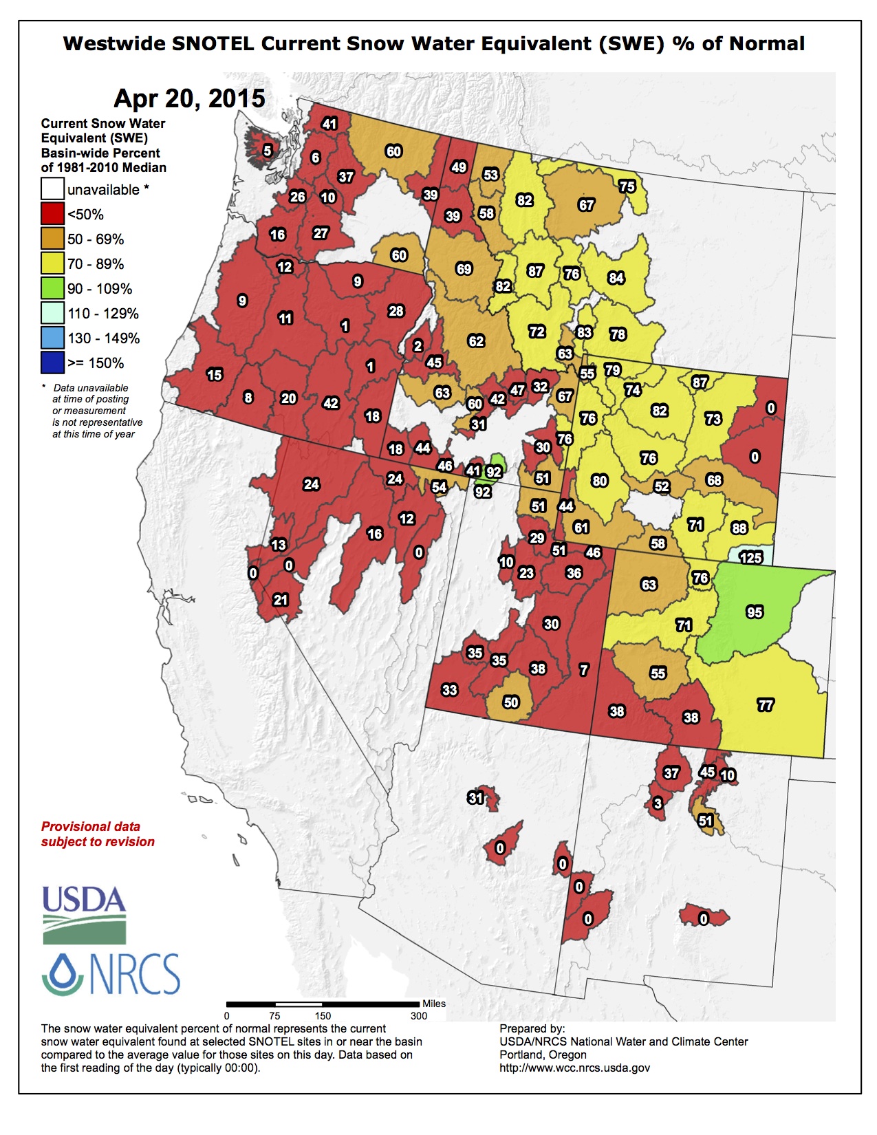
Recent snowstorms have pushed Colorado’s snowpack up to 62 percent of normal. But according to experts, those storms didn’t provide relief to the driest areas in the southern half of the state.
“The San Miguel, Dolores, Animas and San Juan basins are the lowest,” said Brian Domonkos, a hydrologist with the Colorado Snow Survey Program. The mountains where the Rio Grande River originates in Southern Colorado are only at 38 percent of normal, “and they saw very little help in the terms of snowpack from this storm.”
On the flip side, the South Platte River basin, which provides water for Denver and the northern Front Range saw the most moisture. The storm that moved in April 15 and lasted for days brought more than 40 inches of snow in some parts of northern Larimer county.
“The better basins in the state are the South Platte and the Arkansas,” he said. “In terms of moisture this storm seems to have benefited the South Platte the most. They had about 2.4 inches of snow water equivalent come from this storm mainly because it was an upslope storm and that’s where the highest mountains are.”
Recent snow, cool temps slowed #runoff. #EagleRiver at Avon at 106% of normal; snow at headwaters holding. pic.twitter.com/wnOypXtpKU
— Eagle River Water (@VailCOwater) April 21, 2015
These precipitation accumulation graphs were presented by the State Climatologist: http://t.co/Co8nsozuNd pic.twitter.com/ZJXC89iMol
— NWS Boulder (@NWSBoulder) April 20, 2015