Ouray From the Ouray County Plain Dealer (Sheridan Block):
Making an effort to be prepared for the state’s uncertain water future, Ouray County water users are taking necessary measures to protect their supply.
In a joint discussion on the state of local waters last month, local water user groups left with a general consensus of pursuing a water engineering analysis, which would analyze data for the Upper Uncompahgre Basin and ultimately provide options for solutions to future water needs.
The analysis is estimated to cost about $50,000, and last week county attorney and representative on the Gunnison Basin Roundtable, Marti Whitmore, submitted a grant application for a joint project to the Roundtable.
“In talking with other people in the region, including people in the Colorado River District, everyone is supportive of such a widely supported and cooperative effort among many water users in Ouray County,” Whitmore told the Plaindealer. “This cooperative effort will benefit everybody. It’s a positive step in a positive direction and I’ve gotten a lot of favorable feedback.”
According to the grant application, the county (which for the project will also include the City of Ouray, Town of Ridgway, Ouray County Water Users Association and various Log Hill water user entities) is requesting $25,000 from the Gunnison Basin Roundtable and $25,000 from the Colorado Water Conservation Board.
Colorado Water Plan website screen shot November 1, 2013
From Colorado Corn via the High Plains/Midwest Ag Journal:
Colorado Corn representatives sent a letter to state officials recently, weighing in on the current draft of the Colorado Water Plan to help make sure agriculture is appropriately represented in this critical conversation.
In its letter to the Colorado Water Conservation Board, Colorado Corn endorsed the recent input of the Colorado Ag Water Alliance.
In a six-page document sent to the CWCB back on March 31, CAWA leaders asked that the Colorado Water Plan emphasize to the general public the critical role ag plays in the economy and overall well-being of the state, and delineate what’s at stake in terms of lost food and energy production, wildlife habitat and other forfeited environmental benefits if production dwindles due to water shortages.
Like others, CAWA and Colorado Corn representatives want to make sure the common Coloradan realizes that ag is a $40 billion industry in our state, and that we’re also on pace to see as many as 700,000 acres of irrigated farm ground dry up by 2050.
Altogether, CAWA leaders—consisting of representatives from about 20 ag organizations across the state—made 18 specific recommendations in their letter, covering an array of topics that are critical in preserving Colorado’s ag industry, including water-storage projects, groundwater and aging infrastructure, among others.
Colorado Corn board member and Merino-area farmer Charlie Bartlett serves as president of CAWA. Colorado Corn Executive Director Mark Sponsler is also heavily involved in CAWA, and, like Bartlett, helped draft CAWA’s recent input regarding the Colorado Water Plan.
In a separate letter, Colorado Corn representatives attempted to bring added attention to CAWA’s recommendations.
A second draft of the Colorado Water Plan is expected to be complete by July 15, with a final version due to the governor in December.
Arkansas River rafters are anticipating a banner summer of white-water fun thanks to late April and May snowfall in the high country.
Arkansas River Outfitters Association members attended an annual meeting last month to gear up for the season and nervously eyed snowpack figures. Instead of fearing the worse, they were celebrating the recent designation of national monument status bestowed on Browns Canyon, one of the most popular sections of the river, located between Salida and Buena Vista.
“Since that meeting, the snow has been flying in the upper elevations that feed the Arkansas River. As of May 11, the Fremont drainage is at 117 percent of normal and the Independence drainage is at 125 percent of normal, which will provide great water for summer activities,” said Monica Ramey, outfitters association spokeswoman.
Rafting is big business in the Upper Arkansas River Valley. Outfitters experienced a 7 percent increase in business last summer and are hoping for more success this summer.
Last summer’s 191,307 boaters spent $23.7 million in direct expenditures, which rolls over to a $60.7 million economic impact when accounting for spending on things like lodging, gas and food. “The outlook for the 2015 season on the Arkansas River is great. With the recent snow and overall snowpack conditions, we anticipate an awesome high-water season early in June for the adventure thrillseekers, but more moderate water levels throughout August to provide a longer season for the families,” said Mike Kissack of American Adventure Expeditions.
Kissack said there should be rafting through the end of August, which will provide opportunities for people attending the Gentlemen of the Road Festival in Salida featuring Mumford and Sons on Aug. 21-22.
“The water conditions may be moderate compared to 2014, but more moderate flows are much better for families as parents have a lot less concerns when the water conditions are a bit lower,” said Mike Whittington of Independent Whitewater.
The Arkansas River Outfitters Association website shows daily water conditions at four locations on the river including The Numbers above Buena Vista, Browns Canyon below Buena Vista, Bighorn Sheep Canyon below Salida and the Royal Gorge from Parkdale to Canon City. To see updated conditions, log onto http://www.aroa.org
Here’s the release from the CWCB (Taryn Finnessey/Tracy Kosloff):
Activation of the State Drought Mitigation and Response Plan, and the activation of the Agricultural Impact Task Force remain in effect to respond to ongoing drought conditions in Southern Colorado.
April and early May weather conditions improved compared to March. Temperatures in April were slightly above normal statewide. April precipitation was much greater than normal in northeastern Colorado, the upper Arkansas River Basin and the Grand Junction area. The wet pattern continued for the first half of May throughout the state with a great deal of moisture concentrated over Morgan County.
Water year-to-date precipitation at mountain SNOTEL sites, as of May 13, is at 86% of normal, an improvement compared to the last drought update, due to a relatively wet late April and early May. Most basins had lower than normal peak snow pack (the exception was the South Platte Basin), but the melt off has been at a slower rate than normal. This means that comparisons of day of the year snowpack to the normal for that day may show near normal snowpack levels, however, the total amount of snow available for water supply purposes, is lower than normal in most basins this year.
May 1st streamflow forecasts are near normal only in a few South Platte subbasins and the Blue River. Streamflow forecasts in the southwest and northwest are less than 70 percent of normal with several subbasins forecasted to be less than 50 percent of normal.
Reservoir Storage statewide is at 108% of average as of May 1st. Storage in the northern half of the state is well above average with multiple basins seeing storage levels in excess of 120% of average. The Upper Rio Grande and the Arkansas have the lowest storage at 75% and 79% of average, respectively.
The Surface Water Supply Index (SWSI) is near normal in much of the South Platte, Colorado River, and Lower Arkansas, but showing moderate to severe drought in the northwest and southwest. The lowest SWSI value in the state is in the North–Fork Gunnison where stream flow forecasts range from 31 to 43% of average, the highest value is in the northern South Platte River basin.
Water providers in attendance reported their systems are in good shape, largely due to plentiful storage. While demand is low due to the cool and wet spring conditions.
Some areas of Weld and Morgan County are cleaning up and will need to repair roads after a slow moving storm over Mother’s Day weekend resulted in flooding.
Click here to read my notes (Tweets). More Colorado Water Conservation Board coverage here.
From the Associated Press (Dan Elliott) via The Pueblo Chieftain:
…[recent] precipitation isn’t helping dry downstream states in the Southwest that rely on the Colorado River, which originates in western Colorado.
The U.S. Drought Monitor said Thursday a series of recent storms have dropped up to four times the normal weekly rainfall in some areas of the West. However, three-quarters of the region remains in a long-term drought.
Nearly half of California was classified as being in an exceptional drought — the most severe of five categories.
The Colorado River supplies water to about 40 million people and 6,300 square miles of farmland in seven states, including California.
Much of the river’s water comes from melting snow in the Colorado mountains. At its deepest point last winter, the snow in the Colorado River Basin reached only about 82 percent of normal.
Click here to go to the US Drought Monitor website. Here’s an excerpt:
Summary
During the current U.S. Drought Monitor week, a series of storm systems moved out of the southwest and ejected onto the plains. With the Gulf of Mexico wide open, there has been ample atmospheric moisture feeding into these storms. Severe weather and record-setting rains were widespread on the front end, while areas on the backside of these storms recorded several feet of wet snow. The greatest precipitation amounts were recorded in Oklahoma, Arkansas, and north Texas, with widespread areas of 8-10 inches of rain. Portions of southeast Nebraska also recorded up to 10 inches of rain, with a swath of 6-8 inches from north central Kansas into southeast Nebraska. Many areas in the western half of the U.S. received 200-400 percent of normal precipitation for the week. Tropical storm Ana impacted portions of the southeast where 3-6 inches of rain fell along the coastal Carolinas. Temperatures for the week were above normal over the eastern United States with departures of 5-10 degrees above normal while the western half was cooler than normal with departures of 5-10 degrees below normal…
Great Plains
Most of the region had below-normal temperatures for the week, with the greatest departures (10 degrees or more) over portions of eastern Wyoming, western Nebraska and western South Dakota. Areas of eastern Kansas, eastern Oklahoma, and most of Texas were above normal for temperatures, with departures of 4-6 degrees common. The big story for the region was the torrential rains and severe weather. The widespread 2-4 inch readings across South Dakota resulted in 1-category improvement to the D2 and D1 conditions in the state. Much of the precipitation which did occur was snow. Snow amounts ranged from 12 inches in the plains of South Dakota to 16 inches in the Black Hills while portions of western Nebraska had up to 24 inches of snow. The improvements extended into North Dakota where D1 was improved in the southeast part of the state, while D0 was expanded over the northern and northwest portions of the state. There was a slight trimming of D1 and D0 conditions over Nebraska where the rains were enough to show improvements. The recent rains allowed for a large-scale 1-category improvement across southern Kansas and parts of southwest and west central Kansas. A small area of D2 was introduced into northwest Kansas where the recent rains have not been as substantial and conditions are worsening. In Oklahoma and Texas, large-scale 1-2 category improvements were made after copious rains of 6-10 inches or more were recorded. Most areas in Texas and Oklahoma were good out to 24 months, but some residual dryness was still evident at 36 months. D4 has been completely eliminated from Texas and Oklahoma for the first time since July 2012. With the short-term indicators all showing drought-free conditions, a substantial shift of the long-term delineation line to the north was made this week as only long-term issues are impacting the southern plains…
West
Cooler than normal temperatures along with scattered precipitation through the region this week allowed for some changes. The D0 in Montana was connected to the areas of D0 in the Dakotas. After another good week of rains and cooler temperatures, D0-D2 conditions improved in southeast Colorado. In west central Colorado, D2 was improved as well. Western Wyoming saw a large expansion of D0 while eastern Wyoming had improvements to D0…
Looking Ahead
Over the next 5-7 days, temperatures over the eastern United States are anticipated to be above normal with departures of up to 6 degrees. Most of the rest of the United States will have temperatures at or below normal, with the greatest departures (up to 9 degrees below normal) over the west coast. An active pattern looks to continue over much of the plains states and into the southeast. Precipitation forecast amounts of more than 6 inches are being projected over east Texas and up to 3 inches through the Dakotas. The latest 7-day projections have precipitation chances over almost the entire country.
The 6-10 day outlooks show the likelihood of above-normal temperatures over the southeast, Pacific Northwest, and Alaska while there are above-normal chances of temperatures being below normal through the plains, Midwest and southwest. There are below-normal chances of precipitation over the upper Midwest and Great Lakes regions. A good portion of the United States has above-normal chances of seeing precipitation above normal, with the best chances over the southeast and Great Basin.
House Bill 1006 creates the Invasive Phreatophyte Grant Program.
Governor John Hickenlooper signed the bill at a ceremony in Montrose on Tuesday…
Republican Representative Don Coram of Montrose sponsored the bill.
He called the invasive plants ‘water thieves’ that menace riparian areas.
“I truly believe the eradication of phreatophytes is the first tool in the Colorado Water Plan,” Coram said at the signing ceremony.
Coram said these plants are a problem in his district and across the state.
“If you travel the Colorado River [and] the Dolores River for example, it’s a thicket in many areas that you can’t even walk through, but it’s also a water quality issue because the tree sucks up the water and it drops salt so nothing else really [can] grow,” he said.
The water conservation board will oversee the program and distribute grants for projects. The program is set to end in 2018.
Pikes Peak with Garden of the Gods in the foreground FromThe Colorado Springs Gazette (Billie Stanton Anleu and Ryan Maye Handy):
Millions of dollars in damage has county officials preparing to request state and federal emergency money…
Swelling of North Rockrimmon Creek has torn chunks of back yards and retaining wall boulders from two houses in Rockrimmon. The saturated soils are so heavy, the banks of the creek gave way from sheer weight, said Travis Easton, public works director for Colorado Springs…
Damage was severe on Ute Pass Trail near Green Mountain Falls, at Rainbow Falls near Manitou Springs and in Bear Creek Park, said Jason Meyer, project manager with the county’s Community Services Department planning division…
Potholes, erosion, flooding and sewer system glitches now have the city’s public works staff responding to too many calls to count, Easton said…
The Colorado Springs Airport got 1.26 inches on May 4, breaking the 1902 record of 1.23 inches for that day, said Randy Gray, meteorological technician for the National Weather Service.
The Broadmoor area had received 7.36 inches and Manitou Springs, 7.32 inches, this month as of Wednesday, Gray said.
The Northgate area east of Interstate 25 had received 6.81 inches through Tuesday, he said…
The county’s quest for state emergency funds hinges on documenting $2.1 million worth of damage in the county and all its cities, Meyer said. If the state reaches the $6.9 million threshold, it can request money from the Federal Emergency Management Agency (FEMA), he added.
The complexity, drama and careful planning behind Colorado’s water system took center stage Wednesday afternoon at the Union Colony Civic Center.
The Greeley Chamber of Commerce symposium, “Water: Yours? Mine? Ours?” began with “Water 101,” as panelists explained the ins and outs of Colorado’s management system, and wrapped up with pointed questions from attendees on some of Weld County’s largest water-use dilemmas.
Moderator Nicole Seltzer, executive director of the Colorado Foundation for Water Education, described the conversation as “moving upstream to downstream,” flowing throughout the diversity of topics and interests that influence resource management.
Harold Evans, chairman of the Greeley Water & Sewer Board, highlighted the challenge of preparing for a Colorado population expected to double by 2050 while maintaining the agricultural economy. Even with supplies flowing into Greeley from four river basins — the Poudre, Upper Colorado, Big Thompson and Laramie — Evans said much more work remains to be done. “We are fortunate to have forefathers who had the vision, courage and understanding of good water planning,” he said, emphasizing that water planners of the future will need to maintain the same dedication.
A message that resonated throughout panelist comments was a call for greater storage capacity and more efficiency in completing reservoir projects.
In years of heavy rainfall and high stream flows, Erik Wilkinson, general manager of Northern Colorado Water Conservancy District, said Colorado must take better advantage of storing supplies to prepare for times of drought,
“Conservation without storage is not worthless but it’s close to it. If you conserve the water, you have to have a place to store it,” Wilkinson said.
Evans and Wilkinson both attributed the lack of progress in reservoir projects in large part to long and complex federal permitting processes.
Evans pointed to the delays in expanding Seaman and Windy-Gap reservoirs, both sources of Greeley water storage, as prime examples of the lag in permitting.
“These projects are all going in excess of 10 years, and we still don’t have a permit on any of those projects,” Evans said.
During the session’s question-and-answer period, Pierce-based dairyman Charles Tucker turned the conversation toward the issue of agricultural buy-and-dry from municipalities. He described his hometown as “Thornton territory,” referring to the extensive purchase of agricultural water supplies by the Denver Metro-area city in the 1980s.
Seltzer asked the panelists if a silver lining could be found in the situation.
The panel at first struggled to answer the question, with Evans saying, “I don’t know if right now there is a silver lining.”
He later added that perhaps the silver lining is Colorado’s dedicated water planners that are working to address difficult questions.
Charles Bartlett, chairman for the Colorado Ag Water Alliance, said the future of agricultural supplies will depend on the industry’s ability to stay competitive.
“The best way to keep water in agriculture is to keep agriculture profitable,” he said.
For those struggling to find the value in maintaining stable supplies for agriculture, New Cache la Poudre Reservoir Co. manager Dale Trowbridge said we need look no further than our dinner plates. Trowbridge said the importance of Weld County agriculture and its water supply can be seen in Fagerberg onions, Hungenberg carrots, and Petrocco red cabbage, to name a few.
It’s a nuance, but of such subtleties are progress often made.
In the Bureau of Reclamation’s new “Moving Forward” report on the future of the Colorado River Basin, a subtle change to the bureau’s canonical map:
Colorado River Basin including Mexico USBR May 2015
There, at the bottom. See that little bit poking down into Mexico? That’s the Colorado River Delta. The Bureau’s official map used to cut off its depiction of the Colorado River Basin at the U.S.-Mexico border…
On the heels of the enormously successful Minute 319 environmental pulse flow down through that Mexican Delta, a quiet recognition that the Colorado River Basin is a thing changed.
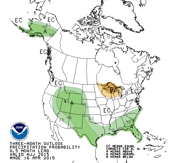
Three month precipitation outlook April 16 thru July 31, 2015 via the Climate Prediction Center Click here to go to the Western Water Assessment climate dashboard (scroll down to the current briefing). Here’s an excerpt:
Highlights
While April was overall wetter and cooler than the previous three months, and May has gotten off to a wet start, very poor runoff is still expected in most basins across the region.
April precipitation was well-above-average in some areas, and below-average in others. The first part of May has been very wet so far over most of the region.
Snowpacks in most basins peaked 4–6 weeks early and are well along towards meltout, with many individual SNOTEL sites at lower and middle elevations having already melted out.
The May 1 spring-summer runoff forecasts are even lower than the April 1 forecasts in most basins. Most points are expected to see much-below-average (50–69%), far-below-average (25–49%) or extremely low (<25%) runoff, especially in Utah.
El Niño conditions have strengthened further and are expected to continue into the winter. A wet tilt in seasonal precipitation through the summer is forecasted for our region, largely due to El Niño’s influence
Here’s the release from the Bureau of Reclamation (Rose Davis/Carly Jerla):
The Bureau of Reclamation and stakeholders throughout the Colorado River Basin (Basin) released a report today that documents opportunities and potential actions to address the future water supply and demand imbalances projected in the 2012 Colorado River Basin Water Supply and Demand Study.
The Moving Forward Phase 1 Report is part of the Colorado River Basin Study Moving Forward effort launched in May of 2013. The Moving Forward program is an effort by the Department of the Interior (DOI) and stakeholders throughout the Basin to respond in a coordinated and collaborative manner in identifying and implementing actions that address projected water supply and demand imbalances, have broad-based support, and provide a wide range of benefits.
In Moving Forward Phase 1, funded jointly by Reclamation and the seven Colorado River Basin States, over 100 stakeholders spanning all water use sectors engaged in three workgroups focused on water use efficiency (urban and agricultural) and environmental and recreational flows. The Phase 1 Report includes chapters contributed by each workgroup.
“The impacts of the ongoing drought are widespread and are currently being addressed at the local and regional levels. Looking ahead to the longer-term challenges facing the Basin documented in the 2012 Study, it is clear that these challenges must be tackled collaboratively involving all sectors of use,” Lower Colorado Regional Director Terry Fulp said. “The Phase 1 Report is a critical first step towards this level of collaboration.”
Twenty-five opportunities were identified by the workgroups. Similar components resulting from each workgroup’s individual set of findings include opportunities related to funding and incentives, data and tools, outreach and partnerships, coordination and integration, infrastructure improvements, and flexible water management.
Building from the Phase 1 Report, Phase 2 of the Moving Forward effort will be underway later this year and includes the selection and implementation of several pilot projects.
Snowpack statewide measured 68 percent of normal Tuesday, up from 62 percent May 1, federal data show. Traditionally, snowpack has served as a frozen, slow-release water supply reservoir for the state.
Denver Water reservoirs overall were 93 percent full, above the normal May median 82 percent, and Northern’s dozen reservoirs overall were 92 percent full.
Weld County Commissioner Sean Conway urged accelerated efforts to complete the Northern Integrated Water Supply Project, which would install two new reservoirs, and to expand the Halligan-Seaman reservoir.
“This would be a way to capture that high runoff in May and June and store that water for farmers and growing municipalities to meet their needs — and at the same time provide a flood-control option,” Conway said.
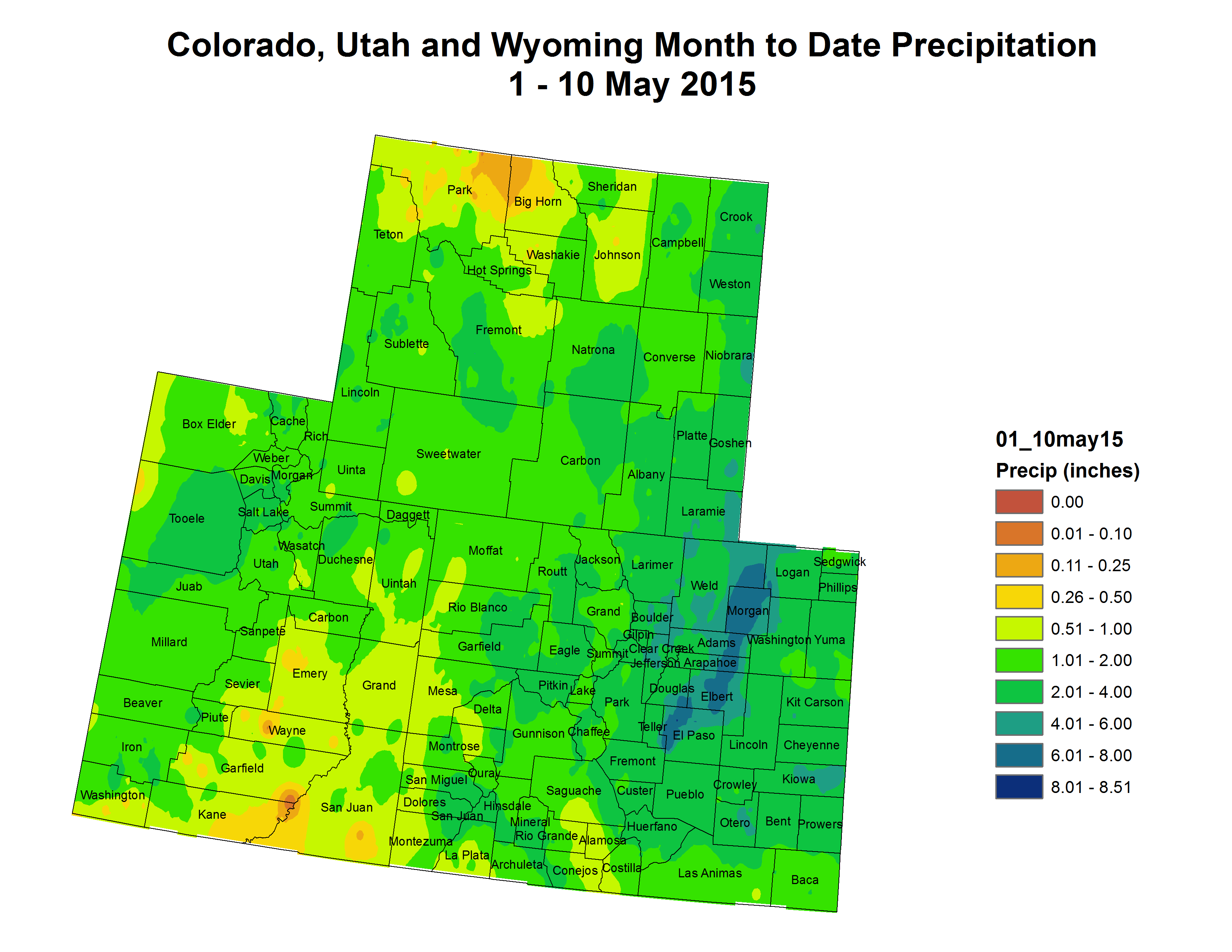
April precipitation statewide underperformed, according to the monthly update released May 8 by the Natural Resource Conservation Service.
The report doesn’t include data from the latest storm, which bumped snowpack in Summit County’s Blue River Basin to above-average for this time of year and brought about 12 inches of snow to Arapahoe Basin Ski Area…
Statewide April 2015 precipitation was 71 percent of normal, while the South Platte April precipitation was 110 percent of normal.
Snowpack follows the same storyline. The South Platte snowpack was at 96 percent of normal on May 1, while statewide snowpack was 61 percent of normal.
The Rio Grande snowpack was the lowest in the state at 25 percent of normal.
Snowpack in the West has almost all melted, according to data from the fifth 2015 forecast by USDA’s National Resource Conservation Service (NRCS).
“Across most of the West, snowpack isn’t just low – it’s gone,” NRCS Hydrologist David Garen said. “With some exceptions, this year’s snowmelt streamflow has already occurred.”
Snowpack at many stations in the Western U.S. are at record or near record lows, says Garen. Unseasonably warm weather accelerated melt and hindered snowpack growth.
“We still have some snowpack in Northern Colorado, Western Montana, and Southern Wyoming,” said Garen. “In addition, snowmelt from Canada will flow into the Columbia River.”[…]
It’s been a dry year for the Colorado River,” NRCS Hydrologist Cara McCarthy said. “Snowmelt inflow into the Lake Powell Reservoir is forecast at 34% of normal. We only forecast streamflow from current conditions. Spring and summer rains might relieve areas that are dry.”
The Lake Powell Reservoir supplies water to much of the Southwest, including Las Vegas, NV; Los Angeles, CA; and southern Arizona.
The challenges facing the Colorado River Basin are varied and significant. In particular, population growth, drought, and climate change all are likely to further strain the regional water budget unless our management of water uses evolves to match our expertise in managing water resources. Fortunately, there’s also no shortage of viable, cost-effective solutions, and the many reforms enacted during the past decade have opened a short window of opportunity for basin residents to consider what a lasting solution might look like. It’s clear that any real solution must take advantage of the many inefficient water uses that persist throughout the basin, which are every bit as much of an opportunity to embrace as a problem to lament.
In providing “the case” for conservation in the Colorado River Basin, we are explicitly rejecting a few of the common myths that surround and burden the concept. We find that the popular characterization of water conservation as implying a sacrifice, an added cost, and a loss of productivity or opportunity is, at best, misleading and is arguably the direct opposite of the reality we face in the basin. Additionally, the notion that an increase in population must equate to an increase in consumption is not only inconsistent with the water use statistics, but when treated as fact, can become a dangerous self-fulfilling prophecy that pushes the region toward ill-advised supply-side options. While it’s true that some of the low- hanging fruit of water conservation has already been captured, there’s nothing to suggest that we are close to exhausting the urban conservation potential, and the potential for significant agricultural conservation is exciting as long as it’s married to a commitment to protect the economic and social viability of rural communities.
We also appreciate that urban users fear losing their green spaces, while rural areas fear a loss of productive acreage. But that is not always the cost of conservation, and when it is, such reductions in irrigated land can be selected in a strategic and limited manner if rules and programs are created for that purpose. And what is the alternative? Further draining streams, reservoirs and aquifers to a point of collapse? Spending billions to import or desalinate new supplies (if available, and only after decades of work)? Without creative solutions, market forces and crisis scenarios will inevitably dry-up irrigated agriculture in unplanned ways that create undesirable third-party impacts.
As people that live, work, and recreate in the Southwest, we think the path forward is obvious: we should pursue the options that offer the greatest bundle of benefits for the lowest bundle of costs, that are easily scalable and can be done relatively quickly, that offer the lowest risks, and that leave the door open in the future to other approaches should they prove necessary. That is the case for conservation.
Denver Water employees Rick Geise and Nate Hurlbut assisted in setting the plug, which helps prevent chunks of ice and snow from falling into the spillway. Photo credit: Denver Water
At the end of April 2015, almost 60 percent of Oklahoma was experiencing moderate to exceptional drought, and 30 percent of Texas was experiencing drought conditions. Extreme drought conditions occupied central Texas and reached northward into central and western Oklahoma, with pockets of exceptional drought scattered along the border between the two states.
But according to the May drought outlook, conditions are likely to improve in the southern Plains this month. Forecasts indicate moderate to heavy rain in early May 2015 and enhanced chances of above-normal rainfall through the end of the month. The map pair at right shows U.S. Drought Monitor status as of April 28 (left) and the NOAA Climate Prediction Center’s U.S. monthly drought outlook for May (right).
Many of the areas experiencing extreme (bright red) or exceptional (dark red) drought in the southern Plains are projected to at least improve (tan) or see the end of drought (green) in May. The colors indicate that there is little opportunity for drought improvement in the northern Plains, but North Texas and western Oklahoma are likely to benefit from much-needed rainfall.
The NOAA Climate Prediction Center notes that May is one of the wetter months in the Great Plains region, generally bringing 10 to 20 percent of annual rainfall. NOAA’s monthly precipitation outlook for the United States shows western Texas and Oklahoma have at least a 40 percent chance of being wetter than normal through the end of the month, while much of the northern Plains region has an equal chance for precipitation totals that are below, near, or above the long-term average.
Some slight improvement has already occurred in Texas and Oklahoma during late April. According to the U.S. Drought Monitor website, the coverage of extreme to exceptional (D3-D4) drought decreased from 37 to 24 percent from April 21 to 28 due to heavy rainfall in the western and central parts of the state. Recent rains also improved conditions in Texas, helping water supplies recover in the Dallas-Fort Worth and San Antonio urban areas.
The local National Weather Service Office in Amarillo, Texas, explains that while short-term relief in the form of periodic heavy rain events has benefited farming and ranching operations in the Texas and Oklahoma panhandles, long-term drought impacts remain across the area, including low reservoir levels, drier than normal deep soil zones, and thinned grass stands on rangeland. CPC forecasters also caution that “one month of above-normal precipitation during one of the wetter times of year is not necessarily enough to bring substantial drought relief.”
Even though the rain-barrel bill got dunked in the Colorado Legislature this year, another measure that could help conserve and reuse urban water on a much larger scale passed without much controversy.
Senate Bill 212 could make it easier for places like Denver to start designing new stormwater management systems that would reduce the demand for water from rivers and reservoirs. Instead of simply letting stormwater run down the drain, the water could potentially be slowed down to water parks and ballfields.
The bill was sponsored in the Senate by Sen. Jerry Sonnenberg, a Republican representing a rural agricultural district in northeastern Colorado. Sonnenberg opposed the rainbarrel bill partly because he feared that a boom in the urban rain-barrel biz could cut flows to rivers that supply water for farms farther downstream.
But [SB15-212 (Storm Water Facilities Not Injure Water Rights)], the stormwater bill, doesn’t pose the same threat because it doesn’t specifically allow people to capture and use water, Sonnenberg said, explaining that his bill was aimed at ensuring that cities don’t have to apply for water rights when they design and build stormwater systems.
In a comment letter on the Colorado water plan, Denver Water explained the history of the stormwater runoff issue. Most senior water rights were established in a time when there weren’t a whole lot of paved surfaces to channel water into drains. Instead, the water from big rainstorms spread out evenly over the land.
The idea that cities should have to apply for water rights for the stormwater they manage is “shortsighted, unnecessary and in conflict with the goals and values” of Gov. John Hickenlooper’s executive order for the plan, Denver Water wrote.
The Arkansas River near Avondale was measured at a gauge height of 9 feet Saturday night, nearly 2 feet above flood stage.
Despite that, no widespread flooding was reported there, according to the Pueblo County Sheriff’s Office…
“The Arkansas is showing it’s at flood stage in Avondale, but it’s not flooding. I’ve got two captains that have been down there looking and it’s within its banks,” said Mark Mears, the sheriff’s office emergency bureau chief.
Fountain Creek in Pueblo roared Saturday, measuring at a gauge height of just over 6 feet which was at least 2 feet higher than the river was at any point Friday.
Cathy Todd, who manages stables owned by her father near Fountain Creek on Overton Road, said Saturday’s water levels on the creek are among the worst she has seen.
“It’s taken out probably a football fieldsize chunk of land and all the trees and has taken pretty much everything out since last night,” Todd said. “We’ve been moving horses and horse trailers and anything we could salvage. It’s a huge, huge lake down there right now and the water is coming in really fast and really high, so it’s flooding the whole place.”
Todd said the last of the horse stables she kept near the creek were washed away by the waters Saturday…
There were no tornadoes spotted, but the system that prompted the tornado warning was responsible for producing golf ball-size hail in the county near the Pueblo Memorial Airport and its vicinity.
That hail didn’t impact farmers in the Vineland area, however.
Carl Musso, owner of Musso Farms, said crops in the area were not affected by the weather as wind was minimal and only small bits of hail fell there for a short time.
“I can’t speak for all of Pueblo County, but I can speak for Vineland farmers here. Everything that we’ve got growing looks great and all the vegetables look fantastic. Chiles are starting to come out of the ground and everything looks good,” Musso said. “We’ll be right on time with everything this year. The hail does worry you and, yes, we did have some fall here. But there was no wind, which is what really drives the hail.”
Tornadoes that touched ground were spotted later in the afternoon in remote areas north of Pueblo County.
Pueblo County is a step closer to calling for a hearing to decide whether to repeal or significantly alter the provisions of a 1041 permit allowing the Southern Delivery System to be built through the county.
On Monday, commissioners gave direction to staff to release a report to Colorado Springs detailing the progress of an investigation into whether that city’s lack of any specific funding for storm water permits constitutes a violation of the permit.
According to the report, staff’s recommendation is that, so far, the investigation shows there’s enough evidence to go forward with a show cause hearing on the 1041 document. But staff also asked for permission to hold off on issuing such an order until the first of August.
Waiting two months would give staff time to continue working with Colorado Springs, hire Denver-based Wright Water Engineering as a storm water consultant and give the new mayor and city council in Colorado Springs time to assess the issues for themselves.
“I am confident that there is some probability of success in coming up with some solutions to bring to the board, either as revised conditions or new amendments to the agreement,” said Ray Petros, water counsel to Pueblo County.
Petros said that it’s been six years since there was any dedicated funding in place for Colorado Springs’ storm water improvements and in that time, the number of infrastructure improvements that could help mitigate flows and improve water quality in the Fountain Creek have backlogged to the point that nearly $534 million worth of projects are awaiting completion.
Staff has been investigating the issue since April. Petros said it has been difficult to ascertain what high-priority projects have been completed or what kind of money has actually been spent on projects that would be beneficial to Pueblo County.
At the core of the investigation is the Springs’ decision to disband its storm water enterprise in 2009, along with the failure at the polls in 2014 of a measure to establish a new enterprise.
“Our issue has been from Day 1 that the 1041 permit requires some kind of dedicated funding,” said Commissioner Terry Hart. “No pun intended, but it’s been six years of water under the bridge and we’re painfully aware of that.”
Petros quoted a few passages within the 1041 permit that mentioned the funding source specifically, including the environmental impact statements attached to the permit.
The original staff report noted that the delay also gave Colorado Springs Utilities time to respond to information requests, but Hart said he felt Pueblo should set the timeline on that response.
Public Works Director Alf Randall said that the information requested by staff wasn’t complicated but understood if Colorado Springs staffers preferred to wait until the new mayor and council were sworn in.
Randall also said it would be good to have the information once Wright Water’s contract with Pueblo was finalized.
“I don’t understand what would be highly complex about providing staff a list of projects in 2015,” Randall said.
He said he thought it could be done by June 1.
The commissioners then directed that the June 1 deadline be included in the memo to Colorado Springs.
There are likely more investigations to follow. Commissioner Sal Pace asked staff to consider land purchases, reclamaneighbors. tion issues and potential impacts to Pueblo West homeowners in the investigation.
But the investigation came from a resolution focusing specifically on storm water issues.
All three commissioners said they would like to see future investigations into those other issues.
The commissioners also noted that the past week’s rainfall was a reminder of the urgency for the improvements, as runoff from Colorado Springs churned mud and debris in Fountain Creek and eroded property along Overton Road.
“We have a job to advocate for our constituents and I think the representatives from Colorado Springs, whether they like the process or not, would agree there’s been an impact to the community,” said Commission Chairwoman Liane “Buffie” McFadyen.
More Southern Delivery System coverage here and here.
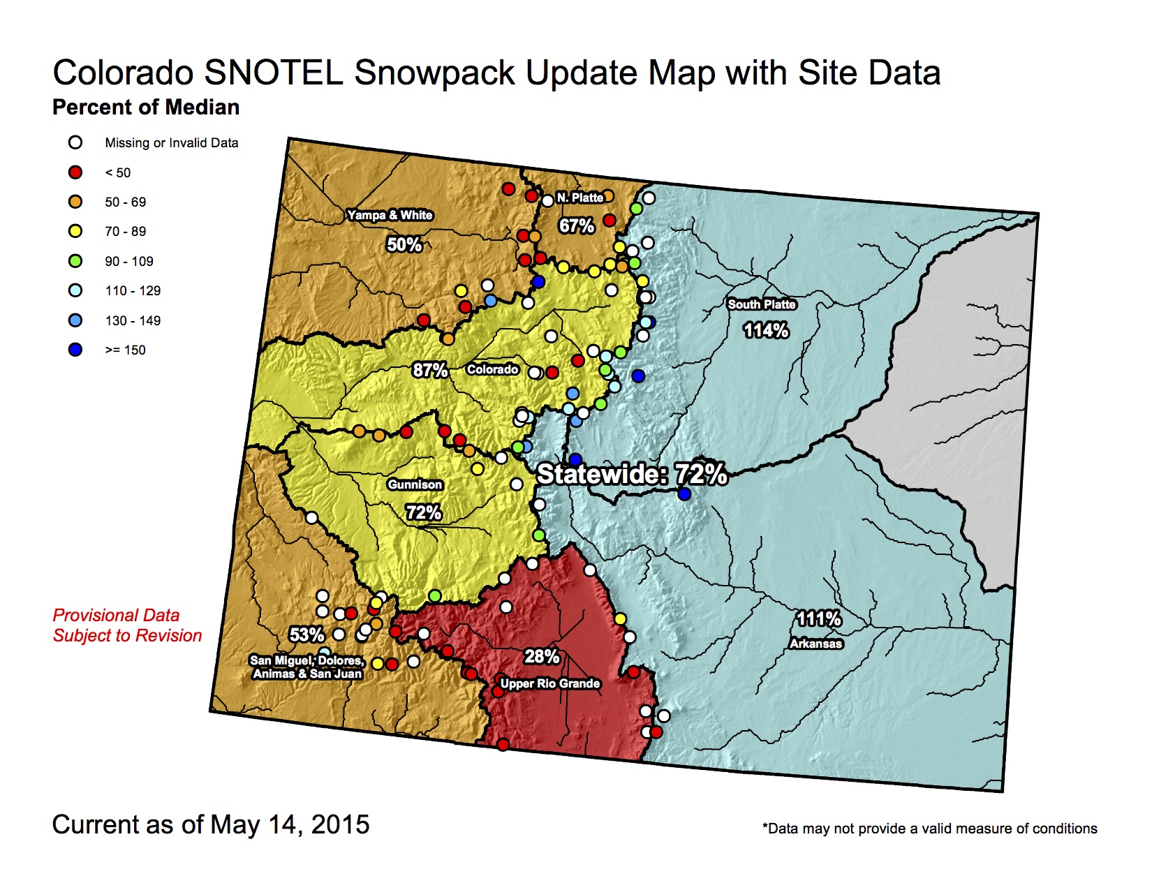
Click on the thumbnail graphic to view an updated statwide snowpack map from this morning. The other products have not updated yet.
FromThe Grand Junction Daily Sentinel (Dennis Webb):
Colorado’s peak snowpack was about 75 percent of normal this year, the Natural Resources Conservation Service said Friday.
That peak occurred from early to mid-March, about a month earlier than normal. April precipitation didn’t help things, being only 71 percent of normal statewide, the federal agency said. Statewide snowpack was just 61 percent of normal May 1.
May 1 snowpack ranged from 25 percent of normal for the Rio Grande River basin to 96 percent for the South Platte.
The Colorado basin was at 68 percent, and the Gunnison, 53. The Yampa/White basins were at just 46 percent; the Arkansas, 89; the North Platte, 61; and the San Juan/Animas/Dolores/San Miguel, 36.
Colorado’s 75 percent snowpack peak will mean a corresponding 25 percent drop-off from normal when it comes to this year’s snowmelt contribution to streamflows. Brian Domonkos, hydrologist with the NRCS Colorado Snow Survey Program, said in a news release that other factors such as spring rain also can affect streamflows and water supply.
“Monthly precipitation has been well below normal in nearly every basin for the last two months, which carries more weight since March … and April are the two months of the year in which Colorado typically receives the most precipitation. Additionally, April often provides rain at the lower elevations, which does not add to the snowpack, but often augments streamflow. Largely that rain has not come to Colorado,” he said.
He said that these and other factors “paint a poor streamflow forecast picture for much of the state heading into spring and summer.”
One bright spot continues to be reservoir storage, which is at 108 percent of average statewide. Storage by basin is at 129 for the Colorado, 123 for the Gunnison, 120 for the Yampa/White, 113 percent for the South Platte, 85 for the San Juan/Animas/Dolores/San Miguel, 79 for the Arkansas and 75 for the Rio Grande.
Summit’s Blue River Basin recorded snowpack near the 30-year average, and the six speakers at the 22nd annual State of the River meeting on Tuesday, May 5, stressed that local residents should feel fortunate that the headwaters community was spared the immediate water supply problems others are facing around the West.
“Everybody has Blue River envy,” said Eric Kuhn, general manager of the Colorado River District. “You’re the sweet spot this summer.”
However, the event’s speakers also emphasized the coming impacts of long-term drought and overconsumption on Summit and other communities that supply the majority of the West’s water.
Kuhn said major water players including Denver Water, which owns and operates Dillon Reservoir, are for the first time loudly prioritizing certainty of water supplies over development because they are worried about their future abilities to deliver water to their current customers…
County Open Space director Brian Lorch and Blue River Watershed Group board treasurer Jim Shaw said restoration projects on the Swan River northeast of Breckenridge and the Tenmile Creek east of Copper Mountain are moving forward with success.
Summit County water commissioner Troy Wineland said Summit’s snowpack didn’t quite reach average this winter, according to data from the Blue River Basin’s four SNOTEL measuring sites. Half of the snowpack arrived in November and December, and it was gone at lower and middle elevations by the end of March, which was unusually dry and warm.
Runoff started sooner this year, and Tenmile Creek flows in early April were five times greater than average, Wineland said. He predicted peak runoff will occur in early June depending on the weather.
On Monday, May 4, Wineland said Old Dillon Reservoir achieved its first complete fill of 303 acre feet. The reservoir is jointly operated by the county and the towns of Silverthorne and Dillon, and it was stocked with golden trout from California that Wineland said should mean good fishing in the next year or two.
Wineland stressed the role that Summit residents can play in shaping the state’s first-ever water plan, which will outline Colorado’s water policy priorities for the next 50 years and will be handed to the governor in December…
Bob Steger, water resources engineer with Denver Water, said his calculations of Summit snowpack included data from Fremont Pass, which is why he measured Summit’s snowpack as above average but “nowhere near the snowpack that we had last year.”
The Blue River Basin may be the only basin in the state that peaks above average, and Denver Water’s No. 1 priority of filling Dillon Reservoir “should be no problem,” he said. “We’re only two feet from full right now.”
It should be a great summer for boating as well as rafting and kayaking below the dam, Steger said. “The fishing will eventually be good, but if you don’t like high water you probably better stay out until sometime in July.”
He answered a question about Antero Reservoir in Park County, which Denver Water will empty this summer ahead of repairs to the 100-year-old dam. The phase that requires draining the reservoir should be done by the end of 2015 with refilling beginning next spring. Steger also said Denver Water is still working on a permit to enlarge Gross Reservoir in Boulder County.
Ron Thomasson, a hydrologist with the U.S. Bureau of Reclamation who oversees Green Mountain Reservoir operations, said runoff flows won’t be high enough this year to allow coordinated reservoir operations that would protect endangered fish on the Colorado River.
Peak flows must be between 12,900 cfs and 23,000 cfs to do that, and the current forecast is for 9,600 cfs, he said…
Kuhn presented last and detailed continued threats facing Lake Powell and Lake Mead operations.
“We’re going to have to cut back our uses,” he said, “after 100 years of develop more, develop more, develop more.”
Lake Mead could likely see its first shortage next year or in 2017, he said, and “bad things happen when Lake Mead and Lake Powell get drained.”
Allowing Lake Powell’s water level to fall below the amount needed to generate electricity would lead to dramatically higher utility bills costs, the elimination of funding for the important environmental programs funded by the hydropower revenue noted above that protect current and future water use in Colorado.
If Colorado and the other Upper Basin states violate the 1922 Colorado River Compact and fail to provide enough water to Lower Basin states, the West could be fighting over water in lengthy court battles and Colorado could be forced to prohibit some water uses.
Western states could lose control of water to the federal government, Kuhn said, and Colorado would likely lose power in management of the Colorado River and water in the state.
When asked about building an interstate water pipeline to solve some shortages, Kuhn said water managers have discussed pipelines of absurd lengths and he doesn’t think that method will work.
“To expect that we can export our problems to somebody else, I just don’t see that somebody else will willingly accept them,” he said.
In the West, the snowpack of the winter 2014-15 is history, the Natural Resources Conservation Service said Friday.
“Across most of the West, snowpack isn’t just low – it’s gone,” NRCS hydrologist David Garen said in a release. “With some exceptions, this year’s snowmelt streamflow has already occurred.”
“The exceptions are northern Colorado, western Montana and southern Wyoming,” Garen said.
Garen could have included the southwest corner of Colorado where the snowpack isn’t great, but still exists.
Noah Newman at the Colorado Climate Center said the four basins in the region still have some snow.
As of May 1:
The San Juan Basin had 5.4 inches of snowpack, compared with the 30-year median of 15.4 inches (35 percent).
The Animas Basin had 68 percent of the 30-year median – 7.4 inches compared with 11 inches.
In the San Miguel Basin, there were 4.6 inches of snow on the ground, compared with the 30-year median of 10.4 inches (44 percent).
The Dolores Basin is hurting – 0.7 inches compared with the 30-year median of 3 inches (23 percent).
It’s been a dry year for the Colorado River Basin, the NRCS statement said.
“Snowmelt inflow into Lake Powell Reservoir is estimated at 34 percent,” said hydrologist Cara McCarthy. “We forecast streamflow from current conditions. Spring and summer rain might relieve areas that are dry.”
El Niño (ENSO) phenomenon graphic from the Climate Predication Center via Climate Central From the Aspen Daily News (Collin Szewczyk):
According to AspenWeather.net forecaster Cory Gates, the valley is heading into a moderate, and possibly strong, El Nino summer, which will bring more rain and cloudy days.
This week’s precipitation levels would be considered above average in most years, but not in an El Nino spring, Gates said.
However, he called this week’s deluge a “30-year rainfall” in and around Basalt.
“This ain’t going away. It will be a wet summer,” Gates said Friday. “The water’s way too warm in the Pacific, and we’re going to have a jet stream. … This is an El Nino spring and summer. I guarantee it, 100 percent.”
What is a bit unusual is that the weather pattern is getting stronger, with Pacific water temperatures likely to be 1.4 to 1.5 degrees above normal, he said…
According to river data from the U.S. Geological Survey, the deluge has caused the Roaring Fork River in Glenwood to rise from 2,700 cubic feet per second (CFS) last week to more than 7,000 this week. The Roaring Fork has grown from 70 to 140 CFS in Aspen, and from 473 to 776 CFS in Emma, during the same time frame.
The Crystal River near Redstone has also increased, from 268 to 616 CFS since last week.
Even though the water flows downstream very quickly during these rain events, it still benefits the health of local rivers. The strong flows help to move sediment down river, improving the riverbed habitat for the tiny organisms upon which trout feed, said Chad Rudow, water quality coordinator for the Roaring Fork Conservancy…
Gates said 7 to 8 inches of snow fell above 12,000 feet during the past week, and 3 to 6 inches between 10,500 and 11,200 feet.
But Rudow noted that many of the snowpack measuring sites are at elevations that may have seen the precipitation falling as rain.
He said the Roaring Fork watershed snowpack was at 60 percent of average, in terms of snow-water equivalent, last week, and is now at 58 percent. The Colorado River Basin as a whole dropped from 52 percent of average to 46 percent this week.
Rudow added that the snowpack on Schofield Pass fell from 19 percent of average last week to 16.5 percent on Thursday.
But the snow telemetry station at Ivanhoe Lake, near Hagerman Pass, did see an increase this week from 99 percent of average to 101 percent, he reported.
Colorado Springs Utilities has filed notice that it intends to appeal a jury’s $4.6 million judgment in favor of rancher Gary Walker, who let Utilities build a 5.5-mile pipeline on his land for the Southern Delivery System.
Walker and Utilities had agreed that the easement was worth $82,900, and the pipeline was installed on his northern Pueblo County land in 2012 as a conduit for the Southern Delivery System, or SDS.
That regional project is designed to pump Arkansas River water from the Pueblo Reservoir to Colorado Springs, Fountain, Security and Pueblo West, delivering up to 96 million gallons a day to those communities. Water delivery was expected to begin in 2016.
At trial, Walker’s counsel said Walker was negotiating a conservation easement worth more than $30 million with the Nature Conservancy, but degradation of the utility easement destroyed those prospects.
Colorado Springs, which owns Utilities, “had no opportunity to prepare a rebuttal to this surprise, unprecedented argument,” said the notice of intent to appeal filed late Thursday.
The notice questions, among other things, how a property value can be agreed upon at $82,000 and then valued at more than $30 million before a jury, and whether it was appropriate to deny the jury an opportunity to view the property.
The Pueblo County District Court jury deliberated for nine days before rendering its verdict April 23.
Neither Walker and his attorneys nor the Nature Conservancy returned calls Friday.
But SDS spokeswoman Janet Rummel said storms on the land drained water onto the pipeline alignment, causing erosion after the easement had been restored.
“We’ve been working ever since to fully restore it,” Rummel said. “His attorney was claiming actually not as much about the reclamation, but really about his lack of ability to ensure future conservation easements on his property. We really saw no evidence presented that that was the case. That was changing the big concern at the 11th hour of this trial. We need to take into account the effects on our ratepayers.”
Utilities paid Walker about $720,000 to move his cattle and laid irrigation lines along the easement to ensure that plants for restoration would survive, she said.
“From our perspective, we’ve gone above and beyond to address the concerns raised.”
The Fountain Creek Watershed, Flood Control and Greenway District isn’t taking a position on the legal battle, said Executive Director Larry L. Small. But the district is supposed to receive $10 million every year for five years to mitigate the extra flow that Fountain Creek will experience.
“If this drags on, it could impact SDS from becoming operational – and our revenue. That wouldn’t be too good because we’re waiting for that money to begin doing the work we need to do.”
Rains along the Southern Delivery System pipeline scar through Walker Ranches is again causing flooding problems in northern Pueblo County.
“Prior to the SDS crossing Walker Ranches, we never had floods like these from that area,” said ranchver Gary Walker. “Mother Nature’s defenses took care of it.”
Walker is involved in litigation with Colorado Springs over the 5.5-mile stretch of buried 66-inch diameter pipeline. A jury in April awarded Walker $4.665 million in damages, which Colorado Springs is appealing.
On Friday, rains created a river of mud along the pipeline route, causing some flooding in adjacent areas. Walker supplied aerial photos to The Pueblo Chieftain that show water crossing and sheet off the pipeline scar, with several hundred feet of plastic irrigation pipe — used for revegetation — hanging above a chasm of rushing water.
Walker said this is a violation of Colorado Springs Utilities’ commitments under Pueblo County’s 1041 permit for SDS because the area has not been returned to pre-construction conditions.
He first raised the issue of the pipeline route, which crosses arroyos, in 2008. He wanted the pipeline to follow the route of the Fountain Valley Conduit, constructed in the 1980s, which he said would be less damaging to his ranchland.
“Now Walker Ranches will become part of the flooding problem to downstream residences of Fountain Creek and the Arkansas River,” Walker said. “These are not Biblical events. Our weather is just returning to normal and our drought is ending, as any ‘old-timer’ like me will tell you.
Colorado Springs Thursday appealed a $4.665 million jury award for damages to Walker Ranches by the Southern Delivery System water pipeline.
The appeal was made in Colorado Court of Appeals in Denver.
The city’s lawyers said the April 23 verdict was delivered after a nine-day trial without any other findings or calculations.
The city’s lawyers added they had no chance to rebut the closing argument of Walker Ranches’ lawyers that the SDS pipeline across 5 miles of the property had diminished the value of surrounding land and that testimony did not support the verdict.
They also claimed the basis for diminished value of the property was not revealed until opening arguments and the value itself only in closing arguments.
A court judgment on the $4.665 million award was entered Wednesday by Pueblo District Judge Jill Mattoon.
Gary Walker, whose family owns the land, said the Nature Conservancy was negotiating with him to buy conservation easements for $1,680 per acre on about 15,000 acres, about $25 million.
“The city had no opportunity to reply to this surprise, unprecedented argument,” Colorado Springs attorneys wrote in the appeal.
Neither side disputed the value of the $82,900 150-foot-wide utility easement for a buried 66-inch diameter pipeline which Colorado Springs offered $1,400 an acre.
Colorado Springs’ filing lists 14 points of law, as well as a catch-all “any other issues” that were not covered by crossappeal.
Among the points raised by Colorado Springs lawyers is whether conservation can be considered the highest and best use for property, a topic Walker elaborated on in an interview with The Pueblo Chieftain after the trial.
Walker explained that conservation is the main purpose for Walker Ranches and illustrated that by pointing out that the millions of dollars from previous conservation easements was used to purchase more land with the intent of preserving ranch land and open spaces for future generations.
Colorado Springs’ attorneys also raised the question of whether Mattoon erred by denying the jury an opportunity to view the property.
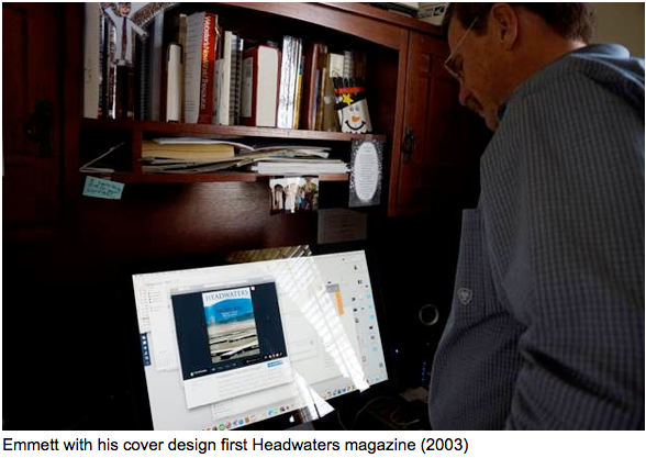
Justice Hobbs was researching a future article about Emmett Jordan’s contributions to the success of the Colorado Water Foundation recently:
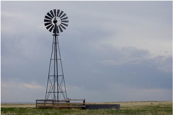
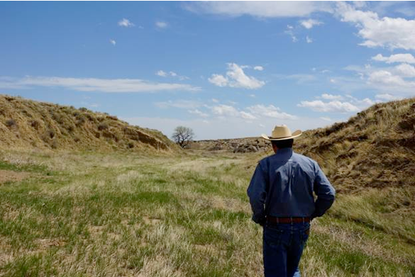
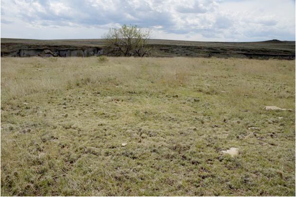
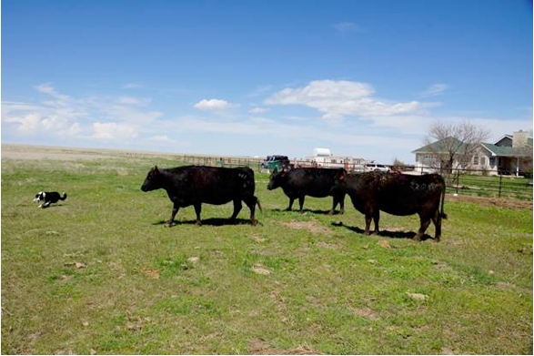
OUT HERE
(in celebration of Emmett Jordan and his foundational role in designing the publications of the Colorado Foundation for Water Education 2003-2015)
Out here, on the high plains,
I marvel at the water trickle
a windmill flows,
All the possibilities,
all the dreams,
a hundred years or so—
To the south,
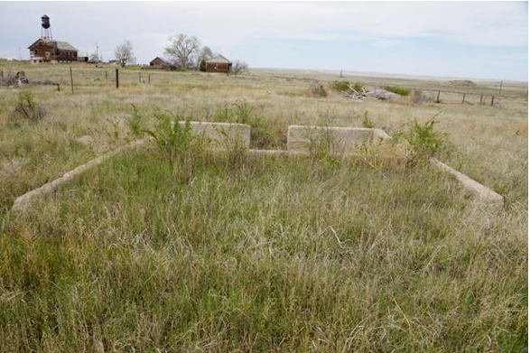
a forgotten cemetery
cows now graze
Claims a handful of
nameless homesteaders—
to the west, a ditch
That never carried
more than dreams
of irrigation bounty—
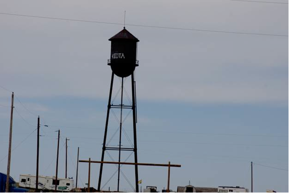
To the north, the waterless
Keota water tower—
to the east, the ruined
Grasslands of
“Government Ground”
busted into lost 160s—
New directions
brittle foundations
squeezed from the planet—
Pardon my ramblings.
In the rhythm of the rivers,
the west finds its most treasured experience.
Thank you, Emmett!
Poem “Out Here” by Greg Hobbs and Emmett Jordan published in Colorado Mother of Rivers, Water Poems (Colorado Foundation for Water Education 2005, designed by Emmett Jordan). Photos by Greg Hobbs 5/3/2015