EPA probes toxic Colorado mine tunnels, investigates possible harm to human health — The Denver Post

On April 7,  2016, the Environmental Protection Agency proposed adding the “Bonita Peak Mining District” to the National Priorities List, making it eligible for Superfund. Forty-eight mine portals and tailings piles are “under consideration” to be included. The Gold King Mine will almost certainly be on the final list, as will the nearby American Tunnel. The Mayflower Mill #4 tailings repository, just outside Silverton, is another likely candidate, given that it appears to be leaching large quantities of metals into the Animas River. What Superfund will entail for the area beyond that, and when the actual cleanup will begin, remains unclear. Eric Baker
On April 7, 2016, the Environmental Protection Agency proposed adding the “Bonita Peak Mining District” to the National Priorities List, making it eligible for Superfund. Forty-eight mine portals and tailings piles are “under consideration” to be included. The Gold King Mine will almost certainly be on the final list, as will the nearby American Tunnel. The Mayflower Mill #4 tailings repository, just outside Silverton, is another likely candidate, given that it appears to be leaching large quantities of metals into the Animas River. What Superfund will entail for the area beyond that, and when the actual cleanup will begin, remains unclear.
Eric Baker

From The Denver Post (Bruce Finley):

Crews are debating whether to try to contain toxic mine drainage or funnel it out and clean it perpetually at huge expense

Colorado and federal authorities want to resolve the issue as soon as possible because today’s untreated flow into Animas headwaters — averaging 3,750 gallons a minute — may be hurting not only the environment but human health, officials said recently.

All it would take inside this abandoned Red and Bonita Mine tunnel is a turn of the blue screw on that bulkhead plug to stop hundreds of gallons of the [acid mine drainage] from leaking. But if the EPA crew does turn that screw, shutting a valve, the blockage could cause new toxic blowouts from other mountainside tunnels, veins, faults and fissures.

So, for now, the feds are letting Animas River mines drain, tolerating the massive toxic discharge that equates to more than a dozen Gold King disasters every week.

“We don’t want to discount the Gold King spill, but it is good to keep it in perspective,” said EPA project chief Rebecca Thomas, who’s managing cleanup at the now-stabilized Gold King Mine and 47 other mining sites above Silverton.

“Think about the millions of gallons draining each day. It’s something we should be paying attention to as a society – because of the impact on water quality,” Thomas said.

The environmental damage from contaminants such as zinc and aluminum (measured at levels up to tens of thousands of parts per billion) already has been documented: fish in Animas headwaters cannot reproduce. But questions remain about harm caused by lead in water at exceptionally elevated levels up to 1,800 parts per billion, cadmium at up to 200 ppb, arsenic at up to 1,800 ppb and other heavy metals.

The EPA this month intensified an investigation of possible effects on people at 15 U.S. Forest Service campgrounds, American Indians whose traditions take them to high valleys, and vehicle riders who churn dust along roads.

Lead contamination at the Kittimack Tailings, a popular 8-acre course for off-road riding, has been measured at 3,800 parts per million, which is 7.6 times higher than the federal health limit. EPA scientists, collecting water and dirt samples this month, planned to interview campground hosts, all-terrain vehicle tour guides and southern Ute tribe members — assessing possible exposures.

If people inhale or ingest contaminants around any of the 48 mine sites, cleanup at that site would be prioritized, EPA officials said.

The federal Superfund cleanup of toxic mines across 80 square miles in southwestern Colorado is shaping up as one of the EPA’s largest mining legacy projects, contingent on Congress and agency chiefs lining up funds. EPA restoration work here is expected to set the standard for dealing with a wide western problem involving tens of thousands of toxic mines contaminating streams and rivers, for which total cleanup costs have been estimated at more than $20 billion.

In the past, cleanup work at toxic mines in Colorado stalled because of technical difficulty, lack of will and scarce funds. No work has been done for years at the collapsing Nelson Tunnel above Creede, where millions of gallons of some of the West’s worst unchecked acid mine drainage contaminates headwaters of the Rio Grande River, despite a 2008 federal designation as a Superfund environmental disaster.

But EPA officials are pushing for this post-Gold King cleanup including 48 Animas sites, concentrated around Bonita Peak above Silverton, because an EPA-led team in August 2015 accidentally triggered a blowout — setting off a 3 million-gallon spill that turned the river mustard-yellow in three states and sent contaminants nearly as far as the Grand Canyon.

This month, EPA project leaders, bracing for winter snowfall that limits what they can do until summer, anticipated a mix of different solutions at the various sites — each unique with different conditions. They’re considering construction of water treatment plants, like the temporary plant set up to neutralize and filter drainage from the Gold King Mine.

That plant has cleaned 273 million gallons of water over the past year before discharging it into Cement Creek, one of three main headwaters creeks flowing into the Animas River. Meanwhile, six surrounding toxic mines along Cement Creek drain an untreated sulfuric acid flow measured at 1,476 gallons per minute to 7,590 gallons.

A water treatment plant can cost up to $100 million with annual operational costs as high as $1 million.

EPA officials said they’ll combine installation of water treatment systems with bulkhead plugs to hold acid muck inside mountains. And the feds also are exploring use of “bio-treatment” systems using plants and plastic devices to filter and remove contaminants.

The overall cleanup is expected to take years.

“Ideally, we would come up with a way to take care of the water that did not involve a lot of very expensive, in-perpetuity water treatment,” Thomas said.

There are questions dogging hydrologists and toxicologists as they embark on remediation studies.They want to know how mining tunnels, dozens of natural fissures and faults, and mineral veins are connected.

“That is a big puzzle piece,” Thomas said, because subsurface links will determine whether bulkhead plugs safely can be used to contain toxic muck without raising water tables and triggering new blowouts.

They want to know how much acid water is backed up in major tunnels, including the American Tunnel and the Terry Tunnel, and in the Sunnyside Mine. The Sunnyside was the largest mine in the area and the last to close in 1991. EPA officials said natural faults or fissures may connect acid water backed-up Sunnyside water in the American Tunnel, where bulkheads have been installed, with the Gold King Mine.

Canada-based Kinross Corp., which owns Sunnyside, is considered a potentially responsible party, along with Gold King owner Todd Hennis, liable for a share of cleanup costs.

And EPA officials say they are monitoring underground changes that may be affecting flows from at least 27 draining tunnels — called adits — that contribute to contamination of Animas headwaters. The state-backed installation of plugs over the past decade may have triggered the rising groundwater levels that documents show the EPA and state agencies have known about for years.

For example, orange sludge oozed from a grate at the Natalie Occidental Mine — one of the worst sources of untreated mine waste — north of the Silverton Mountain ski area.

EPA on-scene coordinator Joyel Dhieux inspected it this month, hiking beneath snow-dusted mountain peaks. The backed-up sludge obscured a culvert installed years ago by state mining regulators. A huge tailings heap, leaching contaminants into a creek, suggested significant underground tunnels.

“The sludge could create a blockage in the mine that could increase the risk of a blowout. … This will require thoughtful planning,” Dhieux said. “Kittimack could be easy. You go in and remove the mine tailings. This one, it could be a more complex solution because of the risk. … This is an ‘unknown unknown.’ I honestly don’t know what the mine works look like behind this grate.”

And then there’s the problem inside that Red and Bonita Mine tunnel where a bulkhead plug is installed but not closed. Dhieux and her crew determined the plug, installed in 2015, 15 feet thick and framed in steel, appears solid.

If the EPA closes the bulkhead, she and other EPA officials said, it will be done very slowly. They’re considering a partial closure, as a test, next summer. The plan is for dozens of researchers to fan out across green mountain valleys, while contractors inside the tunnel turn the screw, watching for sudden orange spurts.

Lyons residents on flood recovery process: ‘We’re just starting to get it together’ — The Boulder Daily Camera

Bohn Park was flooded by the St. Vrain River in Lyons, CO September 18, 2013 via Getty Images

From The Boulder Daily Camera (Amelia Arvesen):

As Lyons entered its fourth year of reconstruction following the devastating September 2013 flood, the FBI and U.S. Department of Housing and Urban Development stopped by to seize documents and computers to probe the handling of federal flood-recovery funding.

Communities savaged by the rushing waters have been receiving fund allocations, totaling millions of dollars from several federal sources, such as HUD and the Federal Emergency Management Agency.

Late Friday, Mayor Connie Sullivan released a statement on behalf of the town’s Board of Trustees, stating that the FBI had concluded its portion of the investigation and would not be proceeding with a case.

Also posted to the town’s website was a copy of a subpoena from the U.S. Department of Housing and Urban Development, stating that a focus of its investigation was documents relating to negotiations and grant services contracts between Lyons and Longmont-based Front Range Land Solutions.

National #Drought Resilience Partnership launches

US Drought Monitor October 4, 2016.

Here’s the release from President Obama’s office:

By the authority vested in me as President by the Constitution and the laws of the United States of America, I hereby direct the following:

Section 1. Purpose. Our Nation must sustain and expand efforts to reduce the vulnerability of communities to the impacts of drought. Every year, drought affects millions of Americans and poses a serious and growing threat to the security and economies of communities nationwide. Drought presents challenges to the viability of agricultural production and to the quantity and quality of drinking water supplies that communities and industries depend upon. Drought jeopardizes the integrity of critical infrastructure, causes extensive economic and health impacts, harms ecosystems, and increases energy costs. In responding to and recovering from past droughts, we have learned that focused collaboration across all levels of government and the private sector is critical to enable productive and workable solutions to build regional resilience to drought.

Among other actions, this memorandum institutionalizes the National Drought Resilience Partnership (NDRP), which builds upon the National Integrated Drought Information System, an interagency program led by the Department of Commerce. The NDRP was outlined in the President’s Climate Action Plan to better coordinate Federal support for drought-related efforts, help communities reduce the impact of current drought events, and prepare for future droughts. In sustaining this focused collaboration, the NDRP will provide the Federal Government with a lasting platform that enables locally and regionally driven priorities and needs to guide coordinated Federal activities.

Sec. 2. Policy. It is the policy of the Federal Government to coordinate and use applicable Federal investments, assets, and expertise to promote drought resilience and complement drought preparedness, planning, and implementation efforts of State, regional, tribal, and local institutions. In addition, where appropriate, the Federal Government shall seek partnerships with such institutions and the private sector in order to increase and diversify our Nation’s water resources through the development and deployment of new technologies and improved access to alternative water supplies. Agencies shall also work with State, regional, tribal, and local institutions to support their efforts to maintain and enhance the long-term health and resilience of working lands and ecosystems. In carrying out this memorandum, executive departments and agencies (agencies) shall continue to recognize the primacy of States, regions, tribes, and local water users in building their resilience to drought.

Sec. 3. Drought Resilience Goals. (a) The heads of agencies shall, to the extent permitted by law and to the maximum extent possible, carry out the policy described in section 2 of this memorandum by implementing policies and taking actions to achieve the following drought resilience goals:

(i) Data Collection and Integration. Agencies shall share data and information related to drought, water use, and water availability, including data on snowpack, groundwater, stream flow, and soil moisture with State, regional, tribal, and local officials to strengthen decisionmaking to support more adaptive responses to drought and drought risk.

(ii) Communicating Drought Risk to Critical Infrastructure. Agencies shall communicate with State, regional, tribal, local, and critical infrastructure officials, targeted information about drought risks, including specific risks to critical infrastructure.

(iii) Drought Planning and Capacity Building. Agencies shall assist State, regional, tribal, and local officials in building local planning capacity for drought preparedness and resilience.

(iv) Coordination of Federal Drought Activity. Agencies shall improve the coordination and integration of drought-related activities to enhance the collective benefits of Federal programs and investments.

(v) Market-Based Approaches for Infrastructure and Efficiency. Agencies shall support the advancement of innovative investment models and market-based approaches to increase resilience, flexibility, and efficiency of water use and water supply systems.

(vi) Innovative Water Use, Efficiency, and Technology. Agencies shall support efforts to conserve and make efficient use of water by carrying out relevant research, innovation, and international engagements.

(b) The NDRP, as described in section 5 of this memorandum, shall facilitate, coordinate, and monitor the implementation of the actions conducted to achieve these goals.

Sec. 4. Drought Resilience Actions. In furtherance of the policies and goals described in this memorandum, I hereby direct agencies to take, subject to the availability of appropriations, by December 31, 2016, the following actions:

(a) Data Collection and Integration.

(i) The heads of agencies participating in the NDRP shall:

(A) improve the integration of all relevant drought-related data and information, and facilitate the use of such data, in coordination with the National Integrated Drought Information System, by State, regional, tribal, and local officials in drought planning and decisionmaking; and

(B) identify and use data formats that will allow these datasets to be incorporated into existing geospatial data platforms.

(ii) The Secretaries of the Interior, Agriculture, Commerce, and the Director of the Office of Science and Technology Policy shall coordinate the implementation of the activities described in section 4(a)(i) of this memorandum.

(b) Drought Planning and Capacity Building.

(i) The heads of agencies participating in the NDRP shall:

(A) provide technical and scientific information to State, regional, tribal, and local officials concerning the integration of drought planning, hazard mitigation, and preparedness planning; and

(B) ensure that local and regional officials are aware of drought-related planning activities and similar initiatives occurring in their region, which will avoid duplication of effort and prompt peer-to-peer collaboration.

(ii) The Secretaries of the Interior, Agriculture, Commerce, and Homeland Security shall coordinate the implementation of the activities described in section 4(b)(i) of this memorandum.

(c) Communicating Drought Risk to Critical Infrastructure.

(i) The heads of agencies participating in the NDRP shall:

(A) support information gathering and analysis to assess the risk of drought to critical infrastructure; and

(B) use the assessment described in section 4(c)(ii) of this memorandum to inform agencies and to better communicate accurate, science-based information about drought, and the risks of drought to communities, critical infrastructure owners and operators, and other drought resilience stakeholders.

(ii) The Secretaries of Commerce and Homeland Security shall coordinate the implementation of the activities described in section 4(c)(i) of this memorandum and jointly publish an assessment describing the risk that drought poses to U.S. critical infrastructure.

(d) Coordination of Federal Drought Activity.

(i) The heads of agencies participating in the NDRP shall:

(A) coordinate and use Federal programs and investments to better support drought resilience through improved information sharing and collaboration, building on existing place-based and program coordination efforts; and

(B) develop tools, guidance, and other relevant resources to ensure drought-related support to State, regional, tribal, and local officials occurs in an effective and efficient manner.

(ii) The Secretaries of the Interior, Agriculture, Commerce, and the Army shall coordinate the implementation of the activities described in section 4(d)(i) of this memorandum.

(e) Market-Based Approaches for Infrastructure and Efficiency.

(i) The heads of agencies participating in the NDRP shall:

(A) identify and share effective practices with State, regional, tribal, and local water users on the use of innovative financing opportunities to facilitate the construction, maintenance, rehabilitation, or restoration of drought-resilient infrastructure;

(B) test innovative financing opportunities, to the extent permitted by law, to attract private investment into underserved and drought-sensitive rural water infrastructure; and

(C) where appropriate, provide technical assistance to support State and local efforts to develop strategies for more flexible water management, including through market-based mechanisms.

(ii) The Secretaries of the Interior and Agriculture and the Administrator of the Environmental Protection Agency shall coordinate the implementation of the activities described in section 4(e)(i) of this memorandum.

(f) Innovative Water Use, Efficiency, and Technology.

(i) The heads of agencies participating in the NDRP shall:

(A) engage with foreign partners in order to establish mechanisms through which to implement relevant research, monitoring, and technical assistance to support transfer and adaptation of more water-efficient practices and technologies domestically;

(B) facilitate the development of new technologies and practices or the expansion of existing technologies and practices to mitigate the consequences of drought; and

(C) promote expanded use of technologies that allow the use of produced, reused, brackish, recycled, or other alternative water sources where possible and appropriate.

(ii) The Secretaries of State, Agriculture, Energy, the Interior, and the Environmental Protection Agency shall coordinate the implementation of the activities described in section 4(f)(i) of this memorandum.

Sec. 5. National Drought Resilience Partnership.

(a) Establishment and Function. There is established the National Drought Resilience Partnership (NDRP) as an interagency task force that is responsible for enhancing coordination of Federal drought resilience policies and monitoring the implementation of the activities and goals described in this memorandum.

(b) Administration of the NDRP. The NDRP administrative functions will be housed within the Department of Agriculture, which shall provide funding and administrative support for the NDRP to the extent permitted by law and within existing appropriations.

(c) Membership. The NDRP shall consist of representatives, serving at the Assistant Secretary-level or higher, from the following:

(i) the Department of Defense, Office of the Secretary of Defense-Policy;

(ii) the Department of the Interior;

(iii) the Department of Agriculture;

(iv) the Department of Commerce;

(v) the Department of Energy;

(vi) the Department of Homeland Security;

(vii) the Environmental Protection Agency;

(viii) the Office of Management and Budget;

(ix) the Office of Science and Technology Policy;

(x) the National Economic Council;

(xi) the Council on Environmental Quality;

(xii) the National Security Council staff;

(xiii) the Army; and

(xiv) such other agencies or offices as the agencies set forth above, by consensus, deem appropriate.

(d) NDRP Co-Chairs. The NDRP shall have two Co-Chairs. The Secretary of Agriculture, or the Secretary’s designated representative, shall continuously serve as the first Co-Chair of the NDRP. The Secretary of Commerce, or the Secretary’s designated official, shall serve as the second Co-Chair for a period of 2 years. The NDRP members shall rotate the second Co-Chair responsibility every 2 years based on majority vote among the Departments of Defense, the Interior, Commerce, Energy, Homeland Security, and the Environmental Protection Agency. Members serving as the second Co-Chair shall not serve in that role over consecutive periods. The NDRP shall meet at minimum on a quarterly basis, with additional meetings as needed.

(e) Charter. Within 90 days of the date of this memorandum, the Co-Chairs of the NDRP shall, with consensus of the members, complete a charter, which shall include any administrative policies and processes necessary to ensure the NDRP can satisfy the functions and responsibilities described in this memorandum.

(f) Reporting Requirements and Action Plan. Within 150 days of the date of this memorandum, the Co-Chairs of the NDRP shall submit a report to the Co-Chairs of the Council on Climate Preparedness and Resilience established by Executive Order 13653 of November 1, 2013. The report shall describe the activities undertaken and progress made concerning the implementation of this memorandum and shall include, to the extent necessary and applicable, information from all NDRP participants. Thereafter, the Co-Chairs of the NDRP shall provide updates on the implementation of the goals described in section 3 of this memorandum to the Council on Climate Preparedness and Resilience following the NDRP’s quarterly meetings, and annually in the National Preparedness Report, established in Presidential Policy Directive-8 or other appropriate annual reports submitted to the President.

(g) Long-Term Drought Resilience Action Plan. The NDRP Co-Chairs, with consensus of the NDRP agencies, shall maintain the Long-Term Drought Resilience Federal Action Plan (the “Action Plan”) and update the Action Plan as necessary. The heads of agencies participating in the NDRP shall implement the Action Plan, or any successor plan or strategy promulgated by the NDRP to guide how agencies achieve the six drought resilience goals set forth in section 3 of this memorandum.

Sec. 6. Regional Coordination and Implementation.

(a) Regional Capabilities. The heads of agencies participating in the NDRP shall establish, and utilize through their regional and field offices, cross-agency methods to coordinate Federal assistance provided to States, regions, tribes, and localities facing drought challenges. These capabilities shall be integrated with existing regional planning and coordination initiatives, including with appropriate resiliency efforts conducted by State, regional, tribal, and local drought stakeholders.

(b) Regional Engagement Coordination. In regions where complementary drought resilience activities are implemented by multiple Federal agencies, those agencies shall coordinate regional outreach strategies. Further, these agencies shall collectively coordinate regional outreach and engagement efforts with the goal of reducing duplication of effort for State, regional, tribal, and local stakeholders.

Sec. 7. Definitions. (a) “Agencies” means any authority of the United States that is an “agency” under 44 U.S.C. 3502(1), other than those considered to be independent regulatory agencies.

(b) “Critical infrastructure” has the meaning provided in section 1016(e) of the USA Patriot Act of 2001 (42 U.S.C. 5195c(e)), namely, systems and assets, whether physical or virtual, so vital to the United States that the incapacity or destruction of such systems and assets would have a debilitating impact on security, national economic security, national public health or safety, or any combination of those matters.

(c) “Drought” has the meaning provided in section 2(1) of the National Integrated Drought Information System Act of 2006 (15 U.S.C. 313d note), namely, a deficiency in precipitation that leads to a deficiency in surface or subsurface water supplies (including rivers, streams, wetlands, groundwater, soil moisture, reservoir supplies, lake levels, and snow pack); and that causes or may cause substantial economic or social impacts or substantial physical damage or injury to individuals, property, or the environment.

(d) “Drought resilience” means the ability to anticipate, prepare for, and adapt to the anticipated consequences of drought conditions, particularly long-term or extreme drought.

(e) “Resilience” means the ability to anticipate, prepare for, and adapt to changing conditions and withstand, respond to, and recover rapidly from disruptions.

Sec. 8. General Provisions. (a) This memorandum shall be implemented consistent with applicable laws, including international treaties, agreements, and obligations, and subject to the availability of appropriations.

(b) Nothing in this memorandum shall be construed to impair or otherwise affect:

(i) the authority granted by law to a department, agency, or the head thereof; or

(ii) the functions of the Director of the Office of Management and Budget relating to budgetary, administrative, or legislative proposals.

(c) This memorandum is not intended to, and does not, create any right or benefit, substantive or procedural, enforceable at law or in equity by any party against the United States, its departments, agencies, or entities, its officers, employees, or agents, or any other person.

(d) The Secretary of Agriculture is hereby authorized and directed to publish this memorandum in the Federal Register.

From The Public News Service:

The Obama Administration is calling for national coordinated action to address the growing threats to food supplies and local economies from widespread drought.

James Eklund, director of the Colorado Water Conservation Board, is also Gov. John Hickenlooper’s representative for the Colorado and Arkansas Rivers. He says western states experiencing a 16-year drought can use the help.

“We’re seeing the effects of drought on an annual basis, if not a monthly and daily basis,” says Eklund. “And so, we’ve got to make sure we’re addressing what can be summarized as a natural disaster that just moves very, very slowly.”

A memo sent this week outlined the need for coordinated action, part of the first White House National Water Summit in the nation’s capital.

The event officially launched the National Drought Resilience Partnership, a multi-agency program rolled out as part of the administration’s climate-change agenda.

Eklund notes Gov. Hickenlooper, as chair of the Western Governors Association, helped lead the charge to coordinate state work on water with federal agencies.

Eklund says those efforts shaped the new plan that will help some 13 agencies, including the U.S. Departments of Agriculture and Interior, and the Environmental Protection Agency, pool their resources to focus on drought.

“To date, they’ve been largely siloed; they don’t work together, especially to tackle drought,” he says. “And what this memo signals is a willingness to really look at making sure that they’re coordinated.”

Eklund says Colorado’s priority going forward is to intensify water conservation efforts.

He says by deploying cutting-edge technologies, it isn’t “pie in the sky” for the state to save 400,000-acre-feet of water by the year 2035 through conservation alone.

GOES-R Will Revolutionize U.S. Weather Satellites — Climate Central

GOES-R with Earth in the background. Credits: NASA

From Climate Central (Brian Kahn):

[On November 4, 2016], the GOES-R satellite is scheduled to be launched into orbit, giving scientists a clearer view of the weather than ever before.

The new satellite will be launched by NASA and managed by the National Oceanic and Atmospheric Administration (NOAA) to monitor hurricanes and other high-impact types of weather like extreme precipitation.

Having a clearer, more real time view of specific storms has major implications for how people prepare on the ground, particularly in a warming world where certain types of extreme weather are likely to become more common.

“An increase in extreme precipitation events over past few years has been extraordinary,” Stephen Volz, assistant administrator for NOAA’s Satellite and Information Service, said. “We need to be able to merge data we get from satellite with radar data to make better estimates for the forecast.”

Hurricane Matthew underscores the importance of having GOES-R in orbit. In places like Haiti, where on-the-ground weather stations are sparse, the satellite will provide another layer of information for forecasters and decision-makers.

Even in the U.S., which has a wealth of weather monitoring resources, the imagery from GOES-R will still play an important role in getting people to take weather threats seriously.

“There’s a human element to people taking action,’ Mary Glackin, the head of forecasting at The Weather Company, said. “Delivering higher resolution imagery is really important.”

There are currently three geostationary GOES satellites (two are active while one is on standby), which each sit over a fixed point roughly 22,300 miles above the earth’s surface. GOES-R will be the latest addition to a fleet that’s been continuously upgraded since 1975.

Attorneys in Widefield water lawsuit want state to pay for blood tests — The Colorado Springs Gazette

Widefield aquifer via the Colorado Water Institute.

From The Colorado Springs Gazette (Jakob Rodgers):

Several residents in the Security, Widefield and Fountain communities last month sued the manufacturers of a toxic chemical fouling their drinking water – each seeking expensive blood tests for themselves and their neighbors.

Now, the attorneys for those residents want the Colorado Department of Public Health and Environment to create and fund its own blood testing program, and quick.

“We think it’s a public health problem,” said Mike McDivitt, an attorney.

The call for a state-run blood testing program comes as the litigants gear up for a lengthy court battle against the companies that made and sold firefighting foam suspected of contaminating the drinking water of thousands of people across southern El Paso County.

Two federal lawsuits seeking class action status were filed in September over the tainted Widefield aquifer. Each lawsuit claimed manufacturers knew chemicals in the firefighting foam were toxic, but nevertheless neglected warning anyone while the foam was used at Peterson Air Force Base.

The lawsuits seek damages to pay for residents’ medical costs. But they also demand manufacturers fund blood tests for the Security, Widefield and Fountain communities. Those tests can cost up to $700, McDivitt said.

On Wednesday, McDivitt and several partnering attorneys called for the state and local health departments, Gov. John Hickenlooper’s office and Colorado lawmakers to spearhead expedited testing.

“Every one of these folks has to be blood tested,” McDivitt said…

Leon acknowledged the tests cannot indicate whether the chemicals caused specific health effects, or whether they will cause someone to get sick in the future. However, he said the tests still let people know if they have above-average levels in their bodies.

Intermountain West Climate Dashboard: New Briefing Available — Western Water Assessment

Upper Colorado River Basin September 2016 precipitation as a percent of normal via the Colorado Climate Center.

Click here to read the briefing (Jeff Lukas, Ursula Rick, Ami Nacu-Schmidt, Klaus Wolter). Here’s an excerpt:

Highlights:

  • September was much drier than normal for Colorado, southeastern Utah, and southeastern Wyoming. The rest of Utah and Wyoming was much wetter than normal. Statewide, Colorado was in the 30th percentile for precipitation, while Utah was in the 91st percentile, and Wyoming, the 89th percentile.
  • Upper Colorado River Basin precipitation as a percent of normal for Water Year 2016 via the Colorado Climate Center.
    Upper Colorado River Basin precipitation as a percent of normal for Water Year 2016 via the Colorado Climate Center.
  • For Water Year 2016 that ended on September 30, all three states ended up slightly wetter than average, with Utah in the 69th percentile (105% of the 1981-2010 normal), Colorado was in the 69th percentile (103% of normal) and Wyoming was in the 55th percentile (103% of normal). Temperatures were unusually warm across the region, continuing the overall warming trend. Wyoming was in the 96th percentile for the water year, Colorado was in the 95th percentile, and Utah was in the 93rd percentile.
  • Since early August, drought conditions have eased in northeastern and north-central Wyoming, eastern Utah, and southwestern Colorado, while worsening and/or expanding in northwestern Wyoming, northwestern and central Utah, and north-central Colorado, with little overall net change for the region over the past two months.
  • Despite below-average inflows to Lake Powell for Water Year 2016, total Colorado River system storage as of September 30 was the same as one year ago, at 51% of capacity. Lake Powell was at 12.82 MAF, 53% of capacity. Lake Mead was at 9.63 MAF, 37% of capacity, and flirting with the 1075′ level that is a trigger for declared Lower Basin shortage.
  • While sea-surface temperatures in the tropical Pacific have recently cooled to weak-La Niña territory, the official ENSO status remains ENSO-neutral. ENSO model forecasts have shifted away from the previous consensus towards a La Niña event, with more than half of the models now forecasting ENSO-neutral conditions through the winter.
  • Lamar: 2016 Annual Meeting Arkansas River Compact Administration, December 9, 2016

    Arkansas River Basin via The Encyclopedia of Earth
    Arkansas River Basin via The Encyclopedia of Earth

    2016_arca_preliminarynotice_10-07

    Fort Collins: Water and sewer rate hikes in the works for budget

    Fort Collins back in the day via Larimer County
    Fort Collins back in the day via Larimer County

    From the Fort Collins Coloradoan (Kevin Duggan):

    The recommended 2017-18 budget for Fort Collins calls for higher rates in all of the city’s utilities — electrical, water, wastewater and stormwater. Inflation and higher operating costs are driving the proposed increases, but so are long-range plans to build and maintain costly infrastructure needed to provide services to a growing community, said Mike Beckstead, the city’s chief financial officer.

    Although charges would vary, the proposed rate increases would add approximately $6.29 per month to the average residential customer bill in 2017, bringing average monthly payments to $166.69. Another $4.65 per month would be added in 2018.

    Overall rates for water service would increase 5 percent in 2017 and 2018, wastewater service would increase 3 percent each year, and stormwater charges would increase 5 percent next year but would not change in 2018.

    Those increases would help the utilities build up funds to pay for projects in 10-year capital improvement plans, said Lance Smith, strategic financial director for utilities…

    Reducing the water and stormwater rate increases from 5 percent to 3 percent would in 2017 save the average residential customer about $1.15 a month, Smith said.

    Without the 5 percent increases, plans to hire two full-time water conservation specialists and a construction inspector would have to wait a year, Smith said. A $1.4 million project to rehabilitate Mail Creek in southeast Fort Collins would not be funded.

    Utilities projects currently funded in the proposed budget include:

  • Replacement of aging water mains in high-priority areas: $1.9 million in 2017; $1.35 million in 2018.
  • Replacement of infrastructure in the city’s Water Quality Lab: $1.3 million each year.
  • Replacement of a raw water line running from the Poudre River to the city’s water treatment facility: $800,000 in 2017.
  • Replacement of equipment used to remove water for wastewater sludge and stabilize biosolids to be spread at Meadow Springs Ranch: $2.1 million each year.
  • Improvements to the oxbow levee on the Poudre River and to keep the Buckingham neighborhood out of the designated 100-year floodplain: $850,000 in 2017.
  • Construction of the third phase of a stormwater system between Lemay Avenue and Redwood Street: $1.6 million in 2017; $1.7 million in 2018.
  • The addition of 10 full-time employees in a variety of roles, including conservation programs: $793,000 in 2017.
  • […]

    The council is scheduled to adopt the budget in November. For online information about the budget, visit http://fcgov.com/budget.

    Tests from some homes in the Little Thompson Water District show elevated levels of lead

    Roman lead pipe -- Photo via the Science Museum
    Roman lead pipe — Photo via the Science Museum

    From The Loveland Reporter-Herald (Pamela Johnson):

    “It is still considered safe (to drink), but you want to follow the six steps to reduce exposure,” said Ken Lambrecht, operations manager with the Little Thompson Water District, which has 8,000 taps in its service area.

    Water providers are required to sample for lead in drinking water, and the most recent samples taken by the Little Thompson district came back with 11 that exceeded 15 micrograms per liter. When this happens, the water district is required to alert customers of the results and health risks of exposure to lead.

    Lead, though common in the environment, can cause health problems, including kidney and brain damage, and children are particularly susceptible to exposure.

    There are several sources of exposure, including paints, soil and plumbing. Lead can leach into drinking water through systems with lead pipes or copper pipes that have lead soldering, which are more common in buildings that were constructed in the 1980s.

    It was from these high-risk homes, built between 1982 and 1988, that the Little Thompson Water District took samples for its most recent testing. They collected 30 samples, which were sent to a laboratory with 27 additional vials of water that specific customers asked to have tested. Of those 57 total, 11 exceeded the 15 micrograms per liter sample. The overall results ranged from undetectable to the highest reading of 65.8 micrograms per liters, according to the water district.

    Only three of the 11 elevated samples, however, were taken after March 31, which is when the Carter Lake Treatment Plant changed some of its chemicals, Lambrecht noted. That, he continued, shows that those treatment changes appear to be working to control lead levels.

    The samples all came from single-family homes within the district, which spans from the south side of Loveland to the north edge of Longmont and from Carter Lake east to Evans in Weld County and also includes some customers west of Loveland…

    Customers of the Little Thompson Water District are advised to take…precautions, including:

    • If you haven’t had the water running for several hours, flush out the system by running cold water until it is noticeably colder. (Save that waster for plants or cleaning.)

    • Always use cold water for drinking, cooking and preparing baby formula. (Note: Boiling water does not reduce lead.)

    • Periodically remove and clean the faucet’s strainer and aerator and run water to remove debris.

    • Consider installing a water treatment device

    • Have a licensed electrician check your home’s wiring because, if grounding wires are attached to pipes, the risk of corrosion may increase.

    #ColoradoRiver: Interior Department Releases Final Environmental Impact Statement for Glen Canyon Dam Adaptive Management

    Glen Canyon Dam releases. Photo via Twitter and Reclamation
    Glen Canyon Dam releases. Photo via Twitter and Reclamation

    Here’s the release from the US Bureau of Reclamation (Marlon Duke):

    The U.S. Department of the Interior today released the Final Environmental Impact Statement (FEIS) for a Long-Term Experimental and Management Plan (LTEMP) for Glen Canyon Dam operations. The LTEMP will provide a framework for adaptively managing Glen Canyon Dam over the next 20 years with the goal of creating certainty and predictability for water and power users while protecting environmental and cultural resources in Grand Canyon National Park and the Colorado River ecosystem.

    “The Colorado River and Grand Canyon National Park are vital resources in the Western United States, and the spirit of cooperation and commitment to their protection and preservation is exemplary,” said Deputy Secretary of the Interior Michael L. Connor. “This work reflects the dedication and expertise of the Department’s Bureau of Reclamation, the National Park Service as well as our state, local and tribal partners who have worked through the complex challenges we face in protecting our finite resources.”

    The FEIS presents a thorough analysis of complex river processes and interests and identifies a preferred alternative that ensures Glen Canyon Dam will continue to meet its purposes while improving downstream resources and recreational experiences.

    This is the first Environmental Impact Statement for Glen Canyon Dam since 1995 and it marks an ongoing focus on balancing project purposes with natural and cultural resources protection. Today’s release culminates an open and transparent process based on the best-available science, extensive public involvement and active collaboration with stakeholders, cooperating agencies and traditionally associated tribes. Interior’s Bureau of Reclamation and National Park Service jointly led the FEIS completion in coordination with 15 cooperating agencies—including three federal and six non-federal agencies and six American Indian Tribes. In addition to addressing suggestions, concerns and comments from those cooperating agencies, the FEIS fully considered all comments received during a 122-day public review and comment period that ended on May 9, 2016.

    The FEIS was prepared in accordance with the National Environmental Policy Act of 1969 and evaluated potential environmental impacts of seven alternatives—including one no-action alternative that would continue operation as guided by the previous 1996 Record of Decision. The FEIS team identified a preferred alternative that improves river system conditions and minimizes adverse impacts to downstream natural, recreational and cultural resources while meeting obligations for water delivery and hydroelectric power generation. The preferred alternative continues high-flow experiments linked to adaptive triggers such as sediment and hydrology and includes fish conservation and management tools to improve fisheries and the aquatic food base.

    LTEMP and this FEIS support the ongoing focus of the Glen Canyon Dam Adaptive Management Program, which includes a diverse group of 25 river system stakeholders. The FEIS team received letters expressing support for the preferred alternative from the seven Basin States, National Parks Conservation Association, Western Area Power Administration, Navajo Nation, river rafting guides and many members of the public.

    The FEIS Notice of Availability was published in the Federal Register on Friday, October 7. The Department of the Interior will issue a final Record of Decision following a minimum 30-day public review period. The Record of Decision will select the alternative that will be implemented and discuss all factors leading to that decision.

    The Final Environmental Impact Statement is available online at: http://ltempeis.anl.gov.

    Compact disc copies of the document are also available at the following locations:

  • J. Willard Marriott Library, University of Utah
    295 South 1500 East, Salt Lake City, Utah 84112
  • Cline Library, Northern Arizona University
    1001 S. Knoles Drive, Flagstaff, Arizona 86011
  • Burton Barr Central Library
    1221 North Central Avenue, Phoenix, Arizona 85004
  • Page Public Library
    479 South Lake Powell Blvd., Page, Arizona 86040
  • Grand County Library, Moab Branch
    257 East Center Street, Moab, Utah 84532
  • Sunrise Library
    5400 East Harris Avenue, Las Vegas, Nevada 89110
  • Denver Public Library
    10 West 14th Avenue Parkway, Denver, Colorado 80204
  • Natural Resources Library, U.S. Department of the Interior
    1849 C Street NW, Main Interior Building, Washington, DC 20240
  • #ColoradoRiver District annual seminar recap — @ColoradoWater #COriver

    Colorado Water Plan website screen shot November 1, 2013
    Colorado Water Plan website screen shot November 1, 2013

    From the Colorado River District (Martha Moore):

    Our ever-popular, one-day annual water seminar was attended by nearly 200, and, for the first time, broadcast live via our Facebook page. For those that participated – thank you!

    Special gratitude goes to our excellent speakers. Your contributions are greatly appreciated.

    For those unable to attend in person or via live feed, or those wanting to relive the awesome experience – please visit our seminar webpage to access the presentations or view the footage of the entire seminar.

    Next year’s event is scheduled for Friday, September 15, 2017 at Two Rivers Convention Center, Grand Junction, Colorado. Mark your calendar and plan on joining us.

    Grand Valley Drainage District looking to loans to accelerate project construction

    Bicycling the Colorado National Monument, Grand Valley in the distance via Colorado.com
    Bicycling the Colorado National Monument, Grand Valley in the distance via Colorado.com

    From The Grand Junction Daily Sentinel (Gary Harmon):

    The district board this week directed staff to look into seeking low-interest loans from a state agency as it contemplates spending about $5 million for the Buthorn drainage system and prepares for improvements in the Appleton area to accommodate new development.

    “We need to investigate indebtedness” as one way to pay for the projects to be funded by the district’s stormwater fee, Chairman Mark Harris said.

    The Colorado Water Conservation Board will lend up to $10 million per project at an interest rate of 2.3 percent for up to 30 years, and officials with the agency have already opined that district projects such as improving the Buthorn drain could qualify for the loan program.

    Looking further into such a loan is a “piece of due diligence we probably should do,” Harris said.

    Diverting 40 percent of stormwater revenues, or about $1 million a year, to paying off debt could allow the district to tackle urgent projects, such as those required by road-repair projects, as well as those that rank high on the district’s priority list, General Manager Tim Ryan said.

    A project planned by the Colorado Department of Transportation could require $150,000 that’s not included in the district’s budget, but which could be otherwise accommodated under a borrowing program, Ryan said.

    The district has collected $2.2 million of the $2.7 million for which it sent out bills within its 90-square-mile area this year. The district board could consider turning over unpaid bills to a state collection agency as early as next month.

    Mesa County and the Grand Junction Area Chamber of Commerce haven’t paid their bills and have sued the district to prevent it from collecting them.

    A Mesa County District Court judge, however, rejected their request for a preliminary injunction this summer and the case is set for trial in June, though the district is asking that a judge rule without a trial.

    The county and chamber contend the charge is a tax that is being levied outside the requirements of the Colorado Constitution, while the district says it’s a fee.

    The court ruled it was “in the nature of a fee” in denying the preliminary injunction.

    The district’s stormwater charge is $3 per month for most residences and $3 per month for every 2,500 square feet of impervious surface, such as roofs, parking lots and driveways owned by businesses, local governments and nonprofits.

    #ColoradoRiver: Bridging science and policy for better water strategies — @ASU #COriver

    From Arizona State University (Click through for the photos):

    Keeping an arid region supplied requires balancing many interests; ASU’s experts are connecting research with decision makers

    Editor’s note: This is the third in a three-part series examining the work that ASU is doing in the realm of water as a resource in the arid West. Today’s focus in on the intersection of law, policy and academia.

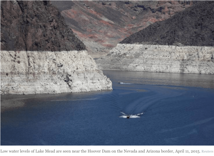
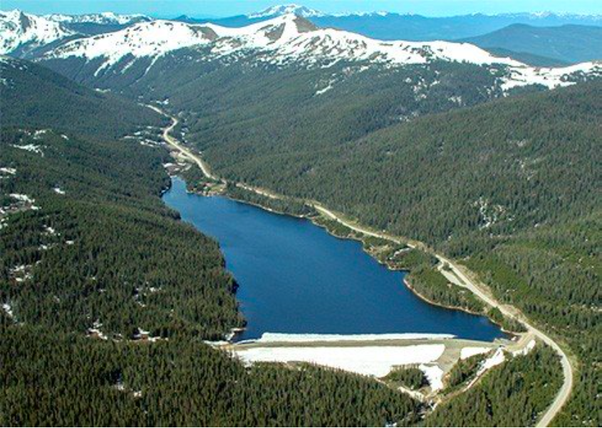
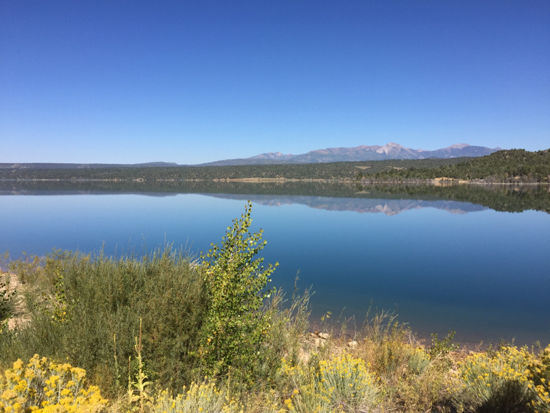
    It’s 118 at Lake Mead on a July afternoon, but the thermometer on the boat’s depth finder says the lake is a cool 67 degrees. Naturally, you jump in. It tastes earthy and mossy, if mossy can be a taste, and ultimately it’s what 30 million people survive on.

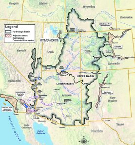
    This is the stuff and place thousands of professionals are focused on. Law, economics, policy and science all underlie this bluish-green water. Some could argue that it begins with the river’s watershed in the Rockies of western Wyoming, but it’s here, where the water wizards of the Bureau of Reclamation determine their annual prognostication, that the West makes its stand.

    Taking action

    The Kyl Center for Water Policy, named after former Sen. Jon Kyl, a distinguished water lawyer, was created about a year and a half ago at Arizona State University to work on water-policy analysis and research. Sarah Porter, a Harvard-educated attorney and former state director of the Audubon Society, was hired as the inaugural director.

    She became intrigued with water when she introduced an initiative to protect riparian habitat for bird migration.

    “It got me more and more interested in water policy,” she said.

    On a Friday morning in August, as the first meeting of the Governor’s Water Augmentation Council convenes down at the Arizona Capitol, a monsoon rain pounds outside.

    “It’s raining outside; that’s awesome,” someone says.

    Gov. Doug Ducey created the council last October. All of Arizona sits around the table: cattle growers, cotton farmers, cities, wine growers, utilities, tribal nations and communities, home builders, businessmen, attorneys and water professionals. Porter is there representing the Kyl Center.

    They’ve been tasked with finding ways to augment water supplies. The state has been divvied into 22 areas. They are to look at each area, learn what the demand and supply imbalances are in each one, and come up with a solution to close that gap.

    Today, they’re talking about the communications plan and what they want to do in the current fiscal year.

    The message they want to get out is that Arizona is a “water success story” — in other words, we’re not California.

    It’s a message with two competing goals: We need to conserve water, but we’re well-supplied. It’s safe to move here and do business.

    “That bathtub ring (at Lake Mead) is not something only people in the Southwest pay attention to,” said Doug MacEachern, the state water department communications administrator.

    They’re looking for a balance between rah-rah and everything’s awful.

    “We need to tell people it’s going to cost more,” said Ted Cooke, general manager of the Central Arizona Project, the giant canal that shunts water from the Colorado River into central and southern Arizona. “It’s going to take more than new showerheads or toilets.”

    “Their costs are going to go up, and that’s real,” said Bas Aja, executive vice president of the Arizona Cattlemen’s Association.

    They create a subcommittee to look into funding for augmentation by using reclaimed and low-quality water. If there’s a shortage declaration on the Colorado in 2018, it’s likely that agriculture will need to make up the shortfall with reclaimed water. Porter volunteers to sit on the subcommittee. This is the rubber hitting the road.

    They create another subcommittee to look into a partnership with Mexico on building a desalination plant on the Sea of Cortez.

    They know people are aware of the value of water. That message is going to be amped up now.

    The most complex legal case in American history

    The way Arizona water law works is called prior appropriation. The first person to take water out of a river and put it to beneficial use gets a priority date.

    If you dig a ditch and divert water out of the river in 1890 and use 10 acre-feet to grow cotton, you have a right, dated 1890, to grow cotton using 10 acre-feet a year. Somebody comes along 10 years later, digs another ditch downstream of you to grow corn with 10 acre-feet — they have a 1900 date. If there’s only 2 acre-feet in the whole river, legally speaking, you, with the 1890 date, gets 2 acre-feet and the person downstream of you gets nothing. That’s the way water law works.

    The Little Colorado River and the Gila River are the two rivers that basically make up all of the surface-water rights in the state that aren’t the Colorado. Who has claims on them? Every kind of water user you can think of: big cities, small towns, large utilities, Native American tribes, little farms, big farms, cattle ranches, mines.

    And they’re all suing each other.

    It’s a giant court case that has been technically going on for 40 years, but actually goes back to territorial days. A class-action lawsuit usually involves thousands of people against a small group of defendants. This involves thousands of people fighting each other.

    “I don’t think it’s hyperbole to say that it’s the most complex case in American history,” said Rhett Larson, the water attorney with the Kyl Center for Water Policy. “Yeah, it’s a complete mess.”

    A water market could improve Arizona’s water management. If a clearinghouse or escrow was set up, people could buy and sell water through that escrow for nature or cities or mining.

    “Once we have effectively priced water in a market, then maybe we’re reaching efficient water allocation,” Larson said. “Right now, we can’t do that because nobody knows who owns what.”

    Until the legal cases, collectively called the general stream adjudication, is resolved, Arizona can’t have an effective water market because people can’t buy and sell water until who owns what has been resolved. The Kyl Center works on the general stream adjudication every day. Ideally, the courts will ultimately make a decree. But not everyone is in a hurry to see the case cleared.

    “So a lot of the work that’s happening behind the scenes is to find ways, if not necessarily to resolve it, to at least allow small people who want to settle out of it and don’t want to pay their lawyers for decades, just to be able to settle out, take some water and leave — and for the others to at least have a faster, smoother process,” Larson said. “But there’s a lot of skepticism of that too, because if you’re going to get ground up into hamburger in the end — do you really want it ground up faster?”

    The center has a group of stakeholders who meet several times a month to negotiate. Larson said the work is promising. “We’ve made a lot of progress in the last 18 months,” he said. The Kyl Center acts as a mediator to avoid litigation.

    Before worrying about conserving water, people need to worry about understanding water, Larson said.

    “Imagine a resource as important as water, to not know who owns it,” he said. “A lot of these assured water-supply designations are based on assumptions on who owns what water that might not be true when the adjudication is decided.

    “So people are like, ‘Oh yeah, we have a hundred years of assured water supply!’ And you always feel like going, ‘You don’t know for sure that you own that water until the court says you do.’ … But I don’t know, I still hope that there’s something that will sort of stoke the fire in people’s willingness to resolve the stream adjudication.”

    Diamonds and water

    When economist Adam Smith wrote “The Wealth of Nations,” he wrote about the water-diamond paradox. Here’s a little tiny, shiny rock that people will pay out the nose for, but it does nothing. And over here is a substance that’s everything, but nobody wants to pay for.

    It’s something Larson wonders about.

    “I think it’s probably for a lot of reasons, partially because it falls for free out of the sky and people think, ‘Why should I pay for that?’ ” he said. “It’s partially because people think of water as a human right, as a fundamental right. I mean, how can you charge me for something that I absolutely need in order to live? And because, you know, in this country we tend to take it for granted. You turn on your taps and clean water comes out all the time, and you just assume this is a part of your life and it doesn’t cost much money.

    “For some reason we will pay quadruple the amount of its price for movie popcorn, but the idea that you would pay full value for your water is just crazy!”

    As the canal manager and the cattleman said at the water council meeting, pricing is on a lot of minds.

    “We need to price water in a sane way to communicate to people this is a high-value commodity,” said Pat Gober, a research professor in ASU’s School of Geographical Sciences and Urban Planning who studies water resources management, decision-making under uncertainty and urban climate adaptation.

    Water is super-cheap in Arizona. SRP charges $90 a year for irrigation. If you look at a Phoenix water bill closely, most of it goes to sewage fees, garbage fees and some taxes. Very little of it is actually water.

    The city of Phoenix Water Services Department spends $175 million annually on operations and management. Of that, $24 million is spent on actual water. The capital improvements budget is $130 million.

    “The cost is in the infrastructure,” water services director Kathryn Sorensen said. A section of the redwood water pipes that used to supply the city in the 1920s sits in the lobby outside her office in City Hall, as if to underscore the point. Phoenix has 7,000 miles of water lines spread across 540 square miles. (Now multiply that around the West.)

    “As those water lines age, they’re going to have to be replaced if we’re going to continue to have reliable water supplies,” she said. “The cost of that is enormous. We estimate, very roughly, that the replacement cost of the city of Phoenix utility — if you were just to go out and build it starting from scratch — is about $15 billion; $11 billion of that is in pipelines. It’s the cost of the infrastructure that’s going to matter in the future. It’s an enormous cost. And our infrastructure is aging.”

    Sorensen is an economist by training.

    “I’m intellectually fascinated with the idea and the questions around resource allocation: Who gets what? Of course the most valuable resource here in Arizona is water,” said the Phoenix native. “It’s a very natural fit for me. I knew at a very early age that this is exactly what I wanted to do. I’m one of those of people blessed to have their calling as a career.”

    Phoenix has tiered water rates. The more you use, the more you pay. There is also seasonal pricing; water costs more in summer.

    “That’s really one of the ways you’re going to get conservation,” Sorensen said.

    She knows the cost of water will go up.

    “Of course,” she said. “The cost of everything increases over time. When you talk about water, it absolutely will become more expensive, particularly Colorado River water.

    “The impact of that in terms of the end customer will kind of vary. Different cities have different supply portfolios. A city that is more dependent on Colorado River water and a city that is more dependent on Salt and Verde water might expect a different mix on the impact of those costs.”

    Agriculture, which uses 67 percent of the water in Arizona, according to the Department of Water Resources, began to pay more in the mid-1990s, when Grady Gammage Jr. served on the board of the Central Arizona Project.

    “Historically, water has been free to farmers,” Gammage said. “What they pay for is the delivery cost. In California, the Imperial Irrigation District is still delivering water to farmers at something like $6 an acre-foot. When I was at CAP, we started charging $30 an acre-foot. The questions were could farmers afford it or not?

    “The farmers’ view at that point was they had long-term rights to water; they owned the water. It was just getting delivered through the canal. But the contracts they had signed for that delivery required them to pay for the canal at the fully loaded cost of it, and they couldn’t afford that. So we re-cut a deal where they don’t have long-term rights to water anymore. Water is in a kind of limited spot market every year.”

    He once sat with a bunch of farmers who told him, “We have to be assured we’ll have water every year, and that the price will never vary.”

    “I said, ‘Are you ensured that the price of seed will never vary every year? Or that the price of insecticide will never vary every year? Or gasoline or diesel fuel?’ ‘Well, no, but that’s different. Water is different.’ No, it’s not. It’s a commodity, like those other commodities,” Gammage said.

    “So what the CAP does now is it tries to price agricultural water at the cost of getting it here, but on a sort of rolling average so the farmers know three or four years in advance how much water there is going to be, and what it’s going to cost, and that can be adjusted. That was hugely revolutionary. They all thought that would destroy agriculture in Arizona, and it’s worked out pretty well. The price had gone up fairly dramatically over time.”

    There’s a trade-off between how much you pay for water and how much you pay for food, said John Sabo, a professor in the ASU School of Life Sciences. We eat a lot of stuff because it’s cheap and available. We eat baby greens in the dead of summer because water is cheap.

    “That’s what farms are sitting on: this resource that’s only going to go up in value over time,” Sabo said. “It’s going to force them to become more efficient.”

    Farms may sell expensive water to cities and use that increased revenue to install things like drip irrigation or switch from low-value crops like alfalfa to high-value crops such as strawberries. We’re not going to get to the point where lettuce is $15 a head, though.

    “No, because people won’t eat it if it’s that expensive,” Sabo said. “Remember when avocados were $4 each? We only had guacamole during the Super Bowl. … I think it’s more that we’ll be focused on eating seasonal things that are cheap, but not all year round.”

    It’s not like farmers are acting like drunken sailors. In central Arizona, farmers are required by state law to use water-conservation practices like lining canals, laser-leveling fields and other best management practices. Farmers are legally required to be at least 80 percent efficient, according to the Department of Water Resources.

    “Agriculture has become more efficient,” Porter said. “We can grow a lot more food with the same amount of water we used 30 years ago.”

    Good news

    “We really have a lot of water (in Phoenix),” Porter said.

    Water usage in the city has fallen 30 percent in 20 years.

    “We serve 400,000 more people than we did 20 years ago, with the same water,” Sorensen said. “Tremendously successful.”

    Las Vegas pays residents to rip out lawns. Tucson has paid out $1.7 million on rebates for rain-harvesting systems. Not all those programs work. A lot of systems have been installed in Tucson, but there’s no decline in demand. In fact, they may be using twice the water they used before. Phoenix hasn’t paid for anything like that, but it’s hitting comparable demand reduction to cities in the region.

    “I’m a big fan of the way the city of Phoenix has dealt with landscape issues, which is primarily about education, not about discouraging landscaping through rate adjustments or about paying people to tear out grass,” Gammage said.

    What’s causing the drop in demand? Less turf, fewer pools being built, and more efficient appliances. One positive effect of the Great Recession Sabo pointed out was people couldn’t afford to buy new homes, so they remodeled. Remodels almost always involve kitchens and bathrooms, and new appliances are built to be water-efficient. Sorensen expects water use to continue to drop.

    “We’re very proud of the way our residents have really embraced a desert lifestyle,” she said. “That’s what it is. Phoenix focuses on the long game when it comes to conservation. We’ve been doing it full-force since the mid-80s, decades before other communities figured out this was important.

    “I know it sounds strange, but we don’t want our customers reacting to hydrologic events. We don’t want them reacting to the water levels in Lake Mead or the fact it’s been a 15-year drought, or any of those things. We want them to save water and use water efficiently because it will always be hot and dry here. That’s the mentality we need them to embrace. This is not a condition. This is not something to react to. This is how to live every day. That strategy has been successful in Phoenix.”

    In-home efficiency is becoming about as good as it gets, Gammage thinks. And tearing out irrigated tall trees and lush lawns would be a terrible mistake.

    “I think we need to be much more discriminating about the appropriate uses of water in the urban environment in the desert,” he said. “There are parts of metropolitan Phoenix where retaining the historic landscape — lush grass and trees — is important because it’s the heritage of Phoenix. … In the newer subdivisions we shouldn’t have grass in the front yards, where it isn’t used.”

    But in making decisions like that, whether in Phoenix or in other arid cities, there’s a dilemma, Gammage said: “You wind up allowing the lush landscape to be preserved for the affluent people, and the lower-income people don’t get it.”

    He’s a fan of Tempe Town Lake. It’s an amenity, a gathering place, and a place for recreation that is open to everyone.

    “It’s a good use of water,” he said, adding that it “creates ambience and gathering space in the urban fabric.”

    Phoenix has a huge amount of give when it comes to water supplies, said Porter, the director of the Kyl Center. The Salt River reservoirs are at half capacity, and not every SRP city uses all their supplies. We’re far from living on a knife’s edge, she said.

    “We talk about a supply gap, and we worry about where we’re going to get water, but we actually — if we stopped growing, and didn’t have any more demand, we wouldn’t have a water problem. Even with all the scary threats to our water supply out there, we wouldn’t be having conversations about a water-supply problem,” said Porter, who added that the issues are sustaining growth.

    Bull in a china shop

    One of the challenges is getting two of the main players — scientists and those making decisions in government — talking to each other.

    “I think, for some reason, and I don’t think it’s either side’s fault, policymakers and scientists aren’t communicating at all,” Porter said. “In a lot of disciplines there’s an expectation when they publish a paper in a scholarly magazine, someone at the legislature is going to pick it up and read it and act on it. Of course it’s absurd to think that if you think about how busy elected officials are and the demands on their attention.”

    There isn’t the beginning of the communication needed, she said, but “there are places at ASU where there are much more deliberate efforts to make those communications happen.”

    That place is the Decision Center for a Desert City. A research unit of the Julie Ann Wrigley Global Institute of Sustainability, the center conducts climate, water and decision research, and develops tools to bridge the boundary between scientists and decision makers. The 12-year-old center has worked hard to become an example of how academia can work with policymakers.

    Dave White is the director and principal investigator of the center.

    “This is a problem that we have faced and hopefully overcome to a large degree,” White said. “When university researchers conduct research independent of collaboration with policymakers, they often miss critical inputs or critical perspective into the research, that if they were aware of these perspectives they could vastly improve the relevance of the research.”

    For example, if a scientist talked to a policymaker before embarking on a study, they could set a geographic scope to a political decision-making unit. A study about the Phoenix Active Management Area instead of “greater Phoenix” “could potentially increase the relevance of the study,” White said. (Active Management Areas are five places identified by the state as being heavily reliant on groundwater.)

    Research also needs to meet the timing of policymaking. Agencies have deadlines and deliverables, just like the private sector does.

    All of which raises the question: Exactly what do public water officials want to know from academia? Where does the rubber hit the road? These six titles are a random recent sampling of what policymakers want to know, from papers written for the Decision Center for a Desert City.

  • neighborhood microclimates and vulnerability to heat stress
  • regional relationships between surface temperature, vegetation and human settlement in a rapidly urbanizing ecosystem
  • determinants of small-area water consumption for the city of Phoenix
  • residents’ yard choices and rationales in a desert city: Social priorities, ecological impacts, and decision trade-offs
  • the impact of the Phoenix urban heat island on residential water use analysis of drought determinants for the Colorado River Basin
  • ‘We listen’

    Kelli Larson, an associate professor in the School of Sustainability, said she saw some of the dread policymakers have of scientists early in the center’s history.

    “There’s this new water center opening, and some of the language was to improve water resource decision-making, which, as a decision maker, you might be sitting there thinking, ‘We’ve been working on these issues for 10, 20, 30 years, and now there’s this new center, and they’re going to improve our decisions?’” Larson said. “It may burn relationships.”

    The majority of the center’s “clients” tend to be technical staff at various agencies: water providers, planners, utility managers. Larson thinks about what they need and the policy implications. The center is proactive; it goes to decision makers, so they don’t have to navigate ASU to find the right people. Center staff — some of whom are former policymakers themselves — ask them what they’re working on, what their concerns are, what questions they have.

    “It takes time to build those relationships, to build trust,” Larson said. “We’ve been quite successful with that. Part of why we’ve been successful at that is because we listen. I see the planners and the decision makers as experts in their own right. They’re not scientists per se, they’re not researchers, they’re not academics, but oftentimes they do do their own form of research, and they have their own knowledge base. There’s a lot they can offer to our understanding and insights, including informing our research agendas.

    “When I first got here, I felt like we were outsiders trying to enter the water community, and now I feel like we’re a part of the water community,” she said. “That feels really good to see that unfold over 10 years.”

    And people in government agree that it’s successful.

    “They haven’t been (overbearing),” Sorenson said. “That’s exactly the reason we’ve been able to build such good relationships.”

    Boundary organization

    “One of the things we do really well that a lot of universities are getting into, but we’re on the leading edge of, I’d say, is integrating people into the decision-making process from the beginning,” Sabo said. “We’re very good at understanding the institutional context and the decision-making context of water resources and doing the planning and interface with the science that allows people to contribute to that process.”

    The Decision Center for a Desert City (DCDC) calls itself a boundary organization. It is a link between scientists and water-resource practitioners. The goal is to have a space — both physical and intellectual — that creates an institutional connection between the university and its partners.

    “We don’t operate in consultancy mode,” White said. “We involve the partners we work with in the design of the studies. The partners are involved in constructing the framing of the problem, they’re involved in constructing the research questions themselves, in designing and carrying out the research studies, and then interpreting and utilizing the results.”

    Sorensen and Tom Buschatzke, the director of the Arizona Department of Water Resources — the state’s two most influential water leaders — sit on DCDC’s advisory board. They, along with the National Science Foundation, which has invested $18 million in the center, evaluate the center every two years. White sits on the mayor’s water advisory board.

    Science should fill in the gaps and provide evidence for alternatives. It’s a fine line to walk, White said.

    “If you just throw your hands up in the air and say, ‘This is ridiculous!’ that’s not going to get you very far,” he said. “If you want to have policy-relevant work, then you need to understand how did the system converge this way. … It’s not up to us to make those decisions. It’s up to us to help to diagnose what the consequences of different decisions are.”

    Water Sim and the Decision Theater

    Because water problems tend to be extremely complex, that makes it difficult for non-water professionals and elected officials to understand them. DCDC has created two opportunities to make them visual.

    Water Sim is a software program that models system dynamics. You can fiddle around with various scenarios to see how an El Nino or a thin snowpack will affect water. It’s a systems model; it takes a lot of data usually collected separately — like water supply, demand, climate, population and policy data — and puts it together. Users can change one variable and see how it affects the rest.

    ASU’s Decision Theater provides meeting rooms with large-format ultra-high-definition displays and on-site computer systems, tools and personnel that can provide specialized geographic information systems, systems modeling, business intelligence, and 3-D spatial modeling and simulation, among other capabilities.

    With water problems, the importance of visualization really ratchets up.

    “A picture is worth 1,000 words, right?” Sorensen said. “One of the things that’s been really constructive is to work with DCDC on the Decision Theater. You can bring in policymakers and elected officials and instead of having to sit there and lecture them for three hours on the background of a problem and why it matters and why they should care about it, the Decision Theater helps them visualize it. You can tell the story much easier in a way that makes sense and in a way that’s compelling to them.”

    What policymakers say

    Water is immensely complex, even if it’s your field, even if you have a PhD. If you really take a look at water problems, what you’ll find is they’re wicked problems. They’re extremely complex. The low-hanging fruit has already been picked.

    “The solutions that are left to us to face the challenges of a changing climate and global uncertainty are few and far between, difficult to achieve, and they tend to be incremental in nature,” Sorensen said. “And yet ahead of us are enormous risks. As a policymaker, someone who has to actually make sure 1.5 million people in the middle of the desert have water, finding your way through that path is extremely difficult. You have to make decisions at different times with relatively little information and huge amounts of uncertainty.

    “That’s kind of ASU’s focus: How do you make good decisions in such an uncertain world with such wicked problems ahead of you? It has been a really useful and collaborative partnership. We’ve been thrilled to have been involved with it. … Water wonks are always a little bit nervous when academics forge their way into policy arenas, but I would say for the most part it’s been tremendously successful. It’s been a benefit to us, and hopefully to ASU as well.”

    And many people across many fields at ASU are working to make that happen.

    “A place like the Global Institute of Sustainability and DCDC help to serve as a glue for all of us, so that our efforts are bigger than just one professor’s efforts,” said hydrologist Enrique Vivoni said. “I think we’re starting to make inroads in increasing our reputation, and attracting great students and doing interesting projects and generating a niche that we can become world leaders in.”

    #ColoradoRiver: Floating new ideas for water solutions — @ASU #COriver

    The Colorado River Basin is divided into upper and lower portions. It provides water to the Colorado River, a water source that serves 40 million people over seven states in the southwestern United States. Colorado River Commission of Nevada
    The Colorado River Basin is divided into upper and lower portions. It provides water to the Colorado River, a water source that serves 40 million people over seven states in the southwestern United States. Colorado River Commission of Nevada

    From Arizona State University (Click through for the photos):

    From desalination to homes with dual pipe systems, scientists and policy analysts exploring wide-ranging strategies

    Editor’s note: This is the second in a three-part series examining the work that ASU is doing in the realm of water as a resource in the arid West. Today, we explore technology and innovative approaches.

    Mike Reisbig moored his boat there on an August afternoon. The Huntington Beach man, a football coach at Long Beach City College in California, has been coming to Temple Bar for about 50 years.

    “I’ve noticed a lot of changes,” he said. “I’ve been here when the water’s all the way up, going to the spill wells, to where it is today. It’s a scary sight. You don’t know whether you’re going to be able to get your boat on the water anymore or not. It’s such a beautiful place. It’s the only place I’ll bring this boat. … It’s getting scarier each year, trying to figure out how to get it in the water. We seem to figure out a way and get it in. This is the best lake I’ve ever been to, and I’m going to keep going.”

    His parents discovered the lake decades ago.

    “It just has become one of those things the family does,” Reisbig said. “Believe it or not, I brought a 3-month-old baby up here with this heat in this boat, so she could experience this lake. I know she doesn’t remember any of it, but she comes up here every year. It’s just what the family does. I have yet to find a better place to bring a boat. It’s perfect out here. You’ve got your rough days, and you’ve got your beautiful days. It’s just perfect. It doesn’t get better.”

    Like Reisbig, hydrologists, policy analysts and researchers are figuring out ways to keep going in the arid West. Here you’ll hear about technology and innovation behind water.

    Straws in the ocean

    It’s possible that the West will someday get to the point where new water supplies need to be found. One possibility being discussed in Arizona is building a plant to remove salt from seawater in Mexico on the Gulf of California.

    The idea is in the early stages, but the broad outline of how it would work goes like this: Arizona builds it, Mexico uses it, and we take their Colorado River allotment.

    Building — and permitting — a plant in California would be so expensive it’s not on the table.

    “A lot of people are very pessimistic about desalination and its future,” Rhett Larson said. “I’m one of the optimists. I actually think that it’s going to be a big part of water-supply solutions, and probably sooner than people realize.

    “The technology’s come a lot further. A lot of people think about desalination as just, ‘Well, it’s insanely expensive and nobody will ever do it,’ but the technology has come a long way and I think it has a really bright future.”

    Larson is a fifth-generation Arizonan.

    “I grew up worrying about water,” he said. “I’m one of the weirdos who actually went to law school wanting to be a water lawyer.”

    Larson, an associate professor in the Sandra Day O’Connor College of Law at Arizona State University, is a senior research fellow with the Morrison Institute of Public Policy and sits on the advisory board of the Morrison Institute’s Kyl Center for Water Policy.

    A privately owned desalination plant opened in Carlsbad, California, last December. Under a 30-year operating agreement with the San Diego County Water Authority, the plant produces 56,000 acre-feet per year. Most water managers call an acre-foot — one acre covered by water a foot deep — enough water for a suburban family for a year.

    “That water’s cheaper for San Diego (residents) than pumping the water from the Colorado River,” said Larson, pointing out that the river water would require the construction of a pipeline across the state.

    Sarah Porter, director of the Kyl Center for Water Policy at ASU, is not a believer.

    “I think a lot of the talk about desal (desalination) is wishful thinking,” she said. “People want an easy fix.”

    Desal water from the Carlsbad plant is selling at more than $2,000 per acre-foot. SRP water is about $16 per acre-foot. Putting $2,000 acre-foot water on crops doesn’t make any sense.

    “I think if we build a desal plant in Mexico, and that water were used in Mexico as a substitute for Colorado River water, I’m not sure how Mexico’s allotment of river water results in residential water,” Porter said. “The percentage that’s agricultural water is extremely cheap water, and it’s hard to figure out how you could use ocean desal for crops in a way that made sense.”

    Desal plants also need constant demand. We usually build infrastructure and then demand catches up with it.

    “I don’t think we should build something before we have the demand for it,” Porter said. “It’s a huge investment. … If we do get desal, (who pays for it) will definitely be municipal users, not growers.”

    The ick factor

    Reusing water is a huge part of the solution to close the demand gap.

    “You don’t need a new supply if you’re reusing,” pointed out John Sabo, a School of Life Sciences professor who studies riverine ecology and freshwater sustainability. Reclaimed water is also cheaper than desalinated seawater. “We do need to work at becoming more efficient, because in the future that’s going to be our primary source for growth.”

    ASU’s Central Arizona–Phoenix Long-Term Ecological Research (CAP LTER) program studies urban ecology. It has been ongoing for the past 20 years. Biological, physical, engineering and social scientists are studying eight aspects of what happens when you plop a city in a desert. Nancy Grimm
    directs the project and has worked on it since the beginning.

    One part of the study was looking at the reuse of treated wastewater for drinking water across the United States.

    “The findings would be surprising to you, because there’s a lot more reuse of water in that particular interaction — between treated wastewater and reuse as drinking water or as municipal water — than you would think,” Grimm said.

    “In some places it becomes really important during droughts. So in Texas, for instance, some of the cities are definitely using a pretty high proportion of the treated wastewater as municipal water supply. So there’s sort of what they call the “yuck” factor, the “ick” factor associated with that, but there’s really quite a lot of research that suggests that the water is quite safe.”

    One of Sabo’s ideas is homes with two sets of pipes: one for potable water and one for reused water, which would go into the toilet, onto landscaping, etc. It would be an expensive retrofit, but one that could be gradually phased in. (When electricity came along, not everyone had their homes wired at once, for example.)

    Golf courses and fake lakes already use reclaimed water.

    “Why can’t everybody have some access for their outdoor watering to treated wastewater?” Grimm asked. “Those kinds of ideas are things that we’re exploring in CAP LTER, with people from the community, so government officials, people from flood-control districts in Maricopa County, various community leaders and so forth, we’ve been having these workshops that are creating what we’re calling sustainable future scenarios for Phoenix.”

    Phoenix has been using reclaimed water on a huge scale since the 1960s. It cools Palo Verde Nuclear Generating Station, irrigates farmland and recharges aquifers. The city will use even more in the future, water services director Sorensen said.

    “We’ve been pioneers in that, literally decades ahead of other communities,” she said. “Its importance will increase in the future. … That means the value of reclaimed water will increase. It means the importance of really managing our wonderful aquifer here increases exponentially.”

    Future H2O

    One of ASU’s three main water initiatives is Future H2O, unveiled by Sabo at a White House Water Summit in March. It’s a five-year plan focused on identifying opportunities for domestic and global water security. ASU researchers will partner with private and public sectors to find solutions to difficult water problems. The whole idea is to focus on the situation at hand, rather than hoping it will change.

    “Where are the opportunities of the future to do better?” Sabo described it.

    It has five pillars, one of which is aimed at averting what water managers call “the Silver Tsunami,” the imminent retirement of a lot of water professionals with institutional memory and expertise.

    “The opportunity is the next generation is going to be more capable of harnessing the technology that surrounds us because they’re embedded in that technology,” Sabo said. “They know how to use it. The next generation is going to build on what the incumbents have left us, which in Arizona is quite strong.”

    Two other areas of focus are:

    • Developing funding for an urban landscape design and renovation campaign that reduces residential outdoor water use in at least one Phoenix metro service area by a third by 2025.

    • Delivering research and advice to at least 10 of the largest corporate water users in the U.S. to scope, plan and implement restoration projects at scales that improve water reliability in stressed water basins nationwide.

    Sabo created a software tool that helps corporations apply analytics to how they use water, simultaneously helping water conservation, habitat restoration and their bottom lines. It’s being used by Dow Chemical at their west Texas operations on the Brazos River.

    “It tells Dow how to meet their water bottom line for manufacturing by creating wetlands instead of creating gray infrastructure,” said Sabo.

    The nature of desert cities

    One of things Grimm’s long-term desert cities project looks at is how storm water moves through the city and how it’s handled.

    She’s interested in the idea that cities are potentially really good experimental test beds for thinking of water as a unified system. She envisions a city water department that manages drinking water, wastewater and storm water holistically.

    “Some of that is going on in Phoenix, because Phoenix has been pretty innovative about things like reusing treated wastewater for watering golf courses and filling up fake lakes and things like that,” she said.

    What happens when you plop a city in the middle of a desert? How does that affect the way water moves and behaves?

    “We know very little about that,” said hydrologist Enrique Vivoni
    , an associate professor in the School of Earth and Space Exploration.

    Vivoni is interested in how changes in climate and land cover affect water as a resource. He uses observations of sensors and satellite data and computer modeling of hydrological systems.

    “The movement of hydrologists studying cities in depth is actually very new,” he said.

    Most other schools specialize in natural systems hydrology, like rivers, mountain watersheds and wetlands.

    “None of them have this special expertise on human-environment relations in cities, where water is important currency,” Vivoni said. “Humans are primarily going to be urban dwellers moving forward. As a species, more than half of us live in cities. We do all these changes around us, and we have almost no clue about how the system works internally.

    “Part of my work at ASU is on that angle: understanding, measuring, quantifying and eventually predicting how water moves, is transformed and flows through desert cities. My work focuses on arid and semi-arid areas.”

    What does climate change and covering land with a city do, in concert or separately, to alter hydrological systems? When it comes to hydrology, codes and regulations don’t have much to offer: Don’t create more runoff than would have been produced without the development, make sure that water has a place to go, and that’s about it.

    “We don’t tell our developers, ‘Make sure your development does not increase urban heat,’ ” Vivoni said. “That’s not in our regulations. What I’m trying to get at is we’ve built cities with very little hydrologic and atmospheric science in mind. ‘Just do it. The consequences we’ll figure out later.’ ”

    What Vivoni’s group does is provide datasets, models and model outputs that can inform policy from science.

    “I think we have to be a little more proactive about our water resources,” he said. “That’s going to require more science in our agency.”

    Vivoni feels there needs to be more emphasis put on soft infrastructure: plans, policies, procedures, modeling systems, operational plans that say if the drought is this severe, we’re going to do this; if it’s that severe, we’re going to do that.

    “How can we prepare the planners, the cities, the decision-makers with information and knowledge beforehand so that there are plans in place that can be followed under the eventual drought that will eventually hit us someday? That’s squarely in the academic world, and ASU is well-prepared with its social science and natural science expertise to contribute to that.”

    Bridging the gap between science and policy is called “sociohydrology.” It’s a recognition that the natural science community hasn’t taken humans into account well enough in their work.

    Government used to speak only to consultants.

    “We’re at a phase now where academia is starting to play a role,” Vivoni said. The university provides consulting that’s broader than just an engineering goal that needs to be met.

    “It can’t only be from one angle,” he said. “It can’t only be from the engineering angle, and it can’t only be from the anthropological angle. It has to be from some combination of lenses. … We’re trying to improve models that can be used in context with stakeholders, to have them have access to tools that can enhance decision-making. I’m at the technical back end of that. I’m not the person with the skills to interface directly with the Phoenix water manager.”

    How ASU ended up bridging the gap between science and government

    Water in the West in general has historically been a by-product of agriculture. Grady Gammage Jr. explained how ASU arrived where it is now.

    Gammage (son of ASU’s third president) wears a lot of hats. If there’s a public or private board making important decisions about the state, you can count on seeing him there. He is an academic, a lawyer, an author, a real-estate developer and a former elected official.

    At ASU, Gammage is a senior fellow at ASU’s Morrison Institute, the Kyl Center for Water Policy, and a senior scholar at the Julie Ann Wrigley Global Institute of Sustainability. He also teaches at the Sandra Day O’Connor College of Law and at the W. P. Carey School of Business.

    When he was in high school, he had a summer job with Salt River Project. “I’d get to drive around and look at the dams,” he told an oral history interviewer in 2007. “That was sort of my first exposure to Western water issues a little bit.”

    “We study water, we think about water, we produce water, we build big water projects, all because of the heritage of the Bureau of Reclamation and John Wesley Powell and the creation of the great Western water projects,” he told ASU Now. “That means that the places where water has historically been studied the most are the land grant institutions, where it’s a by-product of the study of agriculture. The (University of Arizona) has been the water school, forever, and it is a world leader in hydrology and those kinds of things. That’s been weird, because ASU should have been the land grant school. Agriculture is here; it was never in Tucson. But, for historical reasons, it happened differently. ASU has had to come at this from the non-agriculture perspective.”

    Gammage thinks that’s beneficial to the perspective ASU brings to water, because the West isn’t about agriculture any more. It’s about people and cities.

    “Sometimes that historical overhang of the cultural legacy of water in the West distorts the way water is studied and planned and dealt with,” he said.

    Gammage said ASU’s policy orientation — “big-picture water policy” — has evolved over the past 10 or so years.

    “I think the niche for ASU is more to focus on the arid West and the way in which water and water rights are managed and adjudicated going into the future,” he said. “That’s why I’m excited about Rhett (Larson) being here. The Kyl Center for Water Policy is a really good idea. To me, that’s the more comfortable niche to exploit: the legal and policy aspects of water. That’s what I do; that’s what I like. I’m not a scientist.”

    Loveland: Algae bloom in Green Ridge Glade Reservoir update

    Green Ridge Glade Reservoir
    Green Ridge Glade Reservoir

    From The City of Loveland (Gretchen Stanford):

    I hear your concerns about the water quality and taste and odor issues we are experiencing in Loveland. My goal is to be as transparent as possible by sharing information about what is causing the taste and odor issues in Loveland and what Loveland Water and Power (LWP) is doing to resolve the problem.

    Loveland has been abuzz for months about the unusually large, stubborn algae bloom at Green Ridge Glade Reservoir, one source of Loveland’s drinking water. Although this bloom is fierce, the drinking water in Loveland still meets federal regulatory requirements, plus even more-stringent state standards, for drinking water.

    This algae bloom in particular is the largest we have ever seen. As a result of the 2013 flood, more nutrients have entered into runoff as it makes its way to our reservoir. The extreme heat and abundant sunshine we have had this summer developed into the perfect storm for an enormous algae bloom.

    This bloom has revealed new algae species that reproduce more quickly and produce stronger geosmin, the compound that causes taste and odor issues. Additionally, the Big Thompson River is now afflicted with a significant level of the same algae. We cannot treat the free-flowing river water in the same way as we do the reservoir. And at this time, we are blending water from both the river and the reservoir at the Water Treatment Plant (WTP).

    LWP water quality specialists are closely monitoring water quality by testing water samples at the Water Treatment Plant as well as at homes and businesses throughout the city on a daily basis. We are also treating the reservoir with a hydrogen peroxide-based algaecide that was developed as an environmentally safe alternative to copper-based algaecides. The only end-products of the treatment we use are oxygen and water. In addition, we are using a safe, absorbent activated-carbon compound inside the treatment plant to remove as much taste, odor and color from the water as possible.

    Our technical staff continues to explore safe alternatives for treating algae blooms in the future while walking a thin line between the price tag of new technology and reasonable rates for our customers. Next week, LWP will begin a feasibility study to evaluate options for algae mitigation. The study will include permanent aeration or oxygenation system in the reservoir. We will also do a preliminary design of a larger system to store and dispense the activated carbon compound at the WTP. Unfortunately, those large capital costs are currently not budgeted.

    While we would like to predict when the algae will die, it is important to note that algae is a living, unpredictable organism. Blooms usually end shortly after the first frost but we have no way to predict when that might be. We will continue to update our website http://www.cityofloveland/waterquality and Facebook page http://www.facebook.com/LovelandWaterandPower with timely information as we receive it.

    The safety and quality of our drinking water is one of LWP’s most important goals. We recognize the vital role water plays in our daily lives. LWP takes water quality very seriously and will continue to produce safe, clean drinking water for our customers. We ask for your patience while we work to resolve this problem and find a way to prevent it in the future.

    From The Fort Collins Coloradoan (Jacy Marmaduke):

    An algae bloom in Green Ridge Glade Reservoir, the worst Loveland’s Water and Power division has experienced, is to blame for the unsavory taste and odor plaguing the city’s water supply. The blue-green algae is harmless, health-wise, according to state lab test results.

    While the minuscule taste-and-odor compound released by the algae makes the taste disgusting, a lucky 25 percent of residents think the water’s fine because they can’t taste or smell the compound.

    Soon, the other 75 percent of the city will have better-tasting water. The first hard freeze will mean a slow die-off of the algae bloom, water treatment manager Scott Dickmeyer said. After that, the water’s taste and smell should return to normal within a week or two.

    But Loveland will have to invest in some new mitigation methods to keep the algae at bay.

    Green Ridge Glade has always been susceptible to algae growth because it’s deep and relatively still. It’s not a recreation hub like Horsetooth Reservoir, from which Fort Collins gets its water, and water doesn’t flow in and out of it at a rapid rate like at Horsetooth because Loveland is its sole user.

    So as temperatures rise, the reservoir’s deeper, stiller water produces nutrients that promote the growth of anabaena, a type of algae common in water systems.

    Loveland officials use a hydrogen peroxide-based product to kill the algae, but the issue has gotten worse since the 2013 Big Thompson floods because of the nutrient influx and the mysterious introduction of a new species of algae that’s harder to kill.

    That’s why even though the algae issue is nothing new, many residents noticed it for the first time late this summer…

    The city’s been using powder-activated carbon to remove the taste-and-odor compound from the water and funneling more Big Thompson River water into its treatment plant, but each method has drawbacks.

    Powder-activated carbon removes only 50 to 60 percent of the compound because it’s not great at trapping such tiny particles. Loveland’s treated water contains about 20 to 40 parts of the compound per trillion parts of water…

    “It’s a very, very small amount, but most people are very, very sensitive to it,” Dickmeyer said. “It only takes about 5 parts per trillion for our customers to start noticing it.”

    And within the last few weeks, algae started cropping up in the Big Thompson River, so diluting the taste with another water source wasn’t an option.

    Loveland Water and Power is considering adding oxygen to the reservoir to discourage algae growth. The division is also considering more aggressive treatment options that won’t “cost a fortune,” Dickmeyer said.

    Hermosa Creek Watershed Management Plan update

    From The Durango Herald (Jonathan Romeo):

    Several hundred public comments were received regarding a resource management plan for the Hermosa Creek Watershed Management Plan, U.S. Forest Service district ranger Matt Janowiak said Wednesday.

    “This is one of the first NEPAs (National Environmental Policy Act) that I’ve been a part of where I’ve seen people really take the time and tell us what they think,” Janowiak said.

    On Wednesday, Janowiak, along with Trout Unlimited’s Ty Churchwell and Trails 2000 executive director Mary Monroe, took a tour of the Hermosa Creek watershed with Republican Congressman Scott Tipton.

    “The volume of public comments really speaks to how engaged this community is,” said Churchwell.

    In 2014, after six years of negotiations, the Hermosa Creek Watershed Protection Act was signed, a bipartisan effort that designated 37,400 acres as a wilderness area and 70,600 acres as a Special Management Area in the San Juan Mountains, north of Durango.

    Lauded as a landmark collaborative victory, the Forest Service is drafting a management plan for the special-use area that would allow a range of recreational uses that include hiking, horseback riding, mountain biking, ATV and other motorized use. A draft plan was released in July and comments were taken until Oct. 1…

    The tour showcased the cutthroat reintroduction programs in the watershed that, once complete next year, will create the longest continuous stretch of cutthroat habitat in the United States, Churchwell said. The group also stopped at the facilities and campgrounds proposed for changes in the draft plan throughout Hermosa Creek, which Janowiak said is the second-most used area in the Forest Service’s Columbine District with thousands of visitors each year.

    Janowiak said the Forest Service will review public comments and make any necessary changes to the environmental assessment, which will again be up for public comment in the spring.

    Cutthroat trout historic range via Western Trout
    Cutthroat trout historic range via Western Trout

    #Drought news: Some improvement in Central #Colorado, SW US megadrought

    Click here to go to the US Drought Monitor website. Here’s an excerpt:

    Summary
    The current U.S. Drought Monitor period was dry through much of the Midwest and Plains states. Dryness also dominated much of Idaho, the interior regions of Washington and Oregon, much of California and Nevada, and the Southeast. A slow-moving system brought with it soaking rains from eastern Illinois into the Mid-Atlantic. Some areas of the Mid-Atlantic into Virginia and North Carolina recorded over 5 inches of rain with this event. The soils were primed to soak in the moisture and little runoff was observed, as short-term dryness had dominated this area. Eastern Idaho, northwest Wyoming and central Montana all had good rains this week as well as some of central and eastern Arizona, into western New Mexico. Temperatures were cooler than normal over the coastal regions of the Pacific Northwest and into northern California as well as Arizona where the wet conditions were observed. Much of Texas and Louisiana were cooler than normal; below-normal temperatures also extended up the Mississippi River Valley into portions of Kentucky and Tennessee. Warmer than normal temperatures dominated much of the Rocky Mountains, Central and Northern Plains, Upper Midwest, and East Coast. Some departures in eastern Montana were 6-8 degrees above normal…

    High Plains and South
    Temperatures were warmer than normal over the northern and central Plains while they were cooler than normal over most of Texas, Louisiana and southern portions of Arkansas and Oklahoma. Portions of Nebraska, South Dakota, and North Dakota did pick up some precipitation this week, but the region was generally dry, again helping with fall agricultural activities and crop maturity. Due to the recent patterns, the moderate drought was eliminated from North Dakota, with only a few pockets of lingering D0 remaining. The recent pattern allowed for an assessment of conditions in western South Dakota, where extreme drought was reclassified as severe drought and the extent of severe drought and moderate drought was also reduced. In southwest South Dakota, the recent dryness in the area did allow for the slight expansion of moderate drought and abnormally dry conditions. In Nebraska, the abnormally dry conditions were improved in the western and central portions of the state. Dryness over the last 30-60 days has allowed for abnormally dry conditions to be introduced into southwest Kansas and the Oklahoma and Texas panhandles. In south Texas, moderate drought and D0 were also expanded slightly, and a new pocket of D0 was added along the Gulf Coast. Northeast Texas had more expansion of both moderate drought and D0 conditions this week as a short-term dry pattern continues. Oklahoma had some expansion of severe and moderate drought in the eastern portions of the state, but this may be short-lived as decent rains fell over the expanded area after the data cutoff for the week. Abnormally dry conditions were expanded in eastern Oklahoma, western Arkansas and central Louisiana as well this week…

    West
    The new water year started over the West with some rain along the coastal regions of northern California, Oregon, and Washington as well as much of central and eastern Arizona. Areas in eastern Idaho, southwest Montana, and northwest Wyoming also recorded widespread precipitation this week. Temperatures were warmer than normal from the Great Basin into the Rocky Mountains, with departures of 6-8 degrees above normal. Most other areas were normal to cooler than normal along the west coast, with departures there of 2-4 degrees below normal. Improvements were made this week to the moderate drought in southwest Washington and extreme northwest Oregon.

    Accordingly, some improvements were also made to the abnormally dry conditions in this area. Abnormally dry conditions also improved in central Colorado, southwest Wyoming and north central Wyoming in response to the most recent wet pattern. An assessment of conditions in northeast Wyoming led to a reduction in severe drought, similar to what was done in the Black Hills of South Dakota. Arizona saw D0 conditions improve in the southeast and northwest portions of the state where the greatest rains fell…

    Looking Ahead
    Over the next 5-7 days, many across the Southeast and along the eastern seaboard will be watching to see what Hurricane Matthew does. There is a potential for significant rains over drought areas, so it will be watched closely. Precipitation is anticipated over much of the central United States from New Mexico northeastward into the Great Lakes, with some areas projected to receive 2-3 inches of rain. Another storm system will impact the Pacific Northwest, bringing with it heavy rains along the coastal regions of Washington and Oregon. Temperatures during this time remain above normal, with only those areas along the coastal region, where rain is expected, projected to record temperatures near normal or slightly below.

    The 6-10 day outlooks show all of the United States and Alaska having above-normal chances of recording temperatures that are above normal; the greatest chances are in the Plains. Precipitation during this time is anticipated to be greatest over the Pacific Northwest. There are higher chances of below-normal precipitation along the East Coast and in the Plains.

    A new peer-reviewed report Relative impacts of mitigation, temperature, and precipitation on 21st-century megadrought risk in the American Southwest (Toby R. Ault, Justin S. Mankin, Benjamin Cook, and Jason E. Smerdon) has recently been released by Science Advances. Here’s the abstract:

    Megadroughts are comparable in severity to the worst droughts of the 20th century but are of much longer duration. A megadrought in the American Southwest would impose unprecedented stress on the limited water resources of the area, making it critical to evaluate future risks not only under different climate change mitigation scenarios but also for different aspects of regional hydroclimate. We find that changes in the mean hydroclimate state, rather than its variability, determine megadrought risk in the American Southwest. Estimates of megadrought probabilities based on precipitation alone tend to underestimate risk. Furthermore, business-as-usual emissions of greenhouse gases will drive regional warming and drying, regardless of large precipitation uncertainties. We find that regional temperature increases alone push megadrought risk above 70, 90, or 99% by the end of the century, even if precipitation increases moderately, does not change, or decreases, respectively. Although each possibility is supported by some climate model simulations, the latter is the most common outcome for the American Southwest in Coupled Model Intercomparison 5 generation models. An aggressive reduction in global greenhouse gas emissions cuts megadrought risks nearly in half.

    Hurricane #Matthew is a record setter already and it’s not over yet

    Hurricane Matthew SE of Florida October 5, 2016. Photo credit NASA (via The Washington Post).
    Hurricane Matthew SE of Florida October 5, 2016. Photo credit NASA (via The Washington Post).

    From The Washington Post (Phil Klotzbach):

    On Sept. 28, Matthew developed from an area of low pressure as it approached the Windward Islands. It was a very fast-moving system early in its formation, and it steered rapidly westward by high pressure to its north. In the first few days of its life, that speed inhibited intensification, but as soon as it slowed, Matthew began to strengthen.

    Matthew reached hurricane intensity Sept. 29, and since then has been breaking records. Below are some of the milestones that Matthew has achieved so far:

  • Hurricane Matthew underwent a remarkable rapid intensification of 80 mph in 24 hours, intensifying from a Category 1 hurricane to a Category 5 hurricane. This was the third-strongest rapid intensification in a 24-hour period for any Atlantic hurricane on record, trailing only Hurricane Wilma (2005) and Hurricane Felix (2007).
  • It also became the first Atlantic-basin Category 5 hurricane since Felix (2007). Matthew is the 31st Atlantic-basin Category 5 hurricane on record.
  • One of the remarkable things about Matthew during its time in the eastern Caribbean (<=20°N, 75-60°W) was its very slow forward speed. Typically, hurricanes have to move at least 8 to 10 mph to not churn up cold water, which would significantly weaken the storm. But the Caribbean is very warm and very deep, which means there was less cold water to churn. As such, Matthew has been able to sustain itself as a very strong hurricane for a long time. Because of its slow movement and strong intensity, it has achieved several notable records for intensity and duration.

  • Hurricane Matthew is the longest-lived Category 4-5 hurricane in the eastern Caribbean on record.
  • The storm was a Category 4-5 hurricane for 102 hours, which is the longest that a hurricane has maintained such a strength on record during October in the Atlantic basin.
  • Matthew has been a major hurricane (Category 3-5) for more than five days, the longest-lived major hurricane since Hurricane Ivan (2004).
  • One index that hurricane scientists frequently use when they assess integrated effects of a hurricane is accumulated cyclone energy (ACE). This index takes into account intensity and duration of a hurricane.

  • Hurricane Matthew generated the most ACE of any hurricane in the eastern Caribbean on record.
  • As of Wednesday morning, Matthew had generated the most ACE by any single Atlantic hurricane since Igor (2010). Given the forecast track and intensity of Matthew, it is likely to be one of the highest-generating ACE storms of the past 50 years.
  • Matthew has already devastated portions of the Caribbean along its slow northward trek. It made landfall as a Category 4 hurricane in Haiti and then in Cuba and is now currently bearing down on the Bahamas. As such, Matthew has set some notable landfall records as well.

  • It was the first Category 4 hurricane to make landfall in Haiti since Hurricane Cleo (1964). Matthew was also only the third Category 4 hurricane to make landfall in Haiti on record, in addition to Flora (1963) and the aforementioned Cleo.
  • Hurricane Matthew was the first Category 4 hurricane to make landfall in Cuba since Hurricane Ike (2008).
  • What potential future records are possible for Hurricane Matthew? The latest National Hurricane Center forecast as well as model guidance indicate that Matthew may last in the Atlantic for another week or more…

    No hurricanes on record have made landfall north of Miami along the east coast of Florida in October, and as mentioned earlier, no major hurricanes have made landfall since Wilma in 2005. Each of these records has the potential to be broken in the next few days.

    From CNN (Max Blau, Steve Almasy and Catherine E. Shoichet):

    Here’s what you need to know now about the powerful storm that forecasters say is gaining strength:

    • Authorities urged more than 2 million people to leave their homes in coastal Florida, Georgia and South Carolina as the storm neared — the largest mandatory evacuations in the United States since Hurricane Sandy hit the East Coast in 2012.

    • Based on the latest projections, Matthew could make landfall in Florida early Friday as a Category 4 hurricane. It could also skirt the coast as it continues north. Outer rain bands from the storm are already approaching Florida.

    • The storm has already killed at least 15 people in several Caribbean countries.

    • It’s moving northwest at about 12 mph and packing 125 mph (205 kph) winds — a Category 3 storm. Thursday morning it was about 30 miles (45 km) south-southwest of Nassau, Bahamas, and 215 miles (350 km) from West Palm Beach, Florida.

    • Florida Gov. Rick Scott offered a dire warning Thursday morning for people living in evacuation zones: “This is serious. … Don’t take a chance. A small movement (of the storm) could mean a lot. That’s why we have to prepare for a direct hit. So again, if you need to evacuate and you haven’t, evacuate. This storm will kill you. Time is running out. We don’t have that much time left.”

    • “This could be an extremely disastrous hurricane for so many large areas where so many people can be affected,” National Hurricane Center Director Rick Knabb told CNN Thursday. “It’s not just going to come ashore and affect a narrow zone and then move on. It’s going to be going up the coast and could remain a major hurricane at the coast, or very close to it, the whole way up. That’s awful.”

    #cop21: Paris climate deal a ‘turning point’ in #ClimateChange fight — The Guardian

    Indigenous people #cop21 via the Department of Interior.
    Indigenous people #cop21 via the Department of Interior.

    From The Guardian (Oliver Milman):

    The climate accord is set to be activated on 4 November after the European Union, Canada, Nepal and India all formally ratified the deal. The latest ratifications mean that 73 nations accounting for nearly 57% of the world’s greenhouse gas emissions are fully committed to the process, meaning the two key thresholds to the agreement have now been met.

    Obama said: “Today is a historic day in the fight to protect our planet for future generations. This gives us the best possible shot to save the one planet we got. With optimism and faith and hope, we are proving it is possible.”

    The US president said the Paris agreement will prove a “turning point” in the fight against climate change, should nations fully commit to cutting emissions. The US and China, the world’s two largest emitters, both ratified the agreement in September.

    Obama said the deal, which commits countries to ensuring that the average global temperature doesn’t rise 2C above pre-industrial levels, will “open the floodgates for low-carbon innovation at a scale we haven’t seen before”. But he warned that emissions will need to be scaled back even further, along with mooted cutbacks in aviation and HFC pollution, if runaway climate change is to be avoided.

    “No nation, not even one as powerful as ours, can solve this on its own – we have to do this together,” he said. “Even if we meet every target, we will only get to part of where we need to go. But this will help delay or avoid the worst consequences of climate change. It’ll help set bolder targets.”

    The Paris agreement, struck last year, calls for all 195 signatories to come up with their own voluntary plans to reduce emissions. While the landmark deal is the first commitment by all countries to reduce emissions, the individual pledges are unlikely to be sufficient to stay within the 2C limit, which could be breached as early as 2050, according to recent research.

    Separate studies have shown the world is on course for a temperature rise of around 3.5C by the end of the century, based on the emissions cuts promised in Paris. This would cause a range of disastrous environmental consequences, including heatwaves, sea level rise, species extinctions and spread of disease.

    There are doubts that the US is on track even to meet its initial promise to cut emissions by 26% to 28% by 2025 by 2005 levels. In a further complication, Donald Trump, the Republican nominee for president, has promised to withdraw the US from the deal should he win power. However, the ratification locks countries into the deal for four years, so an immediate US exit wouldn’t be possible.

    But green groups have celebrated the activation of the Paris deal, pointing to the lightening pace of ratification after decades of international wrangling over climate change. United Nations agreements often take years to come into force, with the Paris deal taking less than a year to pass its ratification thresholds.

    “The unprecedented speed of the entry into force of the Paris agreement demonstrates that Paris was not a one-off deal, but rather a long-term commitment to climate action,” said Jennifer Morgan, executive director of Greenpeace International.

    Michael Brune, executive director of the Sierra Club, added: “After years of tireless dedication and work toward an international climate deal, the Paris agreement has finally jumped off the page and into reality.

    “Now that the agreement is a reality, we must finally align our global energy and economic policies to meet these goals and end subsidies for outdated fossil fuels, transition to 100 percent clean energy, and stop harmful trade agreements like the Trans-Pacific Partnership that run counter to the goals of the Paris Agreement.”

    Christiana Figueres, former executive secretary of the United Nations Framework Convention on Climate Change and a key architect of the Paris deal, said the deal should be met with “unbridled optimism.”

    “We now we have our starting signal – this is the “go” toward a low carbon future,” she said. “That future is going to be exciting: ending the dominance of fossil fuels will deliver an abundance of innovation and opportunity for all of us.

    “We can deliver cleaner air, healthier cities and a new kind of ‘industrial’ revolution underpinned by technologies that enable us to live a prosperous life within the boundaries our planet can sustain. To achieve that, we must now increase our ambition to ensure the legacy of this moment is sealed as a positive pivot point in history.”

    Weekly Climate, Water and #Drought Assessment of the Upper #ColoradoRiver Basin #COriver

    Click here to view the current assessment. Click here to go to the NIDIS website hosted by the Colorado Climate Center.

    Arvada: Rate increase in the cards?

    arvadareservoir
    Arvada Reservoir via the City of Arvada.

    From The Wheat Ridge Transcript (Shanna Fortier):

    Owners of a typical single family home in Arvada will likely have to pay $1.41 more a month — or $16.90 additional a year — for water and sewer services fees in 2017.

    The average single-family home is considered to be 3.2 people and a yard. And the average single family drinking water bill in Arvada runs about $481 annually and $291 annually for sewage.

    Jim Sullivan, director of utilities for Arvada, said the average single-family account in Arvada uses 120,000 gallons of water each year for domestic and irrigation purposes and generates 60,000 gallons of sewage. Single-family accounts form the largest customer group in Arvada, using about 60 percent of the water.

    Arvada City Council heard the proposed rate increases at the Sept. 26 workshop and will discuss the proposals during council meetings on Oct. 3 and Oct. 17, also the date of a public hearing. The rates have been raised every year over the past decade.

    When taken separately, the proposed increases amount to 2 percent for water and 3 percent for wastewater. A 1.45 percent increase for water tap fees is also proposed. Stormwater and sewer tap fees are not projected to increase, city officials said.

    The increases are needed because of rising vendor prices, new equipment and materials, and employee salary raises, Sullivan said.

    Sullivan added that over the next 10 years, water operation costs will likely slowly increase as the city prepares to contribute payment for the Denver Water Gross Reservoir expansion project.

    Sources of water

    Arvada has two sources of water. The first is a 1965 contract with Denver Water. The second source is the city’s Clear Creek water right holdings.

    But “these two sources will not be sufficient to meet the residents’ needs at buildout of the city,” Sullivan said. “The city has entered into an agreement with Denver Water to financially participate in the Gross Reservoir expansion in exchange for additional water supplies. This project should increase Arvada’s water supplies sufficiently to meet the city’s needs at buildout.”

    Gross Reservoir, named for Denver Water former Chief Engineer Dwight D. Gross, was completed in 1954. It serves as a combination storage and regulating facility for water that flows under the Continental Divide through the Moffat Tunnel and supplies water to Denver Water’s North System.

    The reservoir was originally designed with the intention of future expansion to provide necessary storage.

    With demand expected to increase in coming years, expanding Gross Reservoir will increase sustainability to the water supply as part of Denver Water’s multi-pronged approach that includes conservation, reuse water and developing additional supply to meet customers’ future needs.

    “We think we have enough money in the fund to avoid issuing debt for this project,” Sullivan told city council.

    The proposed 2017 water fund budget is $29 million, with 75 percent going toward water system operations, 8 percent for debt services and 17 percent for capital improvements. The Gross Reservoir project is the majority of the capital improvements area.

    The city’s current debt service is $2.2 million, paid mostly from tap fees, Sullivan said. He added that in 2020 the water bonds issued in January 2001 will be paid off.

    The projected increase in the operations budget for water is $656,000 or 3 percent. However, the bond repayment in 2020 will reduce operating costs by $445,000 annually. Because of this, city staff is proposing to increase water rates by 2 percent rather than 3 percent in 2017, smoothing out future rate changes.

    The proposed 2 percent rate increases the water fee part of the bill by $8.52 annually or 71 cents per month. The 3 percent increase for wastewater amounts to $8.40 annually or 70 cents per month.

    It is expected that by 2023, the 20-year program to rehabilitate the sanitary sewer system in the city will end and the $2 million needed annually will drop to $500,000 for major repairs and maintenance.

    The water tap fee increase of 1.45 percent applies to new construction and would increase by $275, bringing the total cost of a single family water tap to $19,275.

    Denver Water is seeking approvals from the U.S. Army Corps of Engineers, the U.S. Fish and Wildlife Service, and the state of Colorado to expand Gross Reservoir, which is southwest of Boulder. The 77,000 acre-foot expansion would help forestall shortages in Denver Water’s water system and offer flood and drought protection, according to Denver Water.
    Denver Water is seeking approvals from the U.S. Army Corps of Engineers, the U.S. Fish and Wildlife Service, and the state of Colorado to expand Gross Reservoir, which is southwest of Boulder. The 77,000 acre-foot expansion would help forestall shortages in Denver Water’s water system and offer flood and drought protection, according to Denver Water.

    Cloud seeding study planned in western Idaho — NewsOK

    Cloud-seeding graphic via Science Matters
    Cloud-seeding graphic via Science Matters

    From the Associated Press via NewsOK:

    The $2.1 million research project, funded by the National Science Foundation, will involve Idaho Power Co., University of Colorado-Boulder, University of Wyoming, University of Illinois and the National Center for Atmospheric Research.

    “We are interested in understanding the natural dynamic and micro-physical processes by which precipitation forms and evolves,” said Katja Friedrich, a professor with University of Colorado’s Department of Atmospheric and Oceanic Sciences, adding the data could also help with selecting generator sites and the best types of clouds to seed. The process involves releasing silver iodide into clouds to form more ice nuclei and bolster mountain snowpack.

    Jeff French, an assistant professor of atmospheric sciences at University of Wyoming, said this will represent the second major study on cloud seeding since improvements in instruments recently rekindled interest in the subject, after seeding research halted in the early 1980s.

    University of Wyoming finished the other recent study in the winter of 2014, but French emphasized seeding infrastructure in the Payette, where Idaho Power has long run a seeding program, is far superior to the area analyzed in Wyoming.

    French said the Wyoming project utilized only ground-based seeding generators and relied upon modeling of cloud response. For the Payette project, his university will provide a King Air plane to fly into clouds as they’re seeded by another aircraft and ground-based generators, recording results for comparison with unseeded clouds.

    “We need some validation of the production of ice due to cloud seeding,” French said. “That’s what we’ll be able to get with measurements of the King Air — how many ice crystals are being produced — then we can verify our model is capturing this correctly.”

    French said the additional research is especially timely for Wyoming, which recently completed a six-year seeding pilot project and is commencing with a state-sponsored program…

    Jon Bowling, the electric company’s engineering lead, explained the program will have a roughly $3.6 million budget this winter, with partners contributing more than $1 million. Pledges for this winter from water users include $600,000 from the Idaho Water Resource Board, $125,000 from the Boise water district, $125,000 from the Wood River water district and $200,000 from the Upper Snake River water district. The company also plans to meet with the water board about additional funding to further develop tools to verify benefits of cloud seeding, down to the acre-foot.

    Shaun Parkinson, Idaho Power’s senior water management engineer, said the program has grown its infrastructure by 40 percent during the past two years but will add only three new generators to the system for this winter. In the future, Idaho Power will prioritize adding a second aircraft in the Upper Snake, he said.

    Last winter, Idaho Power estimates its seeding increased the snowpack in the Payette by 11.5 percent, in the Boise by 9.4 percent, in the Wood River by 5.4 percent, in the Northern Snake by 4 percent and in the Eastern Snake by 5.4 percent. Once the program is fully developed, Parkinson projects it will cost $3.6 million per year to run and will result in an extra million acre-feet of water, at a cost of $3.60 per acre-foot, compared with the current rental pool rate of $17 per acre-foot.

    #ColoradoRiver: “The only way to support the current population is by storing water in years of plenty” — @ASU #COriver

    Low water levels of Lake Mead are seen near the Hoover Dam on the Nevada and Arizona border, April 11, 2015. Photo: Reuters

    From Arizona State University:

    Editor’s note: This is the first of a three-part series examining the work that ASU is doing in the realm of water as a resource in the arid West. We’ll explore solutions, but first we look at the current situation and how we got here.

    Atop Hoover Dam on a 115-degree July afternoon, tourists line up to suck cold water from fountains and crowd into the air-conditioned cafe and visitors’ center.

    Transpose both those actions to the 30 million people who depend upon that blue-green water behind the dam. That’s water for a jogger in Santa Monica. Water for an oleander hedge in Phoenix. Water for a shower to wash away a night in Vegas. It’s a comforting sight on a scorching day, all that water.

    What’s disconcerting is the white bathtub ring about 200 feet above the surface.

    Talk to the experts, and they’ll all tell you the same thing: That ring is never going away again. Between climate change and an ongoing drought, the ring is a stark reminder of another iteration of that hated 21st-century term: the “new normal.”

    “I think people have come to the recognition that the infrastructure which has served us so well over the last 100 years is not going to do the same job in the next 100 years,” ASU research professor Pat Gober said.

    That bathtub ring has been growing for years. There’s a number every water professional in the Colorado River Basin knows: 1,075.

    When the water in Lake Mead behind Hoover Dam drops below 1,075 feet, it will automatically trigger a round of mandatory water-use cuts to each state. Agriculture will take the first hit. Subsequent cuts tied to lake levels become more draconian. The ring is a visible symbol of how precariously Westerners live.

    And we do live precariously. Anyone whose air-conditioning has broken during a Phoenix summer or whose car battery has died on the freeway can tell you, it gets unbearable in a hurry. The ancient Hohokam people took off from what is now south-central Arizona during an epic drought in the Medieval Ages.

    But 30 million people aren’t going to just pick up and leave. If this is the “new normal,” we’re going to have to figure out a way to survive here.

    There’s no magic bullet. It’s going to take a range of strategies from experts in law, policy, science, and technology. Some of those strategies are already in place. Some won’t exist for another 10 or 20 years.

    That’s what this story is about. It’s about how a wide range of scientists at Arizona State University are putting their broad and diverse expertise toward solving the problem of how people in the arid West will continue to live sustainably, in a place where people basically have no business living at all.

    “We’re realizing that water as a resource is in many realms, and an institution of this breadth is what’s needed to address these problems and provide solutions and study the phenomenon from multiple angles,” said hydrologist Enrique Vivoni
    .

    This story is about nuance. Conserve! (But keep your lawn and pool.) Worry about levels in Lake Mead! (But don’t worry about every fluctuation or weather event.) Water people know they’re sending mixed messages. They’re mixed on purpose. They have to be.

    “Everything about water is complicated,” said Sarah Porter, director of the Kyl Center for Water Policy at ASU. “I love that about water.”

    Where to begin?

    “It’s such a big issue,” said Karen Smith. “It’s so fundamental.”

    Smith, a faculty associate in the School of Sustainability, teaches a course on water use. She’s a veteran water warrior: strategic planner for the Salt River Project, the quasi-governmental agency charged with administering the flows from the Salt and Verde Rivers, one of Phoenix’s main water sources; water-quality director at the state Department of Environmental Quality; deputy director of the state Department of Water Resources.

    “One of the real problems I think we have when we start to talk about it is where to start,” she said. “Where do you start? Do you start with the science? Do you start with the policy, with sort of the politics to go with the economics of it? It’s crazy. There’s so much to it, and part of the challenge we’ve had in Arizona is knowing where to begin.”

    What’s going on

    “We’re all watching the lake levels in Mead,” said Pat Gober. “That’s the visual emblem of water infrastructure that’s worked for us in the past.”

    Gober, a research professor in ASU’s School of Geographical Sciences and Urban Planning, has won international prizes for her water research. She studies water resources management, decision making under uncertainty and urban climate adaptation.

    “We’re going to fall below (the 1,075 line) soon, and then we’re going to have to figure out a new plan for the future, because the amount of Colorado River water we assumed we were going to get, we’re not going to get,” she said. “It’s a brave new world for us, I think, and that’s the symbol of it.”

    Water and climate people talk about a “new normal” because they don’t believe that those lake levels will return to what they were 50 years ago.

    “That means we have to change the economy and the culture,” Gober said. “It’s going to be some kind of radical change.”

    While changing the economics of water is a relatively simple proposition (more on that later), changing culture is another story.

    Across the West, each city dependent on the Colorado River has its own unique challenges, but overarching all is the urgent need for survival in a dry place, whether that’s Denver, Las Vegas, San Diego or Phoenix.

    The Arizona capital is a river city.

    “We’ve taken the water out of the river and spread it across the landscape,” said ASU professor Nancy Grimm, who studies desert streams and how water works in urban ecosystems.

    “We call it riparianization of the city, because you’ve turned this what was a single riparian strip along the river into this big blob that’s all green, and when you fly into Phoenix you see that,” she said. “A lot of what we see in terms of the ecology of the city, the kinds of things that we’ve been studying in people’s yards, the vegetation that’s here, the kinds of birds that you see, the soil properties, all of these kinds of things are related to that fact. And if you think about it in historical terms, that water was spread across the landscape initially to create farmlands. Farmland has converted to housing.”

    At the turn of the previous century, Arizona had a desolate national reputation because of the desert and violence. It was the wild West, after all. Early boosters of Phoenix created marketing materials around 1910 exhorting people to move to Arizona. Promotional pamphlets usually depicted orange groves and canals. Almost never was a cactus shown. (The same applies to ASU during the same time, where campus was touted as a lush oasis with a huge fountain in front of Old Main.)

    “We made the urban environment attractive to people who were coming here,” Gober said. “We created an oasis culture, not a desert culture. This isn’t a desert city. It uses water from all across the West, dammed up in those big dams to make our city look like Chicago and Philadelphia and northern California. Maybe it was a good thing to do 100 years ago, but it’s not going to work for us.”

    The ability of the region to grow is a function of the ability to capture and use large amounts of water. The future of arid cities is dependent on our use of water. Gober points out we use water to make the place make sense for us.

    To a certain extent, that will have to change out of necessity.

    “We’ve totally transformed this landscape, but the work that (ASU) has done looking at the future in terms of climate change, in terms of population is suggesting that we can’t keep doing that,” Grimm said.

    The only way to support the current population is by storing water in years of plenty to use in times of shortage. The way we’ve been doing that is by using a massive infrastructure of canals, dams and lakes. The heroic engineering marvels of the 20th century, like Hoover and Glen Canyon dams and the Central Arizona Project canal, gave Westerners stability and the ability to change the landscape.

    But now the rains aren’t showing up. Far more people live in the West now than did in the 1930s, when Hoover was built. And the wild cards of drought and climate change hover over it all.

    All of the allocations of Colorado River water that Arizona thought it was going to get have to be rethought. State water managers don’t use historical data sets to predict rainfall and snowpack because they’re not representative of what’s happening now. Arizona’s Department of Water Resources uses rainfall records going back to 1988 — what the agency director calls a stress test period — plus models that incorporate climate change.

    The problem

    If you check the Bureau of Reclamation’s website, Lake Mead is often slightly below 1,075 feet. Why isn’t everyone freaking out over this?

    The lake fluctuates a lot because of rain, evaporation and a host of other factors, according to Porter, of the Kyl Center for Water Policy.

    Mead’s diminishing levels aren’t due to drought: It’s over-allocation, which doesn’t account for loss. About 1.2 million acre-feet are lost every year because of evaporation, seepage into porous surfaces, and so on.

    “The lake level will be going down every year no matter what because of this structural deficit, as it’s called,” Porter said.

    An acre-foot is the measurement water wonks use. They don’t talk about gallons. An acre-foot is one acre covered by water a foot deep. (It’s about 326,000 gallons, if you must know.) Most water managers call an acre-foot enough water for a suburban family for a year.

    According to the Bureau of Reclamation, the lake’s surface drops 12 feet per year. When Hoover was built, no one thought about this.

    “At the time there was so much water, and we didn’t have nearly the demands we have now,” Porter said .

    A 2011 study of the Colorado River Basin by the Bureau of Reclamation (motto: “Managing Water in the West”) predicted a 3 million acre-foot gap in 2040.

    “Too many straws in it,” said John Sabo. Sabo, a professor in ASU’s School of Life Sciences, has loved to fish since he was a boy. He earned a degree in stream ecology, studied hydrology, and eventually ended up studying water, because everything in Arizona revolves around water.

    The Bureau of Reclamation makes its determination for the coming year on Oct. 1, the beginning of the water year. (Like finance, the calendar and taxes, there is a water year.)

    An August report by the bureau headed off a shortage declaration by predicting lake levels will be 4 feet above the trigger point at the end of the year. (They also predicted a shortage to be declared in 2018.)

    “Levels are not declining as quickly,” Porter said. Conservation “efforts are paying off.”

    This wasn’t a huge surprise to anyone in water management. The Colorado River is not a natural system, Smith, from the School of Sustainability, pointed out. No one wants the shortage declaration and the mandatory cuts that will accompany it, so an enormous amount of shuffling happens to prevent that.

    “It’s a highly plumbed river,” Smith said. “And so they manage it. So they’ll look at Mead, and they’ll look at Powell and they’ll say, ‘You know, let’s take a little bit more from Powell now and bring it down to Mead because it looks like they’ll be some better inflows into Powell. … So we’ll see what the bureau does when it gets close to 1,075.”

    It’s an enormous system to manage. There are two countries, upper- and lower-basin states, treaties, regulatory backgrounds, judicial backgrounds and legal precedents. The whole mess is collectively called the Law of the River.

    It’s a delicately balanced system. At a recent water meeting at the state Capitol, one panelist described it as a Rubik’s Cube, with each square representing a different stakeholder. Turn the cube once, and the whole system goes out of whack.

    Water managers aren’t expecting a rosy future.

    “Climate change is already a huge challenge for us,” said Kathryn Sorenson, water services director for the city of Phoenix. “We can expect that the flows of our local rivers, the Salt and Verde, will diminish and become more variable or potentially turbid. We can expect that we will enter into shortage on the Colorado River and probably stay in shortage for quite some time.”

    Climate change, drought, or both?

    This is Arizona’s 16th year in a drought. Is this year 16 of a 16-year drought, or year 16 of a 30-year drought? NASA’s most recent research suggests the latter might be the case, with an 80 percent chance to see a 30-year drought by the middle to end of this century.

    Droughts are part of natural variability in a desert region, but there is research that suggests they are becoming worse and more frequent because of climate change. Weather patterns in the Pacific that affect the West are changing, but researchers don’t know why.

    “(Climate change and drought) are working together, unfortunately,” said state climatologist Nancy Selover, a research professor in the School of Geographical Sciences and Urban Planning. “I wish I could say 43 percent is this and 43 percent is that, but I can’t do that. It’s a fairly complex system.”

    The water series

    Part 1: The current situation and how we got here.

    Part 2, coming Thursday: Science and research.

    Part 3, coming Friday: Law, policy, challenges — and some good news.

    Delph Carpenter's 1922 Colorado River Basin map with Lake Mead and Lake Powell
    Delph Carpenter’s 1922 Colorado River Basin map with Lake Mead and Lake Powell

    NREL’s new chief talks about the path to a carbon-neutral future — Denver Business Journal

    Click here to read the whole interview. Here’s an excerpt:

    “We need to innovate and do research on all different forms of energy,” [Martin Keller] said. “It would be a mistake to write off any — as long as the energy is carbon neutral. That’s the biggest thing, [because] burning fossil fuels is changing the environment.”

    Keller took the reins at NREL, part of the network of laboratories run by the U.S. Department of Energy, at the end of November 2015. He hails from a sister DOE facility in Tennessee, the Oak Ridge National Laboratory, where he served as the associate laboratory director for energy and environmental sciences.

    He succeeds Dan Arvizu, who announced plans in March 2015 to retire from the lab after more than 10 years as its director.

    Denver: Intermountain West DEWS Front Range #Drought Outlook & Stakeholder Meeting, October 25

    Drought outlook through December 31, 2016 via the Climate Prediction Center.
    Drought outlook through December 31, 2016 via the Climate Prediction Center.

    Click here for all the inside skinny and to register.

    The latest issue of “The Current” newsletter is hot off the presses from the ERWC

    Students pulling samples
    Students pulling samples

    CLick here to read the newsletter. Here’s an excerpt:

    Are you a teacher in Eagle County who would like to incorporate place-based, hands-on learning with a focus on our local watershed into your curriculum?

    Through our Watershed Ed program, we offer individualized, standards-correlated lessons for grades K-12. Email schoder@erwc.org with inquires.

    Stay tuned for our next Watershed Wednesday featuring Seth and Jessica Mason of the US Men’s and Women’s Whitewater Raft Teams! They will share photos and talk about their experiences paddling rivers all over the world, and how different cultures interact with water! Details to come.

    Michigan Ditch tunnel hits daylight

    Boring machine photo via City of Fort Collins.
    Boring machine photo via City of Fort Collins.

    From The Fort Collins Coloradoan (Kevin Duggan):

    The rotating cutting wheel of a custom-built tunnel boring machine began to slowly emerge from a mountainside around 5 a.m., said Owen Randall, chief engineer with Fort Collins Utilities.

    The breakthrough was an exciting moment for crews that have been working on the 760-foot-long tunnel near Cameron Pass since June…

    Crews still have four to six weeks of work to wrap up the project, which will carry Michigan Ditch and its valuable water to city-owned Joe Wright Reservoir.

    Dismantling and removing a tunnel boring machine from the mountain will take three to four days. Hydraulic and electronic equipment used to operate the machine will be stripped from the tunnel before a 60-inch diameter pipe is installed to carry the water.

    Weather could be a challenge as crews hustle to wrap up the project before heavy snowfall comes to the area. A few inches of snow fell last weekend, Randall said, but has since melted away…

    Crews have been working on the project 24 hours a day since mid-September to make up for delays caused by equipment problems and the challenge of cutting through exceptionally hard rock.

    Michigan Ditch provides the city with 2,000 to 3,000 acre-feet of raw water a year. The water is used to meet return flow obligations on the Poudre River mandated through various water-exchange agreements.

    The market value of water supplied through the Michigan Ditch-Joe Wright Reservoir system is about $180 million, according to the city.

    The tunnel project is in response to a slow-moving landslide that has been affecting the ditch for several years. Damage was especially severe in 2015.

    City officials decided to protect the piped ditch by sending it through bedrock that the slide can’t affect. The project is expected to cost Fort Collins Utilities about $8.5 million.

    For more information on the project, see http://fcgov.com/michigan-ditch-tunnel.

    Joe Wright Reservoir (Courtesy of Dick Stenzel at the Applegate Group) and the City of Fort Collins.
    Joe Wright Reservoir (Courtesy of Dick Stenzel at the Applegate Group) and the City of Fort Collins.

    Green Mountain Reservoir operations update: 700 cfs in the Blue River below the dam

    Green Mountain Dam via the Bureau of Reclamation
    Green Mountain Dam via the Bureau of Reclamation

    From email from Reclamation (Peter Soeth):

    Green Mountain Reservoir continues to release 700 cfs to the Blue River to meet water delivery obligations. It is expected to continue for at least the next couple of weeks. Green Mountain Reservoir release includes storage water to support the Colorado River Endangered Fish Recovery Program, contract obligations and replacement water for the Colorado River Collection System.

    Upper #ColoradoRiver Basin Water Forum, November 2-3 — Hutchins Water Center #COriver

    uppercoloradoriverwaterforumflyer102016hutchins

    Click here for all the inside skinny and for registration information.

    Happy New Water Year, #ColoradoRiver Basin! Now get to work — John Fleck #COriver

    Colorado River Basin including out of basin demands via USBR
    Colorado River Basin including out of basin demands via USBR

    From Inkstain (John Fleck):

    It is worth noting some good news – despite a mediocre runoff year at 88 percent of average, storage in the basin’s two huge reservoirs, Mead and Powell, is almost exactly the same as it was last year at this time. (source pdf)

    Lake Powell ended September with a surface elevation of 3,611 feet above sea level, five feet above last year. Lake Mead ended at 1,075, three feet below last year.

    But it’s taken a lot of institutional duct tape to hold things together at those levels, and duct tape is not sustainable.

    The current rules for allocating Colorado River water aren’t working. They allow farms and cities in Arizona, Nevada, California, Baja, and Sonora to take out more water than flows into the reservoir each year. Over short time scales in a variable system, that might make sense. The point of a big reservoir is to store water in wet years for use in dry years. But if there’s an imbalance in the long run, if we keep taking out more year after year, eventually we’re screwed unless the rules adjust as the reservoir drops.

    Our current rules don’t.

    I had a great pair of conversations over the last week with Ian James at the Desert Sun, who’s been doing some really thoughtful work about water use in the West (and around the world). He was kind enough to transcribe them to share with his readers some of my take on the Colorado River and why, despite its troubles, I am optimistic. This bit stuck out, when Ian asked about my assertion that “we need new rules” to govern the allocation of Colorado River water:

    Clearly the rules are going to be that everybody, all of the three states in the Lower Basin, are going to be taking less water out of Lake Mead as Lake Mead drops. But how much less and how you allocate the details of those shortages, those have to emerge from the negotiations among California and Arizona and Nevada and the federal government and Mexico, and that’s the really important thing that I learned about how these negotiating processes work.

    This seems like a no brainer – take less water out of Lake Mead! – but the details are hard. As I’ve been arguing over and over again in the interviews I’ve been doing to accompany the release of my book, communities in the West have shown repeated success in using less water when they have to. But no one wants to volunteer to be the one to use less, let those other people over there do it.

    The “drought contingency plan” now under negotiation appears to have a good shot at fixing this problem.

    Pueblo County: $6 million Fountain Creek levee dough before commissioners tonight

    The Fountain Creek Watershed is located along the central front range of Colorado. It is a 927-square mile watershed that drains south into the Arkansas River at Pueblo. The watershed is bordered by the Palmer Divide to the north, Pikes Peak to the west, and a minor divide 20 miles east of Colorado Springs. Map via the Fountain Creek Watershed Flood Control and Greenway District.
    The Fountain Creek Watershed is located along the central front range of Colorado. It is a 927-square mile watershed that drains south into the Arkansas River at Pueblo. The watershed is bordered by the Palmer Divide to the north, Pikes Peak to the west, and a minor divide 20 miles east of Colorado Springs. Map via the Fountain Creek Watershed Flood Control and Greenway District.

    Update: The commissioners approved the project according to Anthony A. Mestas writing for The Pueblo Chieftain:

    The deal is one piece of an intergovernmental agreement between Pueblo County, the city of Colorado Springs and Colorado Springs Utilities.

    Utilities agreed to provide up to $3 million as matching funds to repair or improve the levee system within Pueblo.

    On Monday, the commissioners released funds previously obtained by Pueblo County under the Southern Delivery System 1041 permit to use the monies toward meeting the funding match and the $6 million total.

    The commissioners passed the resolution 2-0. Commissioner Sal Pace was excused from the meeting Monday.

    “We are pretty thrilled with it. The IGA allowed us to leverage an additional $3 million from Colorado Springs to match $3 million coming from Pueblo to go into this project,” said Commissioner Terry Hart.

    Hart said The Lower Arkansas Valley Conservancy District also stepped up to help with debris removal from the creek in the amount of $100,000. The county previously paid $100,000 for the debris removal.

    The county is offsetting the city’s three-year obligation of $3 million with $1.6 million, Hart said.

    “The city’s obligation over three years is basically the remaining $1.2 million. They (city) stepped to the plate Monday (at a council meeting) and said this will work,” Hart said.

    “All of this is designed to see if we can get working as quickly as possible right now that the water is down for the year,” Hart said.

    Hart said the project should start within the next few weeks.

    “We are hoping to get it done as quickly as possible to protect our town as quickly as possible and then go on to all the other things we are supposed to be doing under the intergovernmental agreement under the 1041 permit,” Hart said.

    Hart said the work needs to happen for the safety of citizens and businesses in the event of flooding.

    “We all saw the effect when you have a problem with a levee system when it came to (Hurricane) Katrina and what happened in New Orleans,” Hart said.

    From The Pueblo Chieftain (Anthony A. Mestas):

    The Pueblo County commissioners are scheduled to vote Monday on an agreement with the city of Pueblo and its Stormwater Utility Enterprise that will provide up to $6 million to fund a high-priority project to maintain the integrity of the Fountain Creek levee system.

    County officials said as part of an intergovernmental agreement negotiated between Pueblo County, Colorado Springs and Colorado Springs Utilities, it was agreed upon by Utilities to provide up to $3 million as matching funds to repair or improve the levee system within Pueblo.

    The agreement under consideration by the commissioners today would release funds previously obtained by Pueblo County under the Southern Delivery System 1041 Permit and use the monies toward meeting the funding match and the $6 million total.

    President Obama Just Tied #ClimateChange to National Security — Climate Central

    World map of significant global climate extreme events in August 2016. August 2016 was another record-breaking month for the globe. (NOAA NCEI)
    World map of significant global climate extreme events in August 2016. August 2016 was another record-breaking month for the globe. (NOAA NCEI)

    From Climate Central (Brian Kahn):

    The White House published a presidential memorandum setting up a timetable for more than 20 federal agencies to come up with a plan to put climate science into action when it comes to national security.

    “It’s not a new direction, but it is reinforcing and formalizing a direction in which the U.S. government was already headed,” Sherri Goodman, a fellow at the nonpartisan Wilson Center, said. “That’s how you turn concepts into action in the government. You have to have plans to get agencies to act.”

    Accompanying the memo was a report from National Intelligence Council outlining what some of the main climate threats will be to national security in the coming decades.

    According to the national security-oriented blog New Security Beat, this the first unclassified report from the U.S. intelligence community that explicitly looks at the impact of climate change on national security. It indicates that climate change is not a distant future problem, but something that requires planning here and now. Specifically, the report said that “the effects resulting from changing trends in extreme weather events suggest that climate-related disruptions are under way.”

    Examples of climate disruption are peppered throughout the report from how drought-induced food shortages in Mali led insurgent groups to start a “food for jihad” campaign, to how melting sea ice is raising tensions in the Arctic between Canada, Russia and other countries with a stake in the region.

    Climate impacts have the power to destabilize the regions where they occur as well as places thousands of miles away. The Syrian civil war is the most notable example. Research has tied its start, in part, to a climate change-fueled drought that has sparked the greatest refugee crisis since World War II, according to Goodman. Other researchers were also quick to point out the chain of impacts the drought has had.

    “Climate change has contributed to the emergence of civil war, refugee flows and other elements of instability,” Marc Levy, the deputy director of the Center for International Earth Science Information Network, said. “But the follow-on impacts from climate-triggered instability extend worldwide, as seen in the European refugee crisis, which has strong connections to the Syrian conflict, which in turn has strong connections to climate stress.”

    Yet the present security concerns could pale in comparison to the future as the climate becomes more unstable. Sea level rise could swamp megacities in developing countries with fewer resources to cope, leading to a massive exodus of people, while water shortages could create more intense conflict, particularly in arid regions.

    Even the infrastructure itself that supports the U.S. military faces challenges from climate change. A 2014 government report found that while the military is aware of the risks climate change poses to its 7,600 installations around the world, little action has been taken to address them because there’s been no strong guidance.

    The new Presidential Memorandum changes that by laying out a timeline for creating a plan and implementing it.

    “The tools available for the military to plan for a more unstable world are woefully inadequate, because we have systematically underinvested in the development of such tools out of a combination of a failure of imagination to do what is needed and a failure of courage to stand up to the political opponents of meaningful climate change,” Levy said. “What is so important about yesterday’s Presidential decision is that it shakes free from those self-imposed shackles so that we can do what is needed.”

    Mussel risk at McPhee could limit boat access — The Cortez Journal

    Mcphee Reservoir
    Mcphee Reservoir

    From The Cortez Journal (Jim Mimiaga):

    A plan is being considered by local, state and federal agencies to close the McPhee and House Creek boat ramps with locked gates during times when boat inspectors are absent. The new management strategy would go into effect in 2017.

    Currently, there are no gates at the boat ramps, and trailered boats can launch after hours when boat inspection stations are unattended.

    “It is important to fill the inspection gaps, because the problems and expense of mussel contamination are severe,” said Mike Preston, general manager of the Dolores Water Conservancy District, which manages irrigation at McPhee reservoir…

    Their presence causes damage and vastly increases maintenance costs long-term. They negatively impact the lake’s sport fishery by filtering the water and competing for food.

    McPhee is considered an at-risk lake for the mussels because of its proximity to Lake Powell and Lake Mead, both of which are heavily contaminated with the mussel…

    Locals know about the problem, and understand the importance of draining and drying their boats, Preston said.

    “The worry is a visitor arrives with an infected boat that slips through. It just takes one,” he said.

    DWCD, the Bureau of Reclamation, San Juan National Forest, and Colorado Parks and Wildlife signed a memorandum last week to share long-term costs and management for the proposal to improve the McPhee boat inspection program. The program currently costs $85,000 per year to run.

    McPhee’s two boat inspection stations typically analyze between 8,000 and 12,000 trailered boats per year since 2009, and the numbers have increased in the past two years.

    This year at McPhee, the number of boats needing decontamination went up 40 percent, managers said.

    The new plan would limit access for the public such as for boaters wanting to put on early in the morning, or late evening, before and after the boat inspection stations are open. Access during shoulder seasons would also be reduced because inspections stations are open less.

    Zebra and Quagga Mussels
    Zebra and Quagga Mussels

    USGS: Landslide Types and Processes

    These schematics illustrate the major types of landslide movement. Via USGS.
    These schematics illustrate the major types of landslide movement. Via USGS.

    From the United States Geological Survey:

    Landslides in the United States occur in all 50 States. The primary regions of landslide occurrence and potential are the coastal and mountainous areas of California, Oregon, and Washington, the States comprising the intermountain west, and the mountainous and hilly regions of the Eastern United States. Alaska and Hawaii also experience all types of landslides.

    Landslides in the United States cause approximately $3.5 billion (year 2001 dollars) in dam- age, and kill between 25 and 50 people annually. Casualties in the United States are primarily caused by rockfalls, rock slides, and debris flows. Worldwide, landslides occur and cause thousands of casualties and billions in monetary losses annually.

    The information in this publication provides an introductory primer on understanding basic scientific facts about landslides—the different types of landslides, how they are initiated, and some basic information about how they can begin to be managed as a hazard…

    LANDSLIDE CAUSES
    1. Geological causes
    a. Weak or sensitive materials
    b. Weathered materials
    c. Sheared, jointed, or fissured materials
    d. Adversely oriented discontinuity (bedding, schistosity, fault, unconformity, contact, and so forth)
    e. Contrast in permeability and/or stiffness of materials

    2. Morphological causes
    a. Tectonic or volcanic uplift
    b. Glacial rebound
    c. Fluvial, wave, or glacial erosion of slope toe or lateral margins
    d. Subterranean erosion (solution, piping)
    e. Deposition loading slope or its crest
    f. Vegetation removal (by fire, drought)
    g. Thawing
    h. Freeze-and-thaw weathering
    i. Shrink-and-swell weathering

    3. Human causes
    a. Excavation of slope or its toe
    b. Loading of slope or its crest
    c. Drawdown (of reservoirs)
    d. Deforestation
    e. Irrigation
    f. Mining
    g. Artificial vibration
    h. Water leakage from utilities

    Types of landslide movement.
    Types of landslide movement.

    Poem: I’ve Seen the Mountains Falling — Greg Hobbs

    “Not all who wander are lost,” — J.R.R. Tolkien

    Greg Hobbs can’t help himself. He’s a restless soul and must get to the Colorado mountains often. Click on a thumbnail below to view a gallery of photos from one of his latest wanderings.

    Below is the poem Greg include in his email yesterday accompanying the photos:

    I’VE SEEN THE MOUNTAINS FALLING

    I’ve seen the mountains falling,
    heard the mighty canyons ring
    with Colorado thunder
    and clear blue mountain streams,
    I’ve seen the nights grow brighter
    and the days just shine in gold,
    been looking for El Dorado
    in the mountain of my dreams.

    I hear the eagles calling,
    see torches in the sky,
    went off to Colorado,
    had a gleaming in my eye,
    there I found my measure
    was a bird upon the wing
    and the mountains’ greatest treasure
    is the way the aspen sing.

    I guess you might get crazy
    thinking you’re going to die,
    you drive your body pounding,
    waste beauty on your way,
    you turn your only fortune
    into gambling your life away,
    when El Dorado’s being
    on a Colorado Day.

    I wish I’d seen the world,
    been a woman and a man,
    felt the grip of dry starvation
    and sailed the Rio Grande,
    I’d be a farmer, mountaineer,
    write a book about the mind,
    but lay me down a fossil
    in Colorado land.

    (Justice Greg Hobbs Colorado Mother of Rivers, Water Poems
    at 25, Colorado Foundation for Water Education 2005).

    Crested Butte: End in site for Mt. Emmons Mine saga?

    Mount Emmons
    Mount Emmons

    From The Denver Post (Jason Blevins):

    Freeport-McMoRan — the world’s largest moly producer and owner of the Climax Mine near Leadville and the soon-to-shutter Henderson Mine near Empire — has inked a preliminary deal to permanently remove mining claims from Mount Emmons and return about 9,000 acres to the Forest Service. It will also work with Crested Butte to continue treating tainted water flowing from a long-defunct mine on the mountain.

    For decades, every time molybdenum prices peaked, locals raised money and filed lawsuits to fight a proposed 1,000-worker mine digging 25 million tons of high-grade moly from the belly of beloved Mount Emmons. The crusade was at times so pitched that residents pledged to lay down in the middle of Whiterock Avenue to block ore-hauling trucks.

    “This fight has defined our community for so long and its been an amazing sort of rally cry for what it means to be Crested Butte,” said Glenn Michel, mayor of the 1,500-resident town where a new economy is anchored in tourism and outdoor recreation in some of Colorado’s most pristine playgrounds.

    Crested Butte
    Crested Butte

    In November, Crested Butte voters will be asked to approve use of the town’s real estate transfer tax to fund a $2 million payment to Freeport’s Mount Emmons Mining Co. Town leaders soon will visit Washington seeking bipartisan support for legislation that would permanently remove the mining claims from 12,343-foot high Mount Emmons, known as the Red Lady thanks to the pink hue it takes on as alpenglow dances across the snowy slope above downtown.

    “This is a pretty cool Colorado solution where the town of Crested Butte and a globally traded mine can come together and find a solution and go forward with it,” Michel said. “If we pull this off, it’s going to be something very special that’s occurred.”

    U.S. Sen. Michael Bennet, a Democrat from Colorado, said he would sponsor the legislation in the next session.

    “This agreement represents a commonsense, collaborative, Colorado solution,” Bennet said. “We have been working with Freeport and the community on how best to solidify this agreement into law, and we look forward to working with the rest of the delegation to make sure that happens.”

    Moly mining was never embraced in Crested Butte in the way that it was in Clear Creek County and Leadville. The High Country Citizens Alliance in Crested Butte formed in 1977 in response to the proposed mine above town. The mine plan faded as the price of molybdenum fell in the early 1980s. AMAX, which was running the plant that treated heavy-metal runoff from the Keystone into Coal Creek, applied to patent claims on Red Lady in 1992 as the moly market improved. Crested Butte, Gunnison County, the grassroots Red Lady Coalition and the High Country Citizens Alliance protested the application and labored to block the mine’s application for water rights in state court.

    In 1999, international mining giant Phelps Dodge acquired AMAX and the Mount Emmons mining rights.

    In 2004, the Bureau of Land Management, which handles mineral leases on federally managed land, sold AMAX 155 acres — including the Red Lady Basin — for $5 an acre under the antiquated General Mining Act of 1872. The town, county and HCCA filed a federal lawsuit protesting the sale.

    Lawsuits and appeals flew as Crested Butte attacked the mine’s water plans and the legality of the BLM’s sale of public land to AMAX. Phelps Dodge in 2006 transferred the mining properties on Mount Emmons to its previous owner, U.S. Energy, after a legal battle over the responsibility for running the Keystone Mine water treatment plant.

    In 2007, U.S. Energy and partner Kobex Minerals revived plans for the mine as molybdenum prices neared historical highs around $45 a pound. The next year, U.S. Energy partnered with Thompson Creek Metals, the world’s fifth largest molybdenum producer. That partnership dissolved in 2011.

    In 2013, U.S. Energy won preliminary approval from the Forest Service to develop the mineral deposit on Mount Emmons, reigniting efforts to push the company out of Red Lady Basin and galvanizing locals aghast at the idea of round-the-clock mine traffic hauling 6,000 to 12,000 tons of ore through town every day.

    Then the molybdenum market collapsed again and U.S. Energy struggled to find a partner to help mine Mount Emmons. The company’s financial woes left locals in Crested Butte worried that it could no longer support the $1 million annual cost of running the treatment plant filtering heavy metals watershed above town.

    In August 2015, as molybdenum prices hovered around $5 a pound, HCCA, the town of Crested Butte and Gunnison County submitted a letter to the Colorado Water Quality Control Division, questioning U.S. Energy’s ability to keep the plant running.

    “We were very concerned they were not going to be able to continue,” said Alli Melton, the Red Lady program director for what is now the High Country Conservation Advocates…

    Within days of the Gold King disaster, national reports detailed Colorado’s bounty of abandoned mines swollen with toxic metals. The Environmental Protection Agency began talking about listing more mine sites across southern Colorado on the National Priorities List for Superfund cleanup.

    Freeport acquired U.S. Energy ‘s Mount Emmons mine site in February, taking on responsibility for the water treatment plant. If U.S. Energy had gone bankrupt, the operation of plant and Keystone Mine cleanup would have reverted to the previous owner of the Mount Emmons claims: Freeport-McMoRan.

    “I think Gold King kind of spurred conversations between the companies and the EPA. It was a really interesting time for us,” Melton said.

    Mount Emmons Mining in the spring approached Crested Butte’s town leaders with a plan. The company, which never actually mined on Mount Emmons, offered to sell its mining claims and work with local leaders on a long-term plan for maintaining the water treatment plant.

    “As the previous owner of the site and water treatment plant, Mount Emmons wanted to ensure sustained operation of the water treatment plant that discharges to Coal Creek,” said Freeport spokesman Eric E. Kinneberg.

    First, the company said it would prefund two years of operation of the water treatment plant. And second, if the town came up with $2 million, Freeport said it would ask the federal government to withdraw all the unpatented mining claims from the mountain, permanently removing any chance of a mine on Red Lady.

    In the Sept. 6 memorandum of understanding, Freeport and the town said they understand the deal is “only a first step in a long-term relationship,” and they they will work on other agreements.

    High Country Conservation Advocates chief Brett Henderson called the agreement a monumental shift from decades of failed negotiations with U.S. Energy.

    “It was sort of trench warfare with previous owners,” his colleague Melton said, “and for the first time, there’s a path forward and it’s collaborative.”

    As High Country Conservation Advocates maps future projects, the General Mining Law of 1872 is a target. Oil and gas developers have to divert a portion of their revenues into funds that help clean up after accidents. Mining companies don’t have to do that.

    Building a pool of money for mine reclamation is crucial, said Melton, who hopes the success of HCCA can bolster other mine cleanup efforts around the state.

    The Crested Butte crusade to beat back the mine should serve as an example for other communities, Gunnison County Commissioner Jonathan Houck said.

    “This is a joint effort of federal, state and local governments — supported by citizens and citizen groups — that is respectful of private property rights, mindful of public health, safety and welfare,” Houck said, “and ultimately will unknot a thorny issue in a manner not only productive for the local community but also a model for other actions in our state.”

    Gunnison River Basin via the Colorado Geological Survey
    Gunnison River Basin via the Colorado Geological Survey

    Lake Nighthorse: “It’s like a pitcher on a high shelf we can’t reach” — Manuel Heart

    Lake Nighthorse September 19, 2016.
    Lake Nighthorse September 19, 2016.

    Representatives of the Ute Mountain Ute Tribe were in Washington D.C. for President Barack Obama’s eighth annual White House Tribal Nations Conference, according to this report from Jim Mimiaga writing for The Cortez Journal. President Obama was informed that the Ute Mountain Utes back a Bears Ears National Monument and fulfillment of original intent of the Animas-La Plata Project to build supply infrastructure. Here’s an excerpt:

    …councilwoman Regina Whiteskunk…also reminded Obama of the Bears Ears Monument plan, which is supported by a coalition of five tribal leaders in the Southwest.

    “I was able to shake President Obama’s hand and said ‘Remember Bears Ears,’ and he responded, ‘There is still work to do’,” Whiteskunk said. “It was not a ‘No,’ so I am pushing forward and maintain the thought that it can still get done.”

    […]

    Currently, a key issue for the Ute Mountain Ute tribe is delivering water to the reservation from Lake Nighthorse near Durango, [Tribal Chairman Manuel Heart] said. The tribe owns 40 percent of the water in the 120,000-acre-foot reservoir, and a component of the Animas-La Plata Project built to satisfy Ute Mountain, Southern Ute and Navajo water rights. But while much of the lake’s water is owned by the Ute Mountain Utes, it is out of reach for practical uses, Heart said.

    “It’s like a pitcher on a high shelf we can’t reach. We need delivery to our land, which was initially promised but was eventually cut out, so we have been fighting to get that back.”

    One possibility is to use local rivers to deliver the water to the reservation.

    It could be released from the Lake Nighthorse spillway into the Animas River, then flow to the San Juan River, which meets up with the Ute Mountain reservation near the Four Corners Monument.

    Heart said that idea is being discussed, but has legal and topographical challenges.

    “From the San Juan River, it would require many miles of new pipe and pumping the water uphill before it could arrive at our farms,” he said.

    Delivering it to the tribe via pipelines directly from higher Lake Nighthorse is preferred because it would be gravity-fed, he said. Piping it to Jackson Reservoir could allow it to be delivered via the Mancos River to reservation lands.

    “Delivering it to our land gives us control of our water to grow our economy, expand our farms or build a new community on the east side,” Heart said.

    Federal support is key to getting things done in Indian Country, he said, and Obama’s annual Tribal Nations Conference helps influence federal officials to act and secure funding.

    “I have been so privileged to learn from you while visiting more tribal communities than any other President,” Obama said at the conference. “We haven’t solved every issue. We haven’t righted every wrong. But together, we’ve made significant progress in almost every area.”

    Under the Obama administration:

  • The White House Council of Native American Affairs was created, a cabinet level office that focuses on Indian Country issues.
  • More than 428,000 acres of tribal homelands were restored back to their original owners, and the Cobell settlement was signed into law that established the $1.9 billion Land Buy Back Program to consolidate individual Indian lands and restore them to tribal trusts.
  • Reauthorized the Violence Against Women Act so that tribes can prosecute those who commit domestic violence against women in Indian Country, whether they’re Native American or not.
  • Provided health care services in Indian Country through the Affordable Care Act, including permanent reauthorization of the Indian Health Care Improvement Act.
  • Whiteskunk praised Obama for “elevating the voice of Native Americans and valuing us” during his administration. In her meetings with federal officials, she pushed for improved consultation with tribes on projects and laws affecting Native American lands.

    “We discussed in great length about how consultation is either weak, vague or not consistently applied,” Whiteskunk said.

    “As president he has reached out to work with Native Tribes,” Heart said. “He is the first president to hold these annual meetings, and the hope is that the next president will continue them, so we have to wait and see.”

    The road to Bears Ears via the Salt Lake Tribune.
    The road to Bears Ears via the Salt Lake Tribune.

    #ColoradoRiver: Powell and Mead get a boost from recent rainy weather #COriver

    Upper Colorado River Basin Water Year 2016 precipitation as a percent of normal through August 31, 2016 via the Colorado Climate Center.
    Upper Colorado River Basin Water Year 2016 precipitation as a percent of normal through August 31, 2016 via the Colorado Climate Center.

    From The Grand Junction Daily Sentinel (Gary Harmon):

    Recent and prolonged wet weather across regions that help feed water levels in Lake Powell has had a downstream effect that has water-watchers encouraged.

    Lake Powell wrapped up the water year nearly 500,000 acre-feet more full of Colorado River water than it did last year.

    At the same time, the water level of Lake Mead rose slightly over the 12-month period ending Sept. 30.

    Lake Powell ended the year at 53 percent full.

    The 12-month period beginning Oct. 1 was dubbed the “water year” by the U.S. Geological Survey.

    Conservation efforts by the states of the lower Colorado River Basin — Arizona, California, Nevada — resulted in 10 more feet of water in Lake Mead this year “and thus averted a shortage trigger this year,” said James Eklund, executive director of the Colorado Water Conservation Board, which shepherded the state’s first water plan into existence nearly a year ago.

    “We can’t pop the end-of-water-year champagne just yet,” Eklund said. “We need to continue and finalize the (drought) contingency planning work so that it’s in place as soon as possible.”

    That planning is geared toward keeping water levels high enough in Lake Powell to allow Glen Canyon Dam to generate electricity while also meeting the Upper Colorado River Basin’s responsibility to supply 7.5 million acre-feet of water to the lower basin, based on a 10-year rolling average.

    While Lake Powell grew slightly, Blue Mesa, the largest lake in Colorado, shrunk, according to the U.S. Bureau of Reclamation, which operates the reservoirs.

    Blue Mesa filled in to 825,000 acre-feet and ended the 2015 water year with 725,000 acre-feet of water, or 87 percent of full.

    This year, Blue Mesa’s high-water mark was 799,000 acre-feet and it ended the water year Friday with 668,000 acre-feet, or 80 percent full.