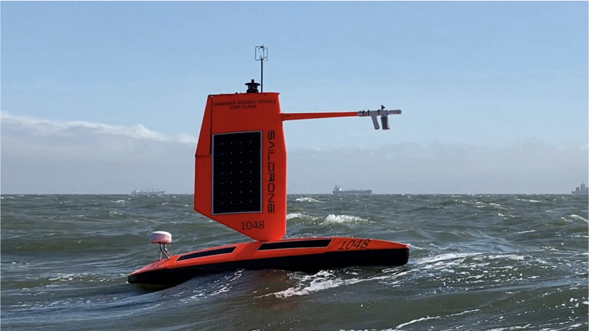
NOAA and Saildrone will launch five specially designed ocean drones to collect weather and ocean data from inside hurricanes in the 2021 season. (Saildrone Inc.)
Here’s the release from NOAA (Monica Allen and Susan Ryan):
NOAA and Saildrone are collecting scientific data from inside Hurricane Sam
Saildrone Inc. and the NOAA have released the first video footage gathered by an uncrewed surface vehicle (USV) from inside a major hurricane barreling across the Atlantic Ocean.
The Saildrone Explorer SD 1045 was directed into the midst of Hurricane Sam, a category 4 hurricane, which is currently on a path that fortunately will miss the U.S. east coast. SD1045 is battling 50 foot waves and winds of over 120 mph to collect critical scientific data and, in the process, is giving us a completely new view of one of earth’s most destructive forces.
Equipped with a specially designed “hurricane wing,” enabling it to operate in extreme wind conditions, SD 1045 is braving Hurricane Sam in the open ocean, collecting real-time observations for numerical hurricane prediction models, which are expected to yield new insights into how large and destructive tropical cyclones grow and intensify.
SD 1045 is one of a fleet of five ‘hurricane’ Saildrones that have been operating in the Atlantic Ocean during hurricane season, gathering data around the clock to help understand the physical processes of hurricanes. This knowledge is critical to improving storm forecasting and is expected to reduce loss of human life by allowing better preparedness in coastal communities.
“Saildrone is going where no research vessel has ever ventured, sailing right into the eye of the hurricane, gathering data that will transform our understanding of these powerful storms,” said Richard Jenkins, Saildrone founder and CEO. “After conquering the Arctic and Southern Ocean, hurricanes were the last frontier for Saildrone survivability. We are proud to have engineered a vehicle capable of operating in the most extreme weather conditions on earth.”
The Saildrones provide data directly to NOAA’s Pacific Marine Environmental Laboratory and Atlantic Oceanographic and Meteorological Laboratory, Saildrone’s partners in this mission.
“Using data collected by saildrones, we expect to improve forecast models that predict rapid intensification of hurricanes,” said Greg Foltz, a NOAA scientist. “Rapid intensification, when hurricane winds strengthen in a matter of hours, is a serious threat to coastal communities. New data from saildrones and other uncrewed systems that NOAA is using will help us better predict the forces that drive hurricanes and be able to warn communities earlier.”
Drought isn’t a new thing in the West, but right now, much of the region is gripped in a historic drought. An unusually dry year coupled with record-breaking heat waves has strained water resources in the West this year. In fact, water levels are so low that the Bureau of Reclamation declared a water shortage on the Colorado River basin for the first time ever in mid-August. There are a lot of ideas for how to relieve the drought and ease its impacts—some more feasible than others. But when you think about water in the West, you have to think about scarcity too.
“You’re really thinking about, well, why is it scarce? Is it too little supply? Or is it too much demand? And in the case of water, it’s both, right?” said Jason Shogren, an economist at the University of Wyoming (UW). “You have a drought, and that is going to restrict the supply of water. And you have an increase in demand because people are moving more and more to the Rocky Mountain region, moving more and more to the west coast.”
And as Shogren pointed out, a lot of people move to the West and expect to keep parts of their lifestyles from where they came from, like lawns of lush green grass. But those require a lot of water. And Shogren said we have to think about all the different demands.
“And since we have a lot of demand for water in Southern California, Phoenix, Las Vegas. We have a lot of demand for water in agriculture production, whether it’s crops, or whether it’s nuts, or whether it’s wine,” he said. “And on the supply side, the question is, ‘Who gets what water? And why?'”
He added property rights over water are different by state and deciding how water rights are allocated and how they can be used gets tricky fast…
And with climate change intensifying extreme weather like droughts and flooding, there’s one potential solution that would help solve both problems. Dr. Tom Minckley said it involves moving water.
Missouri River Reuse Project via The New York Times
“We could say, ‘Oh, well, the western states are in drought. So we could take water from, say, the Mississippi or the Missouri River, and when it floods, we could capture that floodwater, and then basically return it to the head of the watershed,'” he said.
Dr. Minckley is a Professor in the Department of Geology and Geophysics at the University of Wyoming. He studies water in the West and how it’s managed. He said piping water from a flooded place to a place in drought is an idea that’s becoming much more popular. State governments already transfer water between some states in the west…
But because of Wyoming’s high elevation, moving water here from almost anywhere else would mean fighting gravity. It would require a lot of energy because water is actually quite heavy. Not to mention the logistics of where a pipeline would even go and how much it would cost – water is valued by the acre-foot.
“On average, it’s about $2,000 per acre-foot. And some of the Colorado River water in the state of Colorado is running for $85,000 an acre-foot. So, like, there’s these crazy, really big numbers out there,” said Minckley. “And the question is if we start moving water from where it is to where we want it to be, how do we pay for it?”
The idea has been researched and despite its growing popularity, the Bureau of Reclamation found its implementation highly unlikely because of the cost and logistics.
Cloud-seeding graphic via Science Matters
Another idea that’s been floated is cloud seeding…
[Bart] Geerts said farming communities in the High Plains have financially supported seeding operations in thunderstorms for decades, but it can be really hard to prove that kind of seeding actually worked. But, he said it is a lot easier to demonstrate that it worked when they seed winter clouds. Which can be more useful in the High Plains anyway.
Because there’s natural variability between the years, you can’t pinpoint exactly how much more snowfall there was due to seeding and they work with averages. Geerts said a common belief is that cloud seeding keeps moisture from falling in other places where it’s needed.
“It’s really not understood. There is that possibility but in general, these wintertime clouds are not very efficient,” he said. “Essentially water vapor condenses, you extract it, make it into snow, and thereby you reduce the downstream amount of water vapor to some extent. But that amount is so, so small, so insignificant compared to the total water vapor content.”
But Geerts added on the flip side of that, some of the seeding materials may float downwind and increase snowfall on the next mountain range.
“So it can work either way. We don’t really have an answer,” he said.
It seems like a lot of ideas and conversations about this topic end with that – “we don’t really have an answer.” But as droughts intensify, driven by climate change, those conversations continue to happen. And some may lead to more viable solutions.
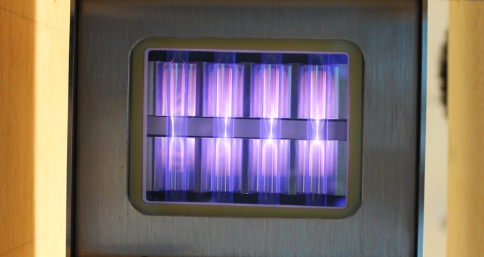
UV light being emitted by a krypton chloride excimer lamp, fueled by molecules moving between different states of energy. (Credit: Linden Research Group)
Here’s the release from CU Boulder Today (Kelsey Simpkins):
A specific wavelength of ultraviolet (UV) light is not only extremely effective at killing the virus which causes COVID-19, but is also safer for use in public spaces, finds new CU Boulder research.
The study, published this month in Applied and Environmental Microbiology, is the first to comprehensively analyze the effects of different wavelengths of UV light on SARS-CoV-2 and other respiratory viruses, including the only wavelength safer for living beings to be exposed to without protection.
The findings, which the authors refer to as a “game changer” for UV light use, could lead to new affordable, safe and highly effective systems for reducing viral spread in crowded public spaces like airports and concert venues.
“Of almost every pathogen we have ever studied, this virus is one of the easiest, by far, to kill with UV light,” said senior author Karl Linden, professor of environmental engineering. “It takes a very low dose. This indicates that UV technology could be a really good solution for protecting public spaces.”
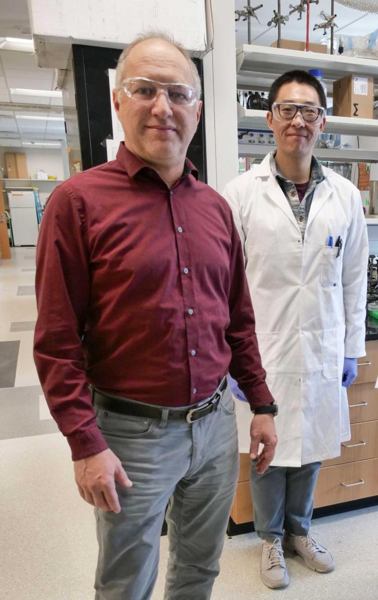
Professor Karl Linden and postdoctoral researcher Ben Ma. (Credit: CU Boulder)
UV light is naturally emitted by the sun, and most forms are harmful to living beings—as well as microorganisms, like viruses. This light can get absorbed by the genome of an organism, tie knots in it and prevent it from reproducing. These harmful wavelengths from the sun, however, are filtered out by the ozone layer before they reach the surface of the earth.
Some common products, like fluorescent tube lamps, use human-engineered UV light, but a white phosphorous coating on the inside protects people from the UV rays.
“When we take that coating off, we can emit those wavelengths, and they can be harmful for our skin and our eyes—but they can also kill pathogens,” said Linden.
Hospitals already use UV light technology to disinfect surfaces in spaces when there are no people in them, utilizing robots which can shine UV light in operating and patient rooms between uses.
And many gadgets on the market today clean everything from cell phones to water bottles with UV light. But safety protocols are still being developed by the FDA and EPA. Linden cautions against using any personal or “germicidal” devices in which a person is exposed to UV light.
The new findings are unique, he said, because they hit the sweet spot between UV light that is relatively safe for humans and harmful for viruses, especially the one that causes COVID-19.
“This can be a game changer for the public use of UV light in indoor spaces,” said Linden.
Death by exposure
For the study, Linden and his team compared different UV wavelengths side-by-side using standardized methods developed across the UV light industry.
“We thought, let’s come together and make a definitive statement on what UV exposure is required to kill off SARS-CoV-2,” said Linden. “We wanted to make sure that if UV light is being used to control disease, you’re delivering the right dose that’s protective of human health and human skin, but also going to be killing off these pathogens.”
The opportunity to do this kind of work is rare, as there are extremely rigorous safety standards required to work with SARS-CoV-2. So Linden and Ben Ma, postdoctoral researcher in Linden’s research group, collaborated with virologist Charles Gerba at the University of Arizona, at a lab cleared to work with the virus and its variants.
The researchers found that while the virus was quite susceptible to UV light in general, a specific wavelength of Far ultraviolet-C, at 222 nanometers, was particularly effective. Created by what’s known as a krypton chloride excimer lamp, fueled by molecules moving between different states of energy, this wavelength is very high energy. Therefore, it’s able to inflict greater viral protein and nucleic acid damage to the virus compared to other UV-C devices, as well as be blocked by the very top layers of human skin and eyes—meaning that it has limited to no detrimental health effects at doses that are capable of killing off viruses.
“Not only is it safe, it’s also the most effective,” said Linden.
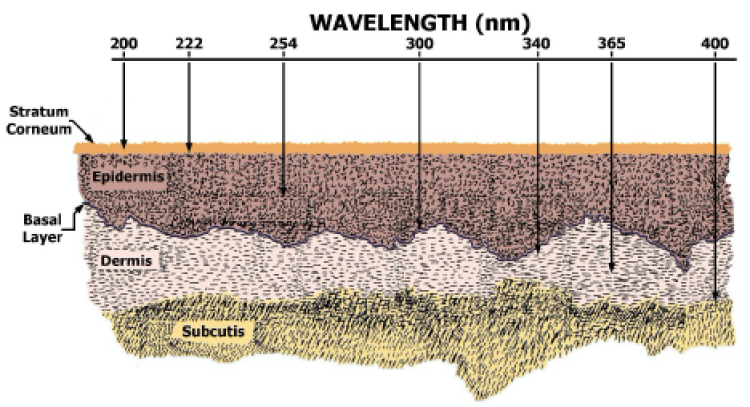
Different wavelength of UV light, measured here in nanometers, can penetrate skin down to different layers. The farther down into the skin these wavelengths go, the more harm they can cause. (Credit: “Far UV-C Radiation: Current State-of Knowledge,” published by the International UV Association in 2021)
The role of UV disinfection today
UV light in various forms has been used widely since the early 20th century to disinfect water, air and surfaces. As early as the 1940s, it was used to reduce the transmission of tuberculosis in hospitals and classrooms, by shining the light at the ceiling to disinfect air as it circulated throughout the room. Today, it’s used not only in hospitals, but in some public bathrooms and airplanes when there are no people in those spaces.
In a recent White Paper published by the International UV Association, “Far UV-C Radiation: Current State-of Knowledge,” which accompanies the new study, Linden and co-authors argue that this safer wavelength of Far UV-C light could serve as a key mitigation measure against the current and future pandemics, in addition to improved ventilation, mask wearing and vaccination.
Linden imagines systems that could either cycle on and off in indoor spaces to routinely clean the air and surfaces, or create an ongoing, invisible barrier between teachers and students, customers and service workers, and people in spaces where social distancing is not possible, to disinfect the air.
UV light disinfection can even rival the positive effects of improved indoor ventilation by providing the equivalent protection of increased air changes per hour within a room. It’s also much cheaper to install UV lights than to upgrade an entire HVAC system.
“There is an opportunity here to save money and energy while protecting public health in the same way. It’s really exciting,” said Linden.
Additional authors on this publication include: Ben Ma of CU Boulder; Patricia Gundy and Charles Gerba of the University of Arizona; and Mark Sobsey of the University of North Carolina, Chapel Hill.
While the glistening golds of fall have just started to drape the landscape of Southwest Colorado, weather updates on the coming months are here – and the Four Corners is slated for a milder winter, with periodic snow systems that come in waves.
Residents of Southwest Colorado might not have to prepare for winter storms until later in December and into January, according to AccuWeather’s 2021-2022 winter forecast, released Wednesday.
At that point, storms from the Northwest might carry precipitation to the Four Corners, delivering snow to ski resorts in Colorado, Utah, New Mexico and Arizona.
Snow will likely fall in spells, rather than consistently, AccuWeather Senior Meteorologist Paul Pastelok said Thursday…
La Niña is weaker this year, contributing to milder winter conditions. The long-term drought in the U.S. Southwest will likely only temporarily be eased by precipitation from winter storms – unless the wet season persists unusually long…
Pastelok said his team believes the ongoing drought will be weaker, although it will still remain a concern. He believes there is a chance the region will get normal snowfall to mitigate it. What ends up happening in the Northeast Pacific – and how that influences the storm track coming into the West Coast – will later help determine whether the winter season skews to more normal levels, he said…
Some October storms would impact higher elevations, particularly in northern Colorado, he said.
Less snowpack is predicted throughout the northern Rockies. After experiencing its snowiest winter in 37 years last year, Denver’s snowfall should return to more normal levels, the report said.
As Great Salt Lake experiences alarmingly low water levels this year—dropping by nearly a foot below its previous historic low, the Utah Division of Water Rights this past week approved applications to deliver water to Farmington Bay of Great Salt Lake via the Jordan River. An innovative partnership is laying the groundwork to voluntarily share water for the lake to meet crucial needs for people, birds, and other wildlife.
The Utah Division of Wildlife Resources, Rio Tinto Kennecott, Central Utah Water Conservancy District, National Audubon Society, The Nature Conservancy, and Utah Reclamation Mitigation and Conservation Commission collaborated to achieve this important step in addressing Great Salt Lake’s declining water levels. Through two donations of water rights, up to approximately 21,000 acre-feet of water annually could be delivered to Farmington Bay over the next ten years, subject to seasonal water availability and priority of water rights.
Ensuring water flows to Great Salt Lake and its wetlands over the long term is the single most important strategy to prevent further drying of the lake. The state’s 2019 Concurrent Resolution to Address Declining Water Levels of the Great Salt Lake (HCR010) clearly “recognized the critical importance of ensuring adequate water flows to Great Salt Lake and its wetlands, to maintain a healthy and sustainable lake system.”
Keeping water flowing to Great Salt Lake’s wetlands and open water habitats is vital to maintaining important natural areas of international and hemispheric importance for birds, while also benefiting people. Recreational opportunities—including birding, hunting, and boating—as well as the minerals and brine shrimp industries that rely on the lake represent nearly $1.32 billion annually in economic activity. In addition to the economic, ecological, and cultural importance of a healthy lake, adequate water levels also protect public health from lakebed dust exposure, and contribute to Utah’s lake effect snow.
“The Utah Division of Wildlife Resources is dedicated to conserving, enhancing and actively managing Utah’s protected wildlife populations, which include shorebirds, waterfowl and other waterbirds,” said Justin Shirley, Director of the Utah Division of Wildlife Resources. “We appreciate this donation that represents a significant milestone for the Division and its ability to manage water needs for wildlife in unimpounded areas of Great Salt Lake and support critical wetland habitat around its shores.”
Rather than leaving the Jordan River at the historical diversion points some 30 to 40 miles upstream, the water will flow down river into Great Salt Lake, where the Jordan River flows into Farmington Bay.
“The Great Salt Lake sits on Rio Tinto Kennecott’s doorstep. It’s always been essential to our operations and our employees who care about the lake,” said Gaby Poirier, managing director of Rio Tinto Kennecott, which is donating up to 18,387 acre-feet of water annually. “This is a significant win for the health of the Great Salt Lake and a first in water rights history that we’re able to contribute to the lake as a beneficial water use. We’re excited to be part of this collaborative partnership that allows us to share water resources that benefit wildlife, habitats, delicate ecosystems and the whole Salt Lake Valley.”
Great Salt Lake water levels vary seasonally and from year to year, but overall have been on a steady long-term decline the last 150 years due to water diversions, drought, and a changing climate. Low water flows have particularly affected Farmington Bay, which includes the second-largest wetlands area on Great Salt Lake, covering approximately 121,500 acres. Currently, much of the lakebed in Farmington Bay is dry and exposed.
The aim is to deliver water for beneficial use into Great Salt Lake through voluntary water transactions while not interfering with other water rights, largely held by duck clubs along the south shores of the lake. Importantly, partners worked to find ways to use existing laws and policies to achieve the transactions.
“We are pleased to join in this partnership and use some of our water rights to benefit Great Salt Lake and Farmington Bay and its wildlife, while building relationships with organizations that understand the complexities of sustaining both environmental and community water needs,” said Gene Shawcroft, General Manager of Central Utah Water Conservancy District (District), which donated 2,927 acre feet of water annually. “The District has made instream flow commitments in many areas of the District, including environmental flows in the Sixth Water, Diamond Fork, and tributaries of the Duchesne River. This collaboration also helps the District realize its efforts to support environmental needs in ways that can have long-lasting effects on policy and provide avenues for future District projects that benefit nature.”
Farmington Bay, one of five Globally Important Birds Areas at Great Salt Lake, is a key resource for migratory birds. The Bay provides habitat for a large number of the world’s bird populations, including American Avocet, Black-necked Stilt, Cinnamon Teal, Ruddy Duck, White-faced Ibis and Wilson’s Phalarope.
“The health of Farmington Bay is essential to the health and productivity of the adjacent wetlands, including Audubon’s Gillmor Sanctuary, and we are grateful for this collaboration and the generous contributions of our partners,” said Marcelle Shoop, director of the National Audubon Society’s Saline Lakes program. “We also believe this project lays the foundation for future water transactions that can benefit wetlands and open water habitats of the lake. Audubon will continue to look for creative ways to ensure flows to Great Salt Lake and its wetlands.”
In 2019, Audubon and The Nature Conservancy approached Wildlife Resources, Kennecott and the District to explore opportunities for using Jordan River water rights to benefit Great Salt Lake’s Farmington Bay and correspondingly, the Lower Jordan River.
“The Nature Conservancy in Utah (TNC) has spent years working to protect the health of the Great Salt Lake ecosystem, which provides invaluable benefits to Nature and the people who live and work along the Wasatch front,” said Dave Livermore, Utah State Director for TNC. “Our Great Salt Lake Shorelands Preserve, located at the edge of Farmington Bay, will also benefit from maintained flows into the Bay, and we greatly appreciate all the contributions of these partners in helping this project come to fruition.”
The Utah Reclamation Mitigation and Conservation Commission (Mitigation Commission), which is responsible for projects to offset the impacts to fish, wildlife and related recreation resources caused by federal water reclamation projects in Utah, also joined the collaboration.
“The Commission has implemented important wetlands mitigation and conservation projects on the Jordan River and Great Salt Lake and we are fortunate to have longstanding relationships with all these partners in our efforts,” said Mitigation Commission Executive Director Mark Holden. “We greatly appreciate water right donations from Kennecott and the District, as well as Wildlife Resources’ pivotal management role using the water to benefit wildlife and the public. Likewise, the leadership of Audubon and TNC in their outreach and deliberative approach to water management lays an important pathway for similar efforts to preserve Great Salt Lake’s future.”
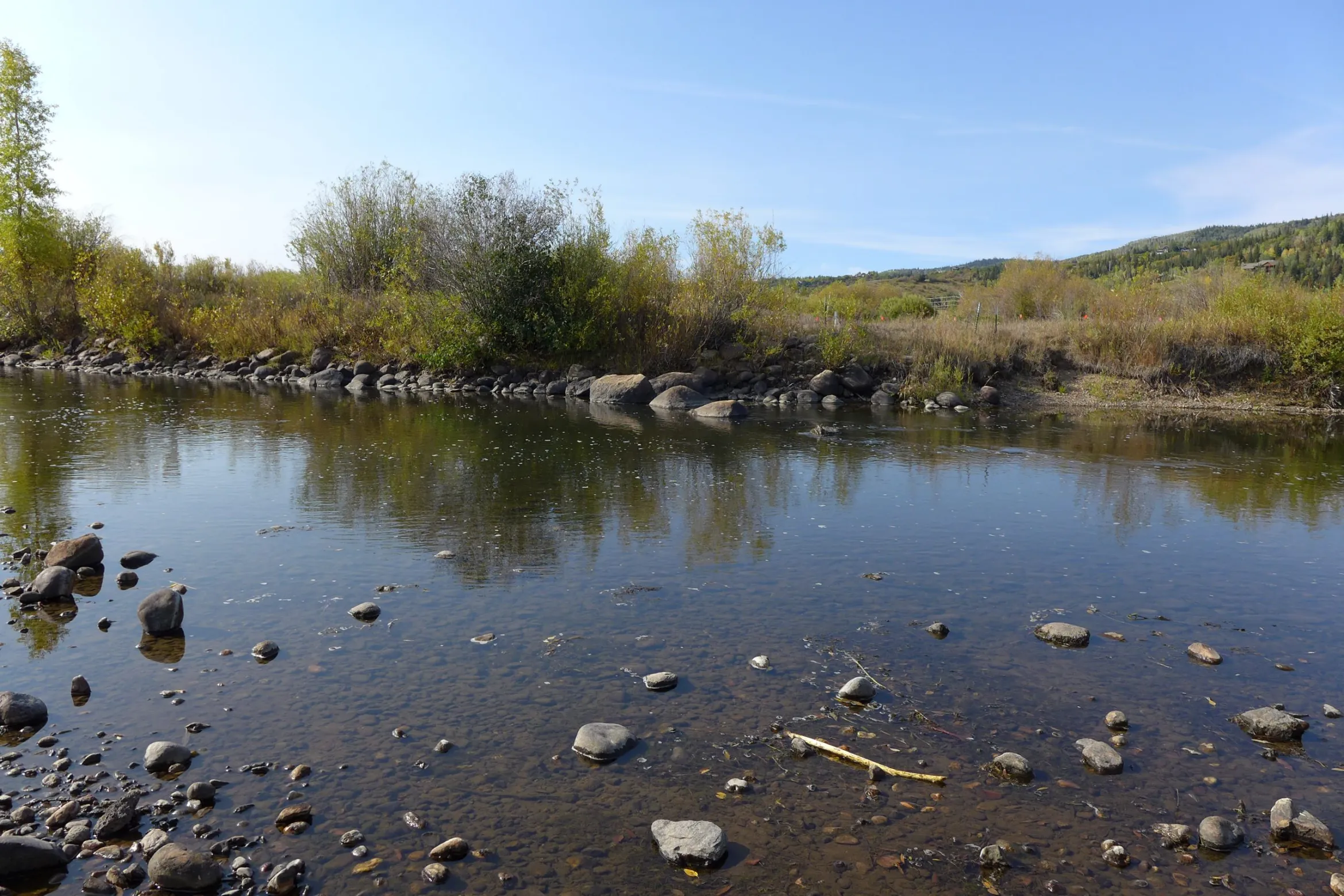
According to the U.S. Geological Survey (USGS), the San Juan River was flowing at a rate of 41.6 cubic feet per second (cfs) in Pagosa Springs as of 10 a.m. Wednesday, Sept. 29.
This is up from last week’s instantaneous reading of 22.3 cfs.
Based on 85 years of water records at this site, the lowest re- corded flow rate for this date is 12 cfs, recorded in 1953.
The highest recorded rate for this date was in 2014 at 1,120 cfs. The average flow rate for this date is 153 cfs.
As of 10 a.m. Wednesday, Sept. 29, the Piedra River near Arboles was flowing at a rate of 43.2 cfs, which is up from last week’s instantaneous reading of 32.9 cfs.
Based on 58 years of water records at this site, the average flow rate for that date is 192 cfs.
The highest recorded rate for this date was 1,490 cfs in 2014. The lowest recorded rate was 13.3 cfs in 2018…
Colorado Drought Monitor map September 28, 2021.
Water report
The district remains in a Stage 1 drought per its drought management plan, according to the press release.
Ramsey notes that the primary driver of this drought stage is the San Juan River flow in conjunction with the U.S. Drought Monitor, which indicates our area is in a severe to moderate drought.
Ramsey notes that PAWSD is continuing to request voluntary odd/even watering days, “requesting that if your address is an odd number only irrigate on odd calendar days and vice-versa for even number addresses.”
There are no other mandatory water use restrictions in place, besides limiting irrigation to after 6 p.m. and before 9 a.m.
Drought report
The National Integrated Drought Information System (NIDIS) was last updated on Sept. 21.
The NIDIS website indicates 100 percent of Archuleta County is abnormally dry. This is up from the previous report of 95.27 percent.
The percentage of the county in a moderate drought remains at 67.47 percent, consistent with the previous report.
The NIDIS website also notes that 42.68 percent of the county is in a severe drought stage, which is consistent with the previous report.
Additionally, the NIDIS website notes that 9.12 percent of the county remains in an extreme drought, mostly in the southwestern portion of the county, consistent with the previous report.
The NIDIS website notes that under an extreme drought stage, large fires may develop and pasture conditions worsen.
The far bank of the Yampa near the Flour Mill will get additional vegetation and trees to help cool river temperatures as part of this restoration project that began last week. The city of Steamboat is exploring a water quality trading program that could lower river temperatures and help the city comply with the permit requirements of its wastewater treatment facility. CREDIT: HEATHER SACKETT/ASPEN JOURNALISM
The city of Steamboat Springs is exploring a way to help it stay in compliance with state regulations and also cool down chronically high temperatures in an impaired stretch of the Yampa River.
A program called water-quality trading could allow the city to meet the requirements of its wastewater-treatment facility’s discharge permit from the Colorado Department of Public Health and Environment by cooling other areas of the river by planting trees.
The Yampa River flows through downtown Steamboat, where several parks and the Core Trail have been built along its banks. The river, a vital and cherished amenity for the Steamboat community, is popular with tubers and anglers. According to a 2017 survey of citizens, 75% of respondents ranked the management and health of the Yampa as essential or very important.
But low flows and high temperatures, made worse in recent years by climate change, have impacted the public’s ability to use one of their favorite amenities. In July, the city closed the river to commercial use because of high temperatures — over 75 degrees. The city also recommended a voluntary closure for noncommercial users of the river.
The entire 57-mile segment of the Yampa from above the confluence with Oak Creek to above the confluence with Elkhead Creek often has temperatures that are too high during the summer months, and in 2016 the segment was designated as impaired for temperature under the Clean Water Act. For July, August, September and November, stream temperatures exceed state standards for a cold-water fishery.
Because the river is classified as impaired, city officials expect that when CDPHE issues a future discharge permit for the city’s wastewater-treatment plant, it will include more-stringent water temperature standards. The wastewater-treatment plant may not be able to meet these standards unless it cools the effluent before releasing it back into the river. The city’s current discharge permit expires at the end of the year.
According to CDPHE Marketing and Communications Specialist Eric Garcia, Steamboat’s next permit will likely not have temperature limits, but will have temperature monitoring requirements. The soonest the city would have temperature limits for the wastewater treatment plan is Jan. 1, 2027.
“These monitoring requirements are included so that we have a full understanding of the temperature issues in the Yampa River and at the plant before we set any temperature limits,” Garcia said in an email.
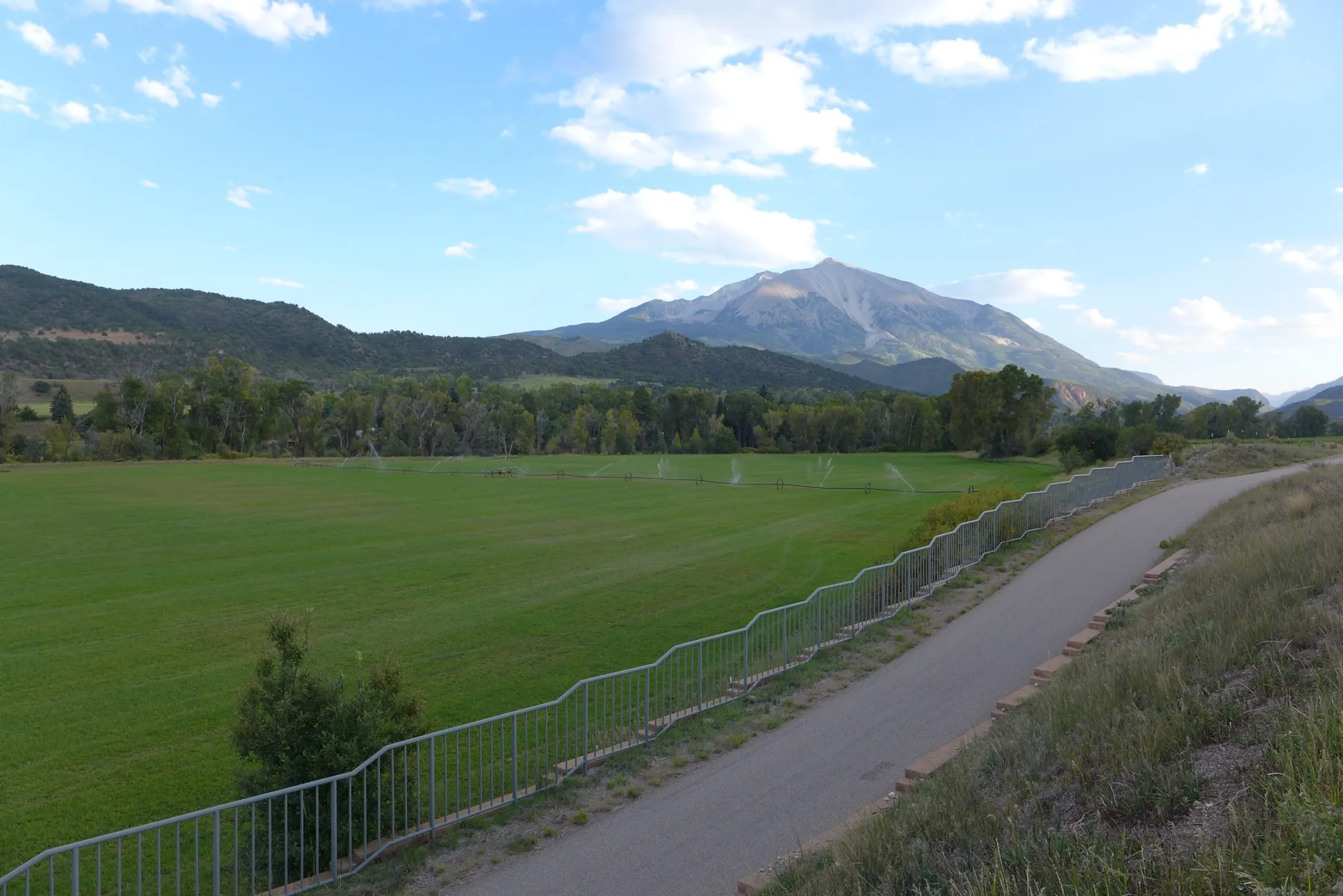
These fields just south of Carbondale are irrigated with water from the Crystal River. The Colorado River Water Conservation District recently released a stakeholder report on a potential state program known as demand management that would pay irrigators to leave water in the river to send downstream to Lake Powell. CREDIT: HEATHER SACKETT/ASPEN JOURNALISM
The Colorado River Water Conservation District staff plans to present its own framework for a water-savings plan — separate from one the state of Colorado is developing — at its October board meeting.
The Glenwood Springs-based River District undertook its own investigation of a plan — known as demand management — that would pay water users to consume less and send the saved water downstream to Lake Powell. The Colorado Water Conservation Board is currently investigating the feasibility of such a program for the state, but the River District convened its own workgroup, made up of Western Slope water users, to look into the issue. Many of the workgroup’s stakeholders represented agricultural interests.
River District staffers will come up with their own market structure and rules for demand management to present to the board, according to general manager Andy Mueller.
“What we are presenting is not something we are necessarily as staff endorsing, but we are going to present more specifics than what the CWCB or our stakeholder group has come up with so far,” Mueller said.
The framework will incorporate some of the findings and recommendations of the River District’s stakeholder group, which were released in an August report. Among these was the unanimous recommendation that the state not rely solely on a demand-management program as a solution to water shortages in the Colorado River basin.
“It was recognized that demand management can’t be the only way in which the state successfully handles the impacts of climate change on the Colorado River,” Mueller said. “It may be a component of that, but the state needs to be really looking at conservation in all water segments.”
At the heart of a demand-management program is paying Western Slope irrigators on a temporary and voluntary basis to use less water in an effort to avoid a Colorado River Compact call. Instead of being spread across hayfields, the water would be sent downstream to a special 500,000-acre-foot pool in Lake Powell, which was established as part of 2019’s Drought Contingency Plan.
A compact call could occur if the upper basin states (Colorado, Wyoming, Utah and New Mexico) can’t deliver the 7.5 million acre-feet of water per year to the lower basin states (Arizona, California and Nevada) as required by a nearly century-old binding agreement. Colorado water managers desperately want to avoid a compact-call scenario, which could result in mandatory water cutbacks.
The participation of Western Slope agriculture is key to creating a workable demand-management program, but the report highlights several reasons this may prove challenging. Stakeholders expressed a strong distrust of decision-making and programs driven by state government and fear that Western Slope agriculture will be sacrificed to meet the Front Range’s and lower basin’s urban interests.
“Many do not view the state as representing the best interest of agriculture on the Western Slope and instead are making decisions that are driven by east slope and municipal interests,” the report reads.
These fields of the Crystal River Ranch outside of Carbondale are irrigated with water from the Crystal River. The Colorado River Water Conservation District released a report that recommends the state of Colorado not rely solely on a demand management program to address water shortages. CREDIT: HEATHER SACKETT/ASPEN JOURNALISM
TMDs in conflict
Other findings of the report are consistent with what River District and agriculture representatives have been saying since the state began its demand-management discussions in 2019: A program must not lead to the permanent dry-up of Western Slope agriculture, and additional diversions to the Front Range are in direct conflict with asking Western Slope water users to save water.
“The committee finds it inconceivable that under a demand-management program, the West Slope could work to conserve 25,000-50,000 acre-feet per year only to see the east slope simultaneously increase water diversions to the Front Range,” the report reads. “This situation would be antithetical to the goals of a demand-management program and efforts to prevent a future compact violation.”
The report says that transmountain diversions — in which Front Range water providers take water from the headwaters of the Colorado River and bring it under the Continental Divide to growing cities — are a driving factor in a potential compact violation. Most water managers agree that water rights that date to before the 1922 compact would be exempt from mandatory cutbacks in the event of a call. Post-1922 water-rights use would fuel a compact violation.
According to numbers from a previous River District study, 57% of Colorado’s post-compact water use is on the Front Range. Therefore, the report says, the Front Range should contribute 57% of the water to a demand-management pool.
Colorado transmountain diversions via the State Engineer’s office