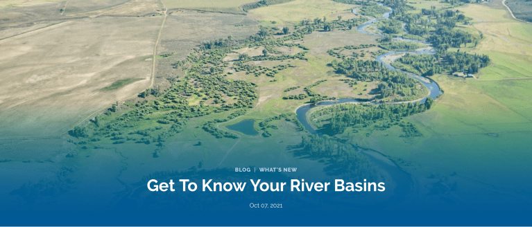
Our rivers are the lifeblood of the American West, and we all know that river and water management are both fundamentally important and infinitely complex, governed through a dizzying network of boards and contracts, local entities and statewide groups, individual expertise, and communal understanding.
Known as the “Mother of Rivers,” Colorado’s water impacts everyone and everything. It’s important that Coloradans from across the state have their voices heard as decisions about our critical waterways are made.
Photo Credit: Russ Schnitzer
It’s especially important to engage right now. The Basin Implementation Plans (BIPs) — locally driven documents identifying goals and actions in each of Colorado’s nine river basins — are undergoing updates and will help inform the update of the state’s Water Plan, due to be final in late 2022. The public comment period for BIPs begins next week and represents a critically important opportunity to learn more, engage in local conversations, and help shape the content of these plans which inform how water is managed at a local level. Before the comment period begins, Water for Colorado has prepared this blog to help you and your community understand the world of river basins and roundtables, and how you can speak up to protect healthy rivers for all who depend on them.
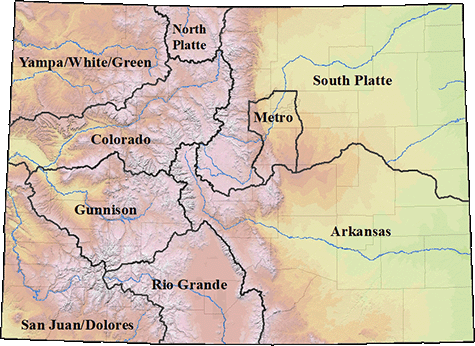
Basins: In order to facilitate conversations around managing our water, Colorado developed nine unique Basins that encompass multiple rivers, natural or artificial boundaries, and watersheds. Each basin has its own governing body called a “basin roundtable” composed of local volunteers who plan and make decisions about how to manage precious water resources.
So why are there nine basins and basin roundtables? The concerns of the Arkansas Basin — from the San Luis Valley to the Eastern Plains, where agriculture reigns supreme — are different from the concerns of the Metro South Platte — where rapid growth and a booming population are key challenges — which are different from the concerns of the Colorado — where the conversations around America’s hardest working river are both intensely local and surprisingly broad. As such, having governing bodies familiar with the unique concerns and opportunities in each basin helps ensure that the management within each basin is driven by locals. This process allows for decisions to be discussed and decided by locals who deeply engage with the rivers that support our environment, economies, and Colorado way of life.
You can check out a map below to determine your river basin; and engage with the graphics at the bottom of this post to learn more about how each basin’s economy is impacted by the recreation in the area.
The eight major river basins, plus the Denver metro area, are shown on this map from the South Platte River Basin Roundtable. Each basin has its own roundtable, made up of volunteers, to address local water issues. Credit: Colorado Water Conservation Board
Basin Roundtable: The basin roundtables were developed by the Colorado Water Conservation Board in 2005 to “facilitate discussions on water management issues and encourage locally driven collaborative solutions” (CWCB Basin Roundtables). These roundtables are composed of local volunteer members who represent a variety of interests including basin agriculture, environment,and recreation. Each basin has its own bank account and funds local projects. Monthly meetings are open to the public, and are where funding and other strategic decisions are made. This means you, and others who care about water conservation can participate and help influence the decision making process. Better yet, you can join these meetings virtually from the comfort of your home.
Basin Implementation Plan: Basin Implementation Plans (BIPs) are developed by basin roundtables to help frame regional issues as part of the overall creation of Colorado’s statewide water plan. While the Colorado Water Plan seeks to address statewide water concerns, BIPs are more focused on local needs, plans, projects, and goals. The BIPs are developed by basin roundtable members with support from the community and ultimately help inform the statewide water plan as well as direct spending priorities for the Roundtables.
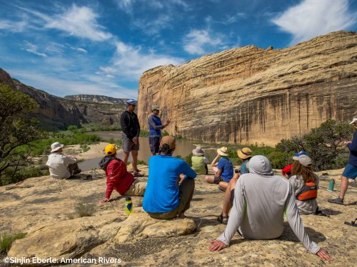
Yampa River. Photo Credit: Sinjin Eberle
Colorado Water Plan: In 2015, then-governor John Hickenlooper ordered the creation of a plan to help coordinate and manage Colorado water. That moment was the impetus for our nine partner organizations to come together to form the Water for Colorado Coalition. The Water Plan was written and developed by the Colorado Water Conservation Board with support from stakeholders, interest groups, and the general public, who submitted 30,000 comments (which Water for Colorado played a major role in gathering) to inform the plan. The core values of the plan are designed to support a productive economy, create efficient water infrastructure, and protect the state’s diverse ecosystems. Colorado’s Water Plan remains a living piece of guidance that undergoes regular updates, the next of which is coming up in June 2022 — and is therefore already underway.
The first step toward responsibly managing water is working to ensure the public helps shape these plans. Members of the public need to speak up ensuring environmental concerns are addressed in the BIP updates. There’s no one better suited to inform local planning than people like you, who live, work, and recreate in the basins and understand the critical role that water and healthy rivers play in our economy, environment, and everyday lives. In the coming weeks, Water for Colorado will share opportunities for you to engage in the update process for the Basin Implementation Plans during the public comment phase that runs from October 13 through November 15. This is a critical opportunity for you to make your voice heard! Until then, we hope that you share this blog with members of your community to help all Coloradans understand the role they can play in supporting Colorado’s rivers and water!
A view of Reflection Canyon in Lake Powell, Glen Canyon National Recreation Area, in 2013. Sedimentary rock forms the landscape surrounding Lake Powell, on the Colorado River at the Utah-Arizona border. (Gary Ladd/National Park Service/Public domain)
WASHINGTON — Experts in government, agriculture, water management and the environment stressed during a U.S. Senate hearing on Wednesday the danger that droughts fueled by climate change pose in the West, including the Colorado River Basin.
During a hearing before an Energy and Natural Resources Committee panel, witnesses said long-term solutions and an investment in water infrastructure are needed to combat the effects of climate change.
“Water has always been a limited resource in the West,” Sen. Mark Kelly, an Arizona Democrat who chaired the hearing of the Water and Power Subcommittee, said. “We have this old saying in Arizona that ‘whiskey is for drinking, water is for fighting.’”
GET THE MORNING HEADLINES DELIVERED TO YOUR INBOX
He said that the issue is a priority for him because Arizona is on the front lines of a major drought, which can increase the risk of wildfires in the West.
Tanya Trujillo, the assistant secretary for water and science at the Department of the Interior, said that “water supply is below average.”
She said the federal government should continue to make investments in water infrastructure, and new technology such as water recycling and desalination systems that remove salt from salt water.
Kelly asked her how the Interior Department will use the $8.4 billion provided for the West in an infrastructure bill passed by the Senate.
Trujillo said that by replacing aging water infrastructure, water will be prevented from escaping, and that the bill also invests in technology that can capture water.
“We will experience unavoidable reductions in farm water supplies and hydropower generation, ecosystem degradation, and urban areas will need to conserve water,” she said, adding that Interior and its state and local partners “have planned for this by being proactive and fully using the tools we have.”
We will experience unavoidable reductions in farm water supplies and hydropower generation, ecosystem degradation, and urban areas will need to conserve water.
– Tanya Tujillo, assistantr secretary for water and science at the Department of the Interior
Tom Buschatzke, the director of the Arizona Department of Water Resources, said that Arizona has been under a state of drought emergency since 1999.
“The past two decades of ongoing drought in the western United States, and in particular the Colorado River Basin, is challenging the seven Colorado River Basin states of Arizona, California, Colorado, Nevada, New Mexico, Utah, and Wyoming, as well as the Republic of Mexico, to meet the needs of the 40 million people and millions of acres of farmland that rely on the river,” he said in his opening statement.
More than 40% of country in drought
Several senators raised their concerns about water availability for farmers, such as Kelly and John Hoeven, a North Dakota Republican.
Kelly asked what can be done immediately to help those farmers and ranchers.
Buschatzke said the state of Arizona has currently made $40 million available for farmers to maintain their infrastructure to help move and use their water supply.
Kelly had requested a Senate hearing on the drought conditions along the Colorado River after water level projections for Lake Mead and Lake Powell were released by the U.S. Bureau of Reclamation.
Lake Mead, a reservoir of the Hoover Dam, hit its lowest levels since 1930.
In a letter to Water and Power Subcommittee Chairman Ron Wyden, an Oregon Democrat, and the top Republican, Cindy Hyde-Smith of Mississippi, Kelly expressed his concern that the “U.S. Bureau of Reclamation issued its first-ever drought shortage declaration for the Colorado River.”
“More than 40 million Americans rely on Colorado River water to support our cities, tribes, and farms,” he wrote. “As of today, total Colorado River system storage is 40% of capacity, down from 49% at this time last year.”
Jennifer Pitt, the Colorado River Program Director at the National Audubon Society, said that 30 tribes also rely on the river.
“Climate change has come barging through the front doors of the Colorado basin,” Pitt said.
An August report by the Intergovernmental Panel on Climate Change found that for every 0.9 degree Fahrenheit the atmosphere warms, some regions will experience an increase in droughts, which can harm agriculture production and the ecosystem.
Droughts, exacerbated by climate change, will likely be more common by 2050, according to Yale Climate Connections, which is an initiative of the Yale Center for Environmental Communication.
As of late September, the National Integrated Drought Information System — part of the National Oceanic and Atmospheric Administration — has determined that more than 40% of the U.S., and nearly 48% of the lower states, are in drought.
NIDIS flagged the Illinois-Wisconsin border as a new area of concern and the area where the border meets Lake Michigan as being in extreme drought.
However, NOAA’s Climate Prediction Center is predicting that “more than half the country, including parts of the West, are favored to have a warmer-than-average October, but for the first time in months, there’s no brown on the map out West, and even a little green. That means the odds of (a) much wetter than average month are as good as or better than the odds of a much drier than average month.”
Colorado Newsline is part of States Newsroom, a network of news bureaus supported by grants and a coalition of donors as a 501c(3) public charity. Colorado Newsline maintains editorial independence. Contact Editor Quentin Young for questions: info@coloradonewsline.com. Follow Colorado Newsline on Facebook and Twitter.
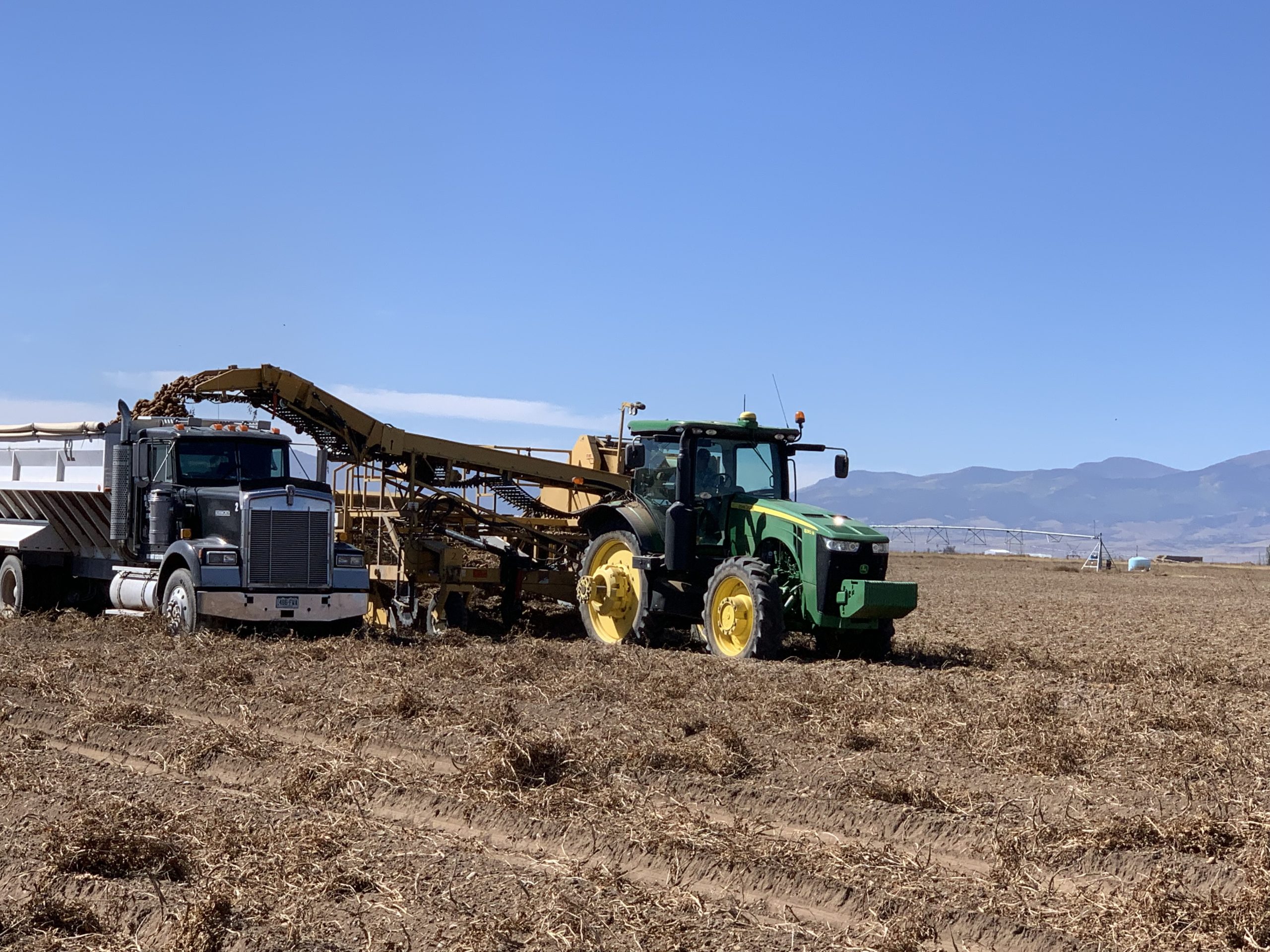
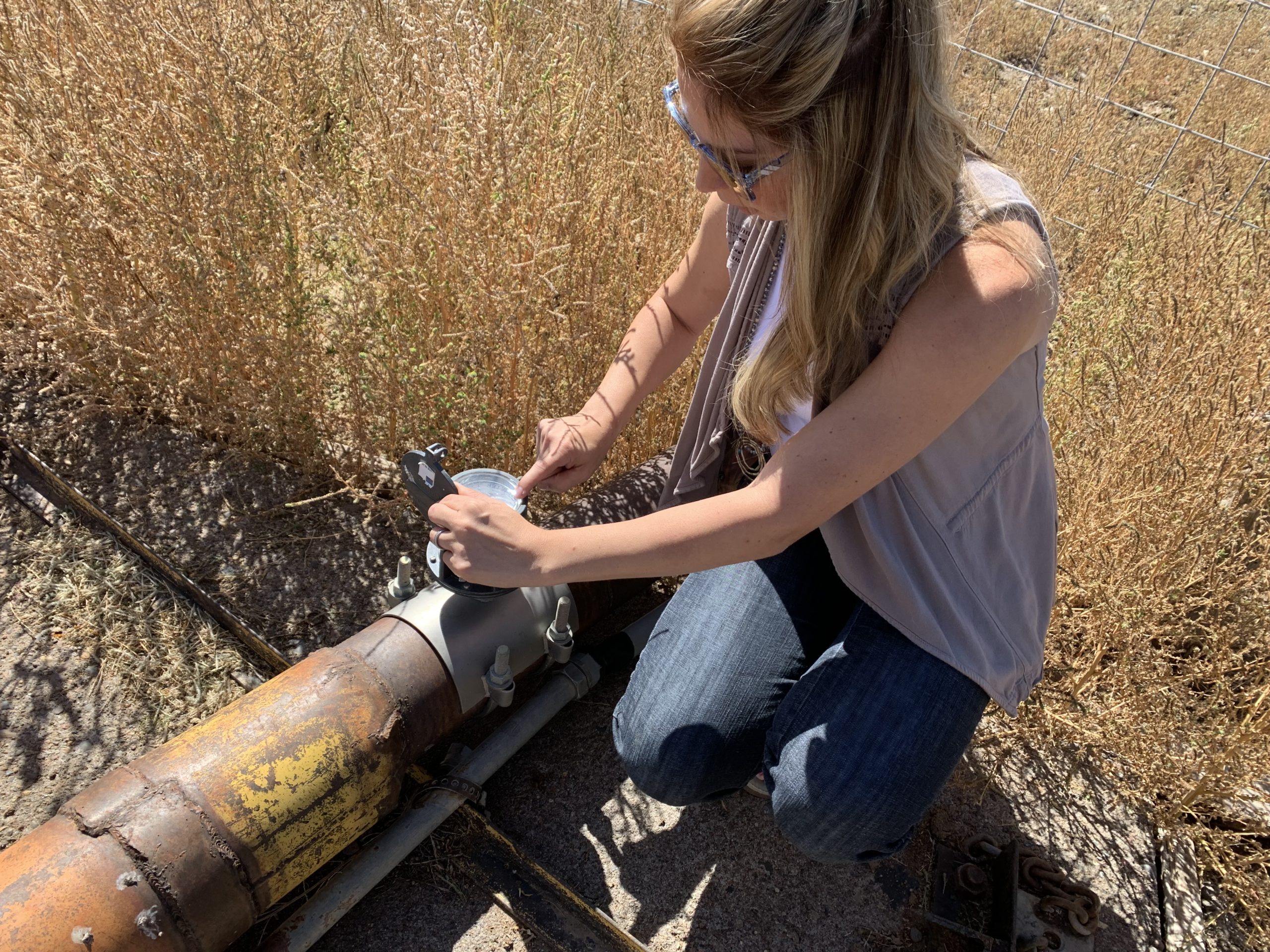
OCTOBER 1 is a date virtually every farmer in the San Luis Valley’s ag-rich Subdistrict 1 has circled on their calendar. It’s when farm managers across Special Improvement District No. 1 of the Rio Grande Water Conservation District will go to their center pivot sprinkler and read their flow meter, and then record that number with the subdistrict’s program manager, Marisa Fricke.
The reading will tell the farm operator how many acre-feet of water they’ve used this irrigation season, and the total of all the meter readings that Fricke records will determine the next steps in the urgent efforts to replenish the shallowest aquifer in the Valley, the unconfined aquifer of Subdistrict 1.
“It’s the ‘hold your breath’ couple of months,” said Fricke, as she navigates her SUV through the subdistrict on a recent fall morning and gives lessons on the state of the Rio Grande. “Everything is riding on it.”
The number she’s looking for is 240,000-acre-feet of water or less. Remember that figure.
The last days of the potato harvest. Photo credit: The Alamaosa Citizen
The Valley’s Most Lucrative Corridor
Subdistrict 1 came into being in 2006 to “take action to help restore a balance between available water supplies and current levels of water use.” Remember, the unconfined aquifer had lost an estimated 1 million acre-feet of water to the changing climate from 2002 to 2004, and now efforts to replenish it have become vital to the Valley’s way of life, its $340 million annual ag economy, its growing tourist economy, and the quality of life, particularly in Alamosa, Saguache and Rio Grande counties where the boundaries of Subdistrict 1 largely lie.
Rio Grande River Basin via the Colorado Geologic Survey
It’s the biggest land subdivision in the San Luis Valley, with 3,000 water wells. When you think about Subdistrict 1, think of Coors and barley. Think about the Valley as the fifth-largest producer of potatoes in America. Think about lucrative ag contracts with Walmart and Safeway. Collectively the cash crops in the subdistrict are valued at approximately $400 million, said Fricke. Think about the farming communities of Center and Sargent and Mosca. Think about the Gator Farm, and the hot springs at the Sand Dunes Swimming Pool in Hooper. All of these attributes of the Valley reside in the Rio Grande Water Conservation District’s Subdistrict 1, and collectively they show what a devastating blow it would be to the Valley if the state of Colorado were to ever shut down wells in the subdistrict.
The state hinted at such a drastic step as recently as 2018 and 2019, when State Engineer Kevin Rein sounded the alarms about the importance of reducing groundwater withdrawals during a drought season and concerns about bringing the aquifer to sustainable levels by 2031. That’s what’s been agreed upon and what a state court-approved water plan calls for.
Subdistrict 1 program manager Marisa Fricke looks at a water meter. Photo credit: The Alamosa Citizen
ENTER Marisa Fricke. After she receives the October flow meter readings from approximately 310 farms in Subdistrict 1, she will analyze the figures and draft a report to the State Engineer and Colorado Water Resources Division on the status of the unconfined aquifer. Her report will tell the state the total amount of groundwater pumped out and the amount of surface water diverted and re-charged through ponds and irrigation ditches.
She’ll get around 1,800 meter readings in October, and she’ll then calculate how much groundwater was pumped, minus the amount of surface water that was diverted in. The net balance will reveal the amount of water that was truly over pumped from the aquifer.
She will also convey that it’s been yet another dry year in 2021 for the San Luis Valley, compounding an even drier 2020. Without consistent snowpack and summer monsoon seasons, the surest way the unconfined aquifer gets restored is through voluntary conservation efforts put in place by the Rio Grande Water Conservation District. Those efforts include:
A Conservation Reserve Enhancement Program (CREP) that pays producers to not use their well for 15 years.
Paying farmers not to plant a field.
Purchasing acres of farmland and retiring the water wells on that land.
Creating water credits so farmers who return more water to the aquifer than they took out can sell credits to other farmers who need more water for their fields.
All of these items will show up in Fricke’s report. “We are trying everything,” she said.
The odd thing is the unconfined aquifer, because of its unique hydrology and recharge decree, adds little injury to the Rio Grande Basin itself. The change in climate, though, means the aquifer struggles to restore itself naturally and farmers then must shoulder more of the burden.
“In my lifetime, I’ve seen the climate changes,” said Fricke, an Alamosa High and Adams State graduate. She was raised in Alamosa county, knows farming, understands the agricultural life of the San Luis Valley, and worries about what’s to come.
“Everyone is very concerned,” she said.
Nine years left to 2031
The subdistrict basically has nine years left to recover 864,000 acre-feet of water, maybe. If Rein determines that it has become evident that the goal to return the unconfined aquifer to a sustainable level by 2031 can’t be met, then the state could take action sooner.
Now you understand the importance of October 1. In 2020, 247,000 acre-feet of water was pulled out of the aquifer. While this year hasn’t been as dry, 2021 certainly has not been a good year for precipitation in the San Luis Valley, and the forecast for October, November and December shows a probability of more of the same – dry and little moisture, which likely translates into an earlier spring runoff in 2022 if snow arrives late in the winter.
This is how the changing climate affects the situation, and why the conservation efforts in Subdistrict 1 are critical to the Valley’s ag and farming industry. The Rio Grande Water Conservation District has purchased another 11 wells this year in an effort to retire groundwater and will offer the same program again in 2022.
Fricke will litter her report to the state with these types of facts to show all the work being done to preserve the aquifer. She describes the next few months as “the worst stress ever.” But then she smiles and flexes her determination to prove to the state that the water plan is working.
Asked what would be a good figure for 2021, she paused, gave it some thought, and said 240,000 acre-feet or less would signal some relief.
Asked when she’ll know, she turned and said, “December we’ll know the numbers.”
Colorado’s second largest electrical utility has committed to 80% reduction in carbon emissions by 2030 as compared to 2005. But can it cut even deeper, faster?
Filings with the Colorado Public Utilities Commission in late September offer a peek into the thinking of both that utility, Tri-State Generation & Transmission, and various other groups at the table.
“It is not reasonable to construct and integrate the sheer quantity of modeled new resources under this scenario,” says Tri-State in a filing submitted on Sept. 28. “The extent of the resources called for in eastern Colorado and Wyoming before 2028 are not physically possible on Tri-State’s transmission system.”
Tri-State was responding to a scenario called Roadmap, which calls for early retirement of 800 megawatts of coal generation—including the final unit at the Craig Generation Station in Colorado by 2028, ahead of Tri-State’s current plans of New Year’s Eve 2029.
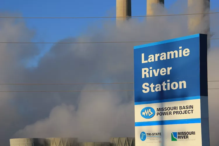
That same Roadmap scenario would also have Tri-State curtail its use of a coal-fired power plant in Arizona called Springerville, cutting off production from the plant altogether in 2028 and also idling its share of Wyoming’s Laramie River Station coal plant for three to five months at a time.
Tri-State supplies electricity to 18 of Colorado’s 22 electrical cooperatives as well as 24 others in New Mexico, Wyoming, and Nebraska. Unlike Colorado’s two investor-owned electrical utilities, Xcel Energy and Black Hills, it had not been required to submit electric resource plans to the state regulatory body until a 2019 state law said it must.
In practice, Tri-State operated much like the private companies even if it is a non-profit cooperative, a creation of its member cooperatives. Individual cooperatives as well as municipal utilities still are not required to submit such plans.
In general, Tri-State wants to go slower in shifting off its coal plants. To go quicker means adding more natural-gas fired generation more rapidly, and the time for permitting such plants remains an unknown.
Several times, Tri-State says it wants to give time for other technologies to become more competitive. In other words, don’t rush the solutions. At least in its rebuttal document filed on Sept. 28, it does not describe those other technologies. It is known to be interested in both hydrogen storage and advanced nuclear technology—as, for that matter, most other utilities also are.
The filing also contains information about how it intends to assist the Craig community as it exits coal. The filings also emphasize the importance of a regional transportation organization, or RTO, in decarbonizing electricity while ensuring reliability and lower costs.
In this inaugural voyage under the 2019 law, Tri-State submitted its electric resource plan in December 2020. Tri-State promises 80% reduction in carbon dioxide emissions by 2030 as compared to 2005 (and 70% renewables). Xcel, the state’s largest utility, says it can achieve an 85% reduction (and 80% renewables).
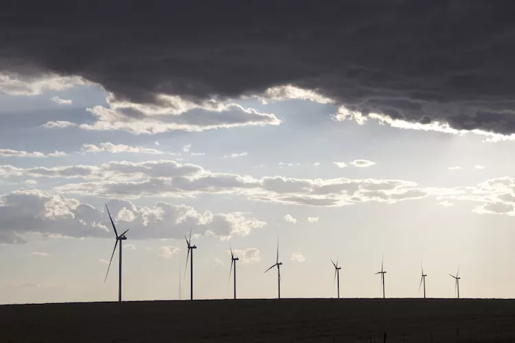
Tri-State sees its path forward including more than 2,000 megawatts of new renewables, both wind and solar, as well as energy storage, by 2030.
Tri-State Generation and Transmission has a power-purchase agreement for 104 megawatts of generating capacity from the Crossing Trails Wind Farm, a wind farm between Seibert and Kit Carson, in eastern Colorado, on Oct. 3. Photo/Allen Best
Stakeholders have alternative ideas about how Tri-State should move forward, most calling for a more rapid retreat from coal. Their proposed scenarios have been modeled by Tri-State with aid of its new modeling software developed for utility planning.
Those stakeholders—who didn’t necessarily agree with each other in all cases—consist of the Colorado Energy Office, Colorado Independent Energy Association; the staff of the PUC; the Conservation Coalition (including Sierra Club and Natural Resource Defense Council); the International Brotherhood of Electrical Workers Local 111; Interwest Energy Alliance; Southwest Energy Efficiency Project; Western Resource Advocates; and Wyoming Rural Electric Cooperatives.
One of the disagreements involves the schedule for closing the units at Craig. Tri-State plans to close the first unit by the end of 2025, the second unit in September 2028, and then the third unit on New Year’s Eve 2029. It proposes to operate the coal units at lower levels during the latter part of the decade as it brings on renewables.
Three of the six alternative scenarios would have the final unit at Craig closed by the end of 2025.
Disagreements are also found in the sequence for closing the Arizona coal plant, Springerville. Tri-State has a contract through 2036 to lease 100% of the power generated by a 420-megawatt unit at the coal plant. Tri-State says it would be costly to escape that commitment quickly, although the details are blacked out in the public version of the filing.
Another point of contention is Laramie River Station in Wyoming. Tri-State is a partial owner as a result of its ownership in the Missouri River Power Project but has not had discussions with its partners. “Therefore, the costs are assumed to be immitigable in the modeling,” Tri-State says, using a word that means unable to be made less severe or serious.
A separate statement posted by Tri-State on its website notes that Tri-State is actually lowering rates, with a 2% reduction in March to be followed by another 2% in 2022.
Eric Frankowski, executive director of the Western Clean Energy Campaign, a group premised in a more rapid retreat from fossil fuels by utilities, found the latest filing by Tri-State to be lacking critical information. “Where is the explanation for why they want to operate Craig (unit 3) until 2029 while the modeling shows it would be better for customers to operate until only 2025. I don’t see that explanation in there.”
Also absent is any exploration of what it would take to close the coal plants in Arizona and Wyoming.
“With the exception of some new gas being delayed, (Tri-State’s revised preferred alternative) doesn’t do a whole lot to move the needle on retiring coal early and getting customers away from one of its most expensive generating sources.”
The other stakeholders have until November to respond to Tri-State’s latest filing. This is the way of the long, drawn-out process for creating the electrical grid of the future.
From The Upper San Juan Enhancement Partnership (Mandy Eskelson) via The Pagosa Springs Sun:
This summer, the Upper San Juan Watershed Enhancement Partnership (WEP) started Phase 3, the last phase of a planning process to develop a local water plan, with potential project opportunities that support river health and our community’s ability to rely on rivers for multiple uses, now and in the future.
The WEP originally planned to host a public workshop in September to share updates and next steps of this planning process, but our group needed to delay this event due to scheduling challenges, as well as developments on new multipurpose pilot projects along the San Juan River that WEP and our partners have been exploring.
The WEP hopes exploring project ideas now could address immediate needs revealed through our Phase 2 watershed assessments and stakeholder interests for ecological and recreational improvements on the San Juan River. We hope these will just be the start of many project ideas community members can consider when we all get together again to develop a list of on-the-ground opportunities to support the agricultural, environmental, municipal and recreational water use needs in the San Juan, Blanco and Navajo watersheds.
We plan to share more about these concept-level projects at our upcoming workshop in October for the community to consider and weigh in on. Projects within the Yamaguchi South area have been publicly shared and reviewed through several town council meetings and http://MyPagosa.org. We hope to share other developing project components very soon, but first, the WEP is connecting with individual landowners adjacent to the project areas to gather their feedback and approval before we open it up to the broader community for input.
The WEP will announce a new workshop date in the next few weeks and details on how anyone from the public can attend this event. The goal of the workshop will be to share areas that our Phase 2 assessment results identified as highly valuable or areas of concerns for river health and/or our community’s ability to use the rivers we rely on.
The WEP is also working on drafting an initial list of goals and objectives to help in identifying specific actions or projects to address these broader watershed goals. We need your feedback to refine and add to this initial list, so we hope you all will attend the WEP’s future workshop to share locations, actions and projects you would like prioritized for this water plan.
If community members cannot attend the workshop, the WEP will offer other options for you to share your feedback and participate. We are currently finalizing a survey that can be done via your computer, phone app or printed options to submit your answers. We also intend to host other public events for stakeholders to help with this planning process.
The WEP will announce the workshop date and share details on how you can get involved and share your ideas in the next few weeks.
If you would like to learn more about the WEP and the planning process, visit http://www.mountainstudies.org/sanjuan/smp and contact Mandy Eskelson (mandy@mountainstudies.org) or Al Pfister (westernwildscapes@gmail.com).
At its regular meeting held on Thursday, Sept. 23, the Pagosa Springs Town Council unani- mously approved two resolutions which approved $150,000 in matching funds needed for grants for river improvement projects in the San Juan River along Yamaguchi South Park and a portion of the river northeast of town.
Planning Director James Dickhoff presented the resolutions to the council, beginning with Resolution 2021-13, supporting submitting grant applications to the Colorado Water Conservation Board for recreational and ecological enhancement of the San Juan River adjacent to Yamaguchi South Park.
With this resolution, the council approved $96,000 of matching funds needed for the grant.
Town Manager Andrea Phillips explained in an email to The SUN that the council approved those funds to be taken out of the reserves for the 2021 budget.
“However, due to the timing of the grant application and notification, it may need to be included in next year’s budget instead. This would require additional council action in the future,” Philips wrote.
Dickhoff noted during the meeting that the total budget for the project along Yamaguchi South Park is $664,720 and the grant application is for $498,540.
Dickhoff explained that the Upper San Juan Watershed Enhancement Partnership ( WEP) has been working on identifying projects that are eligible for grant funding from the Colorado Water Conservation Board.
He noted that the town will administer the grant, if awarded, with help from the WEP…
The initial proposal presented by Dickhoff was structured in a fashion that contemplates the project over three years.
However, the council determined that it would have a stronger application for the funds if the entire amount of matching funds from the town is committed up-front…
Dickhoff explained that a total of $166,180 in matching funds is need- ed for the grant to be awarded.
Along with the $96,000 committed from the council, the WEP will also be requesting funds from other local entities.
He explained that WEP is planning on requesting $22,500 from the tourism board, $30,000 from Archuleta County, $10,000 from the Southwest Water Conservation District, $3,000 from Trout Unlimited, $750 from Friends of the Upper San Juan, $750 from Weminuche Audubon, $1,500 from the Nature Conservancy and $2,500 from Great Outdoors Fund…
The second resolution presented by Dickhoff during the meeting was Resolution 2021-14, supporting grant applications to the Colorado Water Conservation Board for recreational and ecological enhance- ments of the San Juan River upstream of town.
Dickhoff explained that the WEP is also assisting the town with this grant application as well, and that Trout Unlimited would be the entity to administer the grant “on behalf of the community.”
With the resolution, the council unanimously approved $56,000 in matching funds to be taken from the town’s 2022 budget and is contingent upon Trout Unlimited being approved for the grant.
Dickhoff explained that this grant is for river cleanup projects along the section of the San Juan River stretching from Bob’s LP to the Running Iron Ranch…
Dickhoff indicated that the WEP will also be presenting this opportunity to the other entities for requests for matching funds.
He explained that the WEP is planning on requesting $86,859 from the RESTORE Colorado Grant; $300,000 from the Bureau of Reclamation Watersmart Program; $22,500 from the tourism board; $30,000 from Archuleta County; $10,000 from the Southwest Water Conservation District; $3,000 from Trout Unlimited; $750 from Friends of the Upper San Juan; $750 from the Weminuche Audubon; $1,500 from the Nature Conservancy at $1,500 and $2,500 from the Great Outdoors Fund.
Agenda documentation on the topic also indicates funding being requested from the San Juan Water Conservancy District.
The perpetual pump problems that have perplexed the Pagosa Springs Sanitation General Improvement District (PSSGID) continue to persist, with two additional pump failures occurring, leaving the district with no operational backup pump on site.
Should the pumps go down, there is potential for a sewage spill, with the district looking to reduce the possibility of any sewage going into the river.
The district’s sanitation system includes “three lift stations, and the pumping stations that transport
the town’s wastewater to Pagosa Area Water and Sanitation District (PAWSD) for treatment. There are approximately 835 customers using … the collection system,” according to an agenda brief from Tuesday’s PSSGID meeting.
“In 2016, the GID and the Pagosa Area Water and Sanitation District (PAWSD) entered into an Intergovernmental Agreement (IGA) to pump the town’s sewage to the PAWSD Vista Treatment Plant,” explains the brief.
The board discussed the challenge of securing a backup pump in the event of another pump failure at Tuesday’s meeting.
“There continue to be unsustainable failures with the pumps,” a June board agenda brief reads.
The root of the issue is the ability for the district to pump poop uphill from town to the PAWSD ponds west of town.
“Since the last update to the board, we have experienced two more pump failures,” said Public Works Director Martin Schmidt as part of his update on the pump replacement process and the state of the district’s pump stations. “Staff was able to make the adjustments, and move the pumps around to keep the sewage pumping. We are currently out of spare shufflable pumps.”
“The pumps failed due to a seal failure and due to an electrical failure,” reads an agenda brief for the meeting. “Both were stemming from issues that we are addressing with the replacement pumps.”
Schmidt noted that an American Technical team from Farmington came up Tuesday to look at rebuilding a pump…
Schmidt explained they could get the pump to work with bearings and seal replacements. He also noted that it was an older type of pump that has tended to last longer and had the potential to become a spare for the future redesign.
The downside, according to Schmidt, is that rebuilt pump would not be at 100 percent of capacity. It would take about a month to rebuild the pump at a cost between $10,000 and $13,000. The district has spent approximately $2,000 on investi- gating the potential of the pump rebuild…
The rebuild project
The district is in the process of a re-engineering of the pump system. “A $400,000 grant from the Colorado Department of Public Health Environment has been awarded for replacement of the eight pumps at Pump Stations 1 and 2,” reads an
agenda brief.
“The cost of the pump replacement project is $800,000 with a $400,000 grant helping to pay for that project,” Martin explained of the rebuild project.
“Staff is continuing to work with Pentair-Fairbanks on getting the pump engineering complete and all of the orders submitted. Pentair has assured staff that every element of the construction of the pumps is being expedited and and that the last of the submittals for construction are imminent. Once the submittals are complete, a meeting with all involved parties will be conducted to coordi- nate the planning and replacement of the pumps. This meeting will be critical for the smooth transition to the new pumping system because of the complexity of making the change while we are still receiving sewage at the pump station,” reads the agenda brief. “Staff is cautiously optimistic about getting the pumps changed out before the I&I season in the spring, but at this time there is no set schedule.”
In response to a question from board president DonVolger, Schmidt clarified that the district will be getting eight pumps from Pentair-Fairbanks.
“We’re hoping that when we take care of the re-engineering and installation of eight new pumps that our system will be pretty much intact, maybe like it should have been engineered in the first place,” said Volger, with Schmidt confirming.
Schmidt reminded the board that former employee Gene Tautges wrote a grant and the district built a 250,000-gallon overflow tank.
“Right now, in a 24-hour period, we are anywhere between about 215,000 and 260,000 gallons,” Schmidt said regarding current sewage flows. “That usually holds