Basin Implementation Plans Now Available for Public Comment — The #Water Information Program

Here’s the release from the Water Information Program:

The updated Basin Implementation Plan (BIP) documents are out now for public comment through November 15, 2021. There’s no one better suited to inform local planning than people like you, who live, work, and recreate in the basins and understand the critical role that water and healthy rivers play in our economy, environment, and everyday lives.

This represents a critically important opportunity to learn more, engage in local conversations, and help shape the content of these plans which inform how water is managed at a local level. The Public are invited to review the BIP’s and provide comments! Feedback will be delivered to each basin for consideration. Check out the BIPs at: https://engagecwcb.org/bip-public-comment-period

It’s especially important to engage right now. The Basin Implementation Plans (BIPs) — locally driven documents identifying goals and actions in each of Colorado’s nine river basins — are undergoing updates and will help inform the update of the state’s Water Plan, due to be final in late 2022.

Basin Implementation Plan: Basin Implementation Plans (BIPs) are developed in a collaborative process by basin roundtables to help frame regional issues as part of the overall creation of Colorado’s statewide water plan. While the Colorado Water Plan seeks to address statewide water concerns, BIPs are more focused on local needs, plans, projects, and goals that provide a pathway to success. The BIPs are developed by basin roundtable members with support from the community and ultimately help inform the statewide water plan as well as direct spending priorities for the Roundtables. The new BIPs advance the basin roundtables’ 2015 efforts.

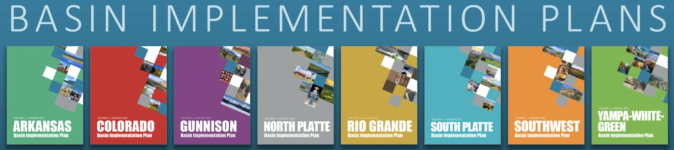
For the first time, a shorter and standardized Volume 1 BIP strategy document makes comparing BIPs easier.

Basin Roundtable: The basin roundtables were developed by the Colorado Water Conservation Board in 2005 to “facilitate discussions on water management issues and encourage locally driven collaborative solutions” (CWCB Basin Roundtables). These roundtables are composed of local volunteer members who represent a variety of interests including basin agriculture, environment, and recreation. Each basin has its own bank account and funds local projects. Monthly meetings are open to the public, and are where funding and other strategic decisions are made. This means you, and others who care about water conservation can participate and help influence the decision making process. Better yet, you can join these meetings virtually from the comfort of your home.

The first step toward responsibly managing water is working to ensure the public helps shape these plans.

The Public Comment Period for the BIPs runs from October 13, 2021 – November 15, 2021.

For more information: contact@swbasinroundtable.com

The latest El Niño/Southern Oscillation (#ENSO) diagnostic discussion is hot off the presses from the #Climate Prediction Center

Click here to read the discussion:

ENSO Alert System Status: La Niña Advisory
Synopsis: La Niña conditions have developed and are expected to continue with an 87% chance of
La Niña in December 2021- February 2022.

In the past month, La Niña conditions emerged, as indicated by below-average sea surface temperatures(SSTs)across the central and east-central equatorial Pacific. In the last week, the Niño-3.4 and Niño-4 index values were -0.6oC and -0.7oC, respectively. The Niño-3 and Niño- 1 + 2 indices were not as cool, with values at -0.3oC and 0.1oC. Below-average subsurface temperatures (averaged from 180-100oW) strengthened significantly in the past month, as negative anomalies were observed at depth across most of the central and eastern Pacific Ocean. Low-level easterly wind anomalies and upper-level westerly wind anomalies were observed over most of the equatorial Pacific.Tropical convection was suppressed near and west of the Date Line and enhanced over Indonesia, while the Southern Oscillation Index and Equatorial Southern Oscillation Index were both positive. Overall, the coupled ocean-atmosphere system was consistent with La Niña conditions.

The IRI/CPC plume average of forecasts for the Niño-3.4 SST index favors La Niña to continue through the fall and winter 2021-22. The forecaster consensus also anticipates LaNiña to continue through the winter, with ENSO-neutral predicted to return during March-May2022. Because of the recent oceanic cooling and coupling to the atmosphere, forecasters now anticipate a 57% chance of one season (November-January) reaching-1.00C or less in the Niño-3.4 index. Thus,at its peak, a moderate-strength La Niña is favored. In summary,La Niña conditions have developed and are expected to continue with an 87% chance of La Niña in December 2021- February 2022 (click CPC/IRI consensus forecast for the chances in each 3-month period).

La Niña is anticipated to affect temperature and precipitation across the United States during the upcoming months (the 3-month seasonal temperature and precipitation outlooks will be updated on Thurs. October 21st).

Opinion: #Colorado has a strong vision for #ElectricVehicles. It needs stronger policies to achieve that vision — The Colorado Sun #ActOnClimate

Leaf charging at the Lionshead parking facility in Vail September 30, 2021.

From The Colorado Sun (Jessica Goad and Silvio Marcacci):

Dangerous air quality is Denver’s new summertime normal, setting an ominous new record of 65 Ozone Alert Days between June and August. While worsening wildfires mostly beyond Colorado’s control — along with oil and gas drilling — often are blamed for our toxic air, a major culprit for this issue is the hazardous air pollution pouring from cars and trucks.

Research shows fossil fuels burned by cars and trucks is making Colorado’s air worse. So, we must cut tailpipe pollution for Denver — and all of Colorado — to breathe cleaner air. Fortunately, solutions to curb this pollution are available if Gov. Jared Polis, our state government, and the General Assembly act now.

In 2019, Colorado set nationally-leading targets of 50% greenhouse-gas emissions reductions by 2030, and 90% by 2050, becoming the first oil- and gas-producing state beyond California to put such reductions into state law. In 2021, the Polis administration released a Greenhouse Gas Pollution Reduction Roadmap to achieve the goals.

But cutting transportation emissions is where the rubber meets the road. As Colorado Energy Office Director Will Toor told the state Air Quality Control Commission on September 17, reducing transportation emissions is the “most complicated” piece of Colorado’s climate puzzle.

The Colorado Electric Vehicle Plan has set a target of 940,000 electric vehicles statewide by 2030, but with just under 41,000 on our roads today, the task seems daunting. And while the Colorado Department of Transportation is proposing new rules to cut transportation emissions, the current draft falls short of Gov. Polis’ own Climate Roadmap goals. And the rules also should address environmental justice considerations by directing clean investments into disproportionately impacted communities to reduce pollution.

The Climate Roadmap recommends accelerating the shift to electric vehicles while cutting “vehicle miles traveled” by changing transportation and land-use planning, but it doesn’t carry the power of law. So how do we reach this clean transportation future?

Transportation emissions keep rising as more gasoline- and diesel-powered vehicles get on our roads, so Colorado should prioritize policies that accelerate vehicle electrification while investing in public transit and other non-driving options.

Independent modeling by Energy Innovation and Boulder-based RMI shows existing state policies such as electric-vehicle tax credits and partnerships to build charging stations simply aren’t sufficient to meet our state’s emission-reduction goals.

An important first step for Colorado is increasing the stringency of its zero-emission vehicle policies. In 2019 state policymakers joined 14 other states and Washington, D.C., in adopting zero-emission vehicle requirements for light-duty vehicles. Since then, California set a goal of 100% zero-emission vehicles by 2035 en route to a clean, electrified transportation future. Colorado should forge ahead by passing our own strong sales targets for zero-emission vehicles, and adopting an advanced clean-trucks policy to electrify large diesel trucks and tractor trailers.

The Energy Innovation-RMI modeling shows a strong electric vehicle sales standard is the most effective way to reduce transportation emissions, and we should ensure this policy does not leave lower-income families behind. Our leaders should carve out electric vehicle and charging infrastructure incentives for these households, and expand incentives to cover used electric vehicles, as proposed in the federal reconciliation bill.

Colorado also must prioritize alternatives to passenger-car travel through policies enabling people to use public transit, walk, and bike. Increasing public transit expands affordable transportation options and can provide much-needed relief from local air pollution in frontline communities located closest to highways. The Energy Innovation-RMI modeling found policies such as these could cut passenger-car travel, and its corresponding pollution, 20 percent by 2050.

Third, while Gov. Polis’ Climate Roadmap targets reducing statewide vehicle-miles traveled by 10% by 2030, the proposed CDOT rule doesn’t include that target, despite forecasts that such a target could deliver $40 billion in economic benefits by 2050. Incorporating the governor’s target into the state’s official transportation policy, then adding policies to reduce vehicle-miles traveled, is a common-sense move that will benefit all Coloradans.

While Colorado can’t single-handedly prevent wildfires burning across the Western U.S. from clouding our skies, we can keep transportation pollution from choking our air by switching to electric vehicles and giving Coloradans more non-driving transportation options to reduce the miles we drive.

What we can control, we must. We want kids to be able to play outside without harming their health. As climate advocates with decades of experience, we know cutting tailpipe emissions strengthens our economy and benefits consumers’ pocketbooks. As Coloradans who vote, we urge our elected officials to act now and clean our air.

Decarbonizing transportation is critical to hitting the state’s own emissions reduction targets. Gov. Polis, our state public health and transportation agencies, and the General Assembly must accelerate their efforts. Our air will be cleaner and our economy will be stronger for it.

Jessica Goad, of Lakewood, is deputy director of Conservation Colorado. Silvio Marcacci, of Denver, is communications director for Energy Innovation.

Assessing the Global #Climate in September 2021: Top-five warmest September; record warm in the Southern Hemisphere — NOAA

Courtesy of Pixabay

From NOAA:

The global temperature for September 2021 was the fifth highest for the month of September in the 142-year NOAA record, which dates back to 1880. The year-to-date (January-September) global surface temperature was the sixth highest on record. According to NCEI’s Global Annual Temperature Rankings Outlook, it is virtually certain (>99.0%) that the year 2021 will rank among the 10 warmest years on record.

This monthly summary, developed by scientists at NOAA’s National Centers for Environmental Information, is part of the suite of climate services NOAA provides to government, business, academia and the public to support informed decision-making.

Monthly Global Temperature

The September 2021 global surface temperature was 1.62°F (0.90°C) above the 20th-century average of 59.0°F (15.0°C) — the fifth-warmest September in the 142-year record. The eight warmest Septembers have occurred since 2014. September 2021 also marked the 45th consecutive September and the 441st consecutive month with temperatures, at least nominally, above the 20th-century average.

Much-warmer-than-average temperatures were observed across parts of North, Central, and South America, Africa, western Europe and southern Asia, as well as across parts of the Atlantic, Indian and Pacific oceans. Temperatures were cooler than average across parts of Alaska, Greenland, western and eastern parts of Russia and central and southern Pacific Ocean.

The Southern Hemisphere’s September 2021 surface temperature departure of +1.26°F (+0.70°C) was the warmest September in the 142-year record. Meanwhile, the Northern Hemisphere had its fifth-warmest September on record.

Regionally, South America and Africa had their warmest September on record, surpassing the now-second warmest September set in 2015 and 2017, respectively. North America had its third-warmest September on record, while Asia had its ninth-warmest on record. Although Europe and Oceania had an above-average September temperature, it was their coolest September since 2013 and 2018, respectively.

Sea Ice

The September 2021 Arctic sea ice extent was the 12th-lowest September extent in the 43-year record at 1.90 million square miles or 575,000 square miles below the 1981-2010 average. According to an analysis by the National Snow and Ice Data Center (NSIDC) using data from NOAA and NASA, the Arctic sea ice extent reached its annual minimum extent on September 16, 2021, marking the end of the summer melt season and the beginning of the winter growth season. The annual minimum extent of 1.82 million square miles was the largest annual minimum extent since 2014; however, it was the 12th-smallest annual minimum extent since records began in 1979.

The Antarctic sea ice extent for September 2021 was 7.12 million square miles, which is close to average. As the Arctic sea ice extent reached its annual minimum extent, the Antarctic reached its annual maximum extent on September 1 at 7.24 million square miles, marking the end of its growth season and the beginning of its melt season.

Global Tropical Cyclones

The global tropical cyclone count from January-September 2021 was 75 named storms — the fifth-highest number of named storms on record for January-September. The Atlantic basin had above-average hurricane activity during September 2021 with 10 named storms (including Ida), tying 2020 and 2010 for the highest number of named storms in September. The eastern North Pacific basin had one named storm, tying with 2010 and 2011 for the fewest named storms in September since 1981. The West Pacific basin had four named storms, two of them reaching Category 5 (Chanthu and Mindulle).

For a more complete summary of climate conditions and events, see our September 2021 Global Climate Report.

One Year Later: Partners Reflect on #EastTroublesomeFire Recovery — @Northern_Water #ColoradoRiver #COriver #aridification

East Troublesome Fire. Photo credit: Northern Water

Here’s the release from Northern Water:

One year ago [October 14, 2020], firefighters responded to a smoke report in the East Troublesome area of the Arapaho National Forest north of Hot Sulphur Springs. Fighting the fire in extraordinarily difficult terrain amidst shifting winds and historically dry and warm conditions with limited resources created enormous challenges, and the fire grew rapidly, repeatedly crossing containment lines as it grew east toward Colo. Highway 125.

One week later, exhibiting behavior unlike anything scientists and fire managers had ever seen, the fire crossed Colo. 125 and made a 20-mile run across northern Grand County, burning 589 homes and structures and taking two lives before jumping the Continental Divide in Rocky Mountain National Park and heading toward the Town of Estes Park.

A winter storm Oct. 25 brought very cold temperatures and snow, resulting in a dramatic drop in fire behavior with smoldering and reduced fire spread on both sides of the Continental Divide. The fire was declared contained on Nov. 30, 2020. At 193,892 acres, East Troublesome is the state’s second largest fire in history. The cause of the fire is still under investigation.

Bent lodgepole pine in some areas revealed intensity of the wind. Photo/National Park Service via Big Pivots

As Sheriff Brett Schroetlin reflected on the firestorm and resulting devastation from the East Troublesome Fire, he shared, “I am humbled by the strength of the people that make up the Grand County community and their resilience to persevere through the last twelve months of their very personal recovery.”

In the 12 months since these devastating events, recovery teams, land managers and water providers have turned their attention to post wildfire emergency response and recovery efforts. A collaborative stakeholder group continues to meet monthly to discuss priorities, challenges, and successes; and to protect their critical source water infrastructure. This collaborative recovery group includes Grand County, Northern Water, the USDA Forest Service, Rocky Mountain National Park, USDA Natural Resources Conservation Service, U.S. Geological Survey, Colorado Office of Emergency Management, and Bureau of Reclamation among others.

Aerial mulching. Photo credit: Colorado State Forest Service

Aerial mulching, water monitoring, utility infrastructure protections, and stabilizing and reopening trails and roads has been a critical part of the work.

“In the weeks and months following the East Troublesome Fire, Northern Water recognized the significant impacts the fire would have on the Upper Colorado River watershed, which is the source of water for more than 1 million residents in Northeastern Colorado,” said Esther Vincent, Director of Environmental Services for Northern Water. “That’s why we partnered with Grand County to be the local sponsors for the Emergency Watershed Protection Program, administered by the Natural Resources Conservation Service.”

Using funds through the federal EWP Program, matched with money from the Colorado Water Conservation Board, Northern Water and Grand County have worked with private landowners and other public agencies to develop projects that would protect human life and property in the burn area. To date, this effort has focused on more than 5,000 acres of aerial seeding and mulching and installing debris booms to protect key water infrastructure during summer monsoon events. More work is planned in 2022, and the effects of the fire on the watershed will be felt for years to come.

“A vast portion of the burned area was Arapaho National Forest lands that are a critical part of the Grand County tourism and recreation economy,” said acting Sulphur District Ranger Kevin McLaughlin. “Our focus has been on reopening as much of our road and trail system as we safely can.”

Forest Service and Rocky Mountain Youth Corps crews spent the summer working with partners, collaborators, and hundreds of volunteers coordinated through Grand Lake Trailgrooming Inc. and Headwaters Trails Alliance to cut more than 10,000 burnt, broken and fallen trees from 120 miles of trails. Crews also dug hundreds of drainage bars to prevent trail washouts and hundreds of miles of roads were reopened after road crews worked to stabilize them.

“This has been a truly massive undertaking to this point and there is an incredible amount of work yet to be done,” McLaughlin said, noting that an estimated 50 to 70 bridges, boardwalks and turnpikes burned in the fire and all need to be replaced next year in addition to various campground infrastructure that burned and roads that were impacted by the monsoons this summer. “We wouldn’t have been able to make the progress we have without our partners, and we look forward to continued collaboration on fire recovery in the years to come.”

The Grand County Board of Commissioners released this statement: “On the anniversary the worst disaster in recent Grand County history, the Commissioners would like to extend our deepest appreciation to the emergency agencies, volunteers, organizations, and companies that helped our community survive, recover and rebuild. While there is still recovery work to be done, we have no doubt the strength and resilience of our Grand community will see us through.”

To commemorate the anniversary of the East Troublesome Fire, the Grand Lake Chamber has planned two events at Grand Lake Town Park: “We gather to Acknowledge” at 7 p.m. Oct. 21 with a moment of silence followed by the ringing of a bell to acknowledge the night we left our homes; and “We gather to remember” at 11 a.m. Oct. 23, which includes a free Community lunch, local music, a community art piece, and an opportunity to thank first responders over a shared meal.

Navajo Dam operations update (October 16, 2021): Releases to decrease to 400 cfs for Monday, October 18th, 2021 #SanJuanRiver #ColoradoRiver #COriver #aridification

Navajo Reservoir, New Mexico, back in the day.. View looking north toward marina. The Navajo Dam can be seen on the left of the image. By Timthefinn at English Wikipedia – Transferred from en.wikipedia to Commons., Public Domain, https://commons.wikimedia.org/w/index.php?curid=4040102

From email from Reclamation (Susan Novak Behery):

In response to decreasing irrigation and increasing flows in the critical habitat reach, the Bureau of Reclamation has scheduled a decrease in the release from Navajo Dam from 500 cubic feet per second (cfs) to 400 cfs for Monday, October 18th, at 4:00 AM.

Releases are made for the authorized purposes of the Navajo Unit, and to attempt to maintain a target base flow through the endangered fish critical habitat reach of the San Juan River (Farmington to Lake Powell). This release change is calculated as the minimum required to maintain the target baseflow.

The San Juan River Basin Recovery Implementation Program recommends a target base flow of between 500 cfs and 1,000 cfs through the critical habitat area. The target base flow is calculated as the weekly average of gaged flows throughout the critical habitat area from Farmington to Lake Powell. Be advised, due to low storage and forecast levels in WY 2022, the minimum release of 250 cfs, as documented in the Navajo Record of Decision (2006), may be implemented this winter as long as that release can satisfy the target baseflow.

#Congress hears from #water experts as #drought continues to imperil #West — KUNC #ColoradoRiver #COriver #aridification

Many Indian reservations are located in or near contentious river basins where demand for water outstrips supply. Map courtesy of the Bureau of Reclamation.

From KUNC (Alex Hager):

The West’s dire drought issues took a national stage on Friday, as a roster of prominent Western water experts from the region testified in front of the U.S. Congress.

Water decision-makers representing seven states and two tribes within the Colorado River basin spoke about drought in a virtual hearing held by the Committee on Natural Resources’ subcommittee on water, oceans and wildlife.

This week’s hearing, and a similar set of testimonies in front of the U.S. Senate last week, comes at a time of crisis for water in the West. More than two decades of drought are straining the region’s supplies, and forecasts predict a hotter, drier future due to climate change. Declining levels in Lake Mead, the nation’s largest reservoir, have forced mandatory cutbacks for some users and projections indicate that more will be necessary in the next few years…

As leaders are faced with the challenge of allocating the steadily shrinking resource, many called for collaboration and additional funding for new and improved infrastructure. Some flatly said the only viable path forward includes major reductions in usage…

Becky Mitchell, director of the Colorado Water Conservation Board, touched on the sprawling effects of a drought currently touching 90% of the state, including shortages threatening the livelihoods of farmers, and increasingly frequent and devastating wildfires. She also highlighted the heavy impacts the drought had on the Ute Mountain Ute tribe, where an agriculture-dependent economy has been challenged by shortages.

Tribal leaders advocated for greater acknowledgement and respect for tribal sovereignty. Darryl Vigil, water administrator of the Jicarilla Apache Nation, urged the federal government to formalize a process for tribal participation in water negotiations.

“We have experience and knowledge developed over many hundreds of years of sustainable and adaptive living,” Vigil said. “We understand the importance of honoring the very things that keep us alive, that feed us and quench our thirst.”

He explained that tribes have senior water rights to at least 25% of the current natural flow of the Colorado River, and said they have historically been “excluded from decision-making or consulted” only after decisions have been made.

“It is my sincere hope that the attention and action of this committee represents the beginning of a new chapter in the management of the Colorado River,” Vigil said. “A chapter in which tribes are treated with the same dignity, respect and responsibility as the other sovereigns in the basin.”

Amelia Flores, chairwoman of the Colorado Indian River Tribes, emphasized the need for new water infrastructure that would allow tribes to use it more efficiently. That group is Arizona’s largest single user of water from the Colorado river – but is unable to use its full allocation. Flores highlighted proposed legislation that would allow the tribes to lease water to other users.

Projection of Lake Mead end-of-December reservoir elevations. The colored region, or cloud, for the hydrology scenario represents the minimum, 10th percentile, 90th percentile, and maximum of the projected reservoir elevations. Solid lines represent historical elevations (black), and median projected elevations for the scenario (yellow). Dashed gray lines represent important elevations for operations, and the vertical line marks the adoption of the 2019 Drought Contingency Plans. Graphic credit: Bureau of Reclamation