The #drought-busting benefits of atmospheric rivers — NOAA

Credit: NOAA

From NOAA (Caitlyn Kennedy):

At the heart of California’s water supply are atmospheric rivers—narrow, long ribbons of moisture that transport huge amounts of water vapor from the tropics toward the poles. When atmospheric rivers move inland and strike mountains, the air rises and cools, creating heavy rainfall. Atmospheric rivers are the source of 30-50 percent of precipitation along the U.S. West Coast, and they are a major driver of the region’s most serious floods. But the events are also called “drought busters” because, as these maps show, just one or two storms can help replenish the water system during dry spells.

Winter 2010 was a case in point. The maps at right show the drought status in California before and after two atmospheric river events in January 2010. Moderate to severe drought dominated California as of January 19 (image left). On January 20-21, an atmospheric river swept down the coast of California, followed by another event on January 24-26 that mainly impacted the northern half of the state. Over the course of the week, California averaged 3.63 inches of total accumulated rainfall, with some areas receiving as much as 21.8 inches (middle). By the end of the week (image right), only 19 percent of the state faced moderate drought conditions, a substantial decrease from 63 percent the previous week.

Persistent droughts often end as a result of the arrival of an especially wet month or a few very large storms—but how often do atmospheric rivers play a role? A 2013 study analyzing drought events along the West Coast over the last 60 years found that 33-74 percent of droughts were broken by storms delivered during atmospheric river events. These events broke up about two-thirds of the droughts in the Pacific Northwest and about one-third to 40 percent of all droughts in California. The remaining droughts in California were mostly broken up by rainfall resulting from local low-pressure systems.

Most of California’s rainfall occurs from November through May, and it’s very unusual for the region to get any rainfall in other parts of the year. A little more than half of California’s precipitation is generally concentrated in winter storms in December through February. This winter, however, an extreme lack of winter precipitation persisted, intensifying the deficit that had developed during the previous two water years. In February, a few storms finally found their way to the drought-stricken state, but unfortunately, they were not enough to alleviate the current drought emergency.

Water shortages during dry years affect the interests of all kinds of water users in California, and they leave water managers trying to strike a careful balance. For instance, Sonoma County, California, has received less than half of its normal rainfall for this water year to date and is currently experiencing its driest period on record. Water levels in Lake Mendocino—the smaller and more vulnerable of the region’s two major reservoirs—have dropped to a near historic low storage level for this time of year. If relief does not come soon, Californians will face significant cutbacks in water use to prevent reservoirs from going dry in the fall.

NOAA Climate.gov maps based on U.S. Drought Monitor data and PRISM precipitation data.

References

Dettinger, Michael D. (2013): Atmospheric Rivers as Drought Busters on the U.S. West Coast. J. Hydrometeor, 14, 1721–1732.

White House, intelligence agencies, Pentagon issue reports warning that #ClimateChange threatens global security — The Washington Post #ActOnClimate

Cars pass the Shanghai Waigaoqiao Power Generator Company coal power plant in Shanghai on March 22, 2016. – Environmental watchdog Greenpeace warned on March 22, 2019 the world’s coal plants are “deepening” the global water crisis as the water consumed by them can meet the basic needs of one billion people. China, the world’s largest emitter, has promised to reach zero net carbon emissions by 2060. (Photo by JOHANNES EISELE / AFP) via Voice of America

From The Washington Post (Shane Harris and Michael Birnbaum):

As the United States and nations around the world struggle to blunt the effects of rising temperatures and extreme weather, sweeping assessments released Thursday by the White House, the U.S. intelligence community and the Pentagon conclude that climate change will exacerbate long-standing threats to global security.

Together, the reports show a deepening concern within the U.S. security establishment that the shifts unleashed by climate change can reshape U.S. strategic interests, offer new opportunities to rivals such as China, and increase instability in nuclear states such as North Korea and Pakistan.

The reports emerge as world leaders prepare to gather in Glasgow, Scotland, next month for crucial U.N. climate talks. And the assessments suggest that the Biden administration is preparing to take on the national security consequences of global warming after four years of inaction under President Donald Trump. During his presidency, climate-related security assessments were routinely suppressed because they did not match his administration’s skeptical stance toward climate science.

Shortly after President Biden came into office, he ordered that climate change play a far more prominent role in U.S. security strategy.

The Pentagon report in particular marks a shift in how the U.S. military establishment is incorporating climate issues into its security strategy, analysts said. Until now, when the Defense Department has considered climate change, it has tended to focus on how floods and extreme heat can affect military readiness rather than the broader geopolitical consequences of a warming world. Now it is worried that climate change could lead to state failure.

“Climate change is altering the strategic landscape and shaping the security environment, posing complex threats to the United States and nations around the world,” Defense Secretary Lloyd Austin said in a statement that accompanied the Pentagon report. “To deter war and protect our country, the [Defense] Department must understand the ways climate change affects missions, plans, and capabilities.”

The shift in Washington comes as militaries and security agencies around the world are accounting for global warming in their planning. At NATO, Secretary General Jens Stoltenberg earlier this year made climate change a major focus of the defense alliance as it overhauls its strategic plans. The British military this spring unveiled a sustainability report that counsels a top-to-bottom overhaul of military operations to prepare for far more climate-related deployments in the coming decades.

The release of the U.S. assessments “sends a warning message ahead of next month’s U.N. summit of the grave risks that we’re facing and why it’s so critical. These reports are overdue,” said Erin Sikorsky, director of the Center for Climate and Security and a former senior U.S. intelligence official focused on climate issues.

The new National Intelligence Estimate (NIE) on climate, a first-of-its kind document by the Office of the Director of National Intelligence, builds on other grim warnings from national security officials about how a changing climate could upend societies and topple governments.

“We assess that climate change will increasingly exacerbate risks to U.S. national security interests as the physical impacts increase and geopolitical tensions mount about how to respond to the challenge,” the document states. It also concludes that while momentum to reduce global emissions of greenhouse gases is growing, “current policies and pledges are insufficient” to meet the goals that countries laid out in the landmark Paris climate accord.

A former senior intelligence official lauded the document’s contribution to understanding the security implications of climate change…

The Pentagon warns that disruption to fisheries could spark conflict over food security. Unpredictable rainfall might increase tensions over access to rivers that cross national boundaries, such as the Nile and the Mekong. Even efforts to combat climate change could lead to unintended consequences, such as conflicts over access to the rare minerals that are needed to build circuitry and wind turbines.

The report says the Defense Department should ready itself to provide humanitarian assistance in climate crises, incorporate climate-related issues into its war-games — and also work on “countering malign actors who seek to exploit climate change to gain influence.” Some of the most specific analyses remained classified.

The White House report on migration, which examines the way climate change is driving human movement around the world, notes that drought and other extreme weather can spark conflicts and force population displacements — and that countries such as China and Russia are poised to take advantage…

It advocates expanding asylum and refugee programs to better take into account climate-driven migration. And it says that U.S. policymakers need to be ready to direct funding and resources toward regions that are facing influxes of migrants driven to move by extreme weather, droughts and climate-related conflicts. It cites one report that estimates that by 2050, up to 143 million people in Latin America, sub-Saharan Africa and South Asia could move for climate-driven reasons…

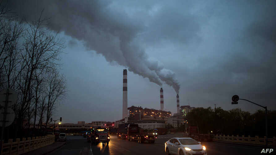
To a significant degree, China will influence how quickly and how much global temperatures rise. The NIE notes that it accounts for about 30 percent of emissions globally, the largest single source.
But “modest reduction targets” in China’s long-term plans raise doubts about whether it will meet its reduction goals, the NIE finds.

“China has not publicly articulated detailed plans for meeting its 2060 net-zero emissions target; to do so, we assess that Beijing would need to follow through on President Xi Jinping’s pledge at the U.S. Climate Summit in April to phase out coal consumption,” the NIE said.

And that will be hard to do. China, along with India — the world’s fourth-largest emitter — are incorporating more renewable and low-carbon sources of energy, the NIE says, “but several factors will limit their displacement of coal.”

The NIE concludes that geopolitical tensions are likely to rise in the coming decades as countries struggle to deal with the physical effects of climate change — which scientists say already is producing more devastating floods, fires and storms — as well as the political ones. Mitigating climate-related disasters may call for solutions that some countries cannot afford and political will that some leaders cannot muster.

The physical effects are likely to be most keenly felt in parts of the world already being reshaped — such as the Arctic — and in regions and countries that are particularly vulnerable because they experience extreme climate events, such as hurricanes or droughts, and because their governments are ill-equipped to manage the fallout.

The NIE identifies 11 countries in that category of acute risk: Afghanistan, Colombia, Guatemala, Haiti, Honduras, India, Iraq, Myanmar, North Korea, Nicaragua and Pakistan.

An NIE is a unique document in that it reflects the consensus view of all the U.S. intelligence agencies. Traditionally, producing the documents can take months, and they present the most comprehensive analysis of significant national security concerns. The NIE released publicly is unclassified, but a classified version will be provided to policymakers, officials said.

Humpback chub now a threatened, not endangered, fish — The #GrandJunction Daily Sentinel

Humpback chub (Gila cypha) as seen in the Little Colorado River, Summer 2021.© Freshwaters Illustrated / USFWS

From The Grand Junction Daily Sentinel (Dennis Webb):

A rapids-loving, odd-looking native fish found locally in the Colorado River is now officially considered to be at a reduced risk of extinction.

The U.S. Fish and Wildlife Service on Friday said it has reclassified the humpback chub from endangered to threatened under the Endangered Species Act, thanks to significant progress made by conservation and recovery efforts of federal agencies, states, tribal entities and private partners.

“It’s a major milestone that we feel very proud of,” Kevin McAbee, acting director of the Upper Colorado River Endangered Fish Recovery Program, told The Daily Sentinel. “We believe that it demonstrates the collaborative conservation efforts that we’ve been undertaking with our partners over the last three-decades-plus are working. It’s really something that we’ve been working towards for many years and we’re just very excited about it.”

[…]

Feeding on insects, crustaceans and plants, the humpback chub can live 20 to 40 years, grow up to 19 inches long and produce up to 2,500 eggs per year. A warm-water species, it is uniquely adapted to live in the turbulent whitewater found in rivers’ rocky canyon areas, according to the Fish and Wildlife Service. Its namesake, fleshy lump behind its head evolved to make it harder to be eaten by predators, and large, curved fins let it stay in place in swift currents.

These traits have helped it survive in the Black Rocks area of the river in western Mesa County and in Westwater Canyon just across the Utah border, where the Fish and Wildlife Service says the most recent estimates indicate there are populations of 430 and 3,300 adults, respectively. The Westwater Canyon population has been growing and the Black Rocks numbers are stable, but a large number of juveniles may boost the Black Rocks population in the future.

Other stable populations exist at the Desolation/Gray canyons area on the Green River in Utah and Cataract Canyon on the Colorado River in Utah. The Grand Canyon is home to the largest number of fish, including an estimated 12,000 in a core area in the Little Colorado River and the Colorado River around their confluence…

Globally, the fish exists only in that handful of core population areas. Another population in Dinosaur National Monument appears to have died out. McAbee said the Westwater and Black Rocks populations combined are the largest population upstream of Lake Powell, making them the home of the largest combined population in the world of humpback chub outside of the Grand Canyon, and an important core population just downstream of Grand Junction…

Two multi-stakeholder efforts, the Upper Colorado River program and Glen Canyon Dam Adaptive Management Program, have worked to try to help recover the species. In the Upper Colorado River, these efforts have included protecting river flows; managing and removing predatory, nonnative fish; and installing and operating fish passage structures where dams otherwise can impede fish travel.

Water-release measures involving upstream reservoirs have helped manage river flows to benefit the fish despite drought conditions that largely have prevailed over the last two decades. The Fish and Wildlife Service concluded that current river flows and temperatures are largely adequate despite climate change, so it doesn’t put the fish at immediate risk of extinction, which would mean it’s endangered. But the agency found that uncertainty about the possible severity of future water-supply declines poses a threat to the fish in the future, so it is likely to become endangered in the foreseeable future — the criteria for determining that it is threatened…

Another uncertainty surrounds the future of conservation efforts in the Upper Colorado River Basin because the recovery program there currently is scheduled to expire in 2023…

“However, commitment to continue the decades-long partnership is strong, as demonstrated by ongoing efforts to extend the partnership beyond 2023,” the Fish and Wildlife Service says in its final rule on the fish’s downlisting…

A further challenge for the program that the Fish and Wildlife Service is monitoring is the status of its funding.

Federal hydropower revenue that has helped support the program is threatened because falling reservoir levels are jeopardizing hydropower generation.

Wolf Creek reservoir project secures #ColoradoRiver District grant: $330,000 will go toward NEPA permitting for new water storage in northwest Colorado’s White River basin — @AspenJournalism #WhiteRiver #GreenRiver #COriver #aridification

A view of the White River foreground, and the Wolf Creek gulch, across the river. The Rio Blanco Water Conservancy District and the State of Colorado have reached a settlement for a reservoir and dam project at this site. Photo credit: Aspen Journalism/Brent Gardner-Smith

From Aspen Journalism (Heather Sackett):

In January, Rio Blanco secured a water right for a 66,720-acre-foot reservoir between Rangely and Meeker. The conservancy district is proposing an off-channel reservoir with a dam 110 feet tall and 3,800 feet long, with water that will be pumped into the Wolf Creek drainage from the White River.

Rio Blanco said it will use the funds for the National Environmental Policy Act permitting process, which will be administered by the Bureau of Land Management, using a third-party contractor. Rio Blanco estimates the permitting will take three to five years at a cost of $6 to $10 million.

In its application, Rangely-based Rio Blanco said that the River District’s support of the permit phase is essential for the eventual development of the project.

“The project provides a desperately needed new storage reservoir for the White River basin,” the application reads. “The White River basin currently does not have adequate storage to meet the current water needs during drought conditions or any additional future water needs within the basin.”

No River District directors voted against the funding. Rio Blanco County representative Alden Vanden Brink abstained from voting because he is the general manager of the Rio Blanco Water Conservancy District.

“I support this concept,” said Gunnison County representative Kathleen Curry. “Investing in a permitting process is wise right now.”

Moffat County representative Tom Gray wondered if funding this request would mean the River District has a moral obligation to approve future funding requests for the Wolf Creek project. But River District General Manager Andy Mueller encouraged board members to look at it as a one-time request because the future of the overall project is still uncertain.

“It is possible that this applicant could have the whole permitting process blow up on them,” Mueller said. “Something beyond our control may occur. … Think of it on an application-at-a-time basis.”

The Wolf Creek project will also need permits from the State Historical Preservation Office, the U.S. Fish & Wildlife Service, the Army Corps of Engineers, the Colorado Department of Public Health and Environment and a consultation under the Endangered Species Act.

This map shows the location of the proposed Wolf Creek reservoir in northwest Colorado. The Rio Blanco Water Conservancy District has secured $330,000 in funding from the Colorado River Water Conservation District for the permitting phase. CREDIT: LAURINE LASSALLE/ASPEN JOURNALISM

Project history

Rio Blanco has budgeted a minimum of $250,000 per year to contribute to the permitting process. Since planning first began in 2013, Rio Blanco and its funding partners, including the Colorado Water Conservation Board, have spent $2.1 million on the project. The project has the support of Rio Blanco and Moffat counties and the Town of Rangely, but so far these governments have not made funding commitments. Rio Blanco estimates the total cost to build the reservoir at $142 million.

Securing the water right for the project took longer than Rio Blanco expected because for five years, Colorado’s top engineers at the Department of Water Resources argued the project was speculative because Rio Blanco could not prove a need for the water. The water right that was eventually granted after years of back-and-forth in water court gave Rio Blanco the amount of water it was seeking, but does not allow the district all the water uses it initially wanted.

The decree granted Rio Blanco a water right for municipal use for the town of Rangely; augmentation within its boundaries; mitigation of environmental impacts; hydroelectric power; and in-reservoir use for recreation, piscatorial and wildlife habitat. The conservancy district will not be able to use the water for irrigation, endangered fish or augmentation in the event of a compact call.

Vanden Brink said there is a sense of urgency to build the Wolf Creek project. He said he is thrilled at the River District’s grant.

“We think it’s a great partnership with the River District,” he said. “It’s critical that this thing gets done.”

The River District’s Community Funding Partnership was established last year when voters passed ballot measure 7A, increasing the River District’s mill levy. Eighty-six percent of the revenue from the tax hike goes toward funding water projects in five categories: productive agriculture; infrastructure; healthy rivers; watershed health and water quality; and conservation and efficiency.

Aspen Journalism covers water and rivers in collaboration with The Craig Press and other Swift Communications newspapers.

New projections for low #ColoradoRiver flows speed need for dramatic conservation

From The Colorado Sun (Michael Booth):

A new federal system for projecting Colorado River water flows in the next two years confirms dire news about drought draining the West’s key reservoirs, and increases pressure on Colorado to conserve water immediately to avoid future demands from down-river states, conservation groups say.

The federal Bureau of Reclamation’s new system for projecting vital Colorado River flows in the next two years drops earlier, wetter years out of the historical reference, and gives more weight to two recent decades of drought. The regular October update this week shows water runoff into Lake Powell, the storage basin for four Upper Colorado Basin states, was only 32% of average for the 2021 water year, which runs from October to September.

The new projections for the next two years show that even with federal officials draining portions of Blue Mesa, Flaming Gorge and Navajo reservoirs to get more water to Lake Powell’s hydroelectric generating station, a moderate winter would leave the Colorado River in the same crisis a year from now. And a low-water scenario this coming winter season would drop Lake Powell well below the minimum level required to generate electricity by November 2022.

In addition to federal officials trying to protect hydroelectric generation at Lake Powell, and at Lake Mead as the downstream water bank for the Lower Basin states, water compacts govern how much Colorado River water needs to go downstream for use by agriculture and cities…

“We don’t have any more time to talk about it,” Matt Rice, co-chair of the Water for Colorado Coalition and Director of American Rivers’ Colorado River Basin Programs, said after reviewing the latest Bureau of Reclamation update.

Starting with the October update, the bureau begins the historical average calculations in 1991, instead of the 1981 cutoff used until now. The 1980s were much wetter in the Colorado River Basin, Rice said.

“These projections are worse than they have been in the past, but they’re also more realistic,” Rice said. Many conservation groups find that a positive step despite the bad news, Rice added, because it increases pressure on state water officials, local water conservancy districts, agriculture interests, cities and environmentalists to work faster on solutions.

At the same time, Rice said, the updated numbers should drive home the reality that there is 20% less water available now in the Colorado River than as recently as 2000. “There’s no more flexibility in the system, right? We’re looking over the edge of the cliff.”

Water conservation experts in Colorado have worked for years to avoid their worst-case scenario, which is a “call” or a sudden demand from federal managers to deliver more water for hydropower or to satisfy the compacts with the Lower Basin. Without advance planning, a call would force the state water engineer and local conservancy districts to cut irrigators’ water rights based only on the seniority of their water-use rights.

While state and local officials have been working with nonprofits on conservation plans, there are legal tangles that could require new legislation, and seemingly endless ethical questions about which parts of the state would suffer the most water loss, said Sonja Chavez, director of the Upper Gunnison River Water Conservancy District…

The boat ramp at the Lake Fork Marina closed for the season on Sept. 2 due to declining reservoir levels. The Bureau of Reclamation is making emergency releases out of Blue Mesa Reservoir to prop up levels in Lake Powell and preserve the ability to make hydropower.
CREDIT: HEATHER SACKETT/ASPEN JOURNALISM

Blue Mesa Reservoir in her region has been nearly drained by drought and by federal officials taking extra from Western reservoirs to solidify Lake Powell’s power pool. Blue Mesa is projected to soon be down to 27% full, Chavez said. Blue Mesa was 33% full in mid-September, according to Bureau of Reclamation records.

State and private officials have cooperated to experiment with “demand-management” programs, where instead of buying agriculture land and its accompanying water rights outright, they buy the right to rent the water for a few years out of a decade. That rented water can be sent downstream in dry years, and in theory the restoration of water in other years should preserve the farm or ranch land while providing income for the farmer.

But renting or buying of water rights on the scale to meet compact demands would require hundreds of millions of dollars, with no current pot of money to pull from, water experts say. Colorado officials have mentioned the possibility of using money from the infrastructure stimulus plan currently under debate by Congress, but it’s uncertain whether the bill will pass, and how much water-related money will be in it if it does…

The largest amounts of water to be conserved are in agriculture, by far, but Front Range residents must be part of the statewide discussion about finding more water for the downstream Colorado River, Rice and Chavez said.

“You’re not going to get as much out of a city compared to what is the amount of irrigation water diverted for agriculture,” Chavez said. “But there’s also agriculture on the Front Range that benefits from our transmountain diversions,” some of which are created and controlled by urban water departments. “That has to be part of the picture.”

Front Range cities take water from the Roaring Fork River basin in a transmountain diversion through the Twin Lakes Tunnel. The city of Aspen is studying the potential for an Alternative Transfer Method, or ATM, to increase its water supplies, which could include approaching transmountain diverters about participating in a water-sharing agreement. Photo credit: Elizabeth Stewart-Severy/Aspen Journalism

Andes Meltdown: New Insights Into Rapidly Retreating Glaciers — Yale Environment 360 #ActOnClimate

The Piedras Blancas glacier in Patagonia in Santa Cruz province, Argentina. Photo credit: Swoop Patagonia

From Yale Environment 360 (Jonathan Moens):

Using satellite data, scientists are documenting the inexorable melting of South America’s glaciers and ice fields, with Andean glaciers thinning by nearly three feet a year since 2000. The loss of ice poses a threat to water supplies and agriculture from Bolivia to Chile.

In recent decades, nearby residents of the Cordillera Vilcanota have watched in dismay as the Colquepunco and surrounding glaciers have steadily shrunk. Now, researchers in Germany and France have quantified just how rapidly ice in Peru and throughout the Andes is disappearing. Using high-resolution data generated by satellites and a 2000 Space Shuttle mission to create three-dimensional representations of Andean glacier change over time, the researchers calculated that the area covered by glaciers in Peru shrank by nearly a third from 2000 to 2016…

Across the Andes, glaciers have lost nearly 3 feet in thickness annually since 2000, according to Etienne Berthier, a glaciologist at the Laboratory of Geophysical Studies and Oceanography in Toulouse, France, who recently published his findings in Nature Geoscience. Warming temperatures also have caused glaciers to swiftly recede, particularly in the southern Andes, where some glaciers have retreated 5.5 miles in the past century. Ninety-eight percent of Andean glaciers have shrunk this century.

Glaciers are vital resources for communities in and around the Andes, where meltwater is used for drinking, irrigation, and hydroelectric power — especially in arid regions and during periods of drought. “The disappearance of glaciers will have an impact on the cities, but not just cities — locals, farmers, and people who do agriculture more broadly,” says Francou.

The loss of Andean glaciers also has global repercussions. Nearly all the world’s ice is locked up in the vast ice sheets of Antarctica and Greenland, with lower-latitude mountain glaciers and ice caps making up only 4 percent of the world’s land ice area. But because the world’s mountain glaciers — including in the Andes, the Himalayas, the Tibetan Plateau, the Alps, and various Alaskan and Russian ranges — are melting so rapidly, they have been responsible for a disproportionate share of global sea level rise in recent decades. No mountain region has lost more ice, relative to its size, than the Andes.

Until recently, information regarding the speed and quantity of Andean ice loss was generally restricted to more easily accessible sites, with scientists manually planting stakes in glaciers and recording changes in their mass over the years, says Berthier. But the recent satellite studies have greatly expanded scientists’ ability to track melting glaciers in the Andes and around the globe.

Patagonia’s ice fields account for 83 percent of all ice loss in South America.

“Our study, and the one from Etienne Berthier, are the first studies that cover the whole [South American]continent based on measurements everywhere,” says Thorsten Seehaus, a glaciologist at Friedrich-Alexander-Universität Erlangen-Nürnberg, who recently published his findings in Nature Climate Change.

Berthier and his team were able to obtain data covering most sub-regions of Andean glaciers, giving the researchers a more accurate picture of the pace of glacial retreat and enabling them to better forecast how quickly glaciers will recede in the future.

What the new data shows is that while Andean glaciers overall are receding, they are doing so at varying rates in different regions. In the Desert Andes, for example, a small number of glaciers are actually expanding or holding steady, says Seehaus — though these account for only 1.3 percent of the glaciers studied.

The overall trend, though, is abundantly clear. Andean glaciers — from the small icy regions of Colombia and Venezuela in the north all the way to Patagonia’s glaciated expanses in the south — are rapidly shrinking.

The south Patagonian ice fields are the fastest-melting on the continent, thinning by an average of nearly 3.3 feet a year, according to Berthier’s study. Together with the northern Patagonian ice fields, these regions account for 83 percent of all ice loss in South America. The reason for this, explains Francou, is that the low-altitude glaciers of Patagonia make them particularly vulnerable to rising air temperatures.

The Olivares Alfa glacier in Chile has lost 66 percent of its ice mass since 1953. CREDIT: LOUIS LLIBOUTRY [TOP]; ALEX CATTAN AND MARC TURREL