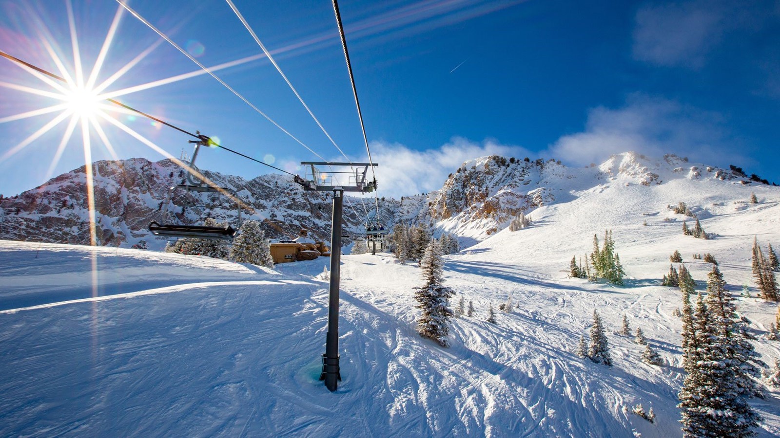
Climate change is predicted to increase temperatures and shift precipitation patterns in Utah, which could have significant impacts on ski resorts. Photo credit: CS Nafzger.
Utah is proud of its snow. The state of Utah even trademarked the phrase “The Greatest Snow on Earth™” and put it on its license plates. But climate change is a significant threat to Utah’s famous snow and ski resorts.
As part of their work in the Climate Adaptation Science program, a group of Utah State University graduate students and faculty from the S.J. & Jessie E. Quinney College of Natural Resources, examined historical temperature data from 1980-2019 and projected climate data for 2021-2100. In addition, they conducted interviews with Utah ski resort managers to better understand how climate change will impact winter recreation, and how ski resorts can adapt to these changes.
Historical data shows that many Utah ski resorts are warming faster than global averages, and that trend is likely to continue in the future. Around the world, scientists are seeing high elevation environments warming faster than sea level. Climate projections show that minimum temperatures are expected to rise during the prime ski season of December-March by up to 10 degrees in Northern Utah and up to 12 degrees in Southern Utah by 2100.
Ski resorts need snow to open. Many resorts supplement early season snow with artificial snow that requires a minimum temperature at or below 23 degrees. Since 1980, the minimum daily temperature has increased at all 14 Utah ski resorts, and at 12 of the 14 resorts the number of early season days with a minimum temperature at or below 23 degrees has significantly decreased.
“I was really surprised by how dramatic the decline is in the proportion of the ski season where snowmaking is possible from 1980-2019,” said Emily Wilkins, a USU post-doctoral researcher with the Institute of Outdoor Recreation and Tourism and one of the lead authors on the research. “We know that minimum daily temperatures have been rising due to climate change, and that means fewer days where snowmaking is possible, but I didn’t expect the decline to be so consistent and drastic across all Utah resorts.”
Utah ski resorts are already impacted by climate change and as the impacts become more severe, adaptation strategies will be needed to minimize negative impacts of higher temperatures and less snow.
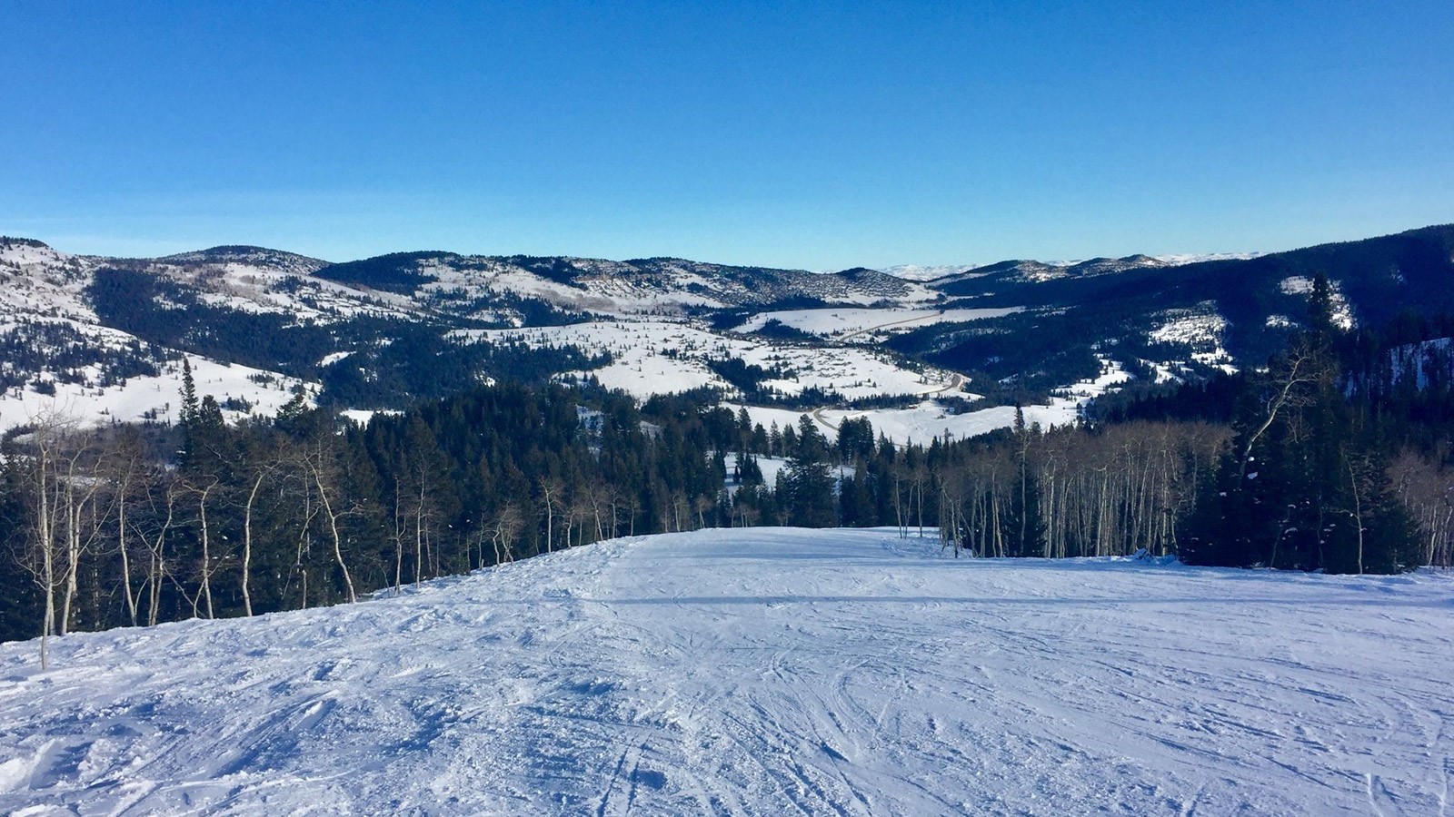
Early season snow at Beaver Mountain ski resort in Northern Utah. Photo credit: Rachel Hager.
Ski resorts have a few options to mitigate the impacts of climate change. Of the eight Utah ski resort managers interviewed, most resorts have already begun to implement adaptation measures such as diversifying winter and off-season activities, increasing snowmaking capacity and closing slopes when there is not enough snow. But resort managers face moderate to extreme barriers in financing adaptation changes and limitations on water availability.
“Skiing is one of the most at-risk recreational activities under climate change due to its dependence on snow,” said Wilkins. “It’s important for ski resorts and surrounding communities to know what climatic changes we have already seen, and what changes we might expect in the future, so they can prepare and adapt.”
Utah’s deep, dry powder is a vital part of this state’s culture and economy. But climate change necessitates adaptation, and ski resorts will need to adapt to stay viable for the coming decades, Wilkins concluded.
The results of this work will be available in an upcoming issue of the journal Mountain Research Development.
Ski resorts are an important part of Utah’s economy bringing in $10 billion in revenue to the state in 2019. Photo credit: Joe Guetzloff.
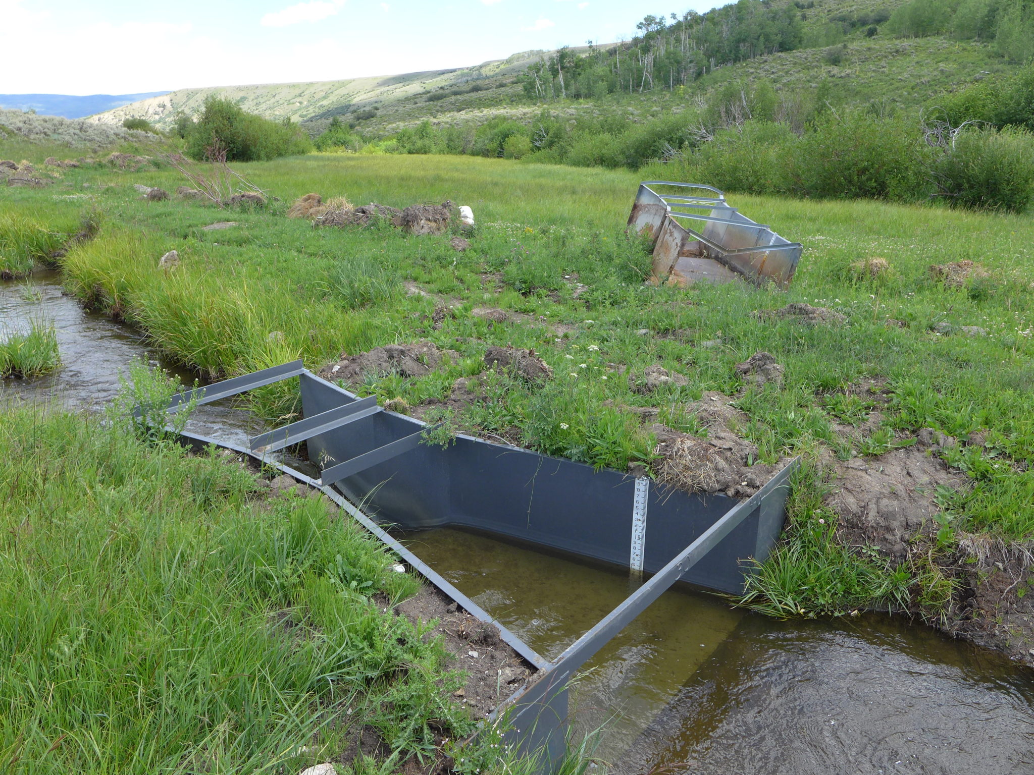
This Parshall flume, which was installed in the Yampa River basin in 2020 and is shown in this August 2020 photo, replaced the old, rusty device in the background. State engineers are developing rules for measuring devices, which would apply to the entire Western Slope. CREDIT: HEATHER SACKETT/ASPEN JOURNALISM
The White and Yampa rivers traditionally supply a comfortable amount of water compared with other waterways across the state, according to Jeff Lukas, a Lafayette climate consultant and former water scientist with the University of Colorado Boulder. But that’s not as much the case recently.
“The whole Colorado River system is on the wrong side of the knife’s edge in the first part of the 21st century,” Lukas said.
Over the last two decades, the Yampa’s average flow decreased by about 6% from its 20th-century average, Lukas said. And the White’s average flow decreased by about 19%.
So officials with Colorado’s Division of Water Resources want to better track who’s taking water from the rivers — and its tributaries — and how much. Better tracking there would bring the division’s northwest region into line with the rest of the state, where that type of data collection is already more common.
Division officials are hosting stakeholder meetings in the region to develop rules by which water usage will be measured and hope to have the process finished by the end of next year, state Engineer Kevin Rein said. And as more data flows in, the state can better allocate water to those legally allowed to take it, an increasingly precise task as droughts continue to plague the Western Slope.
And in the bigger, and unprecedented, picture, if Colorado is called to work with upper- and lower-basin states because not enough water is passing southwest through the Colorado River, it will need that concrete data in hand, Rein said.
“We just need to know where it’s going,” Brain Fuchs, a climatologist with the National Drought Mitigation Center at the University of Nebraska Lincoln, said. “Every drop counts when it comes to water.”
The process underway in northwest Colorado is part of an increasing nationwide trend to better track water use as droughts become more common, Fuchs said…
Drying rivers
One key indicator that water is tighter in northwest Colorado is that senior water rights holders along the Yampa River are more frequently calling state engineers to shut off supply for junior rights holders until their thirst is quenched, according to Erin Light, water division engineer for the region.
The first ever call like that on the Yampa came in 2018, Light said. Another followed in 2020 and then another this year, both of which only ended after Colorado River conservation officials agreed to release water from the Elkhead Reservoir, northeast of Craig.
Water shortages and calls like those can spell trouble not only for those in Colorado but also millions more downstream.
Water from the Yampa and White rivers flows into the [Green River then the] Colorado River and ultimately into Lake Powell, making up to a fifth of the reservoir’s water supply each year, Lukas said.
The reservoir, which sank to its lowest level on record this year, supplies water to about 35 million people, irrigates millions of acres of cropland and generates billions of kilowatt-hours of electricity annually.
While calls from senior water rights holders come each year — even in non-drought years — along the Arkansas, Rio Grande and South Platte rivers, Rein said “it’s a new thing to the Yampa.”
[…]
Not only are those rivers drying due to climate change but more water is allocated from them than the rivers actually have to offer. And now the historically water-abundant Yampa, which is also over-allocated, appears to be joining those ranks, Light said…
Accounting for water
As Colorado’s rivers dry up, like the Ogallala Aquifer on the eastern plains…for example, governments across the country are working to take better inventory of their water supply, Fuchs said. When those water shortages arise, people start to ask where the water went and who took it.
“All of a sudden these questions are starting to be asked and (governments) can’t really put those cards on the table because they don’t have them,” Fuchs said.
The same logic applies when states strike deals with each other over rivers that cross their borders, Fuchs added. The states not only want to make sure they’re following the agreements but also that they’re keeping as much water as possible.
Colorado’s northwest region represents a gap in the state’s inventory.
As of April, only about 54% of the structures used by water rights holders in Light’s region, which covers Craig and Steamboat Springs, have devices to measure their water usage.
For comparison, about 95% of the structures in the Roaring Fork and Crystal river basins to the southeast have measuring devices, [Aspen Journalism] reported.
In late 2019, Light ordered hundreds of water users in the Yampa River basin to install measuring devices and then in March 2020 she issued formal notices for others along the White and Green rivers to follow suit, the Summit Daily reported. And Light’s office is now holding stakeholder meetings this month across the region as they look to cement consistent rules for what kinds of devices can be used, how they should be maintained and how they measure water use.
Rein said he hopes that the rule-making process could be finished by the end of next year, but he doesn’t want to rush it.
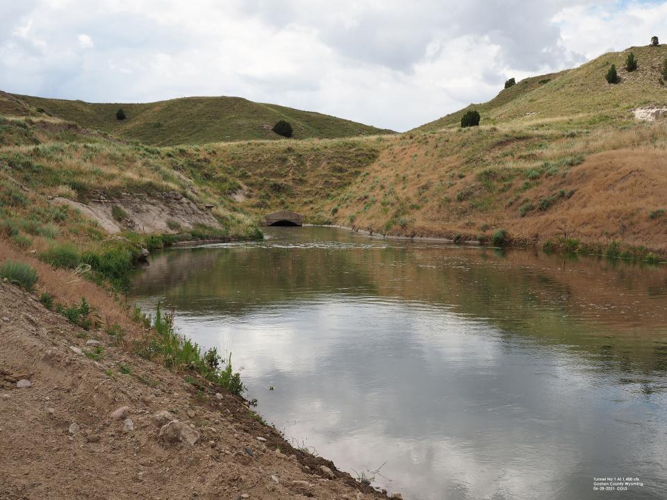
Irrigation water flows through Tunnel No. 1 on the Goshen/Gering-Fort Laramie supply canal on July 16, 2021. Photo credit: University of Nebraska Lincoln
From The Unviversity of Nebraska Lincoln via The Fence Post:
In the months following the collapse of Tunnel No. 2 on the Goshen/Gering-Fort Laramie main canal in July 2019, temporary repairs were made to Tunnels No 1 and 2. Steel ribs were installed inside the tunnels to support the concrete tunnel walls.
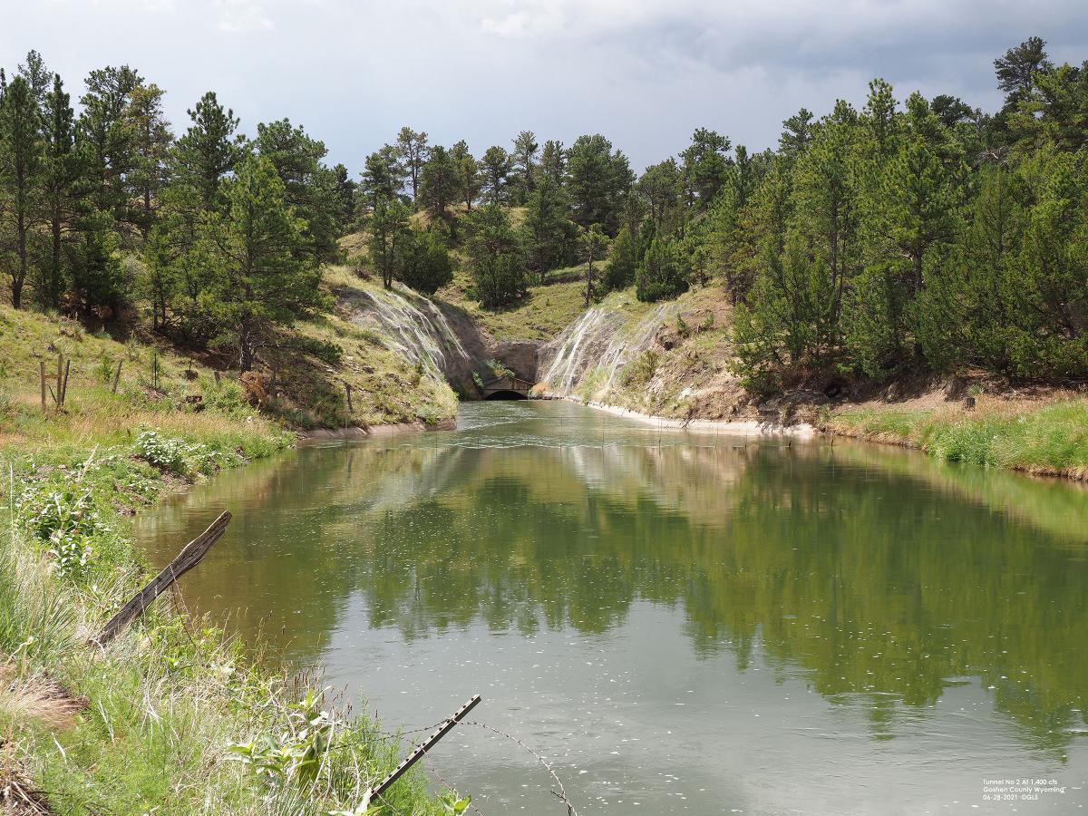
Irrigation water flows through Tunnel No. 2 on the Goshen/Gering-Fort Laramie supply canal on July 17, 2021; this is the tunnel where the collapse occurred in 2019. Photo credit: University of Nebraska Lincoln
The tunnel collapse and resulting washout of the supply canal south of Fort Laramie, Wyo., immediately ended water deliveries by Goshen and Gering-Fort Laramie districts for 44 days, during the critical growth period for crops. About 107,000 acres were affected by the loss of irrigation water, and many farmers’ yields were reduced as a result.
The temporary repairs allowed the irrigation districts to resume deliveries in 2020, but installation of the ribs restricted water flow to 80-85 percent of capacity of the tunnel.
During the winter of 2020-21, metal sheeting was installed over the ribs to increase water flow through the tunnels. This increased the water flow through the tunnels to 97 percent of capacity in the summer of 2021. Water deliveries by the three major irrigation districts in the North Platte Valley (Goshen and Gering-Fort Laramie on the south side of the river, Pathfinder Irrigation District on the north) were near normal for the 2021 growing season.
The districts had to utilize some storage water to meet the needs of the growers, leaving the reservoirs in Wyoming at lower-than-average carryover at the end of the water year. In mid-October, Seminoe Reservoir was at 31 percent, Pathfinder Reservoir at 58 percent, and Glendo Reservoir at 32 percent of capacity.
For spring runoff to fill the reservoirs by the 2022 irrigation season, major snowfall events would be needed in the Snowy Range and Siera Madre mountains of north-central Colorado and south-central Wyoming this winter.
Inspection of the tunnels by the irrigation districts and U.S. Bureau of Reclamation was scheduled for the week of Oct. 18. Permanent repairs to the tunnels still must be completed, the final construction plans pending approval from the Bureau of Reclamation.
The collapse site above Tunnel No. 2 on the Goshen/Gering-Fort Laramie supply canal, as it appears in the summer of 2021, two years after the collapse. Subsequent repairs allow the tunnel to carry 97% of the previous maximum capacity. Photo credit: University of Nebraska Lincoln
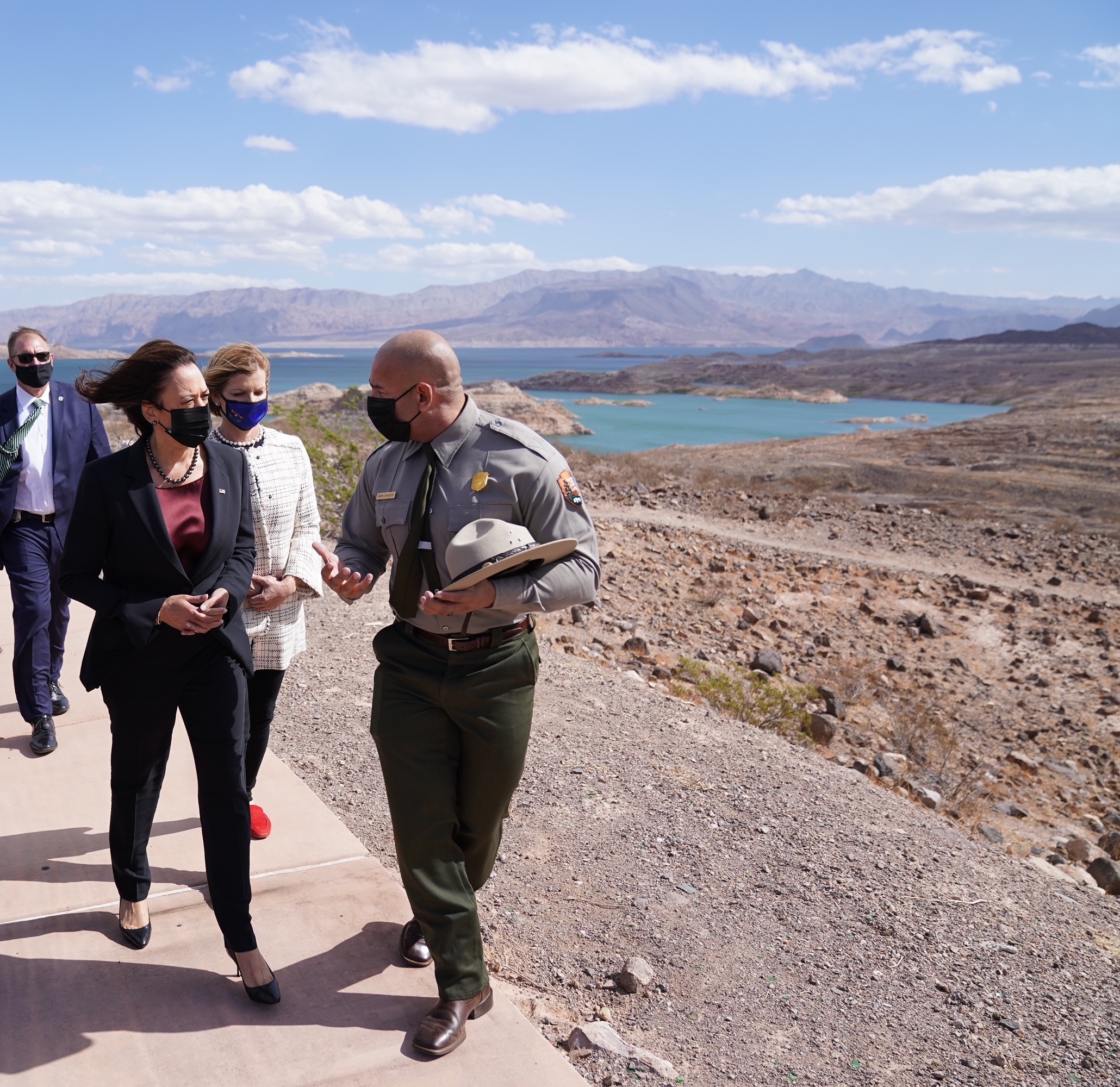
Vice President Kamala Harris stood before the record-low water levels of Nevada’s Lake Mead on Monday and made the case for the Biden administration’s climate change agenda by warning that “this is where we’re headed.”
“Look at where the water has receded over just the last 20 years,” she said, referring to the “bathtub ring” of minerals that marks where the reservoir’s water line previously stood. “That space is larger than the height of the Statue of Liberty.”
The vice president pitched the administration’s infrastructure and social safety net agenda as critical to tackling the effects of climate change — which scientists say intensify extreme weather events such as heatwaves and droughts.
Democrats have struggled to win support for that plan from some members of their party, who want to winnow down its $3.5 trillion price tag.
Harris made the case for the package by connecting human-caused climate change to the scene she stood near, saying emissions are “part of what is contributing to these drought conditions.”
[…]
Federal officials in August declared the first-ever water shortage in the Colorado River, which means Arizona, Nevada and Mexico will receive less water than normal next year amid a gripping Western drought.
In September, Reclamation released projections showing an even worse outlook for the river.
While California is spared from next year’s cuts, the nation’s most populous state has experienced one of its driest years on-record while battling scores of catastrophic wildfires.
In arguing for the $1 trillion public works infrastructure deal, Harris referenced the “good union jobs” that the spending package would create, naming pipefitters, electricians and plumbers as examples. That plan passed the Senate months ago and is awaiting House approval.
It contains roughly $8 billion for Western water projects, including desalination technology to make sea water usable, modernizing rural water infrastructure and building greater capacity to recycle wastewater.
Harris also spoke about the Biden administration’s proposed civilian Climate Corps, which it has said would create hundreds of thousands of jobs building trails, restoring streams and helping stop devastating wildfires…
Harris on Monday met with federal and regional water officials such as Tanya Trujillo, assistant interior secretary for water and science, and U.S. Reps. Dina Titus, Susie Lee and Steven Horsford of Nevada.
Passing Biden’s signature social services and climate change plans would serve future generations, Harris said, “in a way that will not only be about life, but about … beautiful places like Lake Mead.”
Water levels at Lake Mead fell this year to their lowest point since the reservoir was created in the 1930s, and in August, the U.S. government declared the first ever water shortage on the Colorado River.
“When we look at what’s happening here, we know this is about this lake, but it is about a region and it is about our nation,” Harris said.
Harris said Biden’s agenda was “thoughtful and foresightful,” and that along with the bipartisan $1 trillion infrastructure bill currently in Congress, would make investments “in things like water recycling and reuse, what we can do in terms of water desalination, what we can do in terms of implementation of drought contingency plans.”
“This is about thinking ahead, recognizing where we are and where we’re headed,” Harris said…
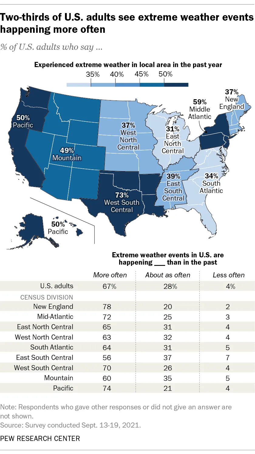
About half of all adults in western states said they’ve seen extreme weather events happening more often in their region, according to a Pew Research survey released Thursday. Currently, 90% of the West is in a drought, according to the U.S. Drought Monitor, and wildfires in California this year surpassed 4 million acres burned earlier this month, a record. The only regions with higher percentages of residents saying they’ve noticed extreme weather events on the rise were the West South Central region, which includes Texas and Louisiana which have been ravaged by hurricanes, and the Middle Atlantic.
Pew found wide support for the federal government to take action when it comes to building systems to make wastewater reusable in dry regions, with 88% of U.S. adults saying it is very or somewhat important. But there was a sharp partisan divide. The poll found 64% of Democrats support the federal government taking action, compared with 36% of Republicans.
The Colorado mountains are off to a great start with lots of October snow, but the lower elevations like the Front Range have been dry. That dry spell may expand to cover the whole state by mid-November.
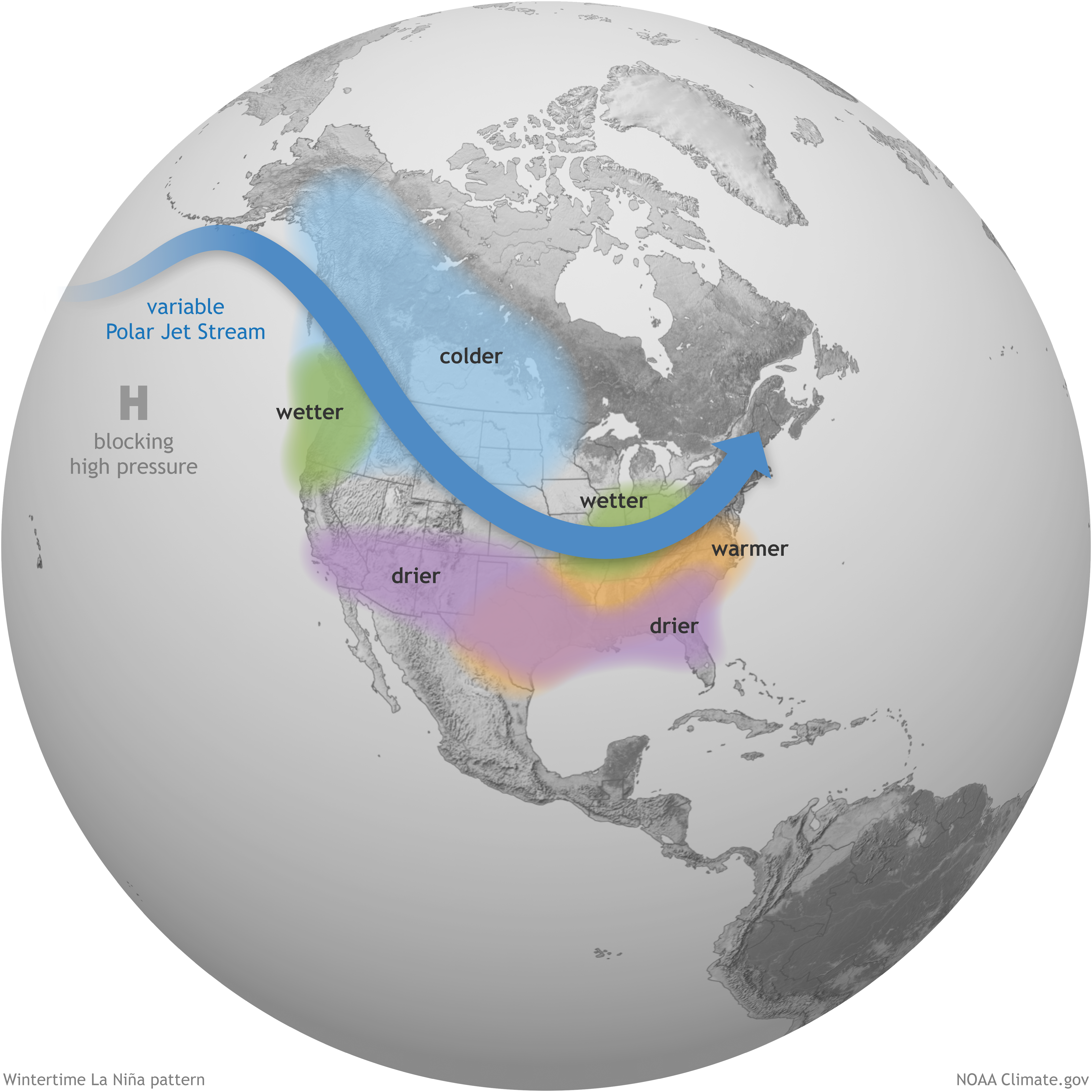
NOAA’s Climate Prediction Center has announced the presence of the La Niña weather pattern for the second year in a row. That favors drier air over the southwestern United States, and it usually includes part of Colorado.
NOAA is also listing about an 83% chance for the La Niña to persist through the entire winter and into the spring months.
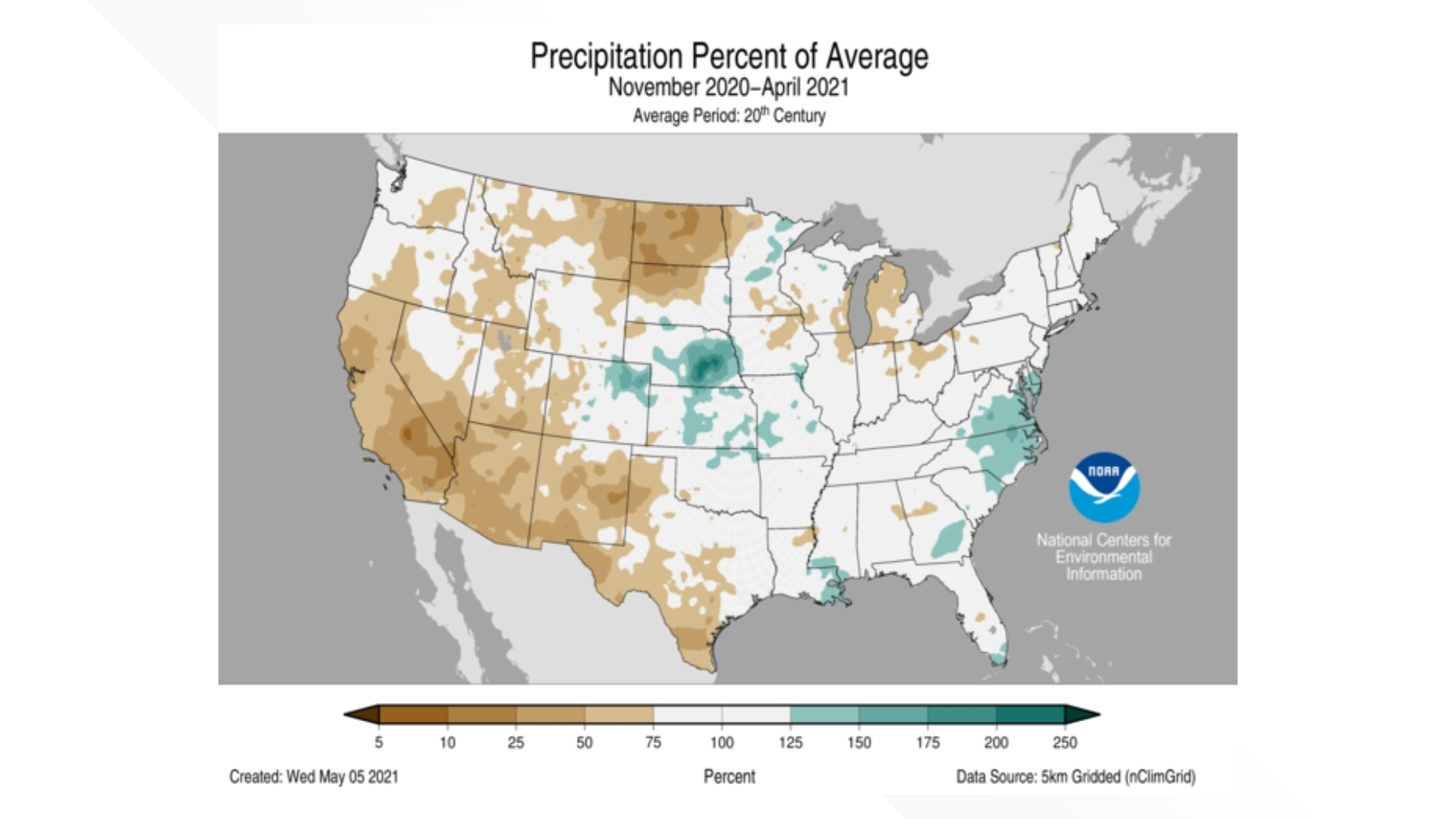
Last winter, a classic La Niña unfolded, with the entire southwest finishing with below-average precipitation. Only the eastern half of Colorado was above average.
La Niña intensifies the average atmospheric circulation—surface and high-altitude winds, rainfall, pressure patterns—in the tropical Pacific. Over the contiguous United States, the average location of the jet stream shifts northward. The southern tier of the country is often drier and warmer than average. NOAA Climate.gov illustration.
Colorado is in between the areas consistently impacted by La Niña, with the colder air to the north and the drier air to the south. So the impacts to our state vary, with the overall trend to drier and warmer than average.
COLORADO TOTAL PRECIPITATION
Out of the last five La Niña winters, three brought below-average precipitation to Colorado from November through April, while two were about average.
This list does not include the partial La Niña that only lasted four months in 2016 from August to December, or the 2008-09 La Niña which ended one month shy of this 6-month comparison. The 2008-09 winter did produce average precipitation across Colorado ranking 69th driest. Most La Niña events develop in the fall and last into the following spring.
The last time Colorado had an above-average winter was the last El Niño in 2018-19.
COLORADO MOUNTAIN SNOWPACK
Mountain snowpack during a La Niña varies much more than total precipitation statewide.
Last year was very close to average, finishing the season in mid-April at only 6% below average.
Two of the last five La Niña winters brought below-average snowpack (2018 was 32% below and 2012 was 48% below), while the other two were above average (2011 was 22% above and 2008 was 34% above average).
The 2008-09 shorted La Niña winter was again not included in this comparison but that one also produced above average snowpack but was just 4% above average.
For Denver, La Niña winters are typically very dry. Last winter was the first above-average snow year during a La Niña since 2001. The last four La Niña’s have had below-average snow in Denver.
The partial La Niña of 2008-09 also produced below average snow in Denver with 38.1″.