The Colorado mountains are off to a great start with lots of October snow, but the lower elevations like the Front Range have been dry. That dry spell may expand to cover the whole state by mid-November.
NOAA’s Climate Prediction Center has announced the presence of the La Niña weather pattern for the second year in a row. That favors drier air over the southwestern United States, and it usually includes part of Colorado.
NOAA is also listing about an 83% chance for the La Niña to persist through the entire winter and into the spring months.
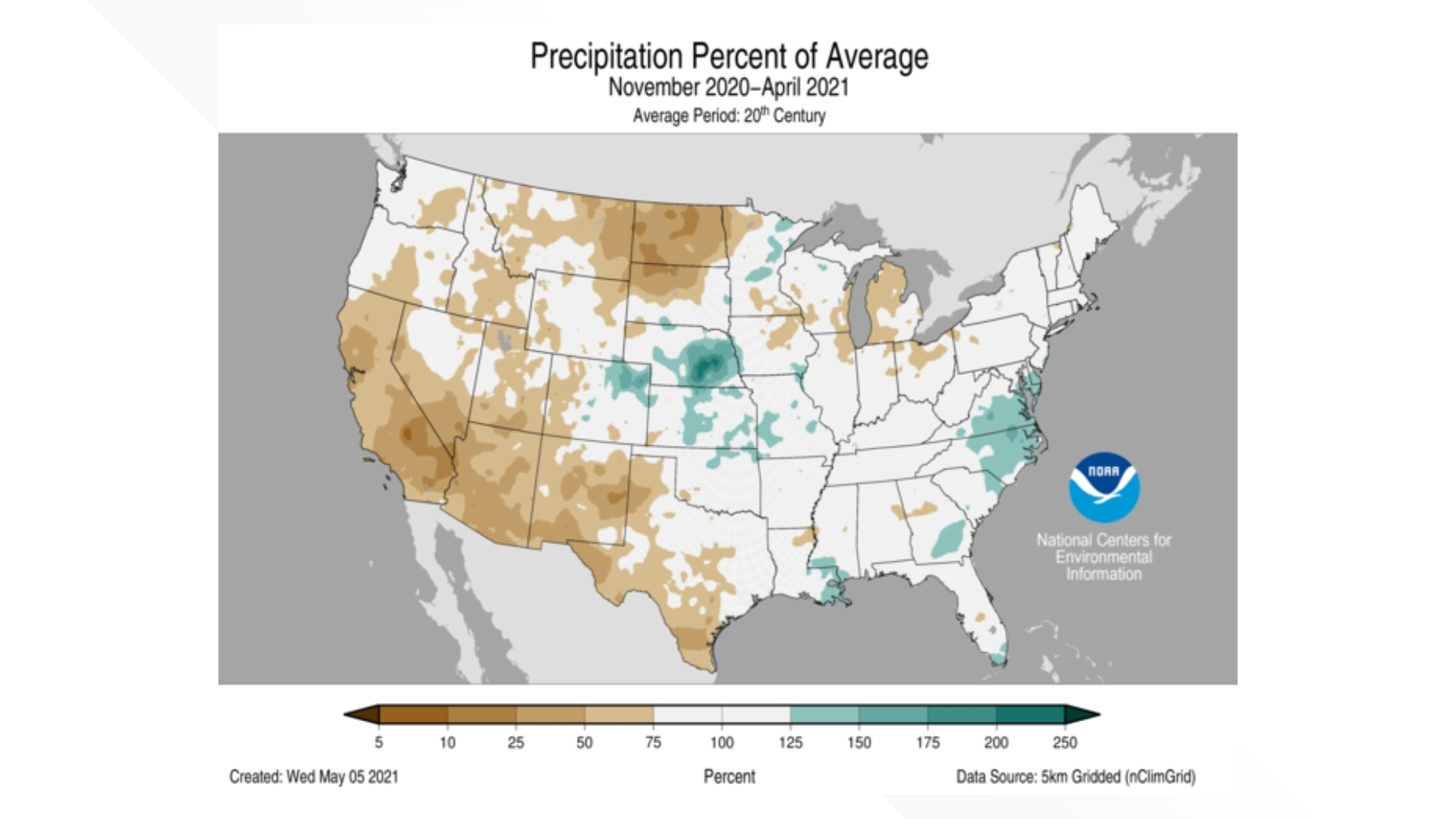
Last winter, a classic La Niña unfolded, with the entire southwest finishing with below-average precipitation. Only the eastern half of Colorado was above average.
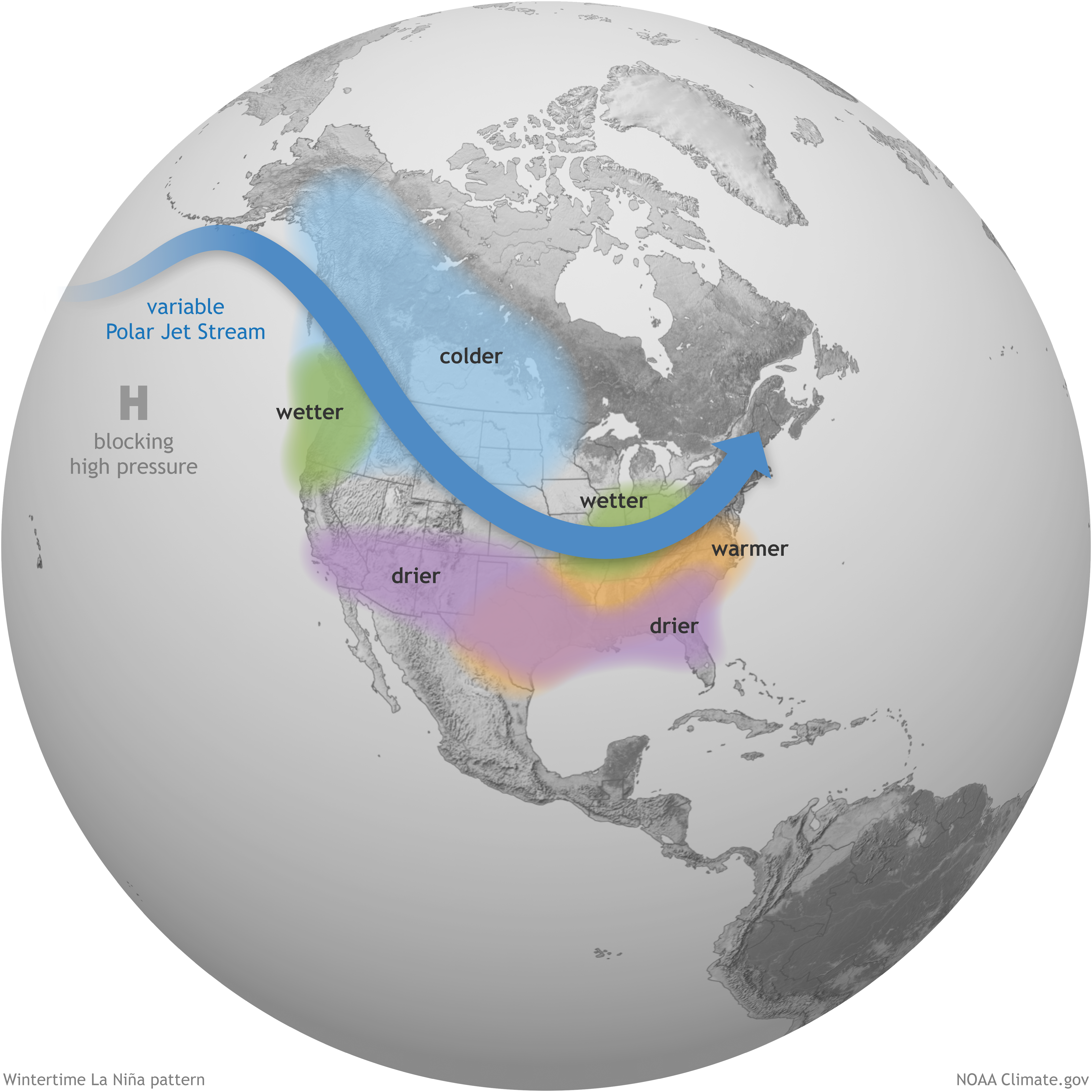
La Niña intensifies the average atmospheric circulation—surface and high-altitude winds, rainfall, pressure patterns—in the tropical Pacific. Over the contiguous United States, the average location of the jet stream shifts northward. The southern tier of the country is often drier and warmer than average. NOAA Climate.gov illustration.
Colorado is in between the areas consistently impacted by La Niña, with the colder air to the north and the drier air to the south. So the impacts to our state vary, with the overall trend to drier and warmer than average.
COLORADO TOTAL PRECIPITATION
Out of the last five La Niña winters, three brought below-average precipitation to Colorado from November through April, while two were about average.
This list does not include the partial La Niña that only lasted four months in 2016 from August to December, or the 2008-09 La Niña which ended one month shy of this 6-month comparison. The 2008-09 winter did produce average precipitation across Colorado ranking 69th driest. Most La Niña events develop in the fall and last into the following spring.
The last time Colorado had an above-average winter was the last El Niño in 2018-19.
COLORADO MOUNTAIN SNOWPACK
Mountain snowpack during a La Niña varies much more than total precipitation statewide.
Last year was very close to average, finishing the season in mid-April at only 6% below average.
Two of the last five La Niña winters brought below-average snowpack (2018 was 32% below and 2012 was 48% below), while the other two were above average (2011 was 22% above and 2008 was 34% above average).
The 2008-09 shorted La Niña winter was again not included in this comparison but that one also produced above average snowpack but was just 4% above average.
For Denver, La Niña winters are typically very dry. Last winter was the first above-average snow year during a La Niña since 2001. The last four La Niña’s have had below-average snow in Denver.
The partial La Niña of 2008-09 also produced below average snow in Denver with 38.1″.