Recreation groups ask for more inclusion in #COWaterPlan — @AspenJournalism

River guide John Saunders paddles a boat down the Yampa River in May 2021. Colorado’s recreation community is asking the state for more inclusion in the updated Water Plan, a final draft of which is scheduled to be released in early January. Photo via Aspen Journalism

Click the link to read the article on the Aspen Journalism website (Heather Sackett):

Colorado’s river recreation community is asking for more recognition in the update to the state’s Water Plan.

In a Sept. 30 comment letter addressed to the Colorado Water Conservation Board Director Rebecca Mitchell and Gov. Jared Polis, a group of recreation, environmental conservation organizations and local businesses ask for river recreation to play a more prominent role in the roadmap for Colorado’s water future.

“Adequate flows to sustain recreation and environmental water needs must be a top priority for CWCB,” the letter reads. “As the update notes, climate change and aridification will contribute to significant temperature-driven river flow declines, disproportionately impacting recreation and river health.”

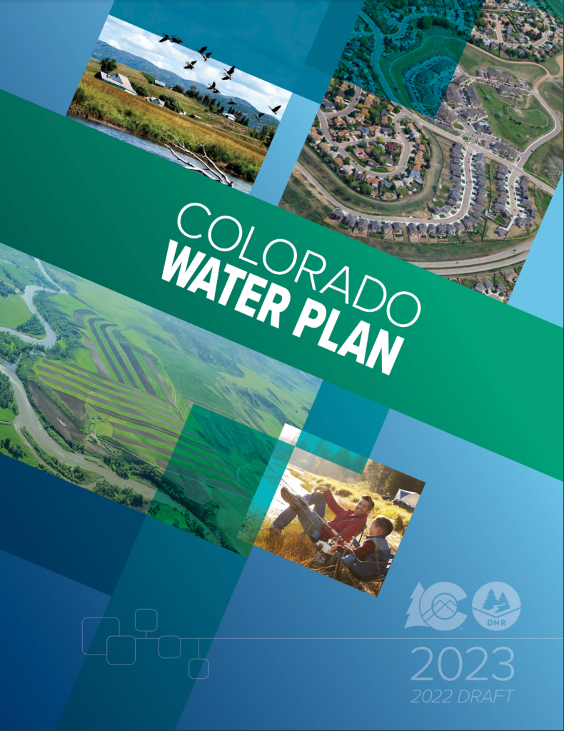
State officials in July released the second iteration of the Colorado Water Plan, a 239-page document that lays out four interconnected areas for action: vibrant communities, robust agriculture, thriving watersheds and resilient planning. The update to the original 2015 plan is a roadmap for how to manage Colorado’s water under future climate change and drought scenarios. CWCB staff said they are currently reviewing the 1,376 comments with about 2,000 observations and suggested revisions they received during the 90-day public comment period, which ended Sept. 30.

In the Colorado water world, recreation usually is lumped together with the environment as a “non-consumptive” use since both seek to keep water in the stream. But signatories to the letter say that grouping overlooks the importance of recreation to the economy.

“We are always talking about environment and recreation together because they are so interconnected, but in doing so we miss out on the larger picture of the importance of recreation and really the economic development aspect of it,” said Hattie Johnson, southern Rockies stewardship director of American Whitewater. “There is special care and special consideration that require a different way of looking at recreation that we feel is still lacking in the update.”

The letter gives six recommendations to better integrate recreation into the Water Plan: reaffirm that water-based recreation is not in conflict with other water uses; include the Colorado Outdoor Recreation Industry Office (OREC) as a collaborating agency; add a CWCB recreation liaison; address recreation flows and temperatures; include recreation in watershed planning; and approach storage and water development in a way that won’t negatively impact flows for recreation.

Despite its contribution to Colorado’s outdoor culture, tourism economy and lifestyle, recreation has struggled to find a foothold in the state’s system of water rights, which was established over a century ago and still reflects the values of that time. Colorado water law prioritizes the oldest water rights, which usually belong to agriculture and cities.

As coal mines close, some communities like Craig are turning toward healthy rivers as a way to transition from extractive industries to an outdoor-recreation-based economy.

“It’s important to note that recreation is a pretty important stream use for a lot of communities on the Front Range and West Slope,” said Bart Miller, healthy rivers program director for Western Resource Advocates. “Just having vibrant rivers running through town not just for people to go and float on, but for businesses and boardwalks and the heart of town for a lot of places.”

The update to the Water Plan recognizes that climate change presents a threat to the long-term viability of water-based outdoor recreation. Some communities like Steamboat Springs, where the Yampa River through town has been closed to recreation in recent summers due to high temperatures exacerbated by low flows, are already feeling the effects. Recreation proponents asked CWCB to address this issue.

“We recommend that the final update include specific actions CWCB will take to address recreation flows, including mitigating summer recreation closures caused by high water temperatures and better quantifying the gap for recreational and environmental flow needs,” the letter reads.

The upstream wave at the Roaring Fork Whitewater Park in Basalt is tied to a recreational in-channel diversion water right. As the only way to ensure a water right for recreation, it is an imperfect tool with some drawbacks. CREDIT: HEATHER SACKETT/ASPEN JOURNALISM

RICDs are imperfect tool

Neither of two recent proposals from recreation proponents — one that would have tied water rights to a natural stream feature and one that would have designated stream reaches for recreation, allowing them to lease water to boost flows — gained wide support from water users or legislators.

Currently the only way to keep water in rivers for boaters is for a local government to get a recreational in-channel diversion (RICD) water right for a human-made wave or whitewater park. But recreation proponents say this method is an imperfect tool. The process of securing the rights can be met with opposition and take years in water court. RICD water rights also sometimes end up making concessions to future water development.

Building the wave features is expensive, meaning a RICD water right may be out of reach for less-affluent communities. Pitkin County has spent more than $3 million on constructing and subsequently fixing its two waves with a RICD water right in the Roaring Fork River near Basalt; the project had an initial budget of $770,000.

The letter also suggests adding a staff position at CWCB to focus on solving the flows challenge and guiding the RICD program.

“A big idea we included was this idea of a recreation liaison,” said Alex Funk, director of water resources and senior counsel at the Theodore Roosevelt Conservation Partnership. “Having someone at CWCB that’s basically your recreation expert, someone that can handle the RICD program, work with the OREC office, someone who is more dedicated to that community and thinking through those things.”

The letter also recommends that recreation be included into watershed planning, specifically by including environmental and recreation flow target recommendations in stream management plans. The 2015 Water Plan had a goal of covering at least 80% of the state’s priority streams with SMPs. And although one of the original goals of these SMPs was to identify flow needs for recreational water uses, only 1% of the plans completed so far did so. In some cases, the SMP process was taken over by agricultural interests, watering down what was supposed to be a tool specifically for the benefit of non-consumptive water uses.

A kayaker runs the 6-foot drop of Slaughterhouse Falls on the Roaring Fork River near Aspen in June 2021. Recreation proponents gave six recommendations to the CWCB to better elevate recreation in the update to Colorado’s Water Plan. CREDIT: BRENT GARDNER-SMITH/ASPEN JOURNALISM

Coalition letter

The comment letter from recreation proponents was an add-on to a more-lengthy submission from the Water for Colorado coalition, which is made up of representatives of environmental advocacy groups including American Rivers, Audubon Rockies, The Nature Conservancy, Trout Unlimited and others.

Recreation was one of three key areas the 40-page letter focused its recommendations on. The letter lays out the criticism that environment and recreation are a secondary focus of the plan and that watershed health is merely “considered” in state water resource planning.

“While we agree that should be a minimum requirement, it doesn’t go nearly far enough,” the letter reads. “Environmental flows and watershed health must also be a coequal goal of state water resource planning itself — not just a secondary consideration.”

The update to the Water Plan lays out projected future “gaps” — the shortage between supply and demand — for agriculture and cities, but not for recreation or the environment.

“There’s not much detail about the volumes of water that are missing or needed,” Miller said. “We’ve got plenty of streams around the state that are short, and we will need to figure out how to improve their health through creative ways of reducing out-of-stream uses.”

CWCB Section Chief for Water Supply Planning Russ Sands said staff appreciates the in-depth feedback from the recreation community.

Sands acknowledged that although there are several locations across Colorado where non-consumptive streamflow needs have been identified, they have not been quantified statewide in the same way as they have been for agricultural or municipal demands. CWCB may revisit addressing those gaps during the next update to the Water Plan, he said.

Sands emphasized the fundamental need for the Water Plan to promote projects that benefit multiple water user groups: agriculture, the environment, recreation and cities.

“Climate change presents a long-term threat to the viability of all sectors of water use,” he said in an emailed statement. “The most promising tool to address this is radical collaboration.”

The final draft of the updated Water Plan is expected by early January.

Aspen Journalism covers water and rivers in collaboration with The Aspen Times.

Colorado Water Plan 2023 update cover

On thin ice: Colorado’s glaciers are telling a ‘rather dismal’ story through data, satellite imagery — #Denver7.com

The Dove circa 1919. Photo credit: George Damon Fuller via University of Chicago Library

Click the link to read the article on the Denver7.com website (Stephanie Butzer). Here’s an excerpt:

Dan McGrath, an assistant professor in Colorado State University’s Department of Geosciences, explained that no single year should set off alarms. Glaciers must be analyzed in the context of much longer periods of time. Having said that, the past couple summers have not been encouraging.

“For these last two summers for Colorado glaciers, the fact that there has been bare ice — they’re obviously thinning and they’re retreating. That’s concerning,” McGrath said. “We want to monitor them in the long run, understand how they’re changing.”

As listed by the USGS, Colorado’s official glaciers are:

Andrews Glacier (hiking information)

Arapaho Glacier (hiking information)

Arikaree Glacier

Fair Glacier

Isabelle Glacier (hiking information)

Mills Glacier (hiking information)

Moomaw Glacier

Navajo Glacier

Peck Glacier

Rowe Glacier

St. Mary’s Glacier (hiking information)

Saint Vrain Glacier (hiking information)

Sprague Glacier

Taylor Glacier

The Dove

Tyndall Glacier

September 2022 tied as Earth’s 5th warmest on record: Tropical cyclones brought devastation around the world — NOAA

Typhoon Noru (Karding) approaching Luzon on the morning of September 25, 2022 (Local Time). By SSEC/CIMSS, University of Wisconsin–Madison, Attribution, https://commons.wikimedia.org/w/index.php?curid=123354121

Click the link to read the article on the NOAA website:

Earth’s warming trend continued last month, with September 2022 tying with 2021 as the fifth-warmest September in 143 years.

The tropics also heated up, with an above-average number of tropical cyclones spinning around the globe, according to scientists at NOAA’s National Centers for Environmental Information (NCEI).

Below are more highlights from NOAA’s September global climate report:

Climate by the numbers

September 2022

The average global temperature for September was 1.58 degrees F (0.88 of a degree C) above the 20th-century average of 59.0 degrees F (15.0 degrees C), tying September 2021 as the fifth-warmest September since 1880. 

Regionally, North America had its warmest September on record, besting the previous record set in 2019 by 0.54 of a degree F (0.30 of a degree C). Asia and Africa had their fifth and sixth-warmest Septembers, respectively. Despite having above-average temperatures, South America and Europe had their coolest Septembers since 2013.

September 2022 marked the 46th-consecutive September and the 453rd-consecutive month with temperatures above the 20th-century average. 

The year to date (YTD, January through September 2022)

The YTD average global temperature was the sixth warmest on record at 1.55 degrees F (0.86 of a degree C) above the 20th-century average.

According to NCEI’s Global Annual Temperature Outlook, there is a greater than 99% chance that 2022 will rank among the 10-warmest years on record, but less than a 5% chance that it will rank among the top five.

A map of the world plotted with some of the most significant climate events that occurred during September 2022. Please see the story below as well as more details in the report summary from NOAA NCEI at http://bit.ly/Global202209offsite link

Other notable climate events

Sea ice coverage was below average: Globally, September 2022 had the eighth-lowest September sea ice extent (coverage) on record. Last month’s Arctic sea ice extent averaged 1.88 million square miles — about 595,000 square miles below the 1981-2010 average — tying September 2010 as the 11th-smallest September extent in the 44-year record. Antarctica had its fifth-smallest September sea ice extent on record at 6.95 million square miles — 190,000 square miles below average. 

A busy month in the tropics: Global tropical cyclone activity was above average in September, with a total of 20 named storms. Twelve of those storms reached tropical cyclone strength (winds of 74 mph or higher), with six of the 12 reaching major tropical cyclone intensity (winds of 111 mph or higher). Following no hurricanes or tropical storms in August, the Atlantic basin saw six named storms in September, four of which became hurricanes, including two major hurricanes, Fiona and Ian. 

The East Pacific and the West Pacific basins also saw above-average tropical cyclone activity during the month. The West Pacific had seven storms, all of which reached typhoon strength (winds of 74 mph or higher) — tying with 1956 and 1996 as the most typhoons in September since 1981. One storm in particular, Super Typhoon Noru, rapidly intensified into the second Category 5 tropical cyclone of 2022 before making landfall in the northern Philippines as a Category 4 storm.

More > Access the September climate report and download images from the NOAA NCEI website.

Fish Protection in Hydropower — National Renewable Energy Laboratory

Cleansing the dirty linen in our geographic drawer: Evans will almost certainly be replaced as the name for Colorado’s 14th highest mountain. But what about Byers and other names associated with an ugly massacre? — @BigPivots

Sand Creek Massacre National Historic Site. Photo credit: Allen Best/Big Pivots

Click the link to read the article on the Big Pivots website (Allen Best):

Our heartburn about the name Evans appears to be nearing resolution. The Colorado Geographic Naming Advisory Board this week heard testimony about the role of John Evans, then the territorial governor, in the Sand Creek Massacre of 1864.

The evidence presented by representatives of Cheyenne and Arapahoe tribes, the primary victims of the massacre, was not new, but it was damning. Can there be any doubt that Colorado’s 14th highest mountain, dominant on Denver’s western skyline, should have a different name? Blue Sky and Cheyenne-Arapaho are among the names formally proposed.

The board will likely adopt a recommendation to Gov. Jared Polis in January or February. Polis will in turn report to the U.S. Board of Geographic Names, the final arbiter.

Other names assigned our mountains, streets and schools may cause indigestion if you examine the historical footnotes. Just how much more geographic cleansing do we need to address those wrongs?

Coyote Gulch’s Leaf in Byers Canyon on the way to Steamboat Springs August 21, 2017.

Take William Byers, a frontier newspaperman who encouraged and then defended the bloodletting. That most lovely triangle of a 12,804-foot peak overlooking Fraser bears his name as does an orange-hued canyon of the Colorado River.

Then there’s Irving Howbert, whose name adorns an elementary school. Then 18, Howbert was among the 3rd Regiment soldiers nearing the end of their 100-day volunteer enlistments. They methodically killed between 150 and 230 people, mostly women and older men but also children and babies. Victims also included several Anglo-Indian “half breeds.” In camping peacefully along Sand Creek, they believed they had been afforded protection from the attack by the U.S. Army. They held up their end of the deal. Howbert, later a founder of Colorado Springs, never apologized.

Evans is the namesake for much in Colorado, including a town in Weld County, a street in Denver and, in Louisville, a court.

And what to do with Downing, one of Denver’s most prominent streets, named after Jacob Downing, who participated in the massacre. Later, he helped create Denver’s City Park. Like many others, including Evans, who also did much good, his story is not a simple one.

Blame comes easily in the case of John Chivington, the commander of the volunteers. He was blatantly driven by aspirations for glory, likely aspiring to elevated military rank and ultimately high political office.

Evans has been a more difficult case. Abraham Lincoln had also appointed him as Indian agent, giving him responsibility for looking after the best interests of the tribes. He did not, as a report issued in 2014 by a Northwestern University panel made clear. A University of Denver report the same year, the 150th anniversary, delivered a more stinging conclusion, putting Evans on the same high shelf of culpability as Chivington. The report found that Evans, through his actions, “did the equivalent of giving Colonel Chivington a loaded gun.”

Both institutions were founded by Evans.

George “Tink” Tinker, an American Indian scholar-activist who contributed to that DU report, told advisory board members that discussions were “much more radical than the final report was.”

Said Ryan Ortiz, a descendant of White Antelope, an Arapaho chief killed and mutilated at Sand Creek: “The most prominent peak in Colorado should not be named after a man who (was) comfortable with the massacre of other human beings.”

As for Byers, no proposal has been filed for shedding his name from Grand County, the site of the peak and the canyon. As editor of the Rocky Mountain News, the mining camp’s first newspaper, Byers had habitually inflamed local fears with “stories that focused on Indian war, atrocities, and depredations, greatly exaggerating the actual threat locally,” says the Northwestern University report. “This press campaign made already apprehensive settlers think that Indians might set upon them at any moment.”

The meadow along the Fraser River, about 70 miles northwest of Denver, with Byers Peak in the background. 2007 photo Allen Best

Like Evans, Byers refused to condemn the massacre even decades later. Instead, he argued that it had “saved Colorado and taught the Indians the most salutary lesson they had ever learned,” according to Ari Kelman’s “A Misplaced Massacre,” one of several dozen books about Sand Creek.

Oddly, while two congressional committees and a military commission that investigated Sand Creek pronounced it an unprovoked massacre, Colorado did not. Until it was toppled by protesters in 2020, a statue honoring veterans located at the Colorado Capitol referred to the “Sand Creek Battle.”

At History Colorado, visitors are asked their thoughts that are provoked by a statue in front of the Colorado Capitol that was toppled during 2020 protests.

That statue now stands several blocks away in History Colorado, where museum visitors are asked: “Do we need monuments?”

Museums, yes, but not monuments, one person answered. But here we are, stuck in 21st century Colorado with a lot of names of 19th century men on our maps. Some seem not to offend, but those associated with the massacre assuredly do.

An Evans-Byers house stands near the Denver Art Museum. The names have been scrubbed from the sign, though. I suspect in time we’ll do the same with our mountains.

Signs on the perimeter of the”mansion” once called the Byers-Evans house no longer advertise the former inhabitants.

Allen Best is a Colorado-based journalist who publishes an e-magazine called Big Pivots. Reach him at allen.best@comcast.net or 720.415.9308.

At considerable risk, Arapaho and Cheyenne Indians traveled to Denver in September 1864 to seek an understanding of peace. Front row, on left, John Wynkoop, the commander at Fort Lyon, in southeastern Colorado, and Silas Soule. Behind Wynkoop was Black Kettle. Photo via The Mountain Town News

Click here to read about Silas Soule on the Wikipedia website:

The Sand Creek Massacre

On November 29, 1864, Captain Soule and Lieutenant Joseph Cramer and the Companies they commanded were at Sand Creek, Colorado. Colonel John Chivington ordered the Third Colorado Cavalry to attack Black Kettle‘s encampment of Cheyenne. However, Soule saw that the Cheyennes were flying the Union flag as a sign of peace, and when told to attack, he and Cramer[6] ordered their men to hold their fire and stay put. Most of the other Third Colorado Cavalry however, attacked the encampment. The resulting action became known as the Sand Creek Massacre, one of the most notorious acts of mass murder in U.S. history. Soule described what followed in a letter to his former commanding officer and friend, Major Edward W. Wynkoop:

“I refused to fire, and swore that none but a coward would, for by this time hundreds of women and children were coming towards us, and getting on their knees for mercy. I tell you Ned it was hard to see little children on their knees have their brains beat out by men professing to be civilized. … I saw two Indians hold one of another’s hands, chased until they were exhausted, when they kneeled down, and clasped each other around the neck and were both shot together. They were all scalped, and as high as half a dozen taken from one head. They were all horribly mutilated. One woman was cut open and a child taken out of her, and scalped. … Squaw’s snatches were cut out for trophies. You would think it impossible for white men to butcher and mutilate human beings as they did there.”

The mining land rush is on: Lithium and uranium claims are staded en masse in southeastern Utah — @Land_Desk

Sign in the Lisbon Valley of southeastern Utah. Jonathan P. Thompson photo.

Click the link to read the article on The Land Desk website (Jonathan P. Thompson):

In the spring of 1951, a 31-year-old Texan geologist by the name of Charlie Steen staked 11 mining claims in the Lisbon Valley in southeastern Utah. He was guided to the spot not by a Geiger counter’s reading—he couldn’t afford one of those—but by intuition and his geological knowledge. He was convinced that the Valley, which follows a salt anticline between Moab and Monticello, contained rich uranium ore some 200 feet below the surface.

Steen finally was able to rustle up the funds to explore the claims in July of the following year. And as he drilled into the earth on his Mi Vida claim, he hit a dark gray rock: It turned out to be pitchblende, or high grade uranium ore.

Steen would ultimately become a millionaire, his find would lure prospectors from all over the nation to the Colorado Plateau, and Moab would be transformed from a sleepy Mormon town with a touch of tourism to a boisterous uranium boom town where, according to one account, millionaires were sleeping in Cadillacs and offering hundreds of dollars for lodging in the county jail.

Credit: The Land Desk

As demand for the minerals used in electric vehicles and other clean energy application soars and federal efforts to bolster domestic supply chains intensify, prospectors are again converging on the Western U.S. in search of the next big find. Some are sampling subterranean brines for lithium, others are reviving old copper mines, and still others—banking on geopolitical tensions driving up the price of uranium—are going after their own Mi Vida-like strike.

Passage from a story in the Moab Times-Independent, July 1956, referring to the way the Steen-inspired prospecting frenzy died off within a few years because making millions off uranium mining proved more difficult than it appeared from afar.

To get a sense of if and how this rush might be playing out in the Four Corners region, the Land Desk delved into a year’s worth of new mining claims staked in southeastern Utah and western Colorado. I limited the geographical scope so as not to be overwhelmed by the sheer number of claims, which turned out to be a wise choice: More than 1,200 mining claims were filed with the Bureau of Land Management in Utah’s San Juan and Grand Counties alone over the past 12 months.

My research led me to two conclusions. One is that in a sort of rerun of the 1950s, the Lisbon Valley of southeastern Utah will be a focal point for this 21st century land rush. The other is that Bears Ears National Monument were restored just in the nick of time, as many of the new claims push right up against its boundaries.

While a few individual mining claims were staked, most of the filings were in bulk, where a single claimant located as many as 500 claims at one time. I focused on those for this report. Let’s get into the biggest ones filed between Oct. 13, 2021 and Oct. 13, 2022:

URANIUM

Recoupment Exploration Co. LLC—a wholly owned subsidiary of Atomic Minerals Corporation—filed 324 claims totaling 6,500 acres on Harts Point, which borders Indian Creek outside the Needles District of Canyonlands National Park. The tribal nations that originally proposed the establishment of Bears Ears National Monument wanted Harts Point to be included. But the Obama administration ultimately left it out, most likely as a concession to uranium and oil and gas interests. Now it forms a sort of peninsula of un-protected land reaching into the national monument where mining claims and oil and gas leasing can continue. In an Atomic Minerals press release, CEO Clive Massey remarked: “The Harts Point area is an excellent exploration target. We staked the ground based on historical drill data indicating Chinle Formation sandstones with significant gamma ray kicks in three holes … ”

White Canyon Uranium LLC filed 33 lode claims of 20.66 acres each on Wingate Mesa in San Juan County, Utah, just southwest of Fry Canyon. These claims lie just outside Bears Ears National Monument. This is another area that was proposed for national monument protection but did not receive it.

While White Canyon Uranium lists a Salt Lake City law firm’s address on its claim filings, it appears to be a branch of Consolidated Uranium (which in August 2021 registered CUR White Canyon Uranium, LLC with the state of Utah). Canada-based Consolidated Uranium, according to its website, recently “completed a transformational strategic acquisition and alliance with Energy Fuels Inc. … and acquired a portfolio of permitted, past-producing conventional uranium and vanadium mines in Utah and Colorado.”

That acquisition included the Daneros Mine, which is in the same area as the new claims. Energy Fuels runs the White Mesa Mill and lobbied both the Obama and Trump administrations to move or shrink the boundaries of Bears Ears National Monument.

Consolidated Uranium Sage Plain LLC filed 84 lode claims at 20.66 acres each in San Juan County. These are mostly on a mesa between Monticello and the Lisbon Valley and seem to be aimed at adding acreage to an existing Sage Plain and Rim Mine projects. Consolidated Uranium, which is allied with Energy Fuels, also owns the Tony M Mine at the foot of the Henry Mountains and the Daneros Mine in the White Canyon area. 

Clean Nuclear Energy Corp stakes 300 lode claims, each 20.66 acres, in San Juan County, for a total of 6,219 acres. The claims are on Wray Mesa, which is on the southern toe of the La Sal Mountains near the community of La Sal. A few months after the claims were filed, Basin Uranium entered into a letter of intent to acquire 100% interest in the Wray Mesa project. In its news release, Basin noted: “The Property is contiguous to and adjoins Energy Fuel’s fully-permitted and production-ready La Sal projects which includes a number of past-producing uranium and vanadium mines.” Energy Fuels owns the White Mesa Mill. The Vancouver-based company announced in September they received permits to begin exploratory drilling at the project.

Kimmerle Mining LLC out of Moab, which gained notoriety for staking uranium mining claims within Bears Ears National Monument after Trump shrunk the boundaries, filed 47 claims in San Juan and Grand Counties. The claims are scattered about, and some seem to be following or anticipating some of the big bulk claims noted here. At least one is on the northeast slope of the La Sal Mountains, others are west of the town of La Sal, and still others are in the Lisbon Valley. Kimmerle has claims all over the area and has leased some out and worked others in the past.

LITHIUM

Boxscore Brands of Las Vegas, Nevada, file 102 placer claims, at 20 acres each (2,040 acres total) in the Lisbon Valley in San Juan County, Utah. Boxscore Brands is “An American Lithium and New Energy Company” that is looking to extract lithium—used in EV and grid-scale batteries—from ancient subterranean brine deposits. They say their method is “environmentally friendly.” They are probably referring to a form of direct lithium extraction, which pulls geothermal brine from deep underground, filters out the lithium, then re-injects the water. The method requires no strip-mining or evaporation ponds.

The claims were staked for its Lisbon Valley Project, which is in the pre-exploration stages. The company’s website notes: “This asset provides access to the targeted brine deposits. Historical data show a substantial commercially viable concentration of lithium brine.” Read the technical report for the project.

The oil and gas industry is also active in the Lisbon Valley and a copper mine is being revived there, too.

Blackstone Resources Corp. of Midvale, Utah, filed 294 lode claims, at 20.66 acres each, between Moab and Green River south of Dead Horse Point in Grand County. We weren’t able to find much reliable information on Blackstone, in part because it’s a very common name for companies. But it shares a Las Vegas address with A1 Lithium, which is the same as Anson Resources, which recently embarked on a lithium exploration project in the same area. These claims appear to add to existing claims owned by A1/Anson that are part of its Paradox Basin Lithium Project. Anson’s plan can be found here. The odd thing is that these lithium projects typically file placer claims, not lode claims.

OTHER/UNKNOWN

American Potash LLC (based in Vancouver BC) filed128 placer claims in Grand County, Utah, between Moab and Green River. These claims are an extension of the company’s Green River Project.

Potash evaporation ponds in the red rock outside Moab, Utah. Source: Google Earth.

Geobrines International filed 18 claims in Grand County, Utah, near the town of Thompson Springs (which is right off of I-70). Geobrines is a Colorado-based company that says it specializes in providing geothermally sourced brines for use for minerals extraction and geothermal energy applications. Plus, they do something with carbon capture and sequestration. I’m guessing they’re looking to do some lithium extraction on these claims.

TAKEAWAYS

By my estimates, this adds up to more than 20,000 acres of public land that has been “claimed” by corporations for potential mining. But it’s not a reason to panic. At least not yet. It’s so easy and cheap ($165 maintenance fee) to stake a mining claim, thanks to the 1872 Mining Law that still applies, that companies or individuals can literally do so just for the heck of it. And they can’t do much without getting permits first.

That said, this apparent land rush on lithium- and uranium-bearing lands is an indicator in where the industry may be headed (more mining) and which regions it may be targeting (the West). It’s a wake-up call, in other words.

But it’s also incomplete. I found very few new claims in western Colorado, even in the Uravan Mineral Belt. That’s not due to a lack of interest. To the contrary, much of the prime mining land there has already been claimed and even patented, so it can’t be claimed again (only bought or sold, which is something that wouldn’t appear in BLM records). Also, uranium-bearing lands have been withdrawn from the public domain and put under the Department of Energy’s leasing program—those lands can’t be “claimed” under the 1872 Mining Law.

The most emphatic conclusion here is that the 1872 Mining Law should be scrapped and replaced with modern regulations. It’s unconscionable that an individual or corporation can simply claim public land without any advance notice, opportunity for public comment, or tribal consultation and that it can be done for a measly $165. It’s illogical and unfair that companies can rip open the land, extract and profit off Americans’ minerals, and not pay a cent in royalties. Even the inadequate 122-year-old Mineral Leasing Act, which governs oil and gas and coal development on public lands, is an improvement.

A modern mining upsurge is already underway. Isn’t it time to bring mining regulations into the 21st century?

The front sign of the White Mesa Mill located south of Blanding, Utah. It is a uranium ore processing facility operated by Energy Fuels Resources. Photograph taken on 2019-01-22T19:36:57Z. Steven Baltakatei Sandoval – Own work

The San Juan Water Conservation District Board of Directors discuss potential reservoir sizes, strategic plan — The #PagosaSprings Sun

Click the link to read the article on The Pagosa Springs Sun website (Dorothy Elder). Here’s an excerpt:

The San Juan Water Conservation District (SJWCD) Board of Directors began consideration of updates to its strategic plan at its Sept. 19 special meeting. The updates are being considered in light of the results from a recently commissioned study by Wilson Water Group(WWG)which forecasted the supply and demand of water through 2050 in the Upper San Juan River Basin…

The study, which calculated potential future municipal, agricultural and recreational water demand and shortages in ranges based on population and climate projections, suggested that a 1,600 acre-feet reservoir would be need- ed to meet low demand and a 10,000 acre-feet reservoir would be needed to meet mid-range demand. It concluded that no feasible reservoir could meet the highest demand calculated…

Board members suggested a deeper look into private property owners and existing or planned water wells; a deeper understanding of population projections and municipal water demand; more data on the agricultural demand analysis due to the limitations of the WWG study; and a cost-benefit analysis of a potential reservoir, factoring in recreational demands. They also made it a long-term goal to continually monitor water data emerging from other entities, especially given the limited economic resources available to the SJWCD to commission large data analyses.

San Juan Mountains December 19, 2016. Photo credit: Allen Best