The downstream face of Glen Canyon Dam, which forms Lake Powell, America’s second-largest water reservoir. Water is released from the reservoir through a hydropower generation system at the base of the dam. Photo by Brian Richter
Click the link to read the article on the Sustainable Waters website (Brian Richter):
I’ve just returned from a glorious 17-day river float in dory boats through the Grand Canyon. Sublime beauty punctuated by adrenalin-pumping whitewater.
Most river runs through the Canyon begin at Lee’s Ferry, located fifteen miles downstream of Glen Canyon Dam. When we arrived at Lee’s Ferry to begin our trip on September 23rd, I headed straight for the river’s edge, anxious to dip my toes in the water.
Bracing for icy water, I was stunned when I realized how warm the river had become!
The river has been — since the construction of Glen Canyon Dam in 1963 — a frigid current of water released from the deep hypolimnion bowels of Lake Powell. For 40 years since the dam was built, the river’s temperature had fluctuated between 47 and 51 degrees Fahrenheit (8-11 degrees C), even in summertime when air temperatures in the bottom of the Grand Canyon regularly soar above 100 degrees F.
This icy river water has long posed a serious risk to river runners who become unintentional swimmers when dumped from their river boats in one of the Canyon’s 80+ big water rapids. When someone gets spilled from their river boat it becomes urgent to get them out quickly, before hypothermia sets in.
But our trip would be a very different one. When I dipped a toe at Lee’s Ferry in late September the river was a comfortable 69 degrees! (21 C).
Our knowledgeable river guides were quick to explain that due to the tremendous shrinkage of Lake Powell (the result of decades of water overuse and climate change), the reservoir has heated up and water released from the dam is now much warmer…
Lake Powell began losing its water volume very quickly during a series of severely dry years from 2001-2004. By the fall of 2004, the reservoir had lost nearly two-thirds of its capacity (orange line). The greatly diminished mass of water in Lake Powell began to warm to the highest temperatures recorded since its construction, and the releases of water from the dam into the Grand Canyon reached 58 degrees in October 2004, then 60 degrees in 2005.
Lake Powell regained some volume from 2006-2018, but a precipitous drop since 2018 has sent the river’s temperature soaring again. This year’s 69-degree high point is a new record in the post-dam years. Lake Powell’s volume has shrunk to three-quarters empty.
I was of course very happy to know that hypothermia was going to be much less likely on our trip, and I was also pleased to remember that this warmer river is a good bit closer in temperature to its more natural, pre-dam condition. The warmer river helped us imagine what the wild Colorado would have been like, a feeling that was accentuated when we reached the confluences of the tributary Paria and Little Colorado rivers, both swollen with runoff from recent thunderstorms that turned the river a more natural reddish brown (Viva el Rio Colorado!) instead of its usual blue-green hue.
However, as I would confirm upon our return from the river, this warmer Colorado isn’t a good thing for the introduced trout fishery in the river. Trout don’t like warm water because warm water doesn’t hold enough oxygen to sustain them. The tailwater fishery below Glen Canyon Dam is famous for its abundance of big fat trout that attract thousands of fly-fishing enthusiasts each year.
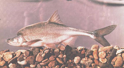
Humpback chub
One would think that the warmer river water would be better for native fish like the imperiled humpback chub, but the dropping reservoir levels are setting up a potentially disastrous situation for this endangered fish.
In recent decades, the humpbacks have been doing quite well in the Grand Canyon, particularly around the confluence with the Little Colorado River where warmer water joins the main river. The humpbacks have been recovering sufficiently that they were recently down-listed from ‘endangered’ to ‘threatened’ status under the US Endangered Species Act. But they’re now facing a bizarre twist of fate.
Lake Powell harbors a slew of invasive, introduced fish such as smallmouth bass that love to eat baby humpbacks. But until now, those predatory invaders in the lake haven’t been a threat to the humpbacks in the Grand Canyon because they hang out in the warmer upper layers of the lake, and the dam has been an effective barrier to their escape.
But as Lake Powell has dropped, the warm epilimnion water layer in Lake Powell has been lowering as well, and it is now at or near the same level as the hydropower outlets in Glen Canyon Dam. This means that the invasive predators may soon be able to pass through the dam’s penstocks in numbers that could put humpbacks in serious danger.
As many readers of this blog know, water solutions are oftentimes elusive and complicated. But there are many bright individuals working on these problems every day, and I remain ever hopeful for their success.
My sincere thanks to the extraordinary crew of river guides from OARS that piloted our safe yet adventurous journey. It has redoubled our hopes and efforts to keep the river flowing.
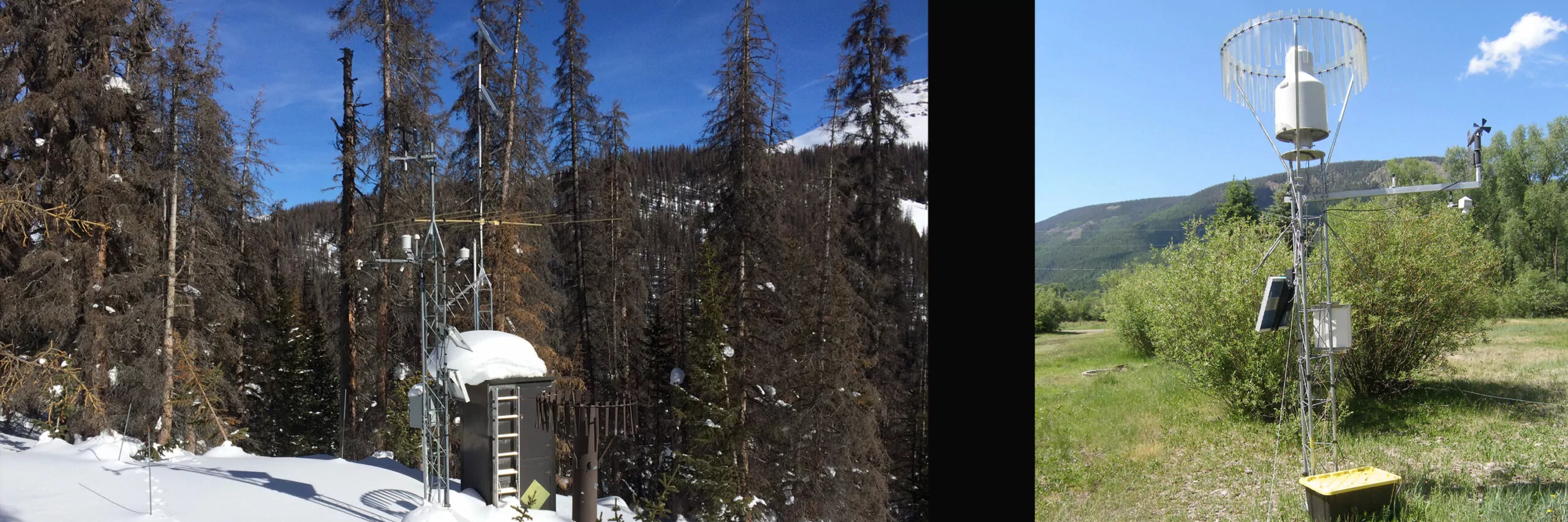
At left: Beartown SNOTEL site near Stony Pass with snow on the ground; courtesy Heather Dutton. Right: A Sno Lite site on the Conejos Valley floor near Platoro; courtesy Matt Hildner.
A location north of Creede, somewhere near Lost Lake around La Jara Creek, a site in the Trinchera area. Those are some of the general areas in the San Luis Valley where new SNOTEL stations, or automated snow monitoring stations, could show up under the Rio Grande Snow Measurement Enhancement Project being developed by water conservancy districts.
San Luis Valley Water Conservancy District Manager Heather Dutton is helping spearhead the project and has an outline for four new full SNOTEL stations and three SNO-Lite stations.
Establishing seven new sites would deliver more data from critical high-elevation areas to improve snow-depth readings and better forecast corresponding spring runoff into the creeks that feed the Upper Rio Grande Basin.
“We’re definitely going to build some sites, it’s just getting them dialed in,” Dutton said this week in an interview with Alamosa Citizen.
What’s at stake
Warmer seasonal temperatures, less snow occurrence, drier snow, and higher winds over the past two decades have created challenging conditions to forecast streamflows on the Upper Rio Grande.
Accurate forecasting, which relies on the accumulation of data from existing National Resource Conservation Service (NRCS) SNOTEL stations, matters particularly to Colorado’s management of the Rio Grande Compact with New Mexico and Texas. Better streamflow forecasting would also aid managers with the Rio Grande Water Conservation District and local irrigators in their management of groundwater well pumping and annual replacement plans.
“The goal of the project is to add more clarity, more data to on the ground sites so we can improve streamflow forecasting,” Dutton said.
The San Luis Valley Water Conservancy District initially received a $45,000 grant from the Colorado Water Plan to assist with establishing a series of SNO-Lite sites. But after showing conceptually that there were big data holes with the existing SNOTEL locations, the project evolved to include the four full stations to help with the NRCS model.
The cost is pegged at $293,000 for the seven sites, with funding coming from the San Luis Valley Water Conservancy District, the Colorado Water Conservancy District, Trinchera Ranch, and potentially from the Rio Grande Water Conservation District.
The additional SNOTEL sites will nearly double the current number of sites in the San Luis Valley, said Craig Cotten, division engineer for the state Division of Water Resources.
“This is really going to be a help for us,” he said.
The current SNOTEL sites, he said, are good for the location that they’re in. “But if you get a couple of miles away, it could be a totally different amount of snow and elevation as well.”
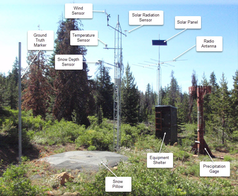
SNOTEL automated data collection site. Credit: NRCS
Why it matters
Data from SNOTEL sites is transmitted in near real time every hour to gauging stations to help water managers predict spring and summer streamflows. The gauging station at Del Norte, for instance, is essential to helping the state determine how much water from the Rio Grande is available to be delivered downstream into New Mexico.
The weight of the snow, which determines how much water is in the snow that has fallen, is the data a full SNOTEL site transmits. A SNO-lite site doesn’t have a similar snow pillow to weigh, and instead estimates the amount of water in snow.
In addition to improving streamflow forecasting, more SNOTEL sites means better soil moisture data, which is critical to assessing drought conditions and estimates of crop yields.
Historically, water managers could make safe assumptions on streamflows based on the readings from SNOTEL stations located in similar elevations. But those forecasts are no longer holding up as a result of the changing ecological environment in the San Luis Valley, Dutton said.
“What it comes down to, is the stream yield based on snow production is not tracking the way it used to,” she said.
The water conservancy districts, Alamosa County and the Rio Grande Water Conservation District contributed to a new Doppler weather radar at the Alamosa Regional Airport two years ago to help improve San Luis Valley weather forecasts.
The addition of SNOTEL stations is another step to get more data. They’ll be located in historically high snow-producing areas and where there currently is a need for more data, like the elevations north of Creede and in the southern end of the Valley.
“We want to make sure (a location) gets enough snow that is useful,” Dutton said.
The conservancy districts will spend the winter modeling the project and then conduct on-site analyses coming out of winter going into spring. The goal is to add two full SNOTEL sites both in 2023 and 2024, and the three SNO-Lite stations in 2023.
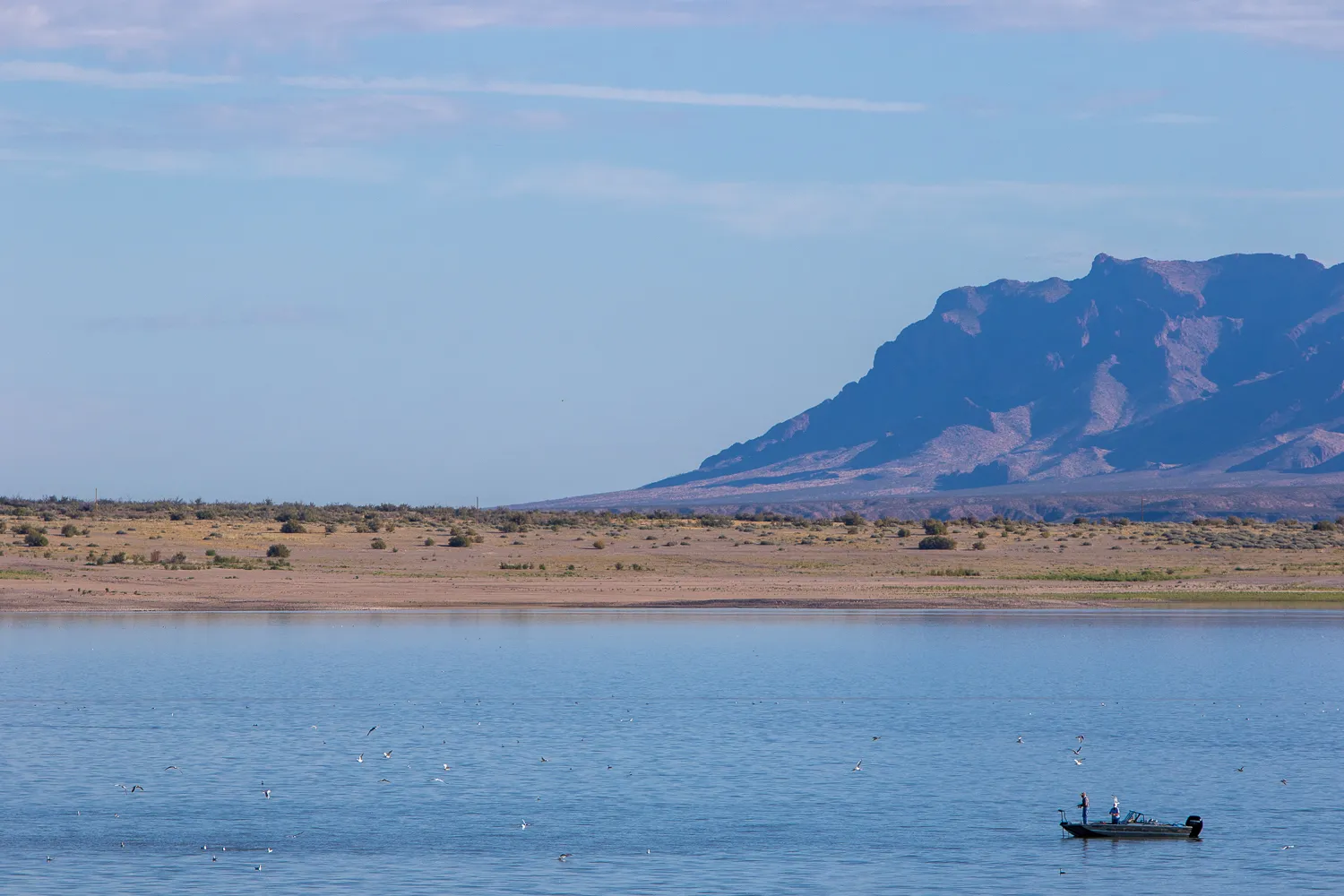
Visitors to Elephant Butte State Park fish despite the diminishing water levels that have exposed wide sand flats all around the lake, on Sept. 23. (Corrie Boudreaux/El Paso Matters)
A settlement draft is on the table to end nearly a decade of litigation over Rio Grande water before the Supreme Court — but not everyone is on board.
On Tuesday, Judge Michael Melloy — who is overseeing the case as the special master — said he would hear arguments on a draft settlement presented by Colorado, New Mexico and Texas, over the objections of the federal government and at least two irrigation districts.
The three states called the draft settlement a “carve-out decree” that resolves all issues of Rio Grande water-sharing between the states, while leaving open discussions of “intrastate” water management in New Mexico. Those discussions would involve disagreements over management of federal irrigation canals and dams, said Jeff Wechsler, the lead attorney for New Mexico.
“The settlement we believe fairly ensures that both Texas and New Mexico receive their fair share of water,” Wechsler said, adding that the state was open to resolving issues with the federal government.
Attorneys for the federal government disagreed that any issues could be “carved out,” and objected to the states’ proposed settlement, the terms of which remain confidential.
“Without the United States agreeing to this settlement, this compact dispute can’t end,” said Fred Liu, assistant to the Department of Justice’s solicitor general.
Texas sued New Mexico in the Supreme Court in 2014, arguing that groundwater pumping in southern New Mexico denied Texas its fair share of river water laid out by the 1938 Rio Grande Compact. In 2018, the high court allowed the federal government to join the case. The federal government has argued that New Mexico’s groundwater pumping threatens a water-sharing treaty with Mexico and arrangements with El Paso County Water Improvement District No. 1 and Elephant Butte Irrigation District.
Attorneys representing the irrigation districts sided with the feds Tuesday in opposing the states’ proposed settlement.
“This is a settlement over the objection of three major participating entities, all who run the (Rio Grande) Project and all who will be responsible for implementing this settlement over our objection, over our rights,” said Samantha Barncastle, who represents Elephant Butte Irrigation District. The Rio Grande Project is the series of federal dams and canals that distributes water and hydroelectric power to communities along the Texas-New Mexico state line.
Barncastle asked Melloy to send all of the parties back to the negotiating table.
Maria O’Brien, the attorney for El Paso County Water Improvement District No. 1, called the draft agreement “not workable.” She charged the states with making offers they could not actually keep.
Melloy on Tuesday called off the Jan. 17 trial date he set last month after the parties failed to reach an agreement after nearly a year of negotiations. He scheduled a Jan. 24 briefing to determine the legal issues surrounding the proposed settlement.
The judge encouraged the parties to continue negotiations in the months ahead of the briefing.
Liu pushed back, saying the federal government’s team did not have the resources to split between negotiating a new settlement, and responding to the states’ draft settlement.
Melloy responded that it was the federal government who had pushed for continuing to negotiate the case in May when the court inquired about scheduling the pending second half of the trial.
“Don’t start down that ‘poor old United States of America. We’re too busy to talk about settlement, and we don’t have the resources and we’re stretched too thin.’ I’m not buying that argument,” Melloy said, clarifying that he was not directing the parties to continue settlement discussions.
“I’m not directing you to do anything, and you can do whatever you want.”
The Rio Grande Basin spans Colorado, New Mexico and Texas. Credit: Chas Chamberlin
Hoover (Boulder) Dam under construction. For scale note the human sitting in the pipe section. Photo via Sibley’s Rivers
George discusses the “Law of the River” and the notion that the river’s hydrology might be the real law of the river. Click the link to read the article on the Sibley’s Rivers website (George Sibley):
For the past several posts, we’ve been exploring the Colorado River Compact, commemorating its centennial this year. Nearly everything I have read about the Colorado River Compact in this centennial year – and it’s getting to be voluminous – speaks of it as the ‘foundation’ of ‘The Law of the River,’ an accumulation of legal and political documents accompanying the development of the Colorado River since the 1922 Compact.
I have a problem with calling the Compact the ‘foundation’ of the Law of the River – as though before the Compact was adopted, the River was lawless. That is not true. The real foundation of the Law of the River is the appropriations doctrine that all seven states (or territories) had embraced in the 19th century – an evolving body of ‘common law’ that is the foundational law of all modern water development in the arid American West.
There is much to appreciate in the appropriations doctrine, which we explored a month or so ago. It democratically only allows the appropriation of the amount of water an appropriator(s) can beneficially put to use, to prevent big money speculation. It protects existing ‘senior’ downstream users from being dried up by new upstream ‘junior’ users. Among other virtues, it has shown flexibility in opening up to incorporate new uses like recreation and the environment.
But the appropriations doctrine also evolved as a powerful engine for growth. Its basic ‘first in time, first in right’ promise of perpetual secure use rewards those who get there first, regardless of what they do so long as it can be construed as economically beneficial, which we now know covers a multitude of sins against both nature and human nature. And ‘judicial expansions’ to the basic law really increased its potential for nurturing growth. The abstract ‘right to use water’ for some specific decreed purpose came to be a property that could be bought and sold like land itself – along with its seniority. The water whose use was purchased could be moved anywhere from its natural watershed with a simple change of purpose, enabling cities with limiting natural water supplies but concentrated economic power to accumulate water from great distances – including water they were not yet ready to use, exempting their ‘prudence’ from the anti-speculation law.
The appropriations doctrine is thus like the reactor in a nuclear power plant, an explosively powerful energy. What makes a nuclear power plant functional is a whole set of systems designed to contain, control, slow down, cool down and spread that explosive energy – turn it from a potentially destructive force to beneficial use.
The Compact commission came together 100 years ago to construct exactly that kind of control mechanism around the appropriation doctrine. Appropriation law based on seniority had emerged as a way of working out local problems; but as the land filled up, the logic of the law seemed to decree that prior appropriations would have to be honored across shared watershed boundaries – and then across state boundaries, in a stream shared among states. That was in fact being tested in the early 1920s in the U.S. Supreme Court, arbiter of interstate conflicts: the state of Wyoming sued the state of Colorado, on behalf of some Laramie River irrigators with decreed water in Wyoming that Colorado diverters upstream were threatening to cut off.
Governor Clarence J. Morley signing Colorado River compact and South Platte River compact bills, Delph Carpenter standing center. Unidentified photographer. Date 1925. Print from Denver Post. From the CSU Water Archives
Colorado water attorney Delph Carpenter had argued, in Wyoming v. Colorado, that the users in every state had the right to develop as much water as they could under their own law, and there would still be plenty to flow to downstream states. But Carpenter assumed he would lose that one, that the court would decree that the states would have to honor each other’s appropriations (which it did in June 1922), and he worried that the growth dynamic of the appropriation doctrine would then launch a ‘seven-state horserace’ with each state trying to appropriate as much water as possible as quickly as possible – with fastest-growing California half a lap ahead at the start, and the courts would be clogged with Wyoming v. Colorado situations. His concern, expressed to others in the region with similar concerns, led to the creation of the Compact Commission in 1922.
The question now, at the century mark, is whether the Compact actually succeeded in an equitable division among the states that prevented the ‘seven-state horserace’ – or whether the division into two basins just turned the seven-state race for appropriations into four-state and three-state races, since none of the states ever really damped down the drive for growth. (Arizona commissioner W.S. Norviel expressed that concern about the two-basin division in Compact meetings.)
The Compact did set a limit of 7.5 million acre feet (maf) for each Basin to use to depletion – but the Compact does not really present that as a limit; it is to be considered a major component of something to be worked out further as distribution from an uncommitted ‘surplus’ becomes possible. The short answer to the question would be that the Compact was very gentle, perhaps too gentle, in fitting the appropriations growth machine with brakes and steering. But the Compact is only the second (if you accept my analysis) element in the Law of the River. How does the further iteration of the Law of the River help or not help the rationalizing of the appropriation doctrine? Three elements came out in the decade following the Compact….
1928 – Boulder Canyon Project Act 1929 – California Limitation Act 1931 – California Seven-Party Agreement
The element following the Compact in the evolving Law of the River, as day follows night, was the Boulder Canyon Project Act in 1928 – the Congressional enabling legislation for the big bold strokes to control the Colorado River, teach it to stand in and push rather than cut and run. This was the first big step in the Compact’s main goal: ‘to secure the expeditious agricultural and industrial development of the Colorado River Basin, the storage of its waters, and the protection of life and property from floods.’
Rarely seen back of the Hoover Dam prior to first fill
But the great dam was only one part of the Boulder Canyon Project. It also included the Imperial Weir Dam and Desilting Works 200 miles downriver, diverting a huge portion of the river’s water into a new ‘All-American Canal’ to move the water over to the Imperial and Coachella Valleys without having to go through Mexican territory to get there. And getting the dam under construction inspired the new Metropolitan Water District, serving the many suburbs in search of a city in the Los Angeles-San Diego area, to begin construction on a 250-mile aqueduct from the Colorado River below the big dam. In addition, every gallon of water that went through the dam passed through a hydropower turbine. And all of that was completed by the beginning of World War II – water, food and power for what was America’s fastest-growing urbanizing and industrializing region.
Possibly more important than the natural challenges overcome, however, was the coming-together of the private and public sectors, which set a standard for the 20th century. Hoover Dam was built by a consortium of modest-sized contractors (operating under the name ‘Six Companies’) who had done nothing on that scale – yet it was completed months ahead of schedule and under budget. Spearheading the project was Henry J. Kaiser, who went on to other mega-dam projects, and then to ship-building during the second World War. The private sector knew how to do things it could not afford to do with private-sector funding; the public sector, however, could amass substantial long-term funding to do things beyond the relatively quick return on investment the private sector required. This project was put together under the often maligned administration of President Herbert Hoover – and set the model for much of Franklin Roosevelt’s ‘New Deal.’ So much so that Roosevelt could not tolerate naming the dam for ‘Hoover,’ and dedicated it in 1936 as ‘Boulder Dam.’
On a spectrum bounded by ‘Controlling the River’ at one end, and ‘Controlling the Growth Energy of the Appropriation Doctrine,’ the Boulder Canyon Project clearly swung far toward the former. But Congress, in the Boulder Canyon Project Act, also tried to do for the Lower Basin what the Compact Commission could not bring itself to do, and that was to set limits for the individual states. Of the Lower Basin’s 7.5 million acre-feet of water, Congress decreed that California would get 4.4 maf plus half of any designated surplus; Arizona would get 2.8 maf plus the flow of its tributaries like the Gila River; and Nevada – which did not have much going on at all in its southeastern area before dam construction began – would get 300,000 af.
The extent to which California was feared in the rest of the Colorado Basin for its fast growth and growing political power was also indicated in the Act by a legislative demand that California pass legislation limiting itself to the 4.4 maf designated in the Act. The state complied with that in 1929 – the fourth specific action in the evolving Law of the River.
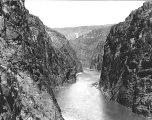
Colorado River, Black Canyon back in the day, site of Hoover Dam
But two years later, on the eve of construction beginning in the Black Canyon (not Boulder Canyon), California water user groups adopted a ‘Seven-party Agreement’ – the fifth ‘Law of the River’ element – that laid some fairly specific claims on ‘surplus water.’
‘Surplus water’ in Colorado River discussions has had three components: most of it (and the most real part of it) was Upper River Basin water that those states were not ready to use, so it flowed on to the Lower Basin, which saw no reason to not ‘borrow’ it rather than wasting it to the ocean. Another, more ephemeral ‘surplus’ component was a million or two acre-feet of water above and beyond the 15 maf divided in the Compact (plus whatever the Mexican allotment would be): the balance of BOR Director Davis’s estimated 16.8-17.5 maf average for the 20-some years of rough records, which would be allotted at some future time. A third, even more ephemeral component was water that the engineers would be ready to import into the river from some larger river, once the Colorado’s water was fully developed.
Remember: contextually we are still back at the naive beginning of the Anthropocene, when everything was still possible. Today, all three components of ‘surplus water’ in the two Colorado River Basins have disappeared – the naked facts have prevailed over the radiant colors of the early romance of engaging the river.
But in 1931 – even with a drier period emerging – a future of surplus was an article of faith, and the ‘Seven-party Agreement’ among the major California water users not only specifically defined how much of the state’s annual 4.4 maf would go to the agricultural users (3.85 maf) and to the new Metropolitan Water District for the Southern California coastal cities (550 kaf); it also got specific about another 962 kaf of surplus water: 662 kaf for the coastal cities and 300 kaf for agriculture – essentially a 10 percent ‘temporary’ expansion of their 4.4 maf allotment.
This was getting pretty specific about something so ambiguous as the ‘surplus water’ described above. But the Metropolitan Water District took it a step further: they designed and built their Colorado River aqueduct to carry not just their designated 550 kaf per year, but the ‘surplus water’ too. They were, in other words, building an aqueduct designed to carry twice their actual allotment; Southern California would grow on borrowed water.
This is why the other states – especially Arizona – were not eager to be sharing the river with California. And it also suggests that the crafters of the Compact and these subsequent LOTR measures were less interested in containing and harnessing the growth energy of the appropriations doctrine than in just grabbing the mane and running with it.
Here at the other end of the Compact’s century, we have to ask if the real underlying foundation of the Law of the River might not be some – well, law of the river itself. It might be good to articulate what law(s) a desert river abides by before inviting 40 million people to partake of it…
Meanwhile – here is an overview timeline of all the elements of the Law of the River as they unfolded over the past century (with gratitude for most of the list to the late lamented Justice Greg Hobbs). This will make no sense right now, but we will be looking more closely at most of them over the coming posts…
1860s to present – Evolution of Appropriation-based Water Law 1922 – Colorado River Compact 1928 – Boulder Canyon Project Act 1929 – California Limitation Act 1931 – California Seven-Party Agreement 1944 – United States-Republic of Mexico Water Treaty
1948 – Upper Colorado River Basin Compact 1956 – Colorado River Storage Project Act 1963 and 1964 – Arizona v. California decision and decree 1968 – Colorado River Basin Project Act 1970 – Operating Criteria for Colorado System Reservoirs 1974 – Colorado River Basin Salinity Control Act 1992 – Grand Canyon Protection Act
2001 – Interim Surplus Guidelines 2003 – Colorado River Water Delivery Agreement 2003 – California Quantification Settlement Agreement 2007 – Colorado River Interim Guidelines for Lower Basin Shortages and Coordinated Operations for Lake Powell and Lake Mead 2019 – Drought Contingency Plans
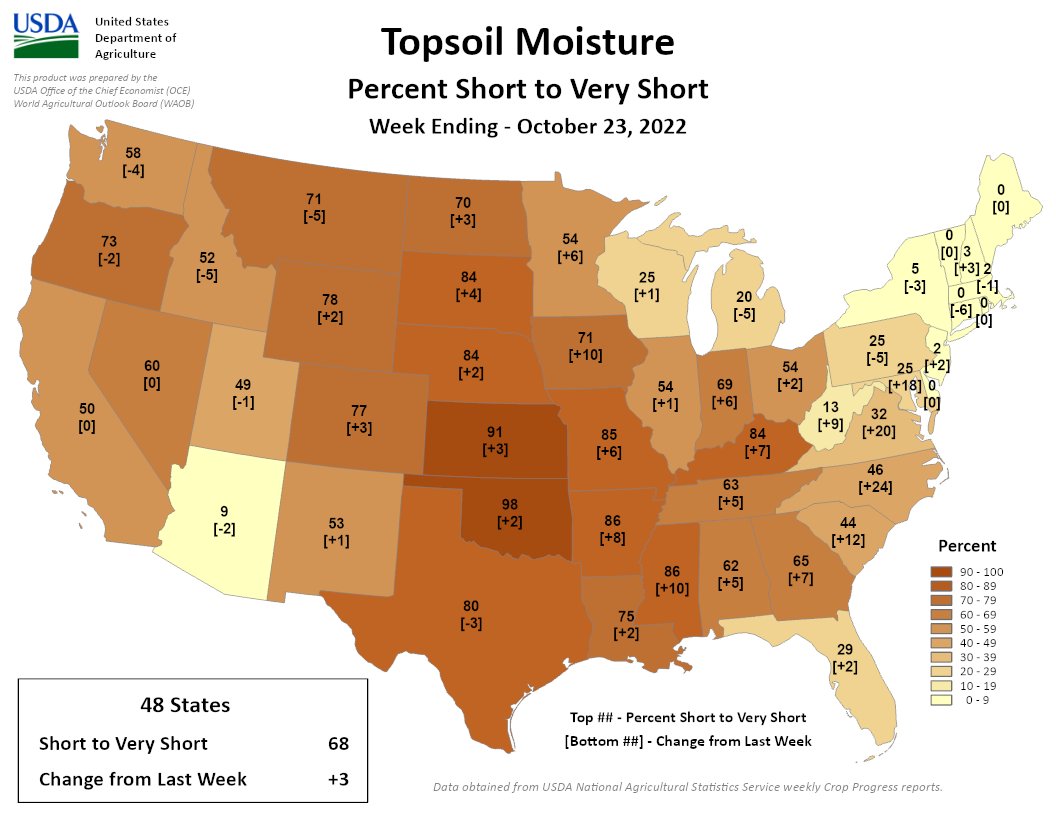
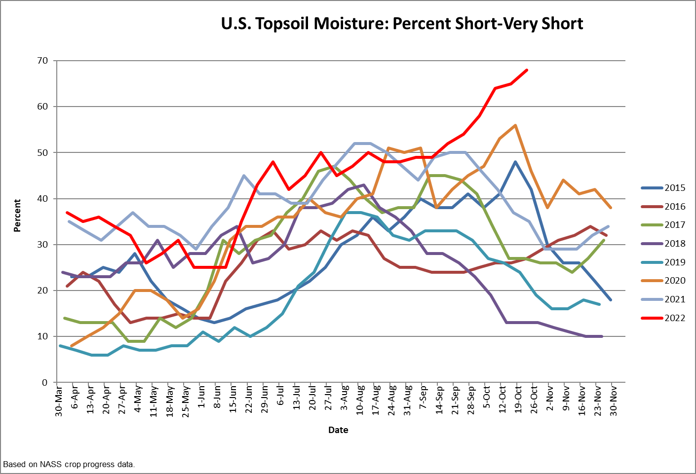
Another week, another rise. For the 3rd week in a row we’ve reached a 6-year high in Topsoil S/VS at 68%. Finally a positive. Some of the states w/ the worst conditions (OK) are going to see a lot of rain.
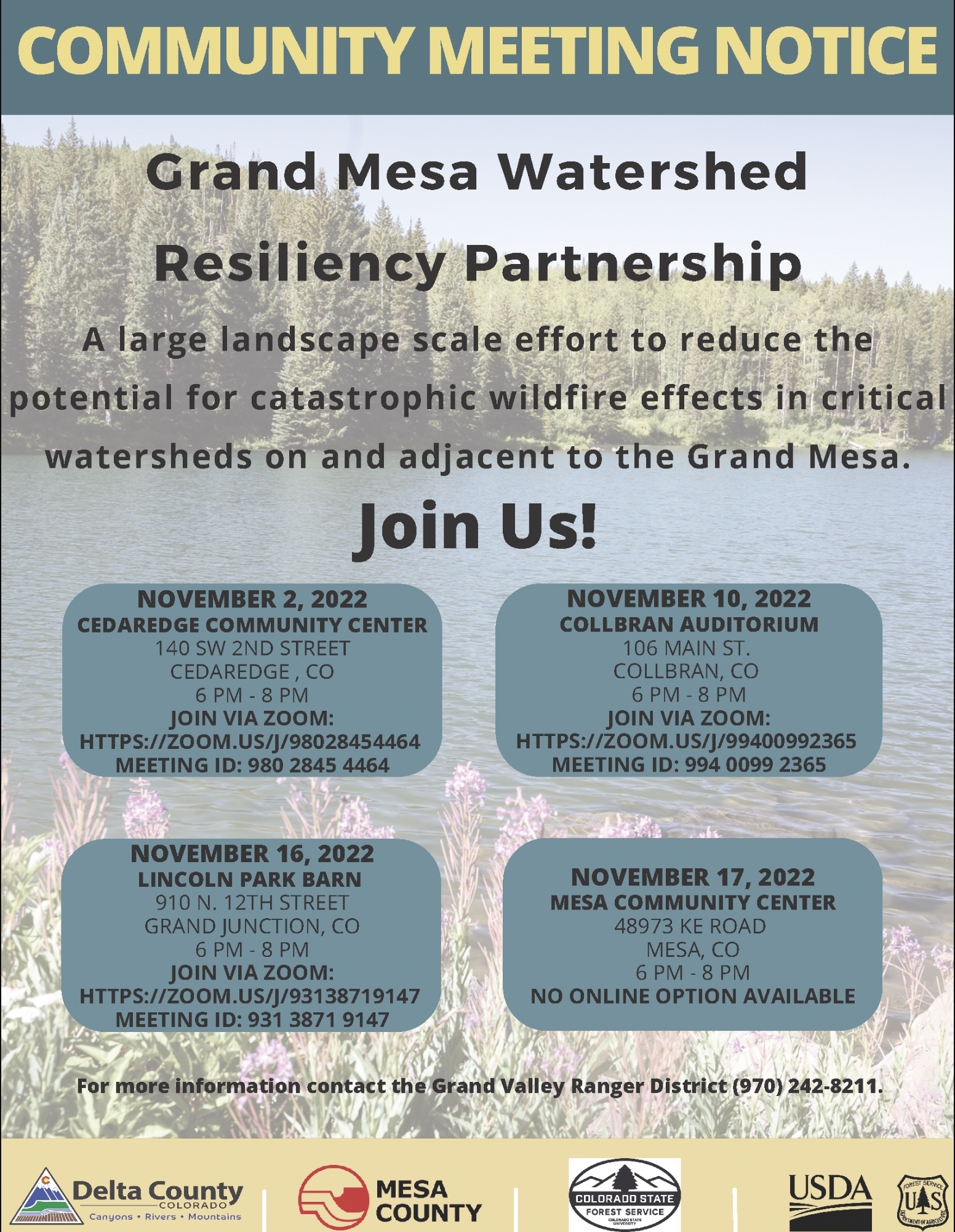
The Grand Mesa, Uncompahgre and Gunnison (GMUG) National Forests’ Grand Valley Ranger District in partnership with Delta County, Mesa County and Colorado State Forest Service announce the Grand Mesa Watershed Resiliency Partnership—a large landscape scale effort to reduce the potential for catastrophic wildfire effects in critical watersheds on and adjacent to the Grand Mesa. A series of community meetings will be offered to provide the public detailed information on the effort, what types of projects are considered and an invitation to be involved in the planning.
The Grand Mesa Watershed Resiliency Partnership was created in the summer of 2022 to plan integrated fuels reduction projects on the western portion of the Grand Mesa National Forest. Significant funding to implement projects is anticipated in two years. Early informational sessions with neighboring agencies, local governments, fire chiefs, utility companies, water producers, and wildfire councils have been very supportive. Community members are invited to actively participate and help create fire-resilient landscapes.
“The size and intensity of large wildfires have greatly increased across the West over the past 20 years, often with catastrophic results to communities and watersheds. In response, Congress has provided funding to implement locally-designed projects to reduce the intensity and negative effects of large wildfires. We are starting to work with our local communities now, so we are prepared to receive funding in two years. We are fortunate and grateful to have this unique opportunity, and community support will be necessary for this to be a successful effort,” said Bill Edwards, District Ranger for the Grand Valley Ranger District.
Several open houses in local communities will be available for in-person and online attendance:
Nov. 2 – 6 p.m. – 8 p.m. Cedaredge Community Center, 140 SW Second St. Cedaredge, CO 81413.
Brad Udall: Here’s the latest version of my 4-Panel plot thru Water Year (Oct-Sep) of 2021 of the Colorado River big reservoirs, natural flows, precipitation, and temperature. Data (PRISM) goes back or 1906 (or 1935 for reservoirs.) This updates previous work with @GreatLakesPeck. Credit: Brad Udall via Twitter
Click the link to read the column on the AZCentral.com website (Joanna Allhands). Here’s an excerpt:
The Gila River Indian Community now says it will conserve 125,000 acre-feet of its own water each year for three years and make available for purchase another 125,000 acre-feet of water it has stored underground for others – mostly, central Arizona cities – to leave more water in Lake Mead during that time. The hope is that this will entice others to follow suit – and that might help finally break the logjam on the additional 2 to 4 million acre-feet of Colorado River water that states must stop using next year, simply to keep Lake Mead and the upstream Lake Powell on life support.
We’re nowhere close to saving Lake Mead
Credit the tribe for leading by example. But don’t expect much to change. Farmers must be on board to achieve this magnitude of savings, considering that agriculture uses the lion’s share of water in Arizona and across the Colorado River basin. Yet many are balking at the price the feds have put on the table. And we’re still woefully short of saving enough water to save the lakes. The Upper Basin states of Colorado, Wyoming, Utah and New Mexico, which rely on Lake Powell, have been adamant that the bulk of cuts should fall on the Lower Basin states of California, Arizona and Nevada, which rely on Lake Mead. California recently sent a letter to the feds saying it would be willing to conserve 400,000 acre-feet each year for the next three years, if it gets money to help stabilize the environmental disaster that is the Salton Sea…
Add in Gila River’s proposal, and that’s 650,000 acre-feet on the table in 2023. Another million (or so) acre-feet of water could be in play if the feds carry through with their promise to begin “charging” the Lower Basin states for water lost to evaporation and transit, which the Upper Basin already pays but the Lower Basin pretends doesn’t exist.