
Click the link to read the article on The Pueblo Chieftain website (Josue Perez). Here’s an excerpt:
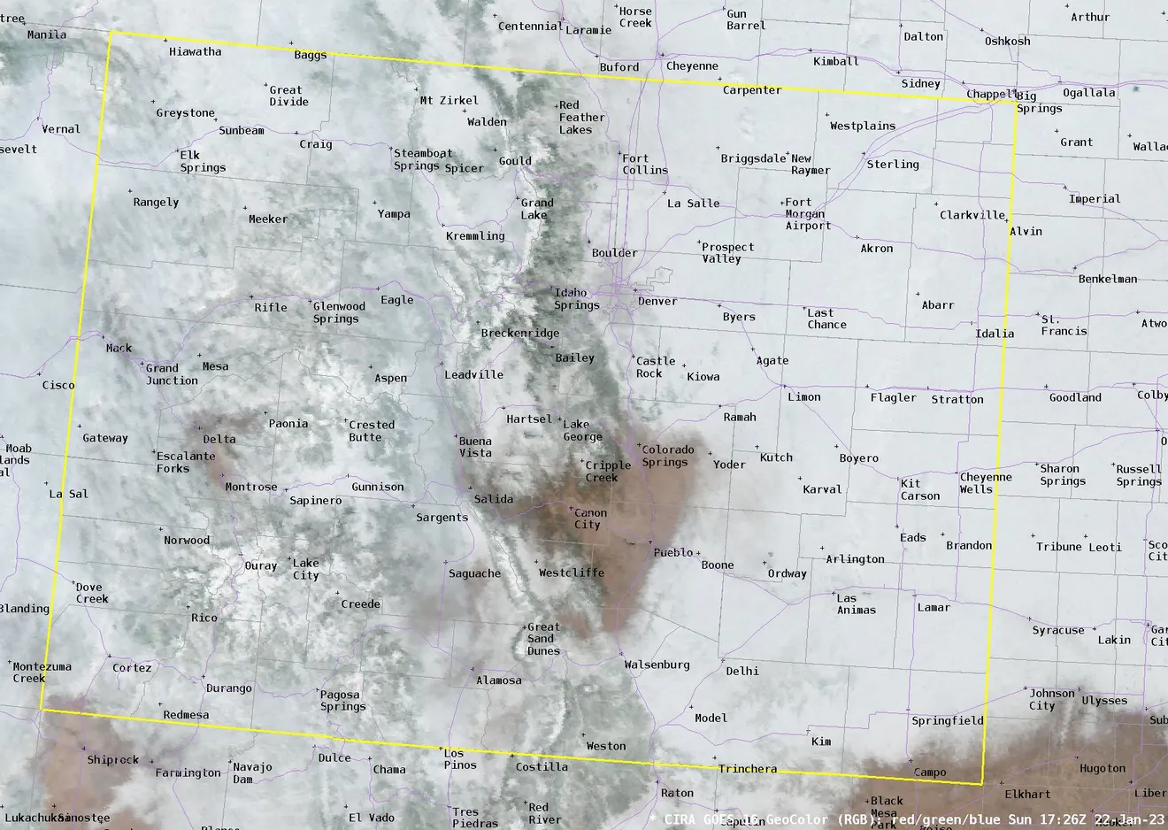
A recent satellite image showing snow throughout Colorado offered a glimpse and insight into a novel southern Colorado weather phenomenon: the Pueblo Precipitation Doughnut Hole. sThe image, released by the National Weather Service of Pueblo, showed that most of Colorado received snowfall on Jan. 20, with some cloud cover mixed in. But there was one specific area that missed out on the precipitation, which encompassed portions of east and northern Pueblo County, as well as portions of Cañon City and some of Colorado Springs.

That area is the home of the Pueblo Precipitation Doughnut Hole, a cross-section of terrain from south to north that tends to receive less precipitation than the areas surrounding it because of different geographical features such as Raton Mesa, the Arkansas River Valley, Palmer Divide and the surrounding mountains.
“It’s all about terrain, elevation and elevation change,” said Michael Garberoglio, an NWS meteorologist. “If you’re moving towards Pueblo from any direction, you’re decreasing in elevation, and when air flows down, terrain tends to dry out.”
Precipitation isn’t a fan of that sinking air flow, so those downslope winds contribute to dry and warmer climates for the region, Garberoglio said. It’s something that’s much more common during winter, especially when dealing with snowfall…
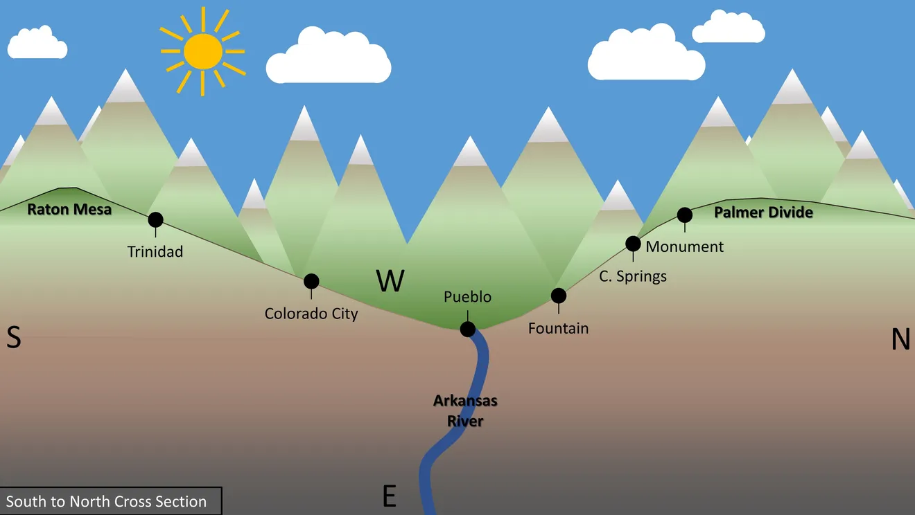
Although westerly winds are frequent in the region, intense, low-pressure easterly winds upslope along the terrain, enhancing the possibility for some precipitation, Garberoglio said, as long as they’re strong enough and have enough moisture in them.