Click the link to read the article on The Los Angeles Times website (Hayley Smith and Ian James). Here’s an excerpt:
At the heart of the feud is the “Law of the River,” a body of agreements, court decisions, contracts and decrees that govern the river’s use and date back to 1922, when the Colorado River Compact first divided river flows among the states. [ed. note: George Sibley argues the “Prior Appropriation” is the base of the Law of the River.]
But as California argues most strongly for strict adherence to this system of water apportionment, the other states say it makes little sense when the river’s largest reservoir, Lake Mead, continues to decline toward “dead pool” level, which would effectively cut off the Southwest from its water lifeline. The Law of the River, they say, is getting in the way of a solution.
“We can argue about whether interpretations of the Law of the River match the physical reality,” said Tom Buschatzke, director of the Arizona Department of Water Resources. “But if you end up in a courtroom arguing these points and something isn’t done, the Colorado River system is going to crash.”
[…]
California’s legal position is based on several factors, said James Salzman, a professor of environmental law at UCLA and UC Santa Barbara. First, the authors of the original Colorado Compact made the “fateful decision” to divvy up water for the river’s lower-basin states of California, Arizona and Nevada in absolute quantities instead of percentages. That means upper-basin states are obligated to deliver 7.5 million acre-feet per year to the lower states, no matter what, which “turned out to be a tragically bad design,” Salzman said. Additionally, the massive Imperial Irrigation District in California established senior rights to the water before the Colorado River Compact — meaning it holds high-priority rights to deliver the single largest share of the river’s water to Imperial Valley farmlands.
Arizona, by contrast, agreed to junior rights to the river in 1968 in exchange for building the Central Arizona Project, the system that transports river water through the state.
In other words, according to the Law of the River, if there’s not enough water to go around, states like Arizona are supposed to be cut off before California.
The Salton Sea (pictured above ) straddles the Imperial and Coachella valleys and has long been a sticking point in Colorado River deals. But the federal government recently committed up to $250 million for restoration efforts at the sea. (Source: Water Education Foundation)
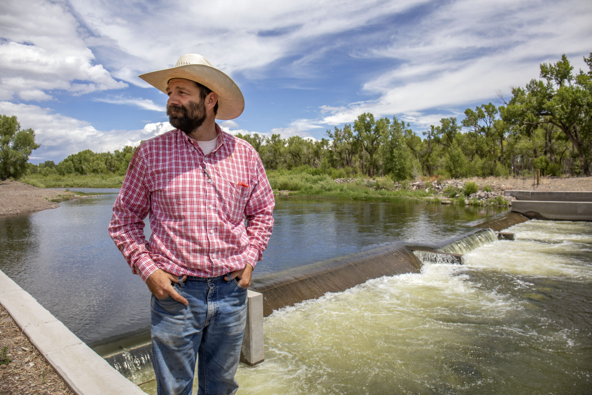
Farmer Kyler Brown in front of a small dam on the Rio Grande at a farm outside of Monte Vista, Colorado. “I’ve ranched. I’ve cowboyed. Now I’m farming and ranching,” Brown said. “You quickly learn in the West how important water is.” (Photo By Diana Cervantes for Source NM).
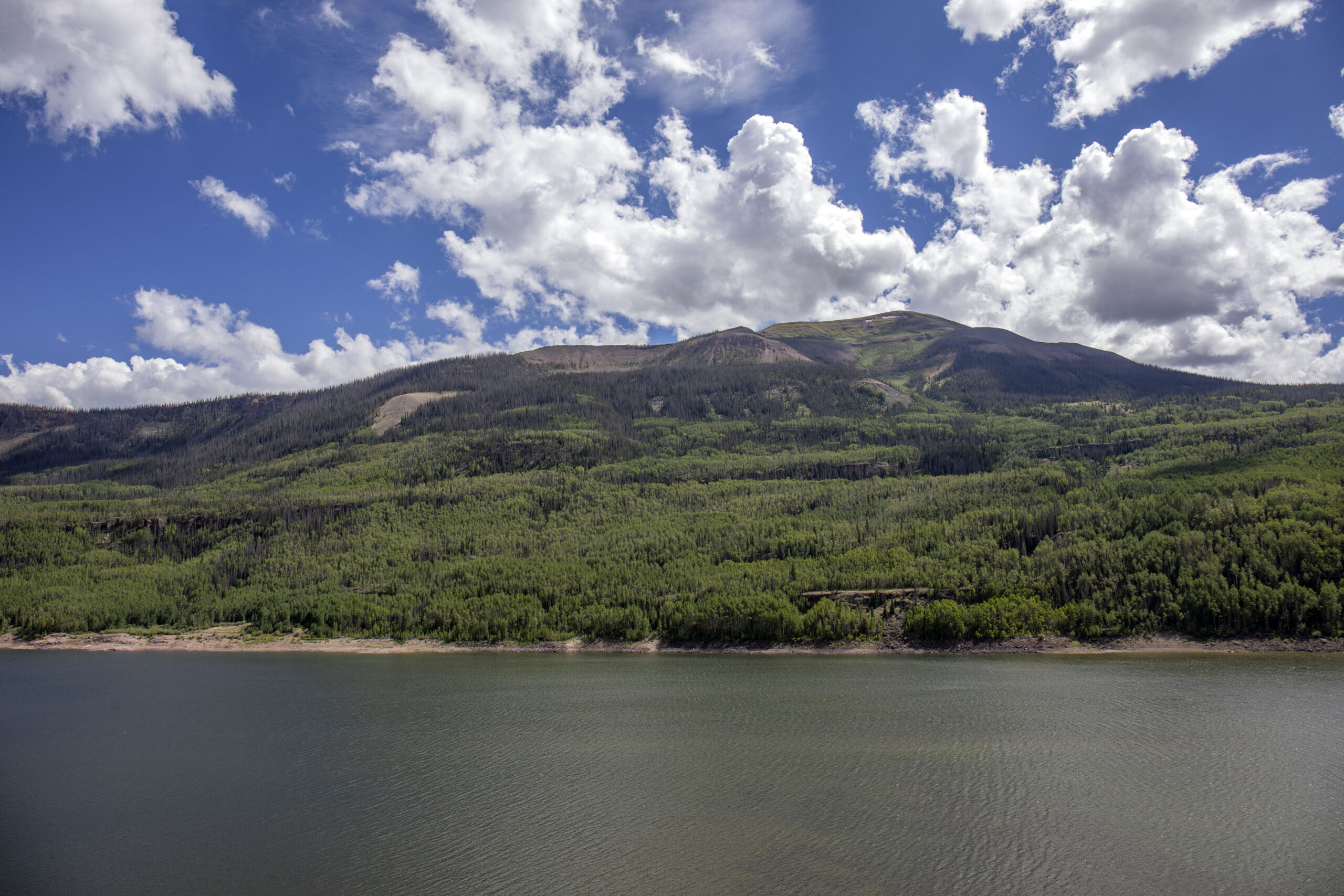
RIO GRANDE RESERVOIR, Colo — After 15 miles of pockmarked dirt road, the Rio Grande spreads wide in the shadows of the San Juan Mountains. It glitters, aqua, whitecaps whipped up by the wind. But even in the birthplace of the river lay the stark stains of climate change.
Deep, bald scars pucker the mountaintops, shorn of trees. In older burn scars, grass grows, flowing in the first summer breezes. In the newer scars, the thin rows of trees list, blackened and cracked, only a skirt of green growth at their base to mark the passage of time.
Crisis on the Rio Grande is a multi-part series that travels along the river from Colorado through New Mexico and into Texas. Read more: A river wounded
The Rio Grande meanders south and east through Colorado’s San Luis Valley, a region of about 8,000 square miles spanning six counties, tucked between two mountain ranges. Agriculture drives the economy. More than 46,000 residents rely on $370 million generated by alfalfa, barley, potatoes, wheat, beef cattle and sheep.
“Now you just really feel that that’s all on a collision course with climate, and that may have some severe ramifications,” said valley farmer and rancher Kyler Brown as he passed over the low Rio Grande that cuts across his father-in-law’s farm in Monte Vista, Colorado. The valley’s way of agricultural life is imperiled.
The San Luis Valley depends on water, for the herds, the crops, for next year’s planting. And for mortgages, farm insurance, sometimes for the shareholders, sometimes for keeping the business in the family.
Average rainfall is only 7 inches to 9 inches annually.
Three-fourths of the water in the Rio Grande instead starts as snow, folded into the crevices of the mountains, slowly seeping through soil or streaming down to the riverbed.
The river pools into the Rio Grande Reservoir at the base of the San Juan Mountains, fed mostly by snowmelt. (Photo by Diana Cervantes for Source NM)
The snowpack acts like a bank, a savings — water frozen for the future. In past decades, that meant cold snowmelt would start filling the rivers in April, peaking in June, eventually slowing through the autumn.
But warmer temperatures, less tree cover due to wildfires, more dust and thirsty soils from years of compounded drought prevent the just-melted snow from ever reaching the riverbed. Over the years, the smaller snowpack is becoming liquid earlier and changing the rhythm of the river.
In scarcity, relationships change
Though the San Juans had all of the snow they usually would in early spring 2022, it didn’t translate to a full river. Brutal May winds stripped away snowpack.
“There was a tension in my gut,” said Heather Dutton, manager of the San Luis Valley Water Conservancy District. “Because as the winds were howling, we knew we were losing snowpack. Every day, we were losing our opportunity to have flows in the river and put water in our aquifers.”
Threats are present. Farmers pump groundwater to make up for the river’s shortfalls, but that means falling groundwater levels. Populations swell on the Front Range around Denver, and downriver, too. And there’s always potential for devastating wildfire.
“We’re living on the knife’s edge with water,” Dutton said.
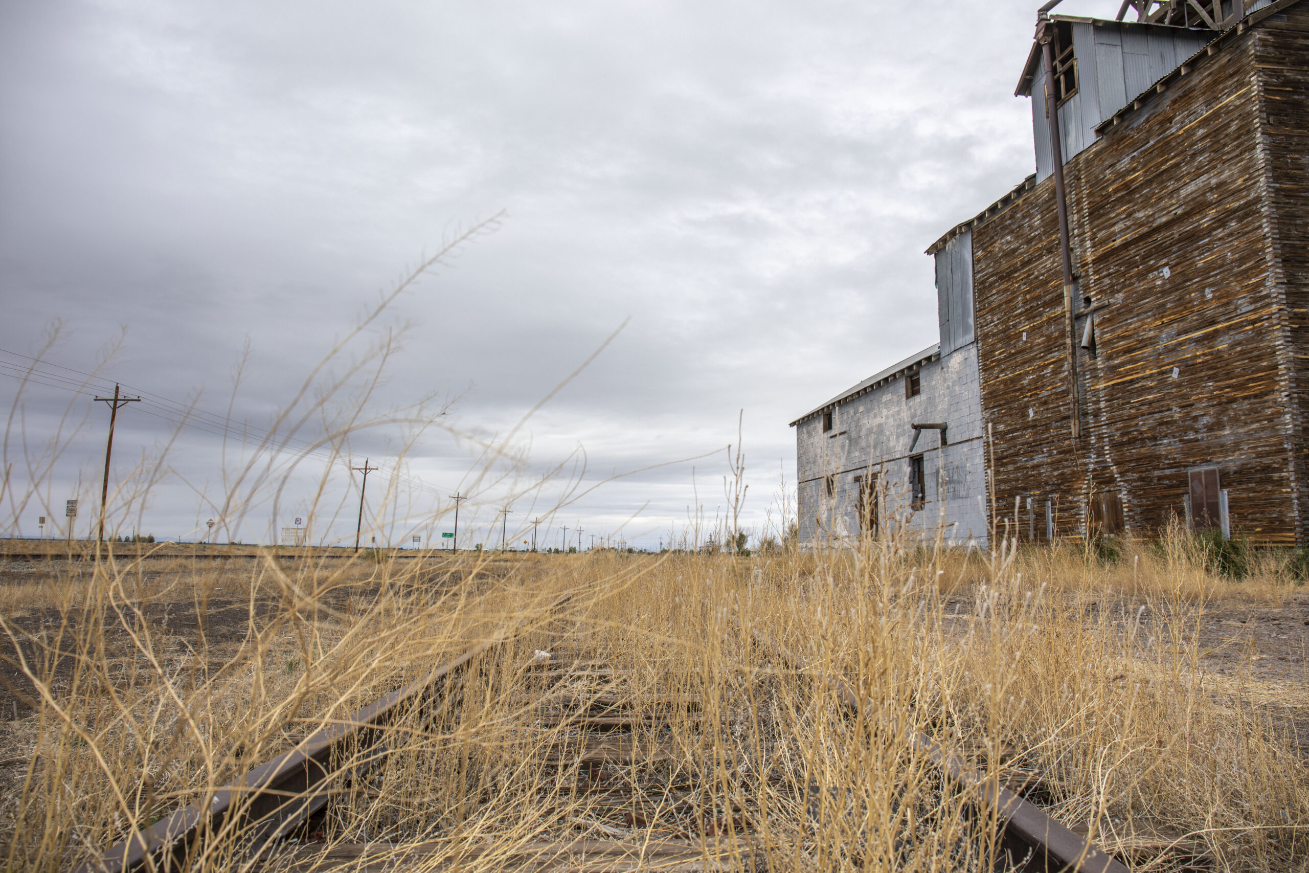
An old train depot captured June 22, 2022 outside of La Jara, Colorado. (Photo by Diana Cervantes for Source NM)
Water managers talk of new efforts to curb water use. They’re trying to change relationships between conservation groups, environmental nonprofits, farmers and the quasi-governmental irrigation districts.
Nathan Coombs, who manages the Conejos River District, said years of trust-building with groups typically at odds means there’s a greater willingness to face issues.
“Once we took down barriers of communication between project partners, we could start clearly seeing problems,” Coombs said. “If you want to solve those problems, you’ve got to talk to people you have never wanted to talk to before.”
It’s not perfect.
“Look, there’s always going to be a skunk at the picnic. I’m not saying everything is always totally kumbaya, but the biggest players for the vast majority are engaged.”
San Luis Valley Groundwater
Hidden waters
SAN LUIS VALLEY, Colo — Groundwater made the valley green, but climate change and over-pumping across time has depleted those water sources.
There are two aquifers underlying the valley. One is called the “confined aquifer,” trapped under an impermeable clay layer deep down, concentrated centrally. The other is a shallow “unconfined aquifer” generally found between 15 feet to 100 feet underground across most of the valley.
Artesian well Dutton Ranch, Alamosa 1909 via the Crestone Eagle
In certain spots in the valley, water used to gush out in artesian wells from the unconfined aquifer. But in recent decades, levels declined steeply after years of too many wells and too little recharge from the river or precipitation.
And the aquifers, explained Colorado State Engineer Mark Rein, take a double hit.
“There’s less water flowing naturally into aquifers that the wells rely on. At the same time,” he explained, “due to the lack of surface water, the wells are going to be more reliant on the aquifers.”
Farmers in the San Luis Valley have just eight years to stop the freefall of groundwater levels, or face the state shutting off wells.
In the valley’s most affluent district stretching between Alamosa and Saguache Counties, the aquifer declined 1.3 million acre feet by 1976, most of that over just 20 years. District officials submitted a plan to replenish the aquifer.
Rein acknowledged the efforts of Valley residents to reduce pumping, saying in June that it was too soon to tell if they could succeed in replenishing the aquifer before the 2031 deadline.
A sprinkler waters barley in a farm at Monte Vista. (Photo by Diana Cervantes for Source NM)
There’s a nexus Subdistrict 1 is dealing with, Rein said.
“We have this very rich culture in the San Luis Valley of irrigation, crops — and the economy is so dependent on it,” Rein said. “And at the same time, they’re facing a reality of less water.” One push to curb use might not go far enough. Another may go too far and erode culture and economy. “That’s what makes success more or less possible.”
All across Colorado, farmers have to offset any groundwater they pump either by submitting plans to water court for individual wells or joining a conservancy district in any of Colorado’s river basins.
Self-governance
People in the Rio Grande basin went further, carving up the basin into seven hyper-local subdistricts with a role in restoring the “balance between available water supplies and current levels of water use.”
Dutton, 36, brims with verve when she speaks about the river. Growing up on a potato farm, both her father and grandfather took on water leadership positions.
She said decisions at the local level were how changes were made to water policy.
The entities, the districts, the boards, they’re all made up of people that have a dog in the fight, she said. “They live and work in the community. They’re water users.”
Farmers in the valley taxed themselves, paying an additional fee for every acre-foot of groundwater they pumped to fund conservation measures.
Rio Grande and River Conejos conservation districts use the money to pay farmers to stay off their wells, to retire them, to retire fields, to purchase farmland. Or the funds go to creating a system of “water credits,” allowing farmers who need more water to buy from farmers who returned excess flows to the aquifer.
In 2022, the Colorado Legislature chipped in another $30 million out of federal coronavirus relief funds to buy land and retire irrigation wells along the Rio Grande.
The efforts are unique. Hundreds of wells were shuttered by the state in northeast Colorado in 2011.
“There were large-scale wells shut-offs, and those wells are still shut off,” Dutton said. “But here, we took the initiative as a community, and we said, ‘We want to regulate ourselves. We want to work together to make this work.’”
Even as the valley had record-breaking monsoon rainfall in 2022, it isn’t enough to recharge the aquifers, which face decades of pumping more water than is sinking in. (Photo by Diana Cervantes for Source NM)
Recent cycles have not been kind, either. After a few frugal years of farmers cutting pumping recharged the aquifer some, bad drought struck again. Without much replenishment from the struggling river, the past three years nearly erased those gains for groundwater.
Even when, in 2021, the district’s farmers pumped the least they had in a decade — the aquifer still dropped to a new historic low.
“It was incredibly disheartening,” Dutton said.
When a near-record monsoon season doused the valley in the summer of 2022, with some places receiving double the annual average rainfall, the river still ran at only 67% of its long-term average.
“It really wasn’t a great year as far as streamflow goes,” Dutton said. “Hopefully enough people saw what was happening in May and made some choices to change their farming plan for the year.”
Time is running out. Subdistrict 1 has to replenish the unconfined aquifer by more than 900,000 acre feet, or face the state capping wells.
Despite all their efforts and sacrifices, Dutton said, “we’re anticipating seeing a significant drop in the aquifer.”
THE San Luis Valley premiere of “Where the Cranes Meet the Mountains,” a short documentary to commemorate the 40th Annual Monte Vista Crane Festival, is slated for Saturday, March 11 at the Ski Hi Events Complex.
Filmmaker Christie Bode-Skeie and Crane Festival volunteer Jenny Nehring joined The Valley Pod for a conversation on the making of the film and all events scheduled for the 2023 Crane Festival.
Listen to the full podcast episode with Christie Bode-Skei and Jenny Nehring: HERE
“We wanted to tell the story of how it feels to see the cranes at the Monte Vista Crane Festival and the impact of that to someone new to the Valley,” explained Nehring.
The film features South Fork artist Amanda Charlton Hurley, who is a new arrival to the Valley experiencing for the first time the sights and sounds of Sandhill Cranes. For Bode-Skeie, it was a perfect way to recreate her own initial experience with the Sandhill Cranes and bring that to life through the documentary.
“I really wanted to strike a deep emotional chord,” Bode-Skeie said, “and I think I had to put myself back in the place when I first saw the cranes in the Valley 10 years ago and what that experience was like and looking at it with fresh eyes. It’s so easy to take things for granted when it’s right in your own backyard.”
The documentary also gives a subtle nod to other attributes of the Valley for residents and tourists alike to appreciate and provides a sense of the small town vibe of Monte Vista and surrounding communities.
In addition to the “Where the Cranes Meet the Mountains” documentary, the 40th Monte Vista Crane Festival will feature a keynote address by George Archibald, co-founder of the International Crane Foundation. The International Crane Foundation is celebrating its 50th year and bringing Archibald in to speak was a natural fit for Monte Vista’s 40th Crane Festival, said Nehring.
Tickets to the documentary premiere and to Archibald’s keynote address are available at mvcranefest.org.
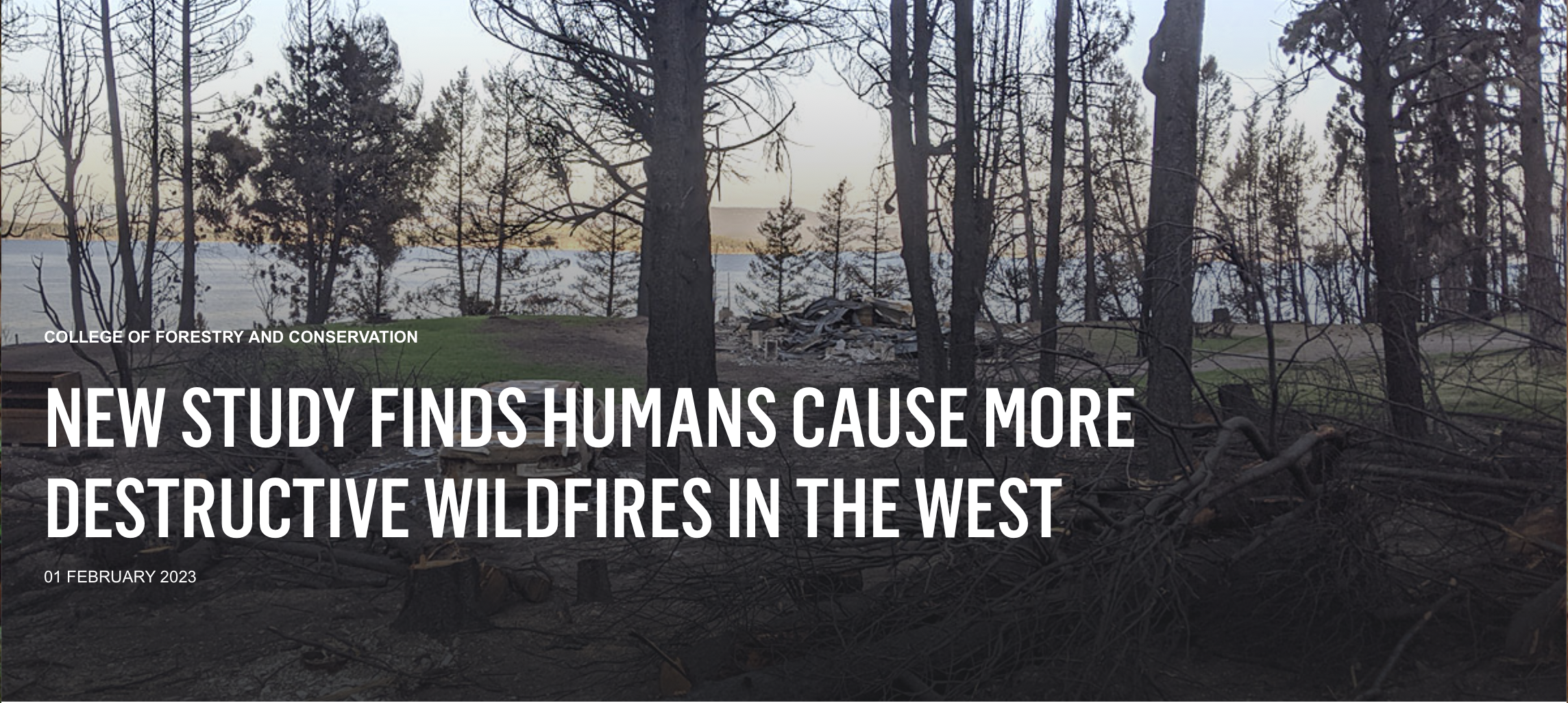
In August 2021, the human-caused Boulder 2700 Fire near Flathead Lake burned 2,230 acres and destroyed 31 structures, leaving debris along Highway 35 and threatening power lines and traffic.
MISSOULA – More than three times as many houses and other structures burned in Western wildfires from 2010 to 2020 than in the previous decade, and that wasn’t only because more acreage burned, according to a new analysis from the University of Montana and its partners.
Human ignitions started 76% of the wildfires that destroyed structures, and those fires tended to be in flammable areas where homes, commercial structures and outbuildings are increasingly common.
“Humans are driving the negative impacts from wildfire,” said lead author Philip Higuera, a UM fire ecologist and professor, who wrote the assessment during a sabbatical at the Cooperative Institute for Research in Environmental Sciences (CIRES) at the University of Colorado Boulder. “Human fingerprints are all over this. We influence the when, the where and the why.”
Most measures of wildfire’s impact – for example, expansion of wildfire season into new months and the number of structures in flammable vegetation – are going in the wrong direction, Higuera said. But the new finding, published Feb. 1 in the Proceedings of the National Academy of Sciences-Nexus, also means that human action can lessen the risks of wildfire damage.
“We have levers,” he said. “As climate change makes vegetation more flammable, we advise carefully considering if and how we build in flammable vegetation, for example.”
During Higuera’s visiting fellowship at CIRES, he worked with several researchers to dig into the details of 15,001 Western wildfires between 1999 and 2020.
Burned area increased 30% across the West, the team found, but structure loss increased much more, by nearly 250%. Many factors contributed, including climate change, our tendency to build more homes in flammable ecosystems and a history of suppressing wildfire.
Ph.D. student Maxwell Cook, a co-author from CIRES/CU Boulder, said the forcible removal of Indigenous people from landscapes played a role by all-but-eliminating intentional burning, which can lessen the risk of more destructive fires.
“Prescribed fire is an incredibly important tool, and we have a lot to learn about how people have been using fire for centuries,” Cook said.
In the new assessment, the team found some horrible years for wildfires. Sixty-two percent of all structures lost in those two decades were lost in just three years: 2017, 2018 and 2020, Cook said.
And some states had it much worse than others. California, for example, accounted for more than 77% of all 85,014 structures destroyed during 1999-2020.
Across the West, 1.3 structures were destroyed for every 1,000 hectares of land scorched by wildfire between 1999 and 2009. Between 2010 and 2020, that ratio increased to 3.4.
Importantly, Higuera and his colleagues also found variability among states in how much burning occurred and how many structures were lost in wildfires. Montana sees less structure loss relative to the West as a whole, and most burning is from lightning ignitions. California, on the other hand, sees high losses from wildfires and burns much more overall.
The paper concluded that all states could benefit from policies that address human-related ignitions, especially during late summer and fall and near developments, as well as policies that address fire-resistant building materials and consideration of nearby vegetation.
Finally, the authors said climate change mitigation is also essential. Longer fire seasons – a result of climate change – mean that human-related ignitions are more consequential, leading to more destructive wildfires in the fall and early winter when they were once rare.
A lateral brings water from the Grand Valley Irrigation Company canal to this parcel of land, which is owned by private equity firm Water Asset Management, a company that has been accused of water speculation. A state work group has released its report on investment water speculation, but failed to come to a consensus and did not make recommendations to lawmakers.
CREDIT: BETHANY BLITZ/ASPEN JOURNALISM
About three-quarters or more of those polled identified as extreme or serious problems issues such as the levels of water in Colorado rivers, lower snowpack, availability of water for farming and ranching, wildfire conditions, and more frequent drought…Eight-four percent of respondents said they viewed out-of-state investment firms and hedge funds buying Colorado water rights, as has happened in Mesa County, as being very threatening to water availability on the Western Slope, and the same percentage consider out-of-state water interests like California to be very threatening. Seventy-eight percent said they consider foreign governments buying Colorado water rights to be very threatening, and 62% view water users from other parts of the state such as Denver and the Front Range as being very threatening…Four out of every five respondents said they would support a small tax increase dedicated to the river district to use easements to protect water, by employing land conservation agreements to pay willing agricultural producers to preserve their water right and keep that water in western Colorado…
Weigel said 53% of respondents in the eastern part of the district said water users from other parts of the state are very much a threat, even though it didn’t rank among their top-five perceived threats.
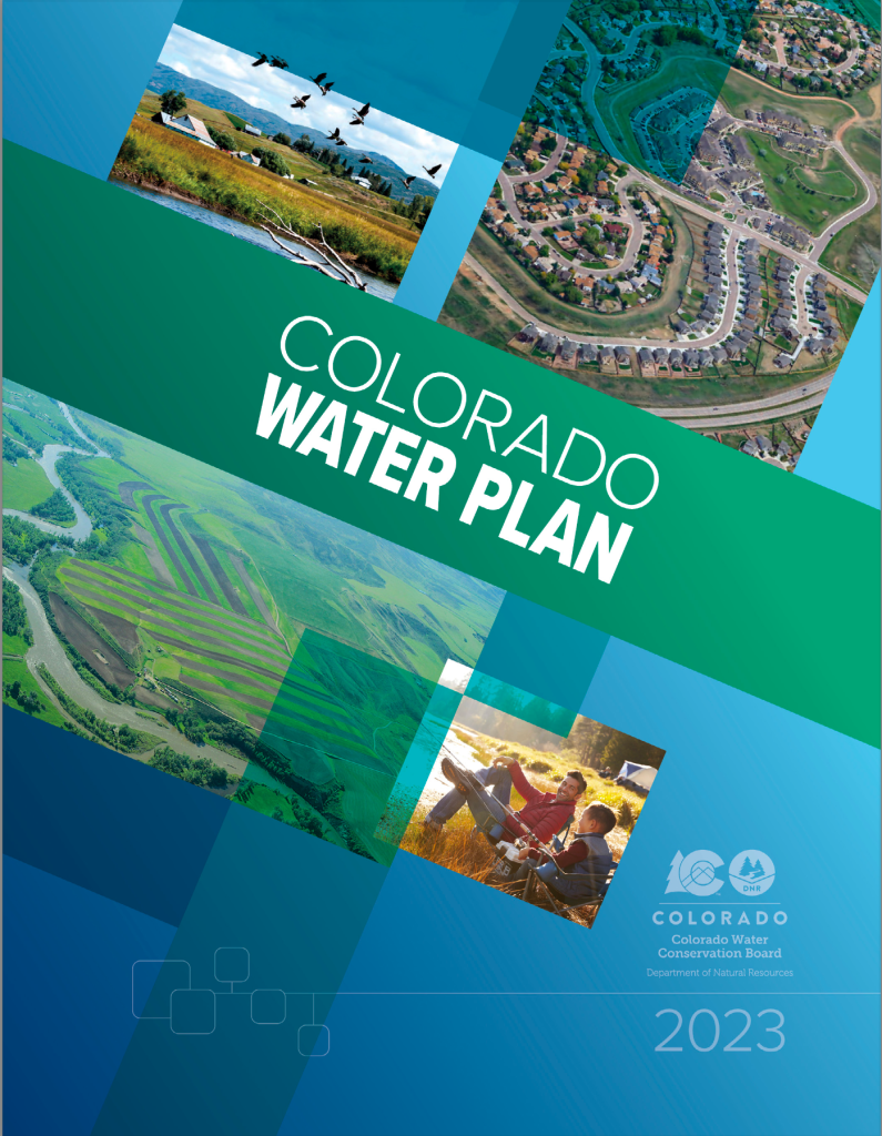
Updated water plan focuses key action areas to spur statewide water development, conservation
DENVER – Today [January 24, 2023], to meet Colorado’s most critical water challenges, the Colorado Water Conservation Board (CWCB) unanimously approved the finalized 2023 Colorado Water Plan. First released in 2015, the Water Plan provides a comprehensive framework to guide collaborative action from water partners, agencies, and Coloradans. From securing supplies that provide safe drinking water to improving farm irrigation to rehabilitating streams—the 2023 Water Plan targets specific, key actions to contribute to a stronger, more water-resilient Colorado.
“In Colorado, water is life,” said Colorado Governor Jared Polis. “Colorado’s Water Plan sets a vision for vibrant communities, successful farming and ranching, thriving watersheds, and climate resilient planning. I’m excited to see how the updated plan supports a more resilient future here in Colorado for years to come.”
Governor Polis championed approval of $17 million this year to kick-start local-level implementation of the Water Plan and is proposing $25.2M, including $12.6M General Fund, for the Water Plan Grant Program, which supports statewide water projects by providing grants and loans in collaboration with local partners in his FY 2023-2024 budget.
The 2023 Colorado Water Plan builds on the successes that followed the initial release of the pioneer plan in November 2015. For example, in recent years: water conservation efforts have decreased statewide per capita water use by 5 percent, water outreach and messaging reached 2.7 million people, and in 2019 Colorado voters passed Proposition DD to dedicate funding for the Colorado Water Plan grants program.
“We are excited about this much-anticipated update. Seven years ago, the CWCB released the original Water Plan—and now, guided by state-of-the-art data and innovative tools, the 2023 Plan puts Colorado’s values into a set of actions that tackle the specific challenges and opportunities of our state,” said Becky Mitchell, CWCB Director. “The 2023 plan will spark the action we need across all sectors to build a better water future in Colorado, setting the stage for future decision-making and water resiliency.”
Now, the 2023 update maintains the values and priorities of the original plan, while reframing actions into four key areas: Vibrant Communities, Robust Agriculture, Thriving Watersheds, and Resilient Planning. Within these four interconnected areas, a list of approximately 50 actions for partners and 50 actions for the state aim to address themes such as equity, climate resilience, water conservation, land use, education, and more. The Water Plan Grant Program welcomes projects and programs that fall in five major funding categories: Water Storage and Supply, Conservation & Land Use, Engagement & Innovation, Agricultural projects, and Watershed Health & Recreation.
Colorado’s water challenges impact everyone from local leaders to stakeholders to families in their own backyards. The CWCB encourages people from all walks of life to get involved with Colorado’s Water Plan: whether that’s by practicing personal water conservation, getting involved in critical water initiatives—or applying for a Water Plan grant, or encouraging local organizations to pursue a grant to advance projects that build water resilience.
Throughout the development of the Colorado Water Plan, engaging with the public has been critical for the CWCB. The team conducted a year-long public engagement phase to incorporate all Colorado’s voices, hosted a public comment period, held workshops, and encouraged Coloradans to share their own water conservation success stories and commit to action through a water conservation pledge.
In total, the public comment period yielded over 528 pages of comments, 1,597 suggested edits to the plan, and more than 2,000 observations. Comments came in a variety of formats including letters, emails, survey responses, feedback at events, and public listening sessions. Of those comments, about 60% were either already captured in the plan or were addressed by modifying the draft plan.
“I congratulate the Colorado Water Conservation Board, staff and all the Colorado water stakeholders who contributed to the 2023 Colorado Water Plan,” said Dan Gibbs, Executive Director, Colorado Department of Natural Resources. “The Plan provides an important vision and roadmap for Colorado’s water future which faces increased challenges from climate change, population growth and changing water demands. But working together we can meet these challenges and ensure our Colorado communities, agriculture and environment will continue to thrive for generations to come.”
CWCB will celebrate the release of the Water Plan on January 24, 2023, at Improper City in Denver from 5-9 p.m. The celebration is open to the public, and will feature speakers, live music, and recognition of 14 local water heroes who were instrumental in bringing the updated Plan to fruition. The Basin Water Heroes include Garret Varra (South Platte Basin), Bob Peters (Metro), Carl Trick (North Platte Basin), Daniel Boyes (Rio Grande Basin), Ken Brenner (Yampa/White/Green Basin), Mark Shea (Arkansas Basin), Carrie Padgett (Southwest Basin), Jason Turner (Colorado Basin), Kathleen Curry (Gunnison Basin); as well as the following Community Water Heroes: Ronda Lobato, Ernest House Jr., Jared Romero, CREA Results, and Water Education Colorado.
Updated Colorado River 4-Panel plot thru Water Year 2022 showing reservoirs, flows, temperatures and precipitation. All trends are in the wrong direction. Since original 2017 plot, conditions have deteriorated significantly. Brad Udall via Twitter: https://twitter.com/bradudall/status/1593316262041436160
Click the link to read the article on The Denver Post website (Conrad Swanson). Here’s an excerpt:
Evaporation and transfer loss is a meaningful starting point, Brad Udall, a water and climate scientist at Colorado State University, said. But the country’s two largest reservoirs, lakes Powell and Mead, are already at historic lows and waiting until they sink further to make cuts doesn’t make sense.
“Let’s cut the crap,” Udall said. “We don’t have elevation to give away right now.”
All told, the six-state plan doesn’t save the smallest amount of water required by the federal government. Evaporation, transfer loss and the tiered water cuts to the lower basin combine to save as much as 1.95 million acre-feet…At a minimum, the states must save 2 million acre-feet a year, federal officials announced last summer, but now water experts are wondering whether the basin must save three times that much, more than Colorado, New Mexico, Utah and Wyoming combined use in a single year…The existing proposal isn’t enough to qualify as a long-term plan, but it might be enough for the basin to survive until it can agree on one, Udall said.
Federal officials’ reaction to the plan remains unclear. After the states published it Monday, a representative for U.S. Bureau of Reclamation Commissioner Camille Touton canceled a Tuesday morning interview with The Denver Post and directed questions to the U.S. Department of Interior, which offered no additional insight.
Shoshone Falls hydroelectric generation station via USGenWeb. Shoshone hydropower plant has the most senior, large-volume water right on the Colorado mainstem. The bonus for other users is that the water returns to the river after producing electricity.
Two proposed pumped water storage projects that could expand Colorado’s ability to store renewable energy – one in Fremont County and another between Hayden and Craig in the Yampa River Valley – are moving forward.
Colorado will need green energy storage of some type if it is to attain its mid-century goals of 100% renewable energy. Solar and wind power are highly variable and cannot be turned off and on, like coal and natural gas plants are.
So the search is on for ways to build large-scale storage projects to hold the energy wind and solar generate. Lithium-ion batteries are part of the answer and are being rapidly added to supplement wind and solar. But they typically have a short life span, while pumped water storage hydropower projects can operate for decades.
Pumped storage hydro electric.
Pumped water storage has been refined in recent decades but the basic principles remain unchanged. Water is released from a higher reservoir to generate power when electricity is most in demand and expensive. When electricity is plentiful and less expensive, the water is pumped back up to the higher reservoir and stored until it is needed again.
This technology even today is responsible for 93% of energy storage in the United States, according to the U.S. Department of Energy. That includes Cabin Creek, Xcel Energy’s 324-megawatt pumped storage unit near Georgetown. It was installed in 1967.
“These pumped-storage projects are anathema to the modern way of thinking,” says Peter Gish, a principal in Ortus Climate Mitigation, the developer of the Fremont County pumped water storage project.
“But once built and operating, the maintenance costs are very, very low, and the system will last, if properly maintained, a century or longer. The capital investment up front is quite high, but when you run the financial models over 30, 50 or 60 years, this technology is, hands down, the cheapest technology on the market for [energy] storage.”
Ortus Climate Mitigation wants to build a 500-megawatt pumped water storage facility on the South Slope of Pikes Peak above the town of Penrose in Fremont County. This facility – essentially a giant battery for energy storage – would require two reservoirs.
Gish hopes to have a permit from the Federal Energy Regulatory Commission in 2026. Construction would take up to five years after the permit is approved.
In the Yampa Valley, another developer continues to plug away at a potential application for a site somewhere between Hayden and Craig. Still another idea is said to be in formulation in southwestern Colorado, but no details could be gleaned about that project.
Phantom Canyon, as Ortus calls its project in Fremont County, would require 17,000 acre-feet of water for the initial fill of the two reservoirs to be augmented by about 1,500 acre-feet annually due to losses from evaporation.
The company says it has accumulated water rights.
Gish, a co-founder of Ortus, says his company is “keenly aware” of water scarcity issues in Colorado and looks into ways to reduce the evaporative loss and hence shave water needs. One option is to place solar panels over the reservoirs, producing energy while shading the water. On a vastly smaller scale, that has been done at the Walden municipal water treatment plant in north-central Colorado.
Unlike an unsuccessful attempt by Xcel in 2021 to build a pumped water storage project in Unaweep Canyon on federal land in Western Colorado, the Ortus project near Pikes Peak would involve only private land. The company has exclusive purchase options for 4,900 acres. It also has secured 12 easements for pipeline access from the lower reservoir to the Arkansas River.
Proximity to water sources matters, and so does the location relative to transmission. Penrose is about 30 miles from both Colorado Springs and Pueblo and major transmission lines.
The company last year laid out the preliminary plans with Fremont County planners and hosted a meeting in Canon City to which environmental groups and others were invited. By then, FERC had issued a preliminary permit which is the start of the permitting process. Gish, who has worked in renewable energy for 25 years, says no potential red flags were noted.
“I have found that the local stakeholders are the first people you need to talk to about a project like this,” Gish says, “If you are able to get local support, the rest of the pieces will tend to fall into place. If not, the rest of the process is a much more difficult proposition.”
In Western Colorado, Xcel faced local opposition but also the more daunting process of permitting for a project on federal land. In the Craig-Hayden area, Matthew Shapiro, a principal in green energy company Gridflex Energy, had been examining sites that are on private land. Work continues on geological assessments and other elements, but he says that a “lot of other pieces need to come together before there is real progress.”
In addition to having water, that portion of the Yampa Valley also has the advantage of transmission lines erected to dispatch power from the five coal-burning units that are now scheduled to close between 2025 and 2030.
Shapiro hopes to also use Colorado-sourced water to generate electricity in a pumped-storage project on the North Platte River in Wyoming. Gridflex Energy filed for a license application with FERC last week for the project on Seminoe Reservoir.
“Very few projects have made it that far since the turn of the millennium. It’s a pretty big deal,” Shapiro said.
Long-time Colorado journalist Allen Best produces an e-journal called Big Pivots and is a frequent contributor to Fresh Water News.
The back of Glen Canyon Dam circa 1964, not long after the reservoir had begun filling up. Here the water level is above dead pool, meaning water can be released via the river outlets, but it is below minimum power pool, so water cannot yet enter the penstocks to generate electricity. Bureau of Reclamation photo.
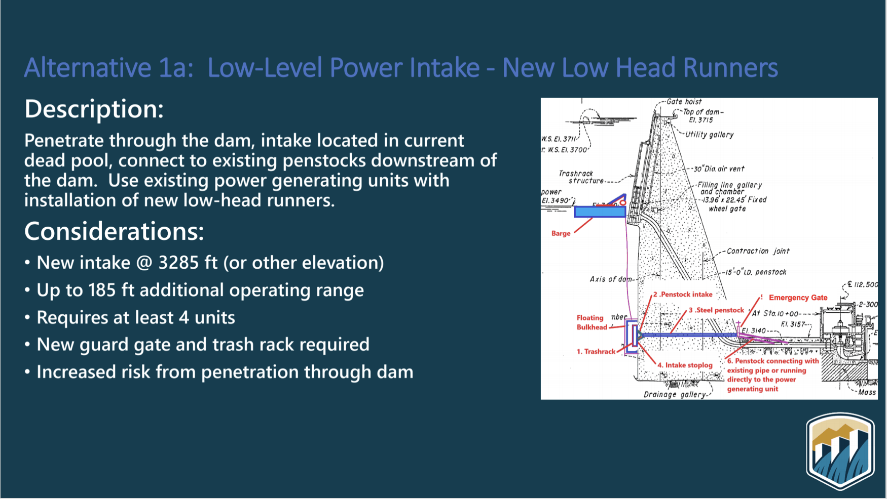
A preliminary analysis of potential modifications to the dam emerged during a virtual meeting held by the federal Bureau of Reclamation, which is also reviewing options for averting a collapse of the water supply along the river. These new discussions about retooling the dam reflect growing concerns among federal officials about how climate change is contributing to the Colorado River’s reduced flows, and how declining reservoirs could force major changes in dam management for years to come…
Roerink and two other people who listened to the webinar told The Times that cost estimates for several alternatives ranged from $500 million to $3 billion. The agency will need congressional approval and will have to conduct an environmental review to analyze options. The Bureau of Reclamation’s presentation, given by regional power manager Nick Williams, included some additional alternatives that wouldn’t require major structural modifications of the dam. Those options included adjusting operations to maximize power generation at low reservoir levels, studying ways of using the existing intakes at lower water levels, and making up for the loss of hydroelectric power by investing in solar or wind energy…
Low-Level Power Intake with New Low Head Runners (Alternative 1a. via USBR)
According to a slide presentation shown at the meeting, officials see potential hazards in some of the six alternatives. Piercing the dam’s concrete to create new low-level or mid-level intakes, for example, would entail “increased risk from penetration through dam,” the presentation says. They also describe risks due to possible “vortex formation,” or the creation of whirlpools above horizontal intakes as the water level declines. Their formation could cause damage if air is pulled into the system. The presentation says one alternative would involve lowering the minimum power pool limit and possibly installing structures on the intakes to suppress whirlpools, but it said this still would not allow for the water level to go much lower.
A high desert thunderstorm lights up the sky behind Glen Canyon Dam — Photo USBR
Outside Capitol Reef, photo courtesy of Michael Shoemaker
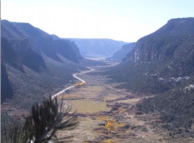
Click the link to read the article on the Writers on the Range website (Richard Knight):
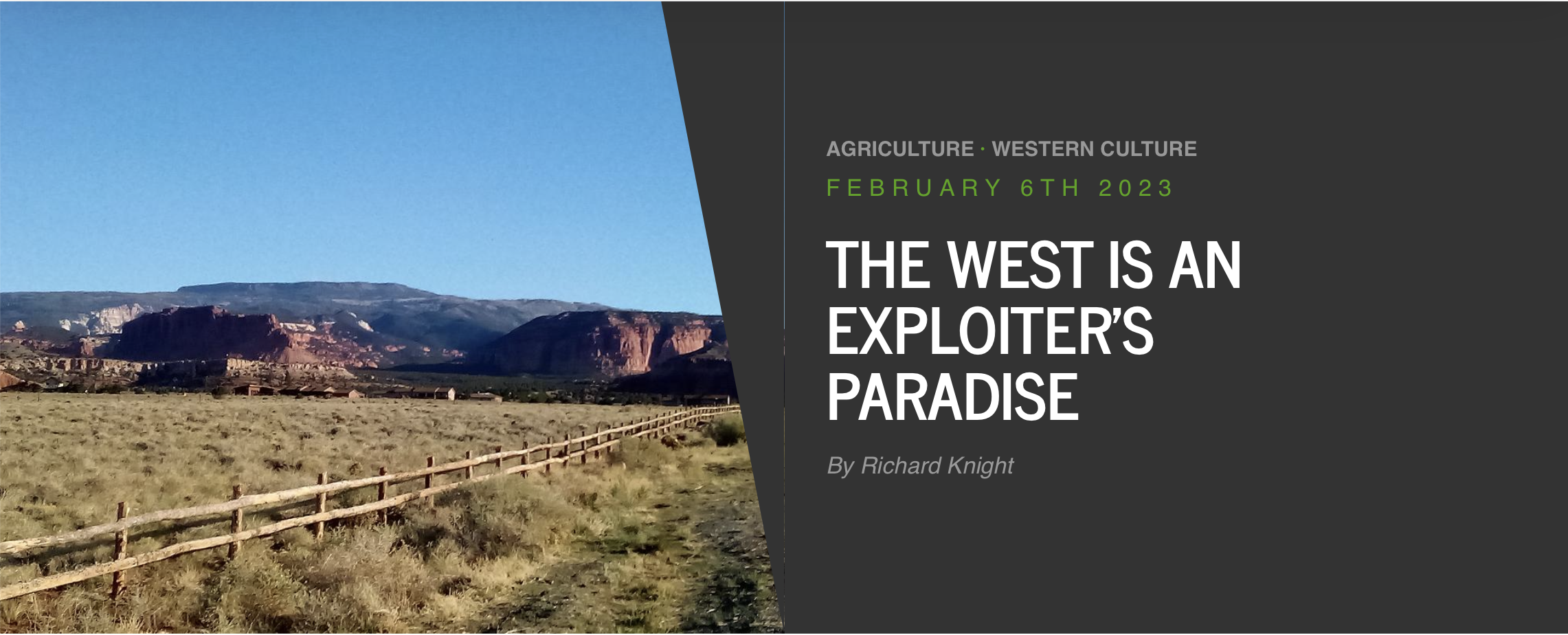
High on a mesa where everyone can see it, a trophy house is going up in the northern Colorado valley where I live. Some of my neighbors hear that the house will be as big as 15,000 square feet. Others say it will take three years to complete. Whether that is valley gossip or truth, the house is now the center of everybody’s attention.
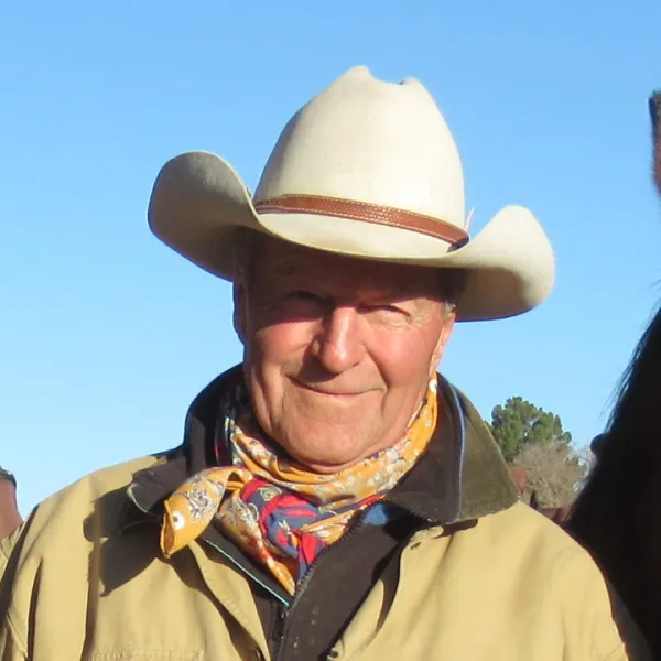
Richard Knight. Photo credit: Writers on the Range
Until this happened, my valley seemed to offer much of the best of what Colorado has to offer, including views of a snow-capped mountain range, and spread out below, irrigated hayfields with black cows on tan rangeland. But now, right in the center of the valley, will be one person acting out a lack of consideration for others.
Gigantic trophy houses seem to signal, “I built here to see, but also to be seen.” It’s a jarring reminder that we in the New West are remaking the Old West in our own image, a job that apparently requires a drastic redoing of topography. These big homes seem to follow a pattern of complicated rooflines, lots of windows that reflect the light and “ego gates” at the beginning of driveways.
Most of us in this valley delight in what we’ve been able to see from our front door: Uninterrupted ridgelines, cliffs, and the rounded slopes that converge to make foothills, which then rise into mountains. Nature made these views, and we’ve been fortunate to have them in our lives every day.
But more and more, houses that resemble castles are sprouting on ridgelines and hilltops, here and all over the mountains. And sometimes it’s ordinary houses or trailers that get built on ridgelines, interrupting the natural flow of the land.
Where only a few years ago our eyes might find comfort in tracing a ridge’s backbone — wondering how it got to be named White Pine Mountain when no white pines grow there — now we look at manmade structures that irritate the eyes.
People who have lived in my valley for decades share a different style. Appreciating what a winter wind can do to steal warmth from inside a house, they looked for sheltered areas to build. They saw it made sense to build low, tucking a home against the south side of a hill or cliff.
Most yard lights were few and hard to see, as were their homes. But the new Western lifestyle broadcasts yard lights at night for all to see, just as the homes are conspicuously visible during the day.
In this newfangled West that has “ranched the view,” people apparently need to stand out to enjoy an amenity lifestyle. Will these new folk ever take time to appreciate the human and natural histories of the place they live in now, to show respect for the land and its natural beauty? Will they learn to be considerate of neighbors and not take away from the views that define where we live?
It’s shameful to think that just as we first moved into the West to exploit its valuable resources, we now exploit the last resource our region has to offer — its heart-stopping beauty.
There is some good news, because in many parts of the West we are learning how to sustainably log, graze, divert water and develop energy. I hope it’s not too late for us to also realize the value of fitting into the land as residents, to keep intact our ridgelines, mesas, mountains and valley floors. Once a house caps a hilltop, however, that view is irretrievable, gone forever.
I hope we can learn how to value homes that blend with the land in shape, color and location. Maybe a new generation of home builders, architects, and developers will lead the way in paying due respect to our region’s natural beauty.
But I’m afraid that it’s too late for our valley. The great writer Wallace Stegner told us that the task of Westerners was to build a society to match the scenery. From what I see, we’re not doing the job.
Richard Knight is a contributor to Writers on the Range, writersontherange.org, an independent nonprofit that hopes to inspire lively conversation about the West. He works at the intersection of land use and land health in the American West.