#ColoradoSprings agrees to give up water rights for Summit County reservoirs — @AspenJournalism #BlueRiver #SouthPlatteRiver

Montgomery Reservoir, a source of water for Colorado Springs Utilities, can hold about 5,700 acre-feet of water. As the result of an agreement with West Slope opposers, Colorado Springs will be allowed to enlarge the reservoir to hold an additional 8,100 acre-feet without West Slope opposition. CREDIT: COLORADO SPRINGS UTILITIES

Click the link to read the article on the Aspen Journalism website (Heather Sackett):

February 6, 2024

Colorado Springs has agreed to give up water rights tied to reservoirs in the Blue River basin in exchange for the ability to expand Montgomery Reservoir on the east side of the Continental Divide without opposition from Western Slope entities.

Colorado Springs Utilities had been fighting in water court since 2015 to hang on to conditional water rights originally decreed in 1952 and tied to three proposed reservoirs: Lower Blue Reservoir, on Monte Cristo Creek; Spruce Lake Reservoir, on Spruce Creek; and Mayflower Reservoir, which would also have been built on Spruce Creek. Lower Blue Reservoir was decreed for a 50-foot-tall dam and 1,006 acre-feet of water; Spruce Lake Reservoir was decreed for an 80- to 90-foot-tall dam and 1,542 acre-feet; and Mayflower Reservoir, was decreed for a 75- to 85-foot-tall dam and 618 acre-feet.

After negotiations with eight opposers, including the Colorado River Water Conservation District, Summit County and the town of Breckenridge, the parties are set to approve an agreement that would cancel the conditional water rights for Spruce Lake and Mayflower reservoirs. A third potential reservoir, Lower Blue, would keep its 70-year-old rights, but Colorado Springs would transfer the majority of the water stored to Breckenridge and Summit County, and would share the costs of building that reservoir, which would be owned and operated by Breckenridge and Summit County.

In exchange, the Western Slope parties will not oppose Colorado Springs’ plan to enlarge Montgomery Reservoir to hold an additional 8,100 acre-feet of water for a total capacity of about 13,800 acre-feet. That project is expected to enter the permitting phase in 2025. After the permitting and construction of the Montgomery Reservoir expansion, the conditional water rights for Spruce Lake and Mayflower reservoirs would be officially abandoned and the water rights for Lower Blue Reservoir transferred to Summit County and Breckenridge.

“These conditional rights we’re relinquishing in the agreement are for future reservoirs that would be difficult to permit and build for us,” Jennifer Jordan, senior public affairs specialist at Colorado Springs Utilities (CSU), said in an interview with Aspen Journalism. “And we can gain in average years that same yield and perhaps a little bit more by getting the Montgomery Dam enlargement completed.”

A 2015 evaluation of the conditional water rights and proposed reservoirs by Wilson Water Group found several potential environmental and permitting stumbling blocks, including the presence of endangered species and challenging high-Alpine road construction.

CSU also agreed to a volumetric limit of the amount it will be allowed to take through the Hoosier Tunnel after the Montgomery Reservoir expansion: 13,000 acre-feet per year over a 15-year rolling average. CSU currently takes about 8,500 acre-feet per year through the tunnel.

Montgomery Reservoir is part of CSU’s Continental Hoosier System, which takes water from the headwaters of the Blue River between Breckenridge and Alma to Colorado Springs via the Hoosier Tunnel, Montgomery Reservoir and Blue River Pipeline. It is the city’s oldest transmountain diversion project.

Each year, transmountain diversions take about 500,000 acre-feet from the Colorado River basin to the Front Range. Colorado Springs is a large water user that draws from this vast network of tunnels and conveyance systems that move water from the mountainous headwaters on the west side of the Continental Divide to the east side, where the state’s biggest cities are located. Colorado Springs’ largest source of Western Slope water is its Twin Lakes system, which draws from the headwaters of the Roaring Fork River above Aspen.

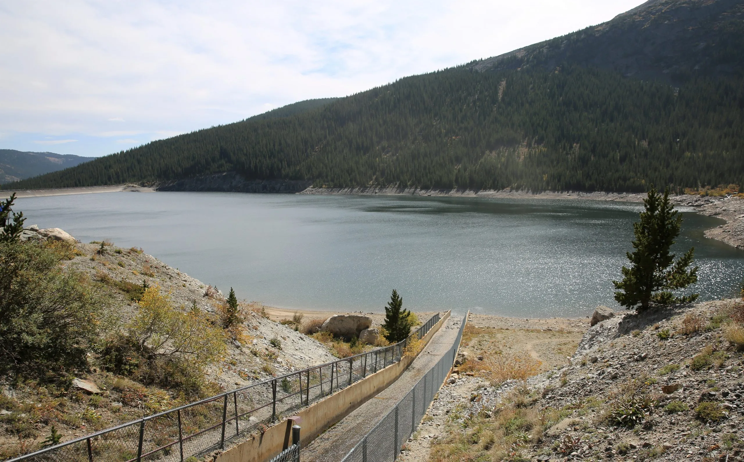
Proposed reservoirs on the Blue River

Map: Laurine Lassalle – Aspen Journalism Source: Colorado Springs Utilities Created with Datawrapper

CSU to support Shoshone

The Glenwood Springs-based River District was created in 1937 to combat these types of diversions and keep water on the Western Slope. It was one of the entities that opposed CSU’s conditional water rights in its nearly nine-year water court battle, which kicked off when the water provider filed a diligence application. That is the process in which a conditional water-right holder must demonstrate to the water court that it can and will eventually develop the water right, and that in the previous six years, it has done its diligence in seeing a project through.

On Jan. 16, the River District board approved the settlement agreement, which includes a commitment from Colorado Springs that the utility will support the River District’s efforts at securing the Shoshone water right.

The River District is working to purchase water rights from Xcel Energy associated with the Shoshone hydropower plant in Glenwood Canyon. The water rights date to 1902 and are nonconsumptive, meaning the water would stay in the river and flow downstream to the benefit of the environment, endangered fish and other water users on the Western Slope. The Colorado Water Conservation Board approved $20 million toward the $98.5 million purchase last week.

Map of the Blue River drainage basin in Colorado, USA. Made using USGS data. By Shannon1 – Own work, CC BY-SA 4.0, https://commons.wikimedia.org/w/index.php?curid=69327693

“The settlement provides additional local water supplies to the Blue River Valley and a commitment of support from Colorado Springs Utilities for the Shoshone Water Right Preservation effort, which provides substantial benefits to the health of the entire Colorado River, including important water security, economic and environmental benefits to the West Slope,” River District General Manager Andy Mueller said in a prepared statement. “In addition, the West Slope will benefit from clearly specified limits on the total amount of water Colorado Springs can divert through its Continental-Hoosier transmountain diversion tunnel.”

The agreement was also good news for Breckenridge, which will split the 600 acre-feet of water from Colorado Springs in a future Lower Blue Reservoir equally with Summit County. The reservoir was originally decreed for 1,006 acre-feet, but the agreement now limits the reservoir capacity to 600 acre-feet. Colorado Springs will retain the remaining amount, about 400 acre-feet, which can be stored in Montgomery Reservoir.

Breckenridge Mayor Pro Tem Kelly Owens said Breckenridge will be able to use the stored water in late summer, when flows in the Blue River are at their lowest.

“The way we see it is that we’ve now protected those waters, the snowmelt, and keeping it in the Blue River basin,” Owens said.

According to the agreement, Colorado Springs would pay 50% of the construction costs of a future Lower Blue Reservoir, and Breckenridge and Summit County would each pay 25%.

Colorado Springs City Council is expected to approve the agreement at its Feb. 13 meeting.

This story ran in the Feb. 5 edition of the Summit Daily.

Atmospheric rivers bring rain and snow, but will they feed the #ColoradoRiver? — 8NewsNow.com #snowpack #COriver #aridification

Click the link to read the article on the 8NewsNow.com website (Greg Haas). Here’s an excerpt:

February 5, 2024

The attention is on Southern California right now, but an atmospheric river’s path will extend inland with potential flooding — and possible drought relief. If you’re watching the weather, it’s still a little early to tell whether these storms will go where they can hope Las Vegas the most. That’s anywhere in the Upper Colorado River Basin, where there’s a chance they could produce snow to help the river that supplies 90% of the water used in Southern Nevada…The paths of this year’s atmospheric rivers are unlike the ones that slammed the Sierras last year. Those storms carried snow straight east through Northern Nevada and Utah, feeding the Rocky Mountains with snowpack levels that reached 160% of normal by the end of winter. That snow provided relief from drought years that had everyone watching nervously as Lake Mead dropped in 2022. This time, the moisture is following a path that is causing concern in Death Valley, where roads were destroyed less than six months ago by the remnants of Hurricane Hilary…

But where will the atmospheric river go from there? The path is currently extending to Salt Lake City, where it fizzles out as it runs up against the Wasatch Mountains…And after rains let up, the biggest question remains: Will the moisture reach the Upper Colorado River Basin? That’s the drainage area that feeds the Colorado River, extending from central Utah to the Continental Divide in Colorado. The moisture is currently tracking toward the upper Green River basin, the northern tip in the map shown below:

Westwide SNOTEL basin-filled map February 5, 2024 via the NRCS.

…Currently, total SWE levels for the Upper Colorado River Basin are at 92% of normal — an improvement over recent weeks. The level was 93% on Jan. 18, and dipped as low as 85% since then, according to information from the U.S. Bureau of Reclamation.

Big snows in January and February 2024 boost #snowpack to nearly normal: Snow provides 90% of #Denver’s water supply. Keep the snow train coming! — @DenverWater #SouthPlatteRiver #ColoradoRiver #COriver #aridification

Click the link to read the article on the Denver Water website (Jay Adams):

February 5, 2024

Denver Water crews measure snow at 11 locations throughout the winter in Grand, Park and Summit Counties. Learn why these surveys are so important to Denver Water customers.

Storms that dumped several feet of snow in Park, Summit and Grand counties in January and February left behind great skiing conditions and a sorely needed boost to the mountain snowpack.

Entering 2024, the snowpack in the areas of the South Platte and Colorado river basins where Denver Water captures snow for its water supply were well below normal due to relatively dry weather in November and December 2023

But storms in mid-January and early February boosted mountain snowpack in the two river basins to nearly normal for this point in the season. 

A snowboarder enjoys the fresh snow at Copper Mountain on Jan. 19. Copper Mountain received 60” of snow in January. The resort is in Denver Water’s collection area, so snow that falls on the slopes flows into Dillon Reservoir. Photo credit: Denver Water.

As of Monday, Feb. 5, the snowpack in Denver Water’s collection areas stood at 106% of normal in the South Platte Basin and 98% of normal in the Colorado River Basin.

“January was great in terms of our water supply. In fact, the snowpack accumulation was nearly double the average for the month,” said Nathan Elder, water supply manager at Denver Water. 

“We are right at normal for the season, and we’re hopeful the stormy weather pattern continues as we head into the snowier months of the year.”

The blue line on the charts below shows how a few big storms can quickly boost a very low snowpack (close to the bottom of the grey area) up to the black or “normal” line:

Image credit: Denver Water.

Monitoring the snow

Denver Water pays close attention to the snowfall in the mountains because snowmelt provides 90% of the water supply for 1.5 million people in its service area across metro Denver.

The utility monitors the snowpack in multiple ways through the season. 

Once a month, January through April, Denver Water crews snowmobile and snowshoe through the snow to collect about a dozen samples of the snowpack along preestablished paths through the wilderness called “snow courses.” 

Denver Water employees John King (left) and Conor Peters get ready to head out on a snow course to check the status of the snowpack in late January 2024. Photo credit: Denver Water.

Denver Water has snow courses at 11 locations in Grand, Park and Summit counties.

Capturing snow samples looks like spear-fishing. Crews jab a specially designed hollow pole into the snow until it hits the ground. The pole measures the snow depth and weight which is then used to determine the snow’s density. 

This information is then used to calculate the snow water equivalent, or SWE. In simple terms, it’s the depth of water that would cover the ground if all the snow melted.

Denver Water crews measure mountain snowpack at 11 locations in Grand, Park and Summit counties from January through April. Photo credit: Denver Water.

“Ski areas love that champagne powder, but we like to see snow with lots of water inside,” said Rick Geise, a facility operator at Dillon Reservoir in Summit County. “The more water packed into the snow, the more water that flows into our reservoirs in the spring when all the snow melts.”

Denver Water shares the data collected from its snow courses with the National Resources Conservation Service, which puts out statewide snowpack and water supply information. 

Donald McCreer, facility operator at Denver Water, checks the weight of the snow inside a special, hollow tube used to calculate snow density at a snow course on Vail Pass. Photo credit: Denver Water.

The utility also uses information gathered from automated mountain weather stations called SNOTEL sites, which are managed by the NRCS. 

Denver Water also gets information on the snowpack from the air, via flights from a company called Airborne Snow Observatories, which uses advanced technology to measure snowpack from the sky.
 
“We use the data to make sure we have a good idea about the amount of water in the snow up in the mountains,” Elder said. 

“These tools give us very good picture of the snowpack so we can provide accurate water supply forecasts for our customers and the general public.”

SNOTEL automated data collection site. Credit: NRCS

In the Contiguous U.S., January 2024 was one of the wettest on record — @Climatologist49

Areas in dark green or blue had at least 150% of their normal January precipitation.