Click the link to read the article on the KJZZ website (Lauren Gilger). Here’s an excerpt:
November 11, 2026
LAUREN GILGER: We just heard before the break how devastating the impacts of all of the rain we’ve seen this fall can be. But now, let’s turn to a conversation about the other side of that story, and it’s at least partially good.
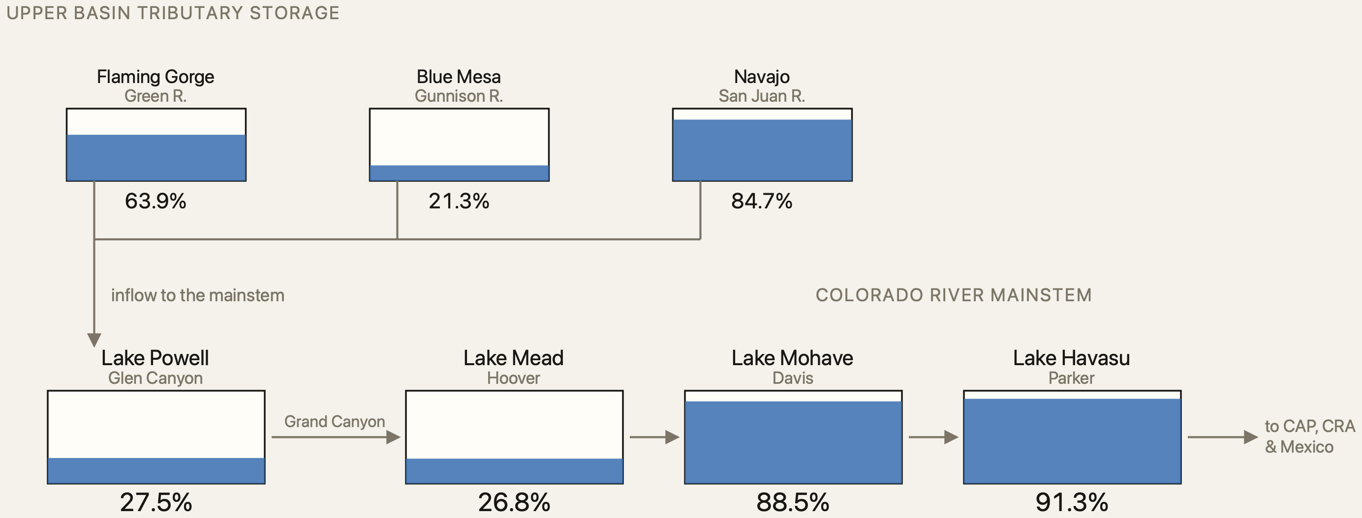
We know we’re facing a dire water future and an ongoing fight over water from one of our main sources, the Colorado River. Well, that water is stored in two big reservoirs up in northern Arizona, Lake Powell and Lake Mead, and they are both historically low. In fact, just a few months ago, in mid-September, Lake Powell sat just 146 feet above dead pool, the level at which there’s not enough water to flow downstream through Glen Canyon Dam.
So how much has this historic rainfall helped those drying-up reservoirs? I took that question to Amy Haas, executive director of the Colorado River Authority of Utah, and she told me it’s a dramatically different situation than what we were looking at just a few months ago.
AMY HAAS: In mid-September, we saw the record low at Lake Powell. Lake Powell hit elevation 3,516 feet and change in mid-September. And today, fast forward, less than two months, we are seeing an elevation at Powell of 3,538 feet. So this is basically a net gain in elevation of about 22 feet from the all-time low at Powell in mid-September…
AMY HAAS: So while it’s been a blessing, we are not out of the woods in terms of these critically low reservoir elevations. And again, we’re still significantly lower than we were just exactly a year ago.
LAUREN GILGER: So we have taken a little bit of a step back from the edge, but we are nowhere near where we need to be, it sounds like.
AMY HAAS: Absolutely. And we’re still very early in the water year. Lake Powell inflows, Lake Powell is most affected based on snowmelt. And we won’t know what our water year really sets up to be until we see what our winter looks like and any sort of snowmelt runoff into the reservoir. So it’s still early days, and I think while this is a very auspicious sign, we’ve still got to be mindful that we’ve got a lot of months to go.
