#COWaterPlan: Even with wording changes, the basin roundtables recommend that the CWCB not adopt the framework

Alan Ward stands at the Ewing Ditch headgate
Alan Ward stands at the Ewing Ditch headgate,

From the Glenwood Springs Post Independent (Brent Gardner-Smith):

Letters sent to the Colorado Water Conservation Board in September about the draft Colorado Water Plan reveal a range of opinions about potential new transmountain diversions and the merits of using a “conceptual framework” to evaluate them.

Various Front Range water providers and interest groups told the CWCB that the conceptual framework should not be included in the water plan, should not be a regulatory requirement, and should not apply to transmountain diversion projects already in the planning and approval stage.

“Even with wording changes, the basin roundtables recommend that the CWCB not adopt the framework as it is a work in progress that may be modified as dialogue continues,” wrote the S. Platte and Metro basin roundtables, two of nine regional water-supply groups that meet under the auspices of the CWCB, in a combined Sept. 17 comment letter.

But a number of organizations based on the Western Slope or that focus on the Colorado River basin say the framework is a good step forward.

Officials at the Getches-Wilkinson Center for Natural Resources, Energy and the Environment at the University of Colorado Boulder, for example, gave an enthusiastic endorsement of the framework.

“This is a revolutionary document and a quantum leap forward in Colorado water history,” Lawerence MacDonnell and Anne Castle, both of the Getches-Wilkinson Center, wrote in a Sept. 17 letter to the CWCB. “The conceptual framework is a critically important part of the Colorado Water Plan and should be formally adopted in the plan and by the CWCB, not just monitored.”

The final water plan is expected to be approved by the CWCB board of directors at their meeting on Nov. 19 at the History Colorado Center in Denver.

The conceptual framework includes seven principles “to guide future negotiations between proponents of a new TMD and those communities who may be affected were it built.”

The concepts covered include a recognition that there may not be water to divert in dry years, that new diversions should not increase the likelihood of a compact call from California, that municipal conservation should also be pursued and that environmental needs must be addressed.

Brent Newman, a program manager in the water supply planning section of CWCB, said Friday that the framework is going to be included in the final water plan and will be called “Colorado’s Conceptual Framework.”

“Folks may not agree with every single principle, or even with discussing the concepts of a transmountain diversion out loud, but it represents a historic milestone in Colorado water policy that’s a long way from ‘Not One More Drop’ or ‘We’ll See You in Court,’” Newman said, citing the long-held positions of the Western Slope and the Front Range, respectively.

RANGE OF VIEWS

Comments on the second draft of the water plan were due Sept. 17 and water-focused organizations filed more than 50 substantive letters.

It’s not hard to pick up on the differing views in the letters about the framework, which was developed over the last two years by members of the Interbasin Compact Committee, which serves as an executive committee for the CWCB’s nine basin roundtables.

Those who don’t think new transmountain diversions are a good idea tend to support the framework. But those who see new diversions as necessary diminish the framework’s authority and reject its potential restrictions.

Castle and MacDonnell of the Getches-Wilkinson Center clearly support the framework, but they see big problems with taking more water from the upper Colorado River basin.

The pair told the CWCB that “development of significant new Colorado River supplies increases the risk of future curtailment to all existing, post-1922 Colorado River water users, reduces the production of renewable hydropower at Colorado River Storage Project reservoirs, and could ratchet up unwelcome and counterproductive political dynamics among the Colorado River basin states.”

But officials at Colorado Springs Utilities, while aware of potential issues with downstream water users in other states, see new TMDs as a likely necessity.

M. Patrick Wells, the managing engineer for water resource planning for CSU, told the CWCB in a Sept. 17 letter that the draft water plan “consistently overlooks the fact that one or more new TMDs will ultimately need to be constructed to address Colorado’s water supply gap.”

As such, Wells said the final water plan “should contain a definitive statement that a new TMD will be constructed, even if no formal concept has been proposed.”

Wells also said CSU has “a significant concern” that adhering to the framework will become a regulatory requirement of new water projects.

The utility “strongly requests” that language be added to the water plan to “make it abundantly clear that the conceptual framework is not a statement of state policy, and is not in any way to be interpreted or construed as a basis for any conditions or requirements in any water court case, state or federal permitting process, or contract negotiation.”

The members of the Front Range Water Council agree with Colorado Springs Utilities on this point.

In its Sept. 15 letter, the council pointed to recent remarks about the framework made by John McClow, a CWCB board member from the Gunnison River basin.

“As board member McClow stated in his remarks at the summer Colorado Water Congress convention, the framework has no regulatory force or effect. Rather, it is guidance, the implementation and use of which will depend on the positions taken by the parties who engage in good faith negotiations on the construction of future specific proposed projects.”

The council includes Denver Water, Aurora Water, Colorado Springs Utilities, Northern Water, the Southeastern Colorado Water Conservancy District, the Twin Lakes Reservoir and Canal Co., and the Board of Water Works of Pueblo.

MORE WATER EAST

A few organizations have told the CWCB that the framework should apply to both potential new transmountain diversions and the “firming” of existing transmountain water supplies.

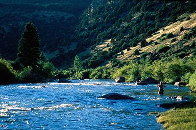
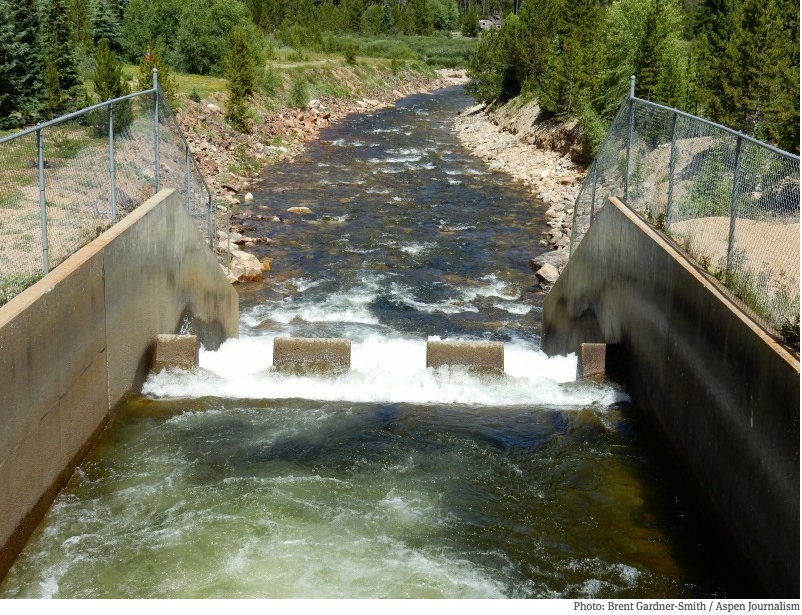
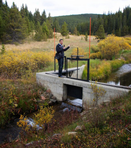
Today, about 600,000 acre-feet of water a year is sent east under the Continental Divide and over 500,000 acre feet of that is diverted from headwaters in Grand, Summit, Eagle and Pitkin counties.

And another 120,000 to 140,000 acre-feet of water could be sent east after changes are made to existing transmountain diversion systems, according to the Colorado River basin roundtable.

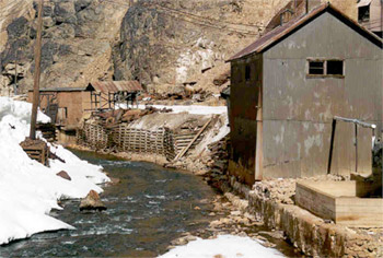
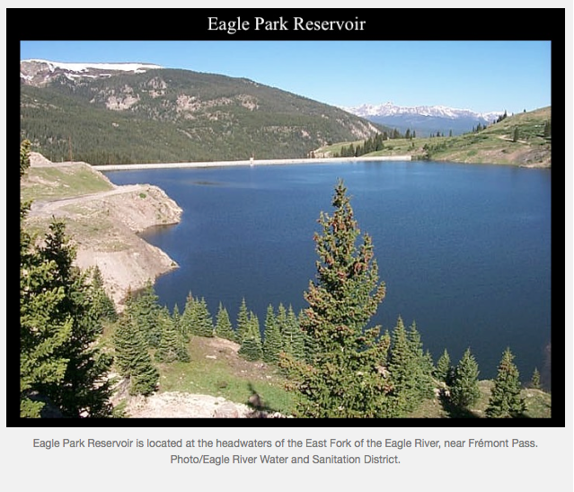
Included in that 140,000 acre-feet figure is 20,000 acre-feet more from the Windy Gap project in Grand County, 18,000 acre-feet more from the Moffat Collection System above Winter Park, and 20,000 from the Eagle River MOU project, which potentially includes an expansion of Eagle Park Reservoir at the Climax Mine and a new dam and reservoir on lower Homestake Creek.

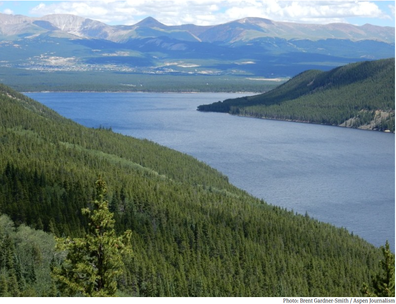
In addition to those, the water quality and quantity committee of the Northwest Colorado Council of Governments told the CWCB that there are other projects in the works that could send more water east, including “future Dillon Reservoir diversions, firming in the upper Roaring Fork and Fryingpan rivers, and Colorado Springs Utilities expanded diversions from the upper Blue River.”

In the language of the Colorado Water Plan, these projects already on the books are called IPPs, for “identified projects and processes.”

The Pitkin County commissioners, in a Sept. 15 letter, told the CWCB that the county “wholeheartedly endorses” the framework but “strongly believes” the framework’s core principles need to be “expanded in scope to apply equally to the various IPPs that involve trans-basin diversions.”

The Pitkin County Healthy Rivers and Streams Board, a tax-funded organization dedicated to leaving more water in the Roaring Fork River and its tributaries, feels the same way.

“The IPPs are the result of simple community canvassing to obtain information as to any potential plans or processes that are being contemplated around the state,” the board wrote in a Sept. 17 letter. “The IPPs have not been vetted and vary widely in size, impact and feasibility. “

SOME PLAIN LANGUAGE

Trout Unlimited, which has been paying close attention to the development of the water plan, said it supports the framework.

But it also gave the CWCB some plain-language criteria it thinks should be used to judge new TMDs.

“These transmountain diversions of water can cause severe economic and environmental damage to the areas of origin,” wrote Richard Van Gytenbeek, the Colorado River Basin outreach coordinator for Trout Unlimited, in a Sept. 17 letter to the CWCB.

As such, Gytenbeek told the CWCB it “should reject all new TMDs” unless the project proponent is already “employing high levels of conservation,” can show “that water is available for the project,” and “makes commitments that guarantee against environmental or economic harm to the basin of origin.”

The Colorado River District, which has board members from 15 Western Slope counties, said it supports the framework.

The river district’s general manager, Eric Kuhn, has been instrumental as a member of the IBCC in developing many of the framework’s key concepts.

“Admittedly, there are elements of the framework that we would prefer to edit but recognize there are others who would address those same edits in an opposite fashion,” the River District told the CWCB in a Sept. 17 memo.

However, the River District said the framework “represents a ‘way forward’ for constructive discussion about possible development of Colorado River basin water resources for out-of-basin use.”

Aspen Journalism is collaborating with the Post Independent and The Aspen Times and on coverage of statewide water issues. More at http://www.aspenjournalism.org…

SEVEN PRINCIPLES

1. East Slope water providers are not looking for firm yield from a new TMD and the project proponent would accept hydrologic risk for that project.

2. A new TMD would be used conjunctively with East Slope supplies, such as interruptible supply agreements, Denver Basin Aquifer resources, carry-over storage, terminal storage, drought restriction savings and other non-West Slope water sources.

3. In order to manage when a new TMD would be able to divert, triggers are needed. Triggers are operating parameters that determine when and how much water a potential new TMD could divert, based upon predetermined conditions within the Colorado River System.

4. A collaborative program that protects against involuntary curtailment is needed for existing uses and some reasonable increment of future development in the Colorado River System, but it will not cover a new TMD.

5. Future West Slope needs should be accommodated as part of a new TMD project.

6. Colorado will continue its commitment to improve conservation and reuse.

7: Environmental resiliency and recreational needs must be addressed both before and conjunctively with a new TMD.

Colorado transmountain diversions via the University of Colorado

Eagle River cleanup: Steady progress over 30 years as a superfund site

Eagle Mine
Eagle Mine

From the Eagle River Watershed Council (Kate Burchenal):

As we all know, Colorado has a rich and fascinating history of mining that dates back to the late 1800s. Between 1991 and 1999, the Colorado Geological Survey inventoried abandoned and inactive mine sites on National Forest lands across the state. Of the 18,000 mine features they inventories, 900 presented environmental problems significant enough to warrant future study. About 250 of those were found to be causing significant or extreme environmental degradation.

For those of you who read the previous installment of this series and have been thinking that the story of the Gold King Mine and the Animas River sounds familiar, you’re correct. One of these abandoned mines happens to be in our backyard, right here in Eagle County. In 1984, that particular mine spilled thousands of gallons of metal-laden water into the Eagle River. The river ran orange, wiping out fish populations and causing Vail Resorts to blow orange snow on their mountains.

But where our story differs somewhat from the Gold King Mine is that we have been fortunate to have willing partners in the cleanup effort. In some parts of the state, mine owners will spend millions of dollars in court to avoid cleaning up harmful mines; here, those millions have gone to greatly improving the situation.

The Eagle mine has been listed as a Superfund site for the better part of three decades. Much progress has been made in that time thanks to coordinated efforts from entities such as the Eagle Mine Limited, Eagle River Watershed Council, Eagle River Water and Sanitation, CBS (the mine owner), Colorado Department of Public Health and Environment and the U.S. Environmental Protection Agency.

Water Treatment

The main goal is and has been to treat all contaminated water before putting it back into the Eagle River, and to divert fresh, clean water around the mine so it remains uncontaminated and out of the water treatment plant. The water treatment facility treats 250 gallons of water every minute and removes 251 pounds of metals from the water passing through each day.

That is not to say, however, that the problem has been solved. Quite the opposite actually, since the mine tunnels and metal-rich rocks below Gilman aren’t going anywhere. This is an issue that will be with our community in perpetuity and so we must guard against complacency. We haven’t seen any large-scale, dramatic spills recently, but that doesn’t mean it couldn’t happen.

Our Best Defense

From here, the best defense we have against a spill like the one at the Gold King Mine is to emphasize existing and augmented preventative measures. While we can’t rule out the possibility of future spills from the Eagle Mine, we can do our best to implement preventative and proactive measures that safeguard our river and our community.

The cleanup contractors have a regular maintenance and monitoring schedule to keep the pipeline – which carries contaminated water to the treatment facility – functioning properly, free of leaks and other issues. This aspect is critical, and very much achievable. Adding in satellite technology will provide remote, real-time monitoring for spills and leaks. This equipment will not eliminate the need for having people on the ground inspecting the mine and pipeline, but rather will provide an added layer of security.

The initial, catastrophic spill from the Eagle Mine in 1984 made the river uninhabitable for the entire fishery that once called it home. Today, hardier fish such as brown trout have returned, while species more sensitive to metals – such as rainbow trout and sculpin – are less prevalent. Though the species diversity is not what we would like to see, this return is a big accomplishment in and of itself.

We have seen this progress because our community pushed for it. The stakeholders in the mine cleanup listened, collaborated and took action. But we can’t pat ourselves on the back too heartily; as a community, we must stay engaged. The Gold King Mine spill is a reminder of what could happen and why we can’t let our guard down.

Kate Burchenal is the education and outreach coordinator for the Eagle River Watershed Council. The council has a mission to advocate for the health and conservation of the Upper Colorado and Eagle River basins through research, education and projects.

The latest “The Current” newsletter from the Eagle River Watershed Council is hot off the presses

Click here to read the newsletter. Here’s an excerpt:

Eagle River Watershed Council has teamed up with the U.S. Forest Service for the inaugural year of our Citizen Science program. This program aims to identify creeks and streams on Forest Service land that currently house populations of native cutthroat trout or could in the future. Participants were trained to collect Environmental DNA samples and assess the physical habitat of streams.

We are no longer accepting new volunteers for the Citizen Science program this year, but there will certainly be ways to get involved in 2016! Email burchenal@erwc.org to sign up for next year or simply to find out more.

Eagle River Basin
Eagle River Basin

The September 2015 issue of “The Current” is hot off the presses from the Eagle River Watershed Council

eagleriver
Click here to read the newsletter. Here’s an excerpt:

Animas spill may stimulate watershed solutions

On August 5, about 3 million gallons of contaminated water burst out of an abandoned mine above Silverton and sent a plume of cloudy, orange water down Cement Creek to the Animas River, through the heart of Durango, and on into the San Juan River in New Mexico, the Navajo Nation and Utah. Downstream: Lake Powell.

The plume of acidic orange water, containing arsenic, lead and other toxic heavy metals, had built up as a result of historic mining activity dating back to the 1870s… The massive plume was set loose by workers for the U.S. Environmental Protection Agency attempting to assess and remediate the source of an ongoing trickle of pollution from the Gold King mine…

In assessing how this catastrophe fits into the overall regional water picture, it is instructive to zoom out geographically and look back in time. The 3 million gallons of contaminated water from the spill translate to a little over 9 acre-feet of water. This quantity is dwarfed by the approximately 13 million acre-feet currently in Lake Powell, despite the fact that it is only 54 percent full…

Hannah Holm is the coordinator for the Water Center at Colorado Mesa University. Holm is a friend of the Watershed Council and wrote this article for our monthly Vail Daily column, The Current. Click here to read on.

Eagle River Cleanup event is Sept. 12

Eagle River Basin
Eagle River Basin

From the Eagle River Watershed Council via the Vail Daily:

As the rivers begin to calm and seasons start to change, the Eagle River Watershed Council is gearing up for its 21st annual Eagle River Cleanup on Sept. 12. The tradition began in 1994 when Trout Unlimited organized the first Eagle River Cleanup. There were two tents and 24 volunteers, half of which were Vail Resorts ski patrollers with radios and trucks. The event culminated with a silent auction, which included a season ski pass and raised a total of $400.

During the past 21 years, the Eagle River Cleanup has grown tremendously and become a fall tradition for many environmentally and community-minded families, groups and companies. This year, over 350 volunteers are expected to help care for and revitalize our local waterways in the cleanup. This popular, county-wide event is organized by the Eagle River Watershed Council, presented by Vail Resorts EpicPromise, sponsored by many local businesses and supported by volunteers from Red Cliff to Dotsero to East Vail.

KEEPING OUR WATERWAYS HEALTHY

From 9 a.m. to noon, teams of volunteers will head for the river banks along the Eagle and Upper Colorado Rivers as well as Gore Creek to pick up trash and show support for the conservation and enhancement of our local watershed. All told, this massive community effort will clean nearly 70 miles of river throughout Eagle County ensuring the health and vitality of our waterways.

Following the cleanup, volunteers and their families are invited to the Broken Arrow at Arrowhead from noon to 2 p.m. for a thank you barbecue provided by Vail Resorts, the Broken Arrow and Arrowhead Alpine Club. The party features music from local favorites the Turntable Revue, beer from Crazy Mountain Brewing Co. and a prize drawing for the entire family.

More volunteers are always needed. Call the Eagle River Watershed Council at 970-827-5406 or email ranney@erwc.org to confirm your usual segment, sign up for a new one or join an existing team. Volunteers meet on the river at assigned locations on the day of the event, so you must pre-register in order to know where you are needed most.

Constant cleanup key to preserving river — the Vail Daily

Eagle Mine
Eagle Mine

From the Vail Daily (Scott N. Miller):

For longtime valley residents, the recent mine waste spill into the Animas River near Durango prompted memories of the winter of 1989-90, when the Eagle River through Minturn ran a dull, depressing orange. Its clarity today is thanks to constant work.

The Eagle Mine — located in a tight valley between Minturn and Red Cliff — closed in 1984. After the mine closed, countless gallons of water flooded the mine works and, five years later, into the river, turning the stream orange. Locals were aghast, of course.

When the river ran orange, the U.S. Environmental Protection Agency had already added the mine to its list of Superfund sites for closely monitored cleanup, but the extent of the problem was still being determined.

CLEANUP CONTINUES

While the river today looks normal — with the exception of some of the orange-tinged boulders in the river — the cleanup continues and will into the foreseeable future.

The “responsible party” for the mine cleanup is CBS, which acquired the mine when it bought Viacom, the previous responsible party. The mine ended up in the hands of those media companies via previous acquisitions and mergers. Today, CBS still pays for much of the work, and will essentially forever. The state and federal governments are also involved.

Because water continues to seep into the mine works — a vast underground network of caverns and tunnels — contaminated water is piped out of the mine and treated at a site at Maloit Park in Minturn. About 250 gallons of water per minute comes out of the mine and is pumped into a facility that allows heavy metals to settle out. About 250 pounds of metallic sludge per day comes out of the water.

Eagle River Basin
Eagle River Basin

PROGRESS

The Eagle River Watershed Council was created out of that environmental disaster. The group, which today looks at the entire length of the river, remains intimately involved in the continuing work at the mine.

“There’s been a lot of progress,” council director Holly Loff said. “But there could always be more.”

The biggest issue today is the age of the equipment, particularly the pipelines carrying contaminated water to the treatment plant. That pipeline, which is above ground in a harsh winter environment, sprung a handful of notable leaks a few years ago. One, in 2009, turned the river orange again for a brief period. Another, bigger spill in 2012 put 428,000 gallons of contaminated water into the river, turning it green.

When word came about those spills, the Eagle River Water & Sanitation District shut off the intake to its Avon water treatment plant.

The district’s Todd Fessenden, who is in charge of drinking water treatment and supplies, said the Avon plant was built to accommodate and treat the metals in the river, but not in the concentrations seen when there’s a spill. That’s why the intakes were shut down.

MONITORING THE MINE

Given the complexity of the mine’s treatment system, Loff said it’s important to have more and better monitoring on the pipeline and pumps, since humans can’t have their eyes on the system all the time.

“They’re moving toward real-time remote monitoring,” Loff said.

Eagle River Water & Sanitation District community affairs director Diane Johnson said the district uses remote monitors at many of its facilities, and they work well. One monitor, in a remote area without cell phone service, is linked to a satellite.

At the moment, though, sometimes the district gets some notifications the old-fashioned way — someone in town will notice something about the river and make a call.

The latest “The Current” newsletter is hot off the presses from the Eagle River Watershed Council #ColoradoRiver #COriver

Click here to read the newsletter. Here’s an excerpt:

Restoration means another chapter for historic Camp Hale
Marcus Selig
August 1, 2015

Most residents and many visitors to Vail and the Eagle River Valley know of Camp Hale as a former WWII mountain warfare training camp and current recreation mecca…

Fewer visitors, however, know that this area – Eagle Park – was once a pristine, high-elevation wetland complex… When the U. S. Government constructed Camp Hale in the early 1940s, over 340 acres of wetlands were filled and over five miles of stream channel were lost as the Eagle River was channelized into a linear ditch.

Throughout the last several decades, the White River National Forest has attempted to restore some of the area’s original ecological values. Unfortunately, numerous issues… have stymied progress.

Recently, however, the National Forest Foundation, in coordination with the White River National Forest, spearheaded an effort to attempt large-scale ecological restoration at the site. This effort has garnered significant community and stakeholder support, and appears to have a realistic shot at success…

Marcus Selig is the Director of the Southern Rockies Region for the National Forest Foundation. Selig is a friend of the Watershed Council and wrote this article for our monthly column, The Current, in the Vail Daily. Click here to read more of what he had to say.

Transmountain diversion concepts discussed in Rifle — Aspen Journalism #COWaterPlan #ColoradoRiver #CORiver

Homestake Dam via Aspen Journalism
The dam that forms Homestake Reservoir on Homestake Creek, a tributary of the Eagle River. An agreement allows for more water to be developed as part of this transmountain diversion project.

From Aspen Journalism (Brent Gardner-Smith):

James Eklund, the director of the Colorado Water Conservation Board, invoked his Western Slope heritage at a “Summit on the Colorado Water Plan” hosted Saturday in Rifle by the Garfield County commissioners.

“The mantra I grew up with in Plateau Valley was not one more drop of water will be moved from this side of the state to the other,” said Eklund, whose mother’s family has been ranching in the Plateau Creek valley near Collbran since the 1880s.

Eklund was speaking to a room of about 50 people, including representatives from 14 Western Slope counties, all of whom had been invited by the Garfield County commissioners for a four-hour meeting.

The commissioners’ stated goal for the meeting was to develop a unified voice from the Western Slope stating that “no more water” be diverted to the Front Range.

“That argument had been made, probably by my great-grandparents, my grandparents and my parents,” Eklund said. “And I know there are a lot of people who still want to make that argument today, and I get that. But it has not done us well on the Western Slope.

“That argument has gotten us to were we are now, 500,000 to 600,000 acre feet of water moving from the west to the east. So I guess the status quo is not West Slope-friendly. We need something different. We need a different path. And these seven points provides that different path.”

The “seven points” form the basis of a “draft conceptual framework” for future negotiations regarding a potential transmountain diversion in Colorado.

The framework is the result of the ongoing statewide water-supply planning process that Eklund is overseeing in his role at the CWCB.

Eklund took the helm two years ago at the CWCB after serving as Gov. John Hickenlooper’s senior deputy legal counsel, and he’s been leading the effort to produce the state’s first water plan, which is due on the governor’s desk in December.

The second draft of the plan includes the seven points, even though the Colorado River Basin Roundtable, which meets monthly in Glenwood Springs under the auspices of the CWCB, is still on the record as opposing their inclusion in the water plan. That could change after its meeting on Monday.

The outflow of the Bousted Tunnel just above Turquoise Reservoir near Leadville. The tunnel moves water from tributaries of the Roaring Fork and Fryingpan rivers under the Continental Divide for use by Front Range cities, and Pitkin County officials have concerns that more water will someday be sent through it.

Not legally binding

The “seven points” seeks to define the issues the Western Slope likely has with more water flowing east under the Continental Divide, and especially how a new transmountain diversion could hasten a demand from California for Colorado’s water under the 1922 Colorado River Compact.

“The seven points are uniquely helpful to Western Slope interests because if you tick through them, they are statements that the Front Range doesn’t necessarily have to make,” Eklund said in response to a question. “If these were legally binding, the Western Slope would benefit.”

Under Colorado water law a Front Range water provider, say, can file for a right to move water to the east, and a local county or water district might have little recourse other than perhaps to fight the effort through a permitting process.

But Eklund said the points in the “conceptual framework” could be invoked by the broader Western Slope when negotiating a new transmountain diversion.

As such, a diverter might at least have to acknowledge that water may not be available in dry years, that the diversion shouldn’t exacerbate efforts to forestall a compact call, that other water options on the Front Range, including increased conservation, should be developed first, that a new transmountain diversion shouldn’t preclude future growth on the Western Slope, and that the environmental resiliency of the donor river would need to be addressed.

“We’re just better off with them than without them,” Eklund said of the seven points.

The downstream face of the dam that forms Homestake Reservoir on Homestake Creek, a tributary of the upper Eagle River. A tunnel moves water from Homestake Reservoir to Turquoise Reservoir, near Leadville.

A cap on the Colorado?

Eric Kuhn, the general manager of the Colorado River District, which is based in Glenwood Springs and represents 15 Western Slope counties, told the attendees that three existing agreements effectively cap how much more water can be diverted from the upper Colorado River and its tributaries above Glenwood Springs.

The Colorado Water Cooperative Agreement, which was signed in 2013 by 18 entities, allows Denver Water to develop another 18,000 acre-feet from the Fraser River as part of the Moffat, or Gross Reservoir, project, but it also includes a provision that would restrict other participating Front Range water providers from developing water from the upper Colorado River.

A second agreement will allow Northern Water to move another 30,000 acre feet of water out of the Colorado River through its Windy Gap facilities, but Northern has agreed that if it develops future projects, it will have to do so in a cooperative manner with West Slope interests.

And a third agreement known as the Eagle River Memorandum of Understanding will allow Aurora and Colorado Springs to develop another 20,000 acre feet of water as part of the Homestake project in the Eagle River basin, but will also provide 10,000 acre feet for Western Slope use.

“So effectively these three agreements, in effect, cap what you’re going to see above Glenwood Springs,” Kuhn said.

The Moffat, Windy Gap and Eagle River projects are not subject to the “seven points” in the conceptual agreement, and neither is the water that could be taken by the full use of these and other existing transmountain projects.

“So when you add all that up, there is an additional 100,000 to 150,000 acre-feet of consumptive use already in existing projects,” Kuhn said.

But beyond that, Kuhn said Front Range water providers desire security and want to avoid a compact call, just as the Western Slope does.

“We’ve been cussing and discussing transmountain diversions for 85 years,” Kuhn added, noting that the Colorado Constitution does not allow the Western Slope to simply say “no” to Front Range water developers.

“So, the framework is an agenda,” Kuhn said, referring to the “seven points.” “It’s not the law, but it is a good agenda to keep us on track. It includes important new concepts, like avoiding over development and protecting existing uses.”

rquoise Reservoir, which stores water brought under the Continental Divide from the Eagle, Fryingpan and Roaring Fork river headwaters.

Vet other projects too?

Rachel Richards, a Pitkin County commissioner, told the attendees that she would like to see more water projects than just new transmountain diversions be subject to the seven points.

As part of the state’s water-supply planning efforts, state officials have designated a list of projects as already “identified projects and processes,” or IPPs, which are not subject to the seven points.

“We would like to see the same environmental standards, and community buy-in standards, applied to increasing existing transmountain diversions or IPPs,” Richards said, noting that the “IPPs” seem to be wearing a halo.

“They need to go through just as much vetting for concern of the communities as a new transmountain diversion would, and we’re probably going to see a lot more of them first,” she said.

At the end of the four-hour summit on the statewide water plan, Garfield County Commissioner Mike Sampson said he still had “real concerns” about the long-term viability of Western Slope agriculture and industry in the face of growth on the Front Range, but he offered some support for the seven points.

“I think the seven points is probably a good starting position,” Sampson said.

He also said Garfield County would make some edits to a draft position paper it hopes will be adopted by other Western Slope counties.

On Saturday, the draft paper said “the elected county commissioners on the Western Slope of Colorado stand united in opposing any more major, transmountain diversions or major changes in operation of existing projects unless agreed to by all of the county(s) from which water would be diverted.”

But Sampson was advised, and agreed, that it might be productive to reframe that key statement to articulate what the Western Slope would support, not what it would oppose.

Editor’s note: Aspen Journalism is collaborating with the Glenwood Springs Post Independent and The Aspen Times on coverage of rivers and water. The Post published this story online on July 25, 2015.

More Colorado Water Plan coverage here.

Pueblo Board of Water Works approves participation in #ColoradoRiver conservation pilot program

Alan Ward stands at the Ewing Ditch headgate,

From The Pueblo Chieftain (Chris Woodka):

A pilot program that would leave some of Pueblo’s water on the Western Slope — for a fee — was approved by the Pueblo Board of Water Works Tuesday.

The program would pay Pueblo Water about $400,000 over the next two years to leave 600 acre-feet (195 million gallons) in the Colorado River basin. It’s part of an $11 million pilot project to test tools that could be part of a Colorado River drought conservancy plan.

The program is sponsored by the Upper Colorado River Commission, Bureau of Reclamation, Southern Nevada Water Authority, Denver Water, Central Arizona Water Conservation District and the Metropolitan Water District of Southern California.

About $2.75 million is set aside for conservation programs in the Upper Colorado states, which are Colorado, New Mexico, Utah and Wyoming. Pueblo would contribute the water in a fairly painless way by shutting down the diversion of the Ewing Ditch, which brings water into the Arkansas River basin from Piney Gulch in the Eagle River basin.

The diversion is one of the oldest in the state, constructed in 1880 at Tennessee Pass.

The diversion ditch originally was dug by the Otero Canal and was purchased in 1954 by Pueblo Water. It delivers an average of about 920 acre-feet, but in wet years like this one, not all of the water is taken.

Pueblo’s storage accounts are full this year, with 52,174 acre-feet in storage, equivalent to two years of potable water use in the city. Pueblo’s total water use annually, including raw water leases and other obligations, is usually 70,000-80,000 acre-feet.

Typically, about 14,700 acre-feet would be brought across the Continental Divide, but this year, only about 5,760 acre-feet has arrived from all transmountain sources.

“There’s no place to put it,” Water Resources Manager Alan Ward told the water board this week. “It’s close to as much as we’ve ever had in storage.”

The Ewing Ditch contribution is about 37 percent of average this year, similar to Twin Lakes, which was shut down when the reservoir near Leadville reached capacity in May. Pueblo Water brought over 71 percent of its Busk-Ivanhoe water even though it was trying not to take any, Ward said.

“The Current” newsletter is hot off the presses from the Eagle River Watershed Council

Eagle River Basin
Eagle River Basin

Click here to read the newsletter.

@westgov: Register for webinar, learn how @VailCOwater navigated extreme #drought

Eagle River Valley State of the River meeting, May 21 #COWaterPlan

Vail Whitewater Series Kicks Off May 12 — Vail Recreation District

gorecreekkayakvailviavailrecreation
Here’s the release from the Vail Recreation District:

The Vail Recreation District will kick off the Vail Whitewater Series Tuesday, May 12 at the Vail Whitewater Park in Vail Village. This is the first race in the five race series, which is presented by the Town of Vail and Howard Head Sports Medicine, with course design by Alpine Quest Sports.

Races will begin at 5:30 p.m. and offer competition featuring kayaking (under 9’6″), two-person raft and stand up paddleboard (SUP). Races will start at the Covered Bridge and finish at the International Bridge. The course for each week will be determined the day prior based on river flows. Each week, the two round format will consist of an individual time trial with results determining the seeding for the second round, head-to-head race. Check vailrec.com or Vail Whitewater Race Series Facebook page at facebook.com/vailrace for updates. Lakota Guides will be onsite with rafts available for R2 Teams to use. Spectators will enjoy viewing from the banks of Gore Creek.

Participants can register for all five races for $40, preregister for $10 for individual races or register on race-day for $15. Preregistration ends at 5 p.m. Monday, May 11. Onsite day-of registration will begin at 4:30 p.m. at the Vail Whitewater Park.

The Covered Bridge will be under construction during Tuesday’s race and competitors will need to access the start on the south side of Gore Creek by crossing the river on Vail Valley Drive or the International Bridge. Participants and spectators are asked to park in the Vail Village parking structure during the event. Short-term gear drop off/pick up will be available at Checkpoint Charlie before and after the race.

An after party will be hosted at Vendetta’s in Vail Village where cash and product prizes will be awarded to the top three winners of all three categories. All participants and spectators over age 21 will receive a free beer courtesy of New Belgium Brewing Company, the race series’ new beverage partner.

Four additional races are scheduled throughout the spring and will take place at 5:30 p.m. Tuesday, May 19, May 26, June 2 and June 9 at the Vail Whitewater Park.

Also new for 2015, the Vail Recreation District and Alpine Quest Sports will raffle off a Hala Atacha SUP board (retail value $1,350). The board will be raffled off on June 9 at the Pazzo’s Vail after party for the final race of series. Everyone who competes in a Vail Whitewater Series event will be automatically entered, once for each race they participate in (up to five entries). Spectators can enter to win by taking a photo with the board at any of the five races, then posting it on Facebook and tagging Vail Whitewater Series and Alpine Quest Sports. Additionally, between May 12 – June 8, anyone can go into Alpine Quest in Edwards to take a photo with the board and posting and tagging will get them an entry. Must be present at Pazzo’s Vail on June 9 to win.

The Whitewater Series is brought to you by the Town of Vail, Alpine Quest, Howard Head Sports Medicine, New Belgium, Vail Recreation District, Altitude Billards & Club, Stolquist, Hala SUP, Red Lion, Vendetta’s, Pazzo’s, Optic Nerve, Astral and Kokatat.

To register or for more information, call the VRD Sports Department at 970-479-2280 or visit http://www.vailrec.com/sports/whitewater-race-series.

More whitewater coverage here.

The latest Eagle River Watershed Council newsletter “The Current” is hot off the presses

eagleriver

Click here to read the newsletter. Here’s an excerpt:

Watershed Wednesday:
State of the Fisheries

Wednesday, May 13th
5:30 pm @ Minturn Anglers shop
102 Main St, Minturn

Come learn first-hand from Colorado Parks & Wildlife (CPW) Aquatic Biologist Kendall Bakich about a variety of topics regarding the status and management of the Eagle and Upper Colorado River fisheries.

“This is an important meeting and we hope to see a good turnout,” said Bakich. “We want to give the public an opportunity to hear how their local fisheries are doing directly from the people who manage them.”

Bakich will present her most recent survey data regarding the variety of fishes and populations currently found in the Eagle and Upper Colorado Rivers.

“Whether you are an avid angler, guide, local restaurateur, hotel owner or you just want to hear about fish, this is a great opportunity to discuss our local fish communities,” added Bakich. “The fish in Eagle County are not only an incredibly important resource for the area, they are one of the most outstanding resources in Colorado.”

More Eagle River watershed coverage here.

The Town of Vail is embarking on a stormwater study to improve stream health in Gore Creek

Gore Creek
Gore Creek

From the Vail Daily (Scott N. Miller):

When tackling a big job, success often depends on good information. Cleaning up Gore Creek is one of those big jobs, and people in charge of that task are still working to find out exactly what they’re facing.

To that end, the town of Vail this year has hired SGM, a Glenwood Springs-based engineering, surveying and consulting company, to do some of the most basic research — locating all of the town’s storm sewers and finding out exactly where they go.

That’s a more complicated job than it sounds. At the moment, town officials know the location of no more than 70 percent of the existing storm drainage system.

Kristen Bertuglia, the town’s environmental sustainability manager, said knowing where all of the town’s storm drains are, and where they go, is an important part of the bigger cleanup effort.

VAIL’S VAULTS

Most of the town’s storm drains flow into vaults, essentially big tanks where sand, oil and other pollutants are separated out before water ends up in the creek.

Bertuglia said knowing where those vaults are, and which parts of the drainage system flow into them — along with good mapping of the system — will help town officials develop a schedule for cleaning the vaults, thus keeping them working as they should.

“As soon as the inventory’s done, we can do a better schedule,” Bertuglia said.

More stormwater coverage here.

Water in the West and California’s drought: Why Colorado Springs should care — Colorado Springs Utilities

Colorado Springs circa 1910 via GhostDepot.com

From Re:Sources Blog (Patrice):

Living in the West offers many advantages. Wide open spaces, majestic mountains and amazing recreational opportunities, to name a few. Still, there are challenges and water is certainly one them.

If you’ve seen the recent news, extreme drought is taking its toll in California. In light of this, we caught up with our own water planners – Abby Ortega and Leon Basdekas – to learn if what’s taking place with our neighbors could affect our community and why we need to stay involved in what’s happening around the region.

Some of our customers many ask, could what’s taking place in California happen in Colorado?

Extreme drought can happen anywhere, and we are certainly not immune. We continuously monitor our water supply situation and maintain a storage reserve in our reservoirs to meet customer demand for at least one year.

Why should we take an interest in or follow what’s happening with drought in the West?

In Colorado Springs and across the Front Range, we are heavily reliant on the Colorado River for our water supply. The Colorado River starts in Colorado, but we only keep a portion of the flow for use in the state per the Colorado River Compact. The Colorado River also serves Arizona, Utah, Nevada, Wyoming, New Mexico and California (see below for a breakdown). There is also an obligation to Mexico. When any of the states or Mexico are in an extreme drought, their reliance on the Colorado River water may increase, possibly resulting in ripple effects that could negatively impact us. At any given time, the Colorado River supplies about 70 percent of our community’s water. Drought can also affect the levels in Lake Powell and Lake Mead, which part of the western United States relies on for power production.

Will Colorado Springs experience any impact from the situation in California?

The California drought will not have direct impacts to our community’s water supply yet. We are working closely with the Upper Basin States to create a proactive contingency plan in the event that storage levels in Lake Mead and Lake Powell drop to critical levels.

What is Colorado Springs Utilities doing to help protect our community from this type of situation?

Maintaining a dependable water supply for Colorado Springs residents and businesses is one of our community’s greatest challenges. Continuous long-term water planning is the reason we have a reliable water system today that supports our economy and quality of life. For us, planning is part of our daily responsibilities and includes factors such as water sources, demand, water rights, infrastructure, storage and much more. In addition, we are currently updating our Integrated Water Resource Plan, which provides the roadmap for sustainably addressing water supply and demand issues, while reflecting our community values.

What can customers do to help?

The intelligent use of water will always be a priority for our community, which has done a great job of adapting to our semi-arid climate. Our customers continue to find ways to use water wisely and we can help. A good place to start is our website, which has free xeriscape class schedules, efficiency ideas, DIY videos, and more. Folks should also join in the conversations we’re having through the Integrated Water Resource Plan process. There are opportunities for input, whether online or at upcoming meetings.

More Colorado Springs Utilities coverage here.

The latest Eagle River Watershed Council newsletter “The Current” is hot off the presses

eagleriver
Click here to read the newsletter. Here’s an excerpt:

Here in Colorado, we tend to think of precipitation in discrete, measured amounts: Inches of snow, cubic feet per second, acre feet of water. In an arid region often afflicted by drought, this is an understandable way to perceive our water situation. But if we dig deeper, the issues we face surrounding water are much more nuanced than simple measurements. Two other factors related to precipitation, the timing and type, are just as important as the amount, if not more so.

As any boater or skier will tell you, a storm bearing an inch of rain in July is very different from a system dropping an inch of rain in January. Though they may produce the same amount of precipitation, all storms are not created equally. Rain and snow are both welcome forms of precipitation and serve their own purposes, but the effects and consequences of each are quite different.

It is a classic case of “the tortoise and the hare.” Rain, the hare, moves quickly through watersheds, rapidly passing from cloud to ground to waterway and beyond. On the other hand, snow (the tortoise) stockpiles water in winter, gradually releasing it into waterways through spring runoff. Rain has more immediate benefits to and effects on the system, while the impacts of snow are on a time delay. I think we all remember who wins the metaphorical race.

For our rivers and streams and for our recreation-based economy, it is imperative that the majority of our annual precipitation (approximately 80 percent) comes in the form of snow. For a few important reasons, rain just won’t cut it.

Capturing the Eagle River’s last drops for those dry, hot summers ahead — The Mountain Town News

eagleparkreservoirviamountaintownnews

From The Mountain Town News (Allen Best):

Expansion of Eagle Park Reservoir and other storage options studied

The summer of 2002 was so hot and dry in Vail that when a rainstorm finally arrived in August, people violated the idiom about common sense and stood and then danced outside in the pouring rain.

In the offices of the local water provider, Eagle River Water & Sanitation District, Linn Brooks remembers worries that Gore Creek—the primary source of Vail’s water, via wells that draw from the creek’s alluvial aquifer—might disappear altogether. Droughts from the 20th century had never been as severe.

September rains in 2002 eased immediate concerns. But 13 years later, water district still seeks to steel itself from a return of drought that severe—or worse.

Twice, upstream reservoirs have been expanded modestly and wells were drilled downstream at Edwards at a cost of several million dollars.

Now comes discussion of a much more ambitious expansion of Eagle Park Reservoir, one of several ideas for increased storage of the final waters of the upper Eagle Valley.

Eagle Park Reservoir is along the East Fork of the Eagle River, near Frémont Pass, about 20 miles south of Vail. It was built in the 1960s to hold tailings from the nearby Climax molybdenum mine. Then, in the mid-1990s, it was cleaned up and converted to water storage beginning in 1998.

Expanded minimally in 2009 at a cost of $250,000, it can now store a maximum of 3,300 acre-feet of water. The idea now being reviewed would expand storage to between 6,000 and 9,000 acre-feet.

Brooks, now the general manager for the water and sanitation district, says the project would address future population growth in Vail and the Eagle Valley, provide water to meet minimum streamflow water rights and, somewhat more nebulously, deliver water to mitigate water quality problems and benefit the river ecosystem.

But the essential driver, says Brooks, is the potential for intensified drought. Before the drought of 2002, the worst year on record was 1977 and local water planners tried to plan for three years of consecutive drought of that magnitude.

Now, they’re trying to plan for three consecutive years as bad as 2002.

“I would say we are still reacting to 2002,” says Brooks.

But stacked up behind the fresh and concrete evidence of 2002 is the worrisome potential for even more intensified drought such as occurred around 800 to 1300 AD.

Tree rings in the Colorado River Basin—including some from trees near Eagle—provide evidence of those droughts. A recent study calculated that such droughts have a 66 percent chance of occurring in the 21st century.

naturalflowbouldercreeknearorodelltreeringsviamountaintownnews

On top of this comes the effect of accumulating greenhouse gas emissions. Climate models have drawn no clear conclusions about effects of precipitation in places like Vail, they are clear in warning of hotter, longer summers and, when it occurs, more intense drought.

Of course, river flows have always been variable on the Eagle and other river basins of the Southwest. Since the record-shattering drought of 2002, points out Brooks, Vail has also had a once-in-100 years runoff. Precipitation in the high Rockies, she points out, has “extreme variability.”

Memorandum of understanding

The Eagle River has three significant reservoirs at its headwaters:

• Black Lakes, located at Vail Pass, at the headwaters of Black Gore Creek, which can hold 750 acre-feet.

• Homestake Reservoir holds 14,000 acre-feet, but only 1,000 acre-feet can be used for Western Slope purposes. The rest is diverted for use by Aurora and Colorado Springs.

• Eagle Park Reservoir is the newest. In the early 1990s, water attorney Glenn Porzak, of Porzak, Browning Bushong, initiated discussions with Climax about converting assets of the mine to accommodate the growing needs of his clients in Vail for water storage. He represents Vail Resorts, and Eagle River Water and Sanitation District as well as the parallel Upper Eagle River Water Authority.

The consortium was expanded to include Eagle County, the Glenwood Springs-based Colorado River Water Conservation District, and owner of the mine, which is now FreeportMorgan. Climax paid to clean up the reservoir at a cost of $12 million.

But Aurora and Colorado Springs also own substantial water rights in the basin. In the 1960s, they joined to build Homestake Reservoir. In the 1980s, they proposed to further expand the water collection system within the Holy Cross Wilderness Area. The project was called Homestake II.

Eagle County thwarted that ambition. Its 1987 denial survived court challenges and statehouse attempts to yank the legal rug from under the local government.

The River District convened discussions that recognized that the water rights of the Front Range cities must be recognized—but, in developing the water, the Western Slope must benefit, too. The Eagle River memorandum of understanding inked in 1998 identifies 30,000 acre-feet of water in the Eagle River Basin to be developed in thirds: for Aurora, Colorado Springs, and the Western Slope.

Even if Eagle Park gets expanded, it’s unlikely to be the only project, says John Currier, chief engineer for the Colorado River Water Conservation District.

“It’s very likely that you can’t develop the water in the Eagle River MOU in one single project. I think it’s more accurate to say it’s one project with multiple components.”

gorecreekvailgolfcourse2002mountaintownnews

Another long-discussed idea is a small reservoir in the Homestake Valley near the Blodgett Campground. Still another is a holding facility, called a forebay, in the same valley, along Whitney Creek, that would hold water pumped back from Camp Hale. From this impound water could be further pumped up the valley to Homestake Reservoir. Yet a third idea is a small reservoir on Red Sandstone Creek, north of Vail.

Benefits of Eagle Park, says Currier, are that it already exists, it’s on private property, eliminating need for the high level of environmental review that other projects on public land would require, and the property has already been disturbed.

The latter is a persuasive argument to Ken Neubecker, a representative of American Rivers, a conservation group.

“Without looking at the details, I would think favorably of it. Eagle Park Reservoir was an old tailings pile to begin with. It wasn’t like ripping up an undammed valley like Blodgett Reservoir would. Adding onto it would be the best use of facilities we already have.”

Expanding Eagle Park, however, will likely be expensive. No cost estimates have been delivered, but Brooks says it’s something “we cannot do on our own. We would have to have partners in a project like that.”

Porzak says Aurora could benefit by storing water from the Columbine Ditch, a water diversion across Tennessee Pass, in the reservoir.

Energy use also is problematic. The reservoir has almost no upstream. Water would have to be pumped 150 vertical feet from the East Fork of the Eagle River, says Porzak.

A small reservoir at Whitney Creek would also require pumping water, says Currier. But for diversions to the Front Range, going farther down the Eagle River is even more challenging.

Scenario planning

Exactly what would best benefit the Vail Valley is still unclear. Brooks has turned to a tool called scenario planning that is used by Denver, Seattle and many other water planners. It tries to calculate a whole range of variables, including population growth and climate change. Expanded storage is only one of the responses. “Basically, conservation and optimization should be applied first,” says Brooks.
Expanded storage, however, will ultimately be necessary for a variety of purposes. “I don’t think we will ever be able to conserve our way out of needing an expanded Eagle Park Reservoir,” she says.

While needs of population growth can be met relatively easily, Brooks sees need to provide broader but somewhat more nebulous environmental and aesthetic benefits.

“It’s always been a little harder for our boards to wrap their heads around paying for the aesthetics in the streams,” she says. “They’ve certainly gone there in the past, paying literally millions to ensure the stream flows for health.”

Making that case is becoming easier. Water quality impacts from urbanization and other development impacts have become documented, and state water quality standards have tightened. As nutrients get washed into the waterways from stormwater, the capacity of the river gets whittled away, Brooks explains.

There seems to be no rush by anybody to build anything quickly. But there is a sense that the decisions made need to be very good. Unless the climate changes to produce more snow and rain, the upper basin will be without additional water to develop. Downstream, there could be more, but not at the headwaters.

“If it’s not the last drop, it’s darned close to the last drop in the Eagle, because you’re just physically constrained by what you can develop,” says the River District’s Currier.

Going farther downstream, as has been discussed with such “big straw” projects as the Yampa River pumpback or Flaming Gore pumpback, remains possible, adds Currier, but “at that point your energy costs are hugely significant.”

More Eagle River watershed coverage here.

Eagle River Basin
Eagle River Basin

The latest issue of “The Current” newsletter from the Eagle River Watershed Council is hot off the newsletter is hot off the presses

Eagle River Basin
Eagle River Basin

Click here to read the newsletter. Here’s an excerpt:

CALL FOR VOLUNTEERS!

Each year the Watershed Council partners with Colorado Parks & Wildlife to survey fish populations in the Eagle River. This is part of an ongoing effort to monitor the effects of the remediation work at the historic Eagle Mine site south of Minturn. It is a fun way to get out on the water and a great way to give back to the river we all love! Click here to learn more about the electrofishing process.

This year the fish surveys will take place on Wednesday, April 1st & Thursday, April 2nd. Those wishing to participate in the fish surveys must help with at least one day of ice breaking on either Saturday, March 28th or Sunday March 29th. For more information or to volunteer, please email info@erwc.org or call (970) 827-5406.

More Eagle River watershed coverage here.

A showdown over how transmountain diversions are calculated is brewing in the Colorado Supreme Court — Chris Woodka

From The Pueblo Chieftain (Chris Woodka):

A showdown over how transmountain diversions are calculated is brewing in the Colorado Supreme Court.

At issue is last year’s ruling on a change of use case filed by Aurora in water court in Pueblo.

Division 2 Water Judge Larry C. Schwartz ruled that Aurora is entitled to export an average of 2,416 acre-feet (787 million gallons) annually, even though Aurora waited more than 20 years to change the use of the water from agriculture to municipal.

Aurora shares Busk-Ivanhoe with the Pueblo Board of Water Works on the system that formerly was operated by the High Line Canal. It brings water into Busk Creek above Turquoise Lake from Ivanhoe Lake through the Carleton Tunnel, which once was a train passage and later an automobile route across the Continental Divide.

Pueblo Water has a 1993 decree changing its water rights from its 1971 purchase of its half of Busk-Ivanhoe. Aurora purchased the other half from High Line shareholders beginning in 1986, but did not file for a change of use until 2009.

Western Slope groups and the state Division of Water Resources are arguing that Aurora’s claim to water should be reduced by 27 percent because the city misused the water after purchasing its share of the Busk-Ivanhoe system.

They claim that Schwartz should have counted the 22-year period as zeros when calculating the historic use of water from the Busk-Ivanhoe system. Schwartz determined that the years where the water was used improperly should not count in the calculation, but said the amount of Aurora’s diversion should be recalculated separately from the amount awarded to Pueblo in 1993.

Aurora’s share is slightly less than Pueblo Water’s (2,634 acre-feet average annually) as a result.

Supporting Schwartz’s decision are the state’s largest municipal water providers, including Denver Water, Colorado Springs, Pueblo Water, Northern Water and the Southeastern Colorado Water Conservancy District, all of which bring water across the Continental Divide.

They argue that water courts serve to prevent injury to other water users, not penalize inappropriate historic uses.

“It’s not very likely to have a direct impact on any of our existing rights,” said Alan Ward, Pueblo Water’s resource manager. “We appreciate the court did not see a need to be punitive. That could be an issue with other water rights in the future.”

The Lower Arkansas Valley Water Conservancy District also supports Schwartz’s position because of its own pending change case on the Larkspur Ditch, which it purchased from the Catlin Canal and uses to bring water over from the Gunnison River basin.

Schwartz ruled in favor of Aurora in the case (09CW142) in May, and it was appealed by multiple Western Slope groups in October. Reply briefs in the case are due March 21, after which the court could hear oral arguments.

More water law coverage here

The Colorado River District, et al. appeal May 2014 Aurora Busk-Ivanhoe diversion water court decision

From Aspen Journalism (Brent Gardner-Smith) via the Glenwood Springs Post Independent:

A water court case in Pueblo over the size of water rights from the upper Fryingpan River delivered through the Busk-Ivanhoe tunnel to the East Slope has now blossomed into a Colorado Supreme Court case full of powerful interests opposing each other across the Continental Divide.

A bevy of West Slope entities, including Pitkin, Eagle and Grand counties, the Colorado River District and the Grand Valley Water Users, Association are arguing against a May 2014 water court decision that gave Aurora the right to use 2,416 acre-feet of water from the Fryingpan for municipal purposes in Aurora instead of for irrigation purposes in the Arkansas River valley.

The new decree gives Aurora the right to divert up to 144,960 acre-feet of water over a 60-year period.

The other West Slope entities in the case are the Orchard Mesa Irrigation District, the Ute Water Conservancy District and the Basalt Water Conservancy District.

On other side, a list of the most powerful water entities on the East Slope have filed legal briefs supporting Aurora’s positions, including Denver Water, Colorado Springs, the Pueblo Board of Water Works, the Northern Water Conservancy District and the Southeastern Water Conservancy District.

Pitkin County is specifically arguing that the water court judge should have counted Aurora’s 22 years of undecreed use of the water for municipal purposes — between 1987 and 2009 — when determining the historic lawful use of the water right, and thus, the size of the right’s “transferable yield” from irrigation to municipal use.

Instead, the judge set 1928 to 1986 as the representative sampling of years and excluded the 22 years of Aurora’s admittedly undecreed use.

Expert testimony in the case indicated that if Aurora’s years of undecreed, or “zero,” use were averaged in, the size of the transferable water right would be reduced by 27 percent — which is what Pitkin County believes should happen.

“When water rights have been used unlawfully for more than a quarter of their period of record, a pattern of use derived solely from the other three-quarters of the period of record will not most accurately represent the historical use of the rights at issue,” attorneys for Pitkin County told the Supreme Court.

The Colorado state water engineer and division engineers in water divisions 1, 2 and 5 are also arguing alongside Pitkin County that the judge should have included the 22 years of “zero” use in a representative sampling of years.

“This court should remand the case with instructions to determine the average annual historical use between 1928 and 2009, including zeros for years when Aurora diverted water through the Ivanhoe Tunnel solely for undecreed uses,” attorneys for the state and division engineers wrote.

The various East Slope entities are arguing in the case that the judge did the right thing by not counting Aurora’s 22 years of undecreed municipal use.

“The water court’s quantification of the Busk-Ivanhoe rights followed all of the rules for a change case — it was based on a representative period of lawful decreed use, it was not based upon undecreed use, and it employed several other factors endorsed by this court to determine a representative period,” Aurora’s attorney’s wrote. “The water court correctly determined it need not go any further, rejecting the appellants’ novel legal theory and finding it unnecessary to prevent injury.”

UNDECREED STORAGE

Meanwhile, other West Slope entities, including the River District and Eagle County, are arguing that Judge Larry C. Schwartz erred in his opinion regarding the right to store water on the East Slope without a specific decree to do so.

“The water court misinterpreted the law and erroneously looked beyond the record in the original adjudication to conclude that no storage decree was necessary and then included water stored and water traded to others within the amount of the changed right,” attorneys for the West Slope entities wrote.

But the East Slope entities support the judge’s conclusion regarding storage.

“The water court correctly interpreted prior case law and ruled East Slope storage was within the ‘wide latitude’ accorded importers of transmountain water provided such storage did not result in an expansion of the Busk-Ivanhoe water rights,” attorneys for Aurora wrote.

Attorneys for Denver Water also told the court that “it does not matter whether a decree specifically identifies storage in the basin of use of the imported foreign water” because “once imported, the foreign water can be stored wherever.”

Built between the early 1920s and 1936, the Busk-Ivanhoe water system now diverts about 5,000 acre-feet of water a year from Ivanhoe, Pan, Lyle and Hidden Lake creeks, all tributaries of the upper Fryingpan River.

The system gathers water from the high country creeks and stores it briefly in Ivanhoe Reservoir, which sits at 10,900 feet. It then sends the water through a 1.3 mile-long tunnel under the Continental Divide to Busk Creek and on into Turquoise Reservoir near Leadville.

From there, the water can either end up in the lower Arkansas River basin, or via pumps, end up in the South Platte River basin, where Aurora is located, just east of Denver.

The Pueblo Board of Water Works owns half of the Busk-Ivanhoe water rights, which have a primary 1928 decree date. In 1990, Pueblo received a decree to use its half of the water for municipal purposes, and that decision is not at issue in this case.

Aurora bought 95 percent of its half of the Busk-Ivanhoe water rights in 1986, and by 2001 had purchased 100 percent of the right, paying at least $11.25 million, according to testimony in the case.

INTO WATER COURT

Aurora came in from the cold in 2009 and applied in water court to change its half of the Busk-Ivanhoe water to municipal uses.

And it also applied for specific water storage rights, including in a new reservoir to be built on the flanks of Mount Elbert called Box Creek Reservoir.

After a five-day trial in Div. 2 Water Court in Pueblo in July 2013, which resulted in 1,075 pages of transcripts and 6,286 pages of exhibits, Schwartz ruled in May 2014 in Aurora’s favor.

West Slope entities filed appeals in October with the Colorado Supreme Court, which directly hears appeals from the state’s water courts.

Opening briefs in the case were filed by West Slope entities in December, and a round of “answer briefs” and “friend of the court” briefs were filed last week by various entities.

The West Slope entities now have until March 21 to file reply briefs in the case.

Once the case is set, oral arguments will be heard before the Supreme Court justices in Denver.

Editor’s note: Aspen Journalism is covering rivers and water in collaboration with The Aspen Times and the Glenwood Springs Post Independent. More at http://www.aspenjournalism.org.

Tomorrow: Source to Sea — Down the Colorado River with Zak Podmore #ColoradoRiver

Zak Podmore and Will Stauffer-Norris

From email from the Eagle River Watershed Council:

Tomorrow, Thursday the 15th
Source to Sea:
Down the Colorado River
with Zak Podmore

Donovan Pavilion
5:30 pm reception & 6 pm presentation
tickets free, $10 suggested donation, cash bar

More Eagle River watershed coverage here.

The latest issue of “The Current” newsletter is hot off the presses from the Eagle River Watershed Council

Eagle River Basin
Eagle River Basin

Click here to read the newsletter. Here’s an excerpt:

When we planted saplings at the Edwards Restorations site a few years ago, we encircled them with wire cages to protect them from local beavers. The trees are now outgrowing the cages but still aren’t quite big enough to withstand the industrious beavers.

A group of 7th and 8th graders from Stone Creek Charter School helped us to remove the beaver cages and paint the trees with a mixture of paint and sand. The beavers don’t like chewing on the sand, plus the paint is breathable and won’t hurt the trees as they continue to grow! Many thanks to Stone Creek Charter School for all their help!

More Eagle River watershed coverage here.

The latest “The Current” newsletter is hot off the presses from the Eagle River Watershed Council

Eagle River Basin
Eagle River Basin

Click here to read the newsletter. Here’s an excerpt:

Collaboration is Key for Water Solutions
by Kate Burchenal

Increasingly, water in Colorado (and around the West, for that matter) is becoming a fierce battleground with distinct lines drawn in the sand. We see environmentalists and recreationists squaring off against water suppliers; farmers duking it out with so-called “water grabbers”; and, unfortunately, the Front Range pitted against the Western Slope.

And it’s no wonder we see tension mounting with each passing year. We have a very finite amount of water at our disposal and seemingly innumerable ways in which we, as Coloradans, want to use that water. Drinking water, landscaping, agriculture, recreation, dust suppression, fire protection, industrial uses, snowmaking, power generation, environmental in-stream flows, and the list goes on. Each and every use is important in its own right, but finding the balance between these uses has proven to be extremely difficult.

Watersheds Conference

So one would think that when water professionals with various backgrounds get together in a room it would be all-out war, right? Wrong, actually. The Eagle River Watershed Council staff recently attended the Sustaining Colorado Watersheds Conference, an assemblage of water professionals from around the state, where that notion is shattered every year.

This was the ninth annual conference hosted by three nonprofit organizations: the Colorado Foundation for Water Education, the Colorado Riparian Association and the Colorado Watershed Assembly. Each of these organizations has a mission to better, in some way, the responsible use of water resources in the state of Colorado.

With nearly 55 speakers covering as many topics, there was no shortage of interesting subject matter to capture the attention of the 300 water professionals attending the conference. During the course of three days, we learned about groundwater, flood recovery, wildfires, resiliency, water quality, stream assessments and much more.

Collaborative Management

The session that most caught my attention was the one entitled “Collaborative Water Management.” Representatives from a municipality, a water utility and a nonprofit came together to speak about their experiences working with other entities to use water in non-traditional ways. One example was from the Front Range, others from the Western Slope, but the unifying factor was that these collaborations relied upon the strengths of various groups to use water in ways that benefited more than just the individual organizations.

Collaboration between entities, organizations and individuals on both sides of the Continental Divide is the answer to Colorado’s complex water issues. The conference highlighted this, perhaps unintentionally. People from around the state came together to learn from one another’s successes and failures, to network and to create partnerships that will help us to solve our problems, both locally and statewide.

Cooperative Agreement

There is always talk about the battle in the water world, but innovation and collaboration are abundant here, too, and it isn’t hard to find examples. Just look at the Colorado River Cooperative Agreement, which brought Denver Water together with 42 Western Slope groups to draft a historic agreement that benefits water quality, the environment, recreation and water supplies on the Front Range and the Western Slope.

Or, for example, the Minute 319 agreement in which the U.S. and Mexico came together in an effort to reconnect the Colorado River with the Gulf of California, where river waters hadn’t flowed since the 1990s. This experiment also paid for infrastructure maintenance and ecosystem restoration in the mighty delta of the Colorado River; a great example of wide-ranging benefits stemming from one bilateral agreement.

As the same folks that attended the conference continue to draft a state water plan that protects their own water interests, it is important to reflect on these past successes in collaboration. Solutions most often lie in collective effort rather than in disparate fighting.

More Eagle River watershed coverage here.

The latest newsletter “The Current” is hot off the presses from the Eagle River Watershed Council

Eagle River Basin
Eagle River Basin

Click here to read the news letter. Here’s an excerpt:

In 2014-15, the Watershed Council is working to put the finishing touches on the Edwards Eagle River Restoration Project.

We were thrilled to have a group of Vail Mountain School 7th & 8th graders help us out for their service learning day. Together we planted 34 narrowleaf cottonwood trees and installed cages around each to protect them from busy beavers. It was a gorgeous and productive day by the river. Many thanks to Ms. Littman, Ms. Zimmer, Mr. Felser and their wonderful students!

Thanks to the work of the VMS students and the Colorado Alpines professional planting crew, all that’s left to round out the $4 million, 6-year project is to continue with weed mitigation. To learn more about the project, click here.

More Eagle River watershed coverage here.

At head gate atop pass, Western Slope, Front Range interests meet — The Grand Junction Daily Sentinel

From The Grand Junction Daily Sentinel (Dennis Webb):

A water-measuring flume on a ditch sitting exactly astride this pass outside Leadville might be as good a place as any to bring Western and Eastern Slope interests together to talk about water.

Those interests met in the middle here last week, at this point where the Ewing Ditch crosses the Continental Divide, on a transbasin diversion tour presented by the Colorado Foundation for Water Education. It was a chance to consider the past of water development in Colorado while also pondering its future. And where better to look back at the history of transbasin diversions than at Ewing Ditch, the oldest diversion of Western Slope water to the Eastern Slope?

This straightforward, unassuming dirt conduit seemingly defies gravity, diverting water from Eagle River tributary Piney Gulch just a short walk from Tennessee Pass, and just high enough up the gulch that the water can follow a contoured course crossing basins and head into the Arkansas River Valley.

“It’s simple, but I love simplicity. It fits my mind,” Alan Ward, water resources manager with the Pueblo Board of Water Works, joked about the ditch, which the utility bought in 1955.

Buried in snow

It was built in 1880 and also is called the Ewing Placer Ditch, which Ward believes suggests early use of the water in mining.

As transbasin diversions go, it’s a minuscule one, delivering up to 18.5 cubic feet per second, or an average of about 1,000 acre-feet in a year. It diverts about five square miles of melt-off from snowpack that can leave the ditch buried beneath 10 to 20 feet of snow in the winter. David Curtis is in charge of clearing that snow and maintaining and operating the ditch during the seven months out of each year that he works out of Leadville as a ditch rider for the utility.

The utility says Ewing Ditch is about three-quarters of a mile long.

“I think it’s a little longer,” Curtis said, adding that at least it seems that way when he and others are busy clearing spring snow.

A chartered bus delivered more than two dozen tour participants to view the ditch, including Boulder County resident Joe Stepanek. He found last week’s two-day tour to be highly informative. He’s interested in Colorado’s history of water development, and is retired from a U.S. Agency for International Development career that had him traveling abroad.

“I come back and join this water tour and learn a lot about Colorado,” he said.

Sonja Reiser, an engineer with CH2M HILL in Denver, likewise was finding the tour to be eye-opening.

“I’m learning so much about how complicated Colorado water law is,” she said as the tour bus moved on from this tiny diversion point to the outlet of the five-mile-long Homestake Tunnel, which goes under the Continental Divide from Homestake Reservoir in Eagle County and is capable of delivering a much more massive 800 cubic feet per second to help meet municipal needs in Colorado Springs and Aurora.

Before getting to those cities, that water also is put to use at another tour stop, the Mount Elbert Power Plant just above Twin Lakes. There, the water goes through hydropower turbines that can be reversed to pull water back up from the lakes to a reservoir above the plant, helping ensure the water is available to create on-demand power to meet grid shortages at times when renewable energy from wind and solar sources wane.

While traveling to the tunnel, the busload heard Pitkin County Attorney John Ely discuss legal means that county has to at least weigh in on transbasin diversion proposals, even if it can’t outright stop them.

He then opined that Pitkin County has more in common with some Front Range counties than it does with some counties on the Western Slope.

“I think that at the end of the day everybody appreciates that we’re in this together,” he said.

More water

Such thinking is helping drive an ongoing effort to develop a state water plan in Colorado. Ely said the priority is always going to be providing water for human consumption, but beyond that, decisions must be made about how to distribute it among competing uses such as agriculture, watering lawns, generating hydropower and maintaining streamflows.

“The only way you can get at that is to invite the public to participate,” he said.

Since 1880, many others have followed the lead taken with the Ewing Ditch and diverted Western Slope water for use on the populous Front Range. As a result, a big challenge facing the state water planning process is reconciling the Front Range’s desire to be able to access yet more of that water with the feeling of many on the Western Slope that they’ve given up enough of it. Although tours like last week’s can’t be expected to lead to breakthroughs on such difficult issues, they at least help to put faces behind the entities involved.

“We’re not three-headed monsters on the Eastern Slope,” Kevin Lusk, who works with Colorado Springs Utilities, said during a windy lunch break alongside Turquoise Lake, which stores water delivered by the Homestake Tunnel.

Front Range lawns

Fielding questions from a few Western Slope residents as they ate, Lusk and some other Front Range utility officials found themselves defending the amount of water conservation they’ve already undertaken, and questioning the Western Slope frustration about water being used to keep Front Range lawns green. Brett Gracely, also with Colorado Springs Utilities, said that watering accounts for just 3 percent of state water use.

“I don’t get it — why do people hate grass?” Lusk wondered.

But as Lusk later described Colorado Springs’ efforts to better shore up its diversion infrastructure to reduce leakage far up the Roaring Fork Valley in Pitkin County, it engendered a frustrated sigh from Lisa Tasker, a member of Pitkin County’s Healthy River Board. She has hiked around that infrastructure, and what has leaked from it has helped vegetation in the same pristine mountain basins from where that water originates, rather than irrigating Front Range lawns.

Still, Tasker bit her lip during Lusk’s presentation. She was on the tour to look and listen, and said earlier it was a chance to see diversion infrastructure firsthand and hear not just the perspectives but the passions of people from the Front Range.

“I’m strictly in learning mode,” she said.

Chris Treese, external affairs manager of the Colorado River Water Conservation District, based in Glenwood Springs, sits on the board of the Colorado Foundation for Water Education, which uses tours and other means to provide unbiased information on water resources and issues. Treese, who also was a presenter during last week’s tour, said he believes such events help foster dialogue about water in the state and get new voices involved in the state’s water future.

“If it’s going to be a state water plan, it can’t just be water buffaloes’ state water plan,” Treese said, referring to the more traditional participants in water issues on both sides of the divide.

“It’s good for us to get outside of our box and look at the bigger picture,” said tour participant Joe Burtard, who works in external affairs for the Ute Water Conservancy District utility in Mesa County. “… It’s good for us to be exposed to the Front Range and Eastern Slope perspectives as well.”

More Colorado Foundation for Water Education coverage here.

The latest Eagle River Watershed Council newsletter “The Current” is hot off The presses

Eagle River Basin
Eagle River Basin

Click here to read the newsletter. Here’s an excerpt:

In 2014, the Watershed Council has had the opportunity to work with various summer camps throughout the valley. We joined the Sonnenalp, Vail Mountain Club and Vail Mountain School’s Summer Quest program for watershed-themed days. We learned about watershed health & pollutants to our waterways; we removed invasive weeds like Canada thistle from our river banks; we found hundreds of bugs in Gore Creek; and we spent hours outside enjoying all that is summertime in Colorado![…]

The Eagle River Cleanup is Saturday the 13th!

We all love to play on our rivers and streams during the warm months but all that love can take its toll. That’s why each September, we get down and dirty for a day of cleaning along the waterways that we all cherish.

More Eagle River watershed coverage here.

There are 44 transbasin diversions in Colorado that move water between river basins. Tour some with CFWE! #ColoradoRiver

Eagle River Valley: Streamflow above average — thanks North American Monsoon #COdrought

Eagle River Basin
Eagle River Basin

From the Vail Daily (Melanie Wong):

For the first time in more than 110 weeks, according to the Colorado Climate Center, none of the state is in “exceptional drought,” the direst level of drought, which has only been seen once or twice every 100 years.

“They are not out of the woods in southeast Colorado yet,” said Wendy Ryan, assistant state climatologist. “They have a long road to recovery after four years of drought. These are the first real rains they have seen in some time.”[…]

It’s been a good summer for the area’s waterways, as far as river levels go. So good, in fact, that the Eagle River Water & Sanitation District hasn’t had to make changes to its water operations in order to keep stream levels up.

The water district’s Diane Johnson said that in previous years, a combination of dry skies and hot temperatures have forced the district to pull the area’s drinking water from different parts of the river in order to maintain the minimum stream-flow levers.

“A benchmark for us is that both the Eagle River and Gore Creek have been above the median for the whole season, which is great,” Johnson said. “Once it peaked, it’s stayed above the norm, which is good for fishing and boating.”[…]

Experts are calling the current wet cycle “monsoon” conditions, which they say is helping to alleviate the dry conditions that racked the state last year. In fact, statewide, precipitation was at 112 percent of average, and so far in August totals are 90 percent of the average.

Eagle River Watershed Council event (Tuesday, August 26): 30 Years Later – an Eagle Mine Update

Eagle Mine
Eagle Mine

From the Eagle River Watershed Council:

For years, the abandoned Eagle Mine dominated all conversation surrounding water in Eagle County. Much progress has been made to clean up the mine – and the Eagle River flowing through the area – since its closure in 1984 and subsequent listing by the Environmental Protection Agency (EPA) as a Superfund site.

The legacy of pollution from the mine, however, is an indefinite one. What is the status of the mine today, three decades later? And what plans are in place for the future of the mine cleanup?

Mr. Russell Cepko, Vice President of Environmental Projects for CBS, will provide answers to these questions and more. As the owner of the mine site, CBS is responsible for administering the cleanup effort. We will also hear from Seth Mason, ERWC’s Water Quality Programs Director about the history of water quality impacts, regulatory action and ongoing concerns among local stakeholders.

Eagle River Cleanup returns Sept. 13 — the Vail Daily

Eagle River Basin
Eagle River Basin

From the Vail Daily:

The Eagle River Watershed Council is celebrating the 20th year of the Eagle River Cleanup. In 1994, before the formation of the Watershed Council, the local Trout Unlimited chapter organized the inaugural Eagle River Cleanup. There were two tents and 24 volunteers, half of which were Vail Resorts ski patrollers equipped with radios and trucks. There was a silent auction, which included a Vail season pass and raised a total of $400.

In the past 20 years, the Eagle River Cleanup has grown tremendously and become a fall tradition for many environmentally and community-minded families, groups and companies. This year, nearly 350 volunteers are expected to help care for our local waterways in the 20th annual Eagle River Cleanup on Sept. 13. This popular, countywide event is organized by the Eagle River Watershed Council, presented by Vail Resorts Echo, sponsored by many businesses and supported by volunteers from Red Cliff to Dotsero to East Vail.

Massive Community Effort

From 9 a.m. to noon, teams of volunteers will be cleaning up the banks of Gore Creek and the Eagle and Upper Colorado rivers. All told, this massive community effort will clean nearly 70 miles of river throughout Eagle County.

Following the cleanup, volunteers and their families are invited to the Broken Arrow at Arrowhead from noon to 2 p.m. for a free thank you barbecue provided by the Arrowhead Alpine Club. The party features music from local Minturn favorites, the Turntable Revue, beer from Crazy Mountain Brewing and a raffle for the entire family.

Volunteers Needed

More volunteers are always needed. Call the ERWC office at 970-827-5406 or email us at serrill@erwc.org to confirm your usual segment, sign up for a new one or join an existing team. Volunteers meet on the river at assigned locations on the day of the event, so you must pre-register in order to know where you’re needed most.

The Eagle River Watershed Council has a mission to advocate for the health and conservation of the Upper Colorado and Eagle River basins through research, education and projects.

More Eagle River watershed coverage here.

The latest Eagle River Watershed Council newsletter “The Current” is hot off the presses

Eagle River Basin
Eagle River Basin

Click here to read the newsletter. Here’s an excerpt:

While most people would consider it blessing enough to have just one incredible asset such as the Eagle River flowing through their communities, Eagle County residents are lucky to live in close proximity to two remarkable rivers. The Colorado River flows through Eagle County for 55 miles and is known locally as the Upper Colorado. It is the economic and cultural lifeblood for much of our state and most of the Southwestern U.S.

The Upper Colorado plays a vital role in our mountain community identity, as well as our tourism and recreation-driven economy. Locals and visitors log tens of thousands of river days each year, and the region’s difficult geography preserves much of the classic Western Slope Colorado culture and scenery that remains undeveloped in Eagle County.

Vail: 12 local high school students are participating [in the] Walking Mountains Natural Resource Internship

Macro Invertebrates via Little Pend Oreille Wildlife Refuge Water Quality Research

From the Vail Daily (Peter Wadden):

Thanks to ongoing support from the National Forest Foundation and Vail Resorts’ Ski Conservation Fund, 12 local high school students are participating in the third summer of the Walking Mountains Natural Resource Internship. The interns are working under the supervision of Matt Grove, fisheries biologist on the Eagle/Holy Cross Ranger District of the White River National Forest, to monitor stream and wetland health throughout the valley. The interns have searched for endangered boreal toads to identify sites where they are still breeding in the area, but most of the students’ work focuses on monitoring stream health.

The interns have learned two tried and true techniques for collecting information that helps the Forest Service gauge the health of waterways. The first is by collecting and measuring stream substrates. This involves plunging their hands into icy water to pull out rocks, pebbles and gravel to be measured. The size of the stones in a stream dictates what aquatic insects can live there because those stones provide a place for the insects to hide and a surface to cling to in the rushing stream.

The second way the interns are gathering valuable stream data is by collecting the macroinvertebrates themselves. What species of insects are living in a stream is a great indicator of how healthy that stream is. Some insects are tolerant of pollution while others are not. If only pollution-tolerant species are found, then we can tell a stream may not be very clean. On the other hand, if insects that require clean, clear water to survive are found in abundance, then we will have strong evidence that the stream is doing well. Samples of insects are netted and collected by the interns in each stream they visit and then are preserved in ethanol so they can be sent to a lab for DNA identification.

The 12 Walking Mountains interns have mastered these data-collection techniques with training and supervision from U.S. Forest Service fisheries biologists and seasonal fisheries technicians. In addition to providing valuable information to the U.S. Forest Service, the interns are gaining experience in field ecology and exposure to careers in science and natural resource management. The high school students also earn four environmental science credits from Colorado Mountain College, giving them a chance to connect their observations in nature to broader concepts in ecology and biology…

Isaac Yoder, a rising junior at Eagle Valley High School, recognizes the value of this type of learning saying, “Through this internship, I gain experience relevant to real life jobs and collect information that affects the community instead of just seeing it in a classroom.”

More education coverage here.

Edwards: Eagle River Watershed Council screening of DamNation July 30

Official poster
Official poster

We are excited to host a screening of Patagonia’s new, award-winning environmental documentary, DamNation, at the Riverwalk Theater in Edwards! “This powerful film odyssey across America explores the sea change in our national attitude from pride in big dams as engineering wonders to the growing awareness that our own future is bound to the life & health of our rivers.”[…]

Doors open Wednesday, July 30th at 6:15 pm, screening starts at 7:00 pm. Tickets are $3 in advance, $5 at the door. For more information or to purchase tickets, call (970) 827-5406.

More Eagle River watershed coverage here.

Eagle River Valley: Eagle River Watershed Councils’s 5th annual RiverFest, August 9

eagleriverwatershedcouncilriverfest08092014
Click here for the announcement.

More Eagle River watershed coverage here.

Water policy briefing Thursday at Donovan Pavilion in Vail, RSVP by July 8 #COWaterPlan

eagleriver
From email from the Eagle River Water & Sanitation District (Diane Johnson):

Business community invited to discuss water policy principles

Contacts:

Diane Johnson, Eagle River Water & Sanitation District, 970-477-5457
Alison Wadey, Vail Chamber & Business Association, 970-477-0075

Join the Eagle River Water & Sanitation District and the Vail Chamber & Business Association for a business briefing on the Colorado Water Plan from noon to 1:30 p.m., Thursday (7/10) at Donovan Pavilion in Vail. A complimentary lunch will be served.

Gov. John Hickenlooper ordered work to begin on the statewide water plan in May 2013; a draft is due to the Governor’s Office no later than Dec. 10, 2014, with the final plan complete by December 2015.

Business leaders have developed statewide business community water policy principles to be part of Colorado’s Water Plan and are seeking regional input to finalize the principles. Working through local business chambers, this statewide initiative seeks local feedback on the principles, which address the business and economic development needs of Colorado.

Thursday’s speakers include:

  • Tom Binnings of Summit Economics will discuss the economics of water from a statewide perspective.
  • Linn Brooks of Eagle River Water & Sanitation District will share local water operations and policy, and discuss needs in the Eagle and Colorado River basins.
  • James Eklund, executive director of the Colorado Water Conservation Board – the state agency tasked with drafting the Colorado Water Plan.
  • Bryan Blakely of Accelerate Colorado and Mizraim Cordero of the Colorado Competitive Council will discuss the business community water policy principles.
  • To ensure enough food for attendees, please RSVP to the Vail Chamber & Business Association at info@vailchamber.org or 970-477-0075 by tomorrow (7/8).

    More Colorado Water Plan coverage here.

    Runoff/snowpack news: Good year to fill storage — if we had it to fill

    Northern Integrated Supply Project via The Denver Post
    Northern Integrated Supply Project via The Denver Post

    From CBS Denver:

    Flooding along the Cache La Poudre River damaged nearly two dozen homes and businesses in Greeley last week, and according to officials at the Northern Colorado Water Conservancy District, the Poudre River does not have any dams or reservoirs specifically for flood control. But there is an effort underway to change that.

    The Poudre River is full of melted snow — so much so right now that levels are well above average in Larimer and Weld counties, spilling over banks, and flooding homes and businesses.

    “We could fill a reservoir in a year like this,” Brian Werner with the Northern Colorado’s Water Conservancy District said.

    He points out farmers’ irrigation dams inside the Poudre Canyon, but says water cannot be diverted to those to prevent flooding. He says there is no reservoir along the river because the idea was unpopular in the past.

    “I think the general public is more aware when they see these flows and saying, ‘Boy, couldn’t we just store a little bit of that?’ Which is what this proposal does,” Werner said.

    Northern Water wants to build two reservoirs off stream that could store water during high flow times. Planners estimate the project would cost $500 million, including $40 million to re-route Highway 287 to make room for Glade Reservoir, and build a smaller one north of Greeley…

    But the federal approval process is moving slowly.

    “We’ve been working on this in some form for over 20 years, taking some of the flood flows here on the Poudre and storing it,” Werner said.

    They do expect to get some news on the status of studies being conducted on the project by the end of this year. It’s unlikely building would start before 2018.

    From the Fort Collins Coloradoan (Ryan Maye Handy):

    Several of the reservoirs that feed Northern Colorado are full, or approaching overfull, said Brian Werner, a spokesman for the Northern Colorado Water Conservancy District, which helps manage the reservoirs. Carter Lake, southwest of Loveland, is full, and Lake Granby near Rocky Mountain National Park is about to overflow, Werner added.

    “We wouldn’t have guessed that in a million years a year ago,” Werner said Tuesday. Only a month ago, it was fifty-fifty if the reservoir would spill. “Now it looks like it will spill.”

    Horsetooth is just 2 feet shy of being full, the highest the reservoir has been in late May and early June in the past six years.

    The reservoir can hold enough to submerge 156,735 football fields in a foot of water. As of June 3, Horsetooth was holding 154,480 acre-feet of water, putting it around 98.5 percent full, said Zach Allen, a spokesman for Northern Water.

    But what happens if Horsetooth does get full? The answer, Werner said, is basically “nothing.”

    “We can control all the inflows to Horsetooth,” he said. Flatiron Reservoir and the Big Thompson River feed Horsetooth, and Northern Water controls all the outflows and inflows to the reservoir; Horsetooth’s water level can’t get higher than Northern Water wants it to, Werner said…

    Lake Granby, on the other hand, is fed with snowmelt straight from the mountains. It’s levels are uncontrollable, and it could spill over any day now, Werner said.

    “You can’t control what nature is going to do” with Granby, he added…

    Northern Water for years has pursued an expansion of its water storage capacity to take advantage of plentiful water years. The Northern Integrated Supply Project would build a reservoir larger than Horsetooth northwest of Fort Collins. The proposal has drawn opposition from environmental groups and is in a yearslong federal review of its potential environmental impacts expected to be released late this year…

    Much of Northern Colorado’s snowpack, around 200 percent of normal levels after an early May snow, has yet to melt, which brings the potential for much more water to come down from the mountains in the coming weeks.

    From email from Reclamation (Kara Lamb):

    We have seen the water level at Green Mountain Reservoir rise to the spillway gates as snow melt runoff inflows continue to come into the reservoir. As a result, we were able to increase the release from the dam to the Lower Blue River by 300 cfs today [June 9], using the spillway.

    We are now releasing 1800 cfs to the Lower Blue.

    From email from Reclamation (Kara Lamb):

    The weekend went pretty smoothly for runoff here on the east slope of the Colorado-Big Thompson Project. Thunderstorms boosted runoff to the Big Thompson River slightly with inflow into Lake Estes peaking early this morning around 721 cfs. But this is still a downward trend.

    As a result, outflow through Olympus Dam to the Big Thompson Canyon dropped today down to about 125 cfs. As we move into the rest of the week, visitors to and residents of the canyon will continue to see nightly flows rise with snow runoff, enhanced some by rain runoff, just as they have seen for the past week.

    Deliveries to the canal that feeds Horsetooth Reservoir have brought Horsetooth back up to full. Its water level elevation has been fluctuating within the top foot of its storage between 5429 and 5430 feet. With it back up near 5430, we have curtailed the canal to Horsetooth and increased the return of Big Thompson River water to the canyon at the canyon mouth using the concrete chute. By 5 p.m. this evening the chute should be running around 300 cfs.

    The drop off in snowmelt runoff inflows will allow us to begin bringing some Colorado-Big Thompson Project West Slope water over again using the Alva B. Adams Tunnel. We anticipate the tunnel coming on mid-week and importing somewhere between 200-250 cfs.

    Once the tunnel comes back on, we will also turn the pump to Carter Lake back on, probably on Wednesday of this week. Carter’s water level elevation dropped slightly during runoff operations. It is around 95% full. Now that Horsetooth is basically full, Carter will receive the C-BT water. Turning the pump back on to Carter means residents around and visitors to the reservoir will see it fill for a second time this season.

    Pinewood Reservoir, between Lake Estes and Carter Lake, is seeing a more typical start to its summer season. It continues to draft and refill with power generation as it usually does this time of year. This is also true for Flatiron Reservoir, just below Carter Lake and the Flatiron Powerplant. Both are expected to continue operating this way through June.

    That is the plan we anticipate the East Slope of the C-BT to follow the rest of this week, June 9-13. We will post information if there is a major change; but as it stands now, I do not plan on sending an update again until next Monday. The state’s gage page is always available for those wishing to continue watching the water on a daily basis.

    From The Crested Butte News (Toni Todd):

    Word on the street this spring was that Blue Mesa Reservoir would be bursting at its banks this summer. Predictions were based on official and unofficial reports of above-normal river flows. However, a 2012 Environmental Impact Statement (EIS) has changed how local dams are operated in wet years, in deference to endangered fish species downstream. This new operational protocol will preclude the reservoir from filling this year.

    “The reservoir is now only scheduled to reach a maximum storage of around 80 percent capacity in 2014,” said Upper Gunnison River District manager Frank Kugel. The U.S. Bureau of Reclamation (BOR) began blasting water through Blue Mesa Dam last week, with simultaneous releases happening at Morrow Point and Crystal Reservoirs, a trifecta of water storage and management that makes up what’s known as the Aspinall Unit.

    The Record of Decision (ROD) states, “The EIS modifies the operations of the Aspinall Unit to provide sufficient releases of water at times, quantities, and duration necessary to avoid jeopardy to endangered fish species and adverse modification of their designated critical habitat while maintaining and continuing to meet authorized purposes of the Aspinall Unit.”

    Given this new norm of operations adapted by the bureau during wet years, will Blue Mesa ever fill again?

    “That’s a valid question, since the reservoir often does not fill in dry years due to lack of supply, and now with the Aspinall EIS, it will have trouble filling in wet years,” said Kugel.

    “We all signed onto this because we agreed it’s important to save these fish,” said Colorado Fish and Wildlife Aquatic Species coordinator Harry Crocket.

    According to the BOR’s website, an update written by hydraulic engineer Paul Davidson, unregulated inflow to Blue Mesa is 126 percent of normal this year, April through July. That’s 850,000 acre-feet of water entering the lake during the runoff months. “This sets the senior Black Canyon Water Right call for a one-day spring peak flow of 6,400 cfs, the Aspinall 2012 ROD target at a 10-day peak flow of 14,350 cfs… Reclamation plans to operate the Aspinall Unit to meet both the water right and ROD recommendations,” said Davidson.

    The Colorado pike minnow, bonytail chub, humpback chub and razorback sucker are the fish that stand to benefit. The big flows are expected to improve the fishes’ critical habitat, at a time when the fish will be looking to spawn. Water will inundate otherwise shallow or dry riverbank areas, creating calm, sheltered spots for hatchlings, and heavy flows will wash the larvae into those areas.

    The Gunnison River, said Crocket, was “mostly omitted” from the EIS as critical habitat. However, he said, “Historically, it was home to at least a couple of these species.”

    “It’s a highly migratory fish,” Crocket said of the Colorado pike minnow. “It’s adapted to this big river system.”

    It’s a system irrefutably changed by humans. Critical habitat for the Colorado pike minnow includes 1,123.6 miles of river, to include stretches of the Green, Yampa and White rivers, from Rifle to Glen Canyon, and the Yampa River to its confluence with the Colorado River.

    “They [US Fish and Wildlife] did designate critical habitat [from the mouth of the Gunnison] to the Uncompahgre confluence [at Delta],” Crocket said.

    The Colorado pike minnow called the Gunnison River home through the 1960s. “After that,” said Crocket, “it blinked out. It’s not been possible for it to be re-colonized.” A new fish passage at the Redlands structure, two miles upriver from the Gunnison-Colorado River confluence at Grand Junction, allows fish to make their way around the barrier and upstream, marking the first time in more than 100 years for those downstream fish to gain passage to the Gunnison.

    Meanwhile, upstream, a form of collateral damage resulting from the big water releases at Blue Mesa worries Fish and Wildlife personnel. The number of fish sucked into and blown out through the dam is staggering. The technical term for this is entrainment.
    “Bigger water years mean more water through the dam, and more fish entrained,” said Gunnison area Colorado Fish and Wildlife aquatic biologist Dan Brauch. “Certainly, loss of kokanee with those releases is a concern.”

    From the Vail Daily (Randy Wyrick):

    Water levels and snowpack are 121 percent of normal, with as much as 40 percent yet to melt at some higher elevation areas, according to Snotel data…

    Snow water equivalent at the Fremont Pass Snotel site, the headwaters of the Eagle River, had 15.1 inches of snow water equivalent on Friday morning still to melt and run into the river. It hit 17 inches on March 18 and kept piling up until May 17 when it peaked at 25.6 inches. It usually doesn’t melt out until June 18, Johnson said.

    Streamflow on the Eagle River in Avon may have peaked on May 30, when the daily mean discharge was 4,110 cubic feet per second, which was 249 percent of median for that date. Thursday’s daily mean discharge was 3,650 cfs, 197 percent of normal for Wednesday.

    Gore Creek in Lionshead may have peaked June 4.

    “Having 20 to 40 percent of the total snowpack remaining in higher elevations in the Colorado Basin is good overall. It should help sustain streamflows through the month,” [Diane Johnson] said…

    Copper Mountain still has 4.1 inches of snow water equivalent. That would normally be melted out by now, Johnson said…

    Reservoir storage in the state is running 95 percent of normal and 62 percent of capacity. That, however, depends on where you are.

    The Southern Delivery System has been a long time coming

    Southern Delivery System route map -- Graphic / Reclamation
    Southern Delivery System route map — Graphic / Reclamation

    Here’s part one of an in-depth look at the Southern Delivery System from John Hazlehurst writing for the Colorado Springs Business Journal. Click through and read the whole article. Here’s an excerpt:

    Contending that the denial [of Homestake II] had been arbitrary and capricious, the two cities [Aurora and Colorado Springs] appealed the decision to the courts. In a comprehensive description of the city’s water system and possible future sources of supply given to City Council in 1991, CSU managers said that “extensive litigation is expected to continue.”

    Denied by the Colorado Court of Appeals and the Colorado Supreme Court, the cities appealed to the U.S. Supreme Court, which declined to hear the case.

    City officials were stunned. They couldn’t believe that a coalition of Western Slope “enviros” and ski towns had prevented them from developing water to which the city had an undisputed right. They had believed the Environmental Protection Agency’s 1990 decision to scuttle Denver’s proposed Two Forks Dam near Deckers on the South Platte River was an outlier, not a sign of things to come…

    Slow to recognize that mountain communities now had the power to kill their water development plans, Utilities officials looked at another alternative. Instead of taking water directly from the wilderness area, the city proposed to build a dam on the mainstem of the Arkansas at Elephant Rock, a few miles upstream of Buena Vista.

    A grassroots rebellion against the project was soon evident, as hand-lettered signs appeared along U.S. Highway 24, which parallels the Arkansas. The signs carried a simple message: “Don’t Let Colorado Springs Dam this River!”

    It soon became clear that Chaffee County commissioners would not issue a construction permit for any such project, dooming it before the first planning documents were created…

    If trans-mountain diversions or dams on the Arkansas were no longer feasible, that left a single alternative for developing the city’s water rights. CSU would have to let its water flow down to Pueblo Reservoir, construct a diversion structure on the dam, and pump it uphill to Colorado Springs.

    It would be, water managers believed, the easiest project to build and permit.

    “It was just a pipeline,” said CSU water resources manager Gary Bostrom, who has worked 35 years for Utilities. “What could go wrong?”[…]

    “We didn’t really understand the importance of partnering with and involving the public in decision-making,” said [Gary Bostrom], “until the Southern Water Project.”[…]

    The plan for the Southern Delivery System was presented to City Council in 1992. Among the material submitted to councilmembers was a comprehensive description of the city’s existing water system. Water managers made sure Council was aware of the importance of the task before them.

    “The massive scope of this project,” CSU staff noted, “requires a very long lead time to allow for complexities of numerous permitting processes, land acquisition, litigation, design, financing and construction.”

    Of all the variables, CSU managers and elected officials gave the least weight to those that may have been the most significant…

    “We weren’t worried about hydrology,” said Bostrom. “The years between 1980 and 2000 were some of the wettest years on record. The water was there for the taking. Shortages on the Colorado weren’t part of the discussion.

    “We knew about the Colorado River Water Compact of 1922 (which allocated Colorado River water between Mexico and the upper and lower basin states), but it wasn’t something we worried about.”

    Then as now, 70 percent of the city’s water supply came from the Colorado River. SDS would tap the city’s rights on the Arkansas, diversifying the portfolio.

    “We have to plan for growth,” said Bostrom. “That’s what history tells us. We know that it will be expensive, but the cost of not building a system well in advance of need would be much greater. People complained about the cost of the Blue River (trans-mountain diversion) project in the 1950s, but we wouldn’t have a city without it — we wouldn’t have the Air Force Academy.”

    But even as the project moved slowly forward, the comfortable assumptions of a wet, prosperous future began to unravel.

    “Exactly 15 years ago today (April 29, 1999),” said Bostrom, “we were in the middle of a flood — remember? We didn’t know it, but that was the day the drought began.”

    More Southern Delivery System coverage here and here.

    Breckenridge: “We can’t just sit up here and say we have all the water, now we’ll use it” — Tim Gagen #ColoradoRiver

    Breckenridge circa 1913 via Breckenridge Resort
    Breckenridge circa 1913 via Breckenridge Resort

    From The Mountain Town News (Allen Best):

    The town council is considering legislation that would cap outdoor use at three days a week. It’s part of an effort to put a new emphasis on water conservation and efficiency, says Tim Gagen, the town manager.

    “We have to walk the talk,” says Gagen. “We can’t just sit up here and say we have all the water, now we’ll use it.”

    Breckenridge is not alone. Other mountains towns in Colorado are devoting more attention to water conservation and efficiency. A coalition in the Roaring Fork Valley is assembling plans for public outreach to elevate water efficiency. The Vail-based Eagle River Water and Sanitation District began crimping water use in 2003. Aspen’s water-efficiency measures go back even further, to the 1990s…

    Colorado’s Front Range cities, where 85 percent of state residents live, have become more efficient with existing supplies. But they have also expanded supplies in recent decades by buying farms in the South Platte and Arkansas River valleys for their water rights, and allowing the farms to then dry up. They have also purchased mountain ranches in such buy-and-dry transactions.

    Front Range water providers also want to retain the option of going to the Colorado River and its tributaries for one final, big diversion. Western Slope water leaders urge caution. But to have credibility, leaders in the mountain valleys realize they first must put their own houses in order.

    “The Western Slope needs to be goosed,” says Chris Treese, director of external affairs for the Colorado River Water Conservation District. “Frankly, the Front Range has led most of the water-conservation efforts in Colorado to date.”[…]

    Gagen says that Breckenridge has been nibbling at water conservation efforts for several years. Leaking segments of existing pipes, which can cause loss of 8 to 15 percent of all the municipal water supply, are being replaced. Sprinklers in parks are being changed out in favor of more efficient devices. And the town is now looking at narrowing irrigation at its golf course to avoid watering of the roughs.

    Breckenridge, in its municipal operation, has also adopted more xeriscaping, using plants that don’t require irrigation, reducing irrigation of remaining turf, and, in some cases, installing artificial turf.

    Still on the agenda is elevating rates for high-consumption users. The average water bill in Breckenridge is just $35 every two months, not much more than dinner at one of the town’s higher-end restaurants. As such, most people probably pay little, if any attention, to the idea of conserving water in order to reduce their costs. They just write the check, says Gagen.

    While Breckenridge has broad goals of improved sustainability, Gagen says the plan to reduce outdoor lawn irrigation to three days a week was pushed by two council members who have been persuaded by books they’ve read: “Blue Revolution,” by Cynthia Barnett (2011), “Cadillac Desert,” by Marc Reisner (1986), and “Getting Green Done,” by Auden Schendler (2011)…

    Eagle River Water and Sanitation District has achieved a 20 percent per capita reduction in use, according to Diane Johnson, communications director. That’s in line with the reduction in water use since 2000 by Denver Water’s 1.3 million direct and indirect customers.

    However, Eagle River has not pushed indoor water savings. Because 95 percent of indoor water is treated and released into the Eagle River, explains Johnson, the impact is small on the valley’s creeks and rivers. This compares with just 15 to 40 percent of water returned to streams after outdoor irrigation. Given limited resources for messaging, the better return is to hammer home the message of reduced outdoor use.

    “What we really try to work with local people to understand is that their outdoor use affects how much water is in the rivers,” says Johnson. “If you are using water indoors, save yourself some money and be efficient, but most of that water comes back to the treatment plant and returns to the river.”[…]

    In adopting its regulations on outdoor lawn watering, Eagle River Water was motivated by the searing drought of 2002. But laws also provide incentives. When seeking permits for new or expanded reservoirs, county regulations ask about “efficient use” of existing resources. State and federal regulations approach it with different wording, but essentially the same intent. “Efficient use of resource is going to be a consideration in any of those permitting processes,” says Johnson.

    Eagle River Water has also adopted tiered rates, charging higher rates per 1,000 gallons as consumers step up consumption. But what do you do about those pockets of consumers for whom money is no deterrent?

    That’s an issue in the Vail Valley that water officials are starting to wrestle with. Aspen recognized years ago that price was no object to some homeowners—and charges nosebleed rates.

    Aspen’s municipal utility, which delivers both electricity and water, uses the income from high-use water customers to pay for front-end renewable energy programs and demand-side energy efficiency, says Phil Overeynder, the former utilities director and now the utilities engineer for special projects.

    Aspen in the early 1990s approached the forked paths of water use. But instead of continuing to build capacity for existing water demands, the city instead reined in use. Last year, Aspen used the same amount of water as it did in 1966, despite having three times as many residents. (See more detailed story).

    Now, an effort has been launched to frame a broad water efficiency strategy for the Roaring Fork Valley. The seed was planted in 2010 by the Community Office for Resource Efficiency, or CORE, a non-profit founded in the mid-1990s. The effort has several motives—including energy.

    Formation of the group was at least partly influenced by the writings of Amory Lovins, a resident of the area, who for decades talked about “negawatts”—the idea that efficiency in energy was as good as new supply. The group he co-founded, Rocky Mountain Institute, further applied this idea of a soft path to water efficiency.

    CORE’s Jason Haber explains that saving water also saves energy in several ways. Developing water resources requires energy, but it also takes energy to pump water. Energy is also embedded in treatment of sewage, he points out. Typically, water and sewage are the largest components of any municipality’s energy budget…

    Whether Colorado truly has any water to develop on the Western Slope is debatable—and has been debated frequently in state-wide water forums. The Colorado River Water Conservation District has suggested that major new diversions would be risky, simply because of the lack of certainty of legally entitled water in future years. Colorado’s use of the river that bears its name is tightly capped by two inter-state water compacts and one international treaty.

    More conservation coverage here.

    The Eagle River Watershed Council “The Current” newsletter is hot off the presses

    Eagle River Basin
    Eagle River Basin

    Click here to read the newsletter. Here’s an excerpt:

    May 14th, 5:30 p.m.
    The Dusty Boot in Eagle
    *grab your drinks & food and bring them into the presentation!*

    Come learn first-hand from Colorado Parks & Wildlife Aquatic Biologist Kendall Bakich about a variety of topics regarding the status and management of the Eagle and Upper Colorado River fisheries.

    “This is an important meeting and we hope to see a good turnout,” said Bakich. “We want to give the public an opportunity to hear how their local fisheries are doing directly from the people who manage them.”

    Bakich will present her most recent survey data regarding the variety of fishes and populations currently found in the Eagle and Upper Colorado Rivers.

    “Whether you are an avid angler, a guide, local restaurateur, hotel owner or you just want to hear about fish, this is a great opportunity to discuss our local fish communities,” added Bakich. “The fish in Eagle County are not only an incredibly important resource for the area, they are one of the most outstanding resources in Colorado.”

    More Eagle River watershed coverage here.

    The Southern Delivery System is on time and under budget, according to @CSUtilities

    The new north outlet works at Pueblo Dam -- Photo/MWH Global
    The new north outlet works at Pueblo Dam — Photo/MWH Global

    From the Colorado Springs Business Journal (Marija B. Vader):

    Wayne Vanderschuere, general manager of the Colorado Springs Utilities water services division, said the Southern Delivery System will be completed on schedule and $150 million under the original budgeted amount.

    More Southern Delivery System coverage here and here.

    Vail: ‘Restore the Gore’ campaign to kick off April 25

    gorecreekwinter

    From the Vail Daily:

    An awareness campaign to help improve the health of Gore Creek is being introduced this spring with a focus on best practices for landscapers and gardeners. The “Restore the Gore” kick off takes place April 25 with a free Moe’s BBQ lunch and learn session from 11:45 a.m. to 12:45 p.m. at Donovan Pavilion. Landscape contractors, gardeners, commercial applicators and lodging managers, in particular, are encouraged to attend. Lunch service will begin at 11:45 a.m. with presentations taking place from noon to 12:45 p.m.

    Sponsored by the Town of Vail and the Eagle River Water and Sanitation District, the program will include short presentations on the causes of Gore Creek’s decline and the everyday actions that can be implemented to help make a difference when it comes to water use, special irrigation permits, invasive plants and pesticides.

    In 2012 Gore Creek was added to the State of Colorado’s 303(d) List of Impaired Waters due to the decline in aquatic life. Scientists have determined the impact is due to degradation and loss of riparian buffer areas, impacts of urban runoff and pollutants associated with land use activities. A Water Quality Improvement Plan has since been adopted that includes an emphasis on community awareness as well as strategies for regulatory measures, site specific projects, best management practices and an ongoing monitoring program.

    In addition to the lunch and learn kick off, the town is distributing a handout on recommended pesticide practices for commercial landscapers and property owners. Additional information is available on the town’s website at http://www.vailgov.com/gorecreek.

    If you plan to attend the April 25 lunch and learn program, please RSVP to Kristen Bertuglia, town of Vail environmental sustainability coordinator, at 970-477-3455 or email kbertuglia@vailgov.com no later than 5 p.m. April 23.

    More Gore Creek watershed coverage here.

    The latest newsletter (The Current) from the Eagle River Watershed Council is hot off the presses

    Eagle River Basin
    Eagle River Basin

    Click here to read the newsletter.

    More Eagle River Watershed coverage here.

    Eagle Valley meeting on the #COWaterPlan, March 27

    avonJackaffleck
    Click here for the pitch. Here’s an excerpt:

    Thursday, March 27th
    Eagle Valley “Town Hall” Meeting on the Colorado Water Plan
    6 to 8 pm @ Walking Mountains Science Center, Avon

    Did you know that Colorado is one of only a few states in the West operating without a formal water plan? As of May 2013, that is changing. Gov. Hickenlooper has asked to have a draft of the State’s Water Plan on his desk in December of 2014 with the final completed in December of 2015.

    For this process, Colorado has been divided into 9 river basins, each responsible for outlining their values, priorities, goals, and objectives moving forward. Here in the Eagle Valley, we fall into the Colorado River Basin and the draft of our Basin Implementation Plan is due in July. This process seeks much public input; now is the time for you to learn more about the Statewide Water Plan and give your feedback!

    Please join us for this very important evening of learning and sharing. We need your help to make sure the Colorado Water Plan reflects the needs and concerns of the Eagle Valley moving into the future.

    More Colorado Water Plan coverage here.

    The March 2014 Eagle River Watershed Council newsletter (The Current) is hot off the presses

    Eagle River Basin
    Eagle River Basin

    Click here to read the newsletter. Here’s an excerpt:

    Watershed Wednesday: the Eagle River Blue Trails Program
    March 19th, 6 p.m.
    Eagle Public Library, Eagle, CO

    The Eagle River has been chosen by American Rivers to become a Blue Trail. In doing so, the Eagle River will be following in the footsteps of other projects around the nation. Just as hiking trails help people explore the land, “Blue Trails help people discover their rivers and provide communities with a host of benefits: protecting the environment; enhancing local economies; promoting healthy living; preserving history and community identity; and connect people and places.”

    More Eagle River watershed coverage here.

    The latest newsletter from the Eagle River Watershed Council is hot off the presses

    Eagle River Basin
    Eagle River Basin

    Click here to read the newsletter. Here’s an excerpt:

    Watershed Wednesday: the Colorado Water Plan
    February 26th
    Avon Public Library, Avon, CO

    Did you know that 80% of our state’s water falls on the Western Slope but 80% of the population lives on the Eastern Slope? Did you know that Colorado is one of the few Western states that hasn’t yet prepared a State Water Plan? Under Gov. Hickenlooper’s direction, the state is now in the process of creating such a plan, one that aims to forge ‘a path forward for providing Coloradans with the water we need’ in all aspects of our active and productive lifestyles. (coloradowaterplan.com)

    Hannah Holm, Coordinator for the Water Center at Colorado Mesa University, will help bring us up to speed on this exciting & complex process. Diane Johnson of the Eagle River Water & Sanitation District will focus on the local level and explain the Eagle River Basin Principles.

    More Eagle River watershed coverage here.

    The current newsletter from the Eagle River Watershed Council is hot off the presses #ColoradoRiver

    The Eagle River Watershed Council: Snowmaking & Ski Area Water Rights ski tour, January 13

    Copper Mountain snowmaking via ColoradoSki.com
    Copper Mountain snowmaking via ColoradoSki.com

    From email from the Eagle River Watershed Council

    Join us Monday, January 13th to see firsthand what snowmaking is all about!

    9 – 11:30 a.m. meet @ the base of Lionshead Gondola

    With the expert guidance of Dave Tucholke, Vail’s Snowmaking Manager, we will be strapping on our skis and touring Vail Mountain to learn more about snowmaking: the history, equipment and process behind the snow we have come to rely on each November. Tom Allender, Director of Mountain Planning for Vail & Beaver Creek, will share his knowledge of ski area water rights and explain the mountain’s “plumbing system” from source to snow.

    This will be a unique look at Vail’s snowmaking from atop your very own skis!

    ****

    Space is limited, so please RSVP to outreach@erwc.org to reserve your spot now!

    **We will be spending most of the morning on skis so we ask that only intermediate and expert skiers/boarders sign up**

    More education coverage here.

    Eagle River Watershed Council: Hydraulic Fracturing & Water an informational panel, Wednesday December 11th

    Directional drilling and hydraulic fracturing graphic via Al Granberg
    Directional drilling and hydraulic fracturing graphic via Al Granberg

    Click here to read the announcement.

    More oil and gas coverage here and here.

    The latest Eagle River Watershed Council newsletter is hot of the presses

    Eagle River Basin
    Eagle River Basin

    Click here to read the newsletter.

    More Eagle River Watershed coverage here and here.