Romancing the River โ€“ The Romance of Conquest, Part 1 — George Sibley (SibleysRivers.com) #ColoradoRiver #COriver #aridification

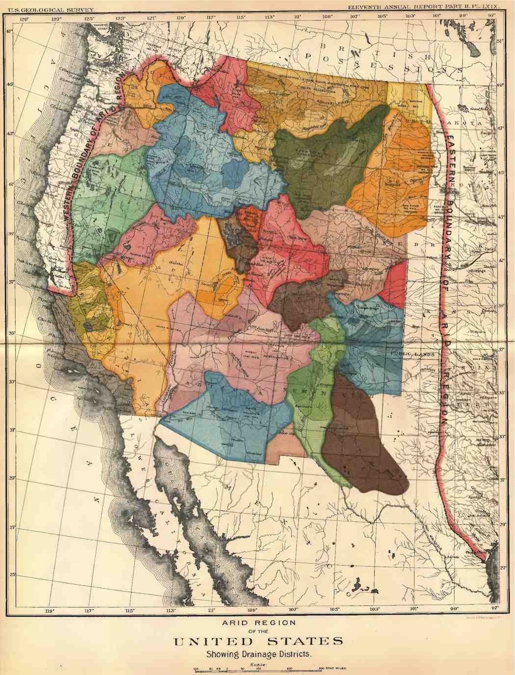
Graphic credit: George Sibley

Click the link to read the article on the Sibley’s Rivers website (George Sibley):

February 17, 2026

Youโ€™ve seen that quote here before โ€“ and youโ€™ll probably see it again; if this were a Wagnerian opera, that line would be a lietmotif, a recurring musical thread associated with a particular character or place or idea in the story being told musically. And whoโ€™s to say, โ€˜The Romance of the Colorado River,โ€™ Frederick Dellenbaughโ€™s title, might make a grand opera.

But before launching into the next chapter in the โ€˜Romance of the Colorado River,โ€™ there are some items of news to note. The no-news item of course continues to be the ongoing stalemate in the ongoing negotiations between the Upper and Lower Colorado River Basins. On the eve of their Valentineโ€™s Day deadline, there is talk of new โ€˜interim interim guidelines,โ€™ two to five years, for at least a nominal state presence as the Bureau of Reclamation tries to keep the lights on and some water flowing.

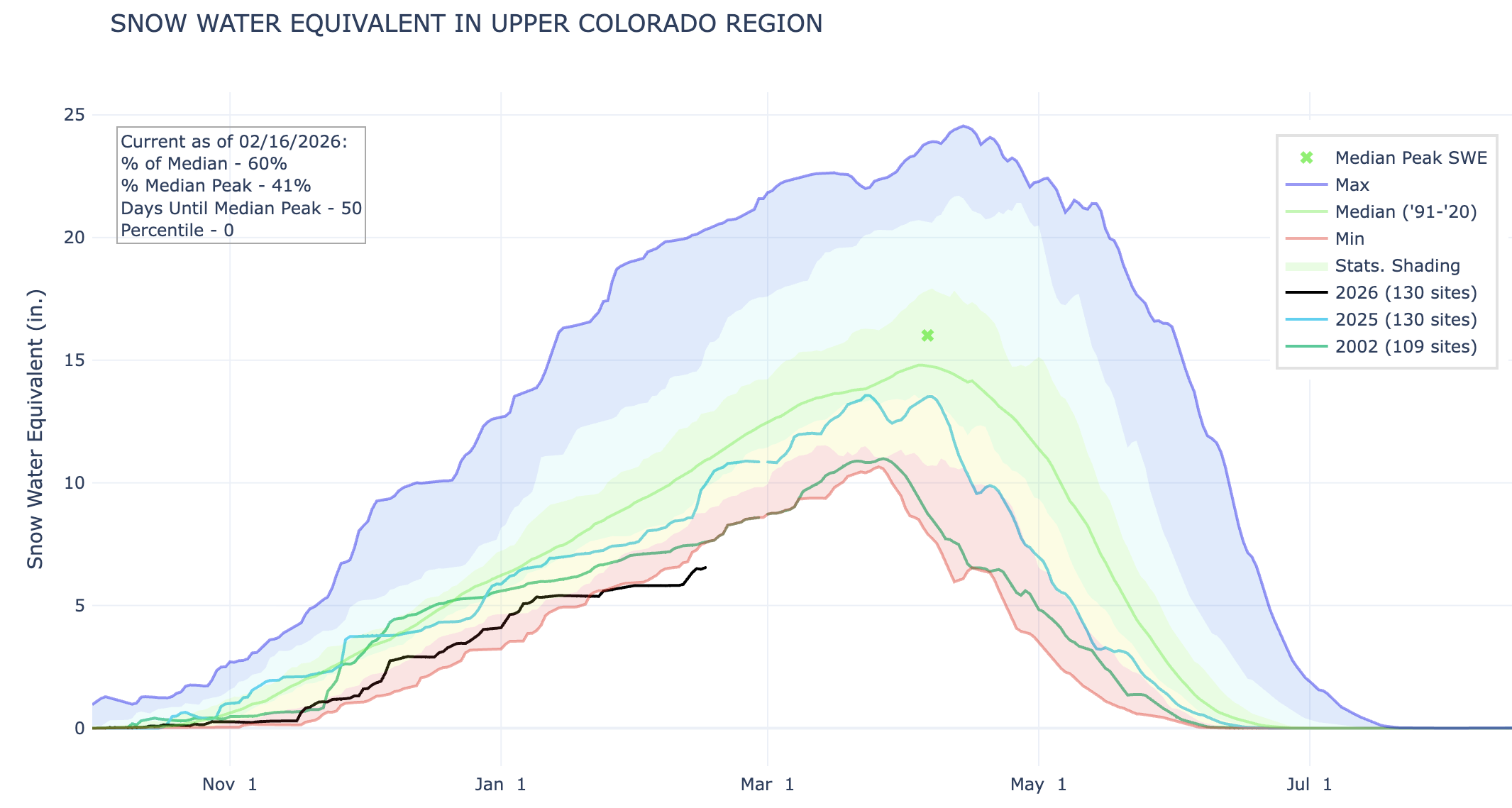
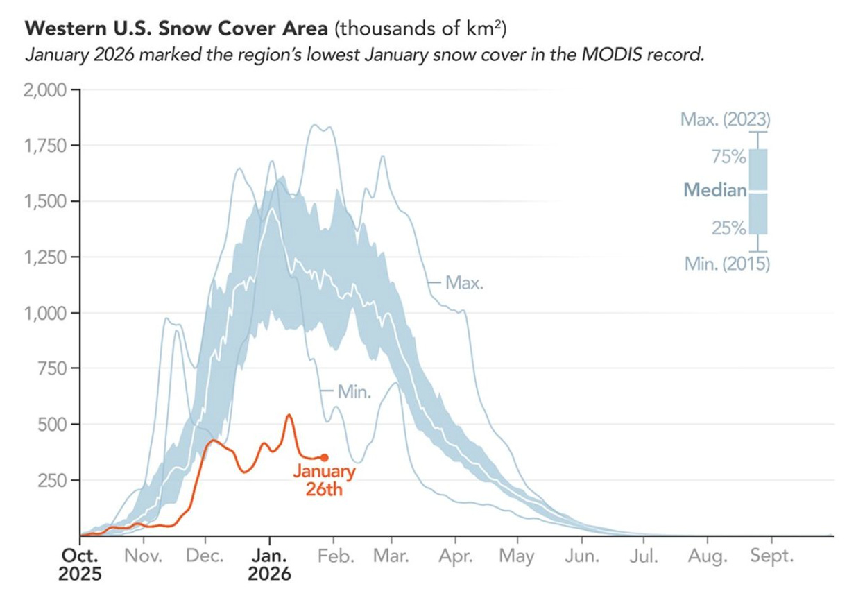
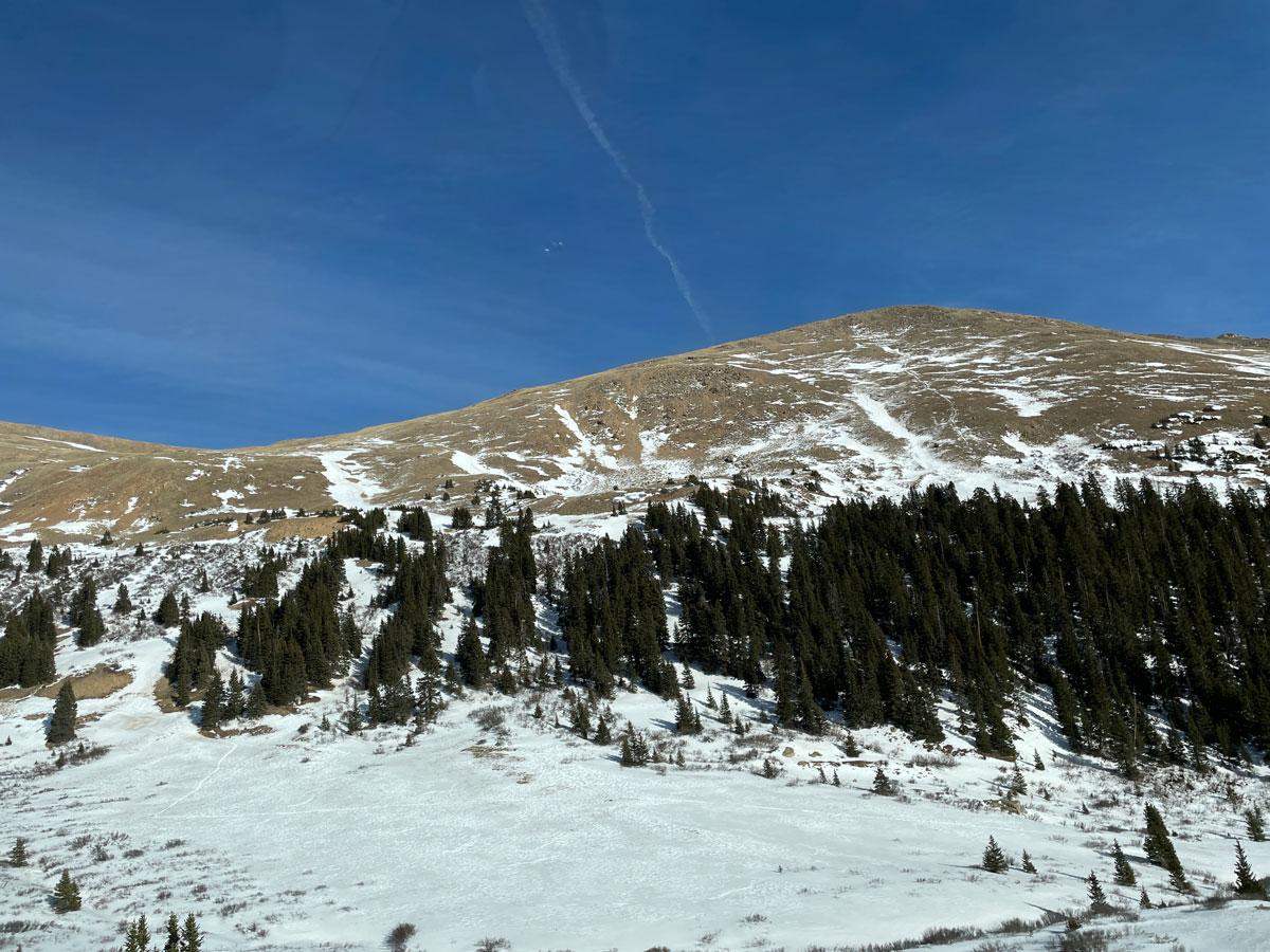
The bigger news is the extent to which the Colorado River Basin continues this winter to experience the reality we have created: an ongoing anthropogenic โ€˜heat droughtโ€™ (February temperatures in the 50s to 8,000 feet elevation this past week), coupled with a โ€˜dry droughtโ€™ โ€“ probably also caused by anthropogenic warming-induced changes over the Pacific Ocean. Snowpacks in the mountains from whence the riverโ€™s waters flow range from 35 to 85 percent of normal in mid-February; we may be heading for new records in low runoff.

The biggest news, but probably less noted, is a new take on the larger reality we have created globally. Late in January, the United Nations headquarters came out with a fairly astounding announcement:

“Amid chronic groundwater depletion, water overallocation, land and soil degradation, deforestation, and pollution, all compounded by global heating, a UNย reportย today declared theย dawn of an era of global water bankruptcy, inviting world leaders to facilitate honest, science-based adaptation to a new reality.”ย (Emphasis added)

This announcement was generally ignored, in the worldโ€™s morbid fascination over โ€˜what the Trumpsters are breaking today.โ€™ But the scientists who generated this report claim that phrases like โ€˜water stressโ€™ and โ€˜water crisisโ€™ are too hopeful, suggesting deviations from a normalcy that we might somehow be able to get back to. Today, they say, โ€˜many rivers, lakes, aquifers, wetlands, and glaciers have been pushed beyond tipping points and cannot bounce back to past baselines.โ€™ Bankruptcy.

A short list of global โ€˜hotspotsโ€™ included the American Southwest, where โ€˜the Colorado River and its reservoirs have become symbols of over-promised water,โ€™ with no reasonable hope of ever fulfilling those promises. Nothing new there โ€“ but calling it a state of bankruptcy bumps the desperation level up a little.

I am not going to get deeper into that report today, or the other news, but will hold it for the last chapter (to date) in this unfolding โ€˜Romance of the Colorado River.โ€™ If the report intrigues your morbid fascination with the apocalypse we seem to be driving toward, as the Trumpsters and financializers part out our civilization for distribution to the morbidly wealthy, you can find the report by clickingย here. [ed. also see Global Water Bankruptcy: Living beyond our hydrological means in the post-crisis era โ€” United Nations University Institute for Water, Environment and Health on Coyote Gulch]

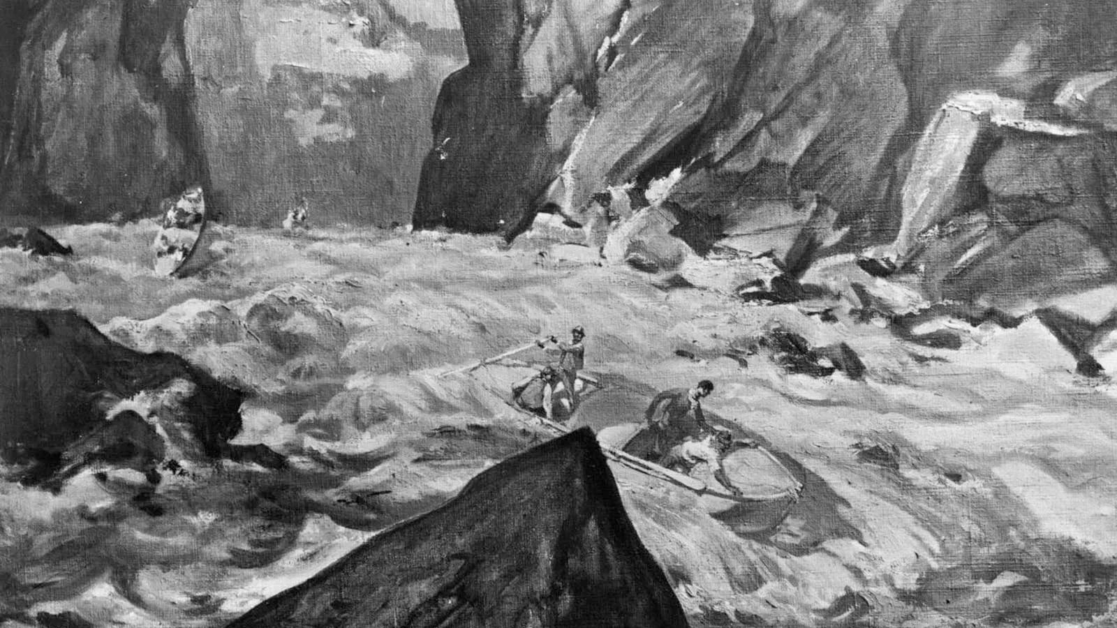
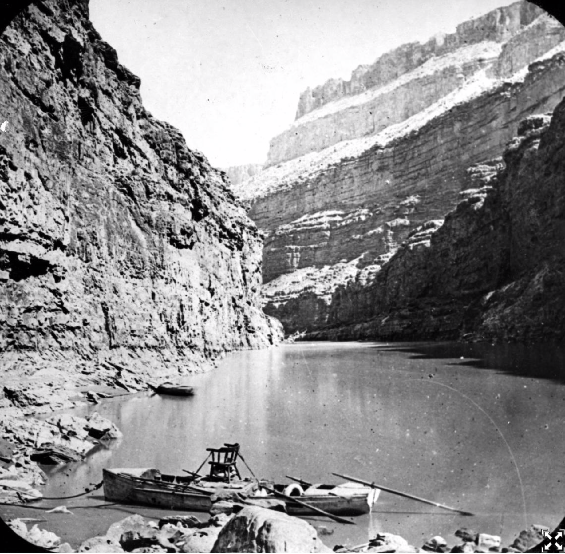
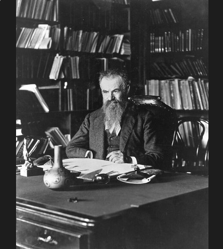
Now, back to the โ€˜Romance of the Colorado River.โ€™ Do remember that when we talk about โ€˜romancingโ€™ here, we are not talking about a sappy love story; we are talking about people muscling up to take on a challenge that is beyond or below the mundanity of life. In the last post on this site, we looked at โ€˜the Colorado River and the Romance of Exploration.โ€™ Dellenbaughโ€™s Romance of the Colorado River was published in 1903, and covered the adventures of everyone from the early Spanish conquistadores trying to sail up the river from its delta, to the trappers strip-mining the beavers from its upper tributaries, with a final focus on the explorations of John Wesley Powell who first sketch-mapped the unknown area between the upper river and the lower.

Dellenbaugh pulled no punches in describing his sense of the river and the challenge it represented. After noting in his introduction that โ€˜in every country, the great rivers have presented attractive pathways for interior explorationโ€”gateways for settlement,โ€™ serving as โ€˜friends and alliesโ€™ โ€“ he launches into his initial impressions of the Colorado River:

By contrast, it is all the more remarkable to meet with one great river which is none of these helpful things, but which, on the contrary, is a veritable dragon, loud in its dangerous lair, defiant, fierce, opposing utility everywhere, refusing absolutely to be bridled by Commerce, perpetuating a wilderness, prohibiting mankindโ€™s encroachments, and in its immediate tide presenting a formidable host of snarling waters whose angry roar, reverberating wildly league after league between giant rock-walls carved through the bowels of the earth, heralds the impossibility of human conquest and smothers hope.

Opposing utility everywhere? Refusing absolutely to be bridled by Commerce? Heralding the impossibility of human conquest, smothering hope? Could he have said anything more stirring in throwing down the gauntlet to an adolescent civilization?

Dellenbaughโ€™s Romance does sort of follow the formula of todayโ€™s sappy romance novel, but on the grand scale of the romantic adventure: first you establish the object of the protagonistโ€™s โ€˜dangerousโ€™ love as arrogant or disturbed or otherwise undesirable or unattainable โ€“ but thereforeโ€ฆ irresistibly attractive. Why are we drawn to such hard cases? Why wouldnโ€™t we leave such an angry and extreme river alone, like countless generations of First Peoples had done, settling riparian along its tributaries and even the mainstream, but just living with the โ€˜veritable dragonโ€™ as it was, and doing nothing to confront or challenge it? Or to bend it to their perceived needs? But we Euro-Americans are a civilization in which โ€˜love conquers allโ€™ โ€“ or else. Love or its simulacra โ€“ lust for wealth, for power, for knowledge, whatever. Come not between a woman and her lust for impossible men โ€“ or a civilization and its lust for everything it doesnโ€™t already control.

So it almost seems more destiny than coincidence that when Dellenbaugh wrapped up the โ€˜Romance of Explorationโ€™ in 1903, that was also the year the U.S. Reclamation Service went to work, following the Reclamation Act of 1902, to reclaim and conserve the river.

Theodore Roosevelt and John Muir at Glacier Point. By Underwood & Underwood – This image is available from the United States Library of Congress’s Prints and Photographs division under the digital ID cph.3g04698. See Commons:Licensing for more information., Public Domain, https://commons.wikimedia.org/w/index.php?curid=3517191

We call Theodore Roosevelt โ€˜the father of American conservation,โ€™ but he did not have the commonly accepted sense of conservation that we have today. Conservation to Roosevelt and his sidekick Gifford Pinchot was the full and efficient development of resources otherwise wasted. Freshwater running off to the ocean in an unmanageable spring flood was a prime example of profligate โ€˜wasteโ€™; they took it on through a Reclamation Service charged with working with farm communities, to develop irrigation systems to get water out of the rampant river and on to the dry land, thus conserving for human use both the land and water, each โ€˜uselessโ€™ until combined with the other.

The Reclamation Service was created as a division of the U.S. Geological Survey, which was still a bulwark of John Wesley Powellโ€™s disciplined science in the otherwise freewheeling Interior Department, aka General Land Office, charged primarily with privatizing the public lands through the Homestead Act and other laws. From the start, the Reclamation Service was filled with idealistic young engineers infused with the spirit of Rooseveltian conservation โ€“ the kind of idealism that could gradually transmogrify into the unconscious arrogance of those who Know They Are Doing Good and are therefore Always Right.

Their idealism is reflected in an article written in 1918 by C.J. Blanchard of the U.S. Reclamation Service, for The Mentor, an educational publication:

A vein of romance runs through every form of human endeavorโ€ฆ. In the desert romance finds its chief essentials in adventure, courage, daring and self-sacrifice. For more than half a century man has been writing a romance of compelling interest upon the face of the dusty earth. Irrigation, with Midasโ€™ touch, has changed the desertโ€™s frown to smiling vistas of verdure.

In a section titled โ€˜The Romance of Reclamation,โ€™ Blanchard described the reclamation engineers as men not concerned about โ€˜large emoluments, for government salaries are notoriuously meagerโ€™; instead, โ€˜as they toiled in the fastness of mountains, an abysmal canyons or far out in the voiceless desert, through the blazing heat of the Southwest or the fierce blizzards of the northern plains, this thought was uppermost, โ€œBy this work we shall make the desert bloom.โ€โ€™

But the reclamation engineers quickly found working at the farm end of irrigation systems drawing water from the wildly varying flows of the Colorado River frustrating at best, impossible at worst. And they were engineers, not scientists โ€“ engineers with a brave new world of technology unfolding; fellow engineers were building the Panama Canal (1904-1914) using steam trains and steam shovels that could move more dirt in an hour than a hundred farmers with shovels could move in a day. Scientists just figure out how the world works; engineers figure out how to make it work better. (or so they hope).

Roosevelt Dam, Salt River, Arizona. By Nicholas Hartmann – Own work, CC BY-SA 4.0, https://commons.wikimedia.org/w/index.php?curid=51639491

So within their first half-decade the Reclamation Service engineers were drawn toward larger projects that, in effect, would โ€˜correctโ€™ the inefficiency and maddening variability of the river: the Roosevelt Dam up in the Salt River canyons storing the spring flood for release to irrigators throughout the whole growing season; a concrete weir dam all the way across the lower Colorado River to keep the late summer flows up to the headgate of the Laguna Irrigation Project near Yuma; a five-mile tunnel from the Black Canyon of the Gunnison River to the water-short (or over-developed) Uncompahgre Valley โ€“ all three projects begun in 1905-6.

Gunnison Tunnel via the National Park Service

Evolving concrete technology, and the evolving internal combustion engine made them dream of even larger projects, addressing all the natural challenges posed by Dellenbaughโ€™s โ€˜veritable dragon.โ€™ In 1907 the Reclamation Service separated from the U.S. Geological Survey and became an independent bureau in the Department of Interior. This separation was more than just a name change; they also began to work independently of John Wesley Powellโ€™s scientific rigor practiced in the Geological Survey.
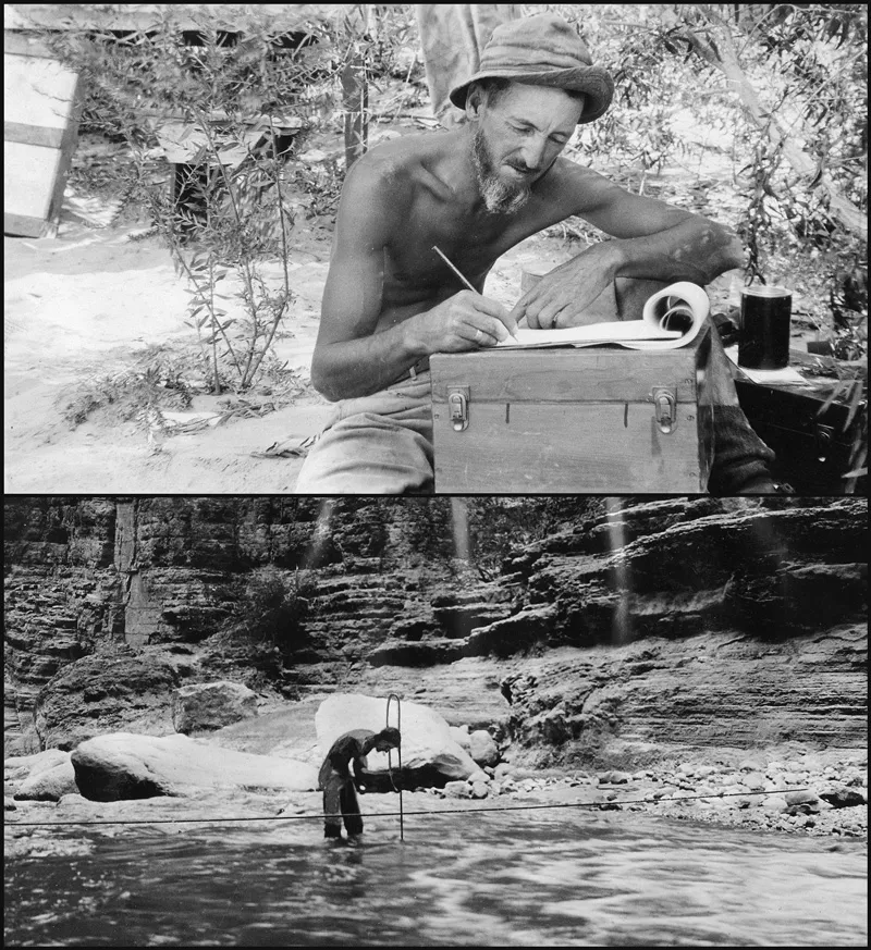
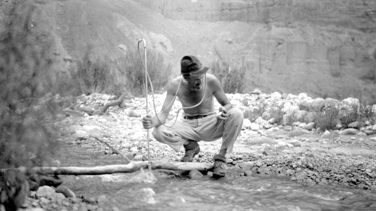
U.S. Geological Survey hydrologist Eugene Clyde La Rue takes notes (top) while in camp on Diamond Creek, a tributary to the Colorado River in Arizona, in 1923. La Rue (bottom; standing in water) measures river discharge along Havasu Creek, another tributary in Arizona, also in 1923. Click image for larger version. Credit: Both: U.S. Geological Survey

This became a background issue when the seven states of the Colorado River Basin gathered in 1922 to try to work out an equitable division of the river among themselves. Knowledge of the actual flow of the river was sketchy. Rough measures of the flow at a Yuma gauge only went back to the mid-1890s, and gave an average in the wild annual fluctuations of just under 18 million acre-feet (maf). But a Geological Survey scientist, E. C. LaRue, had studied tree rings and other evidence, and argued that the river was just in a very wet spell, that the longer-term average flow of the river was probably well under 15 maf, maybe as low as 10-12 maf (what it appears to be today). He also cautioned that extensive storage in desert reservoirs would exact a large toll in reservoir evaporation; there would beย more water availableย for use, but the tradeoff would beย less water overall.

LaRue โ€“ John Wesley Powellโ€™s kind of scientist โ€“ offered to consult with the Compact Commission; but nobody really wanted to hear what he was known for saying, and his offer was ignored by Chairman Herbert Hoover (an engineer). But a constant advisory presence at the compact planning meetings was Reclamation Commissioner Arthur Powell Davis, another engineer and an active participant in discussion leading to the commission accepting the Bureau figures, and deciding that a โ€˜temporary equitable divisionโ€™ of 15 maf between an upper and lower basin was a reasonablyย conservativeย division, leaving enough uncommitted water for โ€˜those men who may come after us, possessed of a far greater fund of information, [to] make a further division of the river.โ€™

Current water mavens Eric Kuhn and John Fleck wrote a well-researched book,ย Science Be Dammed: How Ignoring Inconvenient Science Drained the Colorado River,ย detailing this decision to ignore solid USGS science in drafting the compact. A more mythic summary of what happened probably lies in desert poet Mary Austinโ€™s recollection of a legend about the Hassayampa River, a Colorado River tributary; if anyone drinks its water, according to the legend, they will โ€˜no more see fact as naked fact, but all radiant with the color of romance.โ€™ Whatever was in the Hassayampaโ€™s water may have infiltrated the entire Colorado River in the 20thย century.

Basically, the Bureau of Reclamation, with all the emerging technology and its vision of โ€˜making the desert bloom,โ€™ was itching to take on the โ€˜veritable dragon.โ€™ The โ€˜Romance of Explorationโ€™ had uncovered a rampaging river whose waters were needed for American advancement; the โ€˜Romance of Conquestโ€™ was the obvious next step, and science just based on the โ€˜naked factsโ€™ no longer seemed to dictate the limits of the possible. Weโ€™re an empire now, and when we act, we create our own reality. That may not have been so baldly stated until 2004, but it was the driving theme of the 20th century โ€“ first in America, then globally.

President Franklin Roosevelt at dedication of Boulder (now Hoover) Dam, September 30, 1935

The Romance of Conquest began with the three 1905-6 projects, but shifted into high gear with the Boulder Canyon Project, created by Congress in 1929 following ratification of the Colorado River Compact โ€“ almost simultaneously with the onset of the Great Depression. The Project became practically the nationโ€™s only bright light in the early 1930s, and became a template for much of Rooseveltโ€™s โ€˜New Deal.โ€™

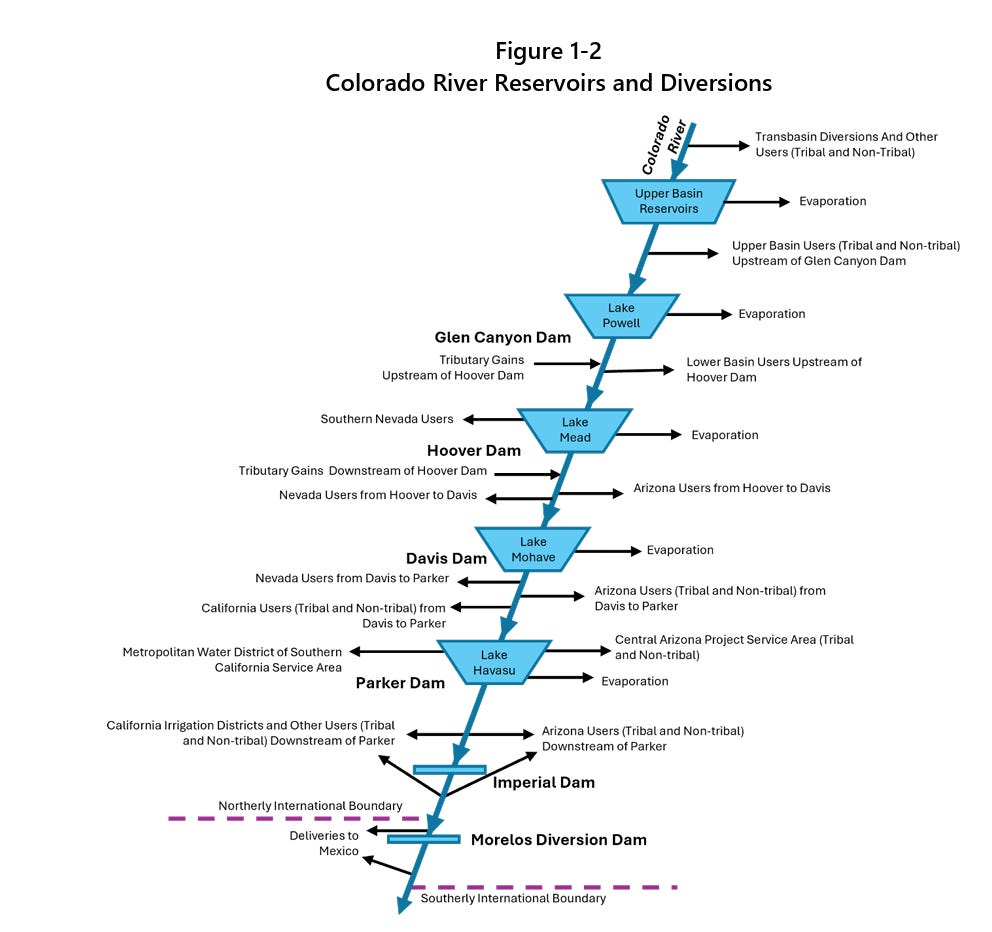
The centerpiece of the Boulder Canyon Project was Hoover Dam, the largest dam project ever undertaken anywhere, capable of storing almost two years of the riverโ€™s flow, and as it released water on demand from the โ€˜desert bloomersโ€™ downstream, it would generate enough electricity to handle most of the Southwestโ€™s power demand at that time. But while the big dam was being built, the Bureau was also building the Imperial Weir Dam 180 miles downstream, to diverting more than three million acre-feetย of water into the All-American Canal for an 80-mile trip to the Imperial Valley where crops could be grown year round. And between those two huge works, the Bureau was also overseeing construction of Parker Dam (not officially part of the Boulder Canyon Project) to pool up water for a 250-mile aqueduct a Metropolitan Water District was building to carry domestic water to Californiaโ€™s burgeoning south coast cities.

All of that was completed by 1941 โ€“ a massive coordinated regional development: food, water and power for cities that quickly became an industrial force in the winning of World War II. And it was all done on budget, and on time, organized by an agency created only forty years earlier to help small new farming communities build local irrigation systems.

And Iโ€™m going to pause there, at the moment of the Bureauโ€™s triumph, and pick up the rest of the story of the Romance of Conquest in the next post here. Stay tuned.

The California Aqueduct, San Joaquin Valley, California. Sources/Usage: Public Domain.

Yikes! #LakePowell likely to receive half or less of its normal water supply this year — Shannon Mullane (Fresh Water News) #ColoradoRiver #COriver #aridification

The Bureau of Reclamationโ€™s latest forecast for the Colorado River predicts Lake Powell will โ€œmost probablyโ€ drop below the critical minimum power pool level before the end of this year, jeopardizing Glen Canyon Damโ€™s structural integrity. In the worst-case scenario, it would do so before summerโ€™s end. This could force the feds to operate the dam as a โ€œrun-of-the-riverโ€ operation to preserve the damโ€™s infrastructure and hydropower output, which would significantly diminish downstream flows and threaten Lower Basin water supplies.

Click the link to read the article on the Water Education Colorado website (Shannon Mullane):

February 19, 2026

Lake Powell could receive only half the normal amount of water from upstream rivers and streams this year, according to a recent federal study.

The U.S. Bureau of Reclamation releases a monthly study that forecasts good, bad and most likely storage conditions for the Colorado River Basinโ€™s key reservoirs over the next two years. The February forecast expects about 52%, or about 5 million acre-feet, of the normal amount of water to flow into Lake Powell by September. The more grim outlook says Powellโ€™s inflows could be 3.52 million acre-feet or 37% of the average from 1991 to 2020.

Itโ€™s enough to spike concerns about hydropower generation at Glen Canyon Dam โ€” which controls releases from Powell โ€” prompt discussions about emergency releases from upstream reservoirs and trigger federal actions to slow the pace of water out of the reservoir.

โ€œI think theyโ€™re going to be nervous about operating the turbines,โ€ said Eric Kuhn, former general manager for the Colorado River Water Conservation District.

In January, about 79% of the 30-year average flowed into Lake Powell โ€” which is on the Utah-Arizona border โ€” from upstream areas of Arizona, Colorado, New Mexico, Utah and Wyoming, according to the federal February 24-month study, released Friday.

The February projections also showed even less water flowing into Lake Powell, a decline of about 1.5 million acre-feet since January.

One acre-foot is enough water to support two or three households for a year. Colorado used an average of 1.96 million acre-feet of Colorado River water between 2021 and 2025.

The Colorado River Basin, which provides water to 40 million people, has been plagued by a 25-year drought that drained its main reservoirs โ€” the largest in the nation โ€” to historic lows amid unyielding human demands.

And that stress is going to continue. The most probable forecast shows nothing but below-average flows in February โ€” 71% of the 30-year average โ€” and for April through July, when flows are likely to be 38% of the norm.

Feds take action to boost Powell

Upstream states like Colorado do not get a drop of water from Lake Powell, Kuhn said. Coloradans rely mostly on local reservoirs to help pace the spring runoff and support year-round water use.

But the reservoirโ€™s status can impact whether upstream reservoirs, like Flaming Gorge in Wyoming and Blue Mesa in Colorado, will have to make emergency releases to elevate water levels in Lake Powell.

In response to the dry and warm winter, the federal government is trying to keep the water in the reservoir above certain critical water levels, according to the study.

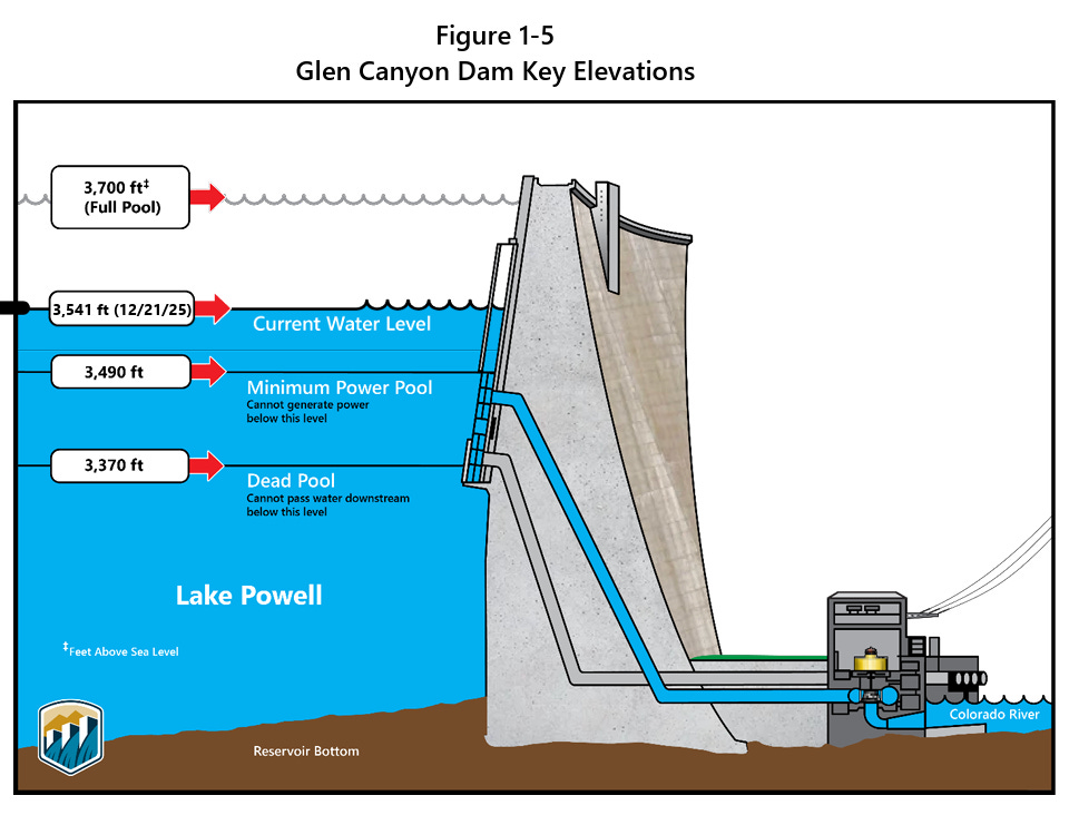
At 3,490 feet in elevation, Glen Canyon Dam can no longer send Powellโ€™s water through its penstocks and turbines to generate hydroelectric power โ€” that would remove a cheap, renewable and reliable power source for communities across the West.

Lake Powell is projected to drop below the critical elevation by December, or as soon as August in one scenario, according to the 24-month study.

Federal officials are likely to call for emergency water releases from upstream reservoirs to keep Powellโ€™s water level from falling to that point. Theyโ€™re working to maintain a cushion by keeping Powellโ€™s water level above 3,525 feet, or at the very least 3,500 feet in elevation, according to the study.

Lake Powellโ€™s elevation was just over 3,532 feet as of Monday, but itโ€™s expected to drop to 3,497 feet by Sept. 30 under the most likely forecast. (The minimum forecast puts it closer to 3,469 feet.)

Putting himself in the Bureau of Reclamationโ€™s shoes, Kuhn would be looking upstream to fill that gap.

โ€œWhere do they plan for it?โ€ he said. โ€œI would be looking to get a lot of water if Iโ€™m going to keep Lake Powell above 3,500. โ€ฆ 3,525 may not be possible. There just may not be enough water in the system.โ€

Facing new lows

That is partly because the Bureau of Reclamation is required by a 2007 agreement, which expires this fall, to release certain amounts of water each year based on reservoir elevations. Replacing these rules is the focus of ongoing high-stakes โ€” and deadlocked โ€” negotiations among states.

Powellโ€™s releases are expected to be 7.48 million acre-feet between Oct. 1, 2025, and Sept. 30, according to the February 24-month study.

To try to keep reservoir levels up, the Bureau of Reclamation has adjusted its normal releases since December to keep about 600,000 acre-feet of water in the reservoir. That water will eventually be released downstream as required by the 2007 rules.

Federal officials could also release less than 7.48 million acre-feet this year to keep more water in Lake Powell, according to the study. A 2024 short-term agreement allows the officials to release as little as 6 million acre-feet of water this year to avoid Lake Powell falling below 3,500 feet.

Lake Powellโ€™s lowest release was about 2.43 million acre-feet in 1964, when the reservoir was first being filled. Since 2000, when the basin dipped into the ongoing 25-year drought, Powellโ€™s average annual release has been 8.69 million acre-feet, according to The Sunโ€™s analysis of water release data.

โ€œI donโ€™t think theyโ€™re going to release 7.48 this year. I think they have to cut the flow down to 7 (million acre-feet) or even below,โ€ Kuhn said.

More by Shannon Mullane

Map of the Colorado River drainage basin, created using USGS data. By Shannon1 Creative Commons Attribution-Share Alike 4.0

ย โ€˜Large-scale fish killโ€™ on the #RioGrande: — Chris Lopez (AlamosaCitizen.com)

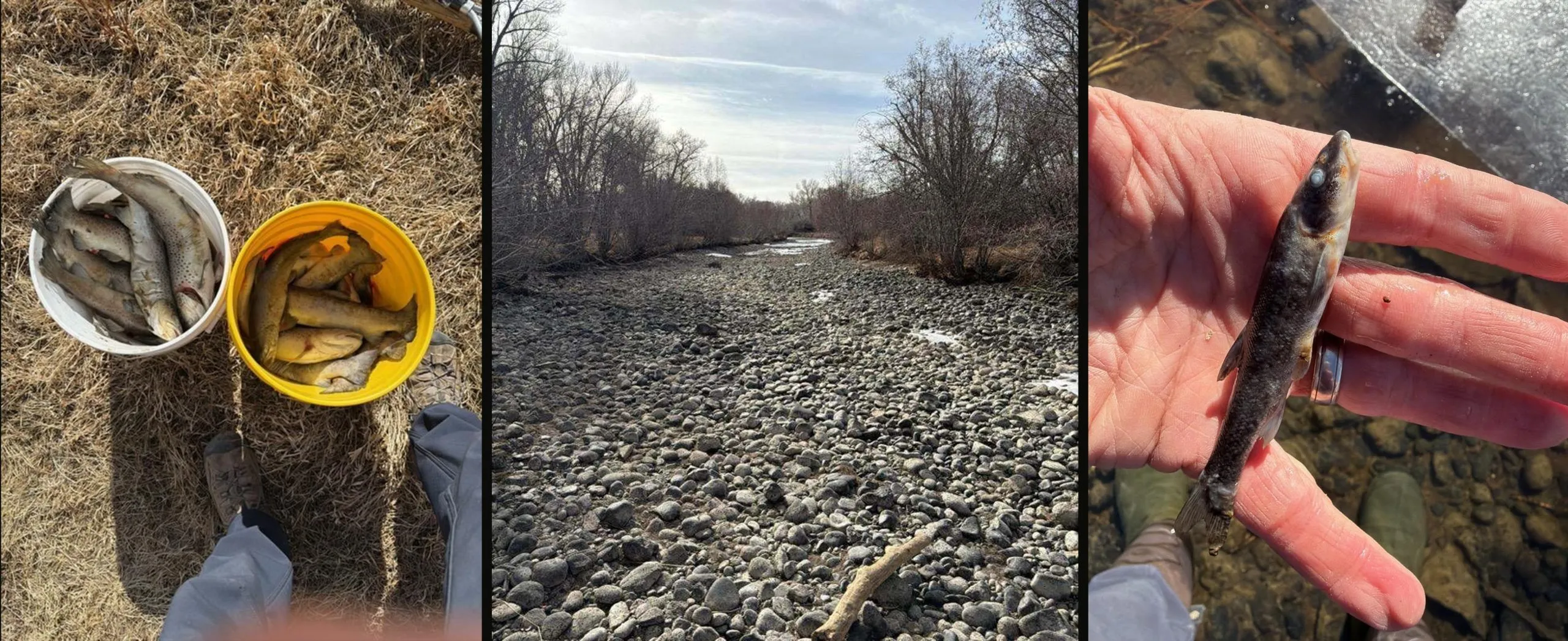
A team of nine CPW staff walked stretches of the river channel and collected as many fish as they could on Monday, Feb. 16. CPW staff reported โ€˜too many dead fish for the team to collect them all.โ€™ Credit: CPW

Click the link to read the article on the Alamosa Citizen website (Chris Lopez):

February 18, 2026

Rio Grande Headwaters Restoration Project work near Del Norte results in 7.2-mile stretch of the river being dried up; biologists say it could take three to five years to recover the fishery

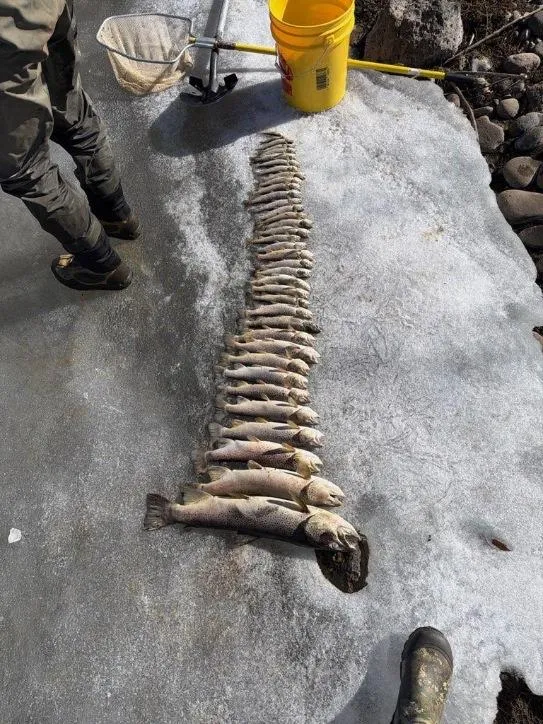
Colorado Parks and Wildlife has confirmed a โ€œlarge-scale fish killโ€ along the Rio Grande below Del Norte that was the result of a 7.2-mile stretch of the river being dried up as part of a river restoration project.

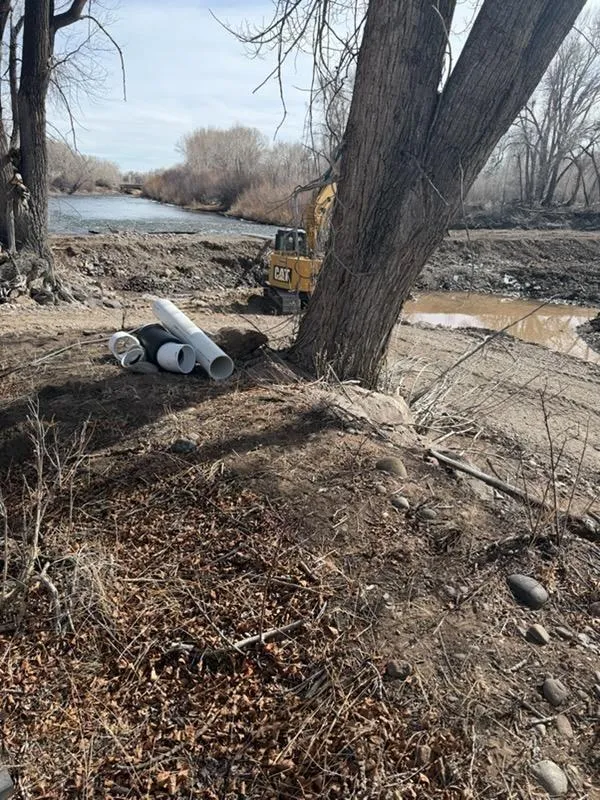
The Rio Grande Headwaters Restoration Project has its Farmers Union Canal Diversion and Headgate Improvement project underway in the area. During construction on this project a decision was made that caused the ecological disaster.

A significant number of the fish populations in this stretch died across all age classes. Brown and rainbow trout as small as two inches and up to 24 inches have been found, along with all sizes in between. Credit: CPW

On Monday, a team of nine CPW staff walked stretches of the river channel and collected as many fish as they could, said John Livingston, southwest region public information officer for CPW.

โ€œThere were too many dead fish for the team to collect them all,โ€ Livingston said in an email exchange with Alamosa Citizen.

The state agency was notified by a landowner on Feb. 3 that the north branch of the Rio Grande east of Del Norte was being dewatered, and fish were dying or dead.

Through its investigation, CPW determined that the species impacted include sportfish such as brown trout and rainbow trout, brook stickleback, longnose dace, fathead minnow and white sucker. Additional species such as northern leopard frogs and aquatic invertebrates such as mayflies, caddisflies and stoneflies, among others have also been found dead, according to Livingston.

โ€œA significant number of the fish populations in that stretch died across all age classes. Brown and rainbow trout as small as two inches and up to 24 inches have been found, along with all sizes in between,โ€ he said. 

Brown trout spawn in the fall and this yearโ€™s eggs that were laid in the rocky bottoms of the river most likely have been lost, CPW reported.

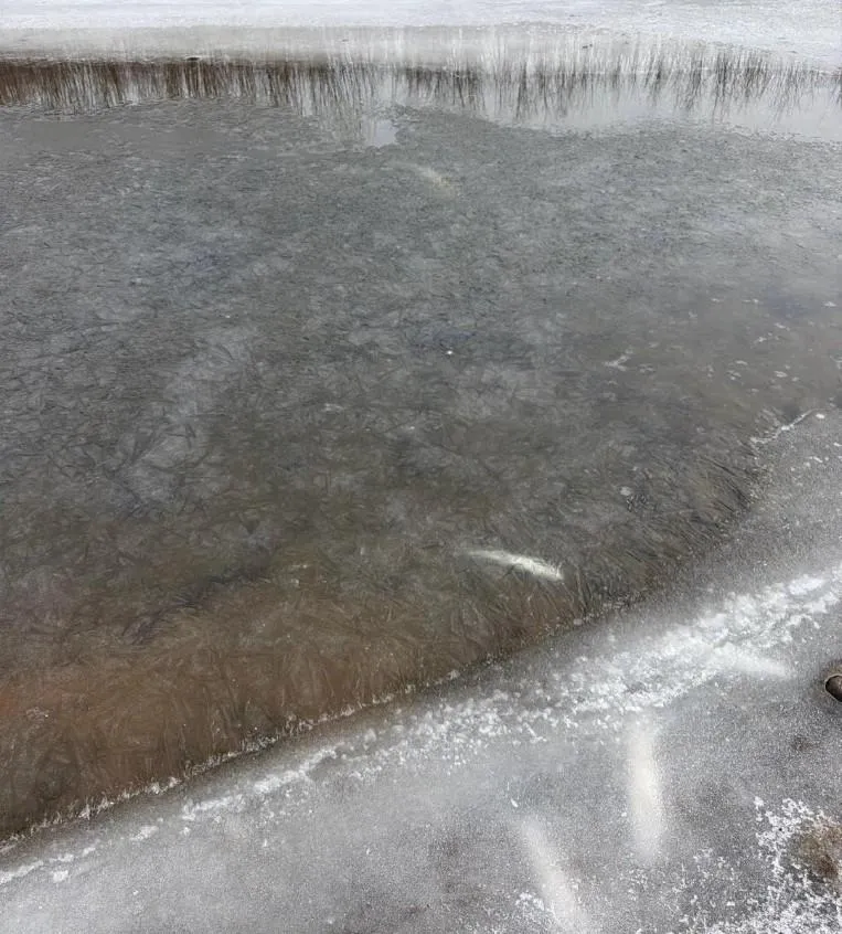
โ€œCPW faces challenging conditions to determine how many fish perished from the rapid dewatering. Many dead fish have also been scavenged by birds, raccoons, skunks, and foxes flocking to the area and others have been isolated in frozen pools,โ€ Livingston said.

The Rio Grande Headwaters Restoration Project has its Farmers Union Canal Diversion and Headgate Improvement project underway in the area. Credit: CPW

The Farmers Union Canal diversion project received nearly $1.3 million in funding through the U.S. Bureau of Reclamation. The Rio Grande Restoration Project and San Luis Valley Irrigation District are teaming up on the project.

Farmers familiar with the project told Alamosa Citizen a โ€œhasty decisionโ€ was made to move ahead on the project during a cold spell this winter, resulting in the drying of the river through private corridors of the Rio Grande.

โ€œThereโ€™s a lot happening behind the scenes to remedy this. Landowners are pissed,โ€ one rancher told the Citizen.

CPW is concerned about the fish kill and potential impacts to other species, such as amphibians and aquatic invertebrates, and the potential impacts to the riparian corridor. An aboriginal population of Rio Grande chub, a Tier 1 Species of Greatest Conservation Need, has been documented in this reach of the Rio Grande, according to state parks and wildlife.

โ€œThis stretch of river is habitat for the federally endangered southwestern willow flycatcher and the federally threatened western yellow-billed cuckoo. While flycatchers and cuckoos do not overwinter in this reach, they rely on this habitat for nesting and rearing their young every spring and summer,โ€ said Livingston.

Fish have been isolated in frozen pools. Credit: CPW

Aquatic biologists estimate it could take three to five years to recover the fishery, he said.

โ€œCPW wants to thank the landowners along the river for their cooperation and for providing access to the river for this investigation, and CPW shares their concerns regarding this incident,โ€ Livingston said.

Alamosa Citizen is seeking comment on this from Daniel Boyes, executive director of the Rio Grande Restoration Project.

Hereโ€™s more on the project itself.

The #ColoradoRiver Crisis is Here: States fail to reach a deal; #LakePowell Deadpool appears imminent — Jonathan P. Thompson (LandDesk.org) #COriver #aridification #megadrought

The Bureau of Reclamationโ€™s latest forecast for the Colorado River predicts Lake Powell will โ€œmost probablyโ€ drop below the critical minimum power pool level before the end of this year, jeopardizing Glen Canyon Damโ€™s structural integrity. In the worst-case scenario, it would do so before summerโ€™s end. This could force the feds to operate the dam as a โ€œrun-of-the-riverโ€ operation to preserve the damโ€™s infrastructure and hydropower output, which would significantly diminish downstream flows and threaten Lower Basin water supplies.

Click the link to read the article on The Land Desk website (Jonathan P. Thompson):

February 16, 2026

Valentines Day wasnโ€™t so lovey-dovey on the Colorado River.

First, the Bureau of Reclamation (BoR) released a grimmer-than-ever spring runoff forecast for the Colorado River and its two big reservoirs. Then the seven Colorado River Basin states announced that they once again had failed to reach an agreement on a plan to bring demand into line with diminishing supplies by the Feb. 14 deadline. While the states have blown by other deadlines since negotiations began in 2022, this time was different in that it triggered the federal government to move forward to impose a post-2026 management plan of its own.

On paper, the states still have until the end of the water year, or Oct. 1, to come up with a deal or to implement an alternate plan. But that may be too little too late to keep Lake Powellโ€™s surface level from dropping below minimum power pool โ€” otherwise known as de facto dead pool โ€” later this year. While the negotiations are over the Colorado River, or rather the water in the river, in many ways they pivot around the need to keep Lake Powellโ€™s surface level above 3,500 feet in elevation. That can only be done by releasing less water out of Glen Canyon Dam, or increasing flows into the reservoir, or a bit of both.

The sticking point in the negotiations hinges upon whether the Upper Basin states will take mandatory and verifiable cuts in water use. The Lower Basin states have already taken cuts, and have agreed to take more, but only if the Upper Basin does the same.

Theย Upper Basinย (aka the Headwaters states) points out that while the Lower Basin has maxed out and even exceeded its Colorado River Compact allocation of 7.5 million acre-feet per year, the Upper Basin hasnโ€™t even come close to using all of the water itโ€™s entitled to. Furthermore, Upper Basin water users, especially those with more junior water rights, have grappled with drastic reductions during dry years because the Upper Basin lacks large reservoirs for storing water, meaning their water use is dictated in large part by the riversโ€™ flows. In 2021, for example, many southwestern Colorado farms had their ditchesย cut off as early as June, forcing them to sit the season out.

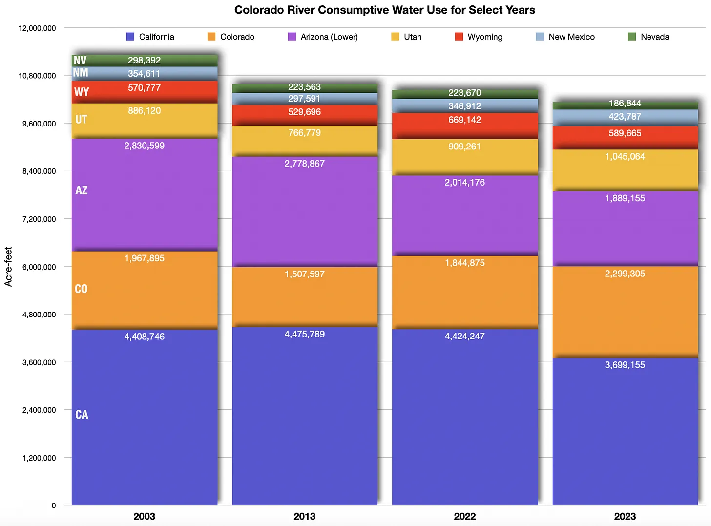
The Lower Basin states long used their entire 7.5 MAF allocation and then some, while the Upper Basin states use only about 4 MAF per year. In recent years, Arizona and California have cut consumptive use. Source: Bureau of Reclamation.

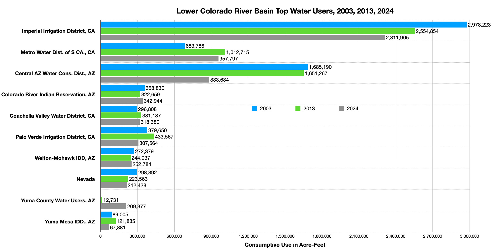
Itโ€™s also far simpler logistically to reduce consumption in the Lower Basin, where huge water users are served by a handful ofย very large diversions, such as the Central Arizona Project canal (which carries water to Phoenix and Tucson), the All-American Canal (serving the Imperial Irrigation District โ€” the largest single water user on the entire river), and the California Aqueduct (serving Los Angeles and other cities), all of which are fed by Lake Mead and other reservoirs. Dialing back those three diversions alone could achieve the necessary water use reduction. The Upper Basin, on the other hand, pulls water from the river and its tributaries via hundreds of much smaller diversions; achieving meaningful cuts would require shutting off thousands of irrigation ditches to thousands of small water users under dubious authority. (ed. emphasis mine]

Also, proposals to divert and consume more of the Colorado Riverโ€™s water โ€” such as the Lake Powell pipeline โ€” remain on the table, albeit tenuously. If that project were to be realized, which is a big if these days, it would further drain Lake Powell and result in even less water flowing down to the Lower Basin.

The Imperial Irrigation District is the largest single water user on the Colorado River by far. Most of that water goes to irrigating agriculture, including a fair amount of alfalfa and other forage crops. Las Vegas uses about one-tenth the amount of water as the IID. Source: Bureau of Reclamation.

Environmental groups tend to side with the Lower Basin on this issue. If the Upper Basin is forced to pull less water from the river, it would leave more water for the river, riparian ecosystems along the river, and aquatic critters. The Upper Basinโ€™s proposal to release a percentage of the riverโ€™s โ€œnatural flowโ€ from Glen Canyon Dam wouldย leave less water in the Colorado River through the Grand Canyon, possibly imperiling endangered fish and rafting.

Meanwhile, the statesโ€™ lack of consensus pushes Glen Canyon Dam closer to the brink of deadpool.

The BoRโ€™sย โ€œPost-2026 Operational Guidelines and Strategies for Lake Powell and Lake Meadโ€ย offers five alternative scenarios for how to run the river. While it doesnโ€™t give a โ€œpreferredโ€ alternative, officials have indicated that without all of the statesโ€™ approval or congressional action, they are only authorized to go with the Basic Coordination Alternative. That would include a minimum annual release of 7.0 million acre-feet from Glen Canyon Dam, with the largest mandatory cuts being borne by Arizona. But according to the BoRโ€™s latest 24 month projection, that release level would lead to Lake Powellโ€™s surface level dropping below minimum power pool by the end of this year, which is aย really big problem.

The back of Glen Canyon Dam circa 1964, not long after the reservoir had begun filling up. Here the water level is above dead pool, meaning water can be released via the river outlets, but it is below minimum power pool, so water cannot yet enter the penstocks to generate electricity. Bureau of Reclamation photo. Annotations: Jonathan P. Thompson

Back in 2022, as climate change continued to diminish the Colorado Riverโ€™s flows and Lake Powell shrunk to alarmingly low levels, the damโ€™s operators were faced with the prospect of having to shut down the penstocks, or water intakes for the hydroelectric turbines, and only release water from the river outlets lower on the dam. Not only would this zero out electricity production from the dam, along with nixing up to $200 million in revenue from selling that power, it might also compromise the dam itself. โ€œGlen Canyon Dam was not envisioned to operate solely through the outworks for an extended period of time,โ€ wrote Tanya Trujillo, then-Interior Department assistant secretary for water and science, in 2022, โ€œand operating at this low lake level increases risks to water delivery and potential adverse impacts to downstream resources and infrastructure. โ€ฆ Glen Canyon Dam facilities face unprecedented operational reliability challenges.โ€

In March 2024, a BoR technical decision memorandum verified and clarified those risks, and recommended that dam operators โ€œnot rely on the river outlet works as the sole means for releasing water from Glen Canyon Dam.โ€

The only way to do that is to keep the water level above 3,490 feet in elevation, which could mean shifting Glen Canyon Dam to aย run of the river operationย โ€” where releases equal Lake Powell inflows minus evaporation and seepage โ€” as soon as this fall. That, most likely, will lead to annual releases far below 7 million acre-feet, which will then lead to Lake Meadโ€™s level being drawn down considerably as the Lower Basin states rely on existing storage to meet their needs, thereby threatening Lower Basin supplies. Such a scenario is clearly not sustainable, would put the Upper Basin states in violation of the Colorado River Compact1, and would almost certainly lead to litigation.

An irony here is that Glen Canyon Damโ€™s primary purpose is to allow the Upper Basin to store water during wet years and release it during dry years, enabling it to meet its Compact obligations. Hydropower, silt control, and recreation were secondary purposes. Now the need to preserve the dam could cause the Upper Basin to run afoul of the Compact. Aridification is rendering the dam obsolete, at least as a water storage savings account. Meanwhile, low levels are diminishing hydropower and recreation. It seems that soon, the damโ€™s main purpose will be to prevent Lake Mead from filling up with silt. [ed. emphasis mine]

Mother Nature, or Mother Megadrought, if you prefer, has left few options for moving forward. The states still could come to an agreement, but itโ€™s difficult to see how, given the long-running stalemate so far. The feds could reengineer Glen Canyon Dam to allow for sustained, low-water releases. That would only be a temporary fix, however, unless climatic trends reverse themselves and the West suddenly becomes much wetter and cooler. Somehow, that doesnโ€™t seem too likely.

๐Ÿฅต Aridification Watch ๐Ÿซ


Is all of this Colorado River talk a bit confusing? Do you find yourself lost in the water-wonk weeds? Yeah, me too.ย Thatโ€™s why I put together theย Land Deskโ€™sย Colorado River glossary and primer. Itโ€™s not behind the paywall yet, so even you free-riders can take a look for the next few days. Itโ€™s worth looking at even if you already received the email edition last month, because it is now updated with new terms and more graphics (it didnโ€™t all fit in the email version). Iโ€™ll keep updating it, too, as new questions about what it all means come up. And if youโ€™re not already, you should consider becoming a paid subscriber and break down the archive paywall, allowing you to read the whole list of analysis, commentary, and data dumps Iโ€™ve done on the Colorado River over the last five years.

A Colorado River glossary and primer — Jonathan P. Thompson


1 The Upper Basin and Lower Basin generally disagree on how to interpret the Colorado River Compactโ€™s provision dictating that the Upper Basin โ€œnot cause the flow of the river at Lee Ferry to be depleted below an aggregate of 75 million acre-feetโ€ for any 10-year period. The Upper Basin sees it as a โ€œnon-depletion obligation,โ€ meaning they canโ€™t exceed their 7.5 MAF/year allocation if it causes the Lee Ferry flow to fall below a 7.5 MAF/year average. The Lower Basin believes itโ€™s a โ€œdelivery obligation,โ€ and that the Upper Basin must deliver 7.5 MAF/year no matter what. Which interpretation is correct determines whether run-of-the-river would violate the Compact or not.

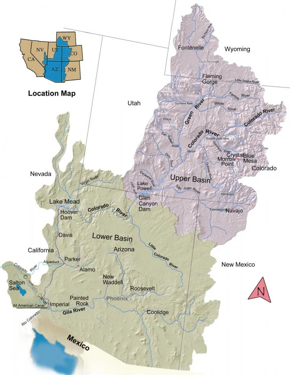
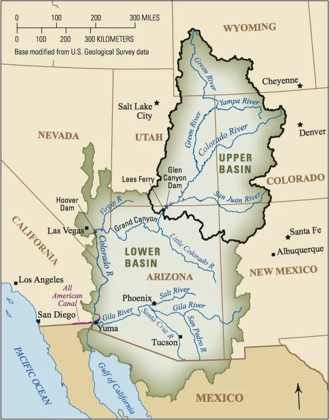
The Colorado River Basin spans seven U.S. states and part of Mexico. Lake Powell, upstream from the Grand Canyon, and Lake Mead, near Las Vegas, are the two principal reservoirs in the Colorado River water-supply system. (Bureau of Reclamation)

#ColoradoRiver states fail to meet another federal deadline for a deal as disastrous reservoir levels loom: #LakePowell could fall beneath level needed for hydropower as soon as July, new projections show — The #Denver Post #COriver #aridification

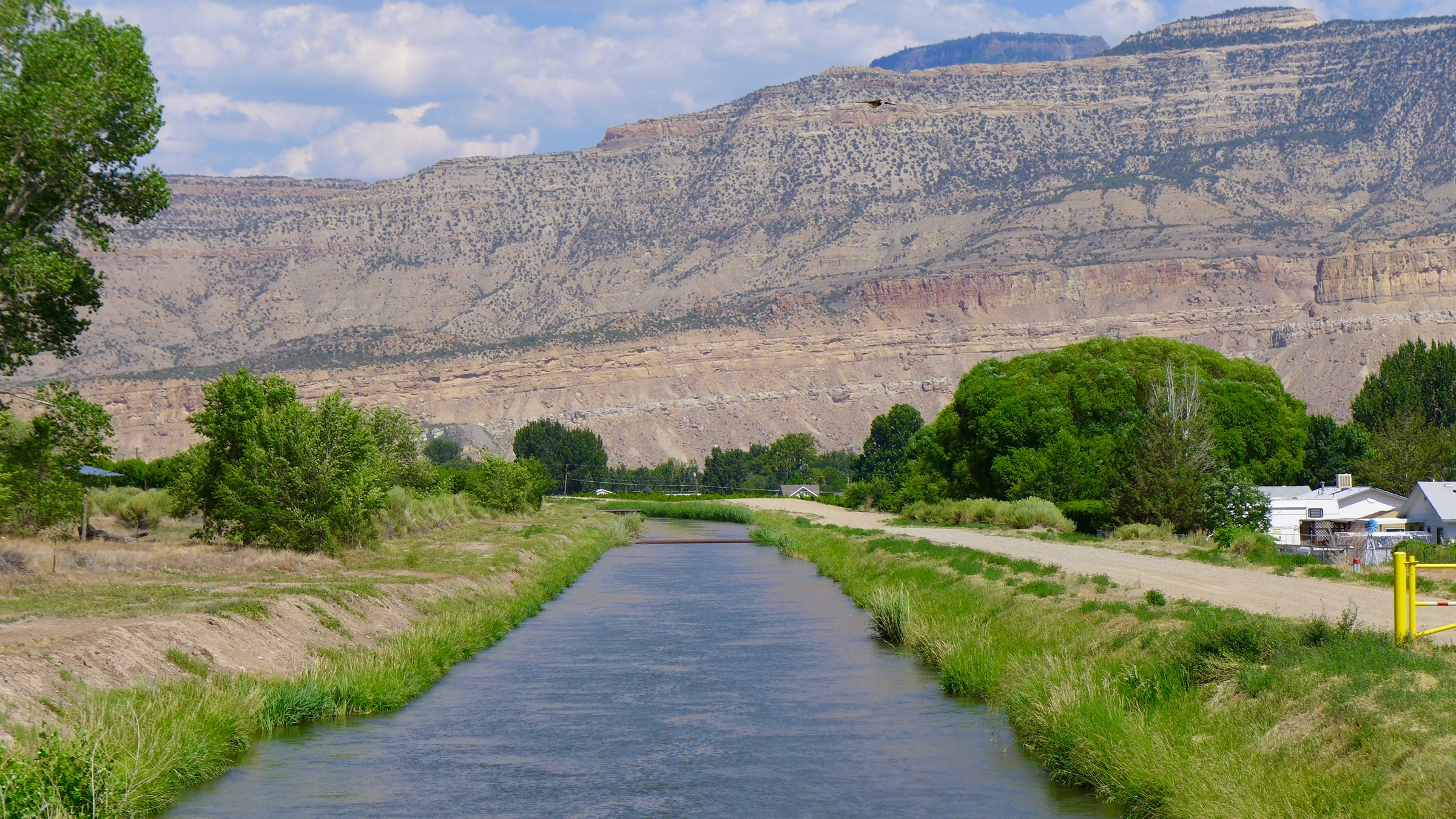
The Government Highline Canal, near Grand Junction, delivers water from the Colorado River, and is managed by the Grand Valley Water Users Association. Prompted by concerns about outside investors speculating on Grand Valley water, the state convened a work group to study the issue. CREDIT: BRENT GARDNER-SMITH/ASPEN JOURNALISM

Click the link to read the article on The Denver Post website (Elise Schmelzer). Here’s an excerpt:

February 17, 2026

Negotiators from the seven states along the Colorado River blew pastย yet another federal deadlineย over the weekend without reaching a compromise on how to share its water โ€” even as this winterโ€™sย dismal snowpackย could spell immediate disaster for the river system.

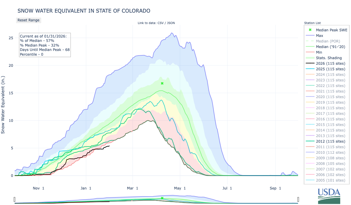
Westwide SNOTEL basin-filled map February 18, 2026.

Years-long discussions about how to split the riverโ€™s shrinking water supply, which is relied upon by 40 million people, remained deadlocked as the Saturday deadline for a final deal came and went. It was a deadline set by the U.S. Department of the Interior. The seven basin states are split into two factions that have not agreed on how to divvy up cuts to water supplies in dry years. The Lower Basin states of Arizona, California and Nevada lie downstream of Lakes Powell and Mead and rely on releases from those reservoirs for water. The Upper Basin states โ€” Colorado, Wyoming, Utah and New Mexico โ€” are upstream of the reservoirs and primarily depend on mountain snowpack for their water supplies. Leaders from each basin pointed fingers at the other as the deadline passed. Lower Basin negotiators have repeatedly said that Upper Basin states must โ€œshare the painโ€ and take mandatory cuts in dry years, which have become increasingly common in recent decades. But the Upper Basin states say their water users already take cuts every year because their supplies depend on the amount of water available and are not propped up by supplies in Lakes Powell and Mead. Repeated overuse in the Lower Basin has drained the two reservoirs, theyโ€™ve argued.

โ€œWeโ€™re being asked to solve a problem we didnโ€™t create with water we donโ€™t have,โ€ Coloradoโ€™s negotiator, Becky Mitchell, said in a statement Friday. โ€œThe Upper Divisionโ€™s approach is aligned with hydrologic reality and weโ€™re ready to move forward.โ€

The Bureau of Reclamationโ€™s latest forecast for the Colorado River predicts Lake Powell will โ€œmost probablyโ€ drop below the critical minimum power pool level before the end of this year, jeopardizing Glen Canyon Damโ€™s structural integrity. In the worst-case scenario, it would do so before summerโ€™s end. This could force the feds to operate the dam as a โ€œrun-of-the-riverโ€ operation to preserve the damโ€™s infrastructure and hydropower output, which would significantly diminish downstream flows and threaten Lower Basin water supplies.

As political leaders unleashed a series of pointed statements Friday, the Bureau of Reclamationย released new projectionsย that show one of the river systemโ€™s major reservoirs could be in peril as soon as this summer. The bureauโ€™s new projections show that, if drought conditions remain dire, Lake Powell could fall so low by the end of July that water would no longer flow through Glen Canyon Damโ€™s hydropower system โ€”ย a level called โ€œdead pool.โ€ย Even if snow conditions improve, the reservoir could still reach dead pool in November โ€” a scenario the bureau dubbed its most probable outcome. Theย Colorado River District, an agency created by the Colorado legislature thatโ€™s based in Glenwood Springs and advocates for Western Slope water needs, said it was disappointing that Lower Basin negotiators walked away from discussions on the day the projections were released.

โ€œWith Lake Powell now quickly approaching dead pool, that decision reflects a continued disconnect from hydrologic reality and a clear refusal to confront the core problem: longstanding Lower Basin overuse,โ€ the district said Monday in a statement.

Snowpack across the mountains that feed the Colorado River remained dismal in early February. Above Lake Powell, snowpack on Feb. 1 sat at 47% of the median recorded for that time of year between 1991 and 2020. The water year โ€” which began Oct. 1 โ€” has so far featured record-setting warmth and limited precipitation,ย according to the National Weather Serviceโ€™sColorado Basin River Forecast Center. That could translate to water supplies at 38% of normal, according to the center. Current projections show inflow into Lake Powell will total a meager 2.4 million acre-feet โ€” far less than the 7.5 million acre-feet allocated to the Lower Basin in theย 1922 Colorado River Compact.

Map of the Colorado River drainage basin, created using USGS data. By Shannon1 Creative Commons Attribution-Share Alike 4.0

#ColoradoRiver states tell feds ‘no deal’ on water shortage plan — AZCentral.com #COriver #aridification

Map of the Colorado River drainage basin, created using USGS data. By Shannon1 Creative Commons Attribution-Share Alike 4.0

Click the link to read the article on the AZCentral.com website (Branson Loomis). Here’s an excerpt:

February 13, 2026

Key Points

  • The seven Colorado River Basins states failed to reach a shortage-sharing agreement in time for a Feb. 14 deadline set by the federal government.
  • State officials say negotiations have yielded “almost no headway” toward a compromise over who will give up water.
  • The Interior Department has said it will impose its own plan, but that prospect could trigger a lengthy legal battle as states move to protect their water allocations.

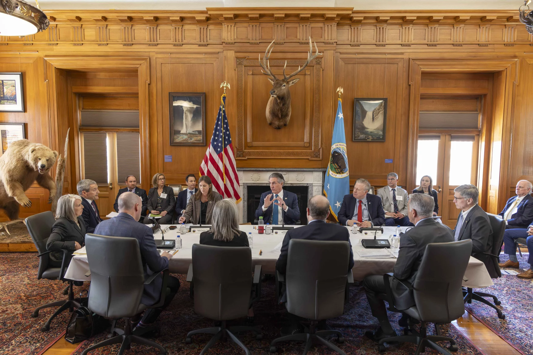
The prospect of a costly and prolonged interstate lawsuit over rights to the Colorado River looms now that the states using the water are blowing past a Valentineโ€™s Day deadline with no water-sharing deal in hand. With no agreement among the states, Interior Secretary Doug Burgum said the federal government could no longer delay action andย would move forwardย with work onย a set of alternativesย outlined late last year.

โ€œNegotiation efforts have been productive,” Burgum said in a statement Feb. 14. “We have listened to every stateโ€™s perspective and have narrowed the discussion by identifying key elements and issues necessary for an agreement. We believe that a fair compromise with shared responsibility remains within reach.”

[…]

The dispute has largely hinged on whether states in the headwaters region would agree to mandatory cuts [ed. no one has the authority to order mandatory cuts in Colorado and likely in the entire upper basin] to their overall supply in especially dry years โ€” a commitment they have so far rejected in part because they do not use their full allocation as the more developed Southwest does…

“As I talk with people throughout Southern Nevada, I hear their frustration that years of negotiations have yielded almost no headway in finding a path through these turbulent waters. As someone who has spent countless nights and weekends away from my family trying to craft a reasonable, mutually acceptable solution only to be confronted by the same tired rhetoric and entrenched positions,” [John] Entsminger said, “I share that frustration.”

Feds will finalize operating guidelines for #ColoradoRiver reservoirs: The seven compact states failed to meet a February 14th deadline for agreement on how to reduce their own usage of water to save the river — AlamosaCitizen.com #COriver #aridification

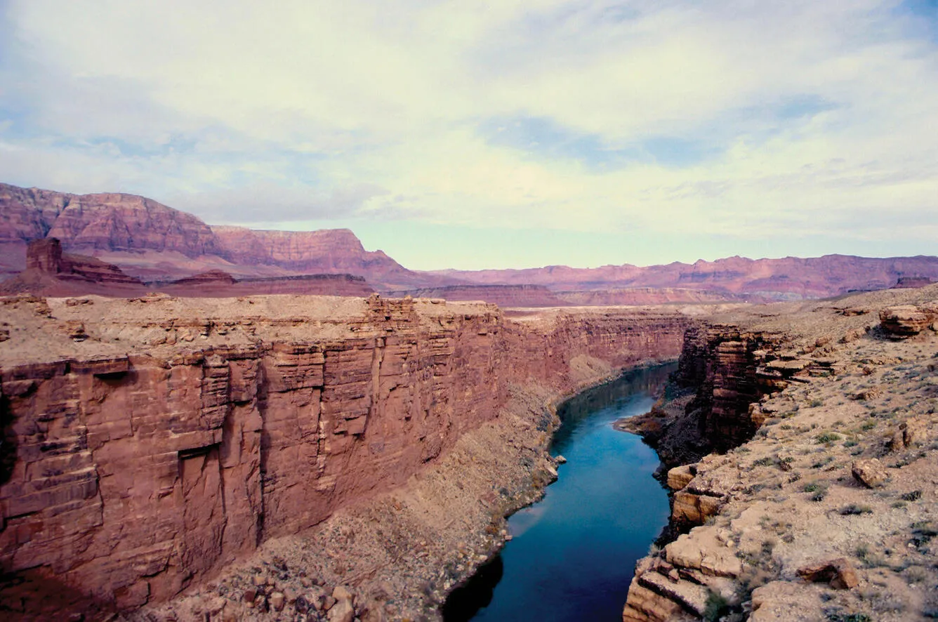
The Colorado River passes through the Grand Canyon in Arizona. Credit: USGS

Click the link to read the article on the Alamosa Citizen website:

February 15, 2026

The U.S. Bureau of Reclamation has released a February 24-month study showing inflow to Lake Powell declining by 1.5 million acre-feet since January as the federal agency highlights the worsening hydrologic conditions across the Colorado River Basin.

The study of the most probable forecast for the Colorado River under current conditions was released on Friday, just as the seven compact states remained at a stalemate and failed to meet a Feb. 14 deadline for agreement on how to reduce their own usage of water to save the river.

U.S. Interior Secretary Doug Burgum announced on Saturday, Feb. 14, that the federal government is moving forward with finalizing operating guidelines for the Colorado River reservoirs by Oct. 1. His announcement adds pressure to Colorado and the other compact states to find compromise or face guidelines forced onto them by the federal government. 

โ€œWhile the seven Basin States have not reached full consensus on an operating framework, the Department cannot delay action,โ€ the U.S. Bureau of Reclamation said in its announcement that the federal government was moving forward.

Colorado River Basin. Credit: USGS

The lack of agreement among the compact states and the idea of federal intervention raises the prospect of litigation that would be drawn out and ultimately end with the U.S. Supreme Court. The current Rio Grande Compact dispute between Texas and New Mexico that has taken 12 years to reach a proposed settlement, now filed with the U.S. Supreme Court, gives an indication to the slow-evolving nature of U.S. water law.

โ€œI am disappointed that the seven Basin States could not reach a consensus agreement on the future management of the Colorado River by the U.S. Department of the Interiorโ€™s Feb. 14 deadline,โ€ said Colorado Attorney General Phil Weiser, who added that Colorado is prepared for litigation to protect Coloradoโ€™s rights and interests.

โ€œColorado will continue to work with our fellow Upper Division States to provide comments on the federal governmentโ€™s draft environmental impact statement, which sets forth a range of possible solutions. The Upper Division States will have to cut back their usage of water from the Colorado River โ€” by 40 percent or more โ€” in the face of an historic drought,โ€ he said.

U.S. Sen. John Hickenlooper said the low snowpack this winter is adding an exclamation point to the dire conditions of the Colorado River Basin. โ€œIf we donโ€™t address this problem together โ€” head-on and fast โ€” our communities, farms, and economies will suffer,โ€ Hickenlooper said.

โ€œThe best path forward is the one we take together. Litigation wonโ€™t solve the problem of this long-term aridification. No one knows for sure how the courts could decide and the math will only get worse.โ€

BLMโ€™s February 24-month study shows a loss of 1.5 million acre-feet is equivalent to approximately 50 feet in elevation in Lake Powell.

โ€œThe basinโ€™s poor hydrologic outlook highlights the necessity for collaboration as the Basin States, in collaboration with Reclamation, work on developing the next set of operating guidelines for the Colorado River system,โ€ said Acting BLM Commissioner Scott Cameron. โ€œAvailable tools will be utilized and coordination with partners will be essential this year to manage the reservoirs and protect infrastructure.โ€

The water year inflow is now estimated at just 52 percent of average, and as a result, the February 24-Month Study projects, for the first time, that Lake Powell could decline (based on most probable projections) to:

โ€œThe basinโ€™s poor hydrologic outlook highlights the necessity for collaboration as the Basin States, in collaboration with Reclamation, work on developing the next set of operating guidelines for the Colorado River system,โ€ said Acting BLM Commissioner Scott Cameron. โ€œAvailable tools will be utilized and coordination with partners will be essential this year to manage the reservoirs and protect infrastructure.โ€

The water year inflow is now estimated at just 52 percent of average, and as a result, the February 24-Month Study projects, for the first time, that Lake Powell could decline (based on most probable projections) to:

3,490 ft โ€“ minimum power pool in December 2026; below this level Glen Canyon Damโ€™s ability to release water is reduced and it can no longer produce hydropower.

3,476 ft โ€“ in March 2027; the lowest elevation on record since filling further constraining the ability to release water from Glen Canyon Dam.

Colorado River managers estimate that around 4 million acre-feet of cuts are needed to bring the basin back into balance โ€“ an amount equal to more than a quarter of the Colorado Riverโ€™s annual average flow.

โ€œThere needs to be unbelievably harsh, unprecedented cuts,โ€ Brad Udall, a senior water and climate research scientist at the Colorado Water Center, told The Guardian media outlet.

 โ€œMother Nature is not going to bail us out,โ€ Udall said.

Udall/Overpeck 4-panel Figure Colorado River temperature/precipitation/natural flows with trend. Lake Mead and Lake Powell storage. Updated through Water Year 2025. Note the tiny points on the annual data so that you can flyspeck the individual years. Credit: Brad Udall

Flows in the Colorado River are down 20 percent over the last century and precipitation has shrunk by about 7 percent with rising temperatures as aridification takes hold across the southwest. 

โ€œThe chickens are coming home to roost,โ€ Udall said. โ€œClimate models have underestimated how much warming we are going to get, and humans are not stepping up.โ€

Jack Schmidt, director of the Center for Colorado River Studies at Utah State University, likened the negotiations among the seven compact states to the final scene in โ€œThelma and Louise.โ€ โ€œSeven people have their hands on the steering wheel driving toward the edge of a cliff โ€” and no one is working the brakes,โ€ he reportedly said.

Fossil Point | Metro-Goldwyn-Mayer

Interior Department moves forward on guidelines for #ColoradoRiver absent full state consensus — USBR #COriver #aridification

Udall/Overpeck 4-panel Figure Colorado River temperature/precipitation/natural flows with trend. Lake Mead and Lake Powell storage. Updated through Water Year 2025. Note the tiny points on the annual data so that you can flyspeck the individual years. Credit: Brad Udall

Click the link to read the release on the Reclamation website:

February 14, 2026

The Department of the Interior is moving forward with the Post-2026 NEPA process to finalize operating guidelines for Colorado River reservoirs by Oct. 1, 2026. While the seven Basin States have not reached full consensus on an operating framework, the Department cannot delay action. Meeting this deadline is essential to ensure certainty and stability for the Colorado River system beyond 2026.

โ€œNegotiation efforts have been productive; we have listened to every stateโ€™s perspective and have narrowed the discussion by identifying key elements and issues necessary for an agreement. We believe that a fair compromise with shared responsibility remains within reach,โ€ said Secretary of the Interior Doug Burgum. โ€œI want to thank the governors of the seven Basin States for their constructive engagement and commitment to collaboration. We remain dedicated to working with them and their representatives to identify shared solutions and reduce litigation risk. Additionally, we will continue consultations with Tribal Nations and coordinate with Mexico to ensure we are prepared for Water Year 2027.โ€

Prolonged drought conditions over the past 25 years and the most recent forecast showing inflow to Lake Powell declining by 1.5 million acre-feet since January underscore the ongoing challenges. The inflow reduction could result in Lake Powell dropping to an extremely low level, threatening water delivery and power generation.

The Colorado River is managed and operated under compacts, federal laws, court decisions and decrees, contracts and guidelines known collectively as the โ€œLaw of the River.โ€ This apportions the water and regulates the use and management of the river among the seven Basin States โ€“ Arizona, California, Colorado, Nevada, New Mexico, Utah, and Wyoming โ€“ and Mexico. The Colorado River Compact is the cornerstone of the โ€œLaw of the River.โ€ The 1944 Treaty with Mexico governs the sharing of the Colorado River between the two nations. 

The Colorado River is a vital resource as it provides economic stability and enhances the quality of life across the basin. The river:

  • provides water to approximately 40 million people for municipal use.ย 
  • supports the generation of hydroelectric energy, producing more than 8 billion kilowatt-hours annually powering the needs of approximately 700,000 homes.
  • sustains 5.5 million acres of farmland and agricultural communities where a significant share of the fruit and vegetables consumed in the United States are grown.ย 
  • serves as a vital resource for 30 Tribal Nations and two Mexican states.
  • supports seven National Wildlife Refuges, four National Recreation Areas, and 11 National Parks.ย 

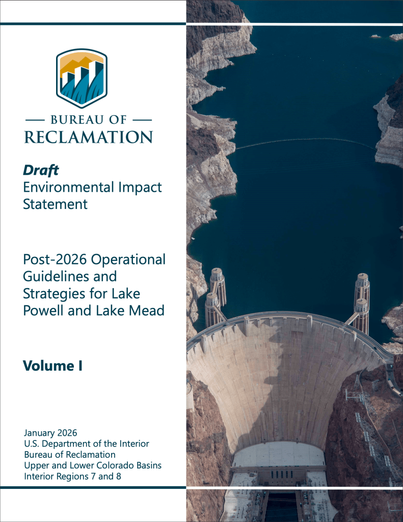
The Post-2026 Draft Environmental Impact Statement (EIS) Post-2026 Operational Guidelines and Strategies for Lake Powell and Lake Mead is available for public review, and comments are being accepted until March 2, 2026. Reclamation has hosted two public meetings and is consulting with Basin tribes to discuss the draft EIS. The Draft Environmental Impact Statement was prepared to evaluate the impacts of a range of operational alternatives to inform the Secretaryโ€™s decision on operations beginning on Oct. 1, 2026. 

โ€œThrough collaboration among the Department and Reclamation, states, Tribal Nations, Mexico and other key partners, we can create more opportunities for innovation and develop stronger tools to address drought and growing water demands,โ€ said Assistant Secretary – Water and Science Andrea Travnicek. โ€œWorking together ensures that we combine expertise and resources to build solutions that benefit everyone and secure the future of the Colorado River.โ€

To learn more about this initiative, please visit the Colorado River Post-2026 website.

Colorado River Post 2026 Website

Unpacking the Controversy over Glen Canyon Dam’s “River Outlet Works”

by Robert Marcos, photojournalist

The controversy surrounding Glen Canyon Dam’s River Outlet Works (ROW) centers on a critical design vulnerability: the dam may soon be unable to reliably release water if Lake Powell drops below the minimum power pool (3,490 feet). 1

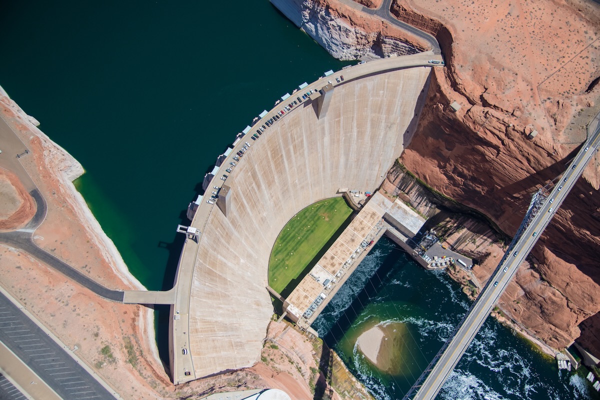
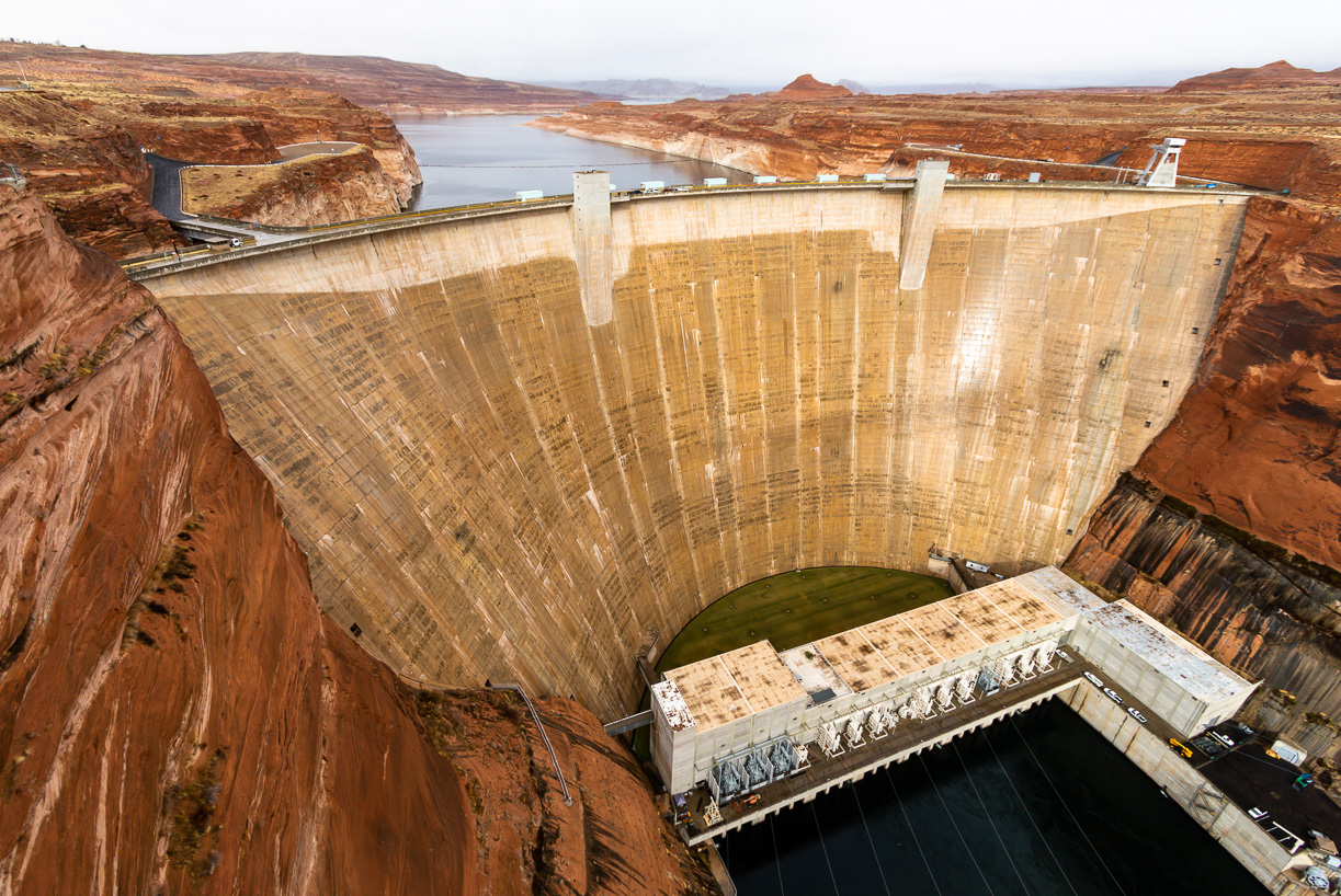
Aerial photo of the Glen Canyon Dam near Page, Arizona. Photo by Alexander Heilner/The Water Desk, with aerial support by LightHawk.

While the dam usually releases water through high-elevation penstocks to generate hydropower, the ROWโ€”four 8-foot-wide steel pipesโ€”is the only way to move water once levels drop too low for the turbines. Recent inspections by the Bureau of Reclamation revealed significant damage to these pipes, including cavitationโ€”a process where high-velocity water creates vapor bubbles that implode, eroding the steel.2

Reliability Gap: The ROW was designed for temporary use (e.g., flood control), not for the continuous, long-term operation that a “dead pool” scenario would require. A March 2024 memo from the Bureau of Reclamation warned that they should not be relied upon as the sole means of sustained water delivery.3

Legal & Economic Threat: If the ROW fails or its capacity is restricted to prevent further damage, the Upper Basin states may be unable to meet their legal obligation to deliver water to 30 million people in the Lower Basin (Arizona, Nevada, California).4

Safety Buffer: Due to the damage, the Bureau recently determined they can only safely operate the ROW at levels at least 24 feet above dead pool (3,370 feet), effectively raising the “failure point” of the dam’s plumbing.5

Proposed Fixes: Environmental groups, such as the Utah Rivers Council, advocate for drilling new, lower-level bypass tunnels around the dam to ensure water can flow even at riverbed levels. However, these modifications are costly and could take over a decade to implement.6

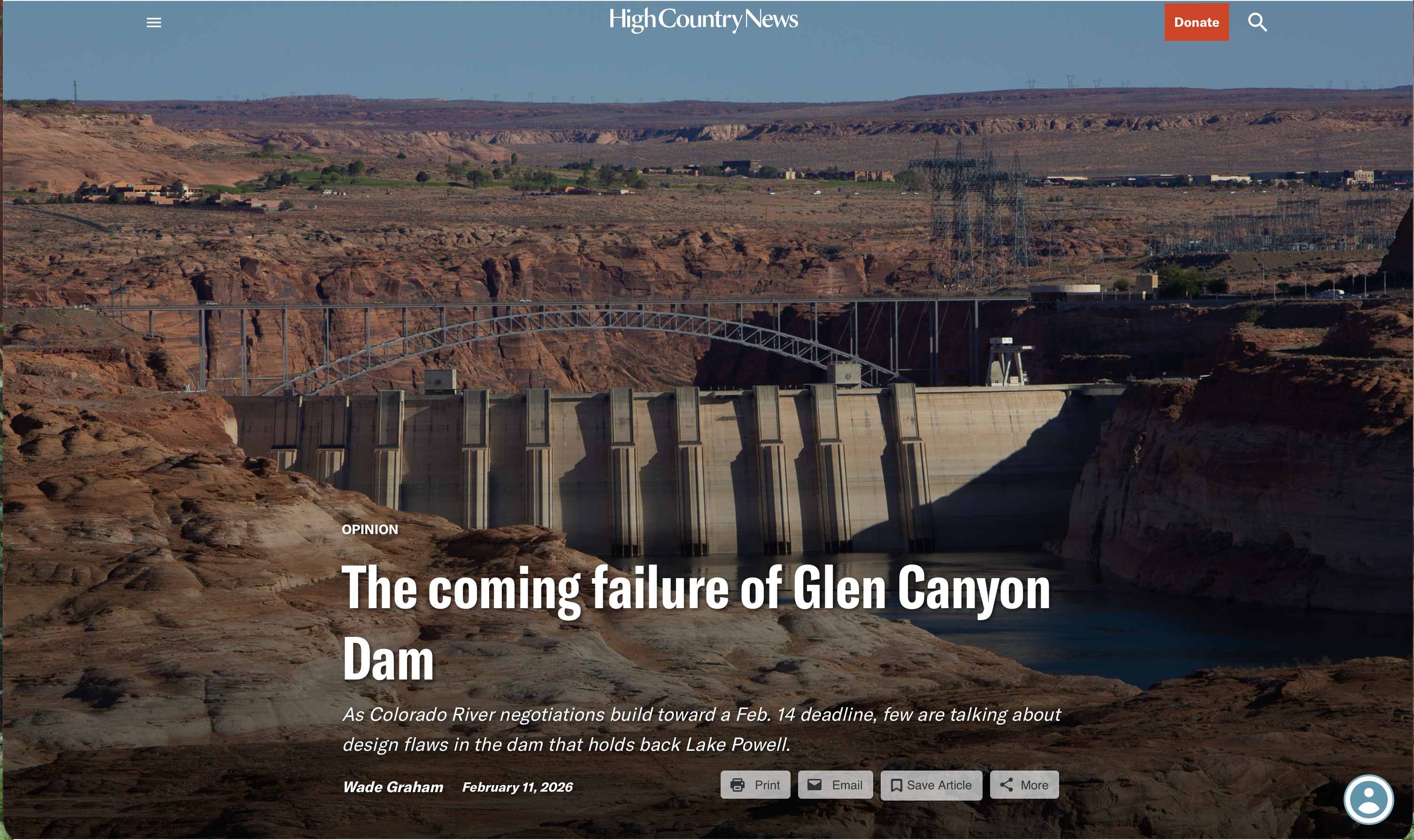
The coming failure of Glen Canyon Dam: As #ColoradoRiver negotiations build toward a February 14, 2026 deadline, few are talking about design flaws in the dam that holds back #LakePowell — Wade Graham (High Country News) #COriver #aridification

A photo of Glen Canyon Dam from 2022, when the dam’s intake points were 33 feet away from minimum power pool. The top of the grate-like penstocks can be seen in this photo.ย Luna Anna Archey / High Country News

Click the link to read the article on the High Country News website (Wade Graham):

February 11, 2026

Floyd Dominy, the commissioner of the federal Bureau of Reclamation in the 1960s, was largely responsible for the construction of Glen Canyon Dam on the Colorado River. In 1963, when the dam was completed, he could not have foreseen the climate situation we find ourselves in today, with declining snowpack, record-high temperatures and alarmingly low water levels in Lake Powell, year after year. But he and his engineers could have, and should have, foreseen that the way they designed the dam would leave little room to maneuver should a water-supply crisis ever impact the river and its watershed.

Indeed, a state of crisis has been building on the Colorado for decades, even as the parties that claim its water argue over how to divide its rapidly diminishing flows. Lately, things have entered a new and perilous phase. Last Nov. 11 was a long-awaited deadline: Either the states involved โ€” California, Arizona, Nevada, Utah, New Mexico, Colorado and Wyoming โ€” would have to agree on a new management plan, or else the federal government would impose its own, something none of the parties would welcome. Meanwhile, the 30 tribes that also hold claims to the river have historically been and continue to be excluded from these negotiations. 

Udall/Overpeck 4-panel Figure Colorado River temperature/precipitation/natural flows with trend. Lake Mead and Lake Powell storage. Updated through Water Year 2025. Note the tiny points on the annual data so that you can flyspeck the individual years. Credit: Brad Udall

That deadline came and went, and instead of acting, the government punted, this time to Feb. 14. Nobody was surprised: Unmet deadlines and empty ultimatums have been business as usual on the river for years. Decades of falling reservoir levels and clear warnings from scientists about global warming and drought have prompted much hand-wringing and some temporary conservation measures, but little in the way of permanent change in how water is used in the Colorado River Basin.

The downstream face of Glen Canyon Dam, which forms Lake Powell, Americaโ€™s second-largest water reservoir. Water is released from the reservoir through a hydropower generation system at the base of the dam. Photo by Brian Richter

For decades, the seven Basin states have used more water than the river delivers by drawing their entitlements from surpluses banked in reservoirs during the wet 1980s and โ€™90s, chiefly in Lake Mead and Lake Powell. Never mind that those entitlements were based on an over-estimate of river flows in 1922, when the Colorado River Compact was established, rendering the โ€œpaperโ€ water of the entitlements essentially a fiction, not to mention a source of continual conflict. That savings account has now been drained: Mead and Powell are each below 30% full, and the trend is steadily downward. Global warming has only accelerated the decline: So far this century, the riverโ€™s flow has fallen 20% from its long-term annual averages, and scientists forecast more of the same as the climate continues to heat up.

The back of Glen Canyon Dam circa 1964, not long after the reservoir had begun filling up. Here the water level is above dead pool, meaning water can be released via the river outlets, but it is below minimum power pool, so water cannot yet enter the penstocks to generate electricity. Bureau of Reclamation photo. Annotations: Jonathan P. Thompson

Meanwhile, the physical infrastructure that enables Colorado River water management is on the verge of its own real and potentially catastrophic crisis โ€” and yet Reclamation has barely acknowledged this, with the exception of an oblique reference in an unpostedย technical memorandumย from 2024. The falling reservoir levels reveal another, deeper set of problems inside Glen Canyon Dam, which holds back the Colorado and Lake Powell. The 710-foot-tall dam was designed for a Goldilocks world in which water levels would never be too high or too low, despite the well-known fact that the Colorado is by far the most variable river in North America, prone to prodigious floods and extended droughts. But the Bureau, bursting with Cold War confidence โ€” or hubris โ€” chose to downplay the threat. In the record-breaking El Niรฑo winter of 1983, the Bureau almost lost the dam to overtopping, due to both its mismanagement and its design, because the dam lacks sufficient spillway capacity for big floods. Only sheets of plywood installed across its top and cooler temperatures that slowed the melting of that yearโ€™s snowpack saved Glen Canyon Dam.

The four 96-inch diameter steel pipes of the River Outlet Works. If the damโ€™s penstocks are closed, these pipes are the only remaining way to pass water through the dam, and are unsafe to use for extended intervals.
Luna Anna Archey / High Country News
Gus Levy, Glen Canyon Damโ€™s plant facility manager, walks past hydropower turbines. In 2022, due to the low water level of Lake Powell, only five of the eight turbines operated on a daily basis, though all eight were kept in working order.
Luna Anna Archey / High Country News

Today, the dam is threatened not by too much water but too little. In March 2023, the water level of Lake Powell dropped to within 30 feet of the minimum required for power generation, known as โ€œminimum power pool.โ€ At 3,490 feet above sea level, minimum power pool is 20 feet above the generatorsโ€™ actual intakes, or penstocks, but the damโ€™s eight turbines must be shut down at minimum power pool to avoid cavitation โ€” when air is sucked down like a whirlpool into the penstocks, forming explosive bubbles which can cause massive failure inside the dam.

Even more worrisome is what would happen next. At minimum power pool, the penstocks would have to be closed, and the only remaining way to pass water through the dam is the river outlet works, or ROWs: two intakes in the rear face of the dam leading to four 96-inch-diameter steel pipes with a combined maximum discharge capacity of 15,000 cubic feet per second. However, the ROWs, also known as bypass tubes, have a serious design flaw: They are unsafe to use for extended intervals, and start to erode when the reservoir is low.

In 2023, when the ROWs were used to conduct a high-flow release into the Grand Canyon at low-reservoir levels, there was, in fact, damaging cavitation, and the Bureau has warned that there would likely be more in the event of their extended use. In practice, safe releases downstream may only be a fraction of their claimed capacity โ€” and if the tubes begin to experience cavitation, flows may need to be cut off entirely. Such a scenario would compromise the damโ€™s legal downstream delivery requirements, or, to put it bluntly, its ability to deliver enough water to the 25 million people downstream who rely on it โ€” as well as the billions of dollarsโ€™ worth of agriculture involved. This means that Lake Powell โ€” and with it, the entire Colorado River system โ€” is perilously close to operational failure.

If reservoir levels drop to the ROWsโ€™ elevation of 3,370 feet above sea level, Lake Powell would reach โ€œdead pool,โ€ where water would pass through the dam only when the riverโ€™s flow exceeded the amount of water lost to evaporation from the reservoir. No other intakes nor spillways exist below the ROWs. There is no โ€œdrain plug.โ€ Yet there is more dam โ€” 240 feet more before the bottom of the reservoir, effectively the old riverbed. This not-insignificant impoundment โ€” about 1.7 million acre-feet of water โ€” would be trapped, stagnant and heating in the sun, prone to algal blooms and deadly anoxia. The lake would rise and fall wildly, as much as 100 feet in a season, because of the martini-glass shape of Lake Powellโ€™s vertical cross section.

Illustration from the report, <a href=”https://utahrivers.org/blog-post/2022/8/9/lenapost“>Antique Plumbing & Leadership Postponed</a> from the Utah Rivers Council, Glen Canyon Institute and the Great Basin Water Network. Courtesy of Utah Rivers Council

Insufficient or no flows through Glen Canyon Dam would be a disaster of unprecedented magnitude, affecting vast population centers and some of the biggest economies in the world, not to mention ecosystems that depend on the river all the way to the Gulf of California in Mexico. The Lower Basin states of California, Arizona and Nevada warned as much in a recent letter to Interior Secretary Doug Burgum, saying that Reclamationโ€™s failure to mention the damโ€™s plumbing problems in its current environmental impact statement for post-2026 operations is against federal law. The letter reads: โ€œAddressing the infrastructure limitations may be the one long-term measure that would best achieve operation and management improvements to the Glen Canyon Dam.โ€

To date, however, the Bureau has made no formal response.

One thing is clear: Glen Canyon Dam will need to be modified to meet its legal and operational requirements. In the process, the health of the ecosystems in Glen Canyon, above the dam, and in Grand Canyon, below it, must be considered. The best way to avoid operational failure and the economic and ecological disasters that would follow is to re-engineer the dam to allow the river to run through it or around it at river level, transporting its natural sediment load into the Grand Canyon.

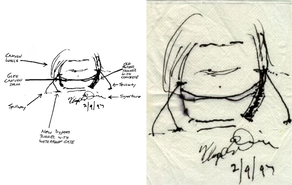
Sketches by Floyd Dominy show the way he’d end the Glen Canyon Dam. From the article “Floyd Dominy built the Glen Canyon Dam, then he sketched its end on a napkin” on the Salt Lake Tribune

As it happens, Floyd Dominy himself provided us with a simple and elegant plan for how to do it. In 1997, the former commissioner sketched on a cocktail napkin how new bypass tunnels could be drilled through the soft sandstone around the dam and outfitted with waterproof valves to control the flow of water and sediment. What it prescribes is treating the patient โ€” the Colorado River, now on life support โ€” with open-heart surgery, a full bypass. Dominyโ€™s napkin, which he signed and gave to my colleague Richard Ingebretsen, the founder of Glen Canyon Institute, is effectively a blueprint for a healthier future for the Colorado River and the people and ecosystems that depend on it.

But the window for action to avoid dead pool is dauntingly narrow and closing fast, especially given the time that would likely be required for the government to study, design and implement a fix. The Trump administrationโ€™s gutting of federal agency expertise and capacity adds yet more urgency to the issue. Whatever may or may not get decided on Feb. 14, the feds and the basin states need to look beyond the water wars and start building a lasting, sustainable future on the Colorado River.

We welcome reader letters. Emailย High Country Newsย atย editor@hcn.orgย or submit aย letter to the editor. See ourย letters to the editor policy.

A high desert thunderstorm lights up the sky behind Glen Canyon Dam — Photo USBR

Misunderstandings on the #ColoradoRiver: Change is coming, and it won’t be easy, espcially for the Lower Basin states — Ken Neubecker (Ken’s Substack) #COriver #aridification

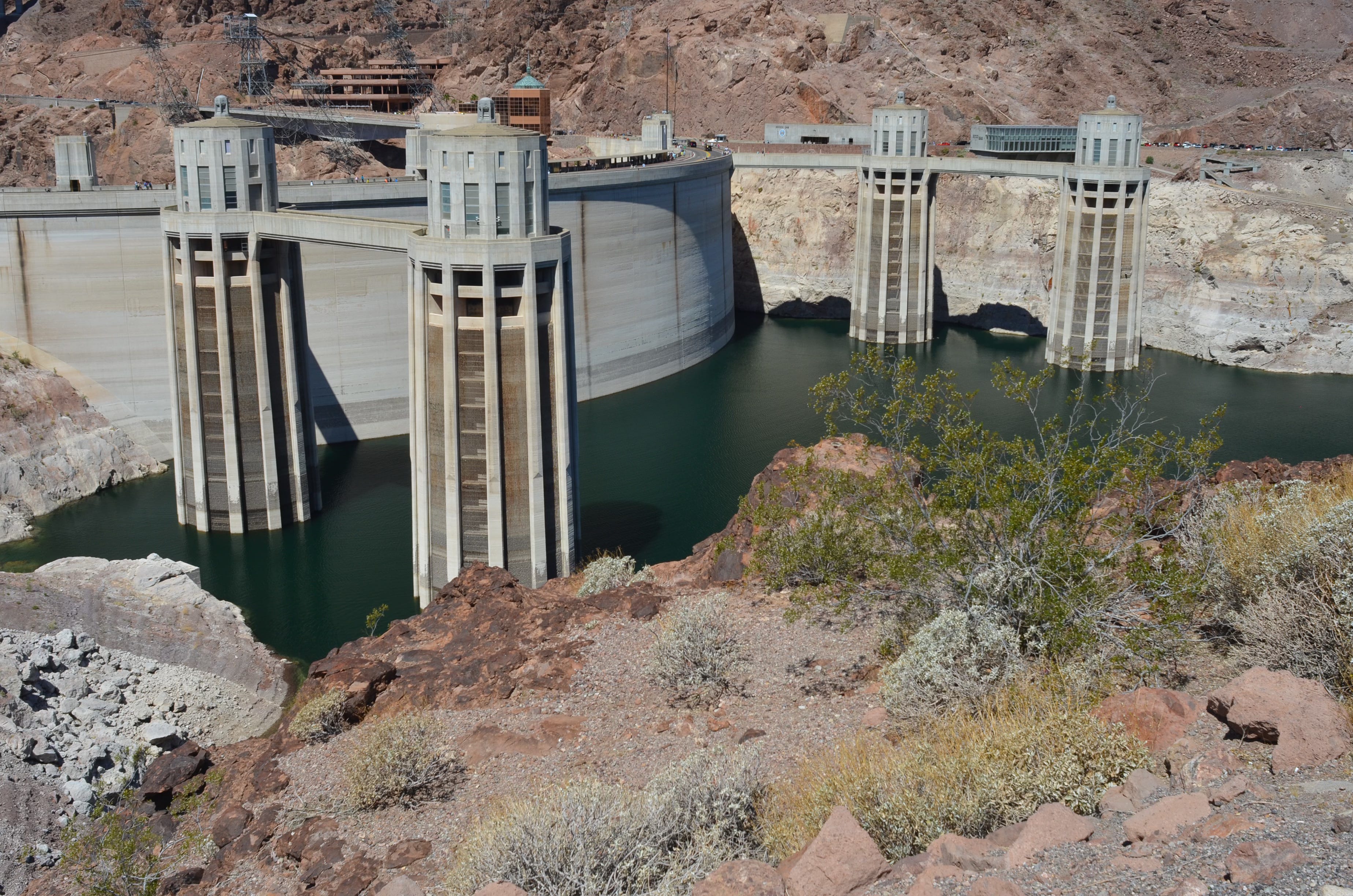
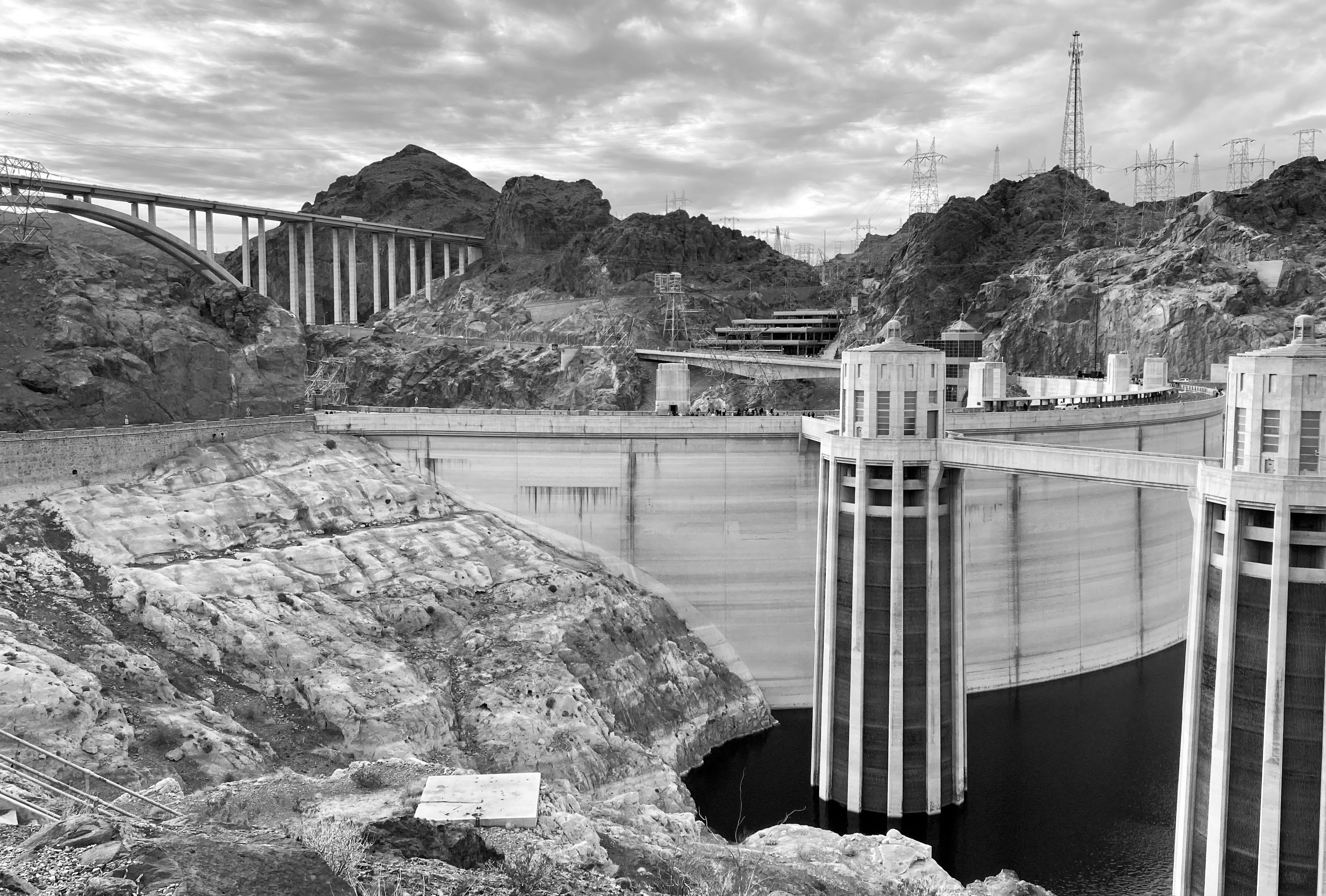
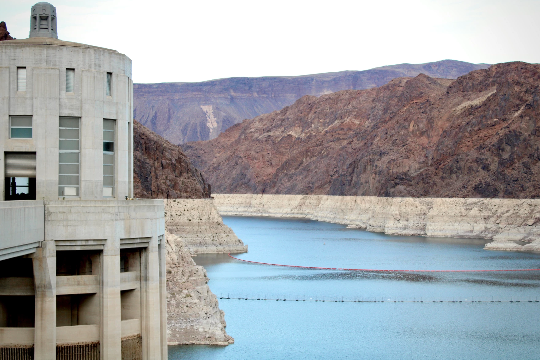
Back of Hoover Dam. Photo credit: Ken Neubecker

Click the link to read the article on the Ken’s Substack website (Ken Neubecker):

February 8, 2026

The seven states that take water from the Colorado River have a deadline of February 14 to come up with a river management plan that they can all agree on. And every day that passes it looks as if that deadline, not the first one they have faced, will also be missed. Valentines Day may not be one of shared love by all.

The Colorado River basin is experiencing the greatest drought and loss of flows in the past 1200 years and the various agreements crafted to deal with deepening drought, particularly the 2007 Interim Guidelines and subsequent Drought Contingency Plans, are set to expire at the end of this year.

The major sticking point is centered around how water diversions from the river will be cut, and there will be substantial cuts. Most of that burden will fall on the Lower Basin states of California, Arizona and Nevada. They are the largest users of Colorado River water. Cuts for the four Upper Basin states; Colorado, Wyoming, Utah and New Mexico are not considered in either the previous guideline and agreements nor in the recently released Draft Environmental Impact Statement (DEIS) for Post-2026 Operational Guidelines and Strategies for Lake Powell and Lake Mead by the Bureau of Reclamation. The DEIS only looks at the river below the upper reaches of Lake Powell.

This has the Lower Basin up in arms. They are demanding mandatory, verifiable and enforceable cuts by the river diversions in the Upper Basin. The Upper Basin is refusing this demand, and Arizona in particular is threatening to unleash its historical use of litigation to try and get what it wants.

Underlying this, however, is a very fundamental misunderstanding of how water diversions work between the Lower and Upper Basins. Iโ€™m starting to think that misunderstanding is deliberate, primarily to mislead the public constituents within the Lower Basin states. [ed. emphasis mine]

Tom Buschatzke, director of Arizonaโ€™s Department of Water Resources, has said, โ€œWe need certainty there are reductions in upper basin usage because that is one of the two tools that we haveโ€ฆ You canโ€™t make it snow or rain. But you can reduce your demandโ€.

But in the Upper Basin that is not as easy as it sounds.

I have read that the true skill of a good negotiator is in being able to truly understand the other sides position. There are skilled and knowledgeable negotiators in the Lower basin, but I donโ€™t think that they truly understand the Upper Basins position. They have been accustomed, some would say addicted, to the reliable delivery of stored water for all their needs since Hoover Dam was built and began releasing stored water some 90 years ago. Only until very recently, even in the face of an unrelenting drought, have they had to deal with shortages. For the Upper Basin shortage is an annual reality.

The Lower Basin takes water from the Colorado River mainly through a small handful of very large diversions such as the All American Canal, which provides water for Imperial and Coachella Valley agriculture, the Central Arizona Project (CAP) providing water for Pheonix, Tucson, Tribes, and Arizona agriculture and the California Aqueduct, which provides water for Los Angeles, San Diego and most Southern California cities. While distribution from these few large diversions to individual contract uses may be complicated by drought, reducing the intake at their diversion points isnโ€™t.

That situation is very different in the Upper Basin. In Colorado, Wyoming and New Mexico there are many thousands of small diversions taking water from the Colorado River, the Green River and their myriad headwater tributaries. There are a few large diversions in the Upper Basin, primarily for water taken out of the basin to Coloradoโ€™s East Slope cities and farms and to Utahโ€™s Wasatch Front, but these diversions are still quite small compared to those in the Lower Basin.

The largest reservoirs in the Upper Basin are those built through the Colorado River Storage Act (CRSP, 1956), such as Flaming Gorge, Blue Mesa and Navajo. These reservoirs were not built to supply Upper Basin water needs, but to provide a โ€œbank accountโ€ for Colorado River Compact compliance. In other words, for the benefit of the Lower Basin. Releases from these reservoirs are contemplated in the Post-2026 DEIS to maintain water elevations in Lake Powell that protect vital dam infrastructure and hydropower generation.

Lake Powell is also an Upper Basin reservoir in the CRSP Act of 1956. It was built entirely for Compact compliance and water deliveries to the Lower Basin. It has no water supply benefit to the Upper Basin other than as a Compact savings account.

A major wrinkle in any mandatory curtailments in Upper Basin diversions is simply in administrative logistics. It would be a complete nightmare for water administration and the State water engineers offices. And in Colorado it would be in the Water Courts as well.

A little legal background is needed here as well.

See Article 6.

All of the Colorado Basin states have Prior Appropriation as the bedrock doctrine for their water laws. California has a bit of a mix with Riparian law, but as far as the Colorado River diversions are concerned prior appropriation rules. Prior appropriation is the doctrine of โ€œfirst in time, first in rightโ€ to divert the available water. Colorado was the first to codify prior appropriation in its state constitution, in 1876. Article 16, Section 6:

The right to divert the unappropriated waters of any natural stream to beneficial usesย shall never be denied. Priority of appropriation shall give the better right as between those using the water for the same purpose; but when the waters of any natural stream are not sufficient for the service of all those desiring the use of the same, those using the water for domestic purposes shall have the preference over those claiming for any other purpose, and those using the water for agricultural purposes shall have preference over those using the same for manufacturing purposes.

In Colorado you donโ€™t actually need a court decreed right to divert water to a beneficial use. Just a shovel and a ditch. However, you are still subject to prior appropriation and can be the first cut off if a call is placed on the stream. There are a lot of such small diversions without an adjudicated right. I used to water my lawn in Eagle that way.

The Colorado River Compact of 1922 was created to avoid prior appropriation between the states. The US Supreme Court had decided that when there is a dispute over water between States that held prior appropriation as their foundational water law, seniority applies across state lines. Southern California was starting to grow at a much more rapid pace than the other states, greatly alarming the headwater, Upper Basin states. The Compact was crafted so that water from the river could be allocated โ€œequitablyโ€, allowing each state to grow and develop its water at its own pace. The Compact became the foundation of what is now known as the Law of the River. Laws based on prior appropriation still govern water use and administration within each State.

Arizona and California began arguing and litigating almost immediately, with Arizona usually on the losing end. That changed in 1963 when the US Supreme Court handed down a decision that once and for all set the water allocations for the Lower Basin, based on the allocations created in the 1928 Boulder Canyon Project Act, which finally ratified the Compact and paved the way for Hoover Dam, Lake Mead and the All American Canal.

Then the seniority picture between states changed with the passage of the 1968 Colorado River Projects Act that authorized construction of Arizonaโ€™s long fought for dream of the Central Arizona Project. To get passage, Arizona had to subordinate its water rights to California, making it the junior and first to take cuts in times of drought.

Upper Colorado River Basin map via the Upper Colorado River Commission.

None of that extended into the Upper Basin, where the States had been getting along just fine, mostly, since the Compact was signed. These four states drafted their own Upper Colorado River Basin Compact in 1948, mainly so they could get more money from the Federal Government to build water storage and delivery projects. They did something novel, allocating each states share by a percentage of the rivers flow, not by set volumes of water as the 1922 Compact had done.

Udall/Overpeck 4-panel Figure Colorado River temperature/precipitation/natural flows with trend. Lake Mead and Lake Powell storage. Updated through Water Year 2025. Note the tiny points on the annual data so that you can flyspeck the individual years. Credit: Brad Udall

Everything was fine so long as the major reservoirs of Lakes Mead and Powell were full. That has changed considerably since the onset of the current mega, or Millennial drought began in 2000. The two reservoirs have dropped to very low levels, levels never anticipated or planned for.

Here is the crux of the matter. The Lower Basin is demanding mandatory cuts from Upper Basin uses so that more water can flow downstream for their use. The 1922 Compact says clearly that the Upper Basin states โ€œwill not cause the river flow at Lee Ferry to be depleted below and aggregate of 75,000,000 acre feet for any period of ten consecutive yearsโ€ฆโ€. The Lower Basin states argue that this constitutes an โ€œobligationโ€ to deliver that much water to them. The Upper Basin states say no, there is no delivery obligation. It is a non-depletion requirement, that through diversions and actual consumption the states canโ€™t let those flows drop below 75 million acre feet (maf) in a ten year running average.

That has never been a problem, until now. The 1922 Compact and its non-depletion requirement is a priority right in itself. Any water right in the Upper Basin that was adjudicated, perfected by actual use and consumption, after 1922 is subject to curtailment for fulfilling the non-depletion requirement. Any and all rights perfected prior to November 1922 are exempt.

So far, as of 2026, the required flows over a ten year running average have not yet hit that non-depletion trigger of 75 maf running average over ten years. Not yet, but it could be getting close.

The Upper Basin states live by a โ€œrun of the riverโ€ system as there are no large storage units dedicated to their use as the Lower Basin has with Powell and Mead. There are many small reservoirs used for a single irrigation season, filled with the spring runoff and then empty by the end of the growing season. But they also are subject to how much water comes in the spring and downstream senior calls.

Every year, especially since this mega drought and increased aridification began, Upper Basin irrigators are curtailed each summer as the streams shrink and the small reservoirs are drained. Some years this curtailment includes water rights that are senior to the Compact as well.

The Upper basin, in short, is forced to live within its means, with what it has and no more than Mother Nature provides with the winter snowpack. As Tom Buschatzke said, โ€œYou canโ€™t make it snow or rain. But you can reduce your demandโ€. The Upper Basin does exactly that every year, especially in years like this with a record low snowpack.

The mandatory, verifiable and enforceable cuts demanded by the Lower Basin would be more than difficult to achieve. And again, it would be an administrative and legal nightmare for those assigned the task on the thousands of relatively small, individual diversions that make up the Upper Basinโ€™s water use from the Colorado River. There are those larger trans-basin diversions to the Colorado East Slope and cities, but even if they took substantial cuts, it would still be a pretty small amount of water. No where near the amounts that the Lower Basin has become accustomed to.

Right now the Upper Basin uses roughly half their Compact allocation, roughly around 4 maf a year, while the Lower Basin has historically used more than their full Compact allocation. To their credit, the Lower Basin has made substantial cuts, some voluntary and some enforced by agreements and obligations. California was forced to cut their water use by 800,000 acre-feet with the 2007 Interim Guidelines, back to their actual decreed limit, a cut some claim as an example of how much โ€œsacrificeโ€ they have made. They and Arizona have made additional cuts as well, now taking around 6 maf, from a historic high near 10 maf per year.

I agree that the Upper basin needs to work harder at conservation, and they have been trying hard over the last few years. They havenโ€™t been hording water or ignoring the needs of the Lower Basin or those spelled out in the Compact and subsequent agreements as some in the Lower Basin claim. But โ€œmandatoryโ€ cuts beyond those already happening each and every summer will require significant changes with state water law and administration. In Coloradoโ€™s case it could well require a change to Article 16, Section Six, of the stateโ€™s constitution which has held unaltered since 1876.

We live now in a very different world from the 1800โ€™s and 1922 when the Compact was drafted, using highly optimistic flow calculations that they already knew were wrong. But the men who drafted it were boosters, as were their fathers, seeing the West as they wanted to, not as it really was. Americaโ€™s westward expansion has always been driven by dreams of abundance, and for a while the river was able to provide that through massive engineering, a still small but growing population and some pretty wet years. Many still hold on to that misguided dream of abundance in an increasingly arid region.

That has all evaporated. All water users in the West, especially the Colorado River basin, expect certainty and reliability, as Tom Buschatzke declared. Weโ€™ve built an entire system, and an entire economy based on those principals. Certainty and reliability are now fading rapidly in the rear view mirror, if we dare to look. Many wonโ€™t. The Colorado River has made the desert bloom and let us build great cities. But its dwindling supply is placing all that in jeopardy. We need to adapt. The only certain and reliable future is one with less water, greater aridity and warmer and much drier climate.
Maybe our great civilization built on a desert river will go the way of the Hohokam who filled the valley Pheonix now inhabits with irrigation canals and a thriving population. Maybe. We can change that scenario if we adapt to the new reality. That will be both hard and painful. Parochial self-interest must be balanced with regional ties and interests, and that is never easy. Nor is it politically palatable. The Lower Basin is railing against the Upper Basinโ€™s refusal to provide water it just doesnโ€™t have. The Upper Basin is living within its means while honoring its commitments to the Compact as best it can.

The Bureau of Reclamation in its DEIS for Post-2026 river management introduced a new concept, at least new for Colorado River management. Decision making under Deep Uncertainty, or DMDU. Many, seemingly, arenโ€™t familiar with that concept. Even the Bureauโ€™s recommendations may not go far enough with that concept. They donโ€™t seriously engage the reality that both Powell and Mead are headed for deadpool, meaning that the only water available from either reservoir will be what flows in. There will be no storage to rely on. None. That will have far more devastating impacts than what any of the alternatives contemplate. [ed. emphasis mine]

But when the well runs dry there isnโ€™t much we can do. A few years ago the concept of stationarity in climate norms, basing predictions within the parameters of historical extremes, was declared dead. The ideas of certainty and reliability are now headed for the same graveyard.

Colorado River “Beginnings”. Photo: Brent Gardner-Smith/Aspen Journalism

Optimism but no deal after governors attend โ€˜historicโ€™ DC meeting about #ColoradoRiverโ€™s future — Scott Franz (KUNC.org) #COriver #aridification


U.S. Interior Secretary Doug Burgum, center, speaks during a gathering with governors from six states in the Colorado River basin on Friday, Jan. 30, 2026. Photo credit: Lowell Whitman/Department Of Interior

Click the link to read the article on the KUNC website (Scott Franz):

February 2, 2026

This story is part of ongoing coverage of the Colorado River, produced by KUNC in Colorado and supported by the Walton Family Foundation. KUNC is solely responsible for its editorial coverage.

Governors and negotiators from the seven Colorado River basin states met behind closed doors for about two hours in Washington on Friday [January 30, 2026] to talk with Interior Secretary Doug Burgum about the dwindling waterwayโ€™s future.

After they left the meeting, governors were quick to issue statements praising the gathering as โ€˜productiveโ€™ and โ€˜meaningful,โ€™ but no deal among the states was announced by Monday afternoon.

โ€œThere isโ€ฏstill a lot of work ahead to get to an agreement, but everyone wants an agreement, and weโ€™ll work together to create a pathway forward,โ€ New Mexico Governor Michelle Lujan Grisham said in a statement.

Arizona Gov. Katie Hobbs said she was โ€œencouraged to hear Upper Basin governors express a willingness to turn water conservation programs into firm commitments of water savings.โ€

Upriver in Colorado, Gov. Jared Polis said in a statement he โ€œdefended our mighty Colorado River.โ€

Colorado Gov. Jared Polis speaks Friday, Jan. 30 at a meeting about the future of the Colorado River at the Interior Department in Washington. Photo credit: Lowell Whitman/Department Of Interior

โ€œI always fight to defend our water, whether itโ€™s at the Department of Interior, Congress, or the courtroom,โ€ he said.

Utah Gov. Spencer Cox said he left the meeting โ€œhopeful that weโ€™ll avoid the path of litigation.โ€

โ€œNo one wins going down that path,โ€ he said in a statement.

And Wyoming Gov. Mark Gordon issued perhaps the most optimistic statement of the group.

โ€œI am wholeheartedly encouraged by our conversation and believe there is a definitive pathโ€ toward a deal, he said.

California Gov. Gavin Newsom missed the meeting, but his natural resources secretary, Wade Crowfoot, was in the room.

Crowfoot said in a statement afterward that he was โ€œcautiously optimistic that an agreement is possible, and weโ€™re working hard to make it happen.โ€

Negotiators from the lower and upper basins entered the meeting at a yearslong impasse over how water restrictions should be managed during dry years.

They now have less than two weeks until a federal Feb. 14 deadline to reach an agreement.

Pressure to reach a deal is building.

Forecasts for the water supply from the Colorado River continue to grow worse as snowpack lags far behind normal across the West.

And negotiators from the basins have said there are โ€œsticking pointsโ€ that remain in the negotiations in recent weeks that even marathon talks have failed to resolve.

“Some in the lower basin wanted some sort of guaranteed supply, irrespective of hydrologic conditions,โ€ Becky Mitchell, Coloradoโ€™s top negotiator, told KUNC last week on the eve of the DC summit. โ€œAnd I think asking people to guarantee something that cannot be guaranteed is a recipe that cannot get to success.โ€

Californiaโ€™s negotiator, J.B. Hamby, said during a recent speech that โ€œcontinued back and forth between the basins havenโ€™t really been moving the ball forward.โ€

He welcomed potential federal intervention to help strike a deal.

โ€œThe administrationsโ€ฆhave this important role in sometimes knocking heads together, sometimes encouraging consensus, and having diplomatic discussions between the states to be able to move conversations forward,โ€ he said.

As clock ticks on #ColoradoRiver talks, #Arizona wants to steer away from the courtroom — KJZZ #COriver #aridification

Click the link to read the article on the KJZZ webdsite (Howard Fischer). Here’s an excerpt:

February 4, 2026

Gov. Katie Hobbs said Monday that unless Upper Basin states actually offer up some firm commitments to conserve water she won’t agree to any deal for Arizona to cut its own withdrawals from the Colorado River. And that would lead to either Interior Secretary Doug Burgum imposing his own solution on the seven states that draw water from the river โ€” or the situation having to be hashed out in court. Only thing is, Burgum has so far refused to do more than bring the governors of the affect states together, as he did on Friday. And Terry Goddard, president of the Central Arizona Water Conservation District, which oversees the state’s Colorado River supply, said the options put forward by the Interior Department “are not palatable to Arizona or California,” one of the two other Lower Basin states.

“All Burgum’s done is set us up for litigation,” he told Capitol Media Services. “And I think that’s sad.”

Still, [Governor Hobbs] said she thinks it doesn’t necessarily have to wind up in court, even though Arizona already has set aside $3 million for litigation.

“While we didn’t leave with a lot of specifics โ€” the details are to be worked out through negotiation โ€” I think that we came away with hearing that nobody wants to end up in litigation,” Hobbs said. “We want to find a way to get to a deal.”

But Hobbs said that means recognizing that Arizona, which already has agreed to give up 27% of the water it has been getting from the Colorado River, won’t give up a drop more unless there are firm and enforceable promises that the Upper Basin states will share in the burden.

Map of the Colorado River drainage basin, created using USGS data. By Shannon1 Creative Commons Attribution-Share Alike 4.0

60 cities, water districts weigh in on #ColoradoRiver Shoshone court case — Shannon Mullane (Fresh Water News) #COriver #aridification

This historical photo shows the penstocks of the Shoshone power plant above the Colorado River. A coalition led by the Colorado River District is seeking to purchase the water rights associated with the plant. Credit: Library of Congress photo

Click the link to read the article on the Water Education Colorado website (Shannon Mullane):

February 5, 2026

Colorado water groups want a seat at the table to weigh in on a historic Western Slope bid to purchase powerful water rights tied to a small power plant on the Colorado River.

Cities, irrigation districts, hydroelectric companies and other groups submitted filings Friday to have a say in a water court case that will decide the future of Shoshone Power Plantโ€™s rights to access water.

The rights are old and large enough to shape how Colorado River water flows around the state. A proposed change to the legal rights has sparked concerns from big dogs in water, like Denver Water, Coloradoโ€™s oldest water utility, over possible impacts to their water supplies and a debate that continues decades of west-versus-east water fights in Colorado.

The Colorado River Water Conservation District submitted a request to the court in November to change the water rights tied to the power plant, a small facility tucked into Glenwood Canyon by Interstate 70. The water is used primarily to generate electricity, but the district wants to add an environmental use to help aquatic species during low flows or if the 117-year-old power plant a few miles east of Glenwood Springs were to shut down in the future.

Historically, groups have used opposition filings, like those made Friday, as a way to weigh in on water cases โ€” it doesnโ€™t necessarily mean they oppose all or any part of the proposal, the Colorado River District said.

The district declined further comment.

If the districtโ€™s bid is successful, it will end up buying the Shoshoneโ€™s water rights from an Xcel Energy subsidiary for about $99 million. The water rights would become the crown jewel of a state-led environmental preservation program and provide long-term certainty for water users across the state.

If the district cannot get court approval to change the water rights, it would scuttle the Colorado River Districtโ€™s entire proposal.

Of the 60-plus parties in the case, some, like several major Front Range cities, have been concerned the water supplies for millions of people could be negatively impacted. Others filed mainly to watch or to support the effort.

At least 18 are part of a coalition that has collectively promised $37.3 million to help the river district meet the hefty price tag.

These filings came from Western Slope irrigation districts, governments and water utilities, including Grand County, Breckenridge, Clifton Water District, Orchard Mesa Irrigation District, Summit County and Glenwood Springs.

โ€œEagle County filed as an โ€˜opposerโ€™ because that is the term thatโ€™s used in water court for parties with an interest in the outcome of the case,โ€ according to a statement from Eagle County staff. โ€œIn this case, the county has an interest in maintaining the existing Shoshone Water Rights flow regime as described in the application for change of water rights.โ€

Others watched to make sure their priorities were discussed during the hearings.

โ€œWestern Resources Advocates joined the Shoshone water rights change case as part of our ongoing work to preserve and improve the natural environment in the Colorado River in Colorado,โ€ Bart Miller, WRAโ€™s healthy rivers director, said in an email to The Colorado Sun.

The proposed change would also help support recommended flows for endangered fish many miles downstream, he said.

Some filings came from big water players on the Front Range who fought against the Colorado River Districtโ€™s proposal during a state process to approve the environmental use. These include the city of Colorado Springs, Northern Colorado Water Conservancy District, the city of Aurora and the city and county of Denver.

These groups have cited concerns that changes in the water rights at Shoshone could impact their own water supplies, which are used by over 2.5 million people up and down the Front Range.

Shoshoneโ€™s oldest water right is more senior than some of the Front Range water rights, which allows it to use water first. Under Colorado water law, junior rights get cut off first in dry years.

Adding an environmental use might mean Shoshone is using water more frequently or in larger amounts than in the past, the providers argued.

Others joined to better follow the case, like the city and county of Broomfield and Southwestern Water Conservation District. The district, like the Colorado River District, was formed by the state legislature to act as stewards of water resources on the Western Slope.

โ€œGenerally we are in favor of the Shoshone water change,โ€ Steve Wolff, SWCD general manager, said. โ€œWeโ€™re watching โ€ฆ how the water right ultimately may have a role in interstate matters.โ€

There is a lot to be determined about the future of Shoshoneโ€™s water rights.

The Colorado River Districtโ€™s plan to buy the rights comes with four stipulations: state approval to use the water to help instream flows; a successful petition in water court to change the legal rights; $99 million to pay the bill; and approval from the Colorado Public Utilities Commission.

The stateโ€™s water agency, the Colorado Water Conservation Board, gave its approval in November.

The court case will identify how much water could be used to benefit the environment and identify any potential ways a change could harmfully impact water flows to farmers, cities, utilities or other water users.

โ€œFrom a legal perspective, this potentially could be a landmark water case,โ€ Wolff said. โ€œWe will certainly be involved in it.โ€

Financing for a potential sale is still to be determined: In January 2025, the Bureau of Reclamation offered $40 million in federal funding through a program authorized by the Inflation Reduction Act. But President Donald Trumpโ€™s administration froze that funding.

If the Colorado River District gets its way in court, theyโ€™ll take it to the utilities commission for consideration. The entire process could take years to finalize.

More by Shannon Mullane

#ColoradoRiver Negotiators Are Nearly Out of Time and #Snowpack — Jake Bolster and Wyatt Myskow (InsideClimateNews.org) #COriver #aridification

Ruh roh. Not looking good out there. Source: NASA.

Click the link to read the article on the Inside Climate News website (Jake Bolster and Wyatt Myskow):

February 4, 2026

With another federal deadline only weeks away and record-low snowfall further drying out the watershed, states have begun talking about whether they are prepared for litigation

Time and water are running low on the Colorado River.

Amid one of the driest winters on record, representatives from seven Western states have less than two weeks to meet an already-delayed federal deadline to find a new way to share the dwindling Colorado Riverโ€”one that recognizes the megadrought and overconsumption plaguing the basin.

The current guidelines for implementing drought contingencies expire later this year, but as the Feb. 14 deadline looms, basin states, particularly Arizona and Colorado, have begun discussing the prospect of settling their disputes in court, suggesting that a deal is far from guaranteed. And while a meeting last week in Washington, D.C. between the Interior Department and all seven basin states brought some hope, state negotiators have again dug in their heels.

โ€œIโ€™ll certainly own whatever failure attaches [to me for] not having a seven-state agreement,โ€ said Tom Buschatzke, the director of the Arizona Department of Water Resources and the stateโ€™s lead negotiator, in a meeting among the stateโ€™s stakeholders on Monday. โ€œThe only real failure for me, when I look in that mirror, is if I give away the state of Arizonaโ€™s water supply for the next several generations. That ainโ€™t gonna happen, and I wonโ€™t see that as failure if we canโ€™t come to a collaborative outcome. To me, thatโ€™s successfully protecting the state of Arizona.โ€

Those who hoped for a repeat of the winter of 2022-2023, when heavy snowfall across the West temporarily and partially replenished critical reservoirs, easing pressure on negotiators, are out of luck. With 2026โ€™s winter about halfway over, it would take record amounts of snowfall for the Colorado River basin to climb back to merely average snowpack levels, said Eric Kuhn, the retired general manager of the Colorado River District and an author on Colorado River issues.

โ€œPeople are mobilizing for potential litigation, and the question is, is somebody gonna pull a trigger?โ€ Kuhn asked. โ€œHydrology may be the driving force. It may not be human action. It may be nature that forces us into litigation.โ€

The Colorado River basin spans parts of Arizona, California, Colorado, New Mexico, Nevada, Utah and Wyoming, and serves over 40 million people across the seven states, 30 tribes and Mexico. It contains dozens of watersheds, all but one of whichโ€”the Green River basin in Wyoming and slivers of Colorado and Utahโ€”have experienced below-average or well below-average precipitation since October, when the new water year begins.

A storm in mid-January, which started in the West and brought several inches of snow to eastern parts of the country, did little to alleviate the drought.

โ€œItโ€™s a very critical situation right now,โ€ Kuhn said. โ€œThis is climate change at work.โ€

Low Water, High Pressure

Low snowpack will result in less water melting into reservoirs across the basin come spring and summer. With less water stored, the Bureau of Reclamationโ€™s options for managing the federal infrastructure along the river, including lakes Powell and Mead, the largest reservoirs in the nation, and their respective Glen Canyon and Hoover dams, will be constrained. 
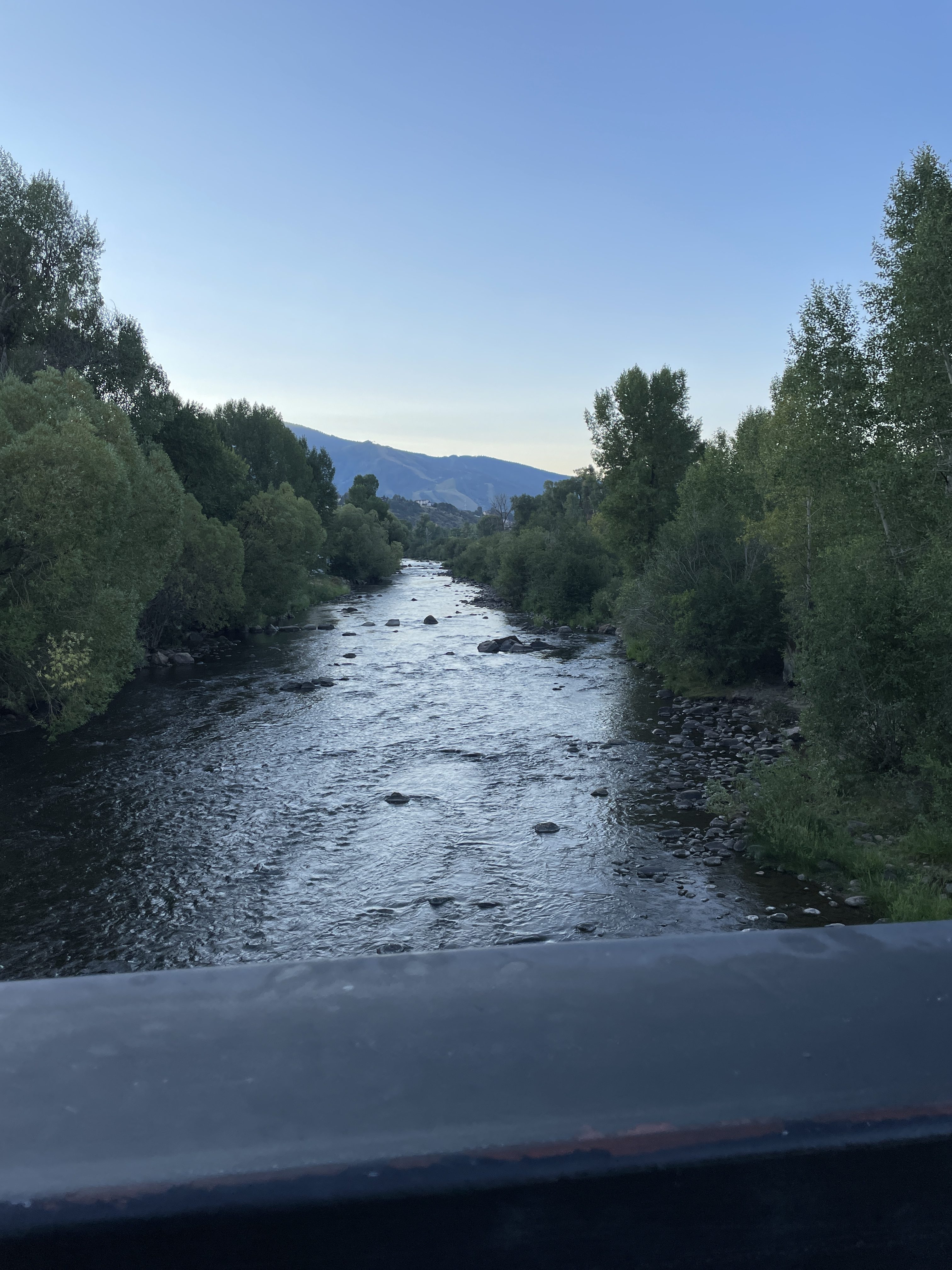
Loveland Pass in Summit County on Dec. 24, 2025. The lack of snow is clearly visible on the higher peaks. Photo credit: Denver Water.

The dams provide hydroelectricity for more than a million people in the Southwest, but must hold water well above the turbines that generate power. If water levels at Lake Powell dip below โ€œminimum power poolโ€ for an extended period of time the agency would have to bypass the turbines, turning off the electricity they produce, and deliver water to the Lower Basin through lower outlets on Glen Canyon Dam, which could compromise the structure. At that point, the Bureau of Reclamation would have to choose between damaging the second-highest concrete-arch dam in the U.S. or reducing water releases to Arizona, California and Nevada, which would be a devastating blow to the regionโ€™s cities and economy. Some experts have predicted that could happen as soon as next summer or sooner if this winterโ€™s dry spell continues.

Last September, Kuhn and a consortium of other hydrologists and Colorado River experts authored a report that found that if the current winter was similar to last yearโ€™s, Colorado River users would overdraw the river by 3.6 million acre-feet, and there would need to be โ€œimmediate and substantialโ€ reductions in water use across the basin to prevent a total collapse of the system. One acre-foot is enough to supply water to two to four households. 

Now, with winter looking even more dismal than initially forecast, Kuhn says the Bureau of Reclamationโ€™s options are โ€œfurther constrained, unless things get wetter in the next two months.โ€

One option that Kuhn found likely was a big release from Flaming Gorge near the Wyoming-Utah border, the largest federally managed dam upstream of Lake Powell. He guessed the release could be anywhere from half a million to 1 million acre-feet of water. 

While todayโ€™s drought and low streamflows are a product of nearly three decades of aridification, water forecasters cannot say for sure how climate change will impact future water supplies. Under some models, precipitation remains low and consistent, but rising temperatures dry out soils across the basin, leading them to absorb more snowmelt and further reduce streamflow. 

Other hotter futures could also be wetter, Kuhn said, but this would not reinvigorate the river. โ€œWeโ€™re expecting stream flows to continue their downward trend,โ€ he said. 

And if that is the case, Mother Nature may be the deciding factor between a successful negotiation and litigation. 

Hydrologically speaking, we are living through a winter where โ€œthatโ€™s a possibility,โ€ Kuhn said. โ€œI think itโ€™s gotta put a lot of pressure on the states.โ€

Looming Litigation 

A resolution in the courts is looking increasingly likely.

During her state of the state address on Jan. 12, Arizona Gov. Katie Hobbs said the โ€œUpper Basin states, led by Colorado, have chosen to dig in their heels instead of acknowledging realityโ€ during negotiations. 

The state, she said, had established a $1 million legal fund in anticipation of litigation, with a bipartisan bill introduced to add another $1 million to it. This will โ€œkeep putting Arizona first and fight for the water we are owed,โ€ she said.

โ€œAs negotiations continue, I refuse to back down.โ€

Arizona Governor Katie Hobbs at signing ceremony November 19, 2024. Photo credit: ADWR

A week later, Colorado lawmakers asked Becky Mitchell, the stateโ€™s lead negotiator, about its prospects in litigation. โ€œWe are gonna have the best lawyer,โ€ she said. โ€œWe will be ready.โ€

Earlier in the week, Colorado Attorney General Phil Weiser assured state lawmakers that he is prepared to go to court and blamed the other basin for the lack of a deal. 

โ€œThe reason itโ€™s hard to get a deal is you need two parties living in reality. And if one party is living in la la land, youโ€™re not going to get a deal,โ€ he said. โ€œIโ€™m committed to not getting a bad deal just to get a deal.โ€

The Upper Basin states of Colorado, New Mexico, Utah and Wyoming, and the Lower Basin states of Arizona, California and Nevada sounded far apart on a deal at the annual Colorado River Water Users Association conference in Las Vegas last December. Some negotiators advocated for a short-term agreement while others called for greater federal pressure.

Last week, negotiators from all seven basin states met in D.C. to try to break the impasse. After the meeting, governors Spencer Cox, of Utah, and Mark Gordon, of Wyoming, said in a joint statement that โ€œall acknowledged that a mutual agreement is preferable to prolonged litigation,โ€ and both felt encouraged by the results of the meeting.

In a separate statement, Arizona Gov. Hobbs said she was also encouraged, and that the states โ€œreaffirmed our joint commitment to protecting the river.โ€ Arizona has been and remains willing to continue bringing solutions, she added, โ€œso long as every state recognizes our shared responsibility.โ€

Earlier this month, the federal government released aย range of alternativesoutlining how it would manage the system if no deal is reached by Feb. 14. If that deadline passes without an agreement, the political and environmental situation across the basin may become as grim as the snowpack.ย 

Arizona officials have said any of the federal governmentโ€™s proposals would likely lead them to pursue litigation and that the Bureau of Reclamationโ€™s draft Environmental Impact Statement puts all the risk of the riverโ€™s decline on the Lower Basin and does not comply with the bedrock law of the river. Under the outlined federal proposals, the vast majority of the cuts would affect Arizona, which relies heavily on the river for water but holds junior rights, often making it the first to face significant reductions. The state has already had a third of its water rights to the river cut.

โ€œThe entire weight of the river cannot fall on Arizonans, the Valley [Phoenix] and the Tucson metro areas,โ€ said Brenda Burman, general manager of Central Arizona Project, the entity delivering Arizonaโ€™s Colorado River water, at a press conference Monday. โ€œThatโ€™s not acceptable. We, as water managers โ€ฆ we will make sure that there is water flowing.โ€

The structural deficit refers to the consumption by Lower Basin states of more water than enters Lake Mead each year. The deficit, which includes losses from evaporation, is estimated at 1.2 million acre-feet a year. (Image: Central Arizona Project circa 2019)

The Lower Basin has volunteered to cut 1.5 million acre-feet, the amount of water lost to transpiration and evaporation in a year, and asked that the Upper Basin share in cuts after that amount. The Upper Basin, which has never used the full amount it is entitled to on paper, has proposed making only voluntary cuts to its use.

Sarah Porter, director of the Kyl Center for Water Policy at Arizona State University, said sheโ€™s felt litigation is increasingly likely since the basin states missed their initial federal deadline in the fall and their negotiations began to deteriorate. 

โ€œI believe that everybody has kind of stared it down and concluded that litigation isnโ€™t such a horrible idea that it needs to be avoided,โ€ she said.

As a former litigator, Porter said the threat of legal action may force both sides to develop their arguments along with facts and data supporting them, which could provide the clarity needed for a settlement. But a lawsuit would extend the uncertainty surrounding the regionโ€™s water supply, Porter said, affecting the planning of cities, tribes and farmers waiting for new guidelines.

Litigation would likely focus on one of the most crucial sections in the 1922 Colorado River Compact: Article III(d)

Under this part of the agreement, the Upper Basin โ€œwill not cause the flow of the river at Leeโ€™s Ferry,โ€ a point just south of Glen Canyon dam, โ€œto be depleted below an aggregate of 75,000,000 acre-feet for any period of ten consecutive years.โ€ Should the average flow at Leeโ€™s Ferry fall below an average of 7.5 million acre-feet, which is a possibility given current hydrological conditions, the Lower Basin could sue the Upper Basin for failing to uphold this part of the compact.

โ€œHigh-Stakes Pokerโ€

Any lawsuit would be risky. 

โ€œThat language has never been interpreted by a court,โ€ said Anne Castle, a senior fellow at the Getches-Wilkinson Center at the University of Colorado and a former assistant secretary for Water and Science at the Interior Department. โ€œThis is high-stakes poker for both basins.โ€

The Lower Basin would presumably argue that Article III(d) means the Upper Basin has an obligation to deliver water, so it would have to adjust its consumption to ensure the Lower Basin receives 7.5 million acre-feet annually. 

But the Upper Basin could counter that Article III(d) only prohibits it from overconsuming the river and leaving less than 7.5 million acre-feet at Leeโ€™s Ferry, and climate change is actually responsible for the meager flows. In that case, they would bear no obligation under the compact to make cuts. 

Porter said the Upper Basinโ€™s interpretation flies in the face of history. The whole reason the compact exists was the fear California would take all of the riverโ€™s water at the time, she said, because thatโ€™s where the growth was.

โ€œIt is silly to think that California would agree to a deal with the Upper Basin that said they have no responsibility to leave water for California,โ€ she said. 

For decades, the Upper Basin cited its delivery obligation to California, Arizona and Nevada to justify building a series of dams and reservoirs above Lake Powell, Porter said.

โ€œThereโ€™s a huge amount of evidence that the Upper Basin states โ€ฆ needed those reservoirs upstream because they had an obligation to deliver water to the Lower Basin,โ€ she said.

Even if Congress originally authorized Upper Basin reservoirs to help satisfy provisions in the compact, โ€œthat doesnโ€™t tell us what those obligations actually are,โ€ Castle said. โ€œFixed number obligations donโ€™t work with a changing climate that is causing shrinking flows.โ€

Not every state is eager to initiate litigation. Wyoming Senior Assistant Attorney General Chris Brown appeared before state lawmakers in January and warned of the pitfalls of letting Congress or the Supreme Court dictate what happens on the river.

Still, โ€œas a headwater state, Wyoming has a long history of zealously defending its rights to use interstate waters, and the rights of its water users,โ€ Brown said in an email. โ€œThe Colorado River is no different.โ€

Tina Shields, water manager for the Imperial Irrigation District, which is Californiaโ€™s biggest and most senior water rights holder, said in a statement that the state continues to work on finding a consensus agreement among all the states that depend on the Colorado River, but could not comment on the status of those negotiations.

โ€œThe Colorado River hydrology is unlikely to wait for a court decision, so any speculation about litigation is premature,โ€ she said.

Although Arizonaโ€™s Lower Basin counterparts have not touted litigation as an option, Buschatzke said he is confident they will support the state, as compliance with Article III(d) affects them too, though less severely.

And the states may not be the only entities to sue. Under a 2004 water settlement, the Gila River Indian Community receives 653,000 acre-feet of Colorado River water a year, a significant allocation. But getting that water depends on the Central Arizona Project (CAP) not getting its water allotment cut.

Any unilateral action by the Department of the Interior to reduce that flow โ€œwould, in our view, constitute a blatant violation of the United States trust responsibility to protect our CAP water as established by Congress under the Arizona Water Settlement Act,โ€ said Gila River Indian Community Gov. Stephen Roe Lewis at the Arizona meeting of water stakeholders.

While litigation may clear up some of the murkier language in the compact, Castle wasnโ€™t sure that it is the best way forward for the riverโ€™s stakeholdersโ€”particularly since these kinds of disputes can take years to resolve. 

โ€œWe might get answers to a few questions after years,โ€ she said, โ€œbut we have a river to operate in the meantime.โ€

Map of the Colorado River drainage basin, created using USGS data. By Shannon1 Creative Commons Attribution-Share Alike 4.0

Civil Servants Arrange Buffet for #ColoradoRiver Negotiators — Brian McNeece #COriver #aridification

Carly Jerla speaking at the Colorado River Water User’s Association Conference December 5, 2024. Photo credit: USBR

From email from Brian McNeece:

January 27, 2026

Colorado River negotiations have bogged down, but dozens of experts at the Bureau of Reclamation (BOR) have been streaming right along. On Jan. 14, the BOR released its draft Environmental Impact Statement (EIS), which is bureaucratese for a report on options for the negotiators after the current rules expire this year.

Itโ€™s a bit complicated. The report includes a modeling of 1,200 possible future scenarios for the entire Colorado River system and runs 1,600 pages. Just the Executive Summary is 66 pages. The theme of this massive undertaking is deep uncertainty. In fact, that is the name of the modeling process: Decision Making Under Deep Uncertainty.
Whatโ€™s uncertain? Well, in a word: the weather. And not just the weather, but also population growth and water use patterns. Most scientists agree that climate change includes aridification, or a general drying of the Colorado River basin, but itโ€™s impossible to quantify reliably. Thus the 1,200 futures.

This massive report took two and a half years to compile with the help of around 150 people with expertise in everything from hydrology to chemical engineering to wildlife management to socioeconomics to anthropology to law. Browsing through it, I marveled at the depth of analysis and the advanced computational and mathematical tools brought to bear on a question, which at the end of the river, is a political one. I thought, does anyone understand all of it? But when I looked at the top of the list of preparers, I realized that yes, someone does.

And that is Carly Jerla. Sheโ€™s the Senior Water Resources Program Manager for the Bureau of Reclamation. Ms. Jerla was hired by the BOR in 2005 as a graduate student at the University of Coloradoโ€™s Center for Advanced Decision Support for Water and Environmental Systems. She is trained in civil and environmental engineering and public policy. Twenty years on, sheโ€™s the boss of this effort.

Iโ€™ve watched Ms. Jerla in action at several of the recent Colorado River Water Users Association (CRWUA) conferences in Las Vegas. A petite woman, Carly has a disarmingly low, warm voice. Speaking to a crowd of 1,700 people, she talks as if sheโ€™s having an over-the-fence conversation with a neighbor. But as the overlays of data stacked up on her slides, I could sense her losing the audience. It was just too much.

We saw a draft of the current report in 2024. Since then, it has grown massively, but the same dilemma exists and can actually be summed up simply. In re-writing the rules for how the water of the river gets divvied up, they need to decide what triggers shortage conditions, how much cuts each contractor must take under those conditions, and where shortages are measured. In the past, Lake Mead and Lake Powell had separate conditions, and the reservoirs above Lake Powell were not in play. Ms. Jerlaโ€™s report emphasizes that the entire system should be considered in the rules, not just the two giant reservoirs.
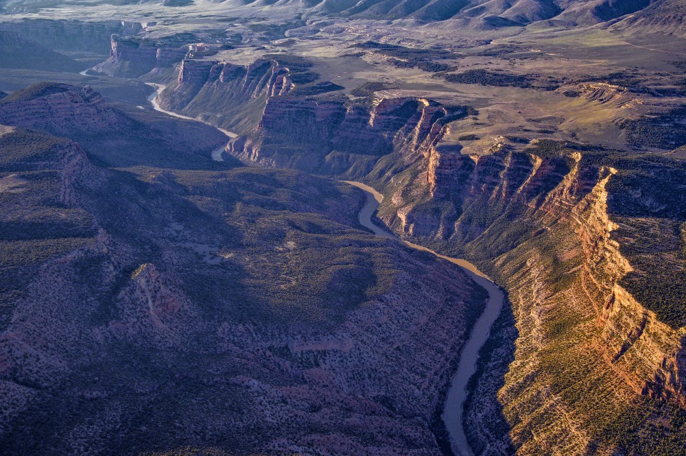
There are currently five major alternatives being proposed. This first one, called the No-Action Alternative, is also the no-go alternative, since it returns us to the world prior to the 2007 guidelines for shortages. The No-Action Alternative would drain the reservoirs. So negotiators must choose one of the other four alternatives. All of them make heavy cuts, either based on prior appropriation (i.e. the Law of the River) or pro rata (i.e. proportional cuts for everyone).

Is there a Goldilocks alternative among the other four? One that splits the difference between the historical, asymmetrical Law of the River and the fairness in a pro rata plan? No, there isnโ€™t. Thatโ€™s why weโ€™re stuck.

Thereโ€™s one future scenario that is completely omitted from the alternatives. Coloradoโ€™s negotiator Becky Mitchell has repeatedly called for the Upper Basin states to get MORE water. She points out that the Colorado River Compact of 1922 allocated the Upper Basin the same amount allocated to the Lower Basin states โ€” 7.5 million acre feet. But thatโ€™s 3 million more acre-feet than the Upper Basin has ever drawn from the system. 

None of the five alternatives, and apparently not one of Carly Jerlaโ€™s 1,200 possible futures, includes that premise. So if the Upper Basin negotiators are staking their claim on the river to include more water for them, they are way off the mark. Their next best hope is to take no cuts, but that option wonโ€™t float in the Lower Basin.

Trying to make a decision under Deep Uncertainty is tough, tough work. Carly Jerla and her team have laid out the buffet for the representatives from the states along the Colorado River. Time to pick from the menu. 

Map of the Colorado River drainage basin, created using USGS data. By Shannon1 Creative Commons Attribution-Share Alike 4.0

#Coloradoโ€™s constitution has been amended repeatedly since 1876, when Colorado achieved statehood, but the provision setting forth prior appropriation has not been touched — Ken Neubecker #ColoradoRiver #COriver #aridification

How #Colorado sees the #ColoradoRiver stalemate — Allen Best (BigPivots.com) #COriver #aridification

Becky Mitchell. Photo credit: Allen Best

Click the link to read the article on the Big Pivots website (Allen Best):

February 2, 2026

Snowpack realities must be recognized by all seven Colorado River Basin states, says Becky Mitchell, Coloradoโ€™s chief negotiator

Becky Mitchell was particularly busy during the last week of January. On Wednesday, Jan. 28, she opened the annual Colorado Water Congress conference with a 1,100-word speech (the prepared remarks are below) that reiterated Coloradoโ€™s position in the stalemated Colorado River discussions.

Lower-basin states, said Mitchell, Coloradoโ€™s chief negotiator in Colorado River affairs, must fully come to terms with the changed realities on the Colorado River. โ€œThis means releases from Lake Powell must reflect actual inflows, not political pressure,โ€ she said. โ€œIf reductions arenโ€™t real, reservoirs wonโ€™t recover.โ€

The next day, Mitchell was in Washington D.C. along with Colorado Gov. Jared Polis and the governors of five of the six other basin states. California Gov. Gavin Newsom, who cited pre-existing family commitments, was the only governor absent.

The New York Times on Saturday reported that the governors achieved โ€œno breakthrough โ€” and whether they made progress was unclear.โ€ Mitchell was quoted in that story saying upper basin states โ€œcannot and will not impose mandatory reductions on our water rights holders to send water downstream.โ€

In other words, as she had said Colorado water users must live with the hydrologic realities, including this one of almost no snow. Colorado does not have the giant reservoirs of Powell and Mead upstream.

Others, including Eric Kuhn, the former general manager of the Glenwood Springs-based Colorado River Water Conservation District, have urged a new model based on proportionate cutbacks, not absolute numbers. See: โ€œDancing With Deadpool on the Colorado River,โ€ Big Pivots. Dec. 12, 2025.

That is how the four upper-basin states among themselves apportioned their share of the river flows in their 1948 compact. The 1922 compact used absolute numbers, i.e. 7.5 million acre-feet for each basin.

The Colorado River Compact of 1922 among the seven basin states uses some language that can be interpreted very differently about delivery obligations. That is a long, involved story โ€” that may eventually be decided by the Supreme Court.

The Arizona Daily Star, however, reported a nuance of possible importance in statements made by Mitchell and Polis afterward. Mitchell emphasized โ€œvoluntaryโ€ conservation in the upper basin, while Polis said Colorado remained โ€œcommitted to working collaboratively to find solutions that protect water for our state, while supporting the vitality of the Colorado River and everyone who depends on it.โ€

An Arizona source told the Daily Starโ€™s Tony Davis that some Upper Basin governors appeared open to possible mandatory, as opposed to voluntary, conservation measures. โ€œI think the other Upper Basin states expressed a willingness to put water on the table in a way that Colorado has not,โ€ said the source, who asked for anonymity to protect continued participation in interstate river discussions.

But again, Colorado insists that it already has mandatory cutbacks โ€” the ones imposed by Mother Nature. Using the prior appropriation doctrine to sort out priorities, Colorado restricts uses even in the more water-plentiful years. This year, the most โ€œjunior usersโ€ will most definitely not get water.

The black line in this chart represents snow-water equivalent in Coloradoโ€™s snowpack as of Feb. 1 relative to 1991-2020, a time frame of which about two-thirds consisted of drought and aridification. The map below shows the snow-water equivalent as of Jan. 31 by basin.ย ย More can be found at the Natural REsources Conservation Service.

Amy Ostdiek, the Colorado Water Conservation Boardโ€™s chief for interstate, federal, and water information, made that point in remarks at the Water Congress the day after Mitchellโ€™s speech.

โ€œThese reductions in the upper basin are mandatory. Theyโ€™re uncompensated. Theyโ€™re the job of each state engineerโ€™s office to go out and shut off water rights holders when that water isnโ€™t available. And what that means in practice is that many years you have pre-compact water rights dating back to the 1800s getting shut off.โ€

The complications of mandatory reduction of water uses also came up in a session with state legislators at the Water Congress.

Ken Neubecker, a long-time Colorado River observer affiliated with environmental groups, said mandatory cuts to Colorado River water use would require an amendment to Coloradoโ€™s state constitution and likely those of other upper-basin states.

Coloradoโ€™s constitution has been amended repeatedly since 1876, when Colorado achieved statehood, but the provision setting forth prior appropriation has not been touched.

โ€œI donโ€™t think you will get an amendment that will give the state any kind of authority to enact mandatory cutbacks beyond existing administrative cutbacks,โ€ said Neubecker. โ€œThatโ€™s just not in the cards.โ€

The upper-basin states also differ fundamentally with lower-basin states in that the lower basin states have just a few giant diversions, such as the Central Arizona Project and the Imperial Valley. The headwaters states have thousands of legal diverters. That also makes application of mandatory diversions more difficult.

These facts would together make mandatory costs a legal and logistical nightmare to administer.

The states have a deadline imposed by the federal government, as operator of the dams, to agree how to share a shrinking river.

Later this year, Mother Nature may impose an even harsher deadline if current thin snowpack continues to prevail. The statewide snowpack was 58% of averageย as of late Januaryย when the Water Congress conference was getting underway.

One barometer, if imperfect, of the snowpack is the snowpack on Vail Mountain. On Jan. 15, the Vail Dailyโ€™s John LaConte reported that the Snotel measuring site at the ski area showed the worst snowpack reading in 44 years of measurements.

The opening of Vailโ€™s Back Bowls also testifies to dryness of the Colorado River headwaters. As recently as 2012, a notoriously dry year, that south-facing ski terrain was not opened until Jan. 19, according to David Williams of the Vail Daily. On Jan. 26, he reported another foot of snow was necessary to open it.

In June 2023, Polis appointed Mitchellto her current position, as Coloradoโ€™s first full-time commissioner to the Upper Colorado River Commission. She had previously overseen the Colorado Water Conservation Board.

โ€œMitchell will now navigate the deep challenges of the Colorado River in this upgraded position, supported by an interdisciplinary team within the Department of Natural Resources and support from the Colorado Attorney Generalโ€™s Office,โ€ said the announcement.

โ€œThe next few years are going to be incredibly intense as we shift the way that the seven basin states cooperate and operate Lakes Powell and Mead,โ€ Mitchell said in that 2023 announcement. โ€œClimate change coupled with Lower Basin overuse have changed the dynamic on the Colorado River and we have no choice but to do things differently than we have before.โ€

Becky Mitchellโ€™s prepared remarks

#Colorado is gearing up to fight for water rights as the #ColoradoRiver stalemate continues — The Summit Daily #COriver #aridification

Colorado River “Beginnings”. Photo: Brent Gardner-Smith/Aspen Journalism

Click the link to read the article on the Summit Daily website (Ali Longwell). Here’s an excerpt:

January 27, 2026

As Colorado continues to negotiate with the seven Colorado River basin states on the post-2026 operations of Lake Powell and Lake Mead, the stateโ€™s attorney general and lead negotiator are ready for a legal battle if the states continue to clash.

โ€œIf it comes to a fight, we will be ready,โ€ said Becky Mitchell, the Colorado River commissioner, who represents the state on the Upper Colorado River Commission, at the Jan. 23 SMART Act hearing for the Colorado Department of Natural Resources, where the agency provided its annual update on priorities and programs to lawmakers. 

After two years of back and forth, Colorado River basin states remain deadlocked, unable to agree on the guidelines for how Lake Powell and Lake Mead should operate beyond 2026. The operations of these two critical reservoirs have widespread implications for the approximately 40 million people, seven states, two counties and 30 tribal nations that rely on the river…In Colorado, the Colorado River and its tributaries provide water to around 60% of the stateโ€™s population.ย 

โ€œWe developed priorities that continue to serve as my north star as we negotiate these post-2026 operational guidelines,โ€ Mitchell said. โ€œThe most important of these priorities is to protect Colorado water users. This means that our already struggling water users and reservoirs cannot be used to solve the problem of overuse in the lower basin.โ€ย 

[…]

Despite disagreements over how the reservoirs should operate in an uncertain future, reaching a consensus between the seven Colorado River basin states remains the objective for all involved, but time is ticking.ย  The U.S. Bureau of Reclamation โ€” which manages Lake Powell and Lake Mead โ€” has given the states until Feb. 14 to reach an agreement before the federal agency steps in and makes the decision itself.ย  Mitchell told lawmakers that she was still โ€œoptimisticโ€ about reaching a consensus by the deadline, adding that she will โ€œsit in the room with the full intent to negotiate,โ€ as long as there are โ€œwilling parties.โ€ย 

โ€œFolks should start worrying when Iโ€™m no longer in the room,โ€ she said. โ€œI will, 100%, be focused on a deal until thereโ€™s not a deal to be had.โ€

Map of the Colorado River drainage basin, created using USGS data. By Shannon1 Creative Commons Attribution-Share Alike 4.0

Putting land into the public’s hands: And other bits and pieces — Jonathan P. Thompson (LandDesk.org)

Fields, trees, and the Abajos. North of Dove Creek, Abajo Mountains in the distance. Photo credit: Jonathan P. Thompson/The Land Desk

Click the link to read the article on The Land Desk website (Jonathan P. Thompson):

January 30, 2026

Updated to get the graphics right.

๐ŸŒต Public Lands ๐ŸŒฒ

If youโ€™ve ever floated the Gunnison River in western Colorado through the Dominguez-Escalante National Conservation Area between Delta and Grand Junction, youโ€™ve probably noticed that the land on either side of the stream alternates between public parcels and private ranch land. If the Bureau of Land Management has its way, some 4,000 acres of that private land will soon be entering the public domain, according to reporting from the Grand Junction Daily Sentinel. Thatโ€™s right, the agency is putting more lovely land into the publicโ€™s hands. 

The parcels were formerly operated as a ranch by Dick Miller. After he died, the Conservation Fund purchased the land from Millerโ€™s son for an undisclosed amount in order to sell it to the BLM. The associated BLM grazing leases will reportedly be transferred back to the BLM, but it isnโ€™t clear whether theyโ€™ll be made available for grazing again.


The BLM is also looking to put a lot of public land into oil and gas companiesโ€™ hands. The agency is seeking public input on proposals to lease 74 parcels covering 33,530 acres in New Mexico, and 271 oil and gas parcels totaling 357,358 acres in Wyoming

The New Mexico parcels are mostly in the Permian Basin, but do include tracts in the San Juan Basin located north and northeast of Chaco Culture National Historical Park (but not within the ten-mile buffer zone, which remains in place โ€” for now). 

The Wyoming parcels are concentrated in the southern part of the state between Rawlins and Green River, the central part of the state, and the Powder River Basin.

๐Ÿฆซ Wildlife Watch ๐Ÿฆ…

Wolves in the West have had a rough go of it ever since white settlers showed up in the 1800s and proceeded to slaughter them en masse. And while theyโ€™ve been able to recover somewhat in the Northern Rockies, thanks in part to endangered species protections and reintroduction efforts, the move to bring them back to Colorado and the Southwest has hit obstacles โ€” and tragedy, including:

  • Another reintroduced wolf has died in Colorado, reports the Colorado Sunโ€™s Tracy Ross, bringing the total number of wolf fatalities since the start of reintroduction to 11. The cause of death has not been determined.
  • Meanwhile, Colorado Parks and Wildlife has paused new wolf reintroductions because it hasnโ€™t been able to find another state or tribal nation to provide the animals.
  • Utah Department of Agriculture officials killed three wolves in the northern part of the state on Jan. 9. While wolves are protected by the Endangered Species Act in most of the state, they were delisted in one small section along the Wyoming border when protections were lifted for the Northern Rockies population. Now, apparently, the state will kill any wolves that wander into that area, just because they can, and to prevent them from going into the protected zone. Thatโ€™s despite the fact that the three animals had not killed or stalked any livestock. โ€œI have not heard any of my neighbors, and we havenโ€™t had the experience ourselves that weโ€™ve had actual issues with our cattle and wolves,โ€ area livestock owner Launie Evans told KSL.
  • And in more sad news: โ€œTaylor,โ€ the Mexican gray wolf that wandered out of southern New Mexico and into the Mt. Taylor region, was found dead on I-40 near Grants. Taylor first roamed onto Mt. Taylor early last year, apparently not realizing that the feds donโ€™t allow wolves to cross I-40. Wildlife officials captured him and deported him back to the southland, but he was persistent, and simply turned around and headed north again. He was removed again in November, but couldnโ€™t stay away from Mt. Taylor. This time, on his return journey, he was struck by a vehicle.

    โ€œTaylorโ€™s death is a heartbreaking reminder that highways like I-40 are not just lines on a map, they are lethal barriers for wildlife,โ€ said Claire Musser, executive director of the Grand Canyon Wolf Recovery Project, in a statement. โ€œAbolishing I-40 as a management boundary is long overdue. If we are serious about recovery, we must allow wolves to move freely across suitable habitats and invest in wildlife crossings and landscape-scale connectivity so highways no longer function as death traps.โ€
  • And, finally, CPWโ€™s latest map of wolf activity is out (at the top of this section), and it shows that wolves have been wandering into new parts of the state. Folks in the Silverton area might just be seeing some soon. If you think you see one, but arenโ€™t sure if itโ€™s a wolf or coyote, this little guide from CPW might help:


Longread: On wolves, wildness, and hope in trying times: How Ol Big Foot’s story restored a shard of optimism — Jonathan P. Thompson


โ›๏ธ Mining Monitor โ›๏ธ

Public Citizen just released an accounting of some of the ways the Trump administration is subsidizing global mining corporations and their operations on public lands โ€” and the ways in which executives made off like bandits as a result. Itโ€™s worth reading the whole report, but here are just a small sampling of highlights:

  • $8.8 million: Amount 13 mining corporations, including Rio Tinto, Resolution Copper, South32, Lithium Americas, and Ambler Metals, spent on lobbying in 2025.
  • $3.5 million: Amount Lithium America paid Interior Department official Karen Budd-Falenโ€™s husband for water rights for its Thacker Pass mine in Nevada. The federal government also took a 5% stake in the company and the mine as a condition of preserving a Biden-era loan.
  • $400 million: Amount the U.S. Defense Department paid for a stake in Las Vegas-based MP Materials, which owns the Mountain Pass rare earths mine in California. The Pentagon also loaned the company $150 million.

The Bureau of Land Management approved the Grassy Mountain gold and silver mine on 469 acres of public land in Malheur County, Oregon. The action allows Paramount Gold Nevada to develop an underground mine, an onsite mill, and โ€œassociated storageโ€ (which Iโ€™m taking to mean theyโ€™ll be able to dispose of toxic mill tailings on public land mining claims).

๐Ÿ“– Reading (and watching) Room ๐Ÿง

Hereโ€™s a great piece by Leah Sottile, who has written authoritatively on right-wing movements and more, on the plague of hypocrisy going around right now.


The Truth Does Not Change According to Our Ability to Stomach It: 67. Hypocrisy On the whiplash of this chaotic moment — Leah Sottile


The Border Chronicle is indispensable reading these days and, well, always. This piece, titled Border Patrol Nation, is an important look at the violent history of the Border Patrol.

*

And you really should be reading Wayne Hareโ€™s writing over at the Civil Conversations Project.


๐Ÿ“ธ Parting Shot ๐ŸŽž๏ธ

Speaking of hypocrisy: Iโ€™m sure most of you have heard Trump administration officials saying that federal ICE and/or CPB agents shot Alex Pretti because he brought a gun to a protest. The photos below were all captured at the May 2014 Recapture rally in Blanding, Utah. Quite a few of the attendees โ€” who were on hand to protest โ€œfederal overreachโ€ โ€” were armed. None of them were shot. Just sayinโ€™.

Folks exercising the right to bear arms at Recapture Canyon to protest federal overreach. Photo credit: Jonathan P. Thompson

Musical Sendoff

Governors leave DC with no deal on #ColoradoRiver, mixed messages — Tucson.com #COriver #aridification

Map of the Colorado River drainage basin, created using USGS data. By Shannon1 Creative Commons Attribution-Share Alike 4.0

Click the link to read the article on the Tucson.com website (Tony Davis). Here’s an excerpt:

January 31, 2026

Arizona Gov. Katie Hobbs and leaders of the six otherย Western states that rely on the Colorado Riverย ended a Friday meeting in Washington, D.C. with no deal to endย a stalemate over rights to the river’s dwindling water supply. Hobbs indicated that progress was made thanks to newfound flexibility from upstream states over their willingness to make commitments to cut some of their river water use, as the Lower Basin states, including Arizona, have already done. But Colorado officials all but directly contradicted Hobbs’ comments, saying they and Upper Colorado River Basin states were sticking to their position opposing any mandatory water use cuts on their part. The meeting was hosted by U.S. Interior Secretary Doug Burgum…

โ€œI was encouraged to hear Upper Basin governors express a willingness to turn water conservation programs into firm commitments of water savings,โ€ [Katie] Hobbs posted on social media after the two-hour meeting. “Arizona has been and will continue to be at the table offering solutions to the long-term protection of the river so long as every state recognizes our shared responsibility…

Mitchell said, “Colorado is committed to being part of the solution, and with our Upper Basin partners, we have offered every tool available to us. This includes making releases from our upstream reservoirs and establishing a contribution program as part of a consensus agreement. However, any contributions must be voluntary, and we have real ideas and plans to achieve the goals…”As several upper basin governors clearly stated at the meeting, we cannot and will not impose mandatory reductions on our water rights holders to send water downstream,” she wrote. “Our water users are already facing uncompensated reductions through state regulation. In many cases, these reductions impact 1880s water rights that predate the (Colorado River) Compact. Any contribution program must recognize our hydrologic realities: we simply cannot conserve water that we do not get to begin with.โ€

[…]

Mitchell spoke in even stronger terms earlier in the week at a public talk she gave in Aurora, a suburb of Denver. She spoke at the annual meeting of the Colorado Water Conference, a professional association that advocates for policies and laws that protect the stateโ€™s waters.


Upper Colorado River Commissioner Becky Mitchellโ€™s prepared remarks โ€œThis is the river we actually live withโ€ for the Colorado Water Congress Annual Convention January 28, 2026 — Coyote Gulch


โ€œFor more than a century, we built a system on optimism and entitlement. We planned for abundance, labeled it normal, wrote it in the law, and when the water showed up, we spent it,โ€ Mitchell told the gathering, in remarks reported by the Colorado Sun news website. โ€œWhen it didnโ€™t, we blamed the weather, climate change or each other. Anything but the simple math.โ€

The seven states need to tie reservoir releases more closely to the actual amount of water coming in, Mitchell said in an interview after the speech. That was a nonnegotiable for the Friday meeting, she said. Overuse by the Lower Basin is draining the system, Colorado officials say.

Udall/Overpeck 4-panel Figure Colorado River temperature/precipitation/natural flows with trend. Lake Mead and Lake Powell storage. Updated through Water Year 2025. Note the tiny points on the annual data so that you can flyspeck the individual years. Credit: Brad Udall

#ColoradoRiver governors express cautious optimism after โ€˜historicโ€™ DC meeting Caitlin Sievers (ArizonaMirror.com) #COriver #aridification

A high desert thunderstorm lights up the sky behind Glen Canyon Dam — Photo USBR

by Caitlin Sievers, Arizona Mirror
January 30, 2026

With the deadline to reach a water usage agreement looming, leaders from the seven Colorado River Basin states expressed cautious optimism that their โ€œhistoricโ€ meeting in Washington, D.C., will spur the compromise needed to reach a consensus.

U.S. Secretary of the Interior Doug Burgum called the meeting at the request of Arizona Gov. Katie Hobbs, after the states blew past a Nov. 11 deadline to reach an agreement. The new Feb. 14 deadline was set by the Bureau of Reclamation, which manages water in the West under the Interior Department. 

Arizona stands to see the largest cuts if the states canโ€™t reach an agreement, because its Central Arizona Project is one of the newest users of the river water, making it legally one of the first to be cut.

The Colorado River is a vital source of drinking water for 40 million people in the seven basin states, Mexico and 30 Native American tribes, and provides water for farming operations and hydroelectricity. 

One of the biggest disagreements between the Lower Basin states โ€” Arizona, Nevada and California โ€” and Upper Basin states โ€” Colorado, New Mexico, Utah, and Wyoming โ€” is over which faction should have to cut back on their water use, and by how much.

โ€œThis is one of the toughest challenges facing the West, but the Department remains hopeful that, by working together, the seven basin governors can help deliver a durable path forward,โ€ Burgum, the former governor of North Dakota, said in a statement. โ€œLooking at this as a former governor, the responsibility each of them carries to meet the needs of their constituents cannot be understated, and we are committed to partnering with them to reach consensus.โ€

The meeting in the nationโ€™s capital lasted more than two hours, Christian Slater, a spokesman for Hobbs, told the Arizona Mirror. The governors of all of the basin states attended the meeting, except for Gov. Gavin Newsom of California, who had a prior family commitment and sent California Natural Resources Secretary Wade Crowfoot in his place. 

โ€œItโ€™s actually a pretty historic meeting, and I donโ€™t use those words lightly,โ€ John Entsminger,  Nevadaโ€™s Colorado River negotiator, said. โ€œIโ€™ve been working on the river for more than 25 years, and Iโ€™ve never seen that many governors and a cabinet secretary in one room talking about the importance of the Colorado River.โ€

In a post on X Friday afternoon, Hobbs described the meeting as meaningful and productive. 

โ€œI was encouraged to hear Upper Basin governors express a willingness to turn water conservation programs into firm commitments of water savings,โ€ Hobbs wrote. โ€œArizona has been and will continue to be at the table offering solutions to the long-term protection of the river so long as every state recognizes our shared responsibility.โ€

Udall/Overpeck 4-panel Figure Colorado River temperature/precipitation/natural flows with trend. Lake Mead and Lake Powell storage. Updated through Water Year 2025. Note the tiny points on the annual data so that you can flyspeck the individual years. Credit: Brad Udall

Reaching a water usage agreement is vital to the basin states because the Colorado Riverโ€™s water supply has been in decline for around 25 years due to a persistent drought spurred on by climate change. The decline is expected to continue into the future. 

Water levels in the two major reservoirs on the river, Lake Mead and Lake Powell, have also been in decline for the last quarter century. 

โ€œOne thing is certain: Weโ€™ll have less water moving forward, not more,โ€ New Mexico Gov. Michelle Lujan Grisham said in a statement. โ€œSo, we need to figure this out. There isโ€ฏstill a lot of work ahead to get to an agreement, but everyone wants an agreement, and weโ€™ll work together to create a pathway forward.โ€

Lower Basin states want all seven states to share mandatory water cuts during dry years under the new guidelines. But the Upper Basin, which is not subject to mandatory cuts under the current guidelines, argue that they already use much less water than downstream states and should not face additional cuts during shortages.

State negotiators for both the Upper and Lower Basin have said they would prefer a seven-state agreement over alternative river management options proposed by the federal government.

Tom Buschatzke, director of the Arizona Department of Water Resources, told reporters last week that the Grand Canyon State does not like the options proposed by the federal government as they place almost the entire burden for cuts on Lower Basin states. 

The Colorado River Compact dates back to 1922, when the seven states made their initial agreement, allocating 7.5 million acre-feet of water each year to be shared by the Upper Basin states and another 7.5 million to be used among the Lower Basin states. 

In 2025, for the fifth year in a row, the federal government imposed water allocation cuts on the Colorado River  due to the ongoing drought and Arizonaโ€™s cut amounts to a loss of 512,000 acre-feet of water for the year. 

โ€œTodayโ€™s discussion was productive and reflected the seriousness this moment requires,โ€ Colorado Gov. Jared Polis said in a statement. โ€œSince 2022, Colorado and the Upper Basin states have shown up to the negotiating table ready to have hard conversations. We have offered sacrifices to ensure the long-term viability of the Colorado River and we remain committed to working collaboratively to find solutions that protect water for our state, while supporting the vitality of the Colorado River and everyone who depends on it.โ€ 

Complicating matters this year is scant snowpack in the Rocky Mountains. Small snowpack means very little runoff, the source for almost all of Coloradoโ€™s water. 

The Lower Basin states have undertaken significant conservation efforts for Colorado River water since 2014 and have reduced their consumption from 7.4 million acre-feet in 2015 to just over 6 million in 2024.

The Upper Basin states have increased their usage in the past five years, from 3.9 million acre-feet in 2021 to 4.4 million in 2024. 

Buschatzke, who attended the meeting in D.C. on Friday alongside Hobbs, has remained insistent that itโ€™s time for the Upper Basin states to do their part. Hobbsโ€™ statement indicated that the states had made some progress toward that. 

If the states canโ€™t reach an agreement and are forced to take one of the federal governmentโ€™s proposals, it will likely lead to litigation โ€” something that the states agree they would prefer to avoid. 

โ€œWe all have to keep working together,โ€ Entsminger said. โ€œWe have to find a compromise, and we have to find a way that the states stay in control of this process and donโ€™t turn it over to the courts.โ€

Last year, Arizona put a total of $3 million to its Colorado River legal defense fund, and Gov. Katie Hobbsโ€™ proposed budget for this year would put another $1 million toward that fund. 

Entsminger said that he thinks the meeting improved the chances of the states meeting  the Feb. 14 deadline. 

โ€œWhether we have a final deal on February 14 or not, weโ€™re still going to have to keep working,โ€ he said. โ€œThatโ€™s not to say I donโ€™t think weโ€™ll meet the deadline, but I do think we keep working until we have a deal, regardless of what day in the future that occurs.โ€

Jeniffer Solis of the Nevada Current contributed to this report.

Map of the Colorado River drainage basin, created using USGS data. By Shannon1 Creative Commons Attribution-Share Alike 4.0

Upper #ColoradoRiver Commissioner Becky Mitchell’s prepared remarks “This is the river we actually live with” for the #Colorado Water Congress Annual Convention January 28, 2026 #COriver #aridification #cwcac2026

Rebecca Mitchell, John Entsminger, Estevan Lopez, Gene Shawcroft, JB Hamby, Tom Buschatzke at the Getches-Wilkinson Center/Water and Tribes Initiative Conference June 6, 2024. Photo credit: Rebecca Mitchell

Click the link to read the remarks on the Coyote Gulch website. Thanks to Michael Elizabeth Sakas for sending them in email:

January 28, 2026

Fellow Coloradans,

First I want to thank Christine Arbogast and the Colorado Water Congress for allowing me to speak today. I will be brief as Amy Ostdiek will be on a panel tomorrow giving a bit more detail of the status of the negotiations. I will be heading to Washington DC with my fellow commissioners to have more discussions.

Letโ€™s start with a truth that somehow still feels radical:

The Colorado River is not broken.

We are.

Udall/Overpeck 4-panel Figure Colorado River temperature/precipitation/natural flows with trend. Lake Mead and Lake Powell storage. Updated through Water Year 2025. Note the tiny points on the annual data so that you can flyspeck the individual years. Credit: Brad Udall

The river is doing exactly what rivers do when you take too much from them for too long. It is responding to reality. And right now, for many, reality is inconvenient.

For more than a century, we built a system of optimism and entitlement. We planned for abundance, labeled it โ€œnormal,โ€ and wrote it into law. When the water showed up, we spent it. When it didnโ€™t, we blamed the weather, climate change, or each otherโ€”anything except the simple math.

The river never signed those agreements. And it is not interested in our love story with the past.

Lake Powell and Lake Mead were supposed to protect the system. Instead, we turned them into shock absorbers for delay.ย We wanted them to be savings accounts, when in reality we treated them like credit cardsโ€”use now, pay later.

Well, interest has accrued and the bill has arrived. Both reservoirs are in a treacherous situation.

The Colorado River fills Glen Canyon, forming Lake Powell, the nationโ€™s second-largest reservoir. The reservoir could drop to a new record low in 2026 if conditions remain dry in the Southwestern watershed. (Alexander Heilner/The Water Desk with aerial support from LightHawk)

Lake Powell was never meant to be drained so that hard decisions could be postponed downstream. It was designed to stabilize the system, to smooth out highs and lows; not to prop up demand that no longer matches supply. Year after year, Powell has been drawn down to protect uses elsewhereโ€”even as inflows decline and the margin for error disappears.

Hoover Dam at low water. Jonathan P. Thompson photo.

Lake Mead tells the same story from the other end. Despite conservation programs, pilot projects, and voluntary agreements, Mead keeps dropping. Not because we lack creativityโ€”but because we are still taking more water out of the system than the river is putting in.

Reservoirs donโ€™t lie.They are the silent accountants of what we actually do, not what we say weโ€™re doing.

Here in Colorado, when the river runs low, the impacts are immediate. We donโ€™t have a giant reservoir upstream to hide behind. Shortages here are hydrologic. They are real. Farmers fallow fields. Municipalities restrict use. Communities adaptโ€”not next year, not after another study or more modeling, but now. These impacts should be the indicator of the level of action that is needed across the entire Basin.

That lived experience mattersโ€”especially as we head into a post-2026 world.

Post-2026 is not just another chapter in the Law of the River, it is a reckoning.

The Interim Guidelines were written for a different riverโ€“-a river of the past. The drought contingency plans were emergency patchesโ€”not as a permanent fix but to buy time at a cost of more than a billion dollars until the next deal. We all know now those bandaids donโ€™t fix holes in reservoirs. And the idea that we can simplyย extendย these frameworks or merely modify them โ€”while Powell and Mead hover near critical elevationsโ€”is not leadership. Itโ€™s hope, not based on reality or experience, but avoidance.

In the post-2026 world, operations must be supply-based. Not demand-based. Not entitlement -justified. And not built on the hope that the next big year will save us. The harm will be irreversible because the Colorado River is NOT TO BIG TO FAIL.

Map of the Colorado River drainage basin, created using USGS data. By Shannon1 Creative Commons Attribution-Share Alike 4.0

Right now, the Basin States have a chance to prevent further irreversible damage and try to avoid bankruptcy. But that will only be possible if we all work together and see the stark reality of our present circumstances with clear eyes. We must build a framework that recognizes and adapts to the math problemโ€“supplies that regularly give us all less than our full rights and entitlements, that improves efficiencies for water intensive sectors, allows us flexibilities to help our neighbors when we can, and requires full transparency for measurement, monitoring, and accounting across the Colorado River System to build trust between us. Trust is difficult to rebuild when some donโ€™t acknowledge or adhere to the agreements already made.

That means releases from Lake Powell must reflect actual inflows, not political pressure.

It means protecting critical elevations is not optional.

And it means Lake Mead cannot continue to serve as a pressure valve for overuse.

We cannot manage scarcity with delay.

We cannot store our way out of imbalance with water that isnโ€™t there-that may never be there.

And we cannot negotiate with the simple arithmetic, no matter how many times we tell ourselves it will be different this time.

As sparks fly in the interstate negotiations, it is important to keep these realities in mind despite the rhetoric that attempts to distract.

Colorado is often told to โ€œcome to the table,โ€ as if weโ€™ve been absent. But weโ€™ve been here the entire timeโ€”bringing hydrology, realism, and a simple message:ย if reductions arenโ€™t real, reservoirs wonโ€™t recover. It is telling that what some refer to as an extreme negotiating position is based solely on the simple facts of hydrologyโ€”using more than the supply will bankruptthe entire system for everyone. How does the saying go? Doing the same thing over and over again and expecting a different result is the definition of insanity.

We are not asking for special treatment. We are not asking for a pass on doing our part to help save the system from collapse. We are asking for honesty. For reductions from both basins that are measurable, enforceable, and in proportion to useโ€”not in proportion to who can avoid the truth the longest.

Because if we donโ€™t choose how to live within the riverโ€™s limits, the river will choose for us. And it will not be gentle.

This is not a call for conflict.

Itโ€™s a call to face the reality of this unprecedented situation and come together to manage the River with wise and mature decision-making.

Lake Powell and Lake Mead are no longer warnings. They are verdicts. They are telling usโ€”clearly and without spinโ€”that the era of surplus, overuse, of clever deals is over.

The question facing all of us post-2026 is simple:

Do we align the rules with the river we actually haveโ€”or keep clinging to a past that no longer exists?

So as I head East I take you with me, because I know you all are doing the real work back on the home front. This year’s current hydrology demands it. I know Coloradans will be prepared, like they always have been. Fields will be fallowed, municipalities will be preparing to manage within their resources, deals will be made to protect fish and flows. Junior priority water users know that years like this one will call for collaboration and innovation, senior priority water users will work within the law and with those that are suffering, you will help each other pay the bill from Mother Nature because you know we all rise and fall together.

You all are here doing the real and hard work, and I will take that with me.Coloradans should be proud that we are choosing reality over fantasy, science over slogans, and responsibility over delay.

That is not weakness.

Thatโ€™s leadership.

Colorado River “Beginnings”. Photo: Brent Gardner-Smith/Aspen Journalism

Fiery speeches and calls for compromise: What #ColoradoRiver negotiators are saying on eve of DC summit — Scott Franz (KUNC.org) #COriver #aridification #cwcac2026

Water policymakers from (left to right) Utah, New Mexico, Colorado and Wyoming speak on a panel at the Colorado River Water Users Association conference in Las Vegas on December 5, 2024. State leaders are deeply divided on how to share the shrinking water supply, and made little progress to bridge that divide at the annual meetings. Photo credit: Alex Hager/KUNC

Click the link to read the article on the KUNC website (Scott Franz):

January 29, 2026

This story is part of ongoing coverage of the Colorado River, produced by KUNC in Colorado and supported by the Walton Family Foundation. KUNC is solely responsible for its editorial coverage.

Governors in the Colorado River basin and their negotiators are meeting with Interior Secretary Doug Burgum in Washington on Friday to try and break a yearslong impasse among states over how to share the dwindling waterway.

On the eve of the high-stakes summit, negotiators from both the upper and lower river basins are not sounding confident they can reach an agreement before a fast-approaching Feb. 14 deadline.

โ€œIt depends on the day that you ask me,โ€ Coloradoโ€™s negotiator, Becky Mitchell, said Tuesday when asked by KUNC News if she thinks the states are heading toward a court battle. โ€œBut I will tell you the level of commitment that we have, both within Colorado and the upper basin, is strong to try to find some way to make a deal. Thereโ€™s some things that we can’t give on.โ€

Negotiators are currently working against the backdrop of record low-snowpack across much of the West and worsening forecasts for the Colorado River’s water supply. 

Mitchell said negotiators are continuing to talk at least twice each week.

But leaders from the upper and lower basin states say they still have sticking points.

They continue to differ on how water cuts should be handled and how releases from Lake Powell should be managed during dry years.

“Some in the lower basin wanted some sort of guaranteed supply, irrespective of hydrologic conditions,โ€ Mitchell said. โ€œAnd I think asking people to guarantee something that cannot be guaranteed is a recipe that cannot get to success.โ€

The lower basin states of California, Arizona and Nevada are proposing to cut 1.5 million acre feet of their water use. Theyโ€™re also asking for water restrictions to be mandatory and shared among all seven states. 

Negotiators from the different basins spoke at public events on Wednesday to set the stage for the summit in Washington.

โ€œItโ€™s tough to say I’m looking forward to it, because that would be a lie,โ€ Mitchell told a large crowd Wednesday at a water conference in Aurora.

Her speech was fiery at times.

Colorado River negotiator Becky Mitchell speaks to the Colorado Water Congress convention in Aurora on Jan. 28, 2026. Scott Franz/KUNC

โ€œOperations must be supply based, not demand based, not entitlement justified, and not built on a hope that the next big year will save us,โ€ she said. โ€œThat harm will be irreversible, because the Colorado River is not too big to fail.โ€

As Mitchell was addressing the water conference in a hotel ballroom, Californiaโ€™s water negotiator, J.B. Hamby, was talking to roughly 600 people on a webinar about his take on the state of negotiations.

He largely focused on his desire to still find a compromise among the seven states in the river basin.

โ€œIt’s better to be able to work something out across the negotiating table, to do something that makes sense and protects our users and people and agriculture in our state, and as a result of that, getting a seven-state agreement that protects those interests,” he said.

Hamby said the federal government is โ€œleaning inโ€ and becoming more involved in the negotiations by offering potential options.

Hamby called the feds’ ideas helpful.

โ€œContinued back and forth between the basins havenโ€™t really been moving the ball forward,โ€ he said. โ€œThe administrationsโ€ฆhave this important role in sometimes knocking heads together, sometimes encouraging consensus, and having diplomatic discussions between the states to be able to move conversations forward.โ€

He pointed to Herbert Hooverโ€™s role in 1922 as then Commerce Secretary to broker a deal among states in the river basin over how to share water. 

โ€œItโ€™s going to take everyone chipping in and making the necessary (water) reductions to balance the supply with the demand we have moving forward,โ€ Hamby said.

Members of the Colorado River Commission, in Santa Fe in 1922, after signing the Colorado River Compact. From left, W. S. Norviel (Arizona), Delph E. Carpenter (Colorado), Herbert Hoover (Secretary of Commerce and Chairman of Commission), R. E. Caldwell (Utah), Clarence C. Stetson (Executive Secretary of Commission), Stephen B. Davis, Jr. (New Mexico), Frank C. Emerson (Wyoming), W. F. McClure (California), and James G. Scrugham (Nevada) CREDIT: COLORADO STATE UNIVERSITY WATER RESOURCES ARCHIVE via Aspen Journalism

Report: Considerations for Assigned Water after Expiration of the 2007 Guidelines — Kathryn Sorensen, Sarah Porter, Anne Castle, John Fleck, Eric Kuhn, Jack Schmidt, Katherine Tara #ColoradoRiver #COriver #aridification

Udall/Overpeck 4-panel Figure Colorado River temperature/precipitation/natural flows with trend. Lake Mead and Lake Powell storage. Updated through Water Year 2025. Note the tiny points on the annual data so that you can flyspeck the individual years. Credit: Brad Udall

Click the link to read the report on the Center for Colorado River Studies website (Kathryn Sorensen1, Sarah Porter2, Anne Castle3, John Fleck4, Eric Kuhn5, Jack Schmidt6, Katherine Tara7). Here’s the executive summary and recommendations:

January 2026

As Colorado River supplies and demands reach razor-thin margins, new tools to provide adaptive capacity will play a critical role in sustaining communities across the West. We mustย reduce our consumption of water, while finding ways to cushion the impact. One of the most innovative tools for doing this, developed over the last two decades, is โ€œAssigned Waterโ€ – giving users the ability to store conserved water earmarked for their own future use.

Originally developed as โ€œIntentionally Created Surplusโ€ in the 2007 Colorado River Interim Guidelines, Assigned Water has been revised and expanded through U.S.-Mexico Treaty Minutes and as part of the 2019 Drought Contingency Plan. While conceptually simple and demonstrably valuable – a savings bank for conserved water – it is crucial to get the policy tools right as Colorado River management rules evolve.

For agencies granted access to the tool, Assigned Water provides important adaptive capacity to prepare for and manage shortfalls on a volatile river with shrinking supplies. But nearly two decades of operational experience also have exposed unintended consequences. With Assigned Water likely to play a critical role in basin management going forward – including its potential expansion to the Upper Colorado River Basin – it is important to review the strengths of the existing program, and essential lessons learned, to guide the development of river management policies after the current operating rules expire at the end of 2026.

HOW ASSIGNED WATER WORKS

Assigned Water allows some users to either conserve water that would have been used, import some categories of tributary water to the mainstem, or to fund system improvements to conserve water that would otherwise have been lost to inefficiencies. This water is then earmarked for the creating agenciesโ€™ use, sitting outside of the priority system through which the rest of the Colorado Riverโ€™s water is allocated. Agencies can pay users to take out their lawns, or fallow farm fields, banking the saved water for future use. By planning ahead, water agencies secure a reliability hedge against shortages as the river shrinks.

But at a time when overall water supplies are declining, Assigned Water creates a category of โ€œprivate water,โ€ available only to specific users, while remaining water allocated to all users under the existing priority system continues to shrink.

Assigned Water created a tool to overcome the โ€œuse it or lose itโ€ problem that left little incentive for water agencies to conserve. Its usefulness and subsequent expansion have led to the existence of 3.5 million acre feet now are stored in Lake Mead, representing the bulk of the available water currently in the reservoir.

UNINTENDED CONSEQUENCES

Delaying Shortage Actions

By keeping Lake Mead levels higher than they otherwise would have been, Assigned Water delayed formal shortage declarations in the Lower Colorado River Basin. While this was an intended benefit, it has had the practical effect of putting off water use reductions to the detriment of reservoir storage.

Subsidizing Evaporation

Although current rules apply some reductions to Assigned Water accounts, they often fail to fully account for actual evaporation. This results in a subsidy for Assigned Water holders at the expense of water available to everyone else.

Crowding Out

Assigned Water creates incentives for agencies to focus their conservation efforts primarily on programs that benefit their own users, potentially at the expense of the kind of broader efforts that will ultimately be needed to bring Colorado River Basin use into balance with physical supply. We must remember that Assigned Water does not permanently reduce the use of a quantity of water; instead it stores it for later, simply deferring that use to the future.

Inequitable Access

Assigned Water is currently available only to a select group of major Colorado River water agencies, depriving other users of the program’s benefits.

KEY RECOMMENDATIONS

Operational Neutrality

Assigned Water should not be included in the reservoir levels used to make shortage declaration and determine reservoir operations.

System Assessment

Agencies granted access to Assigned Water should pay a โ€œsystem assessmentโ€ for the privilege. This mechanism would credit their earmarked storage account for a portion of the conserved water while converting the remainder to โ€œSystem Water,โ€ helping to rebuild storage and meet broad Basin needs.

Evaporation Assessment

Accounting for evaporation should use the best available science, to avoid subsidizing Assigned Water accounts at the expense of the rest of the Basinโ€™s water users.

Expand Access

A wider range of users should be given the opportunity to participate in and benefit from Assigned Water tools.

ADDRESSING THE COLORADO RIVER BASINโ€™S TRAGEDY OF THE COMMONS

For more than a century of development, Colorado River governance has lived under a tension between individual communitiesโ€™ desires to use more water and the collective need to balance basin-scale supply and use for the benefit of the region as a whole. Incentives favoring individual communities at the expense of the collective good have brought us to the edge of the current crisis.

Going forward, Assigned Water can provide a crucial management tool, but the policies we use to implement it must find the balance between individual benefit and collective good.


GLOSSARY OF KEY TERMS

  • Priority Water:ย Water diverted within the U.S. generally under the prior appropriation system of water allocation.
  • Mexican Water:ย Water that flows past the international border into Mexico pursuant to the 1944 U.S.-Mexico treaty
  • Assigned Water: Water resulting from water use reduction programs that is stored in Colorado River Basin reservoirs earmarked for the specific use of the users who created it, outside the normal priority system. Assigned water functions as a sort of private water savings account for those agencies granted the privilege of using the tools.
  • System Water:ย System Water: The collective term for all water in the reservoirs, including Priority, Mexican, and Assigned Water.
  • Intentionally Created Surplus: The term used for the Assigned Water initially created under the 2007 Colorado River Interim Guidelines, which became the prototype for similar programs that followed.
  • System Conservation: Programs that fund reductions of water use to benefit the
  • Colorado River Basin as a whole by creating System Water for rebuilding reservoir storage or general use under the priority system rather than being allocated to the accounts of specific users.

APPENDIX OF ALL RECOMMENDATIONS

NEUTRALITY

  • In any newly developed operational guidelines for Lake Powell and Lake Mead, volumes of Assigned Water created after 2026 should be invisible for purposes of determining shortage conditions.
  • Other than for flood control releases, volumes of Assigned Water created after 2026 should be invisible for purposes of determining surplus in Lake Mead.
  • Volumes of Assigned Water in Lake Mead and Lake Powell created after 2026 should spill before all other water, a condition that also functions as a de-facto limit on total accumulation of Assigned Water.
  • In any newly developed operational guidelines for Lake Powell and Lake Mead, volumes of Assigned Water created after 2026 and held in Lake Mead or Lake Powell should be invisible for purposes of calculating annual releases from Lake Powell.

EVAPORATION

  • Reclamation should establish evaporation coefficients applicable to calculation of evaporation caused by storage of Assigned Water. These evaporation coefficients should be based on on-going monitoring and best available science and appropriately funded. Evaporation coefficients should be reassessed every five years, especially in light of a changing climate.
  • Future volumes of Assigned Water in any reservoir should be assessed a realistic and conservatively high annual evaporative loss based on these coefficients and on the amount of Assigned Water in storage.
  • Future deliveries of Assigned Water should be assessed transit losses where appropriate. Transit losses should also be estimated based on best available science, updated by monitoring and scientific studies, and revised every five years.
  • Future volumes of Assigned Water in any reservoir should proportionately share the evaporative (and transit) losses that occur due to Mexican Water delivery obligations (other than for Mexican Assigned Water, which should bear its own losses) and should be assessed a realistic and conservatively high annual evaporative loss based on these coefficients and due to Mexican Water delivery obligations. The evaporative assessment should reflect the proportionate share of Assigned Water and Priority Water in storage.
  • Evaporative losses should be assessed under all conditions, including shortage.

SHORTAGES AND DELIVERIES

  • Deliveries of Assigned Water should be restricted if necessary to protect critical dam infrastructure.
  • Alternative: The federal government should compel the sale of Assigned Water for immediate conversion to System Water during years in which reservoirs are at critically low levels.

PARTICIPATION

  • In years in whichย System Water storage in Lake Powell and Lake Mead is deemed to be inadequate, any Assigned Water developed or acquired by the federal government in those years should immediately be converted to System Water. Use for other purposes should be allowed only in conditions in which System Water storage is adequate.
  • Dedication of federally-controlled Assigned Water for purposes other than conversion to System Water should occur through a robust and transparent public process.
  • Because they are among those most exposed to involuntary shortage, CAWCD subcontractors that rely on deliveries of Colorado River water to surface water treatment plants should be allowed to create, own and acquire Assigned Water.
  • Entities without an entitlement to Colorado River water should not be allowed to own Assigned Water.
  • The Secretaryโ€™s approval should be required for all agreements for creation, transfer, or sale of Assigned Water.
  • Any Colorado River entitlement holder, with the concurrence of the Secretary, should be allowed to participate in transactions in any state to develop, own or use Assigned Water created from projects in the U.S. (So long as adequate protections are afforded Priority Water and there is agreement between the states regarding accounting for Assigned Water deliveries under the Compact).
  • To avoid profiteering, the Assigned Water held by any given Colorado River entitlement-holder should be proportional to its Colorado River entitlement. The annual accumulation and balance of Assigned Water for a single entity in any reservoir should be limited to some (relatively small) multiple of its annual entitlement to Colorado River water.
  • To ameliorate concerns about permanent water transfers between states, agreements to create Assigned Water from consumptive-use reductions in one state for delivery in another state should be structured such that there is reasonable means for entities within the state in which the reduction in consumptive-use derives to make use of that water within the state in the future. One means to do so would be to allow agreements to create Assigned Water from consumptive-use reductions in one state for delivery in another state only if the agreements expire after five years and do not include a provision for automatic renewal. Existing Assigned Water storage could continue beyond expiration.
  • To ameliorate controversies associated with the transfer of agricultural water for municipal use, agreements to create Assigned Water from consumptive-use reductions in agriculture should include a requirement that the funder of the Assigned Water pay a tax assessed per acre-foot paid to the county or counties from which the consumptive-use reductions derive. The tax could derive from the value of the agricultural economy. Waivers could apply if the Assigned Water creation program creates a net increase in economic value in an agricultural area (e.g., crop switching or crop insurance).

ASSIGNED WATER CREATED THROUGH SYSTEM EFFICIENCIES

  • The federal government should fund efficiency projects for creation of System Water up until the amount of water that results from such projects sufficiently ameliorates the impacts of the annual, national obligation to Mexico to Priority Water users.
    • Thereafter, the creation of Assigned Water via efficiency projects in the U.S. should only be allowed if a) System Water storage in Lake Powell and Lake Mead is deemed to be adequate or b) the efficiency project benefits System Water over Assigned Water on a ratio of 90/10 over the ensuing five years.
  • To the extent participation is offered, participation in efficiency projects in the U.S. in exchange for Assigned Water should be awarded based on an allocation method determined through an open and transparent process (e.g. highest bidder) and should be subject to any limitations on participation,ย total Assigned Water annual accumulation and balance for that entity.
  • The federal government should hold the right of first refusal to purchase any Mexican Assigned Water up for sale and to fully fund any conservation projects in Mexico that can become Assigned Water during years in which System Water stores are deemed to be inadequate for the sole purpose of converting it to System Water.
  • Mexican treaty obligations increase the risk of shortage in the Lower Division and increase the risk of a Compact call. Those in the Lower Division with lowest priority contracts and subcontracts and those in the Upper Division most at risk of curtailment due to a Compact call should be given the second right of refusal up to an amount that equals projected involuntary cuts to Priority Water for each entity over the next two years.
  • Thereafter, purchase of Mexican Assigned Water should be awarded to domestic entity with the highest bid and should be subject to any limitations on participation, total Assigned Water annual accumulation and balance for that entity.

MEASUREMENT AND BASELINES

  • An audit independent of Reclamation should be conducted on the existing Assigned Water program in the Lower Division and Mexico. The goals of the audit should be:
    • to examine claimed savings for accuracy,
    • to assemble a list of lessons learned on measurement and accounting from twenty years of program administration and
    • to assemble a list of qualifying activities for reduction of consumptive use, alongside recommended terms and conditions, that can form the foundation of future agreements.
  • The audit should be made available to the public with and opportunity to review and comment.
  • Assigned Water in any reservoir should only be allowed under a program that accurately measures Assigned Water creation, shepherding, storage and deliveries.
  • Owners of Assigned Water should be assessed an annual fee to fund robust measurement and enforcement programs.
  • Assigned Water created through water savings should derive from a baseline of historic consumptive use, not entitlement or filed water right claims.

FORBEARANCE/SHEPHERDING

  • Forbearance/shepherding should be based on qualifying activities, not participants. In other words, withholding of forbearance/shepherding should not be a veto used to exclude participants that would otherwise qualify for development of Assigned Water.
  • The means of creating Assigned Water that meet the threshold for agreements to forbear/shepherd should be decided ahead of time. Allowing additional qualifying activities down the road increases flexibility but also potentially undermines trust in Assigned Water programs between participants and more importantly among non-participants who rely solely on the prior appropriation system.

TRANSPARENCY

  • Reclamation should compile a centralized, searchable, easily accessible library of all agreements and documents associated with Assigned Water programs.
  • Reclamation should develop a new Assigned Water annual report that clearly shows ownership of the several different types of Assigned Water, the status of funding agreements and the flow of dollars, transactions involving Assigned Water, Assigned Water creation by creation category, method and partner, relevant shepherding arrangements, assessments, evaporative losses, deliveries and ending balances and other relevant details.
  • Graphs and charts of reservoir elevations should clearly delineate Assigned Water by ownership and method of creation.

PROGRAM LENGTH

  • The ability to create or purchase Assigned Water under a given Assigned Water program should expire 20 years after program initiation, a duration long enough for bond financing of capital projects. The ability to store Assigned Water should expire no more than 5 years after expiration of the program under which it was created.

LOANS AND CONVERSIONS

  • Loans against Assigned Water balances should not be allowed where default diminishes the amount of System Water in storage.
  • Conversion of existing Assigned Water into another form of Assigned Water governed by different rules should only be allowed after a robust and transparent public process.
  • Loans between Assigned Water owners for Assigned Water should be allowed in future programs.
  • With proper guardrails, loans from Assigned Water owners to Priority Water users should be allowed, including across state lines.
  • With proper guardrails, loans and/or conversions from Assigned Water to the Priority Water pool should be mandatory when Priority Water stores are deemed to be seriously inadequate.

ADDRESSING THE TRAGEDY OF THE COMMONS

  • Future creation of Assigned Water should be assessed a percentage deduction that becomes System Water at the time of creation to help rebuild System Water in reservoirs.
    • The assessment should be determined based on a sliding scale; a 30% assessment should apply in water years in which System Water stores are deemed to be inadequate. The assessment should then decrease incrementally to 10% as total storage increases.
  • Alternative: Colorado River entitlement holders must agree to take shortages above and beyond shortage levels described in the 2007 Guidelines before being allowed to create Assigned Water.
    • The amount of shortage should equal 30% of the proposed deposit in years in which System Water stores are deemed to be inadequate. The shortage should then decrease incrementally to 10% as total storage increases.
  • During years in which System Water stores are deemed to be inadequate the federal government should hold the right of first refusal to purchase any Assigned Water offered up by willing sellers for the sole purpose of converting it to System Water.

ASSIGNED WATER OPPORTUNITIES IN THE UPPER DIVISION

  • Where possible while still maintaining neutrality to Priority Water, and assuming agreement between the states on how to account for Assigned Water deliveries between the Divisions under the Compact, the amount of Assigned Water stored in different reservoirs should be adjusted to optimize for hydropower, environmental and recreational benefits.
  • Assigned Water created in the Upper Division must be properly shepherded into the relevant downstream reservoir and assessed appropriate transit losses.

1ย Director of Research, Kyl Center for Water Policy, former Director, Phoenix Water Services

2ย Director, Kyl Center for Water Policy

3ย Senior Fellow, Getches-Wilkinson Center, University of Colorado Law School, former US Commissioner, Upper Colorado River Commission, former Assistant Secretary for Water and Science, US Dept. of the Interior

4ย Writer in Residence, Utton Transboundary Resources Center, University of New Mexico

5ย Retired General Manager, Colorado River Water Conservation District

6ย Director, Center for Colorado River Studies, Utah State University, former Chief, Grand Canyon Monitoring and Research Center

7ย Staff Attorney, Utton Transboundary Resources Center, University of New Mexico

Map of the Colorado River drainage basin, created using USGS data. By Shannon1 Creative Commons Attribution-Share Alike 4.0

All alternatives harmful to #Arizona: The Central Arizona Projectโ€™s response to the Draft Environmental Impact Statement for post-2026 #ColoradoRiver operations — DeEtte Person #COriver #aridification

Photo credit: Central Arizona Project

Click the link to read the article on the Central Arizona Project website (DeEtte Person):

January 26, 2026

Reclamation has released a Draft Environmental Impact Statement (DEIS), a required step in the process to develop new operating guidelines for Colorado River operations by the end of the year when the current operating guidelines expire. It comes amid two-plus years of ongoing meetings and negotiations led by Reclamation working with the seven Colorado River Basin states, the Colorado River Basin tribes and other stakeholders.

The DEIS lays out five alternatives for how the Colorado River might be managed after 2026. These include one โ€œno actionโ€ alternative required by law, three alternatives that would require agreements among the basin states, and one โ€œno dealโ€ alternative which may be imposed if there is no agreement among the states.

The DEIS places all the risk of a dwindling Colorado River on the Lower Basin, and all the alternatives proposed are harmful to Arizona.

The โ€œno dealโ€ alternative in particular piles virtually all the mandated cuts on the State of Arizona and Central Arizona Project. The DEIS ignores the obligations of the Upper Basin states to deliver water under the Colorado River Compact and the federal government to release water from the Colorado River Storage Project dams.

The โ€œno dealโ€ alternative would result in a crushing blow to Central Arizonaโ€™s water supply, including tribal water supplies. Millions of Arizona residents would be negatively affected โ€“ including those in the fifth largest city in the United States, as would several of the nationโ€™s key industries, including manufacturing, microchips and national defense.

Our economy is integrated regionally and nationally, which means if Arizona is suffering, neighboring businesses and our national defense are too.

In contrast, the โ€œno dealโ€ alternative imposes no federal cuts to the Upper Basin and allows the Upper Basin to increase water use in the future.

Implementation of any of the DEIS alternatives would likely force Arizona to seek legal options. [ed. emphasis mine]

The basin states and the Bureau of Reclamation can do better than any of these alternatives with a negotiated agreement. As history has shown, the Colorado River has worked best when all basin states agree on how it is managed.

We remain committed to working with the basin states and Reclamation so long as the path is toward recognizing the shared risks and responsibilities for the river and fairly sharing reductions to protect vital infrastructure that benefits the entire Colorado River Basin.

Hereโ€™s what CAWCDโ€™s Board members have to say about the DEIS:

โ€œEach alternative put forward places the risk of a dwindling Colorado River on the Lower Basin โ€“ none of them are good for Arizona and certainly not for Central Arizona Project. In the Lower Basin, weโ€™ve demonstrated that we can accept that the River has less water now and likely in the future. But we cannot bear the shortage alone. The Upper Basin shows no willingness to conserve and in fact demands more water, yet these alternatives do nothing to deny their greed. Thatโ€™s not acceptable to CAP whose millions of water users and billions in industrial investments will bear the brunt of these devastating alternatives.โ€ย  โ€“ Terry Goddard, CAWCD Board President

โ€œThe alternatives laid out for post-2026 Colorado River operations are potentially disastrous for millions of Arizonans โ€“ including the residents of the fifth largest city in the United States. Further, these alternatives all negatively impact several of the nationโ€™s key industries, including manufacturing, microchips and national defense. This means harm not just to Arizona, but to the entire country.โ€ย  โ€“ Alexandra Arboleda, CAWCD Board Vice President

โ€œArizonans have been smart water stewards, conserving water for decades in our desert environment. Whatโ€™s more, weโ€™ve worked with our Lower Basin partners to protect Lake Mead, by voluntarily conserving water beyond the mandatory reductions Arizona has taken for the past several years. Weโ€™ve done our part and itโ€™s so disappointing to see alternatives that make Arizona bear the burden for all Colorado River users.โ€ย ย  โ€“ Karen Cesare, CAWCD Board Secretary

โ€œPinal County has already shouldered the brunt of the Colorado River reductions Arizona has been taking for the past several years. And this has had a monumental negative impact on our agricultural community. Weโ€™ve already felt a great deal of pain and these alternatives would be rubbing salt in the wound and would continue to devastate Arizona.โ€ย  โ€“ Stephen Miller, CAWCD Board Member, Pinal County

โ€œCAP delivers more tribal water than any other entity in the United States. The alternatives proposed for post-2026 Colorado River operations would have a damaging effect on those deliveries, which are part of settlement agreements with the federal government. The negative effects of these alternatives impact all of CAPโ€™s water users โ€“ cities, industries and tribes.โ€ย  โ€“ Justin Manuel, CAWCD Board Member, Pima County and member of Tohono Oโ€™Odham Nation

Map of the Colorado River drainage basin, created using USGS data. By Shannon1 Creative Commons Attribution-Share Alike 4.0

As deal deadline approaches, #ColoradoRiver stewards debate a broad range of options — Scott Franz (KUNC.org) #COriver #aridification

The Colorado River flows through Grand County, Colo. on Oct. 23, 2023. Negotiators from seven states remain at an impasse over how to share and conserve the river’s water despite four days of recent meetings together in Utah.

Click the link to read the article on the KUNC website (Scott Franz):

January 25, 2026

This story is part of ongoing coverage of the Colorado River, produced by KUNC in Colorado and supported by the Walton Family Foundation. KUNC is solely responsible for its editorial coverage.

Itโ€™s crunch time for negotiators from seven western states trying to strike a deal before Feb. 14 on how to share the dwindling Colorado River.

But four days of talks in a Salt Lake City conference room earlier this month did not appear to have sparked a breakthrough.

โ€œWe got tired of each other,โ€ Utahโ€™s negotiator, Gene Shawcroft, said Tuesday at a public board meeting, days after the meeting ended. โ€œAnd two of the days, we made some progress, but one day we went backwards almost as much progress as we made in two and a half days.โ€

The states in the lower and upper basins remain at an impasse over how cuts to water use should be handled during times of drought.

In another sign that talks remain stalled, Interior Secretary Doug Burgum reportedly invited governors from the seven states in the river basin to attend a meeting in Washington on Jan. 30. 

A spokesperson for Colorado Gov. Jared Polis confirmed the meeting invitation to KUNC and said in a statement that Polis โ€œhopes to attend this meeting if it works for the other Governors.โ€

Meanwhile, the Interior Department recently released a playbook of options for how to manage the river in the future.

John Berggren, a water policy expert at Western Resource Advocates, said many of the scenarios on the table can only be taken if all the states in the basin agree to them.

โ€œThe fact that the states don’t have a seven state agreement right now means that we can’t consider some of these really good, new, innovative tools that are in some of the alternatives,โ€ he said Tuesday. And so that’s pretty frustrating.”

What could management of the vital waterway look like after the current rules expire in August?

Berggren, who got his Ph.D. at the University of Colorado focusing on sustainable water management in the Colorado River Basin, helped KUNCโ€™s water desk summarize the five options on the table from the feds.

He said an eventual deal might incorporate pieces from several of the alternatives.

Basic coordination

This is the only path the feds say they currently have the legal power to take if the seven states fail to reach an agreement.

Berggren said this option would likely โ€˜normalizeโ€™ 1.48 million acre feet of water shortages each year in the lower basin states.

โ€œAnd this would just basically say every year, thatโ€™s a given,โ€ Berggren said.

Water in Lake Mead sits low behind Hoover Dam on December 16, 2021. The nation’s largest reservoir, which has reached record-low levels in recent years, serves as the main source of water for the Las Vegas area. It is mostly filled with mountain snowmelt from Utah, Colorado, Wyoming and New Mexico. Photo credit: Alex Hager/KUNC

Upper basin states, including Colorado, would not be forced to contribute more water in dry years.

Berggren said this option โ€œdoes not do enough.โ€

โ€œThereโ€™s many years where the system crashes,โ€ he said.

A crash means Lake Powell and Lake Mead reach deadpool, a scenario where theyโ€™re so critically low that hydroelectricity stops and water stops flowing through their dams.

Millions of water users in the west could see impacts.

Enhanced coordination

Berggren calls this plan โ€˜a little more innovative.โ€™

Highlights include the power to use conservation pools that encourage and incentivize states and water users to find ways to save water.

That could mean the feds paying states to conserve water. Lower basin states could also put water they save in Lake Mead to stay there until they need it.

โ€œItโ€™s water security, because if we can save water today, weโ€™ll put it into storage and we can withdraw it later when we need it,โ€ Berggren said.

This option also includes contributions from the upper basin states each year that would gradually increase over time.

The Interior Department writes this option โ€œseeks to protect critical infrastructure while benefitting key resources (such as environmental, hydropower, and recreation) through an approach to distributing storage between Lake Powell and Lake Mead that enhances the reservoirsโ€™ abilities to support the Basin.โ€

No action

This plan might sound like the path with the least impact, but thatโ€™s far from the case.

This path would revert the operating procedures at Powell and Mead to what they were almost 20 years ago.

โ€œIt basically says Reclamation will shoot to release 8.23 million acre feet of water from Powell, and thatโ€™s kind of it,โ€ Berggren said. โ€œNot a lot of authority for lower basin shortages, not a lot of authority to modify your reservoir operations to try and prevent the worst from happening. No action very clearly crashes the system quickly, and no one wants it.โ€

According to the Interior Department, โ€œthere would be no new mechanisms to proactively conserve and store water in Lake Powell or Lake Mead.โ€

This option was legally required to be included in the feds report on operating scenarios.

Maximum flexibility 

This proposal was developed by a group of seven conservation groups.

Interior said this alternative is โ€œdesigned to help stabilize system storage, incentive proactive water conservation, and extend the benefits of conservation and operational flexibility to a wide range of resources.โ€

Itโ€™s also designed to give dam operators more flexibility to respond to the impacts of climate change.

As water levels in Lake Powell keep dropping, some say they could fall too low to pass through Glen Canyon Dam at sufficient levels. Ted Wood/The Water Desk

Berggren said this option allows water users to conserve water and store it in reservoirs.

It would also change the way water releases are handled.

A โ€œclimate response indicatorโ€ would be introduced to help decide how much water should be released from Lake Powell.

โ€œIf the last three years have been really dry or exceptionally dry, then you adjust your Lake Powell releases,โ€ he said.

Berggren and his environmental group, Western Resource Advocates, had a hand in developing this alternative along with the six other organizations.

All seven of the organizations that crafted the river management proposal have received funding from the Walton Family Foundation, which also supports KUNCโ€™s Colorado River coverage.

Supply driven alternative

โ€œAll this does is say that what you release from Lake Powell down to Lake Mead is based on some percentage of the preceding three years,โ€ Berggren said. โ€œYou look at the past three years, and you take some percentage of that, and that’s what you release from Glen Canyon Dam, and that’s basically it.โ€

He said the plan, which incorporates ideas from the states themselves, was nicknamed โ€œthe amicable divorce of the basins.โ€

โ€œBecause it was basically the upper basin will do its thing with Lake Powell and its upper basin reservoirs,โ€ he said. โ€œAnd then whatever gets released, lower basin deals with that, deals with Lake Mead, deals with lower basin shortages.โ€

Shortages in the lower basin could be up to 2.1 million acre feet a year in this scenario, according to the Interior Department.

Public comment is being accepted on all five alternatives through early March.

Map of the Colorado River drainage basin, created using USGS data. By Shannon1 Creative Commons Attribution-Share Alike 4.0

Driving a system to crisis — Andy Mueller (#Colorado River District) #ColoradoRiver #COriver #aridification

The structural deficit refers to the consumption by Lower Basin states of more water than enters Lake Mead each year. The deficit, which includes losses from evaporation, is estimated at 1.2 million acre-feet a year. (Image: Central Arizona Project circa 2019)

From email from the Colorado River Water Conservation District (Andy Mueller):

January 17. 2026

The Colorado River system is on the brink of collapse, drained by decades of overuse in the lower basin states and accelerated by the impacts of climate change. While this is not the first time that we have stared down a crisis at Lake Powell, in the past, we have gotten lucky, saved by big snows and cold winters.

This year, however, it does not appear that Mother Nature is going to bail us out.

On the Western Slope, we spent our holidays staring at snowless, brown hillsides and dry, rocky riverbeds as water year 2026 began setting records โ€” all in the wrong direction. At the Colorado River District, our job is to protect the water security of the Western Slope, regardless of the condition of the snowpack. We canโ€™t make it snow, but we can hold decision-makers accountable for their choices, and as we near the deadline of the post-2026 river operation guideline negotiations, we can demand that they do not continue to make the same mistakes which have driven us to this crisis.

In recent months, as pressure and public scrutiny have grown around the negotiations between the seven Colorado River Basin states, it has become clear that the Lower Basin states of Arizona, California, and Nevada are looking for a scapegoat. They have begun loudly accusing the Upper Basin states of Colorado, Utah, Wyoming, and New Mexico of being inflexible and unwilling to compromise on a solution to balance the system. They believe that their political might and economic clout entitles them to continue to use more than their share and absolves them of responsibility for their part in the collapse of the system.

But that is not reality.

Over 100 years ago, the Colorado River Compact was designed with exactly this moment in mind. It was created to allow Upper and Lower Basin states to develop their water separately, to meet the needs of their unique communities on their own timeline, and to steward their resources responsibly.

In eight pages, the Compact makes it clear that the communities of suburban Phoenix are not more important than those of western Colorado.

Think about it like this: in 1922, the Upper and the Lower Basin each bought a brand-new truck. Both came with contracts and manuals explaining proper use and maintenance, limits and legal obligations.

For years, their engines hummed.

During this time, the Lower Basin chose to modify their purchase contract to upgrade. They signed on the dotted line to accept the feds as their water master when they wanted to build Hoover Dam, and Arizona agreed to take junior water rights on the system to develop the Central Arizona Project.

But as things heated up in the early 2000s, the warning lights began to come on.

The Upper Basin quickly adapted to changing conditions, slowing down, or driving carefully around uncertain terrain. Without large reservoirs upstream and guaranteed water deliveries, water managers and agricultural producers in these states had to make tough decisions every month based on how much water was actually in the river.

Udall/Overpeck 4-panel Figure Colorado River temperature/precipitation/natural flows with trend. Lake Mead and Lake Powell storage. Updated through Water Year 2025. Note the tiny points on the annual data so that you can flyspeck the individual years. Credit: Brad Udall

The Lower Basin, however, chose to ignore the warning lights on their dashboard. Despite being told by multiple mechanics that they couldnโ€™t continue to drive full speed anymore, they kept their foot on the gas.

Regardless of worsening hydrology, they overused their allotment by as much as 2.5 million acre-feet per year by not accounting for evaporative and transit loss or their full tributary use. In addition to this, Arizona hoarded over 300,000 acre-feet annually of Colorado River water by dumping it into the ground.

Left unaddressed, the problems compounded. Now their truck is seizing up, and the driver is trying to explain to everyone onboard why their broken vehicle is someone elseโ€™s fault.

In western Colorado, we have never had the luxury of looking away from the wear and tear caused by prolonged drought. Every year, we adjust our use to meet our obligations downstream and protect the health of our communities.

The 1922 Compact is not being renegotiated, but the interim rules governing water apportionment on the river are.

Any new agreements must recognize the hydrologic reality that water is a finite and shrinking resource and be consistent with our existing legal framework. New agreements must end the fiction that growth can continue without considering hydrology and reject any deal that forces western Colorado to subsidize decades of overuse elsewhere.


Andy Mueller is the general manager of the Colorado River Water Conservation District based in Glenwood Springs.

Originally published by The Grand Junction Daily Sentinel January 17, 2026.

Westwide SNOTEL basin-filled map January 22, 2026.

A #ColoradoRiver glossary and primer — Jonathan P. Thompson (LandDesk.org) #COriver #aridification

Hoover Dam at low water. Jonathan P. Thompson photo.

Click the link to read the article on The Land Desk website (Jonathan P. Thompson):

January 20, 2026

After last weekโ€™s somewhat wonky dispatch on the Colorado River, a couple of readers asked about some of the terminology used. That, along with the fact that the deadline for an agreement on how to operate the riverโ€™s plumbing is fast approaching, prompted me to put together a bit of a glossary/primer on the Colorado River to give a little more context to related news, which is likely to come fast and furious over the next several weeks. 

If I miss anything, or if you have other questions, please let me know and Iโ€™ll try to answer them soon. Also, Iโ€™ll be doing a host of data-driven, Colorado River-related dispatches in coming weeks to go over some of last yearโ€™s statistics on water consumption, water pricing, alfalfa production and exports, and so forth.

Colorado River Basin: A 250,000 square-mile watershed that includes southwestern Wyoming, western Colorado, southern and eastern Utah, southern Nevada, western New Mexico, Arizona, and eastern California. For administrative purposes, it has been split into the Lower Basin (CA, AZ, NV) and the Upper Basin (CO, WY, UT, NM), with the dividing line at Lees Ferry.

Law of the River: This isnโ€™t an actual law, but rather a collection of agreements, compacts, treaties, laws, and Supreme Court decisions that serve as a framework for governing the Colorado River.

Doctrine of Prior Appropriation, aka First In Time, First in Right: This is the basis for most Western water law, which says that the first entity to put a set amount of water on a stream to beneficial use at a specific place has the highest or most senior priority of water rights. If a senior rights holder is not receiving their full appropriation due to drought or overuse, they can make a โ€œcallโ€ on the river, forcing upstream, junior rights holders to stop diverting water from the stream or its tributaries.

Acre-foot (AF): Amount of water that would cover one acre one foot deep. 1 acre-foot = 325,851 gallons. MAF = million acre-feet.

Consumptive Use:ย The amount of water diverted from a stream minus the amount returned to it. For example, last year Nevada pulled about 443,000 acre-feet of water from the Colorado River, mostly via pumping plants in Lake Mead. But it returned about 244,000 acre-feet of treated wastewater to the reservoir via Las Vegas Wash, leaving it with a total consumptive use of about 198,000 acre-feet for the year. Evaporation and transpiration (or uptake by and evaporation from plants) are considered consumptive uses. Agriculture is the largest consumptive user in both the Upper and Lower basins.

Colorado River Compact: In 1922, representatives from the seven Colorado River states entered into a compact aimed at ending interstate conflict and litigation to clear the way for developing dams and diversions on the river. The compact gives each basin exclusive beneficial consumptive use of 7.5 million acre-feet of water per year, but also mandates that the Upper Basin โ€œnot cause the flow of the river at Lee Ferry to be depleted below an aggregate of 75 million acre-feetโ€ for any 10-year period. A 1944 treaty reserved an additional 1.5 million acre-feet to Mexico, which would be covered by surplus or borne equally by the two basins.

I like to run this one again from time to time, just to remind folks how much the population of the West has grown over the last century. This is what the signers of the Colorado River Compact were dealing with as far as water users go โ€” compared to some 40 million users now. Source: USGS.
  • The Upper Basin divided its 7.5 MAF by percentage:ย 51.75%ย to Colorado;ย 11.25%to New Mexico;ย 23%ย to Utah;ย 14%ย to Wyoming (plus an additionalย 50,000 acre-feetย for the portion of Arizona in the Upper Basin).
  • The Lower Basin allottedย 4.4 MAFย to California;ย 2.8 MAFย to Arizona;ย .3 MAFย to Nevada.
  • 20 million acre-feet: Presumed total annual natural flow of the river upon which the compact was based and which was considered โ€œmore than sufficient to water all lands now being irrigated and all lands which can be economically developed for forty years to come.โ€
  • 17.3 million acre-feet: The actual annual flow recorded by the he U.S. Geological Survey during the nine years leading up to the compactโ€™s ratification, with yearly flows ranging from 9.9 million acre-feet to 26.1 million acre-feet. That was during an unusually wet period.
  • 14.3 million acre-feet: Median annual natural flows at Lees Ferry from 1907 to 2025.
  • 8.5 million acre-feet: Estimated natural flow at Lees Ferry in 2025.
  • 2 million to 4 million acre-feet: Estimated amount of consumptive use that must be reduced to bring the Colorado River supply and demand into balance.
September 21, 1923, 9:00 a.m. — Colorado River at Lees Ferry. From right bank on line with Klohr’s house and gage house. Old “Dugway” or inclined gage shows to left of gage house. Gage height 11.05′, discharge 27,000 cfs. Lens 16, time =1/25, camera supported. Photo by G.C. Stevens of the USGS. Source: 1921-1937 Surface Water Records File, Colorado R. @ Lees Ferry, Laguna Niguel Federal Records Center, Accession No. 57-78-0006, Box 2 of 2 , Location No. MB053635.

Natural Flow at Lees Ferry: This is a calculated estimate of the amount of water that would flow past Lees Ferry if there were no upstream dams, diversions, or human consumptive use. This estimate would guide the supply driven option for dividing up the river. The USBR describes the method for determining it as such:

  • Provisional Natural Flow at Lees Ferry = observed annual flow at Lees Ferry + average Upper Basin consumptive use for the last 5 published years +/- net change in mainstream storage +/- net change in off-mainstem storage +/- net change bank storage + mainstem reservoir evaporation.
The estimated โ€œnatural flowโ€ at Lee Ferry. Some of the alternatives would base Lake Powell releases on recent average natural flows at Lee Ferry. If the recent past is an indicator of whatโ€™s to come, we could expect a relatively minuscule amount of water running through the Grand Canyon to the Lower Basin states. Source: Bureau of Reclamation.

Winters v. the United States:ย 1908 Supreme Court ruling establishing that when the federal government โ€œreservedโ€ land for a tribal nation, it also reserved rights to water. And the appropriation date for those water rights would be the date the reservation was established, whether or not the tribe put the water to โ€œbeneficial useโ€ at that time.ย Wintersย did not quantify the amount of water tribes were entitled to, except that it should be โ€œsufficient โ€ฆ for irrigation purposes.โ€

  • By rights, this would give the 30 tribal nations within the watershed the most senior rights to most if not all of the water in the Colorado River. Five lower Colorado River tribes currently have quantified and settled rights to about 900,000 acre-feet, while Upper Basin tribes have settled and quantified about 1.1 million acre-feet. But other tribes have yet to settle or quantify their rights, so they remain in a sort of limbo.
  • In many cases, the tribal nations lack the infrastructure for putting their water rights to use, meaning they end up relying on federal infrastructure โ€” and on the respective appropriation dates for the infrastructure. An example: The Ute Mountain Ute tribe has 1868 water rights on the Dolores River in southwestern Colorado. But they actually receive their water via the Dolores Project, which only has 1968 rights โ€” which are junior to most of the white farmers on the river. That means during very low water years, the tribe can lose most of its water.
Eugene Clyde LaRue measuring the flow in Nankoweap Creek, 1923. Photo credit: USGS

Eugene C. LaRue:ย One of the early 20th centuryโ€™s foremost authorities on the Colorado River, who warned the Colorado Compact signatories that their negotiations were based on overestimates of the riverโ€™s supply. In 1916, he wrote: โ€œEvidently, the flow of the Colorado River and its tributaries is not sufficient to irrigate all the irrigable lands lying within the basin.โ€ LaRue also warned against building Hoover Dam because evaporation would further deplete water supplies and suggested banning trans-basin diversions, or exporting water from the Colorado River watershed to other parts of the seven basin states. The signatories heard LaRue but clearly didnโ€™t heed his warning, even though he repeated it many times prior to the compactโ€™s signing. (He eventually resigned in protest.)

Minimum Power Pool: Surface elevation of Lake Powell or Lake Mead below which hydroelectric production is no longer possible because it is lower than the damโ€™s penstocks. This is especially critical at Lake Powell because if water canโ€™t be released through the penstocks and turbines, it must go through lower river outlets, which are not equipped for long-term releases and could be damaged by constant use. Also, the electricity from the dam is critical to Southwestern power grids, and sales of it raise revenue for endangered native fish recovery programs.

Deadpool: Surface elevation of Lake Powell or Lake Mead below which no water can be released from the dam. So in Lake Powell, this means the water would drop below the river outlets, which could happen if the reservoir is drawn down to the river outlet level, and then reservoir seepage and evaporation exceeds inflows (which could happen late in a hot, dry summer).

Run of the River: This is the term for when releases from a dam are equal to reservoir inflows minus evaporation and seepage at any given time. In other words, if inflows were 20,000 cfs, releases would be slightly lower, and the dam wouldnโ€™t hold any water back (or release any storage). Glen Canyon dam operators could use this method to keep Lake Powell from dropping below minimum power pool.

Transbasin Diversion: Moving water from one watershed to another, within the same state, e.g. from the Colorado Riverโ€™s headwaters to the stateโ€™s populous Front Range, or from the Navajo River (a tributary of the San Juan, which is a tributary of the Colorado) to the Chama River (a tributary of the Rio Grande).

Central Arizona Project: The 366-mile canal and pumping system that delivers Colorado River water to the Phoenix and Tucson areas. The projectโ€™s water rights have a 1968 appropriation date, making them junior to California users such as the Imperial Irrigation District. That has meant that Arizona must reduce consumption prior to California. 

Imperial Irrigation District: A major agricultural area in southern California and the Colorado Riverโ€™s largest single water user.


Western water: Where values, math, and the “Law of the River” collide, Part I — Jonathan P. Thompson

Western water: Where values, math, and the “Law of the River” collide, Part II — Jonathan P. Thompson


Colorado River “Beginnings”. Photo: Brent Gardner-Smith/Aspen Journalism

Romancing the River: The Romantic Scientist — George Sibley (SibleysRivers.com) #ColoradoRiver #COriver #aridification

Explorer John Wesley Powell and Paiute Chief Tau-Gu looking over the Virgin River in 1873. Photo credit: NPS

Click the link to read the article on the Sibley’s Rivers website (George Sibley):

January 20, 2026

There continues to be no new information from the ongoing negotiations among the protagonists for the seven states trying to work out a new two-basin management plan for the Colorado River. The Bureau of Reclamation, however, is pressing ahead; it recently went public with its โ€˜Draft Environmental Impact Statementโ€™ (DEIS) for โ€˜Post-2026 Operational Guidelines and Strategies for Lake Powell and Lake Mead.โ€™

The five alternative โ€˜operational guidelines and strategiesโ€™ analyzed in this DEIS were announced back in the fall of 2024; the Bureau has spent the past year-plus examining their environmental impacts. Iโ€™m not going to go into their analyses right now; Iโ€™m still working on skimming, skipping, sprinting and plowing my way through enough of the 1600 pages or so of the report to feel reasonably informed on its contents.

But I will note that the first action analyzed (skipping past the mandatory โ€˜No Actionโ€™ alternative) is for the Bureau to go ahead and run the river system as it sees fit, without input from the seven states/two basins โ€“ not something they want to do, but would have to do since the system will not wait while the states stare at their chessboard stalemate. That action would of course precipitate lawsuits from some of the states since the Bureau would have to go ahead with some of the things that are part of non-debate behind the stalemate.

Anyone wishing to submit themselves to the torture of an EIS can find the home page and Table of Contents for the report by clicking here.

And in the meantime, Iโ€™ll go off again on what I hope might be at least a more interesting tangent, and maybe more creative โ€“ fully believing that the only way out of our ever-unfolding river mismanagement is some centrifugal push to get beyond the tight centripetal pull of the Colorado River Compact and its two-basin expedient that has become gospel.

Two posts ago here, I acknowledged a need to explain why I titled all these posts โ€˜Romancing the Riverโ€™ โ€“ โ€˜romanceโ€™ being a degraded term these days for many people, most commonly referring to formulaic fiction about chaotic and improbable couple-love relationships. This is a sad degradation of a word that, in more imaginative times, referred to a much larger quality or feeling of adventure, mystery, something beyond or larger than everyday life โ€“ โ€˜your mission should you choose to accept it,โ€™ as it was expressed in Mission Impossible and The Hobbit.

โ€˜Romanceโ€™ has been used to describe our relationship with the Colorado River for more than a century. C. J. Blanchard, a spokesperson for the Bureau of Reclamation in 1918, spoke of the โ€˜romance of reclamation,โ€™ observing that โ€˜a vein of romance runs through every form of human endeavor.โ€™ The first book compiling the history of the Euro-American exploration of the Colorado River was titled The Romance of the Colorado River. Written by Frederick Dellenbaugh, something of an explorer himself, he first encountered the Colorado River in the company of one of the riverโ€™s greatest romantics, John Wesley Powell, on Powellโ€™s second adventure into the canyon region of the river.

Painting by Henry C. Pitz showing John Wesley Powell and his party descending the Colorado River through the Grand Canyon, presumably during the historic 1869 expedition. (Image credit: Smithsonian Institution, Bureau of American Ethnology)

Now wait a minute, you may say: John Wesley Powell a romantic? Everyone knows he was a scientist! Well, yes, that too. A romantic scientist. Let me try to explain.

Science is a discipline, perhaps summarized in the caution: Look before you leap. Science is the discipline of looking, studying, analyzing for causes in some studies, for effects in others, basically trying to map out what is demonstrably going on in the system or structure being studied. But most scientists will acknowledge being also moved by feelings, convictions, beliefs that lie outside of or beyond the linear relationships of cause and effect explorations. The extreme example might be scientists who believe in a god or gods that oversaw the creation they are studying. More subtly, the very desire to pursue a life in science reflects a belief beyond evidence that the work is important as well as interesting. This is the โ€˜romanceโ€™ underlying science and those who pursue it.

The same year Dellenbaugh published his Romance, 1903, another southwestern writer, Mary Hunter Austin, came out with her Land of Little Rain, a poetic collection of her explorations in the deserts of the lower Colorado River region. In that book she offered what might be a cautionary note about โ€˜romancing the river.โ€™ In an observation about a small central Arizona tributary of the Colorado River, โ€˜the fabled Hassayampa,โ€™ she reports an unattributed legend: โ€˜If any drink [of its waters], they can no more see fact as naked fact, but all radiant with the color of romance.โ€™

That could be construed into a kind of spectrum, the โ€˜naked factsโ€™ of any situation at one end, the โ€˜radiant colors of romanceโ€™ dressing up the naked facts at the other end. The discipline of science is to stay as close to the โ€˜naked factsโ€™ as possible. But is it a bad thing to allow feelings or beliefs to dress up the naked facts with the radiant color of romance?

Hold that question for a bit, and back to Major John Wesley Powell. Powell was a scientist by nature โ€“ meaning born a curious fellow who collected information about things that made him curious. He studied science in a couple of colleges, but never completed a degree โ€“ partially, probably, because college science was a little too tame. One of his early โ€˜field tripsโ€™ was a solo trip the length of the Mississippi River in a rowboat. Another was a four-month walk across the โ€˜Old Northwest Territoryโ€™ state of Wisconsin. Both of those trips pretty unquestionably fall more into the category of โ€˜romantic adventuresโ€™ than โ€˜scientific expeditions.โ€™

As a son of an itinerant farmer/preacher immigrant, growing up on farms in rural New York, Ohio and Illinois, he also shared, to some extent, the romantic Jeffersonian vision of โ€˜another America,โ€™ a nation of small decentralized and mostly locally-sufficient communities of farm families โ€“ now just a nostalgic fantasy-vision of nation building that still haunts the imperial urban-industrial mass society that America has become. But trips to the west had convinced Powell that the mostly arid lands of the West were largely unsuitable for the spread of that agrarian vision, without the development of an appropriate system for settlement and land management specifically for the arid lands.

He had ideas about that, things to say, but he was basically just a high-school teacher who spent his summers adventuring west; how could he get a hearing for his concerns and ideas? He needed some way to gain public attention. So he turned his destiny over to his romantic adventurer side: he would do a scientific investigation into one of the remaining blank spots on the continental map, the region beginning where the rivers draining the west slopes of the Southern Rockies disappeared into a maze of canyons, and ending where a river emerged from the canyons โ€“ a river thick with silt and sand, indicating a pretty rough passage through canyons still in the creation stage.

Wallace Stegner. Ed Marston/HCN file photo

Wallace Stegner, in his great book about Powell and the development of the arid lands, Beyond the Hundredth Meridian, credited Powellโ€™s scientific grounding with getting him through his 1869 expedition into the canyons: โ€˜Though some river rats will disagree with me, I have been able to conclude only that Powellโ€™s party in 1869 survived by the exercise of observation, caution, intelligence, skill, planning โ€“ in a word, Science.โ€™

Iโ€™m one of those who disagree with Stegner on that point. The advance planning for the trip sank in the first set of Green River rapids, with the wreckage of one of the boats containing a large portion of both their food supply and scientific instruments. They gradually acquired some skill at negotiating rapids (and knowing when to portage instead), but they started with no skill and paid the price. Observation was limited to the stretch of river before the next bend. Dellenbaugh asked Powell, on the second trip in 1871-72, what he would have done had he come to a Niagara-scale waterfall with sheer walls, no room for portage and no way back upriver. Powell answered, โ€˜I donโ€™t know.โ€™ Scientific caution was not a factor in this trip; they leapt before looking because there was no way to look first.

Stegner to the contrary, I would argue they survived the way adventurers survive (and sometimes donโ€™t): a kind of adaptive intelligence, for sure, figuring out how to make rotten bacon and moldy flour edible, how to fabricate replacement oars, how to deal with the unexpected quickly and decisivelyBut mostly, just gutting it out, keeping spirits from crashing completely with morbid humor and routines โ€“ Powell getting out the remaining instruments to take their bearing rain or shine, getting back in the boats every morning and turning their lives over to the will of the river again.

And it worked out. Ninety-one days after starting, they made national headlines when they floated half-starved into a town near the confluence with the Virgin River. And Powell, a national hero after that, procured a government job doing a โ€˜surveyโ€™ of the Utah territory.

Then Powell the scientist took over โ€“ but the romantic side of his nature shaped his scientific work. The unstated purpose of the western surveys by the 1870s was to map out potential resources for the fast-growing industrial empire โ€˜back in the statesโ€™; Powell covered those bases, but the heart of his 1879 โ€˜Report on the Lands of the Arid Regionโ€ฆโ€™ was analysis of the potential of the arid lands for fulfilling Jeffersonโ€™s romantic agrarian vision for America. All agricultural activity, he argued, would require irrigation, and there was only enough water to irrigate many three percent of the land.

John Wesley Powell’s recommendation for political boundaries in the west by watershed

He made a strong case for replacing the Homestead Actโ€™s one-size-fits-all 160-acre homestead allotments with two alternatives for the arid lands: 1) 80-acre allotments for intensive irrigated farming, that being as much as a pre-tractor farm family could successfully tend; or 2) โ€˜pasturageโ€™ allotments on unirrigable land of 2,560 acres, four full sections, for stockgrowers, with up to 20 irrigable acres for growing some winter hay and the ubiquitous kitchen garden. He went even further than that: settlement should not be done on a willy-nilly โ€˜first-come-first-served basisโ€™; instead each watershed should be developed by an organized ditch company working from a plan assuring that every member got a fair allotment of water and that the water was most efficiently distributed. And the right to use that water should be bound to the land, he said. No selling your water right to some distant city!

Powell did not just recommend this in his report; he included model bills for state and federal legislation. He was of course thoroughly ignored because everything that he suggested was contrary to the romantic mythology of the Winning of the West โ€“ Jeffersonโ€™s legendary โ€˜yeomanโ€™ conquering the wilderness, the rugged American individualist going forth with rifle, ax and Bible.

Acequia La Vida via Greg Hobbs.

That American mythology from the start was always โ€˜all radiant with the color of romance,โ€™ with very little attention to โ€˜the naked factsโ€™ โ€“  which is the main reason why two out of three homesteads failed as settlement moved into the semi-arid High Plains and the arid interior West. โ€˜The naked factsโ€™ of aridity, on the other hand, had been foundational to the communal land-grant system imported from Spain to Mexico, and it was already known to many of the native peoples already in the Americas: it takes a village and a stream to raise good crops in the arid lands. Powell observed it in the Utah Territory, where the Mormons had borrowed it from the natives and Mexicans.

Powell was philosophical about being ignored โ€“ and kept on pushing. He was โ€˜present at the creationโ€™ of the United States Geological Survey (USGS) in 1879, the same year he presented his โ€˜Report on the Lands of the Arid Region.โ€™ And two years later he became director of the USGS, where he tried to keep both the Agrarian Romanceย andย โ€˜the naked factsโ€™ of aridity front and center. He tried to sell the idea of doing a complete survey of the interior West to map its water resources and the adjacent areas of possibleย successfulย settlement, and he was actually a vote or two from achieving that, and actually shutting down the homesteading process until the study was done. But once some of the senators fronting for the industrialists realized what he was doing, they shut him down with a vengeance โ€“ he quickly realized that to save the USGS, he had to resign from it, and did so in 1894. Western extractive industries depended to some extent on failed homesteaders for their labor supply.

The Powell-Ingalls Special Commission meeting with Southern Paiutes. Photo credit: USGS

Powell was not out of work, however. From his pre-canyon days he had been interested in the First Peoples of the West. While most Euro-Americans saw them, at best, as raw material for conversion to Christianity and industrial labor, and at worse, as vermin to be wiped off the land, Powell saw them as people who had survived and even thrived in the region with Stone Age technology, some still semi-nomadic, some settled in agrarian communities, and therefore people from whom something might be learned. His efforts to communicate with those he encountered in his Utah survey led to the 1877 publication of a book,ย Introduction to Indian Languages โ€“ย which led, two years later to the creation of the U.S. Bureau of Ethnology in the Smithsonian Institute with Powell as director โ€“ a position he held until his death in 1902, finally producing the firstย comprehensiveย linguistic survey of indigenous tongues,ย Indian Linguistic Families of America, North of Mexico(1891).

In both ethnology and the geology survey Major Powell established a high standard for government science โ€“ attention to the naked facts while still trying to carry forward what Bruce Springsteen called โ€˜the country we carry in our heartsโ€™ โ€“ the ever evolving, devolving, careening, diverted, perverted, and currently severely damaged Romance of the American Dream. Next post, weโ€™ll take a look at what happens when that standard gets out of balance.

But I want to leave you with a Colorado River image of Powell, related in Dellenbaughโ€™s Romance of the Colorado River: there were afternoons in that second voyage in the canyons, in the placid stretches between rapids, when the men would rope the boats together, and Major Powell would sit in his chair on the deck of the Emma Dean and read to them from the romantic adventure stories of Sir Walter Scott. Romancing the River.

A stopover during Powell’s second expedition down the Colorado River. Note Powell’s chair at top center boat. Image: USGS

#ColoradoRiver talks: States are still at odds but working toward a 5-year plan: Time is running short, with less than a month to submit a plan to the federal government — Annie Knox (UtahNewsDispatch.com) #COriver #aridification

The so-called โ€œbathtub ringโ€, a deposit of pale minerals left behind where reservoir water levels once reached, is shown on the edge of Lake Powell near Page, Arizona on Sunday, Feb. 2, 2025. (Photo by Spenser Heaps for Utah News Dispatch)

Click the link to read the article on the Utah News Dispatch website (Annie Knox):

January 30, 2026

With just weeks to decide how to share the Colorado Riverโ€™s shrinking water supply, negotiators from seven states hunkered down in a Salt Lake City conference room.ย 

Outside was busy traffic on State Street and South Temple. Inside was gridlock that eased up for a time, only to return, Utahโ€™s chief negotiator, Gene Shawcroft said Tuesday of last weekโ€™s meetings.

The states moved forward on a deal for two-and-a-half days, then went back by almost as far as theyโ€™d come, Shawcroft said. 

โ€œI would just tell you that four days is too long. We got tired of each other,โ€ he said. 

Shawcroft reiterated Tuesday what he and his counterparts from the other Colorado River states have said in recent months: They donโ€™t have a deal, but they do have a commitment to keep talking and meet their upcoming February deadline. 

The earlier goal was to reach a 20-year deal, but Shawcroft told Utah News Dispatch the states are now working on an agreement for a shorter time frame. 

โ€œI think itโ€™ll be fairly simple, but I think itโ€™ll allow us to operate for the next five years,โ€ Shawcroft said.  

Map of the Colorado River drainage basin, created using USGS data. By Shannon1 Creative Commons Attribution-Share Alike 4.0

The river provides water to 40 million people across the U.S. and Mexico, contributing 27% of Utahโ€™s water supply. It is shrinking because ofย drought, [ed. and aridification]overuse and hotter temperatures tied to climate change.

Time for negotiators is also drying up as a Feb. 14 deadline set by the federal government approaches. The current agreement runs through late 2026.

The four Upper Basin states โ€” Utah, Colorado, New Mexico and Wyoming โ€” are at odds with the Lower Basin states of Nevada, Arizona and California.

The upstream states donโ€™t want to make mandatory cuts in dry years, saying they typically use much less than theyโ€™re allocated. The downstream states say all seven need to absorb cuts in difficult years.

Conservation groups have criticized the states for not reaching a deal yet, saying โ€œescalating risksโ€ โ€” including declining storage in lakes Powell and Mead โ€” are piling up every month they fail to agree on a plan. 

Lake Powell and the Wahweap Marina are pictured near Page, Arizona on Sunday, Feb. 2, 2025. (Photo by Spenser Heaps for Utah News Dispatch)

The debate centers in part on upstream reservoirs like Flaming Gorge on the Utah-Wyoming border and whether theyโ€™ll be managed under the new plan. 

โ€œLower Basin believes those reservoirs ought to be used at the beck and call of the lower basin to reduce their reductions,โ€ Shawcroft said at the meeting. โ€œObviously, we think differently.โ€ 

Arizona Gov. Katie Hobbs, for her part, has criticized the upstream statesโ€™ โ€œextreme negotiating posture,โ€ saying they refuse to participate in any sharing in managing water shortages. 

West Drought Monitor map January 13, 2026.

Demand for water is outpacing the riverโ€™s supply, and extended dry periods arenโ€™t helping. At the meeting, board members viewed a map covered in yellow, orange and red, noting the entire Colorado River watershed is experiencing some level of drought. 

Earlier this month, the U.S. Bureau of Reclamation, the federal agency that oversees water in the West,released five options for a framework on managing the riverโ€™s biggest reservoirs, Lake Mead in Nevada and Lake Powell on the Utah-Arizona line.

Amy Haas, executive director of the Colorado River Authority of Utah, said she and her colleagues were still reviewing the 1,600-page document but one thing is clear.  

โ€œNone of the five can provide what for Utah is really the central consideration for the deal, and that is a waiver of compact litigation,โ€ Haas said. 

States can sacrifice more than just time and money in lawsuits over water use. In Texas, similar litigationgave the federal government more leverage in negotiations. 

One of the Bureau of Reclamationโ€™s plans would have Nevada, Arizona and California face potential water shortages. It could go into effect next year if the seven states donโ€™t reach a deal.  

โ€œThe river and the 40 million people who depend on it cannot wait,โ€ Andrea Travnicek, assistant interior secretary for water and science, said in a Jan. 9 statement announcing the five alternatives. โ€œIn the face of an ongoing severe drought, inaction is not an option.โ€

Udall/Overpeck 4-panel Figure Colorado River temperature/precipitation/natural flows with trend. Lake Mead and Lake Powell storage. Updated through Water Year 2025. Note the tiny points on the annual data so that you can flyspeck the individual years. Credit: Brad Udall

Feds summon 7 #ColoradoRiver governors for last-ditch drought talks — AZCentral.com #COriver #aridification

Secretary Scott Turner (L) with Secretary Doug Burgham (R).

Click the link to read the article on the AZCentral.com website (Brandon Loomis). Here’s an excerpt:

January 17, 2026

Key Points

  • After negotiators for the seven Colorado River states failed to reach a water-sharing agreement, federal officials have invited governors to continue talks.
  • The feds may impose their own plan if states cannot agree, potentially leading to major cuts for Arizona, with its junior water rights.
  • The states face a mid-February timeline to present a “deal in principle” to replace guidelines expiring in September.

Interior Secretary Doug Burgum has invited all seven governors and their negotiators to meet in Washington in late January, [Tom] Buschatzke said. Perhaps getting the governors face-to-face could lead to a breakthrough, he added..The seven states haveย tried unsuccessfully for more than a yearย to reach a voluntary agreement to replace dam-operating guidelines that will expire with the end of the water year in September. The U.S. Bureau of Reclamation has asked states to submit an agreement by Feb. 14. That date falls on a weekend and likely isnโ€™t a hard deadline for every detail in the plan, Buschatzke said, but a โ€œdeal in principleโ€ probably needs to take shape by then if the states want to control their own destinies.

Reclamation offers future #ColoradoRiver management options as states pursue a long-sought consensus — Summit Daily News #COriver #aridification

Udall/Overpeck 4-panel Figure Colorado River temperature/precipitation/natural flows with trend. Lake Mead and Lake Powell storage. Updated through Water Year 2025. Note the tiny points on the annual data so that you can flyspeck the individual years. Credit: Brad Udall

Click the link to read the article on the Summit Daily News website (Ali Longwell). Here’s an excerpt:

January 17, 2026

While the four Upper Basin states in the compact โ€” Colorado, New Mexico, Utah, and Wyoming โ€” rely predominantly on snowpack for water supply, the Lower Basin states โ€” Arizona, California, and Nevada โ€” rely on releases from Lake Powell and Lake Mead..Itโ€™s not the compact, but the 2007 operational guidelines for Lake Powell and Lake Mead that are being renegotiated as they are set to expire this year. A decision must be made prior to Oct. 1, 2026, according to the Bureau…The federal government, seven states and 30 tribal nations all agree the best path forward is for a consensus between the upper and lower basins. However, with the looming deadline and unresolved disagreements about the future of the river, the Department of the Interior and its subagency, the Bureau of Reclamation, are forging ahead.ย ย 

โ€‹โ€‹โ€The Department of the Interior is moving forward with this process to ensure environmental compliance is in place so operations can continue without interruption when the current guidelines expire,โ€ said Andrea Travnicek, the assistant secretary of water and science for the Bureau of Reclamation, in a news release announcing the agencyโ€™s latest draft options. โ€œIn the face of an ongoing severe drought, inaction is not an option.โ€ 

One of the main disagreementsย throughout negotiationsย has been who should be making cuts to water use. The Lower Basin states have advocated for basin-wide water use reductions. The Upper Basin states, however, have pushed back on the idea, claiming they already face natural water shortages driven primarily by the ups and downs of snowpack…The draft Environmental Impact Statement released by the Bureau of Reclamation last week offersย five optionsย โ€” including a required โ€œno actionโ€ alternative and four others โ€” that represent a broad range of operating strategies. The draftโ€™s publication initiates a 45-day public comment period ending on March 2, 2026.ย  In a statement, Scott Cameron, acting lead of the Bureau of Reclamation, said that the federal agency has purposefully not identified a preferred alternative, โ€œgiven the importance of a consensus-based approach to operations for the stability of the system.โ€ย  The expectation is that whatever agreement is reached incorporates elements of all five options offered by the Bureau of Reclamation, Cameron added.ย 

The five options identified are: 

  • No Actionย 
  • Basic Coordination
  • Enhanced Coordinationย 
  • Maximum Operational Flexibilityย 
  • Supply Drivenย 


Each option offers differing methods for how the Bureau of Reclamation will operate Lake Powell and Lake Mead, particularly under low reservoir conditions; allocate, reduce or increase annual allocations for consumptive use of water from Lake Mead to the lower basin states; store and deliver water that has been saved through conservation efforts; manage and deliver surplus water; manage activities above Lake Powell; and more.ย 

Map of the Colorado River drainage basin, created using USGS data. By Shannon1 Creative Commons Attribution-Share Alike 4.0

#ColoradoRiver experts say some management options in the draft EIS donโ€™t go far enough to address scarcity, #ClimateChange — Heather Sackett (AspenJournalism.org) #COriver #aridification

Lake Powell is seen from the air in October 2022. Three of the management options released by the feds have the option for an Upper Basin conservation pool in Lake Powell.ย CREDIT:ย ALEXANDER HEILNER/THE WATER DESK

Click the link to read the article on the Aspen Journalism website (Heather Sackett):

January 15, 2026

Federal officials have released detailed options for how the Colorado River could be managed in the future, pushing forward the planning process in the absence of a seven-state deal. But some Colorado River experts and water managers say cuts donโ€™t go deep enough under some scenarios and flow estimates donโ€™t accommodate future water scarcity driven by climate change.

On Jan. 9, the U.S. Bureau of Reclamation released a draft of its environmental impact statement, a document required by the National Environmental Policy Act, which lays out five alternatives for how to manage the river after the current guidelines expire at the end of the year. This move by the feds pushes the process forward even as the seven states that share the river continue negotiating how cuts would be shared and reservoirs operated in the future. If the states do make a deal, it would become the โ€œpreferred alternativeโ€ and plugged into the NEPA process.

โ€œGiven the importance of a consensus-based approach to operations for the stability of the system, Reclamation has not yet identified a preferred alternative,โ€ Scott Cameron, the acting Reclamation commissioner, said in a press release. โ€œHowever, Reclamation anticipates that when an agreement is reached, it will incorporate elements or variations of these five alternatives and will be fully analyzed in the final EIS, enabling the sustainable and effective management of the Colorado River.โ€ 

For more than two years, the Upper Basin (Colorado, New Mexico, Utah and Wyoming) and the Lower Basin (California, Arizona and Nevada) have been negotiating,ย with little progress, how to manage a dwindling resource in the face of an increasingly dry future. The 2007 guidelines that set annual Lake Powell and Lake Mead releases based on reservoir levels do not go far enough to prevent them from being drawn down during consecutive dry years, putting the water supply for 40 million people in the Southwest at risk.

The crisis has deepened in recent years, and in 2022, Lake Powell flirted with falling below a critical elevation to make hydropower. Recent projections from the U.S. Bureau of Reclamation show that it could be headed there again this year and in 2027.

John Berggren, regional policy manager with Western Resource Advocates, helped craft elements of one of the alternatives, Maximum Operational Flexibility, formerly called Cooperative Conservation.

โ€œMy initial takeaway is thereโ€™s a lot of good stuff in there,โ€ Berggren said of the 1,600-page document, which includes 33 supporting and technical appendices. โ€œTheir goal was to have a wide range of alternatives to make sure they had EIS coverage for whatever decision they ended up with, and I think that there are a lot of innovative tools and policies and programs in some of them.โ€

The infamous bathtub ring could be seen near the Hoover Dam in December 2021. The U.S. Bureau of Reclamation has released a draft Environmental Impact Statement for post-2026 management of the river.ย CREDIT:ย HEATHER SACKETT/ASPEN JOURNALISM

Alternatives

The first alternative is โ€œno action,โ€ meaning river operations would revert to pre-2007 guidance; officials have said this option must be included as a requirement of NEPA, but doesnโ€™t meet the current needs. 

The second alternative, Basic Coordination, can be implemented without an agreement from the states and represents what the feds can do under their existing authority. It would include Lower Basin cuts of up to 1.48 million acre-feet based on Lake Mead elevations; Lake Powell releases would be primarily 8.23 million acre-feet and could go as low as 7 million acre-feet. It would also include releases from upstream reservoirs Flaming Gorge, Blue Mesa and Navajo to feed Powell. But experts say this alternative does not go far enough to keep the system from crashing. 

โ€œIt was pretty well known that the existing authorities that Reclamation has are probably not enough to protect the system,โ€ Berggren said. โ€œEspecially given some of the hydrologies we expect to see, the Basic Coordination does not go far enough.โ€

Theย Enhanced Coordination Alternativeย would impose Lower Basin cuts of between 1.3 million and 3 million acre-feet that would be distributed pro-rata, based on each stateโ€™s existing water allocation. It would also include an Upper Basin conservation pool in Lake Powell that starts at up to 200,000 acre-feet a year and could increase up to 350,000 acre-feet after the first decade.

Under the Maximum Operational Flexibility Alternative, Lake Powell releases range from 5 million acre-feet to 11 million acre-feet, based on total system storage and recent hydrology, with Lower Basin cuts of up to 4 million acre-feet. It would also include an Upper Basin conservation pool of an average of 200,000 acre-feet a year. 

These two alternatives perform the best at keeping Lake Powell above critical elevations in dry years, according to an analysis contained in the draft EIS. 

โ€œThere are really only two of these scenarios that I think meet the definition of dealing with a very dry future: Enhanced Coordination and the Max Flexibility,โ€ said Brad Udall, a senior water and climate research scientist at Colorado State University. โ€œThose two kind of jump out at me as being different than the other ones in that they actually seem to have the least harmful outcomes, but the price for that are these really big shortages.โ€

The final scenario is the Supply Driven Alternative, which calls for maximum shortages of 2.1 million acre-feet and Lake Powell releases based on 65% of three-year natural flows at Lees Ferry. It also includes an Upper Basin conservation pool of up to 200,000 acre-feet a year. This option offers two different approaches to Lower Basin cuts: one based on priority where the oldest water rights get first use of the river, putting Arizonaโ€™s junior users on the chopping block, and one where cuts are distributed proportionally according to existing water allocations, meaning California could take the biggest hit. 

This alternative is based on proposals submitted by each basin and discussions among the states and federal officials last spring. Udall said the cuts are not deep enough in this option.

โ€œYou can take the supply-driven one and change the max shortages from 2.1 million acre-feet up to 3 or 4 and itโ€™s going to perform a lot like those other two,โ€ he said. โ€œI think what hinders it is just the fact that the shortages are not big enough to keep the basin in balance when push comes to shove.โ€

Reclamationโ€™s Acting Commissioner Scott Cameron speaks at the Colorado River Water Users conference in Las Vegas in December 2025. The agency has released a draft Environmental Impact Statement, which outlines options for managing the river after this year. CREDIT: HEATHER SACKETT/ASPEN JOURNALISM

Pivotal moment

In a prepared statement, Glenwood Springs-based Colorado River Water Conservation District officials expressed concern that the projected future river flows are too optimistic.  

โ€œWe are concerned that the proposed alternatives do not accommodate the probable hydrological future identified by reliable climate science, which anticipates a river flowing at an average of 9-10 [million acre feet] a year,โ€ the statement reads. โ€œThe Colorado River Basin has a history of ignoring likely hydrology, our policymakers should not carry this mistake forward in the next set of guidelines.โ€

The River District was also skeptical of the Upper Basin conservation pool in Lake Powell, which is included in three of the alternatives. Despite dabbling in experimental programs that pay farmers and ranchers to voluntarily cut back on their water use in recent years, conservation remains a contentious issue in the Upper Basin. Upper Basin water managers have said their states canโ€™t conserve large volumes of water and that any program must be voluntary. 

Over the course of 2023 and 2024, the System Conservation Pilot Program, which paid water users in the Upper Basin to cut back, saved about 101,000 acre-feet at a cost of $45 million.

The likeliest place to find water savings in Colorado is the 15-county Western Slope area represented by the River District. But if conservation programs are focused solely on this region, they could have negative impacts on rural agricultural communities, River District officials have said.

โ€œAdditionally, several alternatives include annual conservation contributions from the Upper Basin between [200,000 acre-feet] and [350,000 acre feet],โ€ the River Districtโ€™s statement reads. โ€œWe do not see how that is a realistic alternative given the natural availability of water in the Upper Basin, especially in dry years.โ€

In a prepared statement, Colorado officials said they were looking forward to reviewing the draft EIS.

โ€œColorado is committed to protecting our stateโ€™s significant rights and interests in the Colorado River and continues to work towards a consensus-based, supply-driven solution for the post-2026 operations of Lake Powell and Mead,โ€ Coloradoโ€™s commissioner, Becky Mitchell, said in the statement.

The release of the draft EIS comes at a pivotal moment for the Colorado River Basin. The seven state representatives are under the gun to come up with a deal and have less than a month to present details of a plan by the fedsโ€™ Feb. 14 deadline. Federal officials have said they need a new plan in place by Oct. 1, the start of the next water year. This winterโ€™s dismal snowpack and dire projections about spring runoff underscore the urgency for the states to come up with an agreement for a new management paradigm. 

Over a string of recent dry years, periodic wet winters in 2019 and 2023 have bailed out the basin and offered a last-minute reprieve from the worst consequences of drought and climate change. But this year is different, Udall said.

โ€œWeโ€™re now at the point where weโ€™ve removed basically all resiliency from the system,โ€ he said. โ€œBetween the EIS and this awful winter, some really tough decisions are going to be made. โ€ฆ Once we finally get to a consensus agreement, the river is going to look very, very different than it ever has.โ€

The draft EIS will be published in the Federal Register on Jan.16, initiating a 45-day comment period that will end March 2. 

Udall/Overpeck 4-panel Figure Colorado River temperature/precipitation/natural flows with trend. Lake Mead and Lake Powell storage. Updated through Water Year 2025. Note the tiny points on the annual data so that you can flyspeck the individual years. Credit: Brad Udall

Federal officials pursue own #ColoradoRiver management plans as states try to overcome impasse: Bureau of Reclamationโ€™s massive document โ€˜highlights need for states to reach an agreement ASAPโ€™ — The #Denver Post

The Government Highline Canal, in Palisade. The Government Highline Canal near Grand Junction. The Grand Valley Water Users Association, which operates the canal, has been experimenting with a program that pays water users to fallow fields and reduce their consumptive use of water. Photo: Brent Gardner-Smith/Aspen Journalism

Click the link to read the article on The Denver Post website (Elise Schmelzer). Here’s an excerpt:

January 15, 2026

Absent a crucial but elusive consensus among the sevenย Colorado Riverย states, federal authorities are forging ahead with their own ideas on how to divvy up painful water cuts as climate change diminishes flows in the critical river. The Bureau of Reclamation last week made public a 1,600-page behemoth of a document outlining five potential plans for managing the river after current regulations expire at the end of this year. The agency did not identify which proposal it favors, in hopes that the seven states in the river basin will soon come to a consensus that incorporates parts of the five plans. But time is running out. The states โ€” Colorado, Wyoming, Utah, New Mexico, California, Arizona and Nevada โ€”ย already blew past a Nov. 11 deadlineย set by federal authorities to announce the concepts of such a plan. They now have until Feb. 14 to present a detailed proposal for the future of the river that makes modern life possible for 40 million people across the Southwest. They were set to meet this week in Salt Lake City to continue negotiations. Federal authorities must finalize a plan by Oct. 1…

โ€œThe Department of the Interior is moving forward with this process to ensure environmental compliance is in place so operations can continue without interruption when the current guidelines expire,โ€ Andrea Travnicek, the assistant secretary for water and science at the Department of the Interior, said in a news release announcing the document.  โ€œThe river and the 40 million people who depend on it cannot wait. In the face of an ongoing severe drought, inaction is not an option.โ€

A 45-day public comment period opens Friday onย the proposed plansย for managing the river system, contained in a document called a draft environmental impact statement. The current operating guidelines expire at the end of 2026, but authorities need a replacement plan in place prior to the Oct. 1 start to the 2027 water year. The water year follows the water cycle, beginning as winter snowpack starts to accumulate and ending Sept. 30, as irrigation seasons end and water supplies typically reach their lowest levels…

Udall/Overpeck 4-panel Figure Colorado River temperature/precipitation/natural flows with trend. Lake Mead and Lake Powell storage. Updated through Water Year 2025. Note the tiny points on the annual data so that you can flyspeck the individual years. Credit: Brad Udall

Already, Lake Mead โ€” on the Arizona-Nevada border โ€” and Lake Powell are only 33% and 26% full, respectively. Projections from the Bureau of Reclamation show that, in a worst-case scenario, Powellโ€™s waters could fall below the level required to run the damโ€™s power turbines by October and remain below the minimum power pool until June 2027. Experts monitoring the yearslong effort to draft new operating guidelines said any plan implemented by Reclamation must consider the reality of a river with far less water than assumed when the original river management agreements were signed more than a century ago.

Map credit: AGU

The Colorado River’s Reaches

Post by Robert Marcos (Robert Marcos Studio):

By now everybody’s sick and tired of the term “Dead Pool”. But what about reaches? Last summer as I was driving from Denver to Grand Junction I was horrified to see that the Mighty Colorado that had been flowing outside my left window had suddenly dried up, completely. This was nine miles east of Glenwood Springs. The view of the dessicated riverbed reminded me of a scene from a post-apocalyptic movie.

The culprit of course was the Shoshone Hydroelectric Generating Station which diverts 1250 cfs from a diversion at Hanging Lake, then returns that water 2-1/2 miles downstream after it’s been used to drive the plant’s hydroelectric turbines.

As the name implies Grand Junction’s “15 mile reach” is much longer. In the late summer a full 15-miles of dry river bottom can be seen along the I-70 beginning at the Cameo Diversion Dam and ending 15 miles downstream at the confluence of the Gunnison River. The Cameo Diversion Dam supplies 1.2 million acre feet of river water annually to irrigate Grand Valley farms, then returns about half of that water to the Colorado river at a variety of points downstream.

Not surprising these dry patches are hell for native fish, at least four of which are on the verge of extinction. The Bonytail – which has no wild populations left, the Colorado Pikeminnow, the Razorback Sucker, and the Humpback Chub, are all critically imperiled due to habitat loss from dams and competition from non- native species.

Gratefully one organization has ponied up to keep the water flowing. The Colorado Water Trust uses donations from people like me to buy water from sources that are upstream of these reaches in order to maintain a limited amount of water flow, year round. It may not be much but they’re hoping it’s enough to keep these fish, and many other aquatic species alive through the summer.

I can’t help but wonder whether those who are responsible for managing the river couldn’t do more to balance its many uses in order to ensure that the river’s ecological health isn’t left hanging by such a fragile thread.

Please visit: https://coloradowatertrust.org

Reclamation releases draft environmental review for post-2026 #ColoradoRiver operations: Process advances planning for future river management amid prolonged #drought and ongoing negotiations #COriver #aridification

Click the link to read the release on the Reclamation website:

January 9, 2026

The Bureau of Reclamation today released a draft Environmental Impact Statement evaluating a range of operational alternatives for managing of Colorado River reservoirs after 2026, when the current operating agreements expire. The draft EIS evaluates a broad range of potential operating strategies. It does not designate a preferred alternative, ensuring flexibility for a potential collective agreement. 

 Prolonged drought conditions over the past 25 years, combined with forecasts for continued dry conditions, have made development of future operating guidelines for the Colorado River particularly challenging. 

 โ€œThe Department of the Interior is moving forward with this process to ensure environmental compliance is in place so operations can continue without interruption when the current guidelines expire,โ€ Assistant Secretary – Water and Science Andrea Travnicek said.  “The river and the 40 million people who depend on it cannot wait. In the face of an ongoing severe drought, inaction is not an option.โ€ 

ย The draft EIS evaluates a broad range of operational alternatives for post-2026 reservoir management informed through input and extensive collaborative engagement with stakeholders, including the seven basin states, tribes, conservation organizations, other federal agencies, other Basin water users, and the public. It includes the following alternatives that capture operational elements and potential environmental impacts:

  • No Actionย 
  • Basic Coordinationย 
  • Enhanced Coordinationย 
  • Maximum Operational Flexibilityย 
  • Supply Drivenย 

The document will be published in the Federal Register on January 16, 2026, initiating a 45-day comment period that will end on March 2, 2026. The draft EIS and additional information on the alternatives are available on Reclamationโ€™s website.  

 “Given the importance of a consensus-based approach to operations for the stability of the system, Reclamation has not yet identified a preferred alternative,” said Acting Commissioner Scott Cameron. “However, Reclamation anticipates that when an agreement is reached, it will incorporate elements or variations of these five alternatives and will be fully analyzed in the Final EIS enabling the sustainable and effective management of the Colorado River.” 

 The Colorado River provides water for more than 40 million people and fuels hydropower resources in seven states. It serves as a vital resource for 30 Tribal Nations and two Mexican states, sustaining 5.5 million acres of farmland and agricultural communities throughout the West, while also supporting critical ecosystems and protecting endangered species.  

 The Draft EIS addresses only domestic river operations. A separate binational process addressing water deliveries to Mexico is underway and the Department is committed to continued collaboration with the Republic of Mexico. The Department will conduct all necessary and appropriate discussions regarding post-2026 operations and implementation of the 1944 Water Treaty with Mexico through the International Boundary and Water Commission in consultation with the Department of State. 

 To provide certainty for communities, tribes, and water users, a decision regarding operations after 2026 will be made prior to October 1, 2026 โ€“ the start of the 2027 water year. 

Photo shows Lake Mead with a water elevation of 1078. Credit: USBR

#ColoradoRiver Deadlines & Incentives — Michael Cohen (InkStain.net) #COriver #aridification

Udall/Overpeck 4-panel Figure Colorado River temperature/precipitation/natural flows with trend. Lake Mead and Lake Powell storage. Updated through Water Year 2025. Note the tiny points on the annual data so that you can flyspeck the individual years. Credit: Brad Udall

Click the link to read the article on the InkStain.net website (Michael Cohen — Pacific Institute):

December 15, 2025

Key Takeaways

  • The consensus-based effort to develop new rules to manage the Colorado River system hasnโ€™t worked โ€“ itโ€™s time for a new approach
  • Federal leadership and the credible threat of managing reservoirs to protect the system is that new approach

Missing Deadlines

Way back at the end of the last century, at the annual Colorado River conference in Vegas, Marc Reisner repeated the Margaret Thatcher quote that consensus is the absence of leadership. On Veterans Day, the seven Colorado River basin states missed yet another deadline to reach consensus on a conceptual plan for managing the shrinking Colorado River after the current rules expire in 2026. Valentineโ€™s Day marks the next holiday deadline, this time for a detailed plan, but multiple missed deadlines give no indication that the states will reach consensus then, either.

The basin states canโ€™t agree on the substance of a new agreement. They also disagree on the process to get there. While Arizona has called for the federal government to break the negotiation logjam, Colorado opposes federal intervention and continues to call for consensus. Each basin-state negotiator acts to protect their stateโ€™s interests, often at the expense of the short and long-term resilience of the Colorado River system as a whole and the 35 million people who rely on it. The continued failure to negotiate a plan challenges the efforts of irrigators, cities, businesses, and river runners throughout the basin to plan for 2027 and beyond.

Meanwhile, river runoff and reservoir storage get lower and lower and snowpack lags well below average. This is not a zero-sum game, with winners and losers. The more appropriate metaphor here is a shrinking pie, with smaller and smaller pieces.

Leadership

The basin state negotiators have met for years behind closed doors, without success. Itโ€™s time for a new approach. Aggressive federal intervention and the credible threat of a federally-imposed Colorado River management plan would offer political cover โ€“ or a political imperative โ€“ for the negotiators. The credible threat of a federal plan would give the negotiators the space to compromise without having to do so unilaterally and then being accused of not protecting their stateโ€™s interests.

But federal leadership alone is not enough โ€“ it must be coupled with a plausible federal plan that compels the states to act and can meet the magnitude of the ongoing crisis. As the Department of the Interior announced in its 6/15/2023 press release, the purpose of and need for the post-2026 guidelines is โ€œto develop future operating guidelines and strategies to protect the stability and sustainability of the Colorado River.โ€ To date, the development of the post-2026 guidelines has prioritized routine operations of Glen Canyon and Hoover dams over the system as a whole, a focus inconsistent with the magnitude and urgency of the problem. Prioritizing routine dam operations and hydropower generation over water delivery and environmental protection elevates the tool over the task. Seeking to preserve routine operations of the dams while imposing draconian cuts on water users is not a path to resilience and precludes alternatives that would help stabilize the system.

The Plan

Instead, by early next year, the Secretary should announce that Interior will implement a federal plan incorporating the following elements:

  1. Grant Tribal Nations the legal certainty and the ability to access, develop, or lease their water.
  2. Make accessible (โ€œrecoverโ€)ย the roughly 5.6 million acre-feet (MAF)ย of water stored in Lake Powell below the minimum power pool elevationย and avoid the additional ~0.25 MAF of annual evaporative losses from Powell by storing such water in Lake Mead and using Powell as auxiliary storage.
  3. As a condition precedent, the Lower Basin states agree not to place a โ€œcompact callโ€ for the duration of the agreement.
  4. Implement annual Lower Basin water use reductions for the following calendar year based on total system contents on August 1:
    • 75% โ€“ 60%: cuts to Lower Basin water uses increasing from 0 to 1.5 MAF<60% โ€“ 38%: static cut to Lower Basin water uses of 1.5 MAF<38% โ€“ 23%: increasing cuts to Lower Basin water uses of up to 3.0 MAF total
    • below 23% of total system contents โ€“ cut Lower Basin water uses to the minimum required to protect human health and safety and satisfy present perfected rights
  5. If the Lower Basin states do not satisfy the condition precedent in #3 above, Reclamation limits Lower Basin deliveries to the minimum required to satisfy present perfected rights when total system contents are <75%.
  6. Recover water stored in federal Upper Basin reservoirs unless the Upper Basin states reduce annual water use based on total system contents:
    • <34% โ€“ 23%: Assuming the first 0.25 MAF โ€œreductionโ€ would be contributed by the elimination of Powellโ€™s evaporative losses and gains from Glen Canyon bank storage, reduce Upper Basin water uses up to 0.65 MAF
    • below 23% of total system contents โ€“ limit total Upper Basin water uses to 3.56 MAF (the minimum volume reported this century)
  7. Expand the pool of parties eligible to create Intentionally Created Surplus (ICS) beyond existing Colorado River contractors, to include water agencies and other entities with agreements to use Colorado River water.
  8. Eliminate the existing limits on the total quantity ofย Extraordinary Conservation ICS and DCP ICSย that may be accumulated in ICS and DCP ICS accounts, while maintaining existing limits on delivery of such water.
  9. Fully mitigate the on-stream and off-stream community and environmental impacts of the water use reductions identified above.
  10. After a three-year phase-in period, condition Colorado River diversions on a clear โ€œreasonable and beneficial useโ€ standard predicated on existing best practices for water efficiency, including but not limited to the examples listed below (state(s) that already have such standards):
  • Require removal of non-functional turf grass (California, Nevada)
  • Incentivize landscape conversion and turf removal statewide (California, Colorado, Utah)
  • Adopt stronger efficiency standards for plumbing and equipment (Colorado, California, and Nevada)
  • Require urban utilities to report distribution system leakage, and to meet standards for reducing water losses (California)
  • Require all new urban landscapes to be water-efficient (California)
  • Require metering of landscape irrigation turnouts (Utah)
  • Ensure that existing buildings are water-efficient when they are sold or leased (Los Angeles, San Diego)
  • Require agricultural water deliveries to be metered and priced at least in part by volume (California)

Many of the elements listed above raise important questions about federal authorities, accounting and data challenges, the roles and obligations of state water officials to implement coordinated actions in-state, water access for disadvantaged communities, environmental compliance, and potential economic and social costs, among others. For each item listed, many details will need to be refined. Similarly, the planโ€™s duration will need to be determined. But as temperatures again climb into the high 40s in the Rockies near the Colorado Riverโ€™s headwaters (in mid-December!), drying soils and reducing next yearโ€™s runoff, and the National Weather Service issues red flag fire warnings for Coloradoโ€™s Front Range, the need for bold action is clear.

The Dominy Bypass

Recovering water stored in Lake Powell will require the construction of new bypass tunnels around Glen Canyon Dam. Former Reclamation Commissioner Floyd Dominy sketched the design of such tunnels almost thirty years ago (see image). Such tunnels would enable the recovery of about 5.6 MAF of water stored below the minimum power pool elevation โ€“ more water than the Upper Basin states consume each year. Current operating rules and the scope of the current planning process effectively treat this massive volume of water as โ€œdead storageโ€ โ€“ a luxury the system can no longer afford. After Reclamation constructs the bypass tunnels, water recovery should be timed to maximize environmental and recreational benefits in the Grand Canyon.

Avoiding a Worse Outcome

Last yearโ€™s Colorado River conference featured a panel on the risks of litigation. Unfortunately, the continued failure to reach a dealgrowing litigation funds, and the preference for repeating the same action thatโ€™s led to the continuing impasse suggest that some believe litigation could generate a better outcome (for them). Both sides have attorneys who assure their clients of victory. Yet, as Arizona learned in 1968winning in the Supreme Court doesnโ€™t ensure a better outcome and certainly wonโ€™t increase Colorado River flows. Placing faith in Congress could entangle this basin with challenges in other basins and other political considerations.

John Wesley Powell at his deskโ€”same desk used by the USGS Director today via the USGS

Running the River

Almost 160 years ago, John Wesley Powell โ€“ the reservoirโ€™s namesake โ€“ demonstrated bold leadership, going where no (white) man had gone before. With leadership and a clear goal, he charted a route through the Colorado Riverโ€™s iconic canyons. Now is the time for more bold leadership, a clear goal, and a plan to get there.

About the author

Michael Cohen. Photo credit: Pacific Institute

Since 1998, Michael Cohenโ€™s work with the Pacific Institute has focused on water use in the Colorado River basin and delta region and the management and revitalization of the Salton Sea ecosystem. Michael received a B.A. in Government from Cornell University and has a Masterโ€™s degree in Geography, with a concentration in Resources and Environmental Quality, from San Diego State University.

Map of the Colorado River drainage basin, created using USGS data. By Shannon1 Creative Commons Attribution-Share Alike 4.0

Whitewater parks in Chaffee County are built with fish in mind — The Mountain Mail

Salida Water Park. Photo credit: Allen Best/The Mountain Town News

Click the link to read the article on The Mountain Mail website (Lijah Sampson). Here’s an excerpt:

January 5, 2025

A recent study by Colorado Parks and Wildlife and a Colorado Springs Tribune article by Jonathan Ingraham have raised concerns about the adverse effects certain whitewater parks might have on local fish populations โ€“ but local CPW officials said they are pleased to report Salida and Buena Vistaโ€™s parks arenโ€™t among them. For Salidaโ€™s Scout Wave, CPW collaborated with Mike Harveyโ€™s company to design the fish passage part of the wave, CPW aquatic biologist Alex Townsend said. โ€œIt definitely took some forethought.โ€ Though there are examples of whitewater parks that are not built with fish welfare in mind, Townsend said the parks in Salida and Buena Vista are built that way, and other whitewater park designers need to be sure to work with biologists and wildlife experts…

When building the fish passage, they have a gradient that extends a little further than the wave itself, with planned drops and pools below those drops. They also created rough elements, which create vortices for the fish to have flow refuge, he explained, resulting in the fish passage being nowhere near the same velocity as the wave…

Mike Harvey, project manager of Recreation and Engineering Planning, who constructed the Scout Wave and fish passage, said, โ€œWeโ€™ve been working with CPW over 15 years. This is not something that is new to us.โ€ In regards to the Tribune article, he said, โ€œItโ€™s a little surprising that this is coming up again,โ€ he said…

Building the fish passage did not require any extra labor on their part, nor was it difficult, he said. โ€œYouโ€™re going to set rocks anyway, so you just set them in the configuration that they need.โ€

As #Coloradoโ€™s native fish struggle, wildlife scientists are working to make their lives easier — ย Elisabeth Kwak-Hefferan (Fresh Water News)

Greenbacks and Colorado River cutthroat via DNR

Click the link to read the article on the Water Education Colorado website (Elisabeth Kwak-Hefferan):

December 30, 2026

A mayfly loving trout โ€” speckled, shiny and perfectly hand-sized for that Instagram hero shot. A five-foot-long torpedo of a predator, capable of powering through floodwaters and migrating hundreds of miles. A three-inch minnow, living only a couple of years and content with life in a small pool in an ephemeral creek. Which fish is the true Colorado native?

The answer is all of them. A state with waterways as diverse as Coloradoโ€™s has naturally produced a diverse assortment of native fish to match. We have cutthroat trout, lovers of pristine, high-elevation streams on both sides of the Continental Divide. Large, long-lived species like Colorado pikeminnow and humpback chub fight their way through the whitewater of the Western Slope. Tiny brassy minnows and redbelly dace ply the shallow, sandy creeks of the Eastern Plains. Each is adapted to its own ecological niche, body and behavior tailored to its particular home waters and the other aquatic creatures that evolved alongside it.

Humans have dramatically altered this delicate balance in a very short time span. While some native populations still thrive, many others struggle as their habitats and predators have changed. Starting a couple of hundred years ago, mining pollution, overfishing, and haphazard stocking of non-native fish led some Colorado species to plummet, or even go extinct. Today, native fish still grapple with climate change, dams, water diversions, and competition with invasive species. But humans are also working to turn back the clock and restore these native species. Follow along on this tour of Coloradoโ€™s waterways, meeting our home-state fish โ€” and learning what it takes to help them endure.

Headwaters

On the Yampa River Core Trail during my bicycle commute to the Colorado Water Congress’ 2025 Summer Conference August 21, 2025.
The headwaters region is the realm of the cutthroat trout. Credit: Water Education Colorado

Letโ€™s begin where the rivers do: high in the Rocky Mountains, where clean, cold streams form and flow downhill, eventually feeding the stateโ€™s largest rivers. This is the realm of Coloradoโ€™s poster fish, the cutthroat trout. Colorful, beautiful and beloved by anglers, cutthroats โ€” recognizable by the iconic red slash markings under the jaw that give the species its name โ€” live in the headwaters of almost every river basin in the state. Cutthroat trout are at home where thereโ€™s oxygenated water, gravelly bars for spawning, and good vegetative cover on stream banks.

โ€œCutthroat troutโ€ isnโ€™t just one type of fish in Colorado, but rather, six. Thereโ€™s the greenback cutthroat trout, originally from the South Platte River Basin on the east side of the Divide. The yellowfin cutthroat came from the Arkansas River Basin, but is now considered extinct. Moving southwest, the Rio Grande cutthroat rose from the Rio Grande Basin. Then, on the Western Slope, the Colorado River cutthroat is further divided into three lineages: the Green River lineage, found in the Green, White and Yampa rivers; the Uncompahgre lineage, of the Dolores, Gunnison and Upper Colorado rivers; and the San Juan lineage, of the San Juan River Basin.

Thatโ€™s not to say the average angler โ€” or indeed, the average fish biologist โ€” can tell the cutthroats apart just by looking at them. Nor can they be identified based on where theyโ€™re caught these days. Humans, from regular people trying to create new fishing opportunities to professional fisheries managers, spent much of the last couple of centuries moving cutthroats around the state with little understanding of the differences between subspecies. โ€œItโ€™s really hard to put the genie back in the bottle once that happens,โ€ says Jim White, southwest senior aquatic biologist for Colorado Parks and Wildlife (CPW). โ€œOne of the great mysteries in cutthroat trout distributions was, what went where? What did these river basins look like before we started widespread stocking of cutthroats and non-natives?โ€

Biologists didnโ€™t know the answer until 2012, when a landmark study led by University of Colorado Boulder researchers conducted DNA analysis on museum fish specimens gathered at the beginning of European contact with the West. Those results confirmed the existence of the six genetically distinct types of cutthroat โ€” five previously known to science, and one brand-new one, the San Juan lineage trout. The study speculated that San Juan cutthroats had also gone extinct, but CPW biologists had to be sure. โ€œWe beat the bushes, surveyed all the populations, and conducted molecular tests on fin clips from all known cutthroat trout populations in the San Juan Basin,โ€ says Kevin Rogers, CPW aquatic research scientist and co-author on the 2012 genetic study. โ€œIndeed, there were about a half-dozen populations that [matched] the fish that had been collected in the mid- to late 1800s.โ€

One thing all five remaining Colorado cutthroat varieties have in common is a reduction in the amount of habitat they occupy. The stateโ€™s cutthroats are now relegated to just 12% of their historical habitat on the high end, down to half a percent on the low end, says Boyd Wright, native aquatic species coordinator with CPW. โ€œMost of the lower elevations have been invaded by non-native trout, so cutthroats are persisting only in the headwaters,โ€ Rogers says. Greenback cutthroats are federally listed as threatened, and Rio Grande and Colorado River cutthroats (occupying just 12% and 11% of their historic habitat, respectively) are state species of special concern. The culprits? What began with pollution, overharvesting and the stocking of non-native fish in the era of Western colonization continues today.

Non-native fish pose a major threat to native cutthroats, particularly the brown, brook and rainbow trout that have been stocked statewide and now thrive in Coloradoโ€™s waters. โ€œTo sum it up, thereโ€™s hybridization, thereโ€™s predation, and thereโ€™s competition,โ€ White says. โ€œAll of those three things can interact to disadvantage our native fish populations.โ€ Rainbow and cutthroat trout can breed, resulting in the hybrid cutbow. Non-native trout sometimes even eat the natives. They also compete with cutthroats for food, and often win. Brook and brown trout spawn in the fall and hatch in the spring โ€” so when the cutthroat fry hatch in late summer, their non-native rivals have already had several months to grow bigger.

Climate change isnโ€™t helping. โ€œWe have the two ugly stepchildren that come along with a changing climate: drought and wildfire,โ€ Rogers notes. โ€œThe toll wildfire can take on cutthroat is substantial. The debris flows that invariably happen afterward can wipe out populations.โ€ Drought can also lower or dry up streams, further contracting ranges.

But CPW and partner organizations like the U.S. Fish and Wildlife Service are actively working to conserve Coloradoโ€™s native cutthroats. Biologists raise the trout in hatcheries for stocking back in their native streams, but thereโ€™s a lot more to it than that. First, managers must prep the waterways by removing non-native trout, often by poisoning with natural fish toxicants, a process that can take years. Any present pathogens, like whirling disease, must be eradicated. Managers also have to make sure non-native fish canโ€™t reinvade the stream, usually by building a barrier, like a waterfall. Despite the difficulty and expense, the state is actively working on recovery projects for all five cutthroat varieties. โ€œThatโ€™s what weโ€™re about, trying to preserve diversity for future generations to enjoy,โ€ Rogers says.

Desert Rivers

The Yampa River winds through towering cliffs on its journey west to meet the Green River in Dinosaur National Monument. Photo Credit: Dave Showalter
Credit: Water Education Colorado

As the mountain streams follow gravity into the western lowlands, they flow into larger networks: Rivers like the Yampa, White and Animas feed the desert arteries of the Green and San Juan, and these, together with the Gunnison, Dolores and others join the Colorado. The entire basin touches seven states, from Wyoming and Colorado up north to Arizona and California in the southwest.

The cold swift headwaters give way to rivers that historically swung between huge springtime floods and slow, turbid flatwater. And the trout give way to large, long-lived fish with bodies suited to big water and wild rapids.

Just over a dozen fish species evolved with the chops to survive in the larger rivers within the Colorado River system. Three of them, called just โ€œthe three speciesโ€ by biologists, are the flannelmouth sucker, bluehead sucker, and roundtail chub. These omnivorous swimmers persist in todayโ€™s rivers, though managers keep a close eye on conserving their populations so that they donโ€™t go the way of four other native species.

These four โ€” all federally listed as endangered or threatened โ€” have struggled in the face of drastic, human-caused changes to their habitats. The bonytail, a large-finned, skinny-tailed omnivore, is the worst off, with no sustainable wild populations left. Its relative, the humpback chub, sports a pronounced bump behind its head, all the better to stabilize the fish in whitewater. Its populations have stayed stable over the past few years, with most of them found near the Grand Canyon, and the species was downlisted from endangered to threatened in 2021. The Colorado pikeminnow, a powerful swimmer shaped like a missile, is the largest minnow in North America. It can migrate 200 miles annually and lives 40 years or more. Its numbers are slowly increasing in the Upper Colorado and San Juan subbasins, but are declining in the Green River. And the razorback sucker, a bug- and plankton-eater, features a similar keel behind its head that helps it maneuver through high flows.

All four populations have crashed in response to human water use and reduced water availability resulting from drought and climate change, which has altered the habitats they once inhabited. โ€œWe have cross-basin diversions that feed water from the Western Slope over to the Front Range,โ€ says Jenn Logan, native aquatic species manager for CPW. โ€œWe donโ€™t have the volume of water that we used to see in the spring. With dams and water going into ditches and filling reservoirs, runoff is nowhere near where it used to be. We donโ€™t have sandbars formed in the way that we used to, and these systems relied on sediment to form complex habitats.โ€ Not only that, but dams change water temperature, with released water alternately cooling or warming the river downstream depending on where in the reservoir it comes from. And of course, they form a physical barrier for fish that evolved migrating through a huge, interconnected river system.

Then thereโ€™s the non-native interlopers โ€” primarily smallmouth bass, northern pike, walleye, and green sunfish โ€” all introduced, either purposely or accidentally, by humans looking for expanded angling opportunities. โ€œTheyโ€™re predatory species โ€” they get in the river and can really compete with and consume the native fish in the Colorado River,โ€ says Josh Nehring, deputy assistant director, aquatic branch, of the CPW fish management team. All have found happy homes in the modern Colorado River Basin with its dams, reservoirs and warmer waters.

But just as in the mountain streams, fisheries managers on the Western Slope are working aggressively to protect the natives. The Upper Colorado River Endangered Fish Recovery Program and the San Juan River Basin Recovery Implementation Program oversee the recovery of the four fish species listed as threatened or endangered. The recovery programs are coalitions of water users, federal, state and tribal agencies, plus nonprofits and energy organizations. They take steps like installing nets at the edge of reservoirs to keep non-natives contained and stocking sterile non-native fish in reservoirs to keep them from establishing a population if they do get out. Other work looks like electrofishing stretches of river โ€” that is, introducing a current that stuns fish in the water โ€” and physically removing the non-natives, leaving the native fish to recover and swim another day; and gillnetting northern pike in their springtime spawning habitats. Water managers go so far as to recontour river channels on the upper Yampa to cut off access to northern pikeโ€™s spawning wetlands.

Dam management is another useful tool for both helping native fish and disadvantaging the non-natives. The Upper Colorado River Endangered Fish Recovery Program works with the U.S. Bureau of Reclamation at Utahโ€™s Flaming Gorge Dam on the Green River on timed releases โ€” releasing water when biologists detect the yearโ€™s razorback sucker larvae โ€œto attempt to move them down to their wetland habitats,โ€ Logan says. Theyโ€™ll release water to disrupt smallmouth bass nesting, when possible. And in the Lower Basin downstream of Lake Powell, managers have begun releasing cooler water specifically to make the Colorado River there less hospitable to smallmouth bass. As long-term drought has dropped water levels in Lake Powell, โ€œWeโ€™ve been seeing increases in water temperature releases coming through the dam,โ€ says Ryan Mann, aquatic research program manager for the Arizona Game and Fish Department. Some smallmouth bass made their way into the river below the dam in years past, but the water had been cold enough to keep them from reproducing. But in 2022, biologists found baby bass. Last summerโ€™s cold-water releases prevented widespread spawning, and managers may continue them into the future.

Todayโ€™s Colorado River Basin is a radically different place than in centuries past, and, โ€œUnless thereโ€™s some amazing technology that comes along to remove all non-native fish or a way to return flows to historic conditions weโ€™re not going to be able to move [major river systems] back to native fish,โ€ Nehring says. But that doesnโ€™t mean those species are doomed. CPW and its partners are actively raising threatened species in hatcheries and reintroducing them to targeted habitats. โ€œWeโ€™re really focusing on the tributaries, to keep the natives alive in enough areas where we know theyโ€™ll persist,โ€ Nehring says.

Eastern Plains

Here at the confluence of the Big Thompson and South Platte rivers near Greeley, a new conservation effort is underway. It restores wetlands and creates mitigation credits that developers can buy to meet their obligations under the federal Clean Water Act to offset any damage to rivers and wetlands they have caused. Credit: Westervelt Ecological Services
Credit: Water Education Colorado

As alpine streams flow east, they meander through Front Range cities, then spread across the arid plains. The water warms, rocky beds grow sandy, and habitats shrink as creeks dry up seasonally. Waters dominated by a single species explode with different fish. โ€œWeโ€™ve got this melting pot of biological diversity along the transition zone,โ€ says Wright. โ€œYou go from historically a one-species profile in the mountains to more than 28 as you go farther east. These [plains] are very harsh, unpredictable environments.โ€

The fish that evolved to thrive on the plains, from the regionโ€™s western edges in Colorado out into Kansas, Oklahoma and Nebraska, are largely the opposite of the big, long-lived species on the Western Slope. Theyโ€™re a few inches long, live just a couple of years, and reproduce early. These fish are used to biding their time in small pools until rain or spring runoff reconnects the intermittent creeks, finally allowing them a change of scenery.

But the Eastern Plains havenโ€™t escaped the challenges affecting Coloradoโ€™s other rivers โ€” its native fish are struggling, too. โ€œMost of our plains fishes are declining or locally extinct because of habitat modification or loss,โ€ says Ashley Ficke, fisheries ecologist with engineering firm GEI Consultants. Humans have diverted water to farms and municipalities, redirected streams into straight channels lacking habitat complexity, and even drained some waters completely. That hits fish like the plains minnow particularly hard, as its semi-buoyant eggs float vast distances between spawning grounds and ideal nursery habitat. โ€œIt needs vast portions of unfragmented stream habitat,โ€ Wright says. โ€œWeโ€™ve really lost that in Colorado, and thatโ€™s a big reason why theyโ€™re very rare.โ€

As elsewhere in the state, though, fish managers are working to replenish the swimmers of the plains. At a hatchery in Alamosa, CPW breeds 12 rare native fish, half of them eastern species: plains minnow, suckermouth minnow, northern and southern redbelly dace, Arkansas darter, and common shiner. โ€œWeโ€™re working with private landowners that have streams or ponds that would be suitable for these native fish, working with them to maintain or improve that habitat, and stocking those waters with the native fish,โ€ Nehring says. By preserving and restoring enough of the plainsโ€™ stream habitats, managers hope to give back sufficient waters for these little fish to persist.

This article first appeared in the fall edition of Headwaters magazine.

More by Elisabeth Kwak-Hefferan

Colorado Rivers. Credit: Geology.com

A World Out of Balance — Brian Richter (SustainableWaters.org) #climate

Above: The Colorado River in the Grand Canyon. Future water flows through the canyon are now highly uncertain due to complications from a very low water level in Lake Powell upstream of the canyon, and concerns about the structural integrity of the lowest dam outlets at Glen Canyon Dam. This situation threatens the water security of major cities and highly productive farmland, and imperils extraordinary freshwater ecosystems. Photo by Brian Richter

Click the link to read the article on the Sustainable Waters website (Brian Richter).

December 31, 2025

โ€˜Sustainabilityโ€™ is a foundational tenet of modern natural resource management. The concept of sustainable development gained global recognition in 1987 when the United Nationsโ€™ Brundtland Commission published its report on Our Common Future, in which sustainable development was defined as โ€œmeeting the needs of the present without compromising the ability of future generations to meet their own needs.โ€ In simple terms, this means avoiding the depletion of natural resources and loss of species over time.

Brian Richter

Our research group has just published our third detailed assessment of water resources management in three major river basins in the western United States. Our three studies โ€” focusing on the Colorado River, the Great Salt Lake basin, and the Rio Grande-Bravo โ€” clearly document that water managers and political leaders are failing in their efforts to manage these water resources for long-term sustainability, meaning that they have not balanced water consumption with natural replenishment from snowmelt runoff, rainfall, and aquifer recharge. As a result, reservoir and groundwater levels are falling, rivers are shriveling, and numerous endangered species are in great jeopardy. The livelihoods and well-being of tens of millions of people dependent on these water systems, along with the extraordinary ecological systems and species sustained by these waters, are now at great risk.

As a Native American friend said recently, โ€œour world is out of balance.โ€

These systemic failures share a common history with hundreds of other stressed river basins and aquifers around the planet. For thousands of years, the human populations dependent on each water source were small enough that water consumed for human endeavors had little to no impact on water sources and associated ecosystems, i.e., their use of water was โ€˜renewableโ€™ and โ€˜sustainable.โ€™ But over the course of the 20th century, the growth of human populations and associated food needs grew rapidly โ€” largely without constraint or control โ€” to the point of consuming all of the renewable annual water supplies in many river basins, including the three we studied. Then as we entered into the 21st century, climate warming began reducing the replenishment of rivers, lakes, and aquifers. The balance between water consumption and replenishment became overweighted on the consumption side as the replenishment side got lighter. Our world went out of balance.

The Risks of Continued Imbalance Are Very Frightening

The potential consequences of this imbalance are nothing short of horrific and dangerous in the three basins we studied. Here are some of the highlights from our trilogy of recent papers:

Colorado River “Beginnings”. Photo: Brent Gardner-Smith/Aspen Journalism
  • Colorado River Basin:ย Since 2000, more water has been consumed than replenished in this basin in three out of every four years, on average. These recurring deficits in the basinโ€™s annual water budget has been offset by depleting water stored in the basinโ€™s reservoirs and aquifers, analogous to pulling money out of a savings account to make up for overdrafts in a checking account. As a result, the basinโ€™s two biggest reservoirs โ€” Lake Powell and Lake Mead โ€” are now 70% empty. There is great concern that if the water level in Lake Powell drops below 3490โ€ฒ elevation (see graph below), it could become physically impossible to release sufficient water through the Grand Canyon to meet the water needs of ~30 million people downstream. In a worst case scenario, the volume of water flowing out of Glen Canyon Damย could intermittently shrink to a trickleย if the damโ€™s managers determine that continuous use of the lowest river outlets is too structurally risky and releases into the Grand Canyon must be drastically reduced. This calamity would further imperil unique freshwater ecosystems and wipe out the $50 million/year whitewater rafting industry in the Grand Canyon. We estimate that average annual water consumption needs to be reduced immediately by at least 13% below the recent 20-year average to rebalance water consumption with natural replenishment in this basin.
Credit: Sustainable Waters
Sunset from the western shore of Antelope Island State Park, Great Salt Lake, Utah, United States.. Sunset viewed from White Rock Bay, on the western shore of Antelope Island. Carrington Island is visible in the distance. By Ccmdav – Own work, Public Domain, https://commons.wikimedia.org/w/index.php?curid=2032320
  • Great Salt Lake Basin:ย The lake has lost nearly half of its volume since 2000, dramatically shrinking the area of the lakeโ€™s surface and exposing extensive salt flats around the lakeโ€™s perimeter. Those salty soils are loaded with toxic heavy metals including arsenic, lead, and mercury. Recurring high winds blow that dangerous dust into the nostrils and lungs of more than two million people living in the Salt Lake City area. Brine shrimp living in the lake also suffer at low lake levels due to extreme salinity, greatly reducing the food supply for more than 10 million migratory birds along the Pacific Flyway and decimating production of brine shrimp eggs that are a critical feed source for the worldโ€™s aquaculture industry. The reduced evaporation from a shrinking lake also impacts the formation of storm clouds that drop the โ€œworldโ€™s greatest snowโ€ onto the Wasatch Mountains, site of the upcoming 2034 Winter Olympics. Water consumption in the basin needs to be rapidly reduced by 21% to stabilize the lake.
Credit: Sustainable Waters
Rio Grande, Colorado | National Park Service
  • Rio Grande-Bravo:ย Reservoir storage in this large international basin is now three-quarters empty. New Mexicoโ€™s reservoirs hold only 13% of their capacity, presenting a โ€œDay Zeroโ€ scenario in which the remaining reservoir storage could be wiped out in just one or two more bad water years. This has created heated political conflict: New Mexico has been failing to deliver the volume of water it owes to Texas under the Rio Grande Compact, and Mexico has been unable to deliver sufficient water to the US under the terms of an international water treaty. Also of great concern is plundering of the vast groundwater reserves in the basin that has accelerated as surface water supplies have run short (see map of groundwater depletion below). Only half of the water being consumed for human endeavors in this basin is sustained by natural replenishment; the other half depends on unsustainably depleting reservoirs and groundwater aquifers and drying the river.
Credit: Sustainable Waters

Governance Failures

The response to these crises has been woefully inadequate. Instead of addressing these imbalances at the scale and speed necessary to avert catastrophe, political leaders and water managers have been unable or unwilling to mobilize sufficient corrective actions to rebalance these water budgets. From my observations, there are multiple interacting causes of these governance failures:

  • There is continuing belief among many political leaders and water users that more bountiful replenishment years in the future will restore the massive accumulated deficits in reservoir and aquifer volumes. This belief runs contrary to the evidence of 25+ years of declining water trends and many scientific assessments warning that replenishment will continue to decline due to climate warming and aridification.
  • Water users have not been adequately or truthfully educated about the potential consequences of continued depletion of reservoirs and aquifers, and the rapid rate at which risks are increasing. The lack of honest communication and misunderstanding of pending dangers perpetuates complacency and inaction. What is needed is full and honest disclosure about the degree to which water consumption is out of balance with replenishment, and which water users and economic sectors are at great risk from deepening water shortages in future years.
  • Fearing hostile reaction to any mandated cutbacks in water consumption, political leaders lack the will to force or incentivize the actions required to rebalance consumption with (diminishing) replenishment.ย There are no plansย in the three basins described above for correcting imbalances at the necessary scale and speed. Legislative appropriations to address these crises have been orders of magnitude smaller than what is needed. These meager appropriations serve to placate the general public by giving the impression that responsible actions are being taken, serving as a smoke screen hiding the monstrous dangers on the horizon.
  • Instead of facing the reality that consumption needs to be speedily reduced, water managers continue to flout pipe dreams for augmenting water supplies such as long distance water importation schemes (bring water from the Great Lakes! bring water from the Yukon!), or desalinating ocean water, or recycling water โ€˜producedโ€™ from oil and gas fracking operations. There is no truthful reporting of how much additional water can be secured by these schemes, how much that water will cost, and who will be able to afford it. Irrigated agriculture is by far the dominant water consumer in the three basins we studied, but there is no way that farmers are going to be able to afford these water augmentation dreams.

The Way Forward: Sustainability Principles

Throughout my career Iโ€™ve always said that one should not deliver criticism without also offering solutions. In my Chasing Water book I outlined seven principles for sustainable water management.

Seven Principles

Credit: Sustainable Waters

I continue to believe in this recipe for water sustainability. But I need to offer some important clarifications:

  • Principle #1 is arguably the most important. Given that water consumed on farms is typically much greater than is consumed in cities, it is critically important to meaningfully engage farmers in water planning because they will bear the greatest burden of any limitations placed on water consumption. They can bring their best ideas forward, and in doing so help to ensure that water plans address both their concerns and their abilities to adapt. But it is essential that any water plans be built upon an honest and technically credible assessment of how much water will be available in the future.
  • Principles #2 and #3 should not be permanent, static volumes. Under a changing climate, the imposed limits need to be adaptive to changing water availability; during wet periods more water can be consumed, but lesser volumes should be allocated during dry times. I believe that the best way to do this is to set a 5-year fixed volume (a โ€œcapโ€œ) on annual consumption based on an average of how much water has been available in the recent 5 years, and then allocate portions or shares of that volume to each user (i.e., to each geopolitical unit, community, or individual water user). The cap volume needs to be updated every five years. I like a 5-year adaptive cap because it gives water users enough time to plan and implement changing allocations while not allowing any overconsumption to cause severe problems before readjusting the cap.
  • Principle #6 acknowledges the reality that water conservation measures can be costly for both rural and urban users, and can impact the profitability of farms. Subsidization of these expenses or losses will be essential in rebalancing these water systems for sustainability, enabling both urban and rural communities to transition to lower water use as rapidly as possible, and with least economic and social impact. The price tags may seem exorbitant or impossible at first blush, but the costs of continued unsustainable water use will be much, much greater.
  • Principle #7 requires investment in continuously monitoring reservoir, aquifer, and river levels, and enforcement of water allocations. One of the most important indicators of management performance is whether reservoir or aquifer levels or annual river flow volumes are declining. If this is the case, allocations need to be adjusted until balance returns.

Passing the Torch to a New Generation

Today is my retirement day.

In my Chasing Water book, I mused about the fact that when I was born in 1956, the western US was in the grips of one of the longest and most severe droughts in American history. It seems fitting to have spent my professional life focusing on water scarcity and environmental flows.

But I now find it quite depressing to acknowledge that our society has still not become any better at sustainable water management. Many river basins, including the three summarized above, are now facing their most dangerous crises.

When I was teaching water sustainability at the university level, I would point out to my students that in my birth year of 1956 virtually all of the Colorado Riverโ€™s water was being consumed. Why we allowed greater and greater use of water in that river basin for another half-century continues to astonish and bewilder me to this day. Why is our species so incapable of recognizing clear and present dangers and so inept at responding accordingly?

But I leave you eternally hopeful. The students that Iโ€™ve taught, and the many younger adults Iโ€™ve met through my work in more than 40 countries, have the intellect and the passion to bend the arc of water management back towards sustainability, if we give them the chance. I urge them to take up this charge, to find ways to gain positions of authority and power to lead toward better days ahead.

Iโ€™ll leave these next generations with one bit of advice: The management of water cannot remain solely in the hands of hydrologists and engineers and economists. We need legions of young new professionals that understand social science, political science, behavioral science. And we need artists.

After all, managing water is about people, and the human spirit.

Adiรณs

10 Big Wins for Rivers in 2025: A snapshot of our biggest river successes from this past year — Hannah Axtell (AmericanRivers.org)

Rio Grande, Colorado | National Park Service

Click the link to read the article on the American Rivers website (Hannah Axtell):

December 19, 2025

Despite the escalating threats to rivers, this past year brought real progress worth celebrating. To highlight the positive strides being made across the country, weโ€™ve curated a list of 10 exciting wins for rivers, community safety, people, and wildlife. From proposed Wild and Scenic protections for nearly 100 miles of the Gallatin and Madison rivers, to major investments in river restoration and wildfire resilience in California, and stronger permit safeguards for the Rappahannock River, 2025 proved to be a year of meaningful breakthroughs for waterways nationwide. 

In no particular order, hereโ€™s a snapshot of 10 of our biggest river wins of 2025: 

  1. Secured major wins for Americaโ€™s Most Endangered Riversยฎ of 2025ย 

Our 2025 Americaโ€™s Most Endangered Riversยฎ report ranked the Tijuana River #2 due to toxic pollution threatening border communities. This designation, developed with partners Surfrider Foundation and Un Mar de Colores, helped catalyze swift federal action. Within three months of the April report release,โ€ฏAmerican Rivers and others were invited to meet with EPA Administrator Lee Zeldin in southern California, which helped build momentum for a landmark agreementbetween the United States and Mexico toโ€ฏaddress the ongoing public health crisis. This demonstrates how strategic advocacy, combined with persistent community leadership, drives solutions forโ€ฏrivers and their communities. 

The Rappahannock Riverโ€™sโ€ฏdesignation as one ofโ€ฏAmericaโ€™s Most Endangered Riversยฎ of 2025โ€ฏbrought crucial national attention to the threats facing Virginiaโ€™s longest free-flowing river. But this spotlight did more than raise awareness; it galvanized action that delivered tangible results. Working alongside our dedicated partners, The Friends of the Rappahannock, the Rappahannock Tribe, and the Southern Environmental Law Center, we achieved a significant victory for the river and the communities that depend on it. This collaborative effort secured permit changes for a proposed data center, banning industrial cooling withdrawals and reducing drought withdrawals by millions of gallons.

  1. Mobilized action to protect Public Lands and Roadless Areasย 

Bipartisan public outcry over a disastrous sell-off provision in a massive tax and spending bill led to the protection of public lands and the rivers that flow through them. Victory was snatched from the jaws of defeat thanks to supporters like you

The Trump administration is looking to rescind the Roadless Rule, which protects clean water and wildlife habitat by preventing road construction and timber harvest on roughly 45 million acres of national forests. This would be a significant setback (100,000 river miles) to our goal of protecting one million miles of rivers. Our team is making sure decision makers understand the impacts to clean drinking water supplies and we are mobilizing our supporters (weโ€™ve collected more than 10,000 signatures so far) in support of these important river protections.

Rainbow trout in the Gallatin River, Montana.
  1. Safeguarding Montanaโ€™s Gallatin and Madison Riversย 

Rep. Ryan Zinke (MT) introduced the Greater Yellowstone Recreation Enhancement and Tourism Act (GYREAT Act) โ€“ Wild and Scenic legislation to protect nearly 100 miles of the Gallatin and Madison rivers and their tributaries in southwestern Montana. This legislation was developed through collaboration with American Rivers and our partners. If passed, these protections would create a vital corridor linking the rivers of Yellowstone National Park to the headwaters of the Missouri River.

  1. Defending healthy rivers and Tribal sovereigntyย 

American Rivers helped rally national, regional, and local partners in urging the Department of Transportation to protect aquatic connectivity programs โ€” efforts that restore fish passage, reconnect rivers and wetlands, and replace outdated culverts and road crossings. The joint comment letter was signed by 140 groups โ€” including Tribes, anglers, businesses, universities, research institutions, conservation organizations, community leaders, agencies, faith groups, and planners โ€” all united for healthier, more connected waterways. 

Additionally, when the Department of Energy urged the Federal Energy Regulatory Commission to roll back its 2024 policy protecting Tribal sovereignty in hydropower permitting, American Rivers acted fast. Working with Tribal attorneys, Native networks, and partner organizations, we mobilized national opposition and filed formal comments โ€” demonstrating our deep commitment to Tribal leadership and ensuring healthy rivers. Weโ€™ll continue working alongside Tribal partners to ensure these protections remain strong.

  1. Restoring mountain meadows in Californiaย 

American Rivers is a key member of The Sierra Meadows Partnership, a coalition of environmental organizations working together to restore 30,000 acres of mountain meadows by 2030. These meadows act as natural sponges that store water, improve drought resilience, and provide essential wildlife habitat. Through this collaborative effort, we successfully secured a $24.7 million block grant from the Wildlife Conservation Board to support our restoration work.

Restored Wilson Ranch Meadow, California | Allison Hacker
  1. Advanced critical protections for New Mexicoโ€™s waterwaysย 

After naming New Mexicoโ€™s waterways #1 on Americaโ€™s Most Endangered Riversยฎ of 2024 list, weโ€™re celebrating significant wins across the state. In the Pecos watershed โ€” home to elk, black bears, Rio Grande cutthroat trout, and generations-old acequia farms โ€” the Department of Interior paused new mining claims across 165,000 acres while pursuing longer-term protections. Through advocacy with our partners, we helped secure Outstanding National Resource Waters protection for over 250 miles of rivers across five watersheds, including the Rio Grande. And now, Senator Heinrich (NM) and the All Pueblo Council of Governors are championing protection of the Caja del Rio โ€” a 107,000-acre landscape along the Rio Grande and Santa Fe rivers that holds deep cultural significance for Puebloan and Hispanic communities while supporting diverse wildlife.

  1. Furthering community safety through dam awarenessย 

American Rivers spoke on panels and hosted webinars addressing the deadly threat of low head dams, generating hundreds of participants from across the dam removal and safety industries. A low head dam is a human-made structure that spans the full width of a river and is designed to allow water to continuously flow over it, creating a dangerous hydraulic and earning them the nickname โ€œdrowning machines.โ€ Our educational workshops brought together leading experts to discuss solutions for addressing these public safety hazards while advancing river restoration solutions.

  1. Building momentum for dam removal across the Northeastย 

American Rivers is celebrating a wave of funding that will free multiple rivers across the Northeast. We were awarded $220,000 to remove the Yopp Pond dam on the Fourmile River in Connecticut โ€” the first barrier blocking this coastal river that drains to Long Island Sound. Fisheries biologists note this removal will be transformational for alewife runs in this critical watershed. Additionally, New Hampshire Fish and Game committed $150,000 to support two strategic dam removals: North Branch Gale dam in the Upper Connecticut River watershed and Mead Brook dam in the Contoocook River watershed. Both dams impact excellent cold-water habitat and are scheduled for removal in 2026. Additionally, the Davis Conservation Foundation granted $20,000 for our hydropower relicensing work in Maine.

  1. Defended Idahoโ€™s Salmon Riverย 

Along with our partners at Advocates for the West and coalition members in Idaho, American Rivers and our Action Fund filed a lawsuit against the Forest Service to prevent a massive open-pit gold mine at the headwaters of the South Fork Salmon River. This important waterway is a national treasure that provides critical spawning habitat for the longest-distance, high-elevation salmon migration on Earth, as well as world-class whitewater recreation and fishing. It has been listed as one of Americaโ€™s Most Endangered Riversยฎ for three consecutive years.

  1. ย Improved wildfire resilience in Californiaย 

American Rivers and our partner, Terra Fuego Resources Foundation, completed prescribed fire burns on 160 acres as part of a 570-acre fuel reduction and prescribed fire project โ€” a critical effort to protect the South Yuba River and the communities of Nevada City and Grass Valley from catastrophic wildfire. In a major boost for river restoration, the California Wildlife Conservation Board approved nearly $5 million to launch the Pickel Meadow Restoration Project on the West Walker River. Construction begins this summer, marking an exciting next chapter for this important watershed.

Created by Imgur user Fejetlenfej , a geographer and GIS analyst with a โ€˜lifelong passion for beautiful maps.โ€™ It highlights the massive expanse of river basins across the country โ€“ in particular, those which feed the Mississippi River, in pink.

#ColoradoRiver Continues to Bring Unlikely Parties Together at the Colorado River Water Users Association — Daniel Anderson (Getches-Wilkinson Center) #CRWUA2025 #COriver #aridifcation

Image by Lex Padilla

Click the link to read the article on the Getches-Wilkinson Center website (Daniel Anderson):

December 29, 2025

The Colorado River Water Users Association annual conference met in Las Vegas [December 16-18, 2025]. Each year, over a thousand government officials, members of the press, municipal water district leaders, water engineers, ranchers, and tribal members meet to discuss the management of the mighty Colorado River. Hanging over the three-day conference was a stalemate between the upper and lower basin states over how to manage the Colorado River after current operational guidelines expire at the end of 2026.

Throughout the conference, the statesโ€™ inability to reach a consensus deal produced ripple effects. The stalemate held back progress on both near term shortage concerns (experts predict that Lake Powell will be only 28% full at the end of the โ€™25-โ€™26 water year) and long-range planning, such as the development of the next โ€œMinuteโ€ agreement between the United States and Mexico.

The closing act of CRWUA 2025 was an orderly (and familiar) report from each of the basin statesโ€™ principal negotiators that their state is stretched thin but remains committed to finding a consensus agreement. This final session had no discussion or Q&A. The basin states now have until February 14th to provide the Bureau of Reclamation with their consensus deal, which would presumably be added to an Environmental Impact Statement (EIS) draft that is expected to be released in early January. With time running short, many worry that public participation in the EIS process โ€“ vital to informed decision-making โ€“ will be greatly reduced.

Still, as Rhett Larson of Arizona State University said on the first day of the conference, โ€œDesert rivers bring people together.โ€ Tribal governments continue to innovate in the areas of conservation and storage, even in spite of ongoing challenges to meaningful access of federally reserved tribal water rights. For instance, the Colorado River Indian Tribes, or CRIT, shared news of a Resolution and Water Code recently passed by their Tribal Council which work together to recognize the Colorado Riverโ€™s personhood under Tribal law. This provides CRIT with a holistic framework for on-reservation use and requires the consideration of the living nature of the Colorado River in off-reservation water leasing decisions. John Bezdek, who represented CRIT at the conference, put it this way: โ€œIf laws are an expression of values, then this tribal council is expressing to the world the importance of protecting and preserving the lifeblood of the Colorado River.โ€ Among others, Celene Hawkins of The Nature Conservancy and Kate Ryan of the Colorado Water Trust also shared about the unique, and often unlikely, partnerships formed to protect stream flows and the riparian environment across the Colorado River basin.

Notwithstanding the basin statesโ€™ current deadlock, one theme rang true at CRWUA 2025: Despite the dire hydrologic and administrative realities facing decision-makers today, the Colorado River continues to bring unlikely parties together.

Map credit: AGU

With stakes sky high, 3 takeaways from this year’s #ColoradoRiver conference — The Las Vegas Review-Journal #CRWUA2025 #COriver #aridification

Left to right: Becky Mitchell, Tom Buschatzke, Brandon Gebhart, John Entsminger, Keith Burron, Gene Shawcroft, JB Hamby, Estevan Lรณpez. Photo credit: Yes To Tap via X (Twitter)

Click the link to read the article on the Las Vegas Review-Journal website (Alan Halaly). Here’s an excerpt:

December 19, 2025

The single most important gathering of Colorado River Basin officials came and went โ€” with no significant announcements regarding the often frustrating yet crucial seven-state negotiations for how to divvy up the river over the next 20 years…Here are three takeaways as the states wrestle with basinwide overuse of water, declining river flows due to a warming world and how to meet the federal governmentโ€™s Valentineโ€™s Day deadline for a consensus-based deal.

States far from deal โ€” with less than 60 days left

Unlike last yearโ€™s conference, the seven states agreed to sit on a panel that was added to the agenda for the last day. The ballroom was still packed for the early morning session. Thatโ€™s because the stakes are high for states to meet Burgumโ€™s Feb. 14 deadline for a seven-state agreement. Should they not deliver one, Burgum could intervene and states are likely to sue. The Lower Basin states have agreed to shoulder the brunt of a massive deficit the system faces that totals 1.5 million acre-feet, or almost 489 billion gallons. However, the Upper Basin states of Colorado, Utah, New Mexico and Wyoming say they donโ€™t have more water to give should cuts in their jurisdictions become necessary. Conflicts exist with state laws, too…

Temporary deal could be on the table to avoid courtroom

Nevadaโ€™s governor-appointed negotiator, John Entsminger, spoke last on the panel and called out the other six states for failing to cede any ground on further conservation in their remarks. Without some compromise from each state on these long-standing arguments, the negotiations are โ€œgoing nowhere,โ€ he said. While the states have been expected up until this point to deliver a 20-year deal, Entsminger suggested on the panel that a temporary, five-year deal could be on the table to comply with the Feb. 14 deadline.

Udall/Overpeck 4-panel Figure Colorado River temperature/precipitation/natural flows with trend. Lake Mead and Lake Powell storage. Updated through Water Year 2025. Note the tiny points on the annual data so that you can flyspeck the individual years. Credit: Brad Udall

Poor outlook sending shockwaves throughout basin

The underlying issues of the Colorado River are making this moment much more precarious. Several experts presented a dismal picture for the system at large. Carly Jerla, senior water resource program manager at the Bureau of Reclamation, said the agencyโ€™s most recent projections place flows into Lake Powell anywhere between 44 percent to 73 percent of average this upcoming year. And since 2006, that replenishment of the reservoir has declined about 15 percent because of poor snow years, evaporative losses and more…

The back of Glen Canyon Dam circa 1964, not long after the reservoir had begun filling up. Here the water level is above dead pool, meaning water can be released via the river outlets, but it is below minimum power pool, so water cannot yet enter the penstocks to generate electricity. Bureau of Reclamation photo. Annotations: Jonathan P. Thompson

Jack Schmidt, who leads the Center for Colorado River Studies at Utah State University, has published several papers this year alongside a group of experts throughout the basin. By his estimation, should snowpack in the Rocky Mountains fail to impress again this winter, water managers may be blowing through a crucial buffer that ensures water can be released from Lake Powell into Lake Mead โ€” and that hydropower generation can continue.

Map of the Colorado River drainage basin, created using USGS data. By Shannon1 Creative Commons Attribution-Share Alike 4.0

New report outlines the crisis on the #ColoradoRiver and the ongoing threats: Analysis comes out as water users meet in Las Vegas — The Deseret News #CRWUA2025 #COriver #aridification

A wall bleached, and stained, in Lake Powell. Photo credit Brent Gardner-Smith @AspenJournalism.

Click the link to read the article on The Deseret News website (Amy Joi O’Donoghue). Here’s an excerpt:

December 16, 2025

A new report from Colorado Lawโ€™s Colorado River Research Group warns the Colorado River Basin is โ€œout of time,โ€ describing conditions so severe they threaten the regionโ€™s water supply, economy and governance. Called โ€œColorado River Insights 2025: Dancing with Deadpool,โ€ theย reportย details a dire assessment of the basinโ€™s worsening crisis and offers options for reform. According to the report, reservoirs that once stored four years of river flows are now more than two-thirds empty. The authors note a single dry year or two could push Lake Powell and Lake Mead below critical thresholds, jeopardizing hydropower, water deliveries, and even physical conveyance downstream. The report concludes that current operating rules through 2026 are unlikely to prevent this scenario.ย 

โ€œThis report underscores that the basin is out of time, the crisis is no longer theoretical,โ€ said Douglas Kenney, director of the Western Water Policy Program of the Getches-Wilkinson Center at the University of Colorado Law School and chair of the Colorado River Research Group.

โ€œPost-2026 negotiations must produce durable, equitable, climate-realistic solutions โ€” and they must do so urgently. The message is stark: the Colorado River system is now dancing with Deadpool.โ€

Among the key challenges:

  • Severe shortage risk: The authors warn that if the next two winters are dry, combined usable storage in Powell and Mead could fall below 4 million acre-feet โ€” far short of whatโ€™s needed for water supply and compact obligations.
  • Climate-driven decline: Rising temperatures, shrinking snowpack efficiency and ocean-atmosphere interactions are reducing runoff and precipitation.ย 
  • Safety nets collapsing: Groundwater reserves are rapidly depleting, while federal capacity โ€” funding, staffing and science programs โ€” are eroding. Interstate cooperation is fraying, and litigation may be on the table.

Authors stress that many challenges are self-inflicted and, in their view, solvable with technical, legal and financial tools already available.

Colorado River Basin Plumbing. Credit: Lester Dorรฉ/Mary Moran via Dustin Mulvaney and Twitter

The Year in Water 2025: The #ColoradoRiver — Brett Walton (circleofblue.org) #COriver #aridification

Click the link to read the article on the Circle of Blue website (Brett Walton):

December 24, 2025

The year is ending with the Colorado River at a critical juncture.

Figure 4. Graph showing active storage in Lake Powell, Lake Mead, and in Powell+Mead between January 1, 2023, and November 30, 2025. Credit: Jack Schmidt/Center for Colorado River Studies

The big reservoirs Mead and Powell remain perilously low and the seven states that share the basin have been unable to agree on cuts that would reduce their reliance on the shrinking river.

Reservoir operating rules expire at the end of 2026. If no agreement is reached the federal government could step in, or the states could take their chances in court. Itโ€™s a risky move that no one in principle seems to want. Yet brinkmanship and entrenched positions have stymied compromise.

Native America in the Colorado River Basin. Credit: USBR

The basinโ€™s Indian tribes, which collectively have rights to more than a quarter of its recent average annual flow, are adamant that their interests โ€“ and more broadly, the river itself โ€“ be protected. โ€œAny progress made in the negotiations to date is merely rationing a reduced supply, not actively managing and augmenting it as a shared resource with strategies and tools that can benefit the entire basin,โ€ the leaders of the Gila River Indian Community wrote on November 12.

The Colorado River Indian Tribes, whose riverside reservation includes lands in Arizona and California, voted in November to extend legal personhood to the river under tribal law.

Map of the Colorado River drainage basin, created using USGS data. By Shannon1 Creative Commons Attribution-Share Alike 4.0

National Park Sites Along #ColoradoRiver Grappling With Declining Water — National Parks Traveler #COriver #aridification

National Park Service officials at Lake Powell (above) and Lake Mead are grappling with declining Colorado River levels/NPS file.

Click the link to read the article on the National Parks Traveler website. Here’s an excerpt:

December 23, 2025

At Lake Mead National Recreation Area in Nevada, “the National Park Service’s focus remains on sustaining boating access and visitor services across the park, including operations at Hemenway Harbor, Callville Bay Marina, Echo Bay, Temple Bar Marina, and South Cove to the extent feasible,” the National Parks Traveler was told.

“As part of that effort, construction began at Hemenway Harbor last summer to extend the launch ramp and help maintain access as conditions change. Lake levels are closely monitored, and NPS operations continue to be adjusted as needed to support safe recreation while protecting park resources,” the Park Service said.

Two years ago Lake Mead officials adopted a plan to “maintain recreational motorboat access in the event water declines to 950 feet.” As of Tuesday, the elevation wasย 1061.76 feet, according to the U.S. Bureau of Reclamation. Atย Glen Canyon National Recreation Area, which straddles the Utah-Arizona border, the Park Service hasย spent more than $100 millionย in recent years to extend boat ramps and relocate a takeout for river runners coming down the Colorado River throughย Canyonlands National Park.

“The public is encouraged to make informed decisions before they plan their visit to Lake Powell by viewing lake level data on the Bureau of Reclamation website at 40-Day Data | Water Operations | UC Region | Bureau of Reclamation and projected reservoir levels at 24-Month Study | Upper Colorado Basin | Bureau of Reclamation,” the Park Servicxe said.

Fig. 1. The Colorado River Basin covers parts of seven U.S. states as well as part of Mexico. Credit: U.S. Geological Survey

Feds demand compromise on #ColoradoRiver while states flounder amid water shortage — Jennifer Solis (States Newsroom) #COriver #aridification #CRWUA2025

Colorado River negotiators are seen, from left to right: Becky Mitchell (Colorado), Tom Buschatzke (Arizona), Brandon Gebhart (Wyoming), and John Entsminger (Nevada). (Photo by Jeniffer Solis/Nevada Current)

Click the link to read the article on the States Newsroom website (Jennifer Solis):

December 25, 2025

Western states that rely on the Colorado River have less than two months to agree on how to manage the troubled river โ€“ and pressure is mounting as the federal government pushes for a compromise and a troubling forecast for the riverโ€™s two biggest reservoirs looms.

Top water officials for the seven Colorado River Basin states โ€” Arizona, California, Nevada, Colorado, New Mexico, Utah, and Wyoming โ€” gathered for the three-day Colorado River Water Users Association conference at Caesars Palace in Las Vegas last week.

Colorado River states have until Feb. 14 to reach a new water sharing agreement before current operating rules expire at the end of 2026 โ€”or the federal government will step in with their own plan.

Despite the fast-approaching deadline, states reiterated many of the same issues they did during previous years at the conference, namely, which water users will need to sacrifice more water to keep the Colorado River stable as overallocation, climate change, and rising demand sucks the river dry.

Nevadaโ€™s chief river negotiator and general manager of the Southern Nevada Water Authority John Entsminger offered a succinct but sharp assessment of the negotiations during a panel discussion Thursday.

โ€œIf you distill down what my six partners just said, I believe thereโ€™s three common things: Hereโ€™s all the great things my state has done. Hereโ€™s how hard/impossible it is to do any more. And here are all the reasons why other people should have to do more,โ€ Entsminger said.

โ€œAs long as we keep polishing those arguments and repeating them to each other, we are going nowhere,โ€ he continued.

The seven states that share the riverโ€™s flows have been deadlocked for nearly two years over how to govern the waterway through the coming decades โ€” even as water levels at Lake Mead and Lake Powell are forecasted to reach record lows after two straight years of disappointing snowpack across the West.

The Colorado Riverโ€™s headwaters saw a weak snowpack last winter, contributing to one of the worst spring runoff seasons on record. Water flow into the river this year was only 56% of average, leading to significant reductions in Lake Powell, according to the Interior Departmentโ€™s Bureau of Reclamation.

Federal officials also released a troubling forecast of expected flows for the river in 2026, which were significantly lower than previous predictions. Projections from the Bureau of Reclamation found the Colorado Riverโ€™s inflow next year would likely be 27% lower than normal, with worst-case scenarios predicting even lower flows.

Without a strong winter snow season, itโ€™s possible Lake Powellโ€™s levels could drop low enough to cease hydropower production by next October โ€” a scenario that would also limit the departmentโ€™s ability to send water downstream to Arizona, California and Nevada.

The federal government has refrained from imposing its own plan for the river, preferring the seven basin states reach consensus themselves. But the Interior Department has ramped up pressure on states to reach a deal.

The Bureau of Reclamationโ€™s Acting Commissioner Scott Cameron said he and other federal officials have intensified efforts to bring states to a consensus, flying out West every other week since early April to meet with the seven statesโ€™ river negotiators.

โ€œThe expiration of the current agreements is not a distant horizon. Itโ€™s less than a year away. The time to act is now,โ€ said Cameron.

Within the next few weeks, the Bureau of Reclamation will release a range of proposals to replace the riverโ€™s current operating rules, but said they would not identify which set of operating guidelines the federal government would prefer

During the conference, negotiators for the seven states repeated that they are still committed to finding a consensus despite missing previous deadlines. Californiaโ€™s biggest water districts said they were willing to โ€œset aside many of their legal positionsโ€ in order to reach a seven-state agreement.

However, a long-term multidecade strategy for managing low river flows is likely out of reach.

โ€œI went into this processโ€ฆadvocating strenuously for a 20- to 30-year deal,โ€ said Entsminger. โ€œI no longer believe thatโ€™s possible with the time we have left and with the hydrology that weโ€™re facing.โ€

Entsminger said the โ€œbest possible outcome at this junctureโ€ is a short-term five-year deal that sets new rules around water releases and storage at Lakes Powell and Mead.

During a panel of state negotiators, states highlighted water conservation efforts they have undertaken to reduce water use and protect the river, but all explained why their state canโ€™t take on more cuts.

Figure 4. Graph showing active storage in Lake Powell, Lake Mead, and in Powell+Mead between January 1, 2023, and November 30, 2025. Credit: Jack Schmidt/Center for Colorado River Studies

โ€œOur savings accounts are totally depleted,โ€ said Utahโ€™sโ€™s river negotiator, Gene Shawcroft. โ€œReserviours were full when we started this process. Theyโ€™re empty now.โ€

One of the biggest disagreements between the Upper and Lower Basin states is over which faction should have to cut back on their water use during dry years.

The Lower Basin โ€“ Nevada, Arizona, and California โ€“ have agreed to take the first 1.5 million acre-feet in water cuts needed to address deficits and evaporation that are reducing flows in the river, but say any additional cuts during dry years must be shared with upstream states. Under the current agreement, Lower Basin states must take mandetory cuts when water levels in Lakes Powell and Mead are low.

The Upper Basin, which is not subject to mandatory cuts under the current guidelines, say they already use much less water than downstream states and should not face additional cuts during shortages.

Any more cuts to water users in downstream states during dry years will be politically perilous, explained Arizonaโ€™s top negotiator, Tom Buschatzke. Arizona requires the state legislature to approve any changes to Colorado River management rules impacting the state.

Buschatzke called for the Upper Basin โ€“ Colorado, Wyoming, New Mexico, and Utah โ€“ to split any additional water cuts with the Lower Basin states 50-50.

โ€œWe need conservation in the Upper Basin that is verifiable and mandatory,โ€ Buschatzke said, during the panel.

โ€œI have to go to my legislature and get that approval,โ€ he continued. โ€œAnd I will say right now, I do not think there is anything on the table from the Upper Basin that would compel me to do that today.โ€

New Mexicoโ€™s river negotiator, Estevan Lรณpez, responded, โ€œI think weโ€™ve been pretty clear. We are unwilling to require additional mandatory reductions on our water users.โ€

This story was originally produced by Nevada Current, which is part of States Newsroom, a nonprofit news network which includes Stateline, and is supported by grants and a coalition of donors as a 501c(3) public charity.

Map of the Colorado River drainage basin, created using USGS data. By Shannon1 Creative Commons Attribution-Share Alike 4.0

Feds issue โ€˜soberingโ€™ #ColoradoRiver outlook — #Aspen Daily News #COriver #aridification #CRWUA2025

Anne Castle, Jeff Kightlinger, Jim Lochhead at the 2025 CRWUA Conference. Photo credit: Water Mark (@OtayMark)

Click the link to read the article on the Aspen Daily News website (Austin Corona). Here’s an excerpt:

December 17, 2025

Federal officials have released a โ€œsoberingโ€ forecast of 2026 water levels in the Colorado River, with expected flows plummeting from previous predictions. Precipitation later in the winter could turn those dire forecasts around, officials say, but the current outlook is grim for a river already flirting with crisis.  Officials published the new forecast on Monday, only a day before negotiators and stakeholders from the riverโ€™s basin states gathered in Las Vegas for a three-day conference. The federal government has given states until February to agree on a longer-term strategy for managing low river flows. The Colorado Riverโ€™s flow in 2026 (specifically, the unregulated inflow to Lake Powell) could be 27% lower than normal, according to the most probable scenario in the December forecast, with worst-case scenarios predicting even lower flows. The projection has worsened estimates released in November (16% lower than normal in most probable scenarios).

โ€œWe all know Mother Nature is a trickster and can often confound our expectations. We certainly hope she intends to do that this year,โ€ said Wayne Pullan, the Bureau of Reclamationโ€™s regional director for the Upper Colorado River Basin, on Tuesday. โ€œBut Decemberโ€™s outlook is troubling.โ€

The bureau, which manages federal dams, will delay water releases at Lake Powell to conserve supplies in the reservoir during the dry winter months in 2026, Pullan said. Even with those efforts, however, the lakeโ€™s water levels could fall to critical levels in 2027 as another disappointing year hits the basin. A bad water year in 2026 would compound already poor conditions from 2025, when river flows have been less than half of normal. The new forecast increases the possibility that water levels in Lake Powell could drop below the intakes for hydropower turbines and that releases from the lake could fall below the annual average required to meet the requirements of the 1922 Colorado River Compact, which governs water allocation between the seven states that use the river. Without above-average flows in future years to bring averages back up, or an interstate deal on how to manage drought, those low releases could set the stage for a legal battle on the river.

The back of Glen Canyon Dam circa 1964, not long after the reservoir had begun filling up. Here the water level is above dead pool, meaning water can be released via the river outlets, but it is below minimum power pool, so water cannot yet enter the penstocks to generate electricity. Bureau of Reclamation photo. Annotations: Jonathan P. Thompson

Federal Water Tap: #ColoradoRiver states have been given less than two months to agree on how to share water cuts from the shrinking river — Brett Walton (circleofblue.org) #COriver #aridification #CRWUA2025

Click the link to read the article on the Circle of Blue website (Brett Walton):

December 22, 2025

The Rundown

  • Colorado Riverย states have been given less than two months to agree on how to share water cuts from the shrinking river.
  • Homeland Securityย waives environmental lawsย to speed the construction of a border wall in parts of New Mexico.
  • A federal judge proclaims federal authority over the contentiousย Line 5 oil pipelineย that crosses the Great Lakes.
  • U.S., Mexican governments signย Tijuana Riverย sewage cleanup agreement.
  • The House passes a bill to changeย environmental reviewsย for infrastructure permitting.
  • USGS study finds lower water levels in Coloradoโ€™s Blue Mesa reservoir the cause of increasedย toxic algal blooms.

And lastly, a draft EIS for post-2026 Colorado River reservoir operations, when current rules expire, will be published in the coming weeks.

โ€œLet me be clear, cooperation is better than litigation. Litigation consumes time, resources, and relationships. It also increases uncertainty and delays progress. The only certainty around litigation in the Colorado River basin is a bunch of water lawyers are going to be able to put their children and grandchildren through graduate school. There are much better ways to spend several hundred million dollars.โ€ โ€“ Scott Cameron, acting commissioner of the Bureau of Reclamation, speaking at the Colorado River Water Users Association conference on December 17, 2025. Cameron encouraged the states to reach an agreement on water cuts and reservoir operating rules instead of suing each other.

By the Numbers

February 14: New Interior Department deadline for the seven Colorado River states to reach an agreement on water cuts and reservoir operations. If the states fail at that, Interior could assert its own authority. There could also be lawsuits. A short-term agreement might be necessary.

The deadline, according to Interiorโ€™s Andrea Travnicek, is for several reasons. It gives states time to pass legislation, if necessary. It provides time for consultation with Mexico and the basinโ€™s tribes. And it allows for reservoir operating decisions in 2027 to be set this fall.

โ€œTime is of the essence, and it is time to be able to adjust those stakes, to arrange so compromises can be made,โ€ Travnicek said.

News Briefs

Line 5 Oil Pipeline Court Case
A U.S. district judge ruled that the federal government, not the state of Michigan, has authority over the contentious Line 5 oil pipeline that crosses the Great Lakes at the Straits of Mackinac.

Michiganโ€™s top officials have attempted to shut down Enbridge Energyโ€™s Line 5 since 2020 when Gov. Gretchen Witmer revoked the companyโ€™s easement.

In his ruling, Judge Robert Jonker determined that the federal Pipeline Safety Act gives the U.S. government the sole authority over Line 5โ€™s continued operation, the Associated Press reports.

In context: Momentous Court Decisions Near for Line 5 Oil Pipeline

Tijuana River Sewage Pollution Cleanup
U.S. and Mexican representatives signed an agreement that will facilitate the cleanup of chronic sewage pollution in the Tijuana River, a shared waterway.

Line 5 Oil Pipeline Court Case
A U.S. district judge ruled that the federal government, not the state of Michigan, has authority over the contentious Line 5 oil pipeline that crosses the Great Lakes at the Straits of Mackinac.

Michiganโ€™s top officials have attempted to shut down Enbridge Energyโ€™s Line 5 since 2020 when Gov. Gretchen Witmer revoked the companyโ€™s easement.

In his ruling, Judge Robert Jonker determined that the federal Pipeline Safety Act gives the U.S. government the sole authority over Line 5โ€™s continued operation, the Associated Press reports.

In context: Momentous Court Decisions Near for Line 5 Oil Pipeline

Tijuana River Sewage Pollution Cleanup
U.S. and Mexican representatives signed an agreement that will facilitate the cleanup of chronic sewage pollution in the Tijuana River, a shared waterway.

Called Minute 333, the agreement outlines actions and sets timelines. A joint work group will assess project engineering and feasibility studies. Mexico will build a wastewater treatment plant by December 2028 and a sediment control basin by winter 2026-27. The agreement also addresses monitoring, planning, and data sharing.

Permitting and Land Use Bills
House Republicans used the week before the holiday break to pass a bill that changes infrastructure permitting processes.

The SPEED Act, which passed with support from 11 Democrats, changes the National Environmental Policy Act and the environmental reviews it requires for major federal projects. It restricts reviews to immediate project impacts, sets timelines, and limits lawsuits.

โ€œOn net, these reforms are likely to make it easier to build energy infrastructure in the United States,โ€ asserts the Bipartisan Policy Center.

Border Wall
Kristi Noem, the secretary of the Department of Homeland Security, is waiving environmental laws in order to speed the construction of a border wall in parts of New Mexico near El Paso, Texas.

The affected laws include the Clean Water Act, National Environmental Policy Act, Safe Drinking Water Act, Migratory Bird Conservation Act, and others.

Studies and Reports

Mississippi River Recap
The U.S. Army Corps of Engineers published a December state of the Mississippi River report, noting how drought conditions this year have influenced operations on the countryโ€™s largest river system.

The Corps authorized construction of an underwater dam that was completed in October in order to impede the upstream movement of salty water from the Gulf of Mexico.

Harmful Algal Blooms in Colorado Reservoir
Blue Mesa is the largest reservoir in Colorado and is part of the Colorado River basin water storage system.

The U.S. Geological Survey investigated why Blue Mesa has been experiencing toxic algal blooms in recent years. Its report concluded that warmer water temperatures enabled by lower water levels are the likely cause.

The affected laws include the Clean Water Act, National Environmental Policy Act, Safe Drinking Water Act, Migratory Bird Conservation Act, and others.

Studies and Reports

Mississippi River Recap
The U.S. Army Corps of Engineers published a December state of the Mississippi River report, noting how drought conditions this year have influenced operations on the countryโ€™s largest river system.

The Corps authorized construction of an underwater dam that was completed in October in order to impede the upstream movement of salty water from the Gulf of Mexico.

Harmful Algal Blooms in Colorado Reservoir
Blue Mesa is the largest reservoir in Colorado and is part of the Colorado River basin water storage system.

The U.S. Geological Survey investigated why Blue Mesa has been experiencing toxic algal blooms in recent years. Its report concluded that warmer water temperatures enabled by lower water levels are the likely cause.

Reducing nutrient inflows is unlikely to help, the researchers said. There are naturally occurring phosphorus inputs and the algae can fix nitrogen from the air.

The best solution might be keeping the reservoir high enough, the report says. That will not be easy in a drying and warming region with competing water demands.

On the Radar

Colorado River Draft EIS Coming Soon
In the coming weeks โ€“ in early January if not by the end of the year โ€“ the Bureau of Reclamation will publish a draft environmental impact statement for changes to how the big Colorado River reservoirs will be managed.

Reclamation began its environmental review about two and a half years ago. The agency had hoped to slot a seven-state consensus agreement into the document. But since there is no agreement, the document will instead describe a โ€œbroad rangeโ€ of options, said Carly Jerla of Reclamation, who spoke at the Colorado River Water Users Association conference.

The draft will not select a preferred option, Jerla said. Instead that will come in the final version.

โ€œWeโ€™ve set up a draft EIS that reflects a range of carefully crafted alternatives to enable the further innovation and the ability of the basin to come to a consensus agreement to be able to adopt in time for the 2027 operations,โ€ Jerla said.

Federal Water Tap is a weekly digest spotting trends in U.S. government water policy. To get more water news, follow Circle of Blue on Twitter and sign up for our newsletter.

The Colorado River Basin spans seven U.S. states and part of Mexico. Lake Powell, upstream from the Grand Canyon, and Lake Mead, near Las Vegas, are the two principal reservoirs in the Colorado River water-supply system. (Bureau of Reclamation)