DOUGLAS County will release a redacted version of an attorney memorandum at the same time it gives its decision on whether to move ahead with a proposal by Renewable Water Resources to transport water from San Luis Valley aquifers to the affluent metro-Denver suburb.
The three county commissioners met for over an hour in a closed-to-the-public executive session Thursday to discuss which portions of water attorney Steve Leonhardt’s analysis and recommendations on the RWR plan would be redacted.
“We will release our decision alongside this redacted memorandum,” said Commissioner Abe Laydon, chair of the board. A disappointed Commissioner Lora Thomas said she was under the impression a redacted version would be released as early as Thursday but now the release will occur at a future board work session.
SLV WATER: Find more coverage of the RWR plan and other Valley water issues HERE
Laydon said a “large majority” of the information contained in Leonhardt’s memorandum to the commissioners would be made public. Redacted would be any information privileged to Renewable Water Resources or any information that would harm Douglas County in any future water discussions. Personal information of individuals Laydon and Leonhardt said they met privately with in the San Luis Valley would also be redacted.
Meanwhile, the SLV Ecosystem Council submitted 255 signatures to the Douglas County commissioners in opposition to the water exportation plan. In the letter, SLV Ecosystem Council Director Chris Canaly slammed the commissioners for canceling a public meeting in the San Luis Valley and for their treatment of water and environmental experts who took time to educate the commissioners on the Valley’s dire water situation.
“… SLV representatives compiled critical research and presented significant facts and valuable findings that embody generations of historical water knowledge of the Rio Grande basin. Your reaction to this good faith effort has been complete dismissal, even disdain.”
Douglas County Commissioner Abe Laydon, right, with attorney Steve Leonhardt, who Douglas County has hired to help it work through RWR’s water exportation proposal. Photo credit: Alamosa Citizen
RIO Grande County Commissioner John Noffsker made Douglas County Commissioner Abe Laydon a counter-offer to the Renewable Water Resources exportation proposal: Douglas County gives the San Luis Valley its annual sales tax collections from Park Meadows Mall in exchange for some water.
Noffsker’s point? That the Valley has no more right to sales tax dollars collected by Douglas County than Douglas County has to water in the San Luis Valley aquifers.
Pleasantries were exchanged Saturday [April 23, 2022] between Laydon and a few mostly elected officials during a two-hour exchange at Nino’s Restaurant in Monte Vista. The conversation didn’t reveal anything new or anything Laydon and Douglas County haven’t heard over the past four months as Douglas County weighs whether to invest in the Renewable Water Resources water exportation plan.
“You’re the tip of the spear on this one,” Noffsker said in making Laydon aware that people watching Douglas County’s deliberations know Laydon holds the deciding vote on the three-member commission, with Commissioner Lora Thomas dead set against RWR and Commissioner George Teal in support.
“Once you start putting a straw in this body of water, there’s no end game,” Noffsker said.
“You’re basically saying to us, much as what happened to the Native Americans, that you have something we want and we can do more with it than you can, and that is wrong,” said Noffsker. “It’s morally wrong. When we have to sit here and defend how we use our water, we shouldn’t have to do that. This water belongs to the Valley. It should not be taken out of here to benefit somebody else.”
The meeting at Nino’s with Noffsker and other local elected officials was Laydon’s second of the day. Earlier Laydon and Special Counsel Steve Leonhardt met privately with farmers who Laydon said expressed a variety of concerns, from lack of knowing what’s going on in the subdistrict formations of the Rio Grande Water Conservation District to concerns about their small operations and whether small farms would survive the period of persistent drought and climate change.
With the local elected officials, which included Monte Vista Mayor Dale Becker and Alamosa Mayor Ty Coleman and Commissioner Lori Laske, Laydon raised the idea of a community fund that Renewable Water Resources has touted as part of its proposal. The Douglas County commissioner was told the community fund was a slap in the face to residents of the San Luis Valley.
“It’s not about money, it’s about keeping the (water) resource here,” said Alamosa City Councilman Mike Carson. Carson works at the Rio Grande Water Conservation District and is coordinating the Protect San Luis Valley campaign fighting the RWR exportation proposal.
Karla Shriver, president of the Rio Grande Water Conservation Subdistrict 2 board, said additional financial relief for Valley farmers is on the way through legislation currently moving through the state legislature. A bill sponsored by state Sen. Cleave Simpson would create a new compact compliance fund and would have around $30 million of American Rescue Plan Act money awarded to Colorado in it to help farmers in the San Luis Valley meet groundwater compliance targets set by the state. Read more about the legislation HERE.
Renewable Water Resources has voiced opposition to the legislation. It sees the bill as a government bailout for San Luis Valley farmers at a time when RWR is asking for money from Douglas County and dangling those tax dollars in front of Valley farmers to buy them out.
San Luis garden. Photo credit: The Alamosa Citizen
Noffsker said the RWR proposal is only about making a return on investment, while the Valley fights for its economic livelihood.
“I don’t mean any urban/rural fights,” said Noffsker. “But what’s happening is an urban area that apparently wants to grow more, wants to take from us to do it. If we do something like this, we are being dictated to by the Front Range on what our lives are going to be. That is not correct.”
Laydon, as he’s said in other meetings, told the group that Douglas County only wants to partner with communities that welcome Douglas County and that want to partner with it. He didn’t find that broad support on his weekend trip to the San Luis Valley, and he hasn’t heard any outpouring of support in the months he and his colleagues have been studying the Renewable Water Resources exportation plan.
Unless, of course, Douglas County wants to give up its retail sales tax revenues. Sacrificing a golf course or two might help as well.
We write to you today, on behalf of our organizations and tens of thousands of supporters across the American West, to express extreme concern over Renewable Water Resources’ proposal to develop a groundwater pumping project in the San Luis Valley that would then export water to the Colorado Front Range. This project represents a serious threat to the water security of the San Luis Valley and to the plant, wildlife, and human communities that depend on this water source. As downstream neighbors we have grave concerns over the cascading effects of this project throughout the entire Rio Grande Basin, and we urge the Commission to reject this proposal.
The Rio Grande Basin cannot afford for any water to be exported out of the Valley.
This project would be the first pipeline built in the San Luis Valley with the intent to export water. But the idea of taking water out of the San Luis Valley for use in other basins is not new. Renewable Water Resources’ proposal is the most recent in a string of such schemes that began in the 1980s. Similar proposals have been decidedly shut down by Colorado courts, which have noted the adverse effects these proposals would have on the aquifer and to surface water rights. In fact, surface waters in the Valley have been recognized as over appropriated since the early 20th century, meaning every drop that flows through the Valley and more is promised to someone. It is incredibly clear that the San Luis Valley has no water to spare.
Sandhill Cranes West of Dunes by NPS/Patrick Myers
Exporting water from the San Luis Valley will threaten hope for a sustainable aquifer.
In addition to surface waters, groundwater is also over appropriated in the Valley. We have serious concerns over the effects of the proposed pumping on overall groundwater levels and their impacts to surrounding wetlands and streams. Of particular concern are potential effects to the Great Sand Dunes National Park and Preserve and the Baca National Wildlife Refuge. Farmers in the Valley are already working together and making sacrifices to reduce water demand through the sub-district project, which was created following decades of drought conditions. This voluntary project facilitates farmers within the Valley combining efforts to ensure groundwater levels are maintained. Renewable Water Resources’ proposal undermines years of this difficult work. The demands for water and challenges associated with allocating it equitably will only increase as the impacts of climate change continue to intensify, this proposal will make an already challenging situation worse and undo years of community-driven efforts to find solutions.
Rio Grande and Pecos River basins. Map credit: By Kmusser – Own work, Elevation data from SRTM, drainage basin from GTOPO [1], U.S. stream from the National Atlas [2], all other features from Vector Map., CC BY-SA 3.0, https://commons.wikimedia.org/w/index.php?curid=11218868
Exporting water from the San Luis Valley will have consequences for the entire Rio Grande Basin.
The concerns over this project expand beyond the San Luis Valley. The project also has the potential to threaten the downstream communities and the environment in the Rio Grande Basin for thousands of miles. The Rio Grande Compact and the 1944 treaty with Mexico define how much water must flow from the Rio Grande’s headwaters in Colorado to New Mexico, Texas and Mexico. As a headwaters state, Colorado has a significant responsibility to its neighbors and it is keenly felt downstream when those responsibilities are ignored. For example, during the twentieth century, Colorado consumed more water than it was allotted under the Compact and subsequently accrued a nearly one-million-acre-foot debt to downstream states. This overuse had consequences to downstream communities, agricultural production, and ecosystems. It resulted in lawsuits that ultimately ended with the U.S. Supreme Court requiring Colorado to repay this debt over time. Luckily for Colorado, a wet period of hydrology that filled downstream reservoirs triggered a provision of the Compact that forgave the prior debt and wiped the slate clean for better management going forward. With projected precipitation regime shifts under climate change, we are unlikely to see such a wet period again.
The water challenges we are facing within the Rio Grande Basin make it painfully obvious that a repeat of this situation would be catastrophic for water users across all three states and Mexico. We must think more holistically about the river systems on which we all depend. The San Luis Valley is an integral part of the Rio Grande Basin, a river that runs nearly 1,900 miles and sustains municipal and irrigation uses for more than six million people and two million acres of land across three states and two countries. We urge the Commission to not further complicate this situation by taking vital water from the San Luis Valley and threatening it and others’ water futures.
The communities of the San Luis Valley are working to address their water scarcity challenges in collaborative and inclusive ways. Although there is still much work to do to create a sustainable aquifer and healthy Rio Grande for people and the environment, Renewable Water Resources’ proposal flies in the face of these efforts. Please do the right thing for the communities within the San Luis Valley and those that depend on the water, also vital downstream, by rejecting this ill-advised project.
Construction workers build a single family home in Castle Rock. The community needs new surface water supplies to reduce its reliance on non-renewable groundwater. Credit: Jerd Smith
Castle Rock’s building boom has barely slowed over the past 20 years and its appetite for growth and need for water hasn’t slowed much either.
The city, which ranks No. 1 in the state for water conservation, will still need to at least double its water supplies in the next 40 years to cope with that growth. It uses roughly 9,800 acre-feet of water now and may need as much as 24,000 acre-feet when it reaches buildout.
With an eye on that growth and the ongoing need for more water, Douglas County commissioners are debating whether to spend $10 million in federal American Rescue Plan Act funding to help finance a controversial San Luis Valley farm water export proposal.
Thirteen Douglas County and South Metro regional water suppliers say they have no need or desire for that farm water, according to Lisa Darling, executive director of the South Metro Water Supply Authority. [Editor’s note: Lisa Darling is president of the board of Water Education Colorado, which is a sponsor of Fresh Water News]
“It is not part of our plan and it is not something we are interested in,” said Mark Marlowe, director of Castle Rock Water. “We have invested hundreds of millions of dollars in our long-term plan and we are pursuing the projects that are in that plan. The San Luis Valley is not in the plan.”
Renewable Water Resources, a development firm backed by former Colorado Gov. Bill Owens and Sean Tonner, has spent years acquiring agricultural water rights in the San Luis Valley. It hopes to sell that water to users in the south metro area, delivering it via a new pipeline. In December, RWR asked the Douglas County commissioners for $10 million to help finance the $400 million plus project.
Tonner did not respond to a request for comment for this article, but he has said previously that the water demands in south metro Denver will be so intense in the coming decades, that the San Luis Valley export proposal makes sense.
Opposition to the export plan stems in part from concern in the drought-strapped San Luis Valley about losing even a small amount of its water to the Front Range. But RWR has said the impact to local water supplies could be mitigated, and that the proposed pipeline could help fund new economic development initiatives in the valley.
Stakes for new water in Douglas County and the south metro area are high. In addition to demand fueled by growth, the region’s reliance on shrinking, non-renewable aquifers is putting additional pressure on the drive to develop new water sources.
Denver Basin Aquifer System graphic credit USGS.
Marlowe and other water utility directors in the region have been working for 20 years to wean themselves from the deep aquifers that once provided clean water, cheaply, to any developer who could drill a well. But once growth took off, and Douglas County communities super-charged their pumping, the aquifers began declining. Because these underground reservoirs are so deep, and because of the rock formations that lie over them, they don’t recharge from rain and snowfall, as some aquifers do.
At one point in the early 2000s the aquifers were declining at roughly 30 feet a year. Cities responded by drilling more, deeper wells and using costly electricity to pull water up from the deep rock formations.
Since then, thanks to a comprehensive effort to build recycled water plants and develop renewable supplies in nearby creeks and rivers, they’ve been able to take pressure off the aquifers, which are now declining at roughly 5 feet per year, according to the South Metro Water Supply Authority.
The goal among Douglas County communities is to wean themselves from the aquifers, using them only in times of severe drought.
Ron Redd is director of Parker Water and Sanitation District, which serves Parker and several other communities as well as some unincorporated parts of Douglas County.
Like Castle Rock, Parker needs to nearly double its water supplies in the coming decades. It now uses about 10,000 acre-feet annually and will likely need 20,000 acre-feet at buildout to keep up with growth.
Parker is developing a large-scale pipeline project that will bring renewable South Platte River water from the northeastern corner of the state and pipe it down to the south metro area. Castle Rock is also a partner in that project along with the Lower South Platte Water Conservancy District in Sterling.
Redd said the San Luis Valley export plan isn’t needed because of water projects, such as the South Platte Water Partnership, that are already in the works.
“For me to walk away from a project in which we already have water, and hope a third party can deliver the water, just doesn’t make sense,” Redd said.
The costs of building two major pipelines would also likely be prohibitive for Douglas County residents, Redd said.
“We would have to choose one. We could not do both.”
Steve Koster is Douglas County’s assistant planning director and oversees new developments, which must demonstrate an adequate supply of water to enter the county’s planning approval process.
Koster said small communities in unincorporated parts of the county reach out to his department routinely, looking for help in establishing sustainable water supplies.
He said the county provides grants for engineering and cost studies to small developments hoping to partner with an established water provider.
“All of them are working to diversify and strengthen their water systems so they are sustainable. Having a system that encourages those partnerships is what we’re looking at,” Koster said.
Potential Water Delivery Routes. Since this water will be exported from the San Luis Valley, the water will be fully reusable. In addition to being a renewable water supply, this is an important component of the RWR water supply and delivery plan. Reuse allows first-use water to be used to extinction, which means that this water, after first use, can be reused multiple times. Graphic credit: Renewable Water Resources
Whether an RWR pipeline will play a role in the water future of Douglas County and the south metro area isn’t clear yet.
Douglas County spokeswoman Wendy Holmes said commissioners are evaluating more than a dozen proposals from water districts, including RWR, and that the commission has not set a deadline for when it will decide who to fund.
Jerd Smith is editor of Fresh Water News. She can be reached at 720-398-6474, via email at jerd@wateredco.org or @jerd_smith.
On an average day, 25 people move to Douglas County. Each one needs to drink, shower, water their lawn and wash their dishes. The full impact of that growth is difficult to see, but it’s easy to understand: more people need more water. And in a county where thousands of homes rely on a limited supply of underground aquifers, water providers are constantly working to shift to more sustainable resources before they run out.
Denver Basin Aquifer System graphic credit USGS.
Some aquifers buried under Douglas County have lost two to six feet in depth of water. Local water providers have noticed their supply wells aren’t producing like they once did.
“It’s like sucking water out of the bathtub with a straw,” said Rick McLoud, water resources manager for Centennial Water & Sanitation. “There’s only so much water in the bathtub and the sooner you suck it out with a straw, the sooner it will be gone.”
[…]
To meet those demands, water providers are planning a mix of conservation efforts, wastewater projects and new infrastructure for renewable resources of water. The county government is also looking at how to bring in more water and is considering spending a portion of their $68 million in federal funds from the American Rescue Plan Act on the issue.
‘Overreliance on groundwater’
As Douglas County’s development has surged since the 1990s, many of the largest communities such as Parker and Castle Rock have relied on groundwater to fill residents’ bathtubs and sinks, said State Engineer Kevin Rein…Groundwater from aquifers makes up about 65% of the water used by Parker Water and Sanitation, which is the provider for Parker and parts of Lone Tree and Castle Pines, and by Castle Rock Water. Centennial Water uses about 20% groundwater. Those ratios can change depending on drought conditions…
Douglas County sits on a layer of several aquifers, including the Arapahoe, Denver, Dawson and the Laramie-Fox Hills aquifers. Most major water providers use the water in the Arapahoe and Denver aquifers, which reach depths of 1,700 and 600 feet beneath the ground, respectively…
Under Douglas County’s guidelines for development in unincorporated areas, only the western part of the county is not allowed to rely on their groundwater for development, said Steve Koster, assistant director of planning services for the county. Those communities must provide either a renewable water source or use groundwater from the eastern part of the county. Koster said the county is not actively looking at requiring or incentivizing developers to instead look for renewable resources of water…
Parker Water and Sanitation is working on a project that will partner with a water conservancy district in Sterling, a town in eastern Colorado, to capture unused water during high runoff years from the South Platte River there and store it to pipe back to the town. The project won’t impact existing water rights and won’t allow buy-and-dry of nearby agriculture, Redd said. In order to meet Parker’s projected water demands, the project will need to be complete by 2040, Redd said. That project would get Parker Water to 75% renewable water and would provide water for more than 300,000 people in Douglas County, including in Parker, Castle Rock and portions of Castle Pines and Lone Tree, according to a project proposal. Castle Rock Water is a partner on that project.
Over the next 20 to 30 years, Castle Rock plans to invest about $500 million in renewable water projects including new pipelines, additional storage and water rights. Marlowe said the reason they spread out those projects over time is to keep rates for their customers down. By 2050, Castle Rock plans to move to 75% renewable and by 2065 have a 100% renewable system for wet or average years.
Dominion Water and Sanitation, which serves about 1,200 homes in Sterling Ranch, plans to be 90% renewable by 2040. Sterling Ranch is slated to add about 11,000 more homes to their community in that same time period at a rate of 450 homes per year. Dominion also plans to include about 700 other existing homes from smaller communities to their service area soon. Right now, Dominion is 100% renewable but is set to drill wells in the Cherokee Ranch area to blend some groundwater into their system, making it more drought-resistant, Cole said. They are also planning to build a river intake on the South Platte River and a wastewater treatment facility, which will provide at least 1,600 acre-feet of water per year to Sterling Ranch…
Castle Rock plans to incorporate programs in the coming years that encourage more efficient utilities and lawns that don’t require heavy irrigation. At the statewide level, a bill being considered by the legislature this session would pay residents up to $2 per square foot to rip out their irrigated turf and replace it with less thirsty alternatives. Sterling Ranch has focused on a program they call “demand management” that allows residents to have a live look at their water usage and bills…Their community also has banned the use of bluegrass, a type of turf that demands lots of water. Instead they offer a variety of drought-resistant plants for landscaping…
A view of public lands around the Sangre de Cristo Mountains and just south from the area Renewable Water Resources has proposed a wellfield for water exportation. Photo credit: Alamosa Citizen
As the commissioners consider how to approach the issue, $68 million in federal funds has the potential to aid in addressing the water demands of a growing community. One proposal for the money, which the commissioners have dedicated six two-hour meetings to discussing, would pump about 22,000 acre-feet of water per year to Douglas County from the San Luis Valley. Renewable Water Resources, the private company proposing the project, says that’s enough for 70,000 houses. The project has been met with ire from many in the valley, though, as multiple water conservation districts and elected officials there have said they don’t have enough water to spare and it would damage their agriculture-based economy…So far, all the major water providers in Douglas County have said they are not interested in using the water from the RWR proposal. Darling says that’s in part because many providers have already heavily invested in other projects…
Commissioners have also heard presentations from Parker Water, who asked them to consider using about $20 million of the federal funds to help their South Platte River project, and Dominion, who asked for help funding their regional wastewater plant in partnership with Castle Rock Water and the Plum Creek Reclamation Authority.
Thousands of people in the Lower Arkansas Valley who’ve struggled to deal with contaminated water for more than 20 years will have access to clean water by 2024 under a new agreement signed by the federal government and two Colorado water agencies last week.
The Arkansas Valley Conduit (AVC), as the clean water delivery project is known, will bring water from Pueblo Reservoir through the city of Pueblo and out to communities on the Eastern Plains, such as Avondale and Boone, by 2024, and other communities, such as La Junta, as soon as 2027.
Arkansas Valley Conduit map via the Southeastern Colorado Water Conservancy District (Chris Woodka) June 2021.
Water officials said the entire pipeline should be completed by 2035 if not sooner. The project will ultimately serve 50,000 people, officials said.
Under the agreements, signed by the U.S. Bureau of Reclamation, the Pueblo Water Board, and the Southeastern Colorado Water Conservancy District March 18, some $40 million in federal and local funding will be available to launch construction, with subsequent funding for the $600 million project anticipated to come from Congress and local water agencies.
In addition, the agreement allows Reclamation and Southeastern to pipe the water through the city of Pueblo’s water system, rather than building a separate system to move the water out to the Eastern Plains. Officials said this new agreement will shave costs and several years off the project.
“This contract signing marks one of the most significant milestones to date towards making the AVC a reality and bringing clean water to communities that desperately need it. It advances the project over 14 miles east from Pueblo Reservoir which puts us much closer to our first participants in Avondale and Boone,” said Brent Esplin, regional director of the Missouri Basin and Arkansas-Rio Grande-Texas Gulf regions for Reclamation, in a statement.
Naturally occurring selenium and lead, as well as radionuclides, have dogged the region’s water systems since the 1960s. Many of the communities face enforcement actions from the state health department because they don’t have the financial resources to treat the water for drinking and then to treat it again for discharge into the wastewater systems that discharge to the Lower Arkansas River and its tributaries, according to Chris Woodka, senior policy manager with the Southeastern Colorado Water Conservancy District. Southeastern operates the federal Fryingpan-Arkansas Project’s Pueblo Reservoir.
“This project will relieve some of the pressures that they face. They will get better quality drinking water and they will see improvements to their discharged water,” Woodka said.
Pueblo Reservoir
The idea is to deliver clean water from Pueblo Reservoir directly to the communities via the 34-mile pipeline, reducing and sometimes eliminating the contaminants that the water now picks up when it travels through streams and irrigation ditches.
The conduit has been on planning boards for more than 50 years but it wasn’t until a new federal law was approved in 2009 stipulating that the federal government would pick up 65% of the costs that the plan began to advance, Woodka said.
Since then the region has wrestled with getting federal cash to start work and convincing local water agencies and the communities who need the water to cooperate on design issues and costs, Woodka said.
“People are convinced it will get built,” Woodka said. “Now the questions are about affordability.”
And for small towns, those are big questions.
Tom Seaba is La Junta’s director of utilities. His city has comparatively clean water, with no radionuclides and a selenium issue that it is treating via reverse osmosis.
“It could be the silver bullet that everyone would like to take care of the contaminants that are in the water. The flip side is the cost,” Seaba said.
La Junta charges customer $2.50 per thousand gallons for water now, which includes treatment costs. The new water will cost $2.19 per thousand gallons, untreated, and La Junta will still have to find a way to recoup the cost to disinfect and treat the water.
“Now that we’re getting down to brass tacks, we need to see if the underlying reality will do for us what everyone hopes it will. If we can connect and that takes care of the problems we have, sign us up. But if it doesn’t, we will have to do something else,” Seaba said.
Jerd Smith is editor of Fresh Water News. She can be reached at 720-398-6474, via email at jerd@wateredco.org or @jerd_smith.
THIS was supposed to be the week that the three Douglas County Commissioners, Lora Thomas, Abe Laydon and George Teal, visited the San Luis Valley to host a community meeting on Douglas County’s consideration of the Renewable Water Resources proposal to export water out of the Valley north.
There’s still an expectation that Laydon and Teal will find their way down, on their own, away from the public spotlight in their own pursuit of reasons to support or not the Renewable Water Resources plan.
For her part, Thomas has been opposed from the outset and prefers that Douglas County focus on a water project in its own backyard – the Platte Valley Water Project with Parker Water & Sanitation and Castle Rock Water.
She’s also been troubled by what she sees as conflicts of interest among her fellow commissioners for their public positioning of RWR and their perceived coziness with Republican moneyman Bill Owens, a former governor of Colorado, and his entourage at Renewable Water Resources.
It would have been those dynamics, a split and at times feuding Douglas County commission, that would have arrived at the Ski Hi Regional Events Complex in Monte Vista to hear from Valley residents. But after Teal made comments that there was nothing to gain from such a meeting since Valley residents didn’t seem interested in finding a deal with Douglas County and supporters of RWR felt threatened and silenced, the commissioners punted.
That doesn’t mean Douglas County – and Laydon and Teal, specifically – has lost interest in RWR. Quite the contrary. What’s puzzling is nobody outside RWR understands why, particularly since Douglas County is not a provider of water services and would find itself entangled in years of litigation at a minimum.
“I have zero ulterior motives, other than wanting to secure proactive win/win water solutions for both communities,” Laydon said to Alamosa Citizen. “I’m persuaded by facts, not noise or propaganda. We have engaged in a deep-dive water series and study with a hydrologist and water attorney who have yet to compile their findings into final recommendations.”
The three commissioners huddled in executive session for two hours Monday to hear from Stephen H. Leonhardt with the law firm Burns Figa & Will, and Tom Hatton from Applegate Group, Inc. Leonhardt and Burns Figa & Will have been retained as special counsel to help Douglas County understand the legal issues surrounding the Renewable Water Resources proposal, while Applegate Group, Inc., has been retained to consult on engineering and hydraulic aspects of the RWR plan, according to public files.
Both the special legal counsel and Applegate consultants had their contracts recently amended to include more money and more time on the RWR plan. Douglas County also this month issued a request for qualifications (RFQ) for additional water consultant services. The RFQ has an April 8 deadline.
Following Monday’s lengthy executive session, the commissioners will receive a confidential memo summarizing what they heard. Where they are with a decision on RWR is harder to determine. Since Thomas is opposed and Teal is in support of RWR, the past weeks have become the Abe Laydon show to see where he lands.
“I don’t know where we’re headed,” said State Sen. Cleave Simpson, who is also general manager of the Rio Grande Water Conservation District and is a farmer and rancher in the San Luis Valley.
San Luis Valley Groundwater
Like others who have made presentations to help Douglas County commissioners understand the ever-declining water conditions of the San Luis Valley aquifers – the unconfined and confined – and threats to the Valley’s ecosystem from 20 years of drought and loss of wetlands, Simpson is frustrated at the spectacle Douglas County has created.
“To make this thing work they have to change the rules and regulations that we all have lived under and crafted over the last 20 years,” he said of the Renewable Water Resources proposal.
It’s not simply Laydon casting the deciding vote to move the RWR proposal forward. If he were to take that gamble for Douglas County, RWR then would have to ask State Engineer Kevin Rein to change the rules governing water to meet the intent of their proposal, said Simpson.
“If I was Douglas County I’d say ‘I’m not going to give you a dime until you get the rules changed’ and the likelihood of them changing the rules here is nearly zero percent from my perspective,” Simpson said.
Coming out of Monday’s executive session with their special counsel and hydrologist consultant, Laydon said he was happy to hear the expertise and “objective facts” that were discussed. He and Teal have made it a point to say Valley representatives and residents they’ve heard from are not objective and instead overfilled with emotion.
“I very intentionally have taken the emotion out of my presentations and conversations with them,” said Simpson. “And honestly, even the folks at RWR from the very beginning, I said ‘I appreciate this is a business proposition from your perspective, I’m happy to sit down with you and let’s debate the pros and cons, but you can’t put out false information.’
“They claim we’re putting out false information and I can say with absolute certainty none of the stuff that I’ve presented or the meetings I’ve been in with them is false information. It’s all 100 percent accurate and quite the contrary from the other perspective. I can demonstrate without doubt that the information they’re getting is false.”
Rio Grande River basin drought monitor map March 22, 2022.
Simpson has sat with Laydon and extended invitations to bring in others like Ken Salazar, the U.S. ambassador to Mexico and one of Colorado’s foremost experts in water law, to help Laydon better grasp the drought conditions and over pumping situation in the Valley. Former Alamosa County Commissioner Darius Allen is another person Laydon has been invited to hear from.
For Laydon, he’s focused on the consultants that Douglas County has hired to help him make a decision. Presumably he heard some of what he’s looking for in Monday’s closed meeting. Following it he, Thomas and Teal sat through their first presentation on the Platte Valley Water Project.
ERIC Harmon is the type of person Douglas County says it wants to listen to.
He’s a hydrogeologist with expertise on the San Luis Valley aquifers of the Upper Rio Grande Basin. In fact, his team completed the groundwater component of the Rio Grande Decision Support System, which is generally described in state water court documents as “an interactive computer-based system that utilizes data and computer models to help decision makers solve unstructured problems.” The RGDSS is what the state relies on to determine the impact of groundwater pumping.
Harmon is also retired and hasn’t been part of any of the presentations that the three Douglas County commissioners have heard on Renewable Water Resources and its pitch to Douglas County to partner on exporting from the San Luis Valley.
What does Harmon’s experience and expertise say about the RWR proposal? He wrote a letter to the Douglas County commissioners outlining his concerns and recommendation that Douglas County reject the RWR proposal. He has yet to hear back from the commissioners. Alamosa Citizen also asked Douglas County for a response to Harmon’s letter.
Hydrogeologist Eric J. Harmon
“The Renewable Water Resources (RWR) proposal to Douglas County to use ARPA funds should be rejected in favor of less risky projects,” Harmon told the commissioners. “RWR’s project would place undue risks on San Luis Valley (SLV) water users and ratepayers (water customers) in Douglas County. Why? For that, we need to get down into the weeds on the SLV aquifers.”
Harmon said he has given expert testimony in the Division 3 Water Court (San Luis Valley) in the AWDI case (1991), the Confined Aquifer New Use Rules case (2006), the Great Sand Dunes In-Place Groundwater Right case (2008) and the Groundwater Rules case (2018).
“Confined aquifer tests in the SLV by my testing team were done as part of Colorado’s Rio Grande Decision Support System (RGDSS) in the early 2000s,” he said to the commissioners. “Our tests showed repeatedly that pumping impacts move outward from a confined aquifer well very rapidly, often causing drawdown (water level decline) up to ½ mile away within one day of pump startup. At several locations, pumping a deep well caused measurable drawdown in layers much shallower than the pumping zone. This is how confined aquifers work: drawdown spreads out very far, very fast. The SLV confined aquifer is ‘leaky.’”
After he sent along his letter to AlamosaCitizen.com for publishing, we asked him a few additional questions. The exchange is below:
AC: What concerns or thoughts, if any, can you share on the drought the San Luis Valley has been experiencing going back to 2002?
EH: Conditions are never static in hydrology. The dynamic nature of water, weather patterns, and the hydrologic cycle means that conditions are always changing. But where there is a long-term drought, the job of scientists and engineers becomes harder. It means that any predictions we are asked to make may be less reliable than we would like, because we don’t always have similar historic conditions we can look back on to compare to.
AC: The streamflow measurements documented by Davis Engineering for the Rio Grande Water Conservation District demonstrate troubling patterns. Have you recently looked at those streamflow measurements? In your view what type of impact is drought, climate change having on the basin and should that be a concern with the RWR proposal?
EH: I have tried to keep up with the general hydrologic trends in the Valley, including snowpack and streamflow. I have also kept up with the trends of Unconfined Aquifer storage change that Davis Engineering has done for RGWCD for many years. It is clear that even after a number of years of self-imposed pumping reductions in the Subdistricts, there is still too little water available to meet the irrigation demand, and to replenish the groundwater storage deficit in the Unconfined Aquifer in the Closed Basin. If drought or climate change persist in the future, as appears likely, then these impacts should be of concern in any new appropriation of water, whether by RWR or anyone else.
AC: Would the change in conditions, drought persistence, declining snow melt, particularly along the Sangre de Cristo range factor into a water court proceeding?
EH: Declining snowpack, earlier and faster runoff, and drought persistence certainly are of concern in the Sangre de Cristos, as they are in the San Juans. Valley-wide, the water supply from the Sangres is considerably less than it is from the San Juans. Smaller drainage areas, the “rain shadow” effect of the San Juans before the snowstorms get to the Sangres, and differences in topography and geology between the two ranges all are factors. If asked, I would advise the water court to look very hard at all of these factors. If groundwater recharge is less in the future than is predicted, it would almost certainly have an impact on the question of injury.
AC: Commissioner Teal said at the last meeting (March 8) that Douglas County has heard repeatedly that there is a “million acre feet” of water in the SLV aquifer. How does one address that notion?
EH: I can’t find any reference to a “million acre feet” in RWR’s proposal or in the presentations to Douglas County. RWR has stated that 22,000 acre-feet per year, the amount they intend to pump, is 2.5% of the aquifer’s annual recharge. So RWR’s number for annual recharge is 880,000 acre-feet. I do not know if this is what Commissioner Teal is referring to. The important thing, however, is not the annual groundwater recharge or the volume of groundwater in storage in the aquifer. The important thing is that the Valley’s water resources are over-appropriated. As Colorado Division of Water Resources officials have pointed out, this means there is no water available for appropriation and full (“1 for 1”) replacement is required under the Rules.
Potential Water Delivery Routes. Since this water will be exported from the San Luis Valley, the water will be fully reusable. In addition to being a renewable water supply, this is an important component of the RWR water supply and delivery plan. Reuse allows first-use water to be used to extinction, which means that this water, after first use, can be reused multiple times. Graphic credit: Renewable Water Resources
The decision to cancel the event came during a March 9 work session in which county staff told the commissioners they were expecting 300 to 400 people to attend and that it appeared a protest was planned to take place…
Commissioner George Teal, who has voiced his support for the project, said was in favor of canceling the meeting, adding that he had initially hoped to have “actual conversations” with residents and “get past the visceral, emotional aspects of this project.”
He said he’s heard from people in the valley who support the RWR project but feel they are being intimidated to remain quiet….Commissioner Abe Laydon, who has said he hasn’t yet decided if he supports the project, said he still wants to go to the valley but said the event had been “hijacked by a group of folks” and said he didn’t want to be part of it…Commissioner Lora Thomas, who has vocally opposed the plan, said she’s not interested in going to the valley…
When asked where the county learned of reports of intimidation, a county spokesperson referenced comments from a speaker during one of the commissioners work sessions on the topic — Jerry Berry, who is a farmer in the San Luis Valley and a representative for RWR…
In a Feb. 28 meeting, executive director of the South Metro Water Supply Authority Lisa Darling told the commissioners that none of the major water districts in Douglas County are interested in the water from RWR.
A view of public lands around the Sangre de Cristo Mountains and just south from the area Renewable Water Resources has proposed a wellfield for water exportation. Photo credit: Alamosa Citizen
Click the link to read the article on the Crestone Eagle website (Lisa Cyriacks). Here’s an excerpt:
Polis has issued a statement that he is: “against any inter-basin transfer without local support of impacted communities. This is a proposed inter-basin transfer with deep concerns and opposition in the San Luis Valley and the governor is opposed.”
Polis joins Colorado Attorney General, Phil Weiser, who has already expressed strong opposition to the trans-basin export.
Last week, US Senators Michael Bennet and John Hickenlooper issued a statement opposing the RWR proposal and invoking Public Law 102-575, also known as the Wirth Amendment. The Amendment, named for former Colorado Senator Tim Wirth, provides for review by the Department of the Interior prior to approval of any export of water from the San Luis Valley.
Third hay cutting 2021 in Subdistrict 1 area of San Luis Valley. Photo credit: Chris Lopez
Click the link to read the article on The Denver Post website (Conrad Swanson). Here’s an excerpt:
Trouble swirls above the aquifers of Colorado’s San Luis Valley, where farmers and ranchers raise and grow much of the region’s cattle, potatoes, alfalfa and barley. Those aquifers are losing water as the American West dries out and whatever remains is spoken for. Farmers and ranchers have labored for decades to use less of the valley’s most precious resource. Today, the farmers say, a new but familiar threat approaches.
Denver Basin Aquifer System graphic credit USGS.
A Front Range company called Renewable Water Resources, backed by a cadre of builders, developers and former Colorado Gov. Bill Owens, wants to drill into the aquifers storing the valley’s declining water supply and pipe it to the ever-growing Douglas County.
The Front Range has money, Renewable Water Resources’ Managing Partner Sean Tonner often says. And the San Luis Valley has water. Tonner is quick to cite poverty statistics for valley residents and says his company can pay those willing to sell their water rights and bring millions more to stimulate the local economy. It’s a win-win deal, he said.
Opposition is widespread among the valley’s farmers, ranchers, water managers, environmentalists, bankers and politicians. Alamosa, Rio Grande and Mineral counties, alongside the cities of Alamosa, Monte Vista, La Jara, Manassa and Crestone passed resolutions opposing the project. So have Conejos Clean Water, the Rio Grande Water Conservation District and the San Luis Valley Ecosystem Council. People in the valley describe the plan as an old-fashioned “buy and dry” scheme…
Not only would Tonner’s plan further dry life in the mountain valley but, residents warn, it would also set a dangerous precedent that other fast-growing Front Range communities could quench their thirst by taking the one thing the San Luis Valley needs most. Money the project would bring into the valley – including a $50 million community fund – isn’t the “magic bullet” for the area’s economic woes, but Tonner argues it’s the best plan proposed yet. And in return, if Douglas County moves now, he said its commissioners can lock-in a renewable source of high-quality water at rates far below market prices.
The deal hinges on Douglas County’s split, three-person Board of County Commissioners.
Potential Water Delivery Routes. Since this water will be exported from the San Luis Valley, the water will be fully reusable. In addition to being a renewable water supply, this is an important component of the RWR water supply and delivery plan. Reuse allows first-use water to be used to extinction, which means that this water, after first use, can be reused multiple times. Graphic credit: Renewable Water Resources
The Navajo-Gallup Water Supply Project is receiving $123 million from the recent federal infrastructure law to help complete the regional water system.
U.S. Department of the Interior Secretary Deb Haaland announced this week that $1.7 billion from the Bipartisan Infrastructure Law will be used to fulfill settlements for several tribal water rights claims, in addition to funding for the Navajo-Gallup Water Supply Project…
Components of the Navajo-Gallup Water Supply Project remain under construction in northwest New Mexico. When completed, it will deliver San Juan River water to communities on the Navajo Nation and the Jicarilla Apache Nation as well as the city of Gallup…
The $123 million will fully fund four existing construction projects and two new construction contracts that the bureau plans to award this fiscal year…
According to the bureau, the current construction projects are pumping plants in Sheep Springs and in the area of Bahatl’ah and Coyote Canyon chapters, a pipeline from Yah-ta-hey to Tsé Bonito and the segment that will serve Church Rock, Iyanbito, Bááháálí, Chichiltah and Tsé Lichíí chapters.
The amount will also pay for the project’s portion on a new electrical transmission line being built by Western Area Power Authority and Navajo Tribal Utility Authority…
That settlement will bring a regional water system to the Pueblos of Nambe, Pojoaque, San Ildefonso and Tesuque.
Many Indian reservations are located in or near contentious river basins where demand for water outstrips supply. Map courtesy of the Bureau of Reclamation.
Douglas County Commissioners should not move forward with Renewable Water Resources’ (RWR) request to utilize American Rescue Plan Act (ARPA) stimulus funds to export water from the northern San Luis Valley (SLV). The RWR proposal would significantly impact the economy, environment, and culture of the San Luis Valley, a unique region home to Great Sand Dunes National Park and Preserve and three national wildlife refuges, which collectively attract more than 600,000 visitors annually to the SLV. The SLV cities, farmers, and residents universally oppose the RWR proposal. The project would result in the “buy and dry” of agriculture, which has led to the devastation of other rural communities in Colorado.
As conservation organizations, we represent thousands of hunters and anglers in Colorado. Healthy wildlife habitats are necessary to sustain wildlife populations, and wetlands, riparian corridors, and mesic areas are critical in our arid state. The proposed RWR project would impact fish and wildlife habitats on multiple fronts. Groundwater and surface water resources in the SLV are connected, with aquifers sustaining streamflow, which supports habitat for cold-water fisheries. Therefore, removing water from the aquifers could negatively affect aquatic ecosystems important to the region. For example, the proposed wellfields of 22 to 25 groundwater pumping wells for the RWR project would neighbor the Baca National Wildlife Refuge, potentially impacting the wetland and aquatic ecosystems that support breeding and feeding grounds of migratory birds and waterfowl. Baca is also home to the state’s most viable population of Rio Grande Chub, a state species of concern. Other potentially affected species include the Rio Grande Cutthroat Trout and Gunnison Sage Grouse. The RWR proposal would also require the dry-up of 20,000 irrigated acres in the valley. Impacts to irrigated agriculture in the SLV resulting from the RWR project would also negatively affect fish and wildlife since most of the SLV’s wetlands occur on private property and are sustained through irrigation and water delivery.
Potential Water Delivery Routes. Since this water will be exported from the San Luis Valley, the water will be fully reusable. In addition to being a renewable water supply, this is an important component of the RWR water supply and delivery plan. Reuse allows first-use water to be used to extinction, which means that this water, after first use, can be reused multiple times. Graphic credit: Renewable Water Resources
The RWR plan runs contrary to the Colorado Water Plan. The plan, which guides state water planning and policy, establishes a conceptual framework for guiding negotiations around new transbasin diversion projects, including developing adequate measures to reduce socio-economic and environmental impacts on the basin of origin, which the RWR fails to accomplish meaningfully. The Colorado Water Plan also strongly condemns the practice of “buy and dry,” which has led to significant socio-economic and environmental impacts in rural communities and instead supports alternative approaches such as investments in conservation and smart land-use planning.
More cost-effective strategies exist, including investments in water conservation and water recycling/reuse. And there is no surplus water in the SLV to export. The SLV aquifers are over-appropriated and climatic trends point to less available water. Therefore, the RWR proposal presents a likely expensive, unpopular, and risky approach to meeting the growing water needs of Douglas County.
Denver Basin Aquifer System graphic credit USGS.
Our organizations recognize that Douglas County is growing and reliant on an unsustainable groundwater resource. We encourage Douglas County to use the federal funds to make needed investments to address water supply needs in a way that prioritizes local water supplies, promotes conservation, and creates jobs for the community rather than siphoning these funds to a speculative and costly water export proposal that will have significant impacts on rural Coloradans and the unique environment of the San Luis Valley.
Theodore Roosevelt Conservation Partnership
Trout Unlimited
National Wild Turkey Federation
Colorado Backcountry Hunters and Anglers
Colorado Wildlife Federation
Alexander Funk is the director of water resources and senior counsel at the Theodore Roosevelt Conservation Partnership.
We write today to bring to your attention a matter in Colorado’s San Luis Valley where your agencies play an important and unique oversight role under Public Law 102-575. Through the attached letter from the Rio Grande Water Conservation District (the District), we have been alerted to a proposal called Renewable Water Resources which would transfer groundwater out of the basin from the confined aquifer beneath the Great Sand Dunes National Park, Baca National Wildlife Refuge, and Closed Basin Project. After hearing concerns from our San Luis Valley constituents about this proposal for months, the District’s letter from yesterday, and considering Colorado’s current exceptional drought, we both oppose this proposal. Further, we ask for your attention under the Wirth Amendment, if an opportunity for review comes before your agencies.
The San Luis Valley is experiencing unprecedented drought that has placed a severe demand on local water resources. Valley residents, including farmers, ranchers, and business owners, rely heavily on groundwater aquifers to support their economy and way of life. Since 2005, in response to this drought, local farmers have undertaken an ambitious, collaborative effort to reduce their own pumping with the goal of achieving sustainability. This export proposal continues to seek funding to move forward despite the fact it would exacerbate local water challenges, even with conservation efforts. In addition to concerns from the District, five San Luis Valley counties are opposed to this proposal.
Public Law 102-575, also called the “Wirth Amendment”, was passed in 1992 and provides a legal framework and elevated standard of environmental review for any transfer of groundwater out of the basin that may adversely affect these public resources. We highlight this law because of its relevance to the San Luis Valley and an elevated standard of review for any project that might adversely affect Great Sand Dunes National Park, Closed Basin Project, Baca National Wildlife Refuge. For your convenience, we have pulled out the relevant language on page 64 of P.L. 102-575 (Title XV, Section 1501-1504):
SEC 1501: PERMIT ISSUANCE PROHIBITED
(a) No agency or instrument of the United States shall issue any permit, license, right-of way, grant, loan or other authorization or assistance for any project or feature of any project to withdraw water from the San Luis Valley, Colorado, for export to another basin in Colorado or export to any portion of another State, unless the Secretary of the Interior determines, after due consideration of all findings provided by the Colorado Water Conservation Board, that the project will not:
(1) increase the costs or negatively affect operation of the Closed Basin Project;
(2) adversely affect the purposes of any national wildlife refuge or Federal wildlife habitat area withdrawal located in the San Luis Valley, Colorado; or
(3) adversely affect the purposes of the Great Sand Dunes National Monument, Colorado.
(b) Nothing in this title shall be construed to alter, amend, or limit any provision of Federal or State law that applies to any project or feature of a project to withdraw water from the San Luis Valley, Colorado, for export to another basin in Colorado or another State. Nothing in this title shall be construed to limit any agency’s authority or responsibility to reject, limit, or condition any such project on any basis independent of the requirements of this title.
The Colorado delegation previously raised similar concerns with your agencies. In 2014, Senator Bennet led a letter with Senator Udall, Congressmen Tipton and Gardner elevating these same responsibilities to your attention in the face of a similar groundwater export proposal.
On behalf of our San Luis Valley constituents and the water resources so critical to their economic future, we must oppose the Renewable Water Resources proposal. We thank you for your assistance when your agencies are presented with the opportunity to review this matter.
Rio Grande River Basin Drought Monitor map February 15, 2022.
The bill creates the groundwater compact compliance and sustainability fund to help finance groundwater use reduction efforts in the Rio Grande River Basin and the Republican River Basin, including buying and retiring irrigation wells and irrigated acreage.
The Colorado Water Conservation Board administers the fund and can make expenditures based on recommendations from the board of directors of the Rio Grande Water Conservation District or the Republican River Water Conservation District. A conservation district’s recommendations must first be approved by the state engineer…
Clearly referencing the water development investment group Renewable Water Resources (RWR), Donovan wanted to know how to explain a group of people wanting to export water from the valley when it is clear water scarcity is already an issue. Robbins, who was testifying at the time, responded that it was something they “were trying to understand themselves” but said that the Rio Grande Water Conservation District is united in their resolve to fight the efforts with all they have.
Referencing the RWR proposal, Donovan then commented that being given money to build a senior citizen center or for law enforcement won’t help much if there are no senior citizens or communities left. She then commented that the General Assembly is receiving the message that the group “needs to look for water somewhere else.”
Click the link to read the article on The Crestone Eagle (Lisa Cyriacks). Here’s an excerpt:
Colorado released a report in January that identified 282 new projects within the South Platte River Basin on their side of the border, at a total cost of $9.87 billion…
Nebraska Attorney General Doug Peterson, a Republican, said Colorado has been issuing water usage permits that would cut into Nebraska’s rightful share…
Douglas County Commissioners are currently considering a plan to supplement their water supply by bringing water from the San Luis Valley (SLV) to their county. Douglas County relies primarily on water from the Denver Basin. The South Platte serves as a principal source of water for the Colorado Front Range and the Eastern Plains.
Renewable Water Resources (RWR) is proposing to move 20,000 acre-feet of water annually from the San Luis Valley’s aquifer to Douglas County…
The unconfined aquifer, which provides irrigation water, has not recharged this winter as it typically does during the off-irrigation season.
Producers in Subdistrict 5 of the conservation district (western Saguache County) will likely face another irrigation season where groundwater wells are shut down…
Potential Water Delivery Routes. Since this water will be exported from the San Luis Valley, the water will be fully reusable. In addition to being a renewable water supply, this is an important component of the RWR water supply and delivery plan. Reuse allows first-use water to be used to extinction, which means that this water, after first use, can be reused multiple times. Graphic credit: Renewable Water Resources
The San Luis Creek runs through the middle of the wellfield and Rio Alto Creek through the southwestern side. Both these creeks supply the wetlands on the Baca National Wildlife Refuge created under the Great Sand Dunes National Park Act.
RGWCD plans to challenge RWR’s proposal in the Water Court. “We can’t see a path forward without injury or that would comply with rules and regulations as they exist today,” [Cleave] Simpson said.
RENEWABLE Water Resources promoter Sean Tonner touted a $50 million community fund in his pitch to Douglas County commissioners Monday to support a plan to move water from the San Luis Valley to Douglas County.
San Luis Valley farmers countered with figures that showed an annual loss of $53 million, or 5 percent, to the Valley’s economy from dried-up irrigated land resulting from the acre-feet of water that RWR wants to pump out of the San Luis Valley on an in-perpetuity basis.
In their fourth work session studying a possible investment in the RWR plan, Douglas County commissioners heard differing views on the economic impact of pumping water from the San Luis Valley to Douglas County. At this point Douglas County isn’t sure how much of its federal COVID relief money it can invest in the RWR plan, or what it actually gets for the money.
The work session also raised questions around Douglas County’s motivation, since it is not a water utility and doesn’t have water customers, and why Douglas County is intently focused on the RWR plan rather than other water projects closer to Douglas County that also have been submitted.
“Why are you doing this and not talking about the Platte Valley Water Partnership with as much gusto?” said Heather Dutton, manager of the San Luis Valley Water Conservation District. She was referencing a proposal to Douglas County from neighboring Parker Water and Castle Rock Water on a renewable water supply through the Platte Valley Water Partnership.
“We are actively looking at all of the proposals,” said Douglas County Commissioner Abe Laydon.
Douglas County also received a letter from the San Luis Valley Board of County Commissioners voicing their opposition: “The proposal from RWR is a threat to the life we are already struggling to maintain. Frankly, we think the use of Federal funds to take the livelihood from an area whose median income is $37,663 to increase the population of Douglas County, median income $119,730, is insulting.”
The work session on the economic impact from the RWR proposal was similar to the previous work sessions covering other topics: Little agreement on the impact 70 years of groundwater pumping and 20 years of drought have had on the Upper Rio Grande Basin, and growing hostilities between RWR pitchmen and San Luis Valley farmers and water managers.
At one point, Douglas County Commissioner George Teal, who during his run for county commissioner benefited from RWR-related campaign donations and now supports the RWR plan, grew testy with Conejos County farmer James Henderson. Teal said he took offense at statements last week by Nathan Coombs, also from Conejos County, when Coombs said ag operations in the San Luis Valley were taking a back seat to unchecked growth in Douglas County.
“It’s almost like, ‘What makes the San Luis Valley more valuable than the agricultural interests in Douglas County?’” said Teal.
Tonner said the proposed community fund would bring a needed infusion of money to help address a myriad of problems he sees in the San Luis Valley, from the lack of restaurants and hotels to the distance he has to travel to find a gas station.
“I have to drive almost 40 minutes to get gas,” Tonner said. Finding a restaurant to eat at is another challenge of his, he said. “It gives you some context of what a community fund like this can do for everyone,” he said.
Henderson and Chad Cochran provided the commissioners with figures on the market value of the crops grown in the San Luis Valley to highlight the damage to the Valley’s ag economy that would come with exporting water from the drying Rio Grande.
“How does the value of land go up when there’s not water,” said Cochran, challenging RWR’s assumption that its plan won’t harm the Rio Grande. “It’s a dust bowl.”
He wasn’t at the meeting with Douglas County commissioners, but retiring 12th Judicial District Court Judge Martín Gonzales perfectly framed what’s at stake in the San Luis Valley’s latest battle to stop a water exportation plan when he talked earlier to AlamosaCitizen.com.
“In my mind the seminal struggle for the Valley is water,” Gonzales said. “I think it’s important to keep agriculture alive. I think it’s important to have the water to keep it alive, kept in the Valley. That’s in my mind the seminal struggle by which I define as ‘If you don’t win that, you may not win anything else.’”
As a part of their process to evaluate a multimillion-dollar proposal to pump water into Douglas County, the Douglas County commissioners on Jan. 31 heard presentations from advocates and farmers from the place the water would come from: the San Luis Valley in south central Colorado.
Speakers from the San Luis Valley Conservancy District, the Conejos Water Conservancy District and the Rio Grande Water Conservation District spoke to the commissioners with one main message: this plan would damage their community.
“We are struggling to keep our ship correct and to try to recover our aquifer and then here comes this seemingly predatory-natured entity to exacerbate our problem when we’re in the middle of a hardship,” said Nathan Coombs, the district manager for the Conejos Water Conservancy District.
Representatives from Renewable Water Resources, a water developer, also sat in the room, defending the proposal at times. One of the representatives, Jerry Berry, is a farmer from the San Luis Valley and spoke in support of the proposal, which would ask some valley residents to sell their water rights and promises to contribute $50 million to the community to use as they see fit.
The two-hour meeting was one of seven that the board plans to hold to evaluate the controversial proposal, which would use a portion of the $68 million in federal money given to the county from the American Rescue Plan Act. In March, commissioners plan to travel to the San Luis Valley to hear from locals about the plan.
While RWR originally proposed that the county pay an initial fee of $20 million for the project followed by a cost of $18,500 per acre-foot for water, they recently revised that request.
In a letter to commissioners dated Jan. 27, RWR said that their attoreys recently informed them that “the rules and regulations governing the use of ARPA funds may not allow the county to spend $20 million on projects that are not completed by 2026,” according to the document provided to Colorado Community Media by the county.
If those restrictions remain, RWR suggests that the county instead pay an initial amount of $10 million from the general fund for the project with a cost of $19,500 per acre-foot. They say they believe the county could then use $10 million from ARPA to backfill the general fund.
During the meetings evaluating the project, proponents and opponents have sparred over whether or not the plan would be harmful to the San Luis Valley, a huge area that relies on agriculture as a primary source for its local economy.
So far, the commissioners have also heard presentations from RWR, the Colorado Division of Water Resources and from various water lawyers.
The northern end of Colorado’s San Luis Valley has a raw, lonely beauty that rivals almost any place in the North American West. Photo/Allen Best
A view of public lands around the Sangre de Cristo Mountains and just south from the area Renewable Water Resources has proposed a wellfield for water exportation. Photo credit: Alamosa Citizen
CALLING it a “carefully crafted plan,” former Colorado Gov. Bill Owens defended efforts by Renewable Water Resources to export water from the San Luis Valley in a pointed opinion published Sunday.
Owens is leading the RWR plan and called out “status-quo politicians who are stoking fear doubling down on one valid reality: the San Luis Valley is one of the most economically challenged areas of our state.”
“When the attorney general and state Sen. Cleave Simpson claim they will do all they can to stop the voluntary selling of water rights, they are saying to Coloradans that they know better than you do what to do with your private property,” Owens penned in the op/ed published in ColoradoPolitics.com.
Simpson responded during Monday’s Douglas County commissioners work session on the RWR plan. Douglas County is vetting the proposal for a $20 million investment, using its federal COVID relief money to potentially buy into the RWR plan and pump groundwater in perpetuity to Douglas County from the Valley.
“Myself and the Rio Grande Water Conservation District very intentionally have not tried to implement any type of rule or legislation that would interfere with private property rights,” Simpson said. “If folks are interested in selling water rights to Renewable Water Resources we’ve not stood in the way. We certainly would challenge that a change in the water right and the proposal as crafted isn’t good for the community, and likely our position would be ‘I’m not sure you can do it without injuring other water rights.’”
Simpson was joined by other Valley water managers who briefed Douglas County commissioners on the most current groundwater withdrawals and condition of the unconfined and confined aquifers in the Upper Rio Grande Basin. The RWR groundwater pumping and exportation plan draws from the confined aquifer in Saguache County and is in a part of the Rio Grande Basin considered not sustainable due to current withdrawals.
Owens, making a point in his opinion piece that there is water in the San Luis Valley available for exportation, said “the San Luis Valley pumps over 600,000 acre-feet of water from the aquifers every year.” Actual water flow meter readings show Valley farmers pumped 458,000 acre-feet in 2020, according to data presented to Douglas County commissioners.
The commissioners also saw figures that show the Rio Grande with an average flow of 550,000 acre-feet over the past 20 years, down 15 percent from the Rio Grande’s historical average going back to 1890 when water flows on the Rio Grande started to be measured.
“We’re not guessing at the numbers that we pump. We’re not guessing at the amount of water we’re withdrawing, and we’re not guessing at what it takes to farm in the San Luis Valley,” said Conejos County farmer Nathan Coombs. He is on the board of the Rio Grande Water Conservation District’s Subdistrict 3.
San Luis garden. Photo credit: The Alamosa Citizen
“We don’t have different points of view on the same subject, we have different interests on the same subject,” Coombs said. “The San Luis Valley, we’re needing just to survive in our agriculture economy and with our neighbors. The Renewable Water proposal is just about money. It’s about an exportation of a cash commodity.
“We are struggling to keep our ship correct and to try to recover our aquifer, and then here comes this seemingly predatory-natured entity to exacerbate our problem when we’re in the middle of a hardship.”
Coombs showed Douglas County commissioners where he farms in Conejos County and how it’s 53 miles away from Renewable Water Resources’ proposed wellfield. He said it’s incomprehensible to think the RWR groundwater pumping and exportation of water to Douglas County wouldn’t impact his operations and farming operations in the Valley as a whole.
Denver Basin Aquifer System graphic credit USGS.
“Those of us who have voluntarily worked our tails off to become sustainable, it’s a slap in the face. Who am I? I’m expendable? Denver Basin aquifer should be sustained, San Luis Valley should not? We should import water so unsustained growth on the Front Range continues to expand, where I have to limit the size of my operation because I have to live within my means?
“Why are we trading one aquifer for the other? I think we all matter don’t we? Why can’t agriculture interests in the San Luis Valley matter as much as the Denver aquifer?”
For Owens, the former governor of Colorado, it’s a “false assertion that there is ‘no water’ available in the SLV.”
Potential Water Delivery Routes. Since this water will be exported from the San Luis Valley, the water will be fully reusable. In addition to being a renewable water supply, this is an important component of the RWR water supply and delivery plan. Reuse allows first-use water to be used to extinction, which means that this water, after first use, can be reused multiple times. Graphic credit: Renewable Water Resources
FromColorado Politics (Marianne Goodland) via The Colorado Springs Gazette:
The project by Renewable Water Resources, a water developer, proposes to tap 25 new groundwater wells in a “confined” aquifer in the valley. That would bring 22,000 acre feet of water to the South Platte River and eventually to a yet-to-be unidentified water provider in Douglas County.
The Renewable Water Resources proposal, which has been underway since 2017, claims a billion acre-feet of water exists in the larger of two San Luis Valley aquifers, a figure disputed by San Luis Valley water experts…
San Luis Valley Groundwater
Renewable Water Resources’ project wants to tap the confined aquifer, which is larger both by geographic footprint and by water volume. The company argued the project is needed to ensure water reliability for Douglas County, and maintained that the plan is sustainable — both for residents of the county and the valley.
Under the proposal, the wells would be situated on land either owned or controlled by RWR, which currently owns approximately 9,800 acres and has options to acquire approximately 8,000 additional acres.
The 22,000 acre-feet of water represents 2.5% of the aquifer’s annual recharge, defined as water pumped back into the aquifer through precipitation, and a volume that RWR claims would not affect diminish the base.
The proposal noted that Colorado’s water law mandates that, in order to develop water, it must be “retired at the same rate,” a doctrine informally known as the “one-for-one” law in the water community. That means every drop of water removed must be replaced by the same amount.
As it turns out, Division 3 Water Court in in Alamosa, where RWR plans to submit its proposal, is the only water court that uses that law…
Under the plan, Douglas County would kick in $20 million from American Rescue Plan federal money, which is already raising questions about whether that’s a legitimate use of the federal relief funds, and whether years of legal battles would run out the clock for using those dollars, which, under federal guidelines, must be spent by December 2024…
Bruce Lytle of Lytle Water Resources, who is working with RWR, told commissioners the aquifer has the water needed for the project. That’s in stark contrast to what they heard from State Deputy Engineer Mike Sullivan, who told the commissioners the aquifer’s water is over-appropriated, meaning there’s nothing left for Douglas County…
Colorado Politics asked most of the 47 water districts, including the dozen largest ones, whether they intend to participate in the project, either as the end user, or, in the case of Denver, allow the reservoirs the county manages to hold that water.
The answer was “no” from all but one potential end-user. Denver Water, which manages the reservoirs, also shot down the idea…
Greg Baker, a spokesman for Aurora water, answered similarly: RWR has not engaged in discussions with Aurora Water regarding storage or conveyance and does not plan to participate in the RWR acquisition…
That Dominion and Sterling Ranch could be the end users — both entities vigorously deny any interest in San Luis Valley water and maintain their supply is sufficient to meet needs — is bolstered by RWR’s proposal, which says the project “will maximize use of existing infrastructures, ultimately supporting the county’s goals of enhancing solutions along the I-85 corridor.”
[…]
Teal said it could be Sterling Ranch, Castle Rock or Parker Water. Regarding Castle Rock, Teal explained that the town provides water to customers outside of its boundaries, part of an I-85 partnership between Castle Rock and Dominion.
The Smethills, in a Jan. 24 letter to Colorado Politics, disputed the story, saying any depiction of Sterling Ranch as a recipient of water from the RWR project or that it is short on water is factually inaccurate…
Castle Rock Water spokeswoman Mary Jo Woodrick said in an email that “at this time, we do not intend to acquire water from RWR’s San Luis Valley project.”
[…]
The state engineer
Among RWR’s claims in its proposal is that State Engineer Kevin Rein “recently urged Denver Metro water providers, including those located in Douglas County, to seek renewable sources of water other than the Denver Aquifer.”
That comes as news to Rein. He told Colorado Politics there have been no new rulings that apply to what RWR describes.
“We are a regulatory agency but we have made no ruling relevant to what the report describes,” Rein said in an email.
The advice to limit the use of the Denver aquifer, he pointed out, came out in 1996, although a memo in 2020 provided guidance to the staff of the engineer’s office that is “a recitation” of the 1996 memo…
RWR has promised valley residents $50 million for economic development, which the company claims is far more than farmers and ranchers would ever get from agriculture. That “community fund” would assist local communities with schools, broadband or food banks, senior services or job training, the company said, adding a separate pool of money, about $68 million, would pay farmers and ranchers who agree to sell their water rights, known in agriculture circles as “buy and dry.”
[…]
In addition, Weiser and Simpson wrote, the proposal will not comply with rules from the State Engineer or the state Supreme Court. The RWR proposal seeks to change the rules, which would undermine Colorado’s compliance with the Rio Grande compact, they said.
ON Instagram Karen Lundquist asks, “Other than locally voting, what else can be done to oppose this horrible proposal?”
“What a crock,” writes Don Richmond on Facebook.
You can say the Valley is gearing up for another fight over its water.
“This fight has now come to the forefront in what would seem to be a David vs. Goliath scenario,” said Alamosa City Councilman Mike Carson, who used last week’s meeting to rally his fellow city council members to the urgent matter of the day – beating back the latest effort to move water out of the Upper Rio Grande Basin and the San Luis Valley. (Read his full statement HERE.)
“The current proposal ‘threat’ to the water security challenges in the San Luis Valley presented by Renewable Water Resources is once again a demonstration of self-serving financial speculation at the expense of others,” said Cleave Simpson, general manager of the Rio Grande Water Conservation District and state senator representing the San Luis Valley and counties east of the Valley.
The conservation district has launched ProtectSanLuisValleyWater.com as its public-facing strategy to address the RWR plan. You can go back through the decades to find other water exportation efforts, including American Water Development Inc.’s (AWDI) application to the Colorado Division 3 Water Court in the 1990s to pump groundwater from the Valley.
This past week Renewable Water Resources engineer Bruce Lytle presented the RWR plan to Douglas County commissioners. They’re weighing whether to use $20 million of Douglas County’s federal COVID relief funding to invest in the RWR plan as a way to bring additional water to the growing Denver-metro county.
Douglas County Commissioner Abe Laydon, who holds what appears to be the deciding vote on the three-member county commission, emphasized Douglas County’s growth and the importance of positioning Douglas County for the future as a basis for any decision he makes on whether to support the RWR plan.
“I have not made any decision whatsoever, nor will I without the input of the community and water experts,” Laydon told AlamosaCitizen.com. “We still have a lot to learn but I hope everyone that is interested will join us in these public meetings and provide their input along the way.
“What I can assure you of is that I will not do anything that is not a clear win/win for both our citizens and the people of the San Luis Valley. That is my commitment, on the record, and I will not deviate from that.”
Laydon is in a position to decide whether the RWR plan moves forward to a formal state review after one his colleagues, Douglas County Commissioner Lora Thomas, voiced opposition to taking water from the San Luis Valley and another, Commissioner George Teal, leaned to supporting it.
On Monday [January 24, 2022], the Douglas County commissioners are scheduled to meet with three attorneys who will talk to them about Colorado water law as it relates to the RWR plan. The attorneys are James Eklund of Eklund Hanlon LLC; John Lubitz, partner with Lewis Brisbois Bisgaard & Smith LLP; and Glen Porzak, managing partner with Porzak, Browning & Bushong LLP.
The backdrop for the RWR push to transfer 20,000 acre-feet of water per year from the confined aquifer of the Upper Rio Grande Basin is an over-appropriated, drought-stricken San Luis Valley that has fewer wetlands, lower stream flows, diminishing natural spring flows, and fewer irrigated acres as the result.
The San Luis Valley Ecosystem Council is raising concerns about damage to the Blanca Wildlife Habitat, among other environmental concerns. RWR’s proposal neighbors the Great Sand Dunes National Park on the northeastern end of the Valley, and RWR’s engineer Bruce Lytle emphasized in his presentation to Douglas County that the plan is “designed to take advantage of the rim recharge coming off the Sangre de Cristos.”
“It’s difficult to get your mind wrapped around the potential environmental impacts of the Renewable Water Resources proposal because effects are so numerous and far-reaching that to quantify on any practical level, we’d have to also keep in mind the exponential affects, because this RWR proposal is asking for perpetuity of ground water withdrawal, so the aquifers potentially won’t ever be able to recharge once the pumps are turned on,” said Chris Canaly, director of the SLV Ecosystem Council.
The San Luis Creek and Rio Alto Creek move through the preliminary wellfield of 22 to 25 groundwater wells that RWR showed to Douglas County.
“The environment in this area has already been changing over time,” said Canaly. “This area is now struggling, in terms of desertification, so RWR’s proposal is just adding fuel to an already burning fire.”
Baca National Wildlife Refuge
Just southwest of the RWR proposed wellfield is the Baca National Wildlife Refuge, where biologists for Colorado Parks and Wildlife and the US Fish and Wildlife Service (USFWS) have been working to conserve two native Rio Grande fish, according to Canaly. The Baca refuge is also home to one of only two aboriginal populations of Rio Grande sucker and Rio Grande chub in the state. Important fish habitat also resides in Crestone Creek, which runs through the refuge, and work in 2017 replaced old culverts to restore fish passage and enhance connectivity in the stream.
“This is the type of restoration work that the RWR project would likely undermine and dismantle,” Canaly said. She said, “if you look at the ‘impact maps’ that RWR Engineer Bruce Lytle displayed, that entire area of the Sangre de Cristo foothills watershed/alluvial fan will be impacted.”
Denver Basin Aquifer System graphic credit USGS.
Whether or not RWR makes it to the phase of well drilling and exportation, what remains is the growth of Colorado’s Front Range from Colorado Springs north and concerns with the Denver Basin.
“Many conversations have and are taking place as to why Front Range cities and towns are going to need to depend less on the Denver Aquifer,” said Monica McCafferty with Renewable Water Resources. “And, why water providers in the Front Range are scrambling to find non-Denver aquifer sources.”
In a world where water is becoming an even more scarce and sought-after natural resource, water exportation proposals like RWR’s only need to win one time in court to sink wells in the ground and pump water north. The San Luis Valley, on the other hand, has to win each and every time to protect one of the most unique ecosystems in North America.
The sandhill cranes are back in the San Luis Valley (2020) on their spring migration. Photo credit: Colorado Parks & Wildlife
eople work on the Perkins County Canal in the 1890s. The project eventually was abandoned due to financial troubles. But remnants are still visible near Julesburg. Perkins County Historical Society
It seems to be a striking proposal: That Nebraska could use eminent domain in Colorado and build a canal that diverts water from the South Platte River for irrigation in Nebraska.
But the idea — floated earlier this month by Gov. Pete Ricketts and other Nebraska officials — is laid out in a compact agreed to by the two states and approved by Congress almost 100 years ago.
Nebraska officials want to invoke the 1923 South Platte River Compact to build that canal and a reservoir system, and ensure Nebraska continues receiving water that they say is at risk as the population on Colorado’s Front Range booms.
But with a $500 million estimated price tag, a history of failed attempts, confusion from Colorado, the potential for lawsuits and a stream of unknown details, one fundamental question hangs over the proposal: Would it be worth it?
Canal idea predates compact
Even in communications between Delph Carpenter, who negotiated the compact for Colorado, and then-Nebraska Gov. Samuel McKelvie, the canal project was referred to as “old.”
“The old Perkins County canal was projected in the early (1890s) with the object of diverting water from the South Platte some miles above Julesburg, within the State of Colorado, for the irrigation of lands in Nebraska lying south of the river and particularly of that beautiful area of land in Perkins County between Ogallala (sic) and Grant,” a 1921 letter from Carpenter reads.
Construction efforts had started in 1891, according to the Nebraska Department of Natural Resources. But it was abandoned due to financial troubles.
Remnants of the abandoned ditch are still visible near Julesburg.
Another effort to pursue the canal, this time by the North Platte-based Twin Platte Natural Resources District, was derailed in the 1980s because it didn’t comply with requirements of the Nongame and Endangered Species Conservation Act.
The compact, borne out of a desire to resolve litigation, is more than the canal…
Current director Tom Riley told The World-Herald that flows drop below 120 cfs nearly every year at times during that time period. When it happens, Nebraska calls Colorado and it addresses the issue by limiting its users who are subject to the compact.
Another part of the compact would allow Nebraska to also claim water outside that growing season — provided there’s a canal.
The canal could run from near Ovid, Colorado, east near the route of the abandoned “Perkins County Canal,” it says. And Nebraska could buy land or even use eminent domain to make it happen.
With such a canal, the state would be entitled to divert 500 cfs for irrigation between Oct. 15 and April 1.
However, data from the Julesburg gage suggests Nebraska has been getting about that much from Colorado for the last 10 years of record during the non-irrigation season, Riley said. The goal of the project would be to keep it that way.
Asked how the state would avoid what happened in the ‘80s, Riley pointed out that was 40 years ago. And, as he understands it, those proponents chose not to try to comply with endangered species requirements…
Colorado disputes Nebraska’s rationale
In revealing his desire to resurrect the plan, Ricketts earlier this month sounded alarm bells that without the project, agriculture, drinking water across the state, power generation and the environment could be affected…
Colorado Gov. Jared Polis and the state’s Department of Natural Resources said they learned of the situation the same day Ricketts announced it publicly…
Since then, officials haven’t shared a vision of an exact route for the newly proposed Perkins County Canal, nor details of the reservoir system it would feed into.
Despite its colloquial name, the canal wouldn’t be located in Perkins County, according to the Governor’s Office. It could be on or close to the county’s northern border, though.
The general manager of the Twin Platte Natural Resources District, Kent Miller, has been promoting the project for over 25 years…
Ninety-eight of the [Colorado Water Plan] projects are in process or complete, according to Sara Leonard, spokesperson for the Colorado Water Conservation Board. But not all are construction projects. Some are water conservation projects, she said, and environment and recreation enhancements.
Joe Frank, a roundtable member and general manager of the Lower South Platte Water Conservancy District in Colorado, said he hadn’t sorted through how many of the projects would even impact the flow of the river, but said that many of them would not…
As for Nebraska’s assessment that flows could be restricted by 90%, he can’t understand how that figures.
A Nebraska Department of Resources fact sheet features that projection. That sheet shows the 90% was inferred from a 2017 Colorado report on water storage options along the South Platte to capture flows that would usually leave Colorado “in excess of the minimum legally required amounts.”
But Frank said that level of restriction could never actually happen…
More important than the straight cost estimate, though, may be another question: Would the water Nebraska actually gets out of this be worth the cost?
Anthony Schutz, a law professor at the University of Nebraska-Lincoln, and Dave Aiken, longtime water and agricultural law specialist at UNL, both pointed out it’s uncertain how much water Nebraska could get out of such a canal…
Colorado would have dibs on some water before Nebraska, even if it were to build the canal. Colorado has the right to divert the first 35,000 acre-feet of water for its own off-season storage, Aiken said, even if it cuts into what Nebraska wants to divert…
Schutz pointed out that there are other water users in line ahead of Nebraska’s canal in the compact, too — anything on the “upper” part of the river, and uses in place before Dec 17, 1921…
Could canal lead to a court battle?
There’s some ambiguity in the compact, Aiken said, and people have built projects and invested in them in the years since it was signed. The states could resolve any differences by negotiation, or by litigation…
Riley, with DNR, said that Nebraska’s approach will be to work collaboratively with Colorado, and that he expects Colorado to comply without a need for court action. If disagreements aren’t resolved, though, he said interstate compacts and conflicts like that are addressed by the U.S. Supreme Court…
The question still remains, though: How much water would Nebraska actually get out of this? Riley didn’t give an estimate, but said actual yield would vary year to year.
The South Platte River Basin is shaded in yellow. Source: Tom Cech, One World One Water Center, Metropolitan State University of Denver.
[The North Fork of the Republican River] is one of the only channels in the Republican River basin in Colorado with consistent flows these days.
[Tracy Travis] part-time farmer and school bus driver works here seasonally as a water engineer. His job is to get water flowing from former agriculture irrigation wells north of here “and into a tank which flows over into a 42-inch pipeline that runs about 12 miles down to the river.”
“It’s not a good thing for the people in this area because we’re giving our water up,” Travis said.
There are a lot of mixed feelings about this pipeline among the people who spoke with KUNC. Nebraskan officials see it as a net positive. Ultimately, all agree it must exist. Explaining why requires going back to 1935…
Republican River Flood of May 30, 1935. Photo credit: NWS
Today, the Republican River in Colorado is described as not even “deep enough to drown in.” But in 1935, it flooded and killed over 100 people in Nebraska and around a dozen in Colorado (if not more) — including four of Republican River Water Conservation District Manager Deb Daniel’s relatives…
Up to that point, Colorado, Kansas and Nebraska had managed the river basin’s water within their borders independently.
“There was hardly any irrigation other than surface water irrigation from the rivers themselves and very little in Colorado,” said Yuma County Commissioner and farmer Robin Wiley. “The majority of it was downstream in Kansas and Nebraska.”
After the 1935 flood, the states needed dams and reservoirs to prevent future disasters. The federal government would help build them, but with one condition: the states needed to find a way to manage the river cooperatively.
After three years of negotiations, the Republican River Compact was approved in 1943.
The High Plains Aquifer provides 30 percent of the water used in the nation’s irrigated agriculture. The aquifer runs under South Dakota, Wyoming, Nebraska, Colorado, Kansas, Oklahoma, New Mexico and Texas.
During the three following decades, new technology made it easier to use groundwater. Development of irrigation wells exploded — from around 90,000 in 1949 to over 1 million in 1992 in Nebraska alone — increasing the viability of agriculture “especially in Yuma County, but throughout our entire basin,” Wiley said.
Wiley’s family has farmed here since the 1950s. He says it’s likely that his grandfather and father knew little about the compact, until the now-drained Bonny Reservoir was built right in their “backyard.”
“I think they realized that there was a compact, signed at the time, but no inclination on really how it was going to impact us,” he said.
Even if they had carefully gone through every page of the compact, his predecessors would have missed the part that impacts water users most today — because it wasn’t written in the original document.
The Ogallala aquifer, also referred to as the High Plains aquifer. Source: National Oceanic and Atmospheric Adminstration
“There was no inclination that the groundwater was tied to the surface water,” Wiley said.
If water wasn’t coming directly from the river or the ground immediately around it, Colorado assumed it didn’t affect the amount of water flowing across the border (a primary measurement for compact compliance). That assumption was challenged in 1998, when Kansas sued Nebraska over its groundwater use.
“And then Colorado got dragged into it,” he said. “That brought all this to the head.”
[…]
The state engineer manages multiple (but not all) interstate river compacts in Colorado. Dick Wolfe was in that position for about 10 years, until retiring in 2017.
As water levels dropped, the interstate agreements forced officials and local water users to make many sacrifices, like draining Bonny Reservoir on the river’s South Fork in 2011.
“Folks banded together, (and did), I think, a great job looking at everything they could to try to make the best of a bad situation,” Wolfe said. “But I think all in all, when I reflect back on it, I don’t know if there’s too much more we could have done differently.”
Colorado’s efforts to reduce groundwater use, including an agreement to shut down 25,000 irrigated acres in the basin by the end of this decade, didn’t guarantee the state couldn’t fall out of compliance in the meantime. And around 2007 to 2010, it very nearly did.
The Republican River’s South Fork near Hale, Colorado, with the region’s seemingly endless fields. Credit: Wikimedia Commons/Jeffrey Beall
To heavily simplify the way this compact’s complex math works: water naturally evaporating from Bonny Reservoir made Colorado get less credit for the water it actually sent across the border on the South Fork…
But, out of all the hard decisions made in 24 years of working with water in a state facing river crises in every corner, emptying that reservoir “was the toughest one,” Wolfe said.
The other reason Colorado almost fell out of compliance: quickly dropping North Fork flows.
Missouri River Reuse Project via The New York Times
“We were in the early stages, 2007, 2008 looking at what options are out there to get us back into compliance,” he said. Suggestions included importing water from the Missouri River. “Some of them just didn’t prove feasible.”
Ultimately, the decision was made to buy out irrigation wells from a producer and connect them to a pipeline. It drops the water right before a measurement gauge at the Nebraska-Colorado border.
Perrin duLac’s Map of the Banks of the Missouri River: “Carte du Missouri : levee ou rectifiée dans toute son etendue” Published the year before the Louisiana Purchase, this map records late-18th/early-19th century French names of the river branches and located settlements of the Missouri River. By Perrin du Lac, M. (François Marie) – Library of Congress, Public Domain, https://commons.wikimedia.org/w/index.php?curid=54698291
Douglas County Commissioners hold work session as they decide on $20 million investment
DOUGLAS County Commissioners were told [January 18, 2022] that there is ample water in the San Luis Valley that can be exported to the Front Range and were shown a preliminary wellfield design for the northern end of the Valley.
Bruce Lytle, engineer for Renewable Water Resources’s proposal to move 20,000-acre feet of water a year to Douglas County, walked the three Douglas County commissioners through the Valley’s complex two-aquifer system and left them with the idea that there is water available for exportation.
“It doesn’t sound like there’s any controversy about the water being there. The water is there,” said Commissioner George Teal.
“I would agree with that,” said Lytle.
While Teal demonstrated interest in Douglas County partnering with Renewable Water Resources, Commissioner Lora Thomas voiced opposition to exporting water from the San Luis Valley. (You can read her letter to The Citizen explaining her position HERE.) That would leave Commissioner Abe Laydon as the deciding vote on whether Douglas County spends $20 million of its federal American Rescue Plan Act money, or COVID relief funds, to push the project forward into state water court.
Laydon said he’s planning to visit the San Luis Valley, including possibly having a community forum in mid-March at Adams State, to hear from Valley residents. RWR is dangling a $50 million community fund as part of its plan, and said it would also make a “$68 million investment to pay local San Luis Valley farmers and ranchers who voluntarily wish to retire their water rights above the market rate,” said spokesperson Monica McCafferty.
Colorado State Deputy Engineer Mike Sullivan offered the Douglas County Commissioners a starkly different picture of the Valley’s water situation.
“There’s no extra water,” Sullivan said, explaining that the groundwater supply is over-appropriated and actual Upper Rio Grande Basin streamflows in decline.
State Engineer Kevin Rein told AlamosaCitizen.com in an earlier story that RWR has misrepresented Douglas County’s reliance on the “Denver Aquifer” and a “proposed rule change” from the state engineer that RWR said would drastically affect Douglas County’s reliance on the Denver Basin.
“The cumulative effect of RWR’s statements is an inaccurate portrayal of the State Engineer’s actions and the facts,” said Rein.
San Luis Valley Groundwater
While Douglas County Commissioners were going through the RWR proposal in Castle Rock, the Rio Grande Water Conservation District Board of Directors was also in session. Board members heard little encouraging news about the Valley’s aquifers heading into the 2022 irrigation season:
The unconfined aquifer is at its lowest point since January 2013, with concerns that it hasn’t recharged as it typically does when there is little irrigation happening in the Valley.
Producers in Subdistrict 5 of the conservation district will likely face another irrigation season where groundwater wells are shut down.
The Great Sand Dunes National Park experienced its fourth hottest year on record and the SNOTEL station that measures the runoff expected from Medano Creek is at 50 percent of normal for the season.
RWR’s proposal neighbors the Great Sand Dunes on the northeastern end of the Valley. Lytle, the engineer for RWR, said they expect to have 22 to 25 groundwater wells pumping, with the well depth at 2,000 feet and wells spaced a mile apart.
The San Luis Creek runs through the middle of the wellfield and Rio Alto Creek through the southwestern side. “The orientation of the project is designed to take advantage of the rim recharge coming off Sangre de Cristos,” said Lytle.
Convinced that there is water available for Douglas County, commissioners Teal and Lytle played out the scenario.
“And so it would be the water court process that determines ‘Is that water available for us?’” said Teal.
“You have to follow the rules. To me, if we follow the rules, then you can get a decree augmentation plan,” said Lytle. “Now, there’s always issues. I’ve been in water court enough to know that nothing is a slam dunk in water court.
“But obviously your best chance of success is if there’s a set of rules, and you follow those rules, then it makes it more difficult for issues to be raised relative to injury.”
RENEWABLE Water Resources has made an “inaccurate portrayal of the State Engineer’s actions and the facts” in its pitch to Douglas County to partner in exporting water from the San Luis Valley, State Engineer Kevin Rein said.
Rein, in an email response to a series of questions from AlamosaCitizen.com, said RWR misrepresents Douglas County’s reliance on the “Denver Aquifer” and how a “proposed rule change” from the state engineer would drastically affect Douglas County’s relationship with the aquifer.
“The cumulative effect of RWR’s statements is an inaccurate portrayal of the State Engineer’s actions and the facts,” Rein said.
Kevin Rein, Colorado state water engineer, explains why Colorado needs stepped-up measuring of water diversions in the North Park and other rivers in Northwest Colorado while Erin Light, Division 6 engineer, looks on during a meeting in Walden on Oct. 22. Credit: Allen Best
Rein said his office has not taken a position on the RWR proposal because the project, led by former Colorado Gov. Bill Owens, has not been formally submitted for regulatory review to the State Engineer’s Office. RWR is courting Douglas County as an investor in its efforts to export water from the San Luis Valley to Colorado’s Front Range. To move the project to formal review both by Rein’s office and state Division 3 Water Court, RWR needs to identify an end user for its effort to export water from the Valley.
The project has created an uproar, with city officials from Monte Vista the latest to blast it as a “scheme to transport our valuable water resources out of the San Luis Valley.”
“The idea that there is an abundance of water for Douglas County suburbia to continue to sprawl at the San Luis Valley’s expense is shameless,” Monte Vista officials said in a letter to AlamosaCitizen.com. The full letter is here.
Denver Basin Aquifer System graphic credit USGS.
In its pitch, Renewable Water Resources said Douglas County is overly dependent on the Denver Aquifer as its main water supply, and remaining dependent on it threatens the Denver suburb’s property values, economic growth and quality of life.
“Additionally, a proposed rule change could drastically impact Douglas County’s relationship with the Denver Aquifer,” RWR states in its pitch to Douglas County for money. “Colorado’s State Water Engineer recently urged Denver Metro water providers, including those located in Douglas County, to seek renewable sources of water other than the Denver Aquifer. This new guidance will limit the use of the Denver Aquifer and essentially maintain the Aquifer as a ‘preserve.’”
Rein, when asked about the accuracy of RWR’s statements, said, “First, as a matter of hydrogeology, there is one hydrogeologic feature known by scientists and water users as the ‘Denver Basin.’ It stretches from approximately Greeley to Colorado Springs and from the foothills to Limon. Within the Denver Basin is a layering of discrete aquifers that for administration purposes are treated as separate sources. Those aquifers, from the top layer to the bottom layer are: the Dawson Aquifer, the Upper Dawson Aquifer, the Lower Dawson Aquifer, the Denver Aquifer, the Arapahoe Aquifer, the Upper Arapahoe Aquifer, the Lower Arapahoe Aquifer, and the Laramie-Fox Hills Aquifer.
“This information is relevant because the (RWR) report states that ‘Douglas County is currently overly dependent on the Denver Aquifer as its principal water supply…’ However, I know that Douglas County municipal water suppliers and private well owners rely on nearly all of the aquifers I’ve listed, from the Dawson to the Laramie-Fox Hills. Their reliance is not on only the Denver Aquifer.
“Second, the (RWR) Report states, ‘Additionally, a proposed rule change could drastically impact Douglas County’s relationship with the Denver Aquifer.’
“The Report does not cite the claimed ‘rule change.’ For your information, the Division of Water Resources recently proposed amended Statewide Nontributary Ground Water Rules, which rules we regard as consistent with the General Assembly’s statutorily-described allocation of nontributary ground water (see SB73-213; section 37-90-137(4), C.R.S.). To my knowledge, neither RWR nor those Douglas County entities have shown evidence that the State Engineer has ever shown a different application of the General Assembly’s intended allocation. Therefore, I find no support for RWR’s claim that ‘a proposed rule change could drastically impact Douglas County’s relationship with the Denver Aquifer.’ As the State Engineer I believe that RWR should account for this claim since it appears to have no basis.
“In summary, there has been no rule change. If RWR believes the State Engineer’s long-standing application of state statute ‘drastically impacts’ Douglas County, they should also be aware that the State Engineer has not changed its application of the statute in the last 48 years. I am not aware of any evidence to the contrary.”
Renewable Water Resources said it relied on information from a January 2021 environmental law and policy alert on a call for public comment around the proposed amended statewide nontributary groundwater rules.
“Many conversations have and are taking place as to why Front Range cities and towns are going to need to depend less on the Denver Aquifer. And, why water providers in the Front Range are scrambling to find non-Denver aquifer sources,” said spokesperson Monica McCafferty. “This is a known fact in the Front Range and likely to be discussed more in the Douglas County public hearings.”
Rein had a third rebuttal to RWR when the group said in the proposal to Douglas County that Rein had recently urged Denver Metro water providers “to seek renewable sources of water other than the Denver Aquifer,” and called it “new guidance” from the State Engineer.
“I see no basis for this claim,” Rein told Alamosa Citizen. “Since 1996, the State Engineer’s Office has included notes on our correspondence to Douglas County regarding subdivision water supplies that remind the county of the non-renewable nature of the Denver Basin as a water supply. We include the same information on Denver Basin well permits that we issue. We provide this information as a courtesy since we are an agency that knows the science and administrative aspects of the Denver Basin.
“The next statement in the report states that ‘(f)or Douglas County, this ruling is an imminent and practical challenge and catalyst for necessary change.’ The basis of this statement is confusing since there has been no ‘ruling.’ The non-renewable nature of the Denver Basin is the result of hydrogeologic events that occurred millions of years ago. Allocation directives that were put in statute in 1973 reflect that nature of the Denver Basin. Nothing that the State Engineer has done has made the challenge any more ‘imminent.’
“Each of these items may seem small,” Rein said, “but the cumulative effect of RWR’s statements is an inaccurate portrayal of the State Engineer’s actions and the facts.
“I have only commented on the aspects of the letter that portray the State Engineer and our actions in a way that I believe is inaccurate. I will not comment on RWR’s opinions or judgments of Douglas County’s ongoing efforts.”
RWR also misrepresents a Dec. 2018 letter from Rein to the Rio Grande Water Conservation District, Rein said. At that time, Rein had sent correspondence to General Manager Cleave Simpson on the amended Plan of Water Management for Subdistrict 1, and the legal authority he has to curtail groundwater diversions from Subdistrict 1 wells if the conservation district isn’t making progress toward restoring the unconfined aquifer to a sustainable level as ordered by the state water court.
RWR said in its proposal to Douglas County that Rein would shut down wells in the subdistrict for a minimum of three years, boosting its project since its efforts do not rely on the unconfined aquifer.
“Regarding RWR’s reference to my December 2018 letter, if the State Engineer is put in a position of curtailing wells, it would not be ‘…so the objective of the Subdistrict 1 groundwater management plan can be achieved…’ as I read in the proposal. Rather, it would be the result of a regulatory decision that would be necessary due to the fact that the Subdistrict’s Annual Replacement Plan does not meet the objectives of the Rules and the Groundwater Management Plan. This is stated in the December 2018 letter. My letter did not address the amount of time the wells would be curtailed and I don’t know the basis of RWR’s claim that the wells would be curtailed for a minimum of three years.
“As I noted earlier, for RWR’s concept to operate, among other things, they would need to demonstrate through a detailed court approved plan that they would have no impact on the basin as a whole. That is yet to be seen.”
The country’s second largest potato producing region, is in its 18th year of drought in 2020. The San Luis Valley in Colorado is known for its agriculture yet only has 6-7 inches of rainfall per year. San Luis Valley via National Geographic
RWR’s proposal to Douglas County is, for an initial payment of $20 million, to build a pipeline that would bring 22,000 acre-feet of water from the San Luis Valley aquifer to the Front Range. If Douglas County agrees, the $20 million would come from ARPS stimulus money.
Struggling with water scarcity, changing climate, and aquifer depletion, San Luis Valley residents object to the proposal. A formidable group has organized around the belief that there is no water available to move outside the San Luis Valley.
Protect Our Water–San Luis Valley lists as members: 15 local water districts and entities; 22 cities and towns; 22 conservation and environmental groups; and two farm groups. On its website local governments in opposition to RWR’s proposal include the Rio Grande Water Conservation District and the Towns of Crestone and Saguache.
Despite their marketing assertions, RWR’s plan to export water from the San Luis Valley was not devised by locals nor will it benefit the entire valley.
RWR needs to find a customer like Douglas County to move its proposal forward. The plan relies on drawing water from the Upper Rio Grande Basin and exporting it to the Front Range. Without an identified end user for the exportation and sale of the water, RWR can’t file its plan in Colorado Water Court.
While the project has been in the works for some time, many questions remain unanswered.
RWR does not own municipal water rights, and RWR would need to buy wells and well rights before filing in court to convert irrigation water rights to municipal water rights.
Until recently, RWR executives asserted specifics about project locations, timetables, or costs were uncertain because they are focused on winning valley support and filing a legal case in Colorado’s water court, which could take three to five years to process. That case would help determine whether the San Luis Valley has enough water for RWR to legally export without hurting existing users.
In general, the proposal before Douglas County Commissioners reveals that RWR would build a wellfield northeast of Moffat. A pipeline would carry water north along state Highway 17, more than 1,000 feet up and over Poncha Pass to two access points along the South Platte River Basin, one at Antero Reservoir and another Elevenmile Reservoir, both in Park County.
In addition, a $50 million “community fund” would be developed under the RWR proposal to assist local communities with schools, broadband or food banks, senior services or job training. A separate pool of money, about $68 million, would pay farmers and ranchers who agree to sell their water rights, known in agriculture circles as “buy and dry.”
Those dollars will come from long-time private investors, according to Sean Duffy, a spokesman for RWR.
An agreement using stimulus money would give Douglas County access to needed water at less than half the typical rate of $40,000 to $50,000 per acre-foot, said RWR spokesman Sean Duffy…
Duffy also pointed out that both the water and economic status quo in the valley are not currently sustainable. Critics say the RWR project will only make the situation worse, while supporters argue it offers a more sustainable solution to the state’s water woes.
The San Luis Valley is described as one of the most arid regions in Colorado, receiving less than 9 inches of precipitation annually. In recent years snowfall on the Sangre de Cristos has been perceptibly less, resulting in reduced stream flows and reduced recharge of the two aquifers below the valley floor.
The shallow unconfined aquifer has been tapped with wells for crop irrigation for several generations and is over-appropriated. Below lies the confined aquifer which Renewable Water Resources believes holds a billion-acre foot of water.
That one-billion-acre foot estimate is highly disputed by local water managers, farmers and ranchers.
San Luis Valley Groundwater
Since 2012 many farms and ranches in the valley have already made self-imposed cuts in irrigation to try and prevent further depletion of the shallow aquifer. A number of subdistricts have been formed as local farmers’ only way of buying more time to solve depletions to the aquifer in their own way. Each subdistrict has until 2031 to replenish water to a predetermined level. Failure to meet those targets could result in the State Engineer’s office shutting down wells until the aquifer reaches that target through unimpeded recharge with no groundwater pumping.
RWR’s proposal is offering very similar benefits to those proposed by Stockman’s Water in 1998, a project that ultimately failed.
Stockman’s Water proposed to export at least 100,000 acrefeet annually, mitigating any water losses by offering, in exchange, 25,000 to 50,000 acre-feet of senior water rights.
Gary Boyce, the manager/ owner of Stockman’s Water, also promised a $3 million trust fund to be administered by Saguache County, and environmental benefits—more riparian and wetland habitat. Renewable Water Resources offers the potential opportunity to add over 3,000 acres to the Baca Wildlife Refuge located off of County Road T.
Cleave Simpson has met with the Douglas County Commissioners. Using federal American Rescue Plan Act funds for the RWR proposal is a twist he didn’t see coming.
“I think it’s unconscionable to use those federal dollars to diminish one community in support of another community,” he said. In addition to representing the San Luis Valley in the Colorado Senate, Simpson is the general manager of the Rio Grande Water Conservation District, which is leading the opposition to the RWR plan.
Simpson reminds us that there is a long history of legal fights over water export claims in the San Luis Valley. The Rio Grande Water Conservancy District already had money set aside to challenge the RWR proposal after the court awarded valley residents legal fees from a previous failed export case involving a developer in the 1970s, called American Water Development Incorporated.
Here’s the release from the Bureau of Reclamation (Elizabeth Smith):
The Bureau of Reclamation released a draft environmental assessment to supplement a final environmental impact statement (FEIS) completed in 2013 for proposed changes associated with construction and operation of the Arkansas Valley Conduit (AVC).
“Reclamation released an AVC Supplemental Information Report, in June 2021, that identified proposed changes in the AVC footprint, AVC participants, and a three-party contract with the Southeastern Colorado Water Conservancy District (Southeastern) and Pueblo Water,” said Reclamation Eastern Colorado Area Manager, Jeffrey Rieker. “This draft environmental assessment provides the supplemental analysis of the information in that report.”
Arkansas Valley Conduit map via the Southeastern Colorado Water Conservancy District (Chris Woodka) June 2021.
Reclamation would construct the AVC trunkline and Southeastern while AVC participants and others would construct AVC spur and delivery pipelines under the Proposed Action. The AVC project would utilize Pueblo Water’s existing system to treat and deliver AVC water from Pueblo Reservoir to a connection point east of the City of Pueblo along U.S. Highway 50, and eliminate 24.7 miles of pipeline construction around the city of Pueblo that was originally included the FEIS’s selected alternative.
The three-party contract will address AVC’s use of Pueblo Water’s water treatment plant and water delivery system, as well as Pueblo Water’s continued use of excess capacity storage in Pueblo Reservoir. The contract also incorporates the storage of additional water rights associated with the Bessemer Ditch and will replace an existing 25-year excess capacity contract that expires in 2025.
The environmental assessment has been prepared in compliance with the National Environmental Policy Act and is available for public review and comment at: https://www.usbr.gov/gp/ecao/avc/. The 2013 AVC FEIS, 2014 AVC Record of Decision, and 2021 AVC Supplemental Information Report can also be accessed from this webpage. Reclamation is requesting that any comments on the draft environmental assessment be submitted by January 30, 2022. Comments can be sent to tstroh@usbr.gov. For additional information, please contact Terence Stroh, Environmental Specialist, at 970-461-5469 or the above email address.
AVC is and authorized feature for the Fryingpan-Arkansas Project in Southeastern Colorado in Pueblo, Crowley, Otero, Bent, Prowers and Kiowa Counties. You can find more information on the Fryingpan-Arkansas Project at: https://www.usbr.gov/projects.
Big Colorado water diversion projects itching to get going on long-sought dam and pipeline dreams are rushing to get first in line for thirsty Douglas County’s $68.2 million in federal stimulus money.
Drinking water dams and pipelines have joined smaller-scale local water treatment and sewage projects, for totaling $247 million of the $280 million in overall stimulus requests in Douglas County so far, a county spokeswoman said. The other categories making up the remainder of the $280 million in proposals include broadband, economic recovery and mental health delivery.
Some of the biggest requests for Douglas County’s share of American Rescue Plan Act spending come from drinking water developers looking to jumpstart projects that can take decades to complete.
An $828 million, two-reservoir, 125-miles-of-pipeline project led by Parker’s water department wants $20 to 30 million of Douglas County’s stimulus to jumpstart the engineering and environmental work. The project would pull junior water rights off the South Platte River near Sterling in high runoff years, fill the new reservoirs, and pipe drinking water down to high-growth cities such as Parker, Castle Rock and others…
A second big request on Douglas County’s plate is a $20 million bid from Renewable Water Resources, which has raised near-unanimous opposition to its proposal to buy up San Luis Valley groundwater, pipe it over the Front Range, and sell it to drinking water providers in Douglas County and other growing communities…
Douglas County held the first of a planned series of live and streamed town halls discussing the American Rescue Plan requests [December 9, 2021], with staff providing information on each of the $280 million in proposals so far. More town halls are planned for early 2022, county spokeswoman Wendy Manitta Holmes said. County commissioners have months of deliberations to go before they allocate the $68.2 million.
The ambitious, multi-county water projects could be in for disappointment. County officials are not sure yet what restrictions the U.S. Treasury could put on stimulus spending, Holmes said. County staff has asked the Treasury department to provide more guidance on, for example, whether DougCo’s share of the stimulus could be spent in other counties for sprawling projects like the water diversions.
Other, simpler water projects making up the bulk of the $247 million in category requests include water treatment, reservoir and pipeline capacity, and sewage disposal, from Highlands Ranch to Sedalia. Seeking citizen input on the biggest priorities is exactly the reason for the extended town halls, Holmes said…
Parker’s proposal, a joint project with the Lower South Platte Water Conservancy District and Castle Rock’s water department, notes that population growth in Parker alone will balloon the city from 60,000 residents to 160,000 in coming years. The South Platte diversions would fill two new reservoirs to be built in farm and ranch country straddling Interstate 76, one called Iliff and the other, in a Phase 2, called Fremont Butte…
As for competition from the San Luis Valley pipeline, Redd said, “We’re not real fans of the project.” There are too many political hurdles to the proposal, and the valley is already suffering from water depletion, Redd said.
Some of the highest concentrations of radium-contaminated drinking water in the nation are clustered in rural southeast Colorado, according to a recent compilation of data.
The problem is hardly new. The presence of radium in the area’s groundwater, which is linked to an increased cancer risk particularly for children, has been known for decades. The newly compiled data shows that out of the 50,000 water systems included in the research, six of the ten worst radium levels in the nation are in Colorado.
The water providers are required to inform their customers of the contamination, and they say they’d like to fix the problem, but providing clean, radium-free tap water in the most remote areas comes with an untenable price tag.
A massive infrastructure project that promises to largely resolve the problem, the Arkansas Valley Conduit, broke ground this year, but its completion is years away and the bulk of its funding hasn’t materialized yet.
For now, most are hopeful that the conduit will be fully funded and fully built, but until then, the faucets in the area will still provide water with as much as four times the legal radium limit…
Radium poses a unique risk to children, because it is treated by the human body like calcium and deposited into developing bones, where it remains radioactive and can kill and mutate cells.
Although the area’s groundwater was known to have contaminants, high levels of radium in Colorado’s groundwater became a regulatory problem around 20 years ago, when the Environmental Protection Agency promulgated new radionuclide standards. Federal law allows up to 5 picocuries of radium-226 or radium-228, the most common versions of the element, per liter of water…
Rocky Ford Melon Day 1893 via the Colorado Historical Society
According to the Environmental Working Group’s new drinking water contamination data compilation, the worst radium content in the nation is found in Rocky Ford, where there was an average of 23 picocuries of radium per liter of water.
Eighteen other water systems in Colorado contain more than the legal limit. Most are clustered around the small rural towns of Rocky Ford, Swink and La Junta, about an hour’s drive east from Pueblo. The new data show one in every six Otero County resident has tap water above the federal limit.
After years of testing, studies and planning, the solution that‘s emerged is one proposed sixty years ago: The Arkansas Valley Conduit, the massive clean water delivery system proposal that stalled for decades over the project’s equally massive price tag.
Elsewhere in the state the Peak View Park mobile home park, situated on a wooded hillside along U.S. Route 24 in Woodland Park, registered more than twice the legal limit of radium for years, as the owners struggled to get the problem fixed…
But a key feature of the system Peak View Park installed is the access to Woodland Park’s sewer system. LaBarre said he had to make arrangements with the city’s wastewater treatment officials about the timing of their extraction system’s wastewater disposal, so that they can send the radium-saturated byproduct of the extraction process into the sewer when the system can adequately handle it…
The lack of a sewer system is what cripples any similar efforts in the more rural areas around La Junta. There, where many of the residents use septic tanks, storing an extraction byproduct would be prohibitively expensive…
Bill Long, the president of the Southeastern Colorado Water Conservancy District, said the towns along the first 12 miles of the [Arkansas Valley Conduit], Boone and Avondale, should be getting clean water from the conduit by 2024.
More funding will be needed to finish the project, and Long said he believes there will be money allocated from the recently passed federal infrastructure bill, and that the funds could help get the conduit finished, but that the details aren’t yet clear.
Arkansas River Basin alluvial aquifers via the Colorado Geological Survey
Brad Udall: Here’s the latest version of my 4-Panel plot thru Water Year (Oct-Sep) of 2019 of the #coriver big reservoirs, natural flows, precipitation, and temperature. Data goes back or 1906 (or 1935 for reservoirs.) This updates previous work with @GreatLakesPeck
The Colorado River Basin encompasses seven U.S. states and supplies water to 40 million people. Over the past two decades, the basin has experienced record-setting heat and some of the driest years ever recorded, which have combined to sap the river of water at unprecedented rates. The largest reservoirs on the river have dropped to alarmingly low levels in recent months, forcing Western water managers to rethink how they operate in the face of scarcity.
Last month, federal officials sounded the alarm by declaring the first-ever water shortage in the basin. The U.S. Bureau of Reclamation cited “historic drought,” climate change, and low levels of runoff from the Rocky Mountains as reasons for the continued decline of Lake Mead…
Lake Mead low elevation. Photo credit: Department of Interior via ensia
With every foot that Lake Mead falls, the basin comes closer to triggering substantial cutbacks for certain water users along the river. The first round of reductions, which will take effect next year, will primarily impact farmers in central Arizona. But if lake levels continue to decline, future cutbacks could impact the 30 Native American tribes with lands in the basin…
Many Indian reservations are located in or near contentious river basins where demand for water outstrips supply. Map courtesy of the Bureau of Reclamation.
Indigenous nations have recognized rights to more than one-fifth of the basin’s annual supply — more than a trillion gallons, or nearly enough to cover an area the size of Connecticut in a foot of water. That allocation is likely to increase in the future, because 12 of the tribes in the Colorado River Basin are still engaged in the decades-long process of resolving their water rights claims, according to the Water & Tribes Initiative, a coalition of tribal representatives, water rights attorneys and academics.
Tribal water rights differ from state-based rights in several ways. Unlike a state or irrigation district, a tribe’s right to water dates back at least as early as the creation of its reservation. Despite having federally reserved water rights, tribal claims were largely ignored until the 1960s, when the U.S. Supreme Court adopted standards allowing tribes to have their rights quantified, a form of legal recognition that identifies the amount of water to which users hold rights.
But even for tribes that have resolved their rights, some face significant barriers to fully using their water, including a lack of necessary infrastructure, funding challenges, and limited legal options to put their water to use outside their reservations through leases or other arrangements.
If a tribe does not (or cannot) use all the water it is entitled to, it doesn’t go unused; thirsty cities and agricultural fields downstream from reservations siphon off the surplus, but with no compensation for the tribe…
Tribes with substantial diversion rights may remain unscathed by the initial reductions, with some even in the position to contribute water back into the system. But other tribes are less fortunate; in addition to unrecognized water rights, deteriorating infrastructure, and water insecurity issues, some tribes could face cutbacks to their water supply as early as 2023.
Whether a tribe is flush with mainstream flows or struggling to access clean drinking water, every tribe in the basin must navigate the complicated legal landscape that governs water rights on the Colorado.
Much of the water that flows through the Colorado River starts as snowpack in the southern Rockies. The snowmelt produced in spring then flows into tributaries in states like Utah, Wyoming, and Colorado. These states are part of the Upper Colorado River Basin: The lands fed by waters of the Colorado River system were divided into an upper basin and a lower basin during the negotiations for the 1922 Colorado River Compact. The so-called “law of the river” is an amalgamation of interstate compacts, statutes, regulations, court decisions, an international treaty, and the seminal 1964 U.S. Supreme Court decree in Arizona v. California, which enabled several tribes to quantify their rights.
In Utah, one of those tributaries — the Green River — flows through the lands of the Ute Indian Tribe, which had a portion of its water rights quantified in the 1920s but is still litigating unresolved claims. Because the Ute tribe has not fully resolved nor developed those rights, much of the tribe’s water goes unused and flows toward Lake Powell, the second-largest reservoir on the Colorado River.
Lake Powell Pipeline map via the Washington County Water Conservancy District, October 25, 2020.
Despite the declining water levels at the lake, the state of Utah is forging ahead with a proposed $2 billion pipeline that would pump water from Lake Powell to largely non-Native communities near St. George — 140 miles away, in southwestern Utah. Critics blasted the proposal, citing the state’s failure to recognize the tribe’s water entitlements, its refusal to conduct meaningful tribal consultation and, more generally, its antiquated approach to water development in the Western U.S.
The Ute Indian Tribe has a pending lawsuit challenging the project, arguing that the pipeline would obstruct the tribe’s efforts to fully develop its water rights. (The Ute Indian Tribe declined a request to be interviewed for this article, citing the ongoing litigation.)
[…]
Battling for water rights is more than just a struggle for adequate water resources; it’s a fight for better health.
Tribes with unresolved water rights must undertake a convoluted settlement process to have their share of the river quantified. And while every tribe is legally entitled to enough water to satisfy their on-reservation needs, having unquantified rights poses additional challenges for those tribes, according to Bidtah Becker, an associate attorney with the Navajo Tribal Utility Authority.
The Navajo Nation has extensive water rights in both the upper and lower basins, but the tribe’s claims in the state of Arizona remain unquantified. Proposed settlements negotiated by the tribe a decade ago never materialized. In the coming years, court proceedings are scheduled to resolve the water rights of the Navajo, as well as the neighboring Hopi Tribe.
Becker said tribes without recognized water rights often face challenges in securing funding for water infrastructure projects, especially in areas where substantial water pipelines and other facilities would be required. The lack of adequate water infrastructure has long plagued the Navajo Nation, where residents are 67 times more likely than other Americans to live without access to running water…
Installing pipe along the Navajo-Gallup Water Supply Project. Photo credit: USBR
As tribes with unresolved rights fight to settle their claims, the basin-wide shortage is forcing all stakeholders on the river to find ways to conserve water. That scarcity is likely to make striking a deal even more challenging than it has been in the past…
[Pam] Adams is one of the chief liaisons between the tribes and Reclamation, an agency under the Department of the Interior. Acknowledging the persistent challenges faced by tribes seeking settlements in the past, Adams said resolving all outstanding tribal claims is a priority among the department’s leaders, including Interior Secretary Deb Haaland, who is a member of the Laguna Pueblo. Clarifying the rights of each tribe also gives greater certainty to other stakeholders in the basin, Adams said, adding, “It’s best for everyone to get them settled and this administration is certainly very supportive of that.”
The Bureau of Reclamation is currently building a 300-mile-long pipeline that will supply water from the San Juan River to portions of the Navajo Nation and Jicarilla Apache Nation. Becker said projects like the Navajo-Gallup Water Supply Project are significant steps, but that more needs to be done to address the lack of water security in Native American communities…
Screen shot from episode of “Tom Talks” April 2020.
Members of the Gila River Indian Community, or GRIC, irrigate thousands of acres south of Phoenix. With a population of more than 13,000 living on the reservation, the tribe traces its roots to ancient cultures that built expansive networks of irrigation canals to support large villages along the waterway. These days, the farmlands are fed by a new stream. The Central Arizona Project, or CAP, completed in the 1990s, is a 330-mile-long canal that conveys Colorado River water from Lake Havasu, on the California border, to central and southern Arizona…
Because the CAP has some of the lowest-priority rights on the river, the canal is subject to the first round of reductions next year. The basin-wide Drought Contingency Plan established a three-tiered system for imposing reductions in the lower basin based on the level of Lake Mead. Under a Tier 1 shortage (which is triggered when the elevation of Lake Mead falls below 1,075 feet), CAP water supplies will be cut by 30 percent — reductions that will primarily impact farmers in places like Pinal County.
The five tribes that draw from the CAP have some of the highest-priority rights on the canal, which largely buffers them from the initial round of cutbacks. If Lake Mead were to fall below 1,025 feet in elevation, the lower basin would enter a Tier 3 shortage, at which point Arizona’s diversion rights would be reduced by roughly 45 percent compared to the canal’s current supply…
Even if continued declines were to trigger a Tier 3 shortage — the direst scenario envisioned in the 2019 Drought Contingency Plan — water deliveries to the Gila River Indian Community would be largely the same, according to Jason Hauter, a tribal member who represents the GRIC as an attorney…
But a Tier 3 shortage is far from the worst-case scenario, because declining streamflows could push the level of Lake Mead below the 1,025-foot mark — a situation left unaddressed by the Drought Contingency Plan. While the chances of Lake Mead reaching critically low levels seemed remote when planning efforts began, projections released by Reclamation last month indicate there is a 66 percent chance the reservoir falls below 1,025 feet by 2025.
Falling below that level would trigger additional cutbacks, which would likely include curtailing tribal water deliveries from the CAP. And, because tribes on the CAP are allowed to lease their water rights directly to municipalities, future reductions to tribal water could also impact the water-supply holdings of cities and towns throughout central Arizona.
If Lake Mead were to fall below 900 feet, it would elicit the disaster scenario known as “dead pool,” in which water would no longer flow through Hoover Dam, cutting off the lower basin and shutting down a hydroelectric plant that provides electricity for millions of people in the Southwest.
Stephen Roe Lewis, governor of the Gila River Indian Community, said via email that the tribe is committed to working with other stakeholders in the basin to avoid that fate.
But, as hydrological conditions in the basin continue to worsen, deeper cuts seem inevitable…
Wheat fields along the Colorado River at the Colorado River Indian Tribes Reservation. Wheat, alfalfa and melons are among the most important crops here. By Maunus at English Wikipedia, CC BY-SA 3.0, https://commons.wikimedia.org/w/index.php?curid=47854613
For thousands of years before the first concrete dams were built on the Colorado, the Mojave people — or AhaMacav, which means “people of the river” — maintained large settlements on either side of the surging stream. In 1865, the U.S. government lumped members of the Mojave and Chemehuevi tribes together to form the Colorado River Indian Tribes, or CRIT, which later came to include Navajo and Hopi families.
The CRIT’s water rights were quantified as part of Arizona v. California, the series of U.S. Supreme Court cases beginning in the 1930s that dealt with water disputes between the two states. Along with confirming the rights of the five mainstream tribes in the lower basin, the case also established the standard of determining tribal entitlements based on a tribe’s “practicably irrigable acreage.”
The tribe’s history of agriculture, including an 80,000-acre irrigation project built by the Bureau of Indian Affairs, enabled the CRIT to secure annual diversion rights of more than 700,000 acre-feet, the largest entitlement of any tribe in the basin. Although the CRIT uses a large portion of its water for farming and agriculture, much of its entitlements in both Arizona and California go unused — a fortunate fact for farmers in central Arizona.
The tribe has employed a number of creative approaches to generate revenue using its reserved water rights, including discontinuing certain existing water uses on tribal land, and using the water that is conserved to prop up levels in Lake Mead.
The tribe has agreed to fallow a portion of its historically irrigated farmland over the next three years, conserving a total of 150,000 acre-feet of water that will be left in Lake Mead. For its help in minimizing cutbacks for lower-priority users — such as agriculture served by the CAP — the tribe is receiving $38 million, mostly from the state of Arizona.
Margaret Vick, an attorney for the CRIT, said that although the tribe is well-positioned to contribute conservation water, its ability to benefit from other types of off-reservation uses are limited. Unlike tribes with water settlements, she said, the CRIT’s decreed water rights generally prohibit the tribe from directly leasing its water to off-reservation users. The tribe proposed federal legislation last year that would allow it to market some of its Arizona allocation, but the bill hasn’t been introduced in Congress, Vick said.
From the 2018 Tribal Water Study, this graphic shows the location of the 29 federally-recognized tribes in the Colorado River Basin. Map credit: USBR
Although the CRIT’s water rights are quantified and it has enough water to contribute to Mead, the tribe has historically suffered from a lack of funding for necessary infrastructure — something that is often negotiated as part of a water settlement, Vick said. According to the Tribal Water Study, parts of the federal irrigation project were built in the late 1800s, and suffer from “design limitations and simple aging problems,” such as unlined canals and deteriorating gates.
Weiner, the attorney for the Quechan tribe, said that while each tribe is in a different situation, they generally agree on the need for more flexibility in the legal framework that governs the river…
Despite the challenges facing tribes in the basin, tribal leaders and water managers see opportunities for solutions that would help alleviate some of the water-supply pressures on non-Native stakeholders while enabling the tribes to benefit from their water. And, regardless of the water management decisions that are made going forward, the tribes want a seat at the table.
Tribal leaders often lament the lack of tribal consultation that occurs when federal or state governments make decisions that impact tribal resources. Secretary Haaland has emphasized the importance of tribal engagement during her time leading the Interior Department, but the level of tribal involvement in the basin’s next round of drought planning remains to be seen.
Noting the importance of cooperation between basin stakeholders, Becker, the attorney for the Navajo Tribal Utility Authority, said the ongoing shortage should also serve as a reminder that water is not simply a commodity, but a vital substance on which our survival depends.
Drought isn’t a new thing in the West, but right now, much of the region is gripped in a historic drought. An unusually dry year coupled with record-breaking heat waves has strained water resources in the West this year. In fact, water levels are so low that the Bureau of Reclamation declared a water shortage on the Colorado River basin for the first time ever in mid-August. There are a lot of ideas for how to relieve the drought and ease its impacts—some more feasible than others. But when you think about water in the West, you have to think about scarcity too.
“You’re really thinking about, well, why is it scarce? Is it too little supply? Or is it too much demand? And in the case of water, it’s both, right?” said Jason Shogren, an economist at the University of Wyoming (UW). “You have a drought, and that is going to restrict the supply of water. And you have an increase in demand because people are moving more and more to the Rocky Mountain region, moving more and more to the west coast.”
And as Shogren pointed out, a lot of people move to the West and expect to keep parts of their lifestyles from where they came from, like lawns of lush green grass. But those require a lot of water. And Shogren said we have to think about all the different demands.
“And since we have a lot of demand for water in Southern California, Phoenix, Las Vegas. We have a lot of demand for water in agriculture production, whether it’s crops, or whether it’s nuts, or whether it’s wine,” he said. “And on the supply side, the question is, ‘Who gets what water? And why?'”
He added property rights over water are different by state and deciding how water rights are allocated and how they can be used gets tricky fast…
And with climate change intensifying extreme weather like droughts and flooding, there’s one potential solution that would help solve both problems. Dr. Tom Minckley said it involves moving water.
Missouri River Reuse Project via The New York Times
“We could say, ‘Oh, well, the western states are in drought. So we could take water from, say, the Mississippi or the Missouri River, and when it floods, we could capture that floodwater, and then basically return it to the head of the watershed,'” he said.
Dr. Minckley is a Professor in the Department of Geology and Geophysics at the University of Wyoming. He studies water in the West and how it’s managed. He said piping water from a flooded place to a place in drought is an idea that’s becoming much more popular. State governments already transfer water between some states in the west…
But because of Wyoming’s high elevation, moving water here from almost anywhere else would mean fighting gravity. It would require a lot of energy because water is actually quite heavy. Not to mention the logistics of where a pipeline would even go and how much it would cost – water is valued by the acre-foot.
“On average, it’s about $2,000 per acre-foot. And some of the Colorado River water in the state of Colorado is running for $85,000 an acre-foot. So, like, there’s these crazy, really big numbers out there,” said Minckley. “And the question is if we start moving water from where it is to where we want it to be, how do we pay for it?”
The idea has been researched and despite its growing popularity, the Bureau of Reclamation found its implementation highly unlikely because of the cost and logistics.
Cloud-seeding graphic via Science Matters
Another idea that’s been floated is cloud seeding…
[Bart] Geerts said farming communities in the High Plains have financially supported seeding operations in thunderstorms for decades, but it can be really hard to prove that kind of seeding actually worked. But, he said it is a lot easier to demonstrate that it worked when they seed winter clouds. Which can be more useful in the High Plains anyway.
Because there’s natural variability between the years, you can’t pinpoint exactly how much more snowfall there was due to seeding and they work with averages. Geerts said a common belief is that cloud seeding keeps moisture from falling in other places where it’s needed.
“It’s really not understood. There is that possibility but in general, these wintertime clouds are not very efficient,” he said. “Essentially water vapor condenses, you extract it, make it into snow, and thereby you reduce the downstream amount of water vapor to some extent. But that amount is so, so small, so insignificant compared to the total water vapor content.”
But Geerts added on the flip side of that, some of the seeding materials may float downwind and increase snowfall on the next mountain range.
“So it can work either way. We don’t really have an answer,” he said.
It seems like a lot of ideas and conversations about this topic end with that – “we don’t really have an answer.” But as droughts intensify, driven by climate change, those conversations continue to happen. And some may lead to more viable solutions.
Could a $134 million pipeline recycling suburban water help wean communities off depleted aquifer sources? The latest complex solution for the arid, fast-growing West…
For the H20 molecules lying thousands of feet underground in the Denver Basin aquifer, trapped by millions of years of geologic shifts, there would be a long journey ahead.
Should they get sucked up a well owned by a northern El Paso County water agency, the water drops may first be sprinkled on a lawn in, say, the Woodmoor district east of Monument. From there, the water would sink back underground and flow downhill toward Monument Creek. On into Fountain Creek, and south toward the Arkansas River.
Then the drops would ripple past Colorado Springs, which is desperate to entrap more water of its own for future growth, and is pushing for unloved dams 100 miles away to bring more Western Slope water over the Continental Divide.
On the water would glide past Security, Widefield and other communities, which are struggling to secure clean water supplies of their own in the wake of contamination from polyfluoroalkyl substances (PFAS) running off firefighting foam used for decades at a local military base.
Still going, the hardworking aquifer water then would pass farmland that will eventually be dried up by Woodmoor and other northern suburbs buying agriculture water for their own growth. At the town of Fountain, the water would pass a town that has slowed new homebuilding because it doesn’t have enough future supply for new water taps.
Chilcott Ditch looking towards headgate. Photo credit: Chilcott Ditch Company
And then those precious H20 molecules would hit a curve of Fountain Creek where the Chilcott Ditch headgate looms like an ominous fork in the road of life: If Woodmoor and its allies get their way, the molecules they pulled from the timeless aquifer will get diverted here and sent into a $130 million-plus pipeline, to be shipped back north to the top of El Paso County. The journey for those molecules would begin all over again, in a project appropriately dubbed The Loop, until — in the official water rights phrase — the original aquifer water has been “used to extinction.”
But that only happens if El Paso County and local water agencies convince the keepers of the federal American Rescue Plan that the stimulus funds can be used for water projects like the Loop, and not just highways.
Can this tortured trip for the ancient, sandstone-filtered water really be the best solution to Colorado’s relentlessly expanding water demands?
“There’s something in it for everybody,” said Jessie Shaffer, Woodmoor Water and Sanitation District manager and a key proponent of the Loop…
Backers of the Loop idea say it would solve many problems at once.
It would reduce unsustainable withdrawals from the Denver Basin aquifers, with local water providers already on notice they need to find alternative sources. The pipeline would allow the homes in subdivisions north and east of Colorado Springs to use southern water rights they’ve already purchased but can’t access. And it would promote water recycling, considered a key to Colorado’s water use future, by allowing those northern areas to reuse aquifer water after it’s run off into Fountain Creek and shipped north again by the Loop.
From a purely practical standpoint, drilling new wells into the aquifer is getting so expensive that the suburban districts think twice even when they own the rights. As the aquifer sinks from overuse, drilling prices soar.
Williams mentioned a northern exurban community that spent more than a million dollars on a well to water its new golf course…
A map being shown around El Paso County by suburban water agencies traces the path of the Loop, a complex $134 million pipeline and pumping project that would allow northern and eastern communities in the county to reuse aquifer water returning to Fountain Creek, and pipe along water rights they have bought up on the southern side of the county. (Provided by Woodmoor Water and Sanitation District)
El Paso County grew by more than 17%, and more than 100,000 people, between 2010 and 2020. As developers work to build out planned communities in areas like Flying Horse or Banning Lewis Ranch, the county’s population is projected to expand by hundreds of thousands more in the coming decades.
State water engineers who control withdrawals from aquifers have allowed cities and other water buyers to take out water at a rate protecting a 100-year life for the underground pools. Alarmed at the drops in the Denver Basin pools, El Paso County changed the local standard to preserve 300 years of life for the aquifers. That was another push to local water providers to find other sources.
The Loop pipeline, Shaffer said, is a key to shifting “off of a finite and exhaustible water supply onto a long term, renewable and sustainable water supply.”
[…]
That’s where the American Rescue Plan, signed by President Biden in March, comes into the picture. State and local agencies will battle over the $1.9 trillion stimulus funding for years to come, but Colorado water officials are hopeful some grants can be used for drinking water supply projects. There also may be far more stimulus and infrastructure funding to come, in a building package awaiting final U.S. House approval and a greatly expanded recovery budget that may pass under reconciliation.
Here’s the release from the Bureau of Reclamation (Patti Aaron and Becki Bryant):
The Bureau of Reclamation today released the Colorado River Basin August 2021 24-Month Study. This month’s study projections are used to set annual operations for Lake Powell and Lake Mead in 2022. Releases from these massive reservoirs are determined by anticipated reservoir elevations.
General map of the Colorado River Basin, depicting the Upper and Lower Basins, and the Grand Canyon ecoregion. Map credit: ResearchGate
Most of the flow of the Colorado River originates in the upper portions of the Colorado River Basin in the Rocky Mountains. The Upper Basin experienced an exceptionally dry spring in 2021, with April to July runoff into Lake Powell totaling just 26% of average despite near-average snowfall last winter. The projected water year 2021 unregulated inflow into Lake Powell—the amount that would have flowed to Lake Mead without the benefit of storage behind Glen Canyon Dam—is approximately 32% of average. Total Colorado River system storage today is 40% of capacity, down from 49% at this time last year.
Given ongoing historic drought and low runoff conditions in the Colorado River Basin, downstream releases from Glen Canyon Dam and Hoover Dam will be reduced in 2022 due to declining reservoir levels. In the Lower Basin the reductions represent the first “shortage” declaration—demonstrating the severity of the drought and low reservoir conditions.
“Like much of the West, and across our connected basins, the Colorado River is facing unprecedented and accelerating challenges,” said Assistant Secretary for Water and Science Tanya Trujillo. “The only way to address these challenges and climate change is to utilize the best available science and to work cooperatively across the landscapes and communities that rely on the Colorado River. That is precisely the focus of the White House Interagency Drought Working Group—a multi-agency partnership created to collaborate with States, Tribes, farmers and communities impacted by drought and climate change to build and enhance regional resilience.”
“Today’s announcement of a Level 1 Shortage Condition at Lake Mead underscores the value of the collaborative agreements we have in place with the seven basin states, Tribes, water users and Mexico in the management of water in the Colorado River Basin,” said Reclamation Deputy Commissioner Camille Touton. “While these agreements and actions have reduced the risk, we have not eliminated the potential for continued decline of these critically important reservoirs. Reclamation is committed to working with all of our partners in the basin and with Mexico in continuing to implement these agreements and the ongoing work ahead.”
Plans that have been developed over the past two decades lay out detailed operational rules for these critical Colorado River reservoirs:
Based on projections in the study, Lake Powell will operate in the Mid-Elevation Release Tier in water year 2022 (October 1, 2021 through September 30, 2022), and Lake Mead will operate in its first-ever Level 1 Shortage Condition in calendar year 2022 (January 1, 2022 through December 31, 2022).
Lake Powell Mid-Elevation Release Tier: The study projects Lake Powell’s January 1, 2022, elevation to be 3,535.40 feet – about 165 feet below full and about 45 feet above minimum power pool. Based on this projection, Lake Powell will operate in the Mid-Elevation Release Tier in water year 2022. Under this tier, Lake Powell will release 7.48 million acre-feet in water year 2022 without the potential for a mid-year adjustment in April 2022.
Lake Mead Level 1 Shortage Condition: The study projects Lake Mead’s January 1, 2022, elevation to be 1,065.85 feet – about 9 feet below the Lower Basin shortage determination trigger of 1,075 feet and about 24 feet below the drought contingency plan trigger of 1,090 feet. Based on this projection, Lake Mead will operate in a Level 1 Shortage Condition for the first time ever. The required shortage reductions and water savings contributions under the 2007 Colorado River Interim Guidelines for Lower Basin Shortages and Coordinated Operations of Lake Powell and Lake Mead, 2019 Lower Basin Drought Contingency Plan and Minute 323 to the 1944 Water Treaty with Mexico are:- Arizona: 512,000 acre-feet, which is approximately 18% of the state’s annual apportionment
– Nevada: 21,000 acre-feet, which is 7% of the state’s annual apportionment
– Mexico: 80,000 acre-feet, which is approximately 5% of the country’s annual allotment
In July 2021, drought operations to protect Lake Powell were implemented under the Upper Basin Drought Response Operations Agreement which project releasing up to an additional 181,000-acre feet of water from upstream initial units of the Colorado River Storage Project to Lake Powell.
Relying on the best available scientific information to guide operations, investing in water conservation actions, maximizing the efficient use of Colorado River water and being prepared to adopt further actions to protect the elevations of Lake Powell and Lake Mead remains Reclamation’s priority and focus.
Lake Mead. Photo: Chris Richards/Flickr (CC BY-NC-ND 2.0) via Audubon
The U.S. Bureau of Reclamation today announced that 2022 will bring unprecedented water shortages to Arizona, Nevada and the Republic of Mexico. The shortage determination follows release of a forecast of water supply in the Colorado River’s reservoirs, indicating that levels continue precipitous decline.
While last year’s snowpack was decent, extraordinarily warm temperatures through the spring meant that by the time the snow melted and flowed into Colorado River reservoirs much of it had evaporated, and the year’s water supply was only 32% of the 30-year average. Since 2000, the decline in Colorado River reservoir elevations has been dramatic, and scientists studying climate change tell us there is no end in sight.
As we watch climate change impacts unfold before our eyes, we worry about the birds and other wildlife that depend on Colorado River (and tributary) habitats. We worry about the communities that rely on Colorado River water supply. We also worry about how decision-makers will respond, because in a crisis, environmental resources will be at risk.
Graphic via Audubon
In recent years, the U.S. and Mexican federal governments and states that share the Colorado River have adopted shortage rules (2007 Interim Guidelines, Minute 323, Colorado River Drought Contingency Plans). That is important, because it allows water users to plan ahead for dry times with some predictability, even in extraordinary drought. Arizona, Nevada and Mexico all have known the 2021 shortage is coming. On a short-term basis, they have plans to mitigate the shortages. Arizona, which will take by far the biggest cuts, will employ diverse strategies including temporarily buying water from willing sellers (funded by Arizona taxpayers and philanthropies), increased water releases from in-state reservoirs, and increased groundwater pumping.
These are good strategies for the short-term, but what about 2023 and beyond? Historically, water management was based on the premise that drought would be followed by wet years. Climate change means we can no longer make that assumption. Good short-term solutions may not be sustainable: Will public and philanthropic funds remain available over the long term? Local reservoirs will need to be refilled with Colorado River water, so what happens once they are emptied? How long can water users rely on fossil groundwater before that resource is threatened as well?
A recent report from Audubon and conservation partners suggests that we need to start investing now in solutions for the long term, including improving forest health, wetlands restoration, and regenerative agriculture. These practices improve soil health such that over time more of the snowpack will translate into water supply as well as improved resilience of the entire watershed.
Good planning and robust investments can help minimize the pain of Colorado River water shortages, and are critical to maintaining reliable water supplies for people and nature alike. It is reassuring that the United States and Mexico have held fast to their commitments to provide a small volume of water to the Colorado River Delta, and the river has been flowing to the sea this summer.
The Colorado River is due for new operating rules in 2026, and Audubon will be working hard to ensure that the results are designed for the 21st century, starting with a process that includes all stakeholders, including Native American tribes with Colorado River water rights and environmental interests. Our goals include a new management framework that stabilizes reservoirs as the water supply declines, robust public investment in long-term strategies to improve the water supply and the basin’s resilience, measures that ensure tribes benefit from their water rights, and that decision-makers do not raid the last drops of water supporting habitats Colorado River habitats.
“deeper levels of shortage are likely in the next few years… additional reductions to CAP water users are likely to occur pursuant to the DCP. Such reductions would include impacts to CAP water currently available to some central AZ municipalities and tribes.” #AZWater#CORiverhttps://t.co/NFHTtB0cNp
Director Buschatzke of @azwater notes that another key trigger has been reached: Lake Mead is projected to hit 1030’. This requires AZ, CA and NV to reconvene to decide what additional steps they will take to keep Mead from falling below 1,020’. #CORiver#AZWater
Due to the low levels of water, the federal government has declared a Tier 1 water shortage in the Colorado River for the first time ever. This declaration reduces the amount of water that Arizona, Nevada and Mexico can claim from the river.
“The Tier 1 shortage declaration highlights the challenges facing the Colorado River Basin; however, this did not come as a surprise,” says Taylor Hawes, The Nature Conservancy’s Colorado River Program Director. “The Colorado River has witnessed a steady decline in flows since 2000 that impacts communities, agriculture, industry, and the health of our rivers in the region. Even as flows decreased, our demand reductions have not kept pace.”
The declaration not only reduces the amount of water available for cities, but it will likely restrict water supplies for farmers. Some farmers may be forced to sell cattle, switch to different crops, or use groundwater from wells.
Colorado River Hit Hard by Climate Change
The Colorado River provides drinking water for more than 40 million people, hydroelectric power to meet the needs of over 7 million people, and water for 30 Native American Tribes. It irrigates around 5 million acres of fields that supply vegetables to the entire world and supports a thriving $26-billion recreation and tourism economy, as well as a wide variety of wildlife.
But climate change is hitting the Colorado River hard. The West has been in the grip of a drought for over 20 years that scientists believe is the worst in a thousand years, and the river is starting to feel the pinch. Its flows are powered by snowmelt in the Rocky Mountains, and as precipitation declines across the region, the river’s supply has dwindled too. Higher year-round temperatures also mean that the water evaporates faster while water use increases. These challenges make it harder and harder to balance the needs of people and the fish and wildlife that depend on healthy, flowing rivers.
“The Colorado River can be a model for resiliency and sustainability but not without a concerted and significant effort by stakeholders in the region,” Says Hawes. “While stakeholders have been developing solutions and adapting to a drier future, we must all accelerate the pace. We need short term solutions to stabilize the system while also working on longer term solutions. These include reducing water use across sectors, modernizing infrastructure, improving forest health, enhancing natural infrastructure, using technology to bolster groundwater levels, and improving stream and river health.”
Already, water levels in Lake Powell and Lake Mead, the two major reservoirs that store the Colorado River’s water, are down to 34% of their capacity and may soon drop too low to spin the hydroelectric turbines in their dams. Some smaller reservoirs began emergency releases in summer 2021 to prop up water levels in these lakes.
The situation is serious, but there’s plenty we can do to improve it. We know that the West will continue to get hotter and drier due to climate change. By proactively working together and planning for this future, we can share the Colorado River’s water equitably among all those who need it, including nature. We can use water more efficiently in our homes and businesses, improve agricultural irrigation infrastructure, adopt innovative water sharing approaches, and plant crops that use less water. With proper planning, the river will have enough water for fish and animals as well as people.
“Water issues are complex and require partnership and collaboration,” says Hawes. “The Nature Conservancy has worked in the Colorado River Basin for 20 years and appreciates the critical importance of partnerships in charting a sustainable and resilient future. However, the river system has changed more quickly than we have adapted. We must accelerate our efforts and think more broadly and creatively than ever before to chart a sustainable course. We must work together, testing ideas, sharing knowledge and investing in both short-term and long-term solutions in order to have the greatest impact in a short amount of time. This approach is our best path forward to minimize more future shortages on the river.”
With our contacts in the region and our history of bringing diverse stakeholders together, TNC is ideally situated to broker agreements that keep the Colorado River healthy. In Colorado, we developed the Yampa River Fund, a compact in which downstream users pay to protect the health of their water supply near its source. In Arizona, we developed a groundwater recharge system and helped farmers switch to water-efficient crops. We helped Mexicali, Mexico, invest in wastewater treatment solutions to leave more water available for nature. We are supporting policies at local, regional, and national levels that safeguard water supplies in the arid West.
Las Vegas has reduced its water consumption even as its population has increased. (Source: Southern Nevada Water Authority)
Here’s a release from the Southern Nevada Water Association (Bronson Mack):
Low water levels in Lake Mead prompted the federal government today to issue a water shortage declaration on the Colorado River, which will reduce the amount of water Southern Nevada will be allowed to withdraw from Lake Mead beginning in January 2022.
Combined with existing water reductions outlined in the Drought Contingency Plan, the declared shortage will cut Southern Nevada’s annual water allocation of 300,000 acre-feet from Lake Mead—the source of 90 percent of the community’s supply—by a total of 21,000 acre-feet (nearly 7 billion gallons of water) in 2022.
“During the past two decades, Southern Nevada has taken significant steps to prepare for these cuts, including constructing Intake 3 and Low Lake Level Pumping Station and storing unused water in reserve for our community’s future use,” said Southern Nevada Water Authority (SNWA) General Manager John Entsminger. “But water conservation remains our most effective management tool, and now is the time for all of us to redouble our conservation efforts in order to remain ahead of the curve and continue protecting the investments we have all made in our community.”
Entsminger said Southern Nevada must continue to reduce outdoor water consumption—which accounts for about 60 percent of the region’s overall water use—by following mandatory seasonal watering restrictions, replacing unused grass landscapes with drip-irrigated trees and plants through the SNWA’s Water Smart Landscapes rebate program (WSL), and preventing and reporting water waste (water flowing off a property into the gutter) to local water utilities.
“Southern Nevada has the capability, the obligation, and the need to be the most water-efficient community in the nation,” Entsminger said. “We already safely treat, recycle and return indoor water use back to Lake Mead, so conserving the water we use outdoors will help us achieve that goal and ensure our long-term sustainability.”
While the shortage declaration is the first of its kind, it is not the first time Southern Nevada was required to reduce its water use in response to drought conditions and a hotter, drier climate. When the drought was first declared in 2002, Southern Nevada was using more than its legal entitlement of 300,000 acre-feet of Colorado River water. However, the community’s commitment to conservation led to a 23 percent decline in water use since 2002 despite the addition of nearly 800,000 new residents.
But conservation progress has stalled in recent years. As an example, only about half of single-family households comply with the year-round seasonal watering restrictions, which limits the number of days landscapes can be watered each season. If every water user diligently followed these restrictions each season, Southern Nevada could save more water than is being cut under the shortage conditions.
In addition, tens of millions of gallons go to waste each year as poor irrigation practices result in water flowing off properties. Reporting this waste to local water utilities helps educate property owners about the issue and gives them an opportunity to correct it. However, those that continue to waste water receive a violation and a water-waste fee.
“In the face of this unprecedented shortage, we must step-up our commitment to conservation,” Entsminger said. “These efforts are imperative to assure our community’s long-term economic success—and history has shown that they work.”
For information on what you can do to conserve water, including SNWA conservation programs, seasonal watering restrictions, and preventing and reporting water waste, visit http://snwa.com.
A longer walk from the dock to the water is in store for boaters at the Elk Creek marina, Blue Mesa Reservoir. Blue Mesa is being drawn down to feed critically low Lake Powell, as continued dry weather and rising demand deplete the Colorado River. (Courtesy photo/National Park Service) via the Montrose Daily Press
The federal government declared a water shortage on the Colorado River for the first time since a compact between seven river basin was inked a century ago, with major 2022 water delivery cutbacks for Arizona and a lesser amount for Nevada and the nation of Mexico.
But water resource experts warned Coloradans not to be smug about far-away troubles in Arizona, where central state farming methods and production will take a big hit. The duty of Upper Colorado River Basin states to continue delivering set quotas of water under the treaty is one of the next big climate change battles in the West, and it will force changes here at home.
“The announcement today is a recognition that the hydrology that was planned for years ago, that we hoped we would never see, is here today,” Camille Touton, deputy commissioner for the Bureau of Reclamation, said at a news conference bringing together officials from all the compact states.
“It’s really a threshold moment,” said Bart Miller, healthy rivers program director for the nonprofit Western Resource Advocates. “They are words a water manager doesn’t like hearing: unprecedented, never done this before. That short-term response is a good one, but the longer term response might be most interesting.”
At the news conference Monday, the U.S. Bureau of Reclamation officially announced what its previous reports had warned was coming: Drought and climate change have drained so much water from the Lower Basin compact states’ main pool, Lake Mead, that the most junior rights on the lower river must be suspended until supplies are restored.
“They will not be delivered the water,” said Tom Buschatzke, director of Arizona Department of Water Resources. “They will physically not have the water, and they will have to figure out how to deal with the ramifications of that outcome.”
Arizona, with primarily junior water rights for its Central Arizona Project canals that take farm water into the desert, will lose more than 500,000 acre-feet from its projected allotment for 2022. That’s about 18% of the state’s usual allotment from the Colorado River.
Nevada will lose 21,000 acre-feet, or about 7% of its planned 2022 allotment; Mexico, which has a treaty with the U.S. over Colorado River water, will lose 80,000 acre-feet, or about 5% of its annual total.
Though the 22-year drought in the West prompted years of contingency planning for the river that delivers water to 40 million people, failing snowpack and dry soils that drink up runoff have forced federal regulators to speed their efforts…
Earlier this summer, another contingency move triggered by the drops at Mead and Powell included partial draining of Blue Mesa Reservoir near Gunnison to help refill Powell and keep its pool above the minimum level needed for generating hydroelectric power. Federal regulators also moved water down to Powell from Flaming Gorge Reservoir on the Wyoming-Utah border, and Navajo Reservoir straddling the Colorado-New Mexico border.
All the compact states will have to contribute to solutions as the drought continues, federal and state officials warned.
“We also recognize the very real possibility that the hydrology that was planned for years ago may not be the worst that the basin may see in the future,” Touton said…
There are a few ways Colorado and federal water managers are working on to leave more water in the river, Miller said:
Improving the efficiency of agriculture — which uses 85% of the water available in Colorado — through fixing canals and ditches and moving to drip irrigation when possible. Capital costs could be funded in part by the infrastructure bill on the verge of passage by Congress, some of which was earmarked for water projects.
Changing crops to those that take less water. Arizona gets criticized for using Colorado River water to irrigate cotton, alfalfa and other high-water crops in an arid climate, but most of western agriculture takes place in a high desert. Colorado farmers could switch from alfalfa and other fodder to rye or other crops.
Letting water go through “demand management.” Cities have been drying up farms for their water rights for decades, raising the anger of rural Colorado. Demand management, by contrast, can rent the water from farmers for a set number of years in a given period, without drying up the land or the water rights entirely. Renting the water takes big money, though, another possible use of infrastructure stimulus.
City water conservation. Front Range cities have come a long way providing household water to millions of new residents without taking more water overall, Miller said, but those efficiency gains are slowing. Still, the cities could make additional trims: Las Vegas spends large amounts buying up lawn grass and paying homeowners to keep low-water or zero-water plantings.
“There’s still more there,” Miller said.
The Roaring Fork River (left) joins with the Colorado River in downtown Glenwood Springs. CREDIT: HEATHER SACKETT/ASPEN JOURNALISM
FromColorado Public Radio (Michael Elizabeth Sakas):
What does this water shortage mean for Colorado? Nothing, legally.
Lake Mead stores water for the states in the lower Colorado River basin — that’s Nevada, Arizona and California. Because Lake Mead has dropped below 1,075 feet, the U.S. Bureau of Reclamation can mandate water cuts in Arizona and Nevada…
Currently, Colorado and this group of states are complying with the water-sharing agreement. The upper basin is not legally at fault for the low levels in Lake Mead.
“When we hear a shortage declaration, that definitely causes angst,” said Becky Mitchell, director of the Colorado Water Conservation Board. “But I do feel like it’s a call to action both in the upper basin and the lower basin.”
Mitchell said all of the states in the Colorado River basin are working to manage “this very precious resource,” so that federal emergency actions like this are rare.
The official shortage declaration in the lower-basin states does add pressure to renegotiations of the Colorado River’s existing management guidelines, which are set to expire in 2026.
“It is much easier to make decisions in times of plenty,” [Rebecca] Mitchell said. “But the decisions are more important in times like now, and they have a greater impact.”
Aerial photo – Central Arizona Project. The Central Arizona Project is a massive infrastructural project that conveys water from the Colorado River to central and southern Arizona, and is central to many of the innovative partnerships and exchanges that the Gila River Indian Community has set up. Public Domain, https://commons.wikimedia.org/w/index.php?curid=326265
But additional cuts affecting more people may be coming more quickly than anticipated until now, officials said at a news conference called to make the formal announcement of the river’s first shortage declaration.
The shortage declaration by the bureau will reduce deliveries to the Central Arizona Project by roughly one-third, or 512,000 acre-feet.
Besides farmers, these cuts will also affect some Indian tribes, “excess water” deliveries to parties who normally buy water that other users don’t have contracts for and recharge of CAP water into various underground storage basins.
The cuts for Arizona, Nevada and Mexico together will be about 613,000 acre-feet, although California will have no cuts in 2022. An acre-foot is enough water to cover a football field one-foot deep with water. The cuts were all prescribed by the 2019 drought contingency plan, an agreement among the seven Colorado River Basin states including Arizona that sought to prop up Lakes Mead and Powell by gradually reducing the states’ take of that water when reservoirs declined to low enough elevations.
But Arizona’s water chief indicated at the news conference that to keep already ailing Lake Mead from falling too low, the three Lower Colorado River Basin states including Arizona will need to take additional water-saving actions beyond what’s already planned. That additional action is legally required under the three-state drought contingency plan, because the latest bureau forecast says it’s possible that Mead could drop to close to critically low levels by June 2023.
The state representatives have already started meeting to discuss possible future cuts, Tom Buschatzke, Arizona Department of Water Resources director, told the news conference without providing much more detail.
“The tools we have to achieve the goal are conserving more water in Lake Mead and reducing water use,” Buschatzke said. “This is a serious turn of events, not a crisis…
…at a separate news conference held after the one held by officials, a group of environmentalists and the head of a huge Southern California irrigation district blasted as grossly inadequate the efforts of federal and state officials to respond to declines in Colorado River flows that have drastically lowered its reservoirs’ water levels since 2000.
They said that despite the much-touted drought plan the basin states approved in 2019, the states and feds really don’t have a long-term plan to bring the river into balance between how much water people use and how much nature provides.
Spray irrigation on a field in the Imperial Valley in southern California. This type of irrigation is a lot better than the extremely water inefficient type of flood irrigation that is popular in this region. Still, in the high temperatures of this desert region a lot of the water evaporates, leaving the salts, that are dissolved in the colorado River water that is used, on the soil.
“This is not the time for small steps, this is a time for large ones,” said J.C. Hamby, director of the Imperial Irrigation District, headquartered in El Centro, California, near Yuma. “This is a tremendous problem that requires tremendous solutions, bold solutions, to respond to the continued drawdown on Powell and Mead.”
The drought contingency plan is only a plan to manage reservoir levels, not to truly adapt to long-term declines in river flows triggered by climate change and the accompanying warming weather, added Zachary Frankel, director of the Utah Rivers Council.
“There is not a climate plan for the Colorado River, it’s just the federal government and states watching the reservoir levels drop,” Frankel said.
The bureau’s CAP cuts for 2022 will take away about 60 percent of the Pinal farmers’ current CAP supplies of about 250,000 acre feet a year, said Paul Orme, a Phoenix attorney representing four Central Arizona irrigation districts. In 2023, the Pinal farmers’ share of CAP will shrink to zero, as prescribed by the 2019 drought plan, he said…
The latest bureau forecast for the end of 2022 is more dire still. The most likely lake level then will be barely above 1,050 feet, the bureau’s monthly 24-month study said. If Mead drops below 1,050 feet at the end of any calendar year, additional cuts kick in, affecting some Phoenix-area cities, Indian tribes and some industrial users, although Tucson wouldn’t be affected.
Arizona, Nevada and Mexico would lose a total of 613,000 acre-feet under that scenario, although California would lose no Colorado River water unless the lake drops below 1,045 feet…
But the bureau’s latest forecast also predicts that under the worst case climate scenario, Lake Mead could hit 1,030 feet by June 2023. If a forecast predicts the lake will fall that low within the next two years, the drought contingency plan requires the basin states to start meeting and find additional water use cuts to keep Mead.
The purpose of such cuts would be to keep Mead from dropping to 1,020 feet or below. The 1,020 foot level is five feet below the lowest level now planned for in the drought contingency plan, a level that would for the first time require cuts to Tucson’s CAP supply of 144,000 acre-feet…
The environmentalists and Hamby, however, said the reservoirs’ continued declines shows that it’s folly for Upper Basin states such as Utah and Wyoming to keep pushing to build more water diversion projects such as the Lake Powell pipeline. It would take 86,000 acre-feet a year of water — almost as much as Tucson Water customers use in a given year — from the lake to fast-growing St. George, Utah.
Lake Powell Pipeline map via the Washington County Water Conservancy District, October 25, 2020.
Cuts to Colorado River apportionments announced Monday by the U.S. Bureau of Reclamation triggered a new flood of protests against St. George’s Lake Powell Pipeline project, the largest proposed diversion of additional water from this river that serves the needs of 40 million people throughout the West.
“St. George is not going to get their pipeline,” said Robin Silver, a founder of the Center for Biological Diversity and a former Phoenix emergency-room physician, in a press conference hosted by environmental groups on Monday afternoon following the one held by the Bureau of Reclamation. “Whether they’re listening or not, they’re going to have no choice. But it’d be nice if they were listening so we could all figure out how to get out of this fix.”
The Lake Powell Pipeline is the Washington County Water Conservancy District’s (WCWCD) solution to the current rate of population growth outpacing its estimation of the local water supply. The project, which has been pursued by the state since the 1990s, would transport up to 28 billion gallons of water per year — enough to support around 150,000 households — from the Colorado River at Lake Powell 140 miles through the desert in a buried pipeline to Sand Hollow Reservoir for use by future St. George residents.
Despite the long history of the project and the $40 million the state of Utah has already spent on feasibility and environmental studies for it, however, the current megadrought has created a region-wide political climate where additional diversions from the Colorado River are becoming increasingly controversial.
Colorado River February 2020. Photo: Abby Burk via Audubon Rockies.
The declaration of a shortage by the U.S. Bureau of Reclamation has been anticipated for months and was triggered by the spiraling decline of Lake Mead, which stores water used by Arizona, Nevada, California and Mexico…
West Drought Monitor map August 10, 2021.
Federal water managers said the first shortage declaration shows how severe the drought has become and how climate change is having serious effects on the river…
“The Bureau of Reclamation cannot control the hydrology. And we also recognize the very real possibility that the hydrology that was planned for years ago may not be the worst that the basin may see in the future,” Touton said. “This may also mean that additional actions will likely be necessary in the very near future.”
[…]
The cuts will be the largest to date on the river, shrinking the flow of water through the 336-mile Central Arizona Project Canal, which for more than three decades has supplied Arizona’s growing desert cites and vast stretches of farmlands.
Farmers in part of central Arizona will face major cutbacks in water deliveries next year, and they’re preparing for the supplies to be entirely shut off in 2023. The reductions will force growers in Pinal County to leave some fields dry and unplanted, while the state is providing funds to help local irrigation districts drill wells to pump more groundwater.
“The cutbacks are happening. The water’s not there,” said Will Thelander, whose family has been farming in Arizona for three generations. “We’ll shrink as much as we can until we go away. That’s all the future basically is.”
[…]
The announcement from the Bureau of Reclamation, which is based on projected reservoir levels over the next two years, also shows that even bigger cuts are possible in 2023 and 2024, meaning some Arizona cities could begin to see their water deliveries slashed as well.
The level of Lake Mead is projected to end the year at an elevation of 1,065 feet, putting the river’s Lower Basin in what’s called a tier-one shortage. The government’s estimates show the reservoir is likely to continue to fall in subsequent years toward lower-level shortages that would bring larger cuts.
The reductions are taking effect under a 2019 agreement called the Drought Contingency Plan, which was aimed at reducing the risks of Lake Mead falling to critical lows. But as extreme heat and unrelenting drought have persisted across much of the watershed, the levels of the Colorado’s largest reservoirs have fallen faster than had been expected.
“There’s no doubt that climate change is real. We’re experiencing it every day in the Colorado River Basin and in other basins in the West,” Assistant Secretary for Water and Science Tanya Trujillo said. “I think the best strategy for planning is to think about a broad range of scenarios and a broad range of potential hydrology, and to work closely with our partners in the basin to try to think through all of those scenarios.”
The 2019 drought agreement included a backstop provision that called for the states to reconvene to consider additional measures, if necessary, to guard against the risk of Lake Mead falling to critically low levels below the elevation of 1,020 feet. Tom Buschatzke, director of the Arizona Department of Water Resources, said the state’s officials have begun to meet to discuss options with representatives of California and Nevada.
While they haven’t yet determined exactly what additional actions they may take, Buschatzke said, the possible steps include reducing the amounts taken from Lake Mead and conserving water in the reservoir…
Representatives of Nevada and California echoed that willingness to cooperate.
“We must adapt to the new reality of a warmer, drier future,” said John Entsminger of the Southern Nevada Water Authority. “While the future is sobering, we are in this together.”
[…]
With Lake Mead projected to continue dropping, water researchers have also warned that the cuts agreed to under the 2019 agreement now are insufficient to deal with the severity of the situation, and that the region will soon need bigger efforts to adapt.
“We’re in an all-hands-on-deck situation. And we have to figure out how we get along with less Colorado River water coming into the state,” said Sarah Porter, director of the Kyl Center for Water Policy at Arizona State University. “I would say that everything’s on the table. How do we continue to have our cities and our economy and quality of life and prosperity on significantly less Colorado River water?”
Porter said the rapid declines of the river’s reservoirs show that the 2019 drought deal won’t be enough and that Arizona and neighboring states need to “figure out strategies to make sure that the Colorado system can stay functional” over the next several years…
Growers in Pinal County have said they may have to stop irrigating about a third of the area’s farmlands, leaving them dry and fallow…
Growers in Pinal County have known for years that their supply of CAP water would eventually be cut off, with a 2004 settlement outlining a schedule of decreasing water deliveries between 2017 and 2030. But the 2019 shortage agreement and the deteriorating conditions at Lake Mead have meant that Pinal farmers will lose their supply of Colorado River water much sooner…
Brad Udall: Here’s the latest version of my 4-Panel plot thru Water Year (Oct-Sep) of 2019 of the #coriver big reservoirs, natural flows, precipitation, and temperature. Data goes back or 1906 (or 1935 for reservoirs.) This updates previous work with @GreatLakesPeck
Water’s retreat has accelerated
The Colorado River provides water for cities, tribal nations and about 4.5 million acres of farmland from Wyoming to the U.S.-Mexico border. About 70% of the water diverted from the river in the U.S. is used for agriculture, flowing to fields of hay and cotton, fruit orchards and farms that produce much of the country’s winter vegetables.
The watershed has been hit by one of the driest 22-year periods in centuries. Scientists describe the past two decades as a megadrought worsened by climate change, and say long-term “aridification” of the Colorado River Basin will require the region to adopt substantial changes to adapt to getting less water from the river.
In 2000, Lake Mead was nearly full. Since then, the water level in the reservoir has fallen about 147 feet, leaving a growing “bathtub ring” of minerals coating the rocky shores. The water’s retreat has accelerated over the past year during months of severe drought and extreme heat…
Arizona and Nevada took less water from the river in 2020 and 2021 under the agreement among Lower Basin states, and Mexico has been contributing water agreed under a separate accord to help the levels of Lake Mead.
California agreed to start taking cuts at a lower trigger point (1,045 feet) if the reservoir continues to fall — which the latest projections show could occur in 2024.
When the deal was signed, some of the states’ representatives described the agreement as a temporary “bridge” solution to lessen the risks of a crash and buy time through 2026, by which time new rules for sharing shortages will need to be negotiated and adopted.
Atmospheric CO2 at Mauna Loa Observatory August 7, 2021.
Climate change ‘is making us face this reality quicker’
The deal wasn’t intended to prevent a shortage, which managers of water agencies have been expecting for the past few years. But the shortage has arrived sooner than officials and observers had hoped.
“We are in unprecedented territory,” said Haley Paul, policy director for the National Audubon Society in Arizona…
“In the end, hydrology is catching up to us and climate change is here and we’re hitting this new threshold,” Paul said. “Climate change is making us face this reality quicker than we would have otherwise. And we have no other choice but to learn to live with this smaller river.”
Scientific research has shown that the Colorado River watershed is sensitive to the higher temperatures caused by climate change, which intensify dry conditions and evaporate more moisture from the landscape. In a 2018 study, researchers found the river’s flow since 2000 had dropped 19 percent below the average of the past century, and that about half of the trend of decreasing runoff was due to unprecedented warming in the river basin.
Paul said the shortage might spur more water-efficiency innovation on top of what’s already been done, or more cultivation of crops that require less water.
“Does this shift how we farm? Both in the crops and the traditional ways of farming?” Paul said. “I think that it’s an opportunity for sure.”
One such crop is guayule, a shrub that tire manufacturer Bridgestone has been paying some farmers to grow while researching the crop as a new source of natural rubber for tires. Thelander said he’s one of two growers in his area who are experimenting with guayule, which requires much less water than cotton or alfalfa.
Dixon said he thinks there’s still a future for agriculture in Arizona if farmers make water-saving changes, like switching to drip irrigation, planting less water-intensive crops and improving management of watersheds. Dixon said he already has drip irrigation installed on some of his cotton fields, which he leases to another farmer, and plans to convert the remaining 120 acres to a drip system to save more water.
A canal delivers water to Phoenix. Photo credit: Allen Best
Cities face no cutbacks for now
Under a shortage, Arizona faces the largest reductions of any state.
Arizona gets about 36% of its water from the Colorado River, while other sources include groundwater and rivers such as the Salt and Verde. The state next year will lose 18% of its supplies from the Colorado River.
Arizona’s plan for dealing with the shortages involves deliveries of “mitigation” water to help temporarily lessen the blow for some farmers and other entities, as well as payments for those that contribute water. The state and CAP officials approved more than $100 million for these payments, with much of the funds going to the Colorado River Indian Tribes and the Gila River Indian Community for water they contributed…
The river’s shrinking flows have coincided with warnings from experts about insufficient water supplies for some of Arizona’s growing cities and suburbs.
Porter and fellow ASU researcher Kathleen Ferris said in a recent report that Arizona doesn’t have adequate measures in place to sustain groundwater, and that the state’s existing laws have allowed for unsustainable over-pumping in many areas. They said state leaders should reform the groundwater rules to safeguard these finite water reserves.
The state’s water agencies have for years been storing some imported Colorado River water in underground aquifers with the aim of using these reserves in the future when needed. The water has flowed into a network of basins, where the water has soaked down to recharge aquifers. The reductions in deliveries through the CAP Canal, however, have eliminated water that would have been available for replenishing groundwater…
Managers of the Arizona Department of Water Resources have also sought to halt approvals for new development dependent on groundwater in Pinal County.
In 2019, the agency’s officials said their data showed the county doesn’t have enough groundwater to provide for all of its planned subdivisions over the coming decades. And during a meeting this June, Deputy Director Clint Chandler laid out the agency’s position: “The days of utilizing native groundwater for development in Pinal are over. It’s done.”
He said ADWR won’t approve new “assured water supply” applications for development reliant on groundwater in Pinal. Those who want to develop in Pinal, he said, “will need to bring their own, non-groundwater supplies.”
In Pinal and other areas, new subdivisions have often been built on former agricultural land. Porter said farmers in Pinal have been “waking up to the fact” that if they heavily draw down the groundwater in the years to come, that could lead to long-term declines in the value of their land…
A new approach to managing the river?
The sorts of struggles that farmers are facing in Pinal could soon spread to other parts of the Southwest.
Paul said dealing with the new reality on the Colorado River will require looking at a wide range of short-term and long-term approaches for adapting to less water, and also examining in detail how severe the shortages might become as negotiations move forward on plans for new rules after 2026…
And while this summer’s monsoon rains have brought flooding and a burst of green vegetation in the Arizona desert, much of the Colorado River watershed remains in an extreme drought.
To address the chronic water deficit on the Colorado River, managers of water agencies have been discussing a variety of other possible steps, such as investing in more wastewater recycling and desalination, and scaling up programs that pay farmers to temporarily leave some fields dry.
But critics have argued that the Colorado River needs to be managed differently as climate change and drought take a worsening toll on the watershed…
“You have this largest reservoir in the nation going empty. There is more water coming out than there is going in,” said J.B. Hamby, vice president of California’s Imperial Irrigation District, which holds the largest single water entitlement on the river.
“Things like continued sprawl, demands for new sources of water being taken from this declining stream, which is the Colorado River, does not make sense when we’re dealing with what could be potentially catastrophic,” Hamby said.
He said everyone needs to recognize the Colorado River is now in “an era of limits” that requires everyone along the river to understand that water use must be limited. He and others stressed that the water level at Lake Mead has been getting closer to 895 feet, a point called “dead pool” at which water would no longer pass at Hoover Dam.
Graphic via the Arizona Department of Water Resources and the Central Arizona Project
Here’s a release from the Arizona Department of Water Resources and the Central Arizona Project:
The Colorado River Basin continues to experience drought and the impacts of hotter and drier conditions. Based on the Jan. 1 projected level of Lake Mead at 1,065.85 feet above sea level, the U.S. Secretary of the Interior has declared the first-ever Tier 1 shortage for Colorado River operations in 2022.
This Tier 1 shortage will result in a substantial cut to Arizona’s share of the Colorado River – about 30% of Central Arizona Project’s normal supply; nearly 18% of Arizona’s total Colorado River supply; and less than 8% of Arizona’s total water use. Nearly all the reductions within Arizona will be borne by Central Arizona Project (CAP) water users. In 2022, reductions will be determined by Arizona’s priority system – the result will be less available Colorado River water for central Arizona agricultural users.
While Arizona will take the required mandatory reductions under a Tier 1 shortage, the reductions to CAP water users will be partially mitigated by resources that have been set aside in advance for this purpose.
“The 2019 Drought Contingency Plan put in place agreements and Arizona water users have taken collective action to mitigate reduced CAP water for affected municipalities, tribes and CAP agriculture,” said Ted Cooke, general manager, Central Arizona Project. “These DCP near-term actions will provide relief from reductions that will occur in 2022 as a result of a Tier 1 shortage.”
Given the recent intensification of the drought, deeper levels of shortage are likely in the next few years. As impacts of drought persist, additional reductions to CAP water users are likely to occur pursuant to the DCP. Such reductions would include impacts to CAP water currently available to some central Arizona municipalities and tribes.
The near-record low runoff in the Colorado River in 2021 significantly reduced storage in Lake Powell. The reduction in storage, combined with projections for future months, has triggered provisions of the 2019 Drought Contingency Plan designed to protect critical elevations in Lake Powell and Lake Mead through additional collective actions.
“ADWR and CAP are working collaboratively with Arizona stakeholders and the Basin States to deploy more adaptive measures consistent with the Drought Contingency Plan and associated agreements,” said Tom Buschatzke, director, Arizona Department of Water Resources. “At the same time, ADWR and CAP will continue to work with partners within Arizona and across the Basin to develop and implement longer-term solutions to the shared risks we all face on the Colorado River now and into the future.”
Buschatzke continued, “We in Arizona have acted and will continue to act to protect the water resources of our state and of the Colorado River system overall.”
Northern Water’s board of directors unanimously overturned the city of Fort Collins’ denial of infrastructure associated with the Northern Integrated Supply Project, clearing the way Wednesday for construction of a pipeline and Poudre River diversion in city limits.
Fort Collins’ Planning and Zoning Commission rejected a SPAR (site plan advisory review) application for NISP infrastructure in a 3-2 vote on June 30. But state law allows governing boards to overrule denials of SPAR applications for public infrastructure with at least a two-thirds majority vote.
The Northern Water board’s decision means the water district, after getting the necessary city permits, should be able to build a river diversion on the Poudre at Homestead Natural Area and about 3.4 miles of pipeline in city limits. The diversion and pipeline are part of Northern Water’s plan to release between 18-25 cubic feet per second of the project’s Poudre River diversions through a 12-mile section of the river in Fort Collins before piping it to NISP participants.
NISP would take water from the Poudre and South Platte rivers to deliver an estimated 40,000 acre-feet of water annually to 15 small municipalities and water districts in Northern Colorado, including Fort Collins-Loveland Water District and Windsor. The water would be stored in two new reservoirs: Glade Reservoir, with a capacity of 170,000 acre-feet located northwest of Fort Collins at the mouth of the Poudre Canyon, and Galeton Reservoir, with a capacity of 45,600 acre-feet located northeast of Greeley.
With federal officials expected to announce a water shortage at Lake Mead next month, this would be an ideal time for Utah officials to kill off that state’s insane plan to divert a huge amount of upstream water to fuel development in the St. George area.
On Thursday, a diverse group of Colorado River stakeholders gathered near Hoover Dam called on Utah to do just that, and pressed for a moratorium on other projects that would divert water from the river.
This wasn’t simply people from other states ganging up on Utah, either. One of the most strident speakers was Zach Frankel from the Utah Rivers Council, who blistered the officials in his state who were backing the pipeline for St. George.
“While the Lower Basin is going on a diet of cutting its water use, we should not allow the Upper Basin to go to an all-you-can-eat buffet of water waste,” Frankel said.
Well put, neighbor.
The Utah pipeline would suck 86,000 acre-feet of water per year from Lake Powell to St. George, where it would be used to grow crops, maintain the grass lawns that are common in the area and to expand development.
Not only is this pipeline unconscionable given the dwindling water supply of lakes Powell and Mead, but the water would be going to a community whose residents are water hogs already. As Frankel pointed out, water usage in Washington County, the home of St. George, averages 306 gallons per person per day — about three times the usage in more water-conscious places like Las Vegas and Phoenix.
Plus, to give some perspective to the amount of water involved in the project, consider that Nevada’s entire annual allotment from Lake Mead is 300,000 acre-feet. (An acre-foot is enough water to cover an acre of ground 1 foot deep, or about 326,000 gallons of water.)
That allotment is all but sure to get a haircut soon, with the looming water shortage declaration by the feds. We’ll lose about 21,000 acre-feet total in mandatory and voluntary cuts. But since Nevada has learned to live with less, we currently use only 256,000 acre-feet per year, meaning we’ll still fall below the 279,000 acre-feet we’ll have after the cutbacks.
Decline of Lake Mead. Graphic credit: Brad Udall via InkStain
Graphic credit: Brad Udall via InkStain
Meanwhile, though, there’s no indication that years of dwindling flow in the Colorado River will reverse themselves anytime soon. To the contrary, long-range forecasts of snowmelt and rain runoff in the Colorado River watershed suggest that what’s happening now shouldn’t be considered a drought but rather a normal condition.
With Lake Mead at just 36% capacity and shrinking, it’s important to note that the Utah pipeline project isn’t the only one of its type. There are more than a dozen proposed dams and diversions upstream of Southern Nevada in the Upper Basin states — Colorado, Utah, Wyoming and New Mexico.
That was another point of emphasis from the group of stakeholders last week at Lake Mead, which included business operators, agricultural interests, Native American advocates and more. They urged all Southwestern states to recognize that their own water projects would affect the entire region and the millions of Americans who rely on the Colorado River.
“No flow, no future,” said Brea Chiodini, tour boat operator and member of the Laughlin-Bullhead City River Flow Committee.
Brad Udall: Here’s the latest version of my 4-Panel plot thru Water Year (Oct-Sep) of 2019 of the #coriver big reservoirs, natural flows, precipitation, and temperature. Data goes back or 1906 (or 1935 for reservoirs.) This updates previous work with @GreatLakesPeck
Putting a moratorium on every current project might be extreme, but at the very least the criteria for approval should be stiffened to reflect the upcoming shortage and the long-term outlook.
One thing is crystal clear, though: The Utah pipeline needs to be shelved. The upcoming water shortage declaration gives officials in the Beehive State an opportunity to terminate the project and save face. If they don’t act on their own, though, it’s a no-brainer that federal officials should put a stake in the heart of this horrible proposal.
It is simply madness that as the Colorado River reaches its lowest levels in recorded history that we’d be proposing a new water diversion upstream,” Frankel said. “At some point, we have to put our foot down and stop this madness.”
Again, a voice of reason from Utah. Frankel’s fellow state residents should listen to him.
Rejection of the NISP pipeline is yet another skirmish in a series of water and pipeline battles playing out in the northern Front Range.
The Fort Collins planning commission on Wednesday rejected an application by Northern Water to run more than three miles of pipeline in a 100-foot-wide construction zone through city parks and neighborhoods as part of the complex Northern Integrated Supply Project.
The 3-to-2 rejection may not stall the massive project for long, as state law allows Northern Water’s own board to override the decision by a two-thirds vote, which it is sure to get. But the unrest in Fort Collins is another skirmish in a series of water and pipeline battles playing out this year in northern Front Range counties.
Water developers say they need supply to meet the demands of growing cities and suburbs, while many residents are objecting to the cost to the environment and to their own wallets.
“What happens during that construction will forever change the activity of wildlife, the patterns of wildlife, and they may never come back to those areas,” Fort Collins planning board member Per Hogestad said before he voted against the NISP pipeline application.
Fort Collins city planners launched the night’s hearing by recommending the board reject the NISP pipeline. Among other objections, city staff said its construction would cut down important riparian cottonwood stands without rebuilding them, and that the plan lacked detailed restoration plans for other areas in the proposed easement…
Northern Water General Manager Brad Wind told the planning commission that the water agency, which serves more than 1 million people in parts of eight counties on the northern Front Range, has made numerous changes to the $1.1 billion NISP to accommodate the steady stream of objections made over more than 10 years. Most importantly, he said, the new system of water buckets and delivery pipes that make up NISP will put a steadier, stronger flow of water into the Poudre River through Fort Collins, improving the health of an overused river that nearly dries up in summer…
Friday morning, Northern Water issued a statement saying in part that it would “look closely at the concerns raised by the City of Fort Collins staff, planning and zoning commissioners and public commenters. We look forward to working with the city to address those concerns while keeping the long-term goal in sight” of building the water delivery project. The board will consider its next steps at a meeting in August, spokesman Jeff Stahla said…
The list of Front Range water fights is long
NISP is one of the longest-running of a growing number of water delivery disputes pitting neighbors against city and county planning boards, and cities and counties against each other.
Thornton wants to build a 74-mile underground pipeline from water it owns in a Larimer County reservoir, through Weld County and onto city treatment plants. After similar years of wrangling, Weld County listened to neighbor and landowner objections and voted against a permit through county space. But Thornton, in Adams County, on Tuesday overrode the decision, which state law allows the applying entity to do when it is financing and building the pipeline.
In Westminster, many residents are furious at city council members for a series of steep increases in domestic water prices, among other planning decisions, and their anger has helped fuel an ongoing series of recalls and marathon voting sessions. Some longtime city residents say the council and city utilities have botched long-term planning for adequate water resources and failed to maintain treatment plants and other infrastructure.
Brighton is also in a series of battles over water use and water prices, including conflicts over power sharing between the city manager and elected officials on water questions.
The Fort Collins planning decision is not likely to be a major hurdle for Northern Water, which is close to breaking ground on the reservoir-and-pipe system that makes up NISP but has more regulatory problems to solve.
The Northern Integrated Supply Project has navigated a tangled route of permits since at least 2004. Fifteen communities that are part of Northern Water want to build new reservoirs called Glade and Galeton, bracketing Fort Collins on the west and east, and connect them through the Poudre and a series of farm water ditches with complex withdrawal and return pipelines.
As part of the overall plan, Northern Water would let about 22 cubic feet per second out of its newly-stored pool in Glade to keep a steady flow in the Poudre through most of Fort Collins, for most of the year. The pipeline under debate Thursday night would then take that water back out of the river and carry it to a separate pipeline that runs on the north side of the project.
Conservationists ridicule that plan, saying Northern Water’s gesture toward the environment would turn the Poudre into a weedy, low-flow “ditch” populated by carp.
The Fort Collins Planning and Zoning Commission denied a development application for the Northern Integrated Supply Project, leaving the ball in Northern Water’s court for a possible overriding vote.
Commission members voted 3-2 on Wednesday to deny the Site Planning Advisory Review (SPAR) application for NISP infrastructure that would be located in Fort Collins city limits.
The components are part of Northern Water’s plan to run a portion of the project’s water deliveries through a 12-mile section of the Poudre River in Fort Collins. A river intake structure at Homestead Natural Area would take the water back out, and a 3.4-mile section of pipeline would shuttle the water southeast to meet up with another pipeline outside city limits.
The decision presents an obstacle to the proposal to take water from the Poudre and South Platte rivers for storage in two new reservoirs, but it isn’t binding…
Commission members who voted against the application — chair Michelle Haefele, vice chair Ted Shepard and member Per Hogestad — agreed with city staff, who recommended denial because of impacts to city natural areas and insufficient detail about several aspects of the project…
Degradation of wildlife and riparian habitat was of particular concern for some of the commission members who voted to deny the application. City staff said the pipeline location would damage restored wetlands and prohibit replanting of cottonwoods the city has worked to restore in riparian corridors. The pipeline route passes through Williams, Kingfisher and Riverbend Ponds natural areas…
Jeff Hansen and Jeff Schneider, the commission members who voted to move the application forward, said they had faith in Northern Water’s ability to address staff feedback. They also wanted to support the agency’s effort to mitigate some of the impacts of NISP by running between 18 and 25 cubic feet per second of water through a portion of the river, which would eliminate some dry-up spots on the river during low flow periods.
“They don’t have to do this pipeline at all,” Schneider said. “They could pull this water out and not even run it through the river. I think there’s some good intent that they’re trying to supply water to the Poudre instead of just pulling it directly out.”
Other points from city staff’s recommendation to deny the application stated that Northern Water didn’t adequately consider protection of natural resources and wildlife when it evaluated alternative routes. Staff also said the application didn’t include enough information about proximity of the NISP pipeline to city-owned utilities; downstream and floodplain impacts of the river intake structure; and how Northern Water will mitigate construction impacts to private property, historic and cultural resources.
Shepard said Northern Water should consider running the water through the river until it intersects with another project pipeline planned for the Larimer-Weld county line.
Brad Yatabe of the city attorney’s office interjected at that point in the meeting to caution commission members against suggesting alternative actions, which he said isn’t in the city’s purview for SPAR.
Northern Water staff described the diversion structure and pipeline as the culmination of a concerted effort to blunt NISP’s impacts on the Poudre through Fort Collins. Northern Water staff picked the diversion point for stability and with a goal of going as far downstream as possible while preserving water quality for drinking, project manager Christie Coleman said…
Northern Water expects that requirements associated with other permits for NISP, including the anticipated record of decision from the U.S. Army Corps of Engineers, will address some of the planning commission’s concerns about environmental impacts, Stahla said. He added that Northern Water will take a closer look at concerns about the construction easement’s impacts to city natural areas.
New Thornton Water Treatment plant June 2021. Photo credit: Emily Hunt
Disclaimer: I work for the City of Thornton.
FromColorado Community Media (Liam Adams) via The Colorado Sun:
Thornton can start building a segment of a water pipeline in Weld County, even though the Weld County Board of Commissioners told the city “no” two months ago.
Thornton City Council on Tuesday night unanimously approved a resolution that overrides Weld County’s denial of a permit to build a segment of the Thornton Water Project, and authorized the start of construction.
The 74-mile Thornton Water Project will deliver water from a reservoir near Fort Collins, nearly doubling the city’s current water supply. Twelve miles of the pipeline will run through Larimer County, 34 miles through Weld County, and 5 miles through Adams County. The rest of the pipeline will pass through towns and cities in those counties…
The council was [approved the measure on June 29, 2021]…
Thornton Water Project route map via ThorntonWaterProject.com
Weld County landowners, including Hicks and her daughter, have been influential opponents of Thornton as the city moved through the permit application process. In 2019, the Weld County Planning Commission recommended approval of the project, but landowner protests caused the panel to reverse its recommendation in 2020. Residents’ complaints were also cited by commissioners as a reason for denying the permit at at a hearing on May 5.
The Weld County commissioners also said in a resolution dated June 3 that the pipeline would negatively affect future growth and that it was inconsistent with a new county comprehensive plan.
Some Weld County residents want Thornton to build its pipeline in the right-of-way, or literally underneath a county road, instead of on private land next to the road.
But since the beginning of the process, Thornton has pursued the private-land option, which was supported by Weld County staff.
Building in the right-of-way requires an easement from the county, while building outside of the right-of-way requires easements from private landowners. Thornton has obtained easements from 98% of landowners. Some were obtained through eminent domain proceedings, frustrating specific landowners and further provoking their protest.
The pipeline, which runs from Terry Lake near Fort Collins to just east of Cobb Lake in Weld County and then south to the Wes Brown Water Treatment Plant in Thornton, will be buried and the city will compensate any landowners, especially farmers, whose land and crops are damaged by construction…
City spokesman Todd Barnes confirmed that the city has already reached an agreement with Hicks’ family to construct part of the pipeline on their land…
Weld County negotiated terms with Thornton after the county recognized the city was able to override the denial. The terms still require the city to apply for road construction permits in areas where the pipeline crosses streets, to regularly communicate with county staff about the progress of construction, and to be diligent about dust management.
The city hasn’t said yet when it plans to break ground.
The Thornton Water Pipeline is closer to becoming reality in Weld County following a unanimous vote Tuesday night by Thornton City Council to override the county commissioners’ denial of a use by special review permit to construct the pipeline.
State law allows political subdivisions to override restrictions of county or municipal zoning regulations in certain cases. The board anticipated the city’s ability to override the decision, sending a letter acknowledging as much to Thornton Mayor Jan Kulmann earlier this month.
The letter, signed by Weld County Commission Chairman Steve Moreno, requested that the city council include a commitment to comply with terms and conditions set forth by the county in its override decision. In overriding the county’s decision, the city council agreed to adhere to the terms and conditions.
Commissioner Mike Freeman said the board denied Thornton’s permit for a number of reasons, including being inconsistent with the county’s comprehensive plan and going through multiple Opportunity Zones. Doing so will negatively affect development on those properties, Freeman said.
Thornton included in its resolution a response to the county’s concerns. The city responded that the pipeline and fiber optic cable will be buried so that it is compatible with the existing industrial zoned properties and heavy industrial use. It also worked with property owners to develop a pipeline alignment that would minimize impacts to those properties, according to the resolution. The city also said impacts to industrial properties will be of limited duration during construction.
Freeman said the county found that the permit application didn’t show that all reasonable efforts had been made to avoid irrigated cropland or minimize negative impacts to agriculture. Weld is the state’s leading producer of beef cattle, grain, sugar beets and dairy, according to the county’s website.
Thornton responded that the pipeline will be buried below the plow line to prevent interference with continuing agricultural and estate land uses. Effects on agricultural uses will be temporary during construction and are anticipated to be minimal after construction, according to the city. Thornton also said it worked with property owners to locate the pipeline, including minimizing effects to the operations of irrigation equipment.
Additional measures the city will take include stripping and storing topsoil separately from excavated trench materials and seeding or leaving land fallow in accordance with the property owner’s agreement for reclamation procedures following pipeline construction.
Another finding by the county that led to the commissioners’ unanimous denial of the permit was that the pipeline could have an undue adverse effect on existing and future development in areas along the municipal limits of Dacono, Firestone, Frederick, Johnstown, Platteville, Severance, Timnath and Windsor.
The city reiterated the pipeline will be buried and that impacts will be temporary during construction and are anticipated to be minimal after construction. Property owners are also compensated for any impacts to future residential, commercial and industrial development if that is the highest and best use of their property, the city added.
Finally, the county found that all reasonable alternatives to the proposal hadn’t been adequately addressed and that the pipeline isn’t consistent with the best interests of the people in Weld County. Multiple property owners have expressed opposition to the pipeline, with at least seven appearing at the Board of County Commissioners’ meeting on May 5, when the commissioners denied Thornton’s application.
The city responded that the pipeline will not have long-term impacts to continuing agricultural uses. It noted that two property owners who opposed the pipeline have since agreed Thornton accommodated their requests. For four property owners whose relocation requests weren’t feasible, the city argues the pipeline will not hinder the property owners’ future development plans.
“What we’re supposed to be looking at on applications is, ‘Is the application in the best interest of Weld County citizens?’ and obviously this pipeline doesn’t benefit Weld County at all,” Freeman said. “At the end of the day, this board did not approve an application that wasn’t in the best interest of the citizens of Weld County, but we can’t prohibit Thornton from doing what they did.”
[…]
While the council did not address Weinmeister’s concerns, Kulmann said the city remains committed to working with communities to the north. In a pointed message, she said, “We remain committed to cooperating with you on our project … we do take their concerns seriously.” She also said the city is committed to securing access to water that it bought back in the 1980s and soon will need for its growing population.
On a spring morning in 1996, then–Interior Secretary Bruce Babbitt stood at Glen Canyon Dam, a concrete bulwark in Arizona that holds back the Colorado River to form Lake Powell. During a live broadcast on the Today show, a popular national TV program, Babbitt opened valves to unleash an unprecedented experimental flood into the Grand Canyon just downstream. As onlookers applauded, water gushed from gaping outlet pipes. Babbitt called the experiment, which was testing one way of restoring Grand Canyon ecosystems damaged by the dam, the start of “a new era” in environmental management.
Jack Schmidt was underwhelmed by the scene. He had spent years helping design the controversial experiment—which cost electric utilities nearly $3 million in lost revenue—and fighting to launch it. But compared with the natural deluges that raged down the canyon before the dam was completed in 1963, he remarked to a Los Angeles Times reporter, “This is a pretty wimpy flood.”
That verdict was typical of Schmidt, a river scientist at Utah State University who thinks big and speaks candidly. During his long research career, he has played a major role in revealing how the Colorado River functions, and how forces—natural and human—are reshaping and often damaging it. Despite his bluntness, Schmidt is a go-to expert for stakeholders and policymakers. He has taken them on river trips to explain key research findings, drawing graphs in the sand. And with other researchers, Schmidt has catalyzed far-reaching changes in how government agencies manage the Colorado River system, a critical source of water shared by seven states and Mexico.
“Jack looms very large in both the science and the policy of the Colorado River,” says Gordon Grant, a hydrologist and geomorphologist with the U.S. Forest Service in Oregon. “He’s not afraid to push back on the water managers and he’s not afraid to push back on the environmental groups,” says Tom Buschatzke, director of the Arizona Department of Water Resources. “He’s willing to use science to try to find practical solutions.”
As a warming climate reduces the river’s flow, Schmidt, 70, is making what could be his most important push to shape the fate of his beloved waterway. He and his colleagues are working to inject a dose of scientific reality into public debate over water resources that, the team says, is too often clouded by wishful or outdated thinking. The biggest delusion: that there will be enough water in a drier future to satisfy all the demands from cities, farmers, power producers, and others, while still protecting sensitive ecosystems and endangered species. The hard truth, according to long-term scenarios produced by Schmidt and his colleagues, is that some users will have to consume less water, and that policymakers will face agonizing choices sure to produce winners and losers.
Those are messages that many players aren’t eager to hear, especially states planning to drain more water from the river to fuel growth. But Schmidt says he and his colleagues simply want everyone to understand the potentially divisive trade-offs. “We ask provocative and uncomfortable questions,” he says.
Lake Mead behind Hoover Dam. Lake Mead last month fell to its lowest level since the Hoover Dam was built in 1936. The shoreline has dropped 45 meters since the reservoir was last full in 2000. Photo by Ken Neubecker via American Rivers
The moment is ripe, as a record-breaking drought provides a taste of what more climate change could bring. Last month, Lake Mead, a second massive reservoir downstream from Lake Powell, dropped to its lowest level ever. At the same time, government officials are beginning a 5-year process of renegotiating several key agreements over use and management of the river’s water. They have sought Schmidt’s views. “We had Jack and his team present to our leadership because of the high regard we hold for their research,” says Katrina Grantz, assistant regional director of the Upper Colorado Basin for the federal Bureau of Reclamation, which operates many major dams.
Some see Schmidt’s tell-it-as-it-is approach as critical to developing realistic policies. “Jack is never afraid to speak the truth, according to what the research is saying,” says Mike Fiebig of American Rivers, an environmental group that Schmidt advises. And, he adds, Schmidt will speak “to whoever is listening.”
FOR A CONTINENTAL-SCALE river, the Colorado is not very big, but it has an outsize importance. Rising in the Rocky Mountains, its muddy water has always been crucial to the development of the arid West. In 1936, the Hoover Dam created what is still North America’s largest reservoir, Lake Mead. The dam’s 17 turbines generate electricity that lights Los Angeles, Las Vegas, and other cities, and also powers pumps that lift river water over mountains and into southern California. Engineers built hundreds of kilometers of canals to carry the water to cities and farmers. In Colorado, they constructed numerous tunnels, including one below the continental divide, to deliver water to Denver. Today, more than 40 million people in seven states and many Native American tribes rely on the Colorado River.
The water has long been worth fighting over. In 1922, in a bid to prevent conflicts, states in the watershed divided the rights to nearly 20 cubic kilometers of water, which they assumed was only part of the river’s annual flow. The compact gave half of the water to the lower basin, where cities and farms, especially in California and Arizona, have long used about twice as much water as consumers in the upper basin. The other half was promised to the upper basin, so that states including Colorado and Utah could develop in the future. A follow-on agreement in 1944 gave water to Mexico, where the river’s last drops barely trickle into the sea.
Lawyers and politicians spent decades disputing the terms of the original compact, parts of which remain contested. Meanwhile, it became ever clearer that the compact rested on flawed assumptions, because it was struck when the region was abnormally wet. After the 1930s, the Colorado River carried considerably less water on average for the next 4 decades (see chart, below). The past 2 decades have seen another decline, as the region endures its worst dry spell in 1250 years; flows have been about 19% less than the entire 20th century average. Climate models suggest an additional 30% decline by 2050, as precipitation continues to decrease and the atmosphere warms. The heat dries the soil and causes plants to transpire more, reducing the runoff efficiency—the fraction of precipitation that reaches the river.
The impacts are impossible to miss. From the air, bathtub rings of white stone encircle Lake Mead, which has been less than 40% full since 2015, as well as Lake Powell, which has been below 50% capacity since 2013. Boat ramps have been extended to help keep a large recreational industry afloat. Farmers in multiple states are expecting cutbacks in water deliveries next year. Nevada is launching new conservation measures, including a ban on using Colorado River water to irrigate lawns after 2026.
In some states, the shrinking river has only intensified claims on its flow. “It’s our water,” Utah State Senator Don Ipson (R) proclaimed in March. He was urging his colleagues to support a bill, now awaiting the governor’s signature, that creates a new commission to advocate for the state’s right to develop future water supplies.
Such assertive political jockeying highlights the challenge facing negotiators. They must grapple with key agreements that expire in just 5 years, as well as an inexorably changing climate. “All of that,” says water policy expert Brad Udall of Colorado State University, Fort Collins, “has combined into this slow-moving trainwreck.”
SCHMIDT GREW UP far from the Colorado in suburban New Jersey. He first glimpsed southwestern landscapes in undergraduate geology classes at Bucknell University in Pennsylvania. An encounter with famed river scientist Luna Leopold during his master’s work at the University of California, Berkeley, inspired his passion for natural resource issues. He went on to a Ph.D. at Johns Hopkins University, studying water policy and how rivers reshape landscapes with one of the field’s top experts, Gordon “Reds” Wolman.
Soon he was immersed in a conflict over the Colorado River that had begun in the 1970s, not long after Glen Canyon Dam was completed. The barrier nearly doubled the storage capacity for water, but it dramatically changed river conditions in the Grand Canyon. It cut off supplies of sediment that had created vast sandbars, for example, and released clear, cold water that allowed introduced species, such as trout, to displace native fish adapted to warm, muddy flows. Sudden releases of water to meet electrical demand, an operation called hydropeaking, disturbed wildlife, plants, and thousands of rafters who were floating the canyon each year.
Annual U.S. precipitation changes by percentage from the 1981–2010 U.S. Climate Normals to the newest data in the 1991–2020 Normals, released by NOAA, May 2021. Decreases indicate a drier Southwest, and increases indicate wetter sections of the Northern Plains, Great Lakes region, and Southeast. Courtesy of CISESS.
Environmental groups sued, demanding that the Bureau of Reclamation do more to protect the ecosystem. In response, in 1982 the federal government launched what became a $12 million research program to probe dam impacts. Schmidt was funded to study the Grand Canyon’s sandbars, which river guides complained were shrinking, depriving them of camping spots.
Schmidt’s research helped explain the losses, revealing how swirling water digs up sediment in certain places and drops it elsewhere. The work “really has been foundational for all the thinking about sandbar dynamics since,” says Grant, who was a student alongside Schmidt at Johns Hopkins.
During a chilly rafting trip studying erosion, Schmidt and others discussed what could be done to prevent the losses. By the light of a campfire, they drafted a “beach bill” in his field book, sketching out the kind of federal legislation that could safeguard the canyon’s beaches.
A few years later, Bill Bradley, a Democratic senator from New Jersey, visited Middlebury College, where Schmidt was a faculty member. He and three students handed the senator a report they had written on sandbar erosion. Bradley took it with him when, the next month, he visited the canyon to see the problems for himself.
Bradley and other lawmakers were crafting their own bill, which became the Grand Canyon Protection Act of 1992. It helped set the stage for the experimental floods that began in 1996. The idea, developed by a small group of researchers including Schmidt, was that artificial floods could carry sand downstream. Although Glen Canyon Dam blocks most of the sand that used to wash down the main river channel, tributaries below the dam still supply some. The floods would drop the sediment onto sandbars. Dam operators weren’t eager to cede control to the scientists, though. “Jack had to duke it out,” Grant says.
The experimental floods have proved only modestly successful, in large part because the tributaries don’t deliver enough sediment to make a huge difference. Rich Ingebretsen, co-founder of the Glen Canyon Institute, an environmental group, says the real significance of the first experiment was that dam operators now consider environmental impacts—and not just the needs of electric utilities, farmers, or recreational boaters—in deciding when and how much water to release. “It ushered in a new world,” Ingebretsen says. “Environmentalists were now working with water managers for the first time in the history of the country.”
POLICYMAKERS HAVE BEEN slower to grapple, at least publicly, with a question that extends far beyond the river’s ecosystems and recreational opportunities: the limits of its ability to supply all the water the West wants, now and in the future.
Schmidt remained focused on river dynamics and developing strategies to lessen the impact of dams on ecosystems, first at Utah State and then, starting in 2011, as chief of the U.S. Geological Survey’s Grand Canyon Monitoring and Research Center (GCMRC), which helps guide restoration and management efforts. Martin Doyle, who studies river science and policy at Duke University, says he was skeptical that Schmidt would thrive as a government official, in part based on his frank approach to peer-reviewing papers. “He always signed his reviews and it was always just brutal, because he wasn’t tolerant of sloppy thinking.” But Schmidt had remarkable success boosting his staff ’s morale and conditions for research, Doyle says. “He started to turn the GCMRC from a monitoring center to a science center.”
The new abnormal
For the first third of the 20th century, the Colorado River supplied plentiful water on average, despite large annual fluctuations (top). Then water supply fell to a relatively constant level while use by cities and farms ramped up. Over the past 3 decades, climate change affected supply as rising air temperatures (bottom) increased water loss from soil and plants. Lower runoff efficiency means less rain and melted snow end up reaching the streams that feed the Colorado River.
One research goal was to figure out exactly when an experimental flood would most benefit ecosystems. “Jack had a huge influence,” says Anne Castle, a fellow at the University of Colorado, Boulder, who oversaw water and science policy at the Department of the Interior from 2009 to 2014. “He cares about getting it right, that the river is managed in a way that reflects the best science available.”
The experience at GCMRC also got Schmidt thinking about how regional water supply decisions, often made decades ago, could thwart efforts to improve river management. For example, when his team participated in writing a new plan for operating the Glen Canyon Dam to make sandbars more stable and protect endangered fish such as the humpback chub, it could not consider any changes that were inconsistent with existing water supply agreements. That was frustrating, Schmidt recalls: “Nobody really asked the question: What’s the way to manage the [whole] system that’s the best for Grand Canyon?”
AFTER SCHMIDT LEFT GCMRC to return to Utah State in 2014, he wanted to explore those possibilities—unhindered by political and institutional constraints. He set up an interdisciplinary research center, and 2 years ago pulled together an all-star team of water experts for the effort, called the Future of the Colorado River Project. Among the collaborators: Udall, a veteran of western water policy; Eric Kuhn, retired general manager of the Colorado River Water Conservation District, a planning agency, who provides a practical perspective; and Kevin Wheeler of the University of Oxford, a master of complex hydrological models.
The group has so far released six white papers. Some address technical matters, such as how to improve the models used to develop management policy for reservoirs. Others have scrutinized hot-button proposals, such as prioritizing water storage in Lake Mead and keeping less in Lake Powell. This proposal, called Fill Mead First, could be a first step toward dismantling Glen Canyon Dam and restoring the canyon behind it. (Schmidt’s team concluded the approach wouldn’t save much water and would likely greatly perturb the downstream ecosystem.)
The latest installment, released in February, evaluated for the first time how rising temperatures and declining runoff might jeopardize the regional water supply. The white paper also looked at how demand might change in coming decades. Using the same computer model that the Bureau of Reclamation and state water agencies use, known as the Colorado River Simulation System, the team examined numerous scenarios, including how meager runoff could reduce water storage in Lake Powell and Lake Mead to critical levels. At one threshold dam turbines couldn’t generate electricity. If levels fall even lower, the reservoirs can no longer release water to alleviate downstream shortages, leaving users at nature’s mercy.
Glen Canyon Dam high flow release photo.
The modeling, done by Wheeler, showed reservoirs might dip into the danger zone, perhaps within 2 to 3 decades, assuming the present drought persists. To maintain a degree of water security, the study found that upper basin users would have to cap consumption at a long-term average, and lower basin states might have to cut their use by as much as 40% by the 2050s. “Colorado River outlook darkens dramatically in new study,” ran a headline in the Arizona Daily Star.
That is a “really bold and difficult upshot,” Fiebig of American Rivers says. And although it’s not news to veteran water experts, says Elizabeth Koebele, an environmental social scientist at the University of Nevada, Reno, “bringing that [message] into the broader policy conversation is pretty provocative now.” The results mean the upper basin can’t develop all of its water rights, Schmidt says. Making that scenario “completely transparent forces everybody to deal with it.”
Not surprisingly, some groups argue the study is overly pessimistic. Amy Haas, executive director of the Upper Colorado River Commission, notes the white paper uses “obsolete” water demand forecasts from 2007. The more recent forecast predicts less of an increase, she says. (Schmidt says those numbers don’t change the overall picture.) Average demand for water has not risen in recent decades in the upper basin, Schmidt notes, and it will likely stay flat and shift. More water may become available to citiesas coal-fired power plants close and agricultural practices shift. Other change may be in store if Native American tribes decide to assert their water rights and develop or market them outside of their reservations.
Buschatzke of the Arizona Department of Water Resources says the group’s sobering scenarios are helpful for informing decision-making. “We understand what they’re doing is pushing the envelope, rightly so for academia.” But he says the department must create a water supply plan that is acceptable to diverse parties. Some lower basin groups are likely to oppose any plan that calls for cuts, he says, whereas conservation-minded advocates might push for even larger cuts.
Upper basin states, meanwhile, remain staunchly opposed to any notion of giving up future development. In Utah, which had the nation’s fastest growing population over the past decade, despite having the second driest climate, officials want to build a 225-kilometer pipeline to tap more water from Lake Powell. They shrug off concerns about how that could affect downstream supplies. Critics of Utah’s new water advocacy agency worry it will simply deny the reality of climate change as it attempts to protect the state’s water rights. “The Utah State Legislature is still mired in an era of unreality,” says Daniel McCool, a political scientist at the University of Utah. The state’s recent moves amount to “a declaration of water war, frankly.”
THE NEW ROUND OF NEGOTIATIONS over the Colorado compact will reveal just how far the parties are willing to go in acknowledging the worst case scenarios. “It’s all coming to a head,” Koebele says. “The extreme drought … is really highlighting that we do need to think more creatively.” Some of the big ideas floated by Schmidt’s group include new water accounting methods that span the entire basin, which would allow more flexible dam operations, and expand voluntary water banking and market exchanges of water rights.
Even as Schmidt works to highlight the risks of business as usual, he knows he may have to accept another difficult truth: that, in the end, people might once again decide to sacrifice the Colorado River ecosystems in order to get the water they want for cities, farms, and power.
Currently, environmental management programs—including some he helped design—mitigate some of the most severe impacts of existing dams and other infrastructure. But that won’t suffice as climate change and new water demands take hold. “We can’t solely rely on tweaking small aspects of reservoir operations to protect river ecosystems,” he says. “We also have to consider how much water rivers need to remain healthy.”
Schmidt would like that need to be a larger part of the upcoming negotiations. His own priority is to preserve the flows of rivers in the upper basin, which are wilder than the lower basin’s highly engineered reaches. When pressed, he confesses to an “aesthetic and philosophical wish” for a return to vanishing and long-gone landscapes of the Colorado. He recognizes that it may be impossible.
Still, Schmidt wants officials debating the future of the Colorado to know the region’s vast and growing human presence is not the only thing at stake. Next month, he will lead scientists, water managers, tribal leaders, and other river stakeholders on a raft trip down the Green River, the longest headwaters tributary of the Colorado. During the 5-day trip, organized by his center at Utah State and American Rivers, Schmidt will use sandbars as classrooms, sharing what he and other researchers have learned about the fish, plants, sand, and dams. The goal, he says, is that “when people are sitting in those conference rooms making decisions about water supply, they have in the back of their mind what these rivers are all about.”
This view is from the top of John Martin Dam facing west over the body of the reservoir. The content of the reservoir in this picture was approximately 45,000 acre-feet (March 2014). By Jaywm – Own work, CC BY-SA 4.0, https://commons.wikimedia.org/w/index.php?curid=37682336
The Arkansas Valley Conduit promises to bring clean drinking water to more residents of southeast Colorado
n the 1940s, the Arkansas River was dammed south of town to build [John Martin Reservoir], a place locals call the Sapphire on the Plains. The reservoir was tied up in a 40-year battle until Colorado and Kansas came to an agreement, in 2019, to provide an additional water source to help keep the levels high enough for recreation and to support fish.
Forty years may seem like a long time to develop a plan to save fish and improve water levels for a reservoir, but southeastern Colorado is used to long fights when it comes to water…
Arkansas Valley Conduit map via the Southeastern Colorado Water Conservancy District (Chris Woodka) June 2021.
For nearly a century, leaders in southeastern Colorado have worked on plans to bring clean drinking water to the area through the proposed Arkansas Valley Conduit, but progress on the pipeline project stalled after a major push in the 1960s. Pollution, water transfers and years of worsening drought amid a warming climate continue to build stress for water systems in the area. Adding to that, the area continues to see population decline combined with a struggling economy.
The water needed for the conduit will be sourced from melting snowpack in the Mosquito and Sawatch mountain ranges [ed. and Colorado River Basin]. Under the Fryingpan-Arkansas Project Act, passed in the early 1960s, the water has been allocated for usage in the Lower Arkansas Valley. The water will be stored at Pueblo Reservoir and travel through existing infrastructure to east Pueblo near the airport. From there, the conduit will tie into nearly 230 miles of pipeline to feed water to 40 communities in need.
Renewed plans to build a pipeline to deliver clean drinking water to the Lower Arkansas Valley are bringing hope for many people in southeastern Colorado. But in an area that is inextricably linked to its water, the future can seem unclear…
“Deliver on that promise”
“It was nearly 100 years ago, in the 1930s, that the residents of southeast Colorado recognized that the water quality in the lower valley of the Arkansas River was quite poor,” said Bill Long, president of the Southeastern Colorado Water Conservancy District and a former Bent County commissioner.
Water systems in the district, which includes Pueblo, Crowley, Bent, Prowers, Kiowa and Otero counties, have two main issues affecting drinking water.
The first is that a majority of those systems rely on alluvial groundwater, which can have a high level of dissolved solids. This can include selenium, sulfate, manganese and uranium, which are linked to human health concerns.
Second, the remaining systems in the water district rely on the Dakota-Cheyenne bedrock aquifer that can be affected by naturally occurring radionuclides. Radium and other radionuclides in the underlying geologic rock formation can dissolve into the water table and then be present in drinking water wells, also carrying health risks.
John F. Kennedy at Commemoration of Fryingpan Arkansas Project in Pueblo, circa 1962.
In 1962, residents in southeastern Colorado thought President John F. Kennedy was delivering a solution to their drinking water problem during a ceremony in Pueblo. Congress had passed the Fryingpan-Arkansas Project Act, and Kennedy came to Pueblo to authorize the construction of a pipeline to deliver clean drinking water…
Residents of the 1930s began working on ideas to deliver clean drinking water to southeastern Colorado. By the 1950s, they were selling gold frying pans to raise money to send backers to Washington, D.C., to encourage Congress to pass the Fryingpan-Arkansas Project Act. But it wasn’t until 1962 that the pipeline authorization became a reality.
Fast forward 58 years, and two more politicians came to Pueblo to address a crowd about the same pipeline project. This time, on Oct. 3, 2020, it was at the base of Pueblo Dam. Because of funding shortfalls, the Arkansas Valley Conduit was never built after it was authorized in 1962.
The Colorado communities could not afford to cover 100% of the costs, as initially required, so in 2009, the act was amended to include a 65% federal share and a 35% local cost share. Additionally, in 2020, Congress appropriated $28 million more toward the project, according to the water conservancy district.
That October day, Sens. Michael Bennet and Cory Gardner took turns talking about the importance of the project. They told a small crowd that when the pipeline is built, it will provide clean drinking water to 50,000 residents in southeastern Colorado…
The water conservancy district estimates the pipeline project’s cost will range from $546 million to $610 million…
Physical construction of the pipeline won’t start until 2022, according to the water district…
“The solution to pollution Is dilution”
A hand-painted sign with stenciled letters welcomes travelers on Highway 96 into Olney Springs. The highway cuts across four blocks that make up the width of the small town with around 340 residents.
Olney Springs is one of six water systems in Crowley County that plans to have a delivery point, known as a spur, on the Arkansas Valley Conduit. The plans for the pipeline call for two spurs in Pueblo County, three in both Bent and Prowers counties, and one in Kiowa County. Out of the 40 total participants, the remaining 25 are in Otero County…
Located along the Arkansas River about 70 miles east of Pueblo, La Junta is the largest municipality in Otero County. With its population around 7,000 and a Walmart Supercenter, a Holiday Inn Express and Sonic Drive-In, La Junta can feel like a metropolis when compared to Olney Springs.
La Junta is one of two Arkansas Valley Conduit participants, along with Las Animas, that uses reverse osmosis to remove potentially harmful and naturally occurring toxins from the water. Reverse osmosis is a process that uses pressure to push water through a membrane to remove contaminants. According to the Department of the Interior and the Bureau of Reclamation’s Arkansas Valley Conduit Environmental Impact Statement, reverse osmosis can treat source water to meet standards, but the brine from the process “is an environmental concern, and operation costs are high.”
The other participants use conventional methods to treat water. The environmental impact statement said those methods can be as simple as adding chlorine for disinfection and filtration or adding chemicals to remove suspended solids, but that those treatments “…cannot remove salt or radionuclides from water.”
Tom Seaba, director of water and wastewater for La Junta, said out of a total of 24 water districts in Otero County, 19 were in violation with the state due to elevated levels of radionuclide.
Four of the 19 came into compliance with the state’s drinking water standards after La Junta brought them onto its water system. The remaining 15 are still in violation with the state, according to Seaba.
La Junta spent $18.5 million to build a wastewater treatment plant that came online in 2019 to help meet water standards for its community. But the city’s water treatment came with its own issue: selenium.
After La Junta treats its water using reverse osmosis, the water system is left with a concentrate, which is safe drinking water. However, it’s also left with a waste stream high in selenium. “That wastewater has to go somewhere,” Seaba said. It goes to the city’s new wastewater treatment plant…
According to the environmental impact statement, “La Junta’s wastewater discharge makes up about 1.5% of average annual flow in the Arkansas River.” The study goes on to say that during drought or low-flow events, the wastewater discharge can contribute up to half of the streamflow downstream from the gage.
Seaba is looking to the Arkansas Valley Conduit as a possible answer. “The solution to pollution is dilution,” he said. The water from the pipeline will not have a selenium problem, Seaba explained. By blending water from the conduit with the selenium waste from reverse osmosis, La Junta hopes to reduce costs and stay compliant with Environmental Protection Agency standards to discharge into the river.
The environmental review studied a section of the Arkansas River from where Fountain Creek runs into the river east to the Kansas border. The study found that a section of the river was impaired by selenium…
“I sure don’t drink it”
The EPA sets a maximum contaminant level in drinking water at 5 picocuries per liter of air for combined radium and 30 micrograms per liter for combined uranium. If contaminant levels are above those numbers, the water system is in violation of drinking water regulations, which the state enforces.
According to data provided by the Colorado Department of Public Health and Environment, the Patterson Valley Water Company in Otero County, one of the 40 pipeline participants, had the highest result of 31 picocuries per liter for combined radium in 2020. In that same county, Rocky Ford, another pipeline participant, had a high result of 0.2 picocuries per liter for combined radium. According to the state health department, Rocky Ford’s combined radium sample numbers were last recorded in 2013.
Manzanola, also in Otero County and a pipeline participant, topped the list with the highest result of 42 micrograms per liter for combined uranium in 2020. In contrast, 19 other pipeline participants, from across the valley, had results of 0 micrograms per liter for combined uranium, according to the most recent numbers from the state health department.
Levels of the two carcinogens are sporadic throughout the valley. The average of the highest results of all 40 participants in the pipeline for combined radium is roughly 8 picocuries per liter and combined uranium is roughly 5 micrograms per liter. According to Seaba, averaging the members’ highest results might seem unfair to some individual water systems because it brings their numbers up, but what those averages do show is that water in Pueblo Reservoir, which will feed the future conduit, is approximately three times less affected by combined radium and combined uranium than the average of current water used by pipeline participants. In 2020, the highest result of combined radium in the Pueblo Reservoir was 2.52 picocuries per liter, and the highest result of combined uranium was 1.7 micrograms per liter…
“I sure don’t drink it,” said Manny Rodriquez. “I don’t think anybody in town drinks the water.”
Rodriquez, who grew up in and still lives in Rocky Ford, was not sure if the water at his apartment was in violation of the state’s clean drinking water act or not. State data showed at that time his water was not in violation. Colorado is required to notify residents if their water system is in violation of the clean drinking water act…
MaryAnn Nason, a spokesperson for the Colorado Department of Public Health and Environment, used an example to show how violations can add up: “If a public water system has two entry points that fail for both combined radium and gross alpha (measures of radionuclides), and they have those same violations for 10 years each quarter, that is going to appear as 160 violations on the website. But really, it is one naturally occurring situation that exists for a relatively long time,” Nason said.
For some residents like Ruby Lucero, 83, it makes little difference to her if her water is in violation with the state or not. She plans to buy her drinking water no matter what the results say about her tap water…
Straight line diagram of the Lower Arkansas Valley ditches via Headwaters
“The struggling farmer”
In the past decade, Otero County has seen a 2.9% drop in population. Residents have a ballpark difference of $38,000 in the median household income compared to the rest of the state, and the county is not alone. All six counties that are part of current plans for the Arkansas Valley Conduit are seeing economic hard times.
Adding to those factors is drought. Years of drought keep hitting the area’s No. 1 industry: agriculture.
The Rocky Ford Ditch’s water rights date back to 1874, making them some of the most senior water rights in the Arkansas River system. In the early 1980s, Aurora was able to buy a majority of those water rights. Over time, Aurora acquired more shares and has converted them to municipal use…
“We still have a heavy lift before us”
Planned off the main trunk of the Arkansas Valley Conduit, a pump station near Wiley will push water along a spur to support Eads in Kiowa County. Water that ends up in Eads will have traveled the longest distance of the pipeline project. The majority of the pipeline will be gravity-fed, but this section will need to be pumped uphill.
The journey is a good representation of Eads’ battle with water. Not only is clean drinking water needed, but the area is also desperate for relief from years of drought exacerbated by climate change…
Long said that Eads is different from a majority of the other participants in the project because it is not located along the Arkansas River…
The domestic water that will be delivered via the conduit is even more important for a town like Eads, said Long. “It’s very difficult to attract new industry when you have a limited supply of very poor water.”
Long believes the conduit will make a huge difference to support communities in the Lower Arkansas River Valley…
Long has been working on the Arkansas Valley Conduit project for nearly 18 years.
“After such a long fight, to finally be where we are feels good, but honestly I can say it doesn’t feel as good as I thought it would. Only because I know we have so much work still to do, and I know how difficult the past 18 years have been,” Long said. “We still have a heavy lift before us.”
Arkansas River Basin via The Encyclopedia of Earth
According to the recent U.S. census, Utah was the fastest-growing state in the nation between 2010 and 2020, increasing its population at a blisteringly fast rate of 18.4%. And in its southwest corner, Washington County, with its stunning vistas, National Park access, recreation opportunities and warm, sunny climate led the state in that trend, attracting nearly 50,000 new residents over the last decade, a 36% increase over its 2010 population.
Those 50,000 new people are just the beginning of a growth pattern projected by the Gardner Institute to flood Washington County with 321,000 additional residents over the next 45 years, to reach a local population of 509,000 by 2065. That number of people — 80% of the current population of Las Vegas — will require a lot of water in this desert landscape, more than is locally available at our current rate of use.
A Solution?
The WCWCD, along with the Utah Division of Water Resources, saw this problem coming as early as the 1990s, and started making plans to import Colorado River water from Lake Powell via a buried pipeline that would stretch 140 miles through rocky desert terrain, crossing some tribal lands and sensitive habitats. The project has inched its way forward over the decades since, finally advancing its federally-required Environmental Impact Statement through the public review process during the Trump administration, which identified the pipeline as one of its infrastructure priorities…
What is most important to today’s Utahns?
Despite these sentiments about Utah’s cultural values driving water infrastructure decisions, there has never been a widespread, unbiased attempt to poll existing Washington County locals on their thoughts about the pros and cons of the Lake Powell Pipeline project and whether they are willing to bear its approximately $2 billion cost. So The Spectrum & Daily News, with funding from The Water Desk, designed and commissioned a survey to do just that.
Survey data were collected by the Utah-based market research firm Dynata, hired based on their reputation and reasonable cost quote. Employees of this company randomly selected residents of Washington County to contact for a phone survey and received responses from 400 of them. Respondents represented a balanced range of ages, gender, household income levels and length of time they had lived in Washington County. The results presented below have been weighted slightly by Dynata to best reflect the actual demographic makeup of the county.
Knowledge is lacking
Of the 400 people surveyed, nearly a quarter (22%) said they had never heard of the Lake Powell Pipeline, despite the fact that this is a decades-old project that will have major financial and lifestyle implications for all Washington County residents. 35% felt they “knew a little about it” and 12% felt they “knew a lot about it.” Only 52% of those surveyed said they felt they knew enough about the project to have an opinion on it.
Support is high
Support for the project outweighed opposition to it, with 59% expressing some level of support for it and 35% expressing some level of opposition to it. A majority held relatively mild views on the project, but 35% of all respondents were “very supportive” and 19% were “very opposed.”
But few want to pay
This high level of support, though, did not carry through to a willingness to help fund the project, which has been estimated to cost anywhere between $1.1 and $2.4 billion, to be initially bankrolled by the state and then repaid over 50 years by Washington County residents. In fact, some already-implemented increases in impact fees, property taxes and water rates are currently being put towards project expenses. The WCWCD estimates that the state has already spent around $40 million on planning costs and feasibility studies.
Only 40% of survey respondents answered yes to the question of whether, “knowing what you do about the project, and that the pipeline is proposed as a way to address potential water shortages in the future, are you willing to help fund it, either through increased water rates, higher taxes, or higher fees charged for new water hookups.” 44% answered no to that question and 15% declined to answer.
Among that 40% of people willing to help fund the project, just 8% said they would pay anything more than $50 per month in fees for it, though some estimates suggest the actual cost may be much higher than this. 22% of those who initially answered both that they supported the project and would be willing to help fund it then said that they would not be willing to contribute anything or refused to answer a question about specific amounts.
Overall, then, 50% of all surveyed residents indicated at some point — either in response to the initial funding question or when asked about specific amounts — that they would not be willing to contribute financially to the project at all, despite the fact that some fees are already being collected county-wide to support it. An additional 18% of all those surveyed said that they were unsure about contributing or refused to answer the question. Less than 1% were willing to pay amounts in the highest tier.
Instead, they show a willingness to conserve
In 2011, the Utah Division of Water Resources submitted a 256-page study to the Federal Energy Regulatory Commission detailing how their water needs assessment justified pursuing the Lake Powell Pipeline project. In it, they outline how much water conservation they determined was “feasible for this area based on local conditions, development types, cost and public acceptance.” Conservation options that were considered but not deemed feasible to adopt included turf removal and some appliance rebates.
Survey results, however, indicate perhaps an increased willingness over the past decade to voluntarily adopt stricter water conservation measures.
When asked if they would be “willing to adopt any conservation practices in your own home or accept fewer amenities in your community if it would help avoid construction of the project,” 63% of survey respondents said they would, including 48% of those who had expressed support for the project. Only 26% said they would not be willing to conserve more water and 11% said they didn’t know.
Specific measures respondents said they would be willing to adopt included high levels of support for conservation measures previously ruled out by state and local officials as conflicting with Utah’s traditional cultural values:
75% of people who were amenable to conserving more water said they would reduce the size of their lawn.
88% were willing to take shorter showers.
75% were in favor of requiring desert-friendly landscaping in new housing developments.
67% thought we should stop building water features in parks and public places.
83% would support scaling back lawns in public places or on golf courses.
78% would be willing to update their home appliances.
76% supported increasing water rates/accelerating a tiered pricing structure.
Summary
Overall, results of our independent survey indicate that Washington County residents generally support the idea of the Lake Powell Pipeline project despite feeling that they don’t know much about it. But few want to contribute to it financially and instead they expressed a greater willingness to adopt new water conservation practices than has previously been recognized.
The people of Washington County have spoken.
Brad Udall: Here’s the latest version of my 4-Panel plot thru Water Year (Oct-Sep) of 2019 of the #coriver big reservoirs, natural flows, precipitation, and temperature. Data goes back or 1906 (or 1935 for reservoirs.) This updates previous work with @GreatLakesPeck
Created by Imgur user Fejetlenfej , a geographer and GIS analyst with a ‘lifelong passion for beautiful maps.’ It highlights the massive expanse of river basins across the country – in particular, those which feed the Mississippi River, in pink.
The Arizona Legislature on Tuesday made a formal request asking Congress to fund a study to determine the feasibility of pipelining Mississippi River floodwater to the Colorado River.
House Concurrent Memorial 2004 passed the Arizona Senate by a 23-7 vote and the Arizona House by a 54-6 margin. A memorial is not a law, but a legislative measure containing a request or proposal, asking other parties outside the Arizona Legislature’s jurisdiction to take action. HCMs have no official standing or effect, but serve as a public record of the request presented for consideration.
The memorial was introduced by Rep. Tim Dunn, R-Yuma. Rep. Leo Biasiucci, R-Lake Havasu City, is among co-sponsors.
It asks that “the United States Congress fund a technological and feasibility study of developing a diversion dam and pipeline to harvest floodwater from the Mississippi River to replenish the Colorado River and prevent flood damage along the Mississippi River.”
It also states that “If shown to be feasible, the United States Congress implement the diversion dam and pipeline as a partial solution to the water supply shortage in Lake Powell and Lake Mead and the flood damage that occurs along the Mississippi River.”
Lake Powell and Lake Mead are the two major reservoirs on the Colorado River. Both are at historically low levels and likely will trigger a Tier 1 water emergency in Arizona later this year or in 2022.
The memorial notes the low water levels of both reservoirs and the “historic flooding in 2011 and 2019 along the Mississippi River” that caused 11 deaths and more than $9.5 billion in damage.
It asks that the request be sent to the President of the U.S. Senate, the Speaker of the U.S. House of Representatives and the governors of states on the Mississippi River — Arkansas, Illinois, Iowa, Kentucky, Louisiana, Minnesota, Mississippi, Missouri, Tennessee and Wisconsin — as well as Arizona’s 11 members of Congress.
“Arizona has long been at the forefront among Western states in supporting the development and implementation of pioneering, well-reasoned water management policies,” Dunn said, a line straight out of the HCM he crafted. “Arizona and the other six Colorado Basin states are in the 20th year of severe drought and experiencing a severe water shortage. Water levels are at critical levels, jeopardizing the water delivery and power generation. A new water source could help augment Colorado River supplies.
“One promising possibility involves piping water that is harvested from Mississippi River floodwaters. Diverting this water, which is otherwise lost into the Gulf of Mexico, would also help prevent the loss of human life and billions in economic damages when such flooding occurs. This concept is already being proven in Denver, where floodwater is being successfully harvested from the Missouri River to help alleviate its water shortage.”
Survey work begins in 2018 for the Navajo-Gallup Water Supply Project on the Navajo Nation. Photo credit: U.S. Bureau of Reclamation via The High Country News
Early this year, five of Gallup, New Mexico’s 16 water wells stopped producing water, including two of its biggest. After a few days of maintenance, two worked. The other three were out of commission for more than a month. Had it happened in summer, the city might have asked residents to dramatically reduce use…
The shortage isn’t wholly surprising — 20 years ago, the city decided it could limp along on aging groundwater wells with dropping water levels until a new water project began delivering San Juan River water in late 2024. The project is also connecting nearby Navajo communities, where many residents lack running water, an issue the Navajo Nation says is long past due and in need of a fix. But now a potential four-year delay could force a growing number of people to rely on these strained groundwater sources. A plan to keep taps from running dry will come with a price tag.
The situation highlights how precarious water has become for this city of almost 22,000 in western New Mexico and offers a peek inside the complicated mix of relationships, creativity and familiarity with multiple government agencies that’s required to manage water in the 21st century.
Gallup sits in the high desert along the red sandstone mesas of the Colorado Plateau. For much of its history, it has functioned as an industrial town and a bustling commercial center. Named in 1881 after railroad paymaster David L. Gallup, freight trains and Amtrak still rumble through, in addition to a steady flow of semi-truck traffic around the exits for Interstate-40. Surrounded by the Navajo Nation, on the first weekend of the month the town swells by 100,000 as people stream in for supplies. Those with no running water at home fill water containers. People do laundry, wash cars, go out to eat.
For decades, the Navajo Nation bordertown has relied on groundwater stored in sandstone layers deep underground. With no nearby rivers, wells tapping that water have been the city’s only option. But because annual rain and snowfall don’t replenish the water, levels have dropped over recent decades. In the 1990s, the city projected shortages by as early as 2010.
“Not only was Gallup running out of water, everybody was running out,” said Marc DePauli, owner of DePauli Engineering and Surveying, which the city has hired to work on the water systems. About 20 smaller surrounding water systems had “straws in the same bucket,” all leaning on dwindling reserves.
Help is coming in the form of the Navajo-Gallup Water Supply Project, the result of a historic agreement that settled Navajo Nation claims to water in this arid region of the Southwest after decades of discussions.
Consisting of two major pipelines that run through Navajo communities in western New Mexico, the project will bring water from the San Juan River to within reach of some of the one in three homes without it on the Navajo Nation. One of the pipelines, the Cutter Lateral that branches to northwest New Mexico, is complete. The other, the San Juan Lateral, will move 37,700 acre feet of water each year for 200 miles along the western edge of the state, up to 7,500 acre-feet of which will come as far south as Gallup. In the future, the city will rely largely on water from the San Juan…
The water was supposed to flow by 2024, but a new design proposed by the Bureau of Reclamation will now likely push that date back by three to four years, putting Gallup in a tight spot, monetarily and water-wise. The construction delay coupled with the city shouldering more demand will require new wells to supply everyone until water from the San Juan arrives.
Interstate water disputes are as American as apple pie. States often think a neighboring state is using more than its fair share from a river, lake or aquifer that crosses borders.
Climate stresses are raising the stakes. Rising temperatures require farmers to use more water to grow the same amount of crops. Prolonged and severe droughts decrease available supplies. Wildfires are burning hotter and lasting longer. Fires bake the soil, reducing forests’ ability to hold water, increasing evaporation from barren land and compromising water supplies.
As a longtime observer of interstate water negotiations, I see a basic problem: In some cases, more water rights exist on paper than as wet water – even before factoring in shortages caused by climate change and other stresses. In my view, states should put at least as much effort into reducing water use as they do into litigation, because there are no guaranteed winners in water lawsuits.
Dry times in the West
The situation is most urgent in California and the Southwest, which currently face “extreme or exceptional” drought conditions. California’s reservoirs are half-empty at the end of the rainy season. The Sierra snowpack sits at 60% of normal. In March 2021, federal and state agencies that oversee California’s Central Valley Project and State Water Project – regional water systems that each cover hundreds of miles – issued “remarkably bleak warnings” about cutbacks to farmers’ water allocations.
The 1922 Colorado River Compact allocated 7.5 million acre-feet (one acre-foot is roughly 325,000 gallons) to California, Nevada and Arizona, and another 7.5 million acre-feet to Utah, Wyoming, Colorado and New Mexico. A treaty with Mexico secured that country 1.5 million acre-feet, for a total of 16.5 million acre-feet. However, estimates based on tree ring analysis have determined that the actual yearly flow of the river over the last 1,200 years is roughly 14.6 million acre-feet.
The inevitable train wreck has not yet happened, for two reasons. First, Lakes Mead and Powell – the two largest reservoirs on the Colorado – can hold a combined 56 million acre-feet, roughly four times the river’s annual flow.
But diversions and increased evaporation due to drought are reducing water levels in the reservoirs. As of Dec. 16, 2020, both lakes were less than half full.
Second, the Upper Basin states – Utah, Wyoming, Colorado and New Mexico – have never used their full allotment. Now, however, they want to use more water. Wyoming has several new dams on the drawing board. So does Colorado, which is also planning a new diversion from the headwaters of the Colorado River to Denver and other cities on the Rocky Mountains’ east slope.
The most controversial proposal comes from one of the nation’s fastest-growing areas: St. George, Utah, home to approximately 90,000 residents and lots of golf courses. St. George has very high water consumption rates and very low water prices. The city is proposing to augment its water supply with a 140-mile pipeline from Lake Powell, which would carry 86,000 acre-feet per year.
Truth be told, that’s not a lot of water, and it would not exceed Utah’s unused allocation from the Colorado River. But the six other Colorado River Basin states have protested as though St. George were asking for their firstborn child.
In a joint letter dated Sept. 8, 2020, the other states implored the Interior Department to refrain from issuing a final environmental review of the pipeline until all seven states could “reach consensus regarding legal and operational concerns.” The letter explicitly threatened a high “probability of multi-year litigation.”
Utah blinked. Having earlier insisted on an expedited pipeline review, the state asked federal officials on Sept. 24, 2020 to delay a decision. But Utah has not given up: In March 2021, Gov. Spencer Cox signed a bill creating a Colorado River Authority of Utah, armed with a US$9 million legal defense fund, to protect Utah’s share of Colorado River water. One observer predicted “huge, huge litigation.”
Southwest Utah’s claim to Colorado River water is sparking conflict with other western states.
Litigation or conservation
Before Utah takes the precipitous step of appealing to the Supreme Court under the court’s original jurisdiction over disputes between states, it might explore other solutions. Water conservation and reuse make obvious sense in St. George, where per-person water consumption is among the nation’s highest.
St. George could emulate its neighbor, Las Vegas, which has paid residents up to $3 per square foot to rip out lawns and replace them with native desert landscaping. In April 2021 Las Vegas went further, asking the Nevada Legislature to outlaw ornamental grass.
The Southern Nevada Water Authority estimates that the Las Vegas metropolitan area has eight square miles of “nonfunctional turf” – grass that no one ever walks on except the person who cuts it. Removing it would reduce the region’s water consumption by 15%.
Water rights litigation is fraught with uncertainty. Just ask Florida, which thought it had a strong case that Georgia’s water diversions from the Apalachicola-Chattahoochee-Flint River Basin were harming its oyster fishery downstream.
That case extended over 20 years before the U.S. Supreme Court ended the final chapter in April 2021. The court used a procedural rule that places the burden on plaintiffs to provide “clear and convincing evidence.” Florida failed to convince the court, and walked away with nothing.
John F. Kennedy at Commemoration of Fryingpan Arkansas Project in Pueblo, circa 1962.
Here’s the release from the Southeastern Colorado Water Conservancy District (Chris Woodka):
Five Directors were reappointed to the Board of Directors of the Southeastern Colorado Water Conservancy District, and were sworn in on Thursday, April 15, 2021.
Reappointed are: Seth Clayton, Executive Director of Pueblo Water, representing Pueblo County, and Secretary of the Board; Andrew Colosimo, Government Affairs Manager for Colorado Springs Utilities, representing El Paso County; Greg Felt, Chaffee County Commissioner and a member of the Colorado Water Conservation Board; Carl McClure, a Crowley County farmer; and Howard “Bub” Miller, an Otero County farmer and rancher.
The Southeastern District is the state agency responsible for the Fryingpan-Arkansas Project, which is operated by the Bureau of Reclamation. The Fry-Ark Project includes Pueblo Reservoir, Twin Lakes, Turquoise Reservoir, Mount Elbert Forebay and Power Plant at Twin Lakes, Ruedi Reservoir, a West Slope Collection System, and the Boustead Tunnel.
The Fry-Ark Project is designed to import 69,200 acre-feet annually for use by cities and farms in the Arkansas River basin from the Fryingpan River watershed near Basalt. Fry-Ark Operating Principles list environmental conditions that must be met when water is diverted.
The District also operates the James W. Broderick Hydropower Plant at Pueblo Dam, which was completed in 2019 under a Lease of Power Privilege with Reclamation.
The District is working with Reclamation to build the Arkansas Valley Conduit, a pipeline that will deliver a clean source of drinking water to 50,000 people in 40 communities east of Pueblo.
The District includes parts of nine counties, and has 15 directors who are appointed to 4-year terms by a panel of District Court judges.
Other directors of the Board are: President Bill Long, Bent County; Vice-President Curtis Mitchell, El Paso County; Treasurer Ann Nichols, El Paso County; Pat Edelmann and Mark Pifher, El Paso County; Patrick Garcia and Alan Hamel, Pueblo County; Tom Goodwin, Fremont County; Kevin Karney, at-large; and Dallas May, Prowers and Kiowa Counties.
A showdown is looming on the Colorado River. The river’s existing management guidelines are set to expire in 2026. The states that draw water from it are about to undertake a new round of negotiations over the river’s future, while it’s facing worsening dry conditions due in part to rising temperatures.
That means everyone with an interest in the river’s future — tribes, environmentalists, developers, business groups, recreation advocates — is hoping a new round of talks will bring certainty to existing water supplies and demands.
The table at which those deals will be hammered out is beginning to take shape. The federal government, mostly in the form of the U.S. Bureau of Reclamation, and the seven basin states hold the greatest power in determining what will be up for debate, what will be left out, and whose voices are listened to.
To prepare for the talks, and to coalesce around a set of priorities, leaders in the individual states are attempting to settle their internal issues before coming to that broader negotiating table. We reached out to leaders in three of those states to learn how they’re preparing:
Sand Hollow Reservoir proposed terminal storage for the Lake Powell Pipeline. Photo credit: Utah Department of Natural Resources
Utah
In Utah, all eyes are pointing toward the state’s southwest corner. That’s where the proposed Lake Powell pipeline would transport water from the Colorado River’s second largest reservoir and deposit it near the fast-growing communities of Washington County.
The proposed pipeline is shaping up to be an important bargaining chip in the state’s overall Colorado River negotiation strategy.
Utah’s pursuit of the project has also led the six other states in the watershed — Colorado, Wyoming, New Mexico, Nevada, California and Arizona — to raise serious concerns…
Central Arizona Project Mark Wilmer Pumping Plant. By No machine-readable author provided. Kjkolb assumed (based on copyright claims). – No machine-readable source provided. Own work assumed (based on copyright claims)., CC BY 2.5, https://commons.wikimedia.org/w/index.php?curid=830400
Arizona
In Arizona, water from the Colorado River enters the Central Arizona Project (CAP) canal, and becomes a ribbon of blue that winds through miles of arid desert to reach the cities of Phoenix and Tucson, where it supplies homes, gardens, businesses, agriculture and golf courses.
Under the 2019 Drought Contingency Plan, Arizona is already taking cuts to its CAP supply. If current projections hold, those cuts will increase nearly three-fold next year, said Ted Cooke, the project’s general manager.
“So 512,000 acre-feet coming out of the CAP supply is about a third — 30% to a third. That’s a lot,” Cooke said.
Arizona could lose a lot more water if the levels in Lake Mead keep dropping. The state’s junior rights mean its Colorado River supply is more vulnerable than others. With drought plans in place now, Arizona is getting good practice at reining in its uses and finding flexibility as supplies shrink, he said…
Colorado River “Beginnings”. Photo: Brent Gardner-Smith/Aspen Journalism
Colorado
The Colorado River starts as a modest-sized stream high up in Colorado’s Rocky Mountain National Park. As the river flows through the Southwest, it picks up enough water from its tributaries to supply 40 million people across the seven basin states and Mexico.
About 70% of the river’s flow comes from Colorado’s Western Slope. That fact alone leads water officials in the state to feel protective of the river, said Colorado Water Conservation Board director Becky Mitchell. She also sits on the Upper Colorado River Commission.
“First and foremost, I think it’s important, as Colorado’s commissioner, that we’re looking at protecting our legal entitlement on the Colorado River and protecting our state’s waters for those who depend on it,” Mitchell said.
Leading up to this new round of negotiations, Upper Basin leaders, like Mitchell, have been under pressure to consider implementing what’s referred to as a “demand cap.” In theory, it could be one half of a “Grand Bargain,” a concept that’s been in the Colorado River management ether for years.
Water demands on the river in Colorado, Wyoming, Utah and New Mexico have been flat since the late 1980s. Putting a hard limit on future uses would give water planners throughout the entire basin more certainty, and could appease downstream users from ever issuing a dreaded Compact Call on the river. But Mitchell said that much buzzed-about concept is a non-starter.
In a photo from 2020, a distinct line around the rocky shore shows how much the water level has decreased in Nevada’s Lake Mead. Photo credit: Roberto (Bear) Guerra/High Country News
FromThe Associated Press (Sophia Eppolito and Felicia Fonseca):
As persistent drought and climate change threaten the Colorado River, several states that rely on the water acknowledge they likely won’t get what they were promised a century ago.
But not Utah.
Republican lawmakers approved an entity that could push for more of Utah’s share of water as seven Western states prepare to negotiate how to sustain a river serving 40 million people. Critics say the legislation, which the governor still must sign, could strengthen Utah’s effort to complete a billion-dollar pipeline from a dwindling reservoir that’s a key indicator of the river’s health.
Other states have had similar entities for decades, but Utah’s timing raised questions about its commitment to conservation and finding a more equitable way of surviving with less.
“There’s a massive disconnect all centered around climate change,” said Zach Frankel, executive director of the Utah Rivers Council, which opposed the legislation. “The other six basin states know the Colorado River is dropping, and they know they have to decrease their usage, while Utah is running around in this fantasy.”
[…]
The six members of the Colorado River Authority of Utah would oversee the state’s negotiations on the drought plan and other rules that expire in 2026. Opponents worry parts of the legislation would allow the authority to avoid scrutiny by keeping some documents secret and permitting closed meetings.
House Speaker Brad Wilson said Utah will pursue conservation, but that alone won’t meet the needs of one of the nation’s fastest-growing states. Utah is entitled to the water under longstanding agreements among the states…
Proposed Lake Powell Pipeline project map via the Washington County Water Conservation District (Utah) as of November 30, 2020.
The bill comes six months after the other states rebuked Utah’s plan to build an underground pipeline that would transport billions of gallons of water 140 miles (225 kilometers) from Lake Powell to a region near St. George, Utah, close to the Arizona border. Other states, such as Colorado and Wyoming, also are pursuing projects to shore up their water supply.
Water experts worry Utah, which experienced its driest year ever in 2020, is banking on water that might not be available and could further deplete Lake Powell. Utah is one of the…upper basin states that get their share of water based on percentages of what’s available but historically haven’t used it all. The lower basin states — Arizona, California and Nevada — get specific amounts that are subject to cuts.
Utah plans to tap 400,000 acre-feet of water on top of the 1 million acre-feet it typically uses.
Colorado River Basin. Graphic credit: Western Water Assessment
Sustaining Lake Mead for the benefit of downstream water users in the Lower Colorado River Basin has been a key objective of the 2007 Interim Guidelines and the 2019 Drought Contingency Plans. (Source: Lighthawk via The Water Desk)
The “bathtub ring” at Lake Powell evidences lower flows coming into the reservoir. Federal officials are making emergency releases from upper basin reservoirs to prop up levels and Lake Powell and preserve the ability to make hydroelectric power. CREDIT: BRENT GARDNER-SMITH/ASPEN JOURNALISM
FromS&P Global Market Intelligence (Richard Martin):
In an era of perennial [aridification], when the future of the Colorado River watershed, the lifeline of the U.S. Southwest, is the subject of fierce debate in state capitols across the region, the idea of bringing more than 26 billion gallons of water a year to a community of fewer than 200,000 people on the edge of the Mojave Desert strikes many as folly. To officials in Washington County, of which St. George is the county seat, though, it is a critical resource for the future.
Currently the county has one primary source of water, the Virgin River, said Todd Adams, director of the Utah Division of Water Resources, and more will be needed in the coming decades.
“They only have one water source, and they have potential vulnerabilities with the Virgin River,” Adams said in a recent interview. “They need a second reliable source.”
What’s more, St. George, a bedroom community about 120 miles from Las Vegas with more than a dozen golf courses, lavish resorts and a high percentage of retirees, is expected to continue to grow rapidly through mid-century. To serve all those new arrivals, and all those fairways, more water will have to be imported, say local and state officials.
“Based on the population growth projections for Washington County through 2060, it’s expected to triple in size to over 500,000,” said Adams. “And with that growth, additional water sources will be needed.”
The problem is that taking water from one part of the Colorado River watershed diminishes the water available for other parts. And long before St. George reaches its ultimate population level, there may not be enough to go around…
Proposed Lake Powell Pipeline project map via the Washington County Water Conservation District (Utah) as of November 30, 2020.
Undead
Approved by the Utah state legislature in 2006, the Lake Powell Pipeline has become one of what opponents and environmentalists have dubbed “zombie water projects”: proposals for diversion and transportation in the Colorado River watershed that face significant opposition and may never get built, but that refuse to die.
The pipeline was originally pitched as a source of water and power generation. The initial plan called for a large hydropower generating station along the route and a reservoir for pumped energy storage, but those elements were scrapped to reduce the environmental impact of the overall system, according to Karry Rathje, a spokesperson for the Washington County Water Conservation District. The line will still include six smaller inline hydropower facilities, to manage the water pressure and to reduce the electricity load from the pipeline on the regional grid. Those stations will total 85,000 MWh of generation annually, at full capacity; the full project will consume around 317,500 MWh, making it a net consumer of 232,500 MWh a year.
Reducing the amount of water in Lake Powell, though, could affect electricity production at the two major downstream hydro stations on the Colorado, at Glen Canyon Dam below Lake Powell, built in 1964, with 1,312 MW of generation capacity, and the two plants at Hoover Dam, built in 1936, with a combined capacity 2,078 MW, below Lake Mead. Both dams have become symbols of the 20th-century conquest of the Southwest and of the human depredation of the Colorado River ecosystem. Glen Canyon, in particular, was controversial from its conception; environmentalists today loudly demand its removal…
Together, the two dams produce enough electricity to feed roughly 630,000 homes across the region. Because hydropower generation is dependent on the volume of water stored in the reservoirs, as the levels of lakes Mead and Powell fall, electricity production will follow. Lake Powell has been below its average annual elevation every year in this century, according to data collected by Western Resource Advocates; in 2018 the difference was more than 30 feet.
Electricity production from all three facilities has fallen slightly in recent years, and water experts believe the future could be far worse.
“Higher temperatures and altered precipitation patterns” — i.e., the effect of global climate change — are expected to reduce streamflows in the basin by up to 11% by 2075, according to a 2013 white paper by Aaron Thiel of the University of Wisconsin-Milwaukee’s Center for Water Policy. “These factors, combined with increased summer evaporation rates, could reduce reservoir storage by as much 10-13 percent, and ultimately reduce electricity generation by 16-19 percent in the Colorado River Basin.”
Reduced electricity from hydropower could be only one of the obstacles facing big water-diversion projects like the LPP, as policymakers face the new drier, hotter era in the Southwest.
Brad Udall: Here’s the latest version of my 4-Panel plot thru Water Year (Oct-Sep) of 2019 of the #coriver big reservoirs, natural flows, precipitation, and temperature. Data goes back or 1906 (or 1935 for reservoirs.) This updates previous work with @GreatLakesPeck
Business risk
Governed by a complex web of agreements and water rights stemming from the Colorado River Compact of 1922, water use in the basin has long outstripped the actual water available. As the climate warms that gap is sure to expand.
A 2017 paper in the journal Water Resources Research, by Bradley Udall of Colorado State University and Jonathan Overpeck of the Colorado River Research Group, found that “As temperatures increase in the 21st century due to continued human emissions of greenhouse gasses, additional temperature‐induced flow losses [in the Colorado River] will occur.” Those losses could exceed 20% below the 20th-century average flow by mid‐century and 35% by 2100.
And they could be devastating to the region’s economy. According to a 2014 study that was produced by Arizona State University’s Seidman Research Institute and commissioned by Business for Water Stewardship, a non-profit organization, the Colorado River supports $1.4 trillion in annual economic activity and 16 million jobs across the seven states of the basin. Water from the river is essential to at least half the gross economic product in each of those states, including 65% in New Mexico and 87% in Nevada, the economists found. A drop in available water of only 10% would endanger some $143 billion in economic activity in a year.
Businesses everywhere are increasingly vulnerable to the risks presented by inadequate supplies of clean water. The 2019 Global Water Report produced by CDP, a nonprofit organization focused on the environmental impacts of companies, investors and governments, found that, worldwide, the total business value at risk due to water shortages and water pollution reached $425 billion. In the U.S. Southwest, that risk grows more acute with each year of persistent drought…
Despite being identified in a June 2020 executive order from the Trump administration as among the infrastructure projects that should be pushed quickly through the environmental review process, the LPP has sparked near-universal opposition from the other six states of the basin. That opposition crescendoed in September with a letter to the Secretary of the Interior from a coalition of state water agencies and governors’ offices in Arizona, California, Colorado, Nevada, New Mexico and Wyoming demanding that the project be paused or abandoned…
In southern Utah that debate is complicated by a range of factors with origins in the economics and politics of water in the West.
People in Washington County use around 300 gallons of water per capita per day, according to the most recent figures from the U.S. Geological Survey, more than twice the national average and 90 gallons more per capita than residents of Las Vegas, a city of nearly 650,000. And they get their water cheaply: water rates in the county average around $1.50 per 1,000 gallons, less than half of what Las Vegans pay and way below the $5/1,000 gal. that Denverites pay.
Zach Renstrom, the general manager of the Washington County Water Conservation District, disputes those numbers, saying that the state of Utah includes evaporation from reservoirs and re-used water in its water-use calculations…
Still, simple economics indicate that if people in southwest Utah paid more for their water, they would use less.
“Water use in Utah is subsidized, mostly by property taxes,” said Gabriel Lozada, an associate professor of economics at the University of Utah who has extensively modeled the Lake Powell Pipeline project. “So people in urban areas don’t see what the right price of water is. Unsurprisingly, Utah urban dwellers use a lot more water. The price of water we face is way way too low.”
And Washington County residents will eventually have to pay for the new pipeline, after the state fronts the construction costs. That, says Lozada, in turn would raise water rates — thus obviating the need for the pipeline as residents use less water. The possibility of rising prices leading to more conservation, and thus less demand, has not factored, at least publicly, into the developers’ considerations.
“In many scenarios it’s possible for Washington County to raise rates enough to pay back the cost of the pipeline,” said Lozada, “but they’d be so high that demand for water would be so low that no one would want to buy the water in the pipeline.”
Renstrom claims that Lozada and other opponents have an underlying agenda…
The argument over the Lake Powell Pipeline is a proxy for a larger debate about the future of the economy and society in the West, between competing visions of unlimited growth and boundless prosperity, on the one hand, and a new era of scarcity, conservation and more modest expectations on the other.
The biggest consumer of water in the Southwest, by far, is not cities like St. George but big agriculture. Since the early 20th century farmers have been growing water-intensive crops like alfalfa and cotton in the desert, using groundwater and Colorado River water. That era could be coming to a close. As the region urbanizes, converting farmland to towns, average water use goes down. Even a golf course uses less water than an alfalfa farm. A 2015 report on Utah’s future water resources and needs by the state’s Legislative Audit Division found that the Utah Division of Water Resources “understates the growth in the water supply when estimating Utah’s future water needs.”
“The division has not attempted to identify the incremental growth in supply that will occur as municipalities develop additional sources of water,” the auditors wrote. “That additional supply will mainly come from agriculture water that is converted to municipal use as farmland is developed.”
At the same time, municipal water districts in the West, such as Las Vegas, are actually using less water per capita as their populations grow…
“The widespread presumption that population growth means growing water demand drives much of the politics of water planning in the Colorado River Basin,” write Eric Kuhn, the former general manager of the Colorado River Water Conservancy District, and John Fleck, director of the University of New Mexico’s Water Resources Program, in their 2019 history of Colorado River management, Science Be Dammed. “But it is wrong. Simply put, we are consistently using less water. In almost all the municipal areas served with Colorado River water, water use is going down, not up, despite population growth.”
That means the fundamental presumption at the heart of the Lake Powell Pipeline — that in order to grow, Washington County needs more water from the river — is likewise flawed. And it offers hope that as the climate warms and the region dries, it’s possible to forge a new relationship between the Colorado River and the communities that depend on it.
“We have been getting it wrong for a century,” write Kuhn and Fleck. Time to get it right is growing short.
This $2+ billion project would pump 28 billion gallons of water 2,000 feet uphill across 140 miles of desert to provide just 160,000 residents in Southwest Utah with more water. Graphic credit: Utah Rivers Council
Last month, the Utah Division of Water Resources reported that water conservation efforts have helped meet growing population needs while postponing the need for water development projects.
While state officials primarily referred to water projects in northern Utah, the southwest corner of the state has also seen its own successes with conservation efforts during an ongoing drought, according to local water officials…
The state has launched several water conservation projects in recent years that Adams gave credit to Utah’s citizens and private sectors for embracing…
State conservation efforts have included the creation of regional water conservation goals and plans, water efficiency projects, the “Slow the flow” information campaign, rebates and the metering of secondary water sources…
Local efforts
In Southern Utah, Zachary Renstrom, the general manager of the Washington County Water Conservancy District, said the district has seen its own success with water conservation over the years thanks to collective efforts of the community. Much of that success, Renstrom said, has come through educating the public…
According to the latest data available from the Utah Division of Water Resources, Washington County’s per capita water use decreased 7.5% from 2010 to 2018…
Under regional water conservation goals – which includes Washington and Kane counties – the region is slated to reduce water use 14%, with 262 gallons per capita by 2030 and ultimately 22%, with 237 gallons per capita by 2065. The regional plan uses 305 gallons per capita per day as a baseline.
The water district either oversees, or is a partner in, several water conservation efforts and programs…
This includes demonstration gardens like the Red Hills Desert Garden, water-efficient landscape workshops, local media campaigns, the “Save the Towel” partnership with local hotels and spas, requiring water conservation plans from municipal customers, water-smart rebates and several other programs…
Has water conservation postponed the need for the Lake Powell Pipeline?
As with other water projects, some question whether conservation efforts in Southern Utah delayed the need for the Lake Powell Pipeline. Renstrom said they have but won’t for much longer.
“We’ve gotten to the point that we’ve conserved a big chunk of water already, and we’re still 10 years out from the pipeline,” Renstrom said. “When we start projecting 10 years out, it shows we’re going to get to a critical situation that will require us to have the Lake Powell Pipeline.”
[…]
Recently state and local water officials asked the Bureau of Reclamation to slow its timeline for the potential approval of the pipeline due to concerns raised by neighboring states that also rely on the Colorado River for water. The additional time will be used to review concerns and address them in a revised environmental study related to the project…
Drought and climate change
Pipeline aside, Renstrom said the climate is expected to become increasing dry with monsoonal rains being reduced to short-lived storms that drop large amounts of rain like the one that hit St. George in August.
“Yes, we are planning for a drier climate … and that’s one of the reasons we’re so adamant about our projects and making sure we have the resilience to withstand fluctuations in weather and the climate.”
[…]
The region has been in a drought for 16 of the last 20 years, Karry Rathje, a spokeswoman for the water district, said, adding that despite that, the county has been able to conserve water while a drying climate has gradually decreased supply…
However, both Renstrom and Rathje have said water conservation and the need for a secondary source of water for the county need to be pursued hand-in-hand in order to secure future water needs.
The entrance to the popular Gates of Lodore stretch on the Green River, not far downstream from where Aaron Million of Ft. Collins has proposed to divert 55,000 acre-feet of water from the river each year and pipe it to the Front Range. There’s plenty of opposition to the idea, but there is also interest in the water in eastern Colorado.
Utah State Engineer Teresa Wilhelmsen has rejected a controversial proposal to divert 55,000 acre-feet of the Green River’s flow from Utah to Colorado’s fast-growing Front Range cities.
A detail of a map produced by Water Horse Resources, and published by the state of Utah, showing the proposed diversion point on the Green River, between Flaming Gorge Reservoir and the Gates of Lodore in Dinosaur National Monument. The red and white line represents a pipeline that heads northeast out of Utah, across a corner of Colorado, and into Wyoming, where it joins an alignment of another potential pipeline that is connected to the Green above Flaming Gorge.
Colorado entrepreneur Aaron Million has been pursuing this idea for more than a decade, resurrecting his pipeline proposal in 2018 after two prior failed attempts at approval. This time his firm White Horse Resources proposed a scaled-down pipeline tapping the Green below Flaming Gorge Dam at Browns Park and running 325 miles underground to Denver. Dubbed the “Green Sun Storage Hydro Power Project,” it would generate hydropower along its 3,800-foot decent from the Continental Divide to the Front Range.
Wilhelmsen found the proposal ran counter to policies Utah has been pursuing for decades regarding the recovery of endangered species of fish and the Beehive State’s own interest in developing its share of water in the Colorado River system…
Meanwhile, Wilhelmsen is considering Utah’s own proposal to substantially alter an 86,000-acre-foot water right associated with Flaming Gorge, moving the point of diversion downstream to feed the proposed Lake Powell Pipeline.
At a hearing before the state engineer two years ago, Million likened his project to the 140-mile pipeline across southern Utah to St. George, claiming there was sufficient flows in the Green to accommodate both diversions.
The Federal Energy Regulatory Commission has previously twice turned down similar Green River diversions proposed by Million.
“This [latest] decision is a big win for the Green River as well as the people and endangered fish that depend on it,” said Taylor McKinnon, a senior campaigner at the Center for Biological Diversity. “We hope the state engineer’s decision is the final nail in the coffin of this absurdly greedy, irresponsible plan.”
[….]
Diverting the water at Browns Park would have undermined costly efforts underway to rescue some of the Green’s native fish, McKinnon and other environmentalists argued.
…city leaders say they are increasingly frustrated by Larimer County’s unwillingness to let them build a critical pipeline that would carry the water from the Cache La Poudre River near Fort Collins to Thornton — so much so that they have started alerting developers that the city may have to stop issuing building permits.
The new language warns that “the City does not guarantee capacity in its water or wastewater systems for proposed or future developments.”
Among the projects at stake for the state’s 6th largest city is dense multi-family housing planned around new N-Line rail stations that just went operational in September.
That’s frustrating to Thornton Mayor Jan Kulmann, who points to the thousands of acre-feet of water the city owns free and clear in the Cache La Poudre River northwest of Fort Collins — water rights it purchased more than three decades ago…
The answer goes back to February 2019, when the Larimer County commissioners unanimously voted to deny Thornton a permit for a 72-mile-long pipeline the city wants to install to carry that water to this suburb of 140,000. Jeff Coder, Thornton’s deputy city manager of city development, said the denial essentially holds Thornton’s growth plans “hostage.”
The city has enough water in its portfolio to supply 5,000 additional housing units, he said, or approximately 160,000 residents. The city’s long-term vision is for a population of 240,000 by 2065.
While no builders have pulled out of the city, Coder said, that day may not be far away. Maybe as soon as 2024 or 2025, he said.
“It’s understandably creating a great deal of concern,” he said. “In fairness to those who are making significant investments in our community, we don’t want someone who has gone through the approvals process expecting to get a building permit to have us at the last minute tell them we can’t because of this water issue.”
We want to prepare people for a worst-case scenario.”
[…]
Fort Collins community members kayak and sit on the shore of the Poudre River during the grand opening of the Poudre River Whitewater Park off of North College and Vine Drive Oct. 12. (Alyssa Uhl | The Collegian)
The obvious solution, [Gary Wockner] said, is for Thornton to let its water flow down the Poudre through Fort Collins — “use the river as a conveyance” — and take it out further downstream near Windsor, obviating the need for a $450 million pipe that will require trenching and burial across 26 miles of Larimer County…
The city counters that allowing its share of water to flow through Fort Collins — and past several water treatment facilities — would severely degrade its quality and cost the city dearly to clean it. Emily Hunt, deputy infrastructure director for Thornton, said the river option was merely one of a number of alternatives the city put on the table as it was firming up plans to access its water.
“We specifically picked a site that was above urban impacts and the price we paid reflected that,” she said. “If we wanted a low-quality source that we clean up later, we could have done that and paid less money.”
According to the city, Thornton paid $578 million for 289 shares of water and storage rights in the Poudre River, along with $92 million for more than 18,000 acres of farmland in Larimer and Weld counties, where it has been sending its Poudre shares by ditch over the last 30 or so years.
But that level of investment wasn’t enough to sway the commissioners in Larimer County last year.
Outgoing Commissioner Steve Johnson said then that the proposed 48-inch diameter pipe, which would run across the northern edge of Fort Collins to Interstate 25 before turning south toward Thornton, ranked as one of the most contentious issues he had ever seen raised in the county.
But just this past September, the same commissioners voted 2-1 to approve a 1041 permit for the Northern Integrated Supply Project, a controversial $1.1 billion water storage initiative that would create Glade Reservoir northwest of Fort Collins and a second reservoir out on the eastern plains.
It also involves several water pipelines running through Larimer County.
Thornton recently included the NISP approval in its court filings appealing Larimer County’s denial of its pipeline project, citing it as evidence that the commissioners’ 2019 decision was “arbitrary and capricious.”
2020 has been a tough year for some of the Colorado River basin’s long-planned, most controversial water projects.
Proposals to divert water in New Mexico, Nevada and Utah have run up against significant legal, financial and political roadblocks this year. But while environmental groups have cheered the setbacks, it’s still unclear whether these projects have truly hit dead ends or are simply waiting in the wings.
The watershed’s ongoing aridification, with record-breaking hot and dry conditions over the last 20 years, and lessened federal financial support for large-scale water projects is adding more pressure on projects that attempt to divert water to fast-growing communities or slow the purchase of agricultural water supplies.
Gila River. Photo credit: Dennis O’Keefe via American Rivers
Gila River watershed. Graphic credit: Wikimedia
In New Mexico, a “solid plan” fails to materialize
Introduced in 2004, when Arizona settled tribal water rights with the Gila River Indian Community, the diversion was billed as a way to provide much needed water supplies for four, mostly rural New Mexican counties.
“The most recent plan was to build this diversion in the Cliff-Gila Valley,” Paskus said. “And to provide water to irrigators,” like farmers and ranchers.
What propelled the project forward was a federal subsidy to cover some of the costs associated with planning and building. Thorny questions over the project’s total cost, its eventual operation and the financial burden of those who would receive the water were present from the start, Paskus said, but the idea of leaving federal dollars unspent kept the effort alive for more than a decade.
“But there was never a really solid plan of how it would be built, or how it would be paid for,” she said. [ed. emphasis mine]
Failure to come up with a plan finally sank the proposal in June this year. The New Mexico Interstate Stream Commission, which had thrown its weight behind the project five years earlier, voted to stop spending money on environmental reviews related to the diversion. Roughly $17 million had already been spent on engineering plans and consultants over the years…
A similar drama played out in Nevada earlier this year. For decades water providers in Las Vegas have pursued a $15 billion plan to pump groundwater from northern Nevada, and pipe it 300 miles south to the fast-growing metro area in the Mojave Desert…
The Southern Nevada Water Authority, the agency pushing for the pipeline, hit legal hurdles this past spring. Just as the coronavirus pandemic was taking hold, a judge denied some water rights associated with the project. A month later the water authority chose not to appeal and tabled the pipeline altogether…
This $2+ billion project would pump 28 billion gallons of water 2,000 feet uphill across 140 miles of desert to provide just 160,000 residents in Southwest Utah with more water. Graphic credit: Utah Rivers Council
Litigation threat puts Utah pipeline on notice
Rising costs have long been at the heart of criticism over the Lake Powell pipeline, a proposal to spend upwards of $2 billion to build a 140-mile water pipeline from the beleaguered Colorado River reservoir to rapidly expanding communities in southwest Utah.
But you can now add political and potential legal troubles to the mix of factors that could put the pipeline’s future in question. And seeing the successes in other parts of the Southwest are giving Utah’s environmental advocates hope that it too can be derailed completely.
“The state of Utah is proposing to divert Colorado River water down the Lake Powell pipeline simply to use more of its water rights out of the Colorado River,” said Zach Frankel, director of the Utah Rivers Council, one of the groups opposed to the pipeline.
But opposition to the pipeline doesn’t end with environmentalists. Political pressure from other users on the river is slowing it down. In September, in the midst of a new environmental review from the Bureau of Reclamation, every other state that relies on the river besides Utah teamed up to say the project has too many unresolved issues to move forward…
Brad Udall: Here’s the latest version of my 4-Panel plot thru Water Year (Oct-Sep) of 2019 of the #coriver big reservoirs, natural flows, precipitation, and temperature. Data goes back or 1906 (or 1935 for reservoirs.) This updates previous work with @GreatLakesPeck
The lesson here, according to Paskus, is that many of these proposals rely on outdated ideas about our relationship to water in the arid West, and that plans will have to change as the region warms.

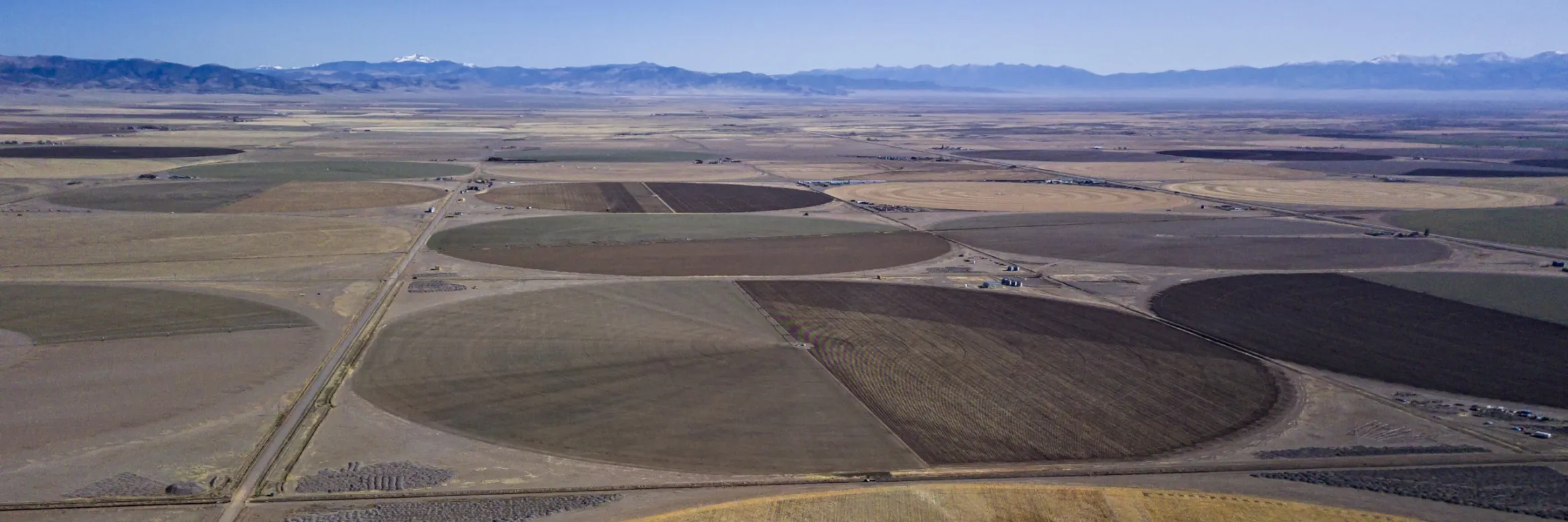


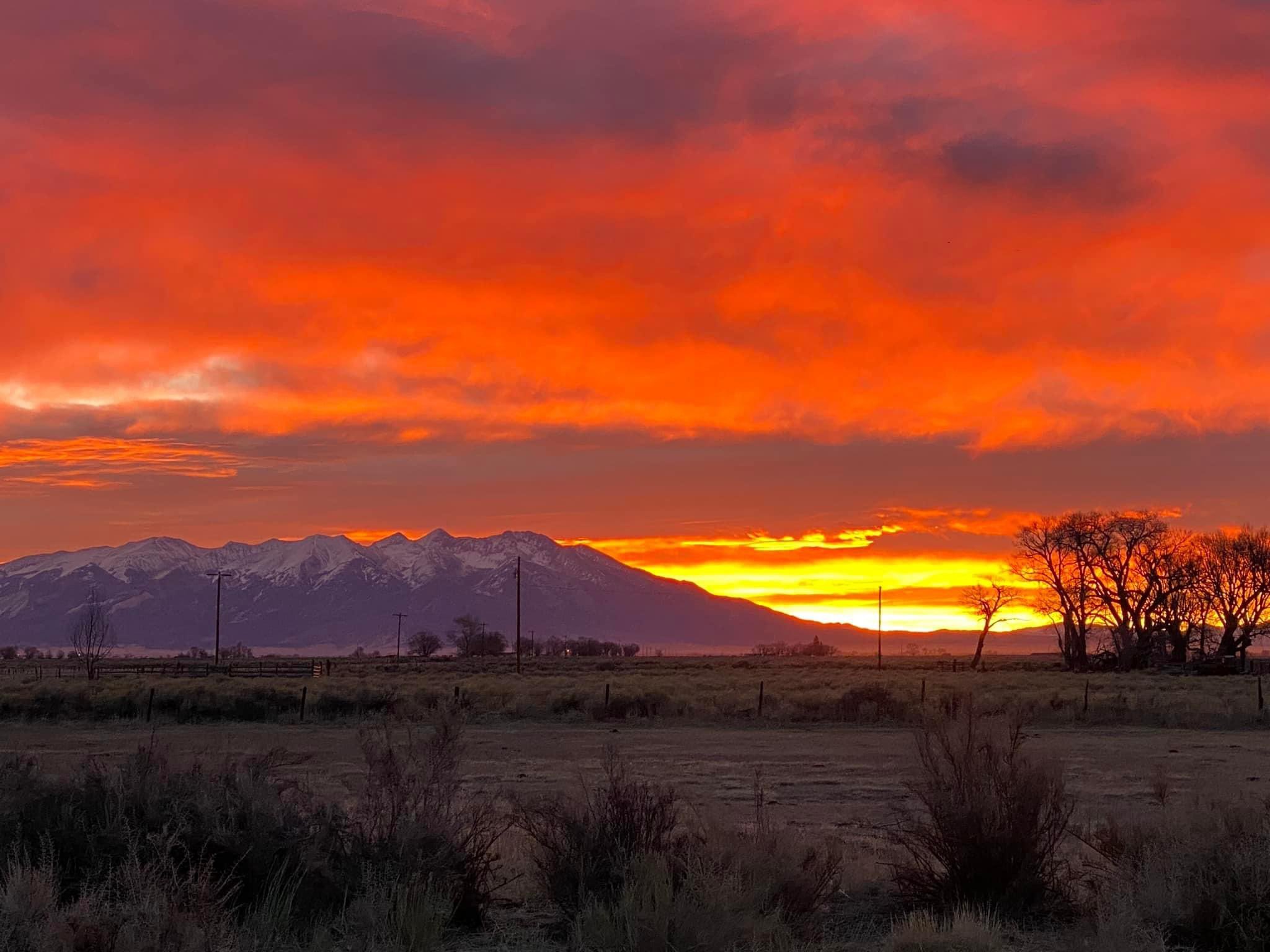
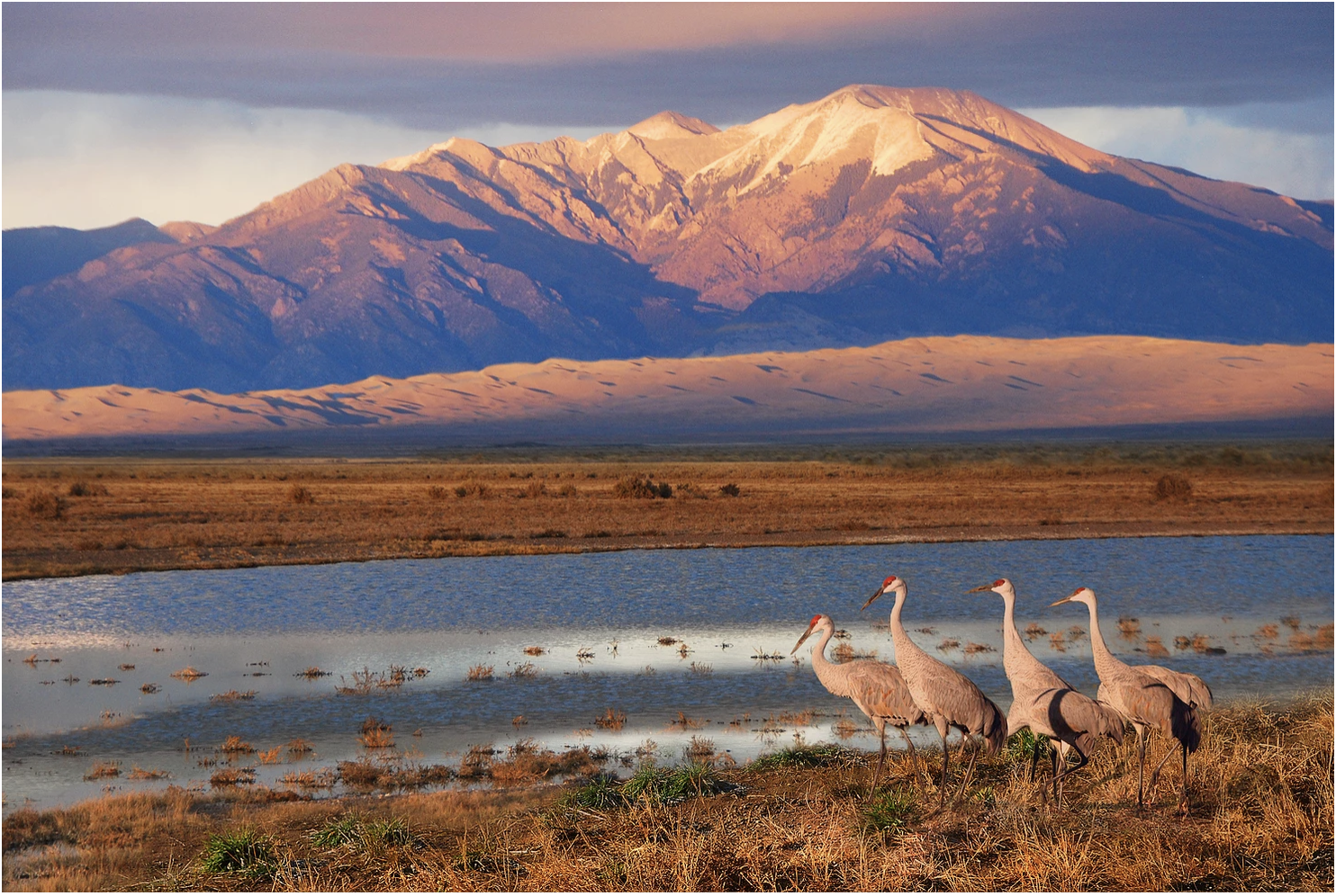


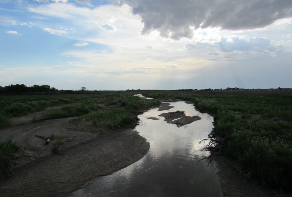


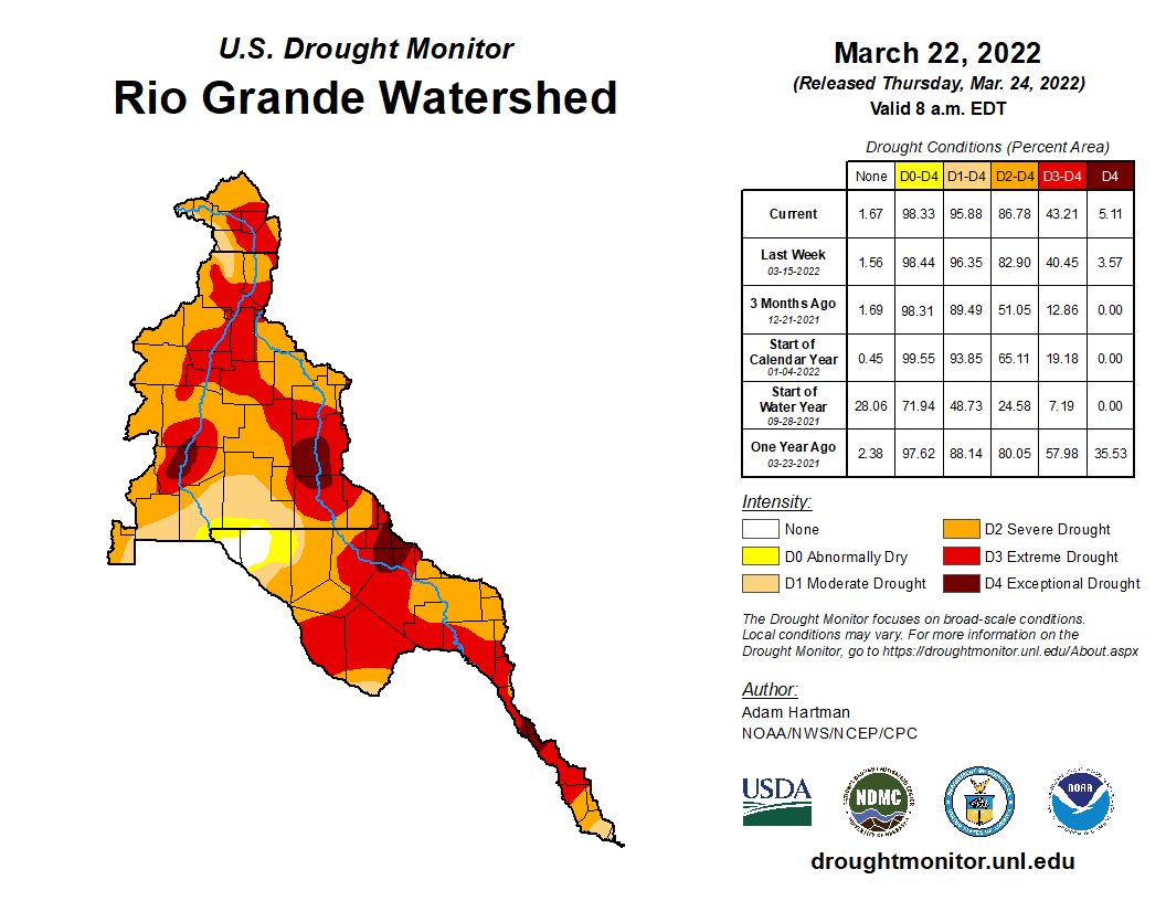


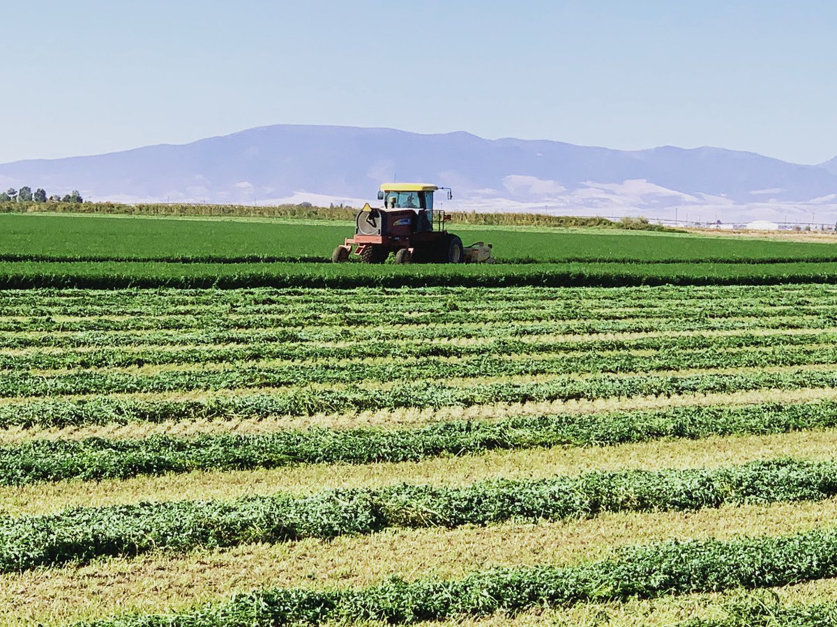


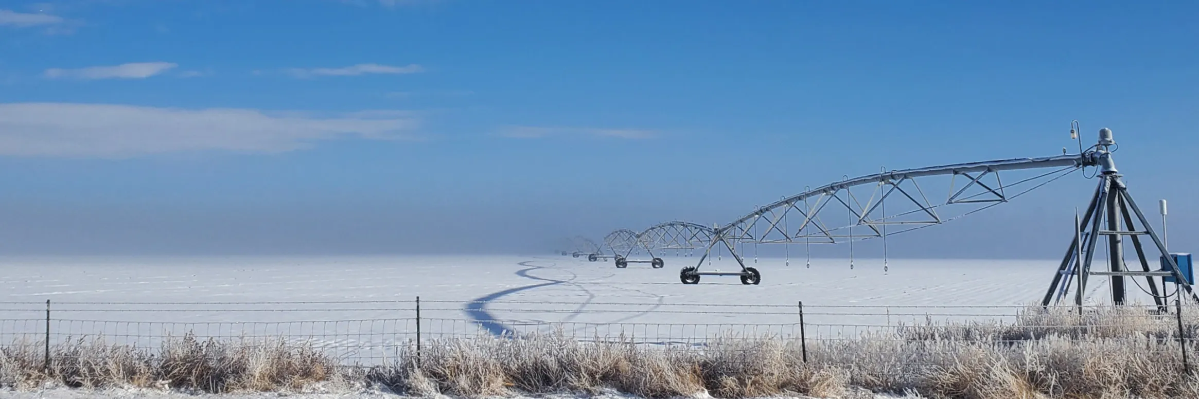
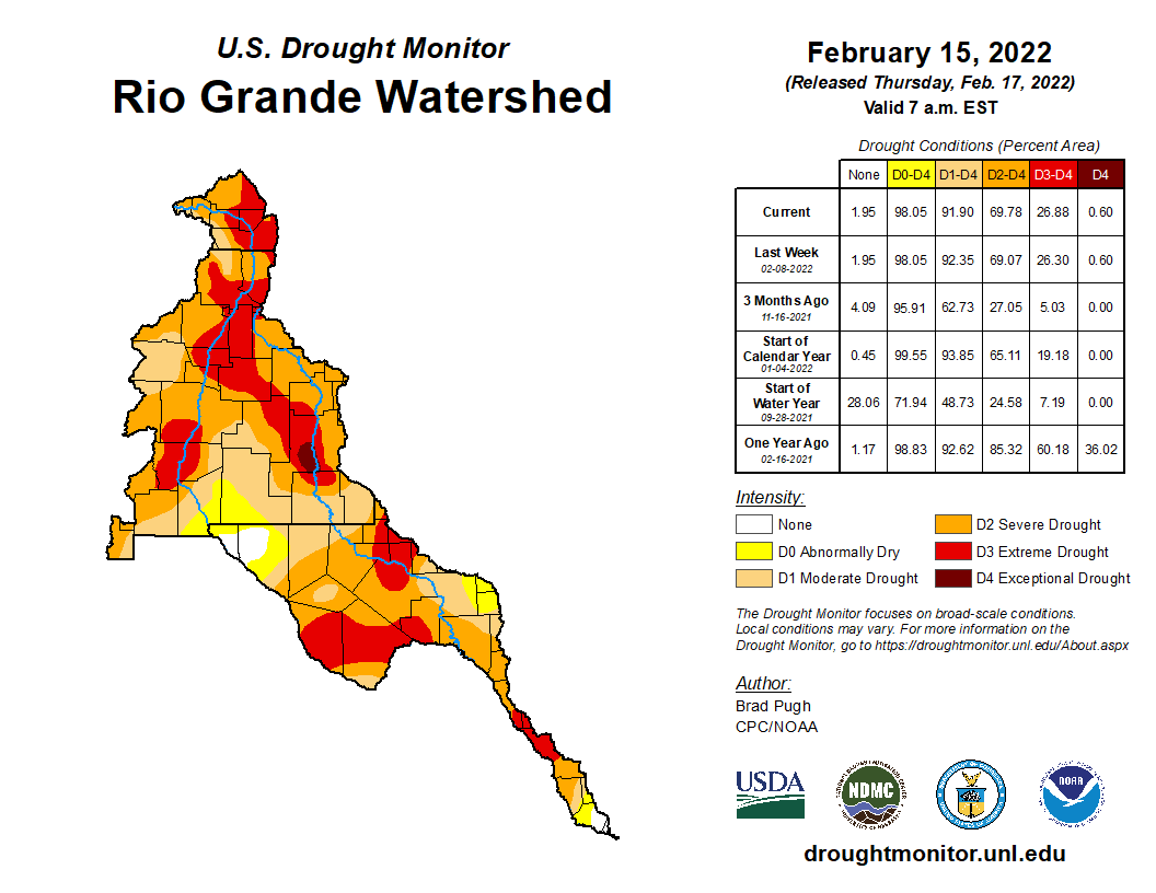


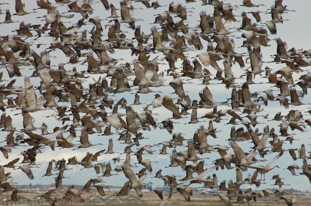


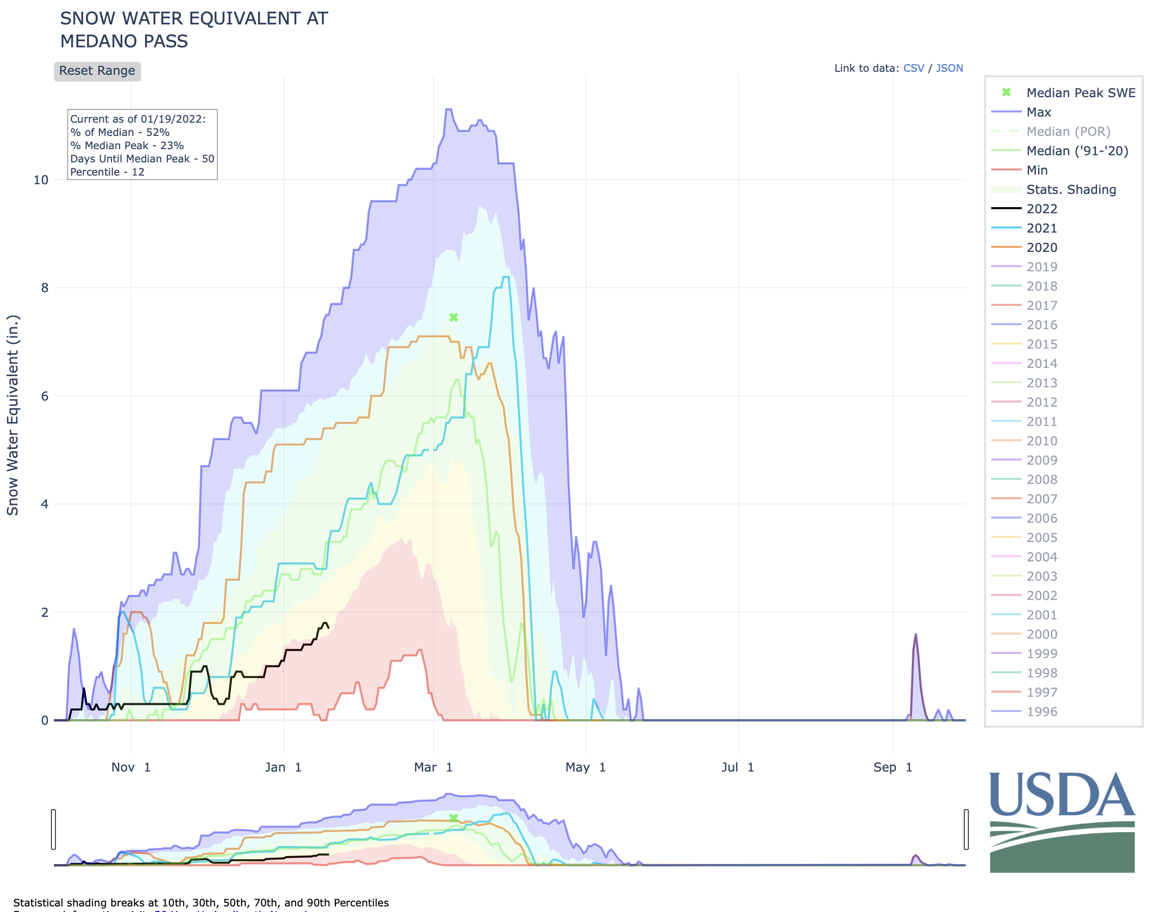
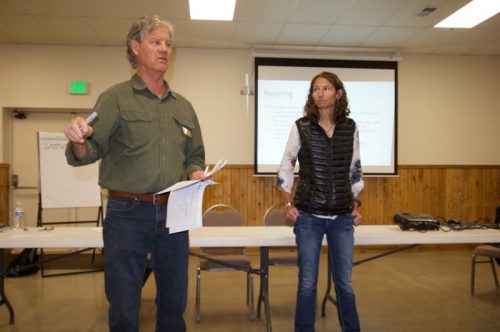
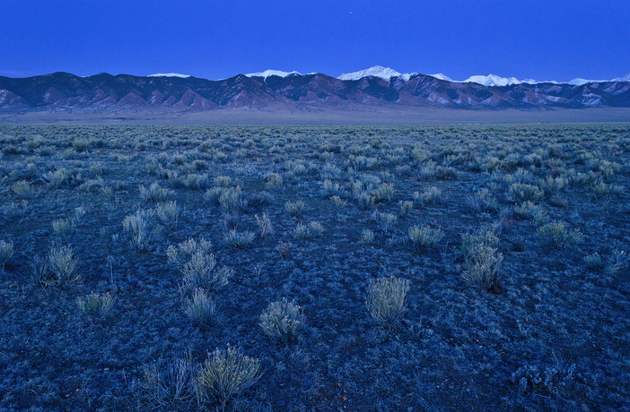


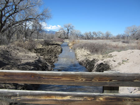


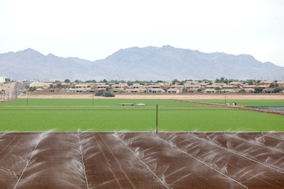

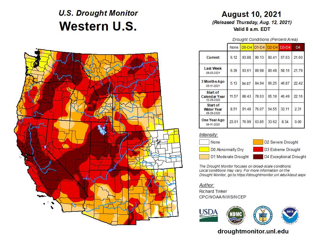

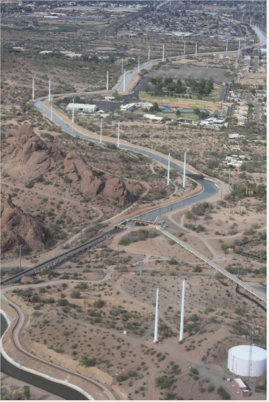


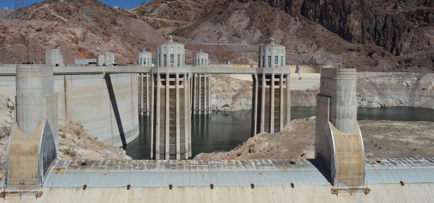


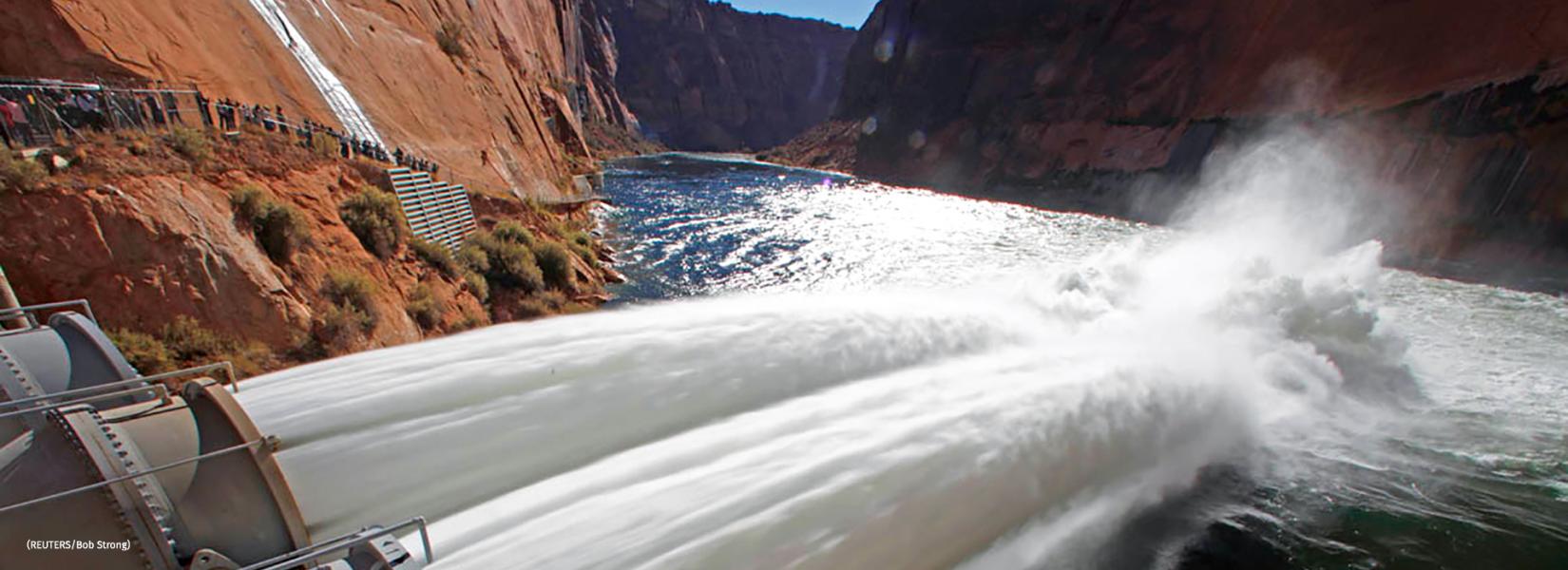


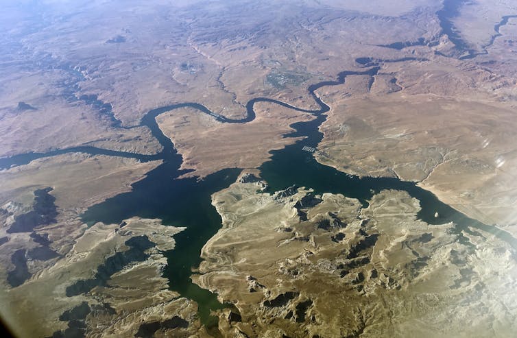
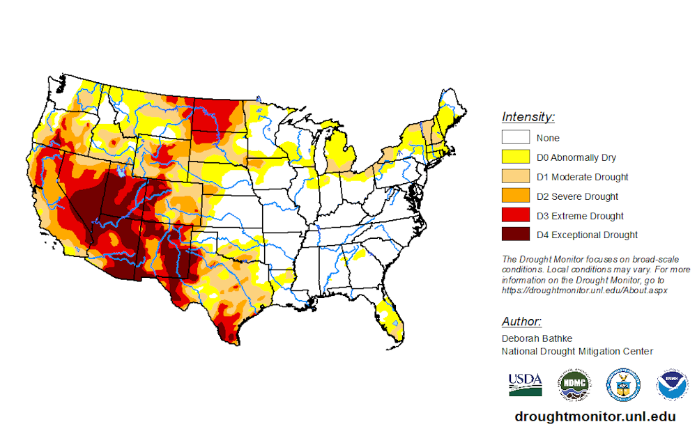
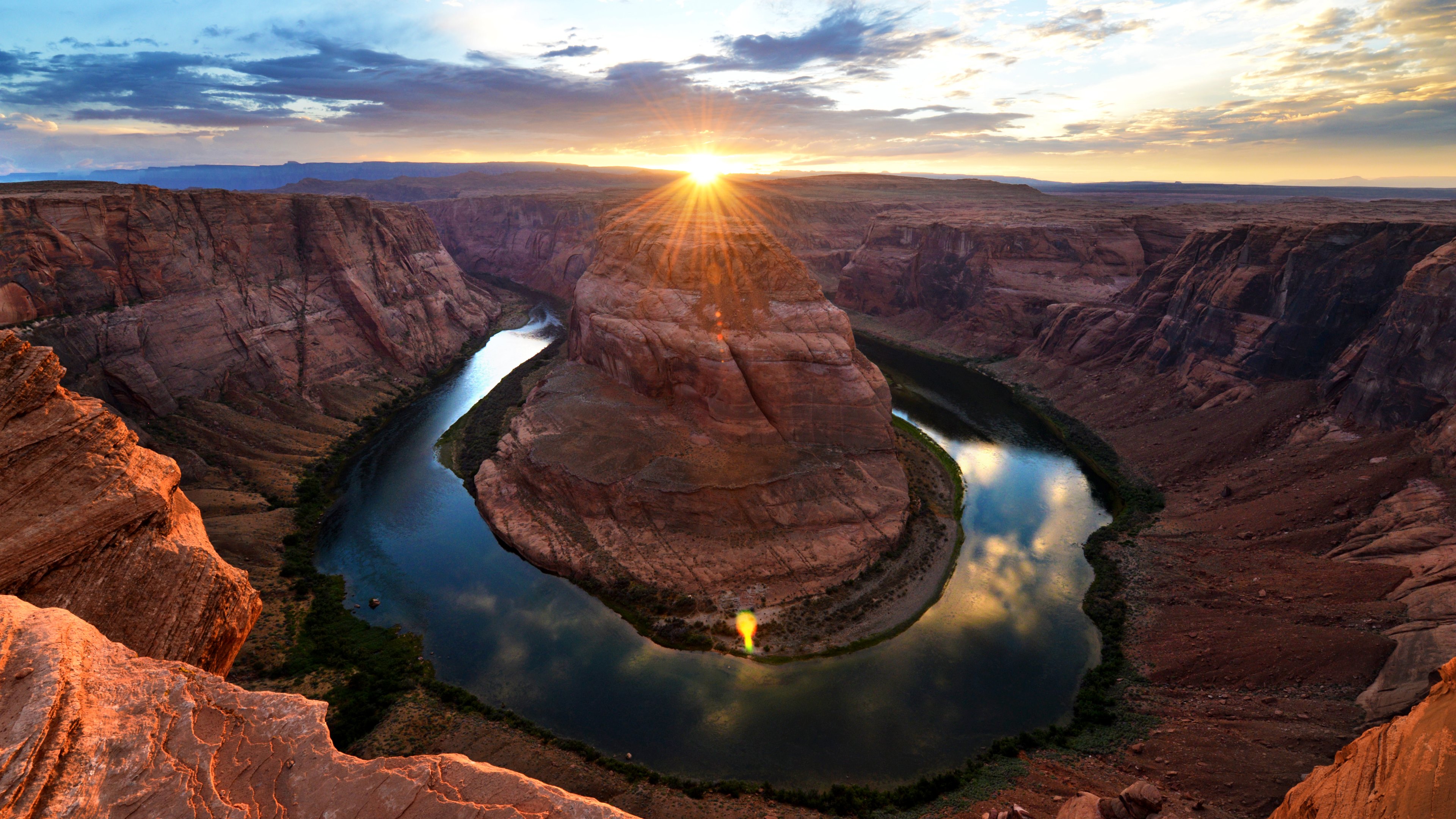
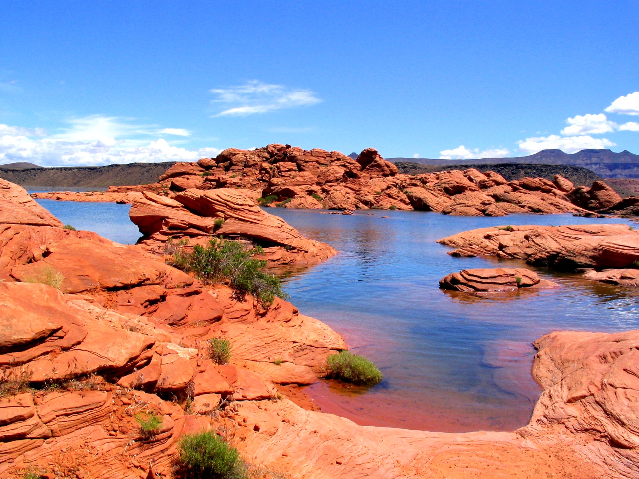


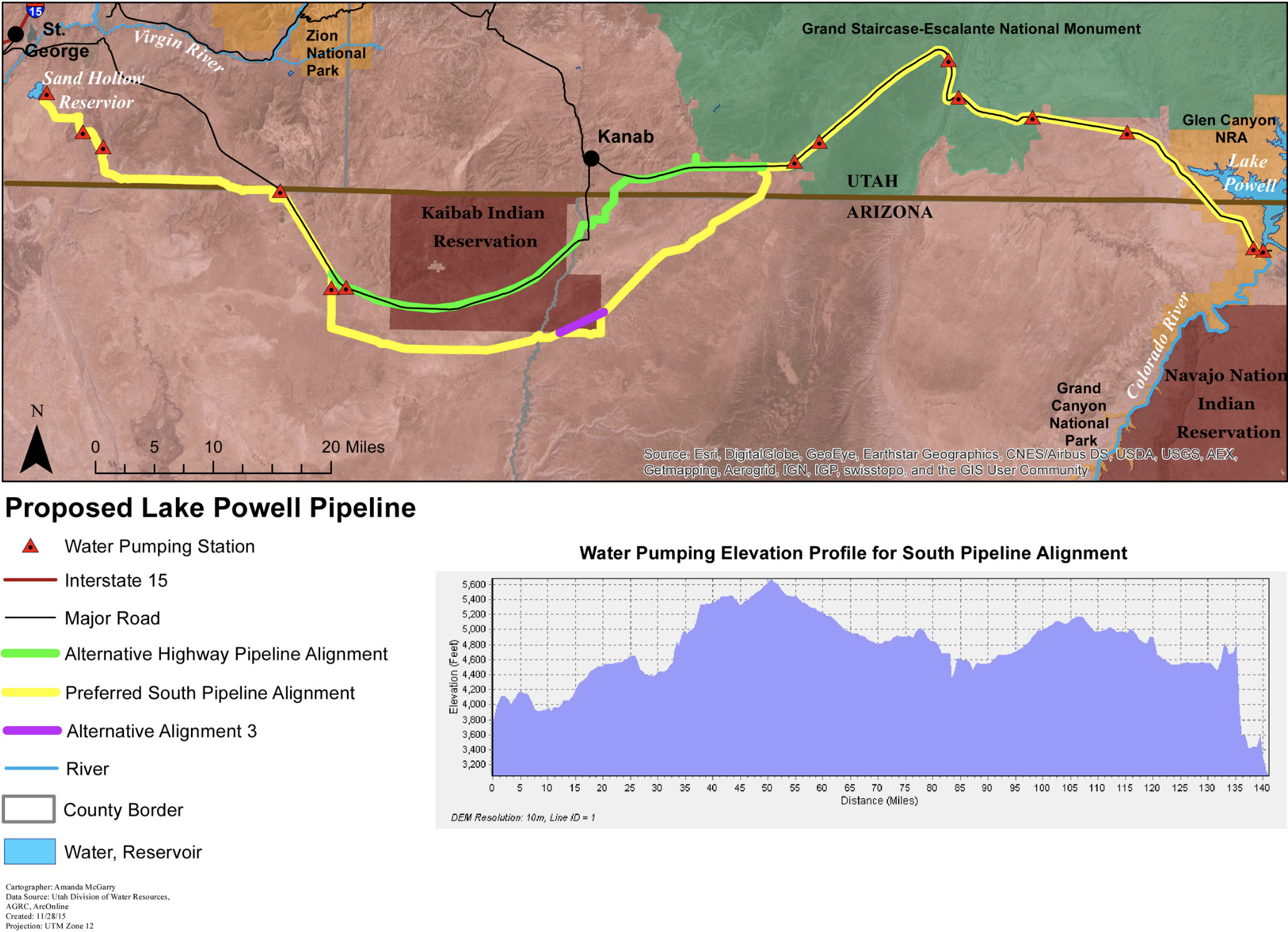

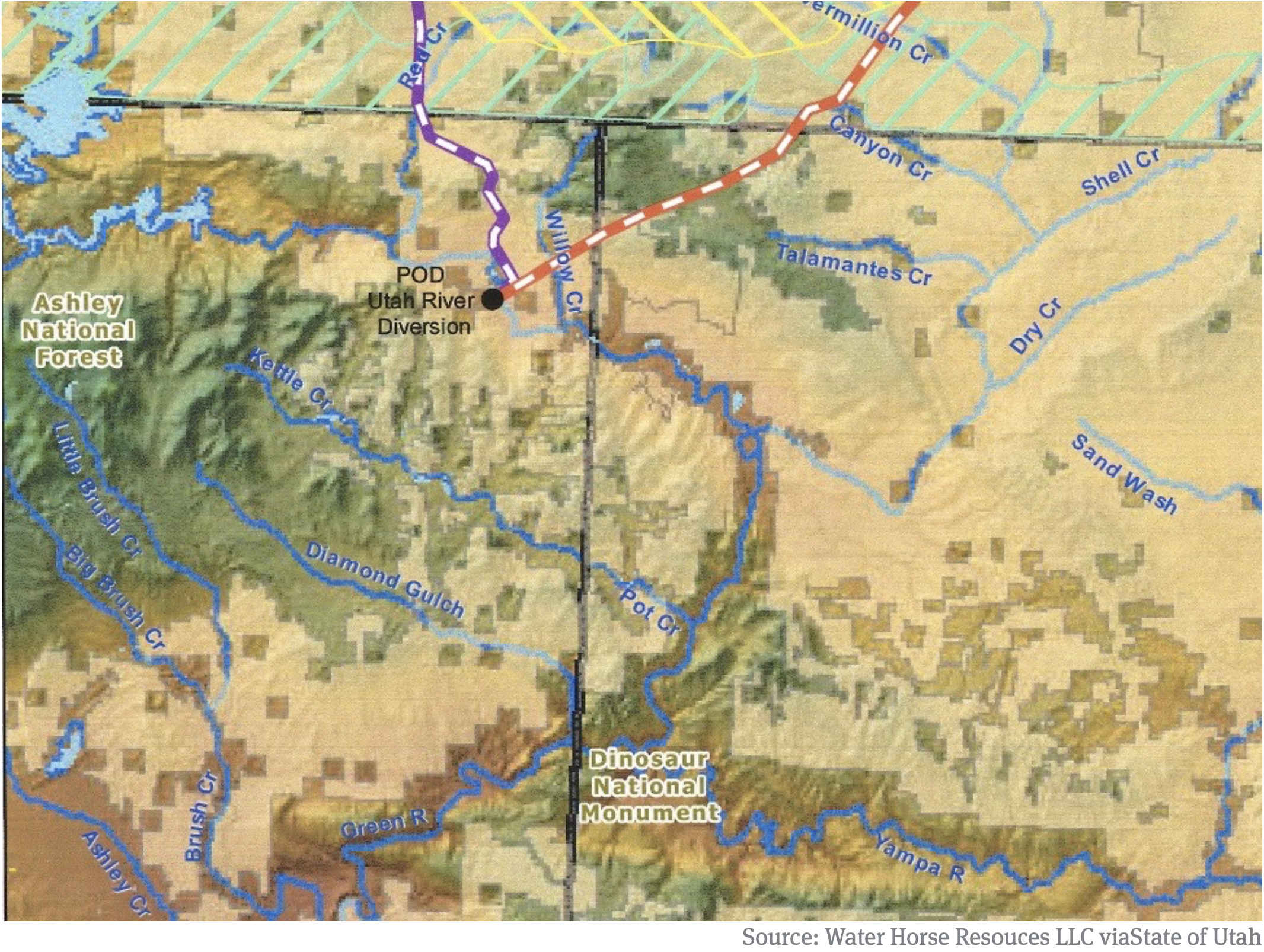


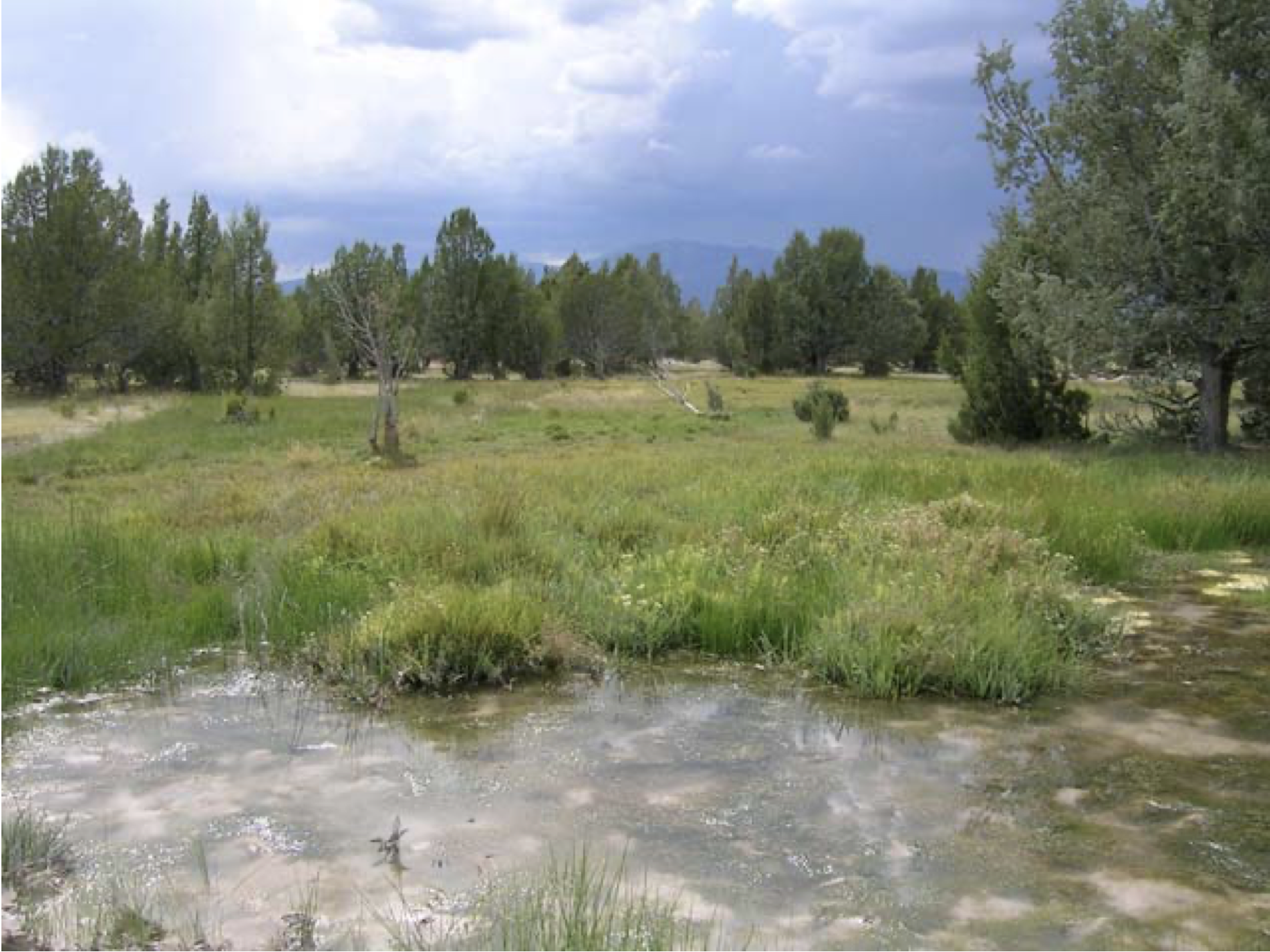
