Click the link to read the article on The Land Desk website (Jonathan P. Thompson):
April 30, 2025
🦫 Wildlife Watch 🦅
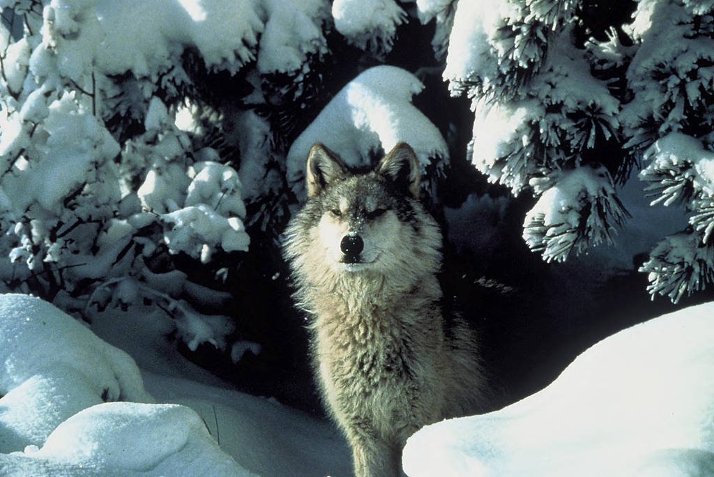
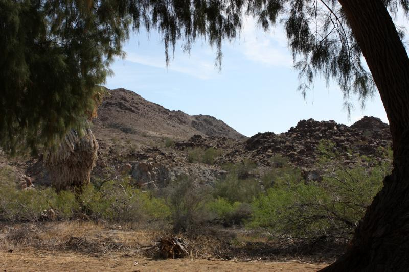
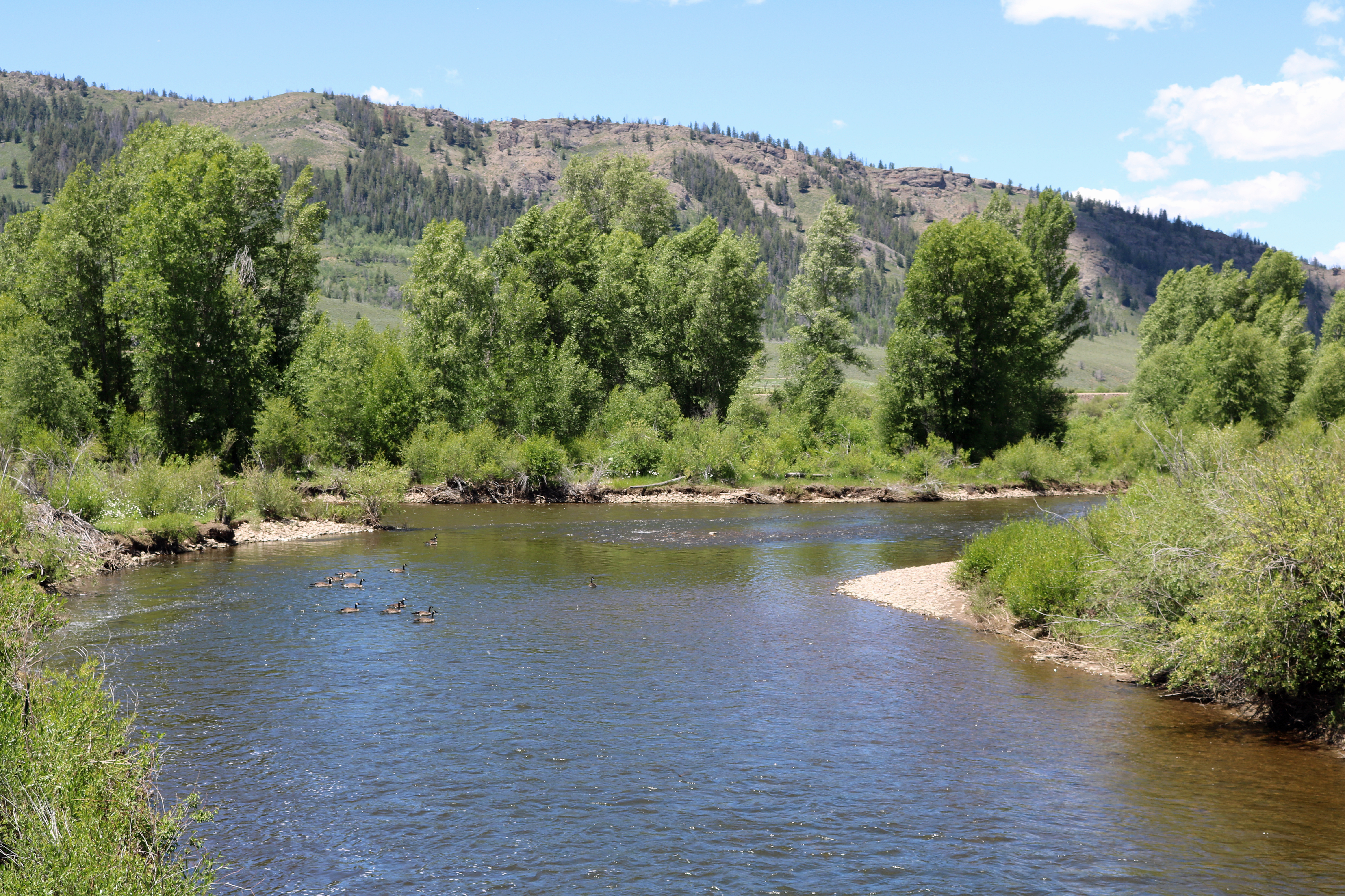
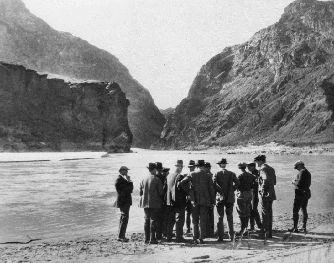
During the 1910s, a large gray wolf — christened Ol’ Big Foot by his human admirers and adversaries — roamed from one end of what is now Bears Ears National Monument to the other, from the sinuous White Canyon to Clay Hills, from the ponderosa-studded glades of Elk Ridge to the gorge-etched Slickhorn Country to the Colorado River where it tumbles through Cataract Canyon.
Big Foot was one of the last remnants of the pre-settler colonial era, a vestige of a time when the landscape — and the people who lived with it — existed in a more harmonious and balanced way. I’ve been thinking alot about this wolf, and its counterparts in other parts of the region in the years prior to the species’ extirpation, amid the news that Mexican gray wolves are making their way north from southern New Mexico and Arizona, and gray wolves reintroduced in northern Colorado are moving southward. Though it ended tragically, Big Foot’s story gives me an inkling of hope during hopeless times.
By the time Big Foot had established dominion over a big chunk of southeastern Utah, the Hole-in-the-Rock settlers had been in the region for a few decades, hunting the deer, elk, and bighorn sheep nearly to extinction, while livestock operators such as J.A. Scorup, the “Mormon Cowboy,” were also covering the vast swaths of un-roaded public domain with thousands of head of cattle and sheep. In other words, they were robbing the wolves, cougars, coyotes, foxes, bears, and lynx of their natural prey, and replacing it with another fatter and slower food source, with a predictable outcome.
Ol’ Big Foot was rumored to be the most efficient livestock culler around, and was constantly trailed by a pack of coyotes looking to scavenge his many kills. The big canine allegedly took down 150 calves in one fell swoop — although that figure is almost certainly exaggerated to provide further justification for slaughtering predators. Not that the invaders needed an excuse: Killing wildlife, especially charismatic megafauna, was part and parcel of the white settler colonial project, even in areas where livestock predation wasn’t an issue. The goal was not just to settle on the land, but to “settle,” or tame, the land itself; to rob the wilderness of its wildness.
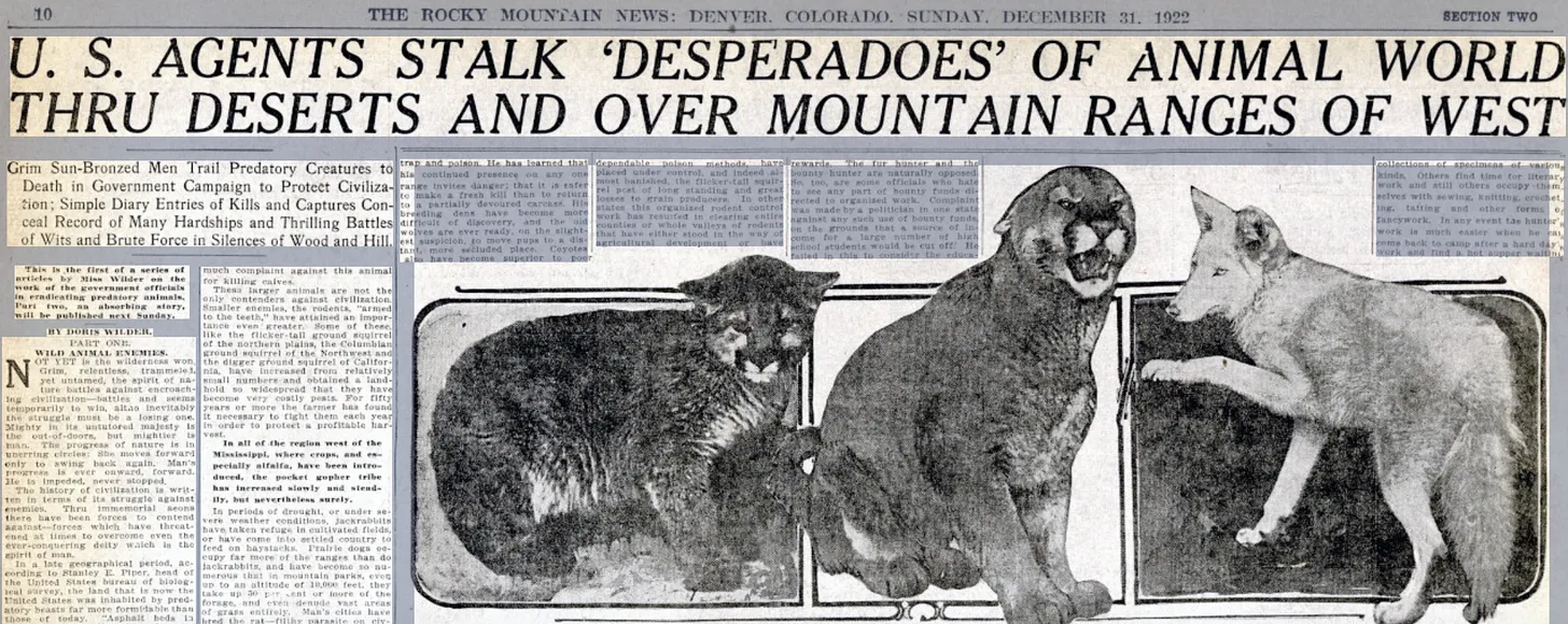
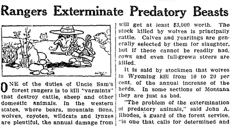
Ranchers and their cowboy hands were no match for the predators so, as is often the case, the fiercely independent Western individualists pleaded for government aid. Federal and county agencies paid cash for evidence of predator kills. La Plata County, Colorado’s “scalp records” from the late 1800s record payouts for some 300 hawk heads (at 25 cents apiece), 200 bear pelts, two-dozen mountain lion hides, and a handful of wolf skins. The mercenary killing spree took a heartrending toll, but it wasn’t enough for the ranchers. So in 1915 the federal government tasked the U.S. Biological Survey with the extermination of every predator in the West, by whatever means necessary, including rifles, traps, and poisons. The resulting systematic slaughter was popularly dubbed “Uncle Sam’s War on Varmints,” thusly described in a 1927 wire service story:

As twisted as it may be, the sentiment in the last phrase — that killing wild predators was actually preserving wildlife and saving other animals from extinction — was a commonly held belief. And the bizarre notion persists among many of those who oppose bringing the wolf back, saying they would compete with human hunters for wild game.

The death toll from the “war,” or attempted speciecide, is stunning. In 1924, for example, the government hunters reported killing 2,000 animals in Colorado, alone, including more than 1,700 coyotes, 153 bobcats, 50 lynx, 8 wolves, 6 mountain lions, 4 bears, and 2 wild dogs. The toll for wolves, cougars, and bears is relatively low because by that point, those species’ populations had plummeted. In 1919 the Biological Survey predicted the West would be wolf-free within five years, and estimated only 100 remained in Utah.
As the wolf populations declined hunters and newspaper reporters started focusing on individual animals, ascribing them with personalities and even christening them. The descriptions often read like those of human outlaws: a mix of fear, condemnation, and veneration.
“Lobo, a great gray wolf who was the king of the pack at Currumpaw, a vast cattle range in New Mexico, was a thinker as well as a ruler,” Ernest Thompson Seton told a newspaper reporter in 1905, after he had killed the wolf by using his dead mate as a decoy. Avintaquint, of the Vernal, Utah, area, was the “crafty leader of one of the wiliest brand of pillagers of the cattle range that ever roamed the west.” Two Toes feasted on lambs in the Laramie River region; another Big Foot led a pack in the Unaweep area of western Colorado; Big Lefty was known to be one of the largest and most cunning wolves in the Crested Butte area, even though he had lost a leg to a trap; and Big Tooth Ben loped about Valencia County, New Mexico.
Old Three-Toes was known not just for preying on livestock, but also for seducing domesticated ranch dogs, which she was forced to settle for since most of the males of her species had been slaughtered. She lived in southern Pueblo County in Colorado and, according to news accounts, would sidle up to a ranch house in the dark, “making her coming known by a peculiar howl. And when she left, the family dog often went with her. Several ranch dogs have paid the death penalty to trapper or hunter when found fraternizing with this vicious destroyer of ranch property.”
In 1923, government hunters trapped some of Three Toes’ pups and lured the matriarch in for the kill. It was an especially deadly time for the other famous wolves, all of whom were captured and killed, to much fanfare, via cruel methods in the early and mid-twenties. Many were poisoned, one dragged a trap for miles before being shot, and at least one was captured alive and used as a decoy to lure others into traps or shooting range.
The Salt Lake Telegram ran a piece on Old Easyfoot, “the celebrated wolf of eastern Kane county,” noting that the huge animal “battled six dogs into submission on Oct. 6, 1928, and gave up the fight only when he had been drilled through and through by the high powered rifles of the biological survey hunters.” Easyfoot’s stuffed carcass was later installed in the state capitol building.
Dr. A.K. Fisher, the Biological Survey’s Director, predicted in 1926 that “within a year Colorado would be a sportsman’s paradise because of the elimination of the wolf and the mountain lion.” He said only six wolves remained in the entire state: one north of Eagle; one north of Fruita; two near Mancos; and two that ranged into Colorado from New Mexico. “Coyotes are our greatest trouble at this time,” Fisher added. “But the elimination of the wolf has given us more funds to concentrate on coyote work and progress is being made against them.”

Fisher was a bit premature in his forecast — Colorado’s last wolf was killed in 1940, and they never got close to wiping out the coyote. Nor did he mention that even as the predator-killing campaign garnered success, the agency found itself putting more and more resources into exterminating prairie dogs, rats, squirrels, and rabbits. Go figure! But his assessment was correct: The wolf of the Western U.S. (outside of Alaska) was doomed, aside from a few specimens that traveled over the border from Canada or Mexico.
The war was not without its critics. In 1931, the American Society of Mammalogists called the biological survey “the most destructive organized agency which ever threatened the native fauna of the United States.” Not that it seemed to sway the agency from its mission, and by then it was too late for the wolf anyway.
In 1929, Arthur H. Carhart and Stanley P. Young wrote Last Stand of the Pack, a non-fiction account of the lives and deaths of the “last nine renegade wolves.” A passage from the Carhart’s introduction illustrates the sometimes contorted, sometimes conflicted, often bizarre attitudes towards wolves — which he refers to as cruel “wilderness killers.”

***
I grew up in southwestern Colorado in the 1970s and ‘80s. Our family vacations were camping trips — it’s what we could afford — and I started backpacking with friends up Junction Creek when I was 12. I don’t remember ever seeing a bear, a mountain lion, or even a bobcat. We knew they were out there, sure, but even black bears were rare enough that we didn’t think about securing our food in camp. My friends and I often prowled around under the light of a full moon without a single worry that we might make a tasty mountain lion meal.
Not only were the grizzlies and wolves long gone by then, but I don’t think I would have believed that at one time they were so plentiful in the San Juan Mountains that members of the 1874 Hayden Survey came to see them as unavoidable pests, encountering grizzlies nearly everywhere they ventured, even on 13,000-foot peaks. I lived right next to, and often ventured into the Weminuche Wilderness, a vast and rugged and untrammeled region, and yet wildness of the kind that flourished in pre-settler-colonial times remained a myth to me, something that may have existed but that was ungraspable, even to my active and sometimes zany imagination.
The idea that wolves or grizzlies would ever return to the region? Inconceivable.
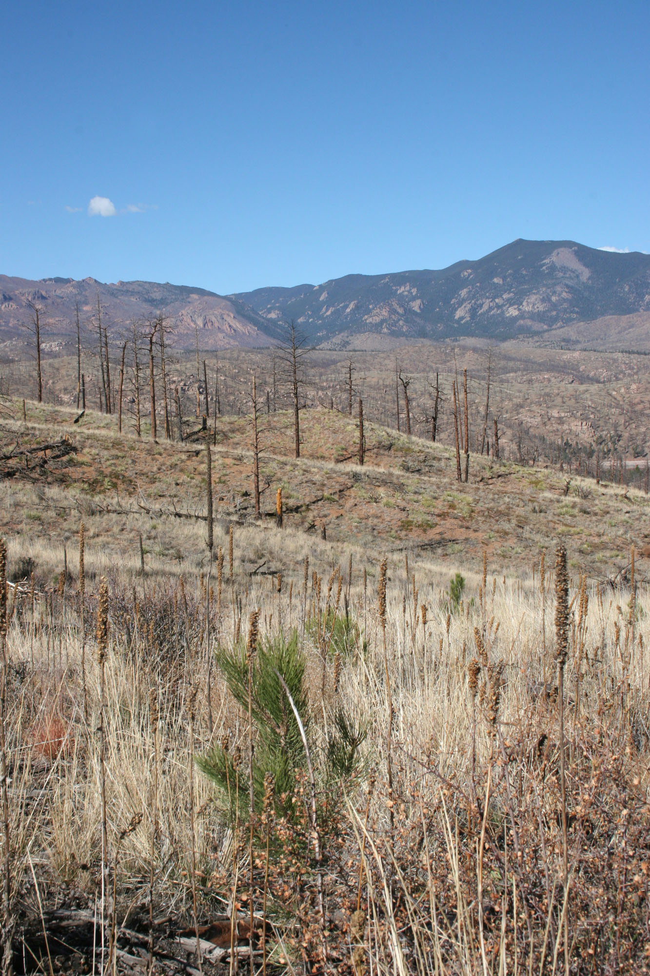
After all, the march of “civilization” and “progress” is linear, the human population and the resources it consumes and the space it occupies and the impacts it has is a runaway train barreling toward inevitable collapse. The climate will continue to heat up, the skies will grow smoggier, the forests will burn, the mighty saguaro will topple, wilderness and solitude will become increasingly commodified, even the coyote’s nocturnal yips will become a thing of the past. Or so it seems, especially in times like these, when greed’s toll becomes more and more apparent, when a huge bloc of the U.S. citizenry puts more value on the price at the pump than they do on the survival of the planet, when the people allow fear to override compassion and leaders cherish wealth and power over humanity and justice.
And yet. In my hometown of Durango, black bears roam freely and plentifully, purloining apples and pears and garbage. Herds of deer graze front lawns up in Tupperware Heights. Mountain lion sightings on the Test Tracks trails on the edge of town are frequent. Up in Silverton, moose-sightings are common, bighorn sheep lick the salt off the roads on Red Mountain Pass, and a lucky few catch a glimpse of Canada lynx. The wildlife, so rare in my youth, has returned, bringing a bit of wildness with it.
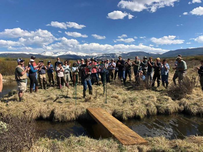
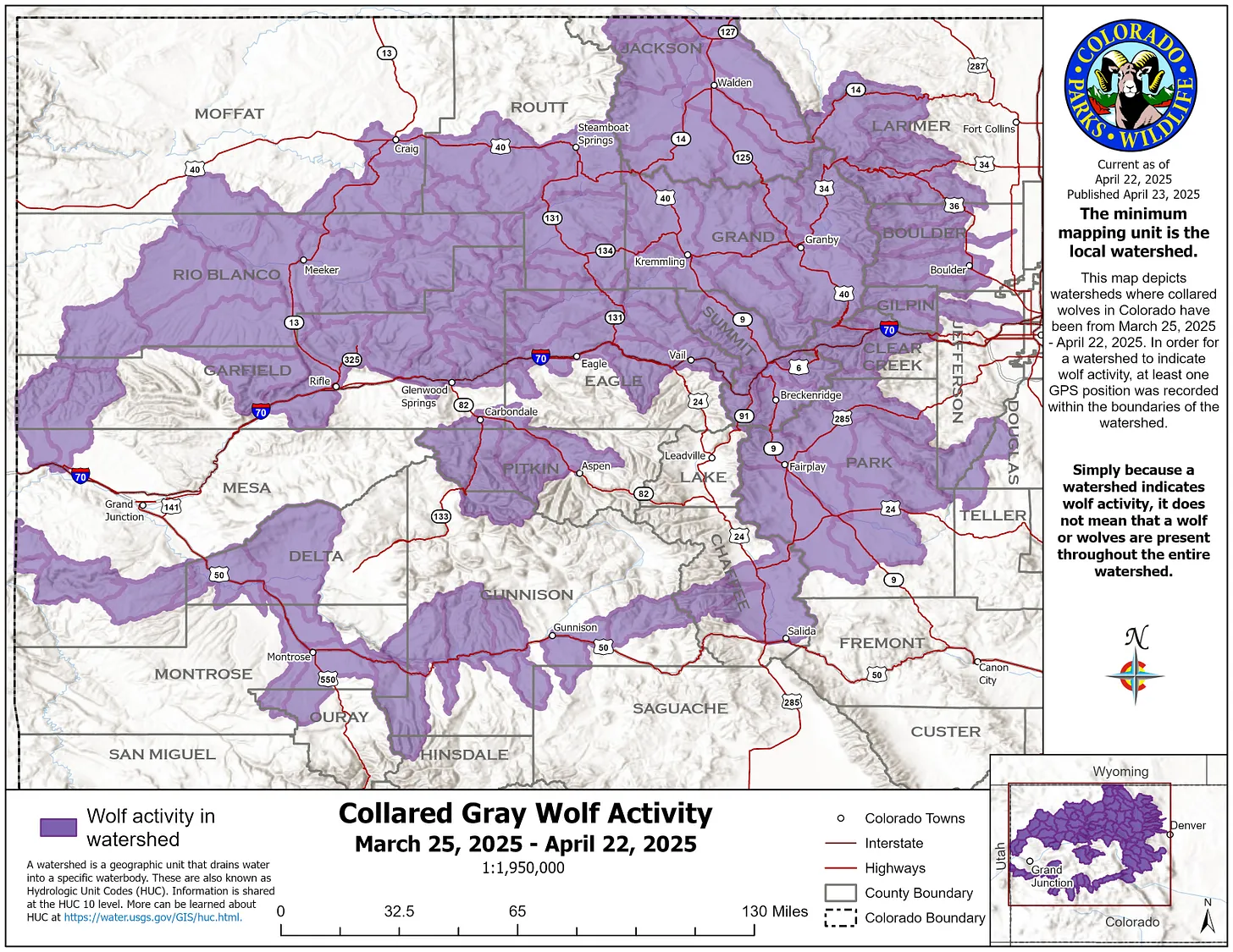
Nearly a century after Canis lupus was extirpated from the Southwest, there is a spark of hope, an inkling of possibility that the wolf will return to the Bears Ears country. In March, a Mexican gray wolf named Ella by local school children, was spotted north of Interstate 40 near Mount Taylor. It was killed by still undisclosed means, but it was an indication that the reintroduced wolf population in the southern part of the state is looking to broaden its horizons. And just last week, Colorado Parks & Wildlife published a map showing where radio-collared gray wolves, reintroduced in the northern part of the state, had roamed. One traveled some 1,200 miles, making it as far south as the Uncompahgre River watershed.
Some might argue that there is no longer a place in Colorado or southern Utah for the solitary wolf. There are too many people, too much development, far too many highways, too many public lands ranchers who refuse to learn non-lethal ways to deter predators, and too many right-wing politicians who despise the wolf and all it symbolizes. Maybe they’re right. Government hunters with Wildlife Services continue the work of their Biological Survey predecessors: Last year, they killed 58,000 coyotes and 317 wolves nationwide, adding to the toll taken by private hunters (hunting wolves is legal in the Northern Rockies, where the population has somewhat recovered), cars, and other causes.
Still, for every human that yearns for the wolf’s demise, there are ten filled with awe and wonder for what the species, and its return, represents. As old Big Foot’s story illustrates, the wolf is resilient. In the spring of 1920, a trap set by bounty hunter Roy Musselman out on Cedar Mesa a few miles east of Grand Gulch finally ensnared Big Foot, doing “what a dozen or more trappers are trying to do,” according to an account by A.R. Lyman following Big Foot’s death.
Lyman wrote that the twelve-year old, eight-foot long wolf had been tormenting ranchers for a decade at least, and had killed thousands of dollars worth of cattle. Big Foot foiled countless hunters and cowboys over the years, driving his bounty up to $1,000, and even Musselman had been on its trail for four years, catching seven other wolves during that time, including Big Foot’s mate. He had a distinctive howl that could be distinguished five miles away, Lyman wrote, “and he has led many an interesting race with white men and Indians, always making safe his escape by his speed and his knowledge of the country.”
His country is one of the few places in the U.S. that hasn’t changed all that much in the last 100 years. Another Big Foot would find plenty of landscape for roaming and many a nook and cranny for hiding out in. And now there are more deer and elk to eat (along with some slow-moving elk, if you know what I mean). I’ll leave you with Lyman’s words from April 1920: