

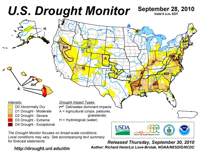
UCLA forecasters may be on to something. The Front Range has drifted into D1 (Drought-Moderate) status according to the U.S. Drought Monitor. Here’s a report on a recent UCLA forecast from NewDesignWorld. From the article:
“If I were concocting a recipe for a perfect drought, this would be it,” said Glen MacDonald, co-author of the study and director of UCLA’s Institute of the Environment and Sustainability. Along with a former graduate student, MacDonald has found that the combination of La Niña with two less commonly known ocean conditions — the Pacific Decadal Oscillation and the Atlantic Multidecadal Oscillation — tends to result in drought in the upper reaches of the Colorado River. The ocean conditions have been known to diminish precipitation in the Southwest but, examined separately, have proven to be poor indicators of drought conditions in the upper reaches of the river.
“It’s the combination that’s key,” said lead author Abbie Tingstad, who conducted the research as a graduate student in geography at UCLA. She is now an associate physical scientist at the RAND Corp.
The convergence of these patterns in the Pacific and Atlantic oceans may well drive water levels in the Lake Mead reservoir below a critical threshold and could potentially result in reduced water allocations for Arizona and Nevada, the researchers say…
By studying ancient tree rings, Tingstad and MacDonald were able to reconstruct river flow and winter snowpack levels going back several hundred to almost 1,000 years for a mountainous region of northeastern Utah. Responsible for 10 percent to 15 percent of the flow in the river, the Uinta Mountains region has a climate representative of the upper Colorado River basin, the researchers say, so conditions experienced there are similar to those that occurred elsewhere in the upper basin. The tree rings came from a combination of dead and living pinyon pines that grow on extremely dry slopes in the Uintas. Described by Tingstad as “listening posts for climate variability and drought,” the trees produce annual rings that are so sensitive to water stress that the researchers can track changes in annual precipitation on the order of an inch by studying them under microscopes. Tingstad and MacDonald then compared their records with existing records for La Niña, the Pacific Decadal Oscillation (PDO) and the Atlantic Multidecadal Oscillation (AMO). During a La Niña episode, the sea-surface temperature across the Pacific Ocean at the equator plummets by as much 18 degrees Fahrenheit, resulting in drops in precipitation rates of as much as 50 percent across the southwestern and southeastern United States for between five and 18 months.
The PDO is a pattern of climate variability with longer-term shifts that last between 20 and 30 years and also affect weather. A negative PDO is characterized by cooler sea-surface temperatures off the Pacific Coast of North America that can result in below-average precipitation in the southwestern U.S. The effect can be thought of as an extended La Niña event. Each phase of the AMO can last for more than 60 years and is characterized by temperature changes in the North Atlantic Ocean. In its positive phase, the AMO has little impact on California weather if it occurs in absence of a negative PDO. But the positive AMO has been linked to past occurrence of major droughts in the Midwest and the Southwest, including the Dust Bowl of the 1930s. “It’s three different things working on different times scales,” MacDonald said. “You may not get them to line up that frequently.”
Tingstad and MacDonald found a “striking and significant propensity” for droughts in northeastern Utah when cool sea-surface temperatures in the Pacific associated with La Niña and the negative phase of the PDO were coupled with warm temperatures in the North Atlantic linked to the positive phase of the AMO. During such episodes, snowpack declined on average between 9 percent and 10 percent, and river discharge decreased on average by 18 percent. The three conditions last converged at least five times between 1945 and 1965, a period that was characterized by generally depressed but variable flows in the river, they said. The findings are troublesome because not only are all three conditions predicted for 2010–11, but they are expected to be particularly strong, the researchers say. The coming year’s La Niña and AMO are at this point supposed to be the strongest in 10 years, and a strong negative PDO is also building.