
From email from the Colorado Water Conservation Board:
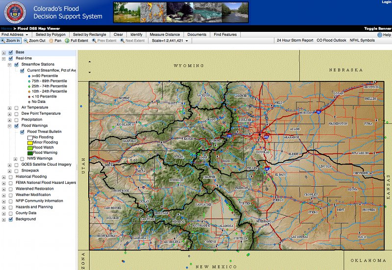
The Watershed and Flood Protection Section of the CWCB is proud to announce the launch of the Flood DSS website. The Flood DSS is a comprehensive map viewing site, created with the goal of bringing together all of Colorado’s flood-hazard and related information. The site includes 3 different map applications: 1) The Flood DSS Map Viewer contains effective FEMA floodplain boundaries, real time weather and streamflow conditions, local and county flood related data, CRS information, historical flood information, and weather modification and watershed restoration data; 2) The Weather Modification site allows a user to review data and assess current snow conditions near weather modification locations, and 3) The Watershed Restoration site allows users to focus solely on information pertaining to watershed restoration activities.
Community officials will be able to access Preliminary FEMA DFIRM mapping products via a password protected section of the site. Officials may request the password from thuy.patton@state.co.us .
The Flood DSS can be accessed directly at http://flooddss.state.co.us, or via a link under Technical Resources on the CWCB website.
Comments, questions, or issues with the site may be directed to Carolyn Fritz.
More CWCB coverage here.