
Click here to go to the CWCB’s Colorado Flood Threat website. Here’s an excerpt from the June 26 update:
An area of cloudiness and disorganized showers and thunderstorms extends for several hundred miles offshore of the coast of southern Mexico and Central America. An area of low pressure is expected to form in a couple of days within this region of disturbed weather south of the coast of Mexico. According to the National Hurricane Center, conditions appear favorable for this system to become a tropical cyclone by late this weekend or early next week while it moves west-northwestward. As it does it’ll set off a chain of events that will culminate with the emergence of the 2014 summer monsoon in Colorado.
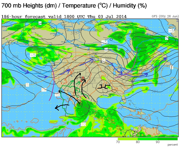
The figure [above] shows the NOAA GFS model forecast for ~10,000 ft over the United States and bordering areas. The blue arrows show the Pacific storms track moving into a more northerly location. The black arrows highlight flow of monsoon moisture into the Southwestern states ahead of a tropical disturbance near the Gulf of California. Based on this forecast expect a weak surge of monsoon moisture into the West Slope for July 3-4 followed by a stronger surge July 10-15. This latter surge will likely enhance the threat of flooding statewide and begin a new summer storms season statewide.