Hotchkiss #water system looking good: Restrictions remain due to drought

East Bridge Street in Hotchkiss, looking towards Mt. Lamborn. By Jeffrey Beall – Own work, CC BY-SA 3.0, https://commons.wikimedia.org/w/index.php?curid=25377313

From The Delta County Independent (Lisa Young):

While recent monsoonal moisture has been a welcome relief for drought-stricken North Fork Valley, residents in Hotchkiss need to continue to conserve water. That message came late during a special water work session held by the town council last week.

“I would think that we’re going to keep our water restrictions at this point and time”, said Mayor Larry Wilkening. “I think the rains that have been coming through are great, but until we get snow pack and rain and maybe two years worth of good water then I think we need to have them.”

The water work session was scheduled to help the town council get a better grip on how Hotchkiss water works and to sort out how they should handle ongoing out-of-town water tap requests.

Mayor-Pro tem Mary Hockenbery requested the water work session last month in the absence of the mayor saying she’d like to have some kind of guidelines for issuing out-of-town water taps…

Fagan and Public Works Director Mike Owens provided the council with a detailed overview of the town’s water system including the town’s raw water supply and demand, water transmission, treatment, storage, distribution and future water challenges.

Fagan showed a map of the water system overview beginning with the raw water supply primarily coming from the Carl Smith Reservoir north of Hotchkiss and then flowing into the Leroux Creek in the Leroux Creek Watershed.

The raw water flows in Leroux Creek to the Highline Canal where the town diverts the water through a sand trap and then to a pipe that carries water to the pre sedimentation ponds above the water treatment plant, Fagan said.

After the water settles, it flows to the water treatment plant where a microfiltration system is used year round to screen out all particles larger than one micron. According to Fagan’s slide presentation, during the warmer months the water is pre-treated with a coagulant, flocculated and settled in clarifiers before running through microfiltration modules…

Fagan said while the town treats water for Rogers Mesa it does not supply the raw water. Paul Schmucker, water commissioner, discussed the town’s water rights and how they affect future usage and storage. There was also a lengthy discussion on the town’s bulk water system usage. Fagan explained that the bulk system is a fraction of the town’s water usage.

As #LakePowell woes worry West, experts call for yet more reduced use — The #Montrose Daily Press #aridification #ColoradoRiver #COriver

A longer walk from the dock to the water is in store for boaters at the Elk Creek marina, Blue Mesa Reservoir. Blue Mesa is being drawn down to feed critically low Lake Powell, as continued dry weather and rising demand deplete the Colorado River.
(Courtesy photo/National Park Service) via the Montrose Daily Press

From The Montrose Daily Press (Katharhynn Heidelberg):

“The inescapable truth is that the Colorado River system is seeing declining flows and for the foreseeable future, is likely to continue on that trend. So we have to adjust expectations and water use accordingly,” [Andy Mueller] said…

Year after year of dry conditions hammered the river and, this year, dropped Powell so low that Blue Mesa Reservoir and others in the Upper Basin had to release water to keep Powell’s power turbines turning.

“It’s our water balance. Last year and this year have been terrible,” said Anne Castle, former assistant Secretary of the Interior for Water and Science during the Obama Administration, during an Aug. 5 webinar hosted by the Colorado River District. Castle is currently senior fellow at the Getches-Wilkinson Center for Natural Resources, Energy and the Environment at the University of Colorado law School…

Given climate science predictions, the poor water years have not been a surprise, she said — but Powell dropped 50 feet last year, equating to 4 million acre feet of water no longer available. The reservoir is projected to drop within six months to the dreaded 3,525 feet elevation, the baseline for power generation and meeting the river compact requirements…

On top of it, the compact prohibits the Upper Basin from depleting more than 75 million acre feet over 10 years (so that it can deliver an average of 7.5 million acre feet a year to the Lower Basin)— a “guarantee,” as far as the Lower Basin sees things, while the Upper Basin’s perception is Lower Basin states are vastly overusing their water.

Under that rolling 10-year average, the Upper Basin has delivered 92 million acre feet, which is well above its obligation, but that is projected to drop to 82 million over 10 years and, if poor hydrology continues, could plunge even further, which stands to put the Upper Basin below its obligations…

Lake Powell not only provides a “savings account” to meet the Upper Basin’s compact obligations, but generates hydropower that is used throughout the basin, [Steve] Wolff said.

That hydropower in turn generates revenue, which flows back to the Upper Basin for infrastructure, Endangered Species Act compliance programs and salinity control…

Changing the rules will have ripple effects on both users and the economy, she said. Although the Upper Basin sees overuse by the Lower, the Lower Basin says it has cut use; is doing what the compact allows, and that the Upper does not have a plan for demand management, [Castle] also said.

“Everyone’s got their grievances and their legal theories. … There’s not enough water for any of the lawyers to be right 100%,” Castle said.

The task is to equitably manage use — and that means reducing it, she said.

Powell is sitting at 32% full and Mead, at 35% full, Mueller said…

The Colorado River Compact accords to the Lower Basin an additional 1 million acre feet. The Upper Basin’s argument is that this is supposed to account for use from the Gila River, a tributary. The 1.5 million acre feet to Mexico under treaty is to be provided from surplus, unless there is a shortage on the river.

What constitutes a shortage is a point of contention between Upper and Lower Basin states, but Mueller said it’s the Upper Basin’s position that the Lower Basin is undercounting its consumptive use.

The Upper Basin uses 4 million to 4.5 million acre feet per year, well below its allocation, while the Lower Basin and Mexico (most years) use their full allotments.

The Lower Basin has use of 2 million to 2.5 million acre feet in tributaries and loses another 1 million to 1.3 million acre feet in federal reservoir evaporation or loss during transit.

Mueller said that evap is not accounted for in the Lower Basin’s consumptive use, which even without it is at 7.5 million acre feet. Evaporation from the Upper Basin’s reservoirs, including Blue Mesa, is counted as consumptive use, and the Upper Basin is still only using 4.5 million acre feet of its allocation, Mueller said…

Through reservoir evap, transit losses, system losses, Lower Basin tributary consumption (excluding Mexico deliveries), species conservation and purported inefficiencies having to do the groundwater storage in Arizona, more than 1.1 to 1.3 million acre feet a year is being lost. Taking the low end of those estimates, over 10 years, more than 11 million acre feet of water would be available in the system had the overuse been addressed, Mueller said…

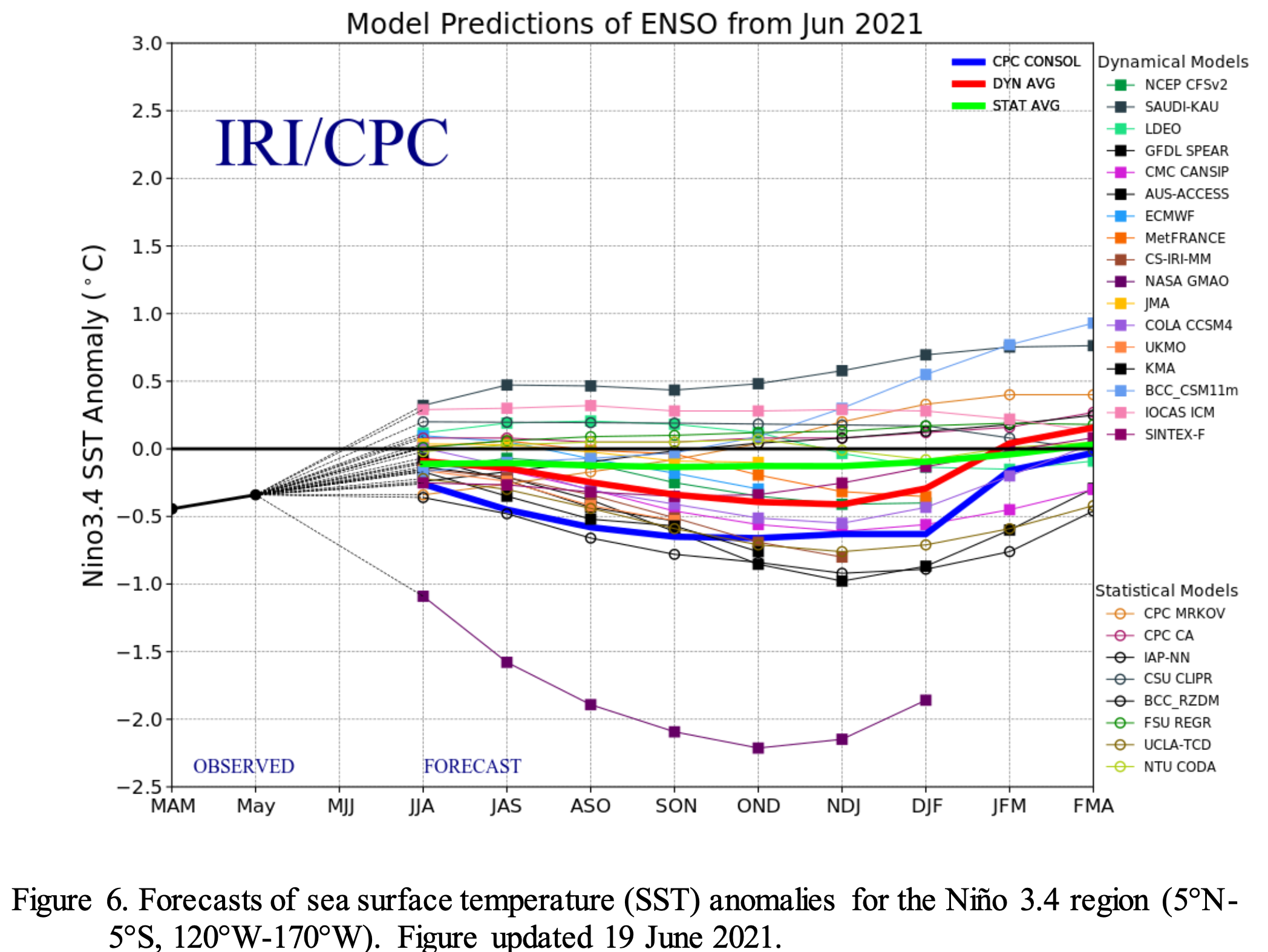
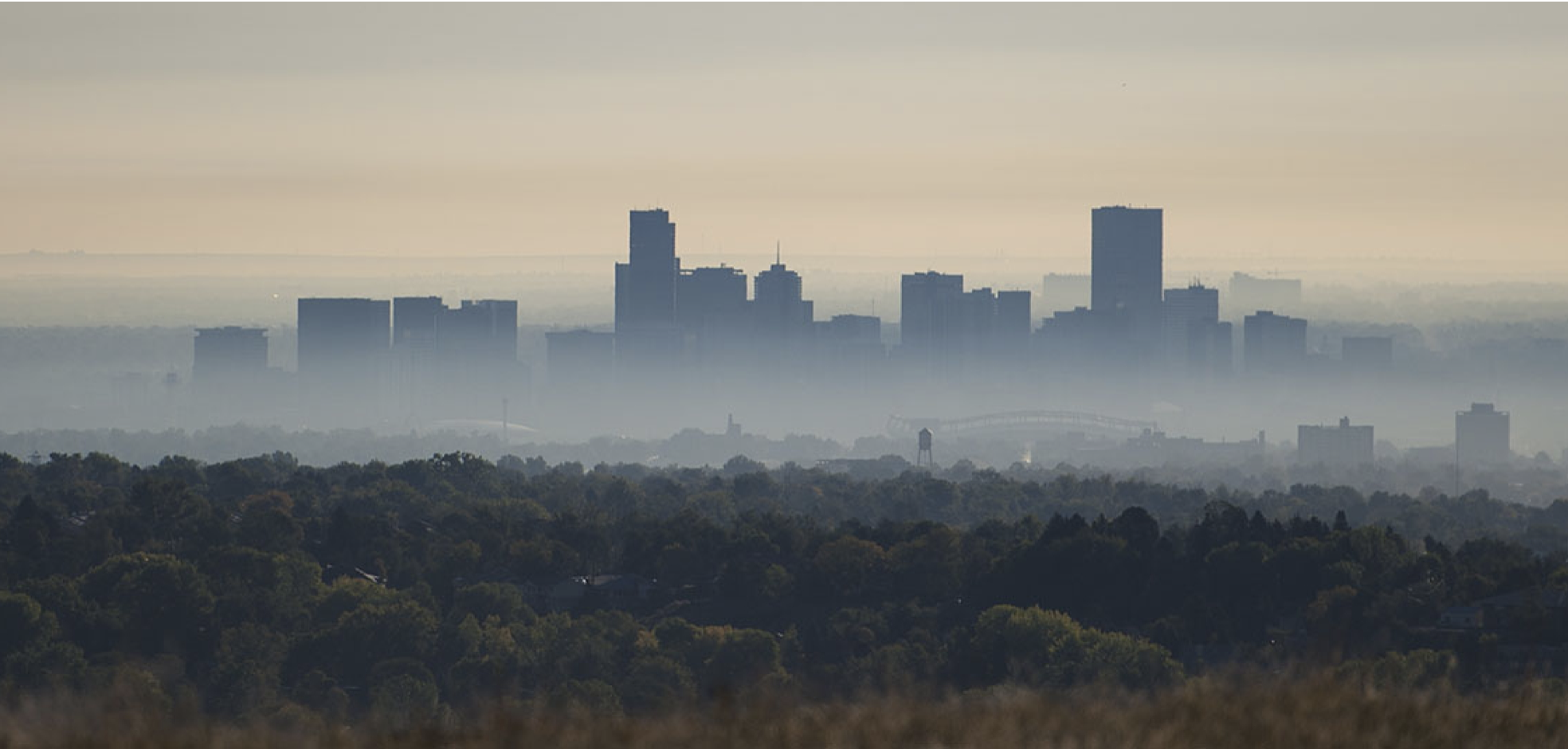
Climate change and rising temperatures concern everyone in the Southwest, [Mueller] also said.

“It’s not a political statement from me. It’s a fact we’re seen that temperature increase,” Mueller said Aug. 5, referring to data between 1895 – 2018.

For every 1 degree rise in temperature, streamflow in the Colorado River system decreases 3 to 8%, he said, citing U.S. Geological Survey data.

“The bottom line is, we have seen and should expect to continue to see decreasing flows in a system that is already stressed,” Mueller said…

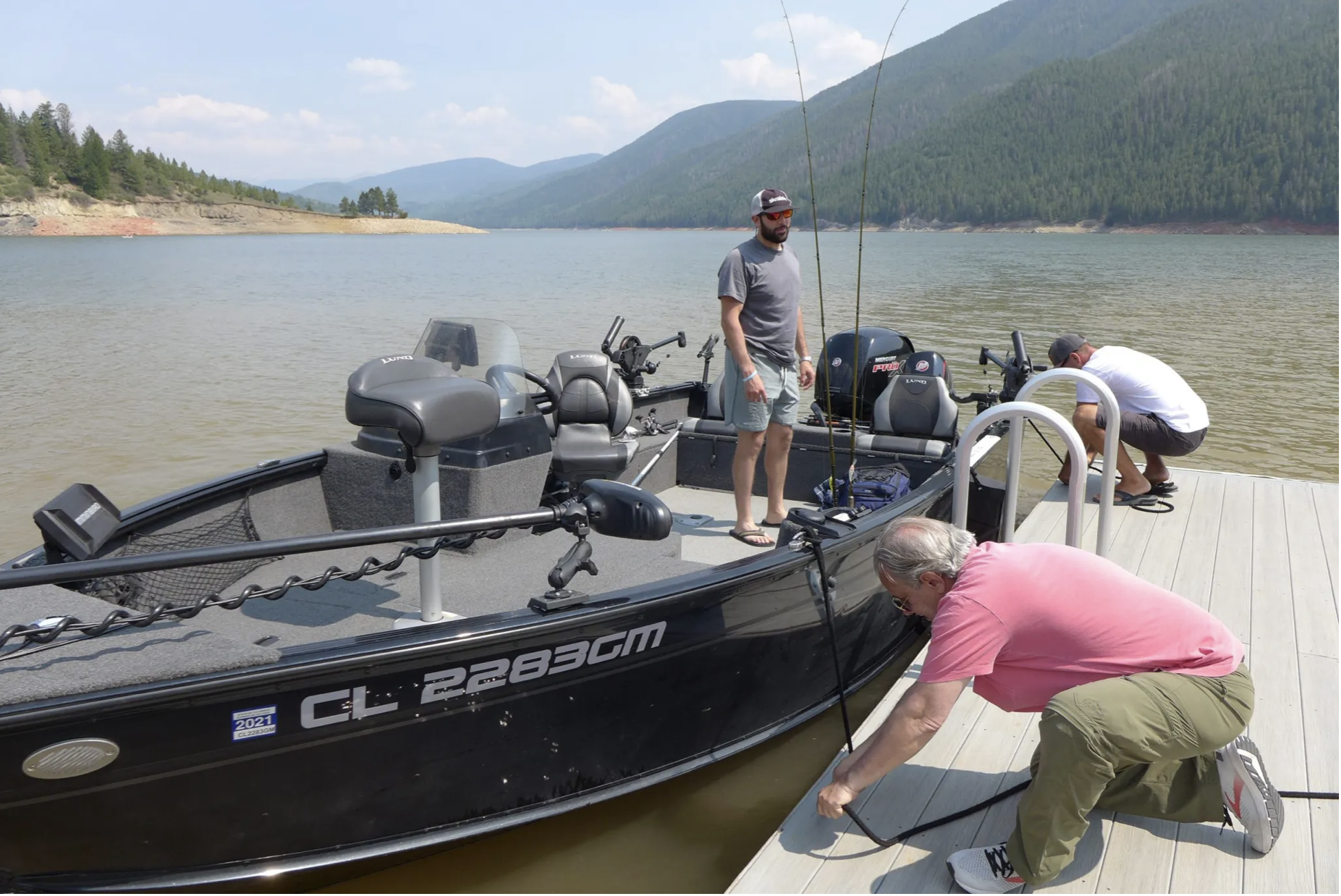
For the Upper Basin, such parched conditions in areas that don’t operate below large federal reservoirs mean a cut in consumptive use — or even near-cessation. Upper sub-basin ranchers and farmers on direct flow ditches don’t have water…

The Uncompahgre and Grand Valley systems do have some reservoir storage above them and can continue to produce…

Farmers and ranchers have been feeling the pinch for the past two decades. They cull herds because there is insufficient water for cattle and/or to grow their feed.

Brad Udall: Here’s the latest version of my 4-Panel plot thru Water Year (Oct-Sep) of 2019 of the #coriver big reservoirs, natural flows, precipitation, and temperature. Data goes back or 1906 (or 1935 for reservoirs.) This updates previous work with @GreatLakesPeck

#LaNiña winter likely for #Colorado: Here’s what to expect — OutThereColorado.com #ENSO

From OutThereColorado.com (Spencer McKee):

The National Weather Service has officially issued a La Niña Watch and if that forecast holds true, it will have an impact on what this winter looks like in Colorado…

With the winter of 2021-2022 shaping up to be a La Niña year, Coloradans can expect weather in their state to be a bit drier than the norm, with stronger winds and less snow. This can amplify issues of drought that may intensify during the summer and fall – likely to be particularly problematic on the western side of the state in upcoming months. La Niña conditions were also present last year, with Colorado having below-median snow throughout the season on a statewide scale.

In contrast to Colorado being drier, La Niña seasons tend to mean more snow for the Pacific Northwest…

Here are the typical outcomes from both El Niño and La Niña for the US. Note each El Niño and La Niña can present differently, these are just the average impacts. Graphic credit: NWS Salt Lake City office

So there you have it – expect a cold winter in Colorado without too much snow.

‘It’s Real’: #Colorado Climatologists Review New #Climate Report — CBS #Denver #ActOnClimate #KeepItInTheGround

From CBS Denver (Shawn Chitnis):

Climatologists at Colorado State University began reviewing a new report from the United Nations on Monday detailing the speed and impact of human-caused global warming. They noticed some are universal around the world while others are more focused by region.

The Calwood Fire approaches Boulder, CO. Photo credit: Malachi Brooks via Water for Colorado

They plan to study the findings further to help understand the outlook for Colorado, but already see the same concerns underlined from past research.

“We certainly know from previous reports, previous summaries that have been specifically for Colorado and the west,” said Russ Schumacher, a climatologist at CSU. “This report narrows down the range of what the human influence on the climate system can be and what that may look like going forward.”

The head gate to Grand Lake’s hydro power plant is blocked by trees washed up during Saturday’s flash flooding. You can see the head gate on the right side of the picture. Photo credit: Town of Grand Lake

Fires and floods as well as heatwaves and drought overseas and across the U.S. demonstrated global warming is rapidly hitting every region of the world in an unprecedented way, according to the U.N. report. Carbon dioxide levels are higher than at any time in at least 2 million years.

Melting ice and rising sea levels are irreversible, even if emissions are limited. Scientists say we have made the world almost two degrees hotter than pre-industrial levels…

Denver smog. Photo credit: NOAA

Drought in western Colorado and the Colorado River Basin highlight the climate issues most unique to our region. Reducing greenhouse gases, which trap heat and make the earth warmer, is a first step to fighting climate change.

Two western states (#NewMexico/#Colorado) act to control #methane — Writers on the Range #ActOnClimate #KeepItInTheGround

Methane contributes to climate change and ground-level ozone, leading to environmental, economic, and public health issues.
(Photo Credit: Delfino Barboza via Unsplash) via Writers on the Range

From Writers on the Range (Tim Lydon):

Tim Lydon via Writers on the Range.

New Mexico, the third-ranking U.S. oil producer, has moved to curtail methane pollution from the oil and gas industry, moving it closer to neighboring Colorado’s leadership. Methane is a dangerous greenhouse gas that contributes to climate change and also damages human health.

With the United States among the world’s top methane polluters and the Biden administration promising tighter nationwide rules, these two Western states set a bar for other states to follow.

For decades, the oil and gas industry has freely discharged the colorless pollutant from tens of thousands of wells as a cost-savings measure. Then, this March, New Mexico banned the wasteful venting and flaring of natural gas, which is comprised almost entirely of methane. New Mexico is only the third state, after Colorado and Alaska, to ban the practice.

This May, New Mexico also proposed a final rule to staunch the leaking of methane from across the state’s oil and gas supply chain, which includes part of the mammoth Permian Basin it shares with Texas. The leaking occurs at well pads, pipelines, compressors, storage facilities, and more.

It’s a system-wide problem that generates methane plumes large enough to detect from space.

The proposed rule on leaking, now up for public comment, improves on a December draft that offered broad loopholes. When it’s made final, it will require regular inspection and repair of leaky equipment, which today goes largely unmitigated as yet another industry cost-savings measure.

The United States is among the world’s top methane producers, and methane hotspots are prevalent in the oil-rich West.
(Photo Credit: U.S. Environmental Protection Agency) via Writers on the Range

The state effort means New Mexico is catching up with Colorado. In 2014, Colorado became the first state to regulate methane and has twice strengthened its original rule. Colorado has also modernized its oil and gas regulatory agency’s mission so that it includes safeguarding public health. And it is reworking oil and gas bonding requirements so taxpayers don’t get burdened with plugging leaky “orphan wells” abandoned by producers.

Colorado’s rules were a model for the first national methane regulations, implemented under President Obama in 2016. Unfortunately, the Trump administration dismantled those rules.

Controlling methane is a climate imperative. Because the gas has 80 times the heat-trapping potential of carbon dioxide, it’s a potent driver of climate change. NASA says it has fueled a whopping 25 percent of the human-caused global warming that today increasingly jeopardizes Western water, agriculture, and recreation.

Research also shows that methane is entering the atmosphere from sources such as wetlands or thawing permafrost. In the latter, warming tied to methane begets more methane. It is the ominous type of feedback loop that global warming alarmists have warned us about for decades.

But the good news is that methane only survives in the atmosphere for about 10 years, unlike the centuries-long lifespan of carbon dioxide. Consequently, methane rules today could produce swift returns on climate as the world grapples with the harder problem of carbon dioxide.

But methane and associated pollutants also contribute to harmful ground-level ozone, which is linked to premature birth, respiratory sickness, and other illnesses. New Mexico Gov. Michelle Lujan Grisham made this part of her campaign for regulation, pointing out that poor air quality disproportionately harms poor communities.

That concern helped build support from Indigenous and other groups, outweighing fears that new regulations would detract from drilling royalties, which provide over a third of New Mexico’s revenue for education, health, and other services.

Part of the New Mexico governor’s strategy in winning support for methane control was focusing on fiscal accountability. Venting, flaring, and leaking — all monumentally wasteful practices — send an estimated $43 million in potential state revenue into New Mexico’s thin air every year.

At the national level, President Biden campaigned on restoring federal methane regulations rolled back under Trump. Biden issued executive orders on his first day in office that set a September goal for proposing a new strategy. Crafting new federal rules is expected to take years, but New Mexico and Colorado now offer strong examples. By applying rules to both new and existing oil and gas infrastructure, they exceed the original Obama regulations, which only addressed new permits.

Today, Western states, along with heavy oil producers Texas and North Dakota, offer only a patchwork of tax incentives and voluntary targets. Limited rules, however, often tilt in industry’s favor. Now, with fossil fuel production ramping back up and global temperatures rising, New Mexico and Colorado show that tougher regulations are the way to go.

Tim Lydon is a contributor to Writers on the Range, http://writersontherange.org, a nonprofit dedicated to spurring lively conversation about the West. He writes from Alaska.

How low can Ruedi Reservoir go? — @AspenJournalism #ColoradoRiver #COriver #aridification

The boat ramp at Ruedi Reservoir allows motor boats to access the water. The Bureau of Reclamation is projecting that the reservoir will fall to 55,000 acre-feet this winter.
CREDIT: HEATHER SACKETT/ASPEN JOURNALISM

From Aspen Journalism (Heather Sackett):

Bureau of Reclamation warns of potential impacts to Aspen hydro plant, water contract holders

Water levels at Ruedi Reservoir could fall so low this winter that the city of Aspen could have difficulty making hydro-electric power and those who own water in the reservoir could see shortages.

That’s according to projections by the Bureau of Reclamation, which operates the reservoir near the headwaters of the Fryingpan River. At the annual Ruedi operations meeting on Aug. 5, officials estimated the reservoir will fall to around 55,000 acre-feet this winter, what’s known as carry-over storage. According to Tim Miller, a hydrologist with the Bureau of Reclamation who manages operations at Ruedi, the lowest-ever carry-over storage for the reservoir was just over 47,000 acre-feet in 2002, one of the driest years on record. Last year’s carry-over was about 64,000 acre-feet.

At 55,000 acre-feet, the elevation of the water is about 7,709 feet. That’s about two feet lower than Aspen officials would like.

“We don’t like being below 7,711,” said Robert Covington, water resources/hydroelectric supervisor for the city.

That’s because the hydro plant needs a certain amount of water pressure to operate. The higher the water elevation, the more water pressure there is.

According to Covington, power providers Xcel Energy and Holy Cross Energy sometimes temporarily and quickly shut down the hydro-electric plant when there are problems with transmission lines or they need to do repairs.

“It’s very common for these types of plants to automatically shut down,” Covington said.

The problem is that restarting the plant requires a larger amount of water than the 40 cubic feet per second that is roughly the minimum amount required to operate the plant efficiently.

“It’s very difficult for us to get back online so we end up pushing more water through for a very short period of time,” he said.

If Aspen has to shut down the plant because flows are too low, the city could purchase more wind power to maintain its 100% renewable portfolio.

“When we go lower on hydro, we go with wind, which is generally the most cost-effective,” said Steve Hunter, utilities resource manager with the city.

Anglers dock at Ruedi Reservoir on Aug. 5. Bureau of Reclamation officials project that low carry-over storage combined with another low runoff year could lead to shortages for water contract holders.
CREDIT: HEATHER SACKETT/ASPEN JOURNALISM

Shortages to contract holders

Another consequence of low carry-over storage means that Ruedi will start out even lower next spring when the snow begins to melt and the reservoir begins to fill again. That means if there is below-average runoff again, some contract holders who own water in Ruedi could have to take shortages, something that has never happened before, Miller said.

There are 32 entities that have “contract water” in Ruedi, which the bureau releases at their request. This is water that has been sold by the bureau to recover the costs of building and operating the reservoir. The contract pool is separated into two rounds and contract holders will take a previously agreed upon shortage amount depending on which round they are in.

“If we get another similar type of runoff this year, there will be shortages most likely to the contract pool,” Miller said.

The 15-Mile Reach is located near Grand Junction, Colorado

But there are still uncertainties in predicting how low the reservoir will go. The biggest of these is how much water will be released for the benefit of the endangered fish in the 15-mile reach of the Colorado River near Grand Junction.

There is a 10,412 acre-foot pool available for the fish, but in dry years entities that store water in Ruedi will sometimes coordinate to release more fish water in the late summer and fall. This would draw down the reservoir even further. It’s still not clear how much water will be released this fall for the four species of endangered fish.

“The release defines the carry-over,” Miller said.

Despite initial bureau forecasts in April that projected Ruedi could probably fill to its entire 102,373 acre-foot capacity, Ruedi ended up only about 80% full this year. July 11 was the peak fill date at 83,256 acre-feet and an elevation of 7,745 feet.

“It was probably a little over-optimistic,” Miller said of the April forecast. “But at the time our snowpack was average. It was a reasonable forecast given the conditions.”

As climate change worsens the drought in the Western U.S., Ruedi is not the only reservoir to face water levels so low that they threaten the ability to produce hydroelectric power. Last month, the bureau began emergency releases from Upper Basin reservoirs, including Blue Mesa on the Gunnison River, to prop up levels in Lake Powell and preserve the ability to produce hydropower at Glen Canyon Dam.

This story ran in the Aug. 10 edition of The Aspen Times.