For the first time, the U.S. Bureau of Reclamation issued a water shortage for Lake Mead starting in 2022. Located between southern Nevada and northwestern Arizona, Lake Mead provides water and generates electricity for the more than 20 million people in the lower Colorado River Basin.
This shortage isn’t a surprise. Water levels at Lake Mead and Lake Powell to the northeast have already reached historic lows amid the summer drought. By January, the bureau projects water levels at Lake Mead to fall to 1,065.85 feet — nine feet below the first shortage trigger elevation. Levels on Lake Powell, which stores water for the Upper Colorado River Basin, are only marginally better, projected to be just 45 feet above the required elevation to produce hydropower.
The overall situation is not good, but why? This whole reservoir system along the Colorado River Basin was designed to get us through the drought years. Why isn’t it working? A glimpse into the history of the system, how it was designed and the impacts of climate change sheds light on why it was destined to fail — and why it may never recover.
Colorado River “Beginnings”. Photo: Brent Gardner-Smith/Aspen Journalism
A crash course on the Colorado River Basin
As Americans began moving west, they found that Western rivers behaved very differently from those found in the Midwest and East Coast.
Western rivers were fed by snow from the peaks of the Rocky Mountains. During the winter, river flows would decrease, sometimes even freeze over. As spring and summer arrived, the warmer temperatures melted snowpack that accumulated on the mountains over the winter. Then the melt would run off at exactly the perfect time — the beginning of the growing season. Water would be abundant for farming and other needs during the warm season.
But issues arose with this “perfect” system. People learned less snowfall in one winter would result in less water flowing in the spring and summer. Water might not be as abundant as desired.
Then came an issue of who could use the water. Consider a farmer named Joseph. He and his family would settle on their land and pull from the river during the warm season. It had been a good winter so they expected high river flows that spring. Instead, the flows were really low. Where was his water?
He would go upstream to find that another farmer named William had settled his family there, and he was taking the water. Joseph told William that he couldn’t have the water. But William said it flowed through his land and therefore it was his. Joseph argued that it would actually flow through this land, and he was here first — it was his.
Thus was born the idea of water appropriation, albeit this is an extremely simplified and embellished version of the story.
Later, the Colorado River Compact of 1922 determined the river belonged to all parties where the river and its tributaries flowed. Everyone would share it equitably. This would include the upper basin states (Wyoming, Utah, Colorado and New Mexico) and the lower basin (Arizona, Nevada, and California).
The compact stated the upper basin would share 7.5 million acre-feet per year and the lower basin would also share 7.5 million acre-feet per year. Since the majority of this water originates in the Rocky Mountains of the upper basin states, those states must ensure the consistent delivery of water to the lower basin.
Lake Mead (initially formed by the Hoover Dam in 1935) was designed to hold water for the lower basin states. As an “insurance policy,” the upper basin had Lake Powell, which began filling in 1963. If drought meant the upper basin states couldn’t deliver their promised amount to the lower basin, they could deliver it with water in the savings account of Lake Powell.
While this plan initially seemed to work well, it was doomed from the beginning, for three reasons.
1. The water was already overallocated
How did the compact come up with the number 15 million acre-feet? Well, the number wasn’t just picked out of hat. There was a bit of analyzing of annual precipitation and runoff to come up with the estimate. In the early 1920s, data from the previous 10 to 20 years would be used to calculate the estimate. Unfortunately, the 1910s was a relatively wet decade and skewed the estimates higher than they should have been.
Brad Udall: Here’s the latest version of my 4-Panel plot thru Water Year (Oct-Sep) of 2019 of the #coriver big reservoirs, natural flows, precipitation, and temperature. Data goes back or 1906 (or 1935 for reservoirs.) This updates previous work with @GreatLakesPeck
The chart above shows the [upper basin average flows] since 1920, as recorded by the U.S. Geological Survey. There is a lot of year-to-year variability, which is why building reservoirs to store during the wet periods became essential…
2. Population increases
Today, the Bureau of Reclamation estimates 40 million people rely on water from the Colorado River Basin. When the compact was signed in 1922, the total population of the seven basin states was not even 6 million people.
While the majority of the water from the Colorado River is used for agriculture, the smaller percentage of municipal use can’t be ignored when considering significant population increases. The old rule of thumb is that one acre-foot of water is enough for two households for a year. An increasing number of households throughout the Southwest puts further strain on the already overallocated Colorado River system.
3. Climate change will further reduce water availability in the basin
Temperatures throughout the Colorado River Basin are increasing, with particular “hot spots” in the Rocky Mountains. Scientists are still parsing out precipitation and snowpack trends on the mountains, but higher temperatures alone will reduce the water supply provided by the Colorado River.
For one, an earlier peak snowpack and earlier melt because of a warmer environment reduces runoff efficiency. Higher temperatures allow more water to evaporate into the atmosphere. This increased evaporative demand also means the same level of crop production requires more water.
Climate change is also increasing the frequency and severity of droughts in the Southwest. We’ve seen this quite obviously play out in the 21st century — repeated and prolonged droughts have chipped away at the available water supply while fewer opportunities for recovery have occurred. These trends will continue.
U.S. Drought Monitor July 23, 2002.
No going back
For many in the upper basin states, the situation became clear after the 2002 drought…
The 2002 drought was the most severe drought in the Upper Colorado River Basin in recorded history. To this day, cumulative flows on the Colorado River near the Colorado-Utah state line have not been lower.
While the lower basin states continued a business-as-usual path, it became clear in the upper basin that the system would not quickly recover from this drought. But with each step forward in recovery, another drought would take the system two steps back again.
Upper basin and lower basin states have worked on drought contingency planning, and new adjustments were written after the 2002 drought to prepare for a time when Lake Mead might get too low.
This year, we reached that point. Moving forward, we need to explore other solutions to meet our population and agriculture demands and preserve our forests, rivers and wildlife.
We all must accept that the question is not: “How do we recover Lakes Powell and Mead and get them back to good water levels again?” Instead, we need to ask: “How do we continue to meet the needs of the Southwest without Lakes Powell and Mead?”
Becky Bolinger is the assistant state climatologist for Colorado and a research scientist at Colorado State University.
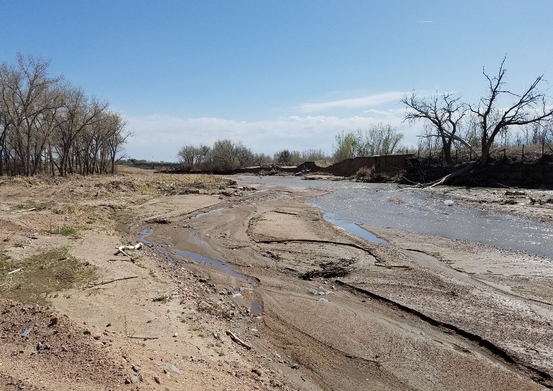
The work managed by the Fountain Creek Watershed, Flood Control and Greenway District can be “unrecognizable,” but its leaders want citizens to recognize the importance of its flood control projects, as well as understand why it’s crucial to find more funding.
One of those projects in Pueblo is the restoration of approximately 3,000 feet of the creek that runs under the US Highway 47 bridge near Jerry Murphy Road, completed in November 2018.
“It was $6.6 million for something you would drive by and not recognize, while at the same time it protects a major thoroughfare,” District Executive Director Bill Banks said while giving the annual tour of the district’s projects on Sept. 10.
After Highway 47 Project. Photo credit: Fountain Creek Watershed Flood Control And Greenway District
In this instance, a 2015 flooding event catalyzed the Colorado Department of Transportation to partner with the district to realign the creek in order to protect the bridge. CDOT contributed $1.5 million to the project, which also included major landscaping design to provide bank and floodplain stabilization…
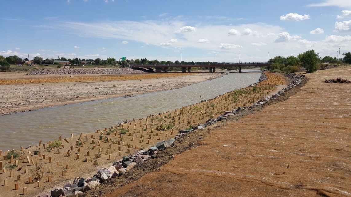
Pueblo Channel Project at 13th Street before. Photo credit: Fountain Creek Watershed Flood Control And Greenway District
Another large project the district completed in June 2021 is a 2,600 feet stretch of the creek that ends at the 8th Street bridge on the East Side. That $3.4 million project narrowed the creek channel from 600 feet to an average of 150 feet. This both stabilized the channel and made it easier for the water to push sediment through, rather than dumping it haphazardly along the banks.
“A lot of conventional wisdom is to make a channel really wide in order to convey as much water as possible to prevent flooding,” said Aaron Sutherlin, who oversaw the 8th Street bridge project with Matrix Design Group. “When you make things as wide as possible, you lose the ability to transport sediment. What you get in a system is sediment that dumps out in places you don’t know where it’s going to go. That’s exactly what happened at this site.”
That project also built the creek to withstand up to 6,000 cubic feet per second, a so-called “100-year flood.”
Pueblo Channel Project at 13th Street after. Photo credit: Fountain Creek Watershed
That influx was a $50 million payout from Colorado Springs Utility to offset the impact of its water delivery system from the Pueblo Reservoir to the cities of Colorado Springs and Fountain. So far, Banks said the district has spent about $27 million from those funds and has identified over $200 million worth of projects.
Corporate America is making a new kind of climate pledge. In recent months, multiple tech giants have pledged to use their reach and resources to join the fight for water conservation. Facebook made an announcement at the end of August declaring their efforts to “be water positive by 2030.” And just this week, Google made a similar announcement to make its data centers more efficient and support water security in the communities it operates in.
Google, Facebook, and several other companies have promised to put more water back into the environment than they pipe in—an exchange they call “water positive.” This means they plan to cut the amount of water needed to run their facilities, while protecting natural waterways and preserving access to clean drinking water in drought-prone areas. The math is based on the number of gallons they want to restore, not newly produced H2O. Both Facebook and Google have also promised to share their conservation research and tech with others…
Given the current state of the planet, it’s only fitting that corporations like Facebook and Google change how they use up water and other vital resources, says Pamela Chasek, a professor and chair of the political science department of Manhattan College, who has also commented on past corporate climate pledges…
A 2020 report by Data Center Knowledge found that Google operates more than 20 data centers around the world. Facebook, meanwhile, has seven data centers in the US. The social media company has also announced that it will open more data centers this year.
“The typical data center uses about 3-5 million gallons of water per day—the same amount of water as a city of 30,000-50,000 people,” Venkatesh Uddameri, professor and director of the Water Resources Center at Texas Tech University told NBC News earlier this year. Much of it is used to chill the giant servers, machine learning systems, and other hardware the companies run around the clock.
Both Facebook and Google say they’re testing out ways to cut down the water used to cool these data centers. “For example, we deployed technology that uses reclaimed wastewater to cool our data center in Douglas County, Georgia,” Google Sustainability Officer Kate Brandt writes in an email to PopSci. “At our office campuses in the San Francisco Bay Area, we worked with ecologists and landscape architects to develop an ecological design strategy and habitat guidelines to improve the resiliency of landscapes and nearby watershed health.”
In its pledge post, Facebook noted that it uses “onsite recycled water systems” at some global offices. The company also stated that it’s developed technology that enables “data centers to be cooled with outside air,” allowing them “to operate 80 percent more water efficiently on average compared to the industry standard.”
For the other end of the “water positive” equation, both companies say they’ve sought out local partners to meet their new water sustainability goals. Google writes that it’s “working with the Colorado River Indian Tribes project to reduce the amount of water that is withdrawn from Lake Mead reservoir on the Colorado River in Nevada and Arizona.” Meanwhile, Facebook points out that it’s providing funding “to the Rio Grande Water Fund to restore the connection between the stressed Cedro Creek and its historic floodplain.”
Water usage has long been a concern as large tech offices and data centers compete with area residents (people and wildlife) over limited water supplies in drought-prone areas. The friction has only intensified in recent years. In 2017, multiple South Carolina-based conservation groups criticized Google for its plans to draw more than a million gallons of water per day from the depleted Goose Creek watershed. The corporation ultimately struck a deal to draw 5 million gallons per day from another aquifer.
When asked if the water pledges felt like greenwashing, Chasek says it’ll depend on how Facebook and Google are held accountable and how transparent both companies are when implementing the actions behind their promises.
“One of the interesting things with the Facebook project is that they’re working with NGOs and other organizations in terms of partnerships,” she explains. “These partnerships can determine where best to do water-restoration work, [which] is one piece of that accountability. How are they investing in these water restoration projects … particularly like in the western US where we’re seeing the highest amount of water stress? Those projects need to see a lot of scrutiny.”
Jim Murphy, an assistant professor and the environmental advocacy clinic director at the Vermont Law School, agrees that major tech companies should be held accountable for their sustainability claims by outside organizations or even governmental agencies. But he argues that while it makes sense for powerful industries to help with water management, policy is the best way to manage responsible use of natural resources, especially in communities hard hit by climate change.
“The problem with private companies, even if they’re publicly owned … is they have certain obligations to their shareholders,” he says. “These are not accountable entities or entities that are created [through] public interest.”
That kind of decoupling is especially important as fossil fuel companies like BP, which helped to exacerbate climate change through greenhouse gas emissions, launch “water positive” campaigns of their own.
“Making sure that we properly protect the entire watershed from pollution and destruction is paramount,” Murphy continues. “The Biden administration has taken some steps in this direction, and they really need to continue that through.”
The city of Greeley is set to bring in at least $60,000 more per year after revising a longstanding agreement on water with the town of Windsor.
An amendment to an existing agreement, approved by city council Tuesday, will make drought supply municipal water available to Windsor during dry times…
While Greeley still owns the rights, Windsor pays to [lease] those water rights to keep the city going if (and when) drought hits.
Greeley and Windsor have worked together on water for decades. The two entered into an intergovernmental agreement back in 1996 when Greeley agreed to treat and deliver potable water drawn from Windsor’s own sources.
In the event we do see times of shortage, Windsor will be able to access up to 350 acre-feet of water per year, enough water for about 700 to 1,050 homes…
The agreement approved by city council Tuesday goes into effect in 2022, starting at $60,000. Windsor is set to pay regardless of whether it is a drought year. The annual payment will then tick up by 3% per year.
Why does this matter?
Greeley hasn’t had to use drought restrictions for almost 20 years. But city officials haven’t forgotten how dire things got in 2002, a drought year that climate experts agree was one of the worst in 300 years.
According to the city, the shortage conditions that would need to kick in for Windsor to use the water happen about twice per decade – but climate change could mean those conditions would be met more often.