Martin Drake Coal Plant Colorado Springs. The coal plant in downtown Colorado Springs will be closed by 2023 and 7 gas-fired generators moved in to generate power until 2030. Photo credit: Allen Best/The Mountain Town News
The Martin Drake Power Plant will burn its last load of coal this Friday, Aug. 27, ending more than a century of coal-burning near downtown Colorado Springs for electrical generation.
Closing of coal plants will become a regular thing in coming years. By decade’s end, only one plant, Comanche 3, is scheduled to remain in operation in Colorado, if at much reduced capacity. Even that limited use scenario remains in doubt.
What will replace the electricity generated by coal combustion in times when neither the wind blows nor the sun shines or—increasingly problematic—the dams that produce hydroelectric generation whither to dead pool?
The answers remain unclear. In the case of Colorado Springs, six natural gas-burning units have been erected at the power plant along Interstate 25. But as Colorado Springs Utilities has made clear, these units costing $100 million, are to be temporary, while energy technology and economics shift further.
Like Xcel Energy and Tri-State Generation and Transmission and other utilities, Colorado Springs continues to wait for technological and perhaps political breakthroughs.
Coal has been a mainstay for the last century. At first, the plants were small. A practiced eye can see those brick buildings erected along rivers in Fort Morgan and Fort Collins.
Cameo power plant circa 2010. Photo via Big Pivots
Then, coal plants became larger and then larger yet. Cameo Station, located along the Colorado River east of Grand Junction, had generating capacity of 73 megawatts when it went on line in the late 1950s. At Hayden, the two units that went on line in the ‘60s and ‘70s together have 441 megawatts of capacity. Then came the true behemoths at Craig and Pueblo, the former with 1,283 megawatts of generating capacity and the latter, called Comanche, with 1,410 megawatts.
Now, the closings have started. The smaller and older ones came first, and Cherokee, located north of downtown Denver, was converted from coal to burn natural gas. Hayden will be shut down by 2028 and Craig by 2030.
What a lot of change. In 2010, utilities were still very tentatively clinging to the past, unsure how much renewable generation they could absorb and still ensure your refrigerator had juice. Too, renewables were still expensive.
Then came 2014-2018, during which a profound shift occurred as wind generation became the lost cost resource, but solar prices rapidly declined, too, both aided by federal tax policies. And now coal has become the expensive fuel in almost all cases.
Utilities also were learning to integrate higher levels of renewables without sacrificing reliability. This was easier done in the middle of the night, when wind was blowing hard across Colorado’s eastern plains, but it applied to all hours of the day, too.
A hallmark of this progression came in December 2018, when Xcel Energy assembled Colorado’s political leaders, reporters and others at the Denver Museum of Nature and Science to announce a goal worthy of national attention. The company said it would cut carbon emissions from its electrical generation 80% by 2030 as compared to 2005 levels.
Days later, directors of Platte River Power Authority—the power provider for Fort Collins, Longmont, Loveland and Estes Park—announced a 100% goal for 2030, if with a list of caveats.
Tri-State, Colorado’s second largest electrical distributor, with 18 member cooperatives from Cortez to Holyoke, in January 2020 announced closings that will allow it to reduce emissions 80%.
Colorado Springs is a microcosm of this expansion of more than a century and now rapid shrinking of coal-based electrical generation. Electricity was introduced into the town in the 1880s, a light bulb at the end of a dangling cord representing the ritziest convenience in the city, a later brochure said. It was enormously expensive to operate, 6.5 cents per kilowatt-hour. Demand was small: a 60-kilowatt-generation plant met the needs of the 350 customers.
In 1968, when the Drake plant was dedicated, cost of electricity has declined to 2 cents per kilowatt hour, but demand had grown, as a brochure noted, to include everything from color TVs to electric blankets.
In June 2020, Colorado Springs Utilities announced that first Drake and then the Ray Nixon Plant, the latter a newer power plant, would close. The passage of Drake will be marked Friday afternoon with remarks by Colorado Springs Mayor John Suthers and Aram Benyamin, the chief executive of Colorado Springs Utilities since 2015.
Colorado Springs has been adding solar and wind generation but, at least during the coming decade, expects to remain reliant on natural gas. Natural gas in 2020 was responsible for 49% of electrical generation. In 2030, according to the municipal utility’s current plan, it will still be 42%. But on that, refer back to 2011 when some utilities were still theoretically planning to build more coal plants. It is, at this point, a placeholder.
What will it take to decarbonize electricity completely? Xcel says it believes it can hit 100% emissions-free energy by mid-century if the answers are not yet clear about that last 10% to 20%. Holy Cross Energy, the electrical cooperative serving Vail, Aspen, and Rifle areas, made its goal of 100% by 2030 unconditional.
Answers must be found. The vulnerability of the electrical grid was exposed by the windless days of February. That winter storm paralyzed Texas, exposing the fallacy of short cuts no matter what the fuel source. Colorado was not immune, though. Xcel Energy spent $600 million buying suddenly expensive natural gas. Tri-State spent only $11 million in extra costs, but turned to burning fuel oil when wind farms that produced an average of 51.2 megawatts of electricity fell to just 0.9 megawatts.
Storage has become the Holy Grail of the 100% quests. Lithium-ion batteries, which have about a four-hour storage life, will be inadequate when the wind doesn’t blow several days in a row on the Eastern Plains.
A regional transmission organization that allows Colorado to use electricity being generated in California or Arizona or even wind from Iowa, might help a lot. Tri-State wants such an organization. So does Holy Cross Energy—and, it would appear, Colorado Springs Utilities. In 2021 Colorado legislators approved a bill that requires integration of the state’s utilities into such an organization within a decade. One energy attorney, Mark Detzsky, calls it the most important energy or climate bill among Colorado’s 30-plus bills adopted in the 2021.
Other storage technologies may deliver the answers. Xcel Energy says molten salt tops the list of storage technologies when it closes its coal units at Hayden in 2027 and 2028. It also is considering green hydrogen, which can use electricity—presumably from renewable sources—to create hydrogen from water (venting the oxygen into the atmosphere). That technology faces cost and other hurdles.
As for Comanche 3, Colorado’s youngest coal plant, completed in 2010, and also its largest. Xcel Energy wants to keep it operating until 2040 at about a third of capacity or just seasonally. Pueblo and Pueblo County have also registered their support. They want the tax base.
But will a new energy storage technology make Comanche 3 obsolete? Maybe not, but that’s a bet I’d take.
Ouray County Water Users Association wants to build a 260-foot dam at this location on Cow Creek that would hold about 25,000 acre-feet of water. One goal would be to lessen daily flow fluctuations, especially during spring runoff. CREDIT: HEATHER SACKETT/ASPEN JOURNALISM
Water users in Ouray County are hoping to satisfy water shortages with what they say is a multi-beneficial reservoir and pipeline project. But the Ram’s Horn reservoir, Cow Creek pipeline and exchange are facing opposition from the state of Colorado and others.
The complicated, three-pronged project proposes to take water from Cow Creek and pipe it into Ridgway Reservoir, take water from local streams via ditches and store it in the reservoir, and build a new dam and reservoir on Cow Creek. This stored water would eventually be sent downstream to be used by the Uncompahgre Valley Water Users Association (UVWUA).
Ridgway Dam via the USBR
The project applicants — Ouray County, Tri-County Water Conservancy District, Ouray County Water Users Association and the Colorado River Water Conservation District — say they need 20 cubic feet per second of water from Cow Creek. Cow Creek is a tributary of the Uncompahgre River with headwaters in the Cimarron mountains. Cow Creek’s confluence with the Uncompahgre River is below Ridgway Reservoir, which is why an upstream pipeline would be needed to capture the water and bring it into the reservoir.
The applicants are also seeking to build Ram’s Horn Reservoir on the upper reaches of Cow Creek, which would hold about 25,000 acre-feet of water behind a 260-foot-tall and 720-foot-long dam. Ram’s Horn would help regulate what are known as diurnal flows during spring runoff — streamflows are higher during the day as the snow melts with warming temperatures, and lower at night as snow re-freezes. UVWUA says they can’t adjust their headgates to capture the high point of this daily fluctuation in flows, leaving the water to run downstream unused. The project would capture these diurnal peaks.
Ouray County Water Users Association wants to build Ram’s Horn Reservoir on the upper reach of Cow Creek, shown here. Colorado Parks and Wildlife opposes the project, in part, because of its potential impact to fish. CREDIT: HEATHER SACKETT/ASPEN JOURNALISM
Goal to prevent a call
The goal of the project is to prevent the UVWUA — one of the big senior water rights holders in the Gunnison River basin — from placing a call on the river.
When the UVWUA, which owns the Montrose & Delta Canal and has a 1890 water right, is not able to get its full amount of water, it places a call on the river. This means upstream junior water rights holders, like Ouray County Water Users, have to stop using water so that UVWUA can get its full amount. According to a state database, the M&D Canal has placed a call three times this summer, most recently from July 12 to 22. In 2020, the call was on for nearly all of July and August. Under Colorado water law, the oldest water rights have first use of the river.
By releasing the water stored in either Ridgway or Ram’s Horn reservoirs to satisfy a UVWUA call, Ouray County Water Users Association would then be able to continue using its own water.
The Glenwood Springs-based River District, which advocates to keep water on the Western Slope, is a co-applicant of the project.
“This (project) is consistent with the River District’s goals and objectives with supporting our constituents and making sure they have a reliable water supply,” said Jason Turner, River District senior counsel.
Ridgway Reservoir, on the Uncompahgre River in Ouray County, is popular with boaters. A proposed pipeline project that would bring water from Cow Creek into the reservoir is being met with opposition for environmental reasons. CREDIT: HEATHER SACKETT/ASPEN JOURNALISM
Potential impacts to fish, instream flows
But some state agencies, environmental groups and others have concerns about the project. Colorado Parks and Wildlife and Colorado Water Conservation Board have both filed statements of opposition to the application, which was originally filed in December 2019, amended in January and is making its way through water court. CPW claims that its water rights in the basin, which it holds for the benefit of state wildlife areas, fisheries and state parks, could be injured by the project. CPW owns nearly a mile of access to Cow Creek on the Billy Creek State Wildlife Area.
Between August 2019 and January 2020, CPW recorded water temperatures of Cow Creek and found they exceeded a state standard for trout. A report from CPW aquatic biologist Eric Gardunio says that the proposed project would likely cause an even bigger increase in water temperatures, resulting in fish mortality.
“The flow and temperature analysis for Cow Creek indicates that the water rights application has the likelihood to damage or eliminate the native bluehead sucker population as well as the rest of the fishery in the downstream end of Cow Creek through the degradation of water quantity and quality,” the report reads.
While less water in Cow Creek could result in temperatures that are too high for trout, water released from the proposed Ram’s Horn reservoir could be too cold for bluehead suckers.
“There’s going to be some changes to temperature and what our temperature data has outlined is that the species are at their extreme ends,” Gardunio said. “It’s nearly too cold for bluehead sucker and it’s nearly too warm for trout, so changes in temperature are going to have an impact to one or the other of the fishery.”
The Colorado Water Conservation Board opposes the project because they said it could injure the state’s instream flow water rights. Instream flow rights are held exclusively by the CWCB to preserve the natural environment to a reasonable degree. Ram’s Horn reservoir would inundate a section of Cow Creek where the CWCB currently holds an instream flow right.
“The application does not present sufficient information to fully evaluate the extent to which the CWCB’s instream flow water right may be injured,” the statement of opposition reads.
Environmental group Western Resource Advocates also opposes the project. Ram’s Horn Reservoir, with conditional water rights owned by Tri-County Water Conservancy District, is one of five reservoirs planned as part of the U.S. Bureau of Reclamation’s Dallas Creek Project, which dates to the 1950s. Ridgway Reservoir is the only one of the five that has been built.
This map shows the potential location of Ram’s Horn Reservoir, as well as other reservoirs originally conceived as part of the U.S. Bureau of Reclamation’s Dallas Creek Project. Only Ridgway Reservoir has been built. CREDIT: MAP COURTESY WRIGHT WATER ENGINEERS
Complex exchange
The third piece of the proposed project is what’s known as an exchange, where water would be conveyed via existing ditches connecting tributaries above Ridgway Reservoir. The exchange water would be stored there and released when senior downstream water users need it, which would benefit upstream water users. In addition to Cow Creek, the applicants are proposing to take water from Pleasant Valley Creek, the East and West Forks of Dallas Creek, Dallas Creek and the Uncompahgre River to use in the exchange.
Colorado Division of Water Resources Division 4 Engineer Bob Hurford laid out the issues his office has with this exchange in his summary of consultation. He recommended denial on the exchange portion of the application until the applicants list the specific ditches participating in the exchange and their locations, and agree that they are responsible for enlarging the ditches so they can handle the increased capacity of water.
“I have to have actual ditch names, the owners of the ditches have to be willing to participate and it has all got to be tracked to a tenth of a cfs,” Hurford said. “It’s not a loosey-goosey thing. It has to be dialed in and defined precisely.”
Another criticism of the project is that it won’t provide water directly to water users in Dallas Creek, which according to a report by Wright Water Engineers, is the most water-short region of the Upper Uncompahgre basin. Even if Dallas Creek water users participate in the exchange, in dry years still there may not be enough water in local creeks for them to use.
“This project has been sold as the savior of agriculture in Ouray County but this project will not provide wet water that would not otherwise be available to anybody that is an ag producer,” said Ouray County water rights holder and project opponent Cary Denison. “I don’t know one irrigator who is saying we need to build Ram’s Horn Reservoir.”
The project application is making its way through water court and applicants say they are continuing to negotiate with opposers. A status report is due in October. Attorney for the Ouray County Water Users Association and River District board representative Marti Whitmore said they want to make sure it’s a multi-purpose project that benefits everyone.
“Fish flows and recreation uses are important, so we are just trying to work out terms and conditions that are a win-win for everyone,” she said.
Aspen Journalism covers water and rivers in collaboration with The Aspen Times and other Swift Communications newspapers. This story ran in the Aug. 30 edition of The Aspen Times.
Photo credit from report “A Preliminary Evaluation of Seasonal Water Levels Necessary to Sustain Mount Emmons Fen: Grand Mesa, Uncompahgre and Gunnison National Forests,” David J. Cooper, Ph.D, December 2003.
FromThe Washington Post (Dino Grandoni and Brady Dennis):
A federal judge Monday threw out a major Trump administration rule that scaled back federal protections for streams, marshes and wetlands across the United States, reversing one of the previous administration’s most significant environmental rollbacks.
U.S. District Judge Rosemary Márquez wrote that Trump officials committed serious errors while writing the regulation, finalized last year, and that leaving it in place could lead to “serious environmental harm.”
A number of business and farm groups had supported the push to replace Obama-era standards with the Navigable Waters Protection Rule, on the grounds that states were better positioned to regulate many waterways and that the previous protections were too restrictive.
The ruling in the U.S. District Court for the District of Arizona, which applies nationwide, will afford new protections for drinking-water supplies for millions of Americans, as well as for thousands of wildlife species that depend on America’s wetland acreage.
Márquez, a Barack Obama appointee, noted that the U.S. Army Corps of Engineers, which oversees permits to dredge and fill waterways under federal jurisdiction, determined that three-quarters of the water bodies it reviewed over a nearly 10-month period did not qualify for federal protection under the new rule. Federal agencies identified 333 projects that would have required a review under the Obama rule, she added, but did not merit one under the Trump standards…
Home builders, oil drillers and farmers — who have long argued that earlier restrictions on developing land made it too difficult to do their work — are likely to appeal…
North American Indian regional losses 1850 thru 1890.
In June, the Biden administration announced that it would write regulations to strengthen wetland protections but would keep the Trump-era rule on the books while it did so. But tribal and environmental groups pressed the court in Arizona to vacate the previous administration’s rule sooner, since some wetlands may be irreparably harmed during the time it would take to replace it…
“We came in and said, ‘No, no, no, no, you can’t leave this in place,’” said Janette Brimmer, a senior attorney for Earthjustice, which represented the Native American and green groups in court. She added, “This is hugely good.”
The ruling marks the latest salvo in a decades-long legal and regulatory battle over the full extent of the Clean Water Act’s reach.
That landmark 1972 law prohibits polluting “waters of the United States” without a permit. But the question of which waterways fall under that category has been debated in courtrooms and agencies ever since.
In 2015, Obama’s administration moved to protect a broad swath of water bodies, including “ephemeral” streams that appear only after rainfall and help purify water. Hydrologists have found that even these intermittent rivulets can affect the water quality of large rivers and lakes downstream.
But the Trump administration replaced that regulation with a far narrower one, on the grounds that the Obama rule exceeded the government’s legal authority.
“They basically ignored it all,” Mark Ryan, a former EPA lawyer who helped craft the Obama-era regulation, said of the Trump team. “It was a voluminous bit of science.”
With Monday’s court ruling, agencies will go back to applying water protection standards from the 1980s, which are more expansive than the Trump-era rule but not as sweeping as Obama’s.
The push to overhaul federal clean-water regulations has caused ongoing fights in places such as in Georgia, near the sprawling Okefenokee Swamp. A proposal to strip-mine for titanium would have received strict scrutiny under the Obama-era standards, and some federal officials and environmental groups raised concerns about its potential impacts.
But last year the Army Corps of Engineers determined that under the revised Trump rule, the area was no longer federally protected…
“This is a welcome day for the Okefenokee, the wetlands surrounding the refuge, and will force Twin Pines to reevaluate this disastrous project,” Christian Hunt, Southeast program representative for Defenders of Wildlife, said in an email.
Created by Imgur user Fejetlenfej , a geographer and GIS analyst with a ‘lifelong passion for beautiful maps,’ it highlights the massive expanse of river basins across the country – in particular, those which feed the Mississippi River, in pink.
Today, the U.S. District Court for the District of Arizona said Trump’s Navigable Waters Protection Rule must be vacated because the rule contains serious errors and has the potential to cause significant harm to the Nation’s Waters if left in place while the Biden administration works on revisions to the rule. It represents the culmination of a lawsuit brought by six federally recognized Indian tribes, who are represented by Earthjustice and sued the Environmental Protection Agency (EPA) and Army Corps of Engineers for passing a rule that eliminated Clean Water Act protections for thousands of waterbodies by redefining them as not “waters of the U.S.”
Thanks to this lawsuit and the Court’s ruling, the country will now return to water protections that were in place for years starting in 1986, wiping the Trump Dirty Water Rule off the books. This outcome ensures Clean Water Act protections are in effect while the Biden administration works to develop a new rule. The Dirty Water Rule was particularly damaging for waters throughout the West, Southwest and Great Lakes. The six tribes and their members have been disproportionately harmed by the rule as their livelihoods and culture were put at risk when the Dirty Water Rule eliminated protection for thousands of wetlands, headwater streams, and desert washes.
“The court recognized that the serious legal and scientific errors of the Dirty Water Rule were causing irreparable damage to our nation’s waters and would continue to do so unless that Rule was vacated,” said Janette Brimmer, Earthjustice attorney. “This sensible ruling allows the Clean Water Act to continue to protect all of our waters while the Biden administration develops a replacement rule.”
For Tribes, just like for every living being on the planet, water is life and has been so since time immemorial. The Trump administration, however, wholly disregarded that when it put industry profit over people by rolling back Clean Water Act protections. Even though the Biden administration has initiated the process to repeal the Trump Dirty Water Rule, it continues to apply the rule in the meantime, exacerbating the harms to Tribes.
In court filings, the federal government acknowledged that the Dirty Water Rule completely disregarded decades of the best science and neglected to assess the impacts the rule had on downstream communities. EPA’s own science advisors said Trump’s rule threatened to weaken protection of the nation’s waters by disregarding the established connectivity of ephemeral wetlands and small streams to downstream rivers and lakes.
Earthjustice is representing the Pascua Yaqui Tribe, Tohono O’odham Nation, Quinault Indian Nation, Menominee Indian Tribe of Wisconsin, Fond du Lac Band of Lake Superior Chippewa, and the Bad River Band of Lake Superior Chippewa.
Quinalt Indian Nation dancers on beach. Photo credit: Quinalt Indian Nation
“Small headwater streams are fundamental to the protection and restoration of salmon and our way of life,” said Guy Capoeman, president of the Quinault Indian Nation. “Today’s ruling will protect all waters on which the Quinault people rely.”
This morning, the #GOESEast satellite's water vapor channel is showing what is now Tropical Storm #Ida as it moves further inland. @NHC_Atlantic says that a dangerous storm surge and flash flooding are continuing over portions of southeastern LA, southern MS, and southern AL. pic.twitter.com/ZBEQP6uzmu
Hurricane Ida, which struck the Louisiana coast on Sunday with winds of 150 miles an hour, gained power faster more than most storms. Because of climate change, such rapid strengthening is happening more often as hurricanes pick up more energy from ocean water that is warmer than before.
But in a summer of extreme weather, Ida’s intensification was extreme.
According to the National Hurricane Center’s forecast bulletins, the storm’s maximum sustained winds as of Saturday morning were about 85 m.p.h., making it a Category 1 hurricane. Less than 24 hours later they were 65 m.p.h. stronger, bringing Ida close to a Category 5.
The storm intensified more than the hurricane center’s forecast, which had called for maximum winds reaching 140 m.p.h. The hurricane center’s definition of rapid intensification is at least a 35 m.p.h. increase in wind speed in 24 hours. Ida strengthened that much in just six hours overnight.
Climate change is part of the reason. Researchers have found that the frequency of rapidly intensifying Atlantic hurricanes has increased over the past four decades as ocean temperatures have risen, in large part because warmer water provides more of the energy that fuels these storms. In the 1980s, there was about a 1 percent chance that a hurricane would undergo rapid intensification. Now, there’s a 5 percent chance.
But experts who study the behavior of hurricanes said other factors played a role with Ida, including seasonal warming of the Gulf of Mexico, the amount of moisture in the atmosphere and the presence or absence of winds that can affect the structure of a storm.
Right now the Gulf is extremely warm because it accumulated heat throughout the summer. It’s this seasonal warming, which happens in the Atlantic Ocean as well, that makes mid-August through October the most active part of the hurricane season every year.
But it’s not just the surface temperature of the Gulf that’s important, said Joshua Wadler, a researcher with the University of Miami and the National Oceanic and Atmospheric Administration. Hurricanes actually cool the ocean as they travel across it, because they stir up the water down to about 150 feet, mixing in colder water from below.
In this case, Ida traveled across water that was much warmer down to that depth. Probes sent into the water by hurricane hunter aircraft on Saturday revealed that the temperature, after it had been mixed by Ida, was about 30 degrees Celsius, or 86 degrees Fahrenheit, Dr. Wadler said.
“That’s on the very high end of sea surface temperatures that hurricanes ever experience,” he said.
The storm’s path happened to track over this warm water, what scientists call an eddy, said Chris Slocum, a NOAA researcher.
“Ida found the perfect path across the gulf, where the warmest water is,” he said, and that provided plenty of energy for the storm to extract. “You could say it’s a worst-case scenario.”
Dr. Slocum compared the situation to that of Katrina, in 2005, which crossed a cooler water column as it neared Louisiana, weakening from a Category 5 to a Category 3. Ida did not encounter any cooler water.
“This one is continuing the upward trend,” he said. “The only thing that’s going to stop the intensification process is landfall,” he said.
Eddies occur in the Gulf every year, formed when part of a looping current breaks off, Dr. Wadler said. And while it’s extremely difficult to link a specific one to climate change, this one “is as deep as we’ve seen in a very long time,” he said.
While ocean temperatures are most important, two other factors affect how much and how quickly a storm strengthens, Dr. Slocum said.
Atmospheric moisture affects the thunderstorms that make up a tropical cyclone. The more humid the air, the more these storms will survive and persist. And the way these thunderstorms interact with each other, particularly at the eye of the storm, can affect whether it strengthens or weakens.
Wind shear — changes in wind speed and direction with height in the atmosphere — can also affect the structure of a hurricane. If the wind shear is too strong, “you can tear a storm apart,” Dr. Slocum said.
The hurricane center’s forecasters had been watching wind shear closely. It had been a factor as the storm entered the Gulf on Friday, giving Ida an asymmetric structure. But the shear dissipated on Saturday, allowing the storm to assume a more regular spiral shape.
The effect on wind speed can be likened to what happens with figure skaters during a spin. Skaters who keep their arms in a tight, precise position will rotate faster. But if one of their arms is extended, they’ll rotate much more slowly.
Here’s Part 1 of the series from The Alamosa Citizen (Mark Obmascik):
The water supply of the San Luis Valley faces pressure as never before
THEY all remember when the San Luis Valley brimmed with water.
South of San Luis, Ronda Lobato raced the rising floodwaters in San Francisco Creek every spring to fill sandbags that protected her grandparents’ farm.
North of Center, potato farmer Sheldon Rockey faced so much spring mud that he had to learn to extract his stuck tractor.
Outside Monte Vista, Tyler Mitchell needed only a hand shovel on the family farm near Monte Vista to reach shallow underground flows in the Valley’s once-abundant water table.
Today those tales of plentiful water seem like a distant mirage. Ten of the past 11 years have delivered below-average snowpacks for the upper Rio Grande basin, with this year’s snowpack measuring just 58 percent of normal at the key May 1 measurement. All but one of the main local reservoirs were less than half-filled.
Farmers face significant cutbacks from wells now and likely from river flows and irrigation ditches later this season.
Against this stark backdrop of drought, three other vast changes loom.
The biggest is a state court judgment that came after decades of excessive well pumping by valley farmers and ranchers. Local irrigators now must restore 400,000 acre feet of water – more than 1.3 million people in metro Denver use in an entire year – to Valley groundwater systems within 10 years.
A second challenge is a plan by former Gov. Bill Owens and a metro Denver business group to pump and divert additional deep groundwater from the San Luis Valley to new buyers outside the San Luis Valley, likely on the Colorado Front Range.
And the third long-term issue is a forecast for flows to be reduced even further, perhaps as much as 30 percent, because of climate change, according to Colorado’s Rio Grande Implementation Plan.
Buffeted by drought, court orders, climate change, and Front Range diversion plans, the water supply of the San Luis Valley faces pressure as never before.
Shortages loom. Cuts seem inevitable.
“Our demand for water has far exceeded our supply for years, and now our supply is in a 20-year downward trend,” said state Sen. Cleave Simpson, general manager of the Rio Grande Water Conservation District. “We keep facing drought after drought. The sense of urgency continues to build.”
It all threatens the way of life for the 46,000 residents of the San Luis Valley, where agriculture is the driving economic force. Farming and ranching account for $340 million of sales each year while providing 18 percent of the region’s jobs. That puts agriculture behind only the government as a source of local employment. About one of every three dollars of basic income in the San Luis Valley comes from agriculture.
The San Luis Valley is the nation’s No. 5 producer of potatoes – behind only the tates of Idaho, Washington, Wisconsin, and Oregon – and a leading supplier of quinoa and alfalfa hay. (The Colorado Potato Administrative Committee says the San Luis Valley is the No. 2 producer in the U.S. for fresh potatoes.)
In a region long beset with poverty – one of every four Valley residents is impoverished, nearly double the statewide rate – farming and ranching have offered one economic success story. In Saguache County, the annual net income, or profit, per farm was $113,000, says the US Department of Agriculture census. Net income per farm in Rio Grande County was $105,000.
But all those jobs, all that money, hinge on one thing: an ample and dependable water supply.
“The climate of the San Luis Valley is arid, and a successful agricultural economy would not be possible without irrigation,” says the U.S. Geological Survey.
Average annual precipitation on the Valley floor is 7 to 10 inches, but potatoes, for example, need an additional 14 to 17 inches of irrigation water during the growing season. Alfalfa hay, the Valley’s top crop by acreage, requires up to 24 inches for a crop.
This adds up to an enormous thirst. According to state water engineers, San Luis Valley agriculture accounts for 810,000 acre feet of consumptive water use per year.
By contrast, the Denver Water Department needs only 247,000 acre feet of water to supply the 1.3 million people within its city and suburban service boundaries.
In other words, metro Denver requires only one third as much water as the San Luis Valley to produce a gross domestic product 60 times greater – a $202 billion annual economy vs. a $3.3 billion economy.
Because the San Luis Valley has so much water being put to comparatively low economic use, metro Denver water developers continue to focus a covetous eye on Rio Grande diversions.
After the AWDI proposals of the 1980s and the Gary Boyce plan of the 1990s, the Gov. Bill Owens-backed Renewable Water Resources proposal is the latest push to take advantage of relatively low prices to pipe water out of the San Luis Valley.
> Bella Cruz has lived next to the People’s Ditch in San Luis for more than 60 years. Appropriated in 1852, it is the first surface water right in Colorado. Photo credit: Alamosa Citizen
In the crosshairs is one of the oldest agricultural traditions and cultures in Colorado.
The first surface water right in Colorado, appropriated in 1852, is the People’s Ditch near San Luis. With a series of community irrigation canals called acequias, Hispanic settlers soon started growing food in the high desert with water from the Conejos, Rio Grande, Alamosa, Culebra, San Luis, Saguache, Carnero, and Trinchera, among other rivers and creeks.
By the 1870s, as much as 50,000 acres in the San Luis Valley was irrigated. After the arrival of the Denver and Rio Grande Railroad, that number soared to 400,000 acres by the 1880s. By 1900, demand for water in several valley streams already outstripped the natural supply.
Farmers responded by building reservoirs, and, especially, digging wells. By the time of World War I, the San Luis Valley was home to at least 5,000 groundwater wells. The rush was on. Underground supplies seemed endless.
Until they weren’t. In 1972, Colorado water officials ordered a moratorium on construction of new wells in most of the valley, and then ended new appropriations of groundwater in the rest of the valley in 1981, which was one of the worst snowpack years on record, with just 11 percent of normal on May 1.
Luckily, that one terrible year of drought in 1981 was followed by six successive years of some of the best snowpacks in the recorded history of the Rio Grande Basin. From 1982-1987, few worried much about groundwater because the rivers were flooding.
Another run of giant snowpacks in the mid-1990s helped to keep the pressure off groundwater pumping – while helping to build the memories of valley residents like Ronda Lobato, Sheldon Rockey, and Tyler Mitchell.
“I remember the snowbanks being bigger than me – the winters were so long and cold,” said Lobato, whose aunt and uncle lived along San Francisco Creek. “When the runoff came, we had to fill sandbags to protect against flooding. Today there is no water in San Francisco Creek. It doesn’t run at all.”
Farming is never easy, but water shortages make it even tougher, said Tyler Mitchell.
“I remember as a kid being able to dig with a shovel to find water. Now I might have to go 30 feet to find it,” said Mitchell, whose family runs 18 center pivot irrigation rigs. “The ditch water used to go all summer long. Now we’re lucky to get one month, and some ditches do only a few weeks. We don’t have enough surface water to grow cash-value crops every year.”
The mid-1990s were the heyday of San Luis Valley agriculture, said potato grower Sheldon Rockey, and that era changed the way of thinking for a generation of farmers.
“I remember when the river flooded three years in a row. I got the tractor stuck in the mud,” Rockey said. “There was a lot of money made without worrying much about water. The issue with the older crowd of farmers is that they were so successful for so long. Now that we’re in drought, it’s hard to change your thinking.”
The bountiful water years of the 1980s and 1990s in the San Luis Valley have flipped the typical generational divide in farming. Because they lived through the wettest times, the older farmers tend to have a brighter view than the younger farmers, local agricultural officials say.
“Farming is an optimistic profession,” said Heather Dutton, manager of the San Luis Valley Water Conservancy District and Rio Grande Basin representative on the Colorado Water Conservation Board. “People my father’s age have seen farming here at its best, when we had giant years for water. But the data and science don’t give me many reasons to think those days will come back around.
“If the big water years do come back, that would be tremendous. But I don’t want us to ignore the freight train coming at us right now.”
That train began blasting its horn about 20 years ago.
State water engineers long had been concerned about well-pumping by valley irrigators, but the connection between groundwater and surface water was not clearly understood. Starting in January 1976, engineers began monitoring the level of valley aquifers. Groundwater declined steadily but gradually, which led to the state moratoriums on drilling.
However, 2002 was the driest on record for the Rio Grande Basin, with a May snowpack of just 6 percent. With little available surface water, valley irrigators turned underground for supplies.
The result: In just one year, engineers recorded a 400,000 acre foot drop in Vvalley aquifers. That is a huge amount of water – a single acre-foot is enough to support two families of four people for a year.
In response to the vast agricultural overpumping came a flurry of laws, regulations, and court actions.
For the past decade, valley irrigators have been under a court order to maintain a sustainable aquifer system. That means restoring at least 400,000 acre feet to underground supplies, officials say. (Engineering studies say the unconfined aquifer actually has been drained by as much as 1 million acre feet since 1976.)
Little progress has been made to return that water in the past 10 years. Now irrigators face a 2031 deadline to repay the water debt.
Still, 5,000 irrigation wells continue to pump in the valley, including 3,000 in the key Subdistrict 1 north of Monte Vista and west of Hooper.
The $426,000 state Rio Grande Implementation Plan was blunt: “Because the sustained and lingering drought since 2002 has not been matched with a decline in agricultural consumptive use, use of the aquifers is unsustainable.”
What local water officials now fear is a replay in the San Luis Valley of what happened to irrigators on the South Platte River, where years of over-pumping by farmers, combined with a resulting state court order, led to the 2006 shutdown of 440 wells and the pumping curtailment of hundreds of others.
In the San Luis Valley, the clock is ticking. A reckoning awaits.
“Shutting down wells – there are people here who can’t survive that,” said Simpson, the state senator. “We are 10 years into this plan to create and maintain a sustainable aquifer system, but we are not yet back to where we started. There are no easy solutions.”
Scientists say it won’t get any easier. Because of climate change, a study by the Bureau of Reclamation, Sandia National Laboratories, and the U.S. Army Corps of Engineers forecasts even more challenges for water users in the Upper Rio Grande Basin:
Flows will decrease by 33 percent by 2100 at the Rio Grande near Del Norte, Conejos River near Mogote, Los Pinos River near Ortiz, and San Antonio River at Ortiz. Flows will decrease by 50 percent at the Rio Grande near Lobatos.
Peak river flows will come earlier, shifting from June to May.
Fewer water rights will be served. From 1950 to 1999, the average junior-most water right to be served in June on the Rio Grande was a 1910 priority, but by 2100 it will be an 1890 priority.
“We are an incredible agricultural community, but we don’t have the water supply we used to,” said Dutton, the Rio Grande representative on the Colorado Water Conservation Board. “There are more people who want water than there is water available. We are facing scarcity.”
Not just agriculture at risk: In 2008, the state granted a water right to the Great Sand Dunes National Park and Preserve for the groundwater beneath its boundaries. The Valley’s extensive wetlands and river habitats support at least 13 threatened and endangered species and more than 260 species of birds including a major spring and fall flight of sandhill cranes. Photo credit: The Alamosa Citizen
Here’s Part 2 in the series from The Alamosa Citizen (Mark Obmascik):
Plan to pipe water to Front Range has big backers, few specifics
THE Front Range executives who want to export water from the San Luis Valley to sell elsewhere are clear about a few things:
They have money. They are backed by former Gov. Bill Owens. And they think their plan will benefit the Valley.
Beyond that, however, details remain sketchy.
Where exactly would the Renewable Water Resources project be built? Who are the investors? How much would it cost? What’s the project timetable? Who are the local supporters? Where are the customers?
Also: If this project will truly help the San Luis Valley, then why are the political, water, and farm leaders of the Valley overwhelmingly against it?
“We know San Luis Valley citizens are looking forward to jobs and an uptick in the local economy as a result of our project moving forward,” said Renewable Water Resources executives in a prepared statement. “Citizens responded favorably to the more than $50 million community fund – run by the community – that would be created to address critical issues which could include public education, economic diversity, senior assistance programs, conservation efforts, law enforcement, mental health services, and more.
“We have asked the unelected Rio Grande Water Conservation District Board the following question, ‘What are you for?’ This question has been met with silence other than falling back on the status quo which means higher taxes and more regulation for the valley’s struggling farms and ranches.”
Local officials say Renewable Water Resources is not to be trusted.
“They continue to use false information to describe and promote their project,” said Heather Dutton, manager of the San Luis Valley Water Conservancy District and the Rio Grande Basin representative on the Colorado Water Conservation Board. “I don’t think people will fall for a bunch of falsehoods.”
Valley native Ken Salazar – the former U.S. Secretary of the Interior, U.S. senator, state Attorney General, and current U.S. ambassador to Mexico – said the project would proceed “over my dead body.”
Local opponents of the plan formed a group, Protect Our Water, that lists as members: 15 local water districts and entities; 22 cities and towns; 22 conservation and environmental groups; and two farm groups. It lists statements of opposition to the RWR proposal from eight separate local governments, including the Rio Grande Water Conservation District, the city of Alamosa, and Mineral and Rio Grande counties.
The group says it is organized around a main principle: “There is no water available to move outside the San Luis Valley.” It has a web page dedicated to correcting what it says are RWR’s numerous misstatements about the project.
RWR executives say they can’t be specific about project locations, timetables, or costs because they are focused on winning Valley support and filing a legal case in Colorado’s water court, which could take three to five years to process. That case would help determine whether the San Luis Valley has enough water for RWR to legally export without hurting existing users.
In general, RWR says it wants to build a wellfield northeast of Moffat. A pipeline would carry water north along state Highway 17, more than 1,000 feet up and over Poncha Pass, to some uncertain location.
Though a few Front Range cities such as Aurora and Colorado Springs draw some water from the Arkansas River basin, most metro Denver utilities rely on the South Platte River, a more distant location that would require a much longer pipeline and additional pumping costs for RWR.
RWR says it has no identified customers for its proposed project. Executives have been pitching it to utilities on the Front Range.
The financial incentives for RWR: Wholesale water prices are five to 10 times higher on the populated Front Range than in the agricultural San Luis Valley.
In the San Luis Valley, RWR proposes to drill nearly a half-mile into the Valley’s deep aquifer to pump out 22,000 acre-feet of water per year. At the same time, RWR says it will buy and retire 31,000 acre feet of water currently used in the Valley for irrigated agriculture. As a result, RWR says a “surplus of 9,000 acre-feet will go back into the San Luis Valley’s shallow section of the aquifer.”
The company says it is “investing $68 million to pay local farmers and ranchers who voluntarily wish to retire their water rights above market rate.”
In addition to the purchase of those water rights, RWR said it will donate $50 million to a locally controlled community fund. The company expects that fund to generate $3 million to $4 million per year in contributions for local causes.
RWR also has agreed to donate a 3,000-acre ranch for use as elk habitat near the Baca National Wildlife Refuge south of Crestone.
“To give the above numbers some context,” RWR said in a statement, “the poverty rate of the San Luis Valley is greater than 35 percent and the average median household income is under $26,000. We do believe our commitments to the community will better the valley.”
However, many questions remain unanswered. RWR declined to make available any project executives, including Owens, governor of Colorado from 1999-2007, for an interview for this story, insisting instead that all questions be written and answered via email.
After years of water overuse, Valley irrigators now are operating under state orders to reduce consumption by hundreds of thousands of acre feet. Local water officials remain dubious that RWR can legally remove more water from a system already facing significant cutbacks.
On top of the existing legal challenges, local engineers are girding for hydrologic changes caused by climate change. One state study estimated streamflows in the upper Rio Grande basin will plunge by a third in the next 80 years because of climate change.
Project opponents now must toe a fine line politically. Though they want to highlight the current water shortages because of court rulings, continuing drought, and climate change, they don’t want farmers to give up hope and sell to RWR.
In a Valley dominated by agricultural business, exporting water for other uses will throttle the future economy of the San Luis Valley, RWR opponents say. They point to the example of Crowley County in the lower Arkansas River Valley, where irrigators sold their supplies to Front Range cities, allowing a few farmers to reap big paydays at the expense of the rest of the southeastern Colorado economy.
An irrigator who drops out of a local ditch makes it harder economically for remaining farmers to continue to operate and maintain the ditch.
Many local farmers say buy-and-dry policies threaten the future of agriculture in the Valley.
“Our community is centered on water and farming, and I hope the community sticks together,” said potato farmer Tyler Mitchell. “But in the grand scheme of life, money talks. If the price is right, you might see people sell. I really hope it doesn’t come to that.”
Mitchell and other farmers are heartened by the Valley’s history of defeating other water export proposals.
In the 1980s, former Gov. Dick Lamm and American Water Development Inc. sought to develop and export as much as 200,000 acre-feet per year from the Valley’s confined aquifer. After five years of litigation and a lengthy trial, AWDI lost in court.
In the 1990s, Stockman’s Water, led by Monte Vista native Gary Boyce, purchased the Baca Ranch and proposed to export 150,000 acre-feet of water per year from the Valley. Boyce lost two statewide votes and struggled in water court. The Nature Conservancy bought the Baca Ranch in 2002.
Most political leaders in the Valley supported a drive to convert the Great Sand Dunes into a national park partly to help prevent water exports from the Valley. In 2008, the state granted a water right to the Great Sand Dunes National Park and Preserve for the groundwater beneath its boundaries.
According to the state’s Rio Grande Implementation Plan, it was the first nonconsumptive water right issued by the state of Colorado. “The water right precludes any withdrawal of water from the aquifers that would cause injury to the park’s environments, which are dependent on the groundwater,” the state plan says.
The Valley’s extensive wetlands and river habitats support at least 13 threatened and endangered species and more than 260 species of birds, including a major spring and fall flight of sandhill cranes and the endangered southwestern willow flycatcher.
Still, Sean Tonner, former deputy chief of staff to Gov. Bill Owens, led a drive to buy 11,500 acres of the Rancho Rosado from the former holdings of Boyce, who died in 2016.
The result is the current RWR project proposal, led by Tonner and backed by Owens and other former members of his gubernatorial administration.
(A detailed explanation of the history of San Luis Valley water export proposals, conducted by the University of Colorado Law School, is here.)
“Because of our project offerings – with this proposal – we can enrich the local economy, bring more jobs to the area, support essential non-profits and community groups, and improve the health of the area’s aquatic habits and wildlife,” RWR said in a statement.
The Protect Our Water coalition strongly disagrees.
“A plan being proposed by Renewable Water Resources will remove water from the Valley and permanently dry up at least 10,000 acres of farmland,” the group says. “It could also negatively impact the environment, including streams, rivers, The Great Sand Dunes National Park, refuges, wetlands, fish and wildlife. Water sustains our economy and lifestyle.
“There is no water available to move outside the San Luis Valley.”
The Suncor oil refinery, located just north of Denver city limits, is one of the region’s largest sources of toxic air pollution. (Chase Woodruff/Colorado Newsline)
A state effort to measure air pollution levels near the Suncor Energy oil refinery in Commerce City found elevated levels of hazardous particulate matter in the area, officials with the Colorado Department of Public Health and Environment said in a communication to residents Thursday.
The new data were collected by CDPHE’s mobile air monitoring lab, which was stationed at the Eagle Pointe Recreation Center in Commerce City between May 14 and July 17. They showed that levels of fine particle pollution — an air pollutant known as PM2.5 because it consists of tiny particles less than 2.5 microns in diameter — were higher in the Commerce City and north Denver area in early summer than at many other monitoring stations along the Front Range.
GET THE MORNING HEADLINES DELIVERED TO YOUR INBOX
“CDPHE sent the mobile lab to the area because of department and community concerns regarding air quality in the area,” the department said. “Fine particle pollution in the area comes from local sources, such as Suncor and vehicles, and more distant sources, such as wildfire smoke. The mobile lab is not able to determine the sources of pollution it measures.”
The mobile lab was stationed less than a mile from the boundaries of the Suncor refinery, closer than any of the state’s permanent monitoring stations are located. The refinery and other industrial facilities in the north Denver metro area are known to emit high levels of pollutants, but environmental activists and residents, many of whom are low-income and people of color, have long complained that the area has lacked adequate air-quality monitoring.
The results of the state’s air monitoring investigation suggest that PM2.5 is the “most prominent pollutant of health concern in the area,” CDPHE said. Levels of another common pollutant, ozone, were lower on average than in many other parts of the Denver metro area.
The effort also found that levels of volatile organic compounds, or VOCs, “did not reach levels experts expect would cause health impacts,” though CDPHE officials cautioned that scientists don’t yet fully understand how VOCs may interact with each other or other pollutants to cause or exacerbate health impacts. “Whether someone might experience health impacts depends on many factors, including the amount they are exposed to and for how long,” said a CDPHE website showing the results of the investigation.
The department says that it’s planning to send the mobile lab back to the Commerce City area in the future. It’s one of several efforts to improve air monitoring in the area surrounding the Suncor facility, including a grant-funded community program operated by the nonprofit Cultivando; new requirements for “fenceline” monitoring mandated by legislation passed earlier this year; and a voluntary monitoring website recently launched by Suncor itself.
SUPPORT NEWS YOU TRUST.
Colorado Newsline is part of States Newsroom, a network of news bureaus supported by grants and a coalition of donors as a 501c(3) public charity. Colorado Newsline maintains editorial independence. Contact Editor Quentin Young for questions: info@coloradonewsline.com. Follow Colorado Newsline on Facebook and Twitter.
Click here to read the report. Here’s the abstract:
In 2020, the dominant greenhouse gases stored in Earth’s atmosphere continued to increase. The annual global average carbon dioxide (CO2) concentration at Earth’s surface was 412.5 ± 0.1 ppm, an increase of 2.5 ± 0.1 ppm over 2019, and the highest in the modern instrumental record and in ice core records dating back 800,000 years. While anthropogenic CO2 emissions were estimated to decrease around 6%–7% globally during the year due to reduced human activities during the COVID-19 pandemic, the reduction did not materially affect atmospheric CO2 accumulation as it is a relatively small change, less even than interannual variability driven by the terrestrial biosphere. The net global uptake of ~3.0 petagrams of anthropogenic carbon by oceans in 2020 was the highest in the 39-year record and almost 30% higher than the 1999–2019 average.
Weak El Niño-like conditions in the eastern equatorial Pacific Ocean in early 2020 cooled and transitioned to a moderate La Niña later in the year. Even so, the annual global surface temperature across land and oceans was among the three highest in records dating to the mid- to late 1800s. In Europe, 17 countries reported record high annual mean temperatures, contributing to the warmest year on record for the European continent. Elsewhere, Japan, Mexico, and Seychelles also experienced record high annual mean temperatures. In the Caribbean, Aruba, Martinique, and St. Lucia reported their all-time monthly maximum temperatures. In the United States, Furnace Creek in Death Valley, California, reached 54.4°C on 16 August—the hottest temperature measured on Earth since 1931, pending confirmation. North of 60°N, the annual mean temperature over Arctic land areas was 2.1°C above the 1981–2010 average, the highest in the 121-year record. On 20 June, a temperature of 38°C was observed at Verkhoyansk, Russia (67.6°N), provisionally the highest temperature ever measured within the Arctic Circle.
Near the opposite pole, an atmospheric river—a long, narrow region in the atmosphere that transports heat and moisture from sub-tropical and midlatitudes—brought extreme warmth from sub-tropical and midlatitudes to parts of Antarctica during austral summer. On 6 February, Esperanza Station recorded a temperature of 18.3°C, the highest temperature recorded on the continent, surpassing the previous record set in 2015 by 1.1°C. The warmth also led to the largest late-summer surface melt event in the 43-year record, affecting more than 50% of the Antarctic Peninsula. In August, daily sea ice extent in the waters surrounding Antarctica shifted from below to above average, marking the end of persistent below-average sea ice extent since austral spring 2016.
In the Arctic, when sea ice reached its annual maximum extent in March, thin, first-year ice comprised ~70% of the ice; the thickest ice, which is usually more than four years old, had declined by more than 86% since 1985 to make up just 2% of total ice in 2020. When the minimum sea ice extent was reached in September, it was the second smallest except for 2012 in the 42-year satellite record. The Northern Sea Route along the Siberian coast was open for about 2.5 months, from late July through mid-October, compared to less than a month typically.
Glaciers across the global cryosphere lost mass for the 33rd consecutive year, and permafrost temperatures continued to reach record highs at many high latitude and mountain locations. In the Northern Hemisphere, lakes froze three days later and thawed 5.5 days earlier on average. In Finland, the average duration of lake ice was 42 days shorter. Record high spring temperatures in central Siberia drove rapid snow melt that contributed to the lowest June snow cover extent across Eurasia in the 54-year record.
As is typical, some areas around the world were notably dry in 2020 and some were notably wet. The Middle East experienced an extreme drought during autumn, with most places reporting no precipitation in October. In South America, the Bolivian lowlands suffered one of its most severe droughts on record during autumn. Drought also spanned the Chaco and Pantanal in Bolivia, Paraguay, and southern Brazil. The Paraguay River shrank to its lowest levels in half a century. A decadal “mega drought” in south-central Chile continued through its 11th year, with extreme conditions in the most populated areas. Argentina reported its driest year since 1995. In North America, drought continued to prevail in the West.
The lack of moisture in drought-stricken regions often provide ideal conditions for fire. Total fire emissions in the western United States in 2020 were almost three times higher than the 2003–10 mean. The Arctic experienced its highest fire year in terms of carbon emitted into the atmosphere, surpassing the record set in 2019 by 34%, with most of the fires occurring in Arctic Asia. In the tropics, the Amazon saw its highest fire activity since 2012, while fire activity in tropical Asia—including Indonesia—was one of the lowest on record, related to wet conditions as La Niña evolved during the fire season.
The 2020 Southwest Asian Monsoon season (June–September) was the wettest since 1981, also coincident with the emergence of La Niña. The Meiyu rainy season, which usually occurs between July and August over the Yangtze and Huaihe River Valleys of China, was extended by two months in 2020. The May–October total rainfall averaged over the area was the most since the start of the record in 1961. Associated severe flooding affected about 45.5 million people.
A widespread desert locust infestation during 2019–20 impacted equatorial and northern East Africa, as heavy rains and prevailing winds were favorable for breeding and movement of swarms across Kenya, Ethiopia, northeastern Somalia, Uganda, South Sudan, and northern Tanzania. The massive infestation destroyed thousands of square kilometers of cropland and pasture lands, resulting in one million people in need of food aid in Ethiopia alone. Extremely heavy rains in April also triggered widespread flooding and landslides in Ethiopia, Somalia, Rwanda, and Burundi. The Lake Victoria region was the wettest in its 40-year record.
Across the global oceans, the average ocean heat content reached a record high in 2020 and the sea surface temperature was the third highest on record, surpassed only by 2016 and 2019. Approximately 84% of the ocean surface experienced at least one marine heatwave (MHW) in 2020. For the second time in the past decade, a major MHW developed in the northeast Pacific, covering an area roughly six times the size of Alaska in September. Global mean sea level was record high for the ninth consecutive year, reaching 91.3 mm above the 1993 average when satellite measurements began, an increase of 3.5 mm over 2019. Melting of the Greenland Ice Sheet accounted for about 0.8 mm of the sea level rise, with an overall loss of 293 ± 66 gigatons of ice.
A total of 102 named tropical storms were observed during the Northern and Southern Hemisphere storm seasons, well above the 1981–2010 average of 85. In the North Atlantic, a record 30 tropical cyclones formed, surpassing the previous record of 28 in 2005. Major Hurricanes Eta and Iota made landfall along the eastern coast of Nicaragua in nearly the same location within a two-week period, impacting over seven million people across Central America. In the western North Pacific, Super Typhoon Goni was the strongest tropical cyclone to make landfall in the historical record and led to the evacuation of almost 1 million people in the Philippines. Very Severe Cyclonic Storm Gati was the strongest recorded cyclone to make landfall over Somalia. Bosaso, in northeast Somalia, received 128 mm of rainfall in a 24-hour period, exceeding the city’s average annual total of 100 mm.
Above Earth’s surface, the annual lower troposphere temperature equaled 2016 as the highest on record, while stratospheric temperatures continued to decline. In 2020, the stratospheric winter polar vortices in both hemispheres were unusually strong and stable. Between December 2019 and March 2020, the Arctic polar vortex was the strongest since the beginning of the satellite era, contributing to record low stratospheric ozone levels in the region that lasted into spring. The anomalously strong and persistent Antarctic polar vortex was linked to the longest-lived, and 12th-largest, ozone hole over the region, which lasted to the end of December.
Emissions from fossil fuel use in 2020 dropped by around 6% to 7% over 2019 due to decreased activity during the pandemic (section 2g1); however atmospheric concentration of carbon dioxide (CO2), still reached the highest levels in the modern climate record.
Here’s the release from Colorado Parks & Wildlife (John Livingston):
Colorado Parks and Wildlife successfully stocked a small number of pure Rio Grande Cutthroat Trout into Upper and Lower Sand Creek Lakes via helicopter on Aug. 24.
The fish used to stock the lakes came from the nearby Medano Creek drainage, which is located in the Great Sand Dunes National Preserve in the San Luis Valley. That drainage was previously restored with Rio Grande cutthroat trout in the 1980s.
By pulling trout from Medano Creek, CPW aims to accelerate the restoration project in the Sand Creek drainage by stocking a small number of adult trout capable of producing a spawn as early as 2022.
After capturing Rio Grande cutthroat trout from Medano Creek, CPW coordinated with the Colorado Division of Fire Prevention and Control to stock Upper and Lower Sand Creek Lakes from a helicopter, using the same bucket a firefighting helicopter would use to dump water onto a fire.
CPW will stock another 500 fingerling Rio Grande cutthroat trout spawned at the Monte Vista Hatchery later this year. That stocking will be completed via airplane.
“This is a challenging project, but it will provide ideal and protected habitat for these fish,” said CPW Senior Aquatic Biologist John Alves. “We are on our way to rebuilding a conservation population of the Rio Grande cutthroat trout.”
Last year, CPW treated the Upper Sand Creek drainage to successfully remove non-native fish.
CPW, the New Mexico Department of Game and Fish, the National Park Service, U.S. Forest Service, Bureau of Land Management and Native American tribes have been working to re-establish Rio Grande cutthroats across their native range for more than 20 years. Currently, Rio Grande cutthroat can only be found in about 12% of its historic habitat. Mining, water development, intensive land-use, stocking of non-native fish and over-fishing have caused the trout’s populations to decline significantly during the last 150 years.
The Rio Grande cutthroat is one of three native trout indigenous to Colorado. The Colorado River cutthroat is found on Colorado’s Western Slope, and the Greenback cutthroat is found in the South Platte drainage. CPW is also working on a variety of projects to restore those populations.
Water from the Colorado River environmental release flows into the El Chausse restoration site in Baja California, Mexico. (Source: Jesus Salazar, Raise the River)
From the Water Education Foundation (Gary Pitzer):
Western Water Notebook: Despite water shortages along the drought-stressed river, experimental flows resume in Mexico to revive trees and provide habitat for birds and wildlife
Water is flowing once again to the Colorado River’s delta in Mexico, a vast region that was once a natural splendor before the iconic Western river was dammed and diverted at the turn of the last century, essentially turning the delta into a desert.
In 2012, the idea emerged that water could be intentionally sent down the river to inundate the delta floodplain and regenerate native cottonwood and willow trees, even in an overallocated river system. Ultimately, dedicated flows of river water were brokered under cooperative efforts by the U.S. and Mexican governments.
The first intentional flows happened for about eight weeks in 2014. This year, the flows will be much longer despite an ongoing drought that sparked first-ever declared shortage on the river earlier this month. The flows started May 1 and will continue through October. They are supported by myriad groups, including the International Boundary and Water Commission (IBWC), created by the two countries 132 years ago.
“The United States is committed to meeting its environmental commitments to Mexico,” Daniel Avila, the IBWC’s acting U.S. commissioner, said in a statement. “I’m pleased to see the environmental water deliveries this year as part of our effort to improve wildlife habitat in the region.”
Avila’s counterpart in Mexico, Humberto Marengo, said in a statement that environmental cooperation on the Colorado River in Mexico is very important for both countries, as reflected by the agreed-upon use of water to help replenish parts of the riparian corridor leading to the Gulf of California.
It’s an audacious experiment, part of a multifaceted agreement that helps the two countries share the river. But it comes this time despite shortages elsewhere on the drought-stressed Colorado River, which supplies water to millions of people in the Southwest and large swaths of farmland in the U.S. and Mexico.
Amy Witherall, binational program manager with the U.S. Bureau of Reclamation, said the current flow for the delta has a lower peak volume and is spread across a longer time period than the 2014 experimental flow. And by using Mexico’s irrigation canals, water is moving more effectively to restoration sites.
“As a result of the binational coordination and collaboration that has developed, we were able to design a creative solution to maximizing the benefits of the environmental water available,” she said.
Habitat restoration work (the projects are named in yellow) extends along the main channel of the Colorado River from the US-Mexico border to the upper estuary of the Gulf of California. (Source: Sonoran Institute)
Learning from the Flows
The dedicated environmental flows delight conservation advocates who see ample opportunity to bring back some of the ecosystem benefits for birds, plants and wildlife.
“One really interesting thing to report is that it’s working,” said Jennifer Pitt, Colorado River program director with the National Audubon Society. “There’s definitely been reports and visual confirmation of the connection of those flows to the sea.”
Raise the River, a partnership of six U.S. and Mexican nongovernmental organizations (NGOs), is leading the work to reimagine parts of the Colorado River Delta to establish pockets of wildlife-friendly habitat and recreational opportunities for local communities. It’s an iterative process that reveals how the landscape responds when it gets water from the Colorado River.
It’s likely the lessons learned from the coming months will influence how water is applied during a future flow release – sometimes through the dry reaches and sometimes around them. “We are going to collect data and have lots of conversations about the tradeoffs,” Pitt said.
The flow that began this year will be one in a series of rewatering efforts on the delta’s riparian corridor through 2026. The U.S. and Mexican governments provide the water in tandem with coalition of conservation groups. From the time the first flows began in 2014, those living near the river have been profoundly affected.
“I have grown up watching a river die and today I see a river revived,” Antonia Torres Gonzalez, a member of the Cucapá tribe indigenous to the lower Colorado River, said in a video produced by the Sonoran Institute of Mexico, one of the NGOs involved with the river. “We have been taught that the river is like a person that we have to love and respect.”
Jennifer Pitt, the National Audubon Society’s Colorado River program director, paddles a kayak through a restoration site. (Source: Jesus Salazar, Raise the River)
Even with a drought-stressed Colorado River on the brink of severe use restrictions that limit water for all purposes, water is flowing to restoration sites and will continue to do so under addendums to an international treaty. Still, those restoration flows are expected to be pared back – though not halted – next year as a result of the Bureau of Reclamation’s Aug. 16 declaration of a shortage in 2022 that will reduce water supplies for Arizona and Nevada.
“You can’t just sort of take one part of it and say, oh we’re going to do this part, not this other part,” said Karl Flessa, professor of geosciences at the University of Arizona who closely monitors the delta flows. With Reclamation’s shortage declaration, “Mexico is going to share that shortage and there’s going to be a comparable shortage or sharing of the water that goes towards the restoration projects.”
Bringing Back the Delta
Across the Colorado River Basin, climate change is upending the expected patterns of hydrology. Reduced Rocky Mountain snowpack and rising temperatures are stressing the system, leaving less runoff flowing downstream to reservoirs, farms and cities. Those working to restore delta habitat using river flows hope that their efforts will help.
Tree nurseries at Raise the River restoration sites provide the seedlings to expand native vegetation along the Colorado River corridor in Mexico. (Source: Jesus Salazar, Raise the River)
“We are trying to mitigate [climate change] in the areas with restoration, as we help to lower the temperature with the trees planted,” said Gabriela Caloca Michel, restoration project coordinator with Pronatura Noroeste, the oldest and largest conservation nonprofit in Mexico that manages several restoration sites.
The Colorado River once traveled all the way to the Gulf of California – an estuary of about 2 million acres. Dams and aqueducts moved water to irrigate farms, including those in Mexico and seven western U.S. states, and provide drinking water. As a result, the river made it all the way to the mouth of the estuary only during high flow years.
But people have come to realize that it’s possible to bring back a portion of the Colorado River Delta with relatively small contributions of river water. The first experimental pulse flow of Colorado River water – 105,000 acre-feet of water in total – into the delta was delivered to mimic the flood flows that used to naturally reach the delta with spring snowmelt. Some water was routed to established restoration sites along the river corridor to nurture newly planted native trees, such as cottonwoods and willows.
Much was learned from that 2014 flow. Even though the river would sometimes flood the delta, the 2014 release helped foster knowledge about water movement (including infiltration) that is aiding the current effort.
Pronatura’s Caloca Michel, who has worked on the delta since 2015, said the aim with the 2021 water release is to carefully map out the design of restoration sites, factoring irrigation infrastructure, plant selection and local nursery production, soil type and water table and water rights to be able to irrigate.
Getting To the Green-Up
Under the terms of a 2017 agreement, the United States, Mexico and the coalition of NGOs each agreed to provide one-third of the 210,000 acre-feet of water for environmental purposes in the delta through 2026. The NGOs have provided 26,369 acre-feet of water between 2018 and 2020.
Native cottonwood trees are back in large numbers in some sections of the Colorado River Delta. (Source: Jesus Salazar, Raise the River)
The plan is to move water to different locations at different rates and times to realize the most ecosystem advantages. It’s a give and take between providing open water habitat for birds and moving releases to specific restoration sites that have been cultivated with native vegetation. Some flows are carried via established irrigation canals to limit the amount that seeps into the ground.
Infiltration of the flows into the ground isn’t a loss, Flessa said.
“If you’re pumping groundwater or a Mexican farmer, that’s a good thing. Groundwater does sustain a lot of vegetation along the way,” he said. “But if you want to deliver water to some of the more downstream restoration sites you really need to find a way to make sure that you maximize the efficiency of the water delivery so you don’t lose as much of the delivery as you would by putting water in the main channel.”
Teams constantly measure how the flows affect the groundwater table, the established vegetation and the new acreage plots established by the conservation groups.
Having water available through summer helps, given the harsh desert heat.
“It is a pretty stressful time for everybody,” Flessa said. “For the plants, if there is lack of irrigation or lack of support, those trees don’t like it.”
A common refrain is the surprise about how quickly vegetation such as cottonwoods and willows respond to what Pitt called “a drink of water.” But it’s not just water. The foundation established by conservation groups provides jobs for the community and re-establishes a connection to the riparian environment.
“I see a very big impact that the ecosystem is working well and the work we do has paid off,” said Celedonia Alvarado Camacho, who supervises tree preparation and planting for the Sonoran Institute.
Long-term, the question remains how to reimagine the delta with relatively small amounts of water. The flows were included as part of a pair of recent amendments to the 1944 Water Treaty with Mexico. Conservationists expect that a commitment for environmental flows will be included in future treaty agreements.
“I have every reason to believe an environmental program will be part of [a new agreement], in part because we had it in the last two … and because both countries have made enormous investments in restoring habitat,” Pitt said.
Still, a sense of perspective is needed for the ancient delta. “We are not going to bring the whole river delta back, that’s for sure,” Flessa said. “But I do think we could sort of get a green ribbon from the border to the Gulf of California.”
The emerald ash borer (Agrilus planipennis) is a deceptively attractive metallic-green adult beetle with a red abdomen. But few people ever actually see the insect itself – just the trail of destruction it leaves behind under the bark of ash trees.
Adult emerald ash borer beetles are about 0.5 inches long (photo not to scale). PA DEC, CC BY
I study invasive forest insects and work with the USDA to develop easier ways of raising emerald ash borers and other invasive insects in research laboratories. This work is critical for discovering and testing ways to better manage forest recovery and prevent future outbreaks. But while the emerald ash borer has spread uncontrollably in nature, producing a consistent laboratory supply of these insects is surprisingly challenging – and developing an effective biological control program requires a lot of target insects.
The value of ash trees
Researchers believe the emerald ash borer likely arrived in the U.S. on imported wood packaging material from Asia sometime in the 1990s. The insects lay eggs in the bark crevices of ash trees; when larva hatch, they tunnel through the bark and feed on the inner layer of the tree. Their impact becomes apparent when the bark is peeled back, revealing dramatic feeding tracks. These channels damage the trees’ vascular tissue – internal networks that transport water and nutrients – and ultimately kill the tree.
Before this invasive pest appeared on the scene, ash trees were particularly popular for residential developments, representing 20-40% of planted trees in some Midwestern communities. Emerald ash borers have killed tens of millions of U.S. trees with an estimated replacement cost of US$10-25 billion.
State and federal agencies have used quarantines to combat the spread of several invasive forest insects, including Asian longhorned beetles and Lymantria dispar, previously known as gypsy moth. This approach seeks to reduce the movement of eggs and young insects hidden in lumber, nursery plants and other wood products. In counties where an invasive species is detected, regulations typically require wood products to be heat-treated, stripped of bark, fumigated or chipped before they can be moved.
The federal emerald ash borer quarantine started with 13 counties in Michigan in 2003 and increased exponentially over time to cover than a quarter of the continental U.S. Quarantines can be effective when forest insect pests mainly spread through movement of their eggs, hitchhiking long distances when humans transport wood.
The emerald ash borer has been detected throughout much of the range of ash trees in the U.S. USDA
Next option: Wasps
Any biocontrol plan poses concerns about unintended consequences. One notorious example is the introduction of cane toads in Australia in the 1930s to reduce beetles on sugarcane farms. The toads didn’t eat the beetles, but they spread rapidly and ate lots of other species. And their toxins killed predators.
Introducing species for biocontrol is strictly regulated in the U.S. It can take two to 10 years to demonstrate the effectiveness of potential biocontrol agents, and obtaining a permit for field testing can take two more years. Scientists must demonstrate that the released species specializes on the target pest and has minimal impacts on other species.
Four wasp species from China and Russia that are natural enemies of the emerald ash borer have gone through the approval process for field release. These wasps are parasitoids: They deposit their eggs or larva into or on another insect, which becomes an unsuspecting food source for the growing parasite. Parasitoids are great candidates for biocontrol because they typically exploit a single host species.
The selected wasps are tiny and don’t sting, but their egg-laying organs can penetrate ash tree bark. And they have specialized sensory abilities to find emerald ash borer larva or eggs to serve as their hosts.
An emerald ash borer larva in wood (left); Tetrastichus planipennisi, a parasitic wasp that preys on ash borers; and wasp larva that have grown and eaten the ash borer. USDA, CC BY-ND
The USDA is working to rear massive numbers of parasitoid wasps in lab facilities by providing lab-grown emerald ash borers as hosts for their eggs. Despite COVID-19 disruptions, the agency produced over 550,000 parasitoids in 2020 and released them at over 240 sites.
The goal is to create self-sustaining field populations of parasitoids that reduce emerald ash borer populations in nature enough to allow replanted ash trees to grow and thrive. Several studies have shown encouraging early results, but securing a future for ash trees will require more time and research.
One hurdle is that emerald ash borers grown in the lab need fresh ash logs and leaves to complete their life cycle. I’m part of a team working to develop an alternative to the time- and cost-intensive process of collecting logs: an artificial diet that the beetle larva can eat in the lab.
Fresh cut ash logs await processing to collect newly emerging emerald ash borer adults, which will lay eggs for the laboratory colony. Anson Eaglin/USDA
The food must provide the right texture and nutrition. Other leaf-feeding insects readily eat artificial diets made from wheat germ, but species whose larva digest wood are pickier. In the wild, emerald ash borers only feed on species of ash tree.
In today’s global economy, with people and products moving rapidly around the world, it can be hard to find effective management options when invasive species become established over a large area. But lessons learned from the emerald ash borer will help researchers mobilize quickly when the next forest pest arrives.
Lower Gunnison River Basin irrigated agriculture. Photo credit: The Colorado River District
From The Colorado River District (Marielle Cowdin and Lindsay DeFrates):
The Lower Gunnison River reached an important milestone this summer. During the June 2021 hearing, the Colorado Water Quality Control Commission deemed the Gunnison River in compliance with aquatic life standards for dissolved selenium – a naturally occurring element and micronutrient that can be unhealthy for aquatic ecosystems in high doses. As a result, the Commission delisted 66 miles of the Gunnison River downstream of Delta, Colorado from the impaired waters list. Decades of work in the Lower Gunnison Basin shepherded this achievement, which highlights a healthier environment for native and endangered species like the razorback sucker and the Colorado pikeminnow.
“This is a big victory and a reason to celebrate,” says Raquel Flinker, Senior Water Resources Engineer with the Colorado River District. “The Colorado River District has been a leader in this effort for over 20 years, working alongside multiple partners including the Bureau of Reclamation, the Colorado Water Conservation Board, the Natural Resources Conservation Service, the U.S. Geological Survey, non-governmental agencies, local conservancy districts, ditch companies, and even individual citizens to reach this point.”
Established and led by the Colorado River District as part of the cooperative Selenium Management Program, the Lower Gunnison Project (LGP) has proved instrumental in the final phases of the delisting. The decades of associated work began with the 1988 listing of the Gunnison River as an impaired water, with selenium levels as a focal point. Prevalence of the element results from the area’s marine-derived Mancos Shale, which contains vast amounts of selenium and releases it into ground and surface waters when saturated. Gunnison River Basin selenium levels had increased to such unhealthy levels that the reproductive abilities of egg-laying species – including native fish and birds – were impaired throughout the local ecosystems.
In response, the LGP was formed to address this and other natural resource issues in the Gunnison River Basin by investing in integrated water-use efficiency systems. Investments included enclosing canals and ditches into pressurized piping systems and upgrading irrigation equipment on farms with improved technology control. All together, these systems decreased water losses and minimized selenium-impacted runoff to the river resulting in better water quality and increased water availability. In 2020, the 5-year level of selenium measured at key stations in the river dropped below 4.6 ppb (parts per billion) for the first time, and the declining trend continues, as quantified by independent scientific agencies like the USGS.
“A lot of the credit goes to the local water users, especially the agricultural community,” said Ken Leib, Acting Director of the Colorado Water Science Center during the River District’s Gunnison State of the River event in June. “Often, lower flows in the river, as we are seeing today, result in higher concentrations of selenium. But despite drought conditions, we are not seeing that. So, we are really confident that the decreases we see have resulted from improvements in system efficiencies. It’s really quite impressive.”
Colorado River District Director of Science and Interstate Matters Dave “DK” Kanzer, creator of the Lower Gunnison Project, has been a long-time, integral leader in the Selenium Management. “We’re making a big difference for the environment by improving water quality and the aquatic habitat for sensitive and endangered species, while helping sustain productive agriculture in the Gunnison and Colorado River Basins,” he said. “Investments in strategic structural improvements and increased public education have moved us into full Clean Water Act compliance while helping take another step towards recovering key threatened and endangered fish species. This takes a lot of pressure off our hard-working agricultural producers; it is an important win-win for everyone.”
As federal water managers declared the first-ever official Colorado River water shortage last week, a top official said he’s confident Wyoming will responsibly implement its plans to store and divert even more flows from the troubled waterway.
The Department of the Interior on Aug. 16 said it would reduce water diversions to Arizona, Nevada and Mexico in 2022 after a scheduled August review set the restrictive sideboards for releases next year.
Despite that curtailment, Wyoming plans to corral another 115,000 acre-feet annually by building and modifying dams and their operations to potentially allow more diversions.
At the same time, Wyoming is fleshing out its Drought Contingency Plan and a “demand management” program that could see voluntary reductions in diversions before users in the state might be cut off. Wyoming doesn’t expect curtailments to happen next year, unless drought, aridification and climate change unexpectedly exacerbate the decline in Lake Powell.
In a press call announcing the downstream diversion reductions, a regional Bureau of Reclamation director appeared unfazed by the potential impacts of Wyoming’s dam-building plans.
“Wyoming has exercised foresight in the work of their Wyoming Water Development Commission,” said Wayne Pullan, the BOR’s director for the Upper Colorado River Basin, “and with our long history with Wyoming we’re confident that they’ll pursue any future projects responsibly, fully aware of the context of the hydrology and the difficulties on the Colorado River.”
Wyoming’s representative to the Upper Colorado River Commission, which will decide how any curtailments in Wyoming, Utah, Colorado and New Mexico will be borne, said his cohorts are “very concerned about the hydrology this basin faces.” A Drought Contingency Plan that’s been adopted in skeleton form “does provide the tools to help manage what we’re seeing now, as troubling as that is,” commission member Pat Tyrrell said at the press call.
Wyo forges ahead with dams…
Pullan would not comment on specific ongoing Wyoming projects, at least five of which in the Green River and Little Snake River basins would collectively control an additional 115,000 acre-feet at an estimated cost of $123 million.
“It is worth noting that one of the purposes of the Colorado River storage project is to assist states, making use of their apportionment under the [1922 Colorado River] Compact,” Pullan said. Wyoming has not developed or appropriated its full share of the water entitled under that historic agreement, state officials have said.
Lake Powell end of month projections from August 2021 24-month Study. Credit: USBR
The compact and apportionment among the seven states and Mexico, however, is based on an annual supply of at least 15 million acre-feet, an amount experts say the river basin no longer produces. Further, Wyoming believes the lower basin’s Arizona, Nevada, California and Mexico have historically overused their share while upper division states have not exploited their full rights.
At least one group has called for a moratorium on new storage or diversion projects in the basin until the seven states and Mexico can address what’s widely seen as claims to flows that no longer exist. Wyoming still deserves its share, state officials believe.
“We aren’t obligated to sustain overuse anywhere else,” Tyrrell said in an interview, “to the detriment of our existing demands here in Wyoming.”
Tyrrell offered one scenario where an ongoing dam project could be immediately affected by less runoff. At the Big Sandy Dam in Sublette County, the Bureau of Reclamation is raising the structure to impound an additional 12,900 acre-feet for irrigation.
“That’ll come under a more recent priority date,” Tyrrell said, meaning the new storage area will be among the first to be cut off if lower-basin shortages creep upstream. The doctrine of prior appropriation that governs water use in Wyoming recognizes the first-in-time water appropriation to be first-in-right when shortages occur.
“If we are, for example, under any kind of curtailment,” Tyrrell said, Big Sandy “won’t be allowed to fill.
“It will put no more additional stress on the system if it’s not allowed to fill up,” he told WyoFile.
Other new dams, reservoir enlargements or operational changes that would give Wyoming access to more water would be subject to separate sideboards depending on whether they are built, what priority of appropriation they might impound, who owns them and other factors.
The amount of water involved in the Wyoming projects is “very small in comparison to Lake Powell,” Tyrrell said. Powell holds some 20 million acre-feet of what’s called active storage — the amount that can actually be used.
The downstream reductions — 18%, 7% and 5% of Arizona, Nevada and Mexico’s annual apportionments respectively — amount to 613,000 acre-feet. That’s about 3% of Powell’s storage or, seen another way, about 10% more than Wyoming’s average annual usage of basin flows.
The impact of any additional consumptive use in Wyoming — which could approach the 115,000 acre-feet contemplated in Wyoming’s dam plans — “is very, very small in comparison to what might be stored in Lake Powell,” Tyrrell said.
“I believe the environmental impact statement for Big Sandy found there would be no significant impact to reservoir elevations downstream by an enlargement,” he said.
Wyoming’s legal team stands behind water developers, assistant attorney general Chris Brown said as he echoed Tyrrell’s overview. “We are certainly not obligated to sustain overuse in other places in the basin on the backs of Wyoming water users, either current or future.”
Water developers, including Wyoming itself, understand the priority system and risks associated with constructing impoundments to hold back flows. In the face of dwindling supply, some wonder whether new structures might become stranded assets — facilities built under one scenario that can’t be used as intended in a new reality.
A professor of natural resources law at the University of Colorado Law School expressed skepticism about Wyoming’s basin-wide plans. “That seems like a bad investment,” Mark Squillace said in an interview.
… and plans for curtailments
Already the Bureau of Reclamation has activated provisions under its Drought Response Operations Agreement to release water from Flaming Gorge Reservoir in Wyoming and Utah. Pullan called the action a “small ‘e’” emergency release that will help keep the level at Powell high enough to continue generating valuable electricity.
The Flaming Gorge releases and others also help the four upper-basin states meet their water-flow obligations under the 1922 compact, Wyoming’s Tyrrell said. The dwindling flows, he said, “threaten to get worse.”
WyoFile is an independent nonprofit news organization focused on Wyoming people, places and policy.
This map shows the 15-mile reach of the Colorado River near Grand Junction, home to four species of endangered fish. Map credit: CWCB
Here’s the release (Kate Ryan, Mark Harris, Max Schmidt, Kevin McAbee, and Scott McCaulou):
Responding to drought and summer long low flow conditions on the Colorado River, a coalition of groups and funders led by the Colorado Water Trust, Orchard Mesa Irrigation District, and the Grand Valley Water Users Association is acquiring and releasing 1800 acre feet (586 million gallons) of water from a West Slope reservoir. An anonymous donor came forward with this water supply just in time to keep the river flowing at healthier levels in the critical 15-Mile Reach just East of Grand Junction.
Partners in this emergency action include the Colorado Water Trust, Grand Valley Water Users Association, Orchard Mesa Irrigation District, Colorado River District, Upper Colorado River Endangered Fish Recovery Program and the Bureau of Reclamation. Philanthropic and funding partners include the anonymous donor and Bonneville Environmental Foundation.
The coalition has arranged for a release of water from Ruedi Reservoir to the Fryingpan, Roaring Fork, and Colorado rivers. The water will reach the Grand Valley Power Plant in Palisade on or around August 26. After generating clean energy, the water will return to the 15-Mile Reach where it will support healthier streamflow. At times over the next week and a half, the coalition’s contributions will make up almost a fifth of the streamflow in this critical location. The flows will support four species of endangered fish, including the Colorado pikeminnow, humpback chub, bonytail, and razorback sucker, as well as supporting agricultural water deliveries and the regional recreational economy.
“The corporations and individuals that stepped up to allow us to make these large additions to the Colorado’s flow are the community-minded heroes of this drought year. In the future, ever more creative ways will have to be found to share the water that Nature gives us, with each other and with Nature itself,” says Andy Schultheiss, Executive Director of the Colorado Water Trust. “In the end, the villain is climate change, which isn’t going away anytime soon and we will have to find ways to adapt to it.”
This is the second time this summer, and the fourth time in the past three consecutive summers that Colorado Water Trust has purchased water stored in Ruedi Reservoir for release to the 15-Mile Reach of the Colorado River to help maintain healthier streamflow and water temperatures. Purchases since 2019 will result in delivering over 4500 acre-feet of water to the Colorado River. Colorado Water Trust works closely with Grand Valley Water Users Association and Orchard Mesa Irrigation District to identify when there is available capacity in the power plant canal. Colorado Water Trust also works closely with the Upper Colorado River Endangered Fish Recovery Program to determine when the 15-Mile Reach needs supplemental water most to support the fish. When these two conditions overlap, Colorado Water Trust releases the water purchased out of storage for delivery to the power plant and then the 15-Mile Reach.
“Orchard Mesa Irrigation District and Grand Valley Water Users Association have been collaborating with the Colorado Water Trust and their contributing partners for last several years. Our partnership helps those of us in the Grand Valley and 2200 other water diverters maintain Endangered Species Act compliance. We look forward to our continued collaboration with the Colorado Water Trust,” says Mark Harris, General Manager of Grand Valley Water Users Association.
“We are extremely grateful to the Colorado Water Trust for providing releases to support endangered fish during this challenging water year. These releases will improve habitat in the 15-Mile reach during an especially stressful time of year. The Upper Colorado River Endangered Fish Recovery Program believes that collaborative conservation can enhance populations of endangered fish while also meeting water user needs. Efforts by the Colorado Water Trust, Orchard Mesa Irrigation District, and Grand Valley Water Users demonstrate that with creative thinking and hard work, partnerships can find solutions that support humans and the environment,” says Kevin McAbee, Acting Program Director of the Upper Colorado River Endangered Fish Recovery Program.
The Roaring Fork Conservancy also helps to inform Colorado Water Trust of conditions on the Fryingpan and Roaring Fork Rivers to so that releases will complement flows on the stream sections between Ruedi Reservoir and the Colorado River. This year, the water released from Ruedi Reservoir will serve a few purposes before it supports the health of endangered, native fish in the Colorado River in the 15-Mile Reach. The water will bring flows in the Fryingpan River closer to their average, and will cool water temperatures on the Roaring Fork River. Finally, on the Colorado River, the water will generate hydropower, helping to produce clean energy.
During his tenure as Utah governor, Gary Herbert repeatedly stressed that water is the only limiting factor to the state’s growth.
That day is here for the nation’s fastest-growing state, and water managers are scrambling.
Drought is gripping 17 states in 95% of the service area of the U.S. Bureau of Reclamation, and half of that area is experiencing severe or extreme conditions.
Those states stretch from the West, into the Southwest and the Great Plains region of the United States. Aside from Utah, victims of this megadrought are Washington, Oregon, Idaho, Montana, North Dakota, South Dakota, Nebraska, Wyoming, California, Nevada, Colorado, Kansas, Oklahoma, Texas, New Mexico and Arizona.
It has become so severe at Utah’s Lake Powell, emergency releases were instituted from three upstream reservoirs to prop up its levels and to help keep power generation functioning at Glen Canyon Dam, which produces enough electricity for 336,000 households. On top of that, Colorado River allocations were reduced for Arizona, Nevada and Mexico due to the first water shortage in history being declared for the river.
In a five-year period, the nation’s two largest reservoirs — Lake Mead and Lake Powell — saw their capacity drop by half. They are now the lowest they’ve been since they started filling decades ago.
When the U.S. Bureau of Reclamation announced the 18% reduction for Arizona, the 7% cut for Nevada and the 5% curtailment for Mexico, the historic first underscored how dismal the situation is in the Colorado River Basin.
“The announcement today is a recognition that the hydrology planned for years ago that we hoped we would never see is here,” said Camille Calimlim Touton, the bureau’s deputy commissioner…
Lake Mead behind Hoover Dam. Lake Mead last month [May 2021] fell to its lowest level since the Hoover Dam was built in 1936. The shoreline has dropped 45 meters since the reservoir was last full in 2000. Photo by Ken Neubecker via American Rivers
According to the latest information from the U.S. Drought Monitor, 60 million people across nine states in the West are having their lives touched by what’s been described as a 100-year drought…
Consider this:
The Upper Colorado River Basin, which covers Utah, Colorado, New Mexico and Wyoming, is experiencing its driest 22 years on record.
Lake Powell dropped 145 feet from 2000 to 2005, directly attributed to a record low runoff in 2002 of just 24% of average.
The Great Salt Lake slipped below its lowest recorded elevation, documented in 1963.
Utah water managers are dipping into emergency supplies in the state’s reservoirs and most, if not all, irrigation companies are cutting the season short by weeks.
Tage Flint, general manager of the Weber Basin Water Conservancy District that operates multiple northern Utah reservoirs, said conditions are dire…
Flint fears as the spigots for secondary water are turned off — and if September ends up hot and dry — households and businesses will turn to using treated water for landscaping needs…
How did we get here?
“It’s been pretty dramatic in how bad meteorologically it has been from an impacts point of view,” said Jon Meyer, a climate scientist with Utah State University’s Utah Climate Center.
Meyer said last year the drought was severe — with the driest summer and fall on record — but reservoirs were able to “buffer” that dryness in urban areas particularly.
When last winter’s below average snowpack began to melt, record dry soils stole the moisture…
Echoing Herbert’s concerns on water and growth, water law expert Melissa Reynolds warned if conditions persist, cities and the state throughout the arid West will face tough choices.
“We could see restrictions on new connections,” said Reynolds, an attorney with Holland & Hart. “I do think if we continue to see conditions like we have in 2021, more and more water providers may consider stopping new water connections. Lack of source capacity is a limiting factor on development.”
[…]
With even some “first in time” or the oldest, most senior water rights going dry or getting curtailed this year, Reynolds said impacts are widespread for the economy…
Agriculture and water
When it comes to Utah consumption, some critics point to the agricultural community as a big water waster in a state that is the second-driest in the nation.
They complain about the water it takes to grow alfalfa, admittedly a cash crop but one that is critical to support Utah’s ranching community.
Craig Buttars, commissioner of the Utah Department of Agriculture and Food, editorialized in the Deseret News that what most people don’t realize is that due to the Utah drought, farmers and ranchers have had their water cut from 70% to 75% this year compared to last.
He warned those reductions have forced ranchers to sell off cattle and resulted in crop yields far below normal, which will mean higher food prices…
Blue gramma “Eyelash” grass August 28, 2021 from Mrs. Gulch’s landscape.
Utahns’ love affair with green lawns has been a target of water providers as they push people to replace water-sucking turf with vegetation more suitable to the state’s climate…
How much vegetation must remain — an issue of aesthetics for some communities — varies from area to area, however. That has led some conservation-minded residents to question why there is a requirement at all…
Meyer, from USU, said as periods of extended and intense drought continue to persist, Utah may have to come to grips with abandoning its concerns over aesthetics and being more mindful of water use.
Drought may very well change how Utah looks, and how it grows.
Driving throughout New Mexico and Arizona, Meyer noted, there is an absence of lush green turf. In its place, there is vegetation that is more practical in an era of climate change.
I started for Denver around 9:00 a.m. with a full charge from the night before via the Kum & Go in Steamboat Springs.
The climb up Rabbit Ears pass and run down Muddy Creek is the longest leg of the trip so I wondered how my nearly 5 year old battery would hold up. Going at highway speeds puts a real drain on it, but I pulled into Kremmling with a cushion, where charging is free.
At the the Kum & Go in Granby both chargers were busy but I wanted a bump to get to Fraser and had a short wait. It was good to see the cars, a Bolt and it looked like maybe a Chrysler Plug-In Hybrid, charging. I believe the infrastructure is helped along by the Colorado Energy Office.
I was able to get from Fraser to my house in Denver on only about 36% of charge. The regenerative braking system indicator lights were on much of the time after the summit at Berthoud Pass. I also bypassed all but a short reach of I-70 — to conserve charge and gawk at Clear Creek — using the frontage roads and US-6, then W. 44th Avenue from Golden.
With the charging infrastructure along US-40 it’s easy-peasy to get to the Yampa River Valley and back.
Leaf charging at the Kremmling Town Park August 23, 2021.
Charlie Watts from The Rolling Stones; Rolling Stones concert on December 11, 1981, Rupp Arena, Lexington Kentucky. Creative Commons Attribution-Share Alike 2.0
Charlie Watts, whose strong but unflashy drumming powered the Rolling Stones for over 50 years, died on Tuesday in London. He was 80.
His death, in a hospital, was announced by his publicist, Bernard Doherty. No other details were immediately provided…
Reserved, dignified and dapper, Mr. Watts was never as flamboyant, either onstage or off, as most of his rock-star peers, let alone the Stones’ lead singer, Mick Jagger. He was content to be one of the finest rock drummers of his generation, playing with a jazz-inflected swing that made the band’s titanic success possible. As the Stones guitarist Keith Richards said in his 2010 autobiography, “Life,” “Charlie Watts has always been the bed that I lie on musically.”
While some rock drummers chased after volume and bombast, Mr. Watts defined his playing with subtlety, swing and a solid groove.
“As much as Mick’s voice and Keith’s guitar, Charlie Watts’s snare sound is the Rolling Stones,” Bruce Springsteen wrote in an introduction to the 1991 edition of the drummer Max Weinberg’s book “The Big Beat.” “When Mick sings, ‘It’s only rock ’n’ roll but I like it,’ Charlie’s in back showing you why!”
Charles Robert Watts was born in London on June 2, 1941. His mother, the former Lillian Charlotte Eaves, was a homemaker; his father, Charles Richard Watts, was in the Royal Air Force and, after World War II, became a truck driver for British Railways.
Charlie’s first instrument was a banjo, but, baffled by the fingerings required to play it, he removed the neck and converted its body into a snare drum. He discovered jazz when he was 12 and soon became a fan of Miles Davis, Duke Ellington and Charles Mingus.
By 1960, Mr. Watts had graduated from the Harrow School of Art and found work as a graphic artist for a London advertising agency. He wrote and illustrated “Ode to a Highflying Bird,” a children’s book about the jazz saxophonist Charlie Parker (although it was not published until 1965). In the evenings, he played drums with a variety of groups.
Most of them were jazz combos, but he was also invited to join Alexis Korner’s raucous rhythm-and-blues collective, Blues Incorporated. Mr. Watts declined the invitation because he was leaving England to work as a graphic designer in Scandinavia, but he joined the group when he returned a few months later.
The newly formed Rolling Stones (then called the Rollin’ Stones) knew they needed a good drummer but could not afford Mr. Watts, who was already drawing a regular salary from his various gigs. “We starved ourselves to pay for him!” Mr. Richards wrote. “Literally. We went shoplifting to get Charlie Watts.”
In early 1963, when they could finally guarantee five pounds a week, Mr. Watts joined the band, completing the canonical lineup of Mr. Richards, Mr. Jagger, the guitarist Brian Jones, the bassist Bill Wyman and the pianist Ian Stewart. He moved in with his bandmates and immersed himself in Chicago blues records.
n the wake of the Beatles’ success, the Rolling Stones quickly climbed from being an electric-blues specialty act to one of the biggest bands in the British Invasion of the 1960s. While Mr. Richards’s guitar riff defined the band’s most famous single, the 1965 chart-topper “(I Can’t Get No) Satisfaction,” Mr. Watts’s drum pattern was just as essential. He was relentless on “Paint It Black” (No. 1 in 1966), supple on “Ruby Tuesday” (No. 1 in 1967) and the master of a funky groove on “Honky Tonk Women” (No. 1 in 1969).
If you live in the U.S. Southwest or northwestern Mexico, you may already be familiar with the annual climate phenomenon called the North American Monsoon, especially since rainfall in some spots has been way above average this summer. In fact, this monsoon may turn out to be the wettest on record for some places! More on that later… Now, let’s take a sojourn through some North American Monsoon basics (1).
What is the North American Monsoon?
The North American Monsoon is a seasonal change in the atmospheric circulation that occurs as the summer sun heats the continental land mass. During much of the year, the prevailing wind over northwestern Mexico, Arizona, and New Mexico is westerly (blowing from the west) and dry. (Going forward, to avoid having to say “northwestern Mexico, Arizona, and New Mexico” over and over, I’ll refer to this area as “the monsoon region.”)
As the summer heat builds over North America, a region of high pressure forms over the U.S. Southwest, and the wind becomes more southerly, bringing moisture from the Pacific Ocean and the Gulf of California. This circulation brings thunderstorms and rainfall to the monsoon region, providing much of their annual total precipitation.
Water vapor animation for the afternoon of August 22, 2018 showing the monsoon circulation and thunderstorm formation (dark blue, green, dark red). Dry air is shown in orange. Climate.gov image of original from Albuquerque, NM National Weather Service office via NOAA
The monsoon starts to develop in Mexico in June, and moves into the U.S. Southwest in July. By early to mid-September, wind patterns have generally reverted back to the westerly pattern, bringing an end to the monsoon. There is some variability in the onset and demise of the monsoon.
What impacts does it have on Mexico and the U.S. Southwest?
Rainfall associated with the monsoon is very important for the region. Northwestern Mexico receives upwards of 75% of its average annual precipitation from it, and Arizona and New Mexico more than 50%, during July–September.
Percent of total annual precipitation occurring during July–September, based on 1979–2020 using CPC Unified rain-gauge-based data. Figure by climate.gov.
For many of us, the word “monsoon” conjures images of heavy rain lasting for months. While that’s often the situation for the Indian monsoon, the monsoon in North America behaves a bit differently. The rainfall generally has a strong diurnal cycle, meaning a daily pattern of mostly dry mornings, storms developing through the day, and most rainfall occurring in the afternoon and evening. Some of these thunderstorms can be strong, delivering heavy rain and frequent lightning. Monsoon rainfall activity tends to be grouped into bursts, with periods of rainy days interspersed with drier periods, rather than rain every day. Also, the occasional eastern Pacific tropical storm can increase monsoon moisture and rainfall.
The impacts of the monsoon go beyond just rainfall amounts. There is also an important relationship between rainfall and temperature: usually, more rain leads to cooler conditions, and less rain leads to hotter conditions. One recent study explored the relationship between the monsoon and wildfires in the Southwest and northern Mexico, finding that monsoon rains were important for ending wildfires.
When was the North American Monsoon discovered?
The rainy season would have been critical for Native Americans for thousands of years, and, for some Native American tribes, continues to be so. Scientists first noted the seasonal rainfall patterns in the Southwest in the early 20th century, with the circulation pattern being understood as monsoonal by midcentury. A couple of field campaigns, including the Arizona-based South-West Monsoon Project (SWAMP, 1993) and the international North American Monsoon Experiment (NAME, 2004), provided a lot of observational data and resulted in a better understanding of the mechanics of the monsoon.
The thunderstorm begins. Photo by Udo S. Title: Monument Valley – Arizona / USA. Taken on September 23, 2017. Used under a Creative Commons license.
What affects the North American Monsoon?
Although there has been a fair amount of research into the monsoon, there are still far more questions than answers about how it works, and if the seasonal amount of rain, potential start date, or other characteristics can be predicted. I listened to the Southwest Climate Podcast from CLIMAS, the Climate Assessment for the Southwest, to learn more about what affects the monsoon and its rainfall, and how Monsoon 2021 is shaping up, and reached out to the podcast co-hosts, Zack Guido and Mike Crimmins, for help with this post.
Rainfall, as anyone who has read the ENSO Blog before will know, is an extremely complicated thing to predict! When you add in the sparse rain-gauge observations available in the U.S. Southwest and Mexico, it becomes even more difficult to make confident statements about the effects of the monsoon and how it can be predicted. In the podcast episode “2021—a generational monsoon?” Zack listed some of the factors that influence how much moisture is available to the monsoon, including the position of the high-pressure area, wind patterns, and transient weather features. Another player is land-surface feedbacks—wetter soils provide more moisture to the air through evaporation.
Zack also mentioned our good friend El Niño! Here at the ENSO Blog, we’re always curious about the role of ENSO (El Niño/Southern Oscillation, the entire El Niño/La Niña system). He pointed out that ENSO does influence Pacific tropical storms, which can supply moisture to the monsoon.
I did a quick comparison of the average July–August rainfall in the monsoon region with the Niño-3.4 index, using 70 years of records. Some earlier studies suggested that El Niño may be related to lower July–August rainfall, and La Niña related to higher rainfall, due to large-scale atmospheric circulation changes. We can see some hints of this relationship in my scatter-plot here.
July–August rainfall anomaly averaged over North American Monsoon region for every year 1950–2019 (y-axis) versus Niño-3.4 index (x-axis). Green dots show years with greater-than-average monsoon rainfall while brown dots show less than average. Monsoon region averaged over all land gridpoints, 20°N–37°N, 102°W–115°W. Data from Global Precipitation Climatology Centre (GPCC) and ERSSTv5. Figure by Emily Becker.
“Hey! But El Niño leads to more tropical storms than average,” you’re saying, because you’re not new here. “How would that result in less total July–August rain?” Good question! And yet another element of the monsoon system that needs more study to resolve.
How is climate change affecting the North American Monsoon?
Likewise, it’s not yet clear how the monsoon is changing in the warming climate, or how it will in the future. Zack and Mike mention that last year was an extremely dry monsoon, and this year is extremely wet. So is climate change increasing monsoon variability? It’s largely too soon to tell. When you take an already highly variable phenomenon like rainfall, add in uncertain regional climate change impacts, and factor in the sparse data record, it gets difficult to make a strong case about exactly how the monsoon rainfall is changing.
However, while the effect of warming on the storms is uncertain, temperatures have been increasing. The warming conditions alone can be impactful, drying out soils quicker during breaks in monsoon rainfall, for example (2).
The recent Intergovernmental Panel on Climate Change (IPCC) Sixth Assessment Report covers observed and potential future changes in the North American Monsoon. Regarding changes that have already occurred, the report finds modest evidence that the monsoon rainfall has intensified since the 1970s, and this has been partly attributed to greenhouse gas emissions. On the other hand, there is not much agreement among projections for future change in the monsoon, except for regarding the timing—most projections suggest that, under continued climate change, the monsoon will start later in the summer and end later in the fall than it currently does (3).
Arizona monsoon cloud with lightning striking the beautiful Sonoran desert in North Scottsdale. Photo by James Bo Insogna. Title: Arizona Monsoon Thunderstorm. Taken on August 15, 2016. Used under a Creative Commons license.
What about this year?
It depends where you are! Zack and Mike described this year’s monsoon for southern Arizona as “generational,” meaning once in a generation. It’s not over yet, but possible that the overall monsoon rainfall in Arizona will end up being the highest on record. Some regions have received more than 200% of the average rainfall, and Tucson recorded its wettest month ever this July. On the other hand, New Mexico and northern Mexico are near or a bit below average.
July 1–August 22, 2021 precipitation shown as a percent of the average July 1–August 22, based on 1979–2020. Brown indicates where precipitation has been less than average; green is greater than average. Figure by climate.gov; data from CPC Unified data.
While this will help with the ongoing drought in the southwest, in many regions the precipitation deficit has been building for a long time. The current drought outlooks expect that the drought in Arizona and New Mexico will improve in the short term, but persist. Check out Tom’s recent post on the drought in Arizona to understand more about how drought works in this region.
Precipitation accumulation over the past 12 months, shown as a percent of the average mid-August through mid-August total. Despite the monsoon rainfall this year, much of the region is still in a precipitation deficit. Average is based on 1979–2020 using CPC Unified data. Figure by climate.gov.
Thanks for visiting the North American Monsoon region with me! I’ll be back on my regular beat in a couple of weeks with the September ENSO update. See you then!
Footnotes
(1) The North American Monsoon, published in the Bulletin of the American Meteorological Society by David Adams and Andrew Comrie, provides a comprehensive overview of the North American Monsoon and related research through the late 20th century.
(2) In fact, comparing 1955, a year with very similar total rainfall in Tucson as this year, to this year shows temperature between July 1 and August 23 were on average more than 2 degrees F warmer.
(3) There is a whole lot of interesting detail in this report—about everything, but about the North American Monsoon specifically. I’ve summarized their conclusions above, and include the quotes here, but I suggest you head over to the full science report if you’re in the mood for some specifics. In chapter 8.3, How is the water cycle changing and why?, the report states “In summary, both paleoclimate evidence and observations indicate an intensification of the NAmerM in a warmer climate (medium confidence). The intensification recorded since about the 1970s has been partly driven by greenhouse gas emissions (medium confidence).” In 8.4, What are the projected water cycle changes?, the summary statement is “there is low agreement on a projected decrease of NAmerM precipitation, however there is high confidence in delayed onsets and demises of the summer monsoon.”
The Colorado River at Kremmling in Grand County will enjoy a big bump in flows from August into October as Denver Water pays off a hefty water debt.
The Colorado River meanders through ranch land near Kremmling on Aug. 17, 2021. The river will see additional flows in late summer and fall as Denver Water sends additional water downstream. Photo credit: Denver Water.
The rising flows — an addition of more than 300 cubic feet per second (more on that later) sent from Wolford Mountain and Williams Fork reservoirs — serve as a good example of how Colorado’s intricate system of water rights can drive river flows higher when they might typically be lower as autumn settles in.
In this case, it works like this: A dry year created conditions that now require Denver Water to “pay back” water to the West Slope.
Why? Let’s stick with the easy version.
An agreement that emerged over 50 years of Byzantine legal fights allows Denver to move water from Dillon Reservoir in Summit County to the Front Range when it needs the water for its customers.
Dillon Reservoir stores water from the Blue River Basin in Summit County for Denver Water customers on the Front Range. Photo credit: Denver Water.
But — and this is a big “But” — if another big reservoir called Green Mountain (that’s the very long reservoir you drive past as you cruise Highway 9 between Silverthorne and Kremmling) — doesn’t fill up in the spring and summer, Denver Water has to make up the difference later in the year.
Green Mountain Reservoir is owned by the U.S. Bureau of Reclamation and located in Summit County north of Silverthorne along the Blue River. Photo credit: Denver Water.
Stay with us here. Take a look at the map that accompanies this story to help.
Dillon and Green Mountain Reservoirs are located along the Blue River, which is a tributary of the Colorado River. Water from Wolford Mountain and Williams Fork reservoirs eventually flows into the Colorado River via Muddy Creek and the Williams Fork River respectively. Image credit: Denver Water.
Years like this, when Denver Water has to refund water, are called “substitution” years. There have been big substitution years, when a lot of water is involved in the refund, in dry years such as 2002, 2004, 2012 and 2013.
This year is shaping up as a big one, too; one of the largest. In all, the utility expects to release about 37,600 acre-feet from Williams Fork and Wolford to make up what Green Mountain, a reservoir operated by federal Bureau of Reclamation, lacked this year.
That’s a lot of water — close to the capacity of Gross Reservoir, the big Denver Water reservoir in the foothills northwest of Denver. An acre-foot is roughly enough water to serve three or four households for a year.
Denver Water owns Williams Fork Reservoir (left) and stores water in Wolford Mountain Reservoir (right.) Denver Water uses the reservoirs to fulfill downstream water rights obligation. The water stored in these two reservoirs is not used for drinking water supplies in the Front Range. Photo credit: Denver Water and Colorado River Water Conservation District.
But wait, you say. Water from Williams Fork and Wolford won’t find its way to Green Mountain, since the Green Mountain Reservoir is on the Blue River and those two reservoirs send their water into the Colorado River, not the Blue.
(Also, water can’t flow upstream from the Colorado River into Green Mountain Reservoir. Take another look at the map in this story.)
That’s OK, as the point is to make up for flows in the Colorado River that would otherwise be augmented by releases from Green Mountain. In short, the releases keep the flows moving on the West Slope.
Now, back to those flows. Releases are expected to add an additional 400 cubic feet per second to the Colorado River in August, 320 cfs in September, and then decrease somewhat to an extra 200 cfs in the first two weeks of October.
The confluence of the Blue River (left) with the Colorado River (right), southwest of Kremmling. Muddy Creek, which carries water from Wolford Mountain Reservoir, flows into the Colorado River at this location as well. Photo credit: Denver Water.
How much water is that?
Quite a bit. If you think in terms of gallons (think of the gallon of milk at the grocery story), a cubic foot contains about 7.5 gallons. So 300 cubic feet per second means about 2,250 gallons of water per second added to the river flows. (Think about that many milk jugs floating by each second).
While it’s a lot of water to pay back — and it means Denver Water will need to draw down its supplies in Wolford and Williams Fork quite a bit — it could have been even more.
But a wet spring on the Front Range kept sprinklers off and demand low. Monsoons returned this year as well, boosting flows on both sides of the Continental Divide. All of that allowed Denver Water to reduce what it moved from Dillon Reservoir, through the Roberts Tunnel, to the Front Range.
Which, in turn, allowed a bit more water down the Blue River and into Green Mountain and reduced the “substitution” amount to be repaid.
The Blue River below Dillon Dam in Summit County on Aug. 16, 2021. Denver Water uses the dam to store and release water from the Blue River. Photo credit: Denver Water.
If you’ve stuck with us until now, we raise a toast to you, salute your interest in a puzzling topic, and hope that this boost in late season flows in the Colorado River brings a smile to all of us inspired by the beauty of a moving stream.
Shasta Dam, north of Redding in California, is the only dam in the state a UC Davis study identified as being capable of replicating natural cold-water patterns for aquatic species. (Ron Lute/cc BY-NC 2.0)
Knowing where cold water is likely to stay cold is critical for conservation. But “cold” is more than just a number on a thermometer. Dams do not adequately support cold-water ecosystems.
Dams poorly mimic the temperature patterns California streams require to support the state’s native salmon and trout — more than three-quarters of which risk extinction. Bold actions are needed to reverse extinction trends and protect cold-water streams that are resilient to climate warming, according to a study published in the journal PLOS ONE by the University of California, Davis.
The study helps identify where high-quality, cold-water habitat remains to help managers prioritize conservation efforts.
“It is no longer a good investment to put all our cold-water conservation eggs in a dam-regulated basket,” said lead author Ann Willis, a senior staff researcher at the UC Davis Center for Watershed Sciences and a fellow for the John Muir Institute of the Environment. “We need to consider places where the natural processes can occur again.”
Joe Proudman / UC Davis on the Little Shasta River, outside of Montague, Calif. on May 19, 2017.
The uncommon cold
Understanding where cold water is likely to stay cold is critical for conservation. But “cold” is more than just a number on a thermometer. The term represents the many factors that combine to create cold water capable of supporting aquatic ecosystems.
Water managers deliver cold water from reservoirs to streams to support aquatic life. But Willis said this assumes that all cold water is the same — akin to giving blood to another person without understanding their blood type and health status.
While previous studies have suggested that dams can be operated to achieve ideal temperatures, few tested that hypothesis against the temperature patterns aquatic ecosystems need.
The UC Davis study assessed stream temperature data from 77 sites in California to model and classify their “thermal regimes,” or annual temperature patterns. It found the state’s reservoirs do not adequately replicate natural thermal patterns, making them incapable of supporting cold-water species effectively.
“I’m an engineer; I thought we could operate ourselves into success, but the science doesn’t support that,” Willis said. “It’s not a question of whether we remove a dam, but which dam, and how we need to restructure how we manage water. Or we need to be willing to take responsibility to be the generation that says, ‘OK, we’re letting this ecosystem go extinct.’”
West Drought Monitor August 24, 2021.
What about the drought?
Drought often tempts people to double-down on hard-infrastructure solutions for water storage.
“We falsely equate dams with water security,” Willis said. “More storage does not mean more water. A giant, empty refrigerator doesn’t help you if you’re starving. The same is true for water.”
Of California’s 1,400 dams, only one very large and highly engineered dam — Shasta — stood out in the study as replicating natural cold-water patterns.
The study does not suggest removing all dams. However, considering removing “deadbeat dams” where there are critical ecosystems could help restore natural processes and support fish, people and biodiversity amid climate warming.
Mill Creek, a spring-fed creek that flows from the base of Mt. Lassen to the Sacramento Valley, is an important cold-water stream. (Ann Willis/UC Davis)
Cold comfort
Key cold-water conservation candidates include streams highly influenced by groundwater, such as in the Cascade Range, and places where water easily infiltrates the soil, such as Northern California’s Feather River.
“Classifying these streams and understanding their thermal regimes is an effective way to focus our time and money on the places most likely to make a difference,” Willis said.
The study’s co-authors include Ryan Peek and Andrew Rypel of the UC Davis Center for Watershed Sciences.
Funding for this research was provided by internal support from the UC Davis Center for Watershed Sciences and the John Muir Institute of the Environment.
Aerial image of entrenched meanders of the San Juan River within Goosenecks State Park. Located in San Juan County, southeastern Utah (U.S.). Credits Constructed from county topographic map DRG mosaic for San Juan County from USDA/NRCS – National Cartography & Geospatial Center using Global Mapper 12.0 and Adobe Illustrator. Latitude 33° 31′ 49.52″ N., Longitude 111° 37′ 48.02″ W. USDA/FSA, Public domain, via Wikimedia Commons
From email from Reclamation (Susan Novak Behery):
In response to decreasing flows in the critical habitat reach, the Bureau of Reclamation has scheduled an increase in the release from Navajo Dam from 700 cubic feet per second (cfs) to 800 cfs on Friday, August 27th, starting at 4:00 AM. Releases are made for the authorized purposes of the Navajo Unit, and to attempt to maintain a target base flow through the endangered fish critical habitat reach of the San Juan River (Farmington to Lake Powell).
The San Juan River Basin Recovery Implementation Program recommends a target base flow of between 500 cfs and 1,000 cfs through the critical habitat area. The target base flow is calculated as the weekly average of gaged flows throughout the critical habitat area from Farmington to Lake Powell. This release change is calculated to be the minimum release required to maintain the minimum target base flow.
Click on a thumbnail graphic to view a gallery of drought data from the US Drought Monitor.
US Drought Monitor August 24, 2021.
High Plains Drought Monitor August 24, 2021.
West Drought Monitor August 24, 2021.
Colorado Drought Monitor August 24, 2021.
Click here to go to the US Drought Monitor website. Here’s an excerpt:
This Week’s Drought Summary
Temperatures this week were generally cooler than normal west of the Continental Divide, while warmer than normal temperatures were common in the Upper Midwest and Northeast. Heavy rain fell across widespread sections of the eastern United States, in many locations due to the influences of tropical cyclones Fred and Henri and their remnants. The widespread rainfall led to condition improvements in areas suffering from abnormal dryness or moderate drought. Tragically, this led to a flash flood event with numerous fatalities in Tennessee. Parts of the Midwest, High Plains, and West regions received beneficial rainfall this week, which led to improvement in drought conditions in some locales. Many locations across the central United States that missed out on heavier rains this week saw drought conditions degrade…
In the High Plains region this week, temperatures were mostly below normal west of the Continental Divide in Colorado, in Wyoming, and in far western parts of South Dakota and North Dakota. Elsewhere, temperatures were generally above normal. Rain fell over wide areas of Nebraska, South Dakota, North Dakota, Wyoming, and western Colorado, leading to some improvements in drought conditions. Parts of the Missouri River Valley in northeast Nebraska, northwest Iowa, and southeast South Dakota did not see much rain, however, and moderate, severe, and extreme drought expanded there. Heavy rain, with some areas seeing 5 or more inches, struck northeast Colorado and southwest Nebraska, though as is typical of warm season thunderstorm complexes, rainfall gradients were rather tight in some areas. Drought conditions improved in areas that saw heavy rain, while some expansion of severe drought occurred in areas of southwest Nebraska that missed out on the rain, where agricultural drought impacts and precipitation deficits have been mounting. Heavy rainfall in North Dakota led to some localized improvements to ongoing drought, though some short-term and especially long-term precipitation deficits remain in areas which received heavy rain. Ongoing drought also impacted the bee population in North Dakota…
Colorado Drought Monitor one week change map ending August 24, 2021.
Drought continued to plague much of the West region of the United States this week. Heavy rains in parts of Arizona, Idaho, Montana, and Utah combined with well below normal temperatures (ranging from 4 to 8 degrees below normal) to stave off any expansion or worsening of drought areas this week. Due to recent monsoonal rainfall, drought conditions improved in northern Arizona and southern Utah, and adjacent parts of southern Nevada and southeast California, and in New Mexico. Heavy rain in the far northern Idaho Panhandle led to a small reduction in exceptional drought coverage. It is possible that conditions may continue to improve in some locations after this week’s rainfall, though it is currently unknown how beneficial this week’s rains were in locations that were quite dry previously…
Heavy rains fell this week across parts of central and northeast Texas (and adjacent southeast Oklahoma), in much of central and eastern Tennessee, and in northern Mississippi and Louisiana. A small area of short-term moderate drought straddling the Red River in southeast Oklahoma/northeast Texas received sufficient rainfall to see conditions improve out of drought. Heavy rainfall led to the removal of moderate drought in parts of eastern Tennessee. Northwest Oklahoma was left drier this week, and small areas of short- and long-term moderate drought expanded there and in adjacent southern Kansas. Temperature departures varied across the region and generally were not extreme in either the warm or cool direction…
Looking Ahead
As of Aug. 25, the National Weather Service (NWS) Weather Prediction Center is forecasting two areas of heavy rainfall between Aug. 26-31. The first is expected to span from southern North Dakota south to northeast Nebraska, then northeast to Lake Superior. The second, which is expected near the end of that period, is expected near coastal parts of Texas and Louisiana. From Aug. 31-Sept. 4, the NWS Climate Prediction Center’s forecast leans towards near normal or warmer than normal temperatures for much of the contiguous United States. However, the forecast for the Pacific Northwest leans towards cooler than normal conditions being more likely. Warmer than normal temperatures are also likelier in Alaska during this period. Below normal precipitation is favored in the Pacific Northwest, western Texas and eastern New Mexico, the Florida Peninsula, and parts of the Northeast. Wetter than normal conditions are favored to extend from Arizona and Utah through the northern Great Plains and Upper Midwest, and from Texas and Louisiana northward through the Lower Mississippi River Valley.
US Drought Monitor one week change map ending August 24, 2021.
Ralph Parshall squats next to the flume he designed at the Bellevue Hydrology Lab using water from the Cache la Poudre River. 1946. Photo Credit: Water Resource Archive, Colorado State University, via Legacy Water News.
FromThe Grand Junction Daily Sentinel (Dennis Webb):
Responding to challenges posed by drought, greater demand from a growing population and potential interstate Colorado River compact issues, a state water agency is looking to phase in rules in western Colorado that would require the use of measurement devices when exercising surface and groundwater rights.
State law already requires that owners of irrigation ditches and reservoirs install headgates with measurement devices where necessary, but while the Division of Water Resources can order installation of measurement devices, it never has adopted surface water measurement rules.
Groundwater measurement rules already are in place in several river basins east of the Continental Divide, in some cases as a result of court orders.
“Those have been largely in response to the need to administer groundwater rights within our (seniority-based) prior appropriations system along with surface water rights,” said State Engineer Kevin Rein, director of the Division of Water Resources.
He said surface water in basins such as the South Platte, Rio Grande and Arkansas also long has been overappropriated in terms of water rights, and water rights holders are accustomed to measuring their diversions closely, so surface water measurement rules in those places are not an immediate concern of the state, unlike the Western Slope…
[Mike Sullivan] said that in areas of high demand, many structures already have adequate controls and measurement devices, but some may need repairs to work properly, which is something the new rules can address.
Sullivan said growth in the state and more frequent drought years are contributing to calls for administration of water by DWR under the priority system and helping drive the consideration of the measurement rules…
The division sees measurement as important should Colorado ever face curtailment of water uses under a 1922 interstate compact if it and other Upper Basin states are no longer able to meet a compact provision regarding the amount of river water that flows to Lower Basin states on a 10-year average.
[Kevin] Rein thinks an Upper Basin failure to comply with that provision isn’t likely to happen until at least 2026, and says it’s easy to oversimplify the compact’s possible resulting ramifications.
But he thinks measurement would be important to determine how much water Colorado has been using and how much water would be taken from it in the case of curtailment.
The Division of Water Resources plans to make all the data gathered through measurement publicly available, as it involves diversions of what are waters of the state, administered through a system involving ownership not of water but of water rights…
Scott Hummer, water commissioner for District 58 in the Yampa River basin, checks out a recently installed Parshall flume on an irrigation ditch in this August 2020 photo. Compliance with measuring device requirements has been moving more slowly than state engineers would like. CREDIT: HEATHER SACKETT/ASPEN JOURNALISM
The Division of Water Resources is looking to phase in new rules on the West Slope region by region, likely starting with the Yampa/White/North Platte river basins, DRW’S Division 6…
Rein said DWR may want to successfully work through rulemakings in a couple of its divisions between getting to Division 5, which covers the Colorado River Basin, as the basin is so large, with a lot of water volume and diversion points.
He thinks that Division 5 and Division 4, covering the Gunnison River Basin, have a lot more measurement devices than elsewhere in western Colorado, but said the devices aren’t as prevalent in some of the Colorado and Gunnison sub-basins.
Surface water measurement can be done using systems such as flumes, weirs, radar and current meters, while groundwater use is measured with meters or other devices. State officials say they don’t plan to impose one-size-fits-all rules.
They will takeinto account things such as the size of a diversion and a desire to require devices no more costly than what is needed to properly measure a diversion.
Gothic mountain shrouded in clouds behind several cabins. Site of the Surface Atmosphere Integrated Field Laboratory. Gothic, Colorado, USA. By Charlie DeTar – Own workby uploader, CC BY-SA 3.0, https://commons.wikimedia.org/w/index.php?curid=4795644
The U.S. Department of Energy on Tuesday announced a new kind of climate observatory near the headwaters of the Colorado River that will help scientists better predict rain and snowfall in the U.S. West and determine how much of it will flow through the region.
The multimillion-dollar effort led by Lawrence Berkeley National Laboratory launches next week. The team has set up radar systems, balloons, cameras and other equipment in an area of Colorado where much of the water in the river originates as snow. More than 40 million people depend on the Colorado River.
Alejandro Flores, an associate professor of hydrology at Boise State University, said the weather in mountainous areas is notoriously difficult to model and the observatory will be a “game changer.”
“We have to think about the land and the atmosphere as a linked system that interact with each other,” he said in a call with reporters. “Up until now, there have been a lack of observations that help us understand this critical interface.”
[…]
Scientists will use the observatory to gather data on precipitation, wind, clouds, tiny particles, humidity, soil moisture and other things. Along with a better understanding of the hydrology, they hope to learn more about how wildfires, forest management, drought and tree-killing bugs, for example, play a part in water availability.
A big issue in predicting water supply in the West centers on soil moisture and content, said Ken Williams, the lead on-site researcher and Berkeley Lab scientist. The monsoon season largely was a dud across the Southwest for the past two years, which means more melting snow soaks into the ground before reaching streams and rivers when it does rain, he said…
The new climate observatory, called the Surface Atmosphere Integrated Field Laboratory, brings together federal scientists, university researchers and others to build on a previous effort to study part of the upper Gunnison River basin in Colorado that shares characteristics with the Rocky Mountains.
For the Rio Grande basin, the data could help water managers as they juggle longstanding water sharing agreements among Colorado, New Mexico, Texas and Mexico, Williams said. It also could help improve weather forecasting and experiments to modify the weather, such as cloud seeding to produce more precipitation.
The data will be available to other researchers and provide a benchmark for any collection beyond the two-year project, scientists said.
The Surface Atmosphere Integrated Field Laboratory (SAIL) near Crested Butte, Colo., will start collecting a vast range of weather data on September 1, when scientists flip the switch on a slew of machinery that has been amassed in the Upper Colorado River Basin. (Lawrence Berkeley National Laboratory)
Water managers in the Colorado River basin knew that dry soil conditions and below-average snowpack last winter would lead to reduced runoff into streams, rivers and reservoirs this summer. But predicting just how much water would make its way into the Colorado watershed proved difficult.
In April, the Bureau of Reclamation, which oversees a vast network of water infrastructure in the United States, shared data with the National Park Service that projected a range of water levels in Lake Powell throughout 2021. The models showed the reservoir would likely remain above 3,554 feet in elevation — a level below which many of the boat ramps in Glen Canyon National Recreation area would become unusable — until as late as October.
But those projections turned out to be overly optimistic and were repeatedly revised as the spring snowmelt failed to recharge reservoirs in the basin. Lake Powell fell below 3,554 feet in July, and it has continued to decline, despite unprecedented emergency releases from other reservoirs upstream.
Longer-term models forecasting levels in Lake Mead and Lake Powell proved to be even further off-base, a prediction miss that has consequences for the 40 million people who rely on the Colorado River for water…
Improving the accuracy of weather and streamflow forecasts is one goal of a new project that U.S. Department of Energy scientists led by the Lawrence Berkeley National Laboratory are starting next month. The team is installing a field laboratory in the mountains of Colorado near Crested Butte that will collect a vast array of data to better understand the water cycle in high elevation environments.
Mountain regions, where most of the water in Western rivers originates, are changing rapidly in the face of climate change, explained Alejandro Flores, a hydrologist at Boise State University who is involved with the project.
“Mountain environments,” he said in a press call with reporters Tuesday, “present a particularly difficult environment in which to model the weather and in particular the precipitation and other facets that control how snowpack accumulates over the course of the season.”
The field laboratory will operate for two years and will measure everything from groundwater conditions to wind, clouds, aerosols, temperature, humidity and ozone. It will also bring together scientists specializing in various fields — geologists, hydrologists, microbiologists, plant and vegetation researchers — as well as various universities and federal agencies, including the U.S. Geological Survey, National Oceanic and Atmospheric Administration and the Bureau of Reclamation…
The range of data being collected by the project will allow researchers to study weather patterns in great detail, said Jessie Creamean, an atmospheric scientist at Colorado State University, and findings from the project will likely be applicable to other mountain watersheds.
The project leaders hope the findings from the project can be used to more accurately model runoff into reservoirs but also to improve weather forecasts used by skiers and other recreationists.
FromThe High Country News [August 23, 2021) (Jonathan Thompson):
Climate change and rising demand are sucking the life out of the Southwest’s water supply.
One of the most visible signs of the state of the West’s water supply is the big bathtub ring around the sandstone rim of Lake Powell, the nation’s second-largest reservoir. Whenever the massive hydrological system that delivers water to the lake dwindles, the whitewash halo grows, shrinking only when — or rather, if — that system is replenished by rain and winter snows.
By July 23, the halo occupied some 150 vertical feet of shoreline, showing that the lake’s surface had fallen to its lowest level since 1969, before it was completely filled for the first time. Boat-launch ramps, which had already been extended repeatedly, were finally unusable. The hydropower-generating capacity of Glen Canyon Dam was in danger of disappearing altogether. Even more worrisome, though, is what the diminishing reservoir tells us: The Colorado River watershed is terminally ill.
Two decades of climate change-induced drought and rising temperatures, combined with ever-growing demand, have put the entire water system — and the flora and fauna and more than 40 million people that rely on it — into serious trouble. Now local, state and federal water managers are being forced to reckon with a frightening reality: the incredible shrinking Colorado River system.
Graphic via AudubonInfographic design: Cindy Wehling. Sources: U.S. Bureau of Reclamation, U.S. Geological Survey, Pacific Institute, U.S. Drought Mitigation Center, Utah Board of Water Resources, Central Arizona Project, Colorado Parks and Wildlife, Colorado Department of Natural Resources, Dolores Water Conservation District. Via The High Country News
1922
The year the Colorado River Compact was signed, divvying up the river’s water between the Upper Basin states — Wyoming, Colorado, Utah and New Mexico — and the Lower Basin — Arizona, Nevada and California.
90%
Proportion of the system’s water that originates in Upper Basin states.
16.52 million acre-feet
The quantity of surface and groundwater withdrawn from the basin in 2010.
13.6 million acre-feet
Amount of that year’s total used for irrigation.
8.62 million acre-feet
The average annual “unregulated inflow” into Lake Powell from 2000-2021. (Unregulated inflow means the approximate natural flow, i.e., the Bureau of Reclamation’s estimate of how much water would run into the lake without upstream diversions or withdrawals.)
3 million acre-feet
Projected unregulated inflow to Lake Powell during the 2021 water year (Oct. 1, 2020, to Sept. 30, 2021).
5.2 million acre-feet
Quantity of water diverted out of the basin and into other watersheds — largely to provide water to urban areas such as Denver, Albuquerque and Los Angeles — in 2010.
$803 million
Value of hay grown in Colorado River Basin states and exported in 2020, mostly to China and Saudi Arabia.
328,000 acre-feet
Consumptive use of Colorado River water for thermo-electric power production (coal and natural gas) in 2010. (Consumptive = water that isn’t returned to the stream after use.)
372,000 acre-feet
Approximate amount of water that evaporated from Lake Powell in 2020.
35,000 acre-feet
The amount of water that will be delivered to the Colorado River Delta this year for environmental restoration.
25.8 million acre-feet
Amount of water in Lake Powell as of July 14, 1983.
7.9 million acre-feet
Amount of water in Lake Powell as of July 25, 2021.
Lake Powell is shown here, in its reach between where the Escalante and San Juan rivers enter the reservoir, in an October 2018 aerial photo from the nonprofit environmental group EcoFlight. Colorado water managers are considering the implications of a program known as demand management that would pay irrigators on a temporary and voluntary basis to take less water from streams in order to boost water levels in Lake Powell, as an insurance policy against compact curtailment. CREDIT: ECOFLIGHT
Map by Alison DeGraff Ollivierre, Tombolo Maps & Design/High Country News
Infographic design: Cindy Wehling. Sources: U.S. Bureau of Reclamation, U.S. Geological Survey, Pacific Institute, U.S. Drought Mitigation Center, Utah Board of Water Resources, Central Arizona Project, Colorado Parks and Wildlife, Colorado Department of Natural Resources, Dolores Water Conservation District.
Jonathan Thompson is a contributing editor at High Country News. He is the author of River of Lost Souls: The Science, Politics and Greed Behind the Gold King Mine Disaster. Email him at jonathan@hcn.org
On Aug. 18, 2021, the U.S. Environmental Protection Agency announced that it will end use of chlorpyrifos – a pesticide associated with neurodevelopmental problems and impaired brain function in children – on all food products nationwide. Gina Solomon, a principal investigator at the Public Health Institute, clinical professor at the University of California, San Francisco and former deputy secretary at the California Environmental Protection Agency, explains the scientific evidence that led California to ban chlorpyrifos in 2020 and why the EPA is now following suit.
1. What is chlorpyrifos, and how is it used?
Chlorpyrifos is an inexpensive and effective pesticide that has been on the market since 1965. According to the EPA, approximately 5.1 million pounds of chlorpyrifos have been used annually in recent years (2014-2018) on a wide range of crops, including many different vegetables, corn, soybeans, cotton and fruit and nut trees.
Until 2000, chlorpyrifos was also used in homes for pest control. It was banned for indoor use after passage of the 1996 Food Quality Protection Act, which required additional protection of children’s health. Residues left after indoor use were quite high, and toddlers who crawled on the floor and put their hands in their mouth were found to be at risk of poisoning.
The Environmental Protection Agency has concluded that less-toxic alternatives to chlorpyrifos are available.
2. What’s the evidence that chlorpyrifos is harmful?
Researchers published the first study linking chlorpyrifos to potential developmental harm in children in 2003. They found that higher levels of a chlorpyrifos metabolite – a substance produced when the body breaks down the pesticide – in umbilical cord blood were significantly associated with smaller infant birth weight and length.
Subsequent studies published from 2006 to 2014 showed that those same infants had developmental delays that persisted into childhood, with lower scores on standard tests of development and changes that researchers could see on MRI scans of the children’s brains. Scientists also discovered that a genetic subtype of a common metabolic enzyme in pregnant women increased the likelihood that their children would experience neurodevelopmental delays.
These findings touched off a battle to protect children from chlorpyrifos. Some scientists were skeptical of results from epidemiological studies that followed the children of pregnant women with greater or lesser levels of chlorpyrifos in their urine or cord blood and looked for adverse effects.
Epidemiological studies can provide powerful evidence that something is harmful to humans, but results can also be muddled by gaps in information about the timing and level of exposures. They also can be complicated by exposures to other harmful substances through diet, personal habits, homes, communities and workplaces.
Farm laborers, like these workers harvesting curly mustard in Ventura County, Calif., are especially vulnerable to pesticide exposure. Patrick T. Fallon/AFP via Getty Images
3. Why did it take so long to reach a conclusion?
As evidence accumulated that low levels of chlorpyrifos were probably toxic to
humans, regulatory scientists at the EPA and in California reviewed it – but they took very different paths.
At first, both groups focused on the established toxicity mechanism: acetylcholinesterase inhibition. They reasoned that preventing significant disruption of this key enzyme would protect people from any other neurological effects.
Scientists working under contract for Dow Chemical, which manufactured chlorpyrifos, published a complex model in 2014 to estimate how much of the pesticide a person would have to consume or inhale to trigger acetylcholinesterase inhibition. But some of their equations were based on data from as few as six healthy adults who had swallowed capsules of chlorpyrifos during experiments in the 1970s and early 1980s – a research method that now would be considered unethical.
California scientists questioned whether risk assessments based on the Dow-funded model adequately accounted for uncertainty and human variability. They also wondered whether acetylcholinesterase inhibition was really the most sensitive biological effect.
In 2016 the EPA released a reassessment of chlorpyrifos’s potential health effects that took a very different approach. It focused on epidemiological studies published from 2003 through 2014 at Columbia University that found developmental impacts in children exposed to chlorpyrifos. The Columbia researchers analyzed chlorpyrifos levels in the umbilical cord blood at birth, and the EPA attempted to back-calculate how much chlorpyrifos the babies might have been exposed to throughout pregnancy.
Scientists estimate that U.S. farmers used more than 5 million pounds of chlorpyrifos in 2017. USGS
On the basis of this analysis, the Obama administration concluded that chlorpyrifos could not be safely used and should be banned. However, the Trump administration halted this decision one year later, arguing that the science was not resolved and more study was needed. The Trump administration subsequently abandoned the human epidemiological studies and reverted to using the Dow-sponsored model and acetylcholinesterase inhibition endpoint that was used back in 2014.
History indicates that both political and scientific considerations likely accounted for the long delays. Although the conclusions clearly shifted with different federal administrations, the epidemiological studies and the acetylcholinesterase model also pointed in different directions – one suggested high health risks in humans, and the other suggested relatively lower risks. Policy conclusions thus depended partly on which data scientists chose as the basis for evaluating health risks.
4. What convinced California to impose a ban?
Three new papers on prenatal exposures to chlorpyrifos, published in 2017 and 2018, broke the logjam. These were independent studies, conducted on rats, that evaluated subtle effects on learning and development.
The results were consistent and clear: Chlorpyrifos caused decreased learning, hyperactivity and anxiety in rat pups at doses lower than those that affected acetylcholinesterase. And these studies clearly quantified doses to the rats, so there was no uncertainty about their exposure levels during pregnancy. The results were eerily similar to effects seen in human epidemiological studies, vindicating serious health concerns about chlorpyrifos.
California reassessed chlorpyrifos, using these new studies. Regulators concluded that the pesticide posed significant risks that could not be mitigated, especially among people who lived near agricultural fields where it was used. In October 2019, the state announced that under an enforceable agreement with manufacturers, all sales of chlorpyrifos to California growers would end by Feb. 6, 2020, and growers would not be allowed to possess or use it after Dec. 31, 2020.
Two months after the California decision, the European Union voted to ban chlorpyrifos due to concerns about neurodevelopmental harm. New York, Hawaii, Oregon and Maryland also moved to end use of the pesticide within their borders. On the same day that California sales of the pesticide ceased, the main manufacturer of chlorpyrifos, Corteva Agrosciences, announced that it would stop producing the chemical.
Over a decade passed while the agency reevaluated the science, studying multiple ways of analyzing the data. In 2016 the EPA proposed to grant the petition and ban chlorpyrifos, but did not complete this action by the end of the Obama administration.
In July 2019, under the Trump administration, the EPA denied the petition, saying that claims about neurodevelopmental toxicity were “not supported by valid, complete and reliable evidence.” Nonetheless, a new EPA risk assessment released in 2020 identified significant risks associated with combined exposures to chlorpyrifos from multiple sources, including food and drinking water.
In late April 2021, a federal court in California ordered the agency to either ban use of chlorpyrifos on food within 60 days or show that it was safe. “The EPA has had nearly 14 years to publish a legally sufficient response to the 2007 Petition,” the ruling stated. “During that time, the EPA’s egregious delay exposed a generation of American children to unsafe levels of chlorpyrifos.”
With the agency’s Aug. 18 announcement, that delay is finally over.
This is an updated version of an article originally published on Jan. 23, 2020.
Leaf charging at the Beau Jo’s charger in idaho Springs August 23, 2021.
I’m in Steamboat Springs for the Colorado Water Congress’ Summer Conference. I drove the Leaf over because there are now 2 DC Fast Charger installations in Middle Park: One in the Town of Fraser and one in the Town of Granby. Also, the free Level 2 chargers are still around in Kremmling for that boost over Rabbit Ears Pass.
Leaf at the Berthoud Pass summit August 23, 2021.Leaf charging at the Town of Fraser August 23, 2021.Leaf charging at the Kum & Go in Granby August 23, 2021.Leaf charging at the Kremmling Town Park August 23, 2021.
July 2021 was Earth’s hottest month on record and was marked by disasters, including extreme storms, floods and wildfires. Thomas Lohnes via Getty Images
Climate change has been accumulating slowly but relentlessly for decades. The changes might sound small when you hear about them – another tenth of a degree warmer, another centimeter of sea level rise – but seemingly small changes can have big effects on the world around us, especially regionally.
The problem is that while effects are small at any time, they accumulate. Those effects have now accumulated to the point where their influence is contributing to damaging heat waves, drought and rainfall extremes that can’t be ignored.
The most recent report from the United Nations’ Intergovernmental Panel on Climate Change is more emphatic than ever: Climate change, caused by human activities like burning fossil fuels, is having damaging effects on the climate as we know it, and those effects are rapidly getting worse.
Earth’s energy imbalance
An excellent example of how climate change accumulates is Earth’s energy imbalance. I am a climate scientist and have a new book on this about to be published by Cambridge University Press.
The Sun bombards Earth with a constant stream of about 173,600 terawatts (that is 12 zeros) of energy in the form of solar radiation. About 30% of that energy is reflected back into space by clouds and reflective surfaces, like ice and snow, leaving 122,100 terawatts to drive all the weather and climate systems around us, including the water cycle. Almost all of that energy cycles back to space – except for about 460 TW.
That remaining 460 TW is the problem we’re facing. That excess energy, trapped by greenhouse gases in the atmosphere, is heating up the planet. That is the Earth’s energy imbalance, or in other words, global warming.
Outgoing radiation is decreasing, owing to increasing greenhouse gases in the atmosphere, and leading to Earth’s energy imbalance of 460 terawatts. The percentage going into each domain is indicated. Kevin Trenberth, CC BY-ND
In comparison with the natural flow of energy through the climate system, 460 TW seems small – it’s only a fraction of 1 percent. Consequently, we cannot go outside and feel the extra energy. But the heat accumulates, and it is now having consequences.
To put that in perspective, the total amount of electricity generated worldwide in 2018 was about 2.6 TW. If you look at all energy used around the world, including for heat, industry and vehicles, it’s about 19.5 TW. Earth’s energy imbalance is huge in comparison.
Interfering with the natural flow of energy through the climate system is where humans make their mark. By burning fossil fuels, cutting down forests and releasing greenhouse gases in other ways, humans are sending gases like carbon dioxide and methane into the atmosphere that trap more of that incoming energy rather than letting it radiate back out.
Before the first industries began burning large amounts of fossil fuels in the 1800s, the amount of carbon dioxide in the atmosphere was estimated at around 280 parts per million of volume. In 1958, when Dave Keeling began measuring atmospheric concentrations at Mauna Loa in Hawaii, that level was 310 parts per million. Today, those values have climbed to about 415 parts per million, a 48% increase.
Carbon dioxide is a greenhouse gas, and increased amounts cause heating. In this case, the human increment is not small.
Where does the extra energy go?
Measurements over time show that over 90% of this extra energy is going into the oceans, where it causes the water to expand and sea level to rise.
The upper layer of the oceans started warming around the 1970s. By the early 1990s, heat was reaching 500 to 1,000 meters (1,640 to 3,280 feet) deep. By 2005, it was heating the ocean below 1,500 meters (nearly 5,000 feet).
The average global temperature change at different ocean depths, in zetajoules, from 1958 to 2020. The top chart shows the upper 2,000 meters (6,561 feet) compared with the 1981-2010 average. The bottom shows the increase at different depths. Reds are warmer than average, blues are cooler. Cheng et al, 2021, CC BY-ND
Global sea level, measured by flights and satellites, was rising at a rate of about 3 millimeters per year from 1992 to 2012. Since then, it been increasing at about 4 millimeters a year. In 29 years, it has risen over 90 millimeters (3.5 inches).
If 3.5 inches doesn’t sound like much, talk to the coastal communities that exist a few feet above sea level. In some regions, these effects have led to chronic sunny day flooding during high tides, like Miami, San Francisco and Venice, Italy. Coastal storm surges are higher and much more destructive, especially from hurricanes. It’s an existential threat to some low-lying island nations and a growing expense for U.S. coastal cities.
Some of that extra energy, about 13 terawatts, goes into melting ice. Arctic sea ice in summer has decreased by over 40% since 1979. Some excess energy melts land ice, such as glaciers and permafrost on Greenland, Antarctica, which puts more water into the ocean and contributes to sea level rise.
Some energy penetrates into land, about 14 TW. But as long as land is wet, a lot of energy cycles into evapotranspiration – evaporation and transpiration in plants – which moistens the atmosphere and fuels weather systems. It is when there is a drought or during the dry season that effects accumulate on land, through drying and wilting of plants, raising temperatures and greatly increasing risk of heat waves and wildfire.
Consequences of more heat
Over oceans, the extra heat provides a tremendous resource of moisture for the atmosphere. That becomes latent heat in storms that supersizes hurricanes and rainstorms, leading to flooding, as people in many parts of the world have experienced in recent months.
Air can contain about 4% more moisture for every 1 degree Fahrenheit (0.55 Celsius) increase in temperature, and air above the oceans is some 5% to 15% moister than it was prior to 1970. Hence, about a 10% increase in heavy rain results as storms gather the excess moisture.
Again, this may not sound like much, but that increase enlivens the updrafts and the storms, and then the storm lasts longer, so suddenly there is a 30% increase in the rainfall, as has been documented in several cases of major flooding.
Cyclone Yasa heads for Fiji in December 2020. It was the fourth most-intense tropical cyclone on record in the South Pacific. NASA Earth Observatory
In Mediterranean climates, characterized by long, dry summers, such as in California, eastern Australia and around the Mediterranean, the wildfire risk grows, and fires can be readily triggered by natural sources, like dry lightning, or human causes.
Extreme events in weather have always occurred, but human influences are now pushing them outside their previous limits.
The straw that breaks the camel’s back syndrome
So, while all weather events are driven by natural influences, the impacts are greatly magnified by human-induced climate change. Hurricanes cross thresholds, levees break and floods run amok. Elsewhere, fires burn out of control, things break and people die.
I call it “The straw that breaks the camel’s back syndrome.” This is extreme nonlinearity, meaning the risks aren’t rising in a straight line – they’re rising much faster, and it confounds economists who have greatly underestimated the costs of human-induced climate change.
The result has been far too little action both in slowing and stopping the problems, and in planning for impacts and building resilience – despite years of warnings from scientists. The lack of adequate planning means we all suffer the consequences.
[The Conversation’s science, health and technology editors pick their favorite stories.Weekly on Wednesdays.]
The rising sun illuminates the desert landscape near Channel Island at the head of Virgin Canyon in Lake Mead in the Lake Mead National Recreation Area on the Arizona-Nevada border (Photo from Arizona). Photo by Colleen Miniuk-Sperry via American Rivers
Colorado officials plan to measure use more precisely and pay farmers to send more to Lake Powell
As federal authorities impose the first-ever mandatory cuts in how much water Arizona, Nevada and Mexico take from the Colorado River, the states higher up the river face rising pressure to divert less.
That has Colorado officials embarking on an effort to install measuring devices across the Western Slope to precisely account for just how much farmers, ranchers and cities siphon out. The state is also developing a program to pay farmers, cities and industries to use less of their allotted shares of river water so that more could be banked in Lake Powell to meet the state’s legal downriver obligations to California, Arizona and Nevada.
All of this comes after the summer’s emergency draw-down of Blue Mesa Reservoir near Gunnison and other federal reservoirs to leave more water in the 1,450-mile river.
Monday’s [August 16, 2021] declaration by the U.S. Bureau of Reclamation orders Arizona to cut the water it draws from Lake Mead by 18% (512,000 acre-feet), Nevada by 7% (21,000 acre-feet) and Mexico by 5% (80,000 acre feet). The cuts must begin next year.
The feds also declared that Colorado and its upper basin neighbors (Wyoming, Utah and New Mexico) will be allowed to deliver a little less water next year to Lake Powell, reducing the amount measured at the top of the Grand Canyon from 8.23 million acre-feet to 7.43 million acre-feet. That’s because shrinking mountain snow, drought and heat are depleting headwaters, authorities said.
Brad Udall: Here’s the latest version of my 4-Panel plot thru Water Year (Oct-Sep) of 2019 of the #coriver big reservoirs, natural flows, precipitation, and temperature. Data goes back or 1906 (or 1935 for reservoirs.) This updates previous work with @GreatLakesPeck
Still, average annual flows of water in the Colorado River Basin have decreased by 19% since 2000, federal records show. And water levels in the Lake Powell and Lake Mead have been falling steadily for years as 40 million people tap the river. This year’s record low levels (both about a third full) triggered the declaration.
New projections unveiled by federal hydrologists that the river basin will dry out faster than previously expected may trigger additional cuts before 2025 based on states’ agreed-on operating procedures.
“It’s all connected, one river system, and we’re just in different points of pain,” said Taylor Hawes, Colorado River program director for The Nature Conservancy.
Scott Hummer, water commissioner for District 58 in the Yampa River basin, checks out a recently installed Parshall flume on an irrigation ditch in this August 2020 photo. Compliance with measuring device requirements has been moving more slowly than state engineers would like. CREDIT: HEATHER SACKETT/ASPEN JOURNALISM
Colorado Division of Water Resources director Kevin Rein met with ranchers and farmers around western Colorado last month seeking guidance on how best to install flumes and other devices to measure how much water they divert…
Meanwhile, Colorado Water Conservation Board officials have scheduled a working session this month to consider expansion of pilot program efforts to pay farmers, cities and industries to use less water, which analysts have said could cost the state hundreds of millions.
Board director Rebecca Mitchell, who also represents Colorado in negotiating with other states over the river’s water, said headwaters users “understand the risks and vulnerabilities we face due to severe drought and a potentially hotter and drier future.”
Fossil fuels don’t just damage the planet by emitting climate-warming greenhouse gases when they are burned. Extracting coal, oil and gas has a huge impact on the surface of the earth, including strip mines the size of cities and offshore oil spills that pollute country-sized swaths of ocean.
Years of research has shown how the fracking boom has contaminated groundwater in some areas. But a study published on Thursday in the journal Science suggests there is also a previously undocumented risk to surface water in streams, rivers and lakes.
After analyzing 11 years of data, including surface water measurements in 408 watersheds and information about more than 40,000 fracking wells, the researchers found a very small but consistent increase in three salt compounds—barium, chloride and strontium—in watersheds with new wells that were fracked. While concentrations of the three elements were elevated, they remained below the levels considered harmful by the EPA.
Such salts are commonly found in water coming from newly fracked wells, making changes in their levels good markers for fracking impacts on surface water, said co-author Christian Leuz, professor of international economics at the University of Chicago. The three economists who did the research specialize in studying the effectiveness of environmental regulations.
Though the impact the researchers detected was small, the data came from diluted water in rivers and streams that were often far from wells, Leuz said, so the concentrations could be higher farther upstream and closer to the fracking operations.
The findings suggest that the rapid pace of “unconventional oil and gas development,” like fracking, may be outrunning scientists’ ability to monitor its impacts on surface water. “Better and more frequent water measurement is needed to fully understand the surface water impact of unconventional oil and gas development,” said economist co-author Pietro Bonetti, with the University of Navarra, Spain.
The researchers said they couldn’t determine human health impacts from the elements for two reasons, Leuz said.
First, “there is not enough public data to analyze potentially more dangerous substances,” he said, and second, ”there are limitations in available water-quality measurements.” Even though some states require fracking companies to disclose chemicals in their fluids, they aren’t always listed in public water monitoring databases, Leuz added.
The 2005 amendment to the Safe Water Drinking Act, known as the Halliburton Loophole, also made tracking harder by exempting hydraulic fracturing fluids from the Safe Drinking Water Act, preventing the EPA from regulating fracking fluids…
Directional drilling and hydraulic fracturing graphic via Al Granberg
The data needs to be further analyzed to understand if requiring drilling companies to be transparent about what’s in their fracking fluids led them to clean up their operations, she said, but the study published today also provides important information for drafting regulations and focusing future monitoring and research on potential trouble spots that are more vulnerable to pollution.
Early research on fracking impacts was mostly on groundwater contamination, but in 2016, the EPA published a report with a “more complete record of localized evidence,” that found the potential for surface water pollution under certain circumstances, Michelon said.
The Colorado River District and the Colorado Water Conservation Board (CWCB) is releasing up to 677 acre-feet of water from Elkhead Reservoir to provide relief to farmers and ranchers in the Yampa Valley impacted by severe drought conditions…
Various agencies and water groups have worked to keep restrictions or “calls” off of the Yampa River for junior water rights holders, but if the drought persists as it has in recent weeks, there is potential that a call may be inevitable. The last call was placed on July 29, the third call in the river’s history, though it was later rescinded on Aug. 2.
Marielle Cowdin, director of public relations at the Colorado River District, said that the release was made possible by the Yampa River Flow Pilot Project, which received $50,000 in funding.
Elkhead Reservoir back in the day.
“We have been managers at Elkhead Reservoir of certain pools of water that exist there,” Cowdin said. “So when the call came on the Yampa, earlier this month, we worked in partnership with the Department of Water Resources and their division engineers to release some water to take the call off the Yampa — at least for a temporary time — so that junior water users would not have their water rights curtailed for that short amount of time.”
Because of potential calls in the future, the River District has a financial partnership with the CWCB to provide supplemental water for agricultural producers in the Yampa River Basin. The agreement with CWCB will allow the River District to provide water to local agricultural stakeholders on a first-come, first-serve basis in 2021, specifically for crop and livestock production.
Cowdin also said that because it is only August, the Yampa region still has weeks of potentially hot and dry weather, which could lead to another call. She added that the Colorado River District worked with the state of Colorado and the CWCB to provide contracts with local ranchers and farmers to access the 677 acre-feet of water.
Wildlife crews and water quality experts struggle to even assess the damage, as emergency management officials warn of threats to the western lifeline for years to come.
After decades of fierce arguments over damming up more of the water that rightfully belongs in the Colorado River, nature built a new dam in 5 minutes.
What happened to the fish? What happened to the river channel? What happened to drinking water downstream? Where did all the rafters go?
[…]
The relative silence about the river itself stems in part from immediate questions of who is in charge. For the highway, it’s CDOT. For the river, from the federal side, at least three different branch offices of the U.S. Army Corps of Engineers have a say in any fixes, said emergency services director Mike Willis.
“Albuquerque, Sacramento and Omaha, just for a few miles’ stretch of the river,” Willis said,of the Army Corps involvement. Others who need to be consulted on any river rehab include the U.S. Forest Service, the Colorado Parks and Wildlife, the Colorado Water Conservation Board, and many more.
Sorting out changes to the river could take years, not just months, Willis said. The debris, from rockslides made worse by wildfires that burned up binding vegetation, blocked the Colorado River channel completely at Blue Gulch before the relentless river cut its way through the pile within minutes.
“The channel has changed now in several places. And so we have to be thoughtful about it, do we put the river back in its original channel or live with the channel as it is, and mitigate and protect the critical infrastructure downstream,” Willis said.
One of the first problems, Willis noted, is that the altered river flow may endanger the all-important highway. The changing channel has pushed debris up against the canyon’s complex bridge structures and overhangs, and the continual push of the water could undermine the road.
“In fact, the CDOT engineers have identified some areas where that is the case,” Willis said. “And so we need to assess that carefully and in those instances, we probably will push the river back to its original flow.”
[…]
As for wildlife recovery efforts in Glenwood Canyon, Willis said, the multi-agency task force dealing with the Colorado River has not given Parks and Wildlife full access in the slide area to start making detailed assessments…
Parks and Wildlife northwest division manager Matt Yamashita said biologists were still gathering information about the slide’s impact and waiting for full access to the river bed. But he’s concerned about mud smothering food and breeding spots for Colorado River species for miles downstream…
New plating at the Glenwood Springs water intake on Grizzly Creek was installed by the city to protect the system’s valve controls and screen before next spring’s snowmelt scours the Grizzly Creek burn zone and potentially clogs the creek with debris. (Provided by the City of Glenwood Springs)
The Colorado and its tributaries are also vital resources for humans living along the riverbanks, long before the waterway delivers farm water to Arizona or drinking water to Los Angeles. Glenwood Springs takes its drinking water out of Grizzly Creek and No Name Creek before they hit the Colorado, and sometimes from the Roaring Fork River, if necessary, city public information officer Bryana Starbuck said.
“All of our water source intakes are below burn scars (Grizzly Creek fire and Lake Christine fire) which means that the landscape is very sensitive to heavy rainfall, which causes these debris flows or high sediment-transport incidents,” Starbuck said in an email response to questions. “Given the nature of burn scars, stabilization of the land will take time and impacts will continue to develop.”
[…]
Just as highway engineers in the canyon are looking uphill to design ways to keep future slides off the highway, Willis said, naturalists will have to work with them to think of ways to keep new slides from cutting off the river itself for years to come.
“We do not feel like this is a one time deal,” Willis said. “It’s not a one and done.”
From the Walton Family Foundation (Peter Skidmore):
From May to October, a surge of water is replenishing the Colorado River Delta
Seven years ago, the Colorado River Delta found its pulse when 105,000 acre-feet of water was released into Mexico from the Morelos Dam, filling dry channels and reviving wetland habitat. For the first time in decades, the Colorado flowed from source to sea.
The 2014 “pulse flow” recharged a portion of the West’s most important river that has been dying of thirst since the middle of the last century. It also reignited the memory and imagination of Mexican residents of the Delta, who celebrated the return of water and began to understand the river’s potential to support nature and people in the region.
For scientists, conservationists and governments, the pulse flow was a learning event. We learned that communities were enthusiastic about restoring the Delta and ready to seize the opportunity created by conservation projects in areas once dry and desolate.
A flowing river benefits the environment and local communities. The Vado Carranza site has been popular with kids of all ages to cool off on hot summer days. Photo Credit: Jesús Salazar/Raise the River via the Walton Family Foundation
We also learned it was possible to provide greater environmental benefit to the river with smaller flows over multiple years. To build on the 2014 pulse flow’s success, the U.S. and Mexican governments in 2017 reached an agreement – called Minute 323 – that provides at least 210,000 acre-feet of water over nine years for ongoing riparian restoration and recreation in the Delta.
Fast forward to this summer – and the Colorado River is again flowing in the region.
The first water from the 2021 “pulse flow” is delivered at the Chausse restoration site in the Colorado River Delta. Photo Credit: Jesús Salazar/Raise the River via the Walton Family Foundation
For 126 days, from May to October, more than 35,000 acre-feet of water – about 11 billion gallons – is being released into the Delta, supporting local economies and improving riparian and wetland habitat for wildlife.
The timing and rate of flow for this year’s release were designed by a team of scientists to maximize environmental and recreational benefits.
The current flow coincides with seed dispersal from cottonwood trees – mimicking how floods and seeds have coordinated for millennia – and to maximize recreation during the hottest part of the summer.
While only one-third as big as the 2014 pulse flow – and a fraction of the river’s historic flows – even this smaller amount of water is making a big difference in the health of the delta region.
Throughout the Colorado River Delta, the coordinated release of water is bringing life back to this region. Photo Credit: Jesús Salazar/Raise the River via the Walton Family Foundation
Instead of releasing the water directly into the river at the border, water managers have bypassed the Morelos Dam via canals and released the water about 45 miles downstream. By doing this, more water is delivered to restoration and recreation areas and avoids being absorbed into the driest parts of the river channel.
The flows are delivered to existing restoration sites where they flush salts from soils, replenish local groundwater and provide seasonal habitat for migratory and resident waterfowl. Diverse wildlife – from beavers to panthers – are also returning to the river.
Because the flows are delivered to the central Delta through canals, they are also benefitting local farmers. The extra water in the canals helps water reach farms further down the Delta and reduce salinity, which improves agricultural productivity.
The release of water was carefully planned at strategic points near restoration sites to maximize impact. Photo Credit: Jesús Salazar/Raise the River via the Walton Family Foundation
This year’s flow is proving the value of collaboration that made the 2017 binational water-sharing agreement possible. The deal included a unique three-party arrangement among the U.S. government, the Mexican government and Raise the River, a coalition of six nonprofits committed to conservation in the Delta. While this flow is delivered by the U.S. to meet its obligations under the agreement, our partner organizations in Raise the River are providing additional flow to all of the restoration sites and to the lower river channel every year.
Coming in the midst of the worst drought year on record, as the West is experiencing shortages in available water, this year’s Delta flow is a testament to the strength of Minute 323 and commitment of its partners to community and environment.
By mid-June, the released water reached the sea in the estuary region of the Colorado River Delta. Photo Credit: Jesús Salazar/Raise the River/Lighthawk via the Walton Family Foundation
The agreement has become a global model for binational river management, showing how we can invest in water projects that conserve and share water between countries and dedicate environmental water at the same time.
There is much more work to do for all of us who care about the Delta’s future.
Of all the ecosystems impacted by the harnessing of the Colorado in the 20th century, the Delta suffered most. The construction of the Hoover Dam in the 1930s, and then the Glen Canyon Dam from 1956 to 1966, sapped the Delta of its fresh water and sparked its decline.
Riparian forests of cottonwoods, willows and mesquite, as well as marsh and estuarine wetlands, that once thrived across about 2 million acres now cover just a small fraction of that area.
Workers measure federal flow deliveries in the canals that deliver water for irrigation and to restoration sites in the Colorado River Delta. Photo Credit: Jesús Salazar/Raise the River via the Walton Family Foundation
But based on a decade of testing and refining successful restoration practices, the potential of reconnecting the river to the sea is now in reach.
We see that in the success of this year’s flow.
As of late June, the river is reconnecting with the sea. During high tides, flows in the river channel are meeting the Delta estuary in the Sea of Cortez, mixing fresh water with salt water to sustain estuarine marshes.
As summer builds toward fall, we’re hopeful that this year’s flows will continue to reach the sea, reconnecting the river once again as it did in 2014 – and hopefully as it will do again in the future.
Without a doubt, one of the largest threats to American infrastructure is climate change.
This was illustrated yet again as upwards of 10 landslides ravaged sections of Colorado’s Interstate 70 corridor, closing the Glenwood Canyon portion of the highway indefinitely. This came after weeks of intermittent slides that have exhausted personnel and had a chilling effect on local economies.
Yet despite the impacts, few have sought to elaborate on the relationship between extreme debris flows and the burning of fossil fuels.
This is a grave oversight.
Dismissing the role of climate change in infrastructure resiliency fails to appreciate the inherent relationship between infrastructure and environment. As global temperatures rise, so, too, will the number of extreme events. This places existing structures and byways in new dangers, ranging from some damage to full destruction.
GET THE MORNING HEADLINES DELIVERED TO YOUR INBOX
In the case of mudslides, as wildfires burn bigger and hotter due to rising temperatures and severe drought, ground vegetation of the forest floor is burned off at alarming rates. This creates a layer of dusty ash over bare, scorched soil, resulting in a decreased ability of the soil to absorb water.
While healthy forest floors can hold several inches of water per hour, high or moderately burned areas might only hold one-third of an inch. This results in top layers that can be easily washed away, at least until enough ground vegetation is reestablished — roughly the first year or two post-burn. Meanwhile, even small amounts of rainfall can result in dangerous runoffs, posing great risks to structures and byways located in slide paths. Combined with more intense rainfall — also due to climate change — landslides may occur more frequently and over larger areas with greater force and debris.
This dynamic is consistent with recent events on I-70. Based on post-fire assessments conducted by the Burned Area Emergency Response team, the Grizzly Creek Fire — which was fueled by especially hot and dry conditions last year — burned areas surrounding the canyon. Soil testing revealed that 55% of this area had incurred moderate to high soil burns, leaving the region with unusually high risks of extreme runoffs. Only 12% of the 32,370 acres were estimated to be unburned.
Certainly, mudslides are possible in any canyon so steep — and it’s happened before. However, the size and severity of this particular burn created enhanced risks for severe infrastructure damage. Accordingly, at the recommendation of BAER, mitigation efforts were made.
Shortly after the fire, one large, natural berm was created to protect the most critical infrastructure in the canyon — a mostly hidden command center in the heart of Glenwood Canyon that serves to monitor the interstate. As predicted, less than a year later, some 100,000 cubic yards of debris was diverted with that very berm. John Lorme, the Colorado Department of Transportation director of maintenance and operations, hailed the effort as saving the state millions of dollars and extensive closed highway time — a testament to the role of climate research in protecting infrastructure.
There are, however, limits to our current preventative measures — as evidenced by the current debris damage. During a 47-minute press conference with CDOT, Region 3 director Mike Goolsby acknowledged the lack of radar technology and understanding in predicting slides with enough time to close or protect the highway.
According to the U.S. Geological Survey — the only science agency to exist within the U.S. Department of Interior — much additional research funding and efforts regarding landslides are needed as climate change intensifies. Especially relevant are the needs to better understand debris flow mechanisms, forecasting and mitigation strategies, all efforts that would help safeguard core infrastructure.
One Colorado-based hydrologic engineer, Kelsey McDonough, agrees, adding that some in the private sector may also have access to better, more localized technology. “This could be really useful in a state like Colorado where local knowledge can be utilized to build better regional monitoring and modeling systems than are currently available at the national scale,” she says.
Certainly, Colorado has a number of cutting-edge national laboratories and private companies that may be inclined to help find solutions with the right incentives. Securing these funds is just one of many roles local representatives can play in helping the state navigate the new challenges.
Still, perhaps the most important thing we must do is disentangle the notion that discussions of human-driven climate change during extreme events are signals of political interference. They are not. Climate change is well established in scientific literature, as is its impact to structural integrity. Addressing the role of reducing fossil fuels in related press conferences and articles is therefore necessary to serve the long-term goal of infrastructure stability.
SUPPORT NEWS YOU TRUST.
Colorado Newsline is part of States Newsroom, a network of news bureaus supported by grants and a coalition of donors as a 501c(3) public charity. Colorado Newsline maintains editorial independence. Contact Editor Quentin Young for questions: info@coloradonewsline.com. Follow Colorado Newsline on Facebook and Twitter.
The San Juan Water Conservancy District (SJWCD) board met on Monday, Aug.16, to hear a report, among other business, from the board’s attorney, Jeff Kane, on the Bureau of Land Management’s (BLM) intent to file two applications for water rights.
According to agenda information posted on the SJWCD website, the two water rights applications are for transmountain diversions to the Rio Grande River basin from a tributary of Wolfe Creek. (Note: This spelling of Wolfe Creek is what is found in the BLM’s original application for water rights.) This is a tributary to the West Fork of the San Juan River.
These two applications could mean the diversion of up to 20 cubic feet per second (cfs) of water.
The BLM stated in its applications that the diversion of the water would be to support wildlife management and wetlands habitat at the BLM’s Blanca Wetlands Area and South San Luis Lakes Area.
According to the memorandum presented to the board by Kane, this means that any authorization of this type of diversion causes 100 percent depletion to the originating stream basin. The water that would be diverted under this water rights application would then not be available to support any uses or habitats in the San Juan River or its
tributaries.
The BLM is requesting a change in the places and types of use of the already existing 7 cfs of the Treasure Pass Ditch water right. This water right was purchased in 2019. This current agreement calls for a 1922 priority for the irrigation of 80 acres. The new water rights application by the BLM asks for 13 cfs for the Treasure Pass Ditch and for the right to authorize the BLM to store and deliver water from the Treasure Pass Ditch through several reservoirs in the Rio Grande Basin for support use to the wetlands in the San Luis Valley.
The BLM is also seeking flexibility in approval so it can use the water it wants to divert from the Treasure Pass Ditch in the Rio Grande Basin in a variety of ways, according to Kane.
Kane’s report to the board states, “the applications do not limit the ultimate use of diverted water to support wetlands and wildlife.”
The BLM has the burden of proof when making a request for water rights changes. In a request for a change of water rights, the applicant must prove that the request will not cause an increase in use of requested water as compared in amount, time and place to what has been historically used, according to the memorandum presented by Kane.
A request for an exchange of water rights is when proof is required of the applicant that the request will not harm or impede other water rights and can be applied, Kane’s memorandum explains. A request for a new water right requires the applicant to provide proof that the water to be used will only be beneficial and that there is actually water available to be diverted.
As Kane presented his report on the BLM applications to the board, he noted that both the board and its constituents could be adversely affected in many ways.
The ability of the district to divert and store water under existing water rights or future appropriations considering the diverting water from the Treasure Pass Ditch would not only reduce flows in the San Juan River, but also reduce the water available for Dry Gulch Reservoir, he suggested.
The report also states that the habitat in the tributaries of the San Juan River may also be impacted. The BLM’s applications could also affect the district’s constituents’ efforts to divert and use water if the event a Colorado Compact call were to arise.
The Colorado Compact call is the need to reduce the increasing risk of a compact-driven curtailment which could result in cutting of water to users across the upper basin states of Colorado, New Mexico, Arizona, Utah and Wyoming, Kane reported to the SJWCD board.
Heron Lake, part of the San Juan-Chama Project, in northern New Mexico, looking east from the Rio Chama. In the far distance is Brazos Peak (left) and the Brazos Cliffs (right), while at the bottom is the north wall of the Rio Chama Gorge. By G. Thomas at English Wikipedia – Transferred from en.wikipedia to Commons., Public Domain, https://commons.wikimedia.org/w/index.php?curid=1598784
Kane also noted that the San Juan-Chama Project is currently diverting an average of 110,000 acre feet a year from the San Juan River to the Rio Grande Basin and the BLM is proposing to divert more water from the Wolfe Creek tribu- tary than at any time in history.
Kane recommended that the board file statements of opposition to the BLM’s applications.
Don Everly, half of one of rock’s earliest and most influential harmony groups, the Everly Brothers, died Saturday in his Nashville home at the age of 84. A rep for the singer confirmed his death to the Los Angeles Times. A cause of death was not immediately known.
“Don lived by what he felt in his heart,” Everly’s family said in a statement to the Times. “Don expressed his appreciation for the ability to live his dreams … with his soulmate and wife, Adela, and sharing the music that made him an Everly Brother.”
Starting with 1957’s “Bye Bye Love” and continuing for five more years, the Everlys ruled the pop and country charts with 15 Top 10 hits, including “Wake Up Little Susie,” “All I Have to Do Is Dream,” and “When Will I Be Loved.” Although many of their songs were written by outside writers, Don, the more prolific of the duo, penned three of their finest songs: the rollicking “Cathy’s Clown,” “(‘Til) I Kissed You” and the forlorn “So Sad (to Watch Good Love Go Bad).” In most cases, Don sang lead, with Phil’s wispier, more velvety harmonies wrapping around his brother’s.
The resulting blend, steeped in country music, Appalachia, and early rock & roll, impacted on nearly every harmony-based band that followed, including the Beatles, the Mamas and the Papas, the Hollies and Simon & Garfunkel. But the Everlys’ influenced never waned. The brothers were among the first acts inducted into the Rock & Roll Hall of Fame in 1986. In 2013, just a few months before Phil Everly’s death in January 2014 of chronic obstructive pulmonary disease, Billie Joe Armstrong and Norah Jones released a collection of Everly covers in honor of the brothers.
Born February 1st, 1937, in Kentucky, Isaac Donald Everly — known as Donald to family and friends — was steeped in music from the start. His father Ike was a coal miner who also happened to be a gifted guitarist. The family relocated to Chicago when Don was two; his brother Phillip was born in 1939. Their father played guitar in bars and later hosted a radio show in Iowa. “When he grows up, Donald, 8, wants to be an entertainer like his dad so they can form a vocal and musical team,” read a program at the Iowa radio station. Known as “Little Donnie,” Everly had his own segment on that show while he was in grade school; during an Everly family program, little brother Phil began joining in.
A stock pond that is normally full of water stands dry because of drought on the Little Bear Ranch near Steamboat Springs, Colo., on Aug. 11, 2021. Due to low snowpack, warming temperatures and dry soil during the past two years, followed by the same in 2021, Northwest Colorado is in a severe drought. Credit: Dean Krakel, special to Fresh Water News.
A low snowpack, absent monsoon rains, dry soils, record-high temperatures and thirsty crops made 2020 the third-driest year on record in Colorado, and, according to the Colorado Climate Center, it was the first time since 2012 that 100 percent of the state was in drought for some portion of the year.
A repeat of similar conditions in 2021 is making Colorado’s continuing drought across broad swaths of the state’s Western Slope even more devastating.
“At any given time you can find drought somewhere in our state,” said Assistant State Climatologist Becky Bolinger during a state Drought Task Force tour in Northern Colorado last week. “This may not be the worst drought we’ve ever had, but what makes this year particularly bad is that it follows on the tail of two other droughts [in 2019 and 2020]. We don’t have enough time [between droughts] to recover from the previous drought before we’re in the next one.”
Nowhere is that more clear than in the seven-state Colorado River Basin, where Monday the U.S. Bureau of Reclamation declared the drought situation so extreme that for the first time in history Arizona and Nevada will see their annual water supplies drawn from Lake Mead dramatically reduced.
Closer to home in Colorado, west of the Continental Divide, the state has experienced 50 consecutive weeks of category D4 drought, the most extreme drought condition, according to the U.S. Drought Monitor.
Whether the fall and winter will bring any relief isn’t clear yet.
“I’m not particularly optimistic, unfortunately, about the coming winter,” said Peter Goble, a climatologist with the Colorado Climate Center in Ft. Collins. Goble said La Niña conditions will return for the fall and winter, bringing the potential for more moisture in the north and western parts of the state, but there is little indication that the Four Corners region will get any benefit. In addition, because 2022 is shaping up to be a second La Niña year, “events tend to be warmer and dryer,” he said.
Bolinger described the Colorado River Basin as being at a breaking point and the current drought affecting Colorado, Utah and Arizona as “the final straw that might break the camel’s back.” Lake Powell and Lake Mead, the downstream catchalls, have dropped to historic low levels. The lakes will never be 100 percent full again, said Bolinger, “unless we have 10 amazing winters in a row. The amount of water we have isn’t enough to meet expected demands so in the next 5-10 years we’re going to have to rethink how all of these states are supposed to equally share the water.”
Ranchers across Western Colorado are witnessing water shortages never seen before.
Cattle and sheep are being sold off early. There hasn’t been enough water to grow enough hay. Normally full stock ponds are dry. Grasses are dying. Weeds and grasshoppers are rampant.
“In 40 years this is the first time we’ve had to haul water to our cattle,” said Chad Green, owner of the Little Bear Ranch in the Yampa River Basin. “Usually our irrigation water runs until July 1. This year it was shut off on May 29. We harvested our wheat crop for hay. The past two years have been bad. But this year,” Green paused, “this year is horrible.”
But it’s not just farmers who are suffering. Those who rely on the state’s iconic rivers for recreation are also seeing the devastation this multi-year drought cycle has imposed.
“This river is critical to our community’s health,” said Kara Stoller, CEO of the Steamboat Springs Chamber. Like other mountain communities, Steamboat is home to an array of outdoor gear companies and tubing and rafting companies. And the ski resort relies on the river for snowmaking.
This summer the river has been closed to recreation on multiple occasions to relieve stress on the fish population.
“Our water resources are our lifeblood,” said Stoller.
Bolinger doesn’t feel the “doom and gloom on a state level” that she feels for the entire Colorado River Basin. “But when people talk about drought, they talk about the new normal. We haven’t gotten to the new normal yet. We’re on the climate change train and things are still changing. Where we land will ultimately dictate what things look like.”
A rancher digs a boot heel into the dry ground of the Little Bear Ranch near Steamboat Springs, Colo., during the Northwest Colorado Drought Tour on August 11, 2021. Credit: Dean Krakel, special to Fresh Water News.
To Marsha Daughenbaugh, a 4th generation rancher near Steamboat Springs, the relentless dry spells are about much more than the condition of the local ranching economy.
“This is just one ranch, one county, one region, one state, but really, this is the story of the whole West,” Daughenbaugh said.
Dean Krakel is a photographer and writer based in Almont, Colo. He can be reached at dkrakel@gmail.com.
checking in from a twitter break…was looking at the rain that caused the awful flash flood in the Poudre Canyon on Tues. Nearly 2" in 2 hours at that elevation (9500+ ft) is really unusual, and happened in about the worst possible location with respect to the burn scar 1/ #cowxpic.twitter.com/lMIbeIJTNh
FromThe Fort Collins Coloradoan (Miles Blumhardt):
Two Larimer County floods in July caused $2 million in damages to roads and other infrastructure and prompted a report that concluded the risk to residents of Black Hollow from another flood is too great for them to stay overnight in their homes.
Lori Hodges, the county’s director of Emergency Management, said most of the damage to county roads and culverts has occurred in Buckhorn Canyon west of Fort Collins and the Retreat area just east of Glen Haven. About 6 miles of the newly rebuilt Buckhorn Road from the 2013 flood sustained damage.
Because of the ongoing risk of another flood in the Cameron Peak Fire burn scar, the county will take a wait-and-see approach to rebuilding the roads and replacing culverts, she said, which were damaged during July 20 and July 30 flash floods.
“We have a few more weeks to get through the monsoon season, and so we will have to figure out the best way to rebuild to better be able to withstand more flooding,” she said.
She said a Colorado Geologic Survey assessment of the Black Hollow neighborhood in the upper Poudre Canyon stated the danger from the instability of the area is so great that no one should spend the night.
Squirming black boreal toad tadpoles feed on algae along the shore of Titan Lake above Leadville and just below the 13,209-foot summit of Homestake Peak. Colorado Parks and Wildlife biologists, staff and partner agencies hiked them to the high alpine lake in an effort to rescue the state-endangered toad. Photo courtesy of Colorado Parks and Wildlife/Bill Vogrin
Here’s the release from Colorado Parks & Wildlife (Bill Vogrin):
CPW and partners hike miles in heat to stock state-endangered boreal toad tadpoles
Under a blistering late July sun, a team of Colorado Parks and Wildlife native aquatic biologists, staff and volunteers hiked a steep mountain trail, each loaded with 30-pound bags of water filled with 100 or so squirming, black boreal toad tadpoles.
They were joined by other members of the Arkansas Basin Boreal Toad Team – an interagency workgroup created to coordinate conservation and management of the state-endangered Boreal toads within the Arkansas River basin in Colorado.
Besides CPW, the workgroup includes the Bureau of Land Management (BLM), the Colorado Natural Heritage Program (CNHP) and U.S. Forest Service (USFS).
In all, about 20 people hiked 7-plus miles, round trip, to deposit some 1,800 tadpoles into an alpine wetland along West Tennessee Creek at 11,500 feet elevation.
There, in the shallow waters of Titan Lake, they released their tadpoles, which immediately began swimming and feeding along its algae laden shores, beneath the jagged, snow-tipped summit of Homestake Peak at 13,209 feet.
The tadpole relocation project was done in consultation with the Colorado Boreal Toad Recovery Team. The interagency workgroup long ago identified the West Tennessee Creek drainage as a possible relocation site, given the quality of its wetlands and the potential for breeding and its history as a home to Boreal toads.
Similar parades of CPW biologists, staff and volunteers have recently taken place to high-altitude wetlands statewide as the agency pursues several avenues in its efforts to rescue the tiny brownish-black state-endangered toad.
Boreal toads once thrived in Colorado high country wetlands, but their numbers have been crashing due to a deadly “chytrid” skin fungus that is threatening amphibians worldwide.
The grueling hike was led by Paul Foutz, CPW native aquatic species biologist in the Southeast Region and Boreal Toad specialist. Partner teams were led by Jeni Windorski, wildlife biologist with the U.S. Forest Service in Leadville and Brad Lambert, a zoologist with the Colorado Natural Heritage Program at Colorado State University in Fort Collins.
The tadpoles were taken as eggs from the East Fork Homestake Creek boreal toad population in the Northwest Region, and grown (hatched & grown?) at the John Mumma Native Aquatic Restoration Facility hatchery in Alamosa, in the Southwest Region.
“With our partners, CPW is working hard to recover the state-endangered Boreal toad by creating new populations,” Foutz said. “The deadly chytrid fungus and other impacts to their natural habitat is causing this species to decline dramatically, and we’re doing everything we can to preserve them.
“We have just a few robust populations left on the landscape. They’ve been declining in recent decades. This is the first translocation in Lake County. We’re hoping the tadpoles we released today will survive and thrive, and in a few weeks metamorph into land-dwelling toadlets. We’ll continue to monitor this new population along with existing populations around the state in our effort to maintain boreal toads across the Colorado landscape for generations to come.”
Mature Boreal toad. Photo credit: Colorado Parks & Wildlife.
In an ongoing conservation project, CPW recently released 1,700 boreal toad toadlets in a wetland in the San Juan mountains. Photo credit: Colorado Parks & Wildlife
Biologists collect and record data at a field laboratory as they bathe 35 Boreal toads captured on South Cottonwood Creek, west of Buena Vista, on Sept. 6, 2018. Photo courtesy Colorado Parks and Wildlife.
A submerged Boreal toad. Photo courtesy Colorado Parks and Wildlife / Melissa Butynski
Boreal toad
Squirming black boreal toad tadpoles feed on algae along the shore of Titan Lake above Leadville and just below the 13,209-foot summit of Homestake Peak. Colorado Parks and Wildlife biologists, staff and partner agencies hiked them to the high alpine lake in an effort to rescue the state-endangered toad. Photo courtesy of Colorado Parks and Wildlife/Bill Vogrin
The growing threat of catastrophic wildfires blazing across the West and the resulting detrimental effects, such as hazardous air quality, were top of mind for Nevada and California leaders gathered on a slightly hazy shore Thursday morning for the 25th annual Lake Tahoe Summit.
Before speakers launched into remarks on climate change, wildfires, infrastructure and legislation aimed at preserving the popular year-round tourist destination, Washoe Tribe of Nevada and California Chairman Serrell Smokey began with a prayer.
“We’re in a changing world right now,” he said. “The waters are low. We pray for snow. We pray for better weather, we pray for better change to come … We have a lot of fires going on around right now, a lot of areas being wiped out. We pray for restoration, we pray for regrowth and new beginnings.”
The air quality across the Tahoe region was labeled as “moderate” on Thursday as the Caldor Fire, which is zero percent contained and has scorched more than 65,000 acres, burns less than 100 miles from the southern shore of the lake. While favorable winds provided some relief during the event, a huge plume of smoke from the fire caused the region’s air quality to plummet to hazardous levels earlier this week.
“We know that fires and drought and sky-high temperatures are already taking a toll on Lake Tahoe’s people and their plants and their animals,” said Sen. Catherine Cortez Masto (D-NV).
Elected officials offered solutions against the backdrop of discouraging trends for the lake during the annual event that brings together bistate leadership to collaborate on preservation efforts.
According to the 2021 State of the Lake report published by the Tahoe Environmental Research Center, the region’s annual average temperature increased by more than 3 degrees last year to 58 degrees. The area saw diminished snowpack and increased rain, with annual precipitation below average at 20 inches. Snow made up less than 50 percent of the precipitation average last year.
The precipitation data shows a break in a prior four-year trend of average or above-average levels.
As a result, the lake’s water levels fell by two feet last year. In the report, researchers said it’s likely that the lake will fall below its natural rim for the first time in a decade by October, at which point the water will stop flowing to the Truckee River. The river delivers 80 percent of all drinking water to Reno and Sparks residents and is the main water source for Pyramid Lake.
The forecast, from the National Oceanic and Atmospheric Administration, comes as almost half of the land area of the lower 48 states is experiencing drought.
The severe drought that has gripped much of the western half of the United States in spring and summer is likely to continue at least into late fall, government forecasters said Thursday.
The outlook for September through November, prepared by meteorologists with the National Oceanic and Atmospheric Administration, suggests that above-average temperatures are likely across almost all of the West, except for Washington and parts of Idaho, Montana and North Dakota.
Precipitation is expected to be below normal from the Southwest into the Rockies and the Northern Plains…
US Drought Monitor map August 17, 2021.
According to the United States Drought Monitor, currently 47 percent of the land area of the contiguous 48 states is experiencing various degrees of drought, nearly all of it in the High Plains or from the Rocky Mountains westward. Drought affects the entirety of nine states, including California, Nevada, Arizona, Utah, Oregon and North and South Dakota.
US Drought Monitor Four Week change map ending August 17, 2021.
In the past month, the drought has become less severe in Arizona and New Mexico…monsoon rains have helped, Mr. Rosencrans said. These occur in summer when atmospheric conditions draw Pacific moisture into the region…
But elsewhere in the West, the dry and hot conditions have continued through July, NOAA announced. California, Nevada, Oregon and Washington experienced their hottest July in 127 years of record keeping, while five other states, including Utah and Colorado, came close to setting records.
The drought situation is particularly dire in California, where 49 percent of the state is in the most severe drought category. Farmers in the state’s Central Valley have had sharp cuts in their water allotments, wells are going dry in some towns and several large wildfires are currently raging, including the Dixie Fire, now the largest single fire in California history…
About half of Utah, one-third of Nevada and one-quarter of Oregon are in the most severe category as well.
Over the next three months, the drought may develop in northeastern Colorado and western Nebraska, Mr. Rosencrans said. The only improvement may be in western parts of Oregon and Washington…
Overall, NOAA said, the 48 contiguous states experienced its 13th-warmest July ever. Offsetting the Western heat, below-average temperatures were recorded in the central Plains, parts of the Midwest and Southeast, and northern New England.
Colorado River “Beginnings”. Photo: Brent Gardner-Smith/Aspen Journalism
Click here to read the newsletter. Here’s an excerpt:
SHORTAGE DECLARATION
The Bureau of Reclamation has declared the first-ever official shortage for the lower Colorado River basin, which requires delivery cuts to Arizona, Nevada and Mexico under the 2007 Interim Guidelines for operating Lakes Mead and Powell. The determination was made in response to the Mead elevation projected in the August 24-month Study. This Fact Sheet by the Bureau explains how the declaration was made, how much deliveries will be reduced and details about drought response operations. Under the shortage, Arizona will lose about 18% of its Colorado River supplies, the largest cut. This Central Arizona Project page has details on how the cuts will be allocated and how the state is responding.
Here’s a guest column from Greta Thunberg, Adriana Calderón, Farzana Faruk Jhumu and Eric Njuguna that’s running in The New York Times:
The authors are youth climate activists from Sweden, Mexico, Bangladesh and Kenya, working with the international youth-led Fridays For Future movement.
Last week, some of the world’s leading climate change scientists confirmed that humans are making irreversible changes to our planet and extreme weather will only become more severe. This news is a “code red for humanity,” said the United Nations secretary general.
It is — but young people like us have been sounding this alarm for years. You just haven’t listened.
On Aug. 20, 2018, one child staged a lone protest outside the Swedish Parliament, expecting to stay for three weeks. Tomorrow we will mark three years since Greta Thunberg’s strike. Even earlier, brave young people from around the world spoke out about the climate crisis in their communities. And today, millions of children and young people have united in a movement with one voice, demanding that decision makers do the work necessary to save our planet from the unprecedented heat waves, massive floods and vast wildfires we are increasingly witnessing. Our protest will not end until the inaction does.
For children and young people, climate change is the single greatest threat to our futures. We are the ones who will have to clean up the mess you adults have made, and we are the ones who are more likely to suffer now. Children are more vulnerable than adults to the dangerous weather events, diseases and other harms caused by climate change, which is why a new analysis released Friday by UNICEF is so important.
The Children’s Climate Risk Index provides the first comprehensive view of where and how this crisis affects children. It ranks countries based on children’s exposure to climate and environmental shocks, as well as their underlying vulnerability to those shocks.
It finds that virtually every child on the planet is exposed to at least one climate or environmental hazard right now. A staggering 850 million, about a third of all the world’s children, are exposed to four or more climate or environmental hazards, including heat waves, cyclones, air pollution, flooding or water scarcity. A billion children, nearly half the children in the world, live in “extremely high risk” countries, the UNICEF researchers report.
This is the world being left to us. But there is still time to change our climate future. Around the world, our movement of young activists continues to grow.
In Bangladesh, Tahsin Uddin, 23, saw the impacts of climate change in his village and other coastal areas and was moved to action. He is passionate about climate education and has created a network of young journalists and educators to spread awareness, all while organizing cleanups of waterways teeming with plastic waste pollution.
In the Philippines, Mitzi Jonelle Tan, 23, has had to complete her homework by candlelight as typhoons raged outside and wiped out her community’s electricity. She told us there were times she was afraid of drowning in her own bedroom as water flooded in. Now she is leading youth in her country to respond to the aftermath of those typhoons and other hazards through sharing food, water, clothes and support with the most affected communities.
In Zimbabwe, Nkosi Nyathi, 18, is worried about a potential food crisis if weather patterns continue. Heat waves made school a challenging experience for him and his peers. Now he speaks to leaders from around the world to demand the inclusion of young people in decisions that affect their future.
The fundamental goal of the adults in any society is to protect their young and do everything they can to leave a better world than the one they inherited. The current generation of adults, and those that came before, are failing at a global scale.
The Children’s Climate Risk Index reveals a disturbing global inequity when it comes to the worst effects of climate change. Thirty-three countries, including the Central African Republic, Chad, Nigeria and Guinea, are considered extremely high-risk for children, but those countries collectively emit just 9 percent of global carbon dioxide emissions. The 10 countries with the highest emissions, including China, the United States, Russia and Japan, collectively account for nearly 70 percent of global emissions. And children in those higher-emitting states face lower risks: Only one of these countries, India, is ranked as extremely high-risk in the UNICEF report.
Many higher-risk countries are poorer nations from the global south, and it’s there that people will be most impacted, despite contributing the least to the problem. We will not allow industrialized countries to duck responsibility for the suffering of children in other parts of the world. Governments, industry and the rest of the international community must work together to reduce greenhouse gas emissions, as 195 nations committed to do in the Paris Climate Agreement of 2015.
We have less than 100 days until the U.N. Climate Change Conference, also known as COP26, in Glasgow. The world’s climate scientists have made it clear that the time is now — we must act urgently to avoid the worst possible consequences. The world’s young people stand with the scientists and will continue to sound the alarm.
We are in a crisis of crises. A pollution crisis. A climate crisis. A children’s rights crisis. We will not allow the world to look away.
Greta Thunberg via Twitter
Greta Thunberg, Montreal, September 27, 2019 via Facebook.
Denver School Strike for Climate, September 20, 2019.
From Greta Thunberg’s Twitter feed April 26, 2019.
Youth activists rally for climate justice in front of the US Capitol in Washington,DC (photo from earlier in the year). Image: Lorie Shaull,CC BY-SA 2.0, via Wikimedia Commons
Screenshot of Rolling Stone Special Edition March 2020. [Click image to go to the article.] Greta Thunberg illustration by Shepard Fairey. Based on a photograph by Markus Schreiber/AP Images/Shutterstock
The youth plaintiffs in Juliana v. United States attended the Ninth Circuit hearing in December. Photo credit: Robin Loznak
Greta Thunberg in Stockholm screen shot from the Time Magazine website May 19, 2019.
Chela is a Nairobi based visual artist who specializes in graffiti and fine art. Chela has gained extensive experience experimenting on the streets of Nairobi. Chela has managed to successfully train some young people on how to use art as a tool for social change. Graphic via: RiseForClimate.org
FromColorado Politics (Marianne Goodland) via The Colorado Springs Gazette:
On Monday the bureau announced the first-ever shortage on the Colorado River basin, meaning limitations on water supplies for three states (Arizona, Nevada and California) and Mexico, beginning in January 2022 and continuing for the entire year.
The levels at Lake Mead have been flirting with that 1,075-foot level going back to 2014.
According to the Bureau of Reclamation, both Lake Mead and Lake Powell, the two largest reservoirs on the Colorado River, have been over-appropriated for years. Up until now, the imbalance has been managed and demands met as a result of “the considerable amount of reservoir storage capacity in the Colorado River system.” That includes the dozens of reservoirs in Colorado that feed into the Colorado River.
Water from the Colorado, which begins in Rocky Mountain National Park, is divided up among seven states and Mexico and governed by a 1922 compact that divides the states into upper basin and lower basin regions. The upper basin states are Colorado, Utah, New Mexico and Wyoming, and water is “banked” for those states in Lake Powell.
Delph Carpenter’s original map showing a reservoir at Glen Canyon via Greg Hobbs
The lower basin states — Arizona, Nevada and California — rely on the river‘s waters when it reaches Lake Mead, and the hydropower generated by Hoover Dam…
The lower basin states will feel the first impacts of the bureau’s Monday announcement. Arizona is expected to lose 18% of its share from the Colorado, or 512,000 acre-feet of water. According to the Associated Press, that’s about 8% of the state’s total water use…
Nevada will lose about 7% of its allocation, or 21,000 acre-feet of water. But it will not feel the shortage because of conservation efforts and alternative sources of water, the AP reported Monday.
California holds more senior water rights than either of the two states, so its allocation will be spared, at least for now. Mexico will lose 80,000 acre-feet, about 5% of its allocation from the Colorado.
In a statement Monday, bureau officials said the Upper Basin experienced an exceptionally dry spring in 2021, with April to July runoff into Lake Powell totaling just 26% of average, and that’s even despite near-average snowfall last winter. Total Colorado River system storage today is 40% of capacity, down from 49% at this time last year, the bureau stated…
…22 years of drought along the Colorado have meant other reservoirs — not just Lake Mead and Lake Powell — are also being tapped. Last month, the bureau announced it would draw down water from two reservoirs in Colorado and one in Utah, in order to keep Lake Powell, which includes the Glen Canyon Dam, and its hydropower headed to Nevada, going.
The bureau intends to siphon 36,000 acre-feet from Blue Mesa Reservoir in Gunnison County beginning in August. It will draw 20,000 acre-feet from Navajo Reservoir, on the Colorado-New Mexico border in southwestern Colorado. Flaming Gorge Reservoir, in Utah, will send 125,000 acre-feet later this year.
All that water will raise Lake Powell’s levels by 3 feet.
According to the Bureau of Reclamation, on Monday, Lake Mead’s elevation was 1,067.8 feet (35% of capacity). Lake Mead dropped below 1,071.6 feet on June 8, the lowest elevation on record since the lake first filled in the late 1930s…
But the entire Colorado River basin system is struggling, according to a May Bureau of Reclamation draft report on reservoir operations.
At the beginning of water year 2021 (Oct. 1, 2020), the Colorado River’s total system storage was 48% of capacity, the bureau draft report said. As of Sept. 30, total system storage is expected to be at 41% of capacity.
Taylor Hawes, Colorado River program director for The Nature Conservancy, said in a statement Monday the Tier 1 shortage declaration did not come as a surprise.
“The Colorado River has witnessed a steady decline in flows since 2000 that impacts communities, agriculture, industry and the health of our rivers in the region. Even as flows decreased, our demand reductions have not kept pace,” Hawes said.
“The Colorado River can be a model for resiliency and sustainability, but not without a concerted and significant effort by stakeholders in the region.”
Becky Mitchell is director of the Colorado Water Conservation Board and Colorado’s commission for the Upper Basin states. She told Colorado Politics in a statement that “Colorado and the other Upper Basin states understand the risks and vulnerabilities we face in the Colorado River system due to severe drought and a potentially hotter and drier future.”
[…]
Also on Monday, governors of 10 Western states, including Colorado, sent a request to the Biden administration to issue a drought disaster declaration for the 10 states, which would allow the states to tap into resources from the Federal Emergency Management Agency.
With lower, warmer water levels in the Yampa River during this extreme drought year, town of Hayden employees are carefully watching operations at the water plant this summer to continue to alleviate taste or odor issues for the town’s 1,100 water taps.
“We are always concerned, but we are paying close attention this year due to the abnormal conditions we’ve been experiencing,” said Bryan Richards, Hayden public works director. “We are trying to be very cognizant of the potential water quality problems that may occur in the river. This is a tremendous drought year, and we want to make sure we don’t miss anything.”
Richards said the usual time of heightened summer concern for low water levels and thus increased algae is lasting longer this year, starting about one month earlier than usual in early July rather than the normal early August. Water levels have dropped at the intake on the Yampa River at the water plant north of town, and water temperatures at the intake have increased by 3 to 5 degrees above normal, rising as high as 75 degrees. Lower, slower, warmer water leads to more algae production…
Fortunately, major improvements to the Hayden water treatment plant during the past three years are working to help mitigate the algae increases, said Town Manager Mathew Mendisco. He said the town spent a total of $2.3 million in water system and plant upgrades with half of the funding coming from the Colorado Department of Local Affairs and other funding from a citizen-approved bond measure. The plant was first built in 1978…
Town of Hayden water users have been under outdoor water restrictions this summer that mimic city of Steamboat Springs restrictions and resulted in a 3% decrease in overall water use compared to the past three years, even though the watering season started earlier this dry year, Richards said. Hayden water users will need to continue water conservation efforts when the town’s 1 million gallon water tank on hospital hill goes offline for a planned refurbishment starting with the tank drained by the end of August through project completion Oct. 20, Richards said.
Mendisco said the town secured $989,000 in low-interest financing to upgrade the tank through a state revolving loan fund managed by the Colorado Water Resources and Power Development Authority. The town qualified for a 1.5% interest rate based on its status as a “disadvantaged community” dealing with the impacts of the transition from coal.
The town has a 500,000-gallon water tank near Yampa Valley Regional Airport, so officials do not anticipate impacts to water customers when the larger water tank is off line…
Mendisco said town officials are working with water engineering firm Leonard Rice Engineers in Glenwood Springs to make a decision on whether the town will take the historic step to call the water reserves it owns in Yamcolo and Stagecoach reservoirs in South Routt County. The town has 500 acre-feet of combined water reserves in the two reservoirs that are managed through Upper Yampa Water Conservancy District.
Mendisco said the decision will be made by Monday depending on rain received before then.
Excess lawn irrigation may contribute to flow in urban streams when more water is applied than plants can use or when sidewalks or driveways receive water from mis-aimed sprinklers. We have applied a new approach to estimating how much flow in streams originally came from excess lawn irrigation by using a tracer that is different between tap water in the Denver, Colorado USA area and local rain. We applied this approach to 13 urban streams and 2 grassland streams in 2019 in the Denver area. We found that, on the dry weather days analyzed, over 65% of flow in urban streams was from tap water, and lawn irrigation was a larger source of water in the streams than leaking water pipes. We also found that grassland streams in the region have less streamflow than urban streams, and are generally dry for part or most of the year whereas urban streams generally flow all year. Lawn irrigation and leaking water pipes contributing to changes in streamflow from part of the year to all year round would be expected to lead to dramatic changes in water quality, bank stability, stream ecosystems, and water yield to downstream rivers. This work gives a new way to analyze how much flow is coming from different sources in urban areas that could be applied to other semi-arid regions. Further work in Denver is looking at applying the same tracer for a longer period looking at how contributions to baseflow change seasonally and from wet years to dry years.
Excess lawn irrigation may travel to the stream in 3 ways. Graphic by Noelle Fillo via Colorado State University
A picture of lawn irrigation entering a storm sewer system (path 1). Photo by Aditi Bhaskar.
Click on a thumbnail graphic to view a gallery of drought data from the US Drought Monitor.
US Drought Monitor map August 17, 2021.
High Plains Drought Monitor map August 17, 2021.
West Drought Monitor map August 17, 2021.
Colorado Drought Monitor map August 17, 2021.
Click here to go to the US Drought Monitor website. Here’s an excerpt:
This Week’s Drought Summary
Monsoonal moisture, and associated heavy rainfall, returned to Arizona and New Mexico after a brief hiatus last week, leading to widespread improvements in drought conditions, as well as some flash flooding. In most of Arizona and New Mexico, long-term drought remains, but recent conditions have been wet enough for a green-up in vegetation. Meanwhile, warm and dry weather continued from the West Coast to the northern Great Plains. Tropical Storm Fred, and its remnants, progressed across the Southeast U.S., dropping heavy rain along the storm’s track, and to its east as well. Much of the rain in the drier areas of North Carolina, Virginia, and West Virginia fell after 8 a.m. EDT on Tuesday, so the effects from this heavy rain on dryness will be incorporated into next week’s analysis. However, some limited improvements to conditions did occur with rainfall before the Tuesday morning cutoff. Water shortages and wildfires continued to plague drought-stricken regions of the western and northwestern U.S., while very poor soil moisture conditions and severe agricultural impacts were felt in the northern Great Plains. In Minnesota, hydroelectric power generation along the Mississippi River halted near St. Cloud. River levels in the state lowered towards 1988 drought levels, creating a danger for boats to scrape along the bottoms of rivers. Rainfall from tropical cyclones in Puerto Rico led to improvement in moderate drought in southeast sections of the island. Maui and Hawaii also saw localized improvements of drought conditions from recent rainfall…
Aside from a few pockets of heavier rain in parts of Kansas and in eastern and central Colorado, most of the region was dry this week. Warm temperatures held sway in Colorado, Wyoming, South Dakota, and North Dakota, where temperatures generally ranged from 3 to 6 degrees above normal. Moderate drought developed in northeast Colorado in areas which did not receive significant rainfall this week. Severe and extreme drought grew in coverage along the Missouri River in northeast Nebraska and adjacent South Dakota. Drought coverage also increased in northeast South Dakota and across parts of North Dakota. In North Dakota, some farmers have harvested corn to use as livestock feed as drought continues to adversely affect agriculture. A few parts of south-central Wyoming saw localized improvement in drought conditions due to recent rainfall, while others in the southeast and northwest corners of the state experienced worsening conditions…
Colorado Drought Monitor one week change map ending August 17, 2021.
Amid water shortages and restrictions in the Colorado River Basin and widespread wildfires and extreme fire behavior in northern California and the Northwest, widespread severe, extreme, and exceptional drought continued across much of the region. Conditions worsened in northern California, western Oregon (and adjacent southwest Washington), southeast Oregon (and adjacent Nevada), and in northern and eastern portions of Montana, where soil moisture continued to degrade as hot and dry weather continued. In stark contrast, widespread improvements in drought conditions occurred in Arizona and New Mexico this week, as heavy monsoonal rains made their return after a one-week hiatus. Two-inch rainfall totals were commonplace, particularly in the southern halves of both states, and localized higher amounts also occurred. Most of the remaining drought in these states, while still extreme or exceptional in some locales, is confined to long-term impacts, as conditions are wet in many places on the short-term. While heavy monsoonal rain occurred in Arizona and New Mexico, moderate to heavy amounts were mostly confined to these two states. In central and southern Arizona and New Mexico, temperatures were cooler than normal, in some areas by 3 to 9 degrees. Otherwise, the rest of the region was warmer than normal, in particular northern California, Oregon, and Washington, where temperatures from 9 to 12 degrees above normal were widespread…
Rain amounts from 2 to 6 inches occurred in far southwest Texas, in association with heavy monsoonal rainfall this week. Elsewhere, scattered moderate-to-heavy rainfall amounts occurred, with a few pockets, notably south Texas and northwest Oklahoma, staying mostly dry. Long-term drought continued in a small area around Big Bend National Park in southern Texas, while a few areas of shorter-term drought were occurring along the Red River and in northwest Oklahoma. Cooler than normal weather was common in southern parts of Texas this week, in particular where heavy monsoonal rains fell, where temperatures were 3 to 9 degrees below normal for the week…
Looking Ahead
As of Aug. 18, the National Weather Service (NWS) Weather Prediction Center is forecasting several areas of significant precipitation from Aug. 18-23. As a storm system advances eastward out of the West, moderate to heavy rain is possible from central and eastern Utah northeast into the northern Great Plains and western Minnesota. Significant precipitation is also possible in western Wyoming and in parts of Montana. Any rainfall in these areas would be welcome, as much of the region forecast to receive rain is in drought. Additionally, moderate to heavy rain may occur in Tennessee and northern sections of Alabama and Mississippi. Finally, heavier rain may also fall in the Mid-Atlantic and in the Northeast. In the Northeast, the eventual track of Tropical Cyclone Henri may play a large role in rainfall amounts. To monitor the track and possible local impacts of Henri, please refer to the NWS National Hurricane Center’s latest forecasts, or those from your local NWS office. For the period from Aug. 24-28, the NWS Climate Prediction Center forecast leans towards warmer than normal temperatures in most of the contiguous United States, with the exception of the northern Great Plains and the Upper Midwest. Forecast probabilities strongly lean towards below normal precipitation in much of the West and northern Great Plains, while the Northeast, Southeast, and portions of the South are skewed towards likely wetter conditions.
US Drought Monitor one week change map ending August 17, 2021.
The Government Highline Canal flows past Highline State Park in the Grand Valley. Water Asset Management, a New York City-based hedge fund, has been buying up parcels of land that are irrigated with water from the canal. CREDIT: BETHANY BLITZ/ASPEN JOURNALISM
After nearly a year’s worth of meetings, a work group has not reached a consensus about what Colorado should do to prevent investors from profiting off of speculating on the state’s water.
A report released last week by a group of water managers, policy experts and users — who were convened to explore ways to strengthen current anti-speculation law — lays out a list of concepts but does not give clear direction to state legislators about which concepts to pursue.
“Due in part to the drawbacks that the Work Group identified for each of the brainstormed concepts in Section 5, and a lack of consensus, the Work Group does not recommend any of the concepts for implementation,” the report reads.
The work group was made up of representatives from across water sectors, including Front Range municipal-water providers, Western Slope agricultural-water users, nonprofit organizations and others. At the direction of state lawmakers, the work group looked into how legislation could be enacted or amended to crack down on investment water speculation. The group defined investment water speculation as the purchase of water rights with the primary purpose of profiting from the increased value of the water in a future sale.
The lack of consensus or recommendations underscores how difficult it is to answer the thorny question at the heart of the issue: How can the government balance protecting a public resource from profit-seeking investors without infringing on private-property rights?
“The lack of consensus is informative in and of itself,” said state engineer Kevin Rein, who co-chaired the work group. “That tells the (Water Resources Review) Committee a lot right there.”
This irrigated parcel in Fruita is owned by Water Asset Management, a private equity group that has been accused of water speculation. A state work group has released its report on investment water speculation, but failed to come to a consensus or make recommendations to lawmakers. CREDIT: BETHANY BLITZ/ASPEN JOURNALISM
Eight concepts
Under Colorado law, a water-rights holder must put their water to “beneficial use,” meaning they must use the water for what it was decreed, such as irrigating crops. But Colorado also treats the right to use water as a private-property right. People can buy and sell water rights and change what the water is allowed to be used for by getting the approval of the water court.
This system creates an opening for investors who see water as an increasingly valuable commodity in a water-short future, driven by climate change. A New York City-based private equity fund, Water Asset Management, is now the largest landowner in the Grand Valley Water Users Association, which provides water from the Colorado River to the farmland of Fruita, Mack and Loma. Concern about WAM’s activity in the Grand Valley was a main reason that legislators convened the anti-speculation work group through 2020’s Senate Bill 48.
Of the 19 concepts presented in the report, eight were identified as having the potential to reduce investment water speculation on a large scale. These include taxing profits from the sale of water rights; eliminating agriculture tax benefits when water is removed from the land; encouraging local governments to police speculation through their 1041 powers; and creating a right of first refusal for a public entity to purchase water rights for long-term irrigation use for public benefit.
The most ambitious of the concepts, Concept J, is creating a statewide process to identify and prohibit investment water speculation. State Rep. Dylan Roberts, who represents Eagle and Routt counties and sits on the Water Resources Review Committee, said this concept has a lot of merit.
“I think it’s clear there are a lot of ways people could slip through the cracks of our current system if they did want to speculate in water,” he said. “If we created a statewide process, we might get a better handle on some of this activity that’s happening and find ways to work on a case-by-case basis to prevent it.”
A lateral brings water from the Grand Valley Irrigation Company canal to this parcel of land, which is owned by private equity firm Water Asset Management, a company that has been accused of water speculation. A state work group has released its report on investment water speculation, but failed to come to a consensus and did not make recommendations to lawmakers. CREDIT: BETHANY BLITZ/ASPEN JOURNALISM
Concept drawbacks
All of the concepts had major drawbacks, the most common of which were high implementation costs and potential impacts to all water users, even those who are not speculative investors. According to the report, the drawbacks also include potentially reducing the sale price of water rights and, therefore, their value as property, which presents a risk to the current owners of irrigation water rights.
“The Work Group wants to stress to the Committee the complexity and nuance of the problem identified in SB 20-048 and the fact that any concept that would be effective in reducing or preventing Investment Water Speculation also comes with significant drawbacks,” the report reads.
Peter Fleming, general counsel for the Colorado River Water Conservation District and a member of the work group, said one reason the group couldn’t come to a consensus was because some members were uncomfortable with concepts that peered too closely at water-rights transactions between willing buyers and sellers.
“I do think the (concepts) that are most likely to be met with the least amount of opposition from existing water rights holders might be those that don’t penalize the private-property transaction itself,” Fleming said. “Don’t focus on the transaction. Focus on how the water is used or not used to figure out if there is speculation going on. Even then, it’s not an easy task.”
The Government Highline Canal, near Grand Junction, delivers water from the Colorado River, and is managed by the Grand Valley Water Users Association. Prompted by concerns about outside investors speculating on Grand Valley water, the state convened a work group to study the issue. CREDIT: BRENT GARDNER-SMITH/ASPEN JOURNALISM
Comprehensive report
Although the work group couldn’t find consensus, Fleming and Rein said that doesn’t mean they were unsuccessful. The 66-page report presents a lot of information and the group now leaves the issue in the hands of the Water Resources Review Committee. The report is on the committee’s agenda for discussion at the Colorado Water Congress summer convention next week in Steamboat Springs.
“I think the simple fact that there aren’t consensus recommendations doesn’t mean the report doesn’t contain good information; I think it does,” Fleming said. “It’s up to the legislature at this point whether they want to pick anything up.”
Roberts said the committee should carefully consider all eight of the concepts that have the potential to reduce investment water speculation on a large scale. He called the report comprehensive and said he was not surprised that the work group could not come to a unanimous agreement, especially when members represented so many varied and sometimes conflicting interests.
“I commend them for giving us everything that they considered even if they didn’t reach consensus,” he said. “At the end of the day, that’s not their job to formally propose changes in law; that’s the job of us at the legislature now. I’m glad we have this resource.”
This story ran in the Aug. 18 edition of The Aspen Times.
The Grand River Diversion Dam, also known as the “Roller Dam”, was built in 1913 to divert water from the Colorado River to the Government Highline Canal, which farmers use to irrigate their lands in the Grand Valley. Photo credit: Bethany Blitz/Aspen Journalism
FromThe Grand Junction Daily Sentinel (Dennis Webb):
Tax disincentives, requiring water rights to remain tied to irrigated agricultural land, and penalizing or prohibiting owners of water rights from being paid to not divert and use water are among concepts a water anti-speculation task force has forwarded for consideration by the state Legislature.
The task force’s report focuses on eight conceptual changes in law that the group says could reduce investment water speculation on a large scale, but the 22-member group was unable to come to a consensus on any recommendation.
A state law, Senate Bill 20-048, directed the state Department of Natural Resources to form the work group to explore ways to strengthen current water anti-speculation law…
The task force delivered its 66-page report to the state Water Resources Review Committee [August 13, 2021]. The task force included representation from the legal, nonprofit, municipal and agricultural communities and from a variety of water basins, along with several state-level officials.
Ultimately, group members couldn’t all see eye- to-eye on how to address the challenge.
“The Work Group wants to stress to the Committee the complexity and nuance of the problem identified in SB 20-048 and the fact that any concept that would be effective in reducing or preventing Investment Water Speculation also comes with significant drawbacks,” the report says.
It said the group is diverse, with varied and sometimes conflicting interests, and some of its members found that any concept, “even if further developed to minimize drawbacks, is unacceptable.”
Common drawbacks of the concepts included the high cost of implementation, the time and cost impacts of water transactions for all water users, and the potential reduction in the sale price of water rights and thus their value as property, which presents “a risk to the current owners of irrigation water rights,” the report says.
According to the report, investment water speculation “violates the intent of Colorado’s anti-speculation doctrine because the investor’s primary goal is profit from the water value rather than beneficial use of the water (and the profit that comes from the use).”
PROFITING OFF WATER RIGHTS
Speculation concerns center around things such as water brokers buying water rights and quickly flipping them to a third party for profit, or investors continuing to use water rights for their historical use with the primary goal of later profiting from the increased value of water through a sale, lease or payment for nondiversion of water for the benefit of a downstream user. Another concern is investors cornering a water market, driving up the price for others in need of water…
Other concepts include:
eliminating or reducing the agricultural tax benefit for lands from which water is removed, to reduce the benefit for lands converted from irrigated uses;
requiring water to be tied to the land unless irrigated land is going to be changed to a new land use;
funding and/or creating a right of first refusal before water rights are sold, which would allow for the purchase of the rights by the state or another public entity for long-term irrigation use for public benefit;
creating a statewide process, such as through water courts or a state agency, to identify and prohibit investment water speculation;
encouraging local governments to police investment water speculation through their “1041” powers, which get their name from a law that already lets counties require permits for things like reservoirs;
taxing the profit from sale or lease of water previously bought for investment water speculation purposes;
establishing a maximum rate of water right price increase and imposing higher taxes when exceeded.
One concept [Peter Fleming] was interested in but wasn’t seen as ultimately likely to have a large-scale impact on speculation would be modifying the state’s land conservation easement statute as incentive to tying water rights to their place of historical use.
Fleming said it’s unfortunate there are no recommendations, but even if there were, it would have been a long road to any change in law.

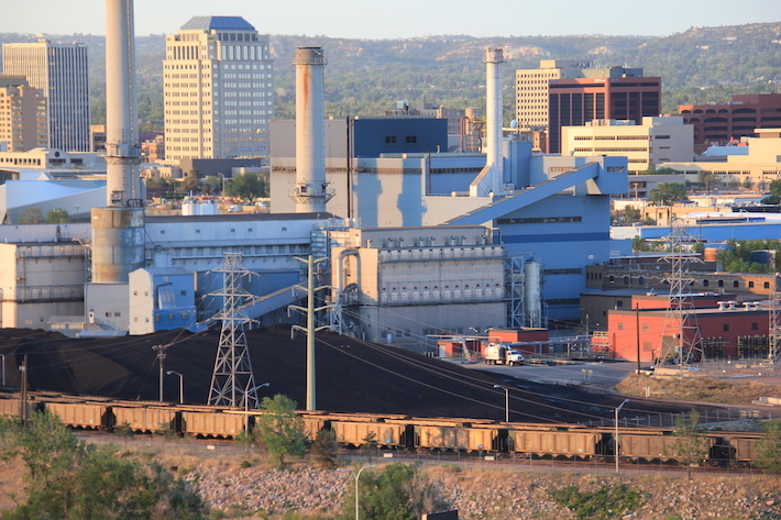
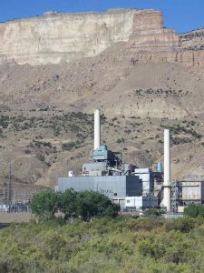


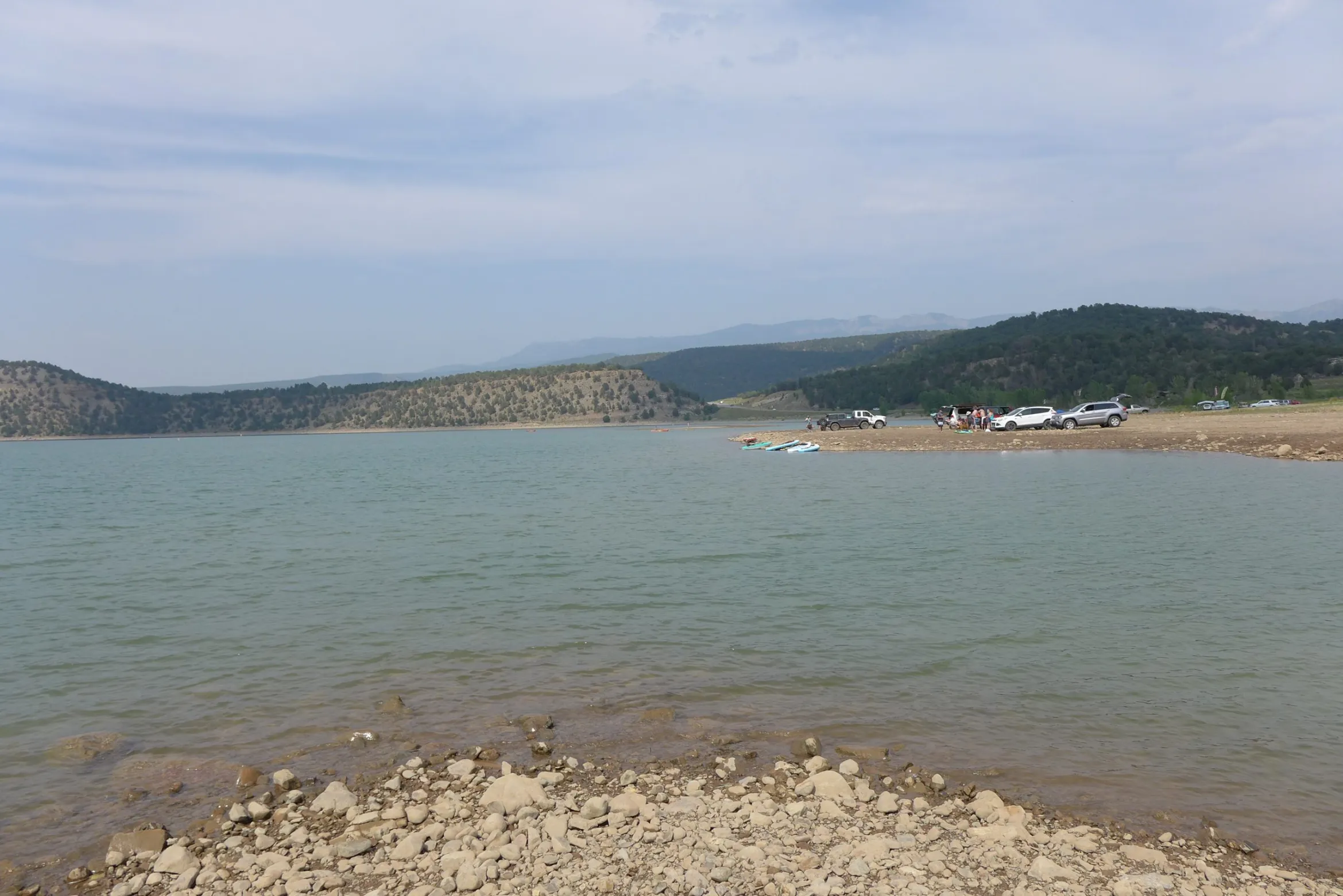
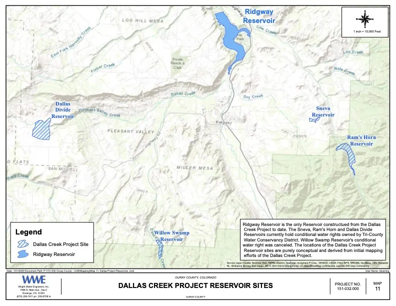


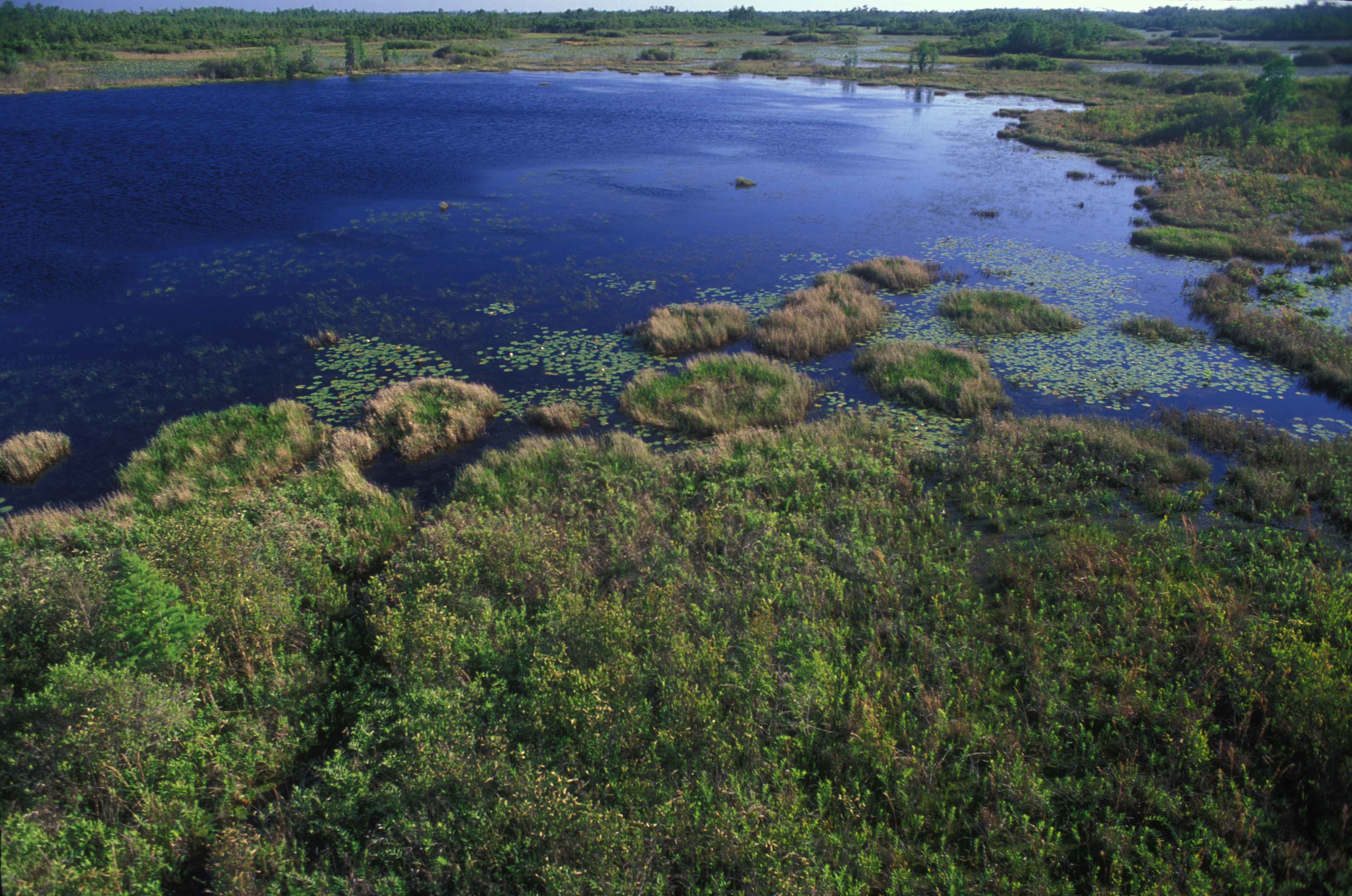

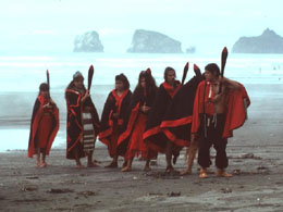

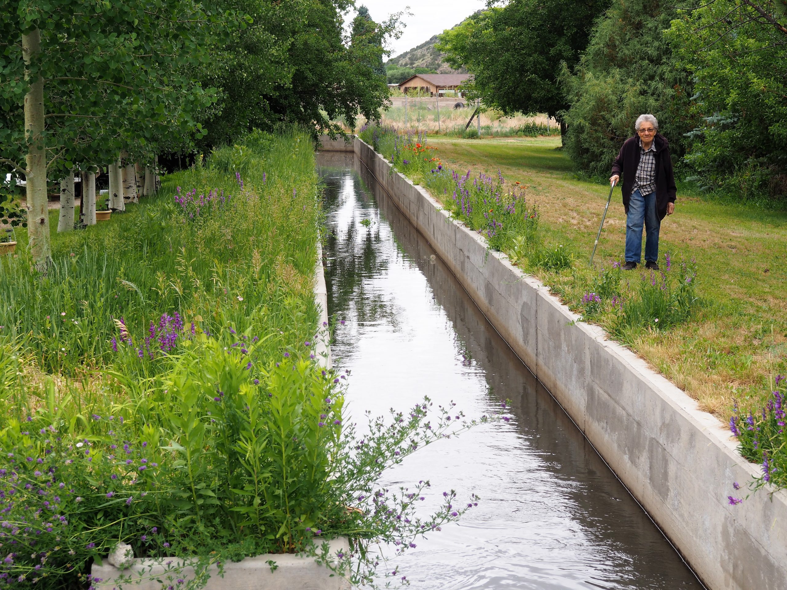
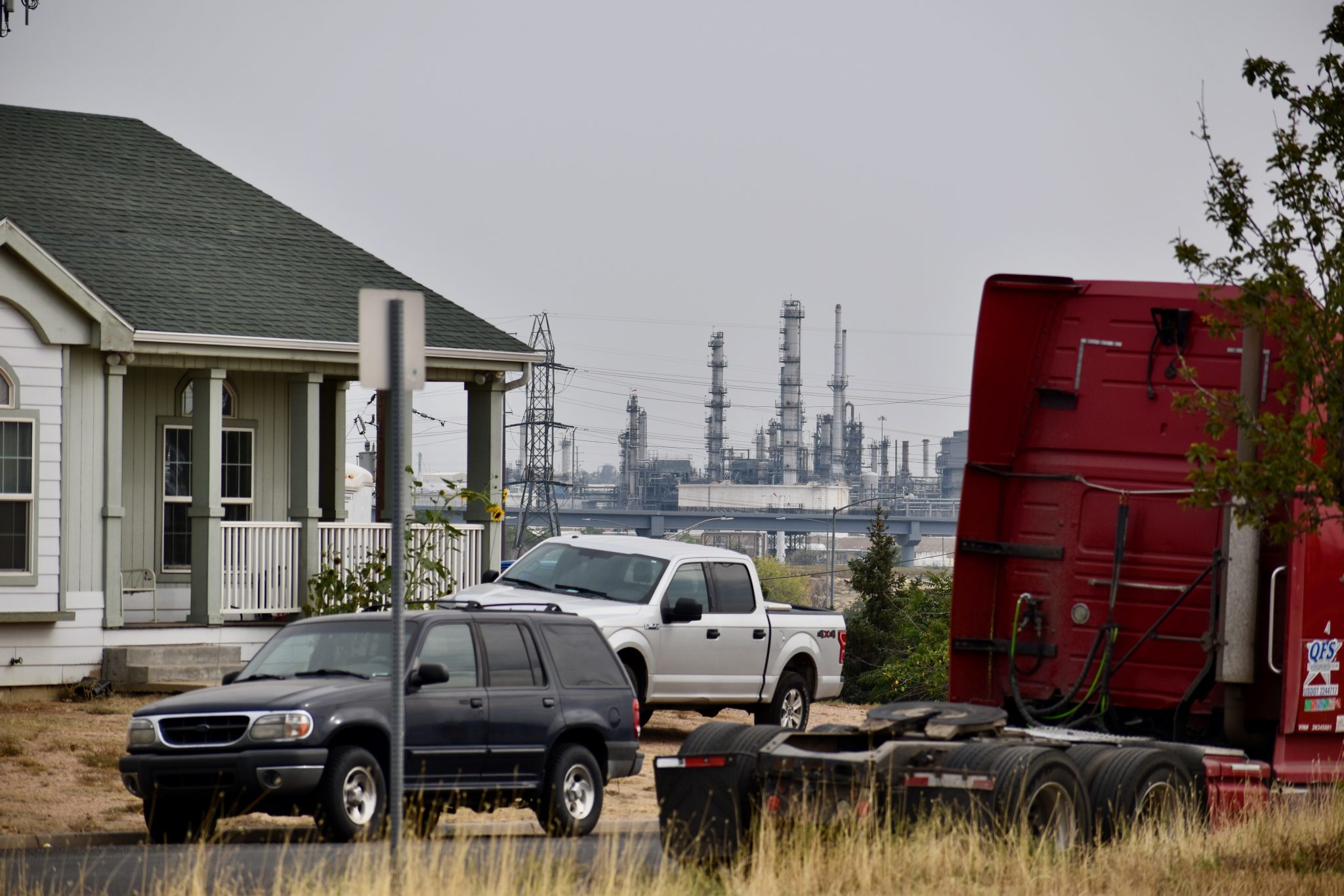


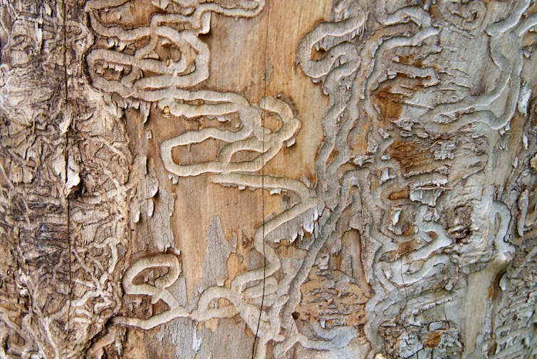

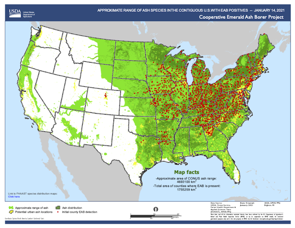

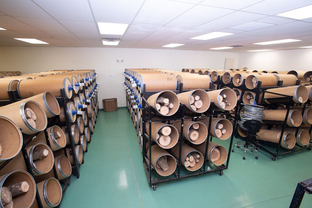
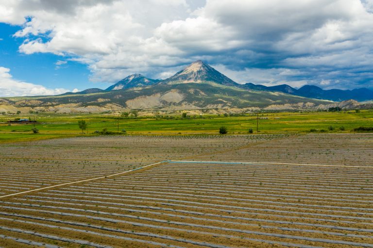

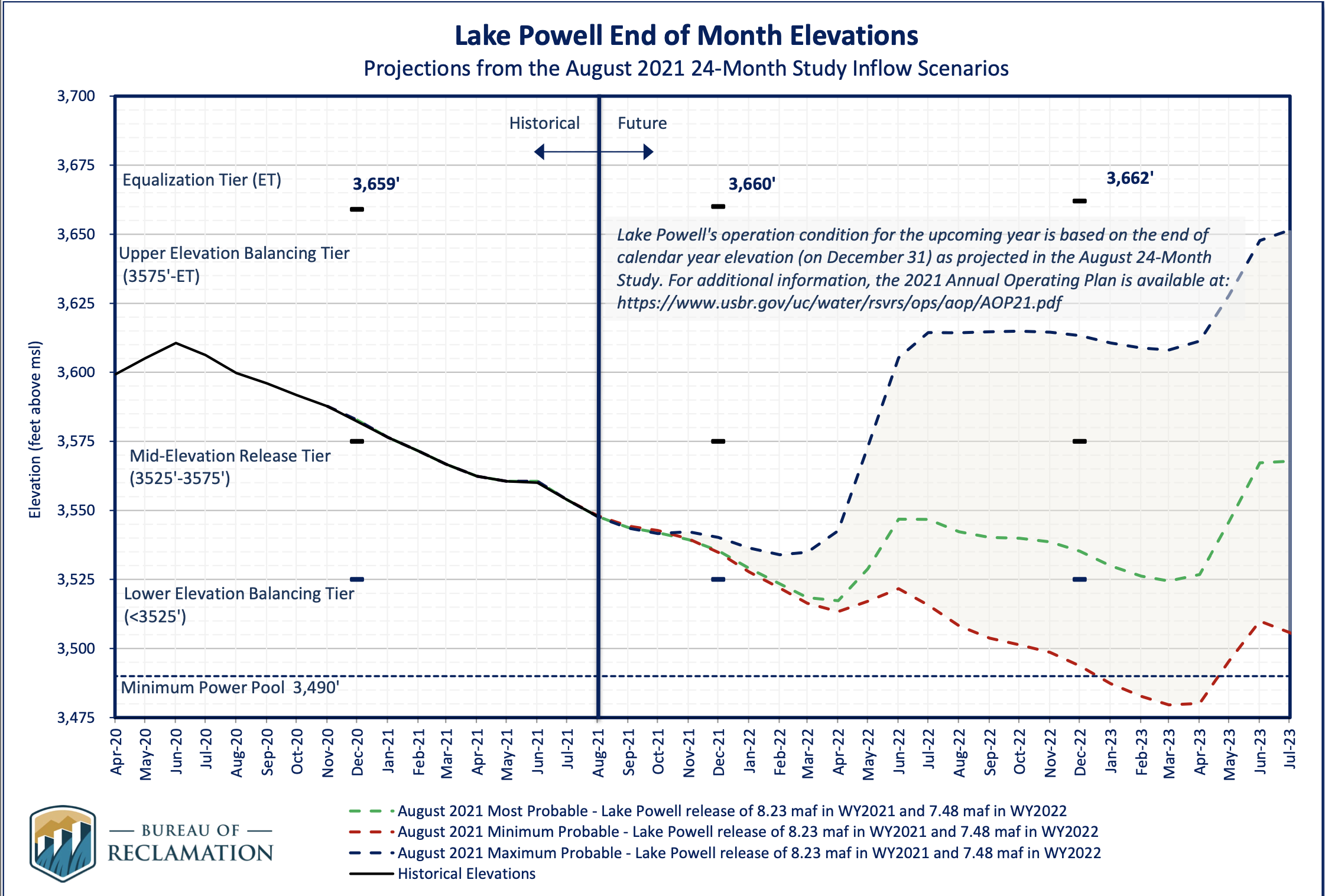

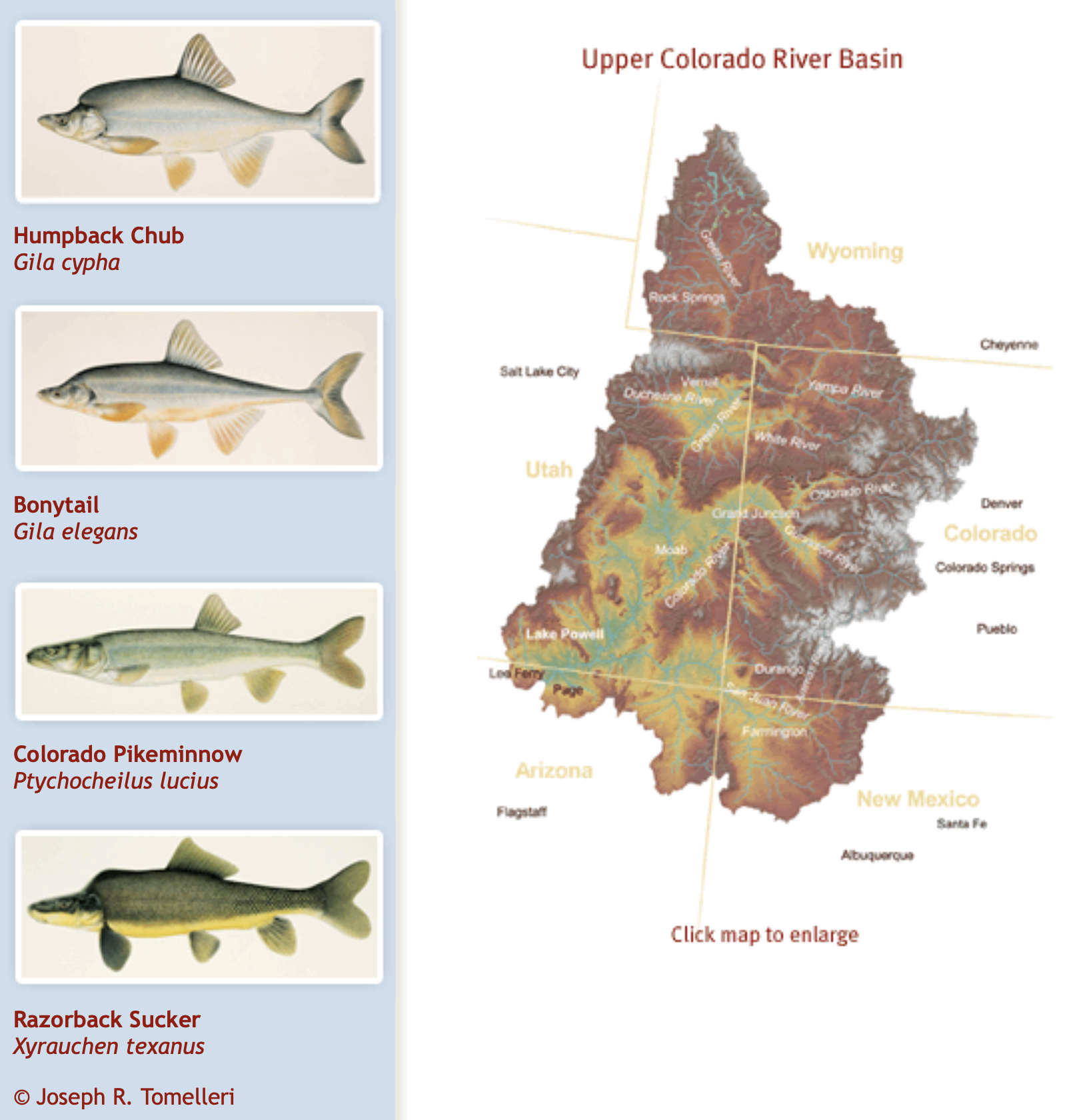


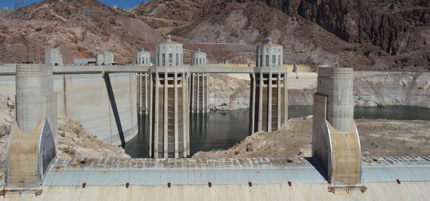
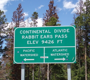


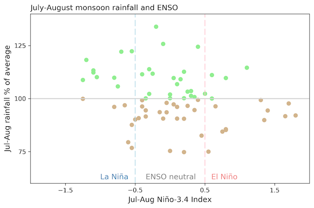
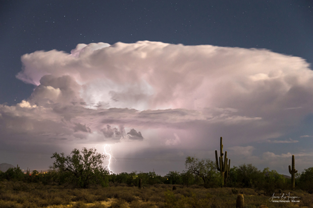
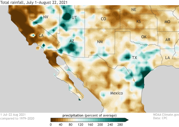
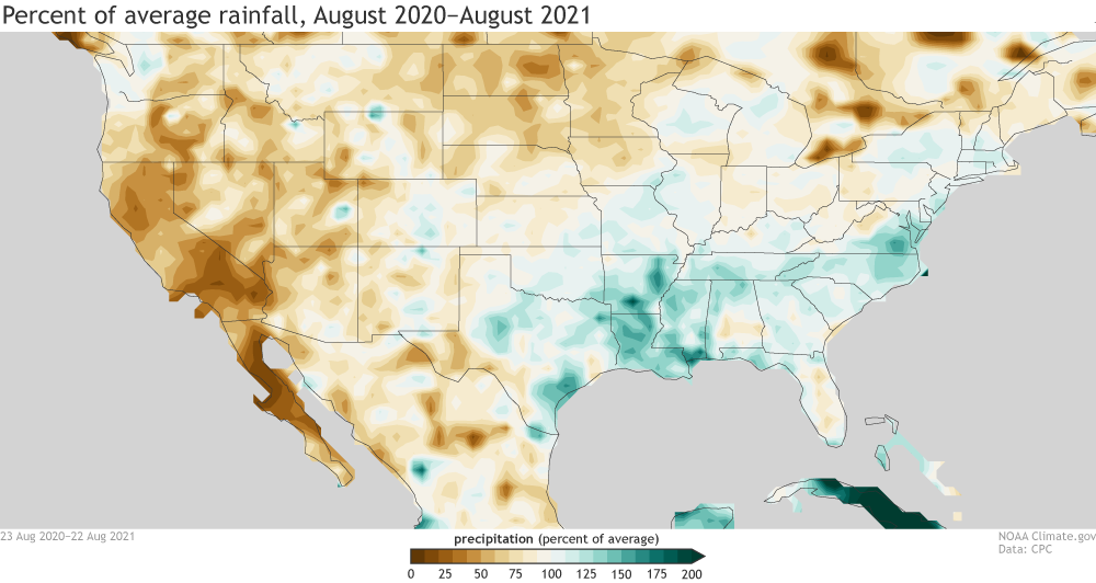
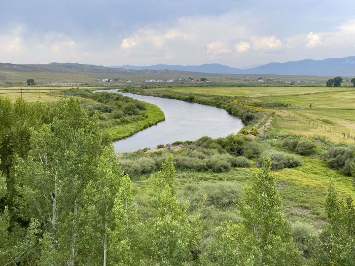


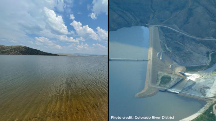
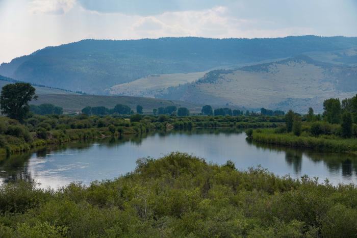
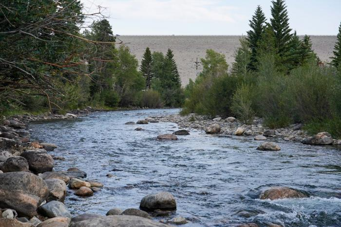
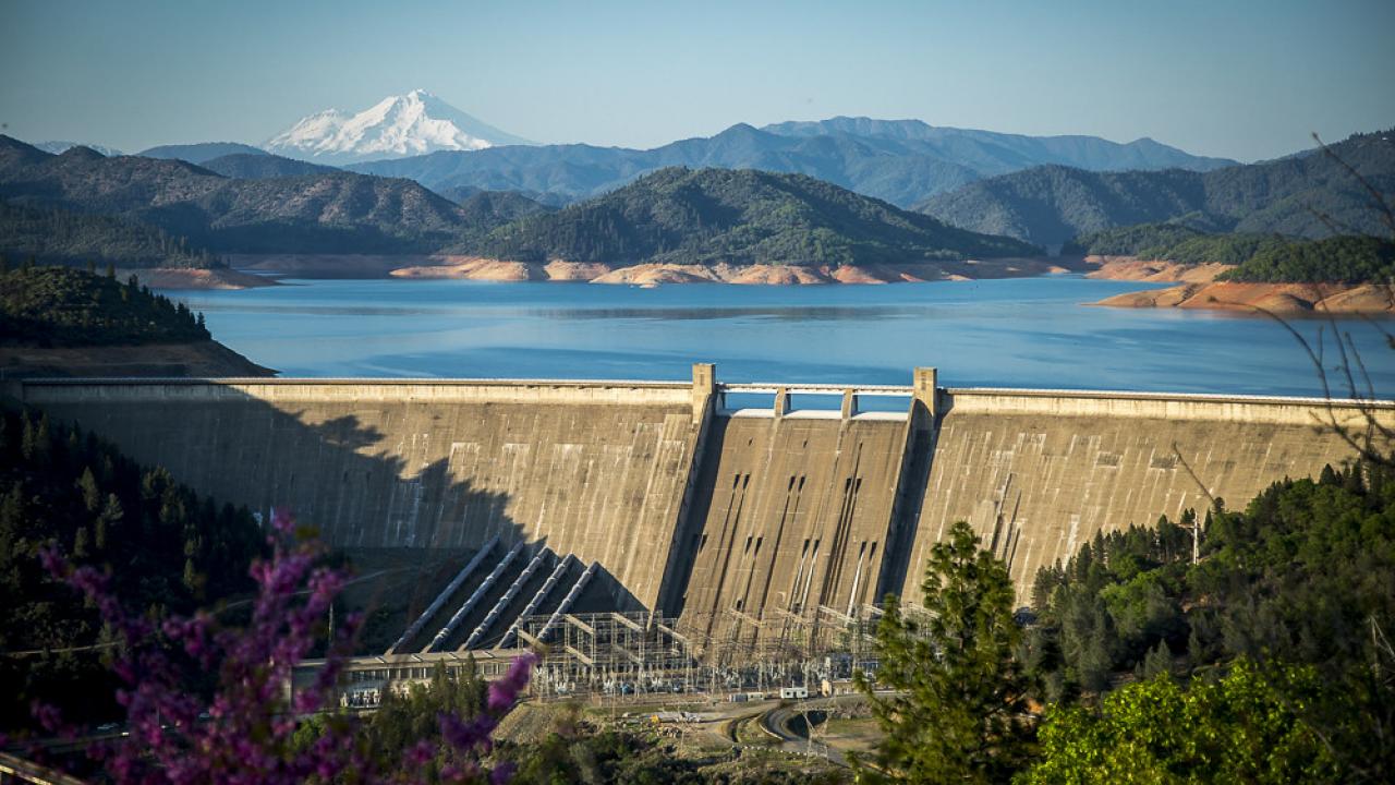
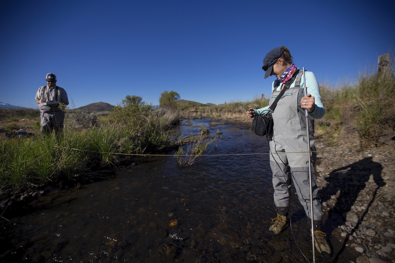
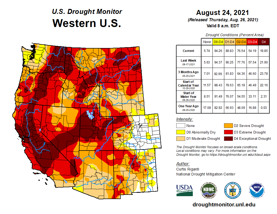
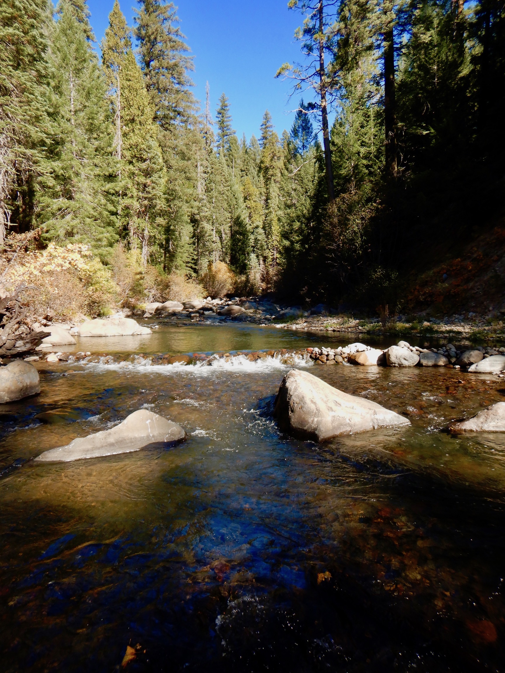


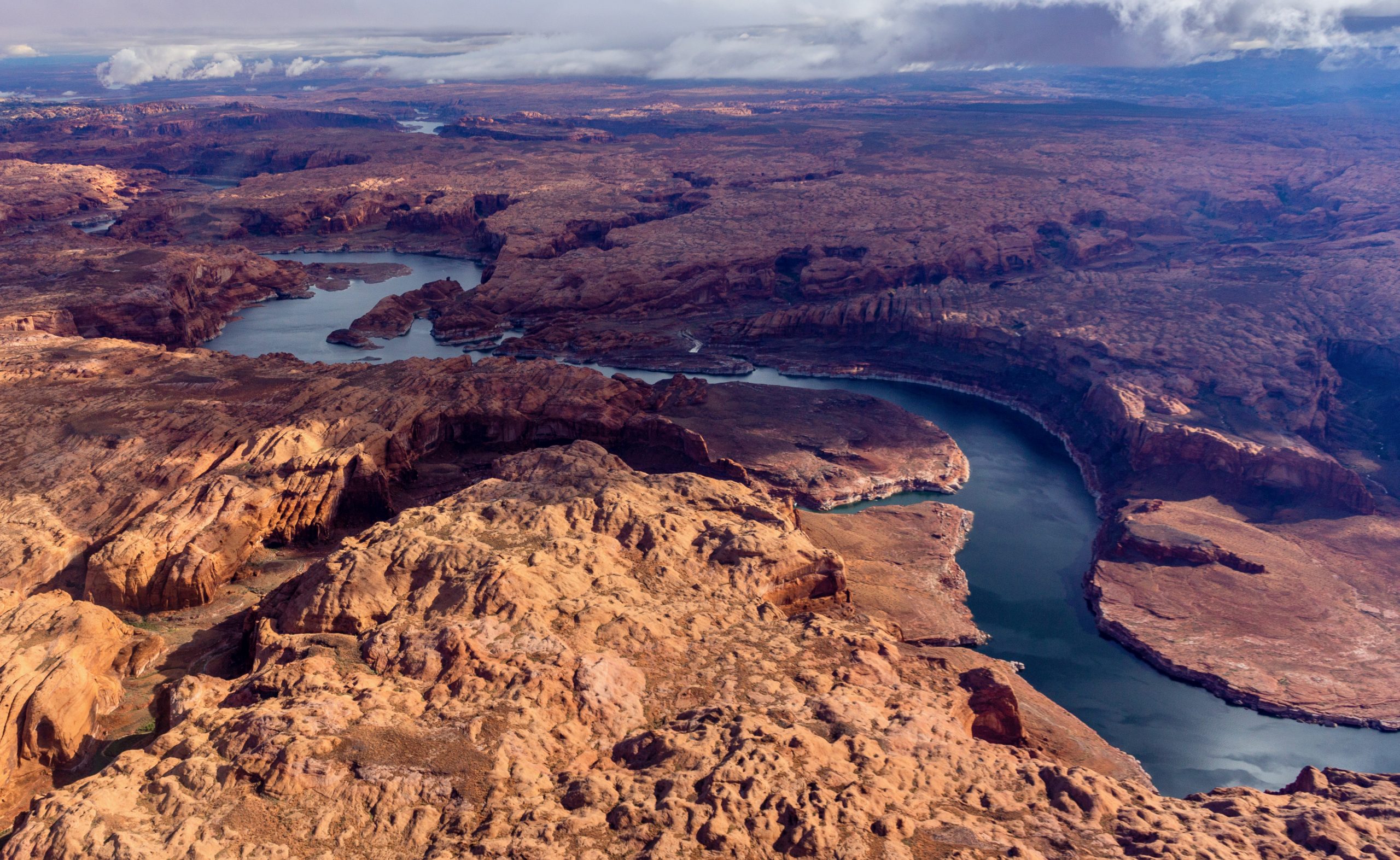
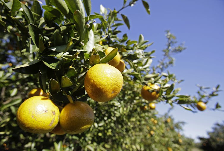
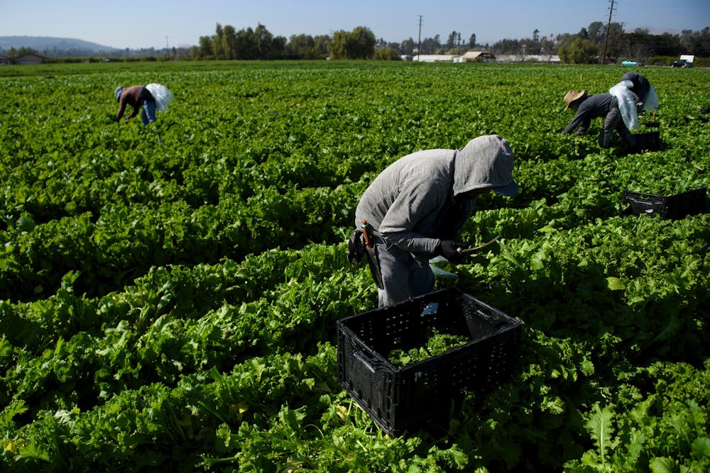
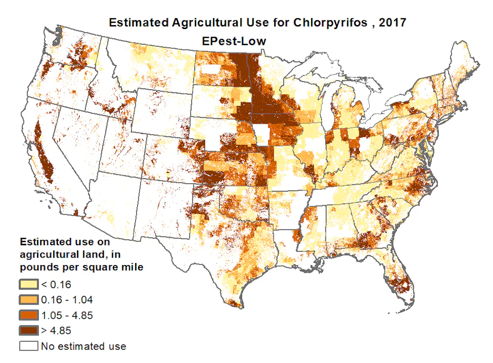
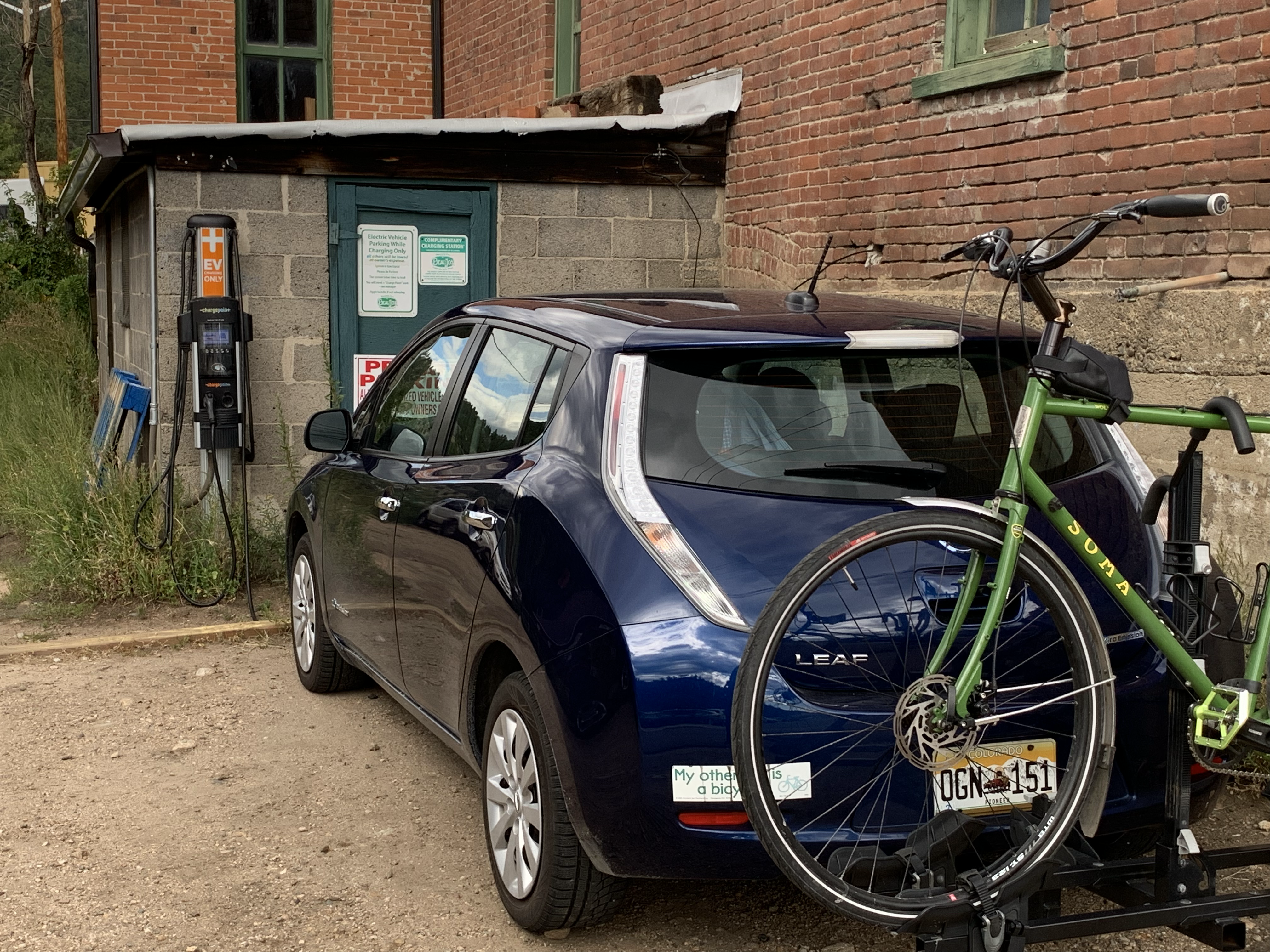
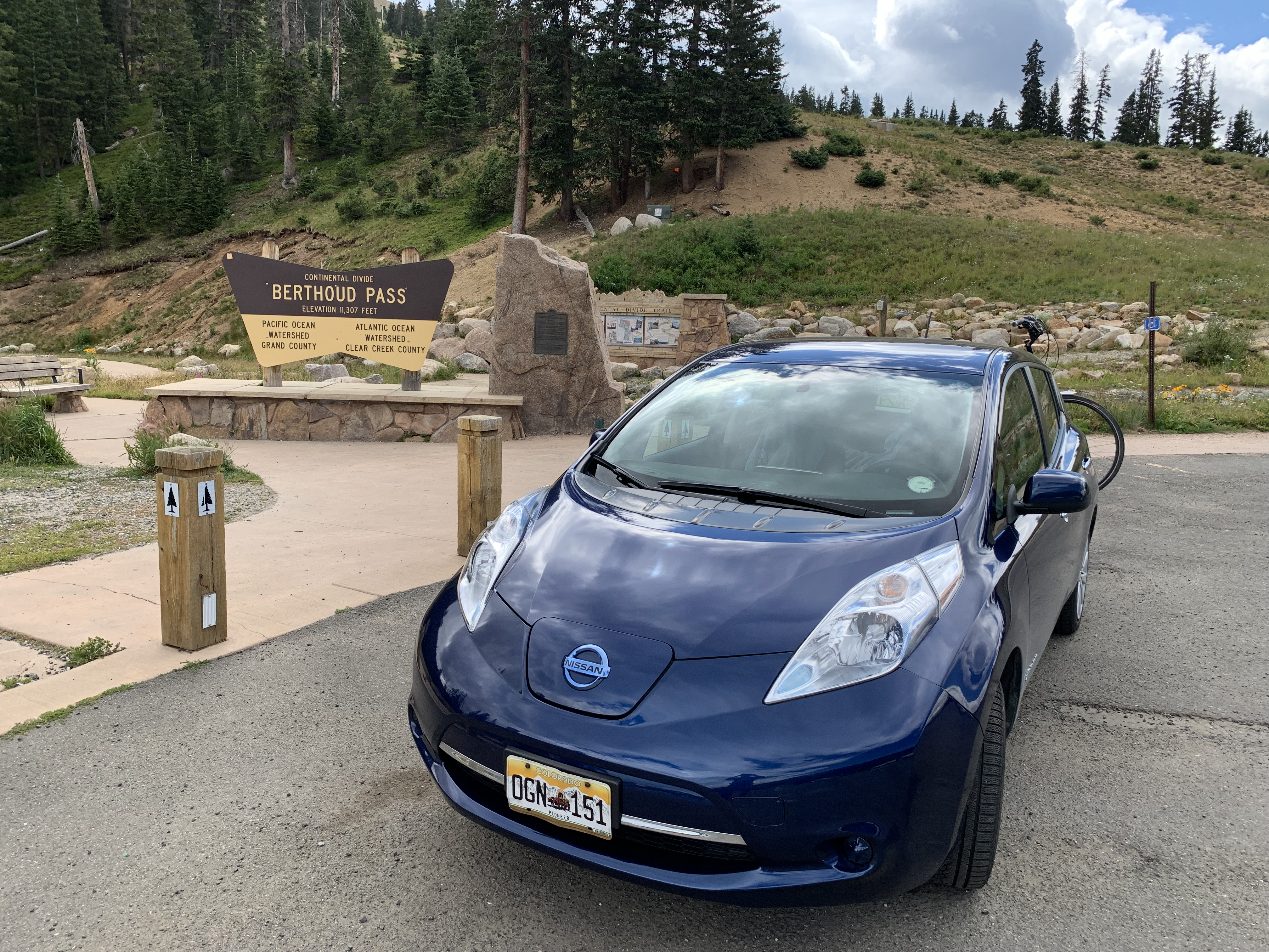


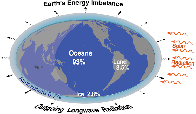
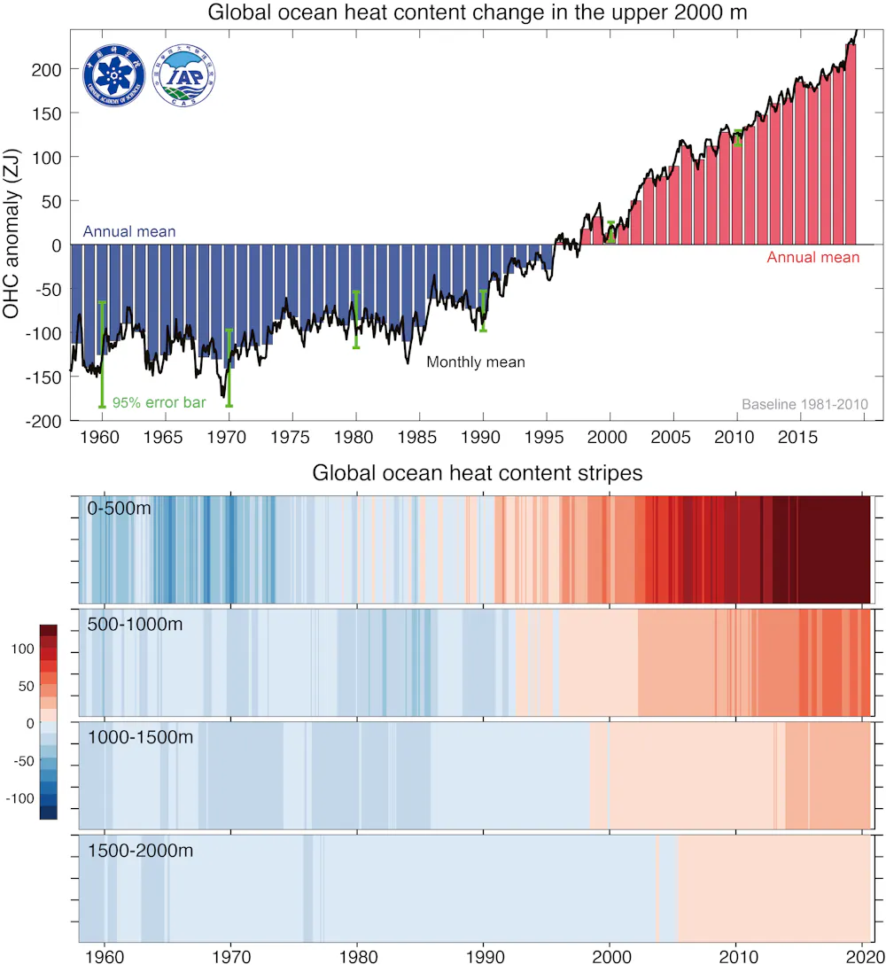

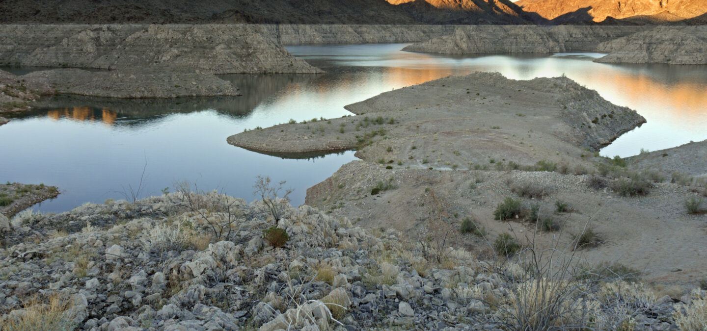


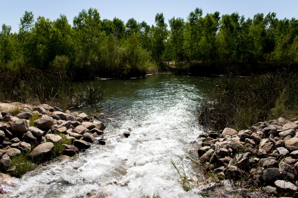
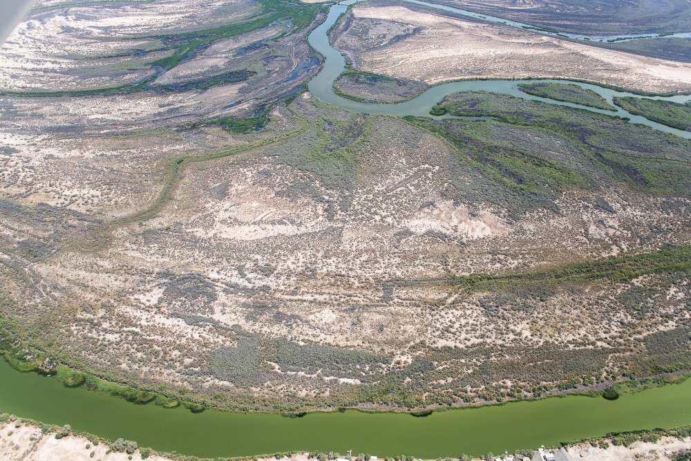


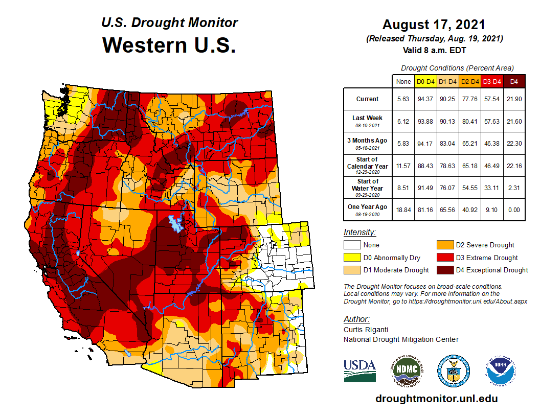


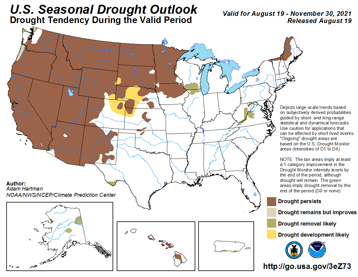
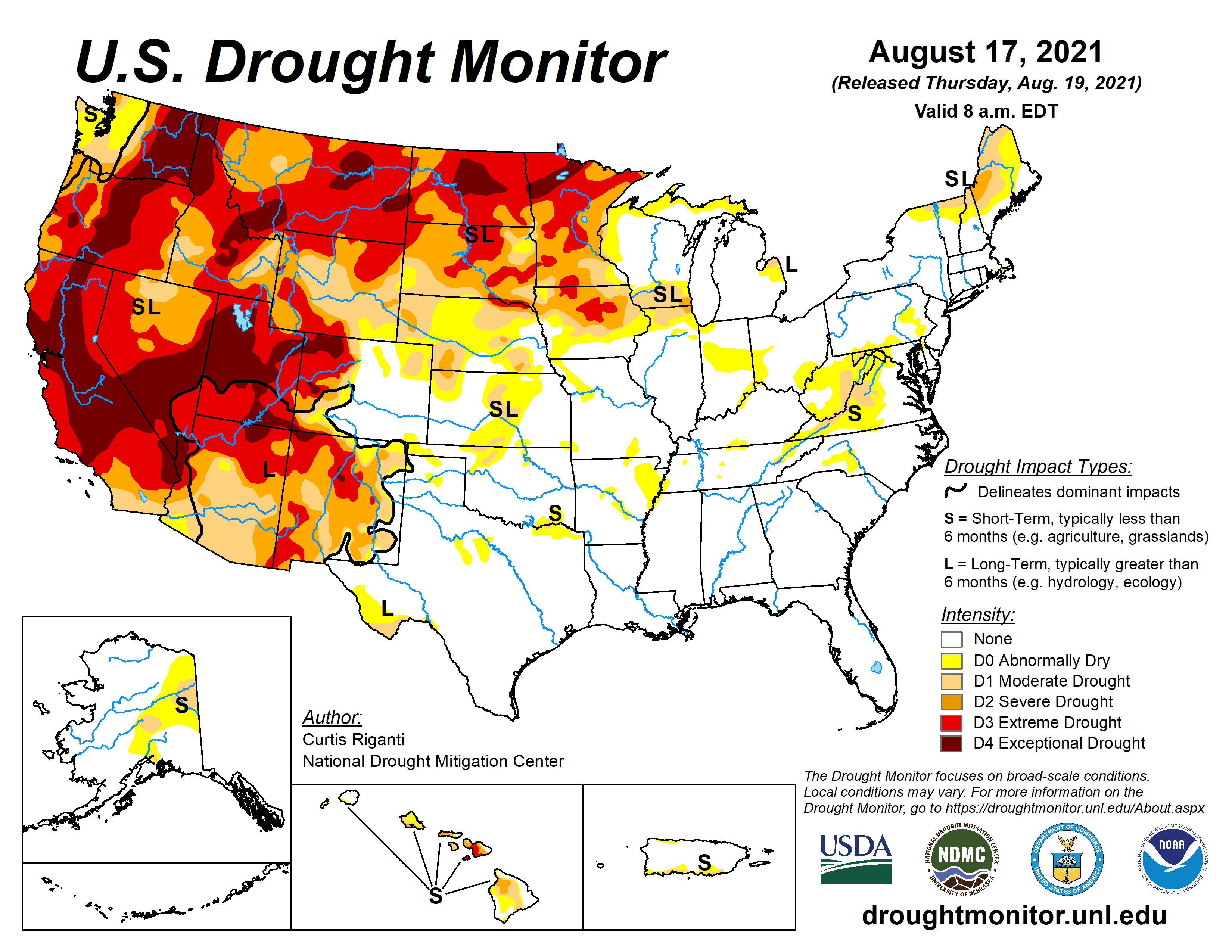
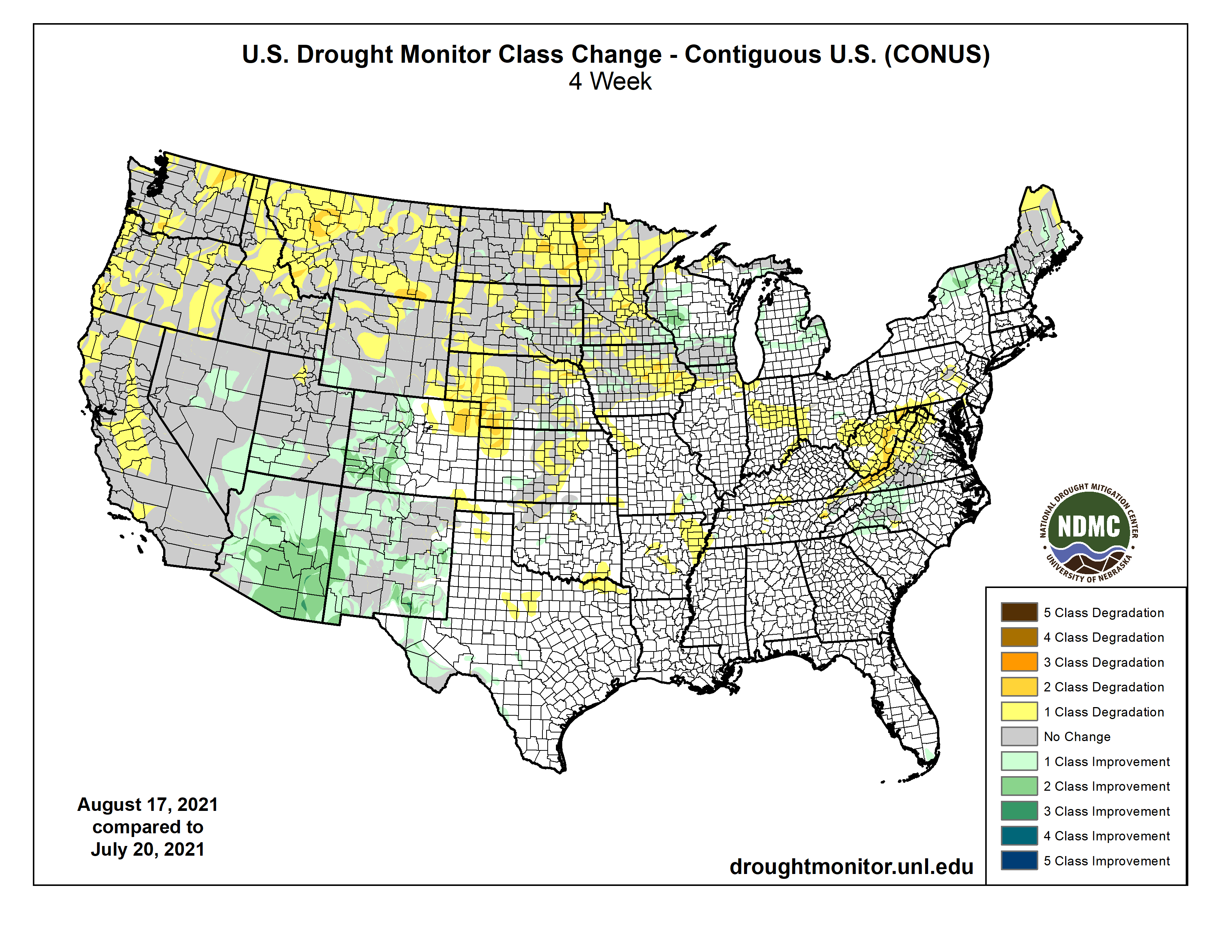

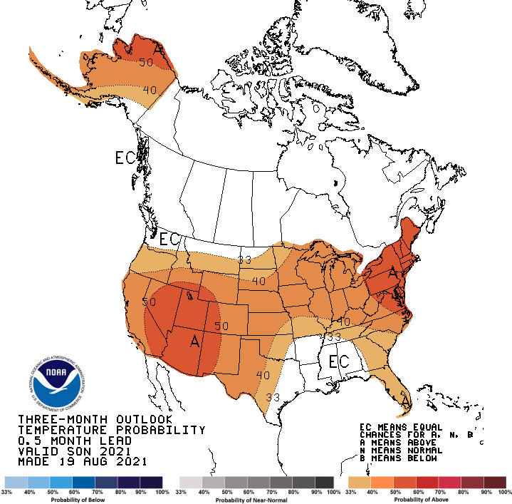

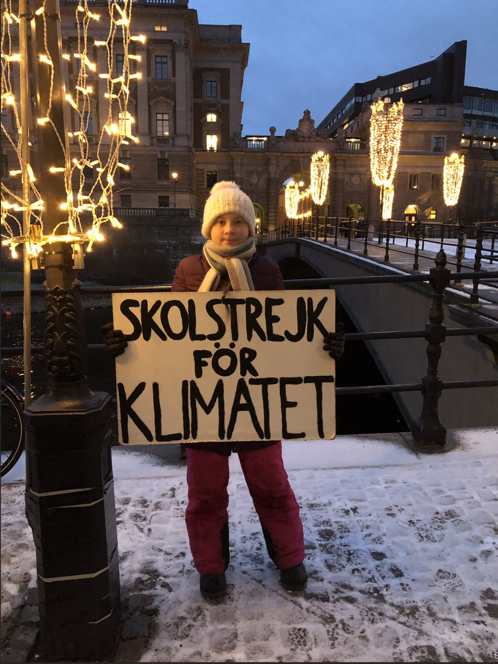


![Screenshot of Rolling Stone Special Edition March 2020. [Click image to go to the article.] Greta Thunberg illustration by Shepard Fairey. Based on a photograph by Markus Schreiber/AP Images/Shutterstock](https://i0.wp.com/coyotegulch.blog/wp-content/uploads/2020/03/screen-shot-2020-03-28-at-8.39.50-am.png?w=300&h=367&ssl=1 "Screen Shot 2020-03-28 at 8.39.50 AM")


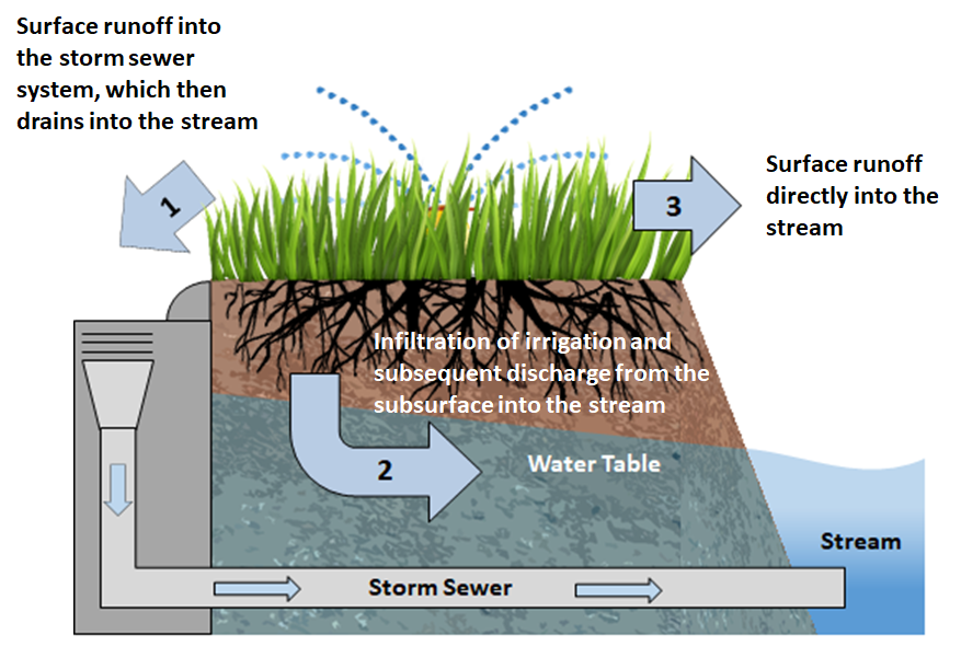


