Click the link to read the summary on the Colorado Water Conservation Board website (Ben Wade):
Observed temperature
This summer has been the 6th warmest summer on record, and the 2nd warmest summer on record for Colorado in terms of average low temperatures due to consistent warm nights. While warm nights indicate more humidity and less evaporative demand, they put stress on people and livestock. September continued the trend of above average temperatures.Observed precipitation and drought conditions
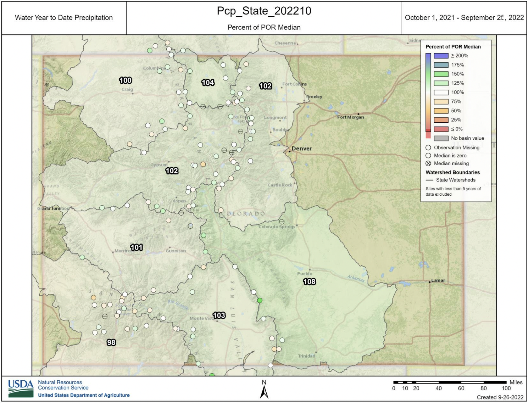
September precipitation was normal to above normal in all but the northern part of the state due to the early onset of the monsoon, particularly in southern Colorado. This summer was the 34th wettest summer on record, and the first above average summer since 2015. However much of this precipitation occurred in the southern part of the state, while the Northeast was very dry.According to the U.S. Drought Monitor, much of Colorado experienced drought condition improvement with parts of central Colorado moving out of drought altogether. About 45% of the state remains in drought conditions (D1 and above), and 15% of the state has no level of drought. Persistent drought conditions still continue in the northeast portion of the state, whereas conditions have improved along the Continental Divide and in southern CO. Water year to date precipitation statewide is just above the median, picking up in mid-June after a dry spring. Most basins are near the long term average for the water year, though the northeast corner and Baca county remain dry. Portions of Phillips and Sedgwick Counties are now in exceptional drought. Summer of 2022 was warm and wet, with above average precipitation in most of the state and temperature 1.5 degrees warmer than average. According to the Drought Monitor, Weld and Yuma counties have been in D3 for 13 consecutive weeks,
Yuma for 11 weeks, Phillips and Sedgwick have been in D4 for 7 weeks, and Montezuma County was in D3/D4 for 122 consecutive weeks.Observed streamflows
Even though higher than normal precipitation in the southern part of the state slightly improved streamflows, below normal streamflows were observed across most of the state for the April-July time period.Snowpack and reservoir storage
Reservoir storage remains below normal in most of the state as a result of lower than expected stream flows attributable to dry soils, as well as warm, dry conditions over several years. The statewide average sits at 78% of normal. The Rio Grande and South Platte basins have the most plentiful storage at 103 and 97 percent, respectively. Reservoir storage is especially low in the Gunnison basin, due predominantly to releases from Blue Mesa, and in the southwest part of the state.Seasonal outlook
La Niña looks likely to continue through fall and into the winter, and the Climate Prediction Center indicates Colorado is more likely to experience warmer than average conditions through the end of the calendar year. While precipitation outlook is less certain, the outlook leans toward drier than average conditions.