This story is part of the Grist seriesParched, an in-depth look at how climate change-fueled drought is reshaping communities, economies, and ecosystems.
In theory, the federal government can unilaterally cut water deliveries from the Colorado River’s two main reservoirs, Lake Powell and Lake Mead, which release more than 2 trillion gallons of water to farms and cities across the Southwest each year. In reality, this has never happened: Previous cuts have always been negotiated between the federal government and the seven states that use the river.
Late last week, however, the federal government sent its strongest signal yet that it is willing to single-handedly impose water cuts on the Colorado for the first time in history, as the U.S. West stares down the consequences of a climate-change-fueled megadrought that has parched the river.
The Department of the Interior, the federal agency that manages water in the Colorado River basin, announced on Friday that it would look into changing the rules for how it operates Lake Powell and Lake Mead, which are located in southern Utah and southern Nevada, respectively. This would pave the way for the department to impose sharp cuts on major water users in Arizona, Nevada, California, and Mexico, which receives water pursuant to a 1944 treaty.
In effect, the letter is a formal warning to the river states, telling them that if they fail to make the major cuts necessary to prevent the reservoirs from bottoming out, the feds won’t hesitate to unilaterally cut their water deliveries to do so.
The Interior Department said in its Friday letter that it would conduct an environmental review before changing the rules to impose new cuts on the states. This will give states one more chance to come up with their own voluntary reductions before the government enacts its own. According to John Fleck, a professor of water policy at the University of New Mexico, the upshot of all this is that unprecedented water reductions are all but guaranteed next year.
“Whether those cuts are imposed by a government action, or voluntary action by the states, or the fact that the reservoirs are fucking empty, they will happen,” he told Grist.
The new review comes after months of tense negotiations between the federal government and the seven basin states: California, Colorado, Utah, Wyoming, New Mexico, Nevada, and Arizona. Earlier this year, as water levels in Lakes Powell and Mead fell to historic lows, officials at the Interior Department’s Bureau of Reclamation ordered states to reduce their water consumption. The Bureau wanted a total reduction of between 2 and 4 million acre-feet — roughly a third of all water usage on the river.
The states have not even come close to meeting that goal. Major water users in California, which is the thirstiest of the seven states by far, agreed last month to cut water withdrawals by about 400,000 acre-feet, a decision that will have major implications for the agriculture-heavy Imperial Valley as well as the Los Angeles metro area. Arizona has reduced its Colorado usage over the past two years in compliance with pre-existing drought restrictions from the feds. The four states that comprise the river’s “upper basin” — Colorado, Utah, New Mexico, and Wyoming — have not announced any concrete steps to cut their water usage.
Meanwhile, the outlook for the river’s two main reservoirs has continued to worsen. As runoff from melting snow in the northern Rocky Mountains works its way down through the Colorado River’s tributaries and into the river’s mainstem, the Bureau of Reclamation stores this water in Lake Powell, which sits on the border of Utah and Arizona. The Bureau then releases some of this water further down the river to Lake Mead in Nevada, and then further on to water users in the Southwest.
The ongoing, two-decade drought has reduced overall precipitation and evaporated more Rockies snowmelt before it can reach the river, which has reduced inflow into both reservoirs. They now sit three-quarters empty, and the most recent federal projections show that they could each decline below a critical threshold in the next two years. In the worst scenarios, it’s possible that the reservoir dams might cease to generate hydropower, or that the water level in the reservoirs would fall lower than the pipes that release it from the dams. This would make it impossible for the Bureau to move water through the river system.
The Interior Department’s Friday announcement brought home the gravity of the situation, albeit in somewhat bureaucratic language.
“The Department currently lacks analyzed alternatives and measures that may be necessary to address such projected conditions,” wrote Tommy Beaudreau, the department’s deputy secretary. He added that the conditions “pose unacceptable risks” to the river system, and that a solution needs to be “expeditiously developed.”
The federal government technically has the authority to make changes to the amount of water it releases from the reservoirs without consulting the states, but it has never had to test that authority: the current shortage guidelines were the product of a yearslong negotiation process between the Interior Department and the states. The feds are now threatening to alter that agreement on their own, and the Interior Department’s announcement helps lay the groundwork for such an intervention. If the government does modify its guidelines, it could set a new threshold for when to stop releasing water from Lakes Powell and Mead, imposing deeper and earlier cuts than states have endured so far. The review process puts the feds on firmer legal footing in case a state water user sues over the new reductions.
The losers in such a scenario would be the lower basin states — California, Nevada, and Arizona — which rely on water that the government releases from Lake Mead, as well as Mexico, where decades of overuse caused the river delta to disappear during the twentieth century. The states use the bulk of this water for agriculture, but a significant share also flows to major cities. The upper basin states draw water from the river before it reaches the reservoir, so they would be insulated from changes to the reservoir rules.
The government’s review won’t conclude until next summer, but new rules could take effect immediately, which means painful new cuts may arrive in the Southwest as the region’s farmers are preparing for peak growing season.
Click the link to read the release on the EPA website:
Today [October 28, 2022], the U.S. Environmental Protection Agency (EPA) announced $748,180 in research grant funding to three institutions for research to improve our understanding of how people are exposed to per- and poly-fluoroalkyl substances (PFAS) in several communities throughout the country.
“Recognizing that exposure to PFAS is a public health and environmental issue facing communities across the United States, and consistent with EPA’s Strategic Roadmap for PFAS, the EPA is investing in scientific research to increase understanding of PFAS exposures,” said Chris Frey, Assistant Administrator of EPA’s Office of Research and Development. “The research announced today will answer critical questions regarding the contribution of PFAS exposures at home to PFAS found in the body and will produce science that can help inform and focus decisions to protect human health.”
PFAS are a large group of chemicals that are used in many consumer products and industrial and manufacturing applications and are commonly known as ‘forever chemicals’ since they take so long to break down. Due to their widespread use and environmental persistence, most people in the United States have been exposed to PFAS. There is evidence that continued exposure above specific levels to certain PFAS may lead to adverse health effects. More data is needed to measure the nature and levels of PFAS in homes and food to understand pathways for human exposure and risk mitigation.
The research grants announced today will help us better understand the sources and pathways related to people’s exposures to PFAS chemicals.
The following institutions are receiving awards:
Silent Spring Institute, Newton, Mass., to measure PFAS in air and dust in homes, and evaluate associations between potential residential sources and PFAS occurrence at home. This research will enhance understanding of the contribution of residential pathways to PFAS exposures and improve the interpretation of PFAS biomonitoring data.
Duke University, Durham, N.C., to determine how different sources of PFAS exposure, including PFAS in drinking water and in homes, contribute to levels measured in blood. This study will address key questions on the most relevant PFAS exposure pathways for the general U.S. population.
Emory University, Atlanta, Ga., to develop a standardized, validated, scientific protocol to measure levels of a targeted set of PFAS in the home. Data collected from home samples will be compared to data collected from PFAS in blood to help identify residential sources of PFAS measured in people’s blood.
October represented the 5th consecutive month with above normal temperatures for Denver (monthly departure of +2.7 degrees). Temperature extremes were limited on both ends.
Denver's 0.46" of precipitation was 0.53" below normal. All areas of NE CO were drier than normal. #COwxpic.twitter.com/LjfB14T1KT
Rockslides in Glenwood Canyon are one reason Eagle County is concerned about the potential for 10 additional train trips daily hauling crude oil. Pitkin County is trying to lend a voice to Eagle County’s objection to the additional rail traffic.. Glenwood Canyon and the Colorado River. Photo credit: CDOT via Roads & Bridges
Pitkin County government has joined a legal challenge to try to prevent crude oil from being shipped by rail from Utah to Denver in an effort to support neighboring Eagle County. Pitkin County doesn’t have a dog directly in the fight, but the county commissioners on Oct. 26 approved attempting to hop in because of concerns over what a train derailment could mean to Colorado’s environment.
“You can only imagine the catastrophe if we had an incident in Glenwood Canyon, for instance, or anywhere on the river corridor on the Upper Colorado,” said Commissioner Greg Poschman. “It would affect 40 million people downstream, so I think it’s a risky thing to do, and I think they can find another way to transport their oil.”
[…]
Pitkin County is one of several counties and municipalities that entered an amicus, or friend-of-the-court brief, asking for permission to join the legal fight headed by Eagle County and a coalition of conservation groups. Eagle County and conservation groups headed by the Center for Biological Diversity appealed a decision by the U.S. Surface Transportation Board that would allow construction of an 88-mile rail line from the Uinta Basin in Utah to carry crude oil from a production field and tie into the existing 457-mile Union Pacific rail line for delivery to a refinery in Denver. The crude oil would be hauled along the Interstate 70 corridor into Eagle County and then into Grand County, through the Moffat Tunnel and down the East Slope to Denver.
Finally, some improvement. After reaching 6-year highs 3 weeks in a row, topsoil moisture short/very short dropped 4% to 64%. The biggest improvements were along the Mississippi River Basin.
During the Fourth Quarterly General and Enterprise Meeting of 2022, the Board of Directors approved $195,293 for four new Community Funding Partnership projects. In less than two years of operation, the Community Funding Partnership has supported over 60 projects and awarded over $5.6 million to benefit West Slope water, according to Amy Moyer, Director of Strategic Partnerships.
Two of the most recent board-approved projects represent critical steps forward in accurately forecasting water supplies in the Colorado River Basin.
The Airborne Snow Observatory (ASO) Snow Mapping in the Roaring Fork and Fryingpan Watersheds, and the Roaring Fork Basin – Evaluation of Soil Moisture for Water Planning will increase the precision, reliability, and understanding of snowpack and soil moisture measurements, respectively.
According to the project summary provided by the Aspen Global Change Institute (AGCI) in its application, “In the Colorado River Headwaters Basin in 2021, a March snowpack of around 91% of average translated into only 54% of average streamflow by end of June (data from NRCS), contributing to severe deficits in the water supply and creating challenges for water managers.”
Devices such as SNOTel (snow telemetry) sites have been used for decades to measure snowpack levels. The data gathered from SNOTEL sites combined with 30-year climate averages predict how much water will likely end up in the river after the snow melts. While the sites accurately reflect snow conditions in a localized area, they are limited in scope and struggle to account for variability between drainages within the same river basin. Soil moisture measurement stations are even more sporadic across the River District’s fifteen counties. The data and analyses gathered by ASO and AGCI will create a more comprehensive picture of the overall health of the snowpack and its transition to streamflow by leveraging new technology and real time measurements.
A large part mission of the Colorado River District is to ensure that policymakers and water managers have accurate and up-to-date data and modeling. Over 65% of the Colorado River’s natural flow originates within the District’s fifteen counties making decision-support tools a critical need for water managers across the West.
Funded Projects
Airborne Snow Observatory Snow Mapping in the Roaring Fork and Fryingpan Watersheds – Water Year 2023
Project Applicant: Airborne Snow Observatory, Inc. Approved Amount: $75,000 Location: Eagle, Pitkin Counties
Initially a program within NASA, Airborne Snow Observatory, Inc. (ASO) is a Colorado Public Benefit Corporation that combines state-of-the-art remote sensing tools with snowpack modeling and fast data processing to deliver snow measurements of high accuracy, high resolution, and full-watershed coverage. The proposed project will support ASO snow mapping flights during winter/spring 2023 in the Upper Fryingpan and Roaring Fork watersheds. This project will provide an unparalleled inventory of the mountain snowpack that supplies the majority of runoff in the Roaring Fork River system.
Roaring Fork Basin – Evaluation of Soil Moisture for Water Planning
Project Applicant: Aspen Global Change Institute Approved Amount: $60,293 Location: Garfield, Pitkin Counties
The Aspen Global Change Institute manages the Roaring Fork Observation Network (also known as iRON) to collect and share data on soil moisture, climate, and ecology in the Colorado River headwaters basin. The iRON program centers around data collected by ten stations at different elevations and ecosystem types across the Roaring Fork Watershed. This project responds to a community need to better understand how soil moisture data can be effectively leveraged to better understand the relationship between snowpack, soil moisture, and streamflow in Western Colorado and beyond.
GVIC ML 260 Lateral Piping Project
Project Applicant: Grand Valley Irrigation Company Approved Amount: $40,000 Location: Mesa County
The Grand Valley Irrigation Company owns and operates the ML 260 lateral, which includes a 3,540-foot stretch that remains an open, trapezoidal ditch comprised of aging concrete. The project will pipe the remaining portion of the lateral resulting in a completely enclosed system. Piping will greatly reduce maintenance, such as monthly silt and root removal and concrete work to patch the ditch, while improving flows by eliminating silt deposition. Additionally, piping will prevent approximately 153 tons of salt from entering the Colorado River and reduce seepage losses that are currently estimated at 45 AF per year.
Increased pressure on the Fryingpan River due to growing population, recreation, and climate change has led to the need for strategic management of Ruedi Reservoir to ensure long-term ecological health and viability of the fishery. Maintaining minimum winter flows at 60-70 cfs increases ecological resiliency through mitigating the formation of anchor ice, which can negatively impact macroinvertebrate community function and diversity. Roaring Fork Conservancy, along with Colorado Water Trust, will partner with the Colorado Water Conservation Board and local entities to fund the release of 25 cfs from Ruedi Reservoir to supplement winter flows on the Fryingpan River. The Fryingpan River, a Gold Medal Stream, hosts thousands of anglers a year. Based on a 2015 Economic Impact study, the river accounts for over $3 million in economic output.
Albemarle Corporation (Formerly Chemetall Foote) Lithium Operation at Silver Peak. By Doc Searls from Santa Barbara, USA – 2010_08_06_rno-phx-bos_033Uploaded by PDTillman, CC BY 2.0, https://commons.wikimedia.org/w/index.php?curid=11770036
Click the link to read the article on Nevada’s only statewide nonprofit newsroom The Nevada Independent (Daniel Rothberg):
There is an otherworldly feel to the crystalline-blue evaporation ponds that sit in Clayton Valley, an arid area in Nevada’s least populated county, Esmeralda. From above, the ponds look like a grid of pooled water arranged in a gradient that moves from a deep-sea blue to a light-sky tone.
The man-made desert pools contain what is naturally underneath the ground: water.
Pumps, drilled deep into the Earth, pull brine from an underground aquifer, and pipes move the salty water into the expansive holding ponds. This is not just any water. It is rich in lithium, a mineral needed for electric cars and large-scale storage batteries, technologies in high demand as countries and industries seek to decarbonize national economies and electric grids.
In the United States, policymakers see these pools and the valley surrounding them as playing a central role. The ponds are part of the Silver Peak mine, an operation run by Albemarle, a global lithium player based in North Carolina. For many years, this mine was the country’s only active domestic lithium source. As lithium prices have skyrocketed, more mines have looked to come online — and Albemarle is looking to expand its footprint and operations in Clayton Valley.
During a recent media tour of Silver Peak, Karen Narwold, Albemarle’s executive vice president and chief administrative officer, said the expansion could double output. Currently, Silver Peak can produce about 5,000 metric tons of lithium per year (one metric ton is about 2,205 pounds).
“The current demand for lithium is probably around half a million,” Narwold noted. “So this is a relatively small site, but very important from the standpoint of a U.S. domestic supply chain.”
“Customers,” she added, “are asking for more and more lithium, all the time, as you see [electric vehicle] demand increasing,” and the expansion of Silver Peak could help fill the supply gap.
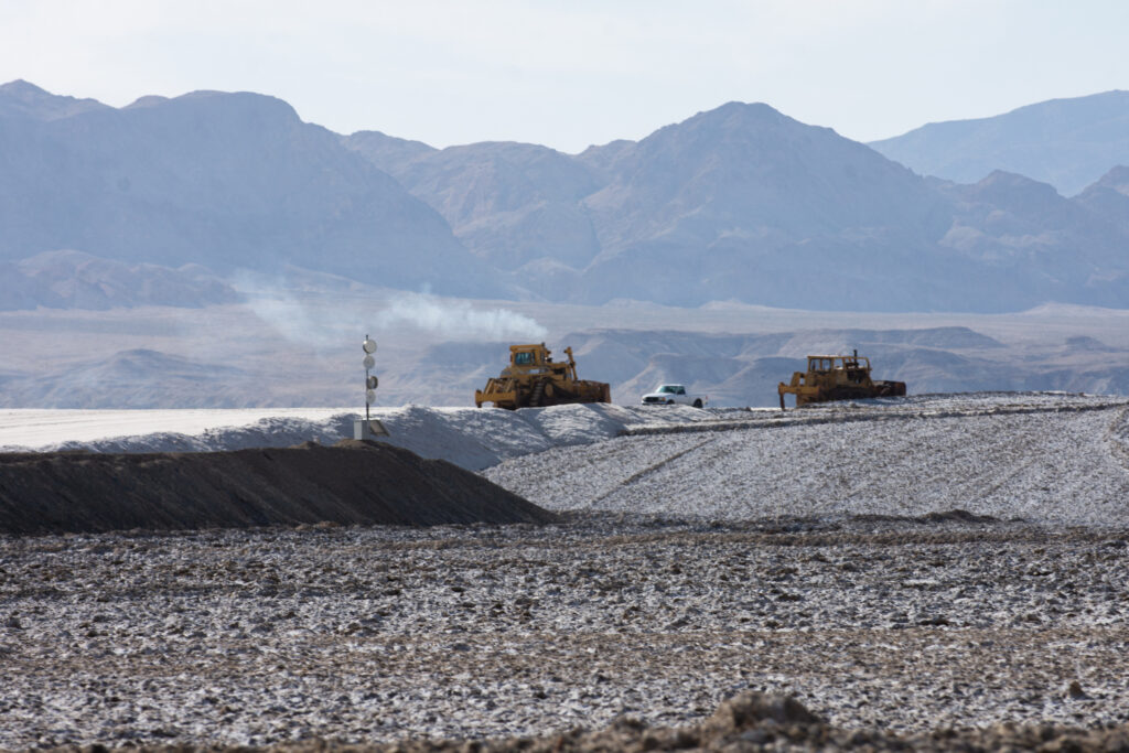
A large-scale evaporation pond at the Silver Peak lithium mine on Oct. 6, 2022. The evaporation process can take a year and a half to complete. (David Calvert/The Nevada Independent)
Heavy equipment is used to manage the Silver Peak lithium mine, an operation that relies on the evaporation ponds. A solid salt is a byproduct of the process. (David Calvert/The Nevada Independent)
Yet Albemarle is not the only player in Clayton Valley. SLB, a global oilfield services company formerly known as Schlumberger, holds mining claims for a lithium project next to Albemarle’s existing ponds. The company, eyeing a pivot from fossil fuels to renewable energy, argues that its plant would extract lithium more efficiently and sustainably, all with a smaller water footprint.
Behind the scenes is a contentious and ongoing administrative battle over water rights and the laws that govern mining in the West. At issue is which company has the legal right to extract the lithium concentrated within the valley’s salty waters — and on what terms mining takes place.
Representatives with SLB’s Nevada project have argued that Albemarle has used its large water holdings to actively prevent competition in Clayton Valley, effectively wielding “monopoly” power and shutting out other players with federal claims to mine lithium using new extraction methods.
The settlement of those water rights and mining claims could have major implications for how the race for lithium in Nevada, and in the United States, unfolds. In total, about 30 companies are involved with mining proposals in Clayton Valley, according to the Nevada Division of Minerals.
The division, which tracks more than 17,000 claims for lithium, has seen a roughly 58 percent annual increase in lithium claims. Lithium companies are exploring areas across Nevada, from Dixie Valley to Railroad Valley. Still, Clayton Valley is an area that continues to capture interest.
“There’s a lot of contention there between the entities in Clayton Valley and who has rights to this, that and the other,” noted Mike Visher, the division’s administrator. “At the end of the day, everyone is trying to determine what assets they have — and what’s the value of that asset.”
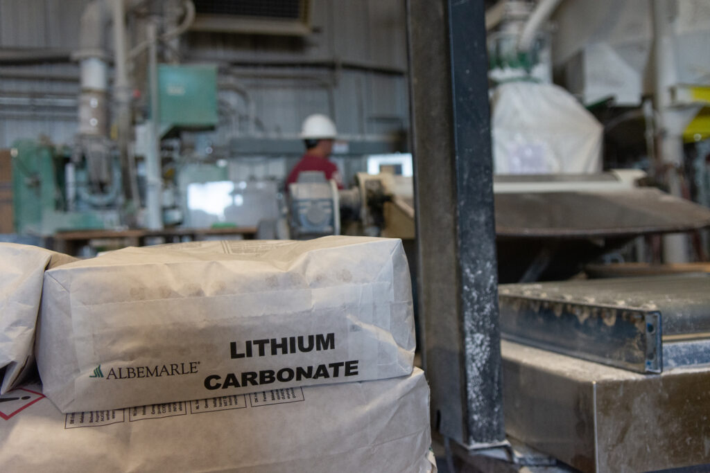
Employees at the Silver Peak mine prepare and stack bags of lithium carbonate, a white powder, on Oct. 6, 2022. Lithium is in high demand as countries seek to decarbonize their economies. (David Calvert/The Nevada Independent)
A water dispute
Here, in Clayton Valley, water rights are everything. Once the brine is pulled from the ground, it is left to sit in the large ponds. Over roughly a year and a half, the brine is transferred to different holding ponds and left to evaporate. With little precipitation and a lot of sunlight, the Silver Peak mine relies on evaporation to get a more concentrated solution. That salty solution is eventually piped to a nearby processing and production facility, where it ends up as a white lithium powder.
All of this is done at scale, and continuously. Albemarle has about 70 wells operating every day, Narwold said. To expand, the company added 22 wells, and it could bring additional evaporation ponds online. The mine includes about 23 ponds. The company, Narwold said, could build two to five new ponds or bring old ponds online by dredging the salt that amasses as a byproduct.
Those investments are to prepare for more brine coming into the system. By the end of the year, Albemarle plans to use all its water rights to produce more lithium, bolstering a domestic supply chain for a mineral increasingly seen as critical for the global economy. Yet SLB is challenging Albemarle’s plans, and its hold on Clayton Valley. SLB argues it has rights to tap into the water.
Two companies with big backing, effectively competing for the same water: Albemarle supplies Tesla and SLB’s operation is strategic partners with Panasonic Energy of North America.
In much of the West and in Nevada, water is regulated on a “first in time, first in right” basis. In the face of scarcity, those who claimed water rights first — or are “senior” — have the priority to use all their water before those who received water rights more recently. But there are important caveats: Water must be put to use within a certain amount of time, or you could lose your right.
That condition, known as “use it or lose it,” is meant to prevent speculators who might otherwise hoard water rights — for financial gain or competitive advantage — without ever using them. At the end of the day, while water in Nevada can be put to private use, water belongs to the public.
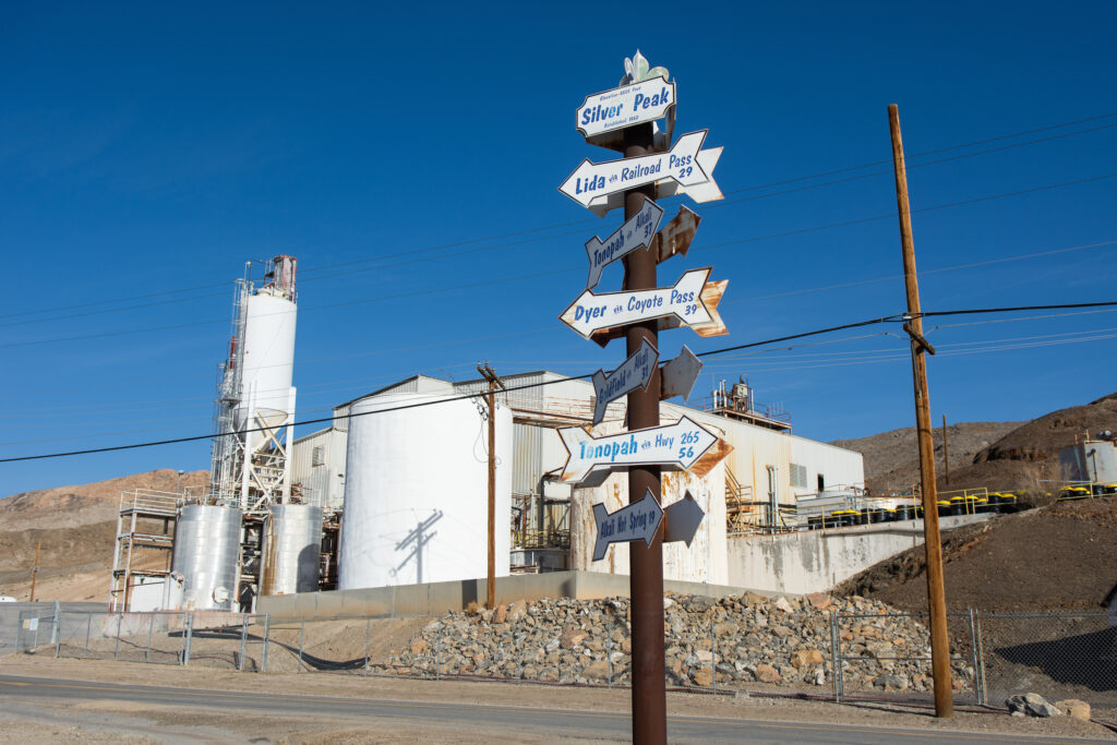
Sign posts show the Silver Peak mine’s proximity to other areas of the state. Mining has taken place in this area of Nevada since the 1860s (David Calvert/The Nevada Independent)
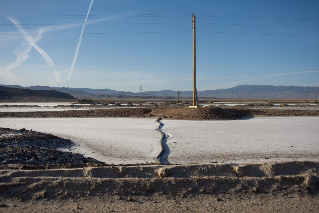
As brine is moved between evaporation ponds, it becomes more concentrated in the water. The ponds, at this point in the process, take on a bright blue color October 6, 2022. (David Calvert/The Nevada Independent)
For more than half a decade, the courts and regulators have been grappling with this issue and the question of who is entitled to profit off of Clayton Valley’s water and the lithium concentrated in it.
Albemarle holds the rights to almost all the water rights in all of Clayton Valley — about 20,000 acre-feet in total (an acre foot is the amount of water that can fill an acre to a depth of one foot).
“Our position quite simply has been there is no water to be given to anyone because we have all the water rights,” Narwold said at the Silver Peak tour in October. “And we’ve been operating for many years here and can successfully show that we’re actually making a commercial product.”
There’s a catch to that: Over the years, the Silver Peak mine has only used about 60 percent of its water allotment. That means Albemarle might be running afoul of the “use it or lose it” rule.
SLB’s Nevada project argues that Albemarle has speculatively held onto water rights it never put to use. In a filing this year, a lawyer for Pure Energy Minerals, SLB’s partner, said that “for over three decades, Albemarle has been permitted to hold excess water hostage in Clayton Valley though it has never been able to put that water to use, nor is it permitted to do so.”
“Albemarle is undoubtedly engaging in speculation that is against Nevada water policy and the anti-speculation doctrine adopted by the Nevada Supreme Court,” Pure Energy Minerals wrote.
Through a subsidiary, Pure Energy Minerals had applied for a series of water rights, water that Albemarle has not used in the past. Those rights, pending approval by state regulators, would help NeoLith Energy — an SLB subsidiary — fully develop its lithium project in Clayton Valley.
Employees in SLB’s NeoLith Energy on-site mobile laboratory. NeoLith Energy is beginning on-site work for a pilot plant to test an extraction process that would have a smaller water footprint. (Courtesy of NeoLith Energy)
That lithium project would rely on direct lithium extraction, a closed-loop system whereby brine would be pumped from the aquifer, processed and put back in the ground. If successful, some industry observers hope the direct extraction process could speed up lithium processing using a smaller water footprint, with an estimated 80 percent of the water recycled back into the aquifer.
NeoLith Energy has mining claims for its project, and 50 acre-feet of permitted water rights for a pilot plant. The company, operations manager Richard Morrison said, also received a state mine permit, and crews are beginning to work on constructing the facility. But for a full build-out of the project, NeoLith Energy needs more water, water Albemarle now plans to use for its expansion.
“The issue is not water availability,” Morrison said during an interview. “The issue is maintaining a monopoly through holding water hostage, and it has been. And that’s not just been for us.”
Pending legal questions
For several years, Pure Energy Minerals has challenged Albemarle’s claims to use most of the water in the valley. Pure Energy Minerals took particular aim at state decisions giving Albemarle “extensions of time,” legal exemptions to the “use it or lose it” condition. In total, Albemarle has received 21 extensions since the 1980s, according to a recent filing from Pure Energy Minerals.
In August 2020, a district court judge sided with Pure Energy Minerals, remanding one of those extensions back to state regulators for further deliberations. That, Morrison observed, was when Albemarle started to get serious about its plans to expand, suggesting water was a key motive.
“Before that, everything’s been very ceremonial,” he said.
Two challenges to state decisions — an extension of time in 2017 and 2018 — are now pending before water regulators, according to Micheline Fairbank, a deputy administrator at the Division of Water Resources. Fairbank said the state agency expects to rule on the issue later this year.
She said the issue has been fraught since about 2014, when companies began exploration and staking mining claims in Clayton Valley. These claims come with their own set of rights under an 1872 federal mining law, a rulebook written more with panning gold, not pumping brine, in mind.
That began about eight years of litigation involving state regulators and companies active in Clayton Valley, what Fairbank described as “one of the more challenging resource management areas we have in the state.” No matter how regulators rule, their decisions often end up in court.
The state agency, she said, “is really kind of caught in the middle.”
At the Silver Peak mine, pipelines can be seen. Some of them appear inactive, part of ponds no longer in use. But other pipelines are used to transport water from wells to the ponds. (David Calvert/The Nevada Independent)
As NeoLith Energy has challenged Albemarle’s water holdings, Albemarle has pushed back against their claims to water rights, filing an extensive protest letter with state regulators. The letter expresses concerns with its proposed water use, its process and raises concerns that it might contaminate the groundwater aquifer (these concerns, Morrison said, are unfounded).
“We’ve been very transparent about what’s being used,” Morrison said, noting the company has worked with state regulators. “What goes back into the aquifer is as clean as what comes out.”
The fight over water is unlikely to be resolved any time soon. Water decisions from the state are subject to judicial appeal, and those with mining claims in Clayton Valley face many unanswered legal questions. Visher, the administrator of the state’s minerals division, said everyone working in the valley has “opinions of what they’re entitled to” when it comes to water and mineral rights.
“The claimant believes that under the mining law, they are entitled to the mineral that’s located under their claim,” he said, referencing the General Mining Act of 1872. “Albemarle contends that ‘No, because we have the water rights, we have the rights to all of the lithium in the basin.”
“And that’s going to end up in the courts at some point, most likely,” Visher added.
In the meantime, Albemarle is pushing forward, with a goal of expanding by the end of the year.
When asked about water, Narwold noted the pending issues, but she said that “until someone tells us we don’t have the water, the default is that we have all those water rights and we can pump them. That’s part of the expansion here, making sure we’re using all those water rights.”
The 2022 State of the Birds report presents data on changes in bird populations across habitats of the United States in the past five decades. These changes are shown for the groups of breeding species that are most dependent on each habitat and for which long-term monitoring data are available.
Population rebounds of waterfowl show that when investments in habitat conservation are made, we can bring birds back. At the same time, continuing declines in other habitats show the critical need to restore ecosystems under stress.
The Birds of Conservation Concern (BCC) list, mandated by law and updated by the U.S. Fish and Wildlife Service, identifies 269 migratory nongame bird species that, without additional conser- vation actions, are likely to become candidates for listing under the Endangered Species Act.
In this report, scientists with the Road to Recovery initiative have identified 70 Tipping Point species from the BCC and/or state lists of Species of Greatest Conservation Need. These birds have lost half or more of their populations in 50 years and are on a trajectory to lose another half in the next 50 years—or they already have small remaining populations and face high threats, but lack sufficient monitoring data (see page 16).
The following pages highlight the plight of birds in each habitat, with the pronounced declines of Tipping Point species shown in red, for species with sufficient data.
In addition to summaries of trends, this report also highlights conservation opportunities and successes in each biome, as examples of how actions that benefit birds create healthier environments for people and all life that depends on these shared habitats.
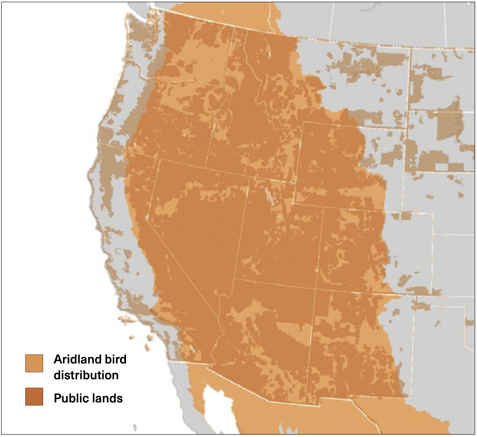
Western public lands are habitat for aridland birds: This map shows the cumulative range for 30 aridland bird species in North America, with the vast majority of that range falling within the boundaries of federal and state public lands. Source: Aridland bird data from Bird Conservation Regions, Bird Studies Canada and NABCI. Public lands map from GISGeography.com.
Click the link to read “More Than Half of U.S. Birds Are in Decline, Warns New Report” on the Audubon website (Margo Rosenbaum):
The Rufous Hummingbird, Greater Sage-Grouse, Pinyon Jay, and 67 other birds in the United States are teetering on the edge of disaster, having lost at least half of their populations in the past 50 years. A report released today [October 12, 2022] by North American Bird Conservation Initiative (NABCI) calls these birds “Tipping Point” species, on track to lose another 50 percent of their populations in the same time frame if conservation efforts do not improve.
Since 2009, NABCI has published a report every few years to track the health of breeding birds in habitats across the nation over the past five decades. The State of the Birds 2022 report for the United States focuses on the wane of bird populations across every habitat except wetlands. Among the groups in the fastest decline are grassland birds, such as Bobolinks and Mountain Plovers, which have shown a total 34 percent loss. Lesser Yellowlegs, Whimbrels, and other shorebirds aren’t far behind with populations down by 33 percent. Despite the dire situation, the report also emphasizes the success of 40 years of concerted wetland conservation: Waterfowl and waterbirds have surged 34 percent and 18 percent, respectively.
While some duck, goose, and swan populations are exploding, more than half of all U.S. bird species are dwindling. Without further efforts to restore ecosystems under stress, the report paints a grim future for birds in a nation where climate-intensified natural disasters and human-caused habitat loss and degradation continue to worsen. The report’s authors call on decision-makers to learn from the accomplishments of wetland restoration to save birds and boost climate resilience in other ecosystems.
“Protecting wildlife and biodiversity is something that everybody should be concerned with,” says Peter Marra, a 2022 State of the Birds science committee member and director of the Earth Commons at Georgetown University Institute for Environment and Sustainability. “Once we save birds, we’re going to save a lot of other species that we share the earth with.”
This year, 33 organizations and agencies, including the National Audubon Society, contributed to the report using data from five sources: the North American Breeding Bird Survey, the Christmas Bird Count, the Waterfowl Breeding Population and Habitat Survey, International Shorebird Surveys, and the American Woodcock Singing-ground Survey.
Compiling data from these reports, the authors illustrate how birds act as indicators of the overall health of the environment, informing policymakers and the public of vital conservation needs. “We really can’t respond or meet the challenges we’re facing to protect a healthy environment for us and for other species unless we really know the state that it’s in,” says co-chair of the report’s science committee, Amanda Rodewald, also the director of the Center for Avian Population Studies at the Cornell Lab of Ornithology.
The 2022 State of the Birds report is the first overall assessment of the nation’s birds since a 2019 Science study indicating the United States and Canada have lost more than 3 billion birds in the past 50 years. “We’re basically watching the process of the sixth mass extinction,” says Marra, who is a co-author of the 2019 paper.
Swift conservation action can bring at-risk birds back from the brink of extinction. The report emphasizes the necessity of these efforts for 90 “On Alert” bird species, which lack Endangered Species Act listings but have lost half or more of their breeding populations in the past 50 years. Within this group, the 70 Tipping Point species are further identified as potentially losing half or more of their populations in another five decades. While there’s a range of urgency within this group, many of these birds are the next likely candidates for listing under the Endangered Species Act, which Rodewald calls “the last-ditch effort” to save a species. “We don’t want to get to the point of having to list species.”
Identifying Tipping Point birds allow conservation efforts to begin before a listing is necessary. “Why should we wait for them to get closer to extinction?” Marra says. “We need to figure out the problem much sooner than that.”
Nicole Michel, National Audubon’s director of quantitative science, points to the report’s emphasis on the success of waterfowl and waterbirds in recent decades as proof that conservation efforts work. It “gives us hope that we can similarly take action to reverse declines of other species, including these Tipping Point species,” she says.
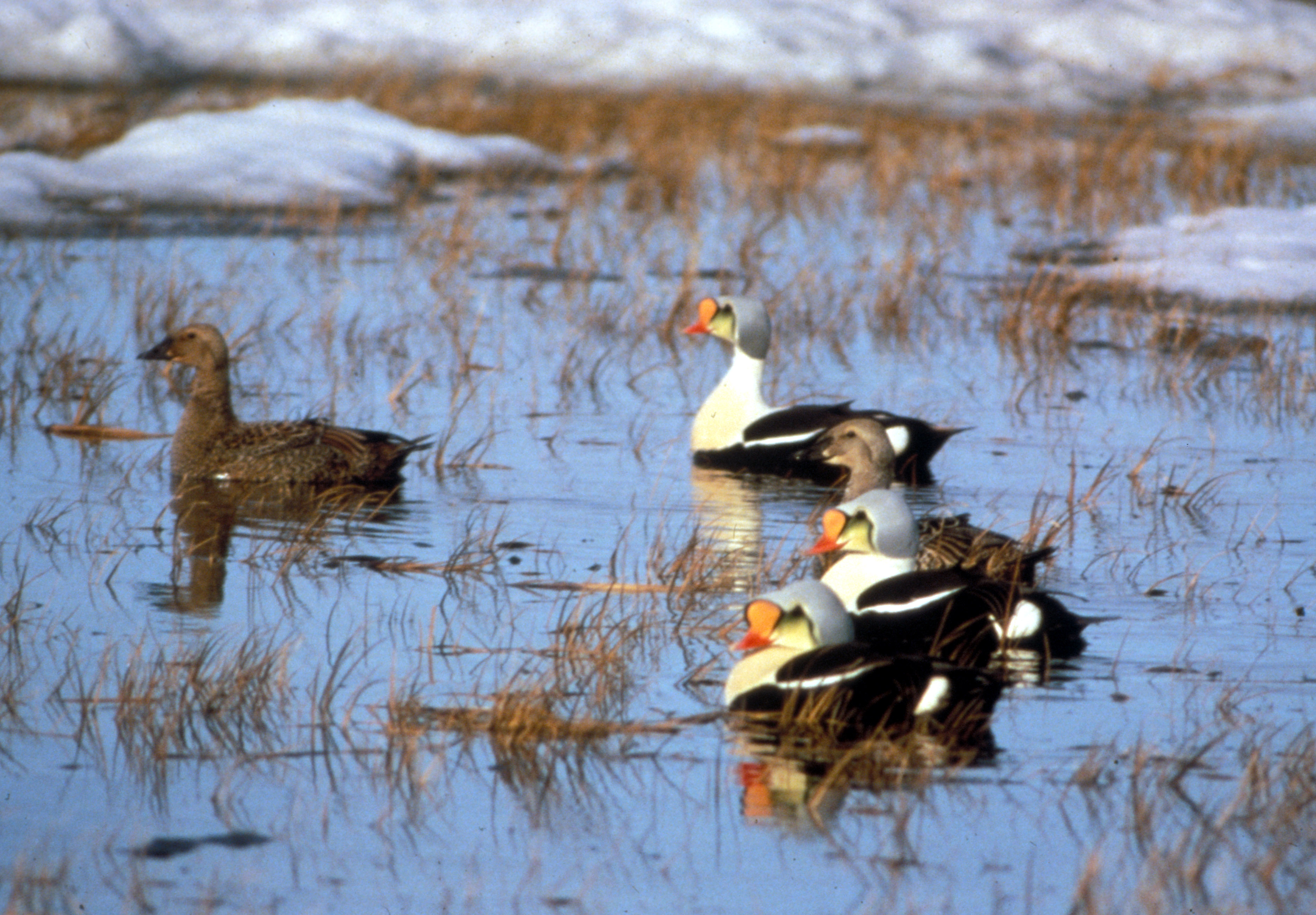
Underscoring such achievements can create tangible motivators but should not drive complacency, says Mike Brasher, co-chair of the report’s science committee and senior waterfowl scientist for Ducks Unlimited Inc. The American Black Duck, for example, is rebounding after a long decline, but not all waterbirds and ducks have healthy populations—Mottled Duck, Black Scoter, and King Eider are listed as Tipping Point species.
“Although waterfowl populations have fared better than other birds or other bird groups, they’re not out of the woods by any stretch of the imagination,” Brasher says. “The threats, and potential threats, facing them are intensifying.”
In habitats across the world, birds face challenges caused by climate change and human actions, such as expanding agriculture, unsustainable forest management, and introduced species. “Climate change is already impacting birds, and especially moving forward, it’s going to increasingly be a major, major threat to bird populations,” Michel says.
NABCI’s U.S. report comes on the heels of the equally distressing State of the World’s Birds published separately by Birdlife on September 29. This year’s report shows how close to half of the world’s bird species are decreasing and “the risk of species going extinct is escalating,” says Lucy Haskell, science officer for the world report. The United States is eighth globally for the greatest number of threatened species.
Despite the alarming findings of both reports, the authors remain hopeful. Advances in research and engagement of community scientists provide researchers with more information than ever before. Estimated at 45 million strong in the United States alone, a global “army of bird watchers” provides a steady stream of new data and insights, Haskell says.
Well-studied and found in nearly every habitat, birds are excellent biodiversity indicators—barometers for the planet’s well-being. Responsive to environmental changes and with population trends mirroring other wildlife, “birds also tell us about the solutions needed to prevent this biodiversity crisis,” Haskell says.
Given the widespread declines, both reports emphasize that proactive conservation across habitats and species will build a healthier environment for animals and people. “It’s not just about birds, right?” Rodewald says. “There are so many reasons to engage in conservation actions because they benefit all people.”