Beaver dams overshadow #climate extremes in controlling riparian hydrology and #water quality — Nature Communications

Beaver dam. Photo credit the Walton Family Foundation

Click the link to access the article on the Nature Communications website (Christian Dewey, Patricia M. Fox, Nicholas J. Bouskill, Dipankar Dwivedi, Peter Nico & Scott Fendorf). Here’s the abstract:

Hydrologic extremes dominate chemical exports from riparian zones and dictate water quality in major river systems. Yet, changes in land use and ecosystem services alongside growing climate variability are altering hydrologic extremes and their coupled impacts on riverine water quality. In the western U.S., warming temperatures and intensified aridification are increasingly paired with the expanding range of the American beaver—and their dams, which transform hydrologic and biogeochemical cycles in riparian systems. Here, we show that beaver dams overshadow climatic hydrologic extremes in their effects on water residence time and oxygen and nitrogen fluxes in the riparian subsurface. In a mountainous watershed in Colorado, U.S.A., we find that the increase in riparian hydraulic gradients imposed by a beaver dam is 10.7–13.3 times greater than seasonal hydrologic extremes. The massive hydraulic gradient increases hyporheic nitrate removal by 44.2% relative to seasonal extremes alone. A drier, hotter climate in the western U.S. will further expand the range of beavers and magnify their impacts on watershed hydrology and biogeochemistry, illustrating that ecosystem feedbacks to climate change will alter water quality in river systems.

Assessing the U.S. #Climate in October 2022: #Drought extends across nearly two-thirds of the Lower 48; Mississippi River at lowest water levels in a decade — NOAA #ActOnClimate

US Drought Monitor map November 1, 2022.

Click the link to read the article on the NOAA website:

Key Points:

  • The average temperature of the contiguous U.S. in October was 55.3°F, which is 1.2°F above average, ranking in the warmest third of the record. Generally temperatures were above average in New England and from parts of the central and northern Plains to the West Coast.
  • October precipitation for the contiguous U.S. was 1.66 inches, 0.50 inch below average, ranking in the driest third of the historical record. Precipitation was above average in Montana and across parts of the Northeast and Southwest and below average across portions of the West, central and northern Plains, Midwest and Southeast.
  • On October 13, the U.S. Drought Monitor (USDM) revealed nearly 82% of the continental U.S. to be abnormally dry or in drought, the largest area affected in the history of the USDM, which launched in 2000.
  • The lowest water levels in the Mississippi River in a decade, caused by a severe Midwest drought, restricted access to the vital channel to barge traffic at a crucial time of the year for the transport of crops from the nation’s heartland.
  • A historic mid-October heatwave brought summer-like heat, shattering daily high records across the Pacific Northwest.
  • According to the November 1 U.S. Drought Monitor report, about 62.8% of the contiguous United States was in drought. Severe to exceptional drought was widespread from the Great Basin to the Pacific Coast, across portions of the Great Plains to Mississippi Valley, and in Hawaii, with moderate to severe drought in parts of the Southeast and Northeast.

Other Highlights:

Temperature 

For the month of October, Washington ranked warmest on record, Oregon ranked second warmest, Maine sixth warmest and California ranked seventh warmest on record for this period. 

Temperatures were above average across much of the contiguous U.S. during the August-October period with record warmth blanketing much of the Northwest. OregonWashingtonIdaho and Montana each had their warmest August-October period on record. The Southeast was cooler than average for this period.

For the January-October period, the average contiguous U.S. temperature was 56.7°F, 1.7°F above average, ranking 13th warmest in the 128-year record. Temperatures were above average from the West Coast to the Gulf Coast and from the Gulf to New England. California ranked third warmest while Oregon ranked sixth warmest on record for this period. Temperatures were near average from the Mississippi Delta to the Upper Midwest.

The Alaska statewide October temperature was 28.8°F, 3.3°F above the long-term average. This ranked in the warmest third of the 98-year period of record for the state. Temperatures were above average across the Panhandle, Aleutians, Yukon Delta, North Slope and parts of the eastern interior while much of the interior experienced near-average conditions for the month.

The Alaska January-October temperature was 32.2°F, 2.5°F above the long-term average, ranking in the warmest third of the record for the state. Above-average temperatures were observed across much of the state with small portions of the North Slope and eastern interior regions experiencing near-average conditions for this 10-month period.

Precipitation 

Precipitation varied across the contiguous U.S. On the dry side, Florida ranked eighth driest while California and Minnesota each had their 11th-driest October on record. Conversely, an abundance of precipitation received during the month resulted in New Jersey ranking 10th-wettest on record. 

The January-October precipitation total for the contiguous U.S. was 23.19 inches, 2.17 inches below average, ranking 15th driest in the historical record. Precipitation was above average across portions of the Southwest, Mississippi, Tennessee and Ohio valleys as well as the Northeast. Precipitation was below average across much of the West, central and southern Plains and parts of the East Coast during the January-October period. California ranked driest on record while Nebraska ranked fourth driest and Nevada eighth driest for this 10-month period.

Monthly precipitation averaged across the state of Alaska was 5.57 inches, 1.18 inches above average, ranking as the third-wettest October in the 98-year record. Much of the state was wetter-than-average, with portions of the Aluetians, southern interior and Kenai Peninsula experiencing near-average conditions during the month. 

The January-October precipitation ranked wettest on record for Alaska, with above-average to record wet precipitation observed across much of the state. The central and Northeast Interior regions as well as the Aleutians experienced near-average precipitation for this period.

Other Notable Events

The Mississippi River was at its lowest water levels in a decade, reported near Memphis, TN, and Vicksburg, MS, restricted access to a vital channel to barge traffic at a crucial time of the year for transport of crops from the nation’s heartland. Since early October, the U.S. Coast Guard reported a total of eight barges that have run aground. 144 vessels and 2,253 barges were in a queue to access narrow passages of the river. 

On October 1-5, the National Weather Service issued coastal flood alerts along the Mid-Atlantic coast, affecting about 30 million people, as remnants of Hurricane Ian churned off the East Coast. Reports of flooding occurred from the Carolinas to New Jersey.

On October 16, a historic October heatwave brought summer-like heat, shattering daily high temperature records, across the Pacific Northwest. 

  • Seattle, WA, broke its previous record high temperature on this day by a staggering 16°F.
  • Portland, OR, set records on seven days in October, reaching at least 80°F on 12 days, doubling the previous October record.

On October 20, Portland, OR, and Seattle, WA, ranked first and second respectively for the worst air quality among the world’s major cities, according to IQAIR, as smoke from a string of wildfires darkened skies across parts of the Pacific Northwest.

On October 22-24, a storm moving through the western United States brought cold air and the first substantial snow of the season to parts of Montana, Colorado, Utah and California.

On October 29, at least five tornadoes were confirmed after a severe weather outbreak along the Mississippi and Alabama Gulf Coast. The National Weather Service confirmed that three tornadoes touched down in Jackson County, MS, each with top winds estimated between 100-110 mph, and two other weaker tornadoes were confirmed in Alabama.

Drought

According to the November 1 U.S. Drought Monitor report, about 62.8% of the CONUS was in drought, up about 11.9% from the end of September. Drought conditions expanded or intensified across much of the Southeast and Mississippi, Ohio and Tennessee valleys, and parts of the Plains, central Rockies, and Northwest. Drought contracted or was eliminated across portions of the Southwest, southern Plains, Northeast and Hawaii.

Monthly Outlook

According to the October 31 One-Month Outlook from the Climate Prediction Center, areas from the Southwest to the Northeast and across western and northern Alaska are most likely to see above-normal monthly mean temperatures in November, with the greatest odds in New England. The best chances for below-normal temperatures are forecast for southeast Alaska, the Pacific Northwest and the northern Rockies. Much of the West, portions of the central Plains as well as northwestern Alaska are favored to see above-normal monthly total precipitation, with the greatest chance near the northern Rockies. Below-normal precipitation is most likely to occur from south Texas to the Gulf of Mexico and the eastern third of the U.S. Drought is likely to persist across much of the West, Plains, and Mississippi and Ohio valleys. Some improvement and/or drought removal is likely across portions of the central and southern Plains, Northwest and Hawaii. Drought development is likely across portions of the Southeast.

According to the One-Month Outlook issued on November 1 from the National Interagency Fire Center, Hawaii and portions of the southern Plains, Midwest, Gulf states, and Mississippi, Ohio and Tennessee valleys have above normal significant wildland fire potential during November.

Colorado’s Suncor Refinery is Fighting a Plan to Monitor its Toxic Pollution — Earth Justice #ActOnClimate #KeepItInTheGround

Suncor refinery Commerce City. Photo credit: Allen Best/Big Pivots

Click the link to read the article on the Earth Justice website (Rebecca Curry):

Suncor filed a suit against the state to block fenceline monitoring requirements for its refinery, but community and environmental groups quickly moved to intervene and ensure they remain in place

Communities have a right to know about exposures to toxic pollution that could affect their health. That’s why Earthjustice and our partners are fighting to protect critical steps the state of Colorado has taken to ensure transparency around toxic emissions. Beginning in 2023, the Suncor refinery in North Denver will be required to operate a new fenceline monitoring system to provide better data about toxic air emissions in real-time. In September, Suncor filed suit against the state to block these requirements, but community and environmental groups quickly moved to intervene and ensure they remain in place.

Suncor is an immense refinery located less than a half mile from residential homes, yet it routinely spews hazardous pollution into the air. After an operational issue in 2019, a yellow dust blanketed the surrounding region and schools were forced to shelter in place. The refinery has repeatedly failed to comply with clean air laws, including by exceeding emissions limits in its permit for harmful air toxics.

Those most affected by Suncor’s toxic emissions include low-income families and people of color who—because of historic environmental racism—have disproportionately faced the cumulative impacts of living in a pollution hot spot. Residents living in Commerce City and the neighboring Globeville and Elyria-Swansea communities, in particular, experience disproportionate rates of cancer, diabetes, and asthma as well as reduced life expectancy.  

Suncor’s new monitoring system is a result of the work of Earthjustice, our partner organizations, and community members to draft and support the passage of HB21-1189 last year. The legislation directs the Suncor refinery to install continuous air monitors along the facility’s perimeter or “fenceline”—where pollution leaves the refinery’s property and spreads into neighboring communities where people live, work and play.

Continuous fenceline monitoring of toxic emissions at facilities like Suncor provides numerous benefits to surrounding communities. It helps to differentiate between the facility’s emissions and other pollution sources, enables rapid detection of hazardous emission spikes that may pose a risk to health, and can spur prompt notification to neighboring residents. Fenceline monitoring is also a critical tool to enable facility operators to quickly identify and address leaks.

Processing crude oil at refineries causes emissions of many air toxics that put communities living over the fence at risk. The Suncor refinery emits a range of hazardous pollutants like hydrogen cyanide; benzene; toluene; xylene; ethylene; hydrogen sulfide; 1,3 butadiene; and ammonia.

The EPA has designated 188 different pollutants as air toxics known to cause cancer or other serious health impacts. However, federal regulations currently require that refineries conduct fenceline monitoring of just one air toxic: benzene. This benzene fenceline monitoring requirement relies on monitoring methods that estimate an average concentration by collecting air over a two-week span of time, which can hide short-term spikes in toxic pollution and delay data delivery.

Building on this federal requirement and following the lead of air regulators in California, HB21-1189 required that the refinery be fully enclosed by a more protective type of monitoring technology known as optical remote sensing, which uses a beam of light to continuously measure concentrations of air toxics along the path of the beam. This monitoring technology provides greater coverage to detect high-concentration plumes, can release data in quick 5-minute increments, and can measure a wide range of pollutants simultaneously.

Critically, Suncor’s new fenceline monitoring system will also enable early notification whenever the refinery’s emissions pose potential health risks to nearby communities. As required by the legislation, Suncor must provide emergency notification to surrounding residents via call or text alert whenever the refinery’s toxic emissions reach levels that pose a risk to health. The refinery must also increase transparency by making monitoring data available on a public website as soon as possible.

HB 21-1189 also required many opportunities for community engagement throughout the development of Suncor’s real time fenceline monitoring plan. Earlier this year, the refinery submitted an initial draft of its plan, which did not meet the requirements of the law. The plan proposed to monitor intermittently instead of continuously, proposed high community notification thresholds that were not protective of public health and aimed to monitor only three air toxics.

In response to community engagement and public comments calling for a stronger plan, Colorado air regulators used their authority to require significant improvements to Suncor’s plan—including lowering the levels of pollution necessary to trigger emergency notifications, ensuring that the monitors operate continuously, and requiring monitoring and reporting of eleven additional air toxics emitted by the refinery. Now, rather than increasing transparency and protections for the surrounding community, Suncor has sued the state of Colorado to defend its profits and ability to pollute.

GreenLatinos, the Elyria-Swansea Neighborhood Association, Healthy Air and Water Colorado, Womxn from the Mountain, Conservation Colorado, and Sierra Club are intervening to defend the Air Pollution Control Division’s (APCD) fenceline monitoring order and will be represented by Earthjustice. The intervention seeks to protect both the strengthened monitoring plan for Suncor and the Fenceline Monitoring Law itself. Suncor’s suit hopes to eliminate improvements made by APCD to the monitoring plan and substantially narrow APCD’s authority under the Fenceline Monitoring Law.

While Colorado has taken significant strides to address monitoring and transparency around Suncor’s air pollution, ultimately additional action is required to protect the communities most vulnerable to air toxics. Monitoring is a critical piece of the puzzle, but Suncor should not be able to repeatedly put public health at risk with its pollution. In the refinery’s air permit renewals, APCD must take the strongest possible actions to protect surrounding communities.

Study to defend #GreenRiver, #LittleSnakeRiver #water would cost at least $500K: Lawmakers will seek money to determine #ColoradoRiver Basin water losses from #Wyoming irrigation canals in hopes of staving off reductions — @WyoFile #COriver #aridification #CRWUA2022

Yampa River Basin via Wikimedia.

Click the link to read the article on the WyoFile website (Angus M. Thuermer Jr.):

Lawmakers will seek $500,000 to study water lost from canals in the Green and Little Snake River basins to ensure Wyoming is accurately credited for conservation when it chooses or is forced to close irrigation systems in the troubled Colorado River Basin.

The study could help Wyoming limit reductions in water diversion as seven Western states and Mexico wrangle with an over-allocated and dwindling supply in the drainage. Members of the Legislature’s Joint Select Water Committee voted to draft a measure to seek the money from the general fund when the legislative session commences early next year.

“I could see [a conveyance loss study] very easily reaching $500,000,” Jason Mead, interim director of the Wyoming Water Development Office told lawmakers Wednesday. State Engineer Brandon Gebhart said his “mind was right at $500,000 for this,” but that “it could be a lot more.

“I do think that this is a really good start,” he said.

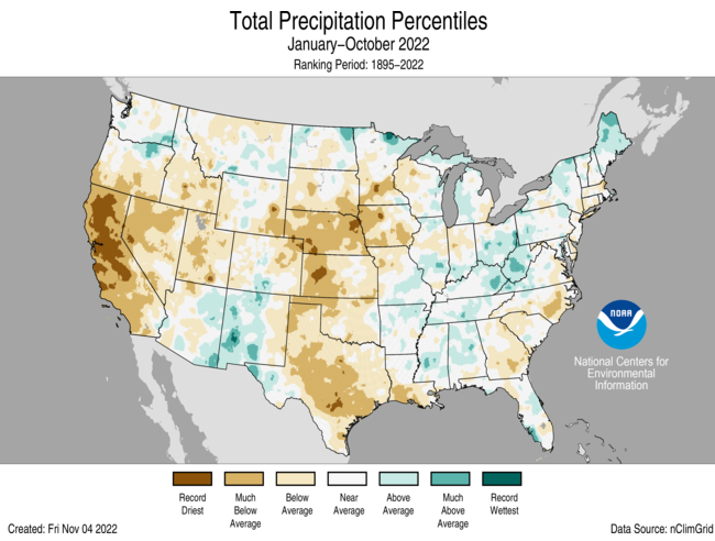
One hundred years after the signing of the Colorado River Compact, water managers cannot accurately measure what’s used and have not agreed on how to resolve conflicting views on rights to use what water there is.

The amount of incidental seepage and phreatophytic losses — canal-side, plant-used water — associated with irrigation is an “area of agriculture data collection that need[s] to be updated and verified,” the U.S. Bureau of Reclamation states in its 2022 Upper Colorado River Basin Consumptive Uses and Losses report.

The proposed Wyoming study could help the state claim that when it shuts off water to a field of crops, it is saving that crop’s consumption plus what’s lost in the conveyance system of canals and ditches that carry the flow from river to field.

By showing it saves more, Wyoming would cut off fewer users in a “curtailment” situation where water managers require conservation. The data could also better inform the purchase of temporary water rights transfers from one user to another.

“Understanding what that conveyance loss is,” Gebhart said, “could benefit the water users in our state.”

80% loss?

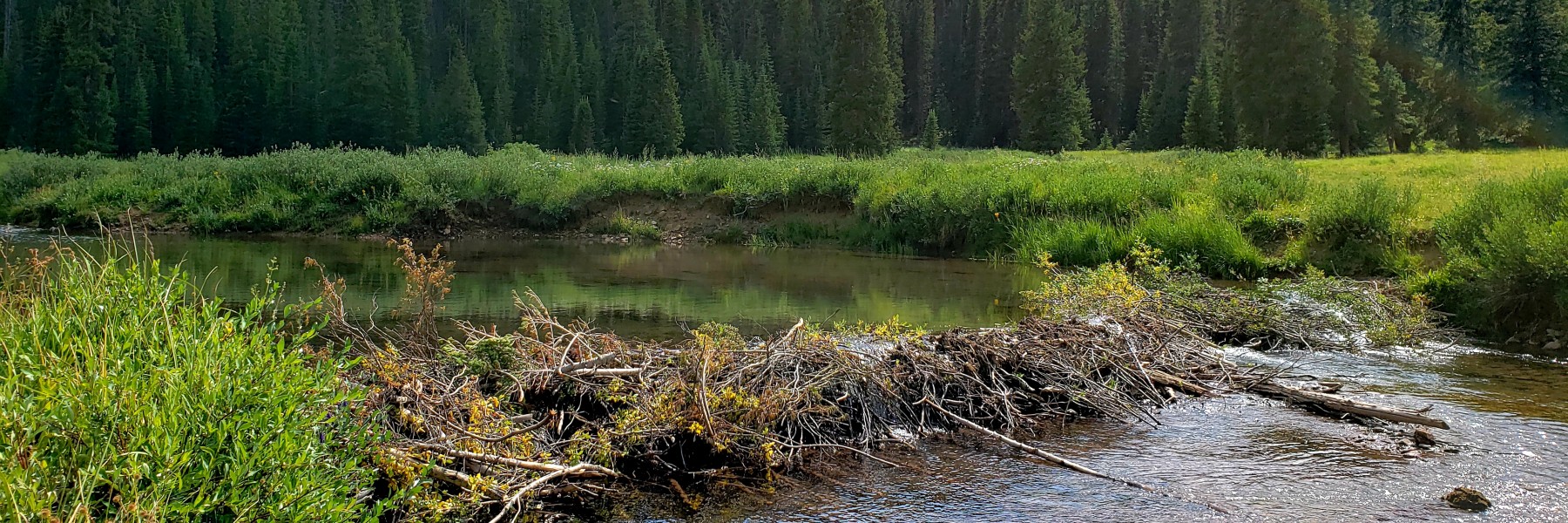
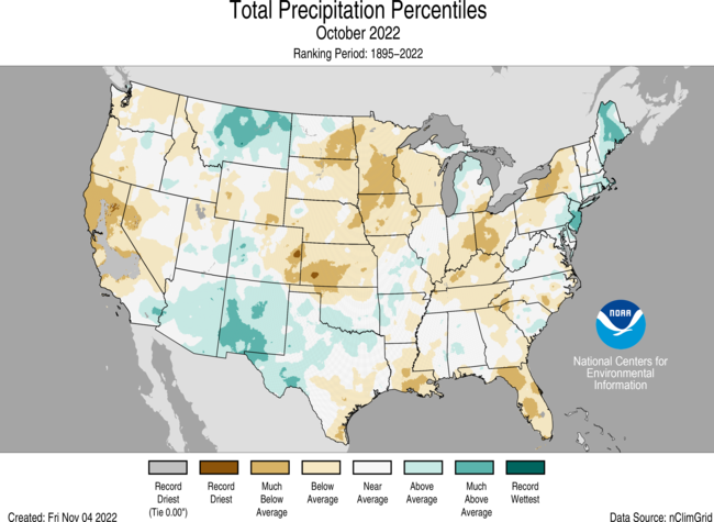
Conveyance loss is significant in Wyoming’s Green River Basin, one lawmaker told the committee.

“We know in Sublette County that we have some canals that are over 20 miles long that go through a glacial till and alluvium that, anecdotally we’ve heard, they lose up to 80%,” Sen. Larry Hicks (R-Baggs) told the committee. Irrigators estimated losses in a survey conducted by the Water Development Office, but none has reported losses as high as 80%; the statewide average is 24%.

A cowboy herds cattle home from the range in the Green River drainage in Sublette County. (Angus M. Thuermer, Jr./WyoFile)

A contractor would lay out the groundwork for the study starting next spring, identifying perhaps eight sites and 50 miles of canals in the Green and Little Snake River drainages that could be monitored. Investigators would install water-pressure sensors in canals to record water-level fluctuations through a season.

Once in place, consultants would measure and record flows and pressures in the 2024 irrigation season. Mead of the WWDO described how the survey would work.

Investigators would be “going out there four or five, six times to actually get measurements on the canal at four or five or six different spots down, say, a 15-mile section,” he said.

The results would show, for example, the difference in canal seepage at the beginning of an irrigation season when the ground is drier compared to seepage in mid-summer when the canal has been flowing and “things are wetted up and primed,” Mead said.

Engineer Gebhart distinguished between two categories of conveyance losses — consumptive loss and seepage — and whether Wyoming could claim credit for staunching either.

Consumptive loss is the amount consumed by ditch-side plants and trees, the amount lost to evaporation, plus that which leaks into an aquifer “that does not return back to the [Colorado River] system,” he said.

Gebhart defined the second category — seepage loss — as leakage that returns to the system. “It may be delayed, but it does return back to a stream,” he said.

As Wyoming calculates what’s consumptively used — and what it can save if that consumptive use is taken off-line — it might not be credited for reducing some associated seepage.

“Seepage [that] returns to the system … that is not considered a consumptive use,” Gebhart said. “I would say a majority of ditch loss is lost to seepage.”

Results from the study would be ready in late 2024 or in 2025, according to a scenario painted by Mead.

Wyoming buffer

Wyoming doesn’t expect to face curtailment — when it might be forced to shut down users — until 2028, if drought continues. Wyoming and its sister states in the Upper Division or upper basin — Colorado, Utah and New Mexico — would face mandatory cuts if the Lee Ferry gauging station just below Lake Powell shows a flow of less than 75 million acre-feet in the previous 10 years.

Under the 1922 Colorado River Compact, “[t]he States of the Upper Division will not cause the flow of the river at Lee Ferry to be depleted” below that level. The upper basin encompasses about 45% of the drainage area but produces 92% of the runoff.

Colorado River laws apportion Wyoming rights to 14% of the upper basin’s water, officials say. They believe upper basin states are not yet at the critical “75/10” metric where reductions are necessary.

“We’re currently about 85 million acre-feet,” Gebhart said, referring to the previous 10 years. “So we’ve got a little buffer.”

“We’ve blown through the hydrology, we’ve used most of the storage in the Colorado River Basin,” Hicks said. “And now … the director of the Bureau of Reclamation, [is] looking for somewhere between 2 [million] and 4 million acre-feet of reductions in the Colorado.”

The original estimate was 15 million acre-feet were in the system annually, but that water, “it doesn’t exist,” Hicks said. In the last decade, it’s averaged 12 million acre-feet or less, he said. One water administrator in Colorado has said experts tell water managers to plan for 9 million acre-feet a year as a worst-case scenario.

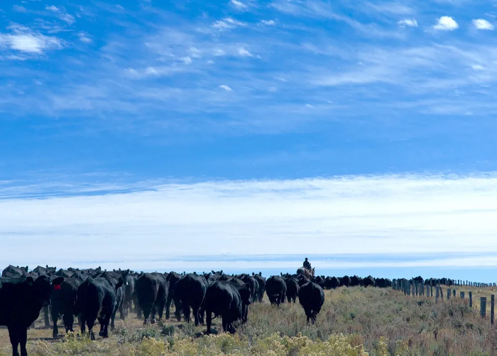
Municipalities and industry — usually holding inferior, junior water rights and so the first to face curtailment — could be looking for water. In Wyoming, agriculture holds 80% of the water rights, Hicks said, and could be approached to sell through a temporary-transfer system or some other arrangement.

“That’s the water bank that you’re looking at,” Hicks said of agriculture.

“At some point in time, we’re gonna have to recognize that there’s not 15 million acre-feet to be divided up,” he said. “That’s really the issue. This is why all the states are lawyering up.”

Wyoming is preparing for negotiations, measurements, debates and possibly fights over water rights. In the last year, the state has added a Colorado-River staffer to the state engineer’s office and also the attorney general’s office, Hicks told the committee.

Brad Udall: Here’s the latest version of my 4-Panel plot thru Water Year (Oct-Sep) of 2021 of the Colorado River big reservoirs, natural flows, precipitation, and temperature. Data (PRISM) goes back or 1906 (or 1935 for reservoirs.) This updates previous work with @GreatLakesPeck. Credit: Brad Udall via Twitter