Phase out oil and gas leasing in #Colorado? — @BigPivots #ActOnClimate #KeepItInTheGround

Pump jack and noise barrier. Photo credit: Allen Best/Big Pivots

Click the link to read the article on the Big Pivots website (Allen Best):

Colorado 350 has set out to ask Colorado voters in 2024 to phase out new oil and gas leasing before 2031. Why so soon?

350 Colorado and associated groups coalesced as Safe & Health Colorado have launched an effort that members hope will result in a ballot proposal in the 2024 general election.

If successful, this ballot initiative would end new oil and gas permits issued on lands governed by state government before the end of 2030.

Micah Parkin

In an interview with Big Pivots, Micah Parkin, the executive director of 350 Colorado, said her group has been buoyed by polling that shows Coloradans are “very concerned about the impacts of the climate crisis that we see in our state.” Too, she added, “we feel this plan aligns with what scientists around the world are calling for, to phase out fossil fuels and move toward renewable energy.”

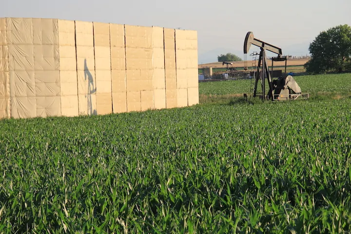
In 2021, Colorado was responsible for 3.7% of crude oil extraction in the United States, fifth among states. Texas was first at 42.4% and New Mexico second at 11.1%.

This is from Big Pivots 73 (April 27, 2023). Please consider subscribing—or, just maybe a donation?

Colorado ranked seventh in natural gas production. It is responsible for 4.9% of the nation’s production.

“We really need to be dealing with our contribution to the climate crisis,” she said.

An additional impetus is more localized. Oil and gas drilling has a substantial contribution in creating high ozone levels during summer months.

Organizers have created two, overlapping draft proposals, unsure which one they will eventually seek to put before voters. They will use polling to evaluate which one is most likely to be approved.

One measure would specifically target oil and gas operations that use hydrofracturing technology, i.e. “fracking,” and the other more broadly all oil and gas drilling.

Both proposals have been submitted to the Legislative Council as required by state law. The state agency is required by law to “review and comment” on initiative petitions, basically to ward off confusions and make sure the proposals conform to state law.

In their first draft, the proponents said they wanted to phase out and discontinue the issuance of new oil and gas operation permits by the state’s Colorado Oil and Gas Conservation Commission by Dec. 31, 2030. The Legislative Council asked whether those permits would be effective beyond this deadline or would there be expiration dates?

The reviewers at the Colorado Capitol also suggested using “gases,” the more familiar spelling, instead of “gasses.”

And then the law requires a single title for the bill? What would that title be?

The Legislative Council also recommended addressing the loss of severance taxes on oil and gas extracted, as those severance taxes are used to fund a wide variety of programs in Colorado, half to water projects and other natural resource management programs, and the other half to local governments.

In fiscal year 2018-2019, before covid slowed drilling, the tax yielded almost $236 million, according to the Legislative Council.

The draft language also calls for a “state program to explore transition strategies for oil and gas workers.”

Legislative council reviewers responded: “Is the new program intended to merely ‘identify’ funding sources for workers and communities to access on their own OR is the program intended to provide funding to assist workers and communities?”

Ballots for the November 2024 election won’t go out until October 2024, still more than 17 months away. Why the effort now?

Parkin points to the necessary legwork, including signatures for petitions for the measure, whatever is finally chosen, to go on the ballot. “It will be more affordable and there will be less competition with other campaigns.”

Why not seek a legislative remedy instead of going directly to voters?

“We actually have been proposing it as legislation, and there was a legislator willing to cover it, but was unable to get leadership approval to move a bill forward. It was a bill just to study the phase-out, what it would be like. And our governor (Jared Polis) really has not shown much interest in reining in the oil and gas industry. The Colorado Oil and Gas Commission has permitted more than 5,000 wells since he has been in office (starting in January 2019), about 1,000 a year. He really has shown no interest. We have talked with different staff members and have gotten no interest, even though (the oil and gas sector) is a massive source of greenhouse gases and runs in opposition to our emission goals and our air quality goals.”

Downsides? “It takes a lot of effort, it’s expensive, and it takes a lot of fundraising. Unfortunately we don’t have the money of the fossil fuel industry.”

Allen Best is a Colorado-based journalist who publishes an e-magazine called Big Pivots. Reach him at allen.best@comcast.net or 720.415.9308.

2023 #COleg: #Colorado lawmakers “belly flop” on #water crisis, opting for further study of #ColoradoRiver over action, experts say — The #Denver Post #COriver #aridification

West Drought Monitor map April 25, 2023.

Click the link to read the article on The Denver Post website (Conrad Swanson). Here’s an excerpt:

Colorado’s legislative leadership promised this year that the state’s water problems would be the “centerpiece” of conservation efforts but their keystone proposal focused on the Colorado River and widespread drought plaguing the West is to study the issue further. At such a late stage in the drying American West, water experts tell The Denver Post that creating another study group amounts to procrastination while time is running out. And, they say, it’s unlikely that evaluating the drought – exacerbated and made permanent by climate change – yet again will yield any new ideas.

Lawmakers introduced the bipartisan bill, SB23-295, late in their session. It is on its way to clearing the Senate and heading to the House of Representatives. Behind the measure are Western Slope Sens. Dylan Roberts, an Avon Democrat, and Perry Will, a New Castle Republican, Speaker of the House Julie McCluskie, and Marc Catlin, a Montrose Republican. The bill would create a 16-member task force, plus an advisory member, consisting of a cross-section of water users including representatives of the Department of Natural Resources, the Colorado Agriculture Commission, members of the Ute Mountain Ute and Southern Ute tribes, water commissions and environmental organizations.

On a day in late May [2022] when wildfire smoke obscured the throat of an ancient volcano called Shiprock in the distance, I visited the Ute Mountain Ute farming and ranching operation in the southwestern corner of Colorado. Photo credit: Allen Best/Big Pivots

Officials in Colorado could be doing far more, though, than convening another task force, Dan Beard, a former U.S. Bureau of Reclamation commissioner, said. He lambasted the proposal.

“It isn’t a flop, it’s a belly flop,” Beard said.

Once formed, the task force would begin meeting by July and by December recommend ways Colorado could counter drought in the Colorado River Basin and related inter-state commitments. The group would have broad leeway for the types of recommendations it could offer…While Colorado isn’t the biggest water user in the Colorado River Basin, it could still contribute meaningful water savings, [Dan] Beard said. For example, lawmakers could work to curb the amount of water piped out of the basin, Beard said. Major urban centers along the Front Range (like Denver) draw water from the river and move it across the Continental Divide to their taps. Farmers and Ranchers east of the divide also rely on Colorado River water. Trans-basin water transfers like those are problematic because all the water taken out of the basin is lost to the Colorado River forever. On the contrary, water used within the basin to irrigate crops will ultimately flow back into the river if it’s not absorbed by the plants.

Colorado transmountain diversions via the State Engineer’s office

#YampaRiver anticipated to reach its highest level yet Thursday into Friday — Steamboat Pilot & Today

Click the link to read the article on the Steamboat Pilot & Today website (Kit Geary). Here’s an excerpt:

Routt County Emergency Management is warning residents to expect flooding Thursday, May 4, into Friday, May 5, with the Yampa River anticipated to reach its highest level yet this season. Emergency Operations Manager David “Mo” DeMorat told Routt County commissioners on Monday, May 1, that the river had hit 6,500 cubic feet per second, and warm temperatures are expected to continue through the week, which could cause the river to reach 7,000 cfs by Friday. DeMorat said this amount of water for the Yampa River is considered “action level” flooding by the National Weather Service. Action levels generally require municipalities to keep a closer eye on flooding and have potential mitigation plans and flood warnings in place…

To gauge what flooding will look like, the county uses snow-water equivalent gauges that provide estimates for the amount of snowmelt that could occur three to four weeks out. This looks at the amount of snow on the ground, but cannot predict at what rate it will melt. Because of this, no exact estimates can be given, as it is ultimately the weather and the freeze-and-thaw cycle that will determine at what rate the snow melts.

DeMorat explained to commissioners that these gauges show areas north of Steamboat and the Stagecoach Reservoir currently have the highest potential for flooding. Three snow-water equivalent gauges stationed north of Steamboat have helped emergency management identify these regions as problem areas for flooding due to the snowpack that could melt. All three are north of Steamboat with one near Dry Lake, one near Lost Dog Creek and another slightly farther northwest. DeMorat noted these locations range from 165-185% of the average snowpack. He told commissioners that Stagecoach Reservoir is another area of concern with 140% of its average snowpack.

Alongside the problem areas DeMorat named, the National Weather Service issued a flood warning for Elkhead Creek, particularly where the creek meets the Yampa River. This flood warning began on Monday and will end Friday unless communicated otherwise by the National Weather Service.

New green infrastructure planning open-source tool available — NOAA

Street-side swale and adjacent pervious concrete sidewalk in Seattle, US. Stormwater is infiltrated through these features into soil, thereby reducing levels of urban runoff to city storm sewers. By U.S. Environmental Protection Agency – U.S. Environmental Protection Agency, Washington, D.C. “Managing Wet Weather with Green Infrastructure:Municipal Handbook:Green Streets” Document No. EPA-833-F-08-009, Public Domain, https://commons.wikimedia.org/w/index.php?curid=5921077

Click the link to read the article on the NOAA website:

The Mid-Atlantic Regional Integrated Sciences and Assessments (MARISA), a NOAA CAP/RISA team, principal investigators Jordan Fischbach, Debra Knopman, and Klaus Keller published a new tool to mainstream green infrastructure planning in the publication, “Rhodium-SWMM: An open-source tool for green infrastructure placement under deep uncertainty.” Green infrastructure measures are stormwater management practices that mimic natural hydrological processes that are used to mitigate negative impacts of urban development and climate change adaptation. While these practices are increasingly being used, there is a challenge to evaluate their effectiveness due to some deep uncertainties and require navigating tradeoffs between multiple objectives. Advanced decision-making tools and methods such as Robust Decision Making (RDM) and Many-Objective Robust Decision Making (MORDM) have been applied to green infrastructure sparingly, but there has still been a lack of open-source tools to support decision-makers.

The MARISA investigators have developed Rhodium-SWMM that connect two open source tools: the Stormwater Management Model (SWMM) and Rhodium, a Python library for MORDM. This new open-source Python library provides an interface for taking SWMM files and applying them to a wide range of parameters identified as uncertainties or levers. . It helps to efficiently search and sample GI decision alternatives and identify vulnerabilities in the system for better multifunctional solutions to future changes.

Access the publication »

Learn more about MARISA »

For more information contact Jessica Garrison

The topsoil moisture percent short to very short was highest in #Nebraska at 78% and #NewMexico at 72% — @DroughtDenise

Topsoil in the SVS category climbed by 15% in Missouri and California, but fell by 36% and 19% in Oklahoma and Colorado after recent precipitation.

Debris and mud covers roads, trails, train tracks in #GlenwoodSprings — The Summit Daily #runoff

Click the link to read the article on The Summit Daily website (Cassandra Ballard). Here’s an excerpt:

After a quick weather jump from cold to warm over the past week, there have now been multiple areas of mud and debris flow throughout Glenwood Springs and the surrounding area due to the rapidly melting snow on Red Mountain and elsewhere. On Tuesday morning, a major debris flow blocked access to the wastewater treatment facility in West Glenwood, along with covering the Union Pacific Railroad train tracks in West Glenwood, causing a freight train to get stuck…

On Monday, local trails on Red Mountain and at Wulsohn Mountain Park, and on the higher trails of the South Canyon trail system were closed from mud flows, and the city was urging people to stay off the closed trails…

In addition, Garfield County emergency management officials reported late Monday that County Road 127 (3 Mile Road) was covered with water and mud and a private bridge was washed out at the half mile mark due to flooding on Three Mile Creek. Several residences were also being impacted. And, the Colorado Department of Transportation was reporting mudflow activity in Glenwood Canyon near Interstate 70.

Follow the Living River journey and take action by May 30! — @AudubonRockies

From email from Audubon Rockies (Abby Burk):

Hi all, and thank you for joining Audubon Rockies and conservation photographer Dave Showalter for his multimedia journey through the living Colorado River! In his new book, Living River: The Promise of the Mighty Colorado, Dave shares the beauty of the watershed and a story of resiliency and resolution to continue the work for healthy watersheds. You can watch last week’s virtual book launch event recording here.

The Colorado River existing management guidelines are set to expire in 2026. The states that draw water from it are about to undertake a new round of negotiations over the river’s future. The use of the river will be renegotiated amid climate change, reduced snowpack, and water shortages, presenting an opportunity to ensure universal access to clean water for more than 30 federally-recognized Native tribes and make the allocation of the Colorado equitable as well as sustainable.

This May is a critical time to be a voice for the river, as the United States Bureau of Reclamation seeks public comment on the Draft Supplemental Environmental Impact Statement (SEIS) to the 2007 Interim Guidelines. This SEIS evaluates different scenarios to better balance water supply in the Colorado River watershed, which will impact ecosystem health in the Grand Canyon and other areas.

The stories, art, and lifeways that deepen our relationships to water are what build the collective voice for healthy rivers that benefit wildlife and people. The Mighty Colorado changes everything it touches, including us. Here are a few ways you can join the Living River conversation:

  • Buy a copy of Living River from Mountaineers Books, your local bookstore, or one of these online sellers.
    • *Audubon members, as a special thank you, get a 20% discount by using the code “LIVINGRIVERLOVE” at checkout from Mountaineers Books.
  • Attend another book launch event or encourage a friend to attend one. The Living River book tour is traveling the West and has both in-person and virtual events.
  • Explore the Living River website and follow the journey on Instagram.
  • Take action by May 30 and urge the Bureau of Reclamation to recognize the important links between human health, stable communities, and the environment and also implement measures that better balance water supply and protect the Grand Canyon ecosystem.

We also encourage you to sign up for Audubon’s Western Water Action Network to stay up to date on Colorado River information and engagement.

Presently, there is less water in the Colorado River system than at any time in recorded history, threatening the vitality of its ecosystem. But wherever there is water, there is abundant, dynamic life. As Dave Showalter says: “The river is not dying. She flows with the same pure purpose as before we arrived.”

There’s no giving up on the Colorado for riverkeepers engaged in riparian restoration. The hard work ahead requires widespread engagement in our future, which begins with all of us asking: Where does our water come from, and who does it connect us to?

All my best and hope to see you downstream,

Abby

Updated Colorado River 4-Panel plot thru Water Year 2022 showing reservoirs, flows, temperatures and precipitation. All trends are in the wrong direction. Since original 2017 plot, conditions have deteriorated significantly. Brad Udall via Twitter: https://twitter.com/bradudall/status/1593316262041436160

Data dashboard: #RoaringForkRiver #CrystalRiver #MaroonCreek #runoff — @AspenJournalism

Click the link to read the article on the Aspen Journalism website (Laurine Lassalle):

Streamflows down from last week

Streamflows in the Roaring Fork basin are down from last week.

Aspen Journalism is now compiling real time streamflow data. At Stillwater, located upstream of Aspen, the Fork ran at 39.7 cfs on April 24 at 1:30 pm. In terms of trends, the Fork ran at 40.1 cfs or 65.7% of average on April 23 after reaching 65.6 cfs on April 19. That’s down from 55.2 cfs and 117.4% of average, on April 16.

You can find all the featured stations from the dashboard with their real-time streamflow on this webpage.

Credit: Laurine Lassalle/Aspen Journalism

The USGS sensor on the Roaring Fork river below Maroon Creek recorded the Fork running at 138 cfs on April 23, or 98.6% of average. That’s down from 164 cfs on April 16.

At Emma, below the confluence with the dam-controlled Fryingpan, the April 23 streamflow of 364 cfs represented about 78.3% of average. That’s down from 412 cfs, and 101.7% of average, on April 16.

The transbasin diversion that sends Roaring Fork basin headwaters to Front Range cities was flowing at 13.7 cfs on April 23, up from 5.9 cfs on April 16.

Meanwhile, the Crystal River above Avalanche Creek, which is not impacted by dams or transbasin diversions, flowed at 195 cfs, or 70.1% of average, on April 23. Last week, the river ran at 244 cfs, or 123.9% of average.

April 1 Brings Start of 2023 Canal Deliveries of Colorado-Big Thompson Project #Water — @Northern_Water #ColoradoRiver #SouthPlatteRiver

Click the link to read the article on the Northern Water website:

How many people does it take to get the Colorado-Big Thompson Project ready for the peak delivery season? For the Northern Water Operations Division, the answer is … just about everyone.

Crews have been working throughout the winter to maintain the 80-year-old infrastructure and make the necessary repairs. Sometimes just decades of freeze-thaw action will create the need for repairs and replacements.

Why work so hard in the winter? Because water users expect consistent and reliable deliveries throughout the spring, summer and fall, meaning there isn’t room on the schedule to make repairs during warm, long days.

Map of the Colorado-Big Thompson Project via Northern Water