At last, states reach a #ColoradoRiver deal: Pay farmers not to farm — Grist #COriver #aridification

A field of produce destined for grocery stores is irrigated near Yuma, Ariz., a few days before Christmas 2015. Photo/Allen Best – See more at: http://mountaintownnews.net/2016/02/09/drying-out-of-the-american-southwest/#sthash.7xXVYcLv.dpuf

Click the link to read the article on the Grist website (Jake Bittle):

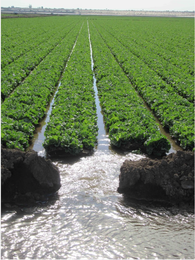
After a year of intense negotiations, the states along the Colorado River have reached a deal to solve one of the most complex water crises in U.S. history. The solution to this byzantine conundrum is deceptive in its simplicity: Pay farmers — who collectively use 80 percent of Colorado River deliveries — to give up their water.

Representatives from Arizona, Nevada, and California announced on Monday that they had agreed to reduce their states’ collective water usage by more than 3 million acre-feet over the next three years. That equals around a trillion gallons, or roughly 13 percent of the states’ total water usage. Under the terms of the deal, cities and irrigation districts in these so-called Lower Basin states will receive around $1.2 billion from the Biden administration’s Inflation Reduction Act, or IRA, in exchange for using less water. Most of the reductions are likely to come from farming operations. 

Many had anticipated a more painful resolution to the crisis. Rather than taking mandatory cuts and losing out on billions of dollars from crop sales, irrigators in the Southwest will get millions of dollars to reduce their water usage for just three years — and will cut their usage by less than half of what federal officials demanded last year. 

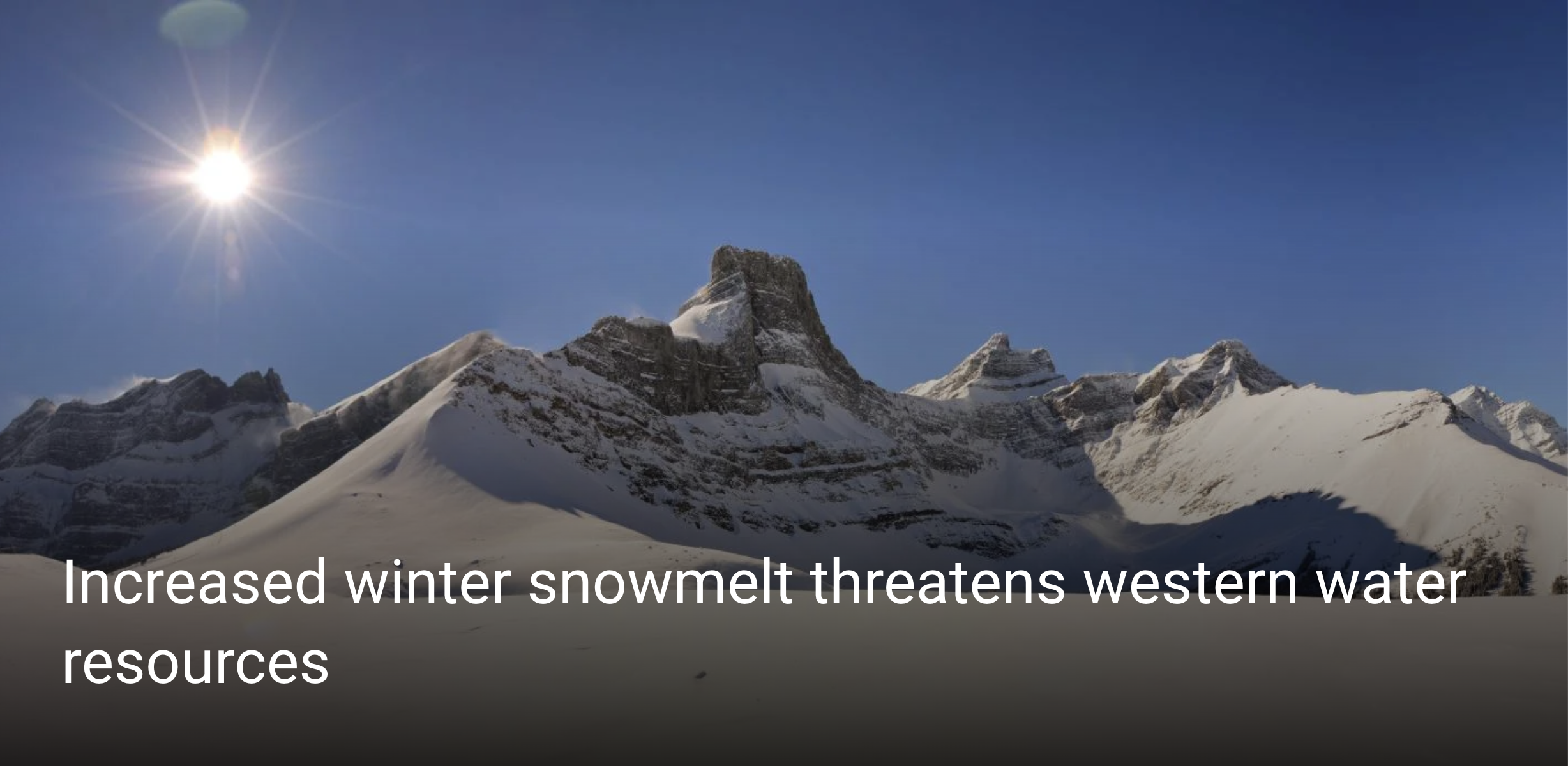
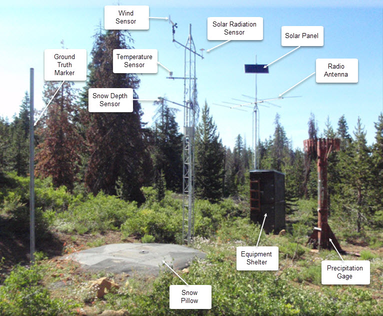
This rosy outcome is only possible because of a wet winter that blanketed the river basin with snow and stabilized water levels in its two main reservoirs, Lake Powell and Lake Mead. Thanks to the ample runoff, the states could lower their target enough that the federal government could afford to compensate them for almost all of it. 

his deal also resolves a key dispute between Arizona and California, the two largest water users on the river, which have clashed over how to respond to the water shortage. California has argued that Arizona should take the most cuts as the most junior user on the river, while Arizona argued that the cuts should be spread more evenly between all the states. The disagreement caused negotiations to drag out for months, and it’s only thanks to the payout from the federal government that they reached an accord.

These compensated cuts are larger than anything the river states have ever implemented before, but they are temporary, a Band-Aid for a crisis that is not going away any time soon. When the three-year agreement expires in 2026, the states will have to come back to the table again and address the elephant in the room: If water use is growing, and the river’s size is shrinking, some people are going to have to make do with less — not temporarily, but for good. 

“This is a step in the right direction but a temporary solution,” said Dave White, a professor at Arizona State University who studies sustainability policy. “This deal does not address the long-term water sustainability challenges in the region.”

The basic blueprint of the deal is not new. Federal and state agencies in the Colorado River basin have tried to pay farmers to use less water before, but they have had difficulty scaling up these compensation measures. That’s in part because many farmers view the measures as an affront to their industry, even when they’re compensated. When a group of states in the river’s Upper Basin relaunched a dormant conservation program earlier this year, offering farmers money to leave their fields unplanted, just 88 water users across four states ended up participating. 

The other issue is that conserving water is expensive. In order to convince farmers to plant fewer acres, officials need to give them more money per acre-foot of water than they would have made from selling crops on a given field. In California’s Imperial Valley, the “salad bowl” region that grows almost all the nation’s winter vegetables, irrigation officials have paid growers to invest in technology that makes their farms more efficient. But farmers in the valley have balked at the idea of taking money to leave their fields unplanted, especially as vegetable prices have remained high. 

“Water is a valuable asset, and I think people are nervous about parting with it, because it kind of suggests that you don’t really need it after all,” said George Frisvold, an extension specialist at the University of Arizona who studies agricultural policy. “I think there’s real concern that this is voluntary now, but it could come back and bite you.”

The Biden administration has resolved those issues for the moment by offering a very generous price for conservation under the new deal. The compensation arrangement in the new deal works out to about $521 an acre-foot on average — three times the price in the Upper Basin pilot program and almost twice the conservation rate in the Imperial Valley’s program.

Frisvold says these payments will be hard to maintain over the long term.

“We have a bunch of IRA money to pay for this right now,” he told Grist. “But is this going to be an ongoing thing? It’s kind of up in the air.”

Until recently, these experimental conservation programs were just that — experiments. But over the past two years, as a once-in-a-millennium drought has all but emptied out the river’s two main reservoirs, the river states have scrambled to cut their water usage and stop draining the river. It is all but impossible to do that without using less water for agriculture.

The Biden administration kicked off the scramble last summer by delivering an ultimatum to the river states. While testifying before Congress in June, a senior official from the U.S. Bureau of Reclamation ordered the states to cut their water consumption by between 2 and 4 million acre-feet, or as much as a third of the river’s normal annual flow. The administration threatened to impose unilateral water cuts if the states couldn’t reach a deal on their own.

The states tangled for months over who should shoulder the burden of reducing water usage. The so-called Upper Basin states of Colorado, Utah, Wyoming, and New Mexico pointed the finger at Arizona and California, which together consume the majority of the river’s water. Meanwhile, representatives from California insisted that legal precedent shields the Golden State from taking cuts and that Arizona should bear the pain. (It isn’t clear whether the other four states on the river’s Upper Basin will make any corresponding reductions.)

In the end it was a very wet winter rather than a diplomatic breakthrough that helped ease tension between the states. Thanks to historic snowpack in the Rocky Mountains, it’s likely that water levels at Lake Powell and Lake Mead will stabilize this summer, even if just for a few months. This plentiful runoff has made the worst-case outcomes for the river much less likely and has given the states some breathing room to negotiate smaller cuts.

The new target was just small enough to make voluntary conservation feasible with the money from the Inflation Reduction Act: In the final hours of the debate over the bill last year, Senator Kyrsten Sinema of Arizona negotiated a $4 billion tranche of funding for “drought response.” That money will anchor the deal for the next three years, but it’s unclear whether payments will continue after that.

The big question now is what happens at the end of 2026, when the conservation deal will expire and when states and tribes will gather to negotiate the river’s long-term future. At that point, the river’s water users will once again debate the big questions that this deal has allowed them to punt on: How much water use can a shrinking river support? Who should use less water to account for the river’s decline? How can the government make whole the tribal nations that still don’t have their water

Even amid the relief surrounding Monday’s deal, some water officials were already looking ahead. 

“This proposal protects the system in the short term so we can dedicate our energy and resources to a longer-term solution,” said Brenda Burman, the manager of the Central Arizona Project water authority, which delivers water to Phoenix and Tucson, in a press release. “There’s a lot to do and it’s time to focus.”

Map credit: AGU

RiversEdge West receives grant for riparian restoration on the #WhiteRiver — The Rio Blanco Herald-Times

White River Basin. By Shannon1 – Own work, CC BY-SA 4.0, https://commons.wikimedia.org/w/index.php?curid=69281367

Click the link to read the release on the Rio Blanco Herald-Times website:

RiversEdge West (REW) is pleased to accept a $48,788 grant award from the Colorado River District’s Community Funding Partnership to continue important riverside (riparian) restoration work along the White River in Rio Blanco County.

REW leads the White River Partnership (WRP), a group committed to restoring and maintaining healthy riparian areas along the White River in northwest Colorado and northeast Utah through collaboration among public, private, and non-profit entities. REW works with WRP partners to prioritize and plan restoration sites, coordinate invasive plant removal with contractors and youth corps, and to monitor restoration sites after invasive plant removal.

Tamarisk

This project will remove invasive plant species, like tamarisk and Russian olive, from the White River corridor on public and private lands. Removing these invasive plants will enhance public access to river recreation areas and improve wildlife habitat and agricultural productivity on nearby privately-owned property. To complete this work, REW will partner with Western Colorado Conservation Corps, based in Grand Junction, which engages young adults on the Western Slope in conservation and restoration work by training them for careers in land management.

“The Community Funding Partnership is a solution-driven funding program to ensure our communities thrive in a hotter, drier future. Riparian restoration projects, such as the White River Project, are critical to West Slope rivers by protecting water quality, improving habitat, and moderating high flow events,” said Amy Moyer, Director of Strategic Partnerships with the Colorado River District.

In addition to the award from the River District, this project is also supported by the Colorado Water Conservation Board and the Bureau of Land Management.

Spring snow meltoff close to reaching its peak for the #GunnisonRiver (May 28, 2023) — The #CrestedButte News #ColoradoRiver #COriver #aridification

Map of the Gunnison River drainage basin in Colorado, USA. Made using public domain USGS data. By Shannon1 – Own work, CC BY-SA 4.0, https://commons.wikimedia.org/w/index.php?curid=69257550

Click the link to read the article on The Crested Butte News website (Katherine Nettles). Here’s an excerpt:

UGRWCD senior water resource specialist Beverly Richards reported that the  Gunnison River at the Gunnison Whitewater Park was flowing at 3,210 cubic feet per second (CFS) last weekend, and is very close to peaking.  Richards said there is currently only one small portion of Gunnison County to the west that is facing drought, and the three month outlook shows drought conditions not recurring with the exception of a few areas to the north. Richards reported that precipitation has generally been within the historic normal range in the past 30 days, while snow water equivalent (SWE) maps show 193% of normal for the entire Gunnison Basin and 153% of normal for the upper basin. SNOTEL sites where SWE is measured are melting out. “But that was for May 19,” she said, which reflects that in May there isn’t usually much snow left. 

The entire Gunnison Basin water storage is at 75% of average;  reservoir storage for the Upper Gunnison Basin is 61%; and projected unregulated inflow for Blue Mesa Reservoir is at 131% of average.  Richards said Blue Mesa is projected to be 97% full with a max fill amount of 102,869 acre feet. There is no indication from the Bureau of Reclamation (BOR) as of yet about how much water might be called downstream. 

“Reservoir storage across the Upper Colorado River is going up, but Lake Powell is expected to only be about 37% full,” said Richards, due to the volume that will come out. For perspective, she offered an estimate that Lake Powell could be filled in three years if the region had the same kind of snowy year as 2023, and if no one took water out. With the reality of outflows, however, she said it would take 6 to 8 years with winters like this one to refill Lake Powell.

Increased winter snowmelt threatens western #water resources — University of #Colorado #runoff

Banner image: Fortress Mountain in the Canadian Rockies of Alberta, Canada. (Credit: Angus Duncan)

Click the link to read the article on the University of Colorado website (Kelsey Simpkins):

More snow is melting during winter across the West, a concerning trend that could impact everything from ski conditions to fire danger and agriculture, according to a new CU Boulder analysis of 40 years of data. 

Researchers found that since the late 1970s, winter’s boundary with spring has been slowly disappearing, with one-third of 1,065 snow measurement stations from the Mexican border to the Alaskan Arctic recording increasing winter snowmelt. While stations with significant melt increases have recorded them mostly in November and March, the researchers found that melt is increasing in all cold season months—from October to March. 

Their new findings, published today in Nature Climate Change, have important implications for water resource planning and may indicate fewer pristine powder days and crustier snow for skiers. 

“Particularly in cold mountain environments, snow accumulates over the winter—it grows and grows—and gets to a point where it reaches a maximum depth, before melt starts in the spring,” said Keith Musselman, lead author on the study and research associate at the Institute of Arctic and Alpine Research (INSTAAR) at CU Boulder. 

Combined photos of the Senator Beck basin in the Colorado San Juan mountains during increasingly warmer months. (Credit: Jeffrey Deems/CIRES and Matthew Kennedy/CU Boulder Extreme Ice Survey)

But the new research found that melt before April 1 has increased at almost half of more than 600 stations in western North America, by an average of 3.5% per decade. 

“Historically, water managers use the date of April 1 to distinguish winter and spring, but this distinction is becoming increasingly blurred as melt increases during the winter,” said Noah Molotch, co-author on the study, associate professor of geography and fellow at INSTAAR. 

Snow is the primary source of water and streamflow in western North America and provides water to 1 billion people globally. In the West, snowy mountains act like water towers, reserving water up high until it melts, making it available to lower elevations that need it during the summer, like a natural drip irrigation system. 

“That slow trickle of meltwater that reliably occurs over the dry season is something that we have built our entire water infrastructure on in the West,” said Musselman. “We rely very heavily on that water that comes down our rivers and streams in the warm season of July and August.” 

More winter snowmelt is effectively shifting the timing of water entering the system, turning that natural drip irrigation system on more frequently in the winter, shifting it away from the summer, he said. 

This is a big concern for water resource management and drought prediction in the West, which depends heavily on late winter snowpack levels in March and April. This shift in water delivery timing could also affect wildfire seasons and agricultural irrigation needs.  

Wetter soils in the winter also have ecological implications. One, the wet soils have no more capacity to soak up additional water during spring melt or rainstorms, which can increase flash flooding. Wetter winter soils also keep microbes awake and unfrozen during a time they might otherwise lay dormant. This affects the timing of nutrient availability, water quality and can increase carbon dioxide emissions. 

SNOTEL automated data collection site. Credit: NRCS

An underutilized data source

Across the western U.S., hundreds of thin, fluid-filled metal pillows are carefully tucked away on the ground and out of sight from outdoor enthusiasts. These sensors are part of an extensive network of long-running manual and automated snow observation stations, which you may have even used data from when looking up how much snow is on your favorite snowshoeing or Nordic skiing trail. 

This new study is the first to compile data from all 1,065 automated stations in western North America, providing valuable statistical insight into how mountain snow is changing. 

And by using automated, continuously recording snowpack stations instead of manual, monthly observations, the new research shows that winter melt trends are very widespread—at three-times the number of stations with snowpack declines, according to Musselman. 

Snowpack is typically measured by calculating how much water will be produced when it melts, known as snow-water equivalent (SWE), which is affected by how much snow falls from the sky in a given season. But because winter snowpack melt is influenced more by temperature than by precipitation, it is a better indicator of climate warming over time. 

“These automated stations can be really helpful to understand potential climate change impacts on our resources,” said Musselman. “Their observations are consistent with what our climate models are suggesting will continue to happen.”

Other authors on this publication include Nans Addor at the University of Exeter and Julie Vano at the Aspen Global Change Institute.