
Click on a thumbnail graphic to view a gallery of drought data from the US Drought Monitor website.
Click the link to go to the US Drought Monitor website. Here’s an excerpt:
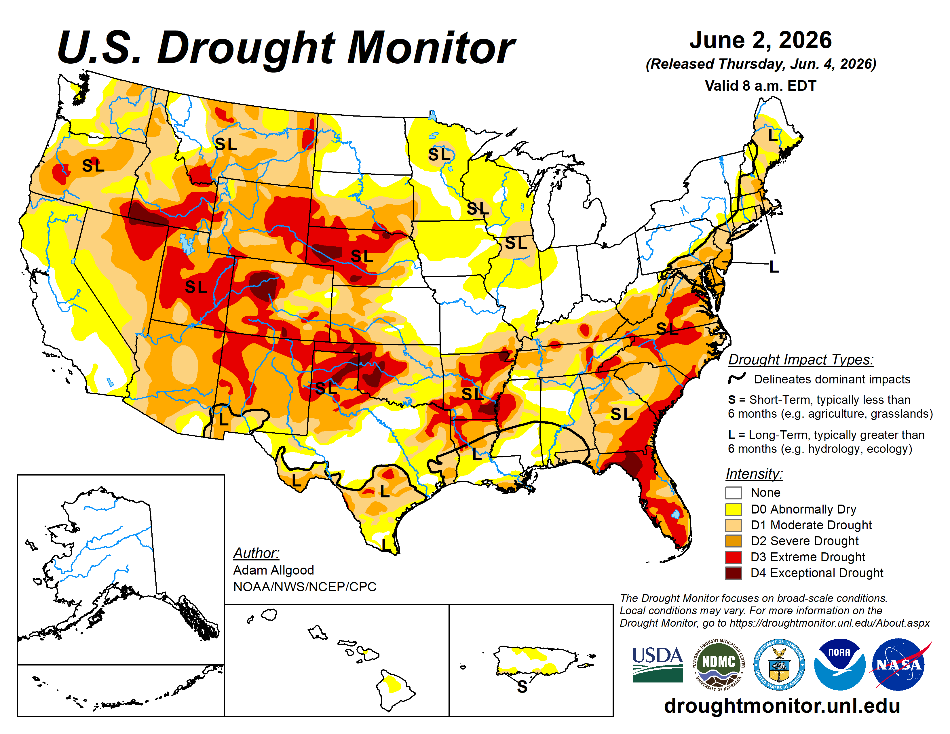
This Week’s Drought Summary
The mid-level height anomaly pattern during the week exhibited an omega-block type pattern, with mean troughing over Alaska and both the West and East, with the western trough cutting off over California, and strong ridging between the troughs across the central contiguous US. This pattern promoted below-normal temperatures across the Southwest for much of the period, with colder air pushing eastward towards the end of the week followed by warming temperatures. Across the East, cooler air overspread New England and the mid-Atlantic, keeping evapotranspiration rates a bit lower than normal. In contrast, much above-normal temperatures were observed throughout the week across the northern Plains and upper-Midwest, though colder weather and storminess overspread the northern Rockies and adjacent High Plains at the end of the week.
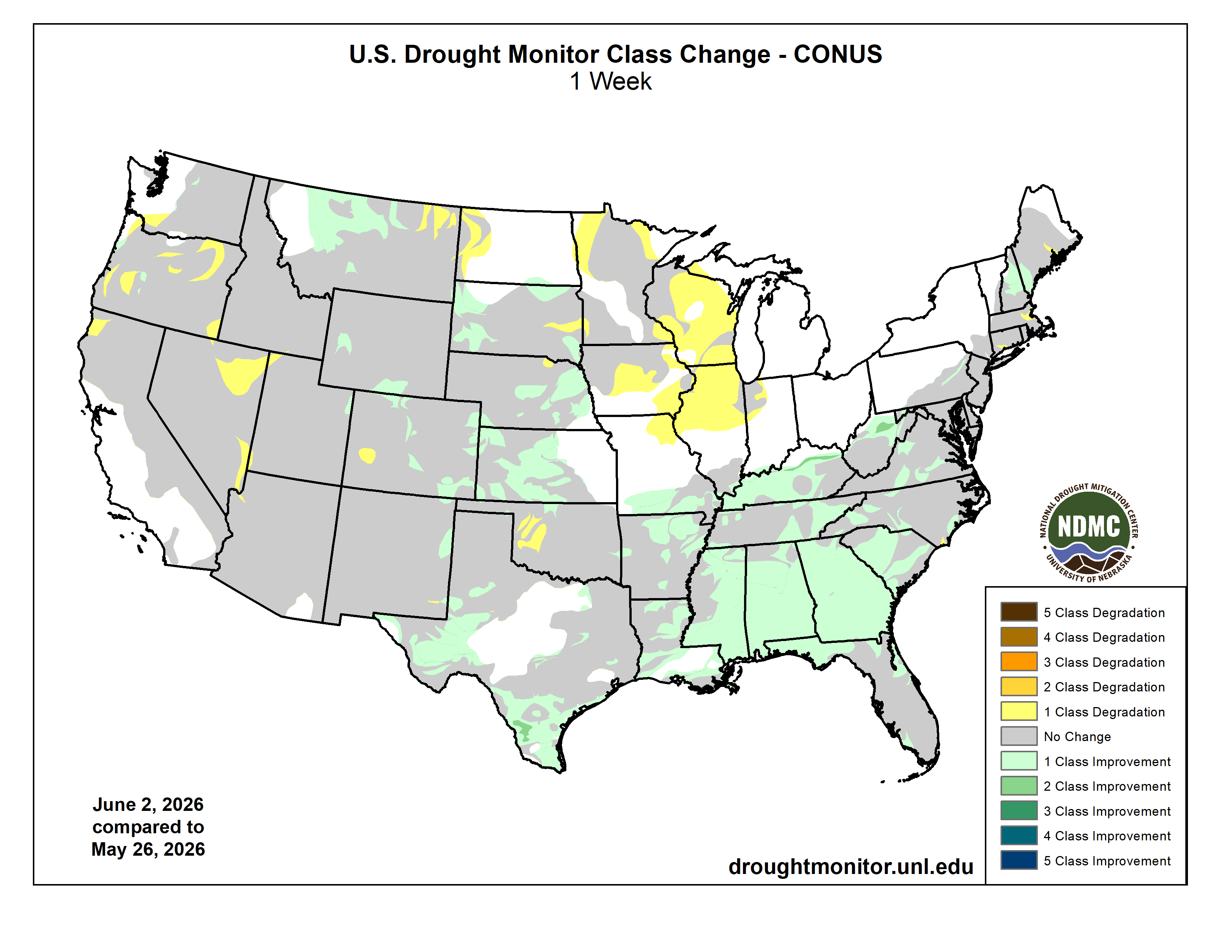
An active pattern was noted across the Plains, South, and Southeast as a mean frontal boundary provided a focus for stormy weather. These rains, in conjunction with a wetter pattern overall during May, prompted widespread additional drought relief for the South and Southeast regions, as well as portions of the High Plains. In contrast, hot, dry weather across the northern Plains and upper-Midwest caused expansion of drought and abnormal dryness, with widespread degradation occurring in western portions of the Midwest region. Towards the end of the week, a storm system brought heavy precipitation to western and central Montana, bringing some drought relief following a period of hot, windy weather. Across the Northeast, additional rainfall benefitted portions of New England, while drier weather overspread the mid-Atlantic and southern New England following a wet week previously…
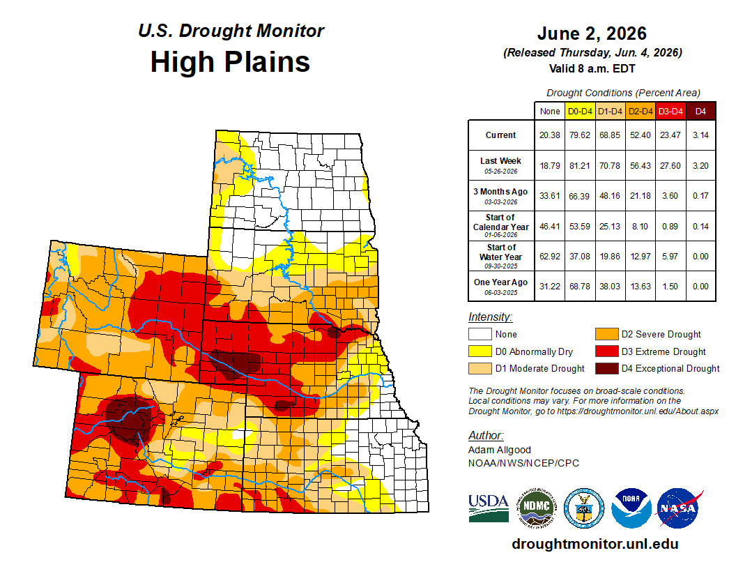
High Plains
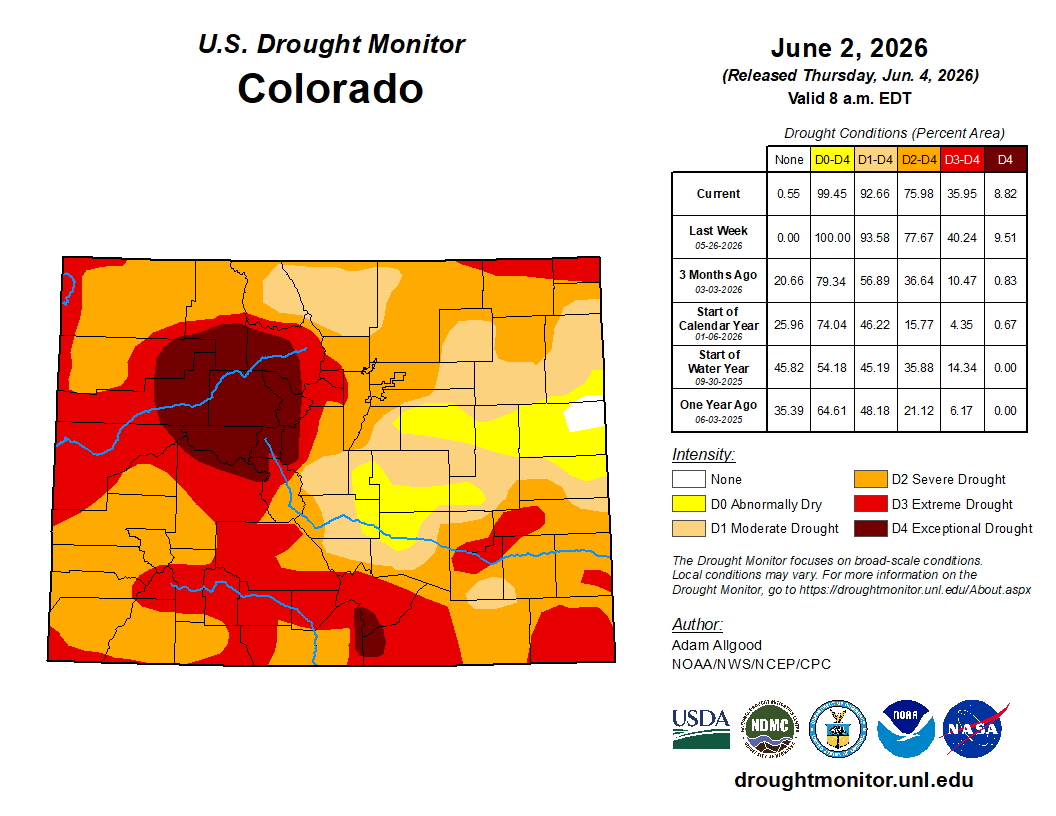
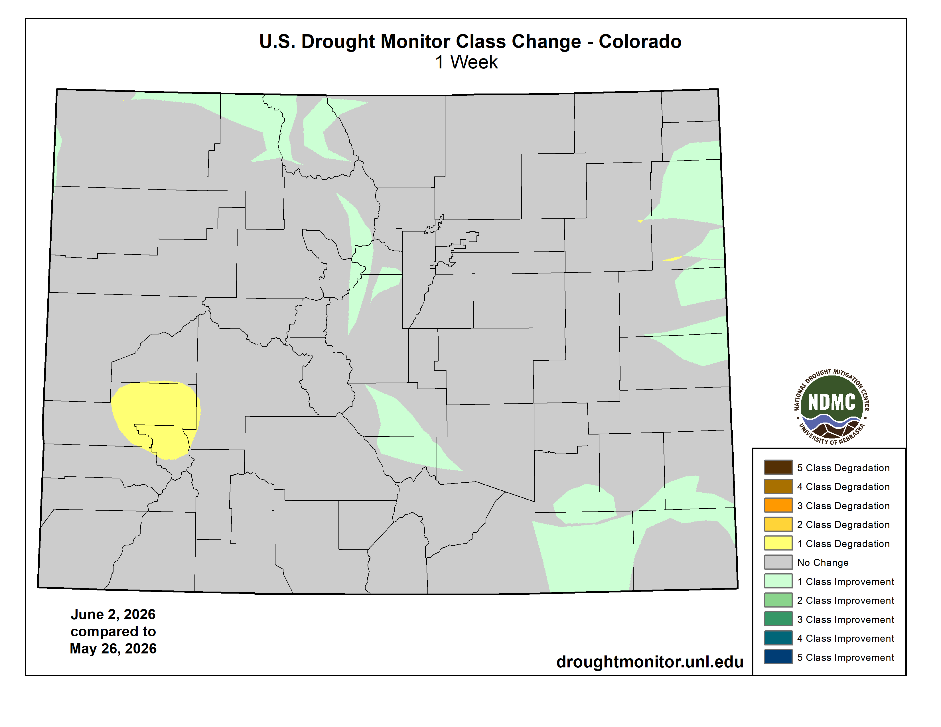
Stormy weather brought soaking rains across much of the High Plains, with the highest coverage and accumulations over Kansas and Nebraska. While beneficial, this precipitation competed during the week with much above-normal temperatures, which maintained high evapotranspirative demands. Accordingly, areas that missed out on significant rainfall, including portions of the Dakotas and far northern Nebraska, experienced some degradation, while reductions were noted across much of Kansas and eastern Nebraska. Further west, beneficial precipitation brought some relief to portions of the Colorado Plains and a few spots in Wyoming, while drier conditions resulted in deterioration in southwestern Colorado…
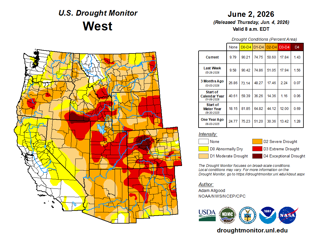
West
A late season storm system brought heavy rainfall to southern Oregon and northern California, sparking a few modest improvements but overall doing little to change the current drought depiction. Some degradations were noted across portions of California, Oregon, and the Great Basin, where impacts from a lack of snowmelt recharge – especially low streamflows – are beginning to be felt. Temperatures during the week were near to above-average across the Northwest, but below average across California, helping to keep evapotranspiration demands lower than average…
South
Soaking rains overspread most of Texas during the week, promoting additional drought reductions, primarily across southern Texas and the Big Bend country. Rainfall also overspread eastern Oklahoma, but conditions worsened across the western half of the state which fared drier during the week. Along the lower Mississippi Valley, heavy rains, exceeding 6 inches in some locations, fell across northern Arkansas, promoting drought reduction. Soaking rains were less intense across Louisiana and Mississippi, but were still sufficient to promote substantial drought reduction at the tail end of a wet May. Although conditions have improved overall across the Southern Region, widespread D3 to D4 continues across northern Texas and western Oklahoma, and long term drought impacts to groundwater remain a concern heading into the summer months across the whole region…
Looking Ahead
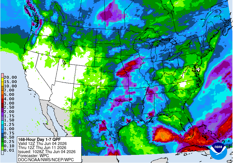
At the start of the next 7 days, drier conditions are favored across much of the East, with daily temperatures quickly warming to above-normal. A storm system now over the Plains will progress slowly eastward, bringing a potential for much needed rainfall across the upper Midwest and Great Lakes region. Current QPF forecasts from the Weather Prediction Center show amounts potentially exceeding 1.5 inches across much of Iowa and far southwestern Wisconsin, but lighter amounts elsewhere will likely be insufficient to overcome the high demands coming from much above-normal temperatures and summer agriculture, especially across Illinois, Indiana, and northern Minnesota. A gradual return to a summer convective regime is favored across the Southeast during the week, but accumulations are forecast to be less than what fell over the past few weeks, especially across northern Florida and east of the Appalachians. Seabreeze-driven convection is favored to remain active across South Florida. Mostly dry conditions are favored across the West, with a storm system bringing some precipitation to the Pacific Northwest. Meager precipitation is forecast for the Northeast region, raising concerns for a return of short term drought impacts.
During Week-2, weak troughing over Alaska is favored to maintain below-average temperatures and above-average precipitation for another week. Downstream, positive height anomalies are forecast for most of the contiguous United States, leading to coast-to-coast enhanced chances for above-normal temperatures. The highest probabilities for above-normal temperatures extend across both the West and the Northeast. Enhanced low-level southerly flow in this pattern favors a wide open Gulf, with moist air penetrating far to the north across the central US. Any interactions with shortwave troughs or other synoptic features could trigger periods of organized convection. Therefore, a broad signal slightly favoring above-normal precipitation extends from the Gulf Coast through much of the CONUS east of the Rockies. Near normal precipitation is the most likely outcome across the Northeast with weak troughing just offshore, and a slight tilt towards below-normal precipitation is forecast for the Pacific Northwest. Across Hawaii, both above-normal temperatures and precipitation are favored, based on a consensus of dynamical model guidance.
Just for grins here’s a slideshow of early June US Drought Monitor maps for the past few years.

US Drought Monitor one week change map ending June 2, 2026. 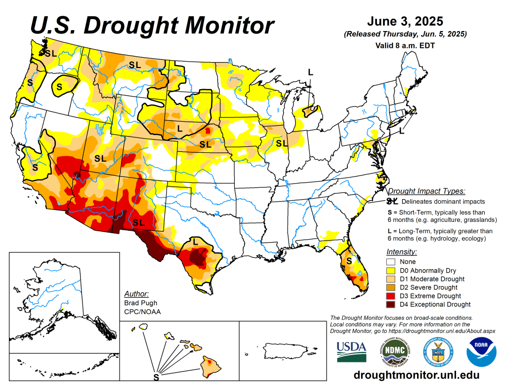
US Drought Monitor map June 3, 2025. 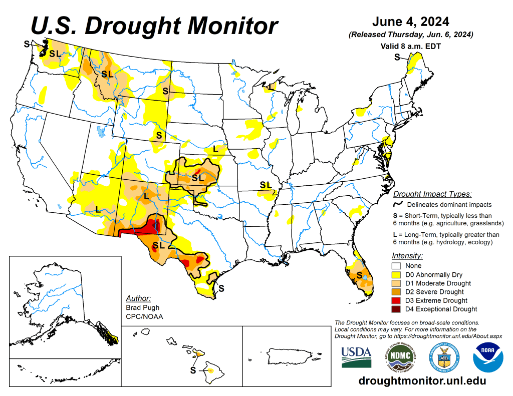
US Drought Monitor map June 4, 2024. 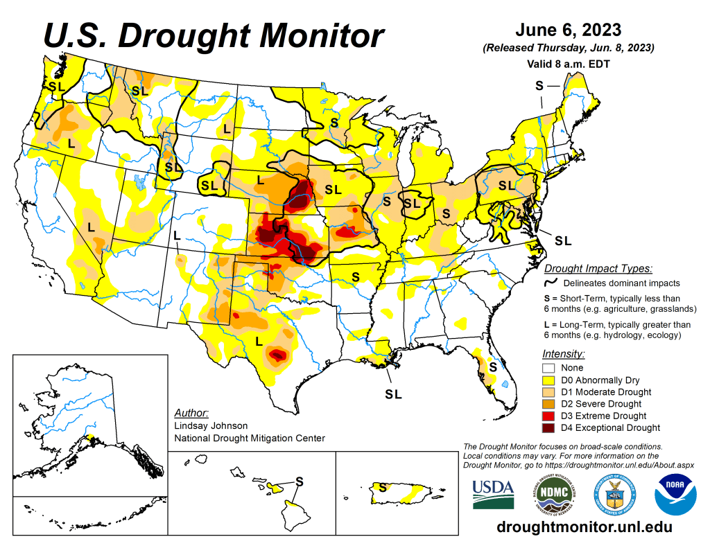
US Drought Monitor map June 6, 2023. 
US Drought Monitor map June 7, 2022. 
US Drought Monitor map June 1, 2021. 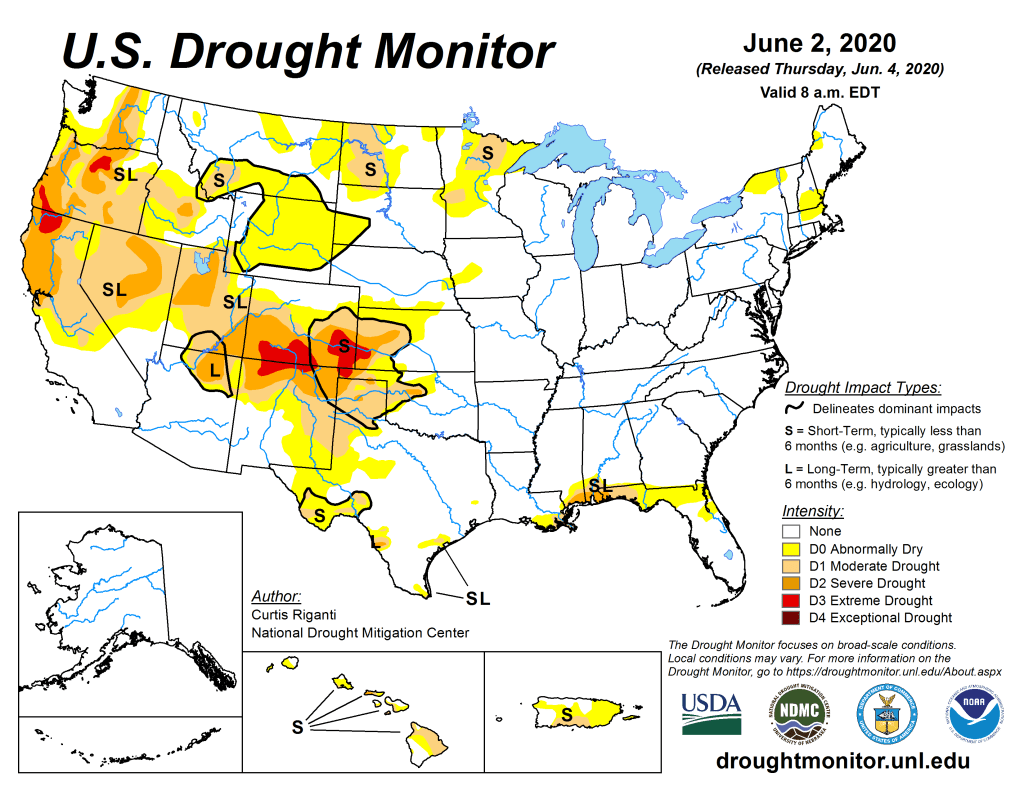
US Drought Monitor June 2, 2020. 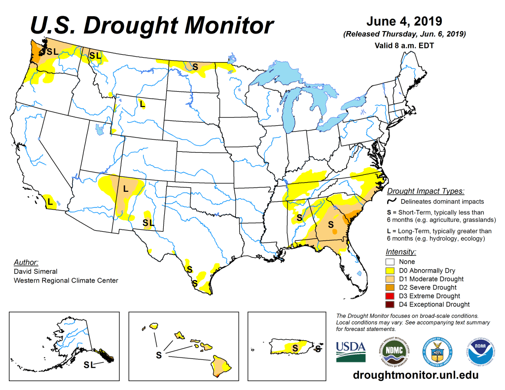
US Drought Monitor June 4, 2019. 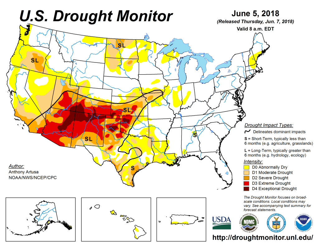
US Drought Monitor June 5, 2018. 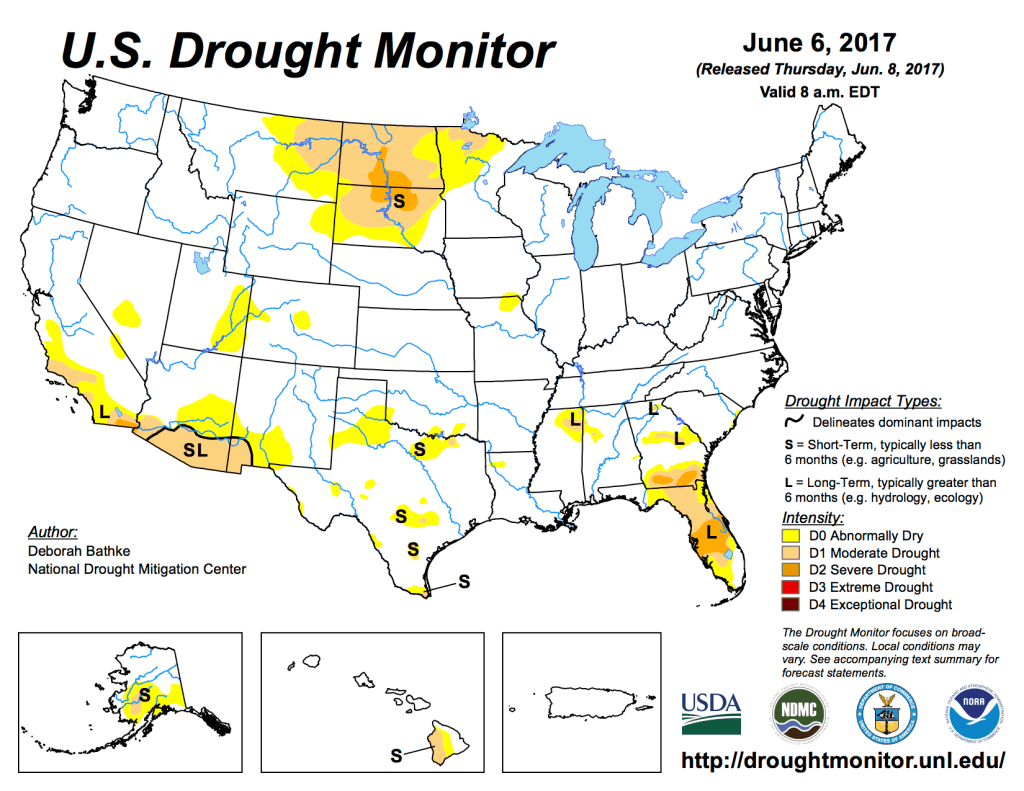
US Drought Monitor June 6, 2017. 
US Drought Monitor June 7, 2016. 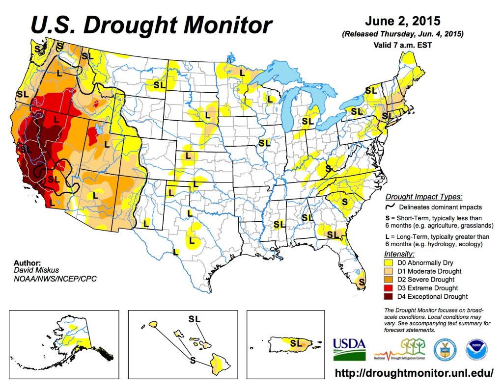
US Drought Monitor June 6, 2015. 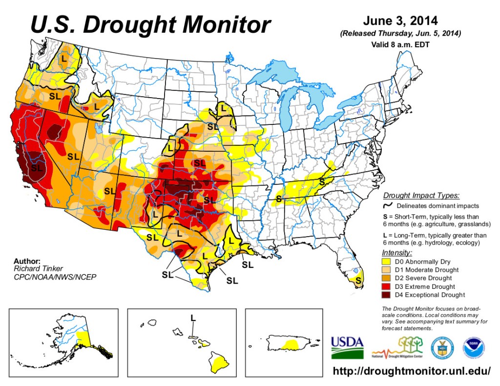
US Drought Monitor June 3, 2014 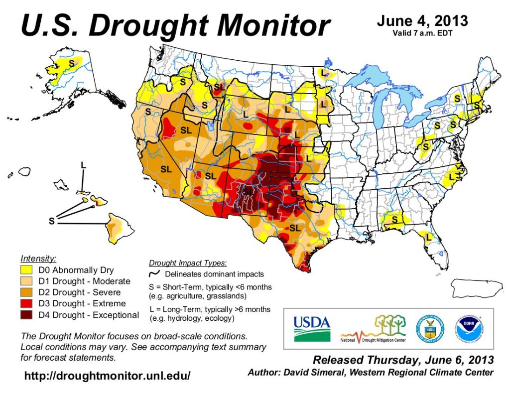
US Drought Monitor June 4, 2013. 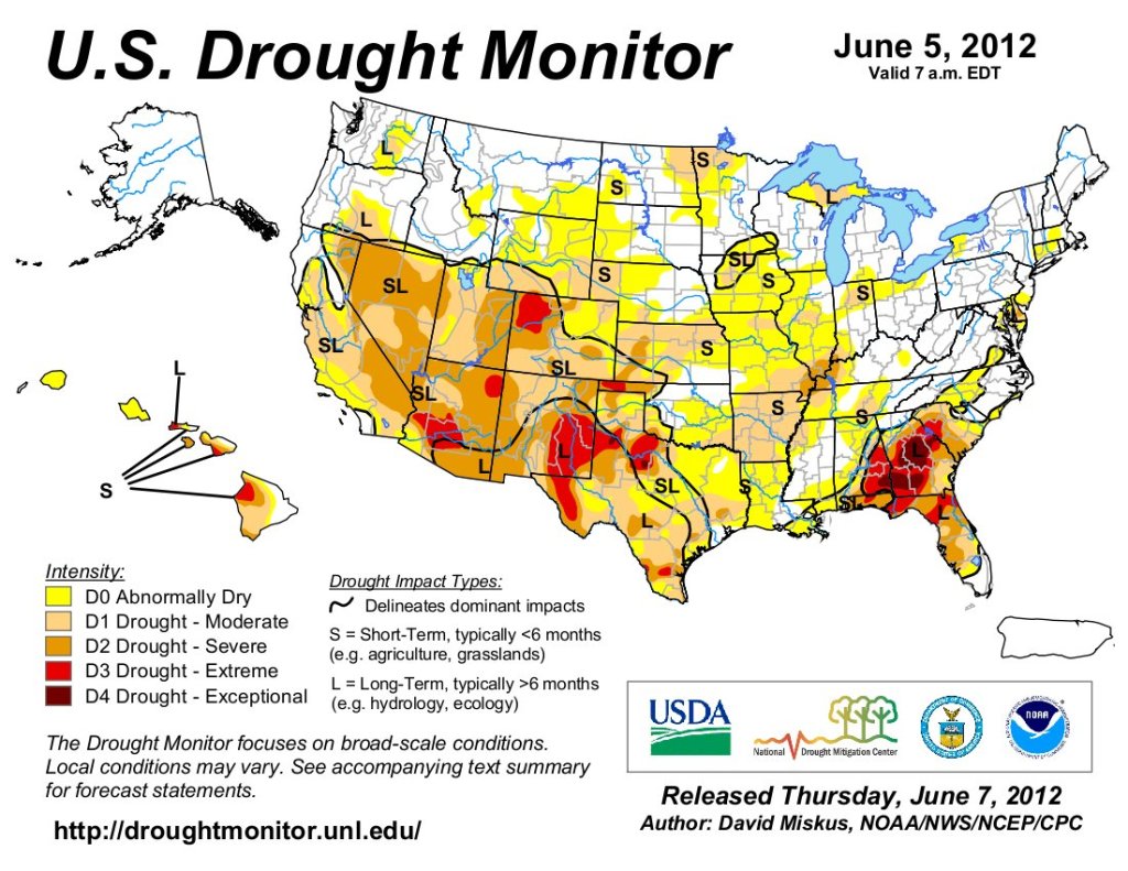
US Drought Monitor June 5, 2012. 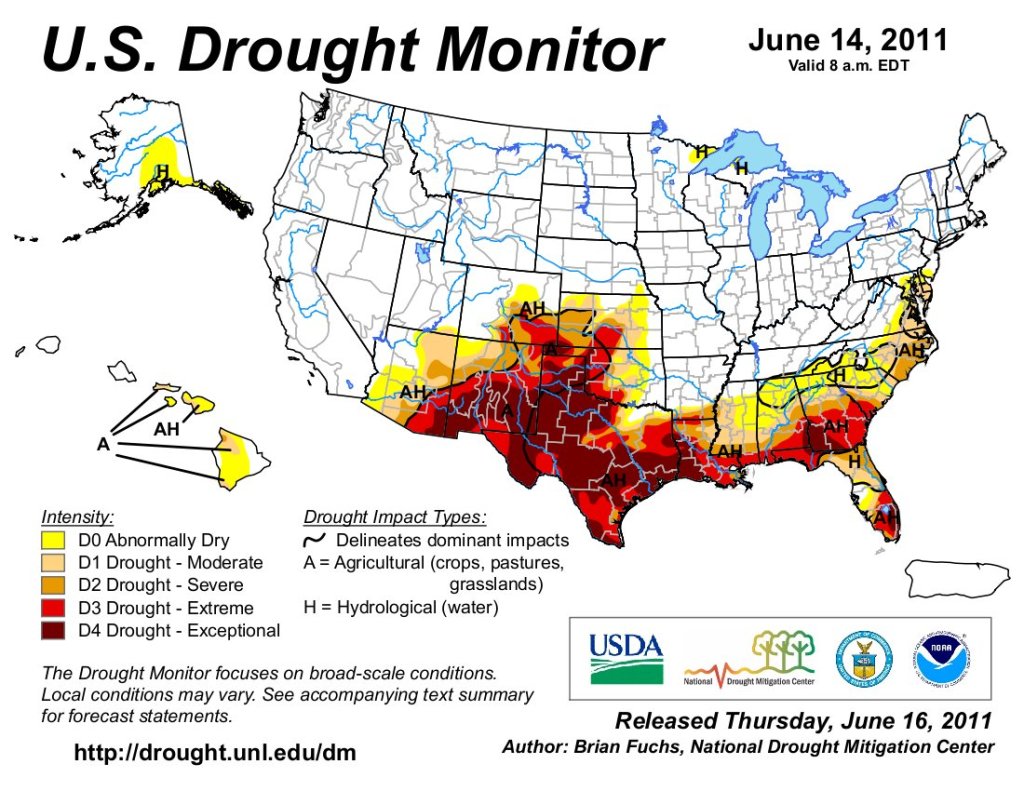
US Drought Monitor June 14, 2011. 