
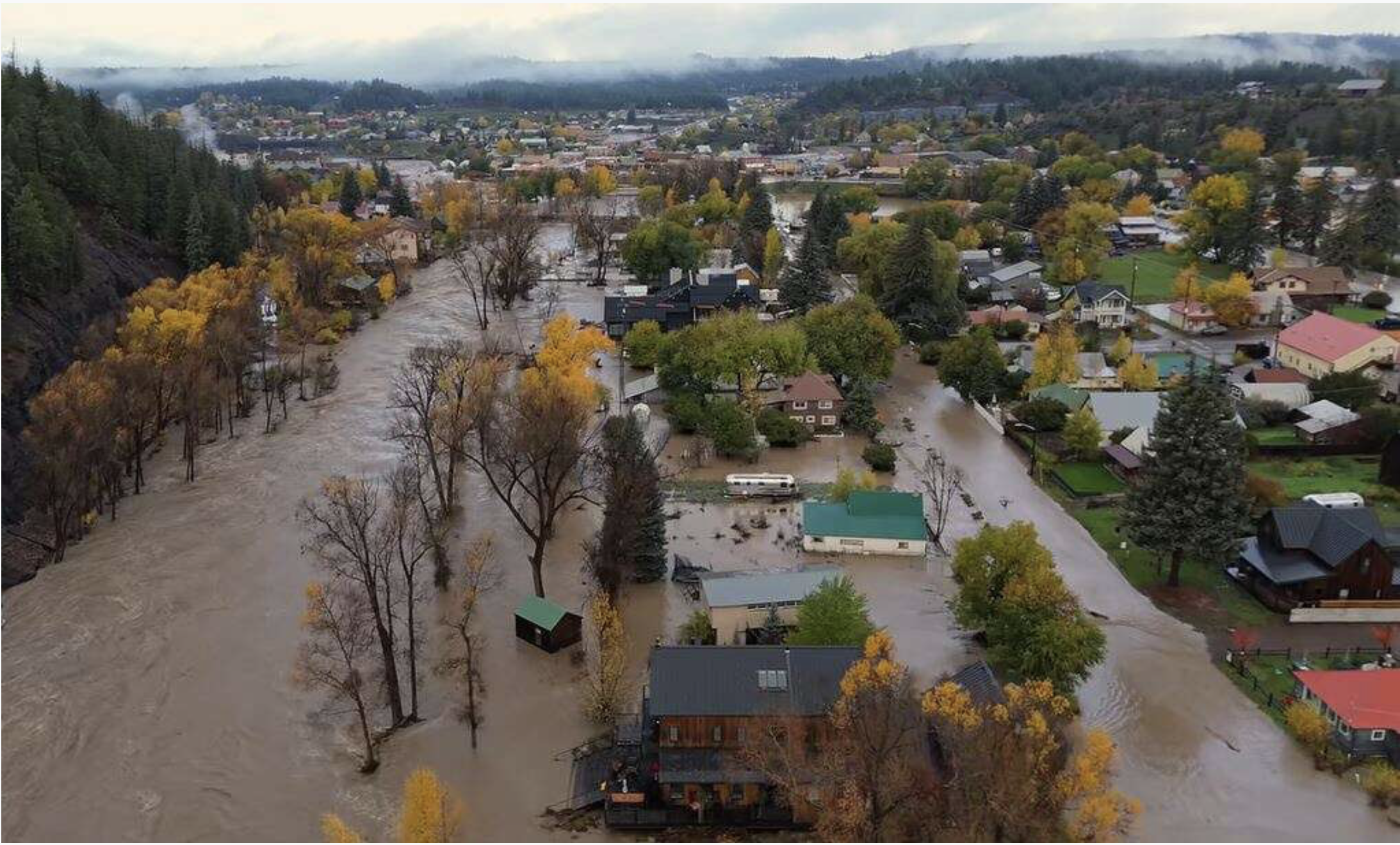
Click the link to read the article on The Pagosa Springs Sun website. Here’s an excerpt:
November 19, 2026
[Roy] Vega explained that [Archuleta County] still has a boil advisory for anyone on a water well, and noted that the county has ordered well-testing kits for residents to use…Vega also mentioned that there are still residents who do not have power along the County Road 500 section south of Estate Circle. He explained that 170 households have temporarily relocated to Airbnbs, but that their time in those accommodations is starting to run out, and that the Department of Human Services and the Public Health Department are working on finding short-term and long-term solutions for people who are still displaced. He noted that supplies are still available at the county’s Mountain Express Transit building…Vega explained that crews still need to finish damage assessments for areas that they have not been able to reach yet, but that currently 37 structures are known to have been destroyed, meaning that water levels came up to door handles or higher. He noted that 50 structures were majorly affected with water coming up to outlets inside, and that 72 structures were minorly affected with some level of water inside. He also noted that 192 structures were affected in some capacity from the flood…For more information on flood recovery resources, visit www.archuletacounty.gov/community/welcome-to-archuleta-county/news/archuleta-county-flood-resources.
On the Public Works side of things, Director Nick Freelen explained that some of the town’s streets are in bad shape.
“Sixth Street and 5th Street, those are gonna be pretty long closures, and we don’t have an estimated time for reopening those,” he said, adding, “They are going to have to be reengineered and then rebuilt appropriately,” he added. Hermosa Street is also still closed, he said, adding, “We are trying to keep traffic off of there to prevent people from wandering down, looking [at the river] when folks are still trying to get debris out of their yards.”
He added that the town’s storm drains on Hermosa have been “completely silted over” from the flood…The town and the county are making applications to the governor for a state emergency declaration, and a “letter will go with Governor Polis’ packet to the president and [the Federal Emergency Management Agency (FEMA)] for their consideration. … We need the [President Trump] to provide this,” he said…On the commercial side, he said the East End properties were impacted as well as Hot Springs Boulevard. Quality Inn had water and mud on the floor on the lower level and Healing Waters had damage as well, he explained…
From the Parks and Recreation Department side of things, Director Darren Lewis noted that, as of now, all pedestrian bridges remain closed. He explained that his department’s priorities right now are the Centennial and Veterans’ (near Town Park) bridges. He added that the 6th Street bridge will not be a priority at this time.
From the house hitting the Veterans’ bridge, “there’s some railing and things that need to be cut off and iron put back on and welded on,” he said…
[Pagosa Area Water and Sanitation District (PAWSD) District Manager Andrew Connor] stated that the first flood had a limited impact on the district, only causing impacts with its wastewater plant having to process large amounts of water and two roads with pipes underneath them being washed out, although the pipes were not destroyed — North Pagosa Boulevard and Mockingbird Place. The impacts of the second flood were more significant, with PAWSD losing several water lines, Connor stated. However, he indicated that the district was able to maintain pressure in the entire water system throughout the flooding and did not have to issue a boil water notice, partially due to efforts to close valves adjacent to river crossings as the flood rose…Connor then moved on to outlining the various damage the district suffered in the second flood, starting with the Apache Street bridge over the San Juan River, explaining that a water line underneath it was damaged. He stated that the district has been able to backfeed water to customers on both sides of the bridge and that repairs on the damaged line are not scheduled for 2026 since PAWSD will have to decide how to approach the repairs on the line before repairing it…Connor indicated that the ditch from Stevens Reservoir to Lake Pagosa held, although it will need to be cleared of debris, which will be done in 2026. He stated that repairing the washout on North Pagosa Boulevard will require temporarily removing the water line and that PAWSD would reactivate its San Juan water treatment plant, which is currently turned off, to provide water to customers in the area during the disruption…Connor explained that the West Fork diversion that feeds PAWSD’s Snowball water treatment plant suffered damage in three areas, including regions where embankment slides near Jackson Mountain damaged the line…Connor indicated that the district’s Fourmile Creek diversion that feeds Hatcher Lake was undamaged, and that the intake structure and reservoir on the San Juan River that supplies water to San Juan water treatment plant experienced some damage and a large amount of silt accumulation during the floods.
