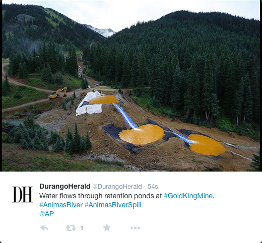
#AnimasRiver: Water-treatment system announced for #GoldKing — The Durango Herald

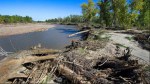
New settlement ponds at Gold King Mine August 2015

From The Durango Herald (Peter Marcus):

The $1.78-million portable treatment facility will be located in Gladstone, according to EPA officials. It will be operational by Oct. 14 and operate during the coming winter. The contract provides for 42 weeks of treatment, with the option to start or stop treatment as needed…

Water continues to flow from the mine at approximately 550 gallons per minute. Without the plant, officials have had to rely on a series of settling ponds to capture the dirty water before being discharged to Cement Creek.

Authorities constructed four ponds at the mine site, which are treating water to remove as much metal loading as possible. The treatment plant will replace the ponds.

EPA officials estimate the plant will cost $20,000 per week to operate, with another $53,200 for demobilization and bonding. EPA will use money from its Superfund coffers to pay for the project. Superfund money is used to clean up blighted areas that could be toxic to humans. Gold King still has not officially been listed as a Superfund site.

The bidding process for the plant was conducted by St. Louis-based Environmental Restoration, LLC, the contractor that was working with the EPA when the spill occurred. The treatment-system contract was awarded to subcontractor Alexco Environmental Group Inc., which has an office in Denver.

Officials said the transition to the plant is necessary as winter temperatures at high elevations can reach well below zero, making it unsafe to manually treat water at the mine site. The system is designed to handle up to 1,200 gallons per minute.

“The objective of the treatment system is to neutralize the mine discharge and remove solids and metals,” stated an EPA news release announcing the facility. “Although the Gold King Mine discharge is just one of many into Cement Creek, the treatment will remove a portion of the metal loading to Cement Creek.”

Though the system is temporary, long-term treatment will be decided after further evaluation of mine discharge, said an EPA spokeswoman.

The DWR sends rules for groundwater pumping in the San Luis Valley to water court

San Luis Valley Groundwater

From The Pueblo Chieftain (Matt Hildner):

For the second time in 40 years, the state engineer has come up with rules and regulations for groundwater wells in the San Luis Valley.

The rules, which were submitted by State Engineer Dick Wolfe to the Division 3 Water Court Wednesday, aim to restore the valley’s two major aquifers and protect senior surface water users from the harm caused by pumping.

The rules would apply to roughly 4,500 high-capacity irrigation wells spread across the valley, with the exception of southern Costilla County, which is not above either aquifer.

Wolfe pointed to provisions that defined sustainable levels for the valley’s groundwater, noting they were a first for any of the river basins in the state.

“You see a lot of what’s going on in a lot of other parts of the Western U.S., particularly California right now, we’re going to look back on this time and say we’re glad we took this step,” he said.

The engineer’s office aims to return the two major aquifers to the levels that existed until 2000, when drought and persistent withdrawals sent them into steep decline.

Toward that end, the rules will require users of the confined aquifer — the deeper and larger of the two — to submit plans to achieve and maintain a sustainable water supply.

The rules would also give the engineer’s office the ability to shut down wells that are not operating under one of three options to mitigate pumping.

To avoid being shut down, well users could join a groundwater management subdistrict, in which its members pool resources to either buy water or pay surface water users for injury.

They could also take out individual augmentation plans for the same purpose.

Third, they could have a short-term temporary water supply plan.

The development of the sustainability section partly accounted for the six years Wolfe, his staff and upward of 100 valley water users took to come up with the regulations.

Developing the computer model that would eventually be used to calculate stream losses from groundwater pumping also took a period of years, Wolfe said.

But it is that computer model that could be one of the biggest differences from these rules and the version from 40 years ago that was never implemented.

“It was really apparent to me that we did not have the hydrologic knowledge to really effectively control wells,” said Mac McFadden, who served as division engineer in the valley in 1975.

After the water court publishes notice of the rules submission, there will be a 60-day period for objectors and supporters to file statements to the court.

Wolfe said he hoped to work out stipulations with objectors that would allow the court to avoid a trial.

It is possible that at least one group of water users in the La Jara Creek drainage will be among the objectors.

They sued the engineer’s office earlier this year, alleging the state’s computer model had failed to find pumping losses to a spring they depend on to irrigate.
Parties in that case are scheduled to meet in court Oct. 5 to determine if consolidation into the rules and regulations is appropriate.

Cucharas Dam: Two Rivers Water & Farming Company fails to meet deadline from the State Engineer

Cucharas Dam via The Pueblo Chieftain

From The Pueblo Chieftain (Chris Woodka):

A legal battle has sprung up over the status of the Cucharas Dam, located on the Cucharas River in Huerfano County south of Pueblo.

The state wants the dam taken out, while the owner wants more time to fix it.
State Engineer Dick Wolfe issued an order to Two Rivers Water & Farming Co. to breach the dam in February, giving the company until the end of June to show 30 percent design work toward removal of the dam.

In a July 27 letter, Wolfe informed Two Rivers that he would file a civil action in Huerfano County District Court seeking $500 per day penalties since June 30 until an acceptable plan to breach the dam is filed.

Two Rivers responded on Aug. 7 with a complaint against Wolfe, Division Engineer Steve Witte and the Welton Land and Water Co. arguing that the Huerfano-Cucharas river system has not been properly administered.

Engineering reports submitted to Division 2 water court attempt to prove that the Welton Ditch on the Huerfano River east of Pueblo has expanded its use and is using water inefficiently. The state will ask for dismissal of those claims.

Two Rivers CEO John McKowen declined to be interviewed for this story.

Two Rivers, a company formed by Denver businessman McKowen, purchased the dam site, along with the rest of the Huerfano-Cucharas Ditch system southeast of Pueblo in 2010. Since then, the company has branched out into farming on the Bessemer Ditch and building greenhouses for marijuana growers through its subsidiary GrowCo.

The company also toyed with projects to supply El Paso County cities with water and to build a reservoir on the Excelsior Ditch east of Pueblo. Those have been abandoned. Two Rivers also got in a tussle with the Lower Arkansas Valley Water Conservancy District over the terms of a conservation easement on one of its Bessemer Ditch properties.

But its first project was taking over the Cucharas Reservoir, which has been under state storage restrictions since 1987, when water began leaking. McKowen at the time said he planned to bring the Huerfano-Cucharas Ditch system back into production and, in fact, harvested several crops.

Two Rivers subsequently purchased other reservoirs and ditches in Huerfano County. McKowen received, then gave back, a $10 million loan from the Colorado Water Conservation Board to renovate Cucharas Dam and eventually build a new dam just downstream.

The Colorado Division of Water Resources agreed to a compliance plan in August 2013, but in February issued a breach order, meaning the dam would have to be removed.

“I think the complaint is trying to slow down the breach order,” Witte said.

“Over the years, Two Rivers has done some work on the dam, but never enough to remove the storage restrictions. . . .

The time for talking about plans is over and it’s time to act on those plans, because it’s unsafe.”

Republican River: Colorado, Kansas, and Nebraska optimistic after latest agreement

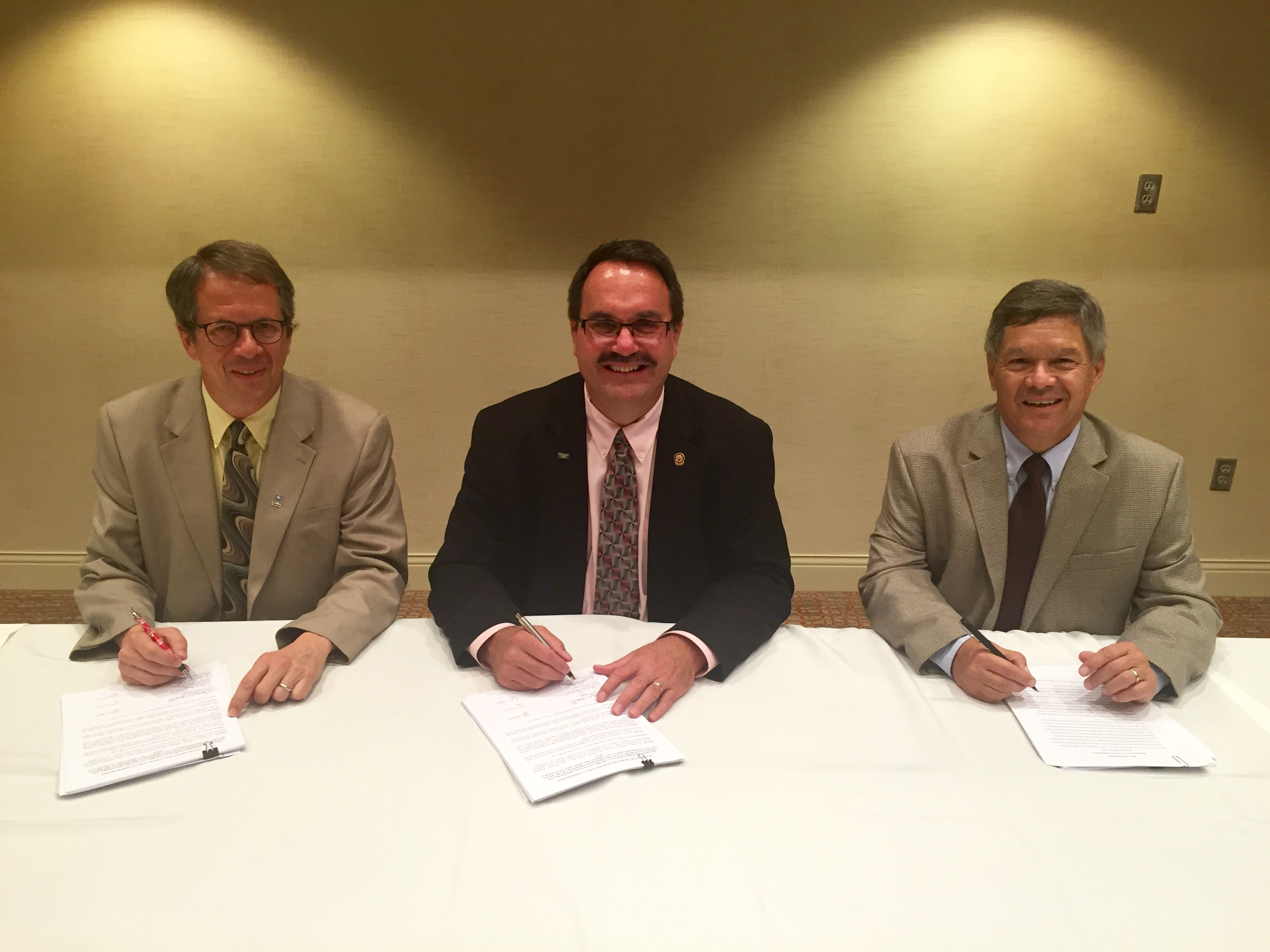
RRCA resolution signing August 27, 2015. From left to right: David Barfield, Dick Wolfe and Jeff Fassett(Photo courtesy RRCA)

From the Kansas Department of Agriculture:

Republican River Compact Adjustments to Benefit Basin Water Users

(Lincoln, Neb.) Today, the states of Colorado, Kansas and Nebraska have reached an agreement that will ensure more certainty to the basin’s water users in both Nebraska and Kansas. The agreement, in the form of a Resolution approved by the Republican River Compact Administration (RRCA), was achieved through collaborative negotiations that began in April 2015 and will provide timely notice and access to water for the 2016 irrigation season.
The agreement provides additional flexibility for Nebraska to achieve its Compact obligations while ensuring that the interests of Kansas are protected. The additional flexibility will allow the Nebraska Department of Natural Resources to provide a portion of the forecasted compliance water early in 2016 and provide any additional shortfall later in 2016 and through April 1, 2017. This also provides some improved operational predictability for Nebraska water users in that water users will not be subjected to closing notices related to the 2016 irrigation season.

The 2016 agreement builds upon the agreement reached for the 2015 irrigation season with further beneficial developments for water users. This agreement provides more advanced notice to irrigators in the basin of compliance activities that will likely occur in 2016, allowing for an advanced planning period producers desire for their efficiently run operations.

The States’ agreement is contingent upon the Nebraska and the Kansas Bostwick Irrigation Districts, working with the U.S. Bureau of Reclamation, – reaching agreement on modifications of certain contract provisions contained in their Memorandum of Agreement (MOA) also adopted last year. Thus, ensuring the availability of the water pumped from Nebraska augmentation projects for RRCA compliance.

Current RRCA Chairman, Gordon W. “Jeff” Fassett, Director of the Nebraska Department of Natural Resources, said, “Today’s agreement is good news for Nebraska water users and represents the continuation of the cooperative and positive collaboration we’ve fostered between our states as we work to find mutually agreeable solutions that best serve our citizens. Additionally, we are hopeful that this positive momentum will continue to move us closer to the goal of securing a long-term agreement. With significantly more planning time, Nebraska’s water users will have greater certainty in their water supply and make the best decisions for their operations.”

“We are pleased to collaborate with Nebraska and Colorado as we continue to develop balanced and fair water solutions benefiting all of the basin’s water users that reflects good water management,” said Kansas Commissioner David Barfield. “This fourth in our series of recent agreements with Nebraska allows Kansas to make effective use of its water supply in 2016 and allows the states additional time and experience with Nebraska’s compliance activities as we continue to move toward long-term agreement.”

Colorado Commissioner Dick Wolfe said, “This agreement exemplifies the success that can be achieved through collaboration and cooperation of the RRCA and the water users in the basin.”

The RRCA is comprised of one member each from the States of Colorado, Kansas and Nebraska. The purpose of the RRCA is to administer the Republican River Compact. This Compact allocates the waters of the Republican River among the three states. The next RRCA annual meeting is scheduled for August of 2016 and will be hosted by the State of Colorado in a location of their choice.

Groundwater rules for the Rio Grande Basin are now in final draft form, next stop water court

San Luis Valley Groundwater

From The Valley Courier (Ruth Heide):

Time’s almost up.

In the works for several years, the groundwater rules for the Rio Grande Basin are now in final draft form and should be filed with the water court within the next month. Last-chance comments on the final draft of the rules are due tomorrow, August 19, with the rules anticipated to be filed with the water court either by the end of this month or next, depending on how many comments come in.

The groundwater rules, which will apply to well owners in the Rio Grande Basin (San Luis Valley), are designed to protect senior surface water rights and Rio Grande Compact obligations in addition to promoting long-term sustainability of the basin’s aquifers.

The rules apply to hundreds of well owners in the Valley including towns and cities. A well solely permitted for in-house use would not need to be regulated under these rules. Primarily these rules will affect those who are using their wells for irrigation of crops, livestock or municipal water supplies, wells required to be metered. Although there’s been a moratorium on new wells for many years, the existing wells have continued to negatively affect senior surface water rights, a problem the well regulations are designed to rectify either en masse through collective water management sub-districts or individually through augmentation plans or substitute water supply plans.

“Essentially, the Confined Aquifer New Use Rules recognize that there is no unappropriated water in the confined aquifer, so that any new withdrawal requires one-for-one replacement,” the proposed rules state.

“The rules are designed to allow withdrawals of groundwater while providing for the identification and replacement of injurious stream depletions and the achievement and maintenance of a sustainable water supply in each aquifer system, while not unreasonably interfering with the state’s ability to fulfill its obligations under the Rio Grande Compact.”

Those themes are stressed throughout the regulatory document: no new withdrawals will be all o w e d w i t h – out the same amount being replaced; injuries to surface r i g h t s m u s t be replaced; and the state’s agreement with downstream states in the Rio Grande Compact must be upheld.

“Nothing in the rules is designed to allow an expanded or unauthorized use of water ,” the rules state.

Colorado Division of Water Resources Division 3 Engineer Craig Cotten told local water leaders last week that State Engineer Dick Wolfe advised legislators serving on the water resources review committee the rules would be completed within the next month.

“We do have the final draft of the rules out for public comment until the 19th,” Cotten said. “We think the rules are basically done, just giving everybody a last chance to make comments. After that we will take those comments and then file in court.”

Deputy State Engineer Mike Sullivan, who previously served as Division 3 engineer, said water court resume timelines start from the end of a month, and folks have 60 days after that to respond to the case in court.

“It doesn’t matter if we filed the rules August 10 or August 31, as the clock starts essentially August 31. Thus I think the earliest we could/ would file would be the end of August or September. It all depends on getting any comments considered and gathering all the pieces into a complete package for the court,” Sullivan stated.

“After all the work from the water user community in helping craft the rules I imagine folks would like to get the next phase rolling as soon as possible.”

The rules will be effective 60 days after publication unless protests are filed in the water court, which would delay the process until the protests were resolved.

An approximately 50-member advisory committee has been working with Wolfe since 2009 to develop groundwater rules for this basin. Advisory committee members included representatives from water conservancy and irrigation districts, water user associations, counties, state and federal agencies, municipalities and attorneys . As a group, the advisory committee concluded its work in May, after meeting 25 times over the last several years. The state sent its final draft out to the advisory committee members for one last look this month.

Once the groundwater rules are in place, well owners in the Valley will have two years to come into compliance with the rules by joining one of several water management sub-districts or filing an individual augmentation plan or substitute water supply plan. The other alternative is to be shut down.

One of the delays in getting the groundwater rules to this stage was the development and refinement of the Rio Grande Decision Support System groundwater model that simulates groundwater flows in this basin and helps determine how much water well users must pay back to make up for the injuries they have caused in the past and are currently causing. That model and subsequent simplified calculations called response functions have been under refinement for several years.

After the first water management sub-district (a subdistrict of the sponsoring Rio Grande Water Conservation District) was formed, subsequent sub-districts throughout the Valley waited for the model and its response functions to be refined to the point that well owners in those sub-districts would know what kind of water debts they were looking at before they formally formed their sub-districts . Many of them have been ready to collect signed petitions from those who will be included in the sub-districts , or have already collected petitions, pending those model runs that would tell them how much they would need to replace to senior surface rights.

Most of the sub-districts are organized by geographical areas of the basin such as Conejos River, San Luis Creek and Saguache Creek, while some are organized by the type of wells they encompass, such as confined aquifer wells.

Only the first sub-district is operating (encompassing wells north of the Rio Grande), but four or five others are in various stages of preparing to file their paperwork and petitions with the water court.

Well irrigators who are part of recognized sub-districts with state-approved water management and replacement plans essentially possess a “get out of jail free card,” but the rules state the sub-districts have to live by their management plans and show some progress over time, or the state will require additional action. Another reason it took longer to finalize the well rules was the lengthy discussions over how to meet the state legislature’s mandate to restore this basin’s confined, or deeper, aquifer to the healthy level it presumably experienced between the years 1978 and 2000, before the devastating drought of the early 2000’s . The draft of the rules, as proposed, allows for fluctuations in the aquifer in the same way the aquifer fluctuated during those years, as long as the average levels are similar to those occurring between 1978 and 2000. Fluctuations will also be permitted in the unconfined , or more shallow, aquifers, which the rules acknowledge are underground water storage reservoirs.

Because artesian pressure data is lacking for the confined aquifer during the period from 1978-2000 , the rules provide for a well network to collect data over the next decade to help estimate artesian pressures in the confined aquifer. Once that data is collected, the state tngineer will define the methods proposed to maintain a sustainable water supply in the confined aquifer system, and if that means a change in the rules, that could trigger another rule making process at that point.

The proposed rules also specify the irrigation season for this basin, presumed to begin April 1 and end on November 1, given some flexibility in climate and other conditions. See http:// water. state.co.us/

CWCB/DNR: July 2015 #Drought Update


From the Colorado Water Conservation Board (Tracy Kosloff):

Following the wettest May since record keeping began in1895, June and July have continued to provide beneficial moisture to the state. For the first time since August 2009, 97% of the state is drought free. As of July 20, the state has received 200% of average in precipitation based on SNOTEL sites. The year-to-date precipitation totals for the state have risen from 80% on May 1 to 97% of average as of July 1.

  • Water year-to-date precipitation at mountain SNOTEL sites statewide, as of July 21, is at 97% of normal. Southwestern Colorado and the Rio Grande Basin, which did not receive as much moisture over the winter, have had a wet spring and early summer. All eight basins have experienced above average precipitation so far in July with the Gunnison basin experiencing 270% of average.
  • June was the 14th warmest June on record (1985-2014) but so far in July, the state has experienced near normal temperatures with a few pockets on the west slope and the Front Range that are two to five degrees below average.
  • All of the CoAgMet sites measuring evapotranspiration (ET) continue to report below average ET and the Olathe and Lucernce stations are reporting record low ET. These stations have been collecting & reporting ET data since the early 1990s.
  • Reservoir Storage statewide is at 112% of average as of July 1st, up five percent from last month. Seven out of eight basins have over 100% of average. The Rio Grande has the lowest value at 89% of average, however, storage has improved since last month when they were at 66% of average. Storage in the Arkansas Basin is the highest since 2000. Between May 1 and July 1, John Martin reservoir, in the Lower Arkansas River basin gained over 250,000 acre feet of additional storage.
  • The NRCS Surface Water Supply Index (SWSI) shows improvements in all but two SWSI values in the Upper Arkansas and South Platte. Several SWSI values in the Southwest basins increased nearly five index points. Only three SWSI values remain below normal, two in the North Platte basin and the other in the Rio Grande.
  • Agriculture officials in attendance reported 131,000 prevented planted acreage due to such wet conditions. The crops that have been planted are expected to do well as soil moisture has greatly improved.
  • The Division of Water Resources announced the completion of the SWSI Automation Project. They will discontinue the 1980’s era SWSI and will begin reporting the automated SWSI, which is similar to the NRCS SWSI, which has been produced since 2011. Additional information is available at: http://water.state.co.us/DWRDocs/Reports/Pages/SWSIReport.aspx
  •  According to water providers in attendance, their respective systems are in good shape as reservoirs are full and customer water demand is low.

    Landowner challenges state’s interpretation of old decree — The Pueblo Chieftain

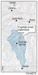
    Fountain Creek Watershed
    Fountain Creek Watershed

    From The Pueblo Chieftain (Chris Woodka):

    A Fountain Creek landowner has filed a complaint in Pueblo water court saying he has a right to the Fountain Creek underflow, as well as surface water.

    Ralph “Wil” Williams, trustee of the Greenview Trust, filed the complaint in June, saying the state has incorrectly administered the water right to the 313-acre farm as solely surface water.

    The property, located 8 miles north of Pueblo on Fountain Creek is emblematic of man’s interaction with Fountain Creek throughout recorded history. It was first settled by “Uncle Dick” Wooten in 1862 and has always been in farmland.

    In the 1990s, it began to experience severe erosion from growth upstream, particularly the development in Colorado Springs.

    Problems with the ditch came to a head after the 1999 flood, leading the owners to sue Colorado Springs for dumping more water in the creek, only to be locked out when the Legislature granted governmental immunity for flood damages.

    In the most recent floods of the past five years, the Greenview has continued to lose land, including about 10 acres of trees to the storms in May and June.

    “We’re trying to conserve the farm,” Williams said. Pueblo County, through a program in conjunction with the Fountain Creek Watershed Flood Control and Greenway District, is interested in purchasing the property as a restoration project.

    The water rights are crucial to determining land value, Pueblo County Commissioner Terry Hart said.

    “We weren’t successful in a Great Outdoors Colorado grant this cycle, and one of the things we have to do is shore up the land and water value,” Hart said.

    Williams contends that past owners always intended to use the underflow of Fountain Creek as an alternate source to irrigate 315 acres of the property. Fountain Creek had intermittent flows, so the underflow would have been used during dry times when surface water could not be diverted, he claims.

    Other water users employed the strategy in the early 1900s, when well technology was more limited. Most famously, the Ball brothers — who found success in the canning jar and aerospace industries — used the underflow of Fountain Creek to fill reservoirs in hopes of selling the water to Puebloans. The quality was unsuitable for drinking, however.

    In preparing for the water court case, Williams collected old plats that show the location of underflow structures, basically horizontal wells that draw water by gravity.

    The Colorado Division of Water Resources does not recognize the dual water right, and says Greenview Trust needs a substitute water supply plan if it plans to irrigate with wells.

    “It’s based on an old statement that was not picked up in the decree itself,” said Division 2 Engineer Steve Witte. “It appears to us that there never was the intention to have a well.”

    Williams disagrees, saying he spent two years collecting information in state files that he was initially told did not exist. “For me to have to spend two years researching the archives is ridiculous,” Williams said. “We are decreed against the source and the underflow. It’s one natural stream.”

    More Fountain Creek coverage here.

    Pueblo Board of Water Works hopes to get a substitute water supply plan for the Riverwalk

    Historic Arkansas Riverwalk via TravelPueblo.com
    Historic Arkansas Riverwalk via TravelPueblo.com

    From The Pueblo Chieftain (Chris Woodka):

    The Pueblo Board of Water Works has filed a substitute water supply plan with the Colorado Division of Water Resources in order to supply water to the Historic Arkansas Riverwalk of Pueblo.

    The plan is to replace water to HARP that is now being diverted by Black Hills Energy, which supplied HARP through a tailwater right, according to Bill Paddock, attorney for Pueblo Water.

    Black Hills is planning on tearing down old Stations 5 & 6, the Downtown power plant, which would throw the diversion into question.

    Pueblo Water has a 1993 water right for 30 cubic feet per second which provides the base flow for HARP. It is planning to supply another up to 90 cfs next year in order to prevent weeds and algae from growing and to maintain water quality.

    Pueblo Water plans to use its fully consumable water rights, mainly those from transmountain diversions, but including some in-basin rights that have been converted, to supply HARP.

    Documents in the case were filed Wednesday and are subject to comments from other water users who might be injured.

    HARP water is diverted just upstream of the Downtown Whitewater Park near the East Fourth Street bridge. The intake became a matter of concern during discussions of the Pueblo Conservancy District in May regarding reconstruction of the levee through the area.

    More Pueblo Board of Water Works coverage here.

    “Miracle May” revisited

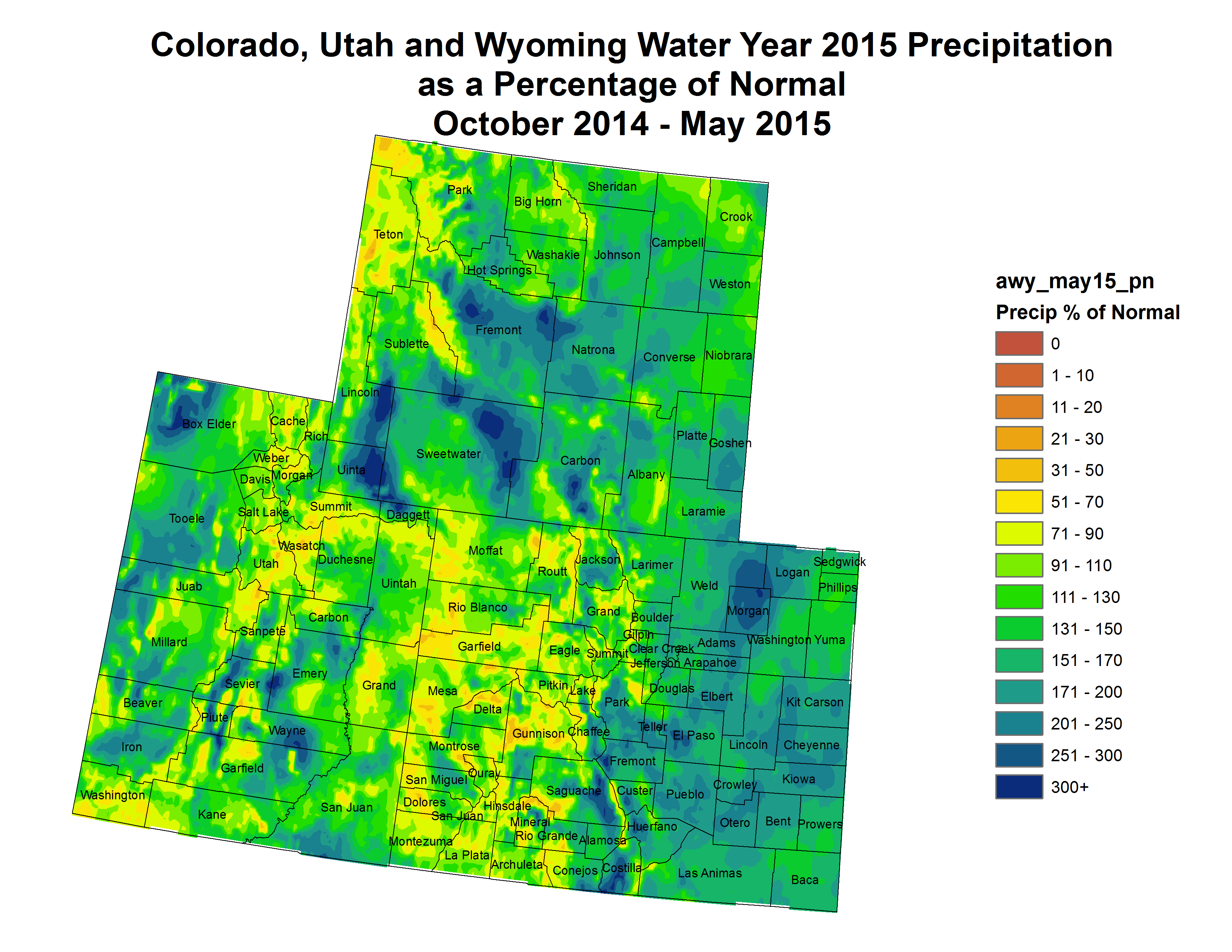
    Federal Water Year precipitation as a percent of normal thru May 31, 2015
    Federal Water Year precipitation as a percent of normal thru May 31, 2015

    From The Produce News (Lora Abcarian):

    “We started in May with a rain cycle,” said Dick Wolfe, Colorado’s state engineer. “Things really turned around.”

    He said conditions during March were not as snowpacked as is typical for the Centennial State. “We were way behind,” Wolfe explained. “But May was a huge turnaround in what we saw.”

    According to Wolfe, the National Weather Service has deemed the month of May the wettest month, setting a national record “which is pretty impressive.” He added that this is the first turnaround of significance to have occurred during more than a decade of drought.

    “Reservoirs are full or nearly full,” he commented. “We’ve got good reservoir storage.”

    Coloradans saw an extended winter season in 2015 with cooler-than-normal temperatures moving into May. Monsoonal flows, typically seen during the summer months, took hold early and resulted in heavier-than-normal springtime rains. News accounts were rife with stories about flooding or potential for flooding.

    The flirtation with summer began in early June as temperatures climbed and rains diminished. But, as Wolfe noted, weather forecasters have been keeping their eyes to the skies and are predicting that rainy patterns will return in July and continue into September.

    “July through September is supposed to be above-average precipitation,” Wolfe commented. “Colorado is right in the bull’s-eye for rainfall predictions.”

    Although the majority of Colorado falls outside the drought profile at the current time, he said areas from the western part of Colorado’s San Luis Valley to Gunnison are still dry.

    According to Wolfe, the much-needed precipitation and favorable water storage condition mean that agricultural producers will have more water available for irrigation in 2015. “With good runoff and water supply, there aren’t the calls on the river that been restricted in years past,” he explained.

    Lower Ark nets 800 acre-feet this season from a recalculation of pond seepage

    Orr Manufacturing Vertical Impact Sprinkler circa 1928 via the Irrigation Museum
    Orr Manufacturing Vertical Impact Sprinkler circa 1928 via the Irrigation Museum

    From The Pueblo Chieftain (Chris Woodka):

    A recalculation of the seepage rate of ponds used to feed irrigation sprinklers means farmers will have to repay less water than originally calculated this year under 2010 surface irrigation rules.

    The savings amounts to about 800 acre-feet (260 million gallons) for Rule 10 plans operated by the Lower Arkansas Valley Water Conservancy District, a 40 percent savings.

    The Lower Ark’s 2-year study still is not complete because of technical glitches. The Colorado Division of Water Resources accepted results for only some of the more than 20 ponds studied, and the state has asked for additional study in some areas.

    But the results altered the basic formula for the Irrigation System Analysis Model. An interim seepage calculation method has been adopted as a result.

    “(The division) does believe that the limited amount of pond study data from ponds where inlet and outlet meters were verified to be accurate are more comprehensive than what was used to derive the original seepage method in ISAM,” the state’s report noted.

    Under the previous ISAM formula, the state estimated losses from the more than 145 farms covered by Lower Ark’s Rule 10 plans would create about 1,947 acre-feet of deficits. Under the interim method, the deficits total 1,137 acre-feet.

    The 2010 rules were written to cover farms that have installed sprinklers or drip irrigation systems fed by ponds as well as other improvements in order to prevent increased consumptive use and potential litigation with Kansas over the Arkansas River Compact. Similar rules, written in 1996, already cover wells in the Arkansas Valley.

    More Lower Arkansas Valley Water Conservancy District coverage here.

    San Luis Valley: Dick Wolfe okays groundwater Subdistrict No. 1 augmentation and pumping plan for this season

    Artesian well Dutton Ranch, Alamosa 1909 via the Crestone Eagle
    Artesian well Dutton Ranch, Alamosa 1909 via the Crestone Eagle

    From The Pueblo Chieftain (Matt Hildner):

    State Engineer Dick Wolfe gave his approval Friday to a plan to mitigate the impacts of groundwater pumping this year in the north-central San Luis Valley.

    Wolfe’s approval, issued at the close of business Friday, confirms Subdistrict No. 1 has sufficient water to cover the depletions caused by the 3,412 wells inside its boundary.

    The subdistrict, which must get annual state approval for its plan, must replace an estimated 3,655 acre-feet in depletions that well pumping is expected to cause to the Rio Grande this year.

    Those wells are projected to pump 238,000 acre-feet of groundwater this year, which impacts surface water given that the two are hydraulically connected to varying degrees around the valley. The subdistrict has a pool of 20,115 acre-feet it can use to replace depletions, drawing off transbasin diversions coming into the basin, reservoir storage and a federal reclamation project that pumps groundwater on the east side of the valley.

    The subdistrict also has nine forbearance agreements with ditch companies that will allow it to pay for damages in lieu of putting water in the river.

    While mitigating the harm to surface water users is a court-ordered priority, the subdistrict’s other aim is to reduce groundwater pumping through the fallowing of farm ground.

    This year, through a federal conservation program, just under 4,000 acres will be taken out of production, a savings to the aquifer of roughly 7,800 acre feet.

    Unlike previous years, the subdistrict will no longer have a financial guarantee by its parent organization — the Rio Grande Water Conservation District, which draws property tax revenue from five of the valley’s six counties.

    Instead, the subdistrict has placed $3.85 million in escrow to ensure well depletions are replaced in the event the subdistrict dissolved.

    More San Luis Valley groundwater coverage here and here.

    Water forum targets pumping in Colorado — Salina Journal

    Republican River Basin by District
    Republican River Basin by District

    From the Salina Journal (Tim Unruth):

    Kansas Gov. Sam Brownback and a few water-conscious underlings plan to discuss with locals Tuesday in St. Francis how water is being used in a three-state region.

    Water from the Ogallala Aquifer, the huge underground driver of farm economies in portions of several states, is being mined to satisfy federal streamflow requirements on the Republican River.

    Rep. Rick Billinger, R-Goodland, wonders about the wisdom of taking a resource that developed over centuries to enhance a river, losing some of the resource to seepage and evaporation.

    “It makes no sense,” he said. “Here we are, trying to get a new vision out to preserve water for 50 years, and we have Colorado across the line, pumping from the Ogallala to replace surface water.”

    The meeting will begin at 10:30 a.m. at the Cheyenne County 4-H Building in St. Francis.

    Billinger aims to gather input on the pumping project and “possible ways to preserve the Ogallala for future users.”

    Two similar augmentation projects just ceased in two areas of western Nebraska.

    The Republican River Water Conservation District in northeast Colorado is pumping from eight irrigation wells into a pipeline that dumps into the north fork of the Republican. The district delivers 7,000 acre feet of water to the river from November through December, and from January through mid-April will pump another 7,000 acre-feet, said Deb Daniel, manager of the district based in Wray, Colo…

    “The only way we can supply enough water to be in compact compliance is by delivering water to the stream,” she said.

    Another effort to comply consisted of draining Bonny Reservoir northeast of Burlington during 2011 and 2012. It was the only lake in the region.

    Evaporation and seepage from the lake were working against Colorado’s compliance, Daniel said…

    Rep. Billinger argues that the pumping project benefits the north fork of the Republican, which doesn’t enter Kansas until it reaches Jewell County, in the north-central part of the state. The south fork dips into Kansas through Cheyenne County and flows back into Nebraska.

    Among Billinger’s options is to influence Colorado to stop pumping water from the Ogallala to replace surface water.

    Hoping for long-term solutions

    The Kansas lawmaker also would advocate for Colorado putting water back in Bonny Reservoir, earmarking storage for Kansas, and enhancing the region’s fishing and other recreation opportunities.

    Given the demands for compliance, Colorado’s Daniel said the district “didn’t have any choice.”[…]

    Representatives from Daniel’s district are planning to attend the Tuesday meeting in St. Francis. NRD officials from Nebraska also are interested in what’s said at the meeting, Jenkins said, and some may attend.

    Accompanying Brownback will be Kansas Agriculture Secretary Jackie McClaskey, Chief Water Engineer David Barfield and Kansas Water Office Director Tracy Streeter.

    Meanwhile the Republican River Water Conservation District board meeting is next Thursday. From the Yuma Pioneer (Tony Rayl):

    Yuma will be the site for the Republican River Water Conservation Board of Directors regular quarterly meeting, Thursday, April 9.

    It will be held in the banquet room at Quintech, 529 N. Albany St. from 10 a.m. to 4 p.m. Public comment will be heard at 1 p.m.

    A discussion regarding negotiations with the Jim Hutton Educational Foundation is on the agenda. The board will discuss possible financial support to the Water Preservation Partnership, as well as membership in the Colorado Foundation for Water Education, along with other matters.

    Pipeline operator Tracy Travis will give a report, and the board will hear reports on other recent meetings and programs. The board holds out the right to have an executive session if necessary.

    For further information, please contact RRWCD General Manager Deb Daniel at 332-3552, or on her cell phone at 630-3525, or email her at deb.daniel@rrwcd.com.

    More Republican River Basin coverage here and here.

    State ditches well plan — The Pueblo Chieftain

    Straight line diagram of the Lower Arkansas Valley ditches via Headwaters
    Straight line diagram of the Lower Arkansas Valley ditches via Headwaters

    From The Pueblo Chieftain (Chris Woodka):

    The Colorado Division of Water Resources last week dropped plans to institute new well rules for Arkansas River basin.

    The rules would have applied to appropriations of groundwater after 1985, when Kansas sued Colorado in the U.S. Supreme Court over groundwater appropriations. The state was not interested in pursuing the rules if water users thought them unnecessary.

    “There wasn’t a consensus that it was needed,” said Division 2 Engineer Steve Witte.

    A survey of ditch company officials, water attorneys and other interested parties was mixed with 39 percent favored new rules, 32 percent opposed and 29 percent neutral. Survey results were posted online.

    Under current rules, new appropriations for wells must have a court-approved augmentation plan or can be approved temporarily under a substitute water supply plan.

    More Arkansas River Basin coverage here.

    Republican River Basin: Nebraska, Kansas and Colorado continue cooperation with water agreement — McCook Gazette

    South Fork of the Republican River
    South Fork of the Republican River

    From the Republican River Compact Administration via the McCook Gazette:

    Today, reflecting the continued spirit of cooperation, Colorado, Kansas and Nebraska, along with the U.S. Bureau of Reclamation, have reached an agreement that will ensure more certainty to the basin’s water users in both Nebraska and Kansas. The agreement, signed through the Republican River Compact Administration (RRCA), was achieved through collaborative negotiations that began in January 2015 and will provide timely access to water for the 2015 irrigation season.

    The agreement provides additional flexibility for Nebraska to achieve its Compact obligations while ensuring Kansas water users’ interests are also protected. The additional flexibility allowed the Nebraska Department of Natural Resources to open Nebraska reservoirs and water user’s rights that were initially limited in 2015. Opening the Nebraska water rights allowed the Bureau of Reclamation to agree to modify certain contract provisions for its irrigation districts, ensuring the availability of the water that was pumped from Nebraska augmentation projects for Compact compliance.

    Additionally, the agreement allows for the Nebraska Department of Natural Resources to ensure no additional regulatory water supply reductions for Nebraska surface water irrigation user’s water supplies for the 2015 irrigation season.

    Current RRCA Chairman Jim Schneider, Acting Director of the Nebraska Department of Natural Resources, said, “This is a significant step forward for the states and our water users. Our collaborative work and this agreement further demonstrate the benefits of the recent cooperation that the states have been able to achieve. I am optimistic that the states and Bureau of Reclamation can work toward ensuring these types of arrangements can be in place each year so that both Nebraska and Kansas water users will secure the benefits of having more certainty in their water supplies.”

    Kansas Commissioner David Barfield said, “Today’s agreement continues to move us forward toward a longer-term solution benefiting the basin’s water users. I appreciate not only Nebraska’s continued willingness to work through these issues, but also the Bureau of Reclamation and its irrigation districts for their part in reaching today’s agreement.”

    Colorado Commissioner Dick Wolfe said, “These recent agreements are emblematic of the new cooperation among the states and the federal government. I hope it continues to be a model for cooperation and successful settlement of the remaining issues within the basin.”

    At the Nov. 19, 2014, meeting in Manhattan, Kansas, the states reached an agreement that provided Nebraska with 100% credit for water delivered from augmentation projects to Harlan County Lake prior to June 1, 2015, and dedicated that water to be used exclusively by Kansas irrigators.

    The RRCA is comprised of one member each from the States of Colorado, Kansas and Nebraska. The purpose of the RRCA is to administer the Republican River Compact. This Compact allocates the waters of the Republican River among the three states. The next RRCA meeting is scheduled for August to be hosted in Lincoln, Nebraska.

    More Republican River Basin coverage here.

    Colorado Division of Water Resources: Well Construction Rules 2015 Rulemaking ― Proposed Changes to the 2005 Rules

    Palmer Lake: “If we could all get together and try to figure this out without getting attorneys involved, I’m all for it” — Rafael Dominguez

    From The Colorado Springs Gazette (Ryan Maye Handy):

    The towns of Palmer Lake and Monument are in a gridlock over 21.8 million gallons of water, a bitter debate that could pit the towns against each other in court.

    Palmer Lake residents, desperate to use the water to save their dry lake, thronged Monument’s Tuesday evening board of trustees meeting to plead for water.

    Palmer Lake has been grappling with the state and other southern Colorado water districts since December 2013, when it asked to convert an old railroad water right into something that could save the lake.

    The railroad water right has gone unused since the late 1950s, when Colorado’s railroads stopped running steam engines.

    For the Town of Monument, losing 67 acre feet of water – an acre foot of water is enough to cover a football field in a foot of water – could have a serious impact on Monument Lake. The towns are working on a negotiation, but without a settlement their dispute will be take to court on Feb. 3.

    Monument carefully monitors the lake, and even when it is down 1/100th, town administrators know, said Tom Tharnish, director of public works. Sixty-seven acre feet, or 21.8 million gallons a year, is about a month’s worth of drinking water for Monument.

    “If you take 67 acre feet, there’s going to be an effect on Monument Lake,” he said.

    While others have steadily dropped from the case, Monument has remained staunch about protecting the town’s water. But Tuesday’s meeting brought together residents from both towns, many of whom pleaded with the board of trustees to let Palmer Lake take the water.

    Most argued that the towns are one community and should be invested in each other’s prosperity. Jodie Bliss, a Monument business owner, was one of a few Monument residents who spoke in favor of using the water right to fill the lake.

    “I support filling Palmer Lake,” she told the trustees. “My point of view has to a lot to do with the fact that we are one community.”

    Residents like Bliss packed the town hall and filled the parking lot. One man in the audience spoke out against Monument turning the water rights over to Palmer Lake. Other audience members joked that the famed “tri-lakes region” has only two lakes.

    Jeff Hulsmann of Awake Palmer Lake, a group founded to help resuscitate the lake, was the last to speak on Tuesday. He echoed earlier pleas to encourage cooperation between the two closely connected towns.

    “It’s incredible to me how many people came up here and said, ‘Well, I live in Palmer Lake but I used to live in Monument’,” he said. “I implore you, do something that works for all of us.”

    From The Colorado Springs Gazette (Ryan Maye Handy):

    When Palmer Lake resident Cynthia Graff took her seat in front of the Monument board of trustees last week, she was one in a long line of area residents who came to plead for a timeless Western right – water.

    Water, specifically in Palmer Lake, is part of what drew Graff and others to the Tri-Lakes region. Even after development cut off the flow of runoff into the natural lake, Palmer Lake residents have fought for six decades to keep the iconic lake full. But now the town is fighting for the water against close competitors, the town of Monument and its lake, pitting the survival of one lake against another.

    For some locals, the fight over an old railroad water right has one resolution – to fill Palmer Lake, which has been dry since 2012 and began losing water a decade ago.

    “We just think this is our water,” Graff said at Tuesday’s meeting. “We deserve to have it back in our lake so we can deserve to be the Tri-Lakes area again.”

    Although the meeting was thronged with Monument business owners, Palmer Lake residents and combinations of both advocating to fill the lake, the towns’ lawyers have yet to agree on the fate of 21.8 million gallons of water.

    Palmer Lake has been unofficially tapping into the water, once used to fill steam engines on the Denver & Rio Grande Railroad, since the engines were pulled from the tracks in the late 1950s. But when the town filed in December 2013 to make that water use official, it met with state and local resistance – common in a state where water rights have always been carefully protected.

    The town asked for 67 acre feet of water to fill the lake each year – an acre foot is enough to cover a football field in a foot of water.

    One by one, objectors to Palmer Lake’s plan to fill the lake settled with the town, all except Monument. Using the water to fill Palmer Lake would lower levels in Monument Lake, which has been declining because of evaporation, said Tom Tharnish, Monument’s director of public works.

    “If you take 67 acre feet, there’s going to be an effect on Monument Lake,” Tharnish said.

    Unless the towns can settle on the fate of the water, the fight is headed to court Feb. 3. Jeff Hulsmann of Awake Palmer Lake, a nonprofit created to help restore the lake, believes the town stands a good chance to secure the water it needs.

    “We have an awful lot of confidence that we will win in court,” he said.

    Hulsmann has a complicated relationship with both towns – as do many people who live in one town but own a business in the other. Hulsmann knows that ultimately helping Palmer Lake could mean harming Monument Lake.

    “I lose on both ends of this deal,” he said.

    A rare body of water

    As legend has it, when General William Jackson Palmer scouted southern Colorado for railroad routes, he believed Palmer Lake – the only natural lake for miles around – to be truly unique.

    “He apparently said, ‘It was the only open body of water between Denver and El Paso, Texas,'” said Tom VanWormer, of the Palmer Lake Historical Society.

    Palmer Lake became an essential part of southern Colorado life, supporting a resort town and providing water for steam engines and ice for refrigeration. Palmer wasn’t the first to discover it, however – Ute Indians lived nearby long before William Finley Thompson plotted the area in the 1880s and christened “Loch Katrine.”

    Although Palmer eventually gave his name to the lake, it remained a contested source of water and recreational spot for railroads passing through, VanWormer said. Palmer’s Denver & Rio Grande railway later competed with the Atchison, Topeka and Santa Fe Railway for use of the lake’s water and shores.

    “It was a great place to come and picnic, to row boats around,” VanWormer said. But to keep the rival railroad’s passengers from venturing to the lake, Palmer had an “8-foot tall barbed wire fence” built on the AT&SF side, VanWormer said.

    Later, reservoirs and dams would add Monument and Woodmoor lakes – giving the Tri-Lakes region its name. None of lakes were used for drinking water. Instead, the towns relied on reservoirs and wells to put water in their taps and used creeks to fill their lakes. But when railroads retired steam engines, water in the Tri-Lakes area took on a new significance – supporting increasing populations and keeping the lakes, diminished without runoff, full.

    ‘It’s an emotional issue’

    Thanks to a lease from the railroad, Palmer Lake had tacitly used the old railroad water right to fill its lake for half a century. But in 2002, a severe drought year, publicity about the lake’s ability to stay full brought scrutiny to that agreement, Hulsmann said.

    “In 2002, the state comes down and says, ‘Hey, what are you guys doing?'” Hulsmann recalled. “So essentially the state says you can’t use the water right (because) it’s an industrial water right.” [ed. emphasis mine]

    Palmer Lake purchased the leased water right in the 1980s, but in state records, the right was still marked for industrial use. According to Colorado’s water laws, it could not be used to fill the town’s lake. In December 2013, Palmer Lake filed to have the right declared a municipal one, fair game for lake-filling. But nothing is that simple in water court.

    “So basically everybody downstream objects, and we expected that. If you don’t object then you get no information,” Hulsmann said.

    To prove its right to use some of the water abandoned by the railroad, Palmer Lake hired expert witnesses to delve into decades of data on the railroad’s water use. Calculating the number of engines that passed by the lake per day between 1871 and 1955 – 20 to 30 – and factoring in tank size, the study determined that Palmer Lake could use 112 acre feet a year to fill the lake. The town settled for 67 acre feet, Hulsmann said.

    The objectors – among them the Colorado Water Conservation Board and the city of Colorado Springs – eventually settled with Palmer Lake, but the town of Monument remained the sole objector, claiming that Palmer Lake abandoned the water and had no right to champion for its official use to fill the lake. Monument officials believe that Palmer Lake has yet to exhaust all ways to get water – for instance digging wells or purchasing another water right. Nonetheless, administrators from both towns say an agreement is in the works.

    “There are still negotiations going on,” said Gary Shupp, the lawyer for the town of Monument. “Whether this case goes to trial or not still remains to be seen.”

    Palmer’s days of railroad wars are long over, but the subject of water clearly remains a deeply personal one when it comes to Palmer Lake’s survival. At Tuesday’s trustees meeting, residents claimed all chairs and standing room. All but one person spoke up and asked the board to drop Monument’s objection to Palmer Lake’s water use request. Ultimately, Monument Mayor Rafael Dominguez had the last word.

    “If we could all get together and try to figure this out without getting attorneys involved, I’m all for it,” he said. “We don’t want to harm Palmer Lake at all. But it’s a water rights issue. And water rights are a big issue in the state of Colorado.”

    The residents absorbed his comments and then, one by one, got up and left the room.

    More water law coverage here.

    Higher streamflow, groundwater Subdistrict No. 1 curtailments, boost unconfined aquifer by 71,440 acre-feet in 2014

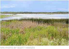
    Blanca Wetlands via the National Park Service
    Blanca Wetlands via the National Park Service

    From The Pueblo Chieftain (Matt Hildner):

    Irrigators and water officials looking to conserve groundwater in the San Luis Valley got a small dose of good news this week. The volume in the unconfined aquifer — the shallower of the valley’s two major groundwater bodies — increased by 71,440 acre-feet in 2014.

    “We did turn the corner,” said Allen Davey, an engineer who conducts the Rio Grande Water Conservation District’s groundwater monitoring.

    The increase was the first since 2009.

    Davey attributed the hike to better stream flows than had been seen in recent years.

    He also pointed to a decline in pumping in Subdistrict No. 1, which has used a combination of fees on pumping and the fallowing of farm ground to reduce demand on the aquifer in the north-central part of the valley.

    The unconfined aquifer has traditionally been used by farmers in the valley to water crops like potatoes, barley and alfalfa when the availability of surface water declines in mid- to late-summer.

    Recharge to the shallow aquifer occurs from streams entering the San Luis Valley floor, canal leakage and irrigation return flows.

    Despite this year’s slight improvement, the unconfined aquifer has declined by more than 1.2 million acre-feet since monitoring began in 1976.

    An acre-foot is the equivalent of roughly 325,000 gallons of water.

    The long-term decline is of concern to the managers of Subdistrict No. 1, who have the goal of increasing the volume of the unconfined aquifer by 800,000 to 1 million acre-feet.

    David Robbins is an attorney for the Rio Grande district, which acts as the umbrella organization for the subdistrict.

    He said the subdistrict’s board is wrestling with the question of whether to seek a change in its water management plan.

    “There are many within the subdistrict boundaries and elsewhere who are concerned there hasn’t been a more dramatic increase in water supply within the subdistrict,” he said.

    More San Luis Valley groundwater coverage here and here.

    First lease-fallowing pilot project under HB13-1248 to move to CWCB next week

    Straight line diagram of the Lower Arkansas Valley ditches via Headwaters
    Straight line diagram of the Lower Arkansas Valley ditches via Headwaters

    From The Pueblo Chieftain (Chris Woodka):

    A state engineer’s review of a plan to lease water from the Catlin Canal to upstream cities will move to the Colorado Water Conservation Board later next week. The state board is scheduled to review the plan on Jan. 26, the first day of its two-day meeting in Denver.

    The plan is the first pilot project under 2013 legislation, HB1248, that allows the CWCB to review projects that lease water from farms to cities on a long-term, temporary basis. In order to provide the water, agricultural land must be dried up during the lease. No more than 30 percent of any given farm may be fallowed during the 10-year lease period.

    Seven farms with 1,128 acres on the Catlin Canal will be dried up on a rotational basis to provide up to 500 acre-feet (163 million gallons) per year to three municipal water users: Fowler in Otero County, and Fountain and the Security Water and Sanitation District in El Paso County. If approved, the lease would begin this year.

    The CWCB accepted the project in September, but will look at the details in the upcoming review. The state engineer’s office reviewed the plans in a way similar to a water court application or substitute water supply plan.

    Bill Tyner, assistant Water Division 2 engineer, told the Southeastern Colorado Water Conservancy District Thursday that a review of the application has been completed and will go to the CWCB next week with a recommendation to proceed.

    The review included concerns about impacts on other water rights from Southeastern and other groups in the Arkansas Valley.

    “It’s an important time in the Arkansas River basin for those who have tired to get a lease-fallowing program going. It’s finally going to occur,” Tyner said.

    The program is supported by the Arkansas Valley Super Ditch, a corporation that includes members from several ditches, as well as the Lower Arkansas Valley Water Conservancy District.

    More HB13-1248 coverage here. More Arkansas River Basin coverage here.

    Free river, futile call policies pondered — The Pueblo Chieftain

    South Platte River near Kersey
    South Platte River near Kersey

    From The Pueblo Chieftain (Chris Woodka):

    The state is looking at changes in water policy that will allow more efficient use of water without violating the prior appropriation doctrine of “first in time, first in use.” The policies deal with a “free river,” a concept that is not found in state statute, and futile calls, which are accounted for in law, but difficult to administer.

    A free river occurs when every water right is satisfied, such as during a flood. In the Arkansas River basin, that condition has not occurred on a widespread scale since 1999, and occurred only about a dozen times in the last 60 years.

    A futile call occurs when water in a reach of stream cannot physically be delivered to a senior water right in another area, even though it is in priority. That can occur during flash flooding, but also during well pumping when groundwater levels are high.

    “The policies, especially the policy dealing with futile call, are less focused on the determination of the stream condition and instead are focused on administration of diversions once the stream condition has been determined,” Deputy State Engineer Kevin Rein said in an email last week.

    “The actual objective of the two policies is to set out the direction through which the State Engineer’s Office and the division engineer can allow maximum utilization of the water supply while complying with the law and preventing injury.”

    The policies most likely would be useful in discussions about flood control structures on Fountain Creek, particularly those designed to stop catastrophic floods. The question of water rights is under review by a technical committee.

    It also could answer similar questions that have arisen in the South Platte River basin following record flooding in 2013.

    The free river policy has provisions for storage under existing water rights or without a water right, as long as water is put to a beneficial use. The policy would allow for storage beyond a decreed water right. It would prevent injury to senior water rights and requires compliance with existing water storage regimen.

    The water could be stored for a one-time use, with successive use of return flows determined by the division engineer on a case-by-case basis.

    The futile call policy also makes provisions for diversion into storage with or without a water right, and outlines the state’s position that such diversions could become conditional or absolute water rights.

    More Colorado Division of Water Resources coverage here.

    Can Colorado approve a water right to grow pot? — Aspen Journalism

    Roaring Fork River back in the day
    Roaring Fork River back in the day

    From Aspen Journalism (Brent Gardner-Smith) via the Glenwood Springs Post Independent:

    Can the state of Colorado issue a water right to irrigate marijuana plants when federal law still says that growing pot is a crime?

    That’s the question being asked by a division engineer and a water referee in Division 5 water court in Glenwood Springs, in response to a water rights application filed by High Valley Farms LLC.

    “Even though the cultivation of marijuana and the sale of marijuana is legal in the state of Colorado, because it is still not legal under federal law, this question is still out there — whether beneficial use includes any use that is not legal under federal law,” said Alan Martellaro, the division engineer in Division 5.

    Martellaro said a water right in Colorado can be issued only if the water is being put to a beneficial use, such as irrigation.

    But the use of the water also has to be lawfully made. If it is not a lawful use, it is not a beneficial use, and so no water right can be issued.

    On the other hand, Martellaro recognizes the logic of a counterargument, which is that if it is legal under state law to grow pot plants, then it is a lawful act to water them, regardless of federal law.

    “We’re not coming down one way or the other, we just want an answer,” Martellaro said.

    High Valley Farms, LLC is controlled by Jordan Lewis, who owns the Silverpeak marijuana store in Aspen and a new 25,000 square-foot indoor marijuana growing facility along the Roaring Fork River south of Basalt.

    High Valley Farms filed an application with the water court in August seeking the right to annually pump 2.89 acre-feet of water (941,710 gallons) from the Roaring Fork River to irrigate 2,000 to 3,000 marijuana plants in the Basalt facility.

    It also is seeking approval of an augmentation plan for a back-up supply of water.

    ‘APPLICANT MUST EXPLAIN’

    On Nov. 19 Martellaro, after conferring with the Division 5 water court referee Holly Strablizky, issued a “summary of consultation” about the High Valley Farms application.

    “The applicant must explain how the claim for these conditional water rights can be granted in light of the definition of beneficial use as defined in (Colorado state law),” the summary of consultation stated.

    “Specifically,” the summary report said, ”beneficial use means ‘the use of that amount of water that is reasonable and appropriate under reasonably efficient practices to accomplish without waste the purpose for which the appropriation is lawfully made.’”

    The word “lawfully” is in italics in Martellaro’s summary report, but that’s the extent of how the question is posed.

    Whether it is legally a “beneficial” use or not, watering marijuana plants in Colorado is a valuable practice.

    In the first 10 months of 2014, people spent $574 million on marijuana legally grown in Colorado, according to “The Cannabist” at The Denver Post.

    In May, the U.S. Bureau of Reclamation issued a policy in response to Washington state and Colorado legalizing the growing of marijuana.

    The federal agency said it “will not approve use of Reclamation facilities or water in the cultivation of marijuana,” given that the Controlled Substances Act of 1970 still prohibits growing weed.

    This has lead to a tentative working assumption by some water providers that it is OK in Colorado to provide water for irrigating marijuana plants, as long as it is done with “nonfederal” water.

    The augmentation plan filed by High Valley Farms includes a contract for a back-up supply of water from an irrigation ditch owned by the Basalt Water Conservancy District.

    The Basalt district often leases water it controls in Ruedi Reservoir, which is a Bureau of Reclamation facility.

    But the contract between High Valley Farms and the Basalt district says the water provided on High Valley’s behalf will be only from “nonfederal sources.”

    High Valley’s augmentation plan also includes a contract to buy water from the Colorado River District out of Wolford Reservoir, which is a nonfederal reservoir north of Kremmling.

    PRECEDENT-SETTING CASE?

    Other marijuana-growing operations in Colorado have so far gotten their water by using existing water rights, Martellaro said, not by applying for new ones.

    For example, a grower might have bought land that came with water rights, or may have leased water from a district or city with existing water rights.

    Martellaro said this is apparently the first time an applicant has filed in Colorado for a new water right specifically to grow marijuana.

    Beth Van Vurst, a water attorney for High Valley Farms, responded to the division engineer’s summary of consultation on Dec. 19.

    “The procedure for addressing this concern will be discussed at the next status conference,” Van Vurst told the court, which has set the next conference for Jan. 13.

    At that time, Martellaro expects that a deadline will be set for High Valley Farms to file a legal brief on the issues raised by the court.

    Van Vurst said Wednesday she could not discuss the issues in the case as they are pending before the water referee.

    If High Valley Farms does file a legal brief, Strablizky, the water referee, would have several options, Martellaro said.

    She could accept the explanation from High Valley Farm and the matter could end there.

    She could, without making a ruling, refer the case to Judge James Boyd, who presides over Division 5 water court.

    She could reject the legal argument, and High Valley Farms could then appeal to Boyd.

    And if the judge eventually rules against it, High Valley Farms could appeal directly to the Colorado Supreme Court.

    Many water court cases include a number of parties that have filed “statements of opposition” in the case, which gives them standing to appeal decisions.

    However, only one party has filed a statement of opposition in the High Valley Farms case, and that’s the Roaring Fork Club.

    The club’s office is next door to Silverpeak’s new growing facility and it owns water rights on the Roaring Fork River.

    “The Roaring Fork Club will probably get invited to weigh in on this, but we’re very likely to take no position on this issue,” said Scott Miller, a water attorney representing the club, referring to the issue raised by seeking a right to water marijuana plants.

    “Our primary issue in this case is to protect our water rights in this stretch of river, which is already heavily diverted,” Miller said.

    Aspen Journalism, The Aspen Times and the Glenwood Springs Post Independent are collaborating on coverage of rivers and water. More at http://www.aspenjournalism.org.

    More water law coverage here.

    NPS via Mashable: Sea of clouds fills Grand Canyon in spectacular weather phenomenon #ColoradoRiver

    Click here to go to the Mashable page.

    Pitkin County: The Colorado River District, et al., to appeal recent water court decree for Busk-Ivanhoe Ditch

    From The Aspen Times (Brent Gardner-Smith):

    Pitkin County, the Colorado River District and the Grand Valley Water Users Association have each filed an appeal with the Colorado Supreme Court over a recent Water Court decree setting the size of a diversion from the headwaters of the Fryingpan River. The decree gives Busk-Ivanhoe Inc., an entity owned by the city of Aurora, the right to divert an average of 2,416 acre-feet of water a year from four high-mountain creeks for use within Aurora’s water-service area east of Denver.

    But the appellants want the high court to review how Water Court Judge Larry C. Schwartz calculated the historical use of the 1928 water right and then used the answer to define the size and scope of Aurora’s new right. At issue is whether the period from 1987 to 2009, when Aurora was admittedly using water from the Busk-Ivanhoe system for municipal purposes without a decree to do so, should be included in a representative study period of use.

    The original 1928 decree for the Busk-Ivanhoe water right only allowed the water to be used for irrigation in the lower Arkansas River Valley.

    Pitkin County Attorney John Ely said if the 22 years of undecreed use at issue is factored in, Aurora’s new right might be half the size of the one approved by the judge.

    The state engineer and three division engineers, who enforce water-right decrees, also have appealed the judge’s decision.

    “The engineers believe that ‘undecreed’ use is equivalent to no decreed use, and that a calculation of average annual historical use must include the 22-year period during which there was no decreed use,” the appeal from the state engineer states.

    But the judge sees it differently.

    “In the circumstances of this case, including the years after 1986 in the study period but attributing zero diversions to all such years is not necessary to protect junior water rights from injury,” Schwartz wrote.

    Aurora, which began buying Busk-Ivanhoe irrigation water in 1987, filed documents with the Water Court in 2009 to change the use of its water from irrigation to municipal uses.

    In July 2013, a five-day trial was held in Pueblo. Schwartz issued a substantial ruling on May 27. On Aug. 15, he issued a decree defining the water right.

    In early October, the four appeals were filed with the Supreme Court, which directly hears appeals from Water Court. Opening legal briefs are expected by mid-February.

    High-mountain water

    Busk-Ivanhoe Inc. owns half of the roughly 5,000 acre-feet diverted by the Busk-Ivanhoe system each year. The other half is owned by the Pueblo Board of Water Works and is not at issue in the case.

    Busk-Ivanhoe has the right to divert 100 cubic feet per second of water from Hidden Lake Creek, 50 cfs from both Pan Creek and Lyle creeks and 35 cfs from Ivanhoe Creek. A 21-foot-tall dam on Ivanhoe Creek forms Ivanhoe Reservoir, and a 30-inch pipe carries water for 1.3 miles under the Continental Divide near Hagerman Pass. Water exits the pipe, runs down Busk Creek to Turquoise and Twin Lakes reservoirs and then is moved to Aurora.

    The new decree would allow Aurora to divert as much as 144,960 acre-feet of water over a 60-year period, at an annual average of 2,416 acre-feet.

    Joining the Colorado River District in its appeal is the Basalt Water Conservancy District and Eagle County, and joining the Grand Valley Water Users Association is the Orchard Mesa Irrigation District and the Ute Water Conservancy District.

    Those entities also question the judge’s decisions regarding the storage of Busk-Ivanhoe water on the Front Range, which has been done for decades without a decreed right.

    Schwartz said even though the original decree was silent on the subject of storage, it was always the “intent” of the water developer to store the water on the Front Range.

    He also found that storing the Busk-Ivanhoe water without a decreed right after it had been moved under the Continental Divide “did not cause an injurious expansion or alteration of stream conditions” in the Colorado River Basin.

    The appellants disagree.

    “We feel the Water Court’s rulings were erroneous and would set a dangerous precedent of holding transmountain diverted water rights to different requirements as in-basin rights when it comes to decree and decree-change calculations,” said Eagle County Attorney Bryan Treu. “There should not be separate rules for transmountain diversions.”

    Greg Baker, manager of public relations for Aurora Water, said Aurora officials couldn’t discuss the litigation.

    Aspen Journalism is an independent, nonprofit news organization collaborating with The Aspen Times on coverage of rivers and water. More at http://www.aspenjournalism.org.

    More water law coverage here.

    Water rules: Be prepared or stop pumping — the Valley Courier #RioGrande

    From the Valley Courier (Ruth Heide):

    It’s not a broken record; the needle’s just stuck. Sounding like a broken record, for several years the Colorado Division of Water Resources has warned well users that rules would be coming soon. Several years’ worth of advisory committee meetings and groundwater model runs later, it appears the well regulations are finally close to completion.

    “We anticipate one more advisory committee meeting ,” Division of Water Resources Division Engineer for Division 3 Craig Cotten told attendees of the Rio Grande Water Conservation District meeting on Tuesday.

    “We are fairly close on the rules, just some last minute tweaks.”

    He said the peer review team working on the groundwater model that is providing crucial data for the regulations will be meeting again on Friday in Denver. He said he hoped everyone would come to a consensus on the model and go forward.

    “We are fairly close to having that model done,” Cotten said.

    Once groundwater rules are in place, well users will have to either be covered by a sub-district of the Rio Grande Water Conservation District or their own augmentation plan, which must be approved by the water court. Well users’ other option would be to shut down.

    Subsequent sub-districts after the first one are going with an opt-in policy where only those who are interested in being included in the subdistrict are part of it. RGWCD staff stressed on Tuesday, however, that well owners opting out of any of the subdistricts would either have to come up with their own augmentation plan to comply with the new groundwater rules or quit pumping.

    “If you want to continue to use water from your well you need to be thinking about how you are going to participate in a sub-district or create an augmentation plan,” said RGWCD Program Manager Cleave Simpson. “It’s that simple.”

    RGWCD Attorney David Robbins added, “If you don’t do a sub-district or augmentation plan, Craig’s guys will come out and red tag the well. They have done it in the Arkansas Valley ” People have choices to make.”

    Cotten said, “One thing’s very important for people to realize these rules aren’t going to be only for irrigation wells. It will be for large capacity wells and even some small subdivision wells in South Fork ” commercial wells ” municipal wells. It’s not just irrigation wells.”

    He said his office is trying to get that word out to folks and has held a meeting in South Fork already to alert folks to the pending well rules and how they would affect them.

    RGWCD staff has also been meeting with water users around the Rio Grande Basin (San Luis Valley) regarding their options in light of imminent groundwater rules. They are trying to work with municipalities and agencies not otherwise qualifying for sub-district inclusion so they can contract with subdistricts to comply with the new rules requiring replacement of injurious depletions to surface water rights. The water district’s first sub-district is already in operation, and four or five others are in the works. Subdistrict #1 is replacing 1,784 acre feet to remedy its injurious depletions this year, with 61 percent of that through forbearance agreements with ditches and canals, RGWCD Program Manager Rob Phillips told the water district board on Tuesday. He said a larger percentage of the sub-district’s replacement water would come through forbearance agreements in the future.

    RGWCD General Manager Steve Vandiver said forbearance agreements have worked well, especially since there is “not enough water in the right places at the right time to offset depletions.”

    He said the sub-district has forbearance agreements with six of the major ditches this year.

    Phillips said the Conservation Reserve Enhancement Program (CREP) was successful this year with 3,400 acres in CREP 1,800 acres in temporary fallowing contracts and 1,600 in permanent retirement.

    Simpson updated the group on the status and size of future sub-districts . The first sub-district encompasses more than 3,000 wells involving more than 300 well owners. A legal challenge to the sub-district’s 2012 annual replacement plan is still pending with the Colorado Supreme Court, which heard arguments on September 30 and could announce a decision sometime between the end of next month and the first of the year, according to Robbins.

    Statistics on the other proposed sub-districts include:

    • #2, Rio Grande alluvium; unconfined aquifer; encompassing about 300 wells, half of which are active and are owned by about 60 individual well owners, with 10 non-irrigation wells in that area including Colorado State Veterans Center, City of Monte Vista, City of Del Norte and school districts; ready for the petition drive; unlike the first sub-district will go with an opt-in approach where only those wanting to be in the subdistrict will be in it; meeting next week will kick off the petition drive; hope to have petitions collected by January 31; next meeting of the work group is 3 p.m. on Oct. 30 in the basement of the Methodist Church in Monte Vista

    • #3, Conejos response area; confined aquifer; about 200 wells, 117 of which are active; 50-55 well owners ; private wells including towns of Manassa, Sanford and La Jara; biggest delay is clarity on sustainability; work session set next week to finalize conceptual plan of water management

    • #4, Alamosa/La Jara response area; confined aquifer wells; 600 wells with 300-400 of them active owned by about 200 individual well owners; more than 40 nonirrigation wells such as the City of Alamosa and wells owned by U.S. Fish and Wildlife and Colorado Parks & Wildlife; conceptual plan essentially completed; community meeting Thursday, Oct. 23, in Carson Auditorium at 6 p.m.

    • #5, Saguache Creek; RGWCD stopped working with this group due to lack of progress but on Tuesday resumed district support after seeing renewed interest in moving forward; working on developing conceptual plan; meeting at 7 p.m. Nov. 6 at the Saguache County Road & Bridge building

    • #6 San Luis Creek; 157 wells, about half active; about 35 individual well owners ; next meeting at 6:30 p.m. on Nov. 5 in Moffat

    Robbins said there is also a way legally to form a subdistrict of well owners within Costilla County but there has not been much interest from Costilla County well owners to do that at this point.

    More San Luis Valley groundwater coverage here.

    Too much of a good thing — The Pueblo Chieftain #RioGrande

    Rio Grande and Pecos River basins
    Rio Grande and Pecos River basins

    From The Pueblo Chieftain (Matt Hildner):

    Too much water has become a bad thing in the Rio Grande basin. That might seem like nonsense in a region that has seen below-average stream flows for most of the last 12 years, but inaccurate stream forecasts coupled with the demands of the Rio Grande Compact have put water managers and users in a pinch. The compact governs how much water Colorado must send downstream and includes separate delivery schedules for the Rio Grande and Conejos River.

    Those deliveries run on a sliding scale with the highest demands in wet years and the lowest ones in dry times. Each spring, the state engineer’s office relies on stream forecasts from the Natural Resources Conservation Service to balance how much runoff can be diverted by irrigators with how much must go to New Mexico.

    The service draws that forecast partly from the eight automated snow gauges and a string of manual snow survey sights in the basin. But this year’s projections were low by roughly 50,000 acre-feet on the Conejos and almost 150,000 acre-feet on the Rio Grande, Division Engineer Craig Cotten said. That has left Cotten and his staff in the position of curtailing or limiting the amount of water that irrigators would otherwise be entitled to according to their respective water rights.

    “The most senior water rights on both rivers are being curtailed dramatically in order to meet the compact,” Steve Vandiver, director of the Rio Grande Water Conservancy District told the basin’s roundtable earlier this month.

    Moreover, the service’s snow measurement and forecasting program may have an uncertain future. Last year, the service proposed eliminating 47 of the 110 manual snow survey sites in Colorado to meet agency budget cuts. While those sites were saved, the threat of future funding cuts along with the inaccuracies plaguing the forecast have led officials in the Rio Grande basin to look at other options.

    The Conejos Water Conservancy District is in the middle of a $237,000 project that will install a temporary radar system, six weather stations and a string of new stream flow gauges. The aim is to get a more accurate forecast that will reduce curtailments for water users. In 2012, the Conejos district estimated that those curtailments cost water users in the basin up to $13,000 per day.

    “We can’t realistically blame Craig because it’s the forecasting error,” said Nathan Coombs, the district’s manager. “We don’t have anything else that helps us.”

    The Conejos basin is home to two of the automated snow gauges run by the service.

    The radar, which will be located either at Antonito or Alamosa, will give officials a clearer picture of where storms are happening, while the six weather stations will allow them to determine how much the storms are depositing.

    Moreover, the project will add flow gauges to key tributaries of the Conejos such as Elk Creek and the South Fork of the Conejos.

    “If we can start measuring better what these tributaries are doing, that will give us an indication of what these sub-basins are looking at,” Coombs said.

    The snowpack and stream flow data gathered by the district will be turned over to researchers at the National Center for Atmospheric Research and the National Severe Storms Laboratory. In turn, those researchers will try to use that data to create a forecasting model. Coombs said the district will stack up that end product with the service forecasts.

    “If there’s enough discrepancy to pursue it, that’s how we’ll go,” he said.

    The Colorado Water Conservation Board played a role in funding the Conejos project and also has pursued the use of satellite technology to help increase the accuracy of snowpack measurement.

    “We’ve had this conversation a lot,” Travis Smith who represents the Rio Grande on the board, told The Chieftain. “Forecasting drives our compact decisions.” Smith, who has been heavily involved in fire recovery issues in the Rio Grande’s headwaters, said temporary radar near Wolf Creek Pass that’s been installed to warn of late summer and fall monsoon storms, may end up playing a role for winter snowstorms as well.

    But moving state officials toward improved forecasting can be difficult given that two of the biggest water management organizations in the state — Denver Water and the Northern Colorado Water Conservancy District — do their own forecasting independent of the service.

    Still, Smith sees a potential ally in the Arkansas River basin, where water managers are dependent on service forecasting for its voluntary flow management program and reservoir operations.

    Mike Gibson is chair of the Rio Grande Basin Roundtable, which also divvies up state funds for water projects and funded a portion of the Conejos pilot project. He wants all options left on the table.

    “I personally feel we need to pursue all avenues available until we come up with a better system than we have now,” he said.

    More Rio Grande River Basin coverage here.

    Lake Pueblo State Park: Proposed new pumping rules to be discussed November 17 #ArkansasRiver

    Arkansas River Basin -- Graphic via the Colorado Geological Survey
    Arkansas River Basin — Graphic via the Colorado Geological Survey

    From The Pueblo Chieftain (Chris Woodka):

    Groundwater rules that could help certain farmers avoid some of the cost of water court applications are being considered for the Arkansas River basin.

    “We’re not necessarily committed to this idea, but it may have benefits,” Water Division 2 Engineer Steve Witte told the Southeastern Colorado Water Conservancy District board Thursday. “The public needs to weigh in.”

    The first chance to do that will be at a meeting at 1 p.m. Nov. 13 at the Lake Pueblo State Park visitors center auditorium.

    The rules would apply to water replacement plans for post-1985 pumping, new uses for wells drilled prior to 1985 or new wells. They would provide an administrative alternative to water court, which can be too expensive for individual water users to navigate.

    Witte reviewed the history of legal issues surrounding wells in the Arkansas Valley, including the 1972 attempt to reconcile surface and groundwater use, the Kansas v. Colorado case filed in 1985 that led to the 1996 well rules and the Simpson v. Bijou decision by the state Supreme Court in 2003 that took many well augmentation plans out of the hands of the state engineer.

    “Decreed plans for augmentation costs have been so prohibitive in the South Platte that thousands of wells remain shut down to this day because of Simpson v. Bijou,” Witte said. There have also been instances in the Arkansas River basin, he said after the meeting.

    On the same day that the Simpson v. Bijou ruling came, the state Legislature entered the Arkansas Valley well rules into law. In 2003, it also gave the state engineer’s office authority to approve five-year substitute water supply plans and to develop future rules.

    Nearly 1,800 wells in the Arkansas Valley are covered by Rule 14 group augmentation plans under the 1996 rules, and those would stay in place even if new well rules are adopted.

    The new rules could benefit a farmer who wants to use his own surface water rights to replace water pumped from wells, revegetation projects or even someone drilling a new well for a business, Witte said. At the same time, they would protect downstream water users and Colorado’s obligation under the Arkansas River Compact.

    Witte acknowledged that there might an “augmentation gap” that makes finding sources of replacement water difficult, as discussed by the Arkansas Basin Roundtable recently. Permanently changing water uses still would require a trip to court.

    But he said the purpose of the rules would be to give farmers a new tool to stay in business while complying with water law.

    “We’re relying on data that were developed 30 years ago,” Witte said. “Life goes on and we need to think of ways to adjust and not be hampered by things already in place.”

    More Arkansas River Basin coverage here.

    “NRCS does their best, based on the SNOTELs they have” — Steve Vandiver #RioGrande

    NRCS Streamflow Forecast June 1, 2014
    NRCS Streamflow Forecast June 1, 2014

    From the Valley Courier (Ruth Heide):

    Nobody’s crystal ball worked very well this year when it came to predicting river flows. In a Valley-wide water meeting yesterday, former long-time Division Engineer Steve Vandiver indicated the Natural Resources Conservation Service’s (NRCS) crystal ball might be cracked.

    “NRCS does their best, based on the SNOTELs they have,” he said.

    However, there are only about eight SNOTEL sites in the entire basin. SNOTEL is an automated system of snowpack sensors. Most of the SNOTEL sites in this basin provide information for the Rio Grande, with only two in the Conejos River system area. Vandiver said he was concerned about the apparent move by NRCS to rely on electronic data such as SNOTEL without confirming it through manual snow courses, a move that he believed would “lessen their ability to give us a good forecast.”

    Vandiver added, “It’s vitally important we keep up with a forecasting system that means something.”

    NRCS forecasts are the primary tool used by the Colorado Division of Water Resources Division 3 office to determine how much water the basin has to send downriver each calendar year and how much water irrigators will have available to them during the growing season. This year the NRCS forecasted annual stream flow for the Rio Grande at the beginning of the irrigation season was nearly 150,000 acre feet lower than the current forecast of 640,000 acre feet and the Conejos River system was almost 50,000 acre feet lower than the current forecast of 225,000 acre feet.

    Because the earlier forecasts were off, the water division must send more water downriver now to make its annual obligation to the states of New Mexico and Texas as required by the Rio Grande Compact, Vandiver explained. That means an earlier cut off on the irrigation season on the Conejos River water users and greater curtailments on both the Rio Grande and Conejos River irrigators. Vandiver explained that because of the way the Rio Grande Compact was structured , the more water this basin receives, the higher percentage of it must be sent downriver, and the obligation percentage on the Conejos is already higher than the Rio Grande. In a big water year, which doesn’t happen very often , the Conejos system would have to send 70 percent of its water downstream, he said.

    In normal water years, the basin has to send about a third of its water downstream to New Mexico and Texas.

    “The delivery schedules dictate how much we can use,” Vandiver explained. Currently Conejos River system users are seeing a curtailment of more than 40 percent and the Rio Grande irrigators about 28 percent.

    “On the Conejos system we are probably going to have to shut off early just to meet the compact,” Division 3 Engineer Craig Cotten said yesterday during the Rio Grande Roundtable meeting. He added the Rio Grande could probably make it to the first of November, the scheduled ending point for the irrigation season, but not extend past that point.

    He said he will meet with Rio Grande irrigators before making the final decision on when to shut off the irrigation season this year. Vandiver, who held the division engineer position prior to Cotten and Mike Sullivan, described the headaches of managing water deliveries in the Rio Grande Basin (San Luis Valley) so that Rio Grande Compact deliveries are made and irrigators receive the water due them.

    He said there are so many variables that affect runoff and stream flow every year from rain to dust on snow. He said NRCS has depended on various snow measurement sites around the basin through the years but has not had the funding and manpower recently to maintain, improve or increase those sites. When SNOTEL sites are not maintained, they are not able to provide accurate information for annual forecasts. For example, he said the SNOTEL site at Wolf Creek had problems ranging from large trees laying across it to a gopher hole in the middle of it that were not fixed before last winter, so the site did not work right, and it is one of the key sites in the SNOTEL system.

    Conejos River irrigators are embarking on a $237,000 pilot project to use a portable radar system coupled with meteorological stations and river data collection sites to determine if there might be a better way to forecast runoff and stream flows in the basin, or at least to augment the information provided through NRCS. The Rio Grande Roundtable and state water board provided funding for that pilot project.

    Nathan Coombs, manager for the Conejos Water Conservancy District that is spearheading this project, said it is not the group’s intention to influence or circumvent NRCS “We don’t need to pitch that aside and start over” but to collect data on a parallel track and see if it is useful for future forecasting efforts. Coombs said the best place for the radar truck to be set up would either be Antonito or at the airport in Alamosa. He added the radar coverage would provide information for both the Conejos and Rio Grande.

    Cotten said his office is not mandated to use NRCS forecasts , “but there’s nothing else out there really.”

    He added the weather service had started doing some forecasting.

    “We are looking at their forecasts also.”

    He said the NRCS and weather service forecasts were about 100,000 acre feet apart from each other this year, and it appeared the weather service’s forecast was closer to the truth this time, “which doesn’t always happen.”

    Roundtable board member Cindy Medina suggested the roundtable or another group take the lead on presenting a package of basin snow measurement needs to legislators like Senator Michael Bennet who could work with NRCS to make sure funding is in place to meet those needs.

    More Rio Grande River Basin coverage here.

    San Luis Valley: Well rules heading into home stretch — Valley Courier

    San Luis Valley Groundwater
    San Luis Valley Groundwater

    From the Valley Courier (Ruth Heide):

    Years in the making, rules to govern wells in the San Luis Valley are likely one meeting away. In Alamosa yesterday Colorado Division of Water Resources State Engineer Dick Wolfe told the advisory group assisting his office in developing the rules that he expects next month’s meeting to be the last one before he submits groundwater rules to the water court.

    “We have been working at this a long time now,” Wolfe said. “We would like to get this through.”

    One of the goals of the rules is to reach sustainability in the confined (deep) and unconfined (shallow) aquifers in the Rio Grande Basin, which encompasses the San Luis Valley. The state legislature has set that sustainability benchmark as the time period between 1978 and 2000, and the rules specify how that goal will be determined and reached.

    Wolfe said the peer review team, which has overseen the technical aspects associated with the rules, will be meeting again on Monday to finalize changes to the g r o u n d w a t e r m o d e l t h a t will be used to implement the rules. They will finalize response functions within the next few weeks, Wolfe added, and the final draft of the rules should be ready about this time next month.

    Wolfe said anyone with further comments at this point should submit them to Deputy State Engineer Mike Sullivan.

    “I envision about a month from now will be the last meeting and would envision very shortly thereafter being in a position to submit these to the water court for their consideration,” Wolfe said.

    After Wolfe submits the groundwater rules to the court, objectors and supporters will have 60 days to file responses. If there are objections to the proposed rules, the judge will have to set a trial date to deal with objections that have not yet been resolved by that date. Wolfe said in Division 2, there were 21-22 objections filed , but the state was able to resolve all of the issues raised in the objections short of a trial.

    “I hope we get to do that on these. We would like to get these implemented and operational,” he said.

    The rules will become effective 60 days after publication or after all protests have been resolved, in the event there are protests.

    Trying to minimize the objections that might arise over proposed groundwater rules, Wolfe set up an advisory group at the onset of the rulemaking process. In January 2009 he signed an order establishing the advisory committee, which includes representatives from senior and well user associations, residents from the basin’s various geographical areas, canal and irrigation companies , municipality and county designees, federal and state agencies, engineers and water attorneys. The initial group, comprised of 56 members , met for the first time in March of 2009. At that time Wolfe told the group he hoped to submit well regulations to the water court by the end of that year.

    The process took longer than initially expected, in part due to the laborious development and revision of the groundwater model, the Rio Grande Decision Support System.

    The arduous process may soon be over, however. Advisory group member LeRoy Salazar told Wolfe yesterday he hoped the rules would be ready by October so the farmers and ranchers could have time to review them in the winter months when they are not as busy.

    “I think we are almost there,” Salazar said. “We appreciate all the work so many of you have done getting these rules.”

    Wolfe explained as he went through changes in the proposed rules yesterday that most of the modifications now are for the purpose of clarity, consistency and flexibility within the document.

    One new definition introduced into the document during yesterday’s meeting was composite water head, the metric by which sustainable water supplies will be evaluated and regulated. The composite water head represents water levels or artesian pressures of an aquifer system within specified areas. It is derived from the annual measurements collected outside of the irrigation season of multiple monitoring wells, water level or artesian pressure and applies weighting within the specified areas. The metric will refer to the change in the composite water head from a baseline rather than an aquifer’s absolute elevation.

    Water Division 3 Assistant Division Engineer James Heath explained that this is not based on individual wells but composite water head representative of different areas throughout the Valley that have been divided into four response areas: Conejos Response Area; Alamosa La Jara Response Area; Saguache Response Area; and San Luis Creek Response Area.

    “Each well would have its own percentage based on the area it represents,” he said. Wolfe said the water division has been working with the Rio Grande Water Conservation District to add new monitoring wells in areas where there might not be sufficient existing wells to provide representative data.

    Those are scheduled to be in place by March 2015, which will serve as a baseline for the groundwater rules. Wolfe said the model would utilize the data that has been gathered over time as well as the new data, which will fill in some gaps that have existed in data collection. He added within 10 years after the effective date of the rules his office, using the model and all of the collected well monitoring data, should be able to establish with a fair amount of confidence the historical average composite water head for each response area for 1978-2000 , the sustainability target set by the state legislature.

    “That’s what we are building back to,” Wolfe said. Heath said the new data would be calibrated into the model, which can go back in time to extrapolate the 1978-2000 ranges not available in existing data.

    “This 10-year time frame gives us time to add in additional information ” that will better give us confidence when estimating the water levels in these locations going forward.”

    The rules require that after five years the composite water head in each response area must be above the minimum level it was in 2015, the starting point.

    “If not, there’s a provision they’ve got to reduce their pumping levels back to what they were in the 1978-2000 period,” Wolfe explained. The next benchmark is at 10 years and the next at 20 years, Wolfe added. Between the 11th and 20th years, composite water levels must be maintained above the 1978-2000 range for at least three out of 10 years, Wolfe explained.

    “Once we reach the 20th year, they’ve got to meet absolutely that sustainability requirement from that point forward ” This is just the first step in that process getting there.”

    Salazar said the 1978-2000 target set by the legislature may have been based on faulty assumptions and may need to be modified.

    “I guess in the end we may need to go back to the legislature and say it didn’t make sense to do what you did,” Salazar said. “We didn’t have the database we needed.”

    Wolfe said the data collected from this point on may confirm the need to go back to the legislature, but “what this does is gets us started on the path so we can collect data we need.”

    He added, “We may have to come back and amend the rules at some point.”

    He said the primary purposes of this plan are to protect senior water rights and reach sustainability, and if the plan needs to be modified in the future, the state can go back to the court to do that.

    Pat McDermott from the water division office said the state is recognizing this basin has finite water supplies.

    “We have to learn to live within our means,” he said. “That’s what this is all about.”

    More San Luis Valley groundwater coverage here.

    Fountain Creek: “It seems to me at some point there will be a balance between water rights and property rights” — Steve Witte

    Fountain Creek flood debris May 2014 via The Pueblo Chieftain
    Fountain Creek flood debris May 2014 via The Pueblo Chieftain

    From The Pueblo Chieftain (Chris Woodka):

    Would a dam on Fountain Creek make a difference in a situation such as last week’s drainage along the Arkansas River?

    “It is something we need to talk about,” Water Division 2 Engineer Steve Witte said Monday, looking back at a wild ride of a week on the river. “It’s a discussion that needs to take place. It seems to me at some point there will be a balance between water rights and property rights.”

    The Arkansas Basin Roundtable earlier this month turned away a grant request from the Fountain Creek Flood Control and Greenway District to study the practical effects of building a dam or system of detention ponds on Fountain Creek.

    Chief among objections: the damage to junior water rights. By changing the peak flow on Fountain Creek floods — delaying the time it takes water to reach points downstream — junior water rights might not come into priority.

    On the other hand, the peak flows that came crashing off the prairie into already full canals caused three of them to blow out after storms early last week.

    “We already have an example, Pueblo Dam, of how we can reduce flood damage,” Witte said. “On the South Platte, they already are using upstream, out-of-priority storage. They use the water where it exists and determines who gets it later.”

    Answering the basic question of whether those types of programs might work on Fountain Creek — the largest single tributary to the Arkansas River in Colorado — needs to be explored. Otherwise the only option to catch floodwater below Lake Pueblo is John Martin Reservoir, Witte said.

    “I hope they’ll come back with a revised request,” he said.

    One of the problems with last week’s storms is that much of the water was flowing in from unmeasured creeks and gullies. There are no gauges on Chico Creek or Kramer Creek, both a few miles east of Pueblo. Chico Creek boosts flows past the Avondale gauge, but no one can be sure just how much is being contributed to the river. The break in the Colorado Canal was caused by heavy flows on Kramer Creek near Nepesta.

    “We were just flying blind,” said Witte, who witnessed the flooding at Nepesta.

    The water from several tributaries hit the Arkansas River at the same time, creating “waves” that peaked quickly and then subsided. Some falsely high readings caused unnecessary worries downstream, where no major flooding occurred.

    While the system of satellite river gauges has grown in the past 25 years, and provide easy access to information on the Internet, some malfunctioned during last week’s storms. Division of Water Resources staff scrambled to find out what was happening.

    “I think we’ve improved, but there is still an element of human judgment,” Witte said. “We need to have people on the ground to verify if our gauges are accurate.”

    More Fountain Creek coverage here and here.

    Colorado Water Officials Association (CWOA) conference October 1-3

    Steamboat Springs
    Steamboat Springs

    From email from the Division of Water Resources (Laura Kalafas):

    Hello, we are having our annual Colorado Water Officials Association (CWOA) conference October 1-3, 2014, in Steamboat Springs, CO. Please let me know if your company/organization is interested in being an event sponsor…We would be happy to list your company/organization in our conference program and other publications.

    Click here for the agenda
    Click here for more information
    Click here for the registration form
    Click here for the sponsorship form

    More Colorado Division of Water Resources coverage here.

    A look at Rio Grande Compact administration this season #RioGrande

    Rio Grande and Pecos River basins
    Rio Grande and Pecos River basins

    From the Valley Courier (Ruth Heide):

    After years of drought, more water in the San Luis Valley’s rivers is a welcome change, but it comes with a price.

    With higher stream levels comes a higher obligation that must be paid to downstream states. Colorado Division of Water Resources Division Engineer for Division 3 Craig Cotten reminded Valley residents of that fact during his report on Tuesday to the Rio Grande Water Conservation District board.

    When the forecasts increased for the Rio Grande and Conejos River systems, so did the curtailments on irrigators, he explained, because Colorado’s obligation to New Mexico and Texas also increased.

    Cotten said the annual forecast for the Rio Grande has increased every month since May because more water is expected now than forecasters predicted this spring. The May forecast for the Rio Grande was 475,000 acre feet. In June the Natural Resources Conservation Service (NRCS) increased the projected annual index for the Rio Grande to 545,000 acre feet and this month bumped it up even higher to 590,000 acre feet.

    “That’s up significantly from what we had projected earlier on in the season,” Cotten said. The obligation to downstream states from the Rio Grande is 158,400 acre feet from that new 590,000-acrefoot forecast. With the water that has already been delivered , estimated deliveries for this winter, and a contribution from the Closed Basin Project, the water resources division is projecting it must deliver about 22,000 acre feet during the remainder of the irrigation season. To reach that goal, the division is curtailing irrigators 25 percent, which is significantly higher than curtailments earlier in the irrigation season. Curtailments in April and May were 7-10 percent, with curtailments increasing to 15 percent in June, 21 percent by July 3 and 25 percent July 4th.

    “That’s just because of the increased forecast amount and needing to deliver quite a bit more to the downstream states,” Cotten said.

    “We are watching that pretty closely,” he added. “Depending on the monsoon season, if we do get a significant amount of rain and rain events, there’s a possibility we may have to go up a little higher than that.”

    Curtailments on the Conejos River system are even higher. Since July 4, the curtailment on the Conejos has been 32 percent with only the #1 and #2 ditches in priority right now, according to Cotten . The curtailment on April 1 was 12 percent, decreasing to 6 percent by April 4 and 1 percent by May 7, but then increasing to 14 percent on June 7 and jumping to 27 percent by June 21.

    “Curtailment of the ditches is indicative of raising the forecast every month,” he said. The projected annual index for the Conejos River system was 185,000 acre feet in May, 210,000 acre feet in June and is now estimated at 220,000 acre feet.

    Of the 220,000 acre-foot annual flow , the Conejos River system owes 57,000 acre feet to New Mexico and Texas. To reach that goal, the Conejos will have to send about 8,000 acre feet downstream during the remainder of the irrigation season, according to Cotten.

    Cotten shared the threemonth precipitation outlook from the National Oceanic and Atmospheric Administration for August, September and October.

    “For the first time in quite a few years we are in the above-average range,” he said. “It’s looking like we are going to have a pretty good monsoon season.”

    Temperatures during that three-month period will be another court case where the fine could top that.

    “We are watching the well meter usage and metering and making sure everybody has active and accurate meters on their wells,” he said.

    In his report to the Rio Grande Water Conservation District board on Tuesday, District Engineer Allen Davey said both the unconfined and confined aquifers had shown some improvement recently, but the basin has a long ways to go to re-establish the kind of aquifer levels the state legislature mandated, reflecting the levels of the period from 1978-2000 .

    The confined aquifer, or deeper aquifer, has improved this last year by an overall total of about 2.66 feet in the wells included in Davey’s study. He said if the weather returned to a wetter cycle, with improved run off, irrigators would not need to pump as much, and the aquifers would naturally improve.

    He added, “If we have bigger water years and the pumping stays the same, the aquifer will recover, and if the pumping is reduced, the aquifer will recover more.”

    Since 1976 the unconfined aquifer, or shallow aquifer, in an area representative of the area now covered by the first groundwater management sub-district has declined a total of more than one million acre feet. Davey said the study area showed some improvement this spring with the aquifer level increasing by 105,000 acre feet during June, for example. “equal chances” of being in the average range.

    Cotten said his office has had to file four or five court cases in the last month or so against well owners who did not comply with the well use rules, specifically not turning in well usage numbers or not having valid well meters in place. Fines could range from a few hundred dollars in simple cases to thousands of dollars. One irrigator is looking at a fine of more than $8,0000, Cotten said, and his office is currently working on He reminded the group that the target level required by legislators is -200 ,000 to -400 ,000 acre feet for a fiveyear running average.

    “Right now it’s about 500,000 acre feet below that -400 ,000,” he said.

    He said it’s like gas in a vehicle’s tank, and the more the vehicle uses, the lower the gas level is.

    “What we need to do in order to recover is reduce the amount of ‘driving’ we are doing ,” Davey said. “Well users need to ‘drive’ less, pump less water, irrigate less land.”

    More Rio Grande River Basin coverage here.

    Arkansas Basin Roundtable approves $175,000 for tailwater study

    Flood irrigation in the Arkansas Valley via Greg Hobbs
    Flood irrigation in the Arkansas Valley via Greg Hobbs

    From The Pueblo Chieftain (Chris Woodka):

    The state is being asked to help fund a study that looks at farmers’ contentions that estimates for return flows to the Arkansas River are inflated. A standard of 10 percent for tailwater — water that sheets off fields during irrigation before it can soak in — is used in mathematical models adopted during the 24-year Kansas v. Colorado U.S. Supreme Court case under the Arkansas River Compact. Those models also affect consumptive use rules that apply to surface water improvements such as sprinklers or drip irrigation.

    The Arkansas Basin Roundtable last week forwarded a $175,000 grant request to the Colorado Water Conservation Board to determine if that number is too high.

    “Farmers on the Fort Lyon did not believe 10 percent was really happening,” said Leah Martinsson, a lawyer working with the Lower Arkansas Valley Water Conservancy District, which is applying for the grant.

    Straight line diagram of the Lower Arkansas Valley ditches via Headwaters
    Straight line diagram of the Lower Arkansas Valley ditches via Headwaters

    The ditch is more than 100 miles long and irrigates 94,000 acres and usually water short. That increases the likelihood that the estimate of tailwater runoff is too high, since much of the water never makes it back to the river, she explained. The higher the tailwater number, the greater the obligation from farmers to deliver water to the Arkansas River. So, reducing the figure in the group augmentation plans filed with the state would mean a reduction in the amount of replacement water.

    While the concern of Fort Lyon farmers is the model used in the consumptive use rules, it also could affect the hydrologic-institution model that guides Colorado’s obligation from wells.

    “If we are prepared with good technical data, we will go in and try to change the H-I model,” said Bill Tyner, assistant division engineer with the Division of Water Resources.

    It would not be the first attempt to change the model. The state also is funding an ongoing lysimeter study at Rocky Ford to determine if evapotransporation rates in the Arkansas Valley are higher than assumed in the model.

    Another study is looking at whether ponds that feed sprinklers leak more than the model assumes.

    More Arkansas River Basin coverage here and here.

    Audit: Division of Water Resources needs to step up pace of dam inspections

    Barker Reservoir
    Barker Reservoir

    From The Denver Post (Joey Bunch):

    State engineers should move faster on inspecting Colorado’s largest and most critical dams, according to an audit made public Monday. Despite the tardiness, however, the dams in question weathered last September’s record floods in good shape, according to the report. Auditors reviewed paperwork on 213 high-hazard dams and found that the Division of Water Resources failed to inspect 27 during the 2012 “water year,” measured as Nov. 1 to Oct. 31. Twelve others were at least six months past their annual inspection dates, auditors found.

    “Regular inspections help ensure that dams operate safely and identify when a dam’s water level should be restricted for safe operation,” the Office of State Auditors said in a statement about the review.

    Only 27 of the more than 1,800 dams under the state’s authority were affected by the rainfall and flooding, resulting in an estimated $5 million for repairs related to cracking, erosion and collected debris.

    Auditors and representatives of the state engineer’s office agreed on the findings and recommendations for improvement during a hearing before the legislature’s audit committee Monday morning.

    “So the public knows, what we’ve found here is we don’t have an issue regarding public safety for our dams, but we can work on our process, our paper trail, to make sure we have them inspected in a timely manner,” said Rep. Jerry Sonnenberg, R-Sterling.

    Inspectors also need to pick up the pace on reviewing dams that could be reclassified for their hazard risks. The review completed last July that elevated Droz Creek Dam in Chaffee County from low risk to significant risk, for example, took 14 years to complete, auditors found.

    “Delays in reclassifying dams to a higher hazard rating could pose a risk to public safety,” auditors stated.

    And although state regulations require dam owners to update emergency action plans annually, those on file with the division are, on average, 7½ years old, and one had not been updated in 31 years, according to the auditors.

    The agency also has not updated some of its fees for dam design review since 1990, so taxpayers pick up about 80 percent of the cost. Auditors recommended that the agency work with legislators to find a solution.

    More Division of Water Resources coverage here.

    Well augmentation enforced by the Colorado Division of Water Resources

    Typical water well
    Typical water well

    Domestic and irrigation well pumping both come with augmentation requirements under Colorado Water law. Here’s a story about augmentation education and enforcement in the Blue River watershed from Alli Langley writing for the Summit Daily News. Here’s an excerpt:

    As water commissioner for District 36 of the state Division of Water Resources, [Troy Wineland] manages water rights in the Blue River basin. This runoff season, he will focus on getting residents using “exempt wells” illegally to change their ways.

    “I’m just continually optimistic,” he said, that “if given the information people will make better choices, the right choices.”

    Of the county’s 2,500 wells, three-quarters are exempt, meaning the prior appropriation system that governs Colorado water rights doesn’t apply to them…

    Exempt wells aren’t shut off during shortages because they require special sewage systems that return used water to the ground. If done properly, the water loss is about 5 percent, which the law says isn’t enough to impact those with senior water rights.

    Permits for exempt wells say water must be used only inside the walls of a single-family housing unit and restrict the amount used per year. Owners can pay to use water in ways that violate their permit as long as they augment the water, or ensure that the used water won’t affect the surrounding watershed and senior water rights.

    Summit well owners can buy augmented water through the county or Vidler Water Co.

    In the next six weeks, Wineland will knock on hundreds of doors where people without the right permits are irrigating, filling hot tubs or using water in other illegal ways. If the well owners are home, he’ll talk with them about the rules and why they’re important.

    “You have to back out from the micro level. ‘Oh, this is my own little fiefdom, and what I do here is not going to affect anyone else,’” he said. Remember the long-term drought and projected shortages, he said. Think about the hundreds of nearby wells and cumulative impact on local streams and rivers. They feed the Colorado River, which supplies seven states.

    He’ll explain the options: Stop the illegal use or get an augmentation contract. Most people are responsive, he said. They just didn’t know or didn’t think it was important.

    In a couple of weeks, if well owners haven’t done anything, he’ll issue a courtesy warning and deadline. After that deadline, violators will receive an injunction and be fined for unpermitted uses: $500 a day.

    People who contact Wineland by July 1 with the necessary information will have until June 1, 2015, to get into compliance.

    “I’m going to put it in their hands and say, ‘Hey, you can do this on your own time line,’” he said, “‘or if I come and knock on your door, you can adhere to my time line,’ which is much tighter, more than likely 30 days.”

    Meanwhile groundwater sub-district 1 implementation rolls on, with state approval of their augmentation plan, in the San Luis Valley. Here’s a report from Ruth Heide writing for the Valley Courier:

    Colorado Division of Water Resources State Engineer Dick Wolfe approved the 2014 Annual Replacement Plan for Subdistrict No. 1 on Monday. The state decision will be submitted to the Division No. 3 Water Court today, April 29. Wolfe determined the plan adequately identified sources and amounts of replacement water and remedies the subdistrict would use to make up for injurious stream depletions this year.

    The sub-district plans to use up to 2,806 acre feet of transbasin water; up to 5,608 acre feet of Santa Maria Reservoir water; up to 2,500 acre feet of Closed Basin Project water; and up to 4,300 acre feet of forbearance water to meet its obligations this year.

    The forbearance agreements are with the Rio Grande Canal Water Users Association (up to 2,000 acre feet); San Luis Valley Irrigation District (up to 1,000 acre feet); San Luis Valley Canal Company (up to 400 acre feet); Prairie Ditch Company (up to 100 acre feet); Monte Vista Water Users Association (up to 300 acre feet); and Commonwealth Irrigation Company-Empire Canal (up to 500 acre feet.) Water currently in storage will be released from the Rio Grande, Santa Maria and Continental Reservoirs at the direction of the division engineer to replace injurious stream depletions in time, location and amounts that they occur, beginning May 1.

    Wolfe approved the annual replacement plan with about a dozen terms and conditions including daily replacement water accounting every month to the local division office and replacement water deliveries in a manner acceptable to the division engineer.

    The terms also excluded the use of “Big Ruby” water, water purchased from Navajo Development Company (John Parker II) in the last two years and held in Rio Grande Reservoir but previously stored in Big Ruby Reservoir. Wolfe stated his office had not yet received all of the information it required to approve a Substitute Water Supply Plan application so he was denying the use of Big Ruby water in the Annual Replace Plan.

    “The approval of this ARP is made with the understanding that if the ARP proves insufficient to remedy injurious stream depletions, the State Engineer has the authority to invoke the retained jurisdiction of the Division No. 3 Water Court,” Wolfe stated.

    Wolfe’s approval followed approval locally by the subdistrict board of managers and the board for the subdistrict’s sponsoring district, the Rio Grande Water Conservation District. The plan is required each year to show how the water management sub-district will replace injurious stream depletions caused by well pumping in the sub-district area. The sub-district encompasses more than 3,400 wells pumping about 230,000 acre feet annually on about 163,500 irrigated acres. The amount of pumping in the sub-district has decreased from nearly 308,000 acre feet in 2010 and nearly 325,000 acre feet in 2011 to about 259,000 acre feet in 2012 and approximately 228,500 acre feet last year.

    The Annual Replacement Plan anticipates well pumping this year to be about what it was last year.

    A groundwater model is used to calculate depletions the sub-district must remedy each year. The only river for which the groundwater model predicts depletions from Sub-district No. 1 is the Rio Grande. This year the estimated total depletions affecting the Rio Grande due to past and projected pumping is 3,971 acre feet. The total lag stream depletions from prior and projected pumping total more than 30,000 acre feet. The sub-district is required to make up those depletions over time in addition to the ongoing depletions.

    The state is holding the sponsoring water district financially responsible to make up those lag depletions if Sub-district No. 1 goes under. In previous years Subdistrict No. 1 has offered fallowing programs, with more than 8,200 irrigated acres fallowed to some extent last year. This year the sub-district is not offering that program but is relying on other measures such as the federal Conservation Reserve Enhancement Program (CREP) re-authorized in the new Farm Bill and administered through USDA Farm Service Agency offices. FSA offices have informed the sub-district that sign-up for the Rio Grande CREP would resume sometime in May.

    More groundwater coverage here.

    Arkansas Valley augmentation plans will enable 3x the pumping this year over last

    Typical water well
    Typical water well

    From The Pueblo Chieftain (Chris Woodka):

    Farmers who use wells will pump more than three times as much water than in 2013 under augmentation plans approved last week by the state.

    “I think one of the things that helped out was that there was so little pumping last year that there are no return flows to be replaced this year,” said Steve Witte, Water Division 2 engineer.

    The plans from the three major groundwater associations, including 1,780 wells, total nearly 102,000 acre-feet (33.2 billion gallons), compared with 32,384 acre-feet in 2013. That’s also about 115 percent of the 12-year average from the three major well pumping plans.

    The largest group is the Lower Arkansas Water Management Association, which plans to pump 60,756 acre-feet this year, up from 13,534 acre-feet in July.

    “In District 67, below John Martin Reservoir, they are influenced by Purgatoire River flows, so that’s had an effect,” Witte said.

    The Colorado Water Protective and Development Association plans to pump 33,000 acre-feet, while the Arkansas Groundwater Users Association has plans for 8,231 acre-feet in farm wells.

    Another factor in the ample well allotments is a reduction in the state presumption of depletions, which dropped to 36.5 percent this year, from 39 percent in the past.

    Surface water replacement plans, primarily driven by large farm sprinkler systems also have been approved.

    There are three major plans under the Rule 10 plans adopted in the 2010 consumptive use rules which prevent injury to downstream users, including Kansas.

    On the Fort Lyon Canal, 161 improvements on 57 farms will require 1,000 acre-feet of replacement water. Non-Fort Lyon plans for 74 improvements on 35 farms will require 891 acre-feet. Both of the plans are administered by the Lower Arkansas Valley Water Conservancy District.

    A third plan, filed by LAWMA for four farms owned by GP Resources call for 836 acre-feet of replacement water.

    More Arkansas River Basin coverage here.

    DWR: HB13-1248 Fowler Pilot Project Lessons Learned Workshop, June 5

    Flood irrigation -- photo via the CSU Water Center
    Flood irrigation — photo via the CSU Water Center

    From email from the Colorado Division of Water Resources (Kevin Rein):

    During the 2013 legislative session, the General Assembly enacted HB-1248 to provide for fallowing-leasing pilot projects. At its November 2013 Board meeting, the CWCB approved Criteria and Guidelines for the pilot projects and in December, the CWCB received an application for selection and approval of a pilot project for the Town of Fowler. That application was subsequently withdrawn.

    On June 5, 2014, CWCB staff will hold an informal workshop to review the Fowler Pilot Project and discuss the lessons learned through the application and review process. The CWCB’s objective is to apply lessons learned to any upcoming pilot project applications.

    Fowler Pilot Project
    Lessons Learned Workshop
    June 5, 2014
    9:00 am to Noon
    1313 Sherman Street
    Room 318

    RSVP Not Required

    More 2013 Colorado legislation coverage here.

    San Luis Valley: Pumpers worry about augmentation water debt

    San Luis Valley Groundwater
    San Luis Valley Groundwater

    From The Valley Courier (Ruth Heide):

    Paying past water debts while trying to keep up with current ones could be a make-or-break proposition for new water management sub-districts throughout the San Luis Valley. the Valley, members of the Rio Grande Water Conservation District (RGWCD) began developing an alternative several years ago that it hoped would allow Valley farmers to stay in business while complying with state regulations. The larger water district sponsored sub-districts for various geographical areas of the Valley, with the first lying in the closed basin area in the central part of the Valley. The sub-districts’ goals are to make up for depletions well users have caused in the past and are causing in the present , plus rebuild the Valley’s aquifers. One of their objectives is to take irrigated land out of production to reduce the draw on the aquifers.

    The first sub-district is operational now with fees collected from farmers within the sub-district paying for water to offset the depletions and injuries to surface Background Knowing the state would soon be regulating the hundreds of irrigation wells in users caused by their well pumping. As the late RGWCD President Ray Wright described the effort, it was a “pay to play” proposition. For example, those who did not have surface water rights would pay more to continue operating their wells than those who had both surface and groundwater.

    The first sub-district is also putting water in the river to replace injurious depletions its well users have caused to surface rights. One of the methods the sub-district has used to meet its goals is to purchase property. Another has been to support the Conservation Reserve Enhancement Program, which is included in the farm bill. That program pays folks to fallow land either permanently or for a specific time period, with cover crops planted for ground cover and erosion Sub-district #1 submitted its annual replacement plan to its board, its sponsoring district and the state engineer and court this week. The subdistrict board of managers and RGWCD board approved the plan, and RGWCD General Manager Steve Vandiver personally presented it to Colorado Division of Water Resources Division 3 Engineer Craig Cotten on Tuesday.

    The 2012 annual replacement plan was challenged, with some of those legal challenges still pending in court. (The 2013 plan was not contested.) RGWCD Attorney David Robbins told the board on Tuesday the Colorado Supreme Court has not yet set the matter for arguments, and if it does not do so in the next week or two, it will probably not schedule the arguments until September or October. The local water court upheld the plan, but objectors appealed to the Supreme Court, which has received briefs from the parties in the case but has not yet set a time to hear arguments.

    Robbins said there are three issues involved in the court case regarding the 2012 annual replacement plan: 1) use of Closed Basin Project water as replacement water, “that’s a good legal argument ;” 2) the way augmentation plans were accounted for in the 2012 replacement plan, “that’s a slap my hand argument;” and 3) when the annual replacement plan becomes effective, a procedural argument. Current activity

    Now that the first subdistrict is operational and the state’s groundwater rules likely to be filed in the next month or two, the sponsoring water district is fervently assisting sub-district working groups from Saguache to Conejos and everywhere in between. One of the proposed sub-districts , for example, lies along the alluvium of the Rio Grande.

    RGWCD Program Managers Rob Phillips and Cleave Simpson are working to get the new sub-districts formed.

    Vandiver told the RGWCD board on Tuesday that Simpson is working hard with working groups for Subdistricts #2, 3, and 4 to get petitions ready to be signed by landowners in those subdistricts and to draft a plan of management and budget for each sub-district . Those will be presented to the water court when they are completed. Simpson told the RGWCD board on Tuesday all three of those sub-district working groups plan to present their completed petitions to the sponsoring water district board before the end of this calendar year.

    Vandiver added that Subdistricts #5 and 6, Saguache Creek and San Luis Creek, are not as far along. The Saguache Creek group has held numerous meetings but is waiting on final numbers from the state’s groundwater model to know how much it will owe in depletions before it can proceed much further. The working group for the San Luis Creek sub-district fell apart, Vandiver said, but a few well owners in that area are getting back together and will meet next week for the first time in a long time.

    Vandiver also told the RGWCD board on Tuesday that a group of federal and state agencies that own wells in the Valley are meeting to discuss their options. They will also have to comply with the groundwater regulations, as will municipalities with wells. Vandiver said state, federal and local agencies/ municipalities will have to join/form a sub-district or create augmentation plans to comply with the pending state rules. Many of the agencies are interested in joining subdistricts , he added. In doing so, they would either have to pay with cash or water, and many of them have water they could contribute, which would be helpful for the subdistricts . Water debt challenges RGWCD Director Cory Off brought up the issue of the district having to provide a guaranty to the state for lag depletions from past pumping , which was determined in the case of Sub-district #1 to be 19 years. Off said District Judge O. John Kuenhold in 2008 ruled the sub-district had to pay lag depletions to the river but did not say the sub-district had to provide a guaranty. The first plan of water management, which the state engineer approved, required the sub-district to have two years of wet water in storage, Off added.

    The state engineer did not say anything about a guaranty in 2011, but in 2012 the state required the district to sign a letter of guaranty, which it did, Off added. He said he believed the water district board needed to rethink this matter because he did not believe the district had an obligation to file a guaranty, particularly for Sub-district #1 since it had already been approved by the court, or any future sub-districts. By signing the letter of guaranty for Subdistrict #1 the district was putting future sub-districts in a precarious position, he said, because subsequent sub-districts do not have the economic ability to cover lag depletions like Sub-district #1 does. Off said the first sub-district is comprised of a large number of farmers, but some of the other sub-districts have a fraction of the populace but even greater depletions to make up.

    RGWCD Director Lawrence Gallegos said that was true of the two sub-districts in Conejos County, and if those sub-districts had to provide a guaranty for lag depletions, their fees would be astronomical.

    “I think it could be make-it or break-it especially for the two sub-districts that are in the county I represent,” he said. “I think we need to have the sub-districts working ” We don’t want to set anybody up to fail.”

    He said the RGWCD board needs to ask its legal counsel to talk to the state engineer about other arrangements that wouldn’t break the subdistricts .

    RGWCD Director Dwight Martin said Sub-district #4, with which he has been involved, has been trying to determine what its obligation will be. It does not have firm numbers yet. Martin said if the depletions are 22,000 acre feet, it is going to be extremely difficult if not impossible to meet that obligation. If the depletion repayment is 8,000 acre feet, the sub-district can put together a workable budget with the approximately 400 wells involved in that sub-district .

    Robbins said Sub-district #1 is close to having enough water or cash to pay its lag depletions if it went out of business today, and each area of the Valley where depletions have occurred must make up for its depletions either cooperatively through sub-districts or individually through augmentation plans. He said the district does not yet know what the lag depletions will be for the rest of the sub-districts because they are hydrologically different than Sub-district # 1. For example, Sub-district #2 is right along the river.

    “The state engineer cannot approve a plan of management unless he’s given assurance the depletions that are caused by the pumping will be replaced so that there is no injury to senior water rights,” Robbins said.

    Cotten agreed. He said it is like getting a 20-year loan. If someone told the bank he would pay the first year but provided no guaranty he would pay the next 19 years, he would probably not get the loan. He added that this is not the only basin where the state engineer has required this type of thing.

    Off said he was not saying the depletions should not be replaced.

    “Paying depletions to the river obviously has to happen ,” he said.

    His problem was with the guaranty for lag depletions, he said.

    Robbins said there might be several ways those lag depletions could be covered . It could be through a permanent forbearance, for example, he said.

    “There are a lots of ways to solve the problem other than simply putting money in escrow,” Robbins said.

    RGWCD President Greg Higel said as a senior water owner he wanted to see lag depletions paid back and wanted to see some sort of guaranty in place that they would be.

    Vandiver said the state engineer’s responsibility is to protect the surface water users that the sub-district plan was designed to protect. He said the senior/surface water users drove the point home to the court and the state that replacement of depletions was a critical issue that must be addressed. “The objectors from the very beginning have said it wasn’t enough, it just wasn’t enough.”

    Vandiver said he was not opposed to going back to the state engineer to talk about lag depletions, but he believed the district must present some options.

    Robbins said, “If the board wants me to talk to the state engineer, we can come up with the options.”

    He added he was not opposed to having a preliminary discussion with State Engineer Dick Wolfe to see how much flexibility he might be willing to provide.

    The RGWCD board unanimously voted to have Robbins speak with the state engineer about the lag depletion guaranties and alternatives.

    More Rio Grande River Basin coverage here.

    HB14-1026: “In theory, it sounds good [flexible markets], but there are still not enough sideboards on it” — Jay Winner #COleg

    Straight line diagram of the Lower Arkansas Valley ditches via Headwaters
    Straight line diagram of the Lower Arkansas Valley ditches via Headwaters

    From The Pueblo Chieftain (Chris Woodka):

    Local officials still are skeptical of pending legislation that would establish a flex marketing water right. The bill, HB1026, as introduced would have allowed agricultural water to be used anywhere, any time and for any purpose, apparently in contradiction of the state’s anti-speculation doctrine.

    […]

    It breezed through the state House, but has been snagged for weeks in the Senate agriculture committee.

    “In theory, it sounds good, but there are still not enough sideboards on it,” said Jay Winner, general manager of the Lower Arkansas Valley Water Conservancy District.

    Winner has been trying to get a provision added to the bill that would limit fallowing of farmland to three years in 10 — a staple of current law regarding temporary transfers. Backers of the bill have pushed for allowing transfers to occur five years in 10, with nearly unlimited dry-up of farm ground during that time.

    The bill was supposed to be heard in the Senate ag committee Thursday, but was again delayed. Winner thinks it should be referred to the interim water resources committee to work out differences.

    Meanwhile, the Pueblo Board of Water Works also is backing off from supporting the bill. Even though provisions were added that prevent moving water from the water district where it originally was used, farms might be permanently dried up, said Terry Book, executive director of the water board.

    “Our question is does it do what it’s intended to do?” Book said. “We would support something that allows farmers to market water, but not this bill.”

    More 2014 Colorado legislation coverage here.

    Ditch companies are running out of time for repairs, the runoff is coming #COflood

    St. Vrain River floodplain November 2013 via the Longmont Times-Call
    St. Vrain River floodplain November 2013 via the Longmont Times-Call

    From the Longmont Times-Call (Tony Kindelspire):

    Left Hand Creek has been diverted from its main channel by a temporary earthen dam with two 48-inch pipes running through the middle of it. That’s so the workmen can rebuild the diversion dam and headgate that last September’s flood obliterated.

    “We have like 13 spots that we’re working on, various levels of destruction, with this being the worst. This is the Allen’s Lake diversion,” said Plummer, vice president of maintenance and operations for the Left Hand Ditch Co. “Most everything was just buried in debris. … The Allen’s Lake diversion was just rolled up into a ball of concrete and steel.”[…]

    Ditch companies control the water rights to irrigation ditches and are charged with maintaining them. The Left Hand Ditch Co. is typical of most such entities: it’s privately held and owned by shareholders — in the case of Left Hand, 460 shareholders. Sixteen percent of its shares are owned by the Left Hand Water District and goes toward drinking water, and the rest goes to agriculture.

    Ditches operate using diversion dams and headgates. The dams slow the water and back it up so it can then flow through the headgate, which is opened to let water through.

    In the Allen’s Lake diversion both the dam and headgate were wiped out, and in the narrow riverbed of Left Hand Canyon, the only way to replace them is to divert the river, build half the structure, then move the river again and build the other half.

    “We’ll get that (side) done and then we’ll move the river back over,” Plummer said as he watched the construction crew pour concrete. “What we’re doing is racing, we’re racing the run-off.”[…]

    Sean Cronin, executive director of the St. Vrain & Left Hand Water Conservancy District, attended an emergency meeting of the Highland Ditch Co. in the days following the flood.

    “Not repairing this is not an option,” Cronin recalls hearing the shareholders — many of whom are farmers — saying in the meeting. “This is how we make our living.”

    Cronin said there are 94 ditches and reservoirs within the St. Vrain & Left Hand district, and of those 43 suffered some amount of damage, totaling about $18 million. Some, such as the Highland, were completely destroyed.

    September’s flood all but wiped out the Highland’s diversion dam and headgate, which were built in 1870. What little remained after the water subsided was not repairable.

    The Highland Ditch, the biggest in the St. Vrain basin, goes all the way to Milliken, primarily serving ag land but also providing some of the city of Longmont’s drinking water.

    The diversion dam and headgate were rebuilt at a cost of $750,000, according to Wade Gonzales, superintendent of the Highland Ditch Co…

    The “Big Three” headgates, as far as Longmont is concerned — the Highland, the Oligarchy and the Rough & Ready/Palmerton — were all destroyed by the flood, according to Kevin Boden, environmental project specialist with the city of Longmont’s Public Works and Natural Resources Department.

    The Oligarchy, it should be noted, actually held up during the initial flood but then finally gave way the following Sunday during heavy rains.

    All three either have been or will be repaired by May 1, Boden said…

    [Dave Nettles] said that although the Poudre, Big Thompson and Boulder Creek watersheds all sustained some damage, none of them reached the “catastrophic” levels seen in the St. Vrain and Little Thompson watersheds.

    More infrastructure coverage here.

    The Spring 2014 Water Information Program newsletter is hot off the presses

    US Drought Monitor March 25, 2014
    US Drought Monitor March 25, 2014

    Click here to read the newsletter.

    Announcement: State and Division One Engineers forum, April 15

    South Platte River Basin via Wikipedia
    South Platte River Basin via Wikipedia

    The State and Division One Engineers will be hosting a forum on Tuesday, April 15, 2014 at the Southwest Weld County Services Building (4209 Weld County Rd 24 ½, Longmont, CO 80504) from 8:30 am to 11:30 am. Water professionals, attorneys, engineers and the general public are invited to attend.

    This forum will provide an opportunity to hear personnel from the State and Division offices talk about current issues regarding engineering practices for establishing historical consumptive use in change of water right cases, summary of consultation changes and participation with the Water Court, and new policy. The goal of this forum is to generate awareness among the water community and provide a discussion on issues, including a question and answer session with personnel from the State and Division offices.

    Please plan to attend! Space is limited. Please RSVP by Wednesday, April 9th, via email to Linda.Korf@state.co.us or by calling Linda at (970) 352-8712 if you plan to attend.

    More Colorado Division of Water coverage here.

    ‘Think about how we can work together to keep this community alive’ — Leroy Salazar

    Artesian well Dutton Ranch, Alamosa 1909 via the Crestone Eagle
    Artesian well Dutton Ranch, Alamosa 1909 via the Crestone Eagle

    From the Valley Courier (Ruth Heide):

    Heading a water solutions team, San Luis Valley resident LeRoy Salazar told those attending a groundwater advisory meeting on Wednesday it is time to get beyond the blame game and work together to preserve Valley communities and the agricultural livelihoods that keep them alive. Part of a group trying to find solutions to affordable, equitable and successful water sustainability, Salazar said a year ago he was only 20 percent convinced “we would be able to make this thing work.”

    He said he is presently up to 60 percent and hopes by the time the state well rules are in place, “I will have an 80 percent probability we are going to be able to keep this thing going.”

    He added, “We are all working really hard.”

    He commended the state engineer’s office for working hard to develop a groundwater model that would work and rules that would work for everybody.

    “The well owners want these as bad as surface users,” he said. “We want to know what hand we are going to be dealt with.”

    He said some flexibility may be required in the next year or two as water users work through some of the challenges they will come up against in complying with the state’s new rules.

    “Some of those things may take us five to six years to work out,” Salazar added. “We may not be able to live at exactly the letter of the law. We can create a little bit of flexibility in there.”

    He said it might not be possible to always replace depletions to the river in exactly the right time and place that the regulations will require.

    “Think about how we can work together to keep this community alive.”

    State Engineer Dick Wolfe said he believed “our greatest successes come from our greatest challenges,” and he is at an 80-percent confidence level. The well rules Wolfe hopes to submit to the water court yet this spring will require wells to make up for the injuries and depletions they have caused senior water rights and the aquifers.

    Salazar said he has both senior water surface rights, which date back five generations , in addition to wells, which are junior water rights. He said wells are part of the reason that rivers are drier and aquifers diminished, but they are not the sole problem. The multi-year drought and the demands of the interstate Rio Grande Compact are also responsible, he said.

    However, he said those trying to reach solutions must get beyond the blame game “and think what’s in the best interest of keeping our communities alive and keep them going.”

    He said he could see at least 100,000 acres of land going out of production, and if solutions cannot be reached to the Valley’s water problems, that total could be twice that.

    “Think what that will do to communities,” he said.

    He said the two main issues to address are sustainability and depletions.

    He said some of the solutions to sustainability are fairly easy. Changing farming practices to use less water would be a better solution than shutting wells down, he said. For example, while alfalfa requires 28-30 inches of water annually, barley only requires 20 inches, so a switch from alfalfa to grain would cut water usage by one third.

    “We can do a little bit better than that,” Salazar added. “A lot of us that are raising grain and potatoes, there are a lot of conservation crops that can apply 6-8 inches that will raise some pasture for cows.”

    A crop like sorghum sudan grass would only require 6-8 inches but would still provide pasture for cattle, for example.

    “There’s alternatives without having to shut a bunch of wells down to increase sustainability,” Salazar said. “We know we have to reduce the drain on the aquifers. I think sustainability can be dealt with fairly easily if we all agree we need to cut back. I don’t think there will be too many farms go out of business if we cut back.”

    Addressing the issue of replacing depletions is a bit trickier, Salazar said. He explained it would take on the order of 20,000-30 ,000 acre feet to replace those depletions throughout the Valley, with the Conejos system owing about 6,000 acre feet. If the drought continues, however, that number could increase to 8,000-10 ,000 ace feet on that river system, he said.

    Forbearance is one key way to deal with the depletions , he said. Some senior water users who have been injured by well pumping may be willing to accept money instead of water, Salazar explained. However , there will be water right holders who will want “wet water,” and that will not always be easy to provide, he said.

    “A lot of depletions we are seeing are owed on the lower Conejos might owe 10,000-15 ,000 acre feet of depletions. How do we get 10,000 acre feet down to that lower part if we have to replace it exactly in time and place and we can’t find enough forbearance agreements ?”

    Another obstacle is reservoir storage in that area. Salazar said the Platoro Reservoir would be a good place to store water that could later be used to replace depletions. However, that reservoir is often restricted under the Rio Grande Compact on whether it can store water or not.

    “It’s a Compact reservoir and a post-Compact reservoir , which means we can’t really store water from one year to the next ” which is what we really need to do if we are going to make this thing work. Trying to find storage is going to be a big issue.”

    Dry riverbeds create other obstacles, Salazar added. If water has to move from one part of the stream to meet depletions on the other end, but there’s a dry riverbed in the middle, “we lose it all.”

    Folks have four options in responding to the state’s pending groundwater rules, Salazar said. One option is to join a sub-district ; another is to formulate an augmentation plan; a third is to take the rules to court and try to keep them there as long as possible “that’s not a real good solution;” and a fourth option is to seek legislative mandates to force polices on the well users. Salazar said he would rather see the Valley work out its own solutions than to go to the state legislature.

    The solutions committee, or team, has been trying to develop alternatives since last April, Salazar said. The team set up technical and legal sub groups and has held numerous meetings in the past year.

    The team has looked at several alternatives such as diverting numerous junior water rights to pay for depletions and replenish the aquifer. Some of the people who own those junior water rights are not producing that much with them and would just as soon get paid for them. The San Luis Valley Well Owners own some junior water rights that produce a lot of water on certain years, Salazar said. That could be a source of replacement water.

    The solutions committee is looking at many options and trying to find the most affordable and efficient ones, Salazar said.

    More Upper Rio Grande River Basin coverage here.

    The September #COflood knocked out stream gages used for administration

    Typical stream gaging station via the USGS
    Typical stream gaging station via the USGS

    From CBS4:

    As of Friday night, crews have replaced or repaired fewer than half of the gauges damaged by the September Flooding.

    Engineers take the data they get from gauges and compare that with what they know about how a stream flows, where it’s deeper and shallower, wider and narrower. During the floods, rushing water changed all that, making it difficult to figure out what the data means, and which areas could flood next…

    [Dave Nettles, Division Engineer for the Colorado Division of Water Resources] said he’s used to working with 23 gauges, but flooding ruined them.

    “It will be a new world for all of us this spring, for all of us, because we never in most of our careers experienced anything like this,” Nettles said.

    Last fall’s flooding changed the landscape. Crews continue to clear debris to keep it from forming new dams.
    In Lyons, floods washed away boulders, leaving a clear, open channel…

    Moving forward means shifting strategy. In Larimer County, Emergency Management plans to rely heavily on sending people up into the canyon to look at conditions…

    “Remote reporting that we have helps us a lot, but there’s also no substitute for a pair of human eyes and judgment,” Nettles said.

    Runoff season typically does not start until May. That gives a window of time to try to repair more gauges, and to survey how rivers and streams changed and where new flood dangers lie.

    “Colorado’s obligations under the ESA are ‘above and beyond’ the requirements of the compact” — Wildearth Guardians

    Rio Grande and Pecos River basins
    Rio Grande and Pecos River basins

    From the Taos News (J.R. Logan):

    Wildearth Guardians has given notice that it plans to sue the state of Colorado over the amount of water pumped out of the Río Grande before it crosses into New Mexico each year. The group argues that irrigation in the San Luís Valley leaves so little water in the river that it imperils habitat of two endangered species — the Río Grande silvery minnow and the Southwestern willow flycatcher.
    Jennifer Pelz with Wildearth Guardians told The Taos News that while the lawsuit is based on requirements under the Endangered Species Act, it is meant to address the health of the Río Grande in general. “My focus is the river, the silvery minnow just happens to be the canary in the coal mine,” Pelz said.
    Sporadic flows in the Río Grande have long alarmed environmentalists because of the effect on vegetation and wildlife that have adapted to the natural cycle of ups and down. The current drought has left some parts of the Río Grande dry, and diversions up and down the river have significantly altered its natural pattern.

    River guides in Taos County have also taken issue with how water in the river is managed. Some have pointed out that Colorado irrigators pull out as much as 98 percent of the river during peak irrigation season, which often coincides with rafting season. They contend that low flows are killing business and hurting the local economy.

    However, Colorado farmers point out that the drought is hurting them as well. Officials there point out that the state is still meeting its obligations under the Río Grande Compact, which spells out exactly how much water Colorado must deliver to the state line every year.
    The notice from Wildearth Guardians contends that Colorado’s obligations under the Endangered Species Act are “above and beyond” the requirements of the compact.

    Pelz said the notice is meant to bring Colorado into the discussion with wildlife managers and irrigation districts in New Mexico to talk about how to manage flows for the health of the river. “We’ve always known that [Colorado] had a role,” Pelz said. “Now is the time that everything is on the table.”

    More Rio Grande River basin coverage here and here. More Rio Grande silvery minnow coverage here.

    Republican River Basin: Over-pumping will be part of the permanent well record under new rule

    Yuma Colorado circa 1925
    Yuma Colorado circa 1925

    From The Yuma Pioneer (Tony Rayl):

    Any overpumping of a large-capacity well from now on will remain on that well’s permanent record, no matter how many times ownership might change.

    The Colorado Division of Water Resources held a meeting in Wray last week to discuss the overpumping issue. It was reported that about 60 people attended. State Engineer Dick Wolfe was among those representing the state government.

    The state enforced overpumping orders beginning with the 2012 irrigation year. A total of 292 wells were overpumped, which actually accounts for only 8.8 percent of the 3,300 active high-capacity wells in Colorado’s Republican River Basin. Total overpumping by those 292 wells was 14,819 acre-feet, which is about the same amount as the maximum that could ever be sent downstream into Nebraska by the compact compliance pipeline. (Per the pipeline’s wells historical consumptive use.)

    As reported in the past, the state issued orders dictating a one-for-one reduction in pumping in 2013 for those offending wells, i.e., a well that overpumped its allowed amount by 50 acre-feet in 2012 was to pump 50 acre-feet below its allowed amount in 2013.

    All offending wells that complied with the overpumping orders in 2013 will be allowed to return to normally permitted acre-foot allocations in 2014.

    It was reported last week at the Wray meeting that only 18 of the 3,300 high-capacity wells (0.5 percent) overpumped during the 2013 irrigation season. The total overpumped amount was 393.6 acre feet.

    Of those 18, three were wells that also overpumped in 2012, meaning the owners did not follow the required overpumping orders from the state. Division of Water Resource staff is in the process of filing complaints with the court against those well owners. State officials said they will collect fines for pumping in violation of the orders. The Attorney General’s Office is in the process of preparing a settlement package for each owner, which the owners have the option to either agree to and sign or not.

    The owners will be under orders again in 2014, only this time it will be a two acre-foot reduction for every one acre-foot overpumped.

    Those wells will now be under order to never overpump again, and if do, the owners could be subjected to additional hefty fines, contempt and possibly more.

    More Republican River Basin coverage here.

    2014 Colorado legislation: Potential groundwater bills bring hope for some irrigators in the South Platte Basin

    HB12-1278 study area via Colorado State University
    HB12-1278 study area via Colorado State University

    From The Greeley Tribune (Eric Brown):

    Talks of a proposed bill, one that’s expected to draw plenty of attention, highlighted the first meeting of the Ground Water Coalition on Friday. During the meeting, guest speakers Rep. Randy Fischer, D-Fort Collins, and gubernatorial candidate Sen. Greg Brophy, R-Wray, each said they plan to push legislation that would allow South Platte River Basin groundwater users to stop making up for depletions to the aquifer that precede September’s flooding.

    For someone to legally pump water out of the ground in Colorado, most wells must have an approved augmentation plan to make up for depletions to the aquifer. When Colorado’s augmentation requirements became more strict in the mid-2000s, many groundwater pumpers were not only required to fully augment for their depletions going forward, but also to make up for their estimated depletions to the aquifer going back years, or even decades. In some cases, the rules have farmers making up for depletions from as far back as the 1970s.

    In their discussions Friday, Fischer, Brophy and others stressed that, with the many reports of high groundwater problems in recent years and the historic flooding in the South Platte Basin during September, the aquifer is believed to be plenty full, and groundwater pumpers — mostly farmers — only need to make up for their depletions from September 2013 and on.

    The bill comes as yet another source of discussion — and likely friction — about how groundwater is used in the South Platte Basin. In general, some believe the existing rules and system work well, but others — many of whom have lost the ability to pump some of their groundwater wells — believe groundwater is being mismanaged and changes need to be made to get the maximum beneficial use out of groundwater and surface water and address the water shortages the region is expected to face in coming decades.

    In 2012, the heated debate led to legislative approval of a groundwater study in the basin. That study was recently completed, and a report was delivered to lawmakers Dec. 31. Now, some lawmakers are looking to continue the discussions during the 2014 legislative session.

    Talk Friday of Fischer and Brophy’s bill was music to the ears of many in attendance.

    When the state increased its augmentation requirements in 2006, many farmers couldn’t afford all of the needed augmentation water, and thousands of wells were either curtailed or shut down across Weld County and northeast Colorado, and many remain so. Some have estimated that the curtailment and shutdown of the many groundwater wells has amounted to about a $50-100 million loss in agriculture’s economic impact.

    Glen Fritzler — a LaSalle-area farmer and member of the new Ground Water Coalition, which was formed last month by other local farmers with the help of Weld County commissioners — said such a bill, if put into law, would help his agriculture operations, and that of others, tremendously.

    The portion of water resources he’s been using to make up for his past depletions could be used for augmentation going forward. That would allow Fritzler to pump much more water from his curtailed wells without acquiring more augmentation resources.

    “It’s certainly a good starting point,” said Fritzler, who, like several others in the LaSalle, Glicrest and Sterling areas, saw his basement flood and some of his fields become over-saturated from high groundwater in recent years. “There’s still a lot of things to be addressed.”

    Many, like Fritzler, believe the high groundwater levels were caused by the state increasing its augmentation requirements in the mid-2000s. They’re now over-augmenting and over-filling the aquifer, they say.

    But others disagree, saying the high groundwater levels were caused by a variety of factors — such as the historically wet years of 2010 and 2011 — and they believe the existing augmentation rules are needed to protect senior surface water rights. Over-pumping of groundwater — in addition to depleting the aquifer — also depletes surface flows, because it draws water that would otherwise make its way to rivers and streams over time.

    All sides agree farmers years ago were pumping too much water out of the aquifer and not enough was being put back in the system. There just hasn’t been agreement on how much groundwater pumpers should be augmenting, among other issues.

    The debate came to a head in 2012. That summer, Weld County farmers, along with Weld County commissioners, asked Gov. John Hickenlooper to make an emergency declaration that would allow them to temporarily pump some of their curtailed wells — in hopes of bringing down the damaging high groundwater, and to also save their crops during the ongoing drought. But objectors, and ultimately Hickenlooper, said no to the idea.

    While those in attendance Friday were excited to hear of Fischer and Brophy’s proposed legislation, they’re also predicting the bill will see plenty of pushback. However, they also believe it’s just one of many things that need to be addressed when it comes to groundwater issues in the South Platte Basin.

    One of the main objectives of the new Ground Water Coalition, organizers say, is to make sure groundwater is fully taken into account in the South Platte Basin and statewide long-term water plans.

    “It’s a resource that’s an estimated 10 million acre feet underneath us, but we’re not including it in our long-term plans, and that’s unacceptable,” said Weld County Commissioner Sean Conway. “That’s why we started this coalition … to make sure this resource is not only a part of the equation, but is used responsibly, and to its full potential.”

    HB12-1278, South Platte Groundwater Study Augmentation report released

    HB12-1278 study area via Colorado State University
    HB12-1278 study area via Colorado State University

    Here’s the executive summary. Click here to access the full report.

    From The Greeley Tribune (Eric Brown):

    A long-awaited groundwater report suggests lawmakers give Colorado’s state engineer more say in future water functions, add staff to the Water Resources Division office in Greeley and further monitor areas where high groundwater caused extensive damage in recent years in Weld and Logan counties. The groundwater research endeavor in the South Platte River Basin — referred to as the HB 1278 study, and spearheaded by Colorado Water Institute Director Reagan Waskom — was initiated in 2012 and has been of great interest to many northeast Colorado farmers and other residents. Waskom’s report and his 2014 legislative suggestions had to be finished and delivered to state lawmakers by Dec. 31. He met the deadline, and his findings were posted on the Colorado Water Institute’s website on Monday morning.

    Many water providers and users might have something to gain or lose from any new policy in the state’s groundwater management. Some believe the existing system works well, but others believe changes need to be made to get the maximum beneficial use out of groundwater and surface water and address the water shortages the region is expected to face in upcoming decades. The debate goes back years and came to a head during the 2012 drought, when crops were struggling in fields but some farmers couldn’t pump their wells to provide relief, even though groundwater was at historically high levels in some spots — even seeping into basements, over-saturating fields and causing other issues. Many impacted residents and others believed the high groundwater problems were caused by the state’s augmentation rules, which had become more stringent in 2006.

    For someone to legally pump water out of the ground in Colorado, most wells must have an approved augmentation plan to make up for depletions to the rivers because groundwater pumping draws water that would otherwise make its way into nearby rivers over time. When the state increased its requirements in 2006, some farmers couldn’t afford the augmentation water, and about 8,000 wells were either curtailed or shut down in Weld County and northeast Colorado.

    In the summer of 2012, local farmers, along with Weld County commissioners, asked Gov. John Hickenlooper to make an emergency declaration that would allow them to temporarily pump some of those curtailed or shutdown wells — in hopes of bringing down the damaging high groundwater, and to also save their crops. But many other water users — particularly surface users downstream from Greeley — urged the governor not to allow it. They said it would deplete senior surface water supplies to which they were entitled. The governor didn’t allow any emergency groundwater pumping for local farmers, saying that the state would likely face a barrage of lawsuits if he did so.

    However, those 2012 discussions led to lawmakers approving the groundwater study, to see if the state has rules in place that are getting the best use out of its water supplies. Now, that study is complete.

    In his recommendations, Waskom wrote that the state engineer — the head of the Colorado Division of Water Resources, a position currently held by Weld County native Dick Wolfe — should be more involved and have more input in augmentation and recharge projects.

    Waskom also wrote that “the state engineer should be directed by the General Assembly to promulgate new rules for the S. Platte to establish a framework for the voluntary movement of excess water supplies between augmentation plans … ” and “promulgate new rules for the S. Platte to establish basin specific guidelines for the implementation of administrative curtailment orders … that reduce waste and facilitate efficient management and distribution of available water supplies …”

    A number of farmers have called for the state engineer to have more authority and more of a say in water functions, rather than being dominated by Colorado’s Water Court system.

    Additionally, Waskom also writes that:

    • “Two pilot projects should be authorized and funded by the General Assembly to allow the state engineer to track and administer high groundwater zones for a specified period of time to lower the water table at Sterling and Gilcrest/LaSalle while testing alternative management approaches.”

    • “Funding should be authorized to provide the Division 1 Engineer (Dave Nettles in Greeley) with two additional FTEs (full-time employees) and greater annual investment in technology upgrades. Additionally, Colorado DWR (Division of Water Resources) needs one additional FTE to focus on data and information services.”

    • “The General Assembly should authorize the establishment of a pilot basin-wide management entity with a defined sunset date.”

    • “The CWCB (Colorado Water Conservancy Board), CDA “Colorado Department of Agriculture” and DWR (Colorado Division of Water Resources) should work with the USGS (U.S. Geological Survey) to implement the basin-wide groundwater monitoring network outlined in this report.”

    • “The State should cooperate with the S. Platte Basin Roundtable and water organizations in the basin to fund and conduct a helicopter electromagnetic and magnetic survey to produce detailed hydrogeological maps of the S. Platte alluvial aquifer.”

    More groundwater coverage here.

    Rio Grande Roundtable meeting recap: Pumping down 30,000 acre-feet from 2012

    Artesian well Dutton Ranch, Alamosa 1909 via the Crestone Eagle
    Artesian well Dutton Ranch, Alamosa 1909 via the Crestone Eagle

    From the Valley Courier (Lauren Krizansky):

    VALLEY Pumping in the Valley’s first sub-district is down 95,000 acre-feet from 2011, and 30,000 acre-feet from last year. Rio Grande Water Conservation District (RGWCD) Program General Manager Steve Vandiver said during the Rio Grande Roundtable meeting on Tuesday afternoon the fees for the 2013 irrigation year were tallied up last month, totaling $7.1 million, down a touch from last year. About 168,000 irrigated acres were charged for 230,000 acre-feet of water pumped.

    Sub-district No. 1 affects 175,000 irrigated acres and 500 or more individual property owners, and lies north of the Rio Grande in what is known as the Closed Basin area within Alamosa, Rio Grande and Saguache Counties . Its purpose includes repairing the damage from well users to surface water rights, helping the state meet its Rio Grande Compact obligations to downstream states and replenishing the Valley’s underground aquifers.

    “It’s not like the well owners in that area aren’t doing something,” Vandiver said. “It is working well.” One problem unveiled this year, he said, was found in some well metering systems, but alternative methods were used to obtain pumping data.

    One problem solved this year, he added, was figuring out how some government entities like the Center Conservation District existing within the sub-district pay their dues since they are tax-exempt. The Colorado State University San Luis Valley Research Center, however, has not reached an agreement with the sub-district .

    The pumping decline complements the snowfall of late, which Division 3 Water Engineer Craig Cotton said is between 130 and 140 percent of the annual average.

    “We are looking better than we have in a number of years,” Cotton said. “We still have a lot of winter to go… hopefully we will get more snow.”

    While the Valley waits to see what will happen this season, preparations for water challenges in the future are being addressed. Vandiver said the RGWCD is moving forward with meetings regarding the creation of more Valley sub-districts and groundwater rules and regulations, which are scheduled for adoption next spring. “We are pushing really hard to get started (with the new sub-districts ),” Vandiver said. “Those participating in a sub-district or participating in an augmentation plan need to pay attention (to the groundwater rules and regulations). It is a pretty important time.”

    He added, “There is power in the sub-district . We can do it as a group instead of one-on-one , and it makes a lot of sense.”

    The Division of Water Resources (DWR) will conduct meetings today regarding several proposed Valley sub- districts. The meetings will discuss the modeling results and the replacement and sustainability requirements of the sub-districts , and are as follows:

  • Saguache and San Luis Creek Sub-districts , 9:30 a.m., Saguache County Road and Bridge Department
  • Alamosa La Jara Subdistrict , 1:30 p.m., Monte Vista Coop
  • Rio Grande Alluvial Sub-district , 7 p.m., Monte Vista Coop The San Luis Valley Advisory Committee to the state engineer concerning rules and regulations for ground water use in the Rio Grande Basin meets tomorrow from 10 a.m. to 4 p.m. at the Inn of the Rio Grande in Alamosa, and, Vandiver said, all water users are encouraged to attend.
  • In addition, the RGWCD purchased a property within the sub-district boundaries with two irrigation wells and Rio Grande Canal water rights, he said. The parcel will be placed in a permanent forbearance plan.

    “This is certainly very helpful to Sub-district No. 1,” Vandiver said. outdoor recreation opportunities . A complete list of grant awards is available at goco.org.

    GOCO invests a portion of Colorado Lottery proceeds to help preserve and enhance the state’s parks, trails, wildlife , rivers and open spaces. GOCO’s independent board awards competitive grants to local governments and land trusts, and makes investments through Colorado Parks and Wildlife. Created by voters in 1992, GOCO has funded more than 3,500 projects in all 64 counties without any tax dollar support . The grants are funded by GOCO’s share of Colorado Lottery revenues, which are divided between GOCO, Colorado Parks and Wildlife, the Conservation Trust Fund and school construction. Projects in Saguache County have received more than $13.1 million in GOCO funds over the years.
    More Rio Grande River Basin coverage here.

    Arkansas River Basin: “We’re getting screwed here. Does Kansas owe me water?” — Dale Mauch

    Augmentation pond photo via Irrigation Doctor, Inc.
    Augmentation pond photo via Irrigation Doctor, Inc.

    From The Pueblo Chieftain (Chris Woodka):

    Farmers are still not happy with the state’s accounting of the impact of surface irrigation improvements on return flows to the Arkansas River.

    “We’ve got to change the formula,” Lamar farmer Dale Mauch told officials Friday after learning of preliminary results from a two-year pond study at a meeting hosted by the Prowers County Soil Conservation District. “We’re getting screwed here. Does Kansas owe me water?”

    The pond study is being conducted under a state grant through the Lower Arkansas Valley Water Conservancy District and won’t be finished until next year. But results from 2013 show that ponds leak about twice as much as assumed under a state formula adopted in 2010 surface irrigation rules.

    The rules are meant to assure that Colorado does not take more of its share than it is entitled to under the Arkansas River Compact with Kansas, said Assistant Division Engineer Bill Tyner.

    The Lower Ark district provided 1,160 acre-feet of replacement water to make up for calculated deficits caused by sprinklers on 107 farms under Rule 10 plans this year. Most of the sprinklers are located on the Fort Lyon Canal. Those included 81 ponds, which were presumed to leak at a rate of about 10 percent under the state formula.

    But a study of 20 ponds by engineers Jerry Knudsen and Brian Lauritsen shows they leaked anywhere from 3-45 percent, averaging about 18 percent. Those numbers were used in the state calculations, but only for ponds that were measured.

    Ponds with higher leakage tend to crack as they dry up between irrigation runs, Knudsen said. Because of the drought, irrigation runs were less frequent this year, and most of the 50 farmers who attended the meeting expressed doubts that a water-short ditch like the Fort Lyon Canal owed any water to the river under those conditions.

    Cutting back the amount of augmentation water needed for the Rule 10 plans is critical to making irrigation affordable. The price of augmentation water is expected to increase, especially in years such as this one when it is not readily available. Water used for this year’s Rule 10 plans ranged in cost from Fry-Ark water, which costs $7.50 per acre-foot, to water leased from the Pueblo Board of Water Works, at a cost of $250 per acre-foot (including storage). Other sources included the Larkspur Ditch and Twin Lakes water owned by the Lower Ark district.

    While the cost is going up, water leasing also competes with well groups, said Jay Winner, manager of the Lower Ark district.

    “Buying water on the spot market in the future is not promising,” Winner said.

    More Arkansas River Basin coverage here and here.

    San Luis Valley Advisory Committee Meeting October 24

    Artesian well Dutton Ranch, Alamosa 1909 via the Crestone Eagle
    Artesian well Dutton Ranch, Alamosa 1909 via the Crestone Eagle

    Click here to go to the Division of Water Resources website to view the agenda and draft rules.

    More San Luis Valley groundwater coverage here and here.

    2014 Colorado legislation: Well users hope to see legislation grease the skids for aquifer recharge

    upperblacksquirrellcreekdesignatedgroundwaterbasin.jpg

    From The Pueblo Chieftain (Chris Woodka):

    The state needs to take another look at groundwater storage as a way to improve efficiency in water use. “We need to come back and revisit aquifer storage, and look at a better way to manage groundwater resources,” Dick Brown, representing El Paso County water users, told the water resources review committee of the state Legislature this week.

    In 2007, there appeared to be momentum for water storage in the Upper Black Squirrel Creek aquifer east of Colorado Springs. The state had funded technical studies that showed there was ample space in the groundwater basin for water storage.

    But the technological and legal hurdles are daunting for local water districts, said Sean Chambers, manager of the Cherokee Metropolitan District, one of 11 water providers in El Paso County looking at groundwater storage as a potential solution for future water needs. “It’s one of the challenges that management districts have,” Chambers said. “Our resources are minimal, so support from a larger government agency is needed to make sure it is managed well.”

    Groundwater storage would fit well with water leasing programs or water bank plans that are being eyed in the Arkansas River Basin.

    Water attorney Andy Jones said several of his clients in the South Platte River basin also see the need for changes to improve management of resources. He submitted draft legislation to the committee.

    Kevin Rein, deputy director for the Division of Water Resources, told the committee legislation is needed to give management districts more latitude in making decisions. “One size does not fit all,” he said.

    More 2014 Colorado Legislation coverage here.