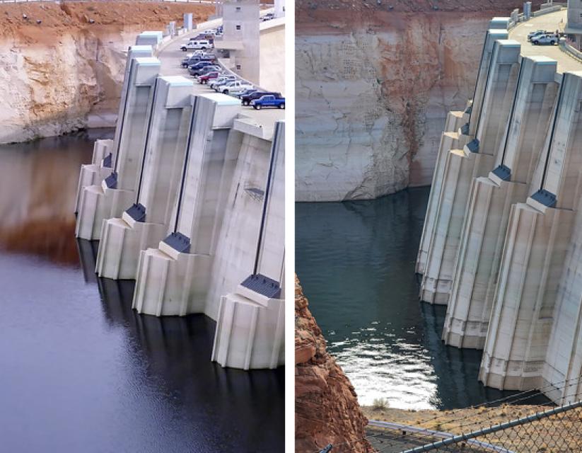
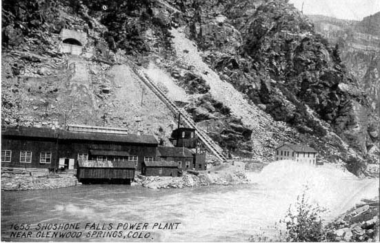
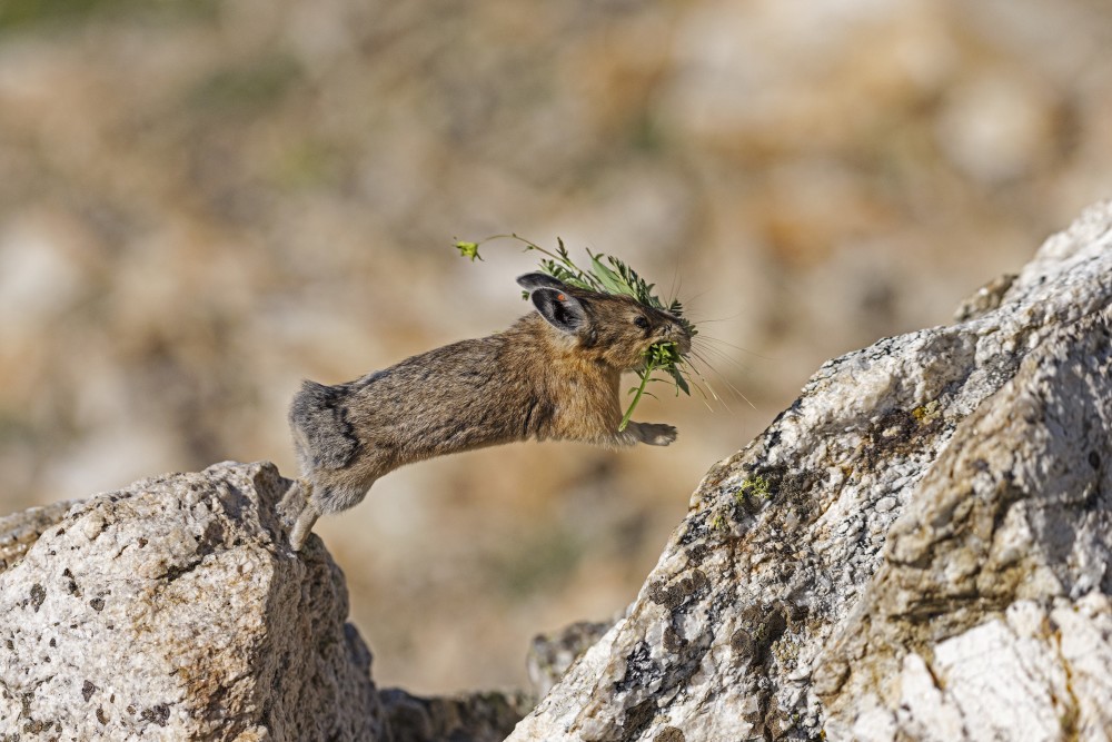
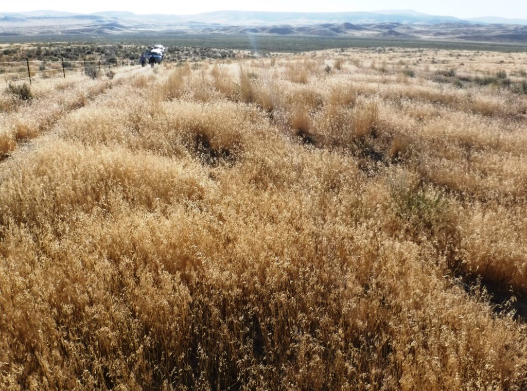
In #NewMexico’s Middle #RioGrande, the wheels are coming off — John Fleck (InkStain.net)

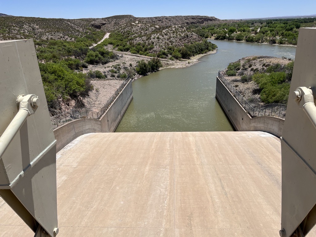
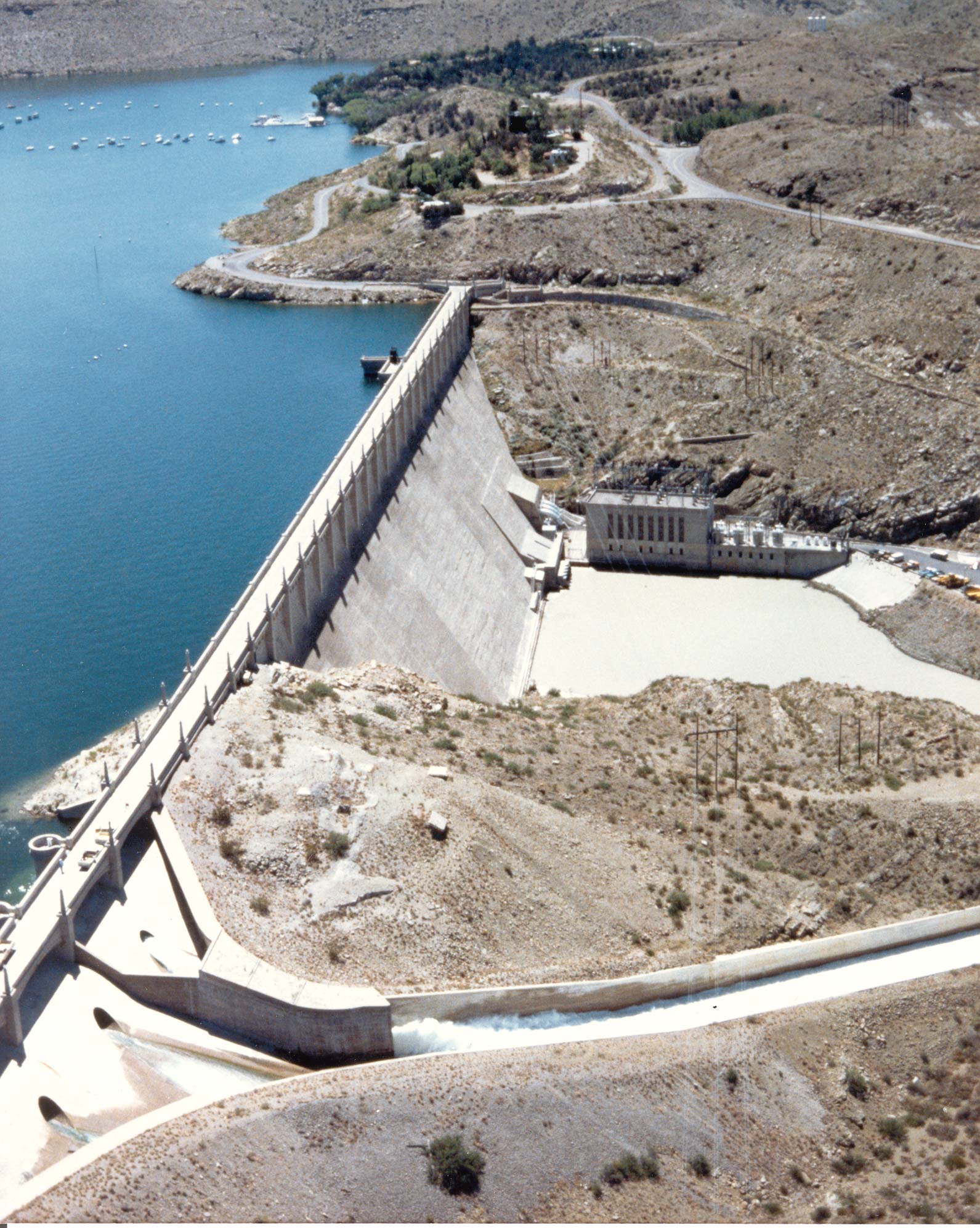
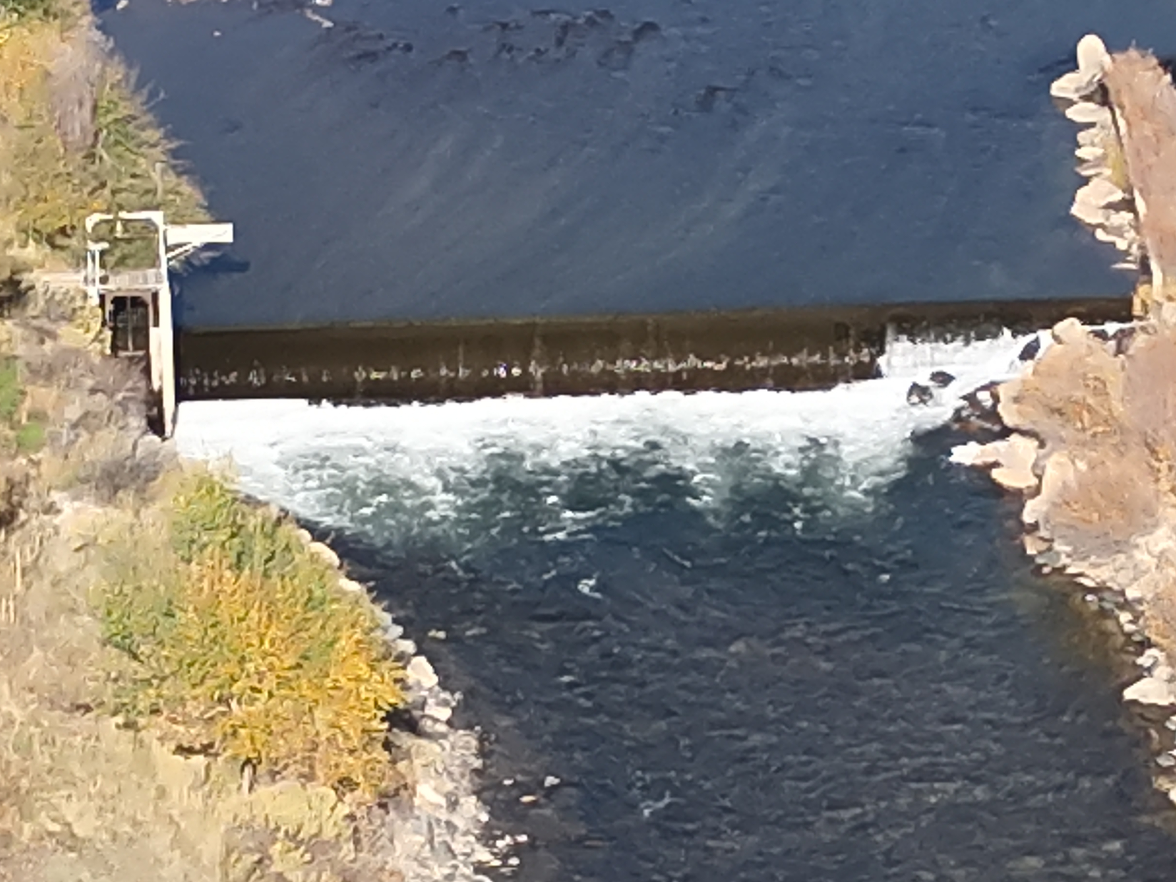
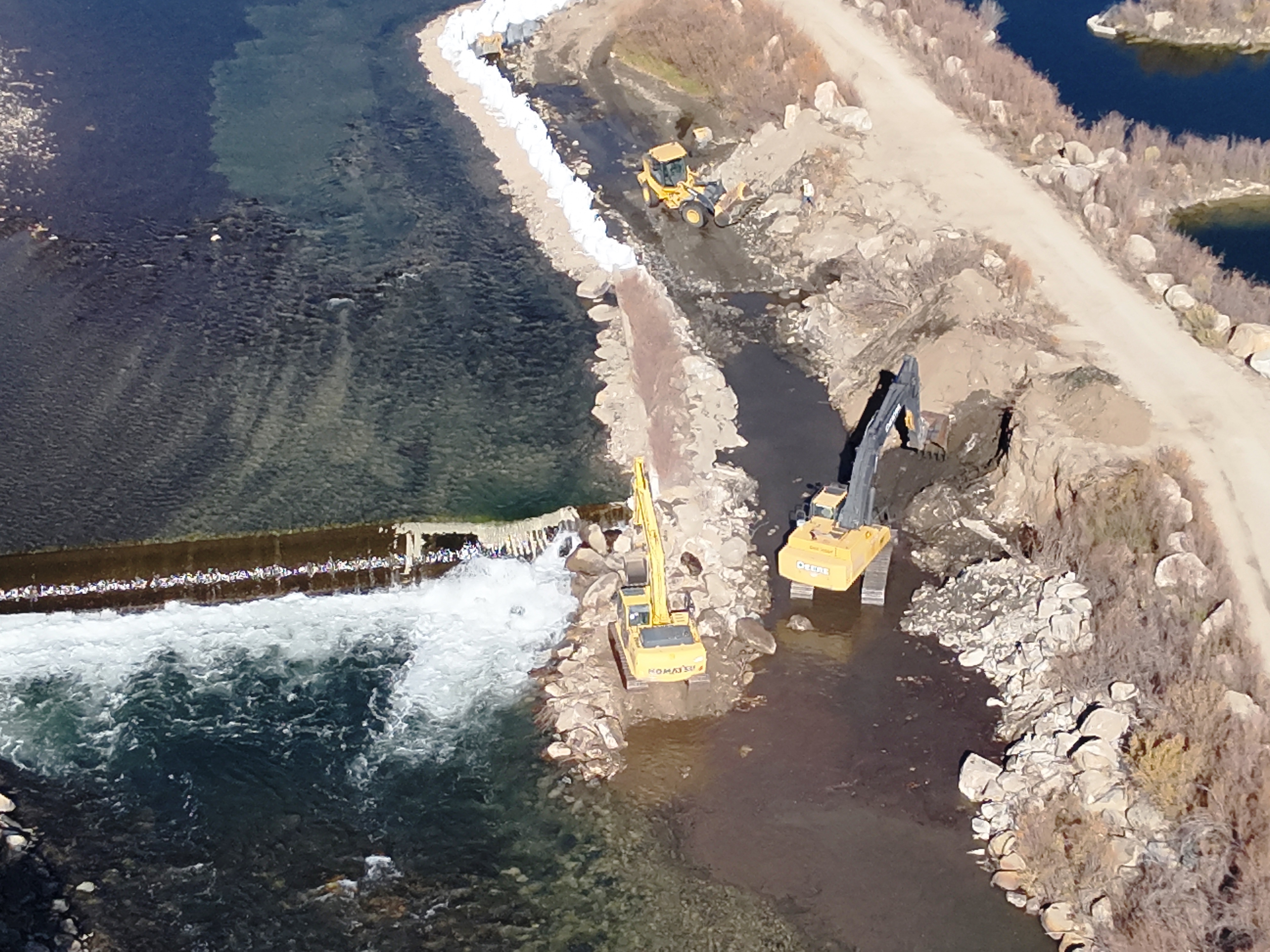
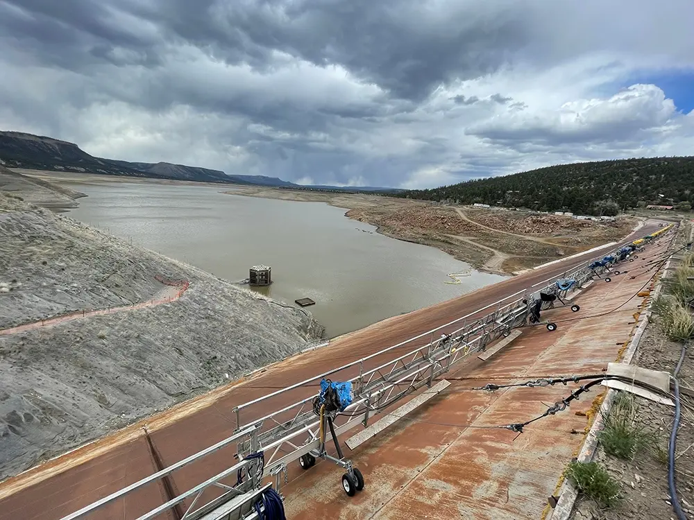
Construction crews attempt to repair the El Vado dam along the Rio Grande in New Mexico. The federal government has been unable to find a way to stop seepage behind the steel faceplate dam. U.S. Bureau of Reclamation

Click the link to read the article on the InkStain website (John Fleck):

July 15, 2024

Talking to Jake Bittle for his Grist piece on the trials and tribulations of El Vado Dam, he asked me a question I loved: “What does this mean in the larger scheme of things?”

My answer:

We seem to be living through a grand convergence of aging water infrastructure failure on New Mexico’s Middle Rio Grande this year.

We’ve talked in this space before about El Vado – built in the 1930s, unusable today. But it is only one example among many right now. If we are frank in recognizing that the main Rio Grande channel is a human artifact, dug in its current place and form in the 1950s, the list right now is long. The Flood Control Acts of 1948 (Public Law 80-858) and 1950 (Public Law 81-516) established the Middle Rio Grande Project and assigned the Bureau of Reclamation the job of performing Rio Grande channel maintenance.

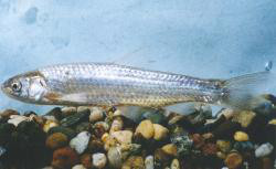
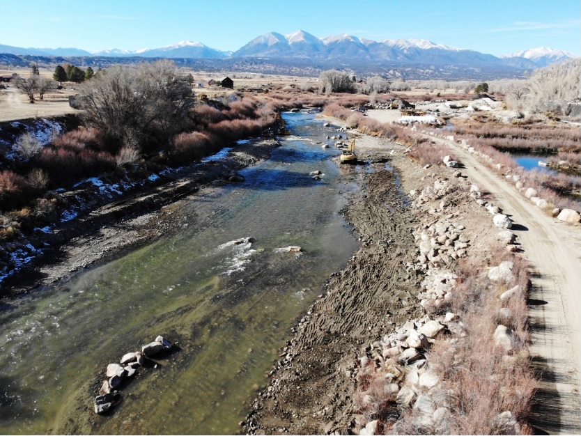
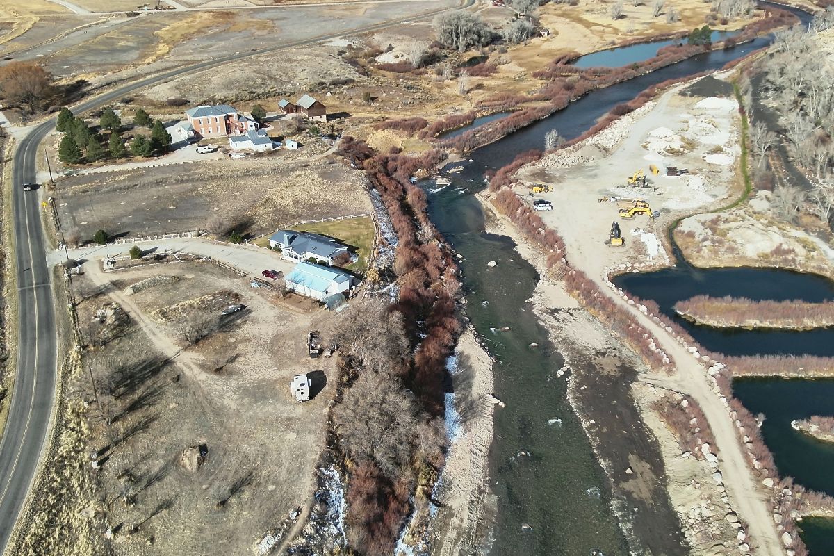
Side channels were excavated by the Bureau of Reclamation along the Rio Grande where it passes through the Rhodes’ property to provide habitat for the endangered silvery minnow. (Dustin Armstrong/U.S. Bureau Of Reclamation)

The channel is infrastructure.

And it’s not just human water use that has optimized around the infrastructure. I was very careful in my comment to Jake – “entire human and natural communities” have optimized around the temporal and spatial flow of a century of altered river systems. When we taught together in the UNM Water Resources Program, my friend and collaborator Benjamin Jones spent significant time on the concept of “coupled human and natural systems”. This is that.

Here’s my current list, feel free to add your favorites in the comments.

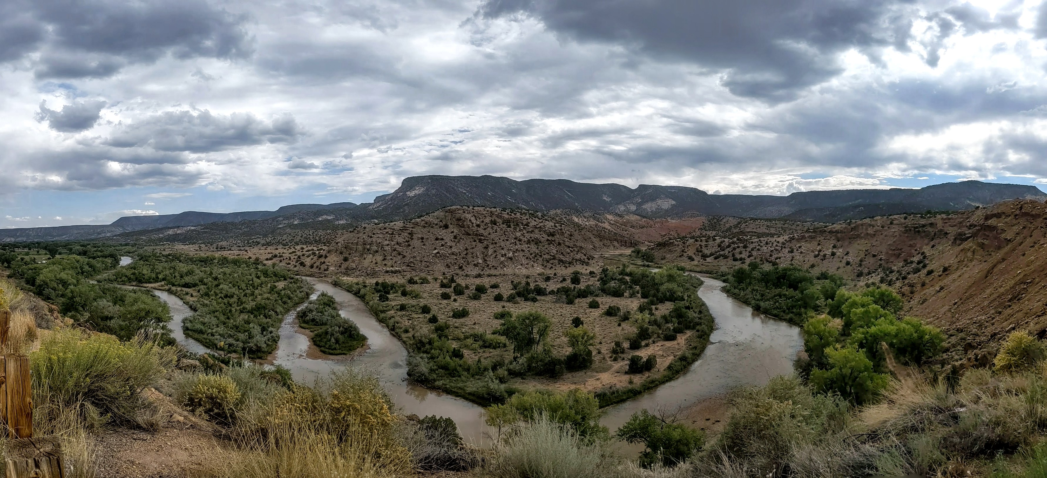
The Rio Chama viewed from US highway 84 between Abiquiú, New Mexico, and Abiquiu Dam. By Dicklyon – Own work, CC BY-SA 4.0, https://commons.wikimedia.org/w/index.php?curid=110189310

RIO CHAMA DOWNSTREAM FROM ABIQUIU

The Army Corps of Engineers has had to curtail releases out of Abiquiu Dam on the Rio Chama because sediment has plugged the river. That means decreased flows downstream. They’re working like crazy to dig a pilot channel. It is not yet working.

CORRALES SIPHON

The Corrales Siphon, built (like El Vado) in the 1930s as part of the early Middle Rio Grande Conservancy District works is (like El Vado) broken. The district has installed temporary pumps, but with the reduced flows out of the Chama, there’s not enough water in the Rio Grande to feed the pumps, which means irrigators in Corrales have no water.

LOWER SAN ACACIA REACH

The Rio Grande’s Lower San Acacia reach, heavily altered by channel reconstruction and management from the 1950s onward, is – I believe the technical term is “a fucking mess”. It’s increasingly difficult to get water through this reach to users downstream who depend on it. Lots more on this situation here.

LOW FLOW LEAK

The Low Flow Conveyance Channel (Yay 1950s engineering!) sprang a kinda big leak the early 1990s. It’s still leaking, much to the delight of endangered willow flycatchers – to the human water users not so much.

Southwestern Willow flycatcher

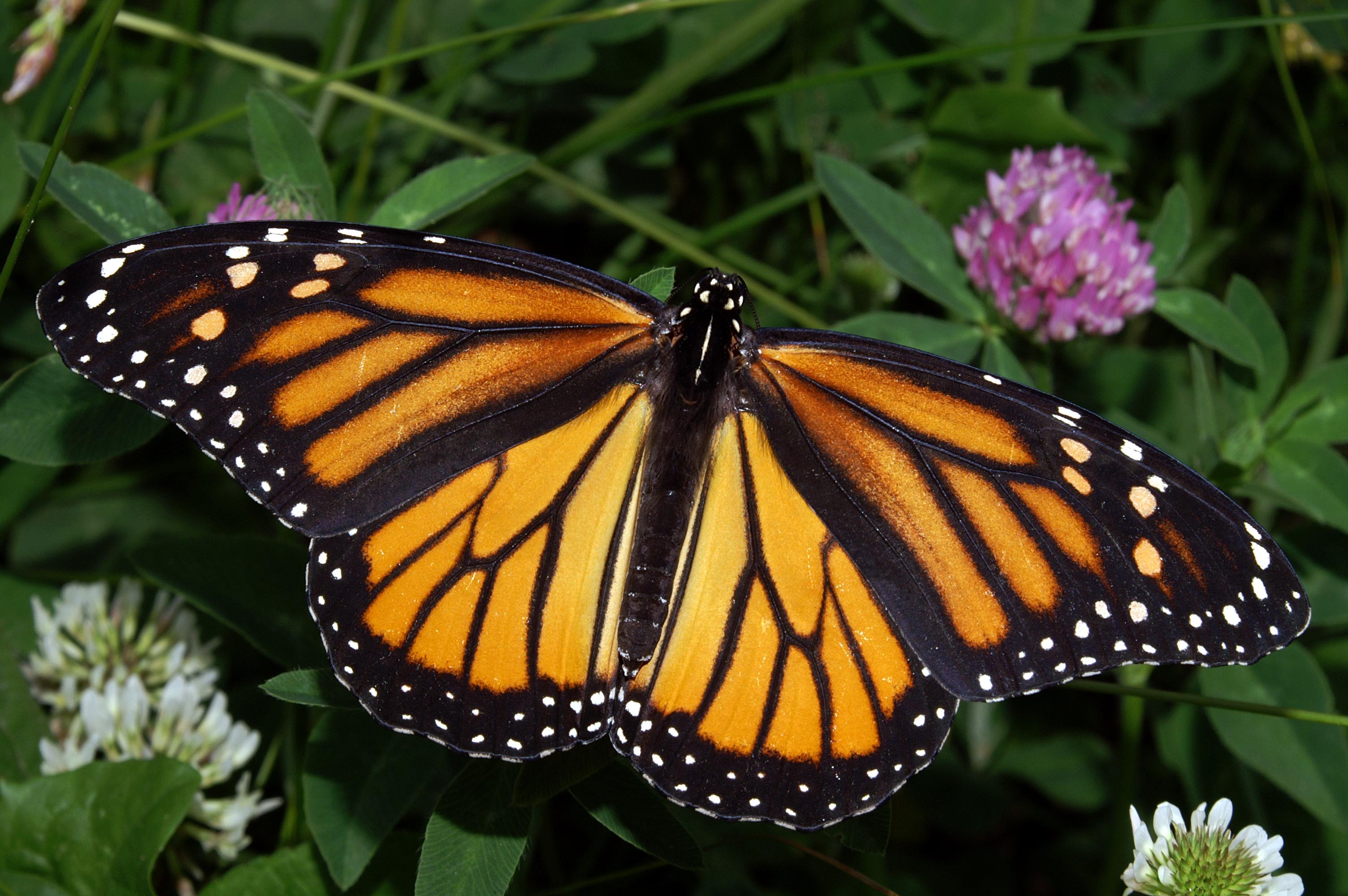
Protecting Monarchs through forecasting the future — USGS #ActOnClimate

Click the link to read the release on the USGS website:

August 24, 2022

With the iconic monarch butterfly’s recent addition to the endangered species list, identifying areas where populations are growing or holding constant provides hope that the declines may be slowed or reversed. For the eastern monarch butterfly, the Midwest U.S is a critical breeding area, but climate change is furthering local population declines. Using extensive data sets and forecasting models, a research team supported in part by the Midwest CASC worked with scientists, community leaders and natural resource managers to identify breeding grounds in the Midwest and Ontario, Canada that are projected to be the least impacted by climate change. This information can be used to aid resource managers in locating areas their work may be the most impactful under the uncertainty of future climate conditions.  

This work is supported by the Midwest CASC project, “Evaluating the Role of Climate on Midwestern Butterfly Trajectories, Monarch Declines, and the Broader “Insect Apocalypse”. 

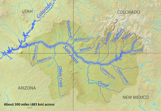
Navajo Dam operations update July 16, 2024 #SanJuanRiver #ColoradoRiver #COriver #aridification

Aerial image of entrenched meanders of the San Juan River within Goosenecks State Park. Located in San Juan County, southeastern Utah (U.S.). Credits Constructed from county topographic map DRG mosaic for San Juan County from USDA/NRCS – National Cartography & Geospatial Center using Global Mapper 12.0 and Adobe Illustrator. Latitude 33° 31′ 49.52″ N., Longitude 111° 37′ 48.02″ W. USDA/FSA, Public domain, via Wikimedia Commons

From email from Reclamation (Susan Novak Behery):

July 15, 2024

Due to falling flows in the critical habitat reach, the Bureau of Reclamation has scheduled an increase in the release from Navajo Dam from 600 cubic feet per second (cfs) to 700 cfs for Wednesday, July 17th, at 4:00 AM.

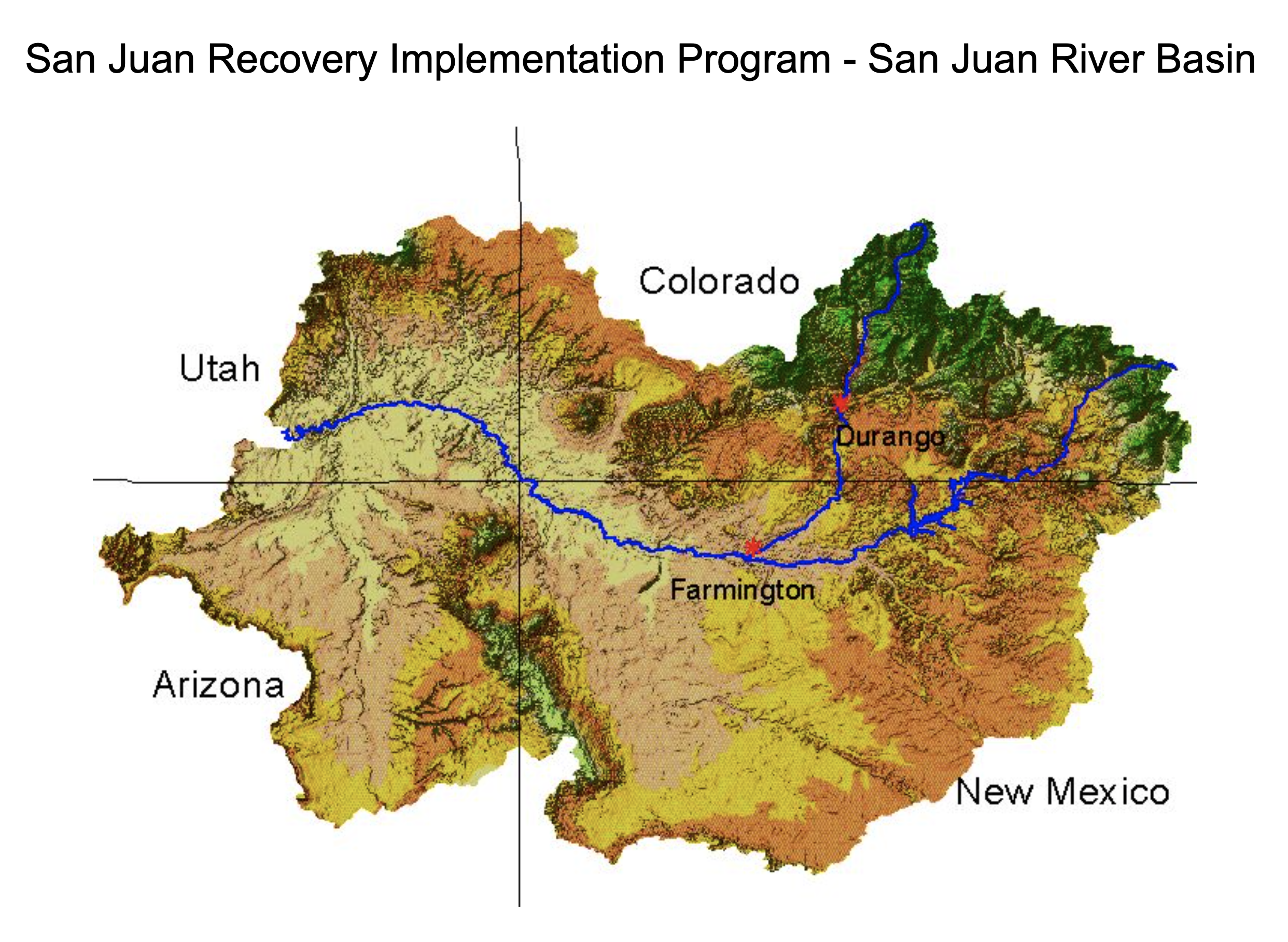
Releases are made for the authorized purposes of the Navajo Unit, and to attempt to maintain a target base flow through the endangered fish critical habitat reach of the San Juan River (Farmington to Lake Powell).  The San Juan River Basin Recovery Implementation Program recommends a target base flow of between 500 cfs and 1,000 cfs through the critical habitat area.  The target base flow is calculated as the weekly average of gaged flows throughout the critical habitat area from Farmington to Lake Powell.

New Songbird Habitat Study Unlocks Benefits for the Monarch Butterfly — USDA

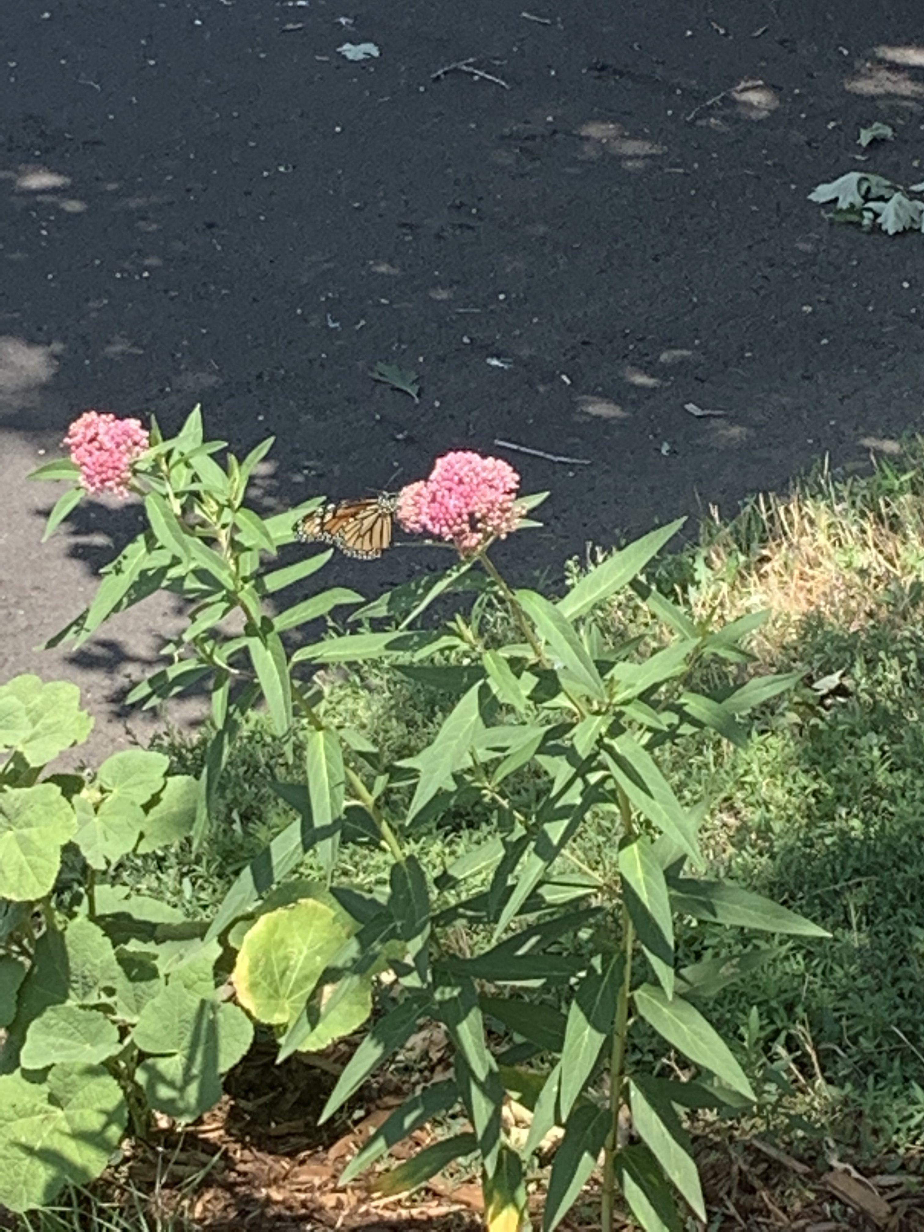
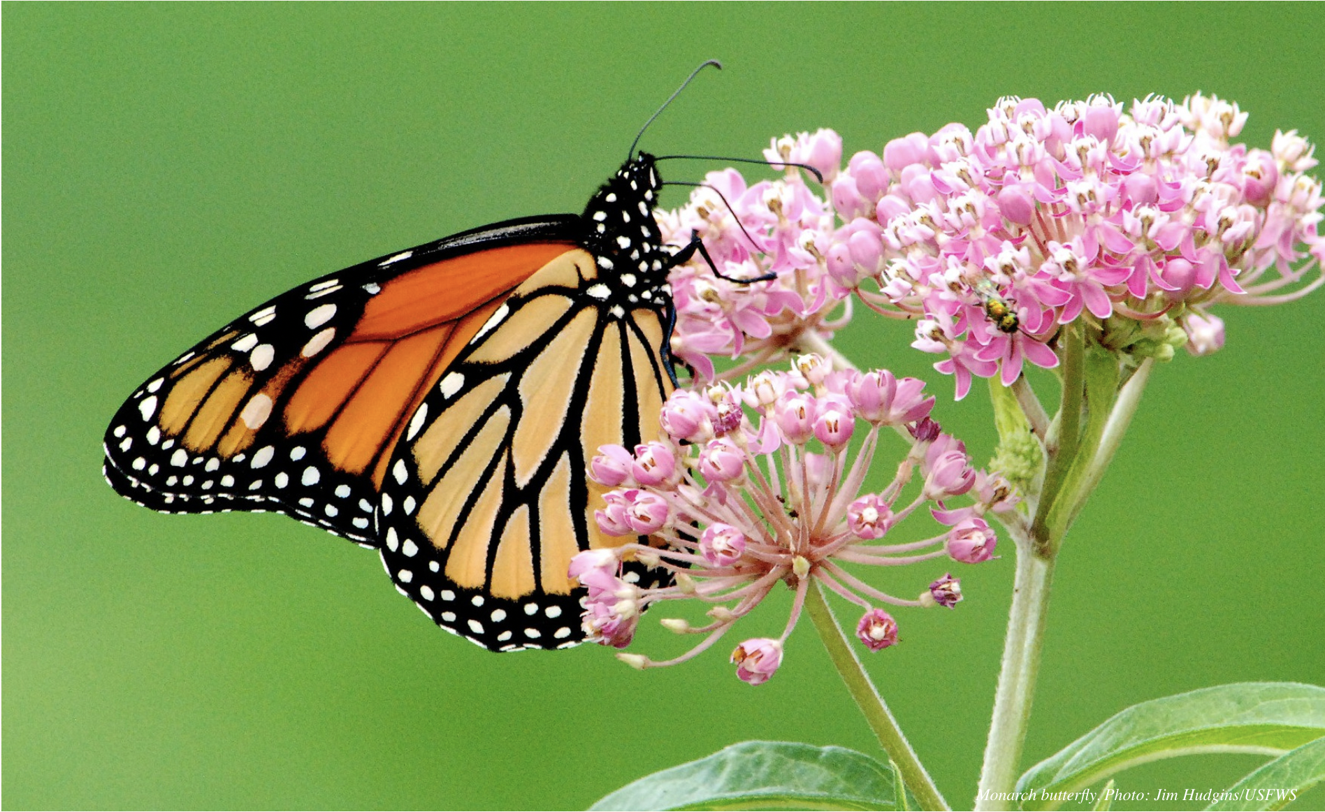
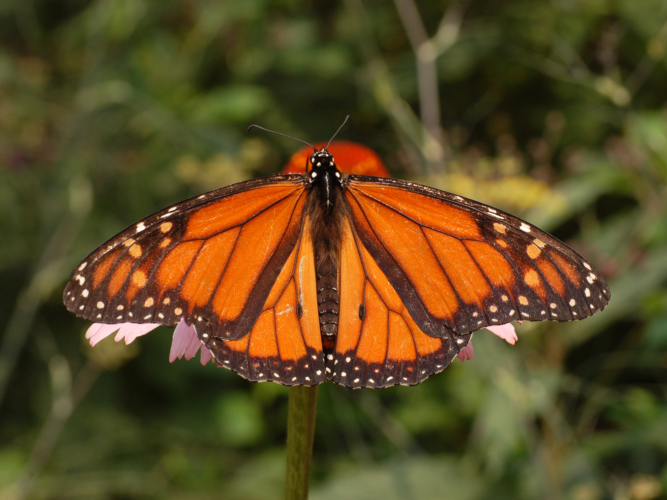
Monarch butterfly on milkweed. Photo credit: USDA

Click the link to read the article on the USDA website (Jocelyn Benjamin):

June 13, 2024

A new study reveals that managing habitat for songbirds like the golden-winged warbler also benefits insect pollinators like the at-risk monarch butterfly.

Exploring the young forests and shrublands within the eastern deciduous forests of the United States, this study, which was highlighted in a Science to Solutions report by the Indiana University of Pennsylvania, thoroughly unravels the co-benefits that managing for early-successional habitat offers to both the golden-winged warbler and monarch butterfly. Managing for forest-age diversity improves the overall long-term health of forest communities and wildlife habitat. This research will help USDA strengthen conservation solutions for the Monarch butterfly and other pollinators.

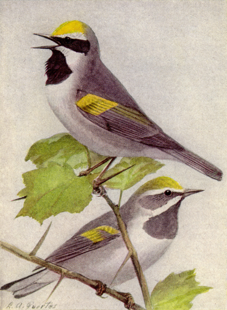
Golden-winged Warbler Male and Female (Vermivora chrysoptera). By Louis Agassiz Fuertes. – 300 ppi scan of the National Geographic Magazine, Volume 31 (1917), page 308, panel C., Public Domain, https://commons.wikimedia.org/w/index.php?curid=167346

Common management solutions promoting early-successional communities like shrublands and young forests, are expensive, due to the management tools needed to simulate natural disturbances like wildfire, beaver activity, and severe weather that revert older sites to early-successional young forest conditions. 

To combat these challenges, USDA’s Natural Resources Conservation Service (NRCS) offers cost-effective management tools and technical assistance to private landowners through the Working Lands for Wildlife (WLFW) initiative.

WLFW offers management planning to improve forest stand quality and structure while promoting conservation benefits for specific wildlife species, which may also impact non-focal species. In this case, the golden-winged warbler is a focal species for multiple NRCS working lands programs in the Appalachian Mountains and Great Lakes, and shares common habitat goals with pollinators, including butterflies and native bees.

The report outlines several recent studies that assessed how pollinator species respond to avian-focused early successional habitat management in the Great Lakes and provides evidence that breeding habitat management efforts for the Warbler not only benefit pollinators but also many other non-focal species of conservation concern, including the American Woodcock and Eastern Whip-poor-will.

The monarch butterfly populations have declined significantly over the past few decades due to critical population stressors, including reductions in milkweed and nectar plant availability, driven by the loss and degradation of habitat across its range. 

This drastic decline has sparked concerted efforts to create and enhance monarch habitat. The studies found that abundant blooming plants within forested landscapes, with emergent herbaceous wetlands nearby, combine habitat components for pollinators by containing pollen and nectar at a single site. Given that many disturbance-dependent flowering herbaceous plants like goldenrod colonize recently managed golden-winged warbler sites, coupling insect pollinators with warbler habitat creation benefits multiple species.

NRCS continues to offer this multispecies benefits approach through its working lands initiative, which nets a win-win for songbirds, pollinators, and owners and operators of working forests.

Learn more about NRCS conservation outcomes for the golden-winged warbler by watching “Outcomes from NRCS Golden-Winger Warbler Conservation Efforts” or how NRCS can help you create or enhance habitat for monarch butterflies on your working lands.

More Information:

NRCS will host a free, one-hour Conservation Outcomes Webinar during National Pollinator Week that shares findings on the value of voluntary conservation practices to support pollinators nationwide. Additional details are available on the Conservation Outcomes Webinar Series webpage.

#Colorado Attorney General Phil Weiser: Supreme Court ruling threatens to create regulatory uncertainty, higher costs and greater harms

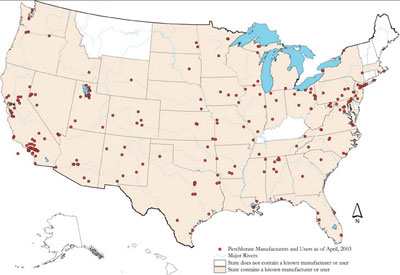
Perchlorate Pollution by State

Click the link to read the release on the Colorado Attorney General’s website:

June 28, 2024

Attorney General Phil Weiser released the following statement regarding today’s U.S. Supreme Court decision overruling 40 years of regulatory law precedent:

“Under 40 years of precedent known as the Chevron doctrine, the Supreme Court has given reasonable deference to federal agencies to implement statutes passed by Congress, notably, when a statute is unclear. As the court has consistently acknowledged, it is impossible for Congress to legislate every detail needed to carry out and enforce complex laws.

“With today’s opinion in Loper Bright Enterprises v. Raimondo, the Supreme Court appoints itself as the super regulator. The court says that it knows better than highly trained experts when it comes to protections for the air we breathe, the water we drink, public lands, worker safety, food and drug safety, public safety, disaster relief, public benefits, or any other regulation that affects American lives. [ed. emphasis mine] The court’s decision in this case threatens to create regulatory uncertainty for businesses, government agencies, and everyday Americans. As a result, it promises not only confusion, but also higher costs and greater harms. Rather than clarifying the scope of the Chevron doctrine, the court chose to sow chaos and uncertainty.

“Today’s decision does not impact state regulations promulgated under Colorado state law. The Department of Law will continue to work with state agency partners to implement and enforce state regulations.”

Colorado was part of a coalition of state attorneys general that filed a court brief defending the Chevron doctrine in Loper Bright Enterprises v. Raimondo.

Helping endangered fish on the #ColoradoRiver: @DenverWater partners with group of reservoir operators to improve river’s ecosystem

Click the link to read the article on the News on Tap website (Jay Adams and Bailee Campbell):

June 14, 2014

Denver Water partners with Front Range, West Slope, state and federal water managers to improve conditions for four species of endangered fish on the Colorado River. Learn about the Coordinated Reservoir Operations program also known as CROS. Learn more here: https://denverwatertap.org/2019/07/16…

Thanks to above-average snowpack this past winter in the northern and central mountains, a section of the Colorado River saw a burst of water in early-June as a group of reservoir operators teamed up with Mother Nature to improve habitat for endangered fish.

As part of the Coordinated Reservoir Operations program, Denver Water, the Colorado River Water Conservation DistrictColorado Springs UtilitiesNorthern Water and the U.S. Bureau of Reclamation worked together to either release extra amounts of water from their reservoirs or stopped diverting water from rivers and streams for a period of time.

The coordinated effort is timed to match the existing natural springtime rush of water down the river from melting snow in the mountains. The flows are not higher than the amount of water that would normally occur during runoff.

The combined effort created a pulse of water that came together at a 15-mile stretch of the Colorado River near Palisade in Mesa County.

The pulse helped the river’s ecosystem, which has been affected by water being diverted from the Colorado River and its tributaries over the years.

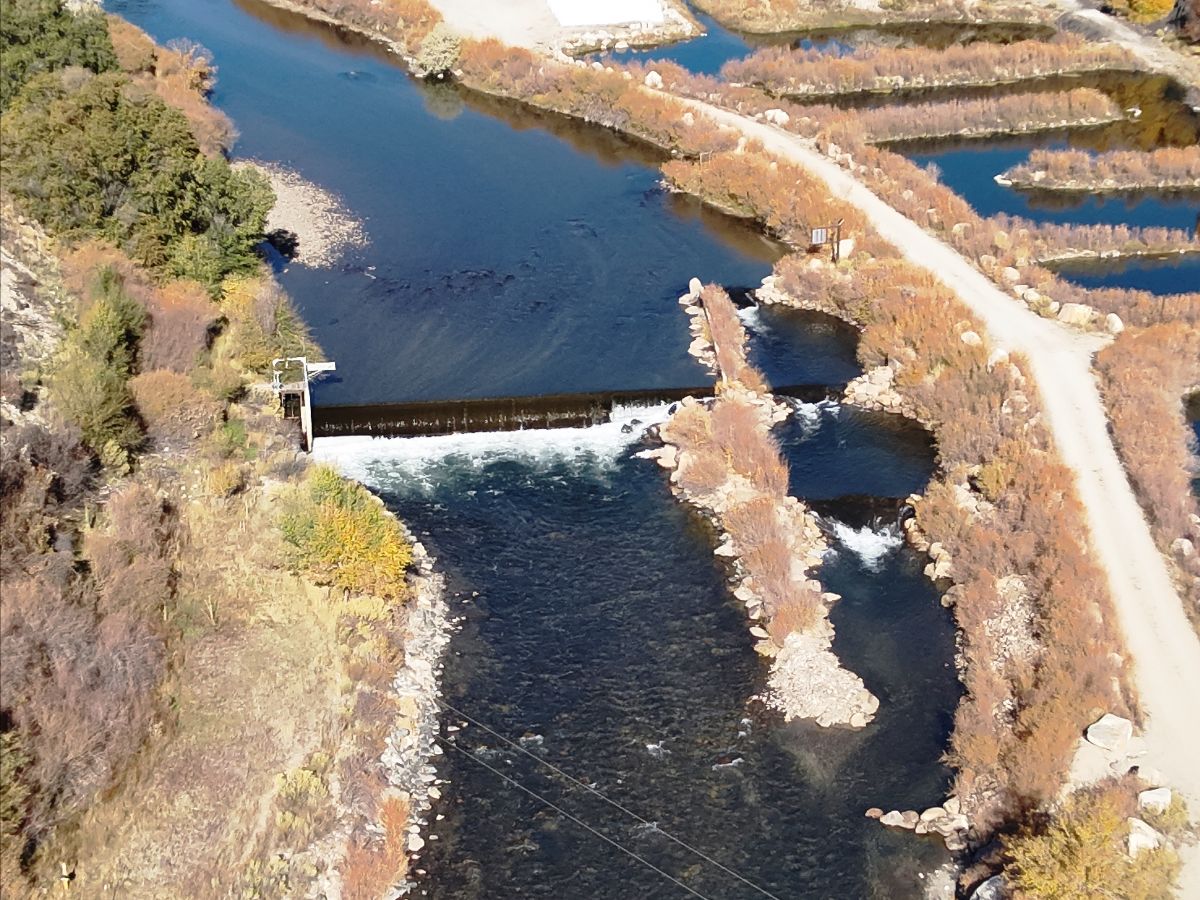
A burst of water from the Coordinated Reservoir Operations program flows down the Colorado River near Palisade in June 2019. Photo credit: U.S. Fish and Wildlife Service.

What is CROS?

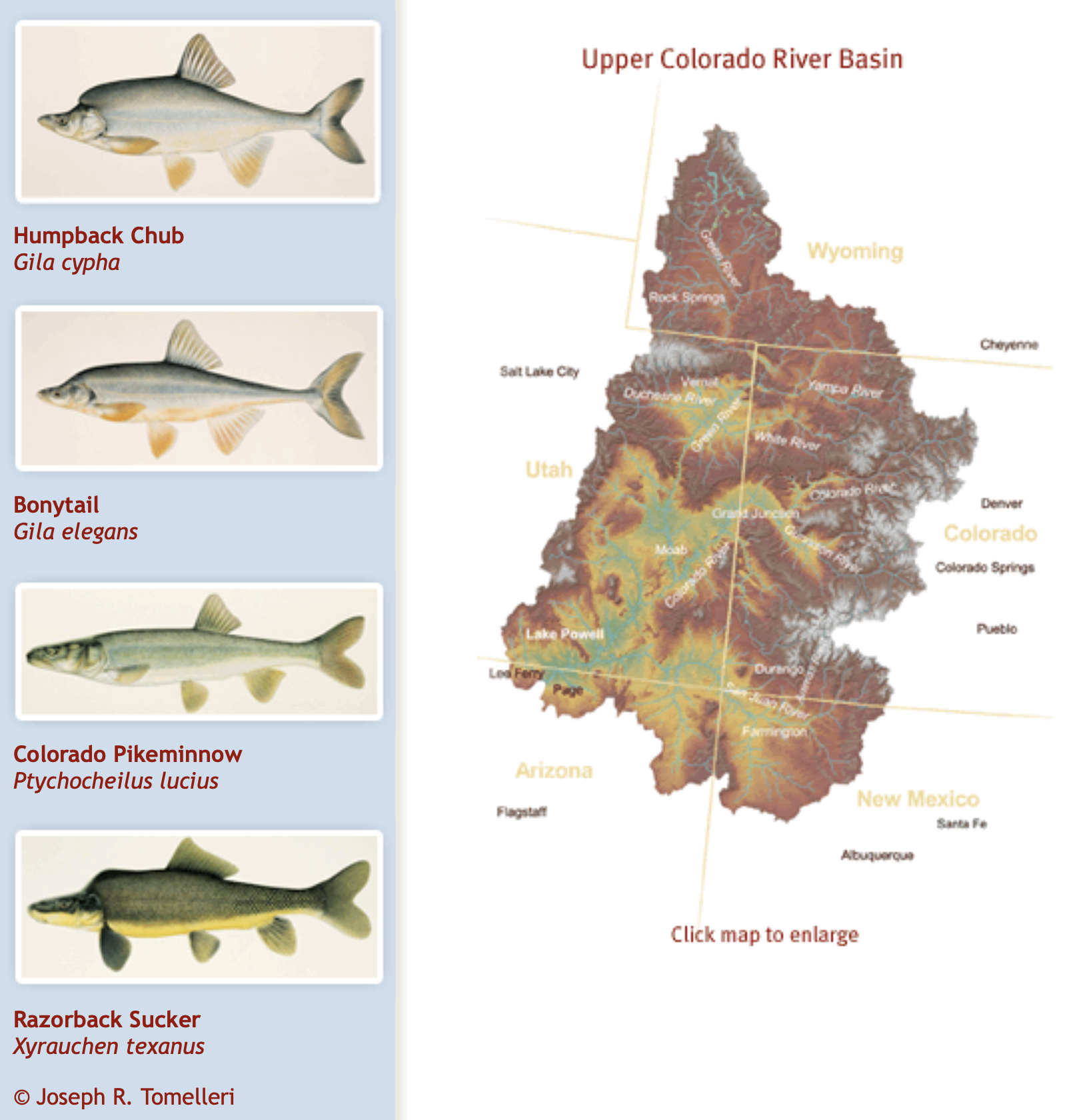
The Coordinated Reservoir Operations, also known as CROS, program began in 1995 when the water managers looked for ideas to improve conditions for four species of endangered fish; the bonytail, the Colorado pikeminnow, the humpback chub and the razorback sucker.

The 2024 effort marked the 13th time since 1995 that reservoir operators have been able to coordinate their operations on the Colorado River. The voluntary operations are coordinated by staff at the Colorado Water Conservation Board.

Before the program started, each reservoir operator had its own schedule for capturing water from the rivers and releasing extra water downstream.

Water releases from the Coordinated Reservoir Operations program are aimed at improving this stretch of the Colorado River near Palisade. Photo credit: Dale Ryden, U.S. Fish and Wildlife Service.

“Reservoir operators realized that if all of us worked together, we could do something to help these endangered fish,” said Travis Bray, an environmental scientist from Denver Water. “Improving this stretch of river was critical to the survival of all four species.”

Reservoirs that can contribute to the coordinated release of water into the Colorado River include Denver Water’s Williams Fork Reservoir along with Green Mountain, Homestake, Ruedi, Willow Creek, Wolford Mountain and Windy Gap reservoirs.

“Typically during above average snow seasons, more water comes through our reservoirs than we can store,” said Cindy Brady, water supply engineer at Denver Water. “When snow conditions allow, we are able to fill our reservoirs for water supply and send the extra water downstream to help the fish habitat.”

The amount of water varies and not all water managers are able to contribute or coordinate flows each year depending on water levels, snowpack and reservoir operating conditions.

Denver Water released water from Williams Fork Dam in Grand County as part of the Coordinated Reservoir Operations program in June 2019. Photo credit: Denver Water.

Benefits to fish habitat

When the reservoir operators coordinate their releases to hit at the same time, the extra water in the river offers improves fish habitat in several ways.

For instance, when there’s more water in the river, it flows faster.

The rushing water flushes tiny pieces of sediment from the rocks on the bottom of the river, which creates space for the fish to lay their eggs. Without these flushing flows, the sediment builds up over time and leaves no room for the eggs.

There are other benefits as well, according to Don Anderson, a hydrologist with the U.S. Fish and Wildlife Service.

“The higher water creates calm side channels for young razorback suckers to swim into,” Anderson said. “The fast-moving water also triggers the Colorado pikeminnows to swim upstream and spawn in the 15-mile stretch.”

An additional benefit, according to Anderson, is that the high flow of water scours away young vegetation that encroaches on the river channel. If left unchecked, the vegetation gradually degrades the habitat available for the fish.

Is the program working?

The coordinated release program has played an important role in restoring fish habitat.

The Fish and Wildlife Service’s recent assessment of the four endangered fish species prompted the agency to propose reclassifying two of them — the razorback sucker and the humpback chub — from “endangered” status to a less-dire “threatened” designation.

The humpback chub is one of four endangered fish species on the Colorado River that will benefit from the higher flow of water this year that came from the Coordinated Reservoir Operations program. Photo credit: Utah Division of Wildlife Resources.

“The change in status signals significant progress in the recovery of these fish,” Anderson said. “Since 2014, we’ve measured record numbers of razorback suckers using a fish ladder to bypass a large dam a few miles upstream of Palisade and access additional habitat upstream.”

The higher flow of water is spread out over several days to prevent flooding in communities along the river.

This map shows the 15-mile reach of the Colorado River near Grand Junction, home to four species of endangered fish. Map credit: CWCB

Improving the environment

The coordinated releases are part of the Upper Colorado River Endangered Fish Recovery Program established in 1988 to bring the four fish species back from the brink of extinction.

The project marks a change in how reservoirs are managed. In decades past, environmental factors were not given as much consideration as they are now.

“Denver Water participates in many different programs that help the four species of endangered fish,” Bray said. “Our goal is to get as many benefits as possible out of every drop of water and be responsible stewards of the environment.”

Coordinated reservoir releases planned to aid fish — The #GrandJunction Daily Sentinel #ColoradoRiver #COriver #aridification

This map shows the 15-mile reach of the Colorado River near Grand Junction, home to four species of endangered fish. Map credit: CWCB

Click the link to read the article on The Grand Junction Daily Sentinel website (Dennis Webb). Here’s an excerpt:

May 30, 2024

Reservoir operators in the Colorado River basin upstream of Grand Junction are looking to coordinate water releases in coming days to help bolster the river’s peak runoff volumes to aid imperiled fish. The coordinated peak-flow releases would be the first that have occurred since 2020. Annual conditions such as winter snowpack accumulations, current reservoir storage levels and the pace of spring runoff help determine what years coordinated releases occur. The releases are intended to help federally endangered or threatened fish in a 15-mile stretch of the Colorado River between irrigation water diversion points in the Palisade area and the river’s confluence with the Gunnison River. Those fish include the razorback sucker, Colorado pikeminnow, humpback chub and bonytail. The goal of the releases is to intensify peak spring runoff levels in the river in order to help clean fine sediment out of gravel beds that serve as spawning habitat for the fish. Such flows also can improve habitat for insects and other macroinvertebrates that fish feed on…

The U.S. Fish and Wildlife Service hopes to see peak runoff reach 16,700 cfs during a year like this one under coordinated releases. But during an online meeting of water officials Tuesday as they look to coordinate operations, David Graf, an instream flow coordinator for the Fish and Wildlife Service, said reservoir releases that extend peak flows in the 15,000-15,500 cfs range a little longer also would be beneficial…The Bureau of Reclamation also has been making extra water releases to boost peak flows in the lower Gunnison River in recent days, again in hopes of benefiting imperiled fish. Those flow increases are expected to largely wind down before the Colorado River flows ramp up, meaning there shouldn’t be a threat of flooding downstream of the confluence. Reservoir operators and water users in some years also try to boost flows in the 15-mile reach during particularly low flows later in the summer, and around early April after irrigation diversions have begun but before the river levels increase from spring runoff.

Migratory freshwater fish populations ‘down by more than 80% since 1970’ — The Guardian

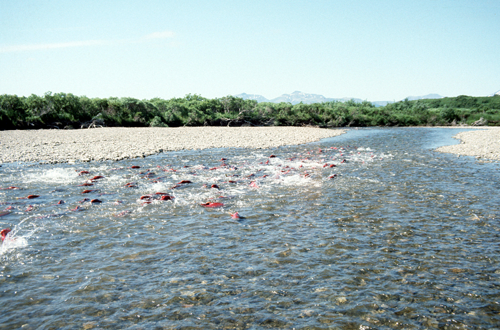
Spawning Salmon in Becharof Stream within the Becharof Wilderness in southern Alaska, USA. By U.S. Fish and Wildlife Service – US Fish & Wildlife Service – [1], Public Domain, https://commons.wikimedia.org/w/index.php?curid=3525119

Click the link to read the article on The Guardian website (Phoebe Weston). Here’s an excerpt:

May 21, 2024

Migratory fish populations have crashed by more than 80% since 1970, new findings show. Populations are declining in all regions of the world, but it is happening fastest in South America and the Caribbean, where abundance of these species has dropped by 91% over the past 50 years. This region has the world’s largest freshwater migrations, but dams, mining and humans diverting water are destroying river ecosystems. In Europe, populations of migratory freshwater fishes have fallen by 75%, according to the latest update to the Living Planet Index.

Migratory freshwater fish partially or exclusively rely on freshwater systems – some are born at sea and migrate back into fresh water, or vice versa. They can in some cases swim the width of entire continents and then return to the stream in which they were born. They form the basis for the diets and livelihoods of millions of people globally. Many rivers, however, are no longer flowing freely due to the construction of dams and other barriers, which block species’ migrations. There are an estimated 1.2m barriers across European rivers. Other causes of decline include pollution from urban and industrial wastewater, and runoff from roads and farming. Climate breakdown is also changing habitats and the availability of freshwater. Unsustainable fishing is another threat.

Herman Wanningen, founder of the World Fish Migration Foundation, one of the organisations involved in the study, said: “The catastrophic decline in migratory fish populations is a deafening wake-up call for the world. We must act now to save these keystone species and their rivers.

“Migratory fish are central to the cultures of many Indigenous peoples, nourish millions of people across the globe, and sustain a vast web of species and ecosystems. We cannot continue to let them slip silently away.”

Federal, state officials laud funding for fish passage in La Plata County — The #Durango Herald

Click the link to read the article on The Durango Herald website (Reuben M. Schafir). Here’s an excerpt:

May 12, 2024

Fish native to the Colorado River Basin evolved in a highly connected network of streams, explained CPW Aquatic Biologist Jim White. Fish will swim into smaller streams like Cherry Creek to spawn, before larvae drift back into larger bodies like the La Plata River. That interconnected network has been severed by roads that pass over culverts that were not designed with fish in mind…With $702,000 of federal funding, contractors will remove a standard 60-foot-long steel culvert pipe in Cherry Creek and replace it with a “box culvert.” The new passage will allow for a more natural stream bed and allow upstream access to about 20 miles of habitat for roundtail chub, bluehead sucker and flannelmouth sucker.

Conservation Works — and Science Just Proved It: But at the same time, it doesn’t take much to do tremendous damage to endangered species — The Revelator

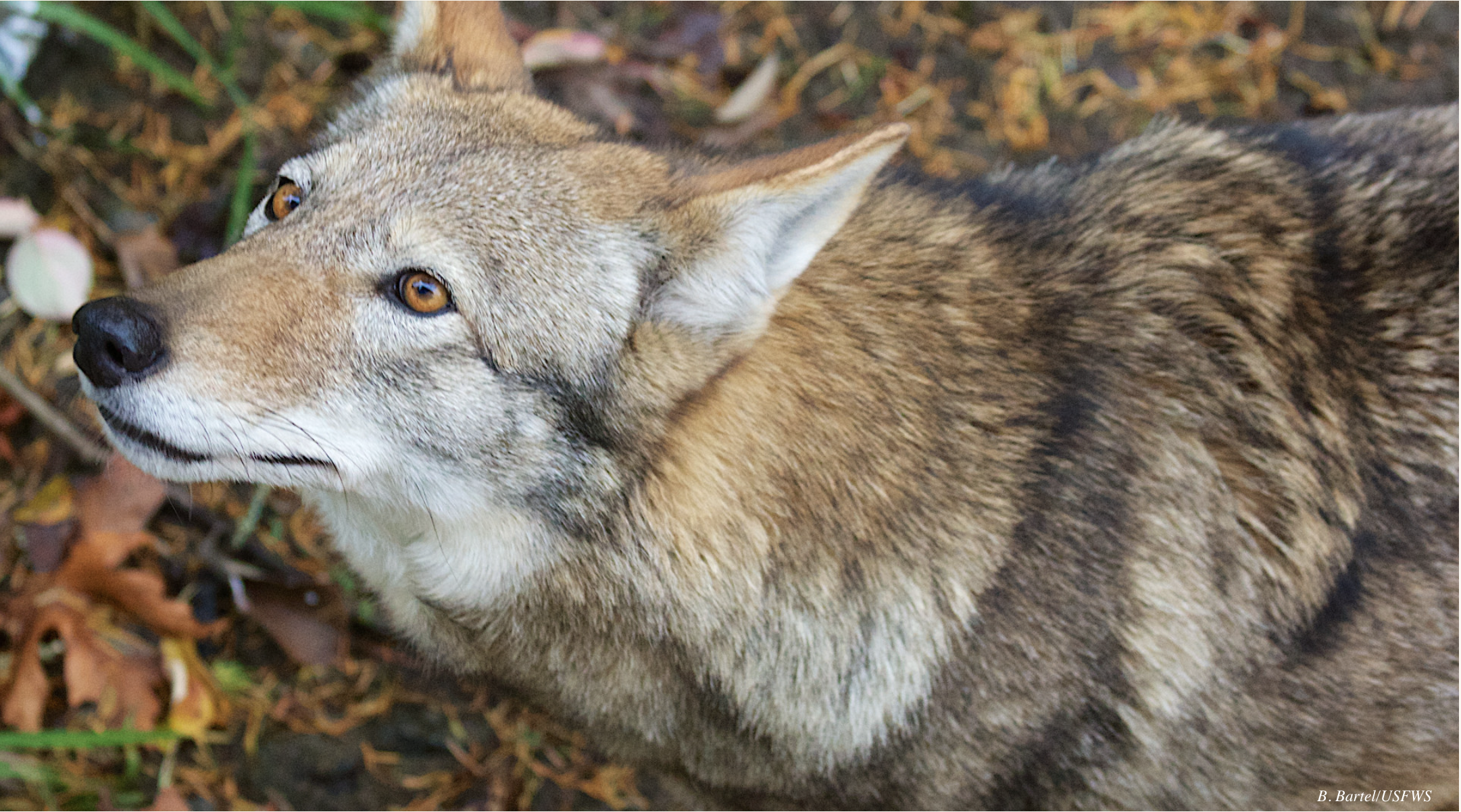
Red wolf (Canis rufus). Photo credit: USFWS

Click the link to read the article on The Revelator website (John R. Platt):

May 13, 2024

Science just proved it: Conservation efforts around the world are working.

According to a study published April 26 in the journal Science, human efforts to help endangered and at-risk species have proven overwhelmingly successful at improving their status.

The researchers — 33 authors from universities and conservation groups — examined 186 studies that measured the effectiveness of conservation efforts over time. The meta-study put the results clearly:

Interestingly, the study found that more recent conservation projects were the most likely to have gone well. We’ve learned a lot over the past few decades, which means we’re doing better all the time.

Toward that point, the paper found that even conservation efforts that don’t work can provide critical information to help future programs, as two of the study authors wrote for The Conversation: “For example, in India, removing an invasive algae simply caused it to spread elsewhere. Conservationists can now try a different strategy that may be more successful.”

And here’s the even bigger takeaway: The benefits aren’t just for the species that are direct targets of conservation efforts. “One of the most interesting findings was that even when a conservation intervention didn’t work for the species that is was intended, other species unintentionally benefited,” lead author Penny Langhammer, executive vice president of the conservation group Re:wild, told BBC News. That often happens when conservationists mitigate a threat in order to help one species but help other nearby plants or animals in the process.

Of course, we could be doing even better: Even though we know conservation works, there’s just nowhere nearly enough funding to help every species in need. As the authors wrote in The Conversation:

The paper itself lists dozens of great conservation examples, but you can find even more in recent news:

  • Critically endangered red wolves (Canis rufus) have enjoyed a much-needed baby boom, with eight new cubs born to a pack in North Carolina last month. Red wolves only have one breeding male left in the wild, so these cubs represent the future of the species. (The proud papa came from a conservation breeding center in Washington state after the previous male was killed by a car — further proof that these wolves wouldn’t continue to exist without dedicated humans looking out for their future.)
  • Devil’s Hole pupfish (Cyprinodon diabolis) are also having a helluva good time and have reached their highest spring population level in 25 years. At just 191 tiny fish, they’re not exactly populous, but this is a huge boost from 2013, when the species’ spring population plummeted to a low of just 35. This sets them up for a good breeding season ahead, when their population (which fluctuates according to the time of year) could hit 500 or more.
  • Meanwhile giant ground pangolins (Smutsia gigantea) have returned to Kenya for the first time in more than half a century. Conservationists put the current population at just 30-80 animals, but it’s a start, and it’s all due to the nonprofit Project Pangolin’s work to remove electric fences and other threats that prevented the return of these heavily poached animals.
  • Similarly, spotted hyenas (Crocuta crocuta) have taken up residence in Gabon for the first time since 1949. A few individuals had briefly wandered into the country over the past few decades, but none of these important predators had stuck around. Now a new study reveals that some of them have finally decided to call their former country home once again — a call for scientists to understand how they did it so others can follow.
  • Also in Gabon, a new study shows that forests certified by the Forest Stewardship Council in that country and the Republic of Congo now enjoy greater abundances of large mammals such as elephants and gorillas, as well as other critically endangered species.
  • Asian elephants living in recently protected habitats in Cambodia appear to have increased in number and now travel in groups of up to 20 or 30, compared to groups of 3-5 just a few years ago.
  • In the UK 150 harvest mice (Micromys minutus) have been reintroduced into a nature reserve near London, the first time they’ve lived in the area since 1979. Conservationists have protected meadows and created wildlife corridors to make the wooded reserve more hospitable to the rewilded mice.

That just scratches the surface, but it proves a point: Humans pushed most of these species toward extinction, but we can also lift them back, given enough time, effort and funding.

Counterpoint

Of course, not everything goes well for imperiled wildlife.

As Mongabay reports, a single gang of poachers may have killed at least 10% of the entire Javan rhino species (Rhinoceros sondaicus) since 2019. A 2021 camera-trap survey put the Javan rhino population at 34 confirmed individuals, although a government report earlier that year estimated the number at 76. Either count was bad enough, and now this gang is suspected to have killed at least seven of the rhinos, according to government officials, pushing the species ever closer to extinction.

This brutal news hit the environmental media like a lead balloon. Other than Mongabay, no media outlets covered the story in English in the week that followed, according to freelance journalist Jeremy Hance broke the news and later wrote on social media, “How can we do anything about the mass extinction crisis if the news refuses to cover it?”

This story — and the journalistic apathy around it — cuts deep. I’ve long been vocal in my criticism that environmental journalism doesn’t do enough to cover wildlife issues and the extinction crisis. Climate change — as critical as it is — has sucked much of the air from the room and left little space for covering other topics.

Part of the challenge is that bad news about endangered species and wildlife is often so heart-wrenching. Stories like poachers killing Javan rhinos embody the cruelest aspects of human character and social conditions. Faced with painful facts and few actionable solutions, many readers tune it out and turn the page.

But we can’t turn a blind eye to the multiple crises around the world. The media needs to cover them, and people who care need to read and share them along with the good-news stories — to help inspire further action and fight the overwhelming ennui that can settle on us in the face of destruction.

If the bad news makes you angry, use that anger. And look to the success stories to keep you going and build on what’s already been done.

Construction wrapping up on Maybell Diversion improvement project — Craig Daily Press #YampaRiver

Maybell Diversion Restoration project. Photo credit: JHL Constructors

Click the link to read the article on the Craig Daily Press website (Ashley Dishman)

May 12, 2024

A major project to update the Maybell Diversion and headgate on the Yampa River is nearing completion as its users prepare for irrigation season. The Nature Conservancy, Maybell Irrigation District and JHL Constructors have worked together on the $6.8 million endeavor, which makes possible the first remote operation of the headgate in over 126 years.

Maybell is home to one of the largest irrigation diversions on the Yampa River. It provides water to about 2,000 acres of irrigated hay meadows in Northwest Colorado through a series of lateral ditches that come off the Maybell Diversion located just west of Craig toward Dinosaur National Monument…In the past, the headgate was manually operated, requiring a 3-mile round-trip hike and special tools and equipment to open the gates to the ditch. This often meant water was not used efficiently or at the most opportune times for ranchers. In addition, the Maybell Diversion has previously posed challenges for both fish and recreational boat passage through that part of the river in Juniper Canyon. In the past, fish movement was constrained by low river flows, especially during irrigation season. The Maybell reach has been considered a recreational-use hazard due to landslides, large boulders that block the river and push-up dams that hinder fish and boaters alike.

The newly modernized diversion and headgate will allow for remote operation and improved water delivery control to agricultural lands. It also aims to improve fish passage and recreational boat access. The redesign will connect two sections of floatable river with a constructed riffle at the diversion.

“We are excited to have this project completed,” said Mike Camblin, president of the Maybell Irrigation District. “Water is a precious resource, and this project allows us to manage it in the way the 21st century demands. We’re grateful to our partners, The Nature Conservancy, JHL Constructors and others who made this possible.”

Yampa River Basin via Wikimedia.

Biden-Harris Administration Delivers $60 Million from Investing in America Agenda for Drought Resilience in the #RioGrande Basin

The Rio Grande looking downstream from Caballo Dam. Photo credit: USBR

Click the link to read the release on the Reclamation website:

May 10, 2024

ALBUQUERQUE, N.M. — Secretary of the Interior Deb Haaland today announced a $60 million investment from President Biden’s Investing in America agenda for water conservation and drought resilience in the Rio Grande Basin. These resources will ensure greater climate resiliency and water security for communities below Elephant Butte Reservoir and into West Texas. Secretary Haaland made the announcement in Albuquerque following a briefing on the Rio Grande Project with state and local officials, irrigators, and other partners.  

Through cooperative agreements with the New Mexico Interstate Stream Commission and the National Fish and Wildlife Foundation, the Bureau of Reclamation will work with the Elephant Butte Irrigation District and El Paso County Water Improvement District #1, the International Boundary and Water Commission, and local stakeholders to develop supplemental water projects or programs to benefit Reclamation’s Rio Grande Project and endangered species in the basin. The water savings from the proposed projects are anticipated to be in the tens of thousands of acre-feet per year.  

“The Biden-Harris administration is committed to making communities more resilient to the impacts of climate change, including the Rio Grande basin and the people, wildlife and economies that rely on it,” said Secretary Deb Haaland. “We continue to make smart investments through President Biden’s Investing in America agenda to safeguard water resources, invest in innovative water conservation strategies and increase overall water efficiency throughout the West.” 

Stretching over 1,200 miles, the Rio Grande provides water supplies for agricultural food production as well as renewable drinking water to fast-growing cities and municipalities throughout New Mexico and Texas. The river supports eight federally recognized Tribes, habitat for migrating birds and other species, and a robust and highly profitable tourism and outdoor recreation industry. Despite improved hydrology in recent months, a historic 23-year drought has led to record low water levels throughout the basin. The Biden-Harris administration continues to deliver historic resources to address ongoing drought and strengthen water security across the region now and into the future. 

Today’s announcement comes from the Inflation Reduction Act, which includes $500 million for water management and conservation efforts in areas outside the Colorado River Basin experiencing similar levels of long-term drought. Funding for other basins will be announced through the summer and fall. The Biden-Harris administration has already invested almost $59 million in the Rio Grande Basin, including more than $30 million for aging infrastructure repairs to improve water supplies and water delivery systems in the Rio Grande and Middle Rio Grande Projects through Bipartisan Infrastructure Law funding. 

“The Rio Grande, like many rivers in the West, has struggled with the impacts of severe drought for decades,” said Reclamation Commissioner Camille Calimlim Touton. “This funding from President Biden’s Investing in America agenda gives Reclamation and our partners the ability to explore options for stormwater capture and other activities to ease the impacts of climate change.”

Southwestern Willow flycatcher

On the Rio Grande, this funding will help efforts to increase storage at existing sediment dams and new off-channel storage to capture stormwater. This water will be used to recharge the aquifer, reduce irrigation demands and improve and create riparian wildlife habitat for threatened and endangered species like the Yellow-Billed Cuckoo and Southwest Willow Flycatcher. Other projects will improve irrigation infrastructure efficiency and fund forbearance and fallowing programs. 

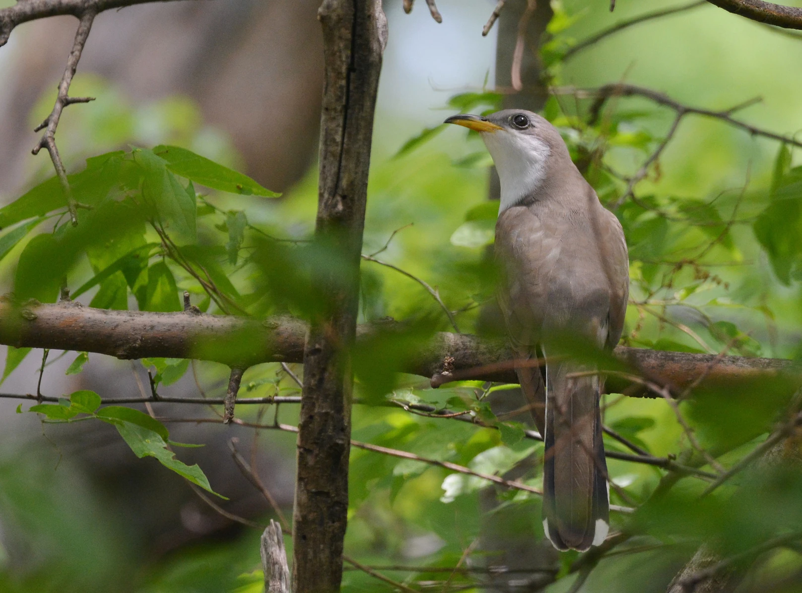
Adult Yellow-billed Cuckoo. Photo: Andy Reago and Chrissy McClarren/Flickr (CC-BY-2.0)

Prolonged drought within the project area and heavy regional reliance on groundwater pumping has caused a reduction in surface water supply, resulting in a decrease in project efficiency and loss of wildlife habitat. 

Implementation of these programs and projects will benefit Rio Grande Project farmers, residents within the counties of Doña Ana and Sierra in New Mexico, and El Paso County in Texas, as well as the Republic of Mexico. These communities are identified as socioeconomically disadvantaged and vulnerable to climate change based on the Climate and Economic Justice Screening Tool.

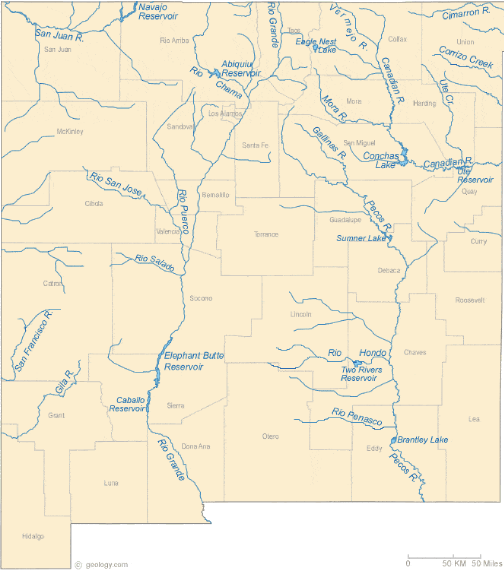
Rio Grande and Pecos River basins. Map credit: By Kmusser – Own work, Elevation data from SRTM, drainage basin from GTOPO [1], U.S. stream from the National Atlas [2], all other features from Vector Map., CC BY-SA 3.0, https://commons.wikimedia.org/w/index.php?curid=11218868

Reclamation announced $21 million from the Bipartisan Infrastructure Law for endangered species recovery and conservation in the #ColoradoRiver Basin #COriver #aridification

“Biologists weighing, measuring and tagging endanged fish pulled from the decades-old Old Charley water control structure, Ouray National Wildlife Refuge, Utah.” – Reclamation photo by David Speas.

Click the link to read the article on the Bureau of Reclamation website:

May 3, 2024

WASHINGTON – The Bureau of Reclamation today announced a $21 million investment from President Biden’s Investing in America agenda for endangered species recovery and conservation in the Colorado River Basin. Project funding from the Bipartisan Infrastructure Law will support the Upper Colorado River Endangered Fish Recovery Program, the San Juan River Basin Recovery Implementation Program and the Lower Colorado River Multi-Species Conservation Program.

“This funding from the Bipartisan Infrastructure Law will aid us in fulfilling our mission of safeguarding and responsibly managing water resources,” said Commissioner Camille Calimlim Touton. “With this investment, each of our programs will have the opportunity to advance initiatives aimed at protecting species affected by drought, contributing to environmental sustainability.”

The Upper Colorado River Endangered Fish Recovery Program and San Juan River Basin Recovery Implementation Program work to recover endangered and threatened fish in the Upper Colorado River Basin while water development proceeds in accordance with Federal and state laws and interstate compacts. The Lower Colorado River Multi-Species Conservation Program was created to balance the use of the Colorado River water resources in Arizona, California and Nevada with the conservation of native species and their habitats.

The selected projects are:

  • Colorado: $1.2 million for the Upper Colorado River Endangered Fish Recovery Program to design a fish exclusion feature at Lake Catamount, roughly 8.5 miles south of Steamboat Springs. The feature will prevent nonnative Northern pike from escaping downstream to critical habitat for threatened and endangered fish in the Yampa River.
  • Utah and Colorado: $2.6 million for the Upper Colorado River Endangered Fish Recovery Program to address needed repairs that will improve performance and efficiency at the Ouray National Fish Hatchery’s Grand Valley and Randlett units in Colorado and Utah, respectively, and enhance production of threatened and endangered fish for stocking purposes at Wahweap State Hatchery in Utah. Utah: $1 million for the Upper Colorado River Endangered Fish Recovery Program to replace the water control structure at Old Charley Wash, a floodplain wetland near the Green River that provides habitat for rearing threatened and endangered fish.
  • New Mexico: $5.2 million for the San Juan River Basin Recovery Implementation Program to design and construct a fish passage structure on the San Juan River roughly 17 miles west of Farmington, New Mexico. The structure would allow threatened and endangered fish to migrate upstream beyond an Arizona Public Service Company diversion weir that currently limits fish passage.
  • Arizona, California: $10 million for the Lower Colorado River Multi-Species Conservation Program to build rearing ponds for native fishes at the Yuma Meadows Conservation Area.
  • Arizona: $1 million for the Glen Canyon Dam Adaptive Management Program to study fish entrainment at Glen Canyon Dam.

This funding builds on a previous $20 million investment announced in 2022 for environmental projects.

Through the Bipartisan Infrastructure Law, Reclamation is investing $8.3 billion over five years for water infrastructure projects, including rural water, water storage, conservation and conveyance, nature-based solutions, dam safety, water purification and reuse, and desalination. Since Bipartisan Infrastructure Law was signed, Reclamation has announced more than $3 billion for more than 440 projects.

Palisade High School Fish Hatchery releases 1,000th razorback sucker into #ColoradoRiver — The #GrandJunction Daily Sentinel #COriver

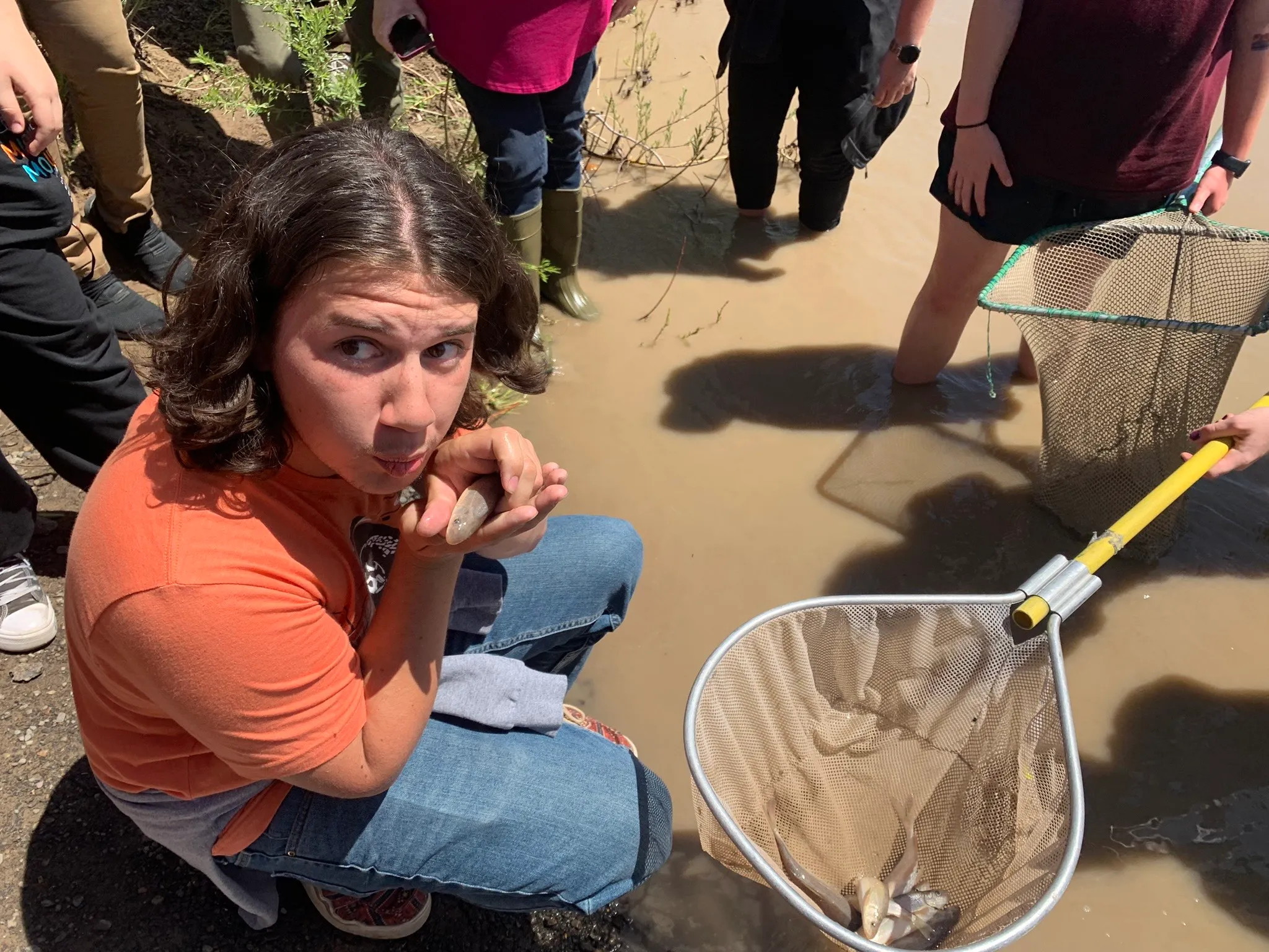
Students from Palisade High School kissed good-bye to hatchery-raised juvenile razorback suckers before releasing them into the Colorado River last month (May 2023). The fish are listed as endangered under the Endangered Species Act, but populations have recovered enough that U.S. Fish and Wildlife Service has proposed to downlist them to threatened. CREDIT: HEATHER SACKETT/ASPEN JOURNALISM

Click the link to read the article and for the photos on The Grand Junction Daily Sentinel website (Nathan Deal). Here’s an excerpt:

May 4, 2024

The Palisade High School Endangered Fish Hatchery program hosted its fourth annual razorback sucker release Friday at Riverbend Park. Students in the program, partnering with the U.S. Fish and Wildlife Service, released 370 razorback suckers into the Colorado River — a single-year record for the program — to surpass 1,000 fish released in the past four years. Many of the fish released, as always, received smooches before being released into the river, as is PHS Endangered Fish Hatchery tradition.

“Our fish release days are always kind of bittersweet. We definitely grow attached to our fish like our pets, so we’re excited to release them, but at the same time, we’re going to miss seeing them every day,” said Palisade Fish Hatchery Teacher Patrick Steele. “We know this is what we’ve been working all year for. The whole purpose of this is to help to recover this population of endangered razorback suckers. When you get to this point, it’s exciting.”

In blow to green groups, Ninth Circuit upholds federal plan for #ColoradoRiver dam — #Utah News Dispatch #COriver #aridification

A high desert thunderstorm lights up the sky behind Glen Canyon Dam — Photo USBR

by Alanna Mayham, Utah News Dispatch
April 28, 2024

(CN) — Conservationists lost an appeal to the Ninth Circuit on Wednesday as they attempted to force the federal government to reconsider climate change studies in managing the Glen Canyon Dam and Colorado River.

Save the Colorado, Living River and the Center for Biological Diversity initially asked the U.S. Department of the Interior to consider emerging climate science and the severe potential of climate change in updating its management plan in 2016 for the Glen Canyon Dam on Lake Powell, which has a water level 3,564 feet above sea level. Experts say the dam will lose hydropower if the water level drops below 3,490 feet.

During the groups’ February appeal hearing, Chief U.S. Circuit Judge Mary Murguia and U.S. Circuit Judge Anthony Johnstone, both Joe Biden appointees, questioned whether the Interior’s absent response violated the National Environmental Policy Act itself and scrutinized the Interior’s historical water flow modeling.

However, neither of the judges’ skepticisms outweighed their conclusion that the Interior did not violate environmental law when developing its 20-year plan for managing water releases from the dam or the plan’s accompanying environmental analysis.

“Appellants contend that Interior impermissibly elevated hydroelectric power generation in its purpose and need statement. We disagree,” the panel wrote in the unpublished memorandum.

The Bureau of Reclamation and the National Park Service, two sub-agencies of the Interior, eventually developed and considered seven alternative plans to manage water releases from Lake Powell through the Glen Canyon Dam. But the agencies ignored alternative proposals that the conservationists say better account for future climate change.

The conservationists sued in 2019, four months after sending the Interior a letter detailing new research, which still hasn’t been answered. In December 2022, a federal judge sided with the Interior in a summary judgment finding the groups didn’t prove the federal agency hadn’t analyzed the effects of climate change.

U.S. Circuit Judge Michael Hawkins, a Bill Clinton appointee, joined Judges Murguia and Johnstone in denying the groups’ appeal.

The panel found that the Interior selected a management plan that adequately juggled its obligations under the Grand Canyon Protect Act of 1992 with other relevant regulations, such as the Colorado River Storage Project Act of 1956.

The judges explained how the groups’ proposals would have either reduced or eliminated hydropower generation at the dam or run afoul of the long-term management plan’s limited purpose: to create monthly, daily and hourly water release schedules.

And since the Interior’s plan controls the timing of water releases from the dam — not the volume of water it must release annually — the panel ruled that the Interior “reasonably focused its climate-change analysis on comparing the performance and effect of each of the seven alternatives under various climate change conditions, rather than providing a full-fledged assessment of water availability in the Colorado River Basin.”

By ignoring the groups’ demand for a supplemental environmental analysis, the panel decided, the Interior made a harmless error.

“Because there is no indication that the studies contain information ‘not already considered’ or that would ‘materially affect the substance of [Interior’s] decision’ regarding the timing of water releases from Glen Canyon Dam, no prejudice resulted from Interior’s failure to respond to appellants’ letter.”

In an email on Wednesday, Center co-founder Robin Silver acknowledged the loss while indicating that the organization’s fight against federally operated dams is far from over.

Silver wrote, “We lost. But operations of Glen Canyon Dam still need to be modified, whether it’s by prevention of the movement of exotic fish (mostly bass) through the dam, and the dam’s dysfunction owing to the river outlet works falling apart resulting in the increasing need to use the penstocks which will further increase movement of exotic fish thus jeopardizing downstream native fish further.”

“Stay tuned,” he added, “there will obviously be more litigation as BuRec continues to ignore River health to provide for subsidized power production.”

This article was first published by Courthouse News Service and is republished under their terms of use.

Utah News Dispatch is part of States Newsroom, a nonprofit news network supported by grants and a coalition of donors as a 501c(3) public charity. Utah News Dispatch maintains editorial independence. Contact Editor McKenzie Romero for questions: info@utahnewsdispatch.com. Follow Utah News Dispatch on Facebook and Twitter.

#Wyoming stakeholders nudge feds in opposing directions on sage grouse #conservation plan — @WyoFile

Sunrise Ceremony

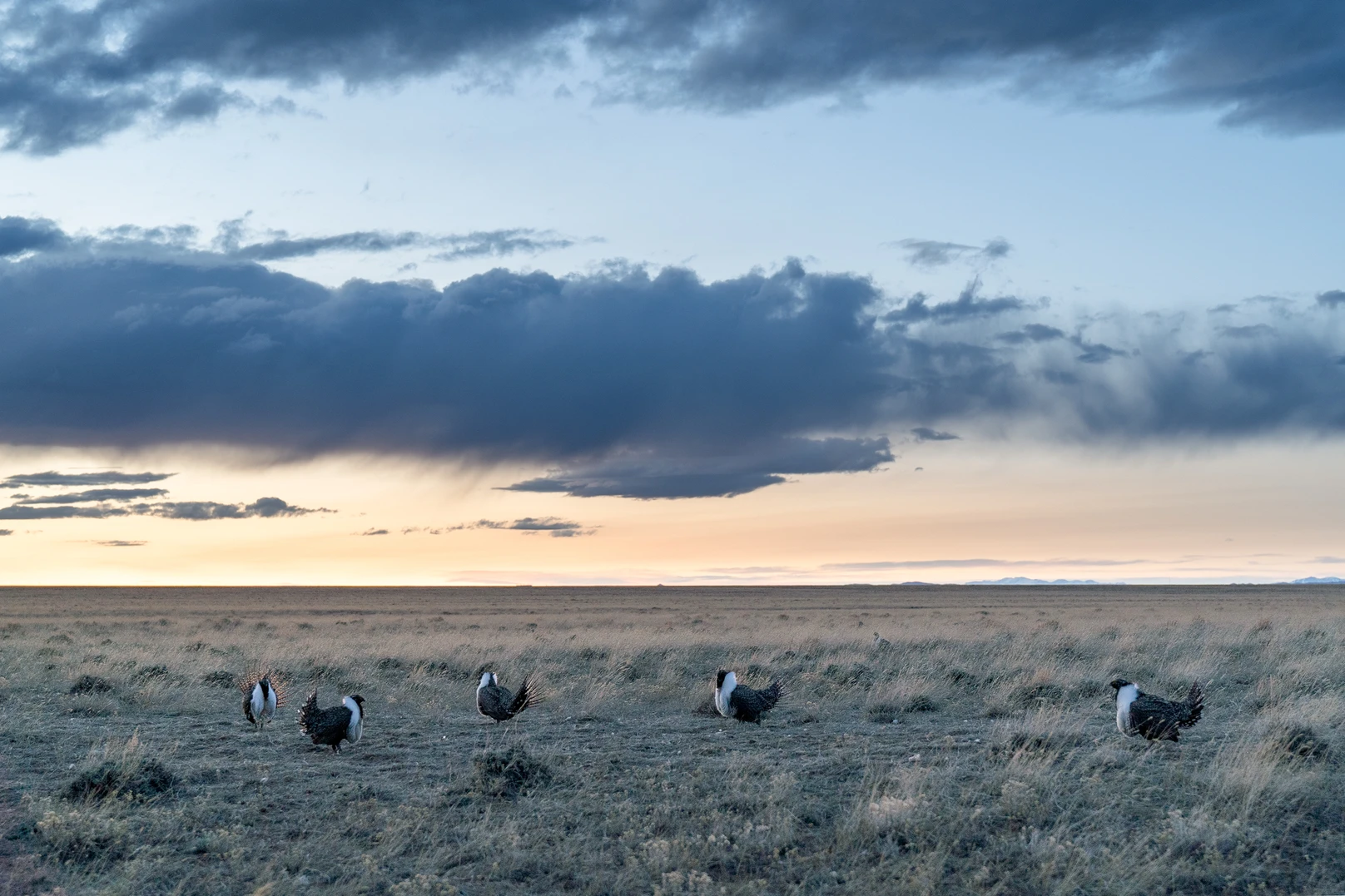
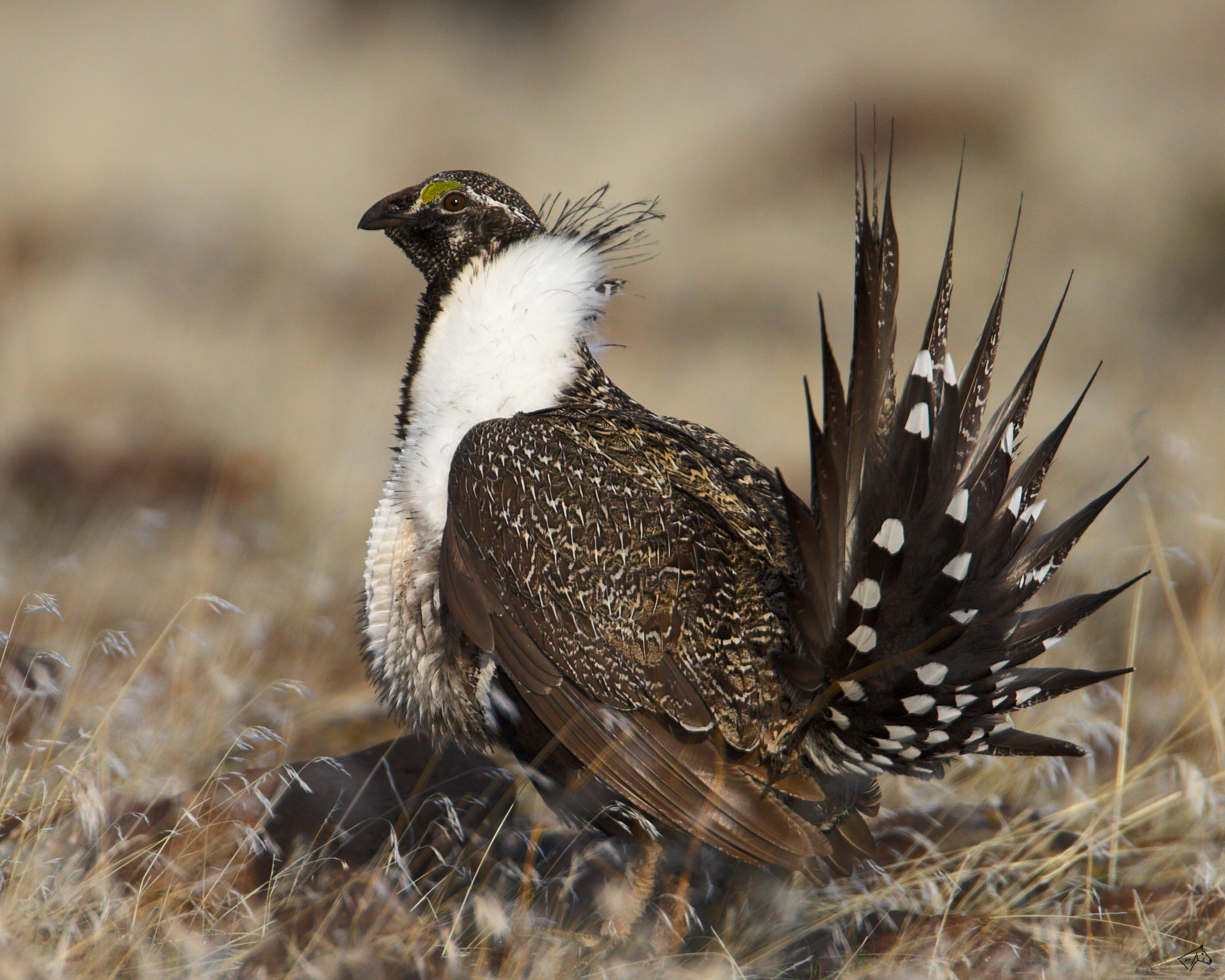
The courtship ritual performed by the sage-grouse, the icon of western North America’s sagebrush plains, is one of nature’s most dramatic. Males woo hens at display sites, called leks, fanning their tails and inflating their breast sacs. For decades, The Nature Conservancty has worked with ranchers and energy and mining companies to protect the grouse’s stage in the sage. GREATER SAGE-GROUSE © Charlie Hamilton James

Click the link to read the article on the WyoFile website (Dustin Bleizeffer):

April 26, 2024

Embracing the state’s decades of collaboration, federal officials have found more agreement than outrage in response to a pending plan to protect the iconic western bird.

As home to about 38% of the planet’s remaining greater sage grouse — far more than any other state or province — and the architect of key conservation measures, Wyoming has a lot to gain or lose from upcoming changes to the complex, multi-agency matrix of rules and regulations governing management of the imperiled bird and its habitat. 

Those stakes were top of mind Wednesday evening for Natrona County rancher Doug Cooper and others who attended a BLM information session on the agency’s recently released draft management plan for sage grouse habitat

“When you say ‘conservation,’ it sounds wonderful,” Cooper said. “But I’m not sure ‘conservation’ is going to mean just that when we get down on the ground.”

Similar questions bubbled up for the dozen residents trying to make sense of the latest developments in what has been a whipsaw of approaches between Republican and Democratic administrations. Does the pending plan account for sage grouse predation from ravens and magpies? Is livestock grazing considered a harmful practice that might come under new restrictions in sage grouse habitats? And how might restrictions on federal lands impact grazing and oil and gas development on adjacent private property?

Natrona County rancher Doug Cooper poses a question to Bureau of Land Management officials April 24, 2024 in Casper. (Dustin Bleizeffer/WyoFile)

Not only is the bird’s future at stake, but it serves as an indicator for 350 other species that rely on a sprawling sage-steppe ecosystem that also supports rural economies in Wyoming and throughout much of the West. If the sage grouse is in peril, so are myriad other species and rural economies, according to proponents. The future of the species and its habitat also has major implications for the oil and gas industry, which frequently targets minerals underlying the sage grouse’s habitat in Wyoming. 

The agency is soliciting public comments through June 13 on its draft environmental impact statement. After weighing that input, the BLM will issue a final rule for how it will manage sage grouse habitat in 10 western states, including the species’ stronghold in Wyoming.

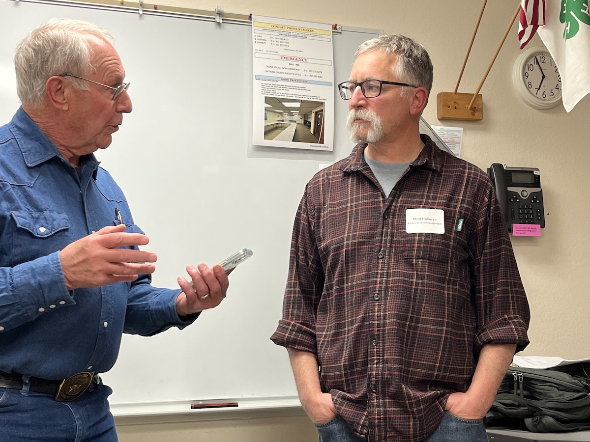
“It is extremely important to get your guys’ feedback and ideas on how this plan can be improved,” BLM Wyoming Sage Grouse Coordinator Matt Holloran said.

Holloran, a wildlife biologist who has led myriad sage grouse studies, explained that the draft plan includes several aspects of the agency’s 2015 and 2019 plans while incorporating new scientific data and accounting for mounting pressures on the bird’s habitat from climate change, invasive plant species and wildfire.

The draft plan includes six alternative approaches, ranging from very stringent conservation measures to no change in current management. The BLM’s “preferred” option is Alternative 5, which mostly aligns with Wyoming’s own evolving management strategies implemented by executive order under recent governors.

Bureau of Land Management Wyoming Sage Grouse Coordinator Matt Holloran (right) visits with a Natrona County resident April 24, 2024 in Casper. (Dustin Bleizeffer/WyoFile)

That alignment with state policy has likely contributed to stakeholders across the spectrum in Wyoming expressing cautious, but caveated, optimism since the BLM published the draft plan in March

Sage grouse conservation in Wyoming

The BLM manages 18 million surface acres and about 43 million acres of subsurface minerals in Wyoming. Although the agency does not manage wildlife, it does manage wildlife habitats, giving it an outsized influence on the state’s bedrock energy, recreation, wildlife and agriculture industries.

When conservation groups in the early 2000s sounded alarms about declining sage grouse populations, state leaders sprung into action fearing economy-endangering federal action, including a potential listing under the Endangered Species Act. Wyoming has earned accolades since for being the first state to voluntarily take on greater sage grouse protections — both a proactive drive for conservation and in defense of ongoing agriculture and oil and gas development.

In some instances, the state’s protections go further than the federal government’s, including a maximum 5% disturbance threshold for industrial activity in sage grouse “core areas.” So far, Wyoming is the only western state with a disturbance threshold that also takes wildfire impacts into account.

How the 5% calculation is made, however, is important. Some critics have alleged that some core area boundaries are simply made larger to allow for more disturbance.

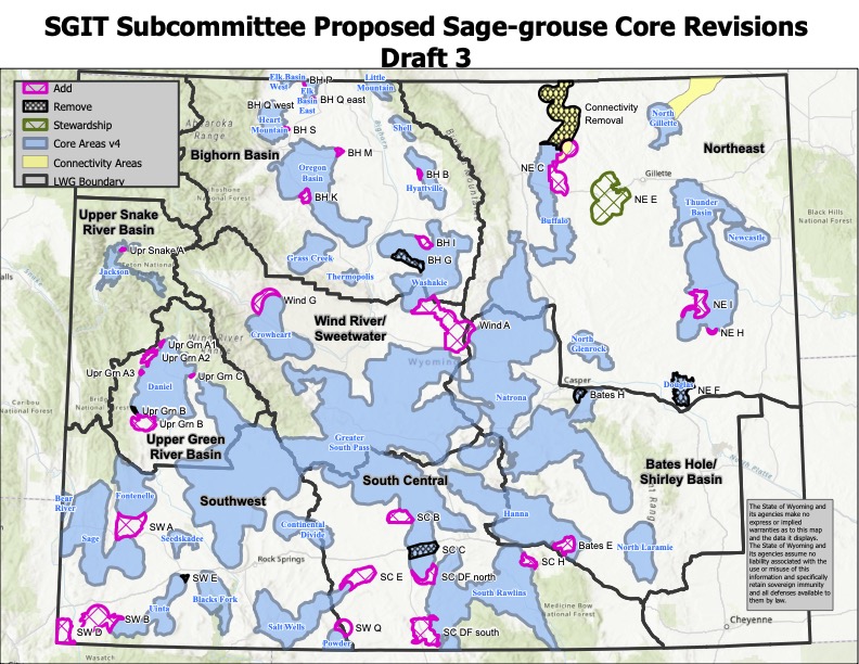
The gubernatorial-appointed Sage Grouse Implementation Team is considering adding tens of thousands of acres of protective “core area,” along with some retractions, to the state map. Proposed changes are outlined here. (Sage Grouse Implementation Team)

So far, the BLM management strategies align with Wyoming’s, which are prescribed in its sage grouse core areas plan and overseen by the Sage-Grouse Implementation Team.

Following Wyoming’s lead, the BLM proposes to maintain livestock grazing within core areas — mostly considered an insignificant impact and, in some cases, beneficial to sage grouse, according to state and federal documents. Although the BLM’s preferred alternative doesn’t include major changes to grazing, it does further define poor grazing practices that would be restricted in sage grouse management areas, according to local BLM officials.

Stakeholder responses

Oil and gas industry officials in Wyoming have tentatively expressed hope for a workable federal approach to conserving sage grouse and its habitat. Notably, the BLM’s preferred alternative does not include new leasing restrictions for oil and gas.

Conservation groups, however, want the BLM to include the use of a special wildlife habitat designation — Areas of Critical Environmental Concern — which would prohibit industrial activities. They point to a 2021 U.S. Geological Survey study that shows sage grouse populations have declined 80% throughout the West since 1965, and that even with recent conservation measures the species’ population is still expected to decline.

Responding to a question Wednesday, the BLM’s Holloran said the agency takes the species’ cyclical population into account. “What you see is those lows keep getting lower and the highs are not as high,” he said.

The Petroleum Association of Wyoming says it will push back against calls to include stringent habitat designations such as Areas of Critical Environmental Concern.

“Alternative 5 is the best option presented, but there is still work to be done,” PAW Vice President Ryan McConnaughey told WyoFile via email. “We appreciate the BLM’s willingness to take a measured approach and will work through the comment process to share our concerns.”

Reached for comment, Gov. Mark Gordon’s office referred to earlier statements regarding the BLM’s draft plan.

“While more analysis of this is needed,” Gordon said in March, “the first pass shows the BLM picked a preferred alternative that will allow for detailed comments that specifically [address] Wyoming’s  concerns, including that the preferred alternative does not propose Areas of Critical Environmental Concern (ACEC) on top of our state identified core areas.”

Visit this BLM website for more information regarding the draft plan and how to comment.

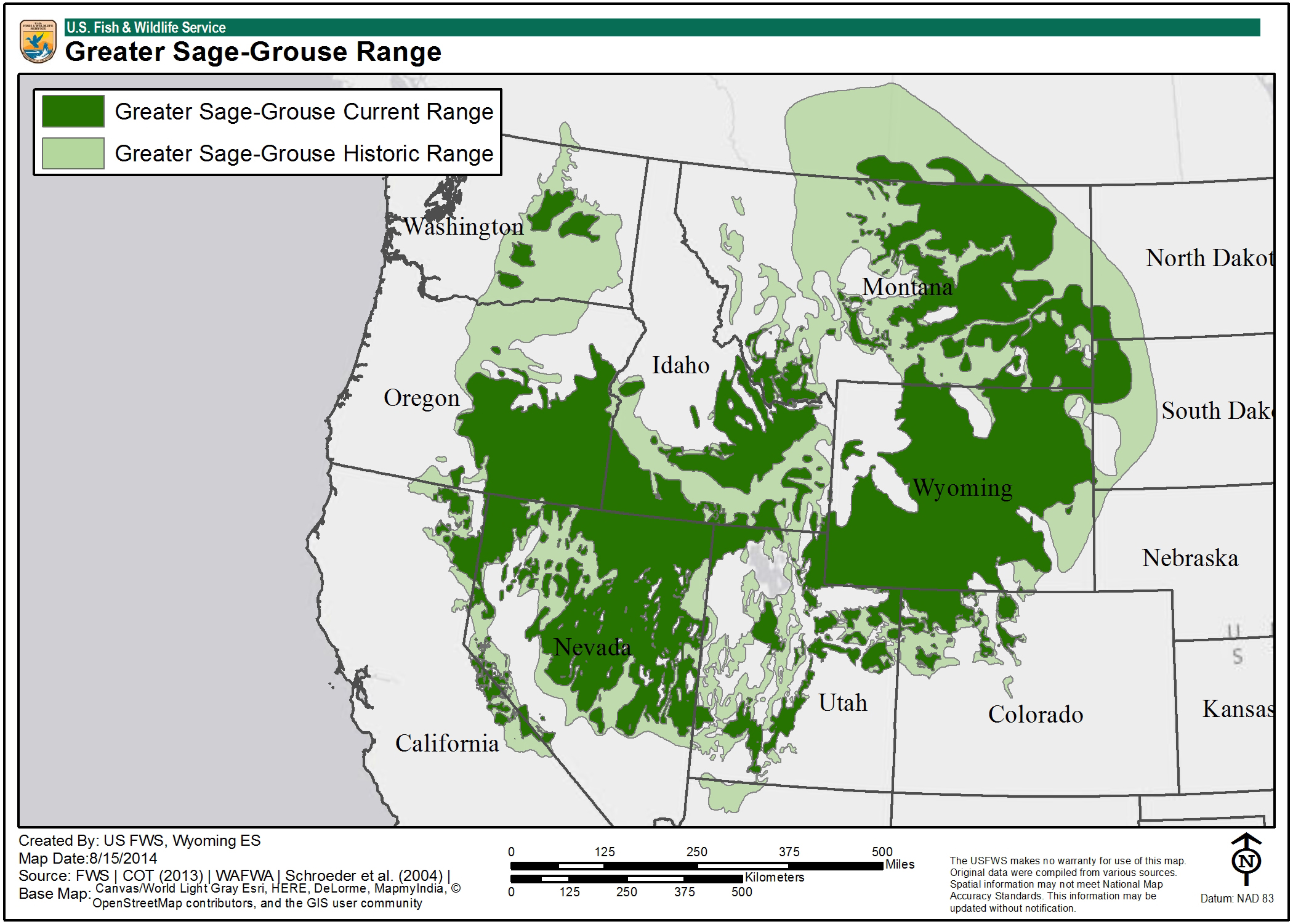
Greater sage grouse range map via the USFWS.

U.S. Bureau of Land Management #conservation rule likely to survive challenges, advocates say — @WyoFile

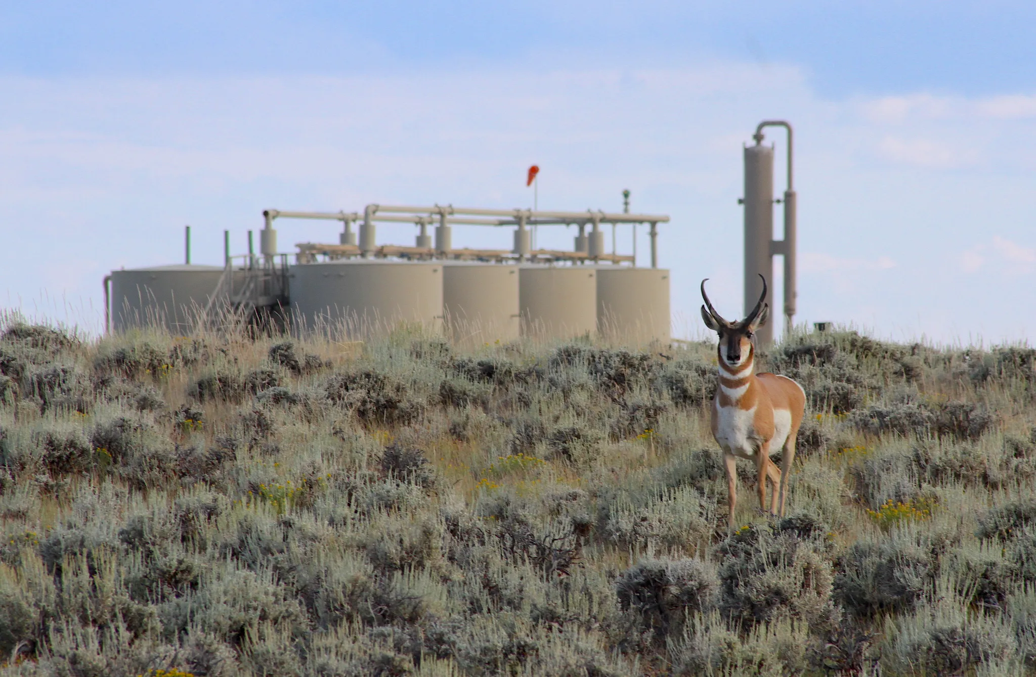
A Sublette Herd pronghorn sizes up an intruder in its habitat within the confines of Jonah Energy’s Normally Pressured Lance gas field in August 2023. (Mike Koshmrl/WyoFile)

Click the link to read the article on the WyoFile website (Angus M. Thuermer Jr.):

April 22, 2024

A federal rule to put conservation on par with extractive industries will not be subject to the Congressional Review Act that could allow it to be easily overturned, a U.S. representative from New Mexico said Monday.

The Bureau of Land Management has drawn criticism from Wyoming’s governor, its D.C. delegation, industrial leaders and agricultural interests after finalizing the Public Lands Rule last week. But a coalition of conservationists defended the BLM in a press call Monday organized by the Conservation Lands Foundation and The Wilderness Society.

The rule will allow the BLM to consider “mitigation restoration leasing” equally with other uses like grazing, mining and oil and gas development.

The rule identifies conservation tools to keep natural landscapes intact and restore them where degraded, a move advocates say marks a shift from what the BLM has considered or ignored when setting frameworks for use of its 18.4 million acres in Wyoming.

Although Republican U.S. Sen. John Barrasso, a staunch advocate for the energy industry, has said he would use the Congressional Review Act to block the rule, U.S. Rep. Melanie Stansbury, a Democrat from New Mexico, said that’s not going to happen.

The review act, successfully employed by former U.S. Rep. Liz Cheney to block another BLM planning effort in 2017, is subject to time limits and deadlines that make its successful use improbable in this instance, Stansbury said. “This rule being finalized now should protect it from a rollback by Congress,” she said. “It should be fine in terms of making it ineligible for Congressional Review Act repeal.”

Wyoming native Jordan Schreiber, a lobbyist for The Wilderness Society, said she was “very confident” about defending the rule. “I’m not losing sleep over it,” she said of congressional discomfort.

A durable measure

To thwart the rule, Barrasso last year introduced a bill that targets the BLM initiative. Nine senators, including U.S. Sen. Cynthia Lummis, another Republican, joined as sponsors. The bill has not advanced.

Industrial users also have challenged the plan, as has Gov. Mark Gordon, who questioned the constitutionality of the BLM action. The Petroleum Association of Wyoming called it “a new, extra-legal, executive branch authority.” That suggests lawsuits will be filed.

BLM supporters said the rule will survive such legal challenges. “We are confident that the rule will prove durable over time and we intend to strongly defend the rule … in the courts,” said Michael Carroll, BLM campaign director with The Wilderness Society.

The Sand Dunes Wilderness Study Area encompasses 27,000 acres of BLM land in the Red Desert. There, people can hike, bird watch and hunt. (Bob Wick/BLM/FlickrCC)

New Mexico’s Stansbury also dismissed misinformation. “This is not a land grab,” she said, blaming Republicans for inaccurate spin.

“This is not an attempt by the federal government to take away activities on public lands,” including utilizing resources “that we use in everyday life,” Stansbury said. “This is really about modernizing the way that we do land management. It’s about putting conservation and cultural uses on par with extractive uses.”

Congress stated that the BLM “should not emphasize the greatest short-term economic element,” when outlining how to manage its 30% of Wyoming’s land and 245 million acres nationwide, said Chris Winter, a professor at the University of Colorado Law School. The U.S. 10th Circuit Court of Appeals has said that “conservation to protect environmental balance” is one of the uses the BLM must weigh along with oil and gas development, grazing and so on, Winter said.

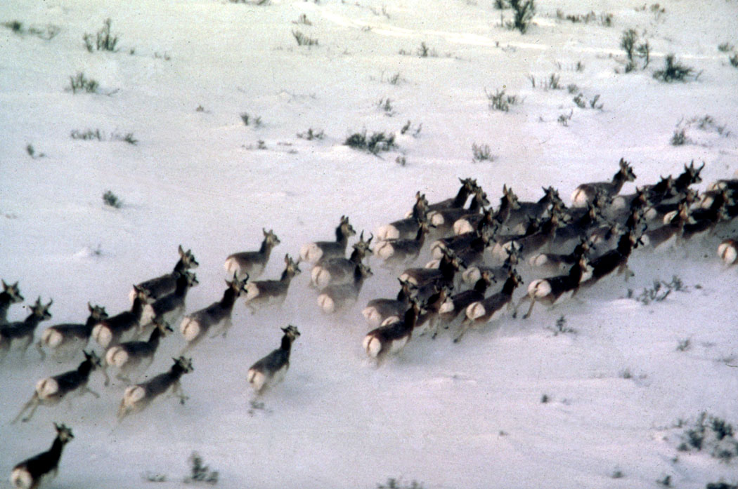
Lander resident Bailey Brennan, an attorney and farmer, said her 3-year-old daughter has been with her on three pronghorn hunts on public lands, all possible because of intact migration corridors. With the rule, restoration leases will allow the National Wildlife Federation she works for to help fight cheatgrass and restore riparian areas along those routes.

That type of work will ensure daughter Frances could have the same pronghorn hunting experience “when she is a grown-up with her children,” Brennan said.

New #ColoradoRiver proposals put environmental needs front and center in deciding river’s future — Fresh Water News #COriver #aridification

Colorado River. Photo credit: Abby Burk via Audubon Rockies

Click the link to read the article on the Water Education Colorado website (Shannon Mullane):

April 17, 2024

Environmental groups and water experts say the U.S. Bureau of Reclamation should give nature a say in how it manages the Colorado River for years to come.

In March, seven states, including Colorado, released two competing proposals for how to manage two enormous reservoirs in the Colorado River Basin and make painful decisions about cutting back on water use once current operating rules expire in 2026.

But they’re not the only ones throwing out ideas: Water experts and environmental advocates have submitted two proposals of their own. They want to make sure endangered fish, Grand Canyon ecosystems, and more aren’t left out of the conversation.  

The experts hope their proposals, which highlight changing climate data and environmentally focused reservoir releases, help inform the Bureau of Reclamation’s final report for how the river should be managed after 2026. A draft of that report is expected in December.

“If you don’t care about the environment, then the whole system crashes,” said John Berggren, a regional policy manager with Western Resource Advocates. “That’s not to say the environment takes priority over water supply and other issues, but rather they can be integrated.”

The current operating rules, established in 2007, focus on how water is stored in Lake Powell on the Utah-Arizona border, released to Lake Mead on the Nevada-Arizona border, and then released to millions of water users in the Lower Basin states of Arizona, California and Nevada.

Together, lakes Powell and Mead make up about 92% of storage capacity, about 58.48 million acre-feet, in the Colorado River Basin. Both are about one-third full.

One acre-foot roughly equals the annual water use of two to three households.

High-stakes negotiations stalled early this year with states at loggerheads over how to share water cuts. The four Upper Basin states — Colorado, New Mexico, Utah and Wyoming — only included cuts to the Lower Basin’s water use, although the states promised to pursue voluntary conservation programs. The three Lower Basin states called on all seven states to make cuts when the amount of available water falls below 38% of the total capacity in seven federal reservoirs.

Several tribal nations submitted their own proposal to advocate for tribal water rights in the federal process.

These proposals have the potential to impact water users across the basin, which provides water to 40 million people, more than 5 million acres of farmland, two states in Mexico, and cities including Los Angeles, Las Vegas, Phoenix and Denver.

One perspective all of the proposals have in common: The status quo operations aren’t going to work in the future.

“We need to use less water, and there’s going to be shortages for the Colorado River going forward,” Berggren said. “We wanted ours to focus more on how to integrate environmental considerations regardless of who’s taking shortages.”

Giving nature a seat at the table

Neither proposal from the basin states places a heavy emphasis on incorporating environmental concerns into how lakes Powell and Mead are managed, and there are plenty of environmental hotspots in the basin.

The Grand Canyon sits below Lake Powell, and its ecosystems and landscape can be helped or hurt by the reservoir’s releases. In 2011, water officials released an 11 million-acre-foot surge of water into the canyon — the right amount of water according to the current rules — that was too big and ended up eroding sandbars where people camp and view the national park. That sand is hard to replace since most of the Colorado River’s sediment is trapped in Lake Powell.

The Upper Colorado River Endangered Fish Recovery Program is trying to boost endangered fish populations in the face of growing numbers of predatory, invasive fish. The Salton Sea in California is shrinking, exposing dry shorelines with toxic dust particles to the wind. The once-vibrant ecosystem in the Colorado River Delta, where the river meets the Gulf of California, is now diminished.

With these areas in mind, one environmental proposal advocates for linking environmental priorities to how the reservoirs operate. It also suggests using updated climate data, in addition to reservoir storage, to determine releases from lakes Mead and Powell.

This proposal was put forward by Western Resource Advocates, Audubon, American Rivers, Environmental Defense Fund, The Nature Conservancy, Trout Unlimited and the Theodore Roosevelt Conservation Partnership.

Since 2007 under the current guidelines, when the water in lakes Mead and Powell dropped to pre-decided water levels, officials knew to release a predetermined amount of water.

Another environmental proposal suggests a more flexible approach: On an annual basis, the secretary of the Interior would decide how much water to release from Lake Powell based on the environmental, recreational, water supply and hydropower goals for that year — rather than using a fixed rule for years to come.

This adaptive-management proposal was submitted by well-recognized Colorado River experts Jack Schmidt, former chief of the federal Grand Canyon Monitoring and Research Center; Eric Kuhn, former Colorado River District general manager and author of “Science be Dammed”; and Kuhn’s co-author John Fleck, a journalist-turned academic at the Utton Transboundary Resources Center at the University of New Mexico School of Law.

“What I have learned in a 40-year career in the Grand Canyon is that scientific understanding evolves, changes and improves,” said Schmidt, currently the director of the Center for Colorado River Studies at Utah State University. “Going forward, we’re making a mistake to define hard and fast rules for what the releases from Lake Powell to Lake Mead would be.”

Big ideas and key questions

Environment and water experts say they are mainly trying to elevate their concerns and the role of nature in the federal process. When it comes to the nitty-gritty, however, each of the proposals raises some key questions for other Colorado water experts.

The joint environmental proposal, which Berggren helped with, identifies several environmental hotspots, like the Grand Canyon, Salton Sea and endangered fish programs, and proposes incorporating them into how lakes Mead and Powell are managed in the future.

For example, the post-2026 operating rules could include minimum flows from Powell into the Grand Canyon of 4.34 million acre-feet per year to ensure that ecosystems, from the lower canyon’s Sonoran Desert to the North Rim’s coniferous forest, stay healthy.

“You incorporate environmental considerations, and suddenly you have a more healthy, flowing Colorado River, which allows the basin states to have a more reliable water supply,” Berggren said.

But incorporating so many different environmental concerns in one document was a big “red flag” for Jennifer Gimbel, a senior water policy scholar at the Colorado Water Center and former deputy commissioner for the Bureau of Reclamation.

How officials manage each of these environments is tied to years of work by programs, rulemaking documents, legislation and more. Reservoir releases that aim to help the environment are often wrapped into established rules that govern how each reservoir operates.

“That is one scary document if we’re looking at how to manage everything on the river,” Gimbel said. “I’m not sure how practical they are with trying to move that forward.”

The environmental groups’ joint proposal also suggested that officials look at both total reservoir storage and updated climate data to guide operations at lakes Mead and Powell.

The climate data would come from a federal three-year climate model that factors in temperature, precipitation, snow and more to guide operations at lakes Mead and Powell. The total reservoir storage would be based on the amount of water stored in seven reservoirs, including federal reservoirs in the Upper Basin such as Flaming Gorge, Blue Mesa and Navajo reservoirs. That’s similar to the Lower Basin states’ proposal.

Considering both factors together would help avoid unreliable forecasting and adjust to changing conditions, according to the proposal. Upper Basin reservoirs would help with calculations but would not be used to move water from one reservoir to another, Berggren emphasized.

But including Upper Basin reservoirs in how lakes Mead and Powell operate is a flashpoint in the Colorado River negotiations.

Officials like Becky Mitchell, Colorado’s top Colorado River negotiator, have been fighting attempts to include these reservoirs in the operations for Lake Powell and Lake Mead. Flaming Gorge and Blue Mesa, Colorado’s largest reservoir, had to release water to boost Lake Powell’s historically low water levels in 2021, and then Flaming Gorge released more in 2022.

“These reservoirs are not intended to protect Lake Mead or provide for additional Lower Basin supply, but are for Upper Basin uses and environmental flows, among other purposes,” Mitchell said in a written statement, adding that her team was still analyzing the proposal. “They are also essential to the success of the recreational and tourist economies in the region.”

Considering both factors together would help avoid unreliable forecasting and adjust to changing conditions, according to the proposal. Upper Basin reservoirs would help with calculations but would not be used to move water from one reservoir to another, Berggren emphasized.

But including Upper Basin reservoirs in how lakes Mead and Powell operate is a flashpoint in the Colorado River negotiations.

Officials like Becky Mitchell, Colorado’s top Colorado River negotiator, have been fighting attempts to include these reservoirs in the operations for Lake Powell and Lake Mead. Flaming Gorge and Blue Mesa, Colorado’s largest reservoir, had to release water to boost Lake Powell’s historically low water levels in 2021, and then Flaming Gorge released more in 2022.

“These reservoirs are not intended to protect Lake Mead or provide for additional Lower Basin supply, but are for Upper Basin uses and environmental flows, among other purposes,” Mitchell said in a written statement, adding that her team was still analyzing the proposal. “They are also essential to the success of the recreational and tourist economies in the region.”

The three water experts’ proposal says the post-2026 rules should include instructions on how to reduce water use when available water is unusually low. But the rules should not include prescriptive annual releases from Lake Powell.

“Because the science on which those rules were developed is going to change in the next 20 years, and then you’re going to have to renegotiate the whole damn thing again,” Schmidt said.

Instead, the annual releases from Powell can fluctuate, as long as they comply with water law. For example, instead of releasing too much water from Powell because the rules say so — and harming the Grand Canyon’s landscape in the process — the Secretary of the Interior could have more flexibility to decide how much water to release.

Deciding releases annually, instead of setting up fixed rules, has caused other water officials to balk, according to Schmidt.

“I have already had behind-the-scenes, off-the-record conversations with some state people, and they basically said, ‘you’re out of your mind. We need certainty,’” he said.

But if water managers do not create rules that are flexible enough to adapt to changing conditions in the river basin, they will continue to run into problems, Schmidt said.

“How do you incorporate flexibility in a water supply negotiation that seeks certainty?” he said. “That is the fundamental problem.”

Map credit: AGU

America’s Most Endangered Rivers of 2024 — @AmericanRivers

Ten rivers. Ten solutions. Ten opportunities to protect the rivers on which all life depends. America’s Most Endangered Rivers® of 2024 shines a spotlight on threats to clean water, and how pollution impacts to our health and our communities.

#1: Rivers of New Mexico New Mexico is the state hardest hit by a recent Supreme Court ruling that slashed protections for streams, threatening drinking water sources and livelihoods across the state.

#2: Big Sunflower and Yazoo Rivers A massive pumping project would impact thousands of acres of wetlands vital to wildlife and the Mississippi Delta ecosystem.

#3: Duck River The drinking water source for 250,000 people and one of the richest rivers for biodiversity is threatened by excessive water withdrawals.

#4: Santa Cruz River This symbol of restoration and resilience is threatened by climate change and water scarcity.

#5: Little Pee Dee River A major highway project is putting clean water and wildlife habitat at risk.

#6: Farmington River A hydropower dam is threatening fisheries and harming water quality in this important drinking water source.

#7: Trinity River This important tributary to the Klamath River is at risk from excessive water withdrawals, threatening both salmon and people.

#8: Kobuk River Road development and mining threaten clean water, wildlife, and Iñupiat culture.

#9: Tijuana River Pollution is choking the river, causing sickness, forcing beach closures, and endangering local economies.

#10: Blackwater River A proposed highway project would be a disaster for water quality and fish and wildlife habitat.

2024 #COleg: #Colorado Wetlands: Lawmakers clash as they seek state protections — Colorado Politics

Colorado River headwaters tributary in Rocky Mountain National Park photo via Greg Hobbs.

Click the link to read the article on the Colorado Politics website (Marianne Goodland). Here’s an excerpt:

April 13, 2024

This month, lawmakers looked at the dueling approaches contained in two measures seeking to implement a way for the state to manage “dredge and fill discharge” permits tied to a recent U.S. Supreme Court decision [Sackett vs. EPA] that redefined how a body of water can be protected under the Environmental Protection Agency’s “Waters of the United States” rule…Supporters of the first bill, which gives the task to the Colorado Department of Public Health and Environment, insist it’s the proper venue because it already experience dealing with permitting and water quality issues. Supporters of the second measure, which hands the responsibility to the Colorado Department of Natural Resources, maintain that the Department of Natural Resources is better equipped, since it already deals with related disciplines, such as water resource management, water rights law and land management.

In any case, policymakers agree that Colorado residents, industries and the wetlands needs certainty…Alex Funk with the Theodore Roosevelt Conservation Partnership told a legislative committee last August that almost 90% of fish and wildlife in Colorado rely on the state’s wetlands at some point during their lifecycle.  House Speaker McCluskie told the House agriculture committee on April 8 that since Sackett v. Environmental Protection Agency held that only permanent streams and rivers are protected under the federal Clean Water Act, those with a continuous surface connection to another permanent water body. That puts Colorado waters at risk, she said.  Pitkin County Commissioner Greg Poschman also noted that the state’s headwaters are made up of small streams that do not have year-round flow because they are under snowpack half the year — suggesting Sackett would put those waters at risk.

The Loss of El Vado Dam — John Fleck (InkStain.net) #RioGrande

El Vado Dam and Reservoir. Photo credit: USBR

Click the link to read the article on the InkStain website (John Fleck):

April 10, 2024

The Bureau of Reclamation’s announcement at Monday’s meeting of the Middle Rio Grande Conservancy District that it is halting work on El Vado Dam repairs raises hugely consequential questions about water management in New Mexico’s Middle Rio Grande Valley.

The short explanation for the halt is that the current approach to repairing the 1930s-era dam wasn’t working. (The meeting audio is here, though at “press time” for this blog post this week’s is not yet up.) I’ll leave it to others to suss out the technical and bureaucratic details of the repair project, and the endless finger-pointing that’s sure to ensue. My interest here is to begin to sketch out the implications here in the Middle Valley of an indefinite period – a decade or more? – without El Vado.

The Middle Rio Grande Conservancy District built El Vado (with substantial federal subsidy) in the 1930s to provide irrigation supplies by storing high spring runoff for use in summer and fall. But while its purpose was irrigation, it completely changed the Middle Valley hydrograph in ways that all the other water uses have adapted to, both human and ecosystem.

Without El Vado (or some interim replacement – see below), we should expect the Rio Grande to routinely go functionally dry in late summer unless propped up by monsoon rains, which are sporadic and unpredictable.

I see impacts in three areas, only one of which is related to El Vado’s initial purpose.

Ristras of varying pod types and ripeness. By Christopher Holden from Albuquerque, United States – Ristras, CC BY-SA 2.0, https://commons.wikimedia.org/w/index.php?curid=95944700

1: IRRIGATION

This is the obvious one. Until El Vado is repaired or some sort of replacement schemed out, irrigators should expect a high risk of low or no supply in late summer and fall. Alfalfa will remain a reliable if modest crop (it can hunker down and wait out the dry), but the few commercial operators who need a more reliable supply for their crops – think pecans and chile – will have to depend on groundwater, with all the problems that entails.

The Albuquerque, New Mexico International Balloon fiesta. (October 2007). By Danae Hurst from Albuquerque, United States – Ballooning Over Albuquerque, CC BY 2.0, https://commons.wikimedia.org/w/index.php?curid=6791765

2: MUNICIPAL SUPPLIES

Albuquerque’s use of its imported San Juan-Chama water in summer indirectly depends on El Vado. Without MRGCD water, released from El Vado, as “carriage water”, the Albuquerque Bernalillo County Water Utility has to leave its imported San Juan-Chama water parked in Abiquiu Reservoir, switching to groundwater. This is what we have done over the last few years, and our much-vaunted aquifer recovery has, as a result, stalled.

This poses a huge challenge for the Albuquerque Bernalillo County Water Utility Authority.

Rio Grande Silvery Minnow via Wikipedia

3: ENVIRONMENTAL FLOWS

The idea of an agricultural irrigation dam providing the water for environmental flows seems super weird. But that’s basically the way it’s worked for years here in the Middle Valley. Releases from El Vado, sent downstream to irrigators, provide environmental benefits along the way. For the last couple of years, without El Vado water to supplement flows in late summer, the Rio Grande has operated on a knife’s edge between flowing and dry through Albuquerque.

This poses a huge challenge for efforts to nurse the Rio Grande silvery minnow back from extinction.

Abiquiu Dam, impounding Abiquiu Lake on the Rio Chama in Rio Arriba County, New Mexico, USA. The U.S. Army Corps of Engineers constructed the dam in 1963 for flood control, water storage, and recreation. By U.S. Army Corps of Engineers, photographer not specified or unknown – U.S. Army Corps of Engineers Digital Visual LibraryImage pageImage description pageDigital Visual Library home page, Public Domain, https://commons.wikimedia.org/w/index.php?curid=2044112

STORAGE ALTERNATIVES

First and foremost, there is a fast-moving and scrambling discussion about storage alternatives.

Abiquiu Reservoir, a flood control facility on the Rio Chama built, owned, and managed by the U.S. Army Corp of Engineers, is an obvious replacement. The part in italics yields knowing nods, or perhaps grimaces, from folks who work in Middle Valley water management, because the Corps is well known for an exceedingly cautious interpretation of its statutory mandates. “Filling in as a water storage facility to replace El Vado” is only sorta barely at the edge of that mandate. Getting the Corps on board to help with this fix will be key.

Heron Lake, part of the San Juan-Chama Project, in northern New Mexico, looking east from the Rio Chama. In the far distance is Brazos Peak (left) and the Brazos Cliffs (right), while at the bottom is the north wall of the Rio Chama Gorge. By G. Thomas at English Wikipedia – Transferred from en.wikipedia to Commons., Public Domain, https://commons.wikimedia.org/w/index.php?curid=1598784

Heron Reservoir, on a Rio Chama tributary, stores San Juan-Chama water imported through tunnels beneath the continental divide. It physically can’t replace El Vado because it’s in the wrong place. But discussions have already touched on the idea of doing it on paper via accounting swaps – hold back San Juan-Chama water, let SJC customers use native Rio Grande water via an accounting swap, then deliver Heron water as if it had been El Vado water.

Downstream of Elephant Butte Dam (back in the day), water issues get even trickier. By Unknown author – http://www.usbr.gov/power/data/sites/elephant/elephant.html, Public Domain, https://commons.wikimedia.org/w/index.php?curid=1267389

Elephant Butte? Again, it’s in the wrong place, but accounting swaps here are also on the table.

INSTITUTIONAL FRAMEWORK

The most important subtext is the institutional framework behind all of this. The loss of El Vado is not solely an MRGCD/Bureau of Reclamation problem. It implicates all the Middle Valley’s water stakeholders – especially Albuquerque’s Water Utility Authority, but also the Corps of Engineers, the Fish and Wildlife Service (because of ESA issues), the state water agencies, the communities on the valley floor that have avoided responsibility for any of this by depending on the state’s obscenely permissive domestic well statute.

New Mexico Lakes, Rivers and Water Resources via Geology.com.

Audubon: New Rule for #FossilFuel Development on Federal Lands Long Overdue #ActOnClimate #KeepItInTheGround

Great Sage-Grouse. Photo: Evan Barrientos/Audubon Rockies

Click the link to read the release on the Audubon website (Jason Howe):

(Washington, DC-April 12, 2024) – The U.S. Bureau of Land Management (BLM) today announced a rule updating the cost of doing business on public lands and helping to balance the extraction of natural resources with the conservation of wildlife habitat and the preservation of landscapes sacred to Indigenous peoples.  

In addition to siting oil and gas development away from wildlife habitat and cultural  resources, the new regulations increase fees – including royalty and rental rates, and minimum bids associated with oil and gas development – bringing them in line with what many states require; and reduce so-called “speculative leasing”, where companies hold leases on land with little potential for development. 

The BLM manages 245 million acres, nearly 40 percent of U.S. public lands. The agency is charged with balancing the protection of America’s natural legacy with managing the 30 percent of the nation’s mineral wealth that lies beneath the surface. But over the past 50 years, the agency has mainly focused on extractive uses (coal, and oil and gas), applying rules governing that extraction that have been unchanged for decades. An estimated 300 bird species spend at least part of their lives there, including Burrowing Owls and the Greater Sage-Grouse, which is already under stress across much of its range.

“When BLM oil and gas leasing policy was last updated, Gerald Ford was in the White House, the Bee Gees were on the radio and a gallon of gas cost an average of 59 cents,” said Christopher Simmons, senior manager of public lands policy for the National Audubon Society. “The BLM’s approach to oil and gas leasing has been the equivalent of a polyester leisure suit – painfully outdated. This is a big step forward towards the BLM fulfilling its mission, delivering common-sense policies that balance responsible development with land and wildlife conservation.” 

For decades, oil and gas policies prioritized development on public lands over activities like hunting, fishing, birding, hiking, grazing and restoration. When oil and gas companies left behind a mess on public lands, American taxpayers were previously forced to foot the bill. Before today’s update, taxpayers could have been responsible for as much as $15 billion in clean-up costs. 

Greater sage grouse range map via the USFWS.

This new proposal for #ColoradoRiver sharing prioritizes the environment — KUNC

A bird perches upon towering mud banks left behind by a shrinking Lake Powell on July 5, 2022. A new proposal for managing the Colorado River and its reservoirs encourages states to include environmental protections as they draw up water sharing plans. Photo credit: Alex Hager/KUNC

Click the link to read the article on the KUNC website (Alex Hager):

This story is part of ongoing coverage of the Colorado River, produced by KUNC and supported by the Walton Family Foundation. It was produced in partnership with The Water Desk, an independent initiative of the University of Colorado Boulder’s Center for Environmental Journalism.

April 1, 2024

A coalition of environmental groups is proposing a new set of rules for managing the Colorado River after 2026, when the current guidelines expire. Their proposal, which aims to weave environmental protections into river management policy, comes amid heated negotiations about how the shrinking river should be shared in the future.

In March, the seven states which use the river found themselves divided into two camps, each faction publishing its own proposal for managing water. The two groups have promised to work towards consensus and are aiming to agree on a singular plan before 2026. The authors of the new environmentally-focused proposal — a group of seven conservation nonprofits — say they don’t expect their own plan will be adopted in full, but hope to encourage state and federal water managers to consider plants, animals and ecosystems while drawing up their own Colorado River policies.

“If you integrate these ideas into those annual operations, you can have your water security — which the states want — but then you also get these environmental benefits that make sure that you do have a healthy flowing river that is the foundation for the entire system,” said John Berggren, a water policy expert at Western Resource Advocates, one of the conservation groups that co-signed the proposal.

All seven of the organizations that crafted the river management proposal receive funding from the Walton Family Foundation, which also supports KUNC’s Colorado River coverage.

“New plot using the nClimGrid data, which is a better source than PRISM for long-term trends. Of course, the combined reservoir contents increase from last year, but the increase is less than 2011 and looks puny compared to the ‘hole’ in the reservoirs. The blue Loess lines subtly change. Last year those lines ended pointing downwards. This year they end flat-ish. 2023 temps were still above the 20th century average, although close. Another interesting aspect is that the 20C Mean and 21C Mean lines on the individual plots really don’t change much. Finally, the 2023 Natural Flows are almost exactly equal to 2019. (17.678 maf vs 17.672 maf). For all the hoopla about how this was record-setting year, the fact is that this year was significantly less than 2011 (20.159 maf) and no different than 2019” — Brad Udall

Current negotiations about how to share the Colorado River are driven by one defining fact: The water supply for 40 million people across the Southwest is shrinking due to climate change. Talks about how to rein in demand accordingly have been contentious since states are reluctant to cut into water supply for the cities, farms and ranches within their borders.

Fish biologist Dale Ryden holds a razorback sucker on Jan. 26, 2024. The native fish species is one of many in the Colorado River protected by the Endangered Species Act. Photo credit: Alex Hager/KUNC

The “Cooperative Conservation Alternative,” as dubbed by the environmental proposal’s authors, offers a series of ideas on how to make sure decisions about the water supply for people and businesses don’t leave the environment behind.

The first idea outlined in the proposal is the implementation of a new way of measuring how much water is stored in reservoirs along the Colorado River, with water releases adjusted accordingly. Among other tweaks to measuring reservoir storage, the proposal suggests adjusting reservoir releases according to recent trends in climate conditions. For example, the new method would take into account snowmelt lost to dry, thirsty soilswhen determining release levels following particularly dry years.

The environmental groups also want to see fish habitats considered as a factor when determining how much water is released from major reservoirs. The proposal cites the health of aquatic ecosystems in the Grand Canyon, where native fish are threatened by predatory invasive species that have been able to travel downstream due to dropping water levels in Lake Powell – the nation’s second largest reservoir.

The proposal also suggests the creation of a “Conservation Reserve,” a program that would allow water users to store some of their supply in major reservoirs. That stored water would be used to help avoid low reservoir levels that could damage infrastructure– including hydropower generators – but would not be counted when determining how much water is released from major reservoirs in a given year. The “Conservation Reserve” would replace the existing “Intentionally Created Surplus” program.

The conservation groups say the ideas in their proposal are designed to benefit the environment, but shouldn’t be seen as objectionable by the water users along the Colorado River or the states which ultimately have the most say in the river’s fate.

“That water supply is available to all of us because of the function of the river as an ecosystem itself,” said Jennifer Pitt, Colorado River program director at the National Audubon Society. “If we ignore that entirely, and the system that sustains that functioning waterway erodes and breaks down, we may lose some of its ability to deliver us water in the first place.”

Pitt also said more robust ecosystem protections can occasionally help water users stay in legal compliance with environmental rules. There are 27 species covered by the Endangered Species Act in the lower Colorado River basin, and water users can face penalties if they’re unable to leave enough water in the river to maintain healthy habitatsfor those protected species.

A toad climbs a rock in a canyon near Lake Powell on July 6, 2022. The authors of a new proposal to protect ecosystems along the Colorado River said a healthy flowing river would benefit human water users as well as plants and animals. Photo credit: Alex Hager/KUNC

The environmental proposal joins prior suggestions from the Colorado River’s upper basin states of Colorado, Utah, Wyoming and New Mexico, and a competing proposal from the lower basin states of California, Arizona and Nevada.

Native America in the Colorado River Basin. Credit: USBR

A number of the 30 federally-recognized Native American tribes that use the Colorado River may also be working on water management proposals. The Gila River Indian Community in Arizona, which has positioned itself as a major tribal player in water management talks, said it did not support the lower basin states’ plan released in March and will soon release its own suggestions for managing the river.

A separate group of 16 tribes sent a letter to the Bureau of Reclamation – the federal agency that manages Western dams and reservoirs – outlining a series of “principles” the tribes want to see reflected in final Colorado River management plans.

While the current rules for sharing the river are set to expire in 2026, the Biden administration’s water officials want to arrive at a final set of replacement rules by the end of 2024 to avoid any complication that could come from a change in presidential administration after the November election.

Map credit: AGU

Six Degrees of Plant Extinction — The Revelator

Click the link to read the article on The Revelator website (John R. Platt):

Credit: John R. Platt/The Revelator

April 5, 2024

Author’s note: My “Extinction Countdown” column will mark its 20th anniversary this summer. As that milestone approaches, let’s look back at some previous entries, which I’ll update for the world we find ourselves in today. A version of this article was published in 2016 in Scientific American.

Japanese knotweed. Purple loosestrife. Kudzu. Mesquite. Giant hogweed. Bitou bush. What do these plants have in common? Easy: They’re among the most “invasive” plant species on the planet. When humans bring these highly adaptable, fast-growing plants to new ecosystems, whether it’s on purpose or by accident, native species often get squeezed out and pushed toward extinction.

But, unlike predators such as rats and cats — which have threatened animal species and caused extinctions around the globe — have displaced plants like kudzu ever actually driven another plant species extinct? The authors of a 2016 paper published in the journal AoB Plants couldn’t document any confirmed cases.

Not yet, anyway. But that’s only because globalization is a relatively recent phenomenon.

“The main reason why there is no clear evidence of extinction that can be exclusively attributed to plant invasions is that invasions have not been around long enough,” co-author Dave Richardson of the Centre for Invasion Biology at Stellenbosch University, South Africa, said in a prepared release. “Our research shows that plant extinction is an agonizingly slow process. However, red flags are evident in numerous locations around the world — species that now exist in fragmented populations, with radically reduced opportunities to reproduce.”

Richardson and co-author Paul Downey from the University of Canberra looked at these “red flags” and came up with a six-point “extinction trajectory” for native plant species facing threats from displaced vegetation:

  1. Plants die more quickly than they can be replaced by their offspring in some locations.
  2. Plants disappear from some locations entirely, but potential offspring remain as “propagules,” seeds or spores that could regenerate a new cohort of individuals.
  3. Some locations lose both individual plants and their propagules. With no plants or seeds, this is a local extinction.
  4. The last locations hosting a species lose their individual plants, but in some places seeds or spores remain in the soil.
  5. The species is entirely lost in the wild, with no individuals or propagules. The only survivors are held in botanic collections.
  6. The remaining plants are lost, and the remaining seeds or spores are no longer capable of becoming new plants.

Downey said that this research suggests we need to start managing threatened plants much earlier than we currently do.

“If we wait until we have sufficient evidence to show that extinctions are occurring, it will be too late to save a great number of species,” he said. Hundreds of plants species, the authors warn, may already be functionally extinct and exist now only as “the living dead.”

The biggest risk point for many plant species appears to exist somewhere between points 2 and 4 on Downey and Richardson’s scale. As we’ve seen with many endangered plants, figuring out how to keep a species alive in a botanical setting is not as easy as simply sticking a seed in the ground. Many plants require very specific conditions in which to germinate — some rely on fire, for example, while others need to be consumed by an animal, after which stomach acids soften a seed’s outer layer before it is pooped back out. Other plants require specific pollinators, which may also disappear as humans destroy an ecosystem’s delicate balance.

Will we discover the details on how these endangered plants propagate in time to save them? That seems unlikely for many species. Another 2016 paper in Conservation Biology warned that plants in general remain understudied while scientists concentrate on mammals and other more charismatic species, much in the same way that scientists also ignore “ugly” creatures. The authors called this “plant blindness” and suggest that it could have severe implications for conservation of many species now and in the future.

As Downey and Richardson wrote in their paper, the lack of evidence for extinctions “does not mean we should disregard the broader threat.” In fact, that may just make it more urgent.

Navajo Dam operations update April 5, 2024: Bumping up releases to 500 CFS in the #SanJuanRiver #ColoradoRiver #COriver #aridification

San Juan River Basin. Graphic credit Wikipedia.

From email from Reclamation (Susan Novak Behery):

In response to falling flows in the critical habitat reach, the Bureau of Reclamation has scheduled an increase in the release from Navajo Dam from 400 cubic feet per second (cfs) to 500 cfs for tomorrow, April 5th, at 4:00 AM.

Releases are made for the authorized purposes of the Navajo Unit, and to attempt to maintain a target base flow through the endangered fish critical habitat reach of the San Juan River (Farmington to Lake Powell).  The San Juan River Basin Recovery Implementation Program recommends a target base flow of between 500 cfs and 1,000 cfs through the critical habitat area.  The target base flow is calculated as the weekly average of gaged flows throughout the critical habitat area from Farmington to Lake Powell.  

Interior Department Announces Nearly $12 Million to Protect and Restore Western Wildlife Habitats and Migration Corridors

Click the link to read the release on the Department of Interior website:

March 26, 2024

The Department of the Interior and National Fish and Wildlife Foundation (NFWF) today announced $11.8 million for 10 projects in seven states that will help restore habitat connectivity and secure key migration corridors for wildlife in the American West. A total of $3 million in grants and $8.8 million in matching contributions will be invested to protect migratory species like elk, mule deer, and pronghorn and their habitats in Arizona, California, Colorado, Idaho, Montana, Oregon and Wyoming. 

“Healthy habitats and interconnected spaces to live and roam are key for the sustainability of species,” said Secretary Deb Haaland. “The Biden-Harris administration is strengthening public-private partnerships and employing an all-of-government approach to ensure the conservation of fish and wildlife in the West and across America through the protection of key migration corridors and habitats.” 

Bureau of Land Management (BLM) Director Tracy Stone-Manning and U.S. Fish and Wildlife Service (FWS) Director Martha Williams highlighted the announcement at the 89th North American Wildlife and Natural Resources Conference in Grand Rapids, Michigan. 

The grants are made possible through the Western Big Game Seasonal Habitat and Migration Corridors Fund, which is administered by NFWF in-part through annual appropriations funding from the BLM, FWS, and the Department of Agriculture. The funding supports Secretary’s Order 3362, which seeks to enhance and improve the quality of big-game winter range and migration corridor habitat on federal lands. Today’s funding builds on nearly $25 million in funding the Department and NFWF announced in 20212022 and 2023. This work supports the President’s America the Beautiful initiative, which aims to conserve, connect and restore 30 percent of our lands and waters by 2030. 

Today’s announcement supplements historic funding through President Biden’s Investing in America agenda, which is supporting critical projects to restore habitats, strengthen landscape resilience, and put create good-paying jobs to restore America’s lands and waters in partnership with Tribes, private landowners, hunting and conservation organizations, and state wildlife management agencies. 

Last month, Secretary Haaland announced more than $157 million from President Biden’s Investing in America agenda to restore our nation’s lands and waters through locally led, landscape-scale restoration projects. The funding from the Bipartisan Infrastructure Law will support 206 ecosystem restoration projects in 48 states, Washington, D.C., and the U.S. Territories and will advance the Department’s ongoing work across several restoration and resilience programs. 

Projects receiving grants and matching contributions are listed below: 

Map of the Salt River watershed, Arizona, USA. By Shannon1 – Shaded relief from DEMIS Mapserver (which is PD), rest by me, CC BY-SA 4.0, https://commons.wikimedia.org/w/index.php?curid=14995781

ARIZONA  

Managing Woody Invasives to Improve Habitat Quality on Perrin Ranch State Lands Grassland  

Grantee: Arizona Elk Society 

Grant Amount: $130,000 

Matching Funds: $130,000 

Total Project Amount: $260,000 

Improve winter habitat quality for migrant and resident mule deer, elk and pronghorn. Project will restore a minimum of 650 acres of grasslands in Northern Arizona by managing the encroachment of woody invasives. 

Restoring Beaver Creek Watershed to Improve Habitat Connectivity  

Grantee: Salt River Project Agricultural Improvement and Power District 

Grant Amount: $489,500 

Matching Funds: $3,376,500 

Total Project Amount: $3,866,000 

Restore wildlife habitat and connectivity, reduce wildfire risk, protect water supplies, communities, infrastructure and improve forest resiliency. Project will restore approximately 3,920 acres by removing invading woody species from grasslands and former healthy woodlands that will allow native grass, browse, and forb species to return. 

Christmas Elk via the Middle Colorado Watershed Council December 2013

CALIFORNIA 

Restoring Steven’s Prairie to Enhance Elk Habitat and Establish New Herds  

Grantee: Yurok Tribe 

Grant Amount: $181,393 

Matching Funds: $181,393 

Total Project Amount: $362,786 

Enhance meadow habitat for Roosevelt elk and provide a stopover site both for dispersing elk from saturated populations and for the establishment of new herds on Yurok lands. Project will survey and identify priority habitat in 160 acres; restore 80 acres of degraded prairie through removal of encroaching trees and invasive plants; establish a 25-acre fuel break along the perimeter of the restored site; and place 440 acres under various planning stages to improve management. 

Aspen’s namesake trees, the quaking aspen, acts as a keystone species that sustains hundreds of other plants and animals. Aspens are also under stress from drier conditions, increased temperatures and over-browsing by large herbivores. Photo credit: Brent Gardner-Smith/Aspen Journalism

COLORADO 

Enhancing Elk Habitat Through Vegetation Treatments in Hay Flats 

Grantee: US Forest Service 

Grant Amount: $200,000 

Matching Funds: $199,896 

Total Project Amount: $399,896 

Enhance elk habitat through vegetation treatments in mountain shrub and aspen communities within the vicinity of Hay Flats. Project will improve 2.25 acres of fencing, treat 430 acres with mechanical methods would create a mosaic of snowberry regrowth and allow understory species to take hold, and treat 220 acres with mastication and hand felling to increase forage, cover, and movement opportunities for elk in spring production areas, summer and winter habitat, and movement corridors. 

Protecting Migration Corridors via the Wolf Mountain VII Conservation Easement  

Grantee: Rocky Mountain Elk Foundation 

Grant Amount: $100,000 

Matching Funds: $1,977,882 

Total Project Amount: $2,077,882 

Conserve vital aspen woodlands, sagebrush, and riparian habitat, as well as a migration corridor and pathway for two of Colorado’s largest migratory herds. Project will permanently protect approximately 1,630 acres of migration corridors for elk and winter range for mule deer, secure habitat connectivity through the valley bottom and highly developable lands near State Highway 40, protect five stream miles, and support a host of other wildlife, including greater sage grouse.  

Mule deer buck. Photo credit: Greg Hobbs

IDAHO 

Modifying Fencing to Improve the Migration Route Across Highway 28 

Grantee: The Mule Deer Foundation 

Grant Amount: $317,922 

Matching Funds: $300,000 

Total Project Amount: $617,922 

Support passage-success of migratory mule deer and elk, reduce animal-vehicle collisions, and simultaneously increase safety for motorists. Project will extend a wildlife funnel fence project on Highway 28 by reconnecting three miles of corridor, improve 10 miles of fencing, remove two miles of fencing, and increase the passage success rate to 95%.

Grassland in Montana. Photo credit: Montana Fish Wildlife and Parks

MONTANA 

Collaborating with Montana Grassland Partnership to Improve Big Game Migration 

Grantee: Ranchers Stewardship Alliance, Inc. 

Grant Amount: $275,000 

Matching Funds: $275,000 

Total Project Amount: $550,000 

Support, connect, and contribute to the partnership of big game migration work being done under the umbrella of the Montana Grassland Partnership as part of the Ranchers Stewardship Alliance (RSA) Conservation Committee. Project will work to improve nine miles of fencing, remove nine miles of unneeded fencing, restore 1,000 acres of grassland for added habitat and add a Conservation Director position with RSA to better serve the RSA project area and collaborate within the Montana Grassland Partnership. 

A male Sage Grouse (also known as the Greater Sage Grouse) in USA. By Pacific Southwest Region U.S. Fish and Wildlife Service from Sacramento, US – Greater Sage GrouseUploaded by Snowmanradio, Public Domain, https://commons.wikimedia.org/w/index.php?curid=12016910

OREGON 

Protecting Migration Habitat via a Fee Title Transfer to the Warm Springs Indian Reservation  

Grantee: Oregon Wildlife Heritage Foundation 

Grant Amount: $199,998 

Matching Funds: $716,350 

Total Project Amount: $916,348 

Protect migration corridors in high use areas in the Metolious winter range. Project will transfer 300-acre acquisition to the Confederated Tribe of the Warm Springs Indian Reservation. 

Treating Invasives to Improve Migration Corridors for Elk and Nesting Habitat for Sage Grouse (OR) 

Grantee: Crook County Soil and Water Conservation District 

Grant Amount: $190,609 

Matching Funds: $213,586 

Total Project Amount: $404,195 

Enhance understory conditions in sagebrush habitats, which will improve conditions for a host of species including sagebrush obligates and improve migration and seasonal habitat for a variety of wildlife species. Project will restore 415 acres of migration habitat for elk and mule deer as well as seasonal habitat for sage grouse through the removal of woody invasives.

Herd of pronghorns. Public Domain, https://commons.wikimedia.org/w/index.php?curid=216046

WYOMING 

Restoring Big Game Migration Corridors for Bates Hole, Dubois and Platte Valley Mule Deer Herds 

Grantee: Wyoming Game and Fish Department 

Grant Amount: $961,250 

Matching Funds: $961,250 

Total Project Amount: $1,922,500 

Improve forage resources and connectivity between seasonal ranges for mule deer and a wide variety of other wildlife. Project will implement 13,530 acres of invasive weed treatments, modify 46 miles of fences and restore 150 acres of habitat. 

Becoming Beavers, a Story About Low Tech Process Based Restoration — Fresh Water News

Click the link to read the article on the Water Education Colorado website (Alex Handloff):

March 18, 2024

When confronted with a challenge, whether it be in the natural world or even in a virtual one, we at Mountain Studies Institute (MSI) like to ask, “What would nature do?” This is not asking what we want nature to do, but rather what it already does, what it is perfectly suited to do. A good example is leap year which occurred this year. As humans, we count our journey around the sun in days so imperfectly that we have to add a day every four years. You may think that that’s pretty darn good, pretty darn accurate. However, does the moon not tell time perfectly? Or the seasons? Or the equinoxes? They never need to catch up with an extra day.

The reason I bring this up is that environmental challenges often arise from this misalignment, from doing things that aren’t in harmony with the way the natural world works. It shouldn’t come as a surprise that streams degrade, for example, when we extirpate beavers, channelize the stream, and divert water for irrigation. Too often, though, it does seem to hit us as a surprise, and our response is to collect information so that we can make adjustments. But we need to dig deeper than that and ask ourselves what the root problem is instead of constantly making leap year-like adjustments ad infinitum. We need to do what nature does.

That is the elusive idea of sustainability when it comes to stream restoration which asks us to make changes to ourselves, not to change the world around us.

We often don’t know the consequences of our actions or inactions on the more-than-human world until a critical piece of nature no longer functions, and we have to restore it, not replace it. Such is the case for a degraded stream that is no longer connected to the floodplain, cannot support wildlife habitat, whose streambanks erode, and often runs dry. If we want that restoration to last — and I mean last in a harmonious way, not in a concrete immovable way — it must align with the way nature already works. Nature is not a machine with replaceable parts, but rather an ecosystem of emergence, of dynamic balance. Sometimes that restoration means embodying the missing pieces themselves, where people must become beavers.

Want to know how healthy a stream is? Ask the beavers! If they aren’t there, ask the fish! If they aren’t there, ask the bugs! If they aren’t there, ask the plants! If they aren’t there, well you’ve got a pretty good answer about the stream’s health — not good. A healthy stream has all those features and more. Restoring it isn’t as simple as plopping fish in a stream, planting willows on the streambanks, and parachuting in some beavers — though those can certainly help.

There are quantitative ways to measure stream health, and those measurable pieces need to be paired with unmeasurable but equally important pieces. As we look at the presence or lack of things, the condition of things that exist, and the amount conditions that need to change to have a particular thing come back, we must look at the context in which those measurements are being made, the connections that are subtle and nuanced, and the system as a whole.

At Mountain Studies Institute, we explore a myriad of strategies, monitoring their effectiveness, and exploring questions and interventions that address our environmental challenges. In the case of stream restoration, we’ve adopted a strategy based on nature itself and its beautiful complexity, something called low tech process based restoration (Utah State University has exceptional resources on the subject). That includes beaver dam analogues (BDAs) and post assisted log structures (PALS) which create pools, eddies, riffles, log jams and turns. Those features help promote conditions that help plants establish, reduce erosion, raise water tables, provide wildfire refugia, and establish wildlife habitat.

We at MSI are intimately involved in several stream restoration projects across the San Juan Mountains of Colorado and in northern New Mexico in partnership with incredible organizations and collaboratives, an example of which has already been highlighted by Water Education Colorado in Headwaters Magazine article, Busy as a Beaver, discussing stream restoration on the Mancos River. Mancos River restoration is a long-term project at multiple sites for MSI and collaborative partners, including Ute Mountain Ute Tribe, Mancos Conservation District, Mesa Verde National Park, and private landowners along the river.

Claire Caldwell of Mountain Studies Institute stands atop a finished post assisted log structure in the Mancos River. Photo credit: Mountain Studies Institute

Additionally, MSI helps coordinate the 2 Watersheds – 3 Rivers – 2 States Cohesive Strategy Partnership, which works across 5 million acres in southern Colorado and northern New Mexico to make forests, watersheds, and communities more resilient. We went to the site of a project on the Rito Penas Negras to tell the story of restoration, beavers, and our relationship with nature.

Overhead view of 2-3-2 Partnership volunteers constructing a beaver dam analog in the Rito Penas Negras. Photo credit: Mountain Studies Institute

We encourage you to listen to that story — the story of stream restoration — in our podcast, The Dirt and Dust, in an episode entitled, Becoming Beavers, which explores the idea of imitating nature to help restore a stream system all in the hopes that beavers come back and do the work themselves, that the dynamism and complexity of the natural system is restored.

I don’t think we’ll be changing leap year anytime soon, but we can change the way we think about the natural world and the role we play as humans. We can strive to work alongside nature, not against it, and hope that someday waterways like the Rito Penas Negras and Mancos River have fish, bugs, plants and beavers.

Yellowstone seeks to stiffen invasive species rules, ban some boats: To defend against troublesome mussels, large motorboats and sailboats would have to be dried for 30 days before being launched — @WyoFile #YellowstoneRiver #MissouriRiver #SnakeRiver

A motorboat on Yellowstone Lake. (NPS/Diane Renkin)

Click the link to read the article on the WyoFile website (Angus M. Thuermer Jr.):

March 12, 2024

To protect the headwaters of three major Western rivers from invasive, troublesome mussels, Yellowstone National Park wants to require larger boats to undergo a 30-day “dry time” before launching.

New rules up for comment also would ban any boat that’s once been contaminated by invasive Dreissena zebra or quagga mussels, regardless of decontamination cleaning.

The proposal builds on existing rules, including inspection of all watercraft, designed to protect Yellowstone and downstream waters from the fingernail-sized freshwater bivalves that cling to hard structures like boat hulls, docks and irrigation headgates. The proposal would help protect the ecological integrity of Yellowstone Park and the Yellowstone, Missouri and Snake rivers downstream in Idaho, Montana and Wyoming.

Map of the Yellowstone River watershed in Wyoming, Montana and North Dakota in the north-central USA, that drains to the Missouri River. By Background layer attributed to DEMIS Mapserver, map created by Shannon1 – Background and river course data from http://www2.demis.nl/mapserver/mapper.asp, CC BY-SA 4.0, https://commons.wikimedia.org/w/index.php?curid=9355543
Map of the Missouri River drainage basin in the US and Canada. made using USGS and Natural Earth data. By Shannon1 – Own work, CC BY-SA 4.0, https://commons.wikimedia.org/w/index.php?curid=67852261
Map of the Snake River watershed, USA. Intended to replace older File:SnakeRiverNicerMap.jpg. Created using public domain USGS National Map data. By Shannon1 – Own work, CC BY-SA 4.0, https://commons.wikimedia.org/w/index.php?curid=62294242

Under the proposed rules, boats with inboard, inboard/outboard and inboard jet motors — as well as sailboats — would have to be dried under a certified program for 30 days before launch. “Large, complex, trailered watercraft pose the highest risk of transporting and introducing invasive mussels … because they are difficult to inspect and less likely to … be fully decontaminated,” the park said in a release.

Manual cleaning is not 100% effective, the park said.

Mussels were recently discovered in waters within a day’s drive of Yellowstone, including the first found in the Columbia/Snake drainage last year near Twin Falls, Idaho. The year before, mussels showed up in Pactola Reservoir, South Dakota, not far from Wyoming’s eastern state line.

People can comment online through April 5 or to Yellowstone Center for Resources, Attn: AIS Proposed Changes, PO Box 168, Yellowstone National Park, WY 82190.

Spreading threat

The zebra mussel is native to the Black, Caspian, and Azov Seas and the quagga also comes from that area of Europe. They have infected the Midwest and lower Colorado River drainage.

Zebra Mussels in Lake Ontario. (John Manier/USGS)

They could threaten Yellowstone cutthroat trout, a species the park has spent more than two decades restoring. The mussels can also be destructive to water and power infrastructure, according to the U.S. Department of Interior. There are no known ways to eradicate the mussels. Any invasion would be expensive to mitigate.

Motor- and sailboats falling under the new rule would be inspected and sealed to a trailer for the 30-day dry period. Seals from Yellowstone National Park, Idaho State Department of Agriculture, Montana Fish, Wildlife, and Parks and Wyoming Game & Fish Department would be honored.

Once-infected boats would be banned because of the possibility they could, even if cleaned, cause a false detection during routine DNA monitoring and consequently waste resources.

Spawning cutthroat trout, Lamar Valley; Jay Fleming; July 2011. By Yellowstone National Park from Yellowstone NP, USA – Spawning cutthroat trout, Public Domain, https://commons.wikimedia.org/w/index.php?curid=50246593

A long-sought deal around a little power plant might be a model for #ColoradoRiver cooperation: Purchase of Shoshone Power Plant water rights in Glenwood Canyon will ensure baseline level — The #Denver Post #COriver #aridification

This historical photo shows the penstocks of the Shoshone power plant above the Colorado River. A coalition led by the Colorado River District is seeking to purchase the water rights associated with the plant. Credit: Library of Congress photo

Click the link to read the article on The Denver Post website (Elise Schmelzer). Here’s an excerpt:

February 26, 2024

A small hydroelectric power plant on the banks of the Colorado River has inspired a unique coalition in a state where water scarcity and politics often pit environmentalists, growers and recreationists against each other. Yet those groups recently set aside their competing interests in western Colorado, banding together to safeguard the water rights tied to the squat brown building tucked just off Interstate 70 in Glenwood Canyon. It still generates power, but its true value has been in the water that flows through it — which just might be the key to the river’s future…

Peter Fleming, the general counsel for the district, said of the interests along the river, from agricultural producers to the recreation industry: “Uniformly, across the board, they are in support of protecting the Shoshone flows. It’s pretty unique. People don’t always see eye to eye on water issues.”

[…]

Environmental protection plans exist based on the assumption that the water will be in the river. If the plant’s right were to disappear, those plans likely would need to be rewritten. The flows also keep water temperatures down for endangered fish and keep salinity low in drinking water for towns on the river…For agricultural producers in the Grand Valley, the water is crucial for growing Palisade peaches, wine grapes, wheat, corn, hay and alfalfa, said Tina Bergonzini, the general manager of the Grand Valley Water Users Association…The consistent flows provided by the Shoshone right also are critical for the $4 billion recreation industry centered on the Colorado River on the Western Slope, according to the river district.

More Coyote Gulch coverage of the Shoshone right.

New U.S. Fish & Wildlife Service Permit Expands Coverage for #Wind Energy and Conservation of Eagles: Audubon worked with partners to ensure that the permitting benefits Bald and Golden eagle conservation — @Audubon

Bald Eagle. Photo: Ryan O’Keven/Audubon Photography Awards

Click the link to read the article on the Audubon website:

February 8, 2024

Today the U.S. Fish and Wildlife Service (FWS) announced revisions to their incidental take permitting program under the Bald and Golden Eagle Protection Act. The final rule includes a general permit for wind energy projects that exhibit a demonstrably low risk to eagles. Audubon and partners submitted recommendations to make permitting more efficient in ways that support the buildout of wind energy while benefitting Bald and Golden Eagle conservation.  

“Bald Eagles and Golden Eagles are deeply important to our nation, and this rule sets a new precedent for how the U.S. Fish and Wildlife Service will work with clean energy developers to avoid and minimize impacts to these iconic birds at wind energy sites as well as transmission,” said Marshall Johnson, chief conservation officer of the National Audubon Society. “We congratulate the Service and the Migratory Bird Program for their hard work in creating a pathway to a more efficient permit program where wind energy companies commit to conservation measures, monitor and share data on eagles at their project sites, and help manage Bald and Golden Eagle populations across the country.”   

Clean energy development is key to reducing carbon pollution and helping slow the rise in global temperatures, but infrastructure must be sited and operated in ways that avoid, minimize, and mitigate impacts to local and regional bird populations. Audubon has set a goal to help achieve 100 gigawatts of new renewable energy and transmission responsibly sited by 2028.   Audubon’s report, Birds and Transmission: Building the Grid Birds Need, outlines the urgent need for additional transmission capacity and shares solutions for minimizing risks to birds. More about incidental take permits under the Bald & Golden Eagle Protection Act can be found here. 

Golden Eagle in flight. By Tony Hisgett from Birmingham, UK, CC BY 2.0, https://commons.wikimedia.org/w/index.php?curid=18249270

#ColoradoRiver managers propose plan to protect #GrandCanyon fish, but some say it’s not enough — KUNC #COriver #aridification

Humpback chub occupied range and critical habitat. Credit: Julie Stahli/USFWS

Click the link to read the article on the KUNC website (Alex Hager). Here’s an excerpt:

February 10, 2024

Federal water managers proposed a new plan to protect native fish species in the Grand Canyon, but conservation groups say it doesn’t go far enough. Water levels in Lake Powell, the nation’s second-largest reservoir, have been dropping to historic lows as the region struggles to rein in demand in response to dry conditions fueled by climate change. Those low water levels have allowed non-native fish to pass through the Glen Canyon Dam, which holds back Lake Powell, and eat native fish that live on the other side, in the portion of the Colorado River that runs through the Grand Canyon. The native species at issue is the humpback chub, which is found nowhere on earth besides the Colorado River and its tributaries. It was previously considered “endangered,” but was downlisted to “threatened” in 2021. The fish still receives protections under the Endangered Species Act.

Lake Powell’s decline is seen in these photos of Glen Canyon Dam taken a decade apart. On the left, the water level in 2010; on the right, the water level in 2021. (Source: Bureau of Reclamation)

Lake Powell, which began filling in the 1960s, was stocked with non-native fish such as smallmouth bass for recreational fishing in 1982. Smallmouth bass prefer warm water near the reservoir’s surface. Now that the surface of the reservoir is dropping, the fish are able to move low enough to enter the tubes inside Glen Canyon Dam that allow water to pass from one side to the other. The Bureau of Reclamation, the federal agency which manages the West’s dams and reservoirs, released a draft plan for water releases from the dam in northern Arizona. It proposed five new ways to manage releases from the dam in an effort to keep native fish thriving in the Colorado River below Lake Powell — four of which involve attempts to make the water cooler and disrupt the spawning patterns of non-native fish…

This 2023 diagram shows the tubes through which Lake Powell’s fish can pass through to the section of the Colorado River that flows through the Grand Canyon. Credit: USGS and Reclamation 2023

Taylor McKinnon, Southwest director for the Center for Biological Diversity, takes issue with two components of the draft plan. The first, he said, is a tangible change. McKinnon encouraged federal water managers to consider making physical changes to the dam intakes themselves — like adding screens — to prevent fish from passing through…The second issue McKinnon described is more of an ideological one. He said federal water managers are not doing enough to look at the long-term viability of the reservoir in the face of a drying climate.

“Federal agencies need to become proactive,” he said. “They need to look at the science. They need to look at the forecasts for future Colorado River flows in one decade, two decades. All that information indicates that Glen Canyon Dam is facing climate-inevitable deadpool and climate-inevitable obsolescence.”

The back of Glen Canyon Dam circa 1964, not long after the reservoir had begun filling up. Here the water level is above dead pool, meaning water can be released via the river outlets, but it is below minimum power pool, so water cannot yet enter the penstocks to generate electricity. Bureau of Reclamation photo.

In $100 million #ColoradoRiver deal, water and power collide — KUNC #COriver #aridification

Shoshone Falls hydroelectric generation station via USGenWeb

Click the link to read the article on the KUNC website (Alex Hager). here’s an excerpt:

February 9, 2024

The purchase [of the Shoshone Power Plant non-consumptive use hydropower rights] represents the culmination of a decades-long effort to keep Shoshone’s water on the west side of Colorado’s mountains, settling the region’s long-held anxieties over competition with the water needs of the Front Range, where fast-growing cities and suburbs around Denver need more water to keep pace with development. Even though the Shoshone water rights carry an eight-figure price tag, the new owners will leave the river virtually unchanged. The river district will buy access to Shoshone’s water from the plant operator, Xcel Energy, and lease it back as long as Xcel wants to keep producing hydropower. The water right is considered “non-consumptive,” meaning every drop that enters the power plant is returned to the river. The river district wants to keep it that way as long as they can and ensure the water that flows into the hydroelectric plant also flows downstream to farmers, fish and homes.

The river district is rallying the $98.5 million sum from local, state and federal agencies. The district has secured $40 million already, with deals in the works for the remainder. It’s rare for a big-money water deal to find this kind of broad approval from a diverse group of water users. But the acquisition is seen as pivotal for a wide swath of Colorado, and has been co-signed by farmers, environmental groups and local governments…Shoshone’s water right is one of the oldest and biggest in the state, giving it preemptive power over many other rights in Colorado. Even in dry times, when cities and farms in other parts of the state feel the sting of water shortages, the Shoshone Hydroelectric Plant can send water through its turbines. And when that water exits the turbines and re-enters the Colorado River, it keeps flowing for myriad users downstream…

The hydro plant itself produces relatively little energy. Its 15 megawatt capacity is only a small fraction of Xcel Energy’s total Colorado output of 13,100 megawatts. Shoshone’s capacity is enough to serve about 15,000 customers, which is less than a quarter of the population of Garfield County, where the plant is located. But the power plant has held legal access to water from the Colorado River since 1902, and can claim seniority over the vast majority of other water owners in the state. That kind of seniority means power and certainty for whoever owns it. And that has raised the hackles of Western Colorado water users, who worry that water users in other parts of Colorado might be interested in buying Shoshone’s water right…The Colorado River District’s plans to buy Shoshone’s water have rallied widespread support, largely because of the transfer’s widespread benefits. Perhaps no constituency will benefit from the move as much as the one that lives in the river itself…Standing on the banks of the Colorado River in Grand Junction, [Dale] Ryden looked out over a murky, meandering stretch of water. It’s part of the “15 mile reach,” a critical section of the river about 80 miles west of the Shoshone plant. The reach is filled partly by water exiting Shoshone’s turbines. Ryden explained that this section of river is home to a variety of species, some of which are endangered, and some which are found nowhere else on earth besides the upper portions of the Colorado River. Those species – with funky names like the flannelmouth sucker and the humpback chub – rely on this stretch of river for virtually every aspect of life.

This map shows the 15-mile reach of the Colorado River near Grand Junction, home to four species of endangered fish. Map credit: CWCB

Navajo Dam operations update February 10, 2024: Bumping releases to 400 cfs to the #SanJuanRiver #aridification

San Juan River Basin. Graphic credit Wikipedia.

From email from Reclamation (Susan Novak Behery):

In response to falling flows in the critical habitat reach, the Bureau of Reclamation has scheduled an increase in the release from Navajo Dam from 350 cubic feet per second (cfs) to 400 cfs for tomorrow, February 10th, at 4:00 AM.

Releases are made for the authorized purposes of the Navajo Unit, and to attempt to maintain a target base flow through the endangered fish critical habitat reach of the San Juan River (Farmington to Lake Powell).  The San Juan River Basin Recovery Implementation Program recommends a target base flow of between 500 cfs and 1,000 cfs through the critical habitat area.  The target base flow is calculated as the weekly average of gaged flows throughout the critical habitat area from Farmington to Lake Powell. 

Save the Poudre is suing to stop NISP project that would provide water to 15 communities — The #FortCollins Coloradoan #PoudreRiver #SouthPlatte #River

U.S. Highway 287 runs through the future site of Glade Reservoir. The Larimer county Board of County Commissioners approved the 1041 Land Use Permit for NISP in September, 2020. Photo credit: Northern Water

Click the link to read the article on the Fort Collins Coloradoan website (Rebecca Powell). Here’s an excerpt:

Environmental group Save The Poudre has filed a lawsuit to try and stop the Northern Integrated Supply Project from going forward to construct two reservoirs and supply water to 15 communities…In the lawsuit, filed Thursday, Save The Poudre says the diversion of water from the Poudre River would cause severe damage to the river, including its aquatic life, the Poudre River Whitewater Park in Fort Collins and the riparian corridor…The lawsuit also alleges that in approving the permit, the Army Corps violated both the National Environmental Policy Act and the Clean Water Act because it didn’t adequately consider alternatives and didn’t choose the least environmentally damaging alternative, respectively…

NISP would divert water from the Poudre and South Platte rivers to store in two new reservoirs: Glade Reservoir north of Fort Collins and the smaller Galeton Reservoir east of Ault. Communities that would be served by the project include the Fort Collins-Loveland Water District and others in Weld and Boulder counties.

Northern Integrated Supply Project (NISP) map July 27, 2016 via Northern Water.

Article: #ClimateChange and the global redistribution of biodiversity: substantial variation in empirical support for expected range shifts — Environmental Evidence #ActOnClimate

An American pika jumps between rocks, carrying flowers and grasses in Rocky Mountain National Park. Photo Credit: Dave Showalter

Click the link to access the article on the Environmental Evidence website (Madeleine A. RubensteinSarah R. WeiskopfRomain BertrandShawn L. CarterLise ComteMitchell J. EatonCiara G. JohnsonJonathan LenoirAbigail J. LynchBrian W. MillerToni Lyn MorelliMari Angel RodriguezAdam Terando & Laura M. Thompson). Here’s the abstract:

Background

Among the most widely predicted climate change-related impacts to biodiversity are geographic range shifts, whereby species shift their spatial distribution to track their climate niches. A series of commonly articulated hypotheses have emerged in the scientific literature suggesting species are expected to shift their distributions to higher latitudes, greater elevations, and deeper depths in response to rising temperatures associated with climate change. Yet, many species are not demonstrating range shifts consistent with these expectations. Here, we evaluate the impact of anthropogenic climate change (specifically, changes in temperature and precipitation) on species’ ranges, and assess whether expected range shifts are supported by the body of empirical evidence.

Methods

We conducted a Systematic Review, searching online databases and search engines in English. Studies were screened in a two-stage process (title/abstract review, followed by full-text review) to evaluate whether they met a list of eligibility criteria. Data coding, extraction, and study validity assessment was completed by a team of trained reviewers and each entry was validated by at least one secondary reviewer. We used logistic regression models to assess whether the direction of shift supported common range-shift expectations (i.e., shifts to higher latitudes and elevations, and deeper depths). We also estimated the magnitude of shifts for the subset of available range-shift data expressed in distance per time (i.e., km/decade). We accounted for methodological attributes at the study level as potential sources of variation. This allowed us to answer two questions: (1) are most species shifting in the direction we expect (i.e., each observation is assessed as support/fail to support our expectation); and (2) what is the average speed of range shifts?

Review findings

We found that less than half of all range-shift observations (46.60%) documented shifts towards higher latitudes, higher elevations, and greater marine depths, demonstrating significant variation in the empirical evidence for general range shift expectations. For the subset of studies looking at range shift rates, we found that species demonstrated significant average shifts towards higher latitudes (average = 11.8 km/dec) and higher elevations (average = 9 m/dec), although we failed to find significant evidence for shifts to greater marine depths. We found that methodological factors in individual range-shift studies had a significant impact on the reported direction and magnitude of shifts. Finally, we identified important variation across dimensions of range shifts (e.g., greater support for latitude and elevation shifts than depth), parameters (e.g., leading edge shifts faster than trailing edge for latitude), and taxonomic groups (e.g., faster latitudinal shifts for insects than plants).

Conclusions

Despite growing evidence that species are shifting their ranges in response to climate change, substantial variation exists in the extent to which definitively empirical observations confirm these expectations. Even though on average, rates of shift show significant movement to higher elevations and latitudes for many taxa, most species are not shifting in expected directions. Variation across dimensions and parameters of range shifts, as well as differences across taxonomic groups and variation driven by methodological factors, should be considered when assessing overall confidence in range-shift hypotheses. In order for managers to effectively plan for species redistribution, we need to better account for and predict which species will shift and by how much. The dataset produced for this analysis can be used for future research to explore additional hypotheses to better understand species range shifts.

A Terrible Dilemma Faces the Great Basin — Writers on the Range #ActOnClimate

Click the link to read the article on the Writers on the Range website (Stephen Trimble):

January 15, 2024

The long drive between Salt Lake City, Utah and Reno, Nevada on Interstate 80 feels endless, the landscape timeless. But these basins and ranges of the Great Basin Desert are changing dramatically.

Wildfire, climate change and aridification are transforming plant communities, while animals, including humans, try to figure out how to respond. Meanwhile, the dwindling Great Salt Lake risks becoming a toxic dust bowl.

Sagebrush now covers only half the territory it did before European settlers arrived with their livestock in the 1800s. Exotic annual grasses, including cheatgrass, have increased eightfold here since 1990, accelerating the fire cycle, outcompeting native plants and decreasing the available forage for grazers, wild and domestic. 

Cheatgrass is an annual invasive plant that crowds out native plants in sagebrush range. Near Elko, Nevada. Photo credit: The Sagebrush Initiative

I called this place “the sagebrush ocean” when I first wrote about it in the 1980s. Now, scientists mourn the loss of 1.3 million acres of healthy sagebrush each year, threatening animals that need sagebrush, like the Greater Sage Grouse and pygmy rabbit. Recent photographs of Nevada and Utah West Desert basins document a cheatgrass sea.

Researchers and federal lands staffers chant the management mantra for sagebrush ecosystems: “identify the core, protect the core, grow the core, mitigate impacts.”

But what is this dwindling core? Think intact ecosystems with abundant sagebrush and native understory, with minimal threats from invasive grasses, encroaching conifers or modification by people. Not much land fitting that description is left.

The core that’s left is rare and vulnerable. Although the Intermountain West is no longer the exclusive domain of the livestock industry, grazing continues to affect more acres than any other human use. Large expanses of sagebrush with grasses and wildflowers eaten down to nubs by cattle do not constitute “restoration.”

That is why land managers are hard put to save threatened animals that need sagebrush, like the greater sage grouse and pygmy rabbit.

But the dilemma is this: Saving sagebrush puts the aromatic shrublands at odds with piñon-juniper woodland—a landscape just as beloved, just as vital. Range ecologists believe that growing the sagebrush core means that half of the Great Basin woodlands need “treatment”—removing younger stands of trees while retaining old growth forest. Treatment means ripping the trees from the earth with a chain stretched between bulldozers or “masticating” trees to shreds.

A spree of “treatments” approved at the end of the Trump administration in 2020 opened millions of acres of woodland in the Great Basin and Colorado Plateau to destruction. I happened upon one such project in the Kern Mountains of easternmost Nevada last summer, where a crew had been contracted to thin a dense woodland. The crew created a firebreak, but I felt I’d entered a war zone, with the scattered corpses of hundreds of trees littering newly cleared ground.

Before 1860, two-thirds of Great Basin landscapes in woodland habitat were treeless. Today, less than one-third is treeless, as trees decrease the acreage and vitality of sagebrush. But it’s unclear if sagebrush animals will repopulate cleared habitat anytime soon.

No more than half of tree treatments result in the regrowth of native grasses. Meanwhile, flocks of Pinyon Jays that depend on the trees suffer steep declines.

Here’s the rub: both sagebrush and woodland landscapes harbor incredible biodiversity. Piñon or sagebrush—which matters most? To sage grouse, pygmy rabbits and piñon mice? To backcountry recreationists, to cattlemen? To Indigenous Great Basin Washoe, Paiute and Shoshone people—citizens of what ethnobotanist Gary Nabhan calls “Piñon Nut Nation?”

Piñon pine (Juniperus_occidentalis). Photo credit: Wikimedia

When you live in a piñon-juniper woodland, you live with the trees, not under them. “Tree” usually means tall, vertical, but these trees often are round, comforting. I have enormous affection for the “p-j,” my home territory. Yet who doesn’t love the smell of sagebrush after a rain and cherish its native wildlife?

As sweeping change comes to the Great Basin, federal managers need to address causes, not symptoms. Their challenge is huge: to confront invading cheatgrass and junipers and reverse the decline of sagebrush, nut harvests, native grass and birds. All this, while ensuring that mule deer and cows flourish.

If we want to heal the land and restore the balance between sagebrush and woodland, we need to treat these landscapes as we would with those we love—using every bit of wisdom from both western and Indigenous traditions for the benefit of our collective future. 

Stephen Trimble is a contributor to Writers on the Range, an independent nonprofit dedicated to spurring lively conversation about the West, writersontherange.org. A 35th anniversary edition of his book, The Sagebrush Ocean: A Natural History of the Great Basin, will be published this year.

Map showing the Great Basin drainage basin as defined hydrologically. By Kmusser – Own work, Elevation data from SRTM, all other features from the National Atlas. Rand McNally, The New International Atlas, 1993 used as reference., CC BY-SA 3.0, https://commons.wikimedia.org/w/index.php?curid=12079426

Momentum Gaining on Important Water Work to Benefit Birds and People in the West — Audubon #BirdsNeedWater

American White Pelican. Photo: Elizabeth Yicheng Shen/Audubon Photography Awards

Click the link to read the article on the Audubon website (Karyn Stockdale):

December 22, 2023

**Este artículo se puede encontrar en español**

This year was marked by incredible progress in terms of Audubon’s priorities for water conservation in the West, and yet, we have so much more to do for the birds and people who rely on clean and reliable water. In my lifetime, North America has lost more than 3 billion birds—a catastrophe reaching a tipping point. If we act now, we can reverse this trend and protect people and birds in the arid West. And while daunting, we are making an impact.

Sometimes we hesitate to celebrate or call an achievement a “win” because the work is so massive and ongoing, with climate change and drought still present, and the threats facing the rivers, lakes, and wetlands—and the essential habitats they provide to birds—are growing. Adding more water into the Colorado River, Rio Grande or Great Salt Lake can feel tiny compared to what they need, or what they once were, or could be. But we are seeing birds respond. These victories add up and show decision-makers that new solutions can work, especially when scaled up. Thanks to our supporters and partners, we’ve directed and secured more conservation funding from federal and state governments to these iconic watersheds, we’ve changed public policies and water management where it was outdated and no longer serving today’s needs, and we continue to push for better outcomes for precious water resources in the West.

Much of the work we do is often behind the scenes because of complex technical and legal requirements (such as water transactions to benefit Great Salt Lake or modeling to determine optimal timing for bird surveys). Because of this, it can be challenging to capture the impact we’re making. On top of that, this work can be politically messy—even while we maintain great relationships with many legislators, government officials, and partners.

Despite the challenges, the momentum continues to build in our work around the West and in Washington, D.C.

In 2023 alone, we:

The range of Audubon’s work is vast: from implementing innovation and market-based solutions, to mobilizing science partners that address knowledge gaps for priority birds, and to thought leadership in water policies and management decisions. Here’s a high-level view of that work:

Great Salt Lake Watershed Enhancement Trust in its first year   

At Great Salt Lake, Audubon, along with The Nature Conservancy, has been co-leading the Great Salt Lake Watershed Enhancement Trust (aka the Trust)—a key effort among many solutions needed in protecting and enhancing the water quantity and water quality for the lake and its wetlands. These are some of the most critical habitats for birds in North America. The Trust, working with the State of Utah’s Divisions of Forestry, Fire and State Lands and Wildlife Resources, have facilitated, provided transaction costs, and contributed funding to water transactions for more than 50,000 acre-feet of water for Great Salt Lake. The bulk of this water was donated or partially donated, including what is believed to be the largest-ever permanent water donation of water to Great Salt Lakefrom the Church of Jesus Christ of Latter-day Saints.

The wetlands surrounding Great Salt Lake provide crucial habitat for millions of migratory birds, recreational opportunities, and many other public benefits including protecting water quality. 

The Trust also awarded $8.5 million in grants for the restoration and protection of approximately 13,000 acres of wetlands surrounding the Great Salt Lake ecosystem to benefit the lake’s hydrology, with the projects bringing more than $6.5 million in matching contributions.

This year is just the beginning, as we’ll secure more water for Great Salt Lake in 2024 and beyond. In the face of climate change, unpredictable drought, and increasing water demands, the Trust, and many other interested parties will need to work collaboratively to bring more water to the lake.

Intermountain West Shorebird Surveys after a 30-year hiatus 

Understanding how migrating shorebirds are responding to habitat changes as saline lakes face the threat of desiccation due to climate change and water diversions has been an essential driver for our work with partners in the regional Intermountain West Shorebird Surveys. Now with three seasons under our belt (Fall 2022, Spring 2023, and Fall 2023), Audubon and Point Blue Conservation Science aim to fill data gaps for at least 30 species of shorebirds and their vulnerable habitats in an area bounded on the West by the Sierra Nevada Mountains and on the East by the Rocky Mountains. Conditions have dramatically changed since the last major effort like this was undertaken over 30 years ago, and the need for updated information is more important than ever. We teamed up with the U.S. Fish and Wildlife Service, several Tribes, 11 state wildlife agencies, 35 Audubon chapters, hundreds of volunteers, private landowners, and many other non-profit organizations to count shorebirds in their peak migration windows at 200 sites across the West—and we will do so through 2025—to inform shorebird conservation.

In the time since we’ve kicked off this enormous survey effort, extremes of “weather whiplash” have made for interesting results. For instance, August 2022 was the peak of this mega-drought; Spring 2023 had record-breaking runoff; August 2023 had the West Coast’s Tropical Storm Hilary. We’ve also seen surprising statistics so far, including a record-breaking maximum count of shorebirds at the Salton Sea. The previous max count was 105,000 and the most recent survey counted over 250,000 shorebirds.

We aim to fill more data gaps, but more resources and collaborations are needed to ensure a robust understanding of these species needs. From American Avocet to Wilson’s Phalarope to Snowy Plovers, many species that rely on saline lakes throughout their lifecycle are benefitting from capable partnerships like this, increasing our shared knowledge and allowing for more focused management and protection of their unique habitat needs. 

Colorado River “Beginnings”. Photo: Brent Gardner-Smith/Aspen Journalism

Colorado River at a pivotal moment to reduce water use while including the needs of birds

The lifeblood of the American West received a lifeline this year with an above average winter—but the decades-long overuse problems remain. We know that it may take a decade or more of above average winters to restore the main Colorado River reservoirs to pre-2000 levels. The overall trend is that the available water in the Colorado River is declining, even while the United States and Mexico, Tribes, state governments, cities within the basin, and farmers are doing more than ever to ensure available water supply for subsequent years.

We know that to save the Colorado River, we need to use less water. And as the U.S. Bureau of Reclamation continues long-term and short-term planning on the Colorado River, it’s important to remember that while the Colorado River is unpredictable, planning for that future can help all of us in the long run. These plans need to also consider the enormous third-party impacts of reducing water uses in the Colorado River. Thank you to the Audubon network members who sent more than 31,000 comments to the Bureau of Reclamation in 2023 in favor of better outcomes for people, birds, and the environment.

Western yellow-billed cuckoo at Montezuma Well, Arizona. Photo Courtesy of Gary Botello via the National Park Service

Wrapping up 2023 and looking ahead to next year

We remind ourselves that birds are not only essential components to a healthy ecosystem, birds are daily reminders of our interconnections. This year, a tagged Western Yellow-billed Cuckoo, a federally threatened bird, taught us a little bit of humility and awe when it passed through at least six protected areas on its international journey south. For these riparian-dependent birds, overuse and over-allocation of water in a drought and climate stressed region has led to a precipitous decline in their population. This one migrating bird had the power to remind us that the water work we’ve prioritized and progress we are making matters.

As we move in to 2024, Audubon will continue to advocate for a more secure future for water in the West. Our livelihoods, our environment, and the well-being of future generations require that we continue this hard work now in hopes of preventing catastrophes later. And for migrating birds, keeping the water needed for the network of conserved, restored, and undeveloped habitat across the Southwest adds up today and towards long-lasting solutions. While the work is important, vast, and sometimes uncertain, we remain dedicated and even hopeful that our work and the work of our partners will result in better outcomes for people and birds.

Created by Imgur user Fejetlenfej , a geographer and GIS analyst with a ‘lifelong passion for beautiful maps,’ it highlights the massive expanse of river basins across the country – in particular, those which feed the Mississippi River, in pink.

Pine beetles are hammering the Tetons’ whitebark pines, again — @WyoFile

Whitebark pines killed by a pine beetle epidemic that spanned from 2004 to 2012 blanket the steep face of Teewinot Mountain overlooking Jenny Lake. (Colin Wann/Creative Ascents/Northern Rockies Conservation Cooperative)

Click the link to read the article on the WyoFile website (Mike Koshmrl):

Vegetation ecologists monitoring the latest mountain pine beetle epidemic fear for the survival of the Teton Range’s remaining ancient whitebark pine stands. 

A keystone species that gained Endangered Species Act protections early this year, whitebark pines were hit hard by a plague of mountain pine beetles that spanned from 2004 to 2012. 

A cold snap ended that wave, giving the region’s embattled whitebark pine a temporary reprieve. Four years ago, however, scientists monitoring the gnarled high-elevation conifers started to see a larger concentration of “brood trees” harboring increasing numbers of the bark-boring insects. 

“It’s just another beetle epidemic happening because they are not being slowed down by cold falls and springs — like they naturally were before,” said Nancy Bockino, a Northern Rockies Conservation Cooperative whitebark pine field ecologist who has long monitored the species in Grand Teton National Park. “And it’s getting worse.” 

The red trees are whitebark pines that were recently killed by mountain pine beetles during an ongoing epidemic that started in 2019. More than a third of all beetle-killed trees in Grand Teton National Park were attacked over the last four years. (Colin Wann/Creative Ascents/Northern Rockies Conservation Cooperative)

Bockino wrote about the ongoing infestation in a publication called Nutcracker Notes, which is produced by the Whitebark Pine Ecosystem Foundation. Her paper was ominously titled — “Here we go again: The mountain pine beetle is killing our remaining old whitebark” — and in the article she referred to the repeat epidemic as a “grave situation.”

“First,” Bockino wrote, “the loss of any of the few remaining cone-bearing whitebark is a significant setback for conservation and restoration.” 

Moreover, she added, “a second epidemic may result in so few whitebark pine that the delicate and obligate mutualism between the tree and the Clark’s Nutcracker could collapse.”

Clark’s Nutcracker (Nucifraga columbiana) photographed in Deschutes National Forest. By David Menke – This image originates from the National Digital Library of the United States Fish and Wildlife Service. Images from the United States Fish and Wildlife Service., Public Domain, https://commons.wikimedia.org/w/index.php?curid=266346

The Clark’s Nutcracker is a species of jay that whitebark pine depends upon to disperse its seeds. But dependency in the relationship is not entirely mutual: nutcrackers can subsist on other pine seeds when whitebark seed stocks are poor. In its rule listing whitebark pine as a threatened species, the U.S. Fish and Wildlife Service wrote that climate change could negatively affect nutcracker populations, potentially exacerbating whitebark decline. 

Mountain pine beetle activity in the Greater Yellowstone Ecosystem from 2019 to 2022 from Forest Health Protection aerial surveys. Left, each blue dot is a severity-weighted polygon that represents up to 99 brood trees per acre. The right panel shows estimated mortality (low, moderate, severe) from Landscape Assessment System data 2003-2009. (Nutcracker Notes/Journal of the Whitebark Pine Ecosystem Foundation)

The Tetons and Wind River Range have historically been bright spots for whitebark pine conservation within the Greater Yellowstone Ecosystem. 

Whitebark pine seeds are a major food source for grizzly bears, and during the height of the 2004-to-2012 epidemic, beetle-killed whitebark monitored by the Interagency Grizzly Bear Study Team amounted to 76% of all the trees being monitored. A higher percentage survived in Grand Teton National Park, however. 

Bockino and others surveyed Teton Range whitebark pine in 2022 to try to get a grip on the scope of the epidemic. They found that 54% of the overstory was dead from pine beetles. Just more than a third of those dead trees — 35% — showed signs of beetle attack between 2019 and 2022.

The reemergent threat from mountain pine beetles is also hitting whitebark hard in other southern swaths of the Greater Yellowstone Ecosystem. Increasing beetle activity has been observed in the Wyoming, Salt River and Wind River Ranges and at sites on the Caribou-Targhee National Forest, according to Bockino. 

Unlike the nonnative fungus blister rust — another threat to whitebark pine persistence — mountain pine beetles are a native species that the long-lived tree evolved alongside. What’s changed and made pine beetles an existential threat are the survival rates of the bark-boring insect. Extreme cold in the spring and fall can knock back beetle populations, but the subzero temperatures needed for beetle die-offs are happening evermore infrequently as the climate warms. 

A pine beetle found in a whitebark pine stand in Grand Teton National Park. (Colin Wann/Creative Ascents/Northern Rockies Conservation Cooperative)

In the rule establishing whitebark pine as “threatened” under the ESA, the Fish and Wildlife Service used 60-year intervals between outbreaks for scenarios modeling how the species would fare. “Unfortunately,” Bockino wrote in her article, that interval is “in contrast to what is happening in the GYE,” where there have now been two epidemics in less than 20 years. 

“Real-time management action is urgent,” she wrote. “The prioritization of retaining every possible existing seed tree at all costs is unquestionable.”

Grand Teton National Park vegetation managers aren’t standing idly by.

“We know that without intervention, the persistence of the species is in jeopardy,” said Laura Jones, the park’s chief of vegetation management. “We’ve been gearing up for restoration actions and we’ve continued doing work protecting trees. And we do have some new funding sources.”

Grand Teton crews will begin planting 4,000 whitebark pine seedlings in the fall of 2025, Jones said. And there are ongoing efforts, she said, to install beetle traps at the known blister rust-resistant whitebark stands. 

In healthy stands of whitebark pine, Bockino and others have also continued hanging pouches of verbenone, a pheromone that signals to the beetles the trees are already occupied. There was talk of stopping the labor-intensive pouch-hanging efforts during the lull between beetle epidemics. 

“Right about that time, I was like, ‘Wait a minute,’” Bockino said. “We were having this massive outbreak on Static Divide, with hundreds of trees getting killed over there. That was 2019. It just kept growing.” 

egetation ecologist Nancy Bockino sizes up a giant living whitebark pine in Grand Teton National Park in 2020. (Colin Wann/Creative Ascents/Northern Rockies Conservation Cooperative)

Bockino has even gone so far as to ski up into the Tetons in the winter to strategically strip the bark off of beetle-infected trees. That fatally exposes the brooding insects to the sun and the cold, Bockino said. 

At least one ecologist is committed to doing whatever it takes to keep old, gnarled whitebarks that remain alive. 

“Think about it. A 700-year-old whitebark pine is beyond precious,” Bockino said. “That’s a long freaking time. Personally, I’m trying to do everything I can to save those.”

The whitebark pine, Pinus albicaulis, at Mount Rainier National Park. By Walter Siegmund (talk) – Own work, CC BY 2.5, https://commons.wikimedia.org/w/index.php?curid=340880

#Colorado Parks & Wildlife partners with USFWS, Great Sand Dunes National Park to expand #RioGrande chub and sucker populations

CPW’s Daniel Cammack, right, and Fred Bunch of Great Sand Dunes National Park transfer Rio Grande chub and sucker captured from Crestone Creek into a holding tank for transport to Big Spring Creek on Sept. 26, 2023 in the San Luis Valley. CPW photos/John Livingston

Click the link to read the release on the Colorado Parks & Wildlife website (John Livingston):

December 22, 2023

A decades-long effort to establish new populations of imperiled Rio Grande chub and Rio Grande sucker fish in Colorado’s San Luis Valley led to a historic day on the Medano Ranch of Great Sand Dunes National Park and Preserve.

Colorado Parks and Wildlife (CPW) collaborated with the U.S. Fish and Wildlife Service (USFWS) and National Park Service (NPS) on Sept. 26, 2023 to translocate a population of Rio Grande chub and sucker from Crestone Creek on the Baca National Wildlife Refuge to Big Spring Creek on the Medano Ranch. 

More than 600 fish were collected from Crestone Creek and transported to Big Spring Creek, where aquatic biologists hope to create a new self-sustaining population of the native fishes. Currently, there are only seven known self-sustaining populations of Rio Grande sucker in the state.

“This is just a good collaboration between the National Park Service, U.S. Fish and Wildlife Service and CPW and shows good common-sense management to replicate this resource in newly acquired habitat,” said CPW Native Aquatic Species Biologist Daniel Cammack. “Using these fish from Crestone Creek and moving them to a habitat where they are likely to thrive and start another population is a really great effort.”

Rio Grande chub and suckers are currently petitioned to be listed as federally endangered. In Colorado, Rio Grande chubs are listed as a species of special concern and have lost as much as 80% of their historical range within the upper Rio Grande Basin. Rio Grande suckers are a state endangered species, whose occupancy has declined as much as 90%.

The NPS acquisition of Big Spring Creek and the Medano Ranch from The Nature Conservancy presented a unique opportunity to restore these fish to historic habitat in the low gradient creek. The creek is sustained by a perennial supply of spring water that averages 5 cubic feet per second, making it pristine habitat for the native fish species.

Through consistent monitoring of Big Spring Creek, the NPS determined conditions would be suitable for Rio Grande chub and sucker. As soon as it was deemed quality habitat, all three agencies worked together to quickly populate the stream.

“This is a great opportunity to replicate an imperiled population from 20 miles north of us on the Baca Refuge,” said Dewane Mosher, biologist for Great Sand Dunes National Park. “It’s important to secure those genetics from the wild fish here in the National Park.”

Crestone Creek exists on the Baca National Wildlife Refuge, adjacent to Great Sand Dunes National Park and is roughly 20 miles north of the Medano Ranch. Fish were first discovered in Crestone Creek in the early 2000s by Ron Garcia, manager of the Baca Refuge. CPW aquatic biologist John Alves identified the population of fish as Rio Grande chub and sucker, only the second known population of both species that existed at that time. 

Since that important discovery, CPW has worked with USFWS to protect and expand the population on the refuge, which is considered one of the most important populations in the species’ range.

“This is an ideal opportunity and it was a historic day to restore some native fish into Big Spring Creek here at the Medano Ranch,” said Fred Bunch, Chief of Resources Management for the Great Sand Dunes National Park and Preserve. “We want to restore endangered species to their habitat. We are very optimistic about their chances of making it here. We want to help these species expand their habitat, and we want to be true to our word and do what we can to help these species.”

The translocation project also allowed CPW and the USFWS to salvage a portion of the population within Crestone Creek. The creek flowing through the Baca Refuge has fluctuating water flows and was running below 1 cfs in September. The Rio Grande chub and suckers occupied small pools where high densities could have led to natural mortality in the winter. 

“Historically, Big Spring and Crestone would have been connected here in the Valley and fish may have migrated from one creek to another,” said USFWS Fish Biologist Cole Brittain. “However, with recent drying and lack of water from the abundance of agriculture and ranching related water use, we don’t have those same connections today.

“With the NPS acquiring this property, we can manually transport these fish, and that’s a unique opportunity. This project is 20 years in the making and one we wish we could replicate all over the place, but these properties don’t come by very often. It takes a lot of work from a bunch of agencies.”

Plans are in place to continue introducing more chub and suckers to Big Spring Creek in 2024 utilizing fish from CPW’s John W. Mumma Native Aquatic Species Restoration Facility and additional salvage of wild fish from Crestone Creek as opportunities are presented.

“Past experience with these reintroductions suggests that it can take anywhere from two to five years of stocking before a self-sustaining population is created,” Cammack said. “We will continue to monitor annually, hoping to detect young-of-year fish, providing evidence that natural reproduction is taking place.”

CPW, NPS and USFWS will remain committed to the protection and restoration of these fish to their native range, as projects such as Big Spring Creek align with their shared mission.

“They’re not the species people want to go out and catch on hook and line, but they are an important part of Colorado’s natural legacy,” Cammack said. “They evolved in this landscape, and if you want to consider the environment good as a whole, we want to keep all the pieces. It’s important we not only pay attention to sport fish but also these native species that historically haven’t been managed very well.”

The Colorado Water Congress is hiring a #ColoradoRiver Project Coordinator to represent #CORiver water users in #CO, #WY, and #UT in the implementation of the Upper Colorado River Endangered Fish Recovery Program

Screen shot from the Upper Colorado River Endangered Fish Recovery Program website August 28, 2021:

Click the link to go to the Colorado Water Congress website to apply:

Contract Opportunity

The Colorado River Project Coordinator (Coordinator) represents Colorado River water users in Colorado, Wyoming, and Utah in the implementation of the Upper Colorado River Endangered Fish Recovery Program (Recovery Program) (https://coloradoriverrecovery.org/uc/). A broad coalition of twenty-three water users in Colorado and Utah provide funding for a Coordinator through the Colorado Water Congress Colorado River Project (Project). Each contributing water user is a member of the Project’s Executive Committee and provides guidance and direction to the Project Coordinator and is kept informed of Recovery Program activities through regular meetings with and correspondence from the Coordinator.

The successful candidate will collaborate with the current Coordinator for sufficient time to gain a complete understanding of the Program and the responsibilities of the position. The water users have benefitted from having the current Coordinator since the inception of the Recovery Program with one point of contact and consistent, successful representation in all of the Recovery Program facets. The water users realize how unique the arrangement has been with the longevity and the waters users will have an ongoing need for a Coordinator as long as the Recovery Program exists. The Recovery Program or its successor is expected to be permanent. A candidate that has a vision to provide a way for historic knowledge learning, retention and application, along with the ability to look toward the future, for a time period of 10-years or more is desired.

Coordinator will be an independent contractor and not an employee of the Colorado Water Congress (CWC). Coordinator could be an individual or a company. If a company wishes to apply, please identify and provide qualifications of the primary person responsible for the scope of work and any additional supporting staff. The company must provide a commitment that one person will serve as Coordinator and that any change in staff must be approved by the Executive Committee.  This does not preclude that person from other duties. The estimated time requirement averages 20 hours per week. The applicant must disclose any potential conflicts of interest.

Compensation range: $120 – $200 per hour, depending on knowledge, skills, and experience.

Minimum Qualifications: Bachelor’s Degree from an accredited college or university in Planning, Natural Resource Management, Environmental Science, Watershed Science, Engineering, or related field. Minimum 6 years of related work experience. Any equivalent combination of certifications, education, or experience that provides the required skills, knowledge, and abilities for the position.

Preferred Qualifications: A candidate with skills/experience in working with Congress on appropriations/authorizing legislation, a track record of successfully working with members of diverse groups to achieve consensus on difficult issues, ESA experience, and knowledge of the Recovery Program is preferred.

Here’s the detailed Scope of Services.

Applicant Submittal Information

Please submit your letter of interest and resume or documents using the portal on the Colorado Water Congress website HERE.

The position will be open until filled. Initial interviews are anticipated to be conducted the week of January 29thcoordinated with the Colorado Water Congress Annual Convention, January 31 to February 2, 2024, in Aurora, Colorado.

Please direct any questions to John McClow at jmcclow@ugrwcd.org

This is an equal employment opportunity.

Background

In mid-1983, the U.S. Fish and Wildlife Service released a draft proposal to restrict future water development in the Upper Colorado River Basin in order to protect native fish species listed as endangered under the federal Endangered Species Act.  The Colorado Water Congress (CWC) Colorado River Project was established on December 1, 1983 by a coalition of Colorado and Utah water users.  The objective of the Project was to develop an acceptable administrative solution to resolve conflicts between protection of federally listed endangered fish species and development and management of water in the Upper Colorado River Basin.  Negotiations among federal agencies, the states of Colorado, Utah and Wyoming, water interests, and environmental organizations between 1984 and 1987 resulted in establishment of the Upper Colorado River Endangered Fish Recovery Implementation Program (Recovery Program) on January 22, 1988 by agreement of the Secretary of the Interior, the Administrator Western Area Power Administration, and the governors of Colorado, Utah, and Wyoming.  The Recovery Program has the objective of recovering endangered fish while water development and management activities proceed in compliance with the ESA, Reclamation project authorizations, and state water and wildlife law.  This objective is being achieved.

Current participants in the Recovery Program include four federal agencies (U.S. Fish & Wildlife Service, Bureau of Reclamation, National Park Service, and Western Area Power Administration), the states of Colorado, Utah, and Wyoming, Upper Basin water users, Colorado River Storage Project power customers (Colorado River Energy Distributors Association), and environmental organizations (The Nature Conservancy, Western Resource Advocates).

Recovery Program actions taken to recover the species include construction of fish passages, fish screens, habitat improvements, non-native fish control, enhancing instream flows in accordance with state water law and interstate compacts, stocking, monitoring, and research.  These actions provide the ESA compliance for water depletions and water management in the Upper Colorado River Basin for federal, non-federal, and tribal water projects.  In entering the agreement to establish the Recovery Program, the United States agreed that any water needed for endangered fish would be acquired in accordance with state law and interstate compacts, and that there would be no taking of water or condemnation of water rights.  The states, water users and the Bureau of Reclamation committed to finding ways to provide water for endangered fish in accordance with state law, interstate compacts and Reclamation project authorizations.

As of December 31, 2022, the Recovery Program has provided ESA compliance for 2,203 water projects depleting approximately 2.8 million acre-feet/year in Colorado, Wyoming, and Utah.  This includes 1,262 projects in Colorado depleting 2.1 million acre-feet per year, 266 projects in Utah depleting 619,439 acre-feet per year, and 434 projects in Wyoming depleting 124,463 acre-feet per year.  No lawsuits have been filed on ESA compliance provided by the Recovery Program.

Role of the CWC Colorado River Project in the Upper Basin Recovery Program 

The CWC Colorado River Project (Project) plays a key role in Recovery Program implementation.  The Project supports participation by the water users’ representative in the Recovery Program’s governing and technical committees.  Participation ensures that the Recovery Program is implemented in accordance with existing agreements.  The Coordinator confers with and seeks input from the Executive Committee on key Recovery Program issues and provides assistance to water users throughout the Upper Colorado River Basin when needed to assure that ESA Section 7 consultations on water projects are carried out in accordance with Recovery Program agreements.

Because the Project is not part of a federal or state agency, it has considerable latitude in dealing directly with the United States Congress and presidential administrations with respect to Recovery Program matters.  Since its inception, the Project has been involved in successful efforts to secure federal funding for the Recovery Program.  In 2000, the Project garnered Congressional support for and coordinated passage of federal legislation (P.L. 106-392) that authorized federal cost sharing for the Recovery Program and use of Colorado River Storage Project hydropower revenues for Recovery Program activities, and recognizes non-federal cost sharing.  This legislation also authorized funding for the San Juan River Basin Recovery Implementation Program (https://coloradoriverrecovery.org/sj/). The Project has played a leading role in passage of subsequent amendments to expand federal cost-sharing as needed.  Each year the Project works with other non-federal participants in both recovery programs to secure annual appropriations by Congress for the Recovery Program and the San Juan Recovery Program in accordance with the authorizing legislation.  The annual appropriations are divided between the two programs pursuant to the authorizing legislation.  As of September 30, 2023, Congress has appropriated $173,552,000 in support of the Recovery Program and authorized $115,774,000 in Colorado River Storage Project Colorado River Project hydropower revenues to support the Recovery Program.  Total Recovery Program costs from FY 1989 through FY 2023 were $478,919,000, including non-federal contributions and credits to participants for various activities.

After Clean Water Act ruling, states that want to protect affected wetlands need millions

Millions of acres of wetlands recently lost federal protection under the Clean Water Act after a U.S. Supreme Court ruling. Some states are attempting to fill the void, but permitting programs — and the staff needed to enforce them — have proven costly. Flickr/USDA NRCS TX

by Alex Brown, Stateline
December 5, 2023

Earlier this year, the U.S. Supreme Court stripped federal oversight from millions of acres of wetlands long protected under the Clean Water Act. Now, erecting safeguards to ensure those waters are not polluted, drained or filled in by developers falls to the states.

They’re finding that it’s not easy.

“States and tribes already didn’t have enough funding to support the programs they have, and now they are being put in a position where they need to step up,” said Marla Stelk, executive director of the National Association of Wetland Managers, a nonprofit group that represents state and tribal regulators.

Wetlands play a crucial role in filtering pollution and nutrient runoff. They also absorb stormwater, help to recharge aquifers and provide essential habitat for many species. When wetland areas are lost, water managers say, communities may suffer from flooding, become more vulnerable to droughts or require expensive treatment plants to make water safe to drink.

In some states, the loss of federal rules means that many waters are now largely unregulated. Some lawmakers, mostly in Democratic-led states, are looking to craft rules to replace the lost Clean Water Act protections, but they expect a yearslong process just to get new regulations on the books.

Other states have had strong rules in place even without the federal coverage. But now they can no longer rely on federal partners such as the U.S. Environmental Protection Agency to help enforce those standards. Regulators in those states are asking lawmakers for millions of dollars to hire more staff to process permits and monitor water quality.

States and tribes already didn’t have enough funding to support the programs they have, and now they are being put in a position where they need to step up.

– Marla Stelk, executive director with the National Association of Wetland Managers

Meanwhile, some conservative states view the rollback as an opportunity for developers and industry. Soon after the court decision, North Carolina passed a law eliminating all state protections that exceeded the federal standard. Environmental advocates say other business-friendly states are unlikely to enact their own protections, and fear that some will follow North Carolina’s lead by cutting existing rules.

“It ought to help with regard to costs and predictability,” said Ray Starling, president of the NC Chamber Legal Institute, the legal strategy arm of the business advocacy group, in a June interview with Stateline. “The Supreme Court knew that this would end up yielding quite a bit more jurisdiction to the states. We would argue that’s actually good.”

State leaders say they remain unclear on exactly which waters have lost federal oversight following the Supreme Court decision and a subsequent EPA rule based on it. Officials expect plenty of litigation as they attempt to make sense of murky legal definitions from the feds. Some fear that developers may take advantage of the confusion, using states’ uncertainty as implicit permission to bulldoze wetlands.

“Every state’s risk has increased,” said Julian Gonzalez, senior legislative counsel for policy and legislation at Earthjustice, an environmental law group. “The whole point of the Clean Water Act was to ensure that there’s not a patchwork of regulations. Even when EPA had full jurisdiction, there were tons of enforcement issues all across the country. This is only going to exacerbate them.”
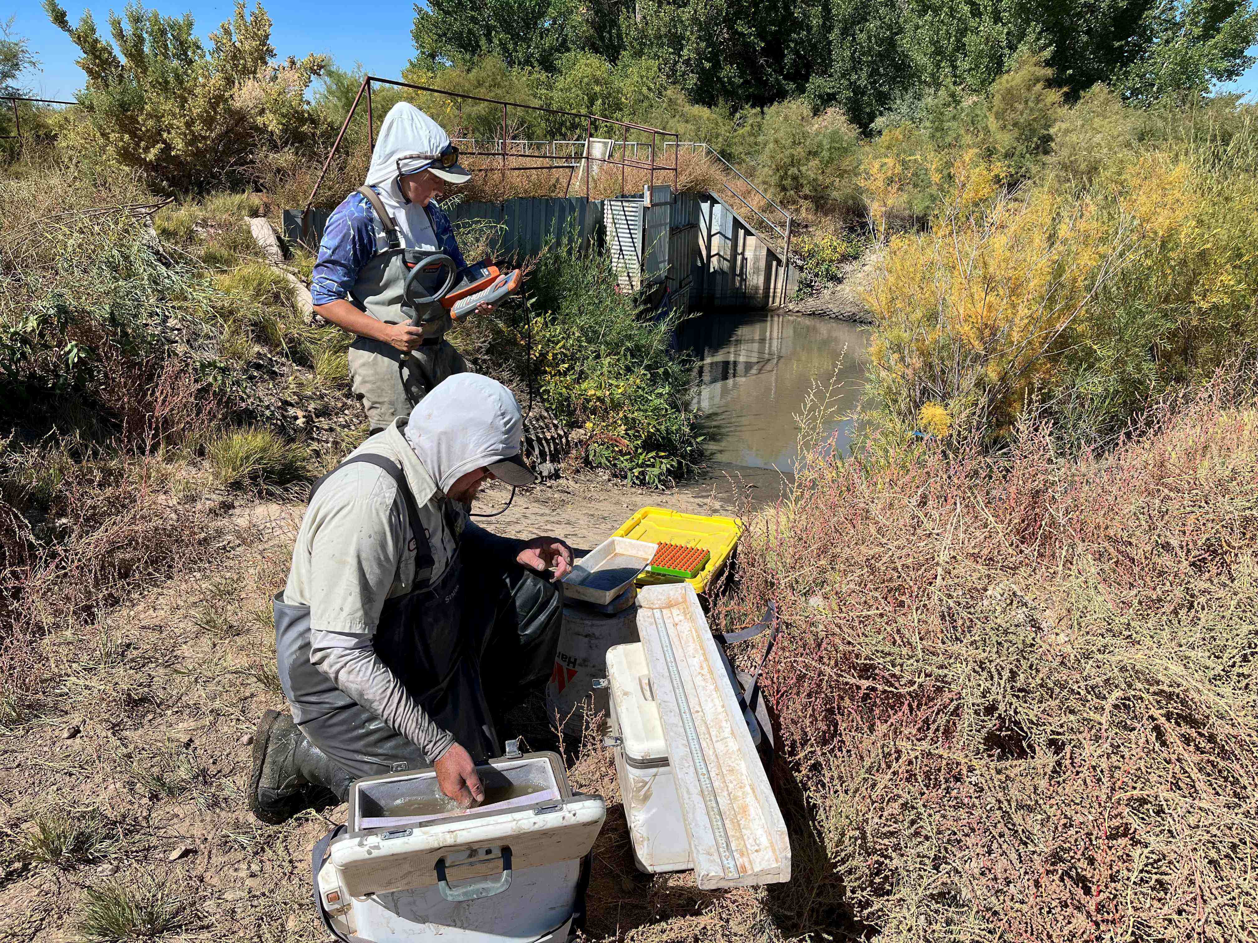
Staffing shortfalls

In May, the Supreme Court ruled that the Clean Water Act does not cover wetlands that lack a continuous surface connection to a larger body of water, which excludes many waters that connect underground. The court also narrowed the law to exclude from protection “ephemeral” streams that flow only seasonally.

Of the nation’s 118 million acres of wetlands, more than half could lose federal protection under the new definition, Earthjustice estimated. The EPA in August issued a new rule revising its regulation known as the “waters of the United States” rule to meet the court’s limitations.

Half the nation’s wetlands just lost federal protection. Their fate is up to states.

https://stateline.org/2023/06/16/half-the-nations-wetlands-just-lost-federal-protection-their-fate-is-up-to-states/embed/#?secret=HZPvD6wZlu#?secret=oxXGJjKM3F

“We still don’t know how [courts] are fully going to interpret what constitutes a surface connection, but we’re still assuming that at least 50% of [Washington’s] wetlands are no longer jurisdictional [under the Clean Water Act],” said Lauren Driscoll, manager of the wetlands program with the Washington State Department of Ecology.

With the feds bowing out, Driscoll’s agency may have to process an additional 50 to 100 permits a year, up from the 12 or so it currently handles. The agency is currently enforcing state wetland standards using a customized administrative order for each permit. Regulators are asking state lawmakers to enact a dedicated permit program that would create a standardized application process.

The agency also is seeking 10 more staffers to process permits, and three more temporary workers to help develop the new program. Once established, the permit program will cost about $2.2 million per year to administer, Driscoll said.

In California, regulators say they’ll also need more funding and staff to enforce state wetlands laws. For waters that are losing federal protection, states such as California will lose access to environmental analyses, expertise and staff capacity from federal partners such as the U.S. Army Corps of Engineers.

“We are anticipating no longer having support from the [U.S.] Army Corps of Engineers for things we’ve relied on them to do on the technical side” in waters that are no longer protected as waters of the United States, said Karen Mogus, deputy director of the Division of Water Quality within the State Water Resources Control Board. “We have protections in place, we have state authority, but we are certainly seeking additional resources to cover the gap that we have estimated is going to be opened up.”

While the agency’s specific funding request remains confidential, Mogus said, the loss of federal support could delay the issuance of permits. Regulators also might have to set up a state version of a federal pollution discharge program that covers wastewater plants and other industries.

GET THE MORNING HEADLINES DELIVERED TO YOUR INBOX

SUBSCRIBE

A few states already have passed laws that are broader than the federal standard, with well-established permit programs to uphold them. In Minnesota, for instance, state officials say their efforts will be largely unaffected by the court decision. But they acknowledge that other states may be hard-pressed to enact protections such as Minnesota’s 1991 Wetland Conservation Act.

“It would be very difficult to even consider doing something like that today,” said Dave Weirens, assistant director for programs and policy with the Minnesota Board of Water and Soil Resources. “Democrats and Republicans found it easier to find common cause to solve problems than they do today.”
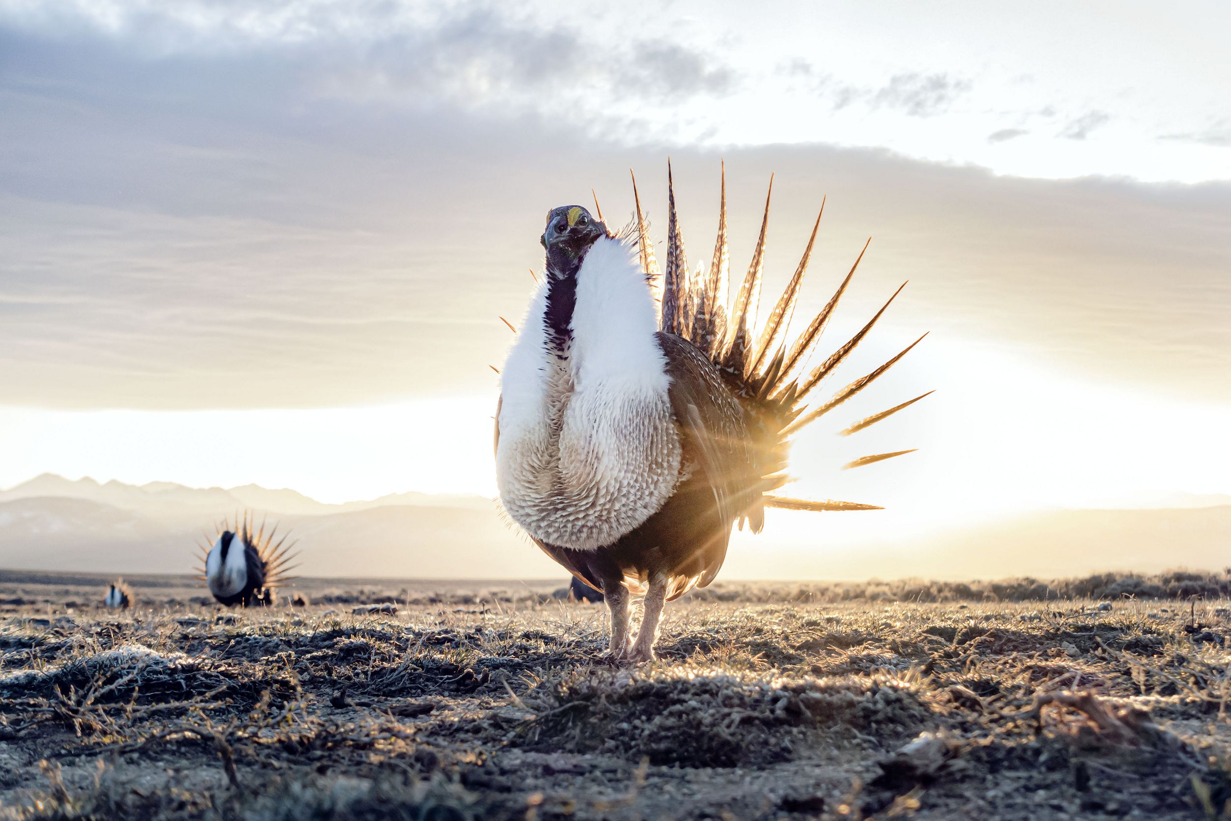
Last year, New York lawmakers passed a measure to expand the wetlands covered by state regulators, in part because of the pending Supreme Court case. Officials with the state Department of Environmental Conservation did not grant an interview about that effort, but supplied a statement saying the expansion would protect an additional 1 million acres of wetlands.

Making investments

Other states are working to put firmer protections on the books. In New Mexico, officials already had been working prior to the ruling to establish a surface water permitting program.

While the state currently has standards to protect wetlands, it’s enforcing them via administrative orders rather than a well-defined program. Agency officials have been coordinating with counterparts in Washington state, which is also using administrative orders, even as both states work toward a more defined program.

“We’d like to get away from boutique permits, these individual one-off permits and standardize this,” said John Rhoderick, director of the Water Protection Division within the state Environment Department. “Each permit is an adventure to say the least.”
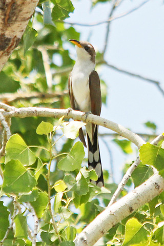
Rhoderick said it will take about five years to get the state program fully established, requiring an additional 35 to 40 staff members and $5 million to $6 million per year. He said state lawmakers have been supportive of that effort, and he anticipates they will empower his agency to begin a rulemaking process late next year.

More States Want Power to Approve Wetlands Development

https://stateline.org/2022/05/11/more-states-want-power-to-approve-wetlands-development/embed/#?secret=J9XXl4rZeN#?secret=rvaHPQI8eS

Colorado is among the states without strong wetlands protections. Gov. Jared Polis, a Democrat, has proposed $600,000 in his budget request as an “initial investment” toward developing a program, spokesperson Katherine Jones said in an email. The governor’s office declined an interview request seeking more details on that proposed program. Developers in the state say they’re monitoring the process, while environmental advocates say they’re working with officials to craft laws that will restore protections for Colorado’s waters.

“We are fully intent, both advocates and the government, to get a program in place that will at a minimum return us to where we were at [with federal oversight],” said Ean Tafoya, Colorado state director with GreenLatinos, an environmental justice organization. “What’s frustrating is that we could have been taking these steps a few years ago.”

While Polis’ budget request may help to kick-start a rulemaking process, Tafoya said, establishing a full regulatory program will cost millions of dollars. While specific bill language hasn’t been released, he said he expects lawmakers to consider legislation that would direct the state Water Quality Control Division to establish standards by a certain date.

Illinois activists also are pushing for legislative action.

“Wetlands are one of the few natural tools we have to filter our nutrient pollution, and they have the capacity to hold water, which helps mitigate flooding,” said Eliot Clay, land use programs director with the Illinois Environmental Council. “They are going to help us get through some of the worst impacts of climate change.”

At present, Clay said, the state’s wetlands protections are vague, and the state Department of Natural Resources is understaffed. But he believes Democratic Gov. JB Pritzker is interested in bolstering the state’s standards, and advocates expect to see a bill in the legislature next year.

Pritzker’s office did not respond to a request for comment.

SUPPORT NEWS YOU TRUST.

DONATE

Stateline is part of States Newsroom, a nonprofit news network supported by grants and a coalition of donors as a 501c(3) public charity. Stateline maintains editorial independence. Contact Editor Scott S. Greenberger for questions: info@stateline.org. Follow Stateline on Facebook and Twitter.

#Mancos Conservation District to receive $2.48 million federal grant — The #Cortez Journal #MancosRiver #SanJuanRiver #ColoradoRiver #aridification

Thanks to a federal grant through the U.S. Bureau of Reclamation, the Mancos Conservation District will build three permanent diversion structures on the Mancos River that will better facilitate irrigation and fish passage. The improved structures, seen here, are tiered so that fish can still swim upstream. (Courtesy of the Mancos Conservation District)

Click the link to read the article on The Cortez Journal website (Reuben M. Schafir). Here’s an excerpt:

The grant, part of the Bipartisan Infrastructure Law, is a ‘game-changer’ for the small district.

The funding will be used for infrastructure improvements, such as permanent diversion and water monitoring structures, and 650 acres of wildfire mitigation in the Mancos River watershed…

“We’re so grateful and thankful for this opportunity,” said MCD Executive Director Gretchen Rank. “We are really looking forward to working with our team at the Bureau of Reclamation and our private landowners here.”

The Mancos River headwaters meet north of its namesake community, pass east of Mesa Verde before cutting southwest and ultimately converging with the San Juan River.

The grant will fund the conservation district’s work to benefit irrigators, as well as the ecosystem. The MCD will build three permanent diversion structures, replacing the push-up dams currently in place. The existing dams are made of stream bed material and are washed away regularly and tend to block fish passage. Instead, the push-up dams will be replaced by permanent tiered structures that create a consistent flow of water for irrigators and allow fish to pass…The project is part of an ongoing effort to enhance fish passage in the Mancos River. In addition to the three diversion installations, 10 existing diversion points will be upgraded with advanced metering technology…There are over 50 irrigation ditches in the Mancos River watershed, Wolcott said. Federal funding will also support wildfire mitigation work on 650 acres of forested private land and riparian zone invasive plant removal.

San Juan River Basin. Graphic credit Wikipedia.

First Water Flows Through #ColoradoRiver Connectivity Channel — @Northern_Water #COriver #aridification

Restoring a river channel in the Upper Colorado Basin. Graphic credit: Northern Water

Click the link to read the article on the Northern Colorado Water Conservancy District website:

November 7, 2023: In what’s been described as “the largest aquatic habitat connectivity project ever undertaken in state history,” crews successfully tested the new Colorado River Connectivity Channel (CRCC) at the end of October. The new channel around Windy Gap Reservoir hydrologically and ecologically now reconnects two segments of the Colorado River for the first time in approximately 40 years.  

Northern Water staff were joined by Grand County officials, Windy Gap Project Participant Representatives, Colorado Parks and Wildlife representatives and others to watch the first flows go through the long-awaited channel. This new video captures the historic day and includes comments from the project participants and stakeholders who were present to witness the occasion.    

While water is now running through the new channel, there is still construction work to be done. Crews will continue putting the finishing touches on the project’s new dam embankment, diversion structure and other elements before winter weather brings activity to a stop in the upcoming weeks. Construction is expected to resume

next spring and wrap up later in 2024. Vegetation establishment along the channel will continue into 2025 and 2026, before the area is anticipated to open for public recreation in 2027.  

The new channel will enable fish and other wildlife to move freely upstream and downstream around what is now a smaller Windy Gap Reservoir. Meanwhile, the reservoir will continue providing a diversion point on the Colorado River for the Windy Gap Project during the high flows of spring and early summer.  

The CRCC is part of a package of environmental measures, valued at $90 million, associated with construction of Chimney Hollow Reservoir, which is ultimately where Windy Gap Project water will be stored once reservoir construction is completed.   

#Colorado Parks & Wildlife lifts closure on #ArkansasRiver after dam removed near #Salida, enhancing public safety

This low-head dam was built on the Arkansas River west of Salida in 1956 to provide water to hatcheries. It was rebuilt in 1988 with a boat chute, seen on the right, to provide a safe passage for watercraft. Still, the dam was a deadly hazard. Colorado Parks and Wildlife removed the dam with help from its partners the Chaffee County Board of County Commissioners. Photo courtesy of Colorado Parks and Wildlife.

Click the link to read the release on the Colorado Parks & Wildlife website (Bill Vogrin):

Nov. 16, 2023 SALIDA, Colo. – Colorado Parks and Wildlife on Thursday lifted a closure of the Arkansas River above Salida that was imposed last month to allow removal of a low-head dam located 1.5 miles upstream from CPW’s Mount Shavano State Fish Hatchery.

The river was reopened as crews completed removal of the dam and an adjacent boat chute, said Tom Waters, CPW’s park manager for the Arkansas Headwaters Recreation Area, which encompasses 152 miles of the Arkansas River from Leadville to Pueblo.

“We are happy to announce the river is open again, weeks sooner than expected, to instream recreation,” Waters said. “The closure and mandatory portage signs have been removed and the buoy line barrier across the river has been taken down.”

Waters said final clean-up work along the banks should be done by Nov. 23.

CPW had closed the stretch of river from the Chaffee County Road 166 Bridge to the Salida Boat Ramp to allow heavy equipment to break up and remove the dam, which was first built around 1956 to collect water for the hatchery downstream. The dam was rebuilt in 1987 with an adjacent boat chute.

“By removing the dam, we have eliminated a deadly threat to the thousands who boat on this popular stretch of the Arkansas River each year,” Waters said. River water, spilling over the dam, churned at the bottom of the dam structure, creating a powerful hydraulic that capsized and trapped boaters and swimmers. Since 2010, three people have died at the dam.

Removing the dam also enhances movements of fish – brown trout, rainbow trout and native white suckers – by easing migration access to about 85 miles of the Gold Medal river upstream. Barriers like the dam limit genetic diversity by essentially isolating segments of the river’s fish population. 

The ability of fish to move freely in a river also helps to prevent overpopulation by balancing the amount of habitat and forage with the number of fish it can support.

“This project is a great example of how CPW works with its local partners to accomplish important projects for the public,” said April Estep, deputy regional manager of CPW’s Southeast Region. She specifically praised CPW’s partners, including the Chaffee County Board of County Commissioners, who provided $100,000 toward the $1.1 million removal effort.

The dam has not been used as a hatchery water supply since 2000 after whirling disease was detected in the river. Whirling disease is caused by a parasite that infects rainbow trout, leaving them deformed and swimming in circles before it quickly kills the youngest fish. CPW spent $1.5 million at the hatchery to convert it to clean spring water to raise its fish.

New Mexico’s #RioGrande Compact debt is likely to grow; El Vado Dam won’t be fixed for a long while yet; we might see a lot more Middle Rio Grande Valley farmers paid next year to fallow — John Fleck (InkStain)

Rio Grande at Albuquerque, November 2023. Photo credit: John Fleck

Click the link to read the article on the InkStain website (John Fleck):

Finishing the new book has thrown me into a time warp.

We’re about to hand in a manuscript for a book that traces a century and a half of the evolution of Albuquerque’s relationship with the Rio Grande, leading up to now. But the now of the act of writing (November 2023) is different from the now that will exist when the book first emerges in 2025, and the now in which readers experience it in the years that follow.

This conceptual muddle is crucial for the book. We are trying to describe the process of becoming that made Albuquerque what it is. That process of becoming, we argue at some length, cannot be understood without understanding how we as a community came together to act collectively to manage our relationship with the river that flows through our midst.

But – and this is the crucial thing, because it explains why we are writing this book – the process of becoming is never done. We hope to help inform Albuquerque’s discussion of what happens next.

There’s less water. What do we do? We will never stop negotiating our complex relationship as a community with the Rio Grande.

I spent a delightful afternoon yesterday that stretched well into the evening, listening to a series of enormously consequential discussions of these issues at the monthly meeting of the board of directors of the Middle Rio Grande Conservancy District. One of the district’s senior folks recently pointed out how often, during the most difficult of discussions, they look at me sitting in the audience and see me grinning. Those most difficult discussions are the most fascinating to me.

I found myself leaning forward in my chair frequently, shifting my position to see the faces of the board members and staff as they wrestled with this stuff.

I grinned a lot.

Three things from yesterday’s meeting stood out. All three are things that would have merited a significant newspaper story back in my Albuquerque Journal days. This blog post is not that, but if you’re paying attention to Middle Valley water you should keep an eye out for these three incredibly important developing issues.

1) NEW MEXICO’S RIO GRANDE COMPACT DEBT IS LIKELY TO RISE

The Rio Grande Compact, an agreement among Colorado, New Mexico, and Texas to share the waters of the compact’s eponymous river, has a tricky sliding formula determining how much water each state is allowed to consume (through human use as well as riparian evapotranspiration), and how much it must pass to its downstream neighbor. It’s got some wiggle room – states can run a debt, as long as it doesn’t get too large and they catch up in subsequent years. But the changing hydrology of the Middle Valley has made it increasingly difficult for New Mexico to meet its downstream delivery obligations.

New Mexico is currently 93,000 acre feet in debt because of under deliveries in recent years. The hole’s likely to get a lot deeper this year, thanks to a big spring runoff (which increases New Mexico’s required deliveries) and a lousy monsoon (good summer rains can help make up a deficit – this year they did not). If our debt rises above 200,000 acre feet, bad things happen.

El Vado Dam and Reservoir. Photo credit: USBR

2) EL VADO DAM RECONSTRUCTION IS TAKING A LOT LONGER THAN IT WAS SUPPOSED TO TAKE

El Vado Dam was built in the 1930s to store water for Middle Rio Grande Valley irrigators, allowing storage of spring runoff to stretch the growing season threw summer and into fall. But it’s kinda broken. Contractors working for the US Bureau of Reclamation began work a couple of years ago to fix it, with the expectation that it would take a couple of years. It is now widely understood that it may not be done and in operation again until 2027. Or later.

This would be devastating to the portion of irrigators in the Middle Rio Grande Valley that farm for a living. As our book will deeply argue, it’s critical to understand that this represents a minority of irrigated land in the valley. Much of the farming here is non-commercial, “custom and culture” farming, a supplemental income (or even, for the affluent, a delightful money loser) for people whose livelihood doesn’t depend on it. But for either class of irrigators, a lack of late summer and fall water makes things incredibly hard.

El Vado’s problems have not been publicly announced yet, but all the cool kids are talking about them. Expect something more substantive at December’s MRGCD board meeting.

Side channels were excavated by the Bureau of Reclamation along the Rio Grande where it passes through the Rhodes’ property to provide habitat for the endangered silvery minnow. (Dustin Armstrong/U.S. Bureau Of Reclamation)

3) FALLOWING

We could see a substantial expansion of acreage fallowed, with a big chunk of federal money paid to irrigators to forego their water in the next few years. MRGCD has been building the institutional widget to do this for several years, with federal money flowing to irrigators to lay off watering their land for either a partial or full season as part of a federally funded program to generate water to meet Endangered Species Act requirements for our beloved Rio Grande silvery minnow. In 2023, that generated (in accounting terms, be skeptical of the four-digit precision) 3,615 acre feet of water.

For 2024, the MRGCD, working with federal money funneled through the state, will push for a dramatic increase. Price per acre will double, to $400 an acre for a split season (irrigate in spring and fall, but not in summer when demand is highest) and $700 an acre for a full season. It’s a voluntary program, so all depends on how much irrigators want to join in, but I can imagine a lot of people looking at the El Vado shitshow and taking the money.

There was a very confusing board discussion that involved an actual invocation of Roberts Rules of Order by the district’s legal counsel and a vote that I still don’t understand with people who support the program voting “no” and people who oppose it (I think) voting “yes”. If I was still a reporter I would have had to sort all of this out while an editor hovered barking about deadlines, but thankfully it’s just a blog that no one actually reads, written by an old guy in pajamas still working on his morning coffee and breakfast.

The bottom line is the possibility of the compensated fallowing of as much as 8,000 acres next year, ~15-ish percent of all irrigated land. I think. As I said it was a pretty confusing thing, and I’m not done with breakfast.

The Rio Grande Basin spans Colorado, New Mexico and Texas. Credit: Chas Chamberlin

Navajo Dam operations update October 31, 2023: Bumping releases down to 400 cfs #SanJuanRiver #ColoradoRiver #COriver #aridification

Map credit: USBR

From email from Reclamation (Susan Behery):

In response to reduced irrigation demand and sufficient forecast flows in the San Juan River Basin, the Bureau of Reclamation has scheduled a decrease in the release from Navajo Dam from 450 cubic feet per second (cfs) to 400 cfs for tomorrow, October 31st, at 8:00 AM.  

Releases are made for the authorized purposes of the Navajo Unit, and to attempt to maintain a target base flow through the endangered fish critical habitat reach of the San Juan River (Farmington to Lake Powell).  The San Juan River Basin Recovery Implementation Program recommends a target base flow of between 500 cfs and 1,000 cfs through the critical habitat area.  The target base flow is calculated as the weekly average of gaged flows throughout the critical habitat area from Farmington to Lake Powell. 

Navajo Dam operations update: Bumping down to 450 cfs October 24, 2023 #SanJuanRiver #ColoradoRiver #COriver #aridification

SAN JUAN RIVER The San Juan River at the hwy 64 bridge in Shiprock, NM. June 18, 2021. © Jason Houston

From email from Reclamation (Susan Behery)

In response to sufficient forecast flows in the San Juan River Basin, the Bureau of Reclamation has scheduled a decrease in the release from Navajo Dam from 500 cubic feet per second (cfs) to 450 cfs for tomorrow, October 24th, at 4:00 AM.

Releases are made for the authorized purposes of the Navajo Unit, and to attempt to maintain a target base flow through the endangered fish critical habitat reach of the San Juan River (Farmington to Lake Powell).  The San Juan River Basin Recovery Implementation Program recommends a target base flow of between 500 cfs and 1,000 cfs through the critical habitat area.  The target base flow is calculated as the weekly average of gaged flows throughout the critical habitat area from Farmington to Lake Powell. 

Protecting West Slope water: Coalition eyes pricy purchase of water rights — The #GrandJunction Daily Sentinel #ColoradoRiver #COriver #aridification

This historical photo shows the penstocks of the Shoshone power plant above the Colorado River. A coalition led by the Colorado River District is seeking to purchase the water rights associated with the plant. Credit: Library of Congress photo

Click the link to read the article on The Grand Junction Daily Sentinel website (Dennis Webb). Here’s an excerpt:

The Colorado River District is leading a coalition in what would be a history-making purchase involving historic water rights that are pivotal to Colorado River flows and water uses in western Colorado. The district and others in the Western Slope coalition are proposing spending potentially $98.5 million to acquire the rights from Xcel Energy for operation of the Shoshone hydroelectric power plant in Glenwood Canyon. According to the river district, Shoshone holds the most senior major water rights on the river, dating back to the early 1900s and totaling 1,408 cubic feet per second…

When river flows drop below 1,408 cfs the plant puts a “call” on the river, preventing access to water by many junior rights holders above the plant to ensure flows to it. That also keeps more water flowing for recreational purposes such as fishing and whitewater boating, and to benefit the environment. Because the flows used by the plant return to the river, they continue downstream, along with the benefits they provide, which also include access to the water by junior water rights holders downstream, and improved water quality for communities and water utilities that rely on the river for their supply. The improved water quality results from higher river flows that dilute pollution. Critically, the water also helps shore up flows in what is called the 15-mile reach of the river starting in the Palisade area, which is important habitat for fish federally listed as endangered or threatened.

”Preserving the Shoshone call permanently secures the flow of the Colorado River and the health of that river for our economies and our environment, literally from the headwaters in Grand County all the way down to the border with Utah,” said river district General Manager Andy Mueller.

Archuleta County joins coalition for #RioGrande fish conservation — The #PagosaSprings Sun

Sunrise March 10, 2023 Alamosa Colorado with the Rio Grande in the foreground. Photo credit: Chris Lopez/Alamosa Citizen

Click the link to read the article on the Pagosa Springs Sun website (Josh Pike). Here’s an excerpt:

At the Board of County Commisioners work session earlier that day, County Attorney Todd Weaver explained that Archuleta County was approached by a coali- tion of counties about contributing $1,000 for the conservation of the Rio Grande trout, Rio Grande chub and Rio Grande sucker in the Rio Grande watershed. He noted that the coalition represents local interests in efforts to enhance the environment for these fish with the goal of preventing them from becoming threatened or endangered, which Weaver stated would trigger a variety of requirements and restrictions.

Navajo Dam operations update September 22, 2023 #SanJuanRiver #ColoradoRiver #COriver #aridification

The San Juan River, below Navajo Reservoir. Photo: Brent Gardner-Smith/Aspen Journalism

From email from Reclamation (Susan Novak Behery):

September 21, 2023

Due to forecast sufficient flows in the critical habitat reach of the San Juan River, the Bureau of Reclamation has scheduled a decrease in the release from Navajo Dam from 850 cubic feet per second (cfs) to 800 cfs for Friday September 22nd, at 4:00 AM.

Reclamation continues to release project water to fulfill a project water release request by the Jicarilla Apache Nation’s subcontractors, The Nature Conservancy and the New Mexico Interstate Stream Commission, in addition to the normally scheduled release required to maintain the minimum downstream target baseflow.  

Releases are made for the authorized purposes of the Navajo Unit, and to attempt to maintain a target base flow through the endangered fish critical habitat reach of the San Juan River (Farmington to Lake Powell).  The San Juan River Basin Recovery Implementation Program recommends a target base flow of between 500 cfs and 1,000 cfs through the critical habitat area.  The target base flow is calculated as the weekly average of gaged flows throughout the critical habitat area from Farmington to Lake Powell.